Category Archives: Past Internships

Summer Camp Round Two – REEF [2]

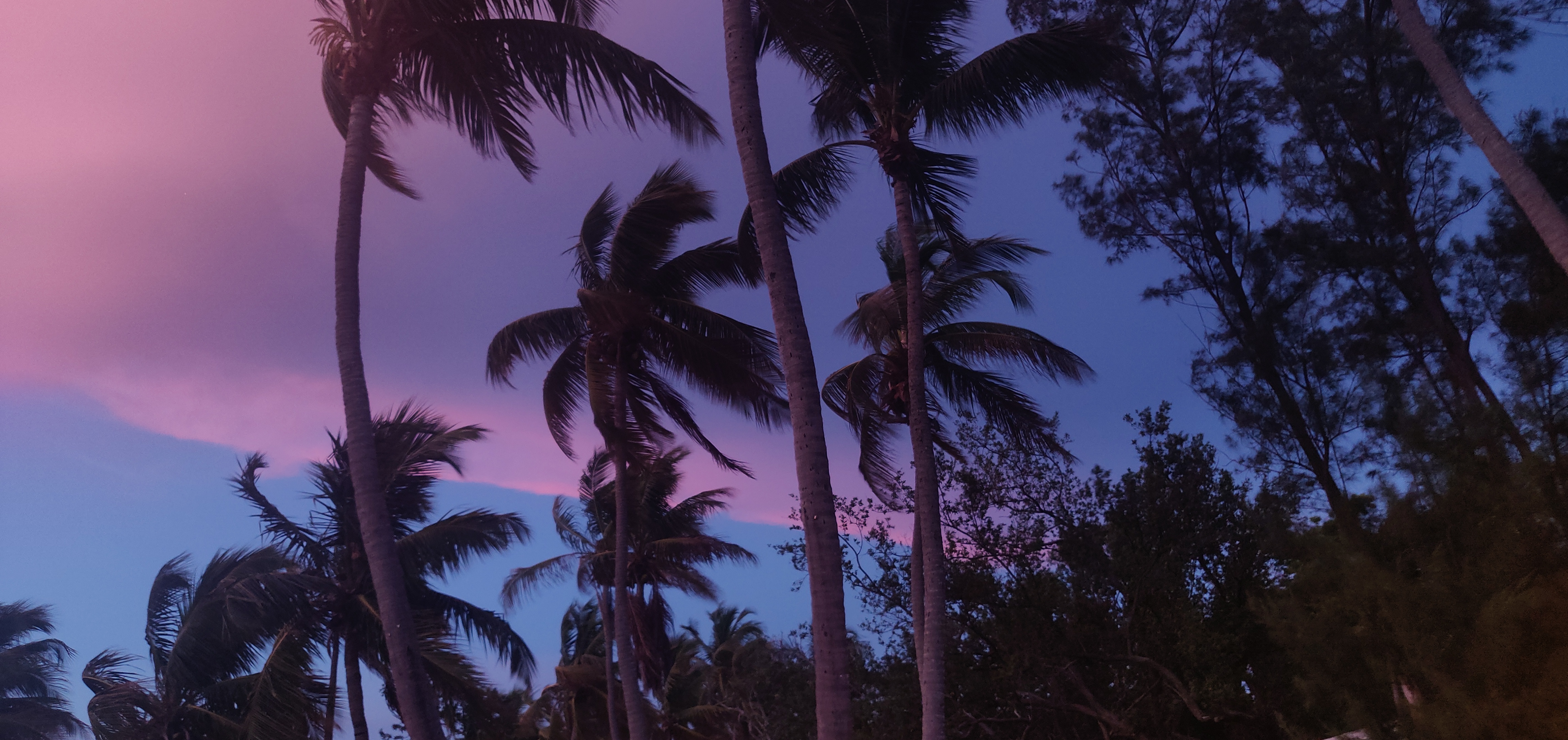
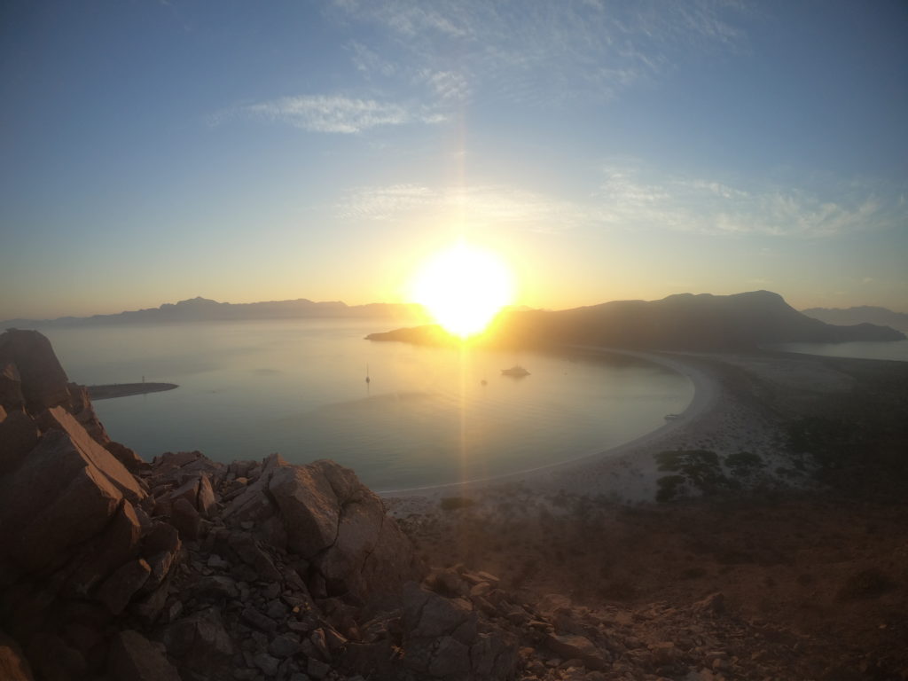
Sunset view of the palm trees swaying in the wind at La Jolla Resort

Summer camp was always a special experience for me as a kid. Growing up, camp was a time for me to escape from the confines of the classroom and explore new possibilities during summer breaks. My parents were great and exposed me to plenty of different kinds of camps, my favorite being one that was held on a sprawling farm called Pepperhill in the backcountry of Kentucky. I begged my parents to sign me up again, year after year, because there was something so reassuring about knowing I had untold adventures awaiting for me every summer. Whether it was horseback riding, gaining experience levels in the pool, shooting archery, or going on caving trips, summers on Pepperhill developed interests for me that I never would have had otherwise. Camp took an already burgeoning personal interest in the outdoors and developed it into a burning curiosity for what lied in store for me, essentially in my backyard.

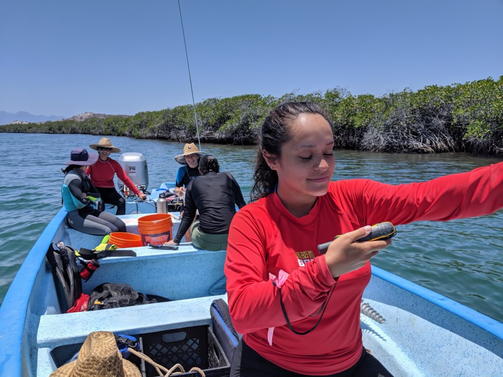
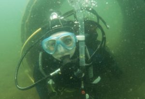
You may be wondering why I am talking about a camp back in Kentucky on a blog post about REEF and the underwater world. Which is reasonable. I say all this because I see no better way of prefacing why contributing to REEF’s Ocean Explorers Camp was so meaningful for me. A few weeks ago I met 15 campers on a Monday morning, bright and early. We were stationed under a small structure called Grouper Pavilion in John Pennekamp Coral Reef State Park, going through the stages of trying to remember everyone’s names. The first few campers that I interacted with under the pavilion only took interest in me because I sat down at the crafts table and started sketching a (terribly depicted) tropical fish. I did not expect them to be so excited to join in, but soon they were producing drawings way better than mine! Keep in mind these were 3rd graders (the ages of campers ranged up to about 8th grade). I had no idea what I was getting into, to be honest, since I had never acted in this kind of capacity with kids so young before. The closest I had come was helping run a live touch tank in Charleston last summer, but being an actual camp counselor this time around brought with it more responsibilities. I did my best to hang back and let the kids enjoy their activities on the first day, and watched to see how Brittany, our supervisor, handled the kids’ endless questions. I wanted to make sure that I was being a good role model, especially since this was Ocean Explorers Camp – what these kids learned about the ocean during their week with us could truly make a lasting impression. That said, my first day mostly consisted of supervising kayaking and snorkeling activities, so my job was mainly to keep kids from absconding into the mangroves.

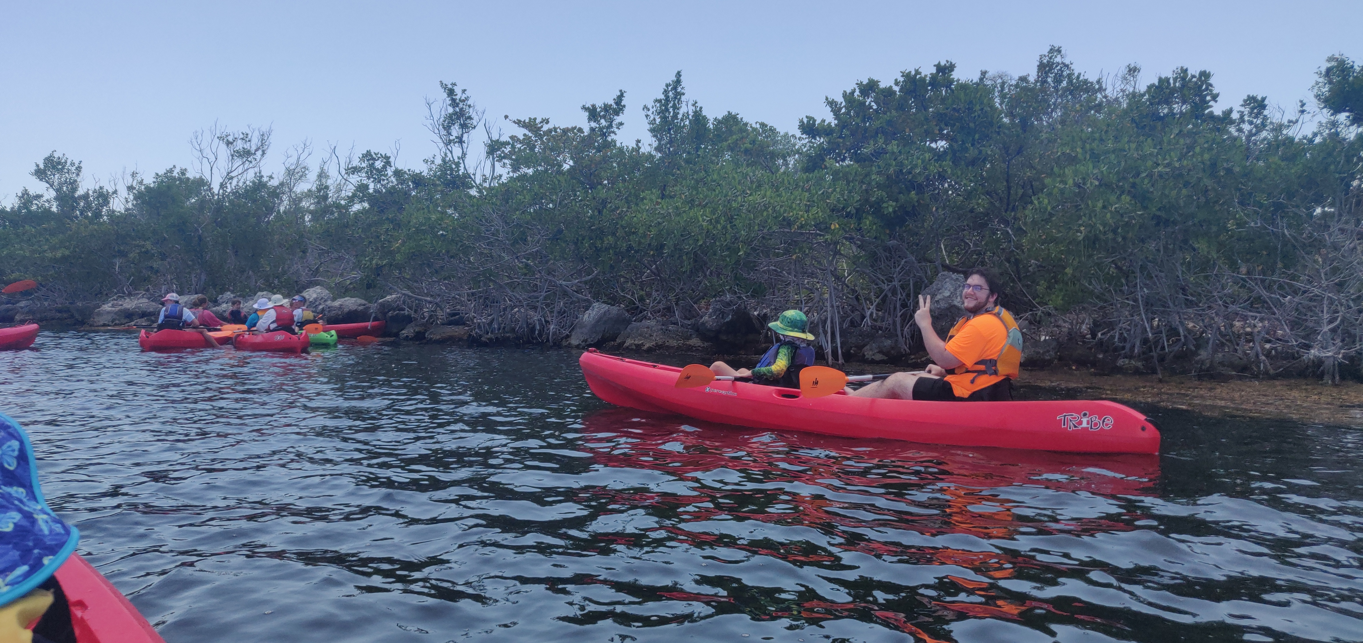
Matt, one of the other interns assisting with Ocean Explorers camp, and his camper Will on our first mangrove kayaking trip

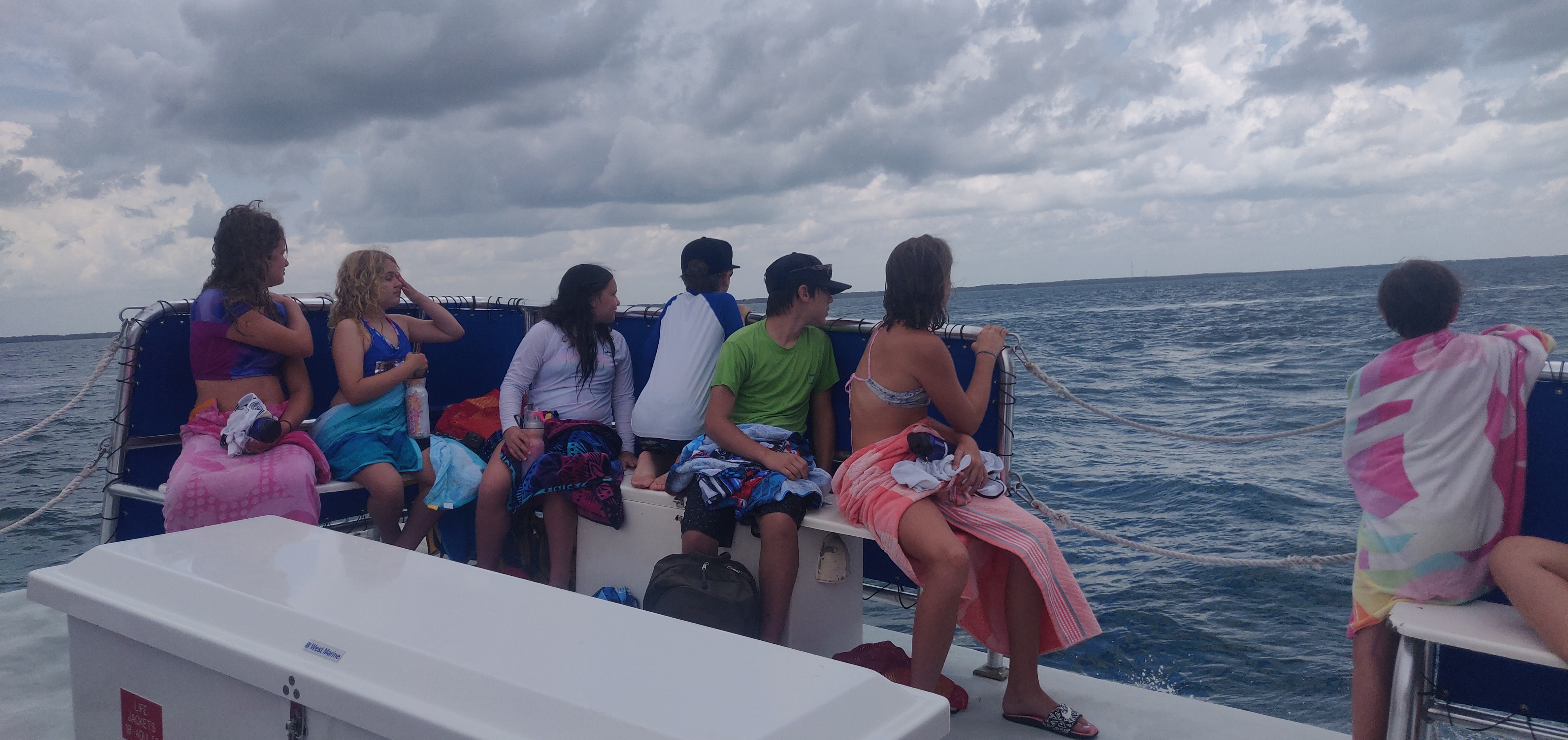
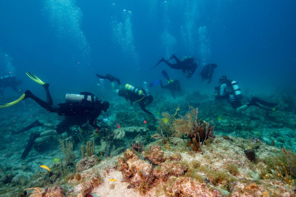
Over the next couple of days at Pennekamp we spent time out on the reef, via glass bottom boat and a snorkeling charter. I learned that there is truly no better way to distract children than by sticking them on a boat where they can look down and see the ocean. Several large nurse sharks and barracudas swam by under the boat, serving to both entrance the kids and provide us interns a much needed break from constantly wrangling runaway children. This was also around the time when a girl named Dakota became particularly enamored with stealing my sunglasses (and occasionally my buff). She and a couple of her friends were actually the same campers who outdrew my feeble attempt at a fish on the first day of camp. I am not sure what was so special about my personal belongings, but she was so proud of wearing them out on the boat that eventually I gave up and let her do her thing.

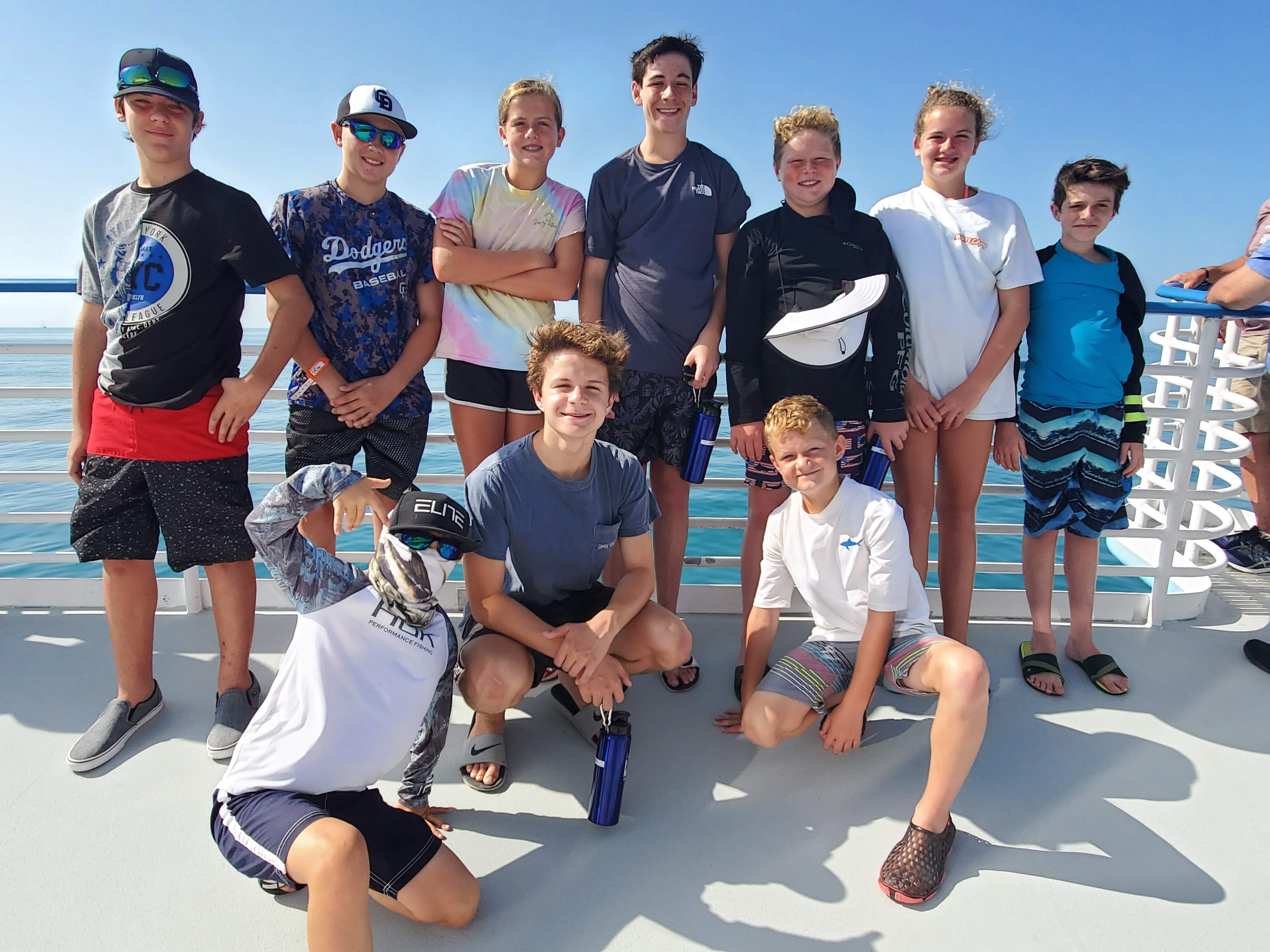
10 out of the 15 campers, at the front of the glass bottom boat. It was never easy to get this many of them in one shot! Photo by Matthew Hall

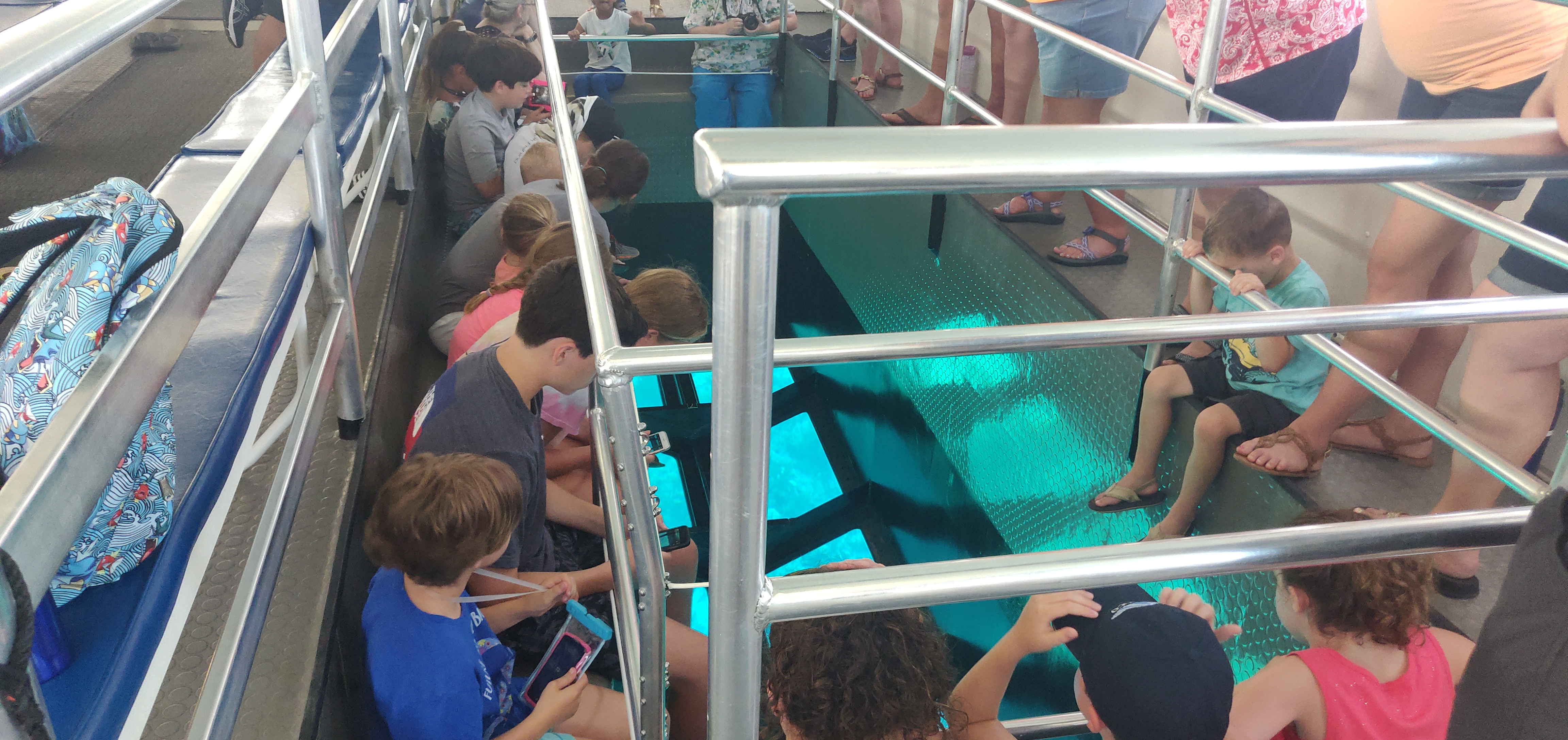
The kids couldn’t keep their eyes off the reef. Nothing like a couple nurse sharks to keep them occupied

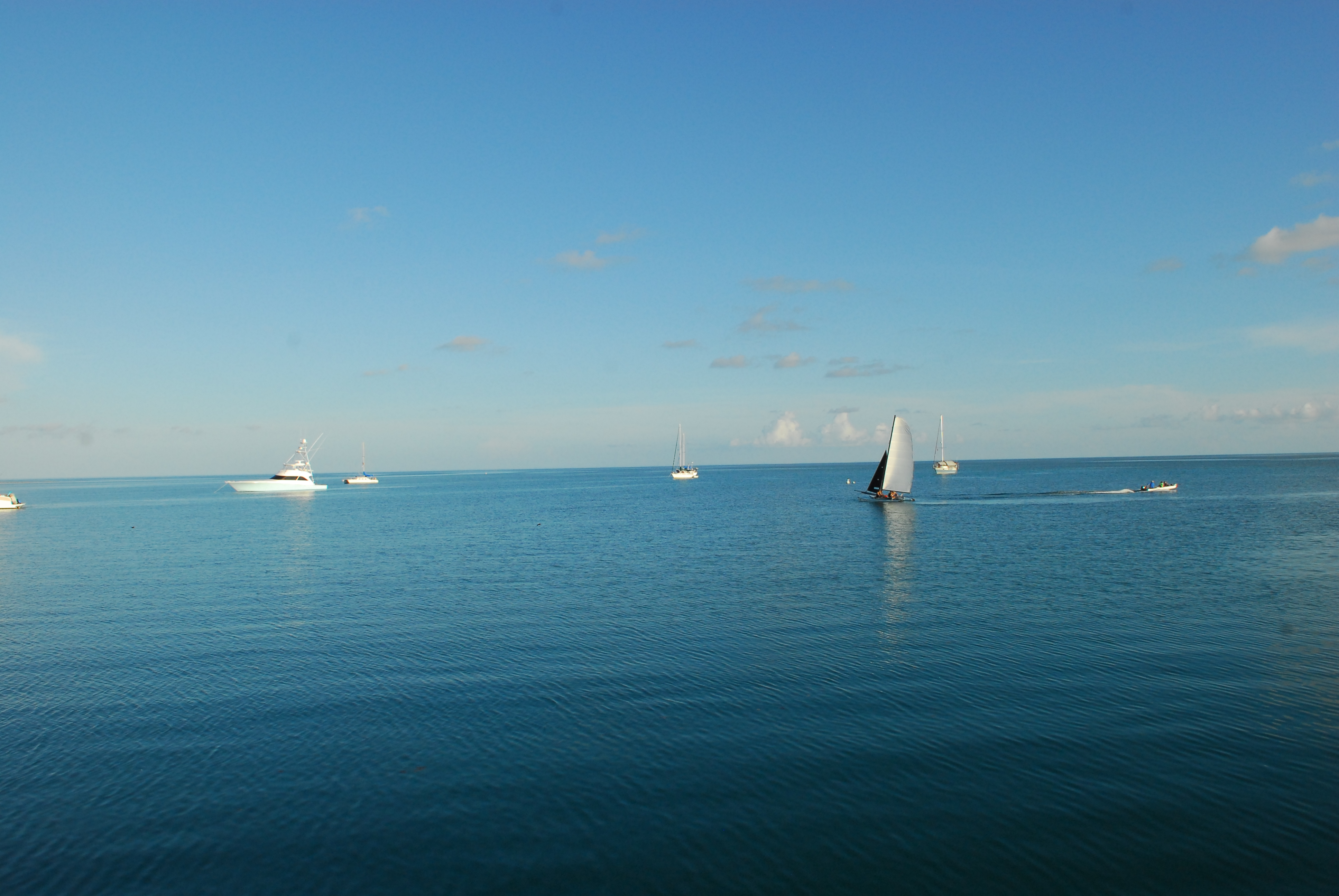
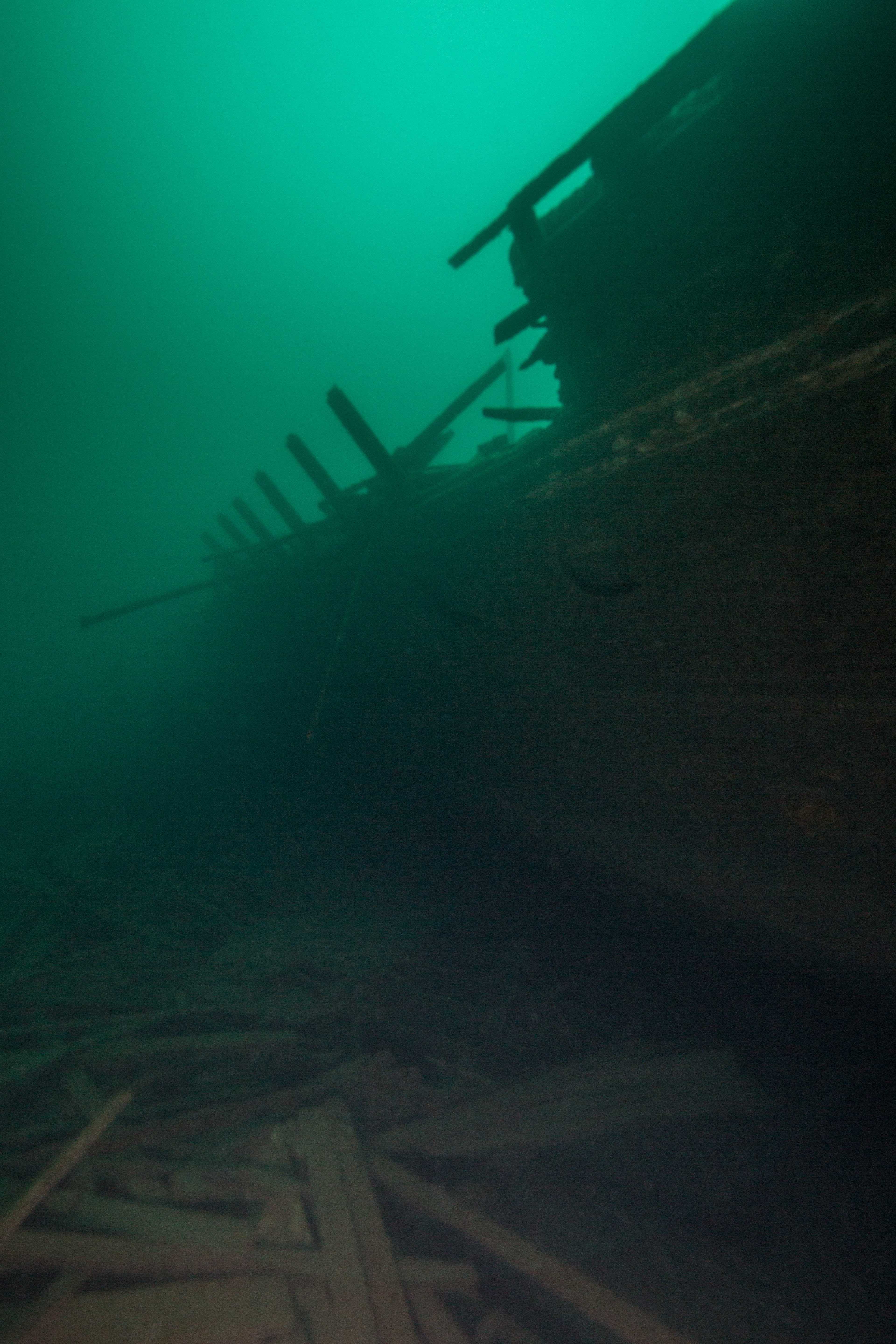
On Thursday, we went back out on the boat, but this time the kids got to jump in the water and see the reef up close. Our boat stopped near the locally famous Christ of the Abyss Statue, which has a neat history, as a Pennekamp Park Ranger told us. It was one of a set of three Christ statues sunk around the world, this one sunk in Dry Rocks reef off Key Largo in 1965. The first two were sunk in Italy and in Grenada, to commemorate a fallen diver and as a gift to the people of St. George’s, respectively. I had never visited this renowned site, and I was just as excited as the kids to snorkel around the statue. Making sure the group didn’t stray too far from the boat was a bit stressful, but if anything it was good preparation for my divemaster training this summer! After a nice day out on the water, we enjoyed a relaxing boat ride back to the mainland, where the kids got to witness a pod of dolphins frolicking through the water.

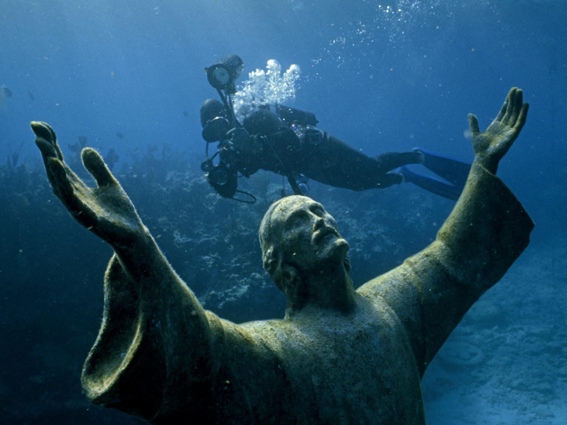
Christ of the Abyss Statue. Photo by Bates Littlehales, National Geographic 1971

Heading back from snorkeling, the captain sighted a pod of dolphins. Here the kids looked on as we circled back around

And so the final day of camp arrived. On a second kayak trip out to the mangroves, my boat partner was none other than Dakota, the sunglasses-snatcher. She asked if I would be back next year, and I had to tell her maybe, but that I would probably be elsewhere. I could tell she really enjoyed being at camp and didn’t want to leave – a very sweet moment. Near the end of the day when the campers got to visit the gift shop, she ended up spending a decent chunk of her money on a pair of sunglasses and a buff, so she could look “just like Mr. Ben.” I honestly had to keep it together a little bit when she said that, and I knew it was going to be hard to say goodbye to this group. Around this time, I also got to spend more time with the other half of the group I had not interacted with as much throughout the week. They were a bit older than the others, and were genuinely interested in hearing what I had to say about identifying all the different fish in Pennekamp’s mini-aquarium. Gaining experience interpreting facts about tropical marine conservation to an age group I wasn’t used to was a huge plus for me during Ocean Explorers camp.

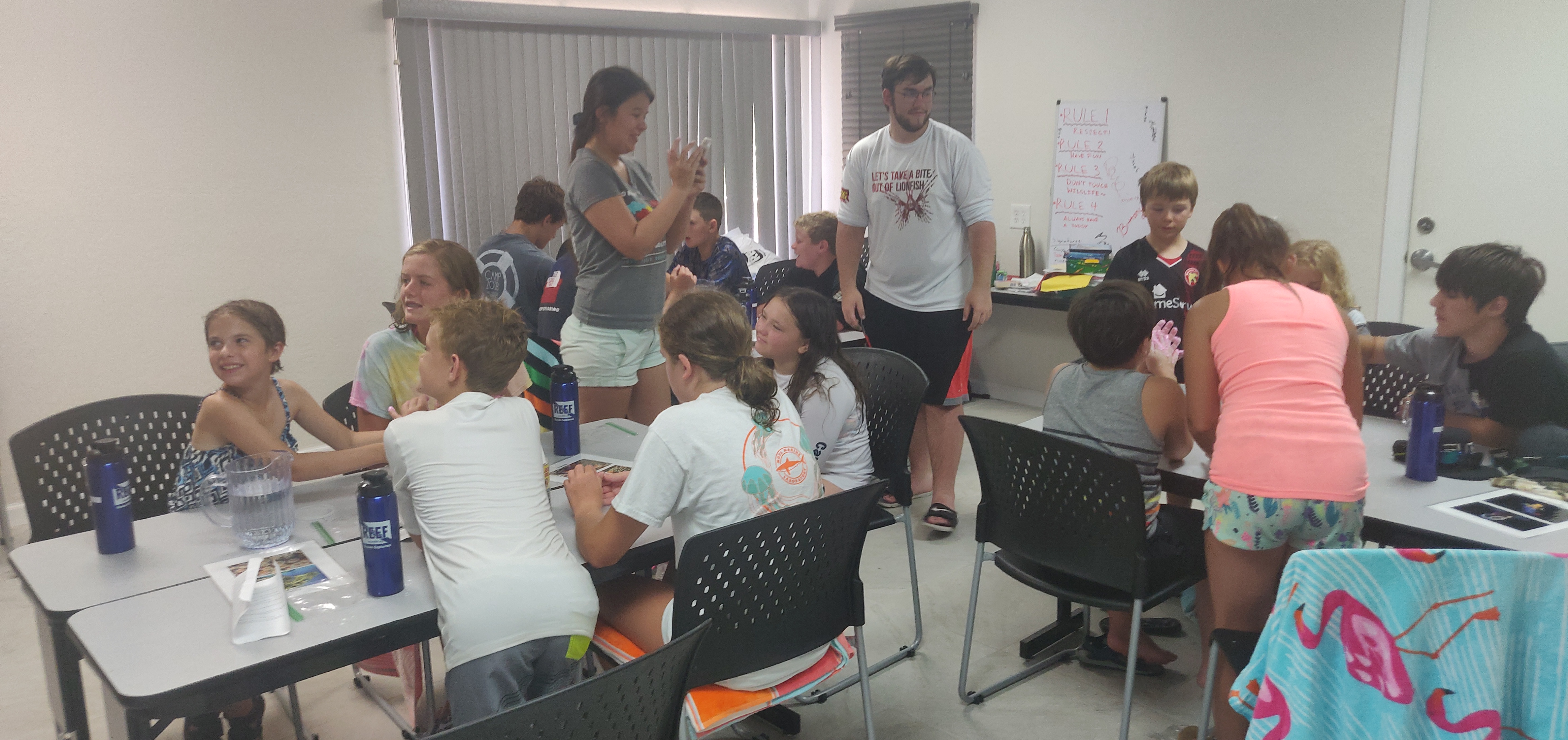
The group learning how to make “slime” (a mixture of water and flour). The slime represented slimy materials that marine fish use all the time, from mucus coating the bodies of moray eels to bubbles that parrotfish sleep in at night

At the end of the day Friday, the campers were tasked with making their own collages using photo prints from the past week. Dakota refused to leave without giving me hers, one that she had put a lot of work into, and my heart melted a little bit more. I realized then that I saw myself in these campers. When I was that age, positive experiences where I could really dive into a new environment were so important, and it was special to be on the other side this time as a counselor. I have actually gone ahead and signed up to help out with another summer camp at the end of the summer, as a nice send-off from my time at REEF.

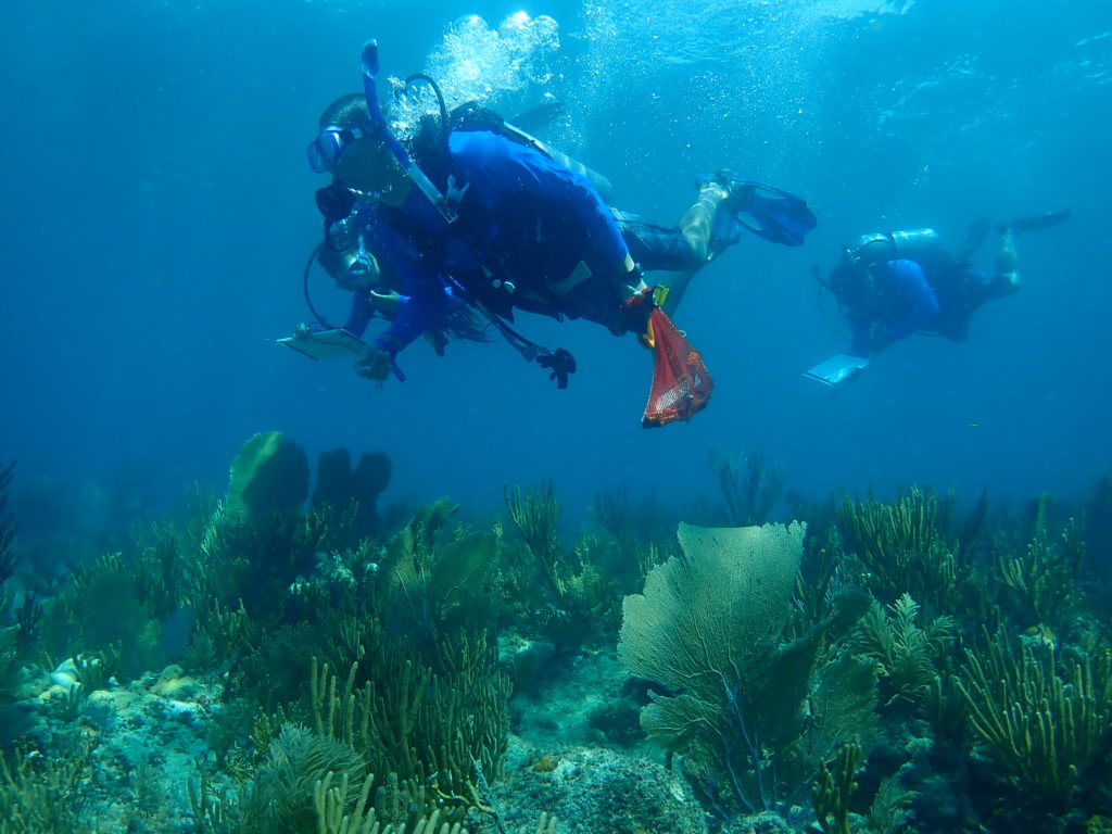
Aside from summer camp, another huge aspect of REEF’s outreach during the summer are lionfish derbies. My first derby was right after summer camp week, which was a pretty dramatic turnaround. Just after the last camper departed on Friday, we grabbed our dive gear and headed up to Ft Lauderdale for the weekend. Friday night we took it easy and met up with Alli and Moose, the staff members that head the Invasive Species Program at REEF. Early Saturday morning, we headed over to Sea Experience dive shop to help set up for the day’s lionfish dive. At the shop, Alli presented about lionfish, explaining to participants how lionfish invaded the Atlantic, how lionfish have devastated native fish populations, and how we can help fend off the invasion. Many of the participants were fishermen, who were very gung-ho about getting in the water and spearing some invasive fish!

After weathering a very rainy and overcast morning, we set out for our afternoon lionfish dives. This would be my first time spearfishing, as well as my first time participating in a drift dive. I was nervous, but very excited to be out on the boat and gaining new experiences. As we approached the dive site about 5 miles off the coast of Ft Lauderdale, the Miami skyline greeted us through a post-rain glow. Giant striding into the ocean with that scenery around me was surreal, and it only got more exciting as we descended to ~80 feet. The ocean floor was very different than what I was used to on the reefs surrounding the Keys – some of the same fish and coral species were scattered across the bottom, but the terrain was flat and unforgiving. Additionally, the concept of having to let the current take me where it pleased was humbling. Not so humbling, however, was being able to spear my first lionfish. I missed the first couple tries and was fairly disheartened, but kept at it and was able to get a great shot into a sizeable fish. Lionfish are so unused to being predated in the Atlantic that it was hardly a hunt at all, but nevertheless I felt a rush of excitement. I was suddenly reminded of why diving is so rewarding for me – there is nothing quite like being able to explore and contribute to scientific efforts. It never hurts to be carrying a spear underwater either.

Me spearing my second lionfish off the coast of Ft Lauderdale. Notice how my hand is not actually around the spear – don’t do that! The lionfish could have easily swum off with the spear in it (not exactly ideal). Photo by Tom Sparke

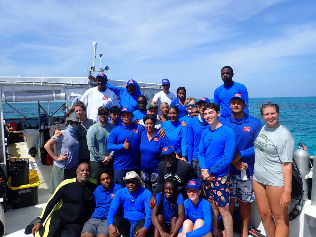
On Sunday, the festivities really began with the Ft Lauderdale Derby. Thirty total divers brought in 417 invasive lionfish (you can read more about that here)! As part of the team helping measure each catch, this meant I was chucking hundreds of lionfish up onto a table for Moose to process. Team members looked on eagerly to see if they brought in the biggest fish, since there were awards for biggest/smallest catches, as well as most fish caught. The biggest catch ended up being 392 mm, or about 1.3 feet! The event was a whirlwind of activity, but it was a great chance to see citizen science in action. Each catch and its measurements were logged, which will help contribute to an ongoing project to see how many lionfish are present off the coasts of Florida. A large part of why I was excited to take this internship was the ability to help out with events that truly engage the local community, and this was a perfect example of that. I am very much looking forward to the Sarasota Derby being held at Mote Marine Laboratory this coming weekend.

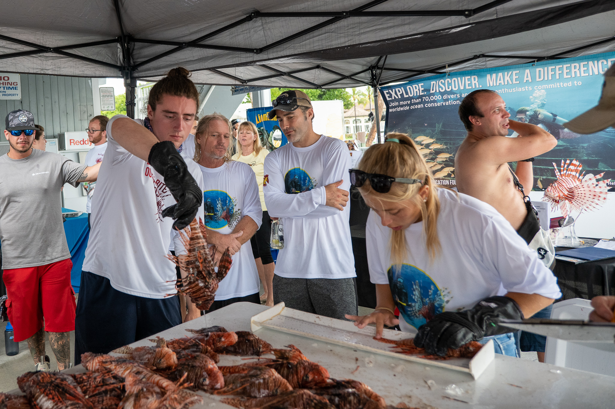
Me and Moose handling lionfish at the Derby, with team members looking on

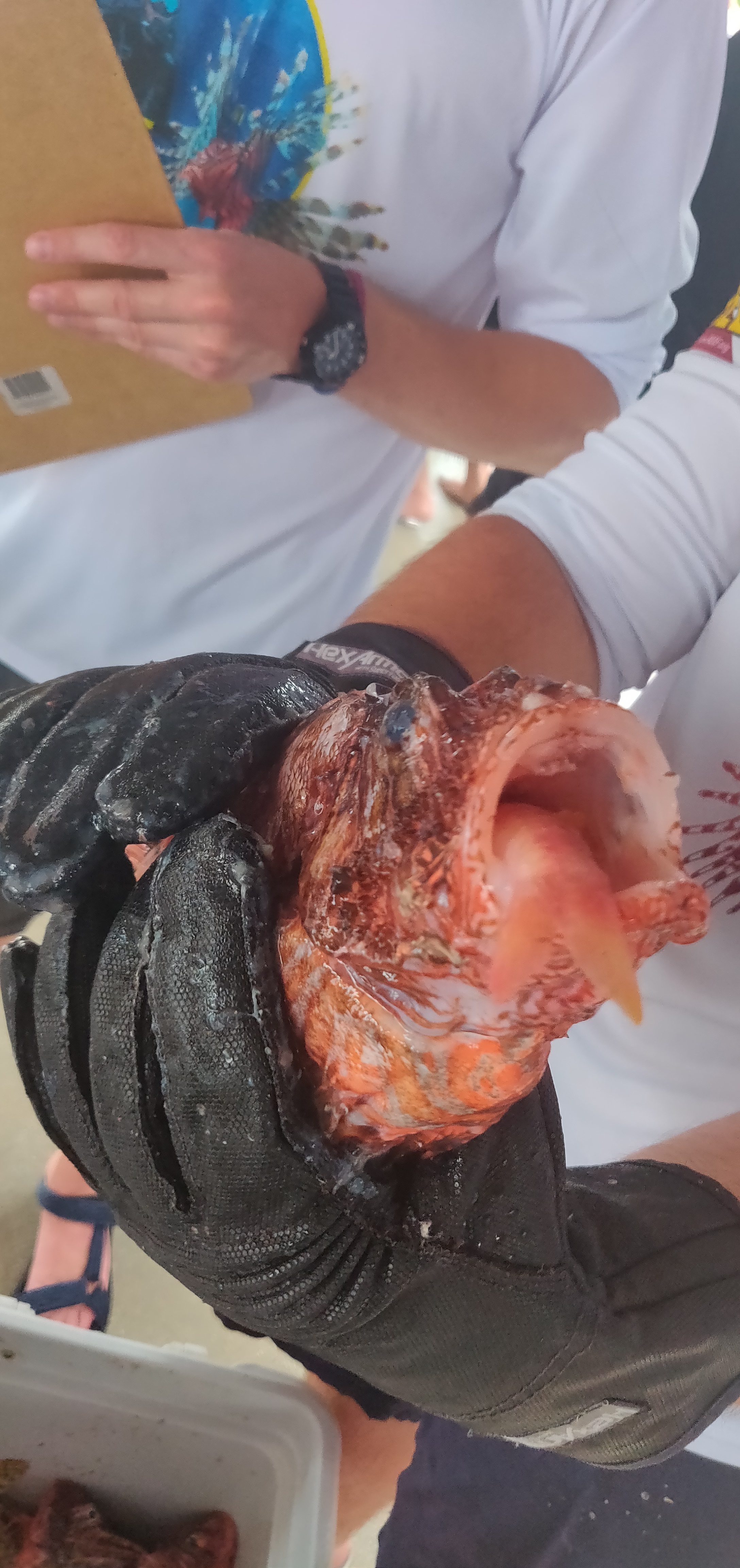
A lionfish that was in the middle of eating a goatfish too big for its stomach. Invasive lionfish are known to be gluttonous, eating just about anything that fits in their mouths

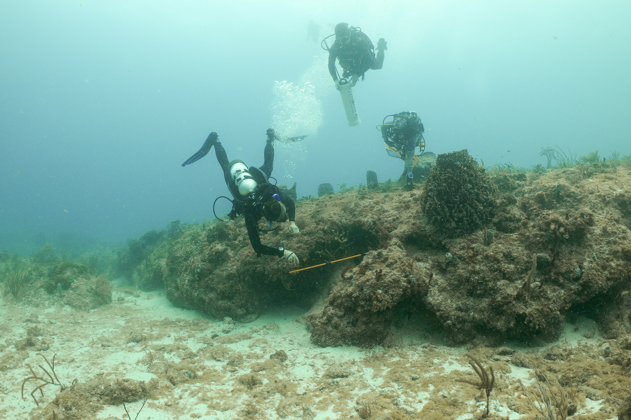
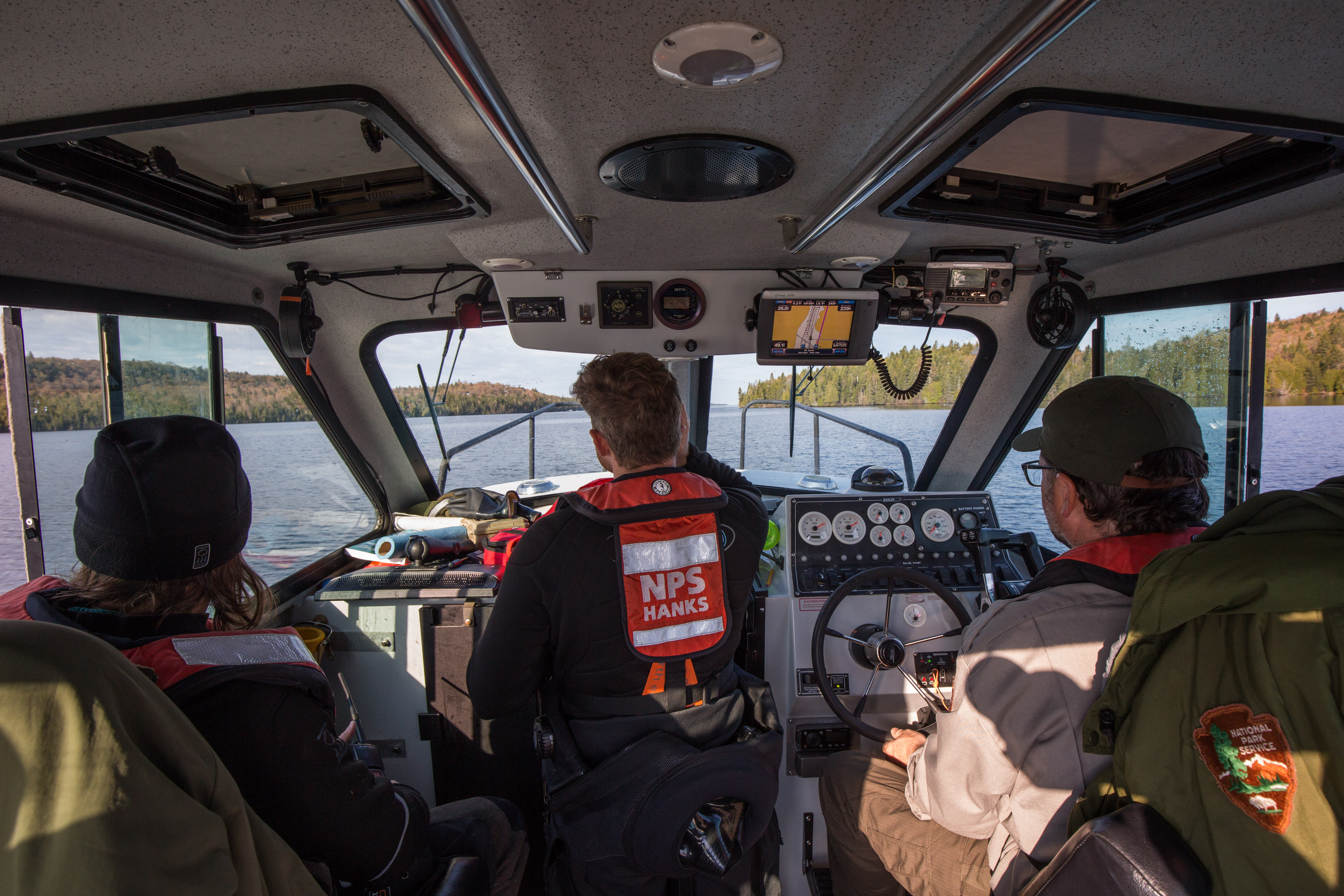
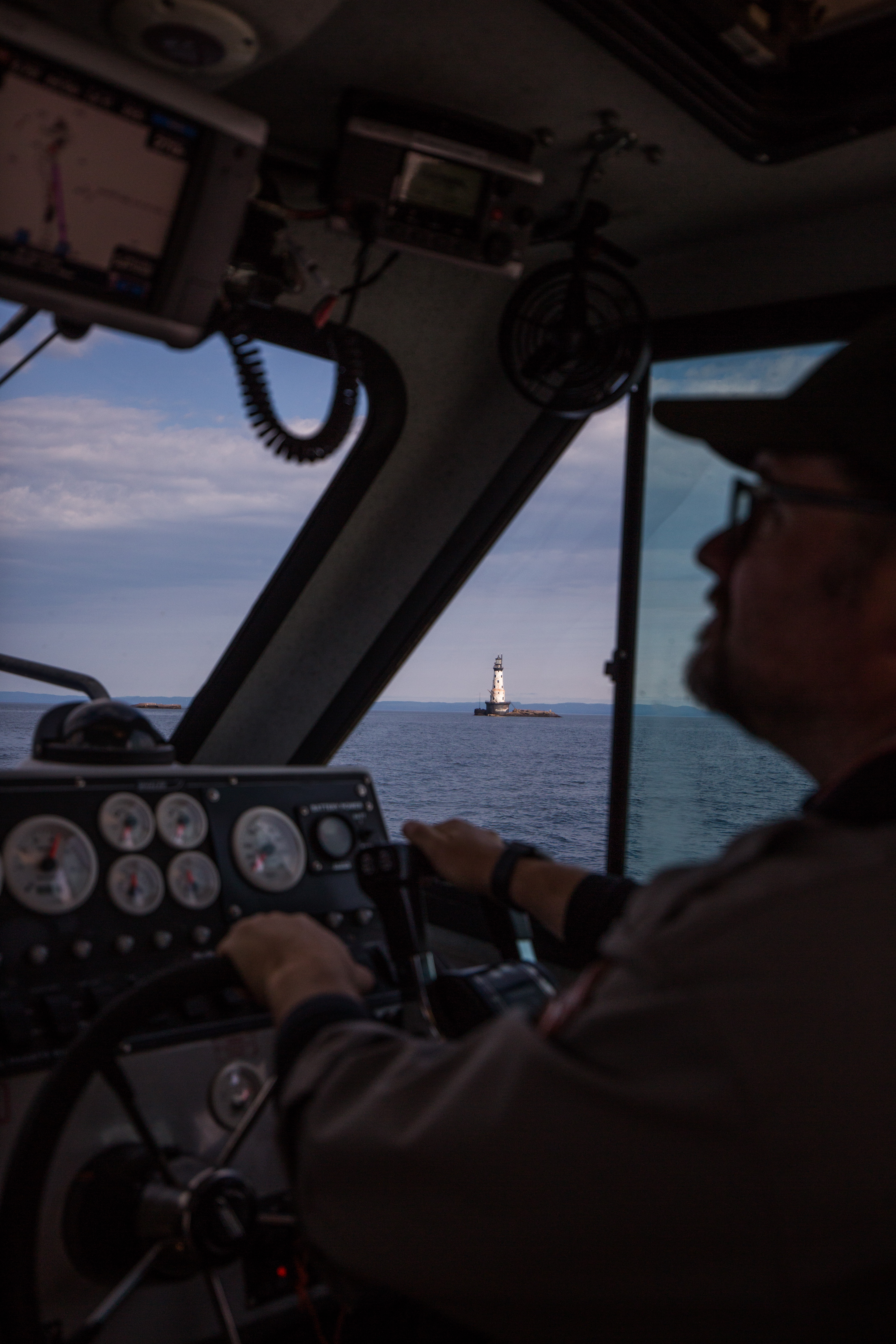
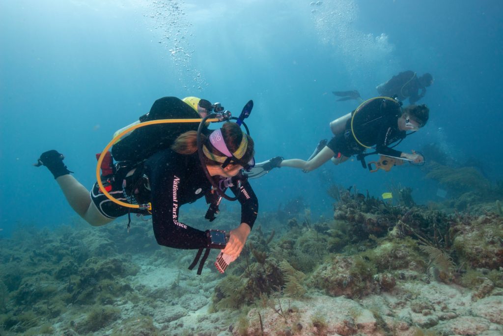
It is strange to think I only have about a month left as a REEF intern – there are so many projects going on here, a few of which I will center my upcoming blog posts about. Of particular interest to me is the Volunteer Fish Survey Project, which I am planning on committing much of my time to in the next several weeks. I am also hoping to team up with Michael, the current National Parks Service Intern, for a day, so stay tuned for that. I would also recommend reading his excellent post about Isle Royale National Park!

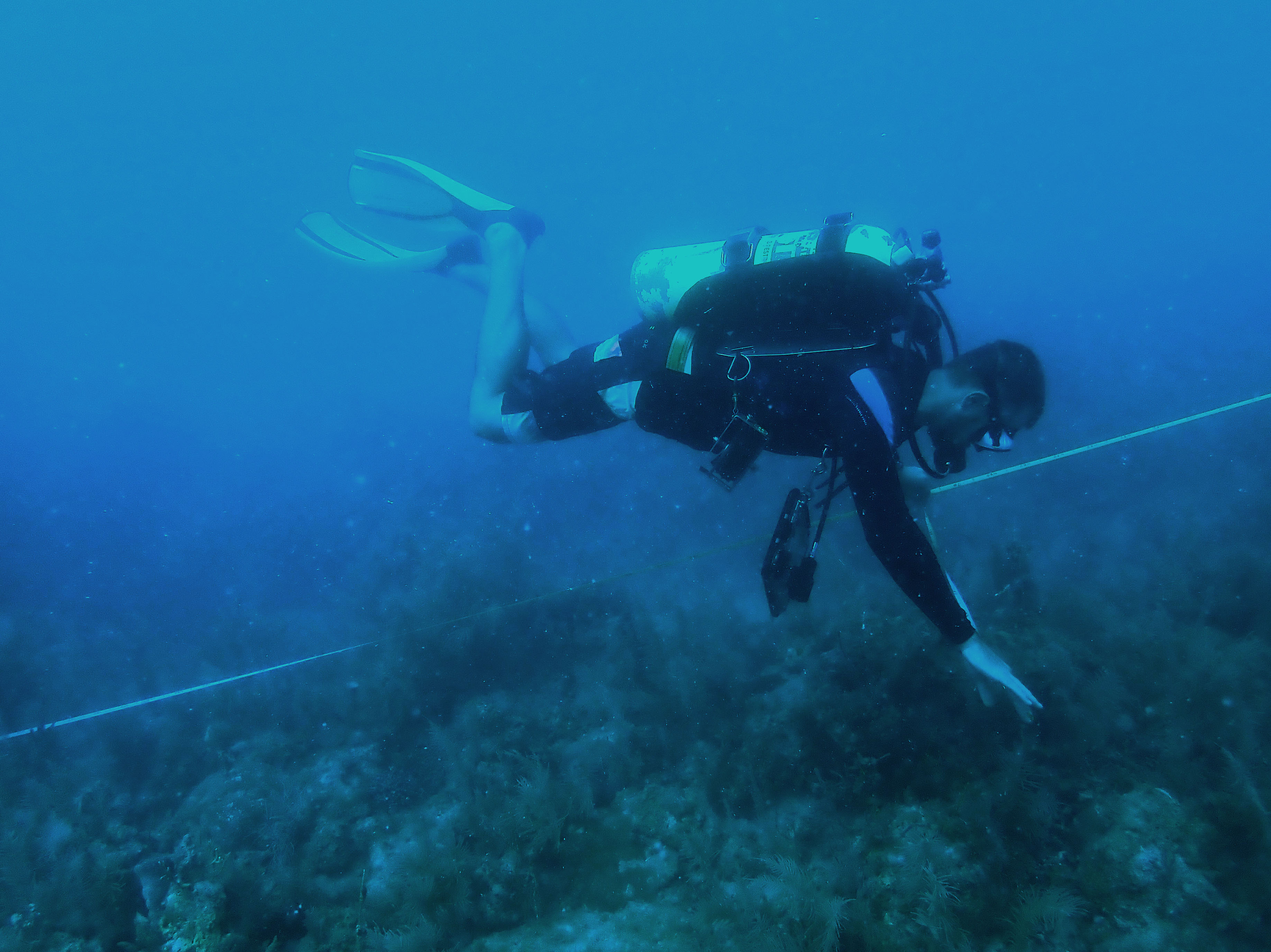
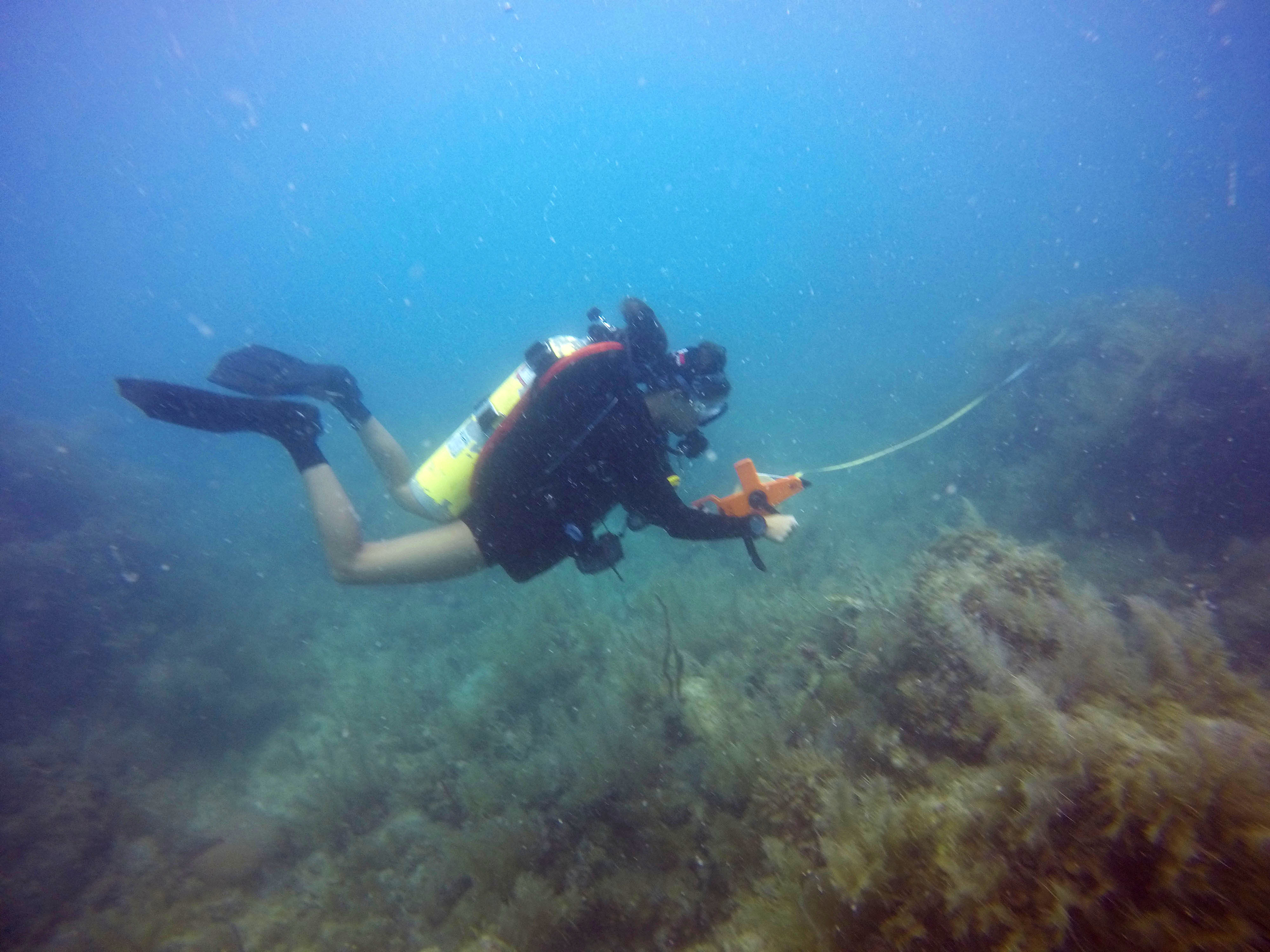
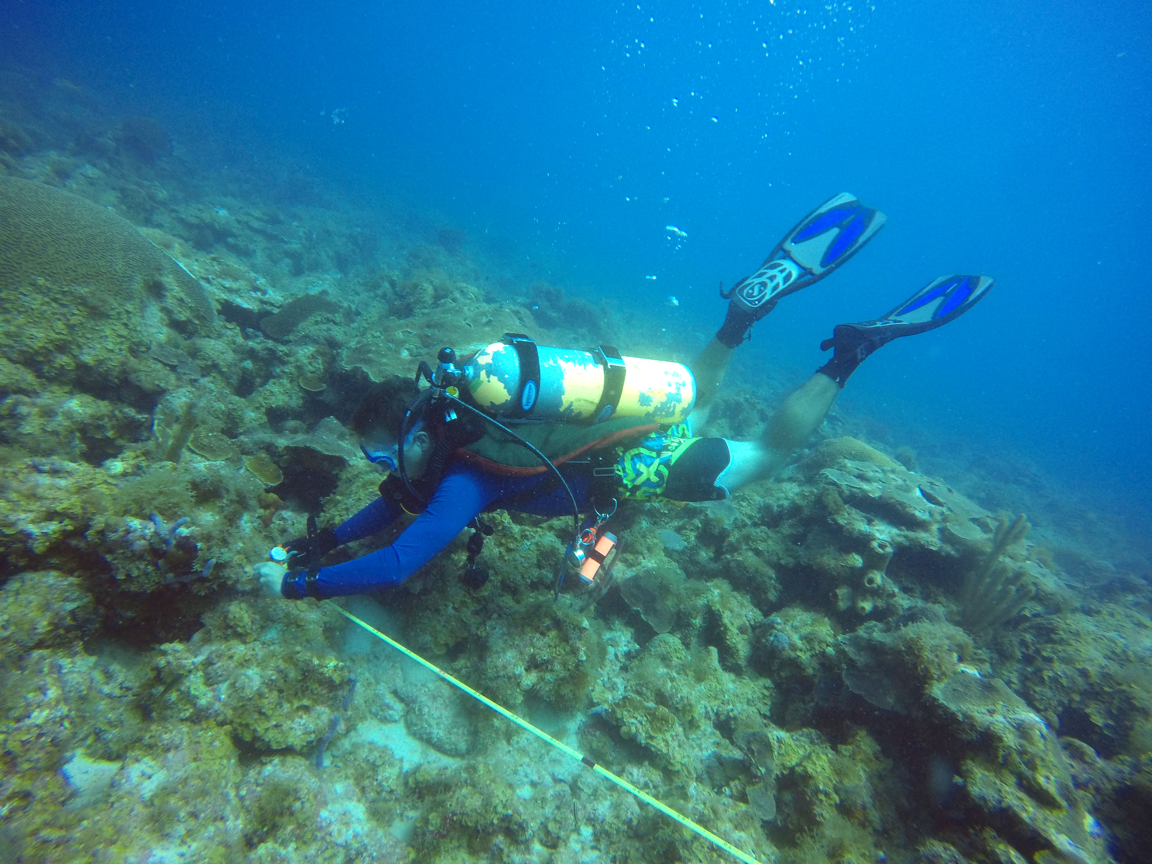
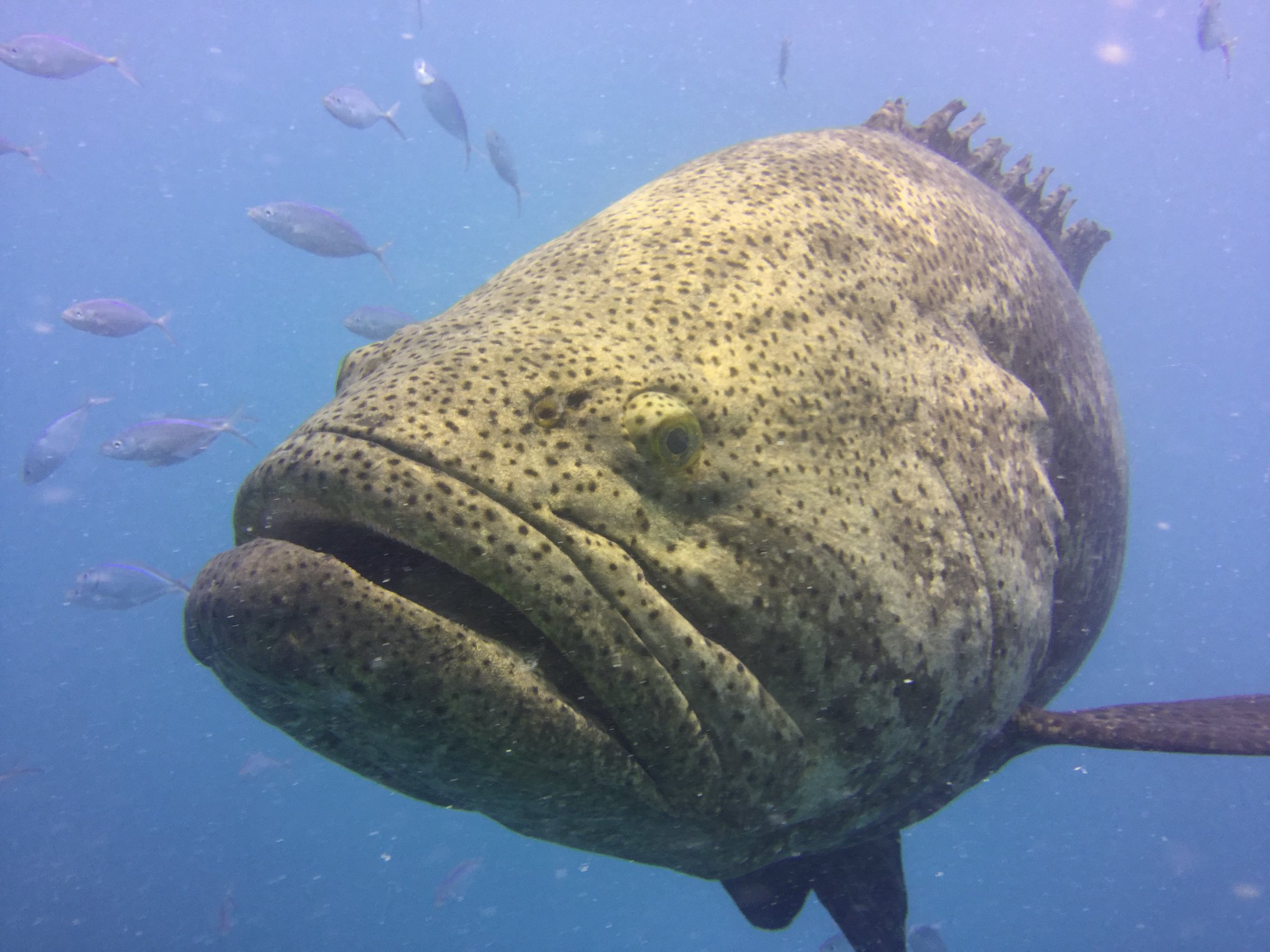
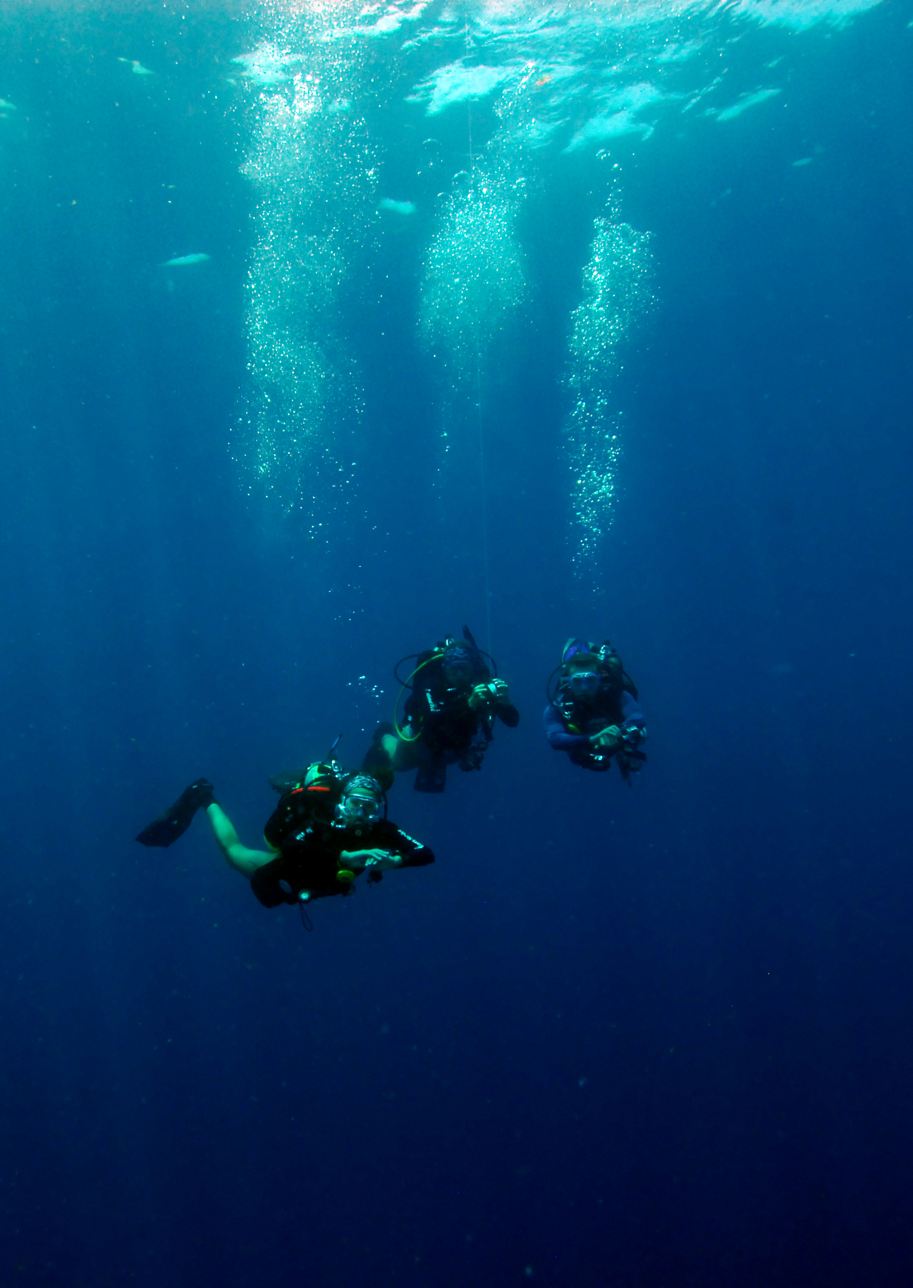
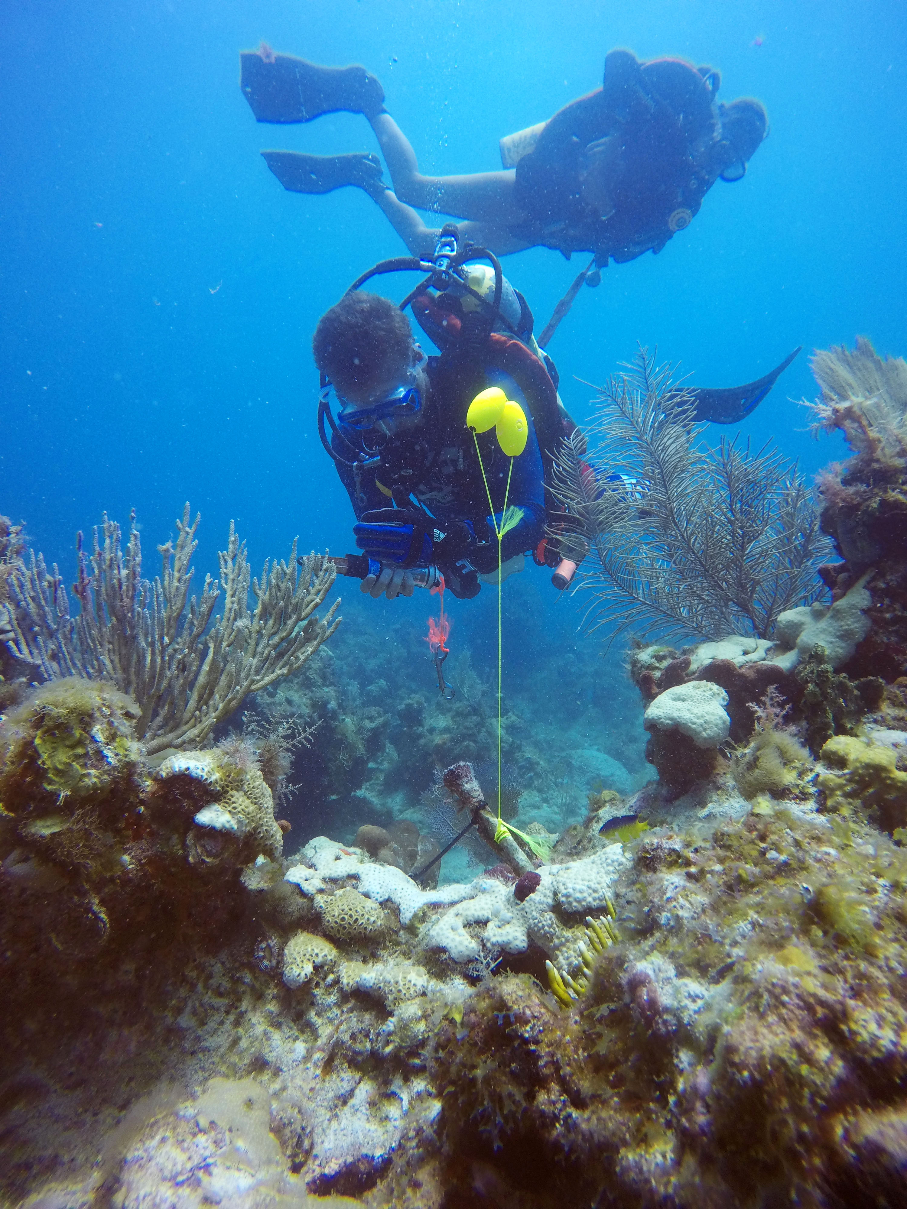
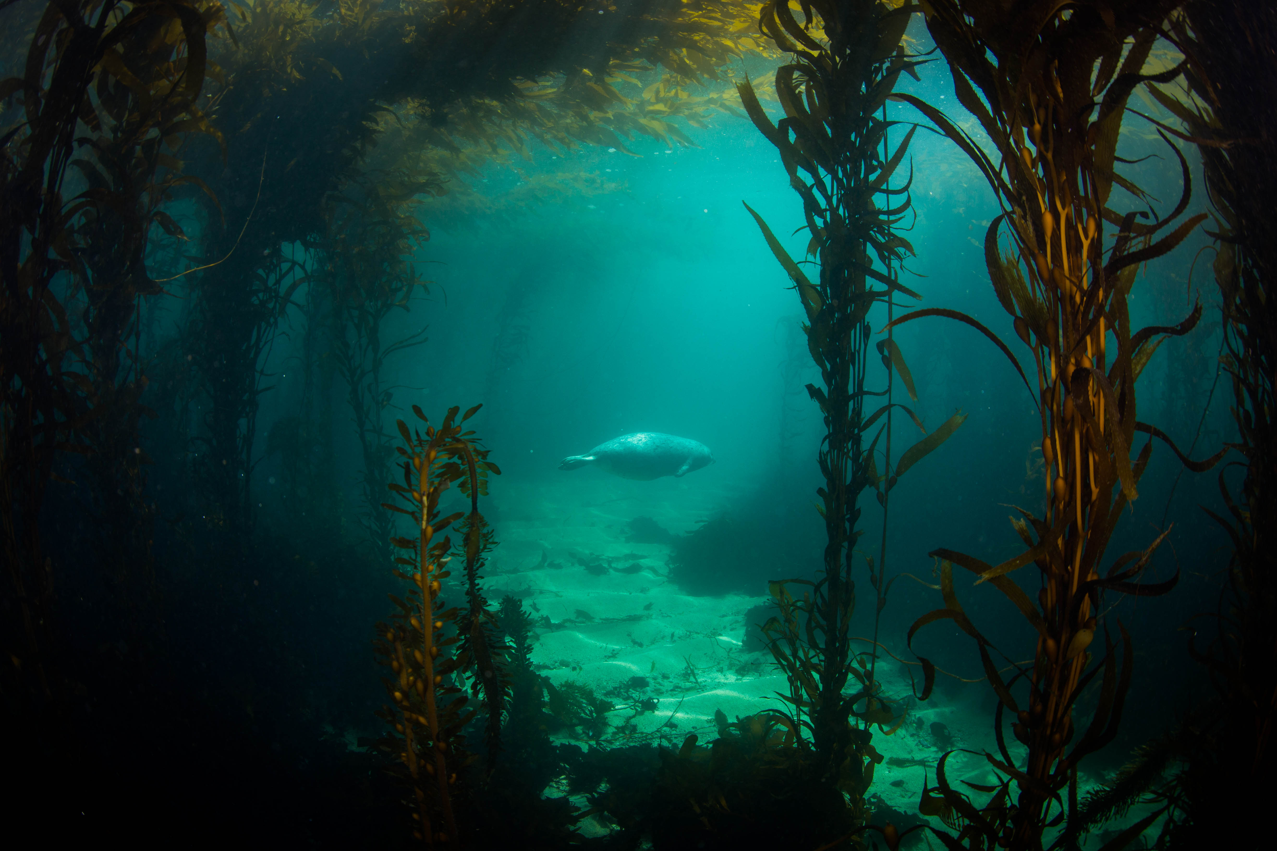
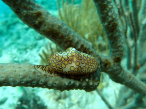
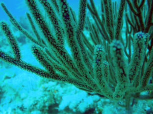
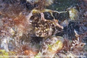
Lastly, below are some stray photos from fish survey dives I have been doing while not corralling kids or spearing lionfish:

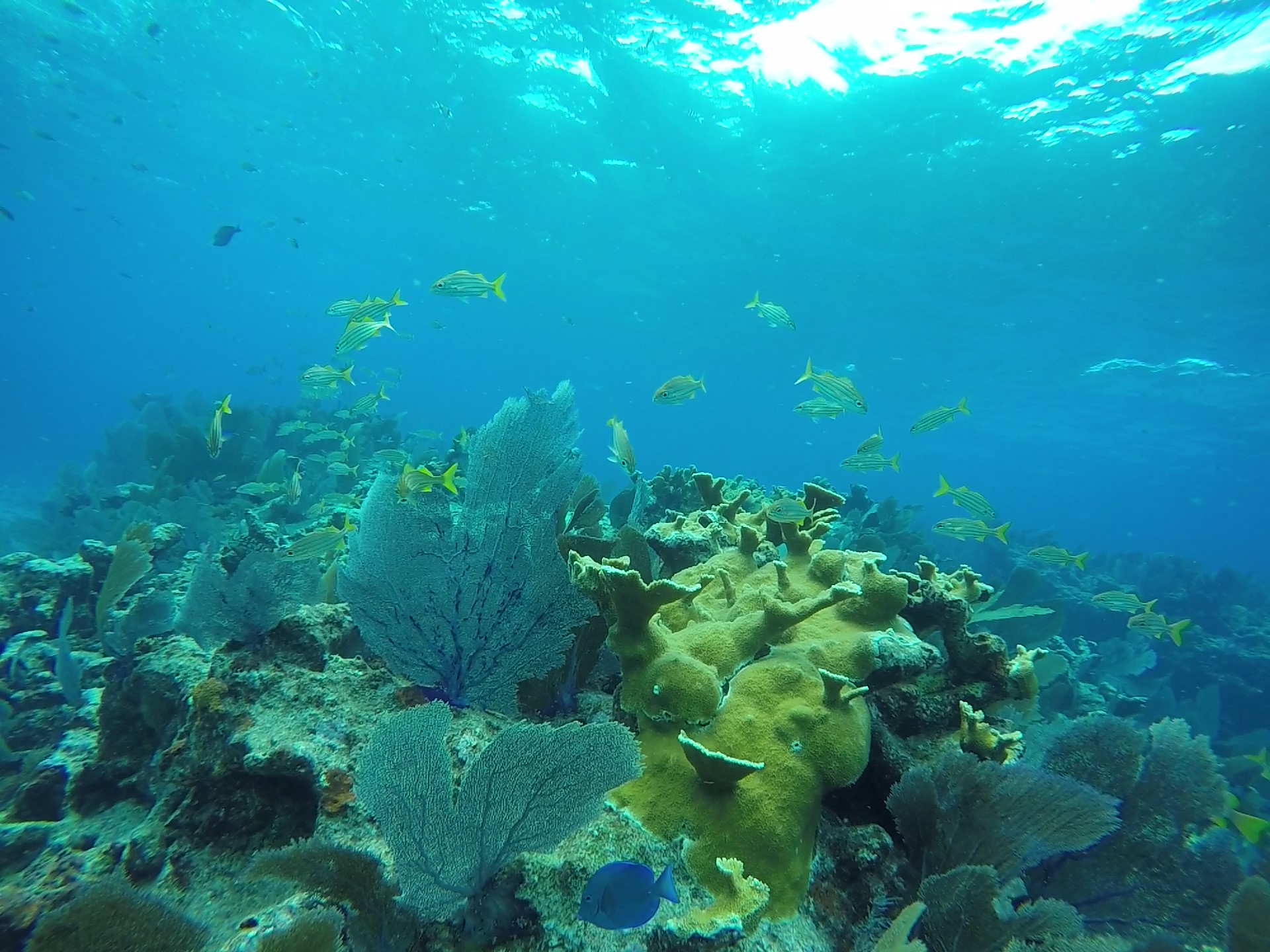
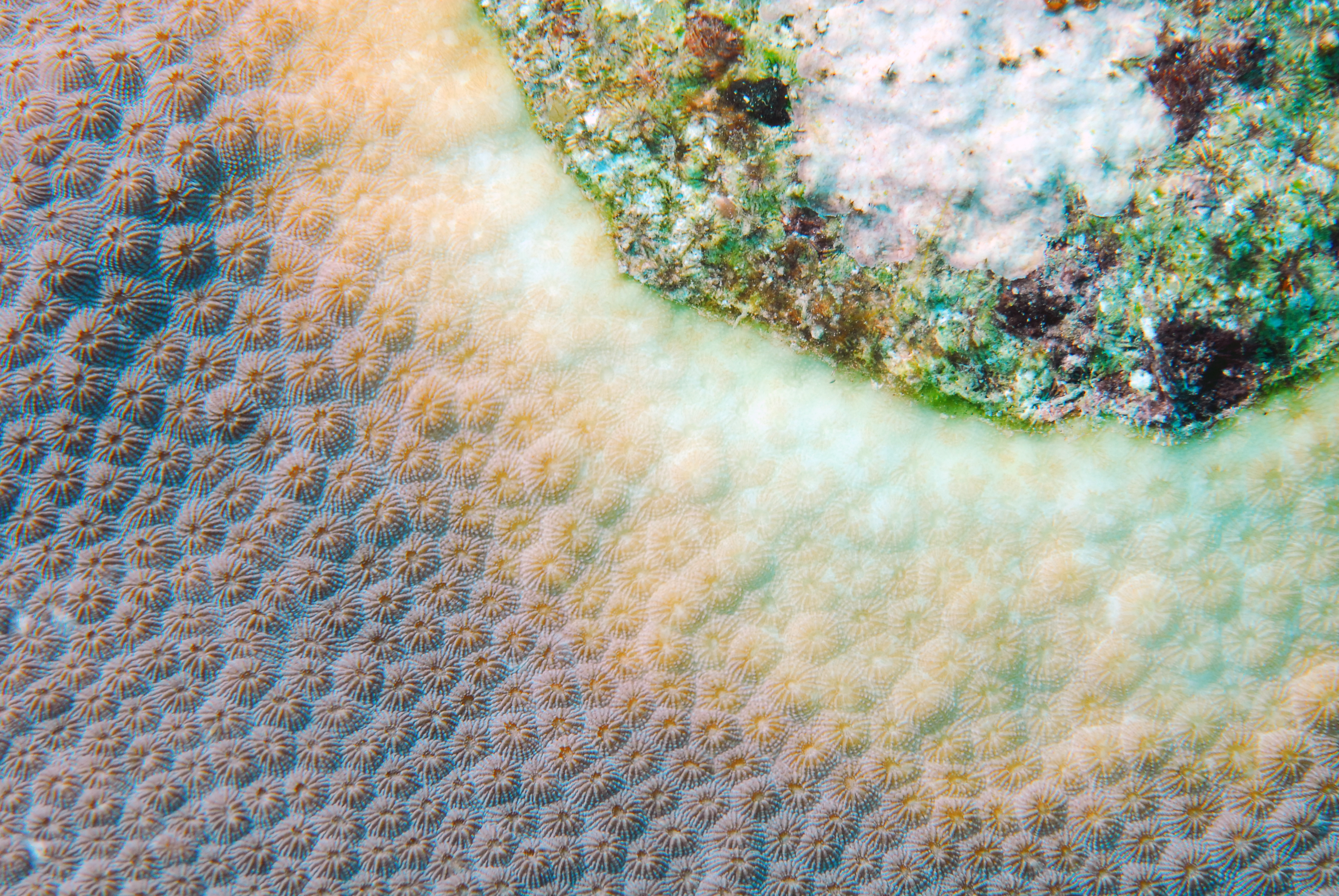
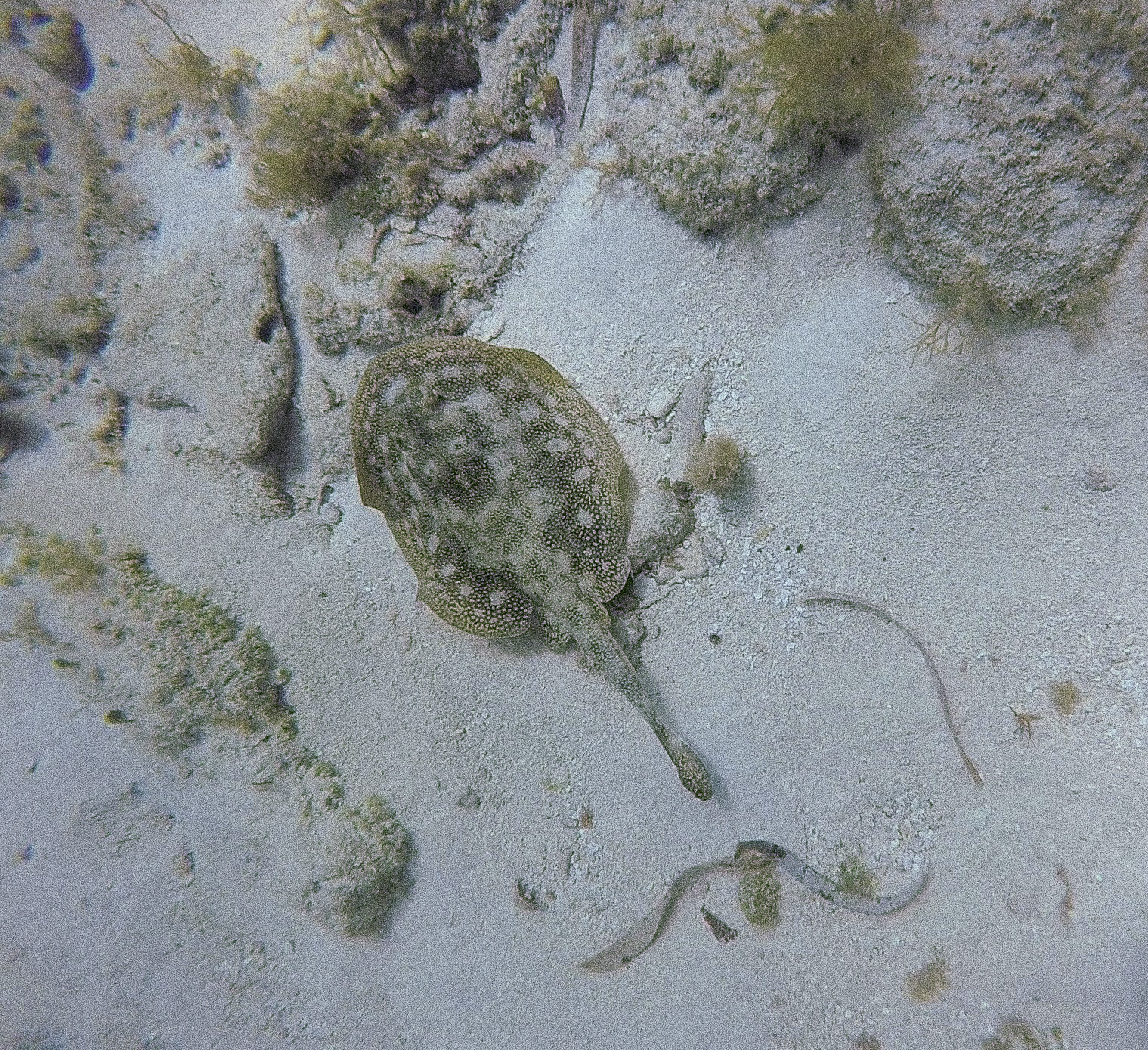
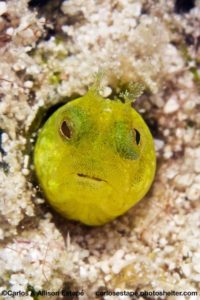
My favorite photo I have taken so far, albeit without any color correction. I love seeing healthy Acropora palmata (elkhorn coral) out on the reefs, as that can be few and far between now in the Keys. Coral Restoration Foundation is doing great things to help restore this species – I hope to volunteer with them soon!

Flowing gorgonian

Share

Isle Royale – Shipwrecks and Buoys in Lake Superior

Isle Royale National Park

After the lengthy and fun-filled 18 hour drive we arrived at Grand Portage MI, our transfer point to the island. Isle Royale is an island in the Northwestern tip of Lake Superior, closer to our Canadian neighbors than Michigan. Made a National Park in 1940 to protect its wild landscape from the impact of the ever-interested logging and mining companies, Isle Royale is a remote and hard to access park boasting untainted northern wilderness, diverse wildlife, and beautiful backpacking. Its 893 square miles of woods host wildlife such as eagles, moose, and wolves. It is also home to the longest-running ecological studies of a predator prey system in the wild (61 years and counting), studying the oscillating population cycles of the island’s moose and wolves. For those of us more interested in the underwater side of things, it also is home to ten major shipwrecks – nicely preserved by the cold, fresh water and free of fouling by invasive zebra mussels. These wrecks, concentrated around the island due to its precipitous bathymetry and centralized location in major shipping routes, are what brought us to this chilly and wild island paradise.

Isle Royale is only accessible by boat or seaplane, and since we couldn’t fit our 2 tons of luggage into a small four passenger plane we opted to boat over. Upon arrival to the harbor we were met by West District Ranger Steve Martin, a close friend of the SRC who had arrived to welcome us to the park and help us across transferring project equipment to the island. Apparently things had been running far too smoothly at this point, because it was then that the SRC’s vessel, Cal Cummings, decided to protest our seamless morning with a myriad of boat-complaints – from battery to steering issues. I was impressed with the SRC’s troubleshooting and repair skills, after a bit of time at work they were easily able to locate the problem and coax the vessel back into service.

Launching the Cal Cummings, the SRC’s vessel


Not a bad day on Lake Superior

While our boat was undergoing a quick attitude readjustment, I joined the first trip across to the island on one of the ISRO boats. My first time on the waters of Lake Superior was stunningly beautiful- sunny, calm, and warm. Reading about the Park and the lake itself, I expected to run into much less favorable weather. Stories of intense storms whipping up 30 ft swells and winter chills dropping far below zero had me prepared for the worst, but my introduction to the park was beautiful and favorable. Zipping through the calm protected waters of Washington harbor and watching small wooded islands and the outstretched fingers of the elongated Isle Royale fly past was thrilling, and heavily reminiscent of the protected inland seas of Southeast Alaska.

After an hour crossing, we arrived at Windigo, our home for the next 3 weeks. Located at the western end of ISRO and consisting of a visitor center, store, campsite, and housing for park employees and visiting researchers, Windigo is the smaller of the two main entry points of the Park. While small, this is the only populated place for miles on this wild island and is a welcome stopping point for backpackers and day-trippers alike. Being a small operation, Windigo is home to one road and one car – an old Jeep that I’m not sure ever gets used, as it sat in the corner of a small field near the store the entire time I was there (and from what I hear, in the same exact spot it was in last year as well). Transportation of gear is handled mainly by a small fleet of miscellaneous vehicles: a golf cart, a utility vehicle, and a tractor hauling a small wooden trailer. The latter is what we used for our first couple trips hauling our bounty of gear up the hill to our housing, and quickly became an invaluable part of our daily pilgrimage to and from the dock. These vehicles are used and maintained by Marty Ogden, lead maintenance staff for the Windigo part of the island, who was incredibly helpful during our time on the island with everything from transportation, to maintaining power, to helping us unload all our gear.

While the primary reason we came to ISRO was to conduct 3D photogrammetry (more on this later) for a couple of the area’s shipwrecks, we couldn’t jump right into the fun. First, we had some other work to do: helping out the ISRO dive team with installation and maintenance of some of their buoys. The Park uses many buoys, some to mark safe passage into harbors or submerged hazards, and others as moorings or markings of wrecks for dive operations. These buoys are instrumental in keeping visitors and passing boaters safe. Unfortunately, the waters of Lake Superior get very cold in the winters and often freeze over – requiring the buoys to be removed when the park closes for the season. This means that, come May when the Park begins to open back up, lots of buoys must be reinstalled. The SRC, as a way to repay ISRO for helping support their photogrammetric efforts,  assisted in buoy installation according the strict manning requirements of OSHA for the first week of our visit. And so, we started our work.

SRC diver Matt Hanks splashes in for the first dive of the trip while Jim Nimz observes from the water

The first dive of the trip was on a sunken passenger ferry just barely inside the mouth of Washington Harbor, the America. This vessel, which lies in the protected waters and juts out of the depths to a mere five feet below the surface, was an easy way to start the trip as well as a good introduction for work to come – as the America was one of the primary photogrammetry targets of this trip. The work – which consisted of two divers locating the wreck and buoy attachment point (pretty easy when it’s visible from the surface), getting passed buoys from surface support on the boat (yours truly), and attaching the buoys via high-tech maintenance tools (wrench and zip ties) – went by without issues. I also got to see my very first wreck of the trip, one of the shallower ones at the bow and quite intact. Seeing glimpses of such a sharp and clean bow emerging from the depths from the deck of our boat was a powerful image for me, a small taste of what lies hidden in the foreboding waters surrounding this island.

Later that afternoon, I got in my first dive of the trip – my first in the Great Lakes and my second freshwater dive I’ve ever done – splashing in the comparatively balmy waters just off the Windigo pier (44 degrees compared to the 36 degree water just outside the harbor). Getting in the water was thrilling, seeing the lake floor carpeted with fallen leaves and branches from the nearby shore, the water dark with tannins. I delighted in the delicately silty bottom, and coming from a biological background, was excited to see some native clam species. As well as an introduction to the lake, the dive served as a check-out for me, where Brett observed and evaluated my skills. I guess he was sufficiently pleased, as shortly after I was cleared to join the team on some working dives.

Heading out for a day of work

Brett Seymour navigating to one of the sites near Rock of Ages lighthouse

The next couple days were a flurry of more maintenance diving. The team installed buoys on more wrecks (the Cox and the Chisolm) out near the Rock of Ages lighthouse, and then boated over to ISRO’s administrative headquarters, Mott Island. There we met Park Dive Officer Mike Ausema, Natural Resources Chief Seth DePasqual, and super volunteer Carol Linteau. From here, we would split the teams up to work on two different objectives. Team one (Mike, Seth, Brett, Susanna, and Matt) would go out on the ISRO park vessel and install a selection of harbor buoys, while team two (Carol, Jim, and myself) would stay back on land and work on some much needed buoy repairs to prepare them for install.

As part of team buoy maintenance, I got to learn some of the more technical, land-based aspects of the craft. Jim, maintenance diving expert and the SRC’s gear guru, is very knowledgeable in these regards and served as a bit of an instructor to Carol and I over the next couple hours. Under his patient direction, I learned a couple of skills essential for buoy work: splicing rope, mousing wire, and removing marking stickers. I was also able to master the art of efficient wrench-usage. With these newly acquired talents, I helped Jim and Carol prepare three new buoys for installation marking submerged wrecks.

ISRO Park Dive Officer Mike Ausema and ISRO Natural Resources Chief Seth DePasqual installing a no wake buoy. Image – Susanna Pershern.

Throughout this first week I was able to learn a bit about the technical aspects of NPS maintenance diving. Unlike most types of NPS dives, which are classified as scientific dives, maintenance dives are considered commercial dives and are sanctioned under OSHA rules. This means that they must be done slightly differently: they cannot be conducted on closed circuit (the SRC’s preferred method of diving), divers must carry a bailout bottle, and there must be a dive tender geared up and waiting at the surface while the maintenance buddy team is down, ready to hop in and assist at a moments notice. It was cool seeing all this work get done in a different fashion – despite not having dove much with the SRC team at this point I knew how much they were into diving with rebreathers, as it makes for more efficient diving (DSO Steve Sellers told me that they had run the numbers and found that they were 40% more efficient diving in the field with closed vs open circuit) – and seeing the team do such varied work. While not necessarily as thrilling as conducting archaeological assessments or 3D modeling shipwreck sites, maintenance diving is an important part of the diving work done at ISRO and is invaluable in making the area safer for visiting boaters.

The SRC geared up and ready to go, maintenance-style (left to right): Matt Hanks as dive tender, Jim Nimz and Susanna Pershern as divers (complete with bailouts)

I guess I had been a good intern during my buoy repair times on Mott Island, as I soon got word of some exciting news. The next day we were traveling to the north shore of the island, where, along with some buoy installs, I was to be treated to my first wreck dive of the trip: a dive on a massive freighter that wrecked there in 1947, the Emperor.

Brett Seymour examines the windlass of the Emperor

The day started off exciting: as well as going to and diving off of the north shore, where some of the islands deepest and most exciting wrecks lie, we were going to make a quick stop at the uninhabited ranger station on Amygdaloid Island to pick up a buoy and change into drysuits. Upon arrival at the small fringe island we were met with a bitter cold wind that felt like it had just came from the Canadian arctic, whipping through the chilly forests and across the border and the small stretch of water that separates Amygdaloid Island from the Canadian coast. Biting and unrelenting, the wind made a compelling argument to put on every warm layer I had and cover it all in a big waterproof suit. Thankfully an old ranger cabin on the island was available for our changing needs, and in its rustic and unheated wooden walls I climbed into enough layers to clothe a small family: three thermal bottoms, five thermal tops, two pairs of wool socks, and two drysuits one-piece undergarments, stacked on top of each other. With my newfound warmth and lessened mobility, I joined the team on our boat as we left that rugged and icy island in search of shipwrecks. The day was already off to a good start.

The cozy ranger station on Amygdaloid Island

As we traveled up towards our site, with the Canadian coast off our port side and Isle Royale’s north shore, speckled with remnants of the winter snowbanks, I thought of what it would be like going down in these waters. Many of the island’s shipwrecks met their watery grave during the lake’s violent winters, where storms thrashed the vessels into shoals and pulled passengers under. Wrecking here during the harsh northern winters was almost a sure death sentence – if the waters didn’t get you, the air would. One of the wrecks we passed on our way up that day, Kamloops, is a testament to this. The ship, now resting at a depth of around 260 ft, wrecked during a violent winter storm in 1927. While some of the passengers went down with the ship (and some remain there to this day), many escaped and made it to shore. These unlucky people didn’t fare much better than their drowned companions – the brutally cold temperatures quickly took their toll and the initial survivors succumbed to the elements. The fate of the Kamloops long remained a mystery – the ship vanished during a winter with no trace of its whereabouts until the discoveries of the bodies of some of the crew the next year along the coast of Isle Royale, and even then the location of the vessel itself was still unknown. It wasn’t until 50 years later that it was discovered by a diver.

Imagine being stranded on a remote coastline like this, during a winter storm with freezing temperatures and blustering winds

The fate of the Emperor, however, shows that storms aren’t the only cause wreckage around Isle Royale. The Emperor, a 525 ft freighter traveling along a common trade route across the lake, hit a barely submerged shoal off of the island’s north shore on a calm and moonlit night around 4AM on June 4th, 1947. Speculation says that an inexperienced first mate may have improperly adjusted the course by a couple degrees, dooming the vessel and setting it on a course for the reef. Reefs like these surround the island, and have caused the end of many of the ships that now rest beneath the surface.

After arriving at the site of the bow of the Emperor, our first team of maintenance divers went down to attach our freshly spliced and stickered buoy. After a successful attachment, it was time for my official introduction to Isle Royale diving. Brett hopped in the water with me and we dropped down to the massive bow of this unfortunate freighter. The size of this ship was hard to grasp at first – despite being relatively intact, years of ice forming and breaking on the surface of the lake has taken it’s toll on the comparatively shallow (40-50ft) bow and has left it partially mangled. Regardless, the wreck was still in great shape and very imposing, with massive features like a huge windlass, deck winches, and anchors present for viewing. Brett took me around the to the good spots and then ended the dive with a quick buoy inspection (have to make sure the team is doing quality work). Being the elite dive team that they are, they passed with flying colors.

The rest of the week was filled with more maintenance diving – attaching buoys to new wrecks, and fixing some older buoys that needed more chain due to lake level rise from last seasons massive precipitation. Maintenance teams went out to add buoys to three more wrecks: the Cox, the Chisolm, and the Glenlyon. Two of Isle Royale’s dive team, Seth and Carol, came down to join in on the festivities for these installs.

Dusk in Washington Harbor, from a nice hike

Not being an experienced maintenance diver myself, I didn’t get in on too much of this fun but instead had a couple days off, where I was able to go on a hike and catch up on some work. I was able to get in a dive on the America with Matt, just to explore the site before we approached doing photogrammetry on it. An absolutely wonderful wreck, the America is an old passenger ferry that lies in 15-85 ft of water. It is very digestible, large enough to be exciting but small enough to swim around it in one dive. It also remains very intact, with the entire hull and most of the deck machinery in place still. It had recently (within the last 10 years) fallen victim to a large swell (or set of large swells) that did some serious damage to the cabin and rest of the deck structure, which made for a very interesting debris field off one side of the wreck. Overall a very nice dive site with lots to explore.


Interspersed in with all of the buoy work was the first test of the SeaArray, the SRC’s flagship photogrammetry machine. This incredible piece of equipment was put to the test on a break between buoy installs on ships – but I’ll save all that exciting stuff for the next blog. Don’t want to get ahead of myself. Overall, the maintenance and buoy work was very successful. Combined, the SRC and ISRO dive teams installed 11 buoys: 5 no wake buoys, 1 channel buoy, and 5 wreck buoys. These buoys will serve their important job keeping the waterways marked and safe for the rest of the season, until their removal before winter and the damaging surface ice comes. Now, with all the maintenance work done, we were free to get on to the exciting part of the trip: the 3D photogrammetry of some of Isle Royale’s beautiful shipwrecks.

Share

Turtley Amazing Trip to El Pardito, Mexico

Over the past few weeks, I’ve had the chance to help on a wide variety of research projects that took place on and around the beautiful island of El Pardito. But before I get into the extraordinary stories of the sunsets, hikes, and inspiring research. I must explain how we got there …

The first segment of the research trip to Mexico consisted of waking up at 3am to go from San Jose Airport to San Diego Airport, then an Uber ride to the border, then a flight from Tijuana to La Paz, Mexico, arriving promptly at our destination at 3pm. This frantic travel time was 100% worth it. The next day we took a few boats to the barren rock island (to be correct, there is actually 1 cactus on the island), El Pardito. The crew on this research trip consisted of a few faculty and their graduate students from UCSC, a graduate student from UCSD, a turtle researcher from Costa Rica, an assisting researcher from Mexico, and myself.

Isla El Pardito, home to incredible fishermen and their families. (Image: Pinterest)

Sunset in La Paz

The first research project that I assisted on was focused on potential turtle food found in riverine mangrove habitat in the San Jose Estero (estuary). Our team (Unofficial Team Name: Dive Goddesses) identified and collected 100 samples (approx. 10 of each species) of sponges, tunicates, and vegetation within the Estero via snorkel. After collection, the goal was to run isotope analysis on all the samples so we had to dry them out. We made small boats out of aluminum foil for cleaned samples to dry in the sun. We not only learned several species identifications but also perfected our aluminum foil origami skills.

Myself and Andrea Paz

Myself, navigating with a GPS (Photo: Dorota Szuta)

Once all the samples were dried and put in their respective vials, the next project started: Benthic Biomass! Our team went back out into the Estero to weigh biomass of the invertebrates that grow on mangrove shoots. My main role was navigator, and I also helped with scraping the organisms from the shoots, removing water from the contents (cowboy with a rope-style), and weighing them. The lovely Dorota Szuta who is a sponge and tunicate expert identified organisms, recorded the data, and brought the shoots to the boat, which was the MVP, the heart and the brain to the project. We finished sites on the main channel, lagoon, and side channels in one day!

Cortez Stingray cruising along the bottom of the sand

Next project: Fish Surveys. Again we traveled within the Estero, we learned new species, and made a species identification PowerPoint, but one thing was different – no origami. Also a few of us on the team dived in shallow water to survey the fish. We learned different species of grunt, snapper, stingray, parrotfish, wrasse, damselfish, and more!

There were other tasks done that related to other projects. For example, Diana Steller and I dived to put in receivers for the turtle tagging project in a non-planned matching wetsuit, hat, and shirt. This was my first dive in Mexico and my first time working underwater with a receiver. The dive consisted of finding the GPS point of the old receiver, dropping cinder blocks with chains attached, descending to attach the receiver to the cinder block. For the second receiver, we used a screw anchor which involved kneeling on the sand and twisting a metal bar into the sand in order to attach the receiver. We also had an audience: a three-banded butterflyfish that took residence in between the cinderblocks.

Diana Steller and myself about to go on our dive to plant new turtle receivers (Photo: Dorota Szuta)

A sentence that I never expected to say is “I went diving for turtle poop”. Before this trip, I never thought about what turtle poop looked like. Here’s some turtle poop history: one component of this ongoing turtle project is to find out where the turtles spend most of their time and what they eat, since Hawksbill sea turtles are Critically Endangered and they are the most threatened out of all turtle species. In the past, researchers that came to El Pardito would put cameras on the turtles to track what they ate and their interactions. But it was hard to see exactly what they wanted to consume. Years ago, Diana and her past graduate student, Dorota found poop (which they thought was human at the time) that had green specks of algae, tunicate, and other benthic life. It was the perfect opportunity to find out what these turtles consume!

Flash forward to now: myself and others had our faces a foot above the sand scanning for turtle poop. There have been 13 poops found in the past, and after about three dives/snorkel trips, we, unfortunately, found 0. There was one potential poop that Dorota and myself collected but it disintegrated.

Sunset from El Pardito (Photo:Kelly Zilliacus)

On a happier and non-poop-related note, El Pardito and the neighboring islands were home to the most amazing sunsets and star gazing. Luckily while we were there, we went as a group to hike, explore, and watch the full moonrise at a nearby island. The views were breathtaking (I may have also been out of breath from running up the hill to catch pictures of the sunset from the top).

Sunset from the top of a hill on a nearby island.

Besides the Turtle projects, there was a project focused on the Manta Rays. Two wonderful scientists, Melissa, a Ph.D. student from UCSC and Nerea, who was working on her postdoc, worked very hard to retrieve drone footage of the rays.

Melissa and Nerea prepping the drone to capture manta ray footage

My view of the manta rays, swimming below and around the boat

Although I didn’t directly help with their project, they let me go with them to watch them in action. It was very exciting to see them work together to find big groups of rays and follow them with the drone. This involved Nerea watching the screen (under a towel) and Melissa driving the drone. They got amazing videos of the manta rays while I watched the water looking for manta ray splashes.

I want to also give a shout out to the 2019 Our World-Underwater Scholarship Society interns. I am incredibly proud to be in the same cohort of interns and excited to share experiences with them and the OWUSS family.

2019 OWUSS Interns (Left to right): Ben Farmer (REEF Marine Conservation Intern), Liza Hasan (AAUS Mitchell Scientific Diving Research Intern), myself, Michael Langhans (National Park Service Intern) and Abbey Dias ( DAN Diver’s Safety Education Intern)

I am so grateful that I had the chance to go on this research trip and I look forward to helping with other research and dive here in California.

A photogenic bunny at the La Paz Serpentarium

Bonus content: Some of us visited the La Paz Serpentarium where we got to see snakes, birds, alligators, foxes, and feed some guinea pigs and rabbits.

Share

The Omnipresent Divers Alert Network

Whether you are new to scuba diving or an experienced scuba instructor, you’ve probably heard “DAN” mentioned more than a few times.

Most of us know that DAN plays an important role in dive safety, probably from purchasing some form of dive insurance from them throughout the years. One of the best-known perks of DAN is the 24-hour availability to speak with dive medical specialists (For DAN’s emergency hotline: +1 (919) 684-9111).

But DAN is much more than answering phones and dive insurance! It wasn’t until I walked through the doors of the headquarters that I began to understand the true scope of its services. DAN is a global leader in dive safety education, research, products, and services like providing emergency medical assistance — and not just limited to diving!

Figure 1. Patty Seery, Director of Training at DAN and PADI Course Director, Jim Gunderson, Assistant Director of Training at DAN and NAUI Course Director Trainer.

This summer, I am the 2019 OWUSS/DAN Dive Safety Education Intern working with Patty Seery and Jim Gunderson. Like Patty and Jim, the many people I have met here at DAN are incredibly passionate about dive safety and accident prevention through education. From the medical professionals to the masters of IT, everyone plays an important role in making DAN accessible to divers across the world. I started my time here meeting with the head of each department: research, communications (including writers of Alert Diver), marketing, insurance, membership, IT, warehouse, and risk mitigation. DAN requires all the essential elements like any company, including marketing devices, a mail room, and lots of Krispy Kreme doughnuts.

Since a large goal of DAN is safety education, my work this summer involves revisions to DAN’s first aid courses for international utilization. Because DAN is a globally recognized organization, it is important that all materials continue to match guidelines for first aid in different countries and are understandable, accessible, and inclusive to partners across the world.

Aside from my position, DAN offers summer research internships. I had the opportunity to serve as a practice patient for their studies.

Figure 2. My heart! Frauke Tillmans, Ph.D., using an echocardiogram. Research interns are practicing using these procedures as part of their studies to look at bubbling in divers.

Although we work hard in the office, we like to have fun outside, too. On the weekends, the best place to find me is underwater.

Figure 3. DAN crew diving at Blanch quarry. From left to right: Hannah DeWitt, Tess Helfrich, Caitlyn Ruskell, Jim Gunderson, Andrea Filozof, Frauke Tillmans, Alex Romfoe, Chloe Strauss, George Anderson, Abbey Dias (me), Shelli Wright. Interns testing out waterproof EKG leads during the dive for research.

I am looking forward to helping make our dive community increasingly safer and more accessible to people across the world!

Figure 4. Me, feeling like a saltwater fish in freshwater, learning to be euryhaline at Fantasy Lake (NC). Photo by Tess Helfrich.

Share

A Return to Home – REEF [1]

My arrival in Key Largo two weeks ago in many ways felt like a return to home. As a junior at the University of Kentucky, I studied abroad in Bonaire where I fell in love with the vibrant coral reefs ringing the small island. Since then I have been looking for ways to return to the tropics, and the Keys get pretty close. Lying just a few degrees above the Tropic of Cancer, Key Largo is by definition subtropical but has many of the same fish and invertebrates I spent countless hours studying in Bonaire. Here with my fellow interns and the staff at Reef Environmental Education Foundation (REEF) as the Dr. Jamie L King Marine Conservation Intern, I have had the chance to view this underwater world through the earnest lens of a nonprofit.

2019 REEF Interns, left to right: Matt, Ben (me), Stacey, Kate. This was taken right before our first fish survey dives, with Rainbow Reef Dive Center. We saw a school of midnight parrotfish and several huge rainbow parrotfishes on one of our first days down here!

My time so far this summer has largely been split between three main avenues: working in and around REEF Headquarters; contributing to the Volunteer Fish Survey Project; and developing career skills such as my Divemaster certification. In the short time since my arrival, I have done everything from helping set up an aquarium tank for showcasing invasive lionfish, to diving with a group of spotted eagle rays on the local barrier reef, to swimming with manatees. While I have not gone diving every day, the office work that fills in the time between has been truly rewarding. Being an intern means being the face of REEF, in that many of REEF’s Volunteer Fish Surveyors never interact with any staff members in person. The organization has its roots in Key Largo, yet is truly global. While my interest as late has been in the Tropical Western Atlantic (TWA) region, there are databases for several other major regions throughout the world that volunteers collect and submit valuable fish sighting and abundance data. I am happy to have started a project creating TWA fish identification practice quizzes to help prepare intrepid surveyors for identifying fish on dives, and I plan to work on other regions such as the Pacific Northwest.

Our second week here, the interns were given a tour of MarineLab, a marine science education center in Key Largo. By a stroke of luck we were able to snorkel with a small group of manatees. Pictured here was a very curious baby!

Just as exciting as REEF’s global reach, however, are the times that we are able to interact with the local community. While I have not had much involvement with education catered to a younger crowd in the past, being able to present on the ecology of the Florida Keys to middle school students recently made my day. I certainly see science as my career path, but I am also committed to making  science accessible. REEF has offered me a great opportunity to develop this skill, and I look forward to outreach/education events in the future. Lionfish derbies are a great example, so stay tuned!

This was an amazing moment on World Ocean’s day, when we contributed to Coral Restoration Foundation’s Coralpalooza event. Families and their kids visited the Interpretive Center at REEF to do fish “surveys,” and this kid in particular was very excited about identifying the Nassau grouper.

A large part of what has enabled me to reach this point as an Our World Underwater Intern has been gaining SCUBA certifications. Acquiring my Rescue and AAUS Scientific certifications while in Bonaire was instrumental in pushing my career forward in marine research, and the next step for me is achieving my Divemaster. One of the best things about REEF so far has been its absolute commitment to furthering its interns’ careers through both networking opportunities and providing access to diving. Both initiatives have helped me work with a dive shop in Islamorada called Key Dives, which will be training me to be a Divemaster throughout the summer. I am so privileged to be in this position, and I look forward to honing my dive skills in order to be a better scientist and instructor in the future.

This is a Yellow Stingray, an exciting sight in the Keys. I somehow missed a 15-ft sawfish on the dive prior, but seeing this beautiful ray undulating through the water made up for it.

Share

On February 13th I got one of the most exciting emails I’d ever received: the one breaking the news that I had been chosen as the 2019 Our World-Underwater Scholarship Society Research Intern with the National Park Service. After a few minutes of jumping around in excitement, I composed myself and calmly replied that yes, I would be absolutely delighted to accept this internship. And that’s where this all began.

A little background on myself: I had graduated from University of California, Santa Cruz the past summer  with a bachelor’s degree in marine biology. At UCSC, I was able to really start to explore how I could interact with and learn about the underwater world and coastal environments. I was lucky to spend four years learning about a plethora of marine science with some really incredible professors: from invertebrate zoology, to the biology of marine mammals, to the ecology of kelp forests.  I furthered my diving career with an AAUS scientific diving certification, allowing me to take my diving past recreational and into the realm of science! This certification opened many doors for me – with it I was able to enroll in two field quarters, conducting ecological research in the kelp forests of Monterey and Southeast Alaska, as well as spending two seasons doing biological surveys on kelp forests inside California’s network of Marine Protected Areas with the UCSC branch of PISCO subtidal (a long term monitoring program of nearshore ecosystems along the Pacific coast).

My local Californian kelp forests!

Along with diving for science, I’ve been lucky enough to get in a good amount of recreational dives throughout my time at university.  Close proximity to great diving and a drive to get underwater as often as I could allowed me to spend a lot of time exploring the kelp forests of the Monterey Bay area for pleasure and doing one of my favorite things: underwater photography. I’ve been diving with a camera of some shape or form ever since my very first couple dives with a head-mounted GoPro, but eventually worked my way up to a housed DSLR system about halfway through my junior year at university. Shooting underwater with this has become one of my biggest passions and something that I’m thankful that I’ve been able to dedicate a lot of time to over the past couple years.

My favorite camera and I enjoying a dive in Big Sur CA (Photo: Marc Shargel)

Jump forward two months to early April, to the Our World Underwater Scholarship Society annual meeting in New York City. Designed as a way for friends and society members to meet and catch up and for scholars and interns of the previous year to share their adventures, this weekend was a whirlwind of introductions and events. The Society is filled with a plethora of talented and distinguished marine conservationists, explorers, researchers, photographers, and enthusiasts and it was an incredible experience to be able to mingle and meet with such a diverse group of individuals. The weekend included a morning of presentations from the 2018 class of scholars and interns at the Explorer’s Club headquarters in Manhattan, an inspirational couple hours of learning what these driven young people had been up to throughout the course of their scholarship year/internship. The morning concluded with inductions into the Explorer’s Club for the 2019 class – what an incredibly surreal experience it was to join such a distinguished organization for scientific exploration, something I still haven’t really gotten over.

2019 OWUSS Interns (Left to right): Ben Farmer (REEF Marine Conservation Intern), Liza Hasan ( AAUS Mitchell Scientific Diving Research Intern), Kyra Jean Cipolla (Dr. Lee H. Somers AAUS Scientific Diving Intern), myself, and Abbey Dias ( DAN Diver’s Safety Education Intern)

Roughly one month after that, on May 12th, I flew out to Denver Colorado to spend a week at the headquarters of the Submerged Resources Center (SRC). The SRC is a group of archaeologists, photographers, and diving experts who make up one of the Parks Services’ most elite diving teams. They are also, luckily for me, my sponsors for the internship. I was to spend a week with them at their offices in Lakewood, CO to get oriented for the summer and get all of my NPS paperwork in line – physicals, dive checkouts, liability waivers and such. After flying in at 7PM and a quick dinner with my hosts for the week, Dave Conlin, archaeologist and the Chief of the SRC, and his lovely wife Michelle, I started the week running. The next morning I was introduced to the rest of the SRC crew: Brett Seymour (Deputy Chief and audio/visual extraordinaire), Steve Sellers (National Dive Safety Officer), Susanna Pershern (audio/visual expert), Matt Hanks (archaeologist), Claire Finn (Office Manager) and Jim Nimz (Diving Operations Specialist). Everyone at the SRC office was incredibly welcoming to me during my time there, and made me feel very much at home.

Entrance to the SRC Office

Monday brought on an exciting doctor’s visit for my NPS Blue Card certification, where I got a very thorough dive physical. After a myriad of tests, from EKGs to spirometry to chest x-rays, I was on my way back to the SRC office. I spent the rest of the day reviewing the current course of my internship with Brett, and then doing some light reading on the history of NPS diving and then a brief foray into 81 pages of dive policy and rules.

Flatiron Mountains outside Boulder CO – Some of the scenery I encountered on my commute to the SRC HQ

The next couple days were just as busy. Tuesday started off with a CPR/AED/first aid recertification with Jim, where we recapped the basics of first aid and CPR administration, AED usage, neurological assessments for SCUBA diving injuries, emergency O2 administration, as well as an overview of the SRC’s first aid kit and medical gear. That was followed with one of the most exciting parts of my week: the gear checkout.

SRC gear locker: pretty much all the dive gear you could ever want in one convenient location

Cylinders, compressors, and camera gear

Tools on tools

The SRC has one of the coolest gear lockers that I’ve ever laid my eyes on: a room right next to their office filled with all the dive gear you could want. Drysuits, rebreathers, cylinders, tools, cameras, DPVs – you name it. Brett and Jim gave me a quick tour of the locker and decked me out with all the dive gear I’d possible need for my travels throughout this internship, and – as I’ve heard the SRC crew say a couple times across the couple weeks I’ve spent with them, “two is one and one is none” – I was also given plenty of spares. The plethora of gear that I was given was compounded by the fact that I was to be doing diving both in the 80 degree waters of the Caribbean and the 30 degree waters of Lake Superior, so I’d be packing both warm and cold water gear. The list of gear that I was given is as follows: a BC, regs, wetsuit, wet gloves, dry gloves, glove liners (X2), wet boots (X2), hoods (X2), dive computers (X2), reel, DSMB, cutting device, Nautilus emergency tracking device, dive lights (X2), dive notebook, mask (X2), fins, drysuit undergarments (many), drysuit (X2), wet gear bag, dry gear bag, dry bag, towel, NPS hat (X2), SRC field shirts (X5), board shorts, rash guard, deck coat, and thermal liners. With this gear overload, I started to ponder the logistics of packing all of this gear up for the many flights I’d be undertaking.

My gear for the summer

After getting geared out, the next logical step was to hop in a pool and test it (and my swimming ability at altitude) out. For that, I headed down to the local pool with Steve Sellers for my NPS blue card checkout. Here we ran through some typical dive and swim tests, like a 900 yard swim and SCUBA bailout drill (jumping in the water with all your gear wrapped up in your hands and donning it underwater). Almost all of these drills I’d done before, but previously I’d been about 5200 ft lower in elevation so this was a little bit more taxing than I was used to.

After getting my blue card certification and getting all prepped to dive with the NPS, I helped the SRC team prep for their next big adventure – 3D photogrammetry up in Isle Royale National Park – a trip that I was lucky enough to be able to join in on. Now, this is a three week field excursion into a relatively remote national park. This means we needed lots of gear and lots of preparation. Isle Royale NP is an island up in northern Lake Superior and is mostly wilderness, so on top of packing food, gear, and supplies for a three week stretch we’d also have to bring drysuits and thermal protection. This, on top of the fact that the 3D photogrammetry work is very gear-intensive in itself, means that we had a whole lot of stuff to pack up. Thursday and Friday of my first week were spent preparing for this big endeavor – running last minute errands, grabbing and fueling up the boat, and loading what felt like a couple hundred pelican cases into the back of our truck and trailer. After a full day of packing, a lovely good-bye dinner with my gracious hosts Dave and Michelle, and a relaxed Saturday off of exploring the Denver area, I was ready to start my next adventure: a 1210 mile drive to the wild and remote waters of Isle Royale National Park.


Heading to Isle Royale National Park

Share

Washington, DC: The End of the Road

The final stop of my internship was Washington, DC where I gave two presentations to National Park Service employees. After arriving in DC, I met Cliff McCreedy, Marine Resource Managment Specialist for the NPS Ocean and Coastal Resources Program. Cliff walked me through my schedule for the next few days and helped me make final edits to my presentation.

Thanks, Cliff for being so welcoming and helpful! I really enjoyed getting to know you.

On Wednesday, I presented to ~25 employees who were gracious enough to give up their lunch hour to hear me speak about my internship. Sharing my experience with such a diverse group was extremely rewarding. I gave my second presentation the following day to Raymond Sauvajot, Associate Director of Natural Resource Stewardship and Science, and Sonya Coakley from the Office of Visitor and Resource Protection (Public Health). This small setting gave me the opportunity to discuss my internship in more detail, and answer follow-up questions regarding each park.

Thanks again, Ray and Sonya for coming to my presentation!

It’s hard to express in words how amazing my summer was. I learned so much, met so many incredible people, and made memories that will last a lifetime. Thanks to everyone in the NPS who welcome me as the 2018 OWUSS NPS intern. And thanks to everyone who has followed my journey via this blog! I hope that in the future I can find a home again with the National Park Service.

Next stop, King Abdullah University of Science and Technology (KAUST) in Saudi Arabia where I will be an MSc candidate in the Reef Ecology Lab!

Share

Biscayne National Park: An Eye Opening Archaeology Experience

For the second time this summer, I pulled up to Biscayne National Park (BISC) with my bags in tow. For the last two weeks, archaeologists from BISC, the Submerged Resources Center (SRC) and the Southeast Archaeological Center (SEAC) had been documenting two sites with the help of colleagues from East Carolina University, University of California Santa Cruz, and Cheikh Anta Diop University in Senegal.

This archaeological work would not only provide detailed maps of these two previously undocumented sites, but it also gave the NPS the opportunity to run a field school for their visiting colleagues. This work at BISC was in coordination with the Slave Wrecks Project, a program which works to research, train, and educate with a focus on the global slave trade. Collaborators of the project include Smithsonian’s National Museum of African American History and Culture, George Washington University Capitol Archaeological Institute, IZIKO Museums of South Africa, the South African Heritage Resources Agency, Diving with a Purpose, SRC, and SEAC.

Upon arriving, I was greeted by familiar faces as I helped offload the boats. Matt Hanks, an archaeologist for the SRC and the project lead, then introduced me at the day’s debriefing. That evening, after some excellent barbeque, I observed as Joel Cook (MSc at ECU) and the three Senegalese students (Laity, Djidere, and Adama) added new drawings to the Boxcar sitemap. While observing, Joel explained the mapping procedure. For each flagged object, a mud map (i.e. a rough sketch with detailed dimension measurements) is drawn. These measurements are used on land to more accurately construct the object. Once resized, the object is transferred to mylar paper and sketched on the larger map.

Laity, Djidere, and Adama exploring the underwater world at BISC PC: Susanna Pershern

On Saturday morning, we rose early and headed to BISC to begin our day of diving. On our first dive, I accompanied Tara Van Niekerk, a Ph.D. student from ECU, as she collected some measurements at the Boxcar site. This shallow, small site was surrounded by seagrass and crowded with divers as everyone worked diligently to get their measurements. Next, we traveled to Morgan’s Wreck, the other undocumented site, where Matt gave me and all unfamiliar with the site a tour. Much larger than Boxcar, Morgan’s Wreck is located at about 30 ft and provides divers more room but also gives them more artifacts to sketch. My day ended with a trip to Pollo Tropical, a must-visit according to several members of the SRC crew.

During the surface interval, two of the Senegalese students enjoyed the stern of the Cal Cummings, the SRC’s boat

The next day, I accompanied Matt and Jessica Keller, an archaeologist for the SRC, on three dives at Morgan’s Wreck. While underwater, I assisted with measurements and got the chance to sketch my own object. Without any maritime archaeology experience, my first sketch of a simple box was awful. After each dive, I would ask Jess and Matt questions before returning to my box on the subsequent dive. Finally, by the last dive, I had adequately taken measurements from an aerial view (i.e. only width and length), and I had used a compass heading rather than angles to orient my object to the baseline. A baseline is a line that runs along the “middle” of the site and is used to orient objects at the site. The baseline is made of a strong cave line with a tape secured alongside.

A prime example of how many archaeology were working on the site at the same time PC: Susanna Pershern

On Monday, we took the opportunity to catch up on mapping and determine what drawings were missing. At each site, numbered flags were placed on each object. Therefore, we were able to determine which points were missing. Excited to draw my simple box, Charlie Sproul, an archaeologist from SEAC, explained the dimensions of the map and how I should go about transferring my object. At that moment, I realized I incorrectly measured again. To orient an object on the map, we used two types of measurements from the baseline. When objects are close to the baseline, baseline offsets are utilized. For this measurement, a tape runs from the baseline at a 90-degree angle to the object. Trilates are when two measurements are taken from a single point on the object to two separate points on the baseline. The length of the tape and location on the baseline is used to determine the position of the object relative to the baseline. Often trilateration and offset measurements are taken before an object is drawn by using the numbered flag as a measurement point; therefore, the diver sketching the object must label the location of the flag on their object…something I neglected to do.

Every evening after a long day of diving, the group works diligently to add their sketches to the sitemap

Ready to correct my drawing, I headed out with Jess, Joel, Charlie, and Arlice Marionneaux, an American Conservation Experience intern at BISC. After a day full of more diving and more measuring, I was excited that I finally had all the necessary information to add my box to the map. Over the past few days, with trial and error, I had learned a lot. I developed a massive appreciation for maritime archaeology and enjoyed assisting the group over the next few days as they worked to finish the mapping at Morgan’s Wreck.

I observed as Arlice finished up the measurements for one of her drawings PC: Susanna Pershern

In addition to our normal crew, while at BISC, we were accompanied by a team of filmmakers who were working on a slavery documentary. While their film is still in the early stages, I got the opportunity to observe document filming first hand, both above and below water. During my week, I also got the opportunity to play with my camera and capture the gorgeous organisms that populated the area around Morgan’s Wreck.


After completing a majority of the mapping, some of the group shifted their priority to jumping anomalies. Last year, in association with the Slave Wrecks project, the NPS dragged a magnetometer around a large portion of BISC’s marine habitat in search of the Guerrero, a Spanish pirate slave ship that wrecked in the Florida Keys. In 1807, Britain and the United States both passed legislation to end the slave trade; however, slavery was still legal in the United States. The heavily armed Guerrero would attack other slave ships and forcibly transfer the Africans to their boat so they could sell them for profit. In 1827, while patrolling for slave ships, the HMS Nimble, caught sight of the Guerrero. The fight ended with both ships running aground. Tragically, 41 enslaved Africans were killed when the Guerrero sunk, while hundreds of survivors were recaptured and transported to Cuba to be sold into the slave trade. For more detailed information, check out this video which was produced through a partnership between the NPS SRC and Curiosity Stream.

During their search for the Guerrero, the group identified over 1,200 anomalies. When the magnetometer was pulled across the ocean surface, the GPS coordinates were recorded when the device sensed iron. While iron can be found on wrecks, it can also be found on anchors, lobster traps, and other marine debris. To examine these anomalies, we traveled to these GPS coordinates, dropped a buoy with a weight, and then completed snorkel or diving surveys to determine what triggered the magnetometer. We spent around 10-20 min at each spot, depending on visibility. If we discovered anything of significance, a picture was taken, and a detailed description was recorded at the surface. At 1 of 12 anomalies checked on Thursday, Bert Ho, a survey archaeologist for the SRC, and I found a large piece of wood with nails. Yes, that was the most significant find out of all twelve anomalies jumped that day! While it seems trivial, jumping anomalies was awesome. Not only did you get to experience different dive sites around BISC, but there was always the small hope that you would stumble onto an undiscovered wreck.

Bert throws out the buoy to mark the anomaly’s location before snorkelers/divers enter the water

After another day of anomaly jumping and a lovely day off, I was fortunate enough to spend my Sunday with Ronnie Noonan, the 2018 OWUSS REEF Intern. Based out of Key Largo for her internship, Ronnie was able to accompany Joel, Jess, Dave Conlin, Chief of the SRC, and I as we visited several wrecks in BISC. Blessed with spectacular weather, we explored four sites along the Heritage Trail. Joel took the time to point out significant ship structures to Ronnie and I. In addition, with Ronnie’s assistance, I got the opportunity to test my fish identification skills. Having been trained to do REEF surveys in Bonaire, I was excited to try my hand in Florida waters. Not only were my fish ID skills a little rusty, but identifying fish while snorkeling made the process far more difficult.

Ronnie and I after a snorkel at the Erl King Wreck. If you look close enough, you can even see Miami’s skyline in the distance

That evening, after a lovely day on the water, I accompanied Dave, Joel, and Arlice at the welcome barbecue for Youth Diving with a Purpose (YDWP). YDWP is a nonprofit organization that works to teach students about ocean conservation and maritime archaeology. As an offshoot of Diving with a Purpose, one of their focuses is the maritime history and culture of African Americans. For the final days of my internship, I would be assisting YDWP as they ran their maritime archaeology program at BISC.

On Monday, we assisted YDWP with their archaeology coursework by setting up a mock wreck for the students to practice baseline offsets and trilates. While in Key Largo with YDWP, I was also fortunate enough to grab lunch with my friend, Lydia. She was an intern with me in Bonaire, and I was extremely excited that we got the chance to catch up. For the next two days, Arlice, Dave, Andie Dowell, Josh Marano (an archaeologist for BISC), and I traveled to an undocumented wreck in BISC and observed as the students practiced underwater mapping. With slates and tapes in hand, the students worked diligently to find objects, sketch them, and record their position at the site. In addition to helping YDWP, I worked alongside Dave to uncover artifacts with a metal detector. This site was discovered while jumping anomalies last year, and archaeologists need more information before determining whether or not the site is the Guerrero.

YDWP students swim from their boat to the site to begin mapping PC: Andie Dowell

Working with YDWP was a privilege. Not only did I meet a group of enthusiast students, but the instructors were clearly passionate about the underwater world as well. Thanks again Dave for allowing me to assist with this program for the final days of my internship!

And of course, we decided to take a group picture where all of us are looking directly into the sun

After drying my gear one last time and packing up my bag, I was ready to head home for a few days before traveling to Washington, DC. While in DC, I would present about my summer internship to various members of the National Park Service.

Thanks to the members of the SRC, SEAC, and all their colleagues who were willing to teach a biologist some archaeology. I really enjoyed my second trip to Biscayne National Park. I got to participate in a project entirely out of my realm, and I had a spectacular time!

Share

Fin

A week has passed since my last day at REEF and I am home reflecting on all the fins I got to see during my three months in The Keys.

Turtle Fins:

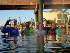
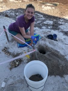
I was able to help trained NOAA volunteers by going out on turtle walks. During the months of June and July, Loggerhead sea turtles come ashore in Islamorada to nest. On our Sea Oats Beach, we had 21 nests and 15 false crawls this season. A false crawl is a marked incident where it looks like a turtle has come ashore to nest but there was no nest dug; this usually happens if the turtle gets spooked or the conditions are unfavourable.

After 60 days since being marked, nests are checked regularly for signs of hatching. I was able to help excavate 3 nests this summer and released 3 baby turtles that were trapped in a nest. We collected data on the number of eggs and which of those were hatched/unhatched. Then we open the unhatched eggs to record if they are fertilized or not. All this information is important to monitor the turtle population in the area.

Fish Fins:

Since getting to know more fish species, I have started to appreciate seeing rare fish. For example, finding these Papillose blennies was a real thrill.

I spotted them during a dive with Allison and Carlos Estape who are established REEF members and fish ID experts. Carlos was very excited by my find as this was the first time they have seen this species in the keys or otherwise. It is an especially rare find because it is not listed in the Alligator Reef and Evirons paper which is the most comprehensive list of species of the area to date; it contains 618 different blenny species!

Another set of small fins belongs to the Mangrove blenny.


Amy Lee, REEF Trip Program and Communications Manager, informed us that she had seen a Mangrove blenny while snorkelling through some dock pilings. This was surprising news because Mangrove blennies have only been described to be in Cuba. So, we organized “The Great Bayside Blenny Hunt”. The group of us pictured below went out to find this far from home fish.

After a couple of hours snorkelling, we were able to capture two live specimen and obtain in situ pictures. The specimens were sent out to a lab for DNA sequencing and we received word that our predictions were correct: this was in fact a Mangrove blenny. Thanks to our efforts, it was the first time its DNA had been sequenced and the first specimen captured in Florida since the 1960s.

Human Fins:

A high percentage of my summer consisted of helping with educational programs. A specific one that I will always remember is Force Blue. Force Blue is a program that unites Special Operations veterans and marine conservation professionals to create a team of conservation warriors. Force Blue employs these veterans’ highly trained diving skills to assist in conservation efforts which accomplishes two missions: helping to assimilate combat veterans to civilian life and supply aid and bodies to citizen science initiatives.

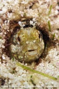
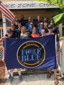
REEF participated in this program by training The Blue Force team to contribute to our database by surveying fish. We also educated them about the lionfish invasion and trained them to properly remove lionfish. It was an amazing opportunity to dive with these men and to learn a little bit about their world. For some of them, this was the first time they had seen a coral reef despite being trained divers for many years.

……

As far as the question I asked in my first blog, how REEF’s extensive database can be used to engage a wide audience on ocean conservation, I have decided to answer that by staying on past my internship to help with the Fishinar program. Fishinars are REEF’s brand of interactive webinars designed to teach the finer points of identifying fish. They are meant to be an aid for those already involved in our Volunteer Fish Survey Project and an introduction to fish surveying for those who are not. Fishinars can also be on relevant topics of ocean conservation.

I will be helping to grow this program by sourcing different advertisement opportunities and creating topics to deliver a Fishinar myself. Speaking, as a form of science communication, is a passion of mine and I am excited for the opportunity to grow that skill.

My time here at REEF gave me first hand experience in the world of marine conservation. Because of this experience, I now have a better understanding of where I want to contribute in the future. The connections I made and the chances I had to grow my skill set were invaluable. I have many people to thank but especially my supervisor, Ellie Splain for giving me the trust and encouragement to accomplish my goals this summer. As well, thank you to the Our World Underwater Scholarship Society who without, this experience would not have been the same.

Best Fishes,

Ronnie

Share

Dry Tortugas National Park: A Fortress of Coral Below the Waves

After arriving in Miami the previous day, in the early hours of Monday morning, Kathryn Grazioso, a marine ecology intern for the South Florida/Caribbean Network (SFCN), picked me up and drove me to the offices of the SFCN inventory and monitoring team. After loading the truck, Mike Feeley, a marine ecologist for SFCN, Kat, and I headed to Key West with the 29-foot boat in tow.

To manage park resources and collection information about ecosystem health over time, the NPS created 32 inventory and monitoring networks. These networks collect and analyze data about the marine and terrestrial ecosystems of over 280 national parks. The data is then used to inform management decisions. The South Florida/Caribbean Network I&M Program encompasses seven parks: Big Cypress National Preserve, Biscayne National Park, Everglades National Park, Virgin Islands National Park, Buck Island Reef National Monument, Salt River Bay National Historical Park and Ecological Preserve, and Dry Tortugas National Park (DRTO).

For the next 10 days, I would be assisting SFCN’s marine team as they completed their annual benthic monitoring at DRTO. The MV Fort Jefferson would serve as our transportation to and from the park and our home base. MV Fort Jefferson is a 110-foot, NPS boat used to transport staff and supplies to DRTO. Aboard the Fort Jeff are three crewmembers: Captain Tim, Brian LaVerne, and Mikey Kent, the Park Diving Officer at DRTO.

After unloading our gear onto the MV Fort Jeff and receiving a tour of the quarters, we grabbed dinner in town and appreciated the final few hours of civilization. At 9 am, the following morning, the MV Fort Jeff left Key West and began its 5 hour trip to DRTO (located 70 miles west). DRTO is a 100-square mile national park; however, with only seven small islands, a majority of the park is the ocean. Fort Jefferson, located on Garden Key, the second largest island in DRTO, was designated a National Monument in 1935. The monument was officially expanded and redesignated as Dry Tortugas National Park in 1992. There are only two ways to reach DRTO: boat or seaplane. While a ferry brings tourists to DRTO once a day, today the MV Fort Jefferson held not only the SFCN crew but a DRTO ranger, several DRTO interns, and a few visiting scientists.

View of the MV Fort Jeff as Captain Tim repositioned the boat in the harbor at DRTO

Upon arriving at Fort Jefferson, Captain Tim parked the vessel as everyone on board watched in awe. In the blazing heat, the SFCN group gave Kat, Tom Hyduk, another marine ecology intern, and I a quick tour of the Fort Jefferson. Construction of the Fort Jefferson began in 1847, and although never finished or fully armed, this impressive 19th-century fort was used as a military prison during the Civil War, a coaling station for warships, and a deterrent for passing enemy ships. Today, park staff work to protect the fort and return the impressive structure to its former glory.

In every direction, the views were spectacular. Fort Jefferson’s clean lines complemented the calm waters.

After our tour, we headed back to the MV Fort Jeff and began loading our boat with dive gear for our afternoon practice dive at Bird Key, located south of Fort Jefferson. At the site, before jumping in, Rob Waara, a marine biologist for SFCN, and Lee Richter, a marine biological technician for SFCN, set up a line/buoy for us to moor on. The purpose of this dive was to practice finding metal pins nailed into the substrate and learn how to set up the tapes for the transects. These pins marked both ends of a transect, and a predetermined compass heading was used to find the terminal pin from the start pin. Compass headings and distances also dictated the whereabouts of the subsequent transects. Photographs taken in previous years provided a little context when searching for the pin; however, the coral head or gorgonian located adjacent to the start pin in 2010 may not still be there in 2018.

For most of the collection week, we were fortunate to have crystal calm water.

On Wednesday, we headed back to Bird Key to begin our first day of collection. To mark the location of our first pin, we dropped a buoy attached to a dive weight at a known GPS coordinate. Affectionately known as “Kitty” because of the zip ties tied around the weight resembling whiskers, this buoy drop system allowed us to effectively travel from transect to transect at the surface between dives. On our first dive, Lee, Rob, and Mike set up the tape at the first transect. Rob then took video, while Mike and Lee swam down opposite sides of the transects collecting coral disease or coral species data. Upon demonstrating the data collection process, they signaled Kat, Tom, and I to continue ahead and begin looking for pins. During our two dives that day, Kat, Tom, and I successfully laid a few more transects while quickly discovering the with low visibility finding these metal pins was going to be harder than expected.

Lee travels along one side of the 10 m transect with a 1 m tape and counts the number of coral colonies.

With two dives complete, we puttered back to the MV Fort Jeff with one engine. Unfortunately, during transport, one of the engine’s gas lines was damaged and began leaking gas. That night, we watched Captain Ron, a required viewing if you are visiting DRTO on the MV Fort Jeff.

The next day, we returned to Bird Key and followed the same transect/benthic survey procedure. While we spent most of our dives heavily focused on the compass or tape in front of us, as we traversed around, it was hard not to notice the spectacular rugosity at Bird Key. In addition to setting up transects, Tom, Kat, and I were responsible for cleaning the pins (i.e. removing the encrusting organisms). To do so, Kat carried a massive, dull knife to smack the pins clean. While this may sound silly, the knife was extremely effective and also produced a loud noise that often notified the remaining divers of our location.

At Bird Key, this goliath grouper hung out below our boat. It’s the biggest fish I’ve ever seen! PC: Lee Richter

After collecting data from the remaining transects on Friday, we moved onto our next site Santa’s Village, located north of Fort Jefferson. Unlike the previous site, Santa’s Village had larger coral heads which dominated the ocean floor and left little space for seagrass and sand. In addition, pin-organization wise, this site was easier to navigate and required shorter swimming distances between transects, which was good because the site’s depth meant less bottom time. On Saturday, having left Bird Key and the mooring spot officially, we transition to live boating. For the next few days, as we finished up Santa’s Village and continued onto Loggerhead Forest, we would arrive at the site, drop Kitty, then Tom, Kat, and I would head down to set up transects. Sometimes, Rob would accompany us to film each transect. After returning to the boat, Lee and Mike, who had switched from open-circuit to closed-circuit, would descend to collect data. Their rebreathers allowed them to stay down for extended periods of time, which was especially useful since both Santa’s Village and Loggerhead Forest had a lot of disease.

Example of yellow band disease which was commonly observed on Orbicella spp. PC: Rob Waara

One afternoon, after a lovely day of diving, Mikey convinced Tom, Kat, and I to take his tiny sailboat out into the harbor. With limited to no sailboat experience, we all hesitantly agreed. Luckily, Kat had some sailing knowledge and was able to keep us from getting stranded. While we struggled slightly with the sails, we did not capsize, and we returned to shore on our own. So overall, I would consider that a success!

The little sailboat slowly gliding through the water in the distance. PC: Rob Waara

As the days began to meld together, Tom, Kat, and I became very in tune with each other and could have entire conversations underwater solely through hand signals. On the final few transects, we also all practiced data collection. Colony count data would be used to determine disease abundance, whereas species lists helped to understand the diversity at each site. On our final survey dive, we were treated to visitors. Curious dolphins watched as we set up our first transect before disappearing into the abyss.

Kat, Tom, and I chilling at our safety stop. PC: Rob Waara

With all benthic surveys complete, our final 1.5 days would be spent collecting HOBO data from the non-annual sites at DRTO. In total, SFCN has 14 sites around DRTO were benthic surveys are completed. Only three sites are surveyed yearly, while the remaining 11 sites are patch reefs with less relief. Therefore, they are checked every few years on rotation. However, no matter the rotation, the HOBO data (i.e. temperature loggers) needed to be checked every year. To do so, 2-3 divers would descend after Kitty was dropped. Then the team would search for small floats tied to a pin. Upon finding the pin, the floats would be replaced and using a shuttle, the data from the two HOBOs at each site would be transferred underwater for future analysis at the surface. If the HOBO transfer failed, the device was taken to the surface for repair. On our final HOBO dive, Lee, Kat, and I saw a bull shark at our safety stop. Kat and I were just a little excited about seeing our first shark of the trip, especially since it felt like Rob, Lee, and Mike saw one every dive.

After Kat replaced the yellow floats, Tom can be seen collecting the HOBO data with the shuttle.

With HOBO collection complete, we stopped at Loggerhead Key, the largest island in DRTO. The island is home to a lighthouse and a few small houses. Currently, an intern lives on Loggerhead Key and performs turtle walks daily in search of new nests.

Built in 1857, the Loggerhead lighthouse is not currently in use.

As our time at DRTO winded down, we packed up our gear and prepared for the ride home. Our last day at DRTO was July 4th. And while no fireworks are allowed within the park, with a clear sky and amazing lightning storm over the fort, fireworks were definitely not missed as a mix of SFCN, and DRTO employees sat on the bow of the MV Fort Jeff.

On Thursday morning, the boat left the dock and headed back to Key West. When we pulled into the harbor, the SFCN crew worked together to load the vehicles, trailer the boat, and begin the long drive back to Miami. After several bumps in the road, we made it back in the evening. I was fortunate enough to find a home that evening with Kat. The next day, I would once again head to Biscayne National Park. This time, however, I would spend time with the Submerged Resources Center and Southeast Archeological Center as they participated in the Slave Wrecks Project.

Thanks to the fantastic group at SFCN for welcoming me into the family for 10 days. We dove, we laughed, and we ate a lot of cheese balls! Also, thanks to the DRTO group and MV Fort Jeff crew for making my visit to DRTO spectacular!

Quick facts about DRTO:

  • 46% of DRTO is a Research Natural Area which was created so the ecosystem could recover with limited human disturbance (i.e. no fishing is allowed)
  • Called “Dry” Tortugas because no freshwater can be found on the keys
  • Spearfishing and lobstering is not permitted within the park
  • More than 200 bird species pass through the area during spring migration
Share