Category Archives: Current Internships

It’s ‘Harbour’ not ‘Harbor’: Red Bay National Historical Site

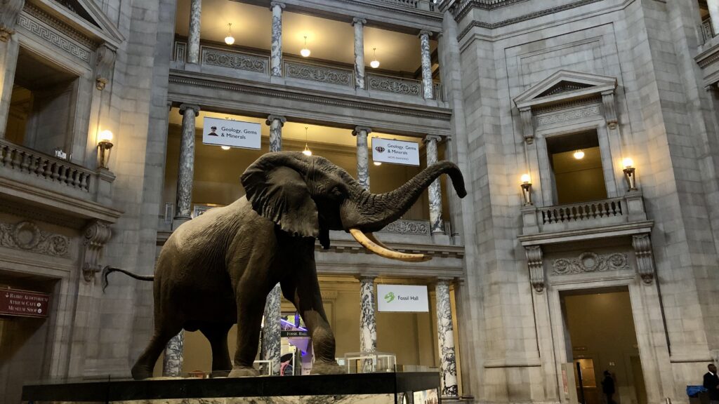
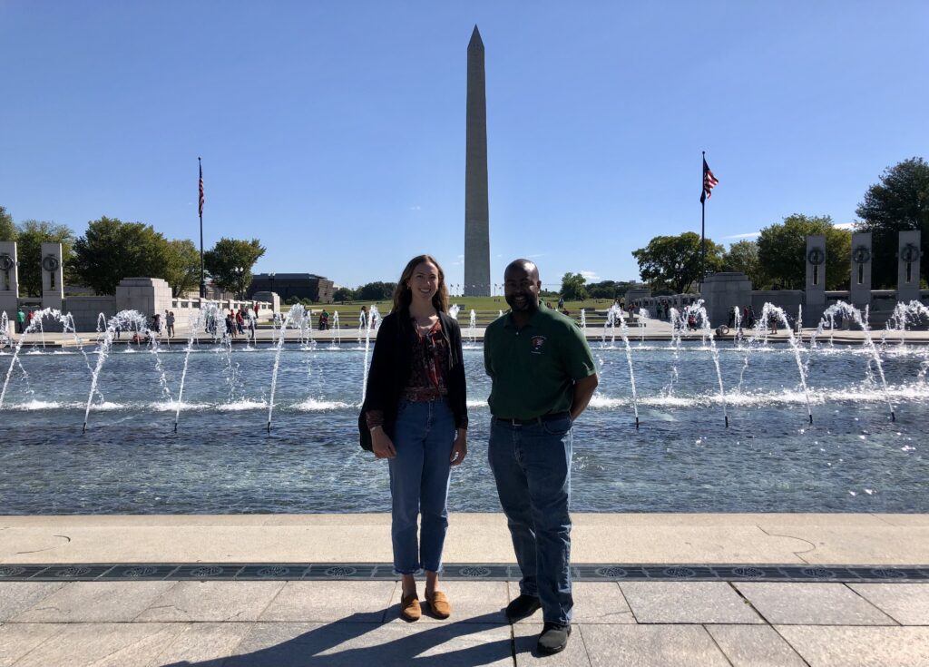
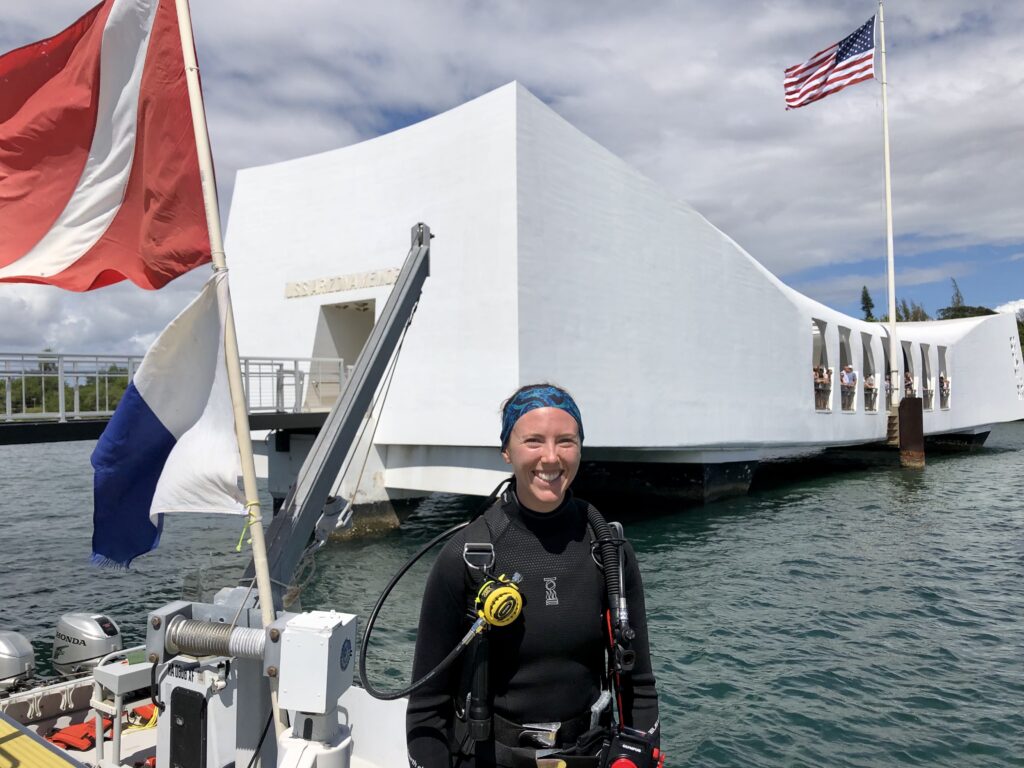
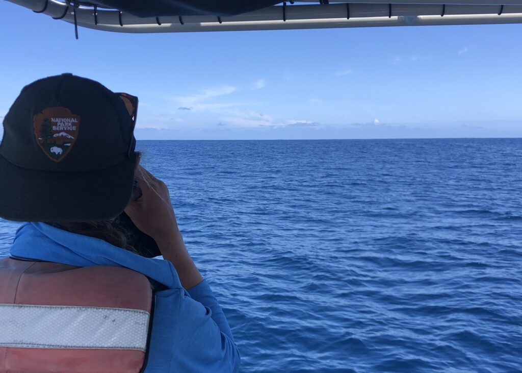
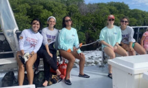
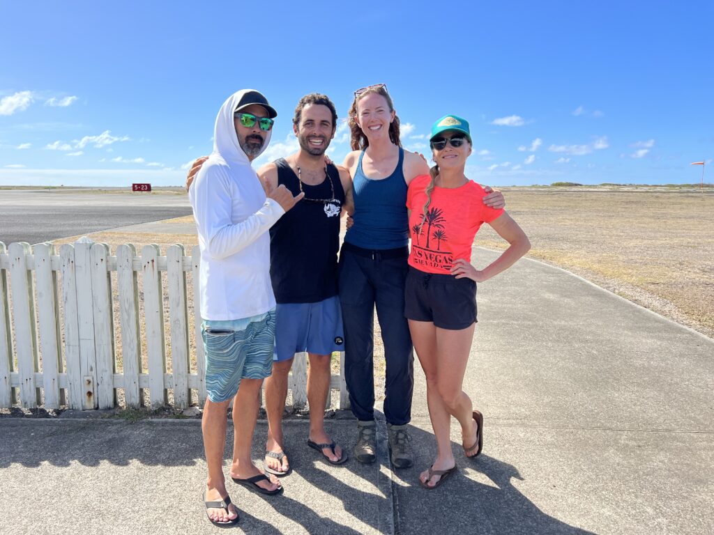
Almost a year has passed since I started compiling my application for the OWUSS NPS internship. Although an organization I had known of and been watching for several years, I never had the “right” qualifications to apply. I knew 2022 would be my chance – I had finally formally completed my Rescue diver training, maintained active scientific diver status over the past several years, and would be graduating shortly, leaving summer open for new adventures and opportunities in learning. 

During my first meeting with Dave Conlin (internship supervisor and Chief of the NPS Submerged Resources Center) and Brett Seymour (Deputy Chief), we wondered aloud if I could take advantage of my Canadian heritage and connect with our friendly neighbors to the north – the Parks Canada Underwater Archeology Team. After exchanging several emails, I soon learned they would have several projects ongoing this summer across Canada, from Lake Superior to the Canadian Arctic and eastern Labrador (did you know this is the only dive team within Parks Canada?). I was beyond thrilled when Jonathan Moore (Senior Underwater Archeologist) put me in touch with Brandy Lockhart (Underwater Archeologist and project lead), putting the pieces of the puzzle together for me to join them in Red Bay, Labrador, at the Red Bay National Historic Site/UNESCO World Heritage Site. 

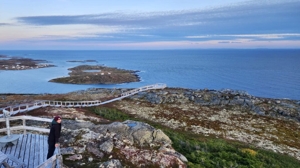
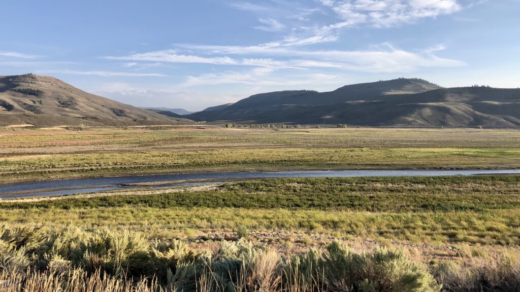
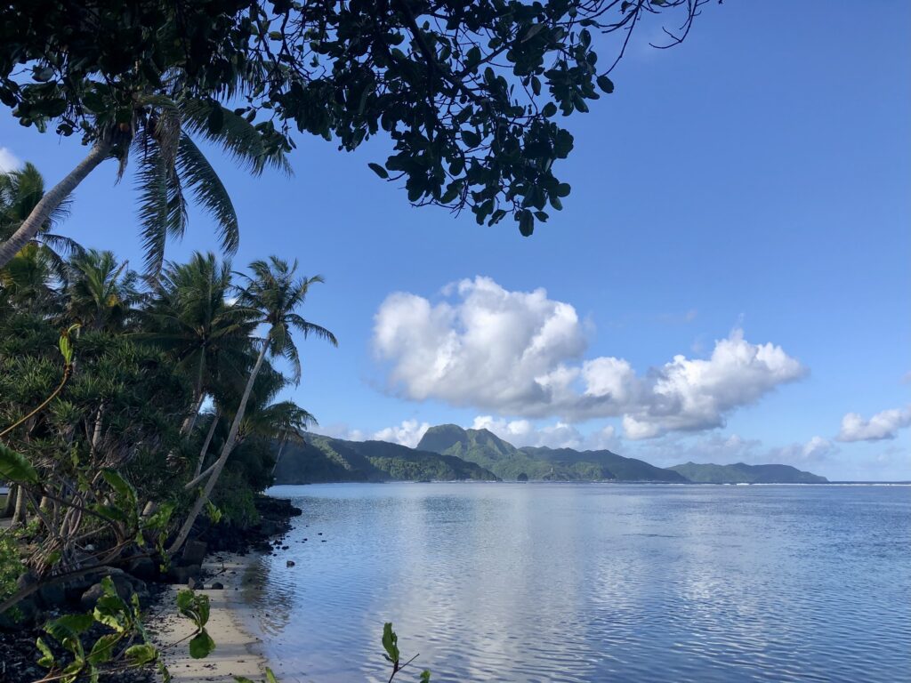
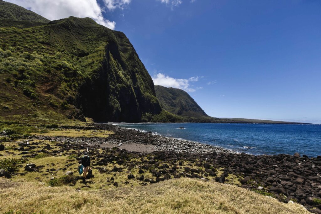
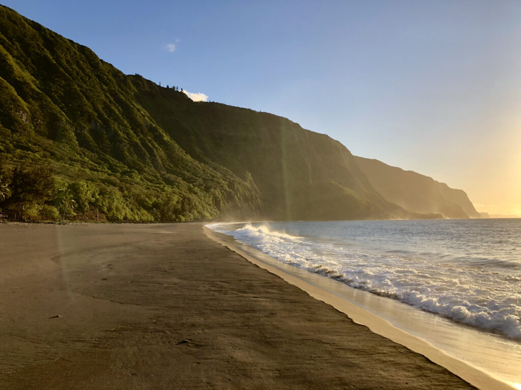
Overlooking Red Bay on the southeastern shore of Labrador. Photo: Todd Stakenvicius

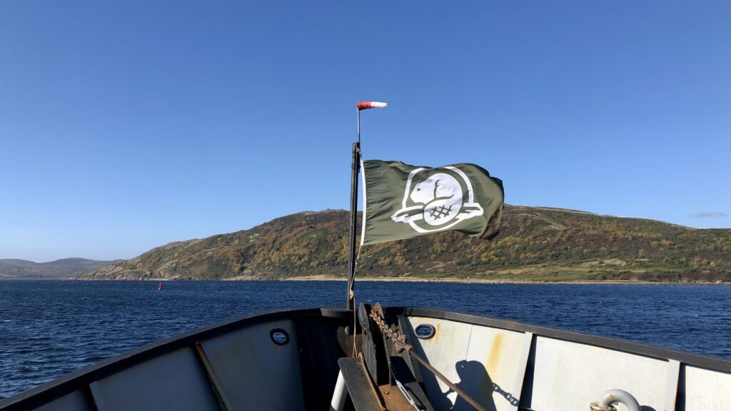
The Parks Canada logo (the Canadian NPS equivalent) features our national animal, the beaver

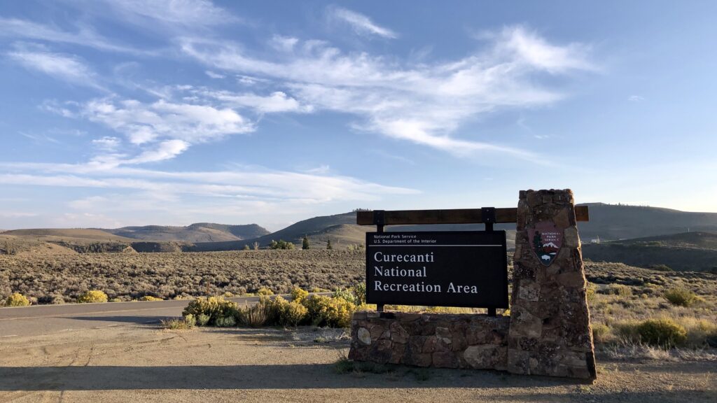
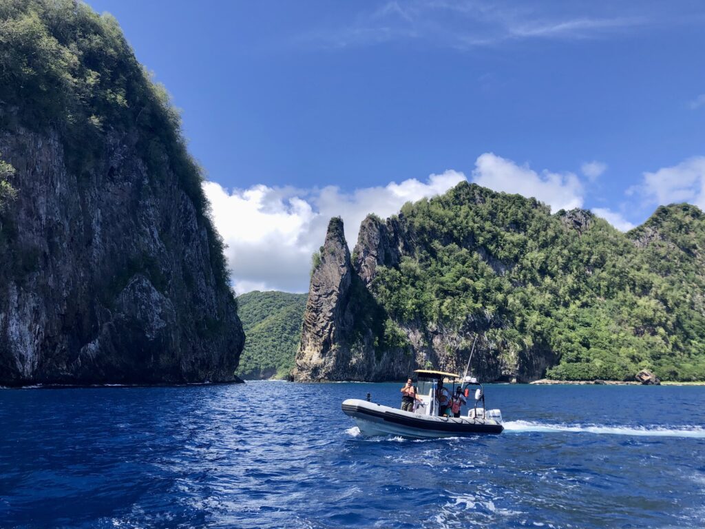
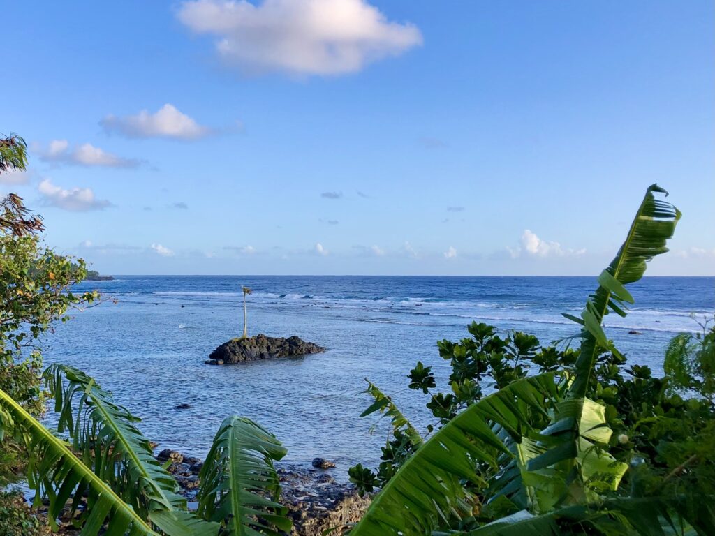
A historic preservation area dedicated to the excavation and documentation of a 16th-century Basque whaling station, including several transatlantic whaling ships, Red Bay draws thousands of visitors each year (a sizable feat considering its current population of approximately 150 and remote location on the southeastern shore of Labrador). To my surprise, this park was the most challenging place to organize travel throughout my internship. It took five planes, two days, and both car and ship travel to get here (one way) from my hometown in northern Ontario. I was ecstatic to be sent on this “international” project, representing NPS on my home turf, and would be joining Parks Canada aboard the RV David Thompson for two weeks, as part of their regularly scheduled site assessment of several shipwrecks that were excavated in the 1980s and later reburied in situ to preserve the remaining structure. 

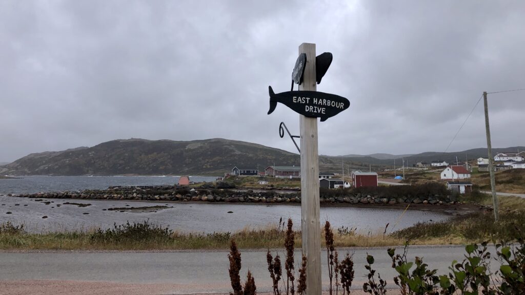
The quiet town of Red Bay, made up of a few hundred people with homes scattered along the shoreline

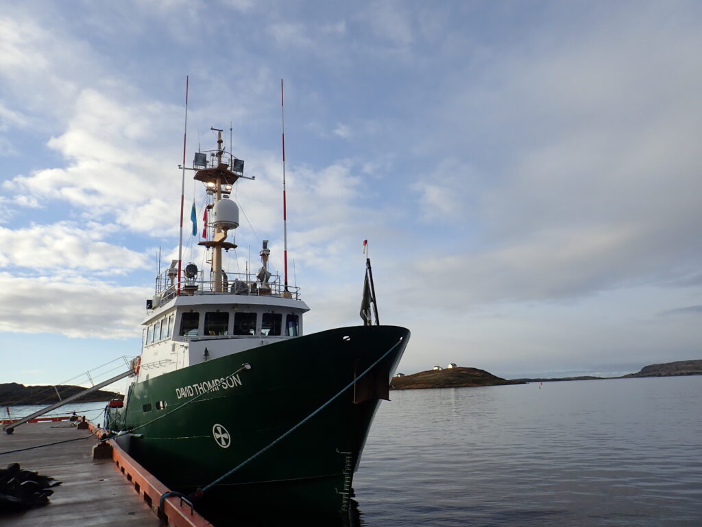
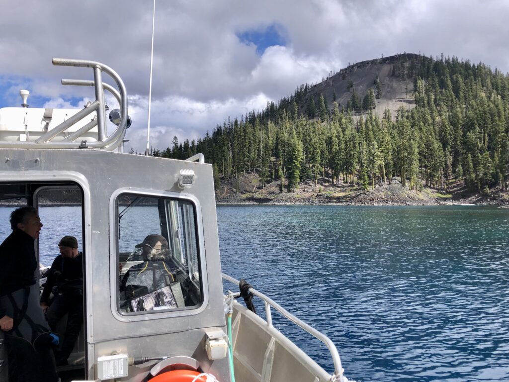
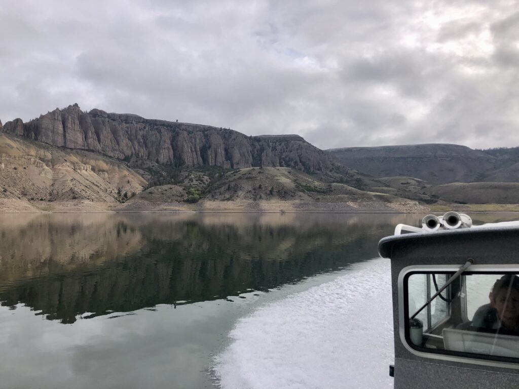
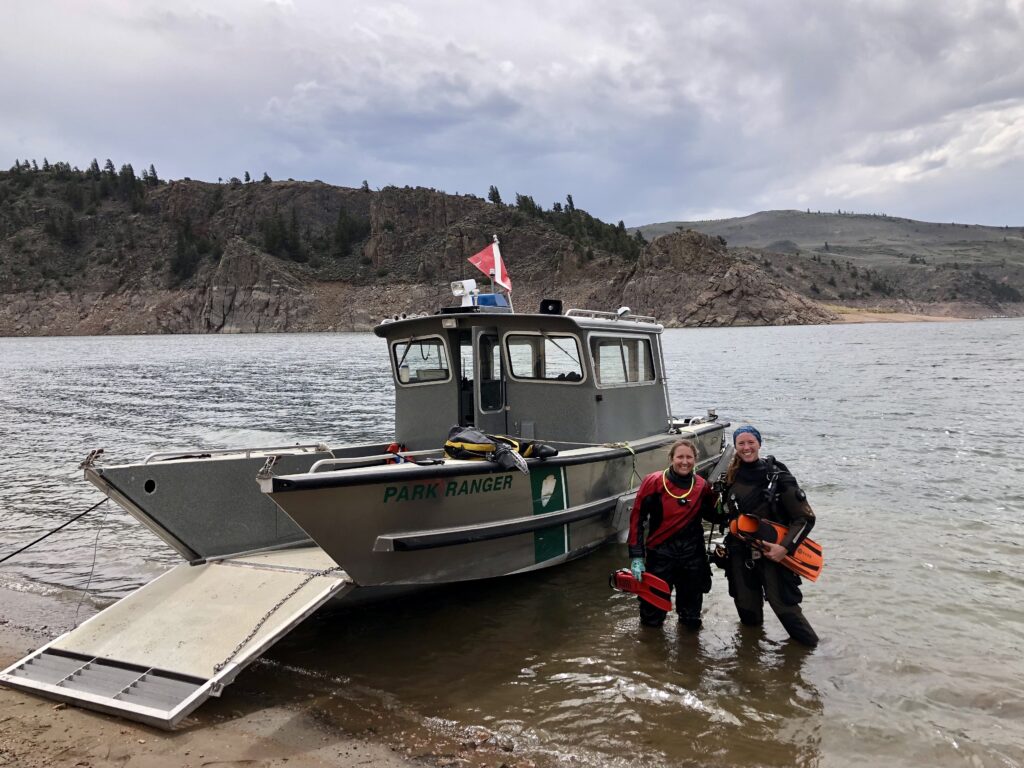
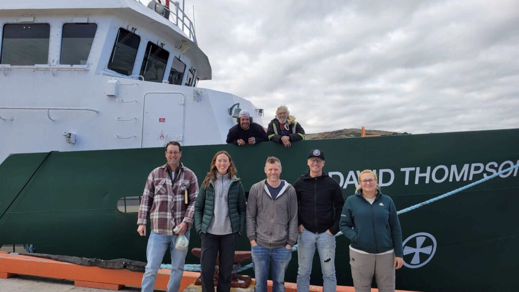
RV ‘David Thompson’, a mid-shore scientific research and survey vessel, used for underwater archaeology work with Parks Canada (including the surveys of HMS ‘Erebus’ and HMS ‘Terror’ – two Franklin Expedition ships lost in Northern Canadian waters).

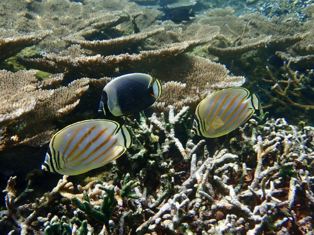
Over 70 years (from the 1540s to early 1600s), over 2,500 Basque sailors, perhaps Europe’s most ancient people, crossed the Atlantic annually, from Spain and France to the Strait of Belle Isle. Here, they established a major whaling port where Right and Bowhead whales were hunted, harvested, and processed to render oil used primarily in European lamps. Over 25,000 animals were killed in these extensive efforts. Today, these whales are some of the most endangered large whale species worldwide. 

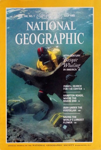
The excavation of Red Bay Basque whaling ships were carried out by Parks Canada in 1980s and was featured on the July 1985 cover of ‘National Geographic Magazine’

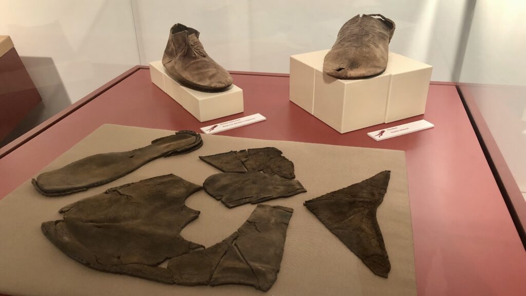
Well preserved remnants of Basque clothing can be seen in the town’s museum, alongside whale bones, coins, oil barrels, and timbers from the 16th century

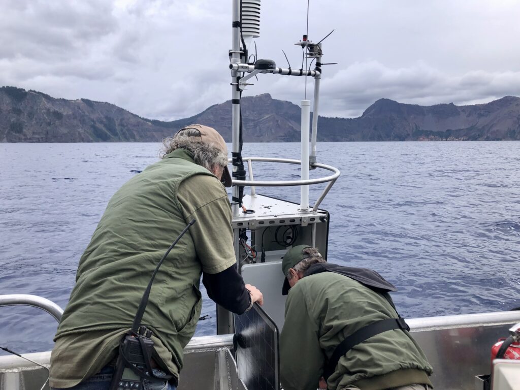
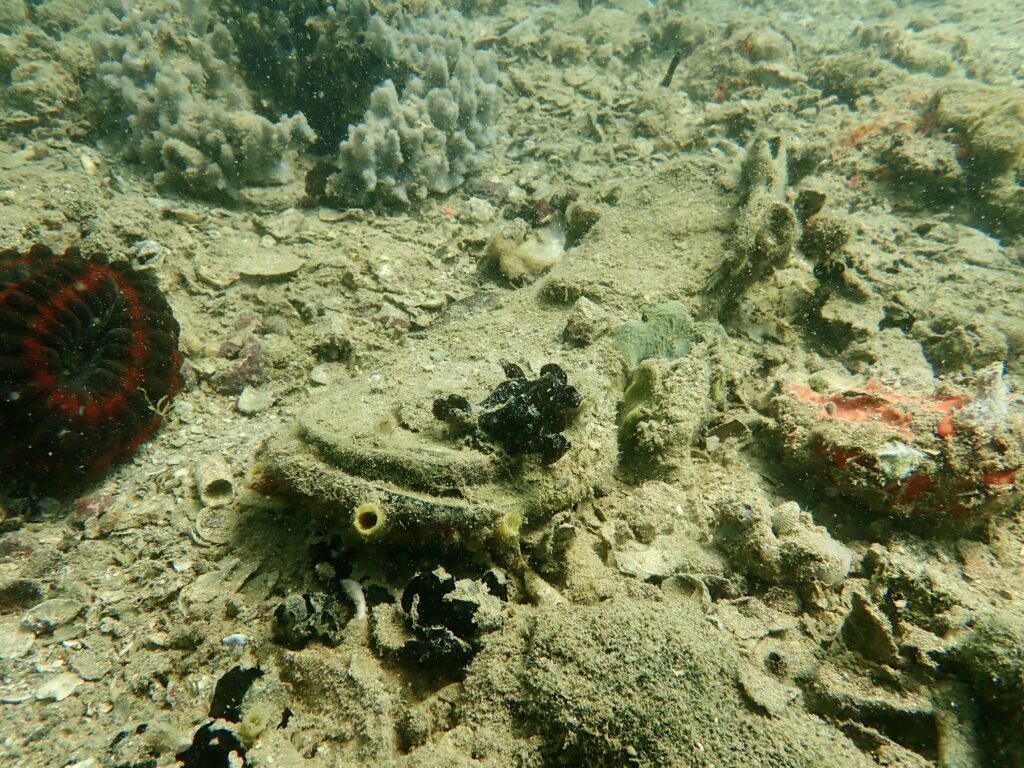
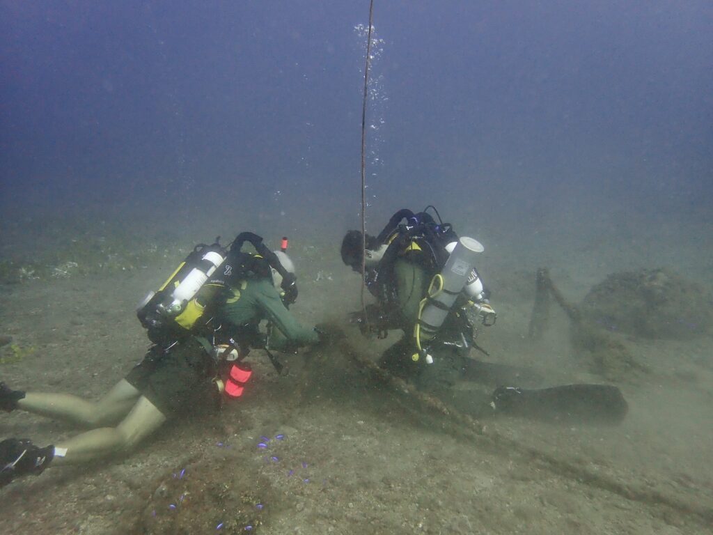
Our mission was to conduct a UNESCO-mandated 5-year site assessment, focusing our efforts on one of the most extensively studied shipwrecks in the Red Bay harbour, the well-preserved wreck of the presumed San Juan. In her prime, this 30-meter ship would have held over 70 sailors but eventually sank, in 1565, with over 1,000 barrels of whale oil on board. Underwater, we would inspect the protective tarp (laid atop the reburial mound in the 1980s), follow up with several repairs and replacements of damaged areas (repairing tears, burying exposed timbers), and ROV imaging of the current condition of the site. This was no easy feat, considering the tarps (weighing over 300 pounds each) are held down by a hundred or more sandbags and tens of heavy tires. Combined with unpredictable and likely unfavourable weather and a short-handed crew due to illness, we had our work cut out for us!

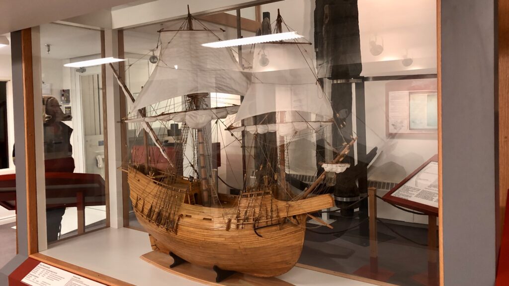
A scale model of the presumed ‘San Juan’, excavated in 1979-1985. Nowadays, Basque shipbuilders are using archaeological data to reconstruct the ‘San Juan’, using traditional methods to produce a functional, life sized replica

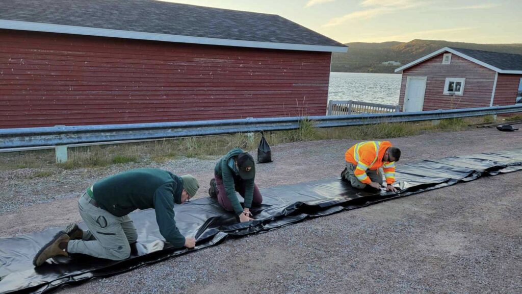
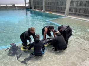
Preparing the protective tarp for preservation of the reburial mound which covers the remaining wreckage. At over 300 pounds each, moving and preparing the tarps is a group effort.

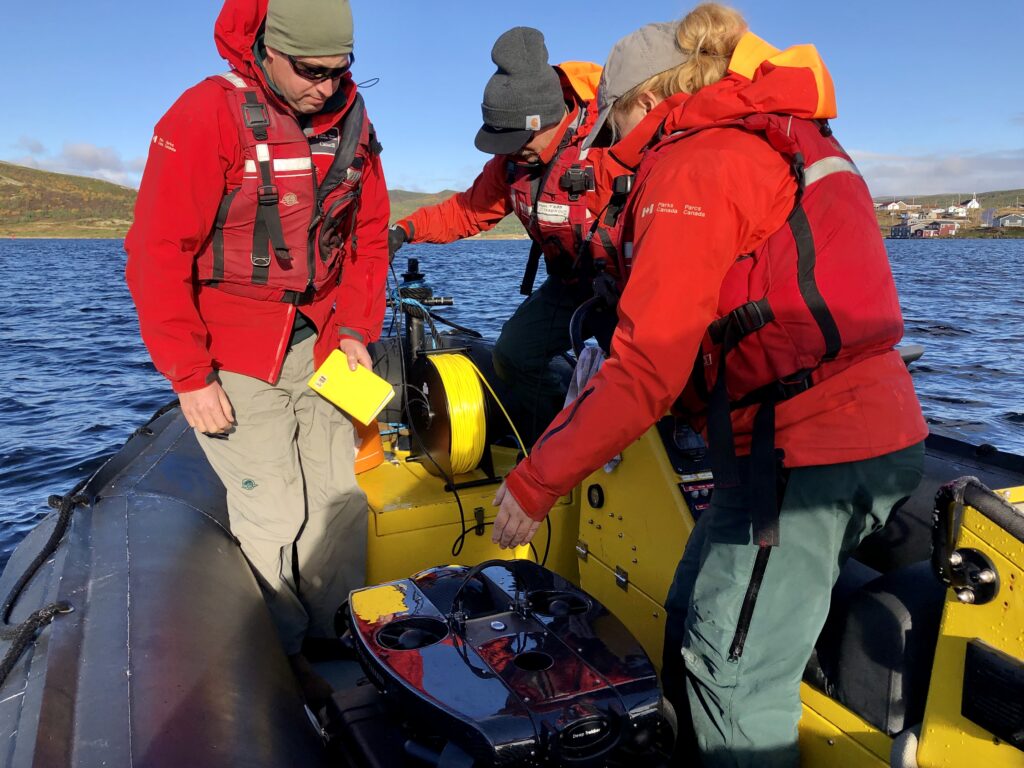
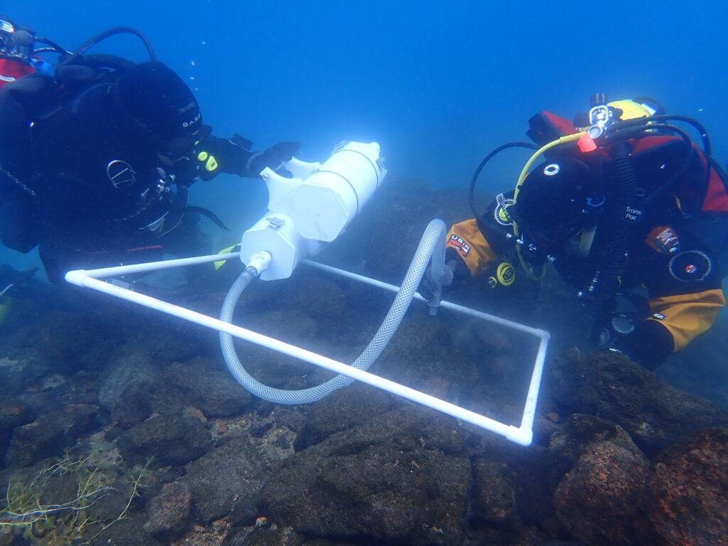
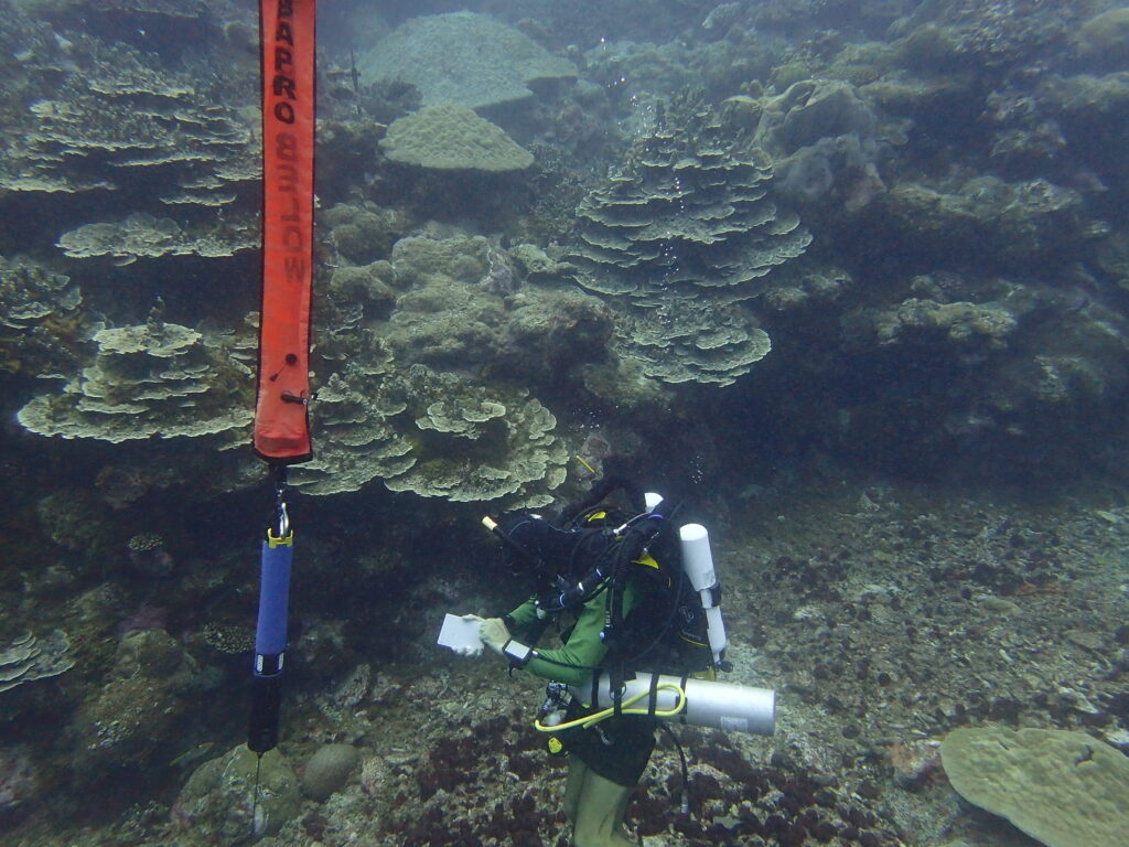
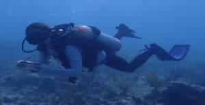
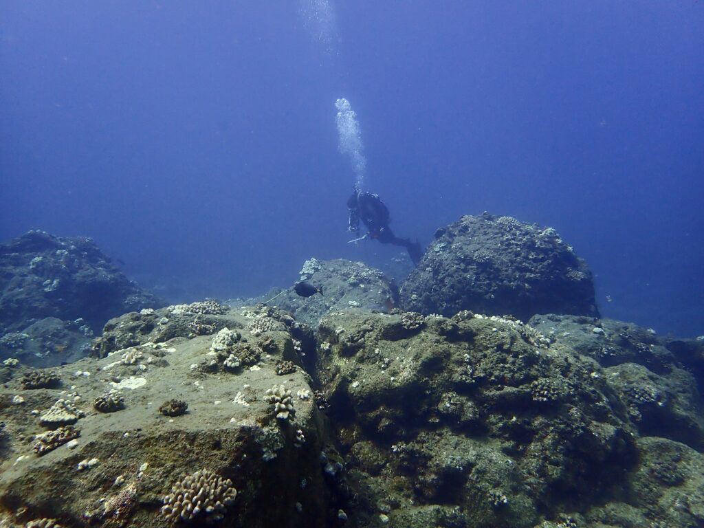
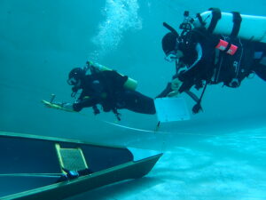
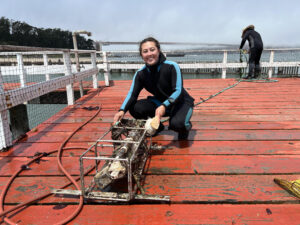
Remote operated vehicles (ROVs) are used to document the site, providing videos and images for future reference

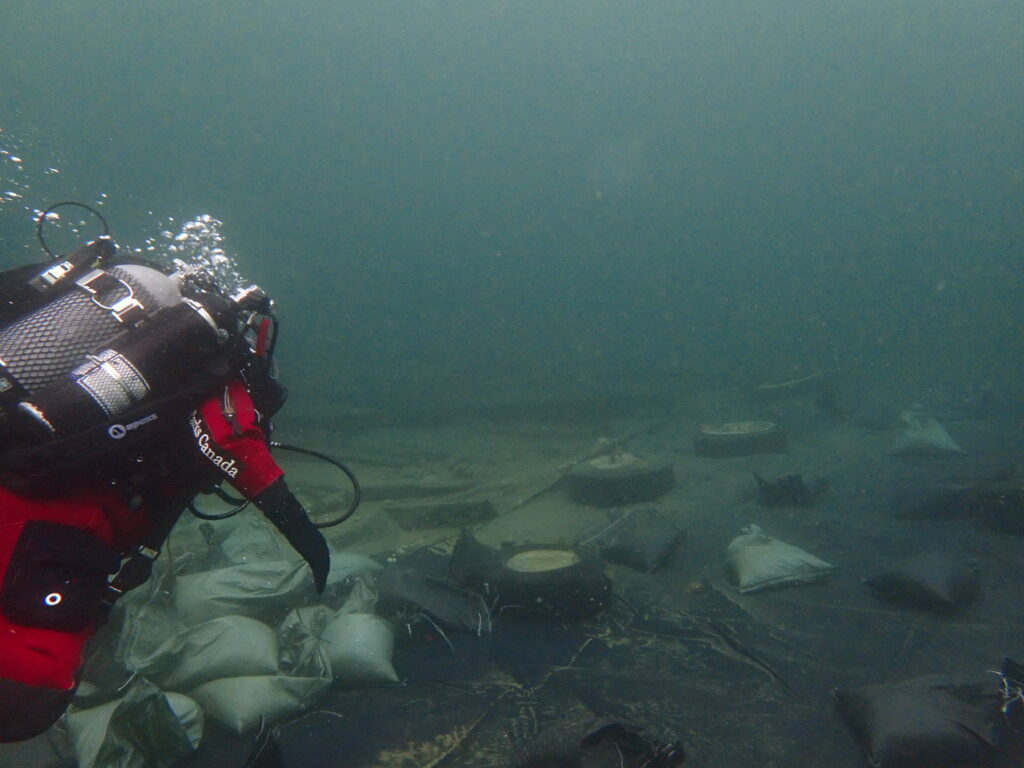
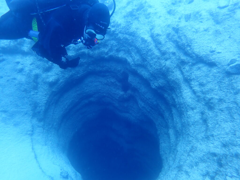
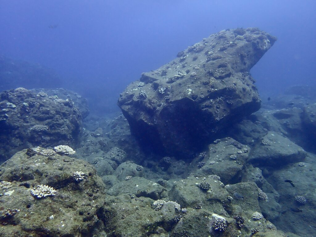
The presumed ‘San Juan’ is covered by a protective tarp, secured in place with tires, sandbags, and cold tolerant zip ties. It has lasted 40 years before requiring replacement

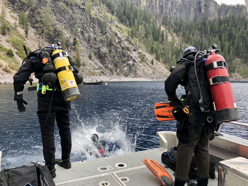
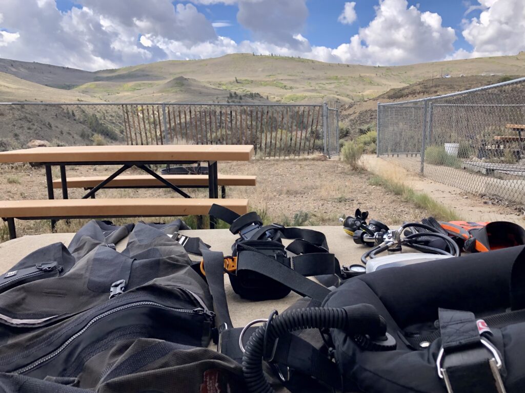
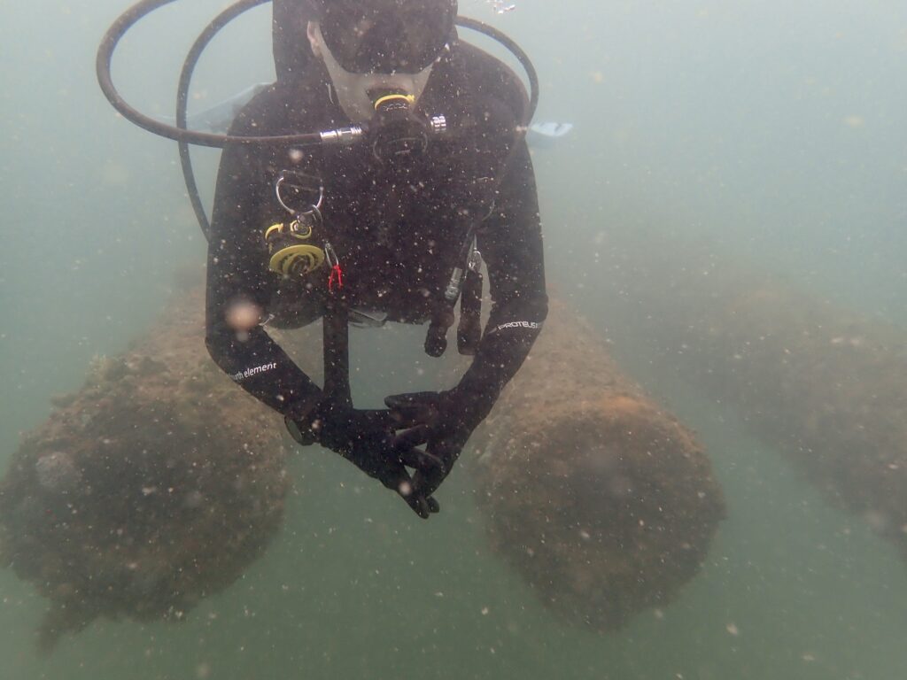
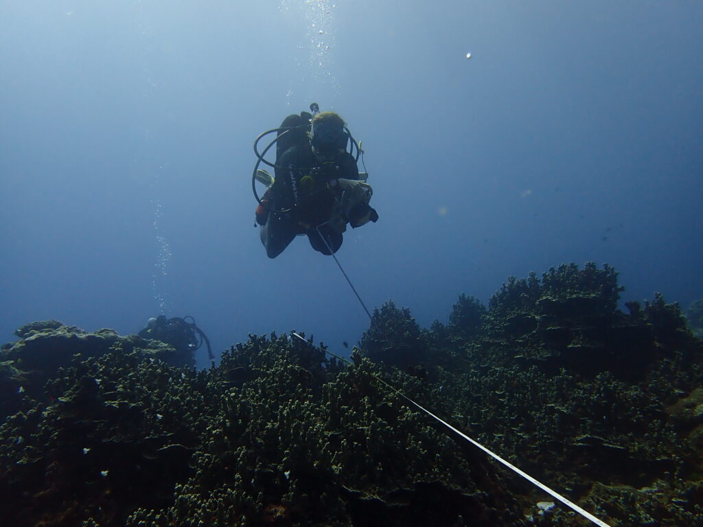
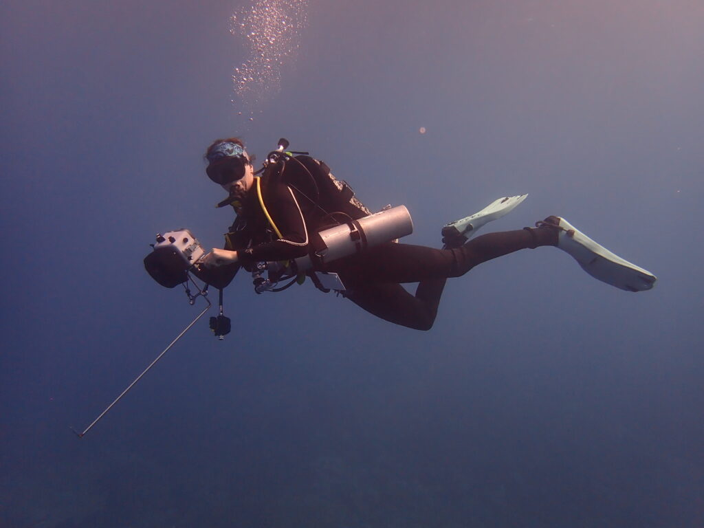
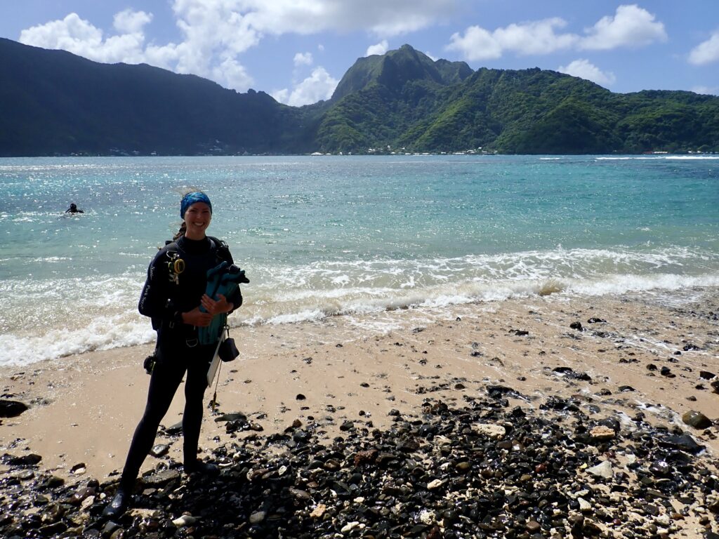
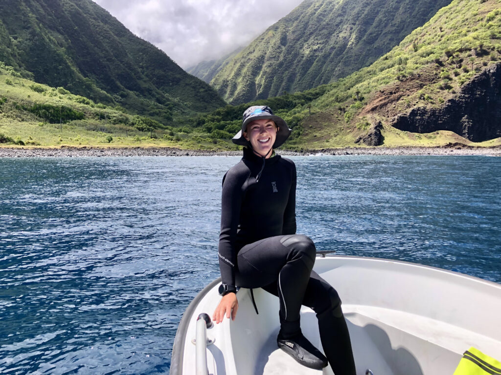
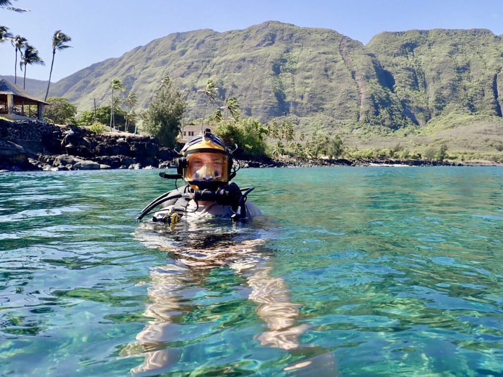
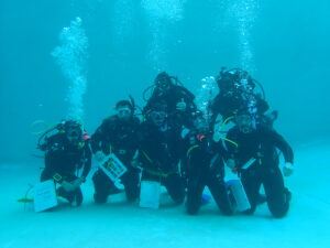
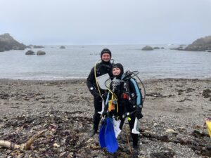
Before getting to work, I was given a general lay of the land and an introduction to the unique gear configuration used by the Parks Canada Underwater Archeology Team. The bulkiest setup and coldest water I’ve encountered to date, I was warned to anticipate -2° to +2°C seas (translating to 28° to 34°F) and more weight, tanks, and hoses than I knew what to do with. Any trepidation about water temperatures and new gear was overshadowed by my excitement to dive in increasingly extreme, unfamiliar environments and cushioned by memories of feeling invigorated and comfortable with cold water diving in the past. 

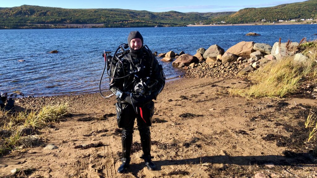
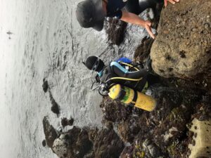
A quick shore dive to try out the new gear, familiarize myself with the environment, and demonstrate several emergency drills before getting to work

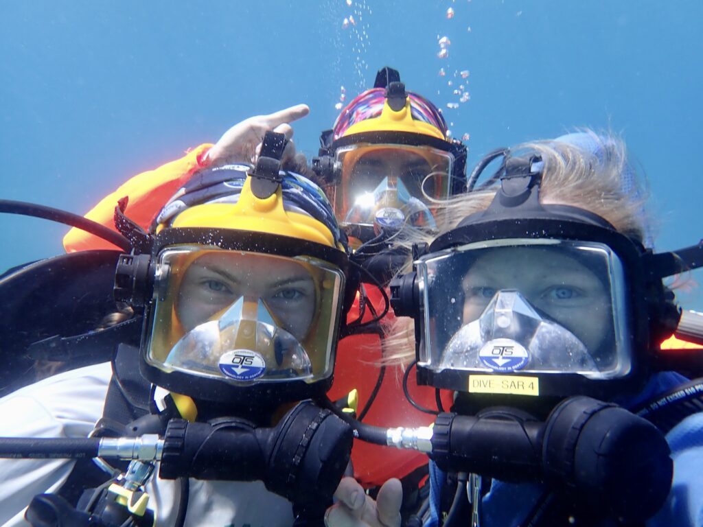
Parks Canada Underwater Archeology Technician, Joe Boucher, gave me a thorough introduction to our gear, demonstrating how to assemble/disassemble/adjust/use each piece, from our full face masks to bailout and emergency air block. We do a shallow water check-out dive and I am pleasantly surprised by the water temperature at 4°C. What I do not expect, though, or at least underestimate, is how exceedingly frustrating it is to be donning and doffing a full face mask, pulling and pushing the small adjustment tabs that secure the mask in place…while wearing bulky three finger “lobster” gloves. Fine motor skills and cold water mix poorly at the best of times, and I spend several minutes underwater trying to replace and reseal the mask properly. Finally, I find myself searching for alternatives to adjust the awkward back strap and try adopting the “full fist” approach, levering my knuckle under the tab until it releases with greater ease. A sign of relief comes, and I finish feeling confident and ready for the days of work ahead.

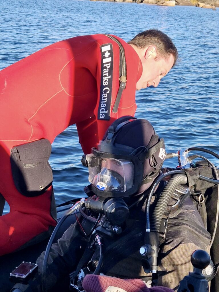
Getting ready for dives is also often a group effort, connecting underwater communication wires, checking air, and securing gear before diving in. Underwater Archeolgist John Ratcliffe (thanks!) connecting my communication line.

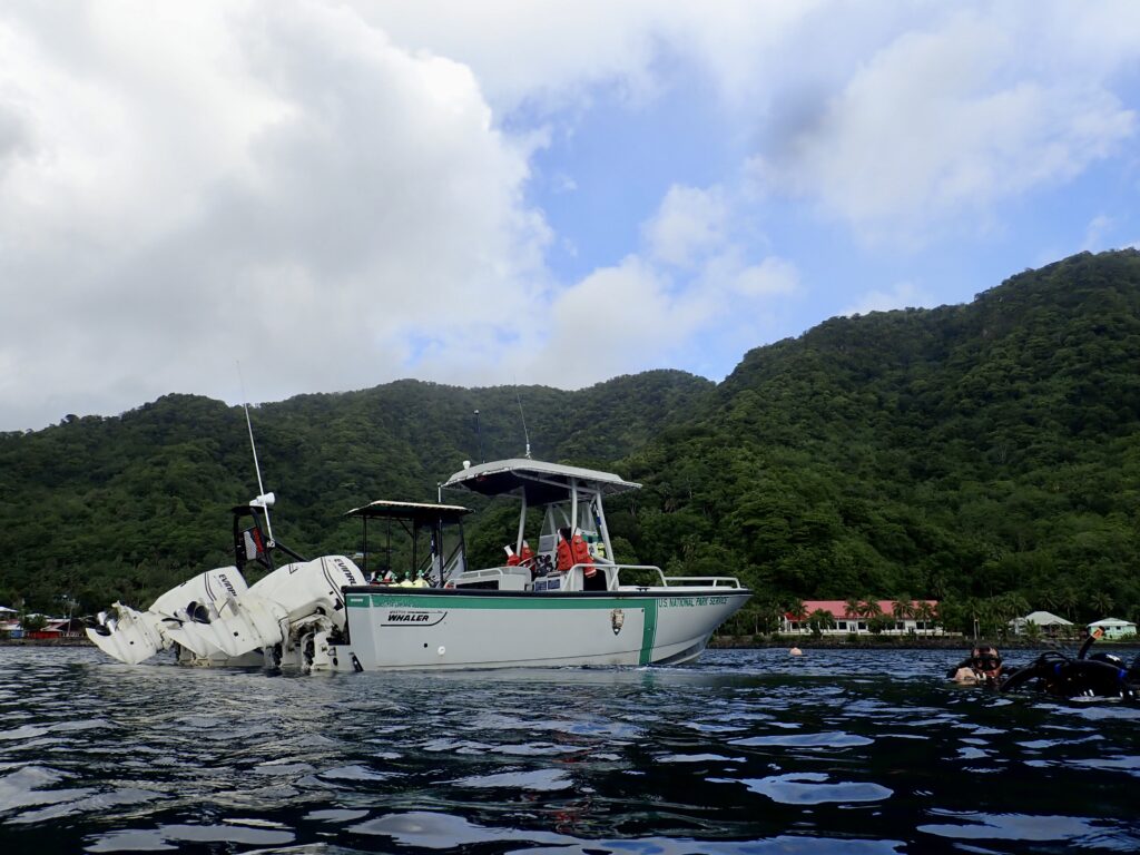
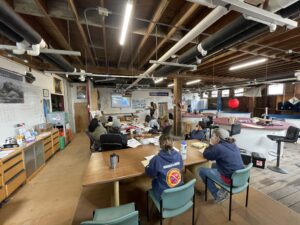
My first time aboard a large research vessel, the captain and First Mate of the RV David Thompson, Simon and Dave, showed me the ins and outs of ship life, from the galley (and, more importantly, the snack cupboards) to the engine room and emergency protocols. I quickly became accustomed to ship life, although I didn’t get a chance to test my sea legs (since we were firmly anchored within the shelter of Red Bay and the local wharf for most of the project). On board, the field team is in excellent hands, with the kind, experienced, welcoming, and friendly crew keeping us well-fed and entertained over group dinners – sharing stories about ship time around the world and memories from home. I have to admit, it is nice to be back on Canadian soil for a moment, to share stories of places we all know and love (and not have to Google the locations and names of cities/landmarks that come up in casual conversation as I sometimes did while in the US). On occasions, after a day in the field, we are treated to a spectacular Thanksgiving dinner (Canadian Thanksgiving is the second Monday of October), homemade corn hole tournaments, visits to the museum, and spontaneous hikes, keeping evenings lively even after long days.

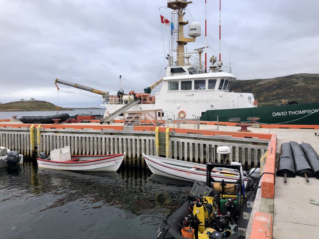
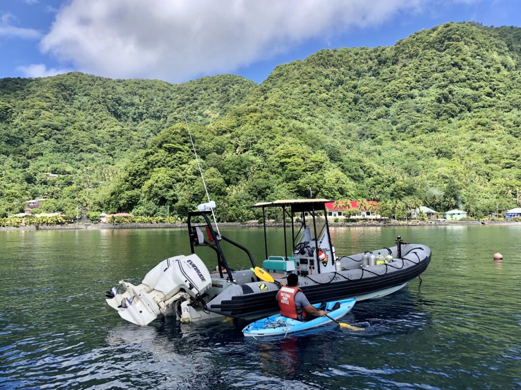
Tying off at the wharf gives us a greater working space, rolling up 25 m tarps, filling tanks, sorting gear, and prepping for field work

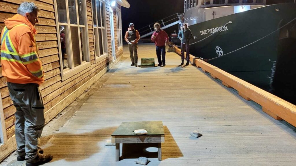
Enjoying a game of corn hole during evenings, custom made by Brandon (energetic and all around jokester Deck Hand), affixed with Parks Canada logos and all

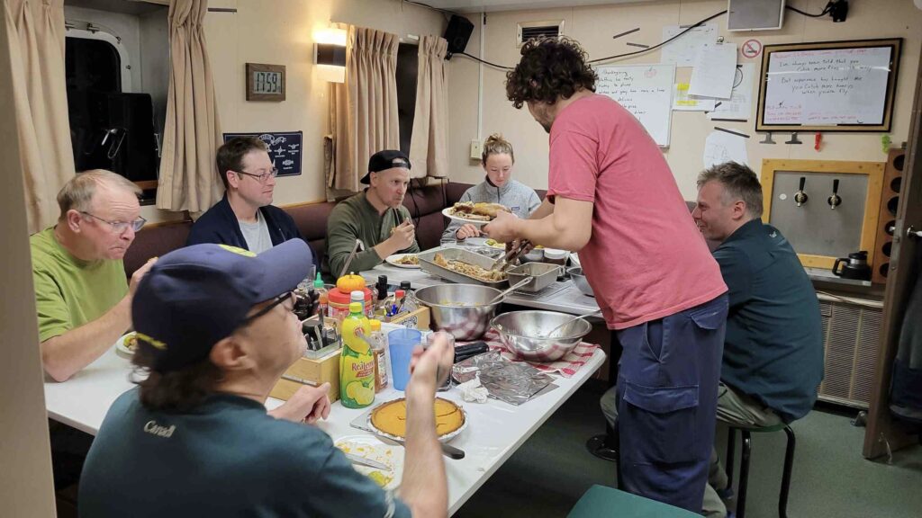
An absolutely fantastic Thanksgiving dinner put together by the ships chef, Jim, and an opportunity to get the entire ship together for a shared meal. One of my favourite evenings of the project

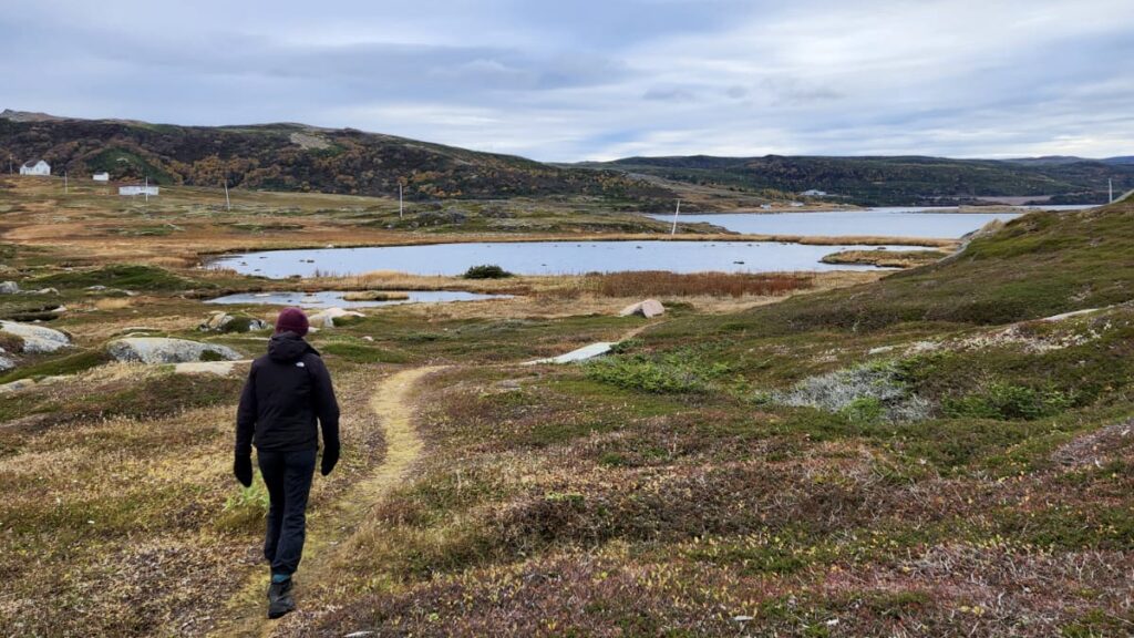
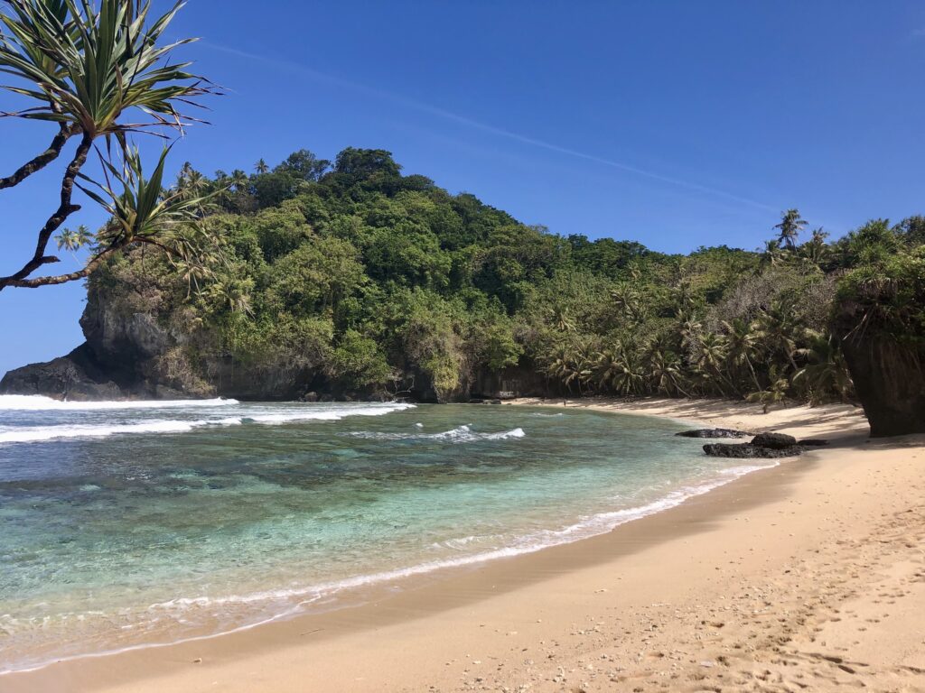
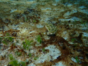
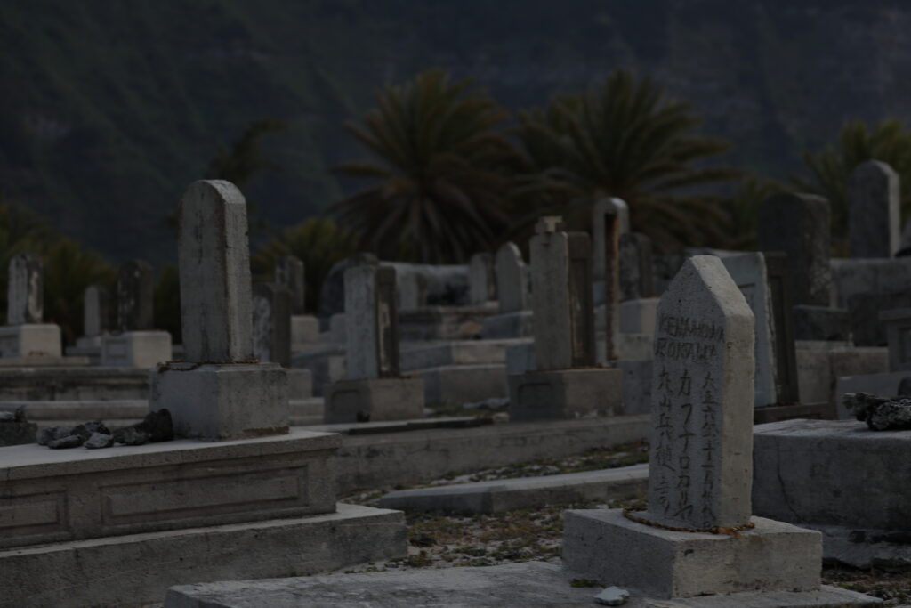
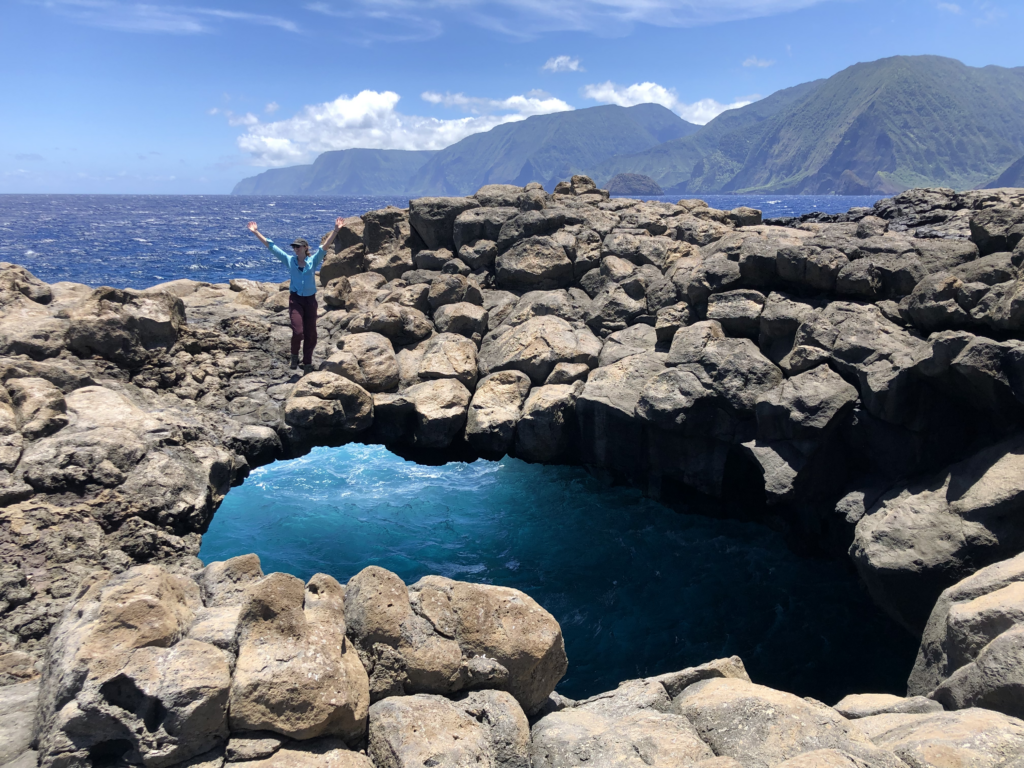
Walking around Saddle Island – the home base for Basque whaling operations, containing a number of former tryworks sites, cooperages, broken ceramic roofing tiles (indicating the locations of Basque buildings), and a cemetery.

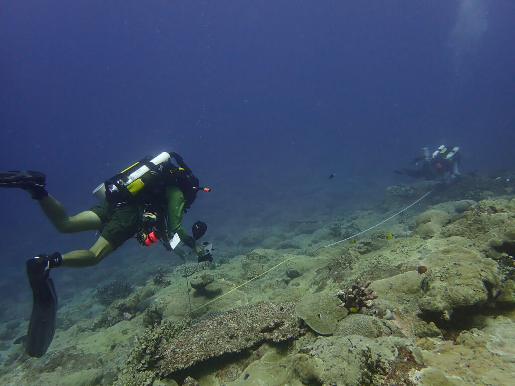
Physically demanding work, we prepare the heavy tarps, fill sandbags, prep gear, and lower it all to the site. Once we lay eyes underwater, we are struck by damage that is beyond that of previous reports. We must continually pivot, improvise, and brainstorm new ways to complete and prioritize the tasks at hand. I admire the team’s unique ability to develop a cohesive plan that incorporates the perspectives of each member, coming from various backgrounds, such as science divers, archeologists, and commercial divers. By continually calling into question, “how can we do this more efficiently, with less physical effort, and more streamline”, the project progresses over several breakthroughs in trial, error, and strategizing. 

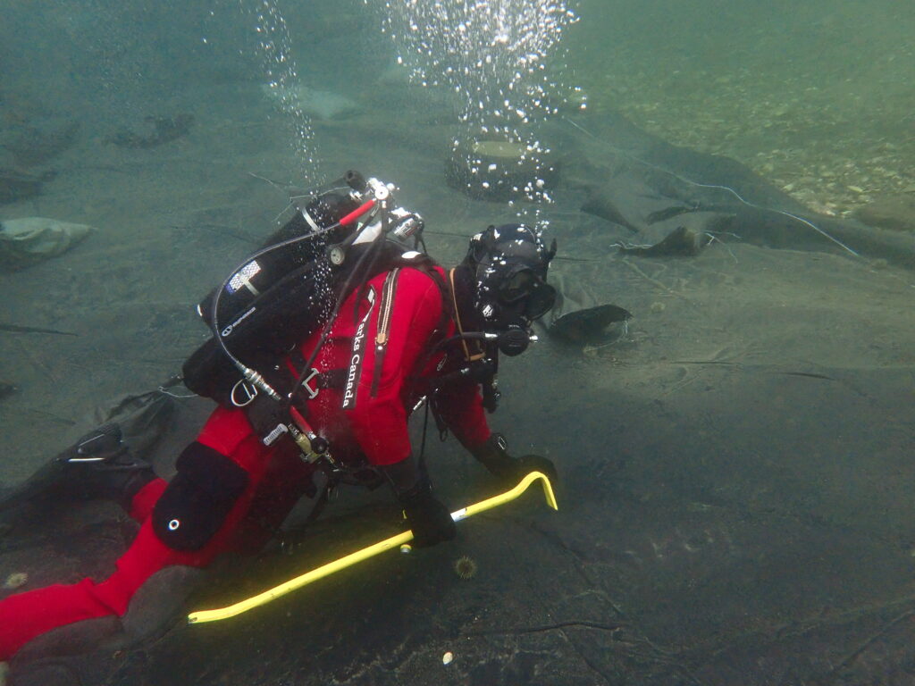
New tasks underwater require new tools, from crow bars and sandbags to steel bars and thick tarps

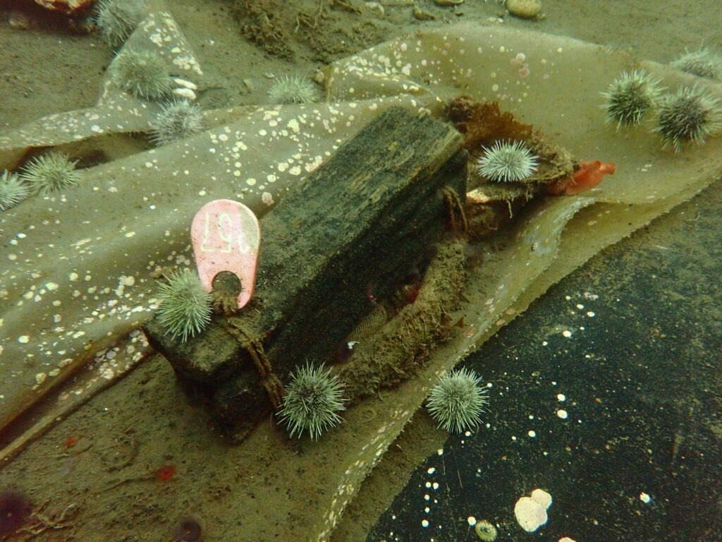
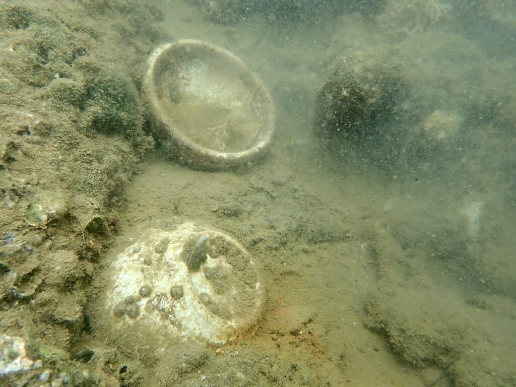
After initial excavation and reburial, several timbers from the ship were marked as samples, to track how the degradation and decay of timbers varies above and below the protective tarp.

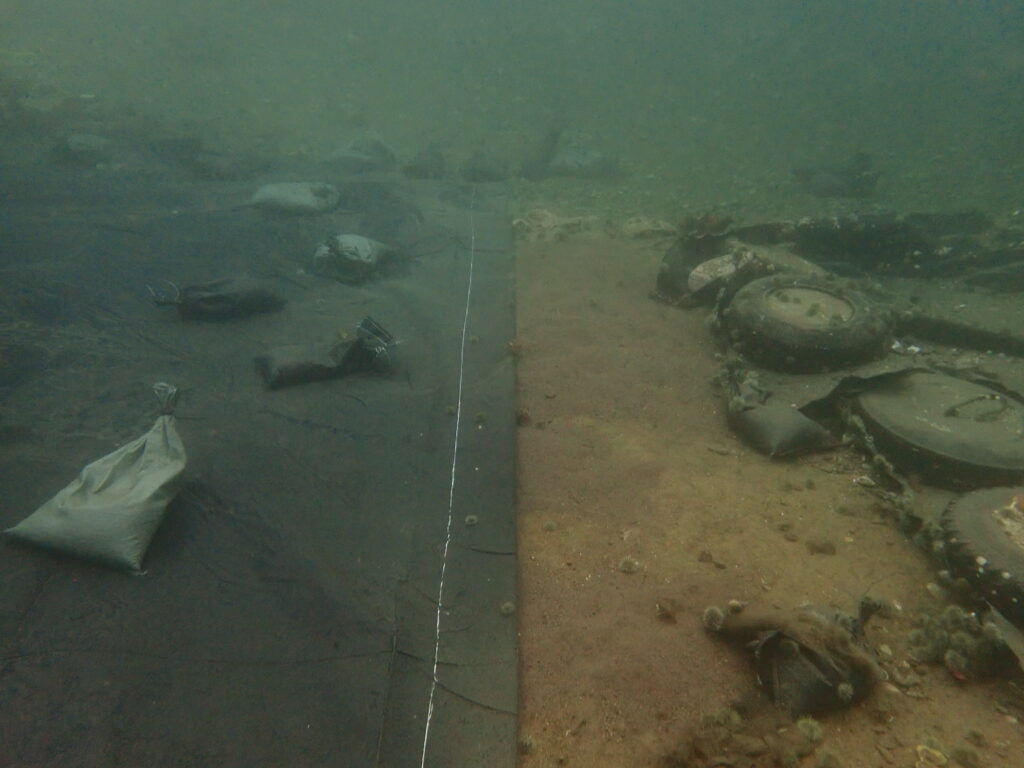
Making progress – (right) old tarp damaged by anchors, glaciers, or weather, and (left) new tarp replacing damaged areas

Each dive brings a new task, from flipping tires and dispersing sandbags to taking photographs, documenting site condition, and rolling out new tarps. After a few days, I am excited by the growing level of comfort I have in this new environment and feel that I can effectively participate in and contribute to each task (and am also very grateful to Brandy for throwing me in the water whenever possible!). By the end of the project, I have gained many new skills and perspectives, and we are successful in stabilizing the site for further follow-up and repair next year.

The icing on the cake of a summer that could not have been any sweeter – my time in Red Bay proved to be a highlight and valuable addition to my time as the NPS Dive Program intern. Thank you, to the Parks Canada Underwater Archeology Team, for the incredibly warm welcome and the opportunity to learn from you by making space for me in this project (and also for giving me an excuse to put the “u” back in harbour and favourite after 5 months of blog writing in the US). I thoroughly enjoyed getting to know and work alongside each of you in such a uniquely beautiful, fascinating, and remote region of our country.

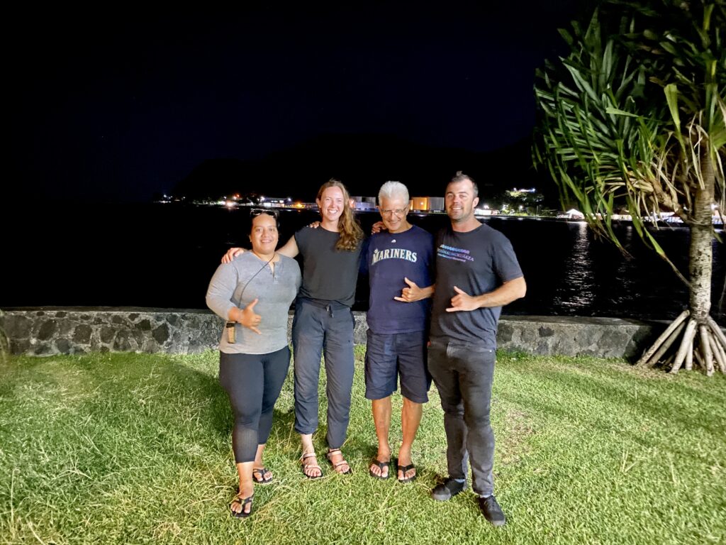
Of course, this excellent collaboration and internship as a whole would not be possible without the decades of impressive work done by the NPS Submerged Resource Center and NPS Dive Program (garnering a well respected international reputation) and the overwhelming support that Dave Conlin and Brett Seymour provide to the OWUSS intern each year. Thank you Dave, Brett, and the SRC team for your confidence in me and continued support. I would like to thank the growing family of NPS OWUSS alumni (made up of excellent divers, researchers, photographers, conservationists, and, now, new friends), who have connected with me, shared valuable advice, and paved the way to make my internship an overwhelming success (a.k.a made my life a whole lot easier!!), and each member of the NPS team who generously hosted me throughout the summer.

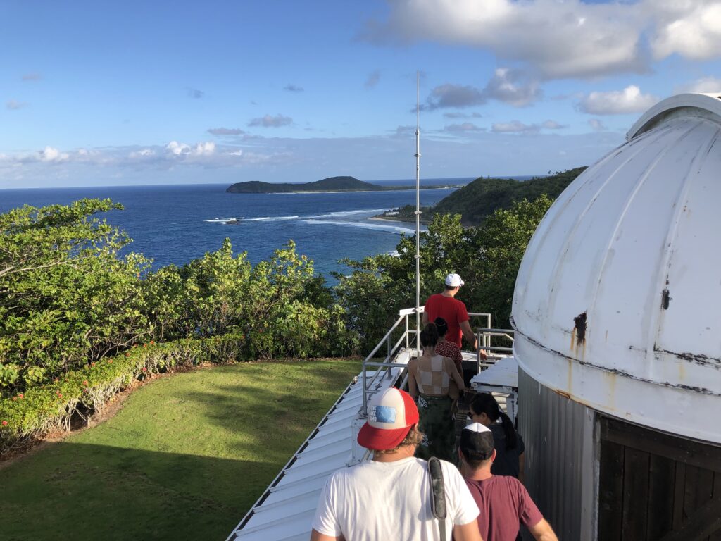
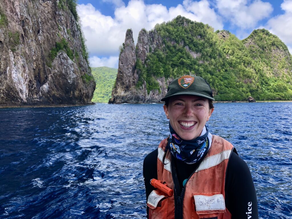
Throughout my journey, I have met many NPS employees and collaborators (thank you for following along!) that I see as role models, with exemplary skills as divers, boat operators, and team leaders (however, it is their dedication, passion for the work, and willingness to support learning opportunities for young people that shines brightest).  I have seen and contributed to diving as a tool for not only resource management but also visitor protection, interpretation, training, maintenance, and facilities needs – and some of the most ‘unusual’ dives have shifted my perspective in the most impactful ways.

In truth, this is neither the beginning nor the end of my grand adventure. In part, it is a series of small steps in the exploration of self discovery, expanding comfort zones, and eagerness to learn that has brought me here. However, my perception of diving has been fundamentally changed, showing me it is feasible as a career, and giving me some of the tools I need to propel myself forward. Some of the seemingly most underrated aspects of the internship are ones that drove home the deepest shifts in my ideas of what my future goals are and what my career might look like. And that has made a lasting difference.

The Our World Underwater Scholarship Society is a web of global connections, shaped by countless volunteers and leaders in the underwater world, that has connected me to numerous organizations that I will continue to be involved with long after my time as an intern is complete. I look forward to taking more advanced tech diving courses, exploring more extreme (cold!) environments, and collaborating with new networks within The Explorer’s Club, The Women Divers Hall of Fame, and others. I share the spotlight with everyone who has contributed their time, knowledge, advice, and support on this journey and look forward to presenting this work at the 49th Annual OWUSS New York City weekend next year. 


Share

The end?: Department of Interior Washington DC

Going into the internship, I knew that many OWUSS NPS interns get the opportunity to present their whirlwind adventures in learning and diving to various NPS Associate and Deputy Directors at the Department of Interior office in Washington, DC. Of course, this means that the presentation is typically scheduled as the last Hoorah – the final destination once an intern has collected their share of experience, memories, perspective, and photographs from parks across the country.

To say that this week crept up on me is a bit of an understatement, and I found myself having to do a double-take once landing in DC. This can’t really be ‘the end,’… can it? I’m just getting good at this! After five or so consecutive weeks (and many months prior) of park hopping, flinging myself into new field teams, new states, and new environments, I am here now, swapping my well-worn NPS SRC field shirt for an ironed button-up, ready to show off the NPS Dive Program to decision makers who hold the future of this program in their hands.

Lincoln Memorial, National Mall, Washington, D.C.

I ease into the week with some sightseeing, having never visited Washington, DC, before. With the generous help and friendly company of Daryl Avery, NPS Branch Chief for Occupational Safety and Health, together, we walk through the National Mall and Memorial Parks – home to the country’s most iconic monuments commemorating historical events that shaped the nation. While the monuments can be appreciated by any passerby (and details read via interpretive signage or a quick Google search), they truly come to life with the help of Interpretive Rangers placed throughout the National Mall grounds. I was grateful to encounter many knowledgeable Rangers who shed light on the history of these significant events and individuals and their architectural design and construction – revealing small details one would likely miss without a trained eye. An educational and enjoyable day for myself and Daryl (featuring a delicious meal at the iconic Old Ebbitt Grill) and an excellent orientation to the city center, during which I noted additional points of interest to visit during downtime throughout the week.

WWII Memorial, National Mall. Interpretive Ranger Adam Cochran provides an excellent overview of each detail of the monument, greatly enhancing my visit.

View from the top of the Washington Monument, National Mall.

Martin Luther King Jr. Memorial, National Mall. Powerful quotes line the walls – Darkness cannot drive out darkness; only light can do that. Hate cannot drive out hate; only love can do that.

Korean War Veterans Memorial, National Mall.

The following day, I grab a hearty breakfast, settle into my new accommodations, and do one last presentation run-through before heading to the Department of Interior office to meet with Daryl and Michael May, NPS Chief of Office of Risk Management. After filing through security, affixing the necessary visitors pass to my collar, and a short tour of the facilities (including a beautiful display of artwork lining the halls – often attracting tourist groups), it comes time to do what I was brought here for… and I eagerly await the opportunity to share my experience with the NPS Executive team.

A 30-minute presentation passes quickly in a small board room, flipping through slide after slide of NPS Dive Program highlights, history, project goals, and accomplishments. Presenting to both divers and non-divers alike, I am relieved to see many encouraging nods and note-writing in the crowd, leading to positive feedback and curious questions in the discussion that follows. While preparing this presentation, I was taken aback by the fact that across 23 NPS dive programs (and 120 individual divers), over 6,500 dives were conducted in 2021 alone. Across seven National Parks, I worked directly with over 40 NPS divers, speaking to the scope of experience that interns gain in such a short timeframe. Bringing fresh eyes, a global perspective, curiosity, a strong diving foundation, and an eagerness to experience applied science, diving, and monitoring outside of academia, I gained a holistic perspective of the NPS dive program. I can honestly say that the multidisciplinary scope and rigorous safety protocols are unmatched by any other dive program or team I have previously been a part of.

A trip to DC would not be complete without visiting several of the impressive museums (often free for visitors), and as such, I filled my spare time with trips to the Museum of Natural History and the National Museum of African American History & Culture. Acknowledging that it is possible to spend multiple days at each museum, I found myself returning to the National Museum of African American History & Culture on several occasions, opting to focus each visit floor by floor (organized in temporal increments from 1400 to the present day), making for a more comprehensive and impactful experience. During the week, I also had the opportunity to meet several NOAA Ocean Exploration employees, including Jeremy Weirich, Director, and Adrienne Copeland, PhD, Grants Program Manager, further enriching my experience in the nation’s capital.

The National Museum of African American History & Culture

Inside the National Museum of African American History & Culture. NPS Submerged Resources Center played an instrumental role in uncovering the remains of the Sao Jose (a Portuguese slave ship), in collaboration with Diving with a Purpose, George Washington University, and Iziko Museums of South Africa.

Museum of Natural History, Oceans Hall

Museum of Natural History

Reflecting on my experiences thus far, I feel empowered. Seeing first-hand the resources dedicated to underwater exploration and monitoring gives me hope – for education, preservation, and understanding of the underwater world, which makes up 70% of our planet. I am proud to stand in DC, representing the NPS Dive Program and sharing just a small glimpse into the work they do. As my time in Washington, DC, comes to a close, I am relieved that it is not yet the final chapter of my internship. Drawing on international connections and collaborating with underwater archeology teams around the globe, the NPS SRC team has connected me with Parks Canada for one last project. I am incredibly excited to represent NPS on my home turf in a few short days. Stay tuned as the OWUSS NPS intern goes international!

Thank you Daryl Avery (and Michael May) for hosting me in DC

Share

Feels Like Home: Crater Lake National Park

Having spent the last several years away from North America, I often worry about losing my “Canadian blood.” Is the antifreeze that naturally runs through my veins wearing thin? I have not spent an entire winter in the great white North since 2016 (my second year of undergrad), and I have been quite successful in avoiding the 7-8 months of snow and 1-2 months of -40C that my hometown is gifted with each year. But by now, I am due for another round of cold weather adventures – and I am tremendously excited to dive into the crisp, clear blue of Crater Lake.

Crater Lake National Park. Photo: Nate Akers

I land in Medford, Oregon, greeted by the airport shuttle bus driver who will take me to the off-site rental car office. Over small talk, he tells me that summer has passed (as of three days ago). He speaks to the steep, sudden decline in temperature (from 90 degrees and sunny last week to 60 degrees and rainy the next). But really, his outfit screams the same nonverbal story. Shorts, flip flops, and a breezy T-shirt… in 50-degree overcast skies. I recognize this familiar homage and resistance towards acknowledging that another short-but-sweet summer has passed. Just a few more days of shorts… before the layers come out and a long winter ensues. He jokes that my arrival has triggered a cold spell that will last throughout the week. That was music to my ears. It sure feels good to feel like home.

Sunset from the scenic Rim Drive during my first evening at the park

A historic stone cabin, towering ponderosa pines, and a lively group of seasonal NPS employees set the stage for my stay at the park. I am immediately impressed by the amount and diversity of natural resource management work happening within the park, from trails, to backcountry, streams, botany, and lakes – I am given a small glimpse into each of these programs throughout my stay.

Our goals for the week are varied but begin with site assessments of one of the lake’s most mysterious underwater landmarks – referred to as the Fumaroles. Cut deep and cylindrical into thousands of years of accumulated peat; they are long-standing natural formations and tunneling depressions in the benthos, of unknown origin and mechanism. What causes these formations? How have they maintained their form over thousands of years? Surely these exist elsewhere, but where? With the hope of garnering insight and scientific advice from other regions around the globe, the NPS Submerged Resources Center will visit Crater Lake next year to document and model in unmatched detail the anatomy of these strange formations, using cutting-edge, in-house-developed, 3D photogrammetry technology.

The “Fumaroles.” Crystal clear waters and mysterious formations amidst ancient peat.

Not long into our first dive, I am met, face to face, with Crater Lake’s most wanted aquatic criminal – a member of the introduced crayfish population. Diving alongside NPS Aquatic Ecologist Scott Girdner, former NPS Aquatic Ecologist Mark Buktenica (and continued NPS volunteer diver), and Fisheries Biologist Joshua Sprague, we conduct benthic aquatic invertebrate surveys as part of an annual monitoring program to quantify the impact of invasive crayfish on the declining endemic newt population. In particular, these surveys aim to evaluate how food availability is altered in areas that crayfish occupy – and park ecologists have indeed detected a dramatic reduction over time. Previous mesocosm studies conducted within the park also identified changes in the behavior of endemic newts in the presence of crayfish (such as the inability to coexist and being driven out of rocky sheltered habitats and induced stress response – driving newts to the surface to gulp air where they are preyed upon by introduced invasive fish).

An invasive crayfish, introduced into Crater Lake over 50 years ago, and threat to endemic newt populations

Aquatic Ecologist Mark Buktenica and Fisheries Biologist Joshua Sprague using an underwater vacuum to collect benthic invertebrates within a 1 meter transect

A compelling example of the reduction of food availability in areas before (left) and after (right) the introduction of invasive crayfish, based on benthic sampling

A topic of interest to me, and the theme of my Master’s thesis work, invasive species are ubiquitous in the present day. Within Crater Lake, Rainbow Trout, Kokanee Salmon, and crayfish have been introduced for tourism purposes – to provide recreational fishing opportunities for visitors. However, over 50 years later, we are beginning to see the repercussions of these actions, and the endemic newt population of Crater Lake is in peril. Once past a certain threshold, an invasive species is almost impossible to eradicate. It is likely a question of when, not if, the newt population will be extinct within the park, with unknown consequences regarding ecosystem health and function. Nowadays, many teams within the Crater Lake natural resource staff work to prevent other invasive species from becoming established – hoping to keep these areas pristine, natural, and native.

Every effort is made to prevent further introduction of new invasive species (including a complete ban on recreational swimming accessories – from goggles to paddle boards), in order to preserve native plants and aquatic organisms

Scott Girdner and Mark Buktenica lead the way for us aquatic interns and seasonal employees, with a combined total of 64 years of experience in and on Crater Lake. Highly attuned to changes in this unique environment, this impressive body of knowledge has been generated year after year, dive after dive, since the 1950s. A testament to the success of the NPS dive program on the ability to cultivate detailed knowledge of natural resources within the park to inform their protection and preservation. This is one of the only parks I visited this summer with such long-term knowledge contained within a single, or couple, of individuals. Knowledge, however, that is free for the asking, as Mark and Scott generously provide mini lectures on the boat before embarking on each new task, contributing to a short but highly successful and educational visit.

Topside view of dive operations

Aquatic Ecologist Scott Girdner and I conducting a shore transect to monitor the growth of filamentous algae booms, a recent occurrence in Crater Lake under changing environmental conditions

Over the week, not only does the dive team work as surveyors of natural resources (from “bug sucking” to crater exploring), but also underwater mooring repairmen, off-road tractor drivers, construction (and deconstruction) workers, weather station mechanics, backcountry hikers, and boat operators. Entering the workforce as a young professional, I aspire to cultivate such a well-rounded skill set, and the ability to contribute to each aspect of these field days, perhaps one day leading a team of interns, students, and employees with a built wealth of knowledge.

NPS Aquatic Ecologist Scott Girdner and Mark Buktenica installing a new solar panel on the weather monitoring station

Overlooking Wizard Island, volcanic cone and crater

Beyond the mesmerizing mystery that is the cold depths of Crater Lake, my time at this park stands out for the community of seasonal employees I met at Sleepy Hollows. Thank you, all, for welcoming me into the park, sharing your perspective, friendship, and personal journeys with me. A special mention to Nate Akers for introducing me to the crew during bonfires, games nights, and Christmas-in-September celebrations, and Hamilton Hasty for showing me hidden gems within the park. Thank you to Scott, Mark, and Josh, for hosting me, answering my many questions, and letting me in on one of perhaps the best-kept secrets of the National Park Service Dive Program. It is not only the rarity of this experience that lingers with me, but the evolving desire to continue cold water diving in even more remote and even colder parts of the globe.

Countless hikes line the rim of Crater Lake

As my internship nears completion, the significance of this opportunity, in terms of personal and professional development and the support I have received from those around me, is at the forefront of my mind. My advice? If given an opportunity so rare, so unique, and so beautifully mysterious as to dive and work in places not even your highly skilled, well-traveled, and internationally acclaimed supervisors have (those same folks who are cracking open doors for you to get into these excellent parks, with the support of the entire NPS diving program)… Run, don’t walk! Send in an application to OWUSS and NPS, share your story and your curiosities, and see how far it takes you. Whomever the next National Park Service Dive Program intern may be, I look forward to welcoming you into the NPS and OWUSS network with open arms, just as those before have done for me.

Share

Knee deep: Curecanti National Recreation Area

Carefully stepping off the boat’s bow ramp, I am nearly ready for our first dive of the day. Instantly, I feel the ground collapse beneath me, sucking me down slowly until I am knee-deep in muck. Hmm – should have seen that one coming. However, the sinkhole does provide a surprisingly stable position to put on the final pieces of my dive gear. I think to myself, we will have to swim away from this spot to start our dive because I have definitely silted up this entire area. I make a mental note to remember basic low-vis dive etiquette.

The public marina at Curecanti National Recreational Area, where we launch the NPS Park Ranger vessel for dives

This week I am diving with the excellent team at Curecanti National Recreational Area. Before my arrival, Melissa Post, Law Enforcement Ranger, host, and dive buddy for the week, warns me, “there’s not much to see in Blue Mesa” (the reservoir we will be diving within the park). Nevertheless, I am curious to see what Curecanti has to offer and look forward to making the short road trip from Denver. As a rule, I tend to avoid looking at images of my destination before I arrive. Really, it is in order to be able to go into a new experience, whether it be a new country, hike, campsite, or city, with minimal expectations or preconceived ideas on how it should look. I arrive at the park as day turns to dusk, pleasantly surprised by the scenic winding roads decorated with cliffs, rivers, mountains, and meadows.

Overlooking Blue Mesa from NPS on site housing – caught in its finest form as I arrive from Denver

Roadside views en route to the park

Underwater is a different story. If there were much to be seen here, well, I wouldn’t have seen it anyway. Quite literally, there is not much seeing to be done underwater – unless it is about a foot in front of your face! Joined by Jessica Frey, NPS Wildlife Technician (and topside support Spencer Reese from the Maintenance team), the four of us spent the next few days together refreshing skills, scoping out suitable dive sites for training, and practicing underwater searches. I enjoyed the challenge of diving in limited visibility. It reminded me of my training as a scientific diver at Cape Breton University in 2018. Snowy weather, an ill-fitting wetsuit in 50-degree seas, low vis, silty bottom, and the fact that we had to precisely locate and change out water quality loggers at fixed sites made for challenging conditions. Gradually refamiliarizing myself with dry suit diving (after receiving training in British Columbia in 2020), this week marks the transition into the cold water portion of my internship. Although I am sad to leave the fish and friends of the tropical Pacific behind, the blow is softened by the next great adventure.

Selecting our dive site alongside the scenic Dillion Pinnacles

Whereas spirits are usually high during dives at the other parks I’ve visited, a day of diving for the team at Curecanti often means something more somber. As a public safety dive team, employees and volunteers are recruited when a visitor is having either a bad – or very, very bad, day. From emergency rescues and body recovery to wreckage removal of planes, boats, ATVs, and other odds and ends, no two dive operations here are alike. In addition to dry suits and scuba tanks, rescue operations require innovative troubleshooting and often feature the help of massive lift bags and customized cranes. Melissa and Jess take me through several search patterns above and below the water, describing their pros, cons, coverage, and suitability for various missions. Although we follow standardized search protocols (such as a windshield-wiper or jackstay), rarely do these searches look as good underwater as they do on paper. Even in an environment seemingly as homogenous as Blue Mesa, a few jutting rocks or sunken logs can catch lines, pulling you off course and jeopardizing the efficacy and coverage of the search. Nowadays, with the help of State Parks and a multi-beam sonar, the Curecanti dive team can narrow down the location of search items before getting in the water – helping to streamline the effort and increase the chances of a successful operation.

Diving in Curecanti is rarely glamorous work but provides a necessary service, keeping the reservoir free from environmental pollutants and providing closure to those affected by recreational boating accidents and mishaps. Truly honorable work, it ignites an inspiration within me to seek opportunities where I can use my unique set of skills as a diver to contribute more to the community in ways beyond basic natural resource monitoring and scientific communication. Day-to-day, each employee at Curecanti fills multiple roles, as the demands and priorities of recreational areas differ significantly and may be more multidisciplinary than National Parks. On occasion, a quick radio call prompts Melissa to change out of field clothes back into Ranger uniform, seamlessly transitioning from boat operator to law enforcement officer at the drop (or swap) of a hat.

Curecanti National Recreational Area hub for Park Rangers, maintenance, and natural and cultural resources

Not without its hiccups (a leaky seal here, vanishing boat keys into a black hole there), the week flies by, and I finish our last dive feeling more confident in my dry suit skills. Now, I am ready to take on colder sites and more complex tasks underwater. Any ruffle in dive operations this week has been amalgamated into a revised mental checklist (to be flipped through before each upcoming cold-water dive), and the chance to whip out my spiffy save a dive tool kit (expertly put together by NPS SRC Chief, Dave Conlin, backed by decades of dive knowledge – a priceless item if ever to be packaged up and put on shelves).

My dive kit gets a bit bulkier these days with the added dry suit, warm undergarments, and weight harness

It was an absolute pleasure to join your team, Melissa, Jess, and Spencer, in the field each day. Visiting Curecanti was a valuable addition to my internship, made memorable by our time both above and below water. Traveling back to Colorado also meant the chance to reconnect with the SRC crew – which I hadn’t seen since the start of my internship (and a quick trip to Jason’s deli in true Lakewood fashion), and time at my home-away-from-home in Boulder, with Michelle, Dave, and Maya the dog, tucking in comfortably for the weekend and catching up over shared meals at a local eatery.

It puts a great smile on my face to think about the enormous cheerleading team I have within the NPS Dive Program, supporting and following along with me during this internship. At each park, I am surrounded by people who love what they’re doing and where they are doing it – and the energy is contagious. Before this internship, I saw diving as likely a bonus, not a focus of a future career. How could I ever get so lucky as to do this every day? However, I can clearly see, that diving is a necessary tool we need to quantify, evaluate, monitor, and discover the valuable submerged resources, including those hidden within the US National Park Service’s impressive range.

All smiles during a dive with Melissa Post, Curecanti National Recreational Area Law Enforcement Ranger and fantastic host – thank you!


Share

Full circle: Pearl Harbor National Memorial

Double-check gear. Double-check directions. Check for traffic, confirm the meeting place, and eat a hearty breakfast. My first (and only) assignment at the park begins at 0900 this morning, and I want to be fully prepared. I arrive at the Joint Base Pearl Harbor-Hickam Pass and ID office to meet Scott Pawlowski, Chief of Cultural and Natural Resources of World War II Valor in the Pacific National Memorial – to receive my sponsored pass to the military base that houses NPS offices, dive lockers, and cultural resource collections. After a quick introduction, I can see time is of the essence (with an average of 4,000 visitors per day and the end of the fiscal year approaching, everyone’s got their hands full, even more so than usual or at other parks I’ve visited). Knowing I’ll need a form of ID to secure my pass, I ask Scott if I should use my passport instead of a driver’s license… since I am not a US citizen. I quickly realize that is the wrong question to be asking when trying to access a high-security, active US naval base. Next thing you know, we were headed straight out the door in search of Plan B. Access Denied!

I stand by during a few quick phone calls and await further instructions. A handful of nervous minutes pass, but Scott relays a new plan. After several pivots, dive operations are still a go. I meet my dive buddies, NPS diver, PERL volunteer, and 2017 OWUSS AAUS intern Erika Sawicki and NPS Interpretive Guide Billy Crowe, at the visitors center, past the tourist ferry, and through to the “employees only” gated dock. Curious eyes watch as we launch the small NPS vessel destined for one of the nation’s most important war memorials, shipwrecks, and mass graves – USS Arizona.

My first glimpse of the USS Arizona memorial from the NPS vessel

Once we arrive at the memorial, while trying to be as inconspicuous as one can possibly be with flashy gear and clanking scuba tanks, Erika and Billy set the stage for our dive. Unrolling a well-used map from his bag, Billy gives me a hushed orientation to the ship, pointing out key features, the location of artifacts, and mapping our path underwater. The anticipation builds, and we wait for the perfect moment to slip underwater during the brief break between ferry arrivals. Knowing that only a handful of individuals are trained and permitted to dive this site each year and the significance of not only the remaining wreckage but of the December 7th, 1941 attack on Pearl Harbor creates an atmosphere unlike any other dive I’ve done. It makes sense – this dive is unlike any other dive I’ve ever done– or ever will do for that matter.

Moments before our dive on the USS Arizona, the memorial full of curious and contemplative visitors in the background

The attack on Pearl Harbor signaled the entry of the US into World War II. The wreckage of USS Arizona is a sacred site, home to the remains of 1,177 crew members who did not escape her fiery fate, forever buried at sea. Nowadays, dive operations are limited to preservation and documentation, in respect to those who have lost their lives and loved ones left behind in this tragedy.

Inside the memorial, stands a list of victims during the December 7th, 1941 attack on Pearl Harbor

During the start of our 90-minute dive, Erika points out a rope. Seemingly innocuous at first, I suddenly remember that this is the line that guides NPS divers during the interment of survivors who choose to return to the vessel after their passing. We descend into the empty turret, the bottom slow to emerge in limited visibility – this is one of the most powerful moments of the dive. It is here that crew members are reunited with their fallen comrades. In the more than 80 years that have passed since the attack, full lives have been lived in the wake, for the nearly 300 survivors. In the devastation of broken families, lost brothers, and national grief, USS Arizona is a place of reunion and remembrance in the present day.

We swim past artifacts scattered aboard the ship’s deck: boots, bowls, and personal belongings frozen in time. We peer into several blown-out portholes on the side of the ship, silted furniture still sits in place, providing context and scale, and a sullen personality to her remaining structure. Having never been on a ship of this size, I find it hard to imagine what everyday life would have looked like onboard. I wonder what these rooms were used for, who they belonged to, or if personal mementos once decorated its walls. Scanning the wreck, swimming under the hundreds of visitors above only feet about us, we round the bow, peering through large holes in the vessel where the anchor chain would have been attached, illuminated with sunlight. Although present, I am surprised at how little marine life occupies the outer walls and deck of the ship (although a few fish manage to pull my attention at times before returning to the task at hand). I snap back to see Erika floating upside down, carefully positioning herself headfirst in a stairway. I follow suit once she emerges and notice small globules of oil gathered on the overhead covering ­– evidence of the steady stream of oil that has been leaking since the first moments of the attack. We disperse slightly and take in a few last silent moments while collecting personal items accidentally dropped overboard by tourists. We quietly tuck away into the NPS vessel upon surfacing, and slowly cruise back to the visitor’s center. Between conversation, I’m left to digest this experience, seeing first-hand what the majority of the population will only ever see through a TV screen.

Three 14 inch guns stand strong among the wreck of USS Arizona

A few remaining artifacts scatter the deck of USS Arizona, including bowls and kitchenware

The sole of a WWII era shoe sitting atop the deck

A watchful porcupine fish peering between the pillars which support the memorial directly above the ship

The next day, a tour of USS Missouri fills in a handful of knowledge gaps and questions I have after yesterday’s dive. For the first time during the internship, I feel like a tourist (thank you, Scott, for organizing tickets for USS Bowfin, USS Missouri, and the Pearl Harbor Aviation Museum for me). Blending in with visitors, I start the day with a walking tour of USS Missouri, which covers general boat specs (including firepower), and its role in the end of WWII as the site of the surrender ceremony of Japan on September 2nd, 1945. Now a historical museum, I am excited to explore below deck. Meandering each hallway of USS Missouri gave me a glimpse into just how well equipped and surprisingly spacious these ships were (although I’m sure no one was saying that when 3,000 crew members were on board). I walk past offices, dorm rooms, officers’ quarters, cafeterias, bakeries, dentist facilities, and post offices. In 30 minutes, I likely barely scratch the surface of the true scale of the ship; however, I quickly realize these are essentially floating cities. The well-staged rooms bring life to the ship, furnished in true mid-1900s fashion, and through this lens, I see the silt-covered, monochromatic remains of USS Arizona in a new light.

Approaching USS Missouri, now a historical museum

On deck of USS Missouri overlooking Pearl Harbor

Officers quarters below deck of USS Missouri

Undeniably a US tragedy, the impact of the attack on the American people, and Pearl Harbor had ripple a ripple effect globally. I wonder how many Canadians have ever had the chance to dive on USS Arizona? To experience history “first-hand” is a remarkable opportunity, and one that leaves a lasting impression. At Pearl Harbor National Memorial, history comes full circle, with historic vessels triggering both the beginning and the end of the US involvement in WWII side by side. The conditions of the vessels perhaps symbolic, the rusting remains of Arizona, heavy with the weight of war, and the polished Missouri leading the way forward, in peace and reconciliation.

Share

Resilient reefs: National Park of American Samoa

In 1917, Alfred Mayer, pioneering marine biologist and zoologist of the Carnegie Institute, began what is now the world’s oldest continuously monitored coral reef transect. Ahead of his time, he performed one of the first robust quantitative reef surveys, with his most notable effort and lasting legacy being the Aua reef transect in Pago Pago harbor, American Samoa.

Healthy shallow reefs line the Pago Pago harbour on the island of Tutuila, American Samoa

Inspiring modern-day scientists to continue in his footsteps, Dr. Alison Green and Dr. Charles Birkeland (who I had the great pleasure of working with and meeting during my Master’s at King Abdullah University of Science and Technology) spearheaded regular surveys of the historical transect, through to its 100th anniversary, and into the present day. Remarkably, these reefs continue to thrive despite being subject to rapid development (as American Samoa transformed from a sustenance to market economy, developing major ports, industrial fishing, large-scale dredging, and wastewater disposal within the main harbor). 1995 surveys revealed that approximately 95% of the corals had been severely degraded following these activities. However, over time, the outer reef within the harbor has flourished. It now hosts an even greater abundance of corals than the pristine community observed by Meyers in 1917 – a truly resilient reef.

A silver plaque marks the world’s longest continuously monitored coral reef transect – a photo that I shared with colleagues back at KAUST, including Dr. Alison Green, who contributed to the areas continued monitoring over several decades

With the guidance and friendly company of my colleague, Valentine Vaeoso (and permission of the local village), I was able to visit this historical site (located only steps away from the main road), do my own informal survey of the area, and take in perhaps one of the only places in the world where you can have a roadside pizza delivered while snorkeling one of the most spectacular shallow reefs sites I’ve laid eyes on.

Underwater, you would never guess that you are only meters from the nearby village, roads, construction sites, and super markets

With field operations up and running, Marine Ecologist Dr. Eric Brown, Marine Biological Science Technician Ian Moffitt, and NPS Intern Valentine Vaeoso and I set off for a week and a half of fieldwork in fulfillment of the annual Pacific Island Inventory & Monitoring Network subtidal surveys. Developed by Dr. Eric Brown during his Ph.D. dissertation, this standardized protocol is now widely used throughout the Pacific National Parks. A highly experienced ecologist and meticulous teacher, I was excited to work alongside Eric on this project and learn more about his path through academia into the National Park Service.

Marine Ecologist Eric Brown, Marine Biological Science Technician Ian Moffitt, and I, immediately before a survey dive, in front of the steep walls of Pola island

In a nutshell, the Pacific Island Inventory & Monitoring Network subtidal surveys are comprised of four key aspects which monitor marine Vital Signs (i.e., indicators of physical, chemical, biological processes, and factors selected to represent the overall health of natural resources): fish surveys, benthic surveys, rugosity measurements, and water quality. Ian took the lead for fish surveys during each dive, identifying and sizing each individual fish. I followed closely behind, taking benthic photos every meter (an excellent opportunity to continue optimizing buoyancy control in different environmental conditions while carefully navigating fragile shelving corals and deep cuts in the reef). In his element, Eric followed behind, taking rugosity measurements on temporary sites – a tedious task that involves inching along the transect with a small metal chain, laying it across each nook and cranny of the reef, often having to wedge himself under shelves and deep holes (in a bulky rebreather to boot!). Water quality sampling duties were shared by all during surface intervals and involved filtering water samples for nutrient analysis.

Bethic photos are taken at each meter along the transect. Photo: Ian Moffitt

Marine Ecologist Eric Brown deploys a water quality sensor during surveys, alongside an impressive wall of coral

The reefs we surveyed are in generally good health – some showing damage by hurricanes but promising signs of recovery. Although NPSA has a high level of species diversity, it is known to have lower marine biomass compared to other parks, which may be due to fishing pressure, poor water quality in certain areas, the 2009 tsunami that altered reef structure, a Crown-of-Thorns (CoTS) outbreak from 2011–2015, and changes in climate leading to bleaching events. Nevertheless, global anomalies continue to thrive here, such as some of the world’s largest corals (including large Porities corals measuring up to 22 meters across, 8 meters tall, and a circumference of 69 meters). Estimated at between 420–652 years old, it is evident that the islands of American Samoa have ideal conditions that support hearty, long-lived, and resilient corals.

An example of one of the massive corals found in American Samoa. Photo: Wendy Cover/NOAA

Topside, I was treated to several marine-related activities to polish off my time in American Samoa. During our last field day, as we were bringing the research vessels back around west to the main harbor in Pago Pago, we encountered humpback whales! Two adults and one calf cruising the surface. My very first encounter with whales – I had to try my hardest not to squeal with excitement in the presence of these beautiful giants, as we followed the group from a distance while Eric narrated details of their behavior and occurrence in the area.

My first time whale watching during the final day of field work – I did not dare take my eyes off of the horizon

My last dive in American Samoa also treated me to a trip “bucket list” species I had yet to spot – the peculiar Hemitaurichtys polylepis

I also joined many of the NPSA staff for a biweekly paddling practice, during which we used traditional Samoan 6-person canoes to race around the harbor. A passion shared by many and the focus of much friendly competition throughout the year on the island, I was incredibly excited to score a seat on one of these boats and had a blast trying to keep up with the pacers rhythm while simultaneously trying not to tip the deceivingly unstable, narrow, canoe. That afternoon on the water gave me a small glimpse into the pride and camaraderie generated by this culturally significant sport – and I was warmed by the celebratory high fives and echo’s of a job well done by all as we finished practice.

Members of the NPSA team, from the Superintendent Scott Burch, to the Marine, I&M, Interpretation, and Terrestrial crew got together to paddle in traditional 6-person Samoan canoes on the harbour in front of the office

In addition to pristine, larger-than-life reefs, American Samoa is home to some of the best air quality across global population centers. As part of NOAA’s Global Monitoring Laboratory, the American Samoa Baseline Observatory collects data to address research on three significant challenges: greenhouse gas and carbon cycle feedbacks, changes in clouds, aerosols, surface radiation, and recovery of stratospheric ozone. Sitting atop the scenic northeastern tip of Tutuila Island, at Cape Matatula, the Coconut Point crew (Ian, Norelle, Taylor, Adam, Joe, Alisha, Casey, Max, Monyca, and Bob the Owl) took a trip to the observatory during my last weekend on the island, for a tour hosted by Observatory Operator Gregory Freidman. One of only four facilities worldwide (Alaska, Hawaii, American Samoa, and the South Pole), these high-tech pieces of equipment aim to generate the best possible information to inform decisions on climate change, weather variability, carbon cycle feedback, and ozone depletion.

A souvenir to take home from NOAA’s Global Monitoring Laboratory, the American Samoa Baseline Observatory. A sample of some of the finest air the world has to offer within global population centers

Touring NOAA’s Global Monitoring Laboratory American Samoa Baseline Observatory

Although my visit to NPSA is the longest I will spend in any park this summer, three weeks pass quickly – and I am left with countless reasons to return one day. My first time in the South Pacific Islands left much to explore – including the Manu’a islands, Rose Atoll, the giant Porites, and the neighboring Independent State of Samoa. I look forward to returning in the future and reuniting with new friends, whenever that may be.

The “hassles” of getting to this spectacular park were greatly eased by the support of the NPS team and new friends. Fa’afetai, Taylor, for graciously letting me crash at your new apartment just moments after returning from two years on the mainland. Thank you to Ian and Norelle for making sure I was always well-stocked with groceries, (and to Ian for suffering through a weekend shopping trip as a try to decide which patterned shirt out of hundreds to bring home with me), for Norelle for showing me where to find the best local treats. Thank you Tine for keeping days on the boats lively with tunes and generously upgrading my daily trip to the office from local buses to the open back of your truck, taking in the view on our daily commute. And lastly, thank you to Eric Brown for sharing your experience with me, being the voice of reason during fragmented field days, and hosting me at NPSA.

Against all odds – this team made it into the field! Thank you Tine, Eric, and Ian for welcoming me into your team, showing me around the island, and persevering across all road bumps we encountered to make my time at the park a great success

Thus far, this internship has been a whirlwind of new experiences, through which I have learnt just how capable I am of integrating into a new environment with the added pressure of a short timeframe and varying roles and responsibilities. Each place I will visit, from New York to Hawaii, and everywhere in between, is an entirely new experience for me – made possible by the unwavering support and encouragement of the NPS Submerged Resources Center and OWUSS. If given an opportunity like such, be sure to bring your energy, enthusiasm, and plenty of sunscreen.

Share

Against all odds: National Park of American Samoa

In the age of Instagram influencers and travel vloggers, it is now easier than ever to share one’s opinion with the virtual masses – critique, praise, compliments, or otherwise. Subsequently, these virtual advertisements and informal ratings often influence where we eat, travel, live, and work. With millions of visitors each year, it is no surprise that the US National Parks have their own archive of online reviews numbering in the thousands.

Mixed amongst glowing reviews about family trips, backcountry getaways, and tropical park paradises are the infamous one-star Google reviews – from visitors who just weren’t having any of it. Forever memorialized by Amber Share, designer, and illustrator, in her best-selling book “Subpar Parks,” she has created eye-catching posters poking fun at the best of the worst – America’s Most Extraordinary National Parks and Their Least Impressed Visitors. Arches National Park? Looks nothing like the license plate. Zion National Park? Scenery is distant and impersonal. Sequoia National Park? There are bugs. And they will bite you on your face.

Driven by curiosity, I flip through a copy of Subpar Parks that lives on Marine Ecologist Dr. Eric Brown’s coffee table. I skim directly to the page featuring the National Park of American Samoa to see what I’m up against. “Not worth the hassle”? We will see about that…

Subpar Parks: America’s Most Extraordinary National Parks and Their Least Impressed Visitors. These posters-turned-book poke fun at real one-star Google reviews left by visitors who did not take to the stunning vistas and pristine waters of American Samoa

I arrive in American Samoa with momentum, ready to jump into fieldwork. I am here to join Marine Ecologist Dr. Eric Brown and Marine Biological Science Technician Ian Moffitt – with the support of boat operator and NPS intern Valentine Vaeoso for the annual Inventory and Monitoring surveys. Having been on the road now for several months, I feel comfortable in the routine of quickly settling in, integrating into a new field team, and conducting fieldwork daily. On top of it all, I can’t wait to lay my eyes on Tutuila’s spectacular reefs.

Shallow reefs just below the surface in the main harbour of Pago Pago, the capital of American Samoa, located on Tutuila island

Despite the entire team’s desire to get back in the water and start chipping away at surveys as soon as possible – for the first time in three years, I soon learn that a few pieces of the puzzle still need to be placed before regular field operations can return.

There are several different types of barriers to conducting work in the field. Weather, environment, safety, staffing, supervision, emergency response, planning, equipment, and team expertise all play a role in a successful operation – some of these are out of our control, others accounted for and mitigated through risk assessments and contingency resources. In a perfect storm, the National Park of American Samoa has been hit by a steady flow of setbacks and delays with returning to “normal” work post-pandemic, taking a toll on team morale at times. Right on cue, my first week at the park coincided with some of the biggest waves of the year, a slew of meetings, and a new spurt of volcanic activity centered around the neighboring Manu’a islands – taking dive operations mostly off the table, but giving us extra time to tidy up the back end of the pre-fieldwork to-do list.

Downtime in the office gave me the opportunity to explore the National Park of American Samoa’s impressive visitor’s center

The team focused on safety training and skill refreshers for the first week and a half. Diving on closed circuit rebreathers, Eric and Ian went through several underwater drills and rescue scenarios. At the same time, I buddied on open circuit, familiarizing myself with their gear and rescue procedures while getting used to slinging a 40 L tank of 100% oxygen, which I will breathe during safety stops during repetitive dives in the coming weeks. On the monitoring side, we took several shore dives and snorkels to practice fish identification and sizing, a familiar task to me, albeit in a new ecosystem with plenty of new eye-catching fish to learn.

Marine Ecologist Eric Brown and Marine Biological Science Technician Ian Moffitt rehearsing drills for the rescue of a submerged closed circuit rebreather diver

Practicing fish ID on a shallow shore dive

A significant (and crucial) caveat in our ability to conduct fieldwork is the ongoing updating and streamlining of marine emergency response within the park. With a lack of coast guard vessels in the water and the usual Fagasa Bay boat ramp broken (the area from which we will conduct fieldwork) – the NPS team is working to train an in-house Search and Rescue crew, while simultaneously finalizing the logistics of mooring a second safety boat in Fagasa Bay, in order to minimize response time in the event of an emergency.

My role in these efforts was two-fold. We dove to inspect the existing mooring within Fagasa Bay, which was designated to support two small research vessels until a second mooring could be installed in the upcoming months. I also participated in several large-scale search and rescue drills, focused on initiating and responding to marine emergencies – such as boat malfunction and loss of communication. With the entirety of the park’s marine crew onboard, mimicking a typical field day, several of the NPSA terrestrial and maintenance employees took lead on the emergency response and used these drills to refresh their knowledge of emergency communication workflows and boat operating (from trailering and boat launching to kayaking to moored vessels, navigation, man overboard, and towing drills). By the end of the week, the team was operating like a well-oiled machine and drastically improved response time with increasing familiarity and confidence in each situation.

Marine Ecologist Eric Brown and Marine Biological Science Technician Ian Moffitt inspecting the mooring we will use to store two small research vessels while conducting field work over the next couple weeks

In an emergency, the terrestrial/maintenance response team would drive from the office to Fagasa Bay and kayak out of the moored safety vessel, as seen in this drill.

Finally, it came time for the moment we’d been waiting for. Our first survey dive! The cards had finally aligned (not without the hard work of many divisions within the NPSA team, and substantial frenzy of effort by Eric, Ian, and Tine before my arrival). We had made the two-hour journey by boat from the main harbor, Pago Pago, west, around the island to Fagasa, with both research vessels now in position. We were finally set up for the next week and a half of fieldwork. On the boat and underwater, spirits were high. In the wise words of Eric Brown, we were determined to “keep this train wreck moving.”

My uniform underwater. A 40L 100% oxygen tank used during safety stops and an underwater camera for benthic survey images

On the island of Tutuila, in front of the town of Leone, stands Niuavēvē Rock, a centerpiece and beacon of hope for community members and long-time residents. On this islet stands a single aging coconut tree, enduring natural disaster, generation after generation – against all odds. To thrive in such an environment takes strong roots, resilience, and unwavering strength, qualities mirrored by the people of American Samoa.

Niuavēvē Rock. A single palm on a rocky islet represents resilience and strength to the community, surviving over generations against all odds

These islands may not come with the easy conveniences of life on the mainland. Simple tasks may take longer, the comforts of home farther away, and a dose of uncertainty goes hand-in-hand with long-term planning. But all of this comes with the great privilege of knowing and exploring the natural and cultural beauty that encompasses American Samoa, a place where less than 20,000 visitors set foot each year.

The view from Coconut Point, my new home for the second week of my visit

Exploring secluded beaches on weekends with new friends

Thank you to Eric Brown and Claire for hosting me, helping me get settled in, showing me local eateries, and taking me to explore the island by foot during my first week at the park. Thank you to Ian Moffitt, Norelle Moffit, and Taylor Kamansky for adopting me into the Coconut Point family and showing me the pristine beaches and reefs during my first week. I feel incredibly grateful to be welcomed here and visit a region of the globe I would have previously deemed largely inaccessible to me, made possible with the support of the NPS Submerged Resources Center and OWUSS.

Share

So Many Fish, So Little Time

Many Sergeant Majors, Few Stoplight Parrotfish, Single Squirrelfish… Are you a Squirrelfish Squirrelfish or Longspine Squirrelfish? These are the thoughts going through my head during my dive, marking down all the fish I can identify on my underwater survey paper. Afterwards, I’ll upload my data into REEF’s online database—one of the largest marine life databases worldwide. 

This database has grown as a result of REEF’s flagship program, the Volunteer Fish Survey Project (VFSP). The VFSP is a citizen science effort, and runs off volunteers; any snorkeler or diver can contribute by recording the species and relative abundance of any fish they see underwater and uploading the data. 

I first began to learn my Fish ID during orientation, while learning the Volunteer Fish Survey Project Presentation, which went over the most common fish you’re likely to encounter in the Florida Keys, their behavior, and different memory tricks to help remember them. These fish were pretty easy to remember, learning just a few fish from each family, especially as I studied and listened to the presentation many times in preparation for when I would teach it myself. 

However, I was sure I had learned them when I went surveying for the first time with my fellow interns, led by REEF’s Education and Outreach Fellow, Maddie. After spending last summer in the Florida Keys as well, I was very familiar with the Keys’ coral reefs and the fish on them, however, I never knew the names of most of the fish. This time though, being able to identify all the different fish swimming around me, completely changed my experience. We were snorkeling, so Maddie was able to point out specific fish to us or we could ask questions on the surface. 

Education and Outreach Fellow Maddie, myself, and Interns Cayla, Grace and Alyssa on our first survey outing with local dive shop Pirates Cove

Back at the office, we submitted our data together, and with two surveys under our belt, myself and the other interns were able to take our Level 2 Surveyor exam (REEF has different surveyor levels for data quality check reasons), which we all passed with flying colors. My journey as a surveyor had begun. 

The rest of the summer I surveyed as much as possible. Although diving was not a part of our daily duties at REEF, we were given a half-day off each week where we could go diving for free with the local dive shops so that we could survey, which was an amazing perk. But one half-day wasn’t enough, and I’m glad my fellow interns were as excited about surveying as I was. They were always ready to go after work or on the weekends, whether it be off a friend’s boat or in the mangroves. We would spend hours talking about the fish we saw, and the ones we did and didn’t know. 

Although I fell in love with the reefs of the Upper Keys and all the fish that lived there, one of my favorite surveying dives was at Blue Heron Bridge in Riviera Beach, Florida. Under the bridge, the water is less than 10 feet deep, but filled with tons of unique creatures, most I’d never seen before. Thankfully, there was a REEF staff member with us who was able to write out the fish we didn’t know on her survey slate, and the next day, we went through all the pictures we took to go over what we saw. With such a shallow site, we were able to dive for over 2 hours, and surveyed 60 different species!

Bandtail Puffer

Buffalo Trunkfish

Scorpionfish

Flying Gurnard


By the end of the summer, I was an Expert Surveyor—and that’s not just a self-proclaimed title. After 25 surveys, I was qualified to take the Level 3 exam, along with two of the other interns. This one was a lot harder than the Level 2, with a lot more fish, but I felt prepared after a summer of surveying and learning more fish, and also biweekly Fish ID classes with Maddie where we would learn more fish from certain families like grunts and damselfish. With a little bit of studying, all three of us were able to pass. 

However, I had reached 35 surveys, meaning I could even take the Level 4 exam. This one required a lot more studying. These exams apply to the entire Tropical Western Atlantic region, and a lot of the fish on the Level 4 exam weren’t common or seen at all in the Keys. The Level 4 exam also focused a lot more on fish families like Jacks, Blennies, and Gobies, where the differences between individual species are a lot smaller and harder to notice than with Angelfish, for example. I was able to pass though, getting over a 90% on the exam of 100 pictures where I had to identify the species and family. 

Surveying completely changed my dive experience, and made me feel so much more connected to the underwater world and the communities of fish that live there.

In the twelve weeks of my time with REEF, I submitted 37 surveys and recorded 130 different species on over 30 different sites.

Not only is it cool for me to be able to keep track of what fish I’ve seen or haven’t seen, but I’m now able to share something more tangible with others. Very few people get to experience ocean ecosystems like divers do, and surveying has helped, and will continue to help, me become a better advocate for the ocean and marine resources. I’m excited to continue surveying in the future, and to travel to more dive sites and grow my fish ID knowledge!

Share

A living history: Kalaupapa National Historical Park

A short, slow drive down a single-lane road takes us into the Settlement as Park Dive Officer Kelly Moore, and Aquatic Biological Science Technician Glauco Puig-Santana pick me up at the Kalaupapa airport, on the northern shore of Molokai, Hawaii. They take the opportunity to provide a brief introduction to my home for the next two weeks. Curiously, Kelly begins by detailing and demonstrating good driving practices on the peninsula. The recommendation? 1) Drive no more than 10-15 mph; 2) at each intersection, slow down, look left-right-left, and right again; 3) don’t assume vehicles will stop at stop signs; and 4) vehicles have the right-of-way over pedestrians. Last but not least? If you encounter a vehicle coming towards you, drop your speed, turn towards the shoulder of grass, pulling all four wheels off the road to create ample space for passing – and the other car will likely do the same. What initially strikes me as a highly unusual style of driving begins to make sense as I come to learn about the history of this captivating landscape and isolated community.

A single road leads into the Settlement from the Kalaupapa airport. The park is only accessible by small plane or by descending the switchbacks of a steep sea cliff on foot

A prison fortified by nature. Medical segregation. Hardship in separation.

The 2,000 ft. pali (sea cliffs) and deep, rough sea surrounding this charming leaf-shaped peninsula frame a dark history. From 1866–1969, this very location served as an isolation settlement for over 8,500 individuals forcefully removed from their homes – individuals who were diagnosed with a widely feared and misunderstood illness, known at the time as leprosy (now, Hansen’s disease – named after the scientist who discovered the bacterium that causes this disease). Easily treatable since the 1940s (and the advent of antibiotics), the settlement is now a refuge for a handful of patients who have chosen to remain here after the mandatory quarantine was lifted over 50 years ago. For many, long-term effects of this disease still impact daily life, such as numbness, paralysis, scarring, and impaired vision. Nowadays, extra precaution is taken at every corner (including the aforementioned driving norms to protect the safety of some patients who still get around on four wheels) with the support of the Hawai’i Department of Health and the National Park Service.

The National Park Service works not only to preserve the natural features of the environment but maintains museum collections, cemeteries, cultural landscapes, and historic buildings around the peninsula. Photo: Shaun Wolfe

Invisible to the untrained eye, this seemingly untouched, impeccably preserved, and dramatic natural coastline is physically scarred by its history. Archeological remains of native Hawaiian ahupua’a (land divides) run through the cliffs and valleys, designating historical land use areas, and contain well-preserved examples of irrigation systems, ancient birthing stones, heiaus (temples), and cultivated taro fields. Now, these remains are reminders of the lost connection with the ‘aina (land) that occurred here once the native Hawaiian population was decimated by a series of epidemics in the mid-to-late- 1800s and displaced following the sale of land to the Board of Health in preparation for incoming patients. During times of quarantine, physical barriers were erected throughout the Settlement to segregate patients from caretakers, visitors, and servicepersons (e.g., patient and non-patient washrooms, chest-high walls dividing two sides of a long, narrow visitors center, and short gates placed on waiting benches outside care homes). Although these barriers have since lost their function, those that remain serve as a daily reminder of the alienation and physical distance maintained for over a century within the buildings we are now working and living in.

Underwater, our goal for the next two weeks is to complete the annual Pacific Island Inventory & Monitoring Network subtidal surveys with Kelly, Glauco, and visiting NPS Marine Ecologist Sheila McKenna. Together, we will collect water quality samples, take benthic photos, and survey fish along fixed, permanent transects. My first time in the tropical Pacific can only be described as “fish Christmas” – as I take in the tens of new-to-me species (from endemic triggerfish humuhumunukunukuāpua’a – say that five times fast! to fancy butterflyfish, Hawaiian hogfish, and psychedelic wrasse).

NPS Marine Ecologist Sheila McKenna conducts fish surveys on a permanent transect, as part of the annual Pacific Island Inventory & Monitoring Network subtidal surveys

The view above and below the surface are equally as mesmerizing. Bus-sized boulders litter the seafloor for miles – dropped from the island over 1.5 million years ago when a third of Molokai collapsed into the ocean. On the east side of the peninsula, we are greeted by lush valleys, deep Pacific blues, spinner dolphins, sea turtles, and long-tailed tropical birds. Being my first time in Hawaii, it seems like someone has turned the saturation up on life. As the weeks progress, just when I think the peninsula can’t get any more beautiful – it always does.

A glimpse into our view during dive surveys

Taking shelter from the waves between dives, in Waikolu valley

Only in the best weather conditions can we reach the survey sites on the east side of the peninsula, pictured here

Persistent trade winds keep us cool and refreshed out on the water but also interrupt boat-based dive operations on several occasions, shifting our focus to terrestrial or shore-based fieldwork. Lucky for me, this means new training opportunities and time with a special marine resident of the peninsula – the endangered Hawaiian monk seal. In partnership with NOAA, the Kalaupapa Natural Resource Management team opportunistically surveys the resident population along approximately 3 km of coastline (which is home to more than 80% of the total monk seal population within the main Hawaiian Islands). This year, Kalaupapa saw the birth of 12 pups, which are continually monitored for general health and growth, tagged for identification, and vaccinated against morbillivirus. Genetic samples are also taken to inform a parental tree of the local population to understand and better protect this endangered species.

Aquatic Biological Science Technician Glauco Puig-Santana carefully places temporary dye on a sleeping monk seal pup, to assist in identification and monitoring. Monitoring and photos conducted under NOAA NMFS permit #22677.

Two monk seal pups play in the shallows, gaining confidence before venturing into deeper waters. Monitoring and photos conducted under NOAA NMFS permit #22677 (and the helpful guidance of Glauco as I try to navigate entry level photography, Mahalo!)

A curious monk seal pup wakes briefly from a mid-day nap. Each seal we encountered on surveys is photographed for reference. Monitoring and photos conducted under NOAA NMFS permit #22677.

Earlier this year, during a routine survey, the NRM team found a young pup with a fishing hook lodged in his throat. After an initial assessment, the pup was taken to Ke Kai Ola Marine Mammal Center for surgery to remove the hook and regain health before his return home. The pup was welcomed back to Kalaupapa in style via US Coast Guard helicopter (with a satellite tag souvenir from his time at the hospital) and surrounded by adoring fans. With the hard work and diligence of the NRM team, US Coast Guard, NOAA, and marine veterinary collaborators, this pup was saved from an uncertain fate – a local success story in protecting this endangered species.

Monk seal pup RP92 found in June with a fishing hook lodged in his throat. The pup received care at the Ke Kai Ola Marine Mammal Center and was returned home healthy and hook-free. Monitoring and photos conducted under NOAA NMFS permit #22677. Photo: National Park Service/Kalaupapa NHP

While conducting fieldwork at the park, I quickly became familiar with an omnipresent force to be reckoned with – the constant pivoting required to keep field operations moving forwards, termed the “Kalaupapa shuffle.” A phrase coined to encompass the challenges of conducting research where weather windows are short, staffing is limited, and access to basic services such as the post office and groceries are restricted to a few hours each day. This delicate dance is necessary in the face of challenges and delays beyond one’s control. We celebrate the days when pivots go smoothly (and we can effectively shift from one project to another within the scope of a day) and learn from and embrace the days when seemingly everything is working against us. In a place where problem-solving requires equal parts creativity and resourcefulness, success teeters on a balance of resilience, flexibility, excellent communication, good spirits, and calm focus – traits all clearly exhibited by the dynamic marine duo of Kelly and Glauco.

Utilizing the sheltered harbour during rough weather to do full face mask training in preparation for cold water adventures later in the internship…

From a day-to-day perspective, Kalaupapa can be described as quite busy, as far as small, unincorporated communities go. Even though the settlement is made up of no more than 70 persons on a given day, there is no shortage of ways to spend evenings and weekends (from volleyball games to music nights, church services, and social gatherings – there is always something going on). In addition to community events, I find comfort in the simple, grounding daily routine I have come to know here. Items such as; checking the ground around a mango tree for freshly fallen fruits, sifting through drying sea salt harvested from nearby tide pools; finding a mortar and pestle to make Hawaiian chili pepper water, and a cliché but soulful sunset walk on the beach occupy my daily to-do list. During moments like these, I don’t dare think about tomorrow. As the days go by, I have a feeling it is going to be very hard to leave.

Harvesting sea salt from dried tide pools, a favorite pastime of many and a typical Saturday morning

Where you’ll find me after a day in the field – a ten minute walk from the office

Although it is the underwater Natural Resource Management program that brought me here, it is the memories of shared meals, conversations with long-term residents and patients, and adventures in nature with new friends that shine brightest in my memory. Kelly and Glauco, I am so happy to have been a part of your team. Two weeks flew by, but each day felt full. Thank you for showing me the best of Kalaupapa. Shared memories of foraging from the land (collecting papaya, avocado, mango, plantain, banana, chilies, lemons, and breadfruit – meaning often more than 50% of our meals were harvested no more than a few miles from the dinner table), learning to make fresh coconut milk (thank you Losa for sharing your knowledge of traditional Samoan techniques), soaking in freshwater streams of the Waikolu Valley, biking touring around the peninsula, and snorkeling in the shadows of offshore islands Okala and Mokapu are just some of the experiences that capture the spirit of Kalaupapa.

2017 OWUSS NPS intern Shaun Wolfe (intern reunion!!) and Prof. Kevin Weng rounded out the Kalaupapa crew for my last weekend at the park. Thanks for the laughs, the meals, and action-packed send off!

To feel connected to not only the land but the community are aspects of this visit that go above and beyond what I could expect from two weeks at a National Park, leaving a lasting impression. Here, community takes on the true essence of its meaning. Where everyone knows your name, and residents, patients, employees, and visitors alike take on a shared responsibility to maintain a harmonious, comfortable, and well-functioning living space while safeguarding and celebrating longstanding natural and cultural resources.

Today, a hard-to-come-by visitor’s pass to Kalaupapa National Historical Park is not only an access card to some of the most striking natural beauty I’ve laid eyes on, but an invitation into a community– an invitation to learn and pay respects and to live alongside a resilient and uplifted patient community who have known this peninsula during times of suffering and neglect. As time progresses and the patient population decreases, questions are raised as to the legacy of the settlement. Although the future of Kalaupapa is uncertain, we must find a way to continue to share the story of Kalaupapa –and the patients who are still writing the final chapter of its history in the present day.


Share

Mastering the Art of Working Under Pressure… Literally

Hi! My name is Yuen Azu, and I am the 2022 Our World Underwater Scholarship Society (OWUSS) / American Academy of Underwater Sciences (AAUS) Dr. Lee H. Somers Scientific Diving Intern, hosted by the University of California, Davis Bodega Marine Laboratory. I’m an undergraduate at Amherst College working towards a Biology degree, and I got an amazing opportunity this year to learn how to dive for research purposes.

My story begins in mid-July. It was a foggy, cool morning when I arrived at the Bodega Marine Laboratory. Surrounded in state protected land, the laboratory entrance is landmarked by a solid group of trees fortifying the gate. I eeked at 15 miles per hour along the last stretch of road after punching in the gate code, keenly aware of my speed after reading the warning signs for wildlife crossings. Horseshoe cove was blanketed in a gradient of whiteness until the undulating water disappeared just beyond the headlands. I was tempted to step out of my car and walk along the shore for a quick scenic stop, but the entrance was closed off with NO ENTRY PERMITTED signs.

Entrance to the Bodega Marine Laboratory in Bodega Bay, California

I stepped out and pulled on a sweater. I had been warned about the mild temperatures of the coast but had naively thought that I could handle it Michigan-style. Still, it was the middle of summer and my brain was wired for heat at this time of year. Jason Herum, the Dive Safety Officer (DSO) for UC Davis and my day-to-day contact at the lab, was here to give me a private tour of the facility. He greeted me warmly outside, and we headed towards the main building. We had long phone conversations about the logistics of my internship over the past several months, and it was great to finally put a face to his voice. At a relaxed pace we made our way to the different wings of the building and walked over to other areas that I would be spending quite some time at, like the dive safety classroom, the dive locker, and the tank filling station. We also made a stop at the north-western edge of the property, a concrete and wood structure designated as the Diver Training Facility. Jason swung the heavy wooden door open and a blue, crystal-clear pool appeared on the other side. If it hadn’t been in the low 60s, I would have dipped my toes in the water without hesitation. We continued the outdoor tour to the edge of Horseshoe Cove, and Jason explained that typically access was restricted due to ongoing research, live feed cameras, and marine mammal pupping seasons. Hence the NO ENTRY PERMITTED signs.

Diver training facility at Bodega Marine Laboratory

I had a couple of days to settle in before the first half of the Research Dive Techniques course would begin. I spent that time sightseeing the Bodega Head, mentally and literally prepping for an intensive week, and catching the 2022 Australasian Scholar, Millie Mannering, right before she headed out to her next adventure. Helping her out was 2019 DAN Intern Abbey Dias, who also happened to work at BML. It was only for a few hours that day, but I was excited to see two familiar faces before my internship officially began.

Sunday rolled around and marked the beginning of a whirlwind week full of lectures, pool time, and mild sunburns. I met the other five students and learned their stories leading them to this course, each at a different point in their lives–either in graduate school, in between school, or working. I also met the other instructors alongside Jason: Shelby Kawana, the Assistant Boating and Diving Safety Officer, John Harreld, the Volunteer Instructor and co-founder of the Sonoma Coast Historical and Undersea Nautical Research Society (SCHUNRS), and Brian Bennett, the DSO at both San Francisco State University and Sonoma State University.

A snapshot of a classroom lecture for the Research Diving Techniques Course (Photo credit: Jason Herum)

With a 2:3 instructor-to-student ratio, we had a highly individualized learning experience. It had been months since I last took a breath while underwater and even longer since I dove in 50-degree water, so I needed a few moments for my body to adjust to the coldness seeping into my wetsuit. I wasn’t sure if I could get used to all of the restrictive layers of neoprene, especially with such thick gloves that made simple tasks cumbersome, but by the end of the week, I became much more confident in myself as a diver. My basic skills improved significantly, and I now feel a greater sense of security and assurance from having gone through rescue drills and learning to provide emergency care. We spent hours practicing CPR and using AEDs on dummies, setting up and breaking down oxygen units, and performing neurological assessments. In the water, we simulated beach and boat rescues, out-of-air scenarios, and my favorite– the ditch and don. In this exercise, we had to remove all of our gear (except our weight belts) at the bottom of the pool, turn off our tank, ascend to the surface, dive back down, turn on our tank, and put everything back on. If that sounds crazy to you, trust me, I was thinking the same thing when it was my turn. The ditching was relatively simple, but the donning was quite a struggle. I felt like I barely made it swimming back down to the 14-foot bottom without either my fins to propel me or my mask to help me navigate the otherwise blurry world. By the time I got my regulator in my mouth and opened up my tank, I was gasping. Conquering that challenge was the highlight of my day, maybe my week. On top of those emergency skills, we also hopped in the rarely-accessed Horseshoe cove to practice freediving and navigation. I had quite a lot of fun with both, but the navigation in particular was another confidence-boosting moment as my buddy and I landed fairly close to our target location in murky, surging waters. 

An injured diver scenario with us students in action (Photo credit: Jason Herum)

Standing in front of Horseshoe Cove and ready to freedive! (Photo credit: Sarah King)

The last two days of the session were dedicated to biological surveys and marine archaeology fundamentals. We simulated invertebrate transects, practiced sketching quadrats, used lift bags and redundant air sources, and performed trilateration. In addition to all of this, I was trained in using enhanced air nitrox (also called simply ‘nitrox’ or abbreviated as ‘EAN’) in which I breathe off a tank that has a higher percentage of oxygen. By the end of the first week of my internship, I obtained DAN DFA Pro certification.

Conducting a trilateration of a sunken canoe in the Dive Training Facility with my dive buddy (left) (Photo credit: Shelby Kawana)

A group shot on the last pool session at the Diver Training Facility (Photo credit: Shelby Kawana)

During the next few weeks of my internship, I joined dive projects, helped out at the tank-filling station, and shadowed a couple of labs at BML. My first dive was a marine archaeology survey in search of an anchor in a cove off the Pacific coast, and my second dive was to help retrieve, clean, upload data from, and re-attach scientific equipment at the NOAA field station located in the San Francisco Bay (with a great view of the Golden Gate Bridge). My third dive was in the cove right off BML, in which I video-recorded two other divers repairing underwater equipment. I also got to join a boat operation to collect water quality data in Tomales Bay, and on a separate occasion I got to dive there for some underwater instrument maintenance. Back at the lab, I got to learn the basics of air compressors and filling tanks with both air and Nitrox, and was also introduced to white abalone restoration research. 

On a mission with John Harreld to GPS-tag an anchor (Photo credit: Shelby Kawana)

Cleaning a CTD instrument with a view of the Golden Gate Bridge in the distance (Photo credit: Gregg Holzer)

In mid-August, we had the second half of the research diving course. We camped along the Sonoma coast and spent five days refining the skills we learned in the pool with a greater focus on scientific diving. We performed two types of marine archaeology search techniques and conducted invertebrate transects. Our final dive was geared towards exploring a shipwreck off Fort Ross, but the visibility was so bad that we instead turned the dive into a navigation exercise back to our entry point. By completing the course, I not only obtained AAUS Scientific Diving certification, but I left with NAUI Rescue Diving and Nitrox certification as well. It only hit me after sitting down and reviewing our course schedule that I had learned so much since the first day. Without the amazingly patient, helpful, and encouraging instructors, volunteers, fellow students, and other BML staff, I wouldn’t have gotten this far. 

Fully geared up and entering the water at Fort Ross (Photo credit: Sarah King)

Off to do invertebrate transects with my dive buddy Will Johnson (Photo credit: Jason Herum)

Holding up my certificate of completion for the UC Davis Research Techniques course (Photo credit: Isabelle Neylan)

For the latter half of my internship, I’ll be relocating to Lake Tahoe for the entirety of September to conduct invasive species surveys alongside the UC Davis Dive Team and work with the California State Parks Dive Team on a marine archaeology project. I’ll miss all of the little charms of Bodega Bay and my adventures around this area, but I’m stoked to start the next leg of my journey. What better place than a picturesque lake to spend a month honing my scientific diving skills! 

Share