Author Archives: Leeav Cohen, 2024 NPS

Every inch of the Titanic through a single strand of fiber – Part 2

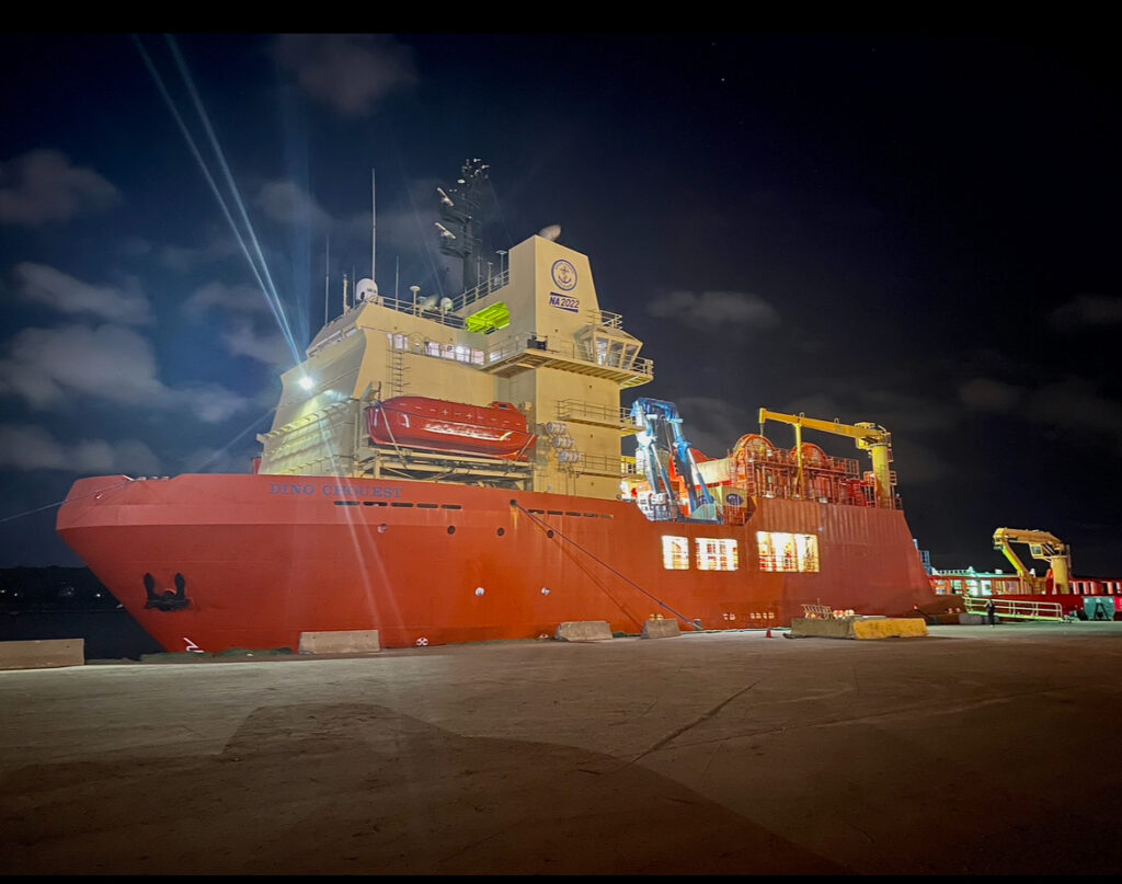
The 348ft (106m) Dino Chouest on the North Atlantic horizon.

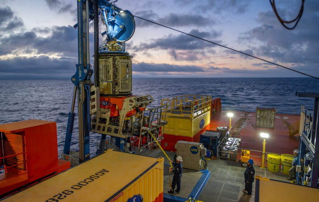
Just as soon as the Dino Chouest has peaked its bow over the continental shelf the sun cracks over the horizon, time for the ROV’s first dive with their new high-tech additions. Not only will this be a shakedown for our cameras, but it will also be a chance for the ROV crew to set the right buoyancy and trim to properly displace the weight of the camera array that has been added on. As we hit the bottom, everyone’s eyes shoot to the screen that has all the cameras live feeds; this is the best screen on the whole ship as every inch of our survey lines will be flashing in front of our eyes three times over. While we are not yet at the Titanic, seeing the bottom, at over 500 meters below, for the first time is still an incredible experience. Throughout our test dive, we test many variations for height off the bottom, light intensities, and camera parameters. The many crabs crawling around act as our test subjects for a few hours as we work to get the sharpest images we possibly can. Imaging in complete darkness is a tremendous challenge, as every parameter you change affects another. Finding the right balance between ROV speed and height off bottom, while maintaining sharp focus and limiting motion blur all while retaining enough light in our images will be a dance we will do for the next few weeks on site.

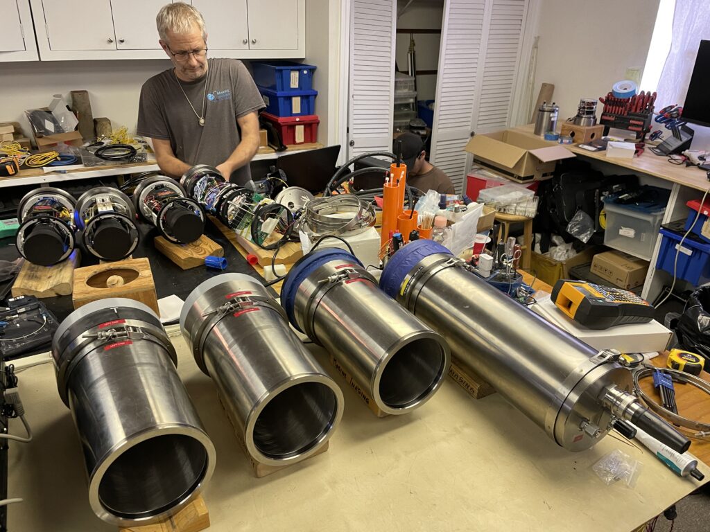
Mounting cameras on the ROV for the trial dives

With trial dives over and a four-day journey ahead of us, there is no time to wait around — workflows for changing camera settings, data management, and exporting begin. Each morning we glance at the vessel’s navigation chart as we get closer and closer, signifying the amount of time we have to tackle what is at hand before the clock runs out. Constant talks about preferred lane spacing for the appropriate overlap surround us as we get closer, and survey lines start to get laid out on the grid of the wreck site. We’ll be separating the wreck site into boxes and within each box running lanes at three-and-a-half-meter spacing. This will ensure we retain enough overlap from lane to lane in order to render models, but also cover enough ground at a quick enough rate to image the site and debris field. As we arrive on site and the subs get prepared for their first titanic dive, final checks are done twice if not three times over. Cameras are mounted, cables are routed, and fiber is cleaned, with over a six-hour round trip journey from the bottom, the project can’t afford to be held back by unnecessary ROV trips back to the surface.

Prepping cameras pre-dive
Evan Kovacs and I dressing cables and securing housings before the ROV’s dive. Photo: Brett Seymour

Leading up to the first dive there were so many tasks I could distract myself with, whether it be becoming familiarized with the software we’ll be using or assisting with camera setup. However, once the ROVs finally splash and start making their way towards the bottom, not much can be done but wonder what the wreck will look like and what kind of debris we will come across. As soon as we reach the bottom, image quality checks and camera parameters are adjusted. Each time we make a change we make sure to export a few images to check our results before moving on to adjust the next camera. Finding the appropriate speed for the ROV to fly is of the utmost importance. Too fast we’ll get impacted by motion blur, too slow and we won’t cover enough ground to complete the survey area. With each change to ROV speed or camera setting, quality checks must start over again, in order to ensure our resolution is where we expect it to be; sub-millimeter.

The view from the ROV pilots seat.

We’ll be in constant communication with the ROV pilots over the next few weeks, as they’ll be calling out lanes and we’ll periodically have them adjust the height and camera tilt according to the frames we see on our camera feed, ensuring exposure and depth of field is ideal for the debris we come across. In the meantime, most of our lanes will be surrounding debris fields and we’ll get to the superstructures later. After the buzz about reaching the bottom dissipates and we make our first few passes, it’s time to head to bed. Brett and I will be in the control van from 12 AM to 6 AM while Evan and Josie will be from 6 AM to 12 PM, and then again from 12 PM to 6 PM and 6 PM to 12 AM. Imaging around the clock in these stints ensures the camera operator will always be sharp and aware of the feed in front of them, crucial for quality control. As we settle into our new routines and our bodies submit to our new alien sleep schedules, days begin to blur. It is amazing how you could be on a vessel in the middle of the North Atlantic and go days without taking a few minutes to stare off into the horizon to absorb your surroundings.

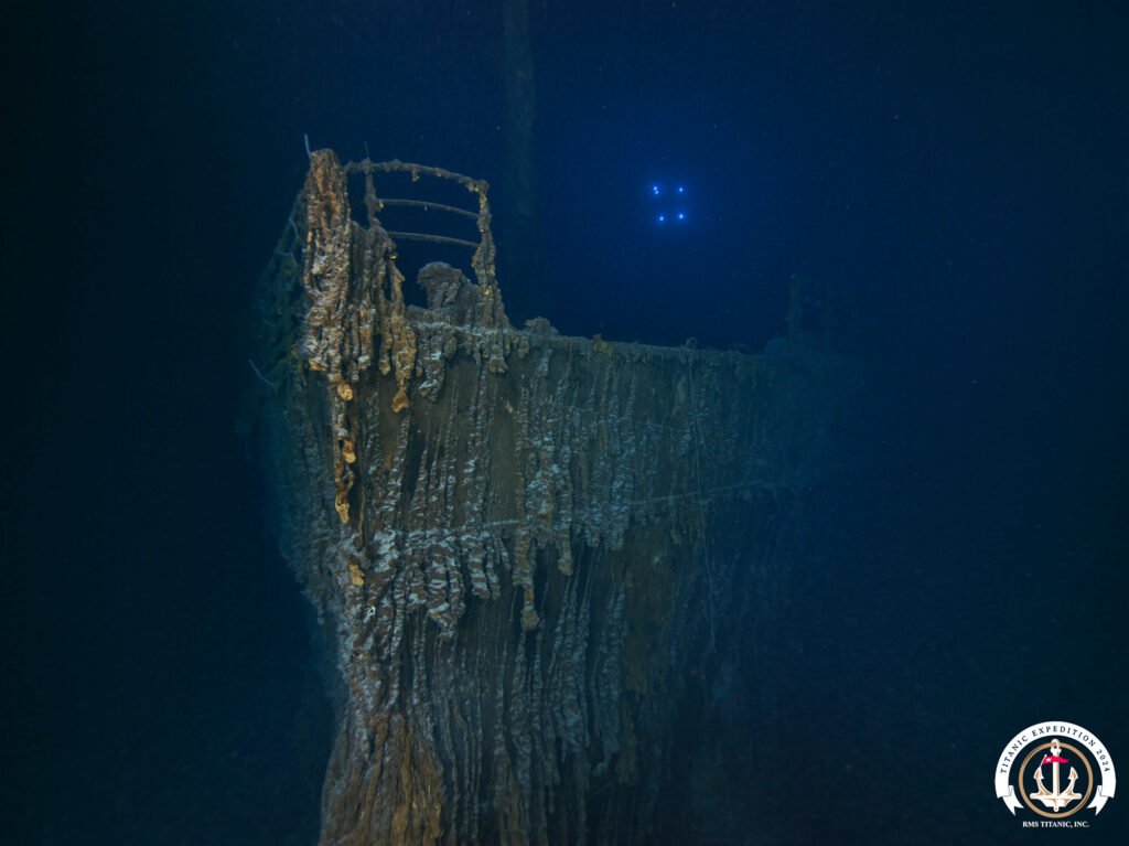
The second expedition ROV hovers over the Titanic’s bow.

As sunrises begin to blur with sunsets and single twenty-four-hour days start to feel like two, the lanes start ticking away. Getting closer and closer to the wreck we start to stumble into bigger debris. Entire sections of the ship and massive boilers that look as though they were made of paper and torn off from the tremendous force of the wreckage. Its always tricky to understand the scale of the objects, but a quick internet search reveals just one of the many boilers we imaged was taller and wider than the control van we were sitting in — truly incredible. Throughout our imaging, we consistently pull images from the servers for field renders. Not only does this serve as a quality check for our lane spacing and camera parameters, to ensure there are no holes, but it also captivates everyone who walks through our control van. As word spreads more and more people stop in to have a look at the live feed that flashes in front of our eyes 24/7, and look at the possibilities of future model creation.

“Painting in” the propellers while in constant communication with the ROV pilots. Photo: Brett Seymour

Many of the debris we came across we were able to image by continuing in our lanes and running three and a half meters off the bottom with the cameras facing straight down. With enough time of your eyes glued to the screen this way the camera feed finds its way to morph, and you start getting the sense you are right there on the bottom swimming along, just with three eyes instead of two that all seem to be blinking at their own rate. What was exciting to see at first like shoes, cups, luggage, and small debris becomes more and more prevalent as you make your way towards the wreck structures. Larger structures take time, patience, and constant communication with ROV pilots to image correctly. Giving them concise direction on ROV placement, camera tilt angles, and distance from the debris is critical to maintaining overlap while capturing the detail of an object for it to be able to be rendered successfully and not have any gaps or holes in coverage. While we are solely looking at our camera feeds, the ROV pilots have a plethora of monitors and controls to manage, from their lateral movements, vertical height adjustments, managing the tether connecting them to the ship, and all while not getting stuck, wrapped around any debris, or silting up the bottom cause us to lose visibility. The skill many of the pilots demonstrated in getting us close to complicated structures that seemed impossible to image was incredible. At certain points when imaging the propellers on the stern, we were under the overhang of the fantail, their efforts to get us in the best possible position are truly admirable. “Painting in” large structures as we began to call it, was a time-consuming component. Often structures would take hours at a time if not days, but running with lines would simply not produce good imagery for modeling as holes would be too prevalent, and light loss from the top-down view due to clearance would mean we would lose all image for a considerable amount of the object and or its surroundings. Throughout the weeks ROV pilots got a good sense of what distance and angles we were looking for while we started understanding where we could or could not fit, but it still never hurts to ask if we can just get a litttttlee bit closer!

ROV returns to surface after one of its last dives on the wreck site. Photo: Brett Seymour

With ROVs in the water until the last possible moment before turning back towards shore, it still feels surreal being able to witness all of Titanic. Every inch of the superstructure and major debris fields flashed before our eyes, from iconic bow shots to debris that told stories of those on board, now safeguarded in over two million images on servers in our control van. With a breakdown of equipment, cleanup of data, and packing up to do, our ride back to shore will be far from a cruise. As we switch back to our normal sleep cycles it seems almost impossible to think I’ll be awake for over six hours in one go. Even now I find myself remembering small memorable moments that seem to have gotten lost in the chaos of all the preparation and work at hand in the moment. It has been truly incredible to assist with an expedition of this scale and collect imagery of this caliber. My time spent learning and observing the experts around me such as Evan set up cameras and leave no stone unturned to achieve the highest possible quality will be an experience I will carry with me for a long time and am grateful to have!

Camera Shack and UHD 327 (ROV) team photo, concluding a successful expedition on RMS Titanic.
Share

Every inch of the Titanic through a single strand of fiber – Part 1

RMS Titanic, 2024

From its tragic sinking in 1912 to current day, the Titanic has retained its capture on audiences worldwide. Whether it’s through famous James Cameron films or recurring expeditions, the stories told have continually captivated audiences and embedded themselves into modern mainstream interest. The wreck now rests nearly two and half miles deep in the North Atlantic, split in two, the bow and stern sections sitting about two thousand feet away from one another. Surrounding the superstructures is a massive expanse of debris, littered with both artifacts and structural pieces from within the ship. 

For 2024, the expedition’s goals are to map and image the site like never before, surveying the area with both cameras and lidar, enabling future 3d reconstruction of the site and debris in situ with millions of images. Evan Kovacs, founder of Marine Imaging Technologies and National Park Service’s partner on the SeaArray – the state of the art multi-camera photogrammetry system – will be the Director of Underwater Photography on this expedition. Brett and I will be joining him along with his imaging intern Josie Clapp for the next month while offshore to collect imagery on the site.

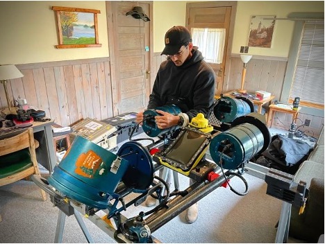
Evan Kovacs preps the camera systems prior to departure offshore. Photo: Brett Seymour

Not without having my fill of lobster rolls and clam chowder along the way, I head up to Falmouth, MA — Marine Imaging’s headquarters — to meet Brett, Evan, Josie, and the remainder of the Marine Imaging team. Everyone is full throttle ahead at helping pack, arrange, and prepare for the upcoming expedition. Shortly after saying our initial hellos we all scatter to get as much done in the two days remaining onshore. I head to Providence to meet the Dino Chouest (the ship we’ll call home for the next month) and pick up the camera housings, while Brett and Evan head to Boston to set up servers and storage for the incoming overload of images.

I get into the Providence port just in time to watch the Dino make its way in and throw its line over. As I sit in the car waiting for the gangway to be lowered, I can’t help but be in absolute awe at the scale of all the ships and machinery running around the port. Troy Launay, the expedition co-leader greets me and gives me a thorough rundown of what has been done to the ship in preparation for such an expedition. Having the ship properly outfitted ensures it will be capable of having two ROVs in the water at a time. One of which will be flying with a lidar and magnetometer while the other will be running lanes with a photogrammetry array. As soon as the gangway is lowered Troy disappears onto the ship and arranges for the pelican cases with housing to be unloaded. With the precious cargo in my possession I return to Falmouth, sneaking in just one more lobster roll in on the way before the next month offshore.

The Dino Chouest in Providence the night before its departure. Photo: Brett Seymour

The next morning all hands are on deck preparing and packing every possible spare and necessary component for our trip, if only Marine Imaging’s shop could fit into one magical pelican case. Always better to have extras and not use them rather than be stuck on-site and out of options, with over a four-day transit time and multiple teams pushing to get a massive amount of area covered no one wants to be the cause of any setbacks. As soon as we arrive at the port and meet the Dino set up begins right away, but not without first doing a lap and getting acquainted with our new home, its many decks, and its many many stairs. This is the first time I get to check out the ROVs that will be diving, and they could not be more impressive, a true feat of engineering, and some of the most advanced ones in the world of deep-sea operations. With a lot of setups yet to be done we head to the back deck where we have been given a control van to make our headquarters for the duration of the expedition.

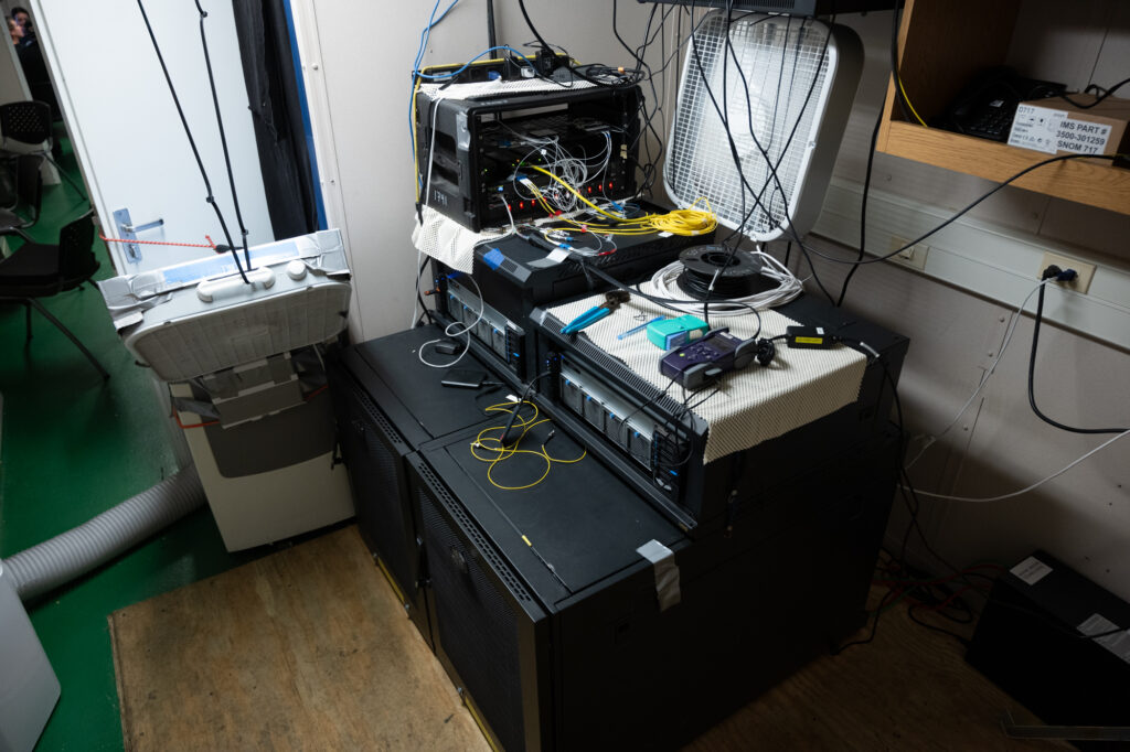
The servers that will hold each subsea image (and its duplicate backup copy) carefully get hoisted onto the ship using one of its many cranes, four petabytes of storage isn’t light. As the raids get set up and switched on the fans kick in and we start getting used to the immense noise and heat that will be generated just a few steps from our desks. Keeping the servers happy is of the utmost importance, the entire expedition relies on them functioning properly and safeguarding each image, and as we soon learn they heat up quickly. Constantly monitoring their internal temperatures and adding A/C units, inventive ducting, and fans all around seems to do the trick in keeping them at an appropriate temperature.  Once our storage system is setup, we quickly shift gears towards the cameras that will be acquiring all the data.

Servers onboard the Dino surrounded by inventive ducting to keep them cool. Photo: Brett Seymour

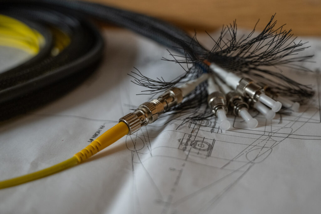
Taking an image on the ocean floor over two miles deep is no simple feat, but depth plays a relatively minor part in relation to the challenges of maintaining camera control and communication, all of which is done through fiber optics. The ROV runs fiber from the sub to the surface in its tether, on either end that fiber is split to accomplish many tasks from control to backups for cameras and ROV function alike. With multiple components on the sub needing fiber for control and a limited amount in its tether, cameras make up just one of the strands of glass fiber that will make its way from the ocean floor to our control van. Both at the surface and on the bottom this single strand is split numerous times, each camera runs a fiber into a control bottle that then merges them and delivers a single strand to the control van, which then needs to be reseparated by wavelengths to regain control and communication which each individual camera. Its effectiveness all comes down to the amount of light that can be delivered, and each connection decreases its efficiency. At a certain point from either too many connections or the connections themselves being dirty the amount of noise (loss) is too high and camera communication is lost altogether.

The single fiber running from the ROV into our camera shack. Photo: Brett Seymour

With the entire project relying on these strands of glass fibers you can imagine the nerve-wracking stress that comes with dealing with them, whether it be to disconnect/reconnect them, route cables, or secure them to the sub. Exposure to dealing with them constantly helps dilute the nerves, but even better is watching a professional like Evan deciding on a whim to redo nearly all the connections at any given moment to get rid of as much light loss as possible.

ROV getting ready for its first test dive at sunrise. Photo: Brett Seymour

With fiber connected and cleaned everywhere it can the little time remaining is spent learning the software we’ll be using to control camera parameters and record data to the servers. One of the many screens that will be sitting in front of will show us live feed from the three cameras on the photogrammetry array so we are able to adjust parameters like aperture, shutter, and focus on the fly depending on proximity, speed, and light availability. We head to bed after a blur of days spent packing, unpacking, and getting acquainted with our new home. No one will be sleeping for long as we have just left port and in a few hours get to drop the ROVs off the continental shelf for their first shakedown with the cameras in some deeper water. After that it will be a four-day transit before we reach the Titanic wreck site, where I’ll be writing again!

Share

Skimming the surface at Isle Royale NP

Situated on Lake Superior’s northern border with Canada and only accessible by either ferry or seaplane, you can’t haphazardly add a stop along your route to visit Isle Royale. The 45-mile-long island designated as a wilderness area is home to over 160 miles of trails in which only moose, wolves, and few hikers roam, without a single car in sight. Most commonly, backpackers prepare for the 4-5 day traverse from Rock-Harbor to Windigo on either end of the Island connected by the 40-mile-long Greenstone Ridge Trail. It’s safe to say far fewer visitors come to dive the many shipwrecks scattered around the island, as Lake Superior’s waters consistently hover around 40 degrees even in summer months. Given that I’ve only recently been introduced to diving in a drysuit and am a newly minted rebreather diver, I won’t be joining the SRC below the surface on a working dive quite yet, but I am looking forward to seeing the SeaArray system in operation and providing topside support. 

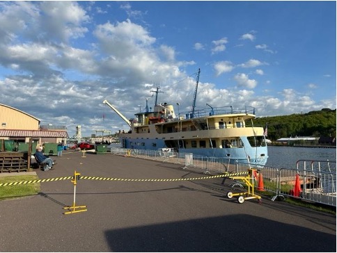
The Ranger III docked in Houghton, MI before departing for Rock Harbor

I leave Miami so early in the morning I feel that I might still be dreaming. Finally, the much-anticipated long day of travel is here. Aside from a few emails and phone calls, I still have yet to meet anyone from the SRC team. It was at a short layover in Chicago that I met Brett Seymour, SRC Deputy Chief and Audiovisual Production Specialist, for the first time. From there, we board a smaller plane heading into Houghton, Michigan where we would then catch the Ranger III ferry the following day to get to Isle Royale. It’s always a great sign of what’s to come when you trade bigger planes for smaller planes. Once we arrive in Houghton, we head to the dock to greet AJ, an Archaeologist with the SRC who is heading back from Isle Royale after assisting the park with buoy maintenance. We load up the coolers and head to the grocery store to tackle my most dreaded task; stock up on all the food I could possibly need for the next week on the island. A few panic buys and countless extra aisle pass-throughs later, and I manage to fill up a cooler that I am confident will last me at least a week. 

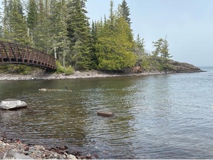
A family of Geese take a morning swim around Mott Island.

The next morning, we pick up David Morgan, a Senior Archaeologist with the SRC, who flew in straight from a family vacation in Mexico to join Brett in diving and gain cold water dive experience (talk about a temperature difference). Once all our bags and coolers make it onto the Ranger III, we board and do a lap around the ship to get accustomed to its Wes Anderson-esque design and the many seating options it has to offer for our six-hour journey to Mott Island — home for the next week. Jim Nimz, SRC Dive Operations Specialist, is already on Mott Island after completing various National Maintenance Dive Team tasks the week prior. We spend the evening settling into our dorms, unpacking our food, and becoming acquainted with our surroundings. Because the sun only sets around 9:30 PM, I’m able to squeeze in an evening hike to get to see some of the park’s gorgeous scenery and rocky shores. 

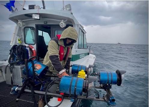
Preparing the SeaArray another day of imaging Photo: Brett Seymour

Seth DePasqual, the Cultural Resource Manager at Isle Royale, joins us each morning to discuss our field plans, the park’s priorities, and how SRC can help achieve them. Most of our days over the next week will be spent at the Glenlyon shipwreck, a 328-foot freighter powered by a triple expansion steam engine that sunk after striking the reef during a storm in 1924. The stern and bow sections sit to either side of a shallow relief fittingly named Glenlyon shoal, where the freighter initially ran aground and split in two. Due to the size of the site and the depth range from one section to the other it typically requires at least three imaging dives to piece together the entire wreck — stern, bow, and shoal in the center connecting the two.

Preparing the SeaArray system for the long days ahead, I’m fortunate to go through the setup piece-by-piece with Brett. He has meticulously developed and refined the system over the past four years alongside Evan Kovacs from Marine Imaging Technologies. Each component of the camera array is uniquely selected for ease of use in harsh field conditions, where divers are commonly wearing dry suits, gloves, and thick undergarments greatly limiting their dexterity and mobility. There is a fine balance throughout the system — components need to be robust enough to deal with the wear and tear of extensive field operation yet be replaceable and interchangeable if damaged. Maintaining a modular design, its arms can be folded in, letting it fit through dive doors and limit its footprint on valuable deck space while aboard the Cal Cummings (SRC’s Vessel). In combination with UWIS (a subsea positioning system), real-time location can be relayed to the diver on an underwater iPad, assisting with navigation across big sites and revealing track lines to show coverage and areas that may need more passes. 

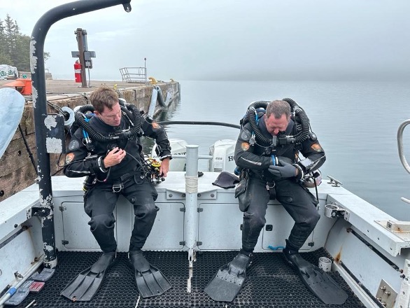
(from left) David Morgan and Jim Nimz preparing for a shakedown dive / weight check at Mott Dock

Throughout the week, I start each day with a hike on Mott Island, exploring trails, encountering moose, and enjoying the island’s gloomy weather. It’s no surprise many ships have run aground on the surrounding shoals; fog and weather can roll in quickly, reducing visibility to near zero. Depths can drop to just a few feet even miles off the coast. The island’s lighthouses often appear and disappear in the fog, evoking the eerie experience of those who were once on the now-sunken ships. Given the unpredictable conditions of Lake Superior, we maintain constant radio communication to ensure safety, relaying position, status, and ETAs with dispatch centers via the island’s radio repeaters.

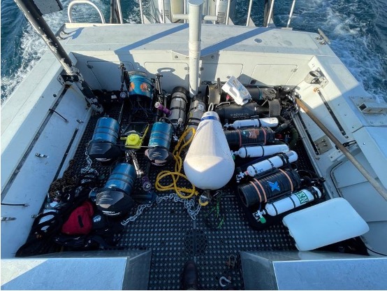
Valuable deck space aboard the SRC Cal Cummings Photo: Brett Seymour

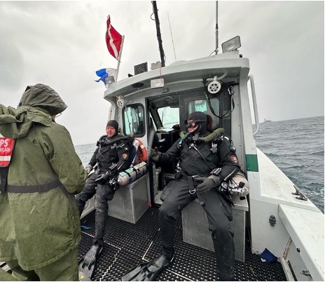
Between our daily trips to the Glenlyon, we take a day of long motoring to Windigo, where the SS America, a 182-foot freighter that ran aground in 1928, lies at the entrance of Washington Harbor. This ship is largely intact and sits with its bow in only four feet of water, while the stern reaches approximately eighty feet. The large variation in depth makes imaging difficult as it greatly impacts buoyancy and available light. While I’m not typically used to being on the boat while others are diving, the unforgiving nature and challenge of diving in Lake Superior is not a place to be trying multiple new things out all at once. However, the allure of diving in such a challenging environment is something I am determined to take part in in the future. Funny enough, I can still say I managed to take a dunk in Lake Superior. My overcommitment to hook a subsurface buoy while not hooking my leg on the gunnel taught me a valuable lesson. And yes it’s cold…very cold.

Moments before SeaArray enters the water at Glenlyon wreck site. Photo: Brett Seymour

With a week’s worth of imagery collected, every evening is spent combing through images, running preliminary alignments, ensuring backups, and preparing SeaArray for another long field day. Having the ability to process data in the field is not a luxury I am accustomed to, and having portable computers that are powerful enough to run models throughout the night is an incredible asset. Talking through various processing methodologies and data organization surrounds the background of most of our nights, as the desire to streamline and perfect any workflow is always constant and never-ending.

(From left) David Morgan runs Jim Nimz and Brett Seymour through thorough checklists before entering the water on the Glenlyon.

Our last days at Isle Royale are spent repacking the numerous Pelican cases of equipment like tetris into the trailer that will be loaded back onto the Ranger III and towed with us to Denver. We get to meet with the park’s superintendent, Denice Swanke, with whom the SRC summarizes what it has accomplished, what work remains, and future goals. It is apparent that the SRC is first and foremost at the service of the park it is visiting, keeping the park’s priorities at the forefront while managing to accomplish imaging in conjunction with other tasks. Once the crane on the Ranger III picks the loaded trailer up to its deck, the long road back to Denver begins: a day and a half of continuous driving with a short pit stop just outside Minneapolis. David Morgan and I take turns driving behind Jim and Brett who are towing back the Cal Cummings. On the home stretch, one of the trailer tires blows out as though just to keep us on our toes. 

Once in Denver, the unpacking begins, or rather the repacking. Dave, Brett, and Jim are headed to Alaska in a few days and much of the equipment coming out of the trailer will be organized in a pile to head there with them. Dave Conlin, SRC Chief, shows me around the new dive locker, a massive area where things are currently staged as they are being moved from the old headquarters. Building shelves, organizing equipment, and making sense of what belongs where keeps everyone busy over the next few days. 

This trip has given me a glimpse of the operating tempo and caliber of work the SRC provides the NPS, and I am extremely grateful to have the opportunity to work alongside  the team on more trips this upcoming summer. Stay tuned for my next blog from an expedition to a shipwreck you just might have heard about – RMS Titanic.

Share

Breathing in a loop: XCCR training in cave country

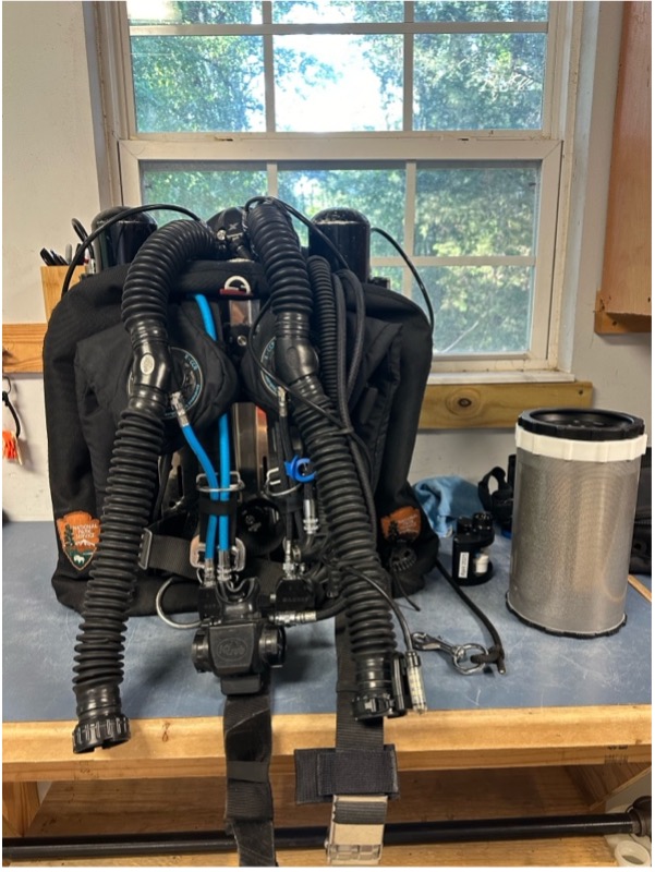
I am starting my internship with the National Parks Service by completing a lifelong dream of mine, getting trained to dive on a closed circuit rebreather (CCR). I have yet to meet the Submerged Resources Center (SRC) team beyond our phone calls, but they have sent over an XCCR for me to use for training while taking a weeklong course in the springs of northern Florida, otherwise regarded as the cave diving capital.  Opening the green pelican case to be greeted by the unit inside with National Parks Service badges embroidered on its wing was a very surreal moment, the first of many to come. I will be joined by University of Miami Diving Safety Officer (DSO) Jason Nunn and Jessica Keller who are undergoing their XCCR instructor training from Randy Thornton. Sub Gravity shop manager Brian Sanders-Smith and I will be learning how to walk for the first time over the next week; CCR diving flips open circuit on its head quite literally. The physics of buoyancy operates in a vastly different way from what we’ve grown accustomed to with conventional open circuit diving.   

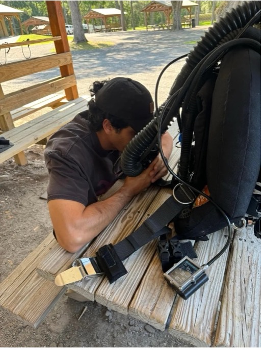
On Sunday, I meet Jason at the UM Dive Safety Office. All our equipment is staged and ready to be loaded after going through checklists throughout the week to ensure nothing is left behind. Just 15 minutes later, the bed and backseat of his truck are filled with all the equipment we could possibly need over the next week. Five hours on the road and an infinite round of CCR questions I’ve been occupying Jason’s time with, and we finally get to Randy’s house near High Springs, FL where we meet Jess and start to unload all our gear. Randy’s house is set up for exactly this, and I’m happy to be staying with him during this time, making morning setups and evening breakdowns incredibly efficient after long days of diving. We’re expecting Randy and Brian to get in from Utah late at night, so we head to bed; smiling all day is tiring. 

The XCCR unit the SRC team has generously lent me for my training. Staged in Randy Thorntons purpose-built garage and ready for a dive the following morning.

Unfortunately, due to car issues, Randy and Brian only got in around eight the following morning, but after a quick power nap, we got straight to work. We spent the entire day reviewing the units’ components and building it up for a dive. It’s hard to wrap your brain around all the new information thrown at you; saying it is a steep learning curve is an understatement. Luckily for me, I’ve been a complete XCCR nerd over the past year and have read through the manual on multiple occasions.  Never did I imagine I would be getting my hands on one so soon, and the thought that I’ll be diving it tomorrow is simply inconceivable.  Before you know it it’s dinner time, and we go out for pizza to discuss pressing topics: Is the pizza in NY infinitely better than Florida?  Yes. Is it really the water? I can’t say, but it’s in a league of its own, although I might be biased growing up in the northeast. 

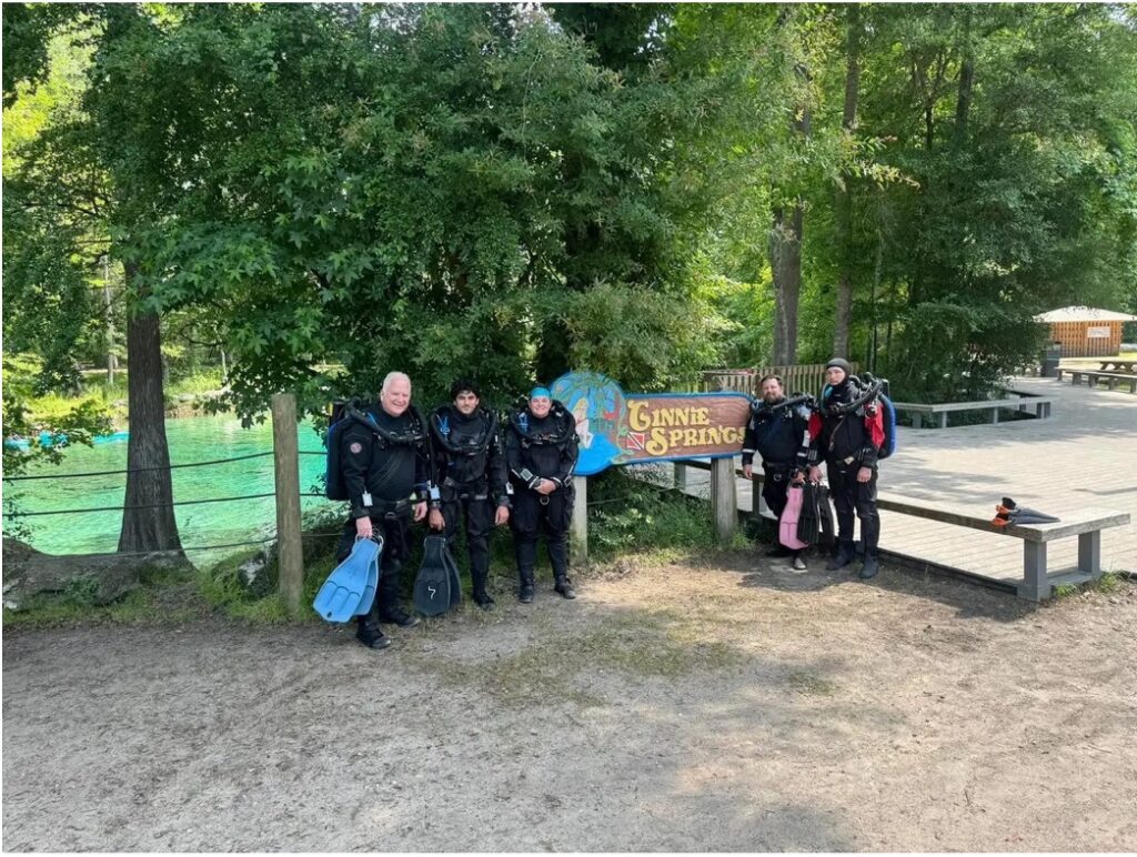
Before we can get into the water at Ginnie Springs, home of well-known caves such as the Devil’s Spring System, we have an extensive predive checklist we must go through thoroughly. Overlooking a step or becoming complacent with these can lead to serious diving emergencies and jeopardize the safety and lives of you and your dive team. We hit the water midday by Ginnie Ballroom and prepare to be humbled, growing accustomed to controlling buoyancy and managing three different air spaces. We progress slowly to incorporate some basic drills, and by the end of the day, we get to poke our heads down into the Ballroom, a cavern just below our feet with mesmerizing beauty. The rest of the evening is spent recalibrating my brain to the new physics of CCR diving, rehearsing drills in my head, and digesting all the new information. 

Group photo before our first dive at Ginnie Springs. From left: Randy, myself, Jess, Jason, and Brian.

We spend the next two days at Blue Grotto, about an hour’s ride away from Randy’s. Morning checks to make sure everything is in the car before we leave becomes routine, always double-checking your lunch isn’t being left behind. We focus on getting comfortable with emergency drills, dealing with issues associated with hypoxia, hyperoxia, hypercapnia, lost gas, and failures. Creating the neural pathways for these new motions is only one component.  However, having to actively think through the procedures  is a critical part of diving on a rebreather; how your actions  will  affect the loop you are breathing and the gas composition in it means everything.  Constantly playing with your buoyancy throughout this makes keeping track of your thought process difficult, so repetitions matter, and soon enough, all our long discussions about theory start syncing with proper responses. We get to experience the cavern area in Blue Grotto, and with depth comes the welcomed ease of buoyancy control. Blue Grotto is also home to a permanent resident, Virgil, a soft-shell turtle who seems to find a way of paying a visit at the most inconvenient time, swimming within inches of Jess’s and Brian’s masks in the middle of a drill to reclaim his status as the center of attention. After a long day of learning from our mistakes and rehearsing drills, it concludes with some much-needed sushi and completing the remaining final written exams. No rolls are left behind, and any stragglers are added to Jess’s “breakfast sushi platter” (a brilliant idea if you ask me).

Completing a Pre-Breathe while closely monitoring pO2. Photo credit: Randy

The final day is a bittersweet experience. While  I’m excited to graduate from the confines of Blue Grotto and be certified, I’m subduing  the  thoughts that are screaming at me, which means tomorrow I won’t be in the water.  I’ve grown to love the steep learning curve and challenges,  driving  me to want to become as proficient as possible  which  will require hours and hours of practice and logging more dive time, something I’m greatly looking forward to. A massive weather system is pushing its way through the area, and on our way to our home away from home (Blue Grotto), we encounter multiple downed trees, detours, and close calls. Hesitant that the Grotto will remain closed because of lightning, we decide to keep pushing forward, even if that means driving around downed trees on dirt shoulders. By the time we arrive, the skies are clearing, almost as a reward for persevering through the doubts running through everyone’s heads on the ride over. Checks, checks, checks, and then we hit the water, demonstrating skills in conjunction with problem-solving surprise scenarios. We take a tour of the deepest corner Blue Grotto has to offer at thirty meters and follow the cave line, conscious not to silt the narrow corridor and make a mess of the visibility.  Our way up follows a steep and tight slalom-like pass, and we head to the surface to discuss our next task: rescues. If I had to categorize my first rescue attempt, it would be “acrobatic”, and that is being generous. Maintaining and controlling six air spaces is a challenge at best and requires a feel you can only develop with more practice and failed attempts. Caution was my friend on future tries, and after closing discussions, we got to shake each other’s hands as new XCCR divers (Brian and I) and new XCCR Instructors (Jason and Jess)!  The fun didn’t stop there; I had my first-ever peanut butter and jelly sandwich awaiting me in the cooler for lunch. It was good, it was really good, actually it was really really good, and the more bites I took  the  bigger  the smile got on my face I  just  could not hide it.  Peanut butter and jelly, who knew. 

The final day of training and I still find myself questioning if this is really happening. Photo credit: Jason

With a new world of diving adventures ahead of us we got back to Randy’s to sanitize and break down our units. I assured Randy I’ll be pestering  him in the future to do  a full  cave course; the peace and almost meditative-like state of diving silently in a dark cave  is something that  still leaves me drooling. That night, we all enjoy laughing at our mistakes made over the course of the week. My personalhighlight reel would include bouncing like a basketball off the bottom while attempting semi-closed rebreather drills and my initial cirque du soleil inspired demonstration of a rescue. We all say our farewells in the morning, load up Jason’s truck  one more time, and head back to Miami. This experience has been humbling, inspiring, and rewarding. I am grateful for being taught by such amazing talent and receiving feedback and instruction from Randy, Jess, and Jason.

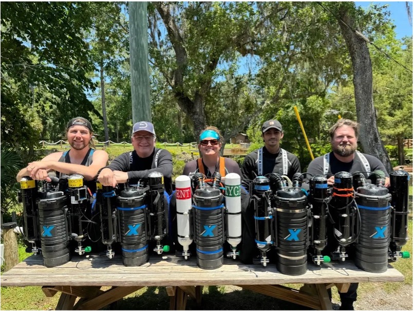
Our five units all lined up in front of Blue Grotto. From left: Brian, Randy, Jess, myself, and Jason.

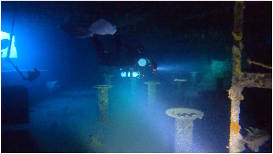
But just when I thought my week wouldn’t get any better, Jason and I conspired to dive the following day in Key Largo on the USS Spiegel Grove, all while on the car ride back.  Forecasts are just too good to spend the day out of the water.  As soon as we get our gear unloaded, we go over a dive plan, pack our scrubbers, and load the truck yet  again. The Spiegel is a five-hundred-and-ten-foot-long US Navy dock landing ship decommissioned in 1989 and sunk as an artificial reef off the coast of Key Largo in 2002. The following morning, we hit the water by nine thirty for our two-hour deco dive, and to be quite honest, I am  still digesting what my eyes saw. Spending an hour and a half at depth  between forty-five and thirty meters exploring the ship’s multiple decks and interior rooms while being accompanied by four reef sharks all in complete silence has  easily  jumped to the best dive experience I have yet to have, making past open circuit tech dives seem recreational in comparison.  All  these highlights and I haven’t even fully started my time with the SRC team yet. What adventures await on my upcoming trip to Isle Royale NP can’t come soon enough. 

Following Jason through one of the many tight and dark spaces we explored in the Spiegel, always helps to have a local lead the way!

Share

Inside a blue mind 

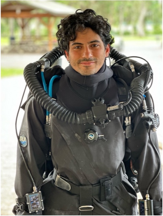
Growing up between New Jersey and Israel, I learned from a young age while diving in the Red Sea that I am more comfortable underwater than on land. Naturally, I couldn’t get enough. I spent my summers taking as many dive courses as I could — from intros to specialties. Eventually leading me into technical diving where my detail-oriented mind could roam free and obsess about things like equipment configurations, underwater procedures, and dive planning. My passion for being underwater and in the environment I felt most connected with led me to pursue an undergraduate degree in Marine Science at the University of Miami. I was determined to do anything it took to build a career centered around an insatiable passion for diving while contributing to valuable research efforts. 

My passion for our surrounding natural resources also extends far beyond marine habitats. After graduating in 2020, I was fortunate enough to go on multiple cross country motorcycle trips, camping and hiking in countless national parks and forests, which may just be the only thing I would be willing to entertain instead of being underwater. Little did I know many of the places I visited, such as Yellowstone National Park, are not beyond the scope of the Submerged Resources Center. Whether I knew it or not diving was still in the background of my adventures and my newfound intrigue for our national parks would eventually find its way back to me.

Over twenty thousand miles and numerous national parks later, I found myself on a ten-mile-long island in the middle of the Caribbean, Little Cayman. This was my first opportunity to gain hands on field experience researching mesophotic reefs and sea mounts while on a remote field station. It also gave me a taste for what it was like to conduct research operations while applying my passions for technical diving and utilizing the photogrammetry principles I learned in my undergraduate degree to examine mesophotic reefs. 

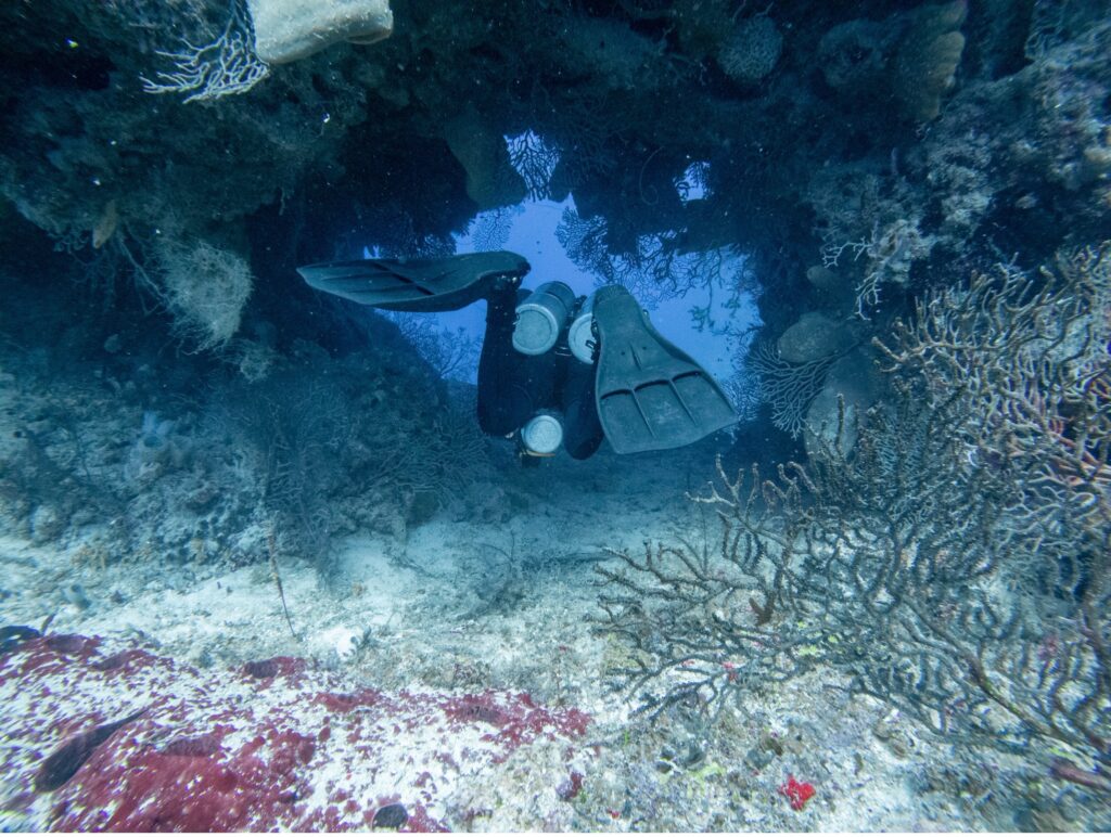
Blurring the lines between fun and working dives while in the Cayman Islands.

As my interest in photogrammetry snowballed, I began to search for what was next. An opportunity to refine my skills and collect high quality imagery led me back again to the University of Miami, where I have worked as a Research Associate, responsible for collecting and processing imagery within the Florida Keys National Marine Sanctuary, providing reef-scale baseline imagery in support of NOAA’s: Mission Iconic Reefs Initiative, and doing so for other lab groups both within and collaborating with UM. Our models will serve as a crucial tool for examining effects of restoration efforts, continued benchmarks of reef health, and providing an invaluable set of time series data across an environmental scale. 

I’m thrilled to join the Submerged Resources Center this summer as the 2024 Our World Underwater Scholarship Society National Parks Service Intern. Working alongside the SRC team presents the exciting opportunity to further sharpen my proficiency in collecting and processing imagery. I am eager to apply my experience in utilizing high-quality multi-camera imaging systems with robust data processing and management to the workflows surrounding the SeaArray system. The idea that I’ll be able to merge my passion for technical diving and utilize cutting-edge tech at otherwise nearly inaccessible field locations is still hard to believe. I could not be more excited for the adventures that await me this summer, and am thankful for both OWUSS and NPS-SRC for making such an opportunity possible.

Share