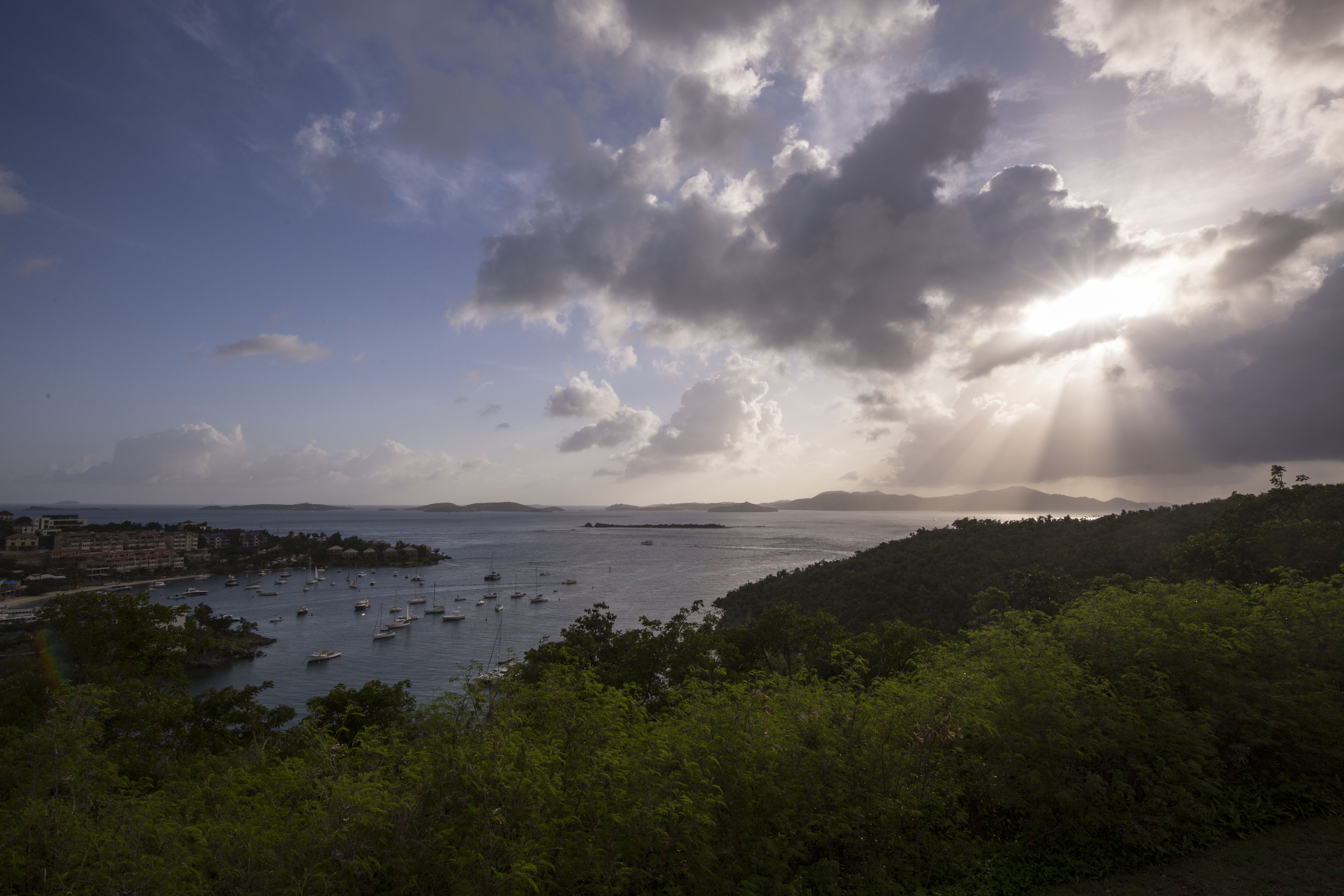
As soon as I saw the bright blue tropical water from the small plane window I knew my flight was going the right way. The unmistakable vibrant waters of the Caribbean were moving closer and closer as we began our descent. I was eager to return to this part of the world and was looking forward to more picturesque beaches and wildly clear waters. This trip I was returning to the Virgin Islands, but to a new one this time: St. John, home of Virgin Islands National Park.
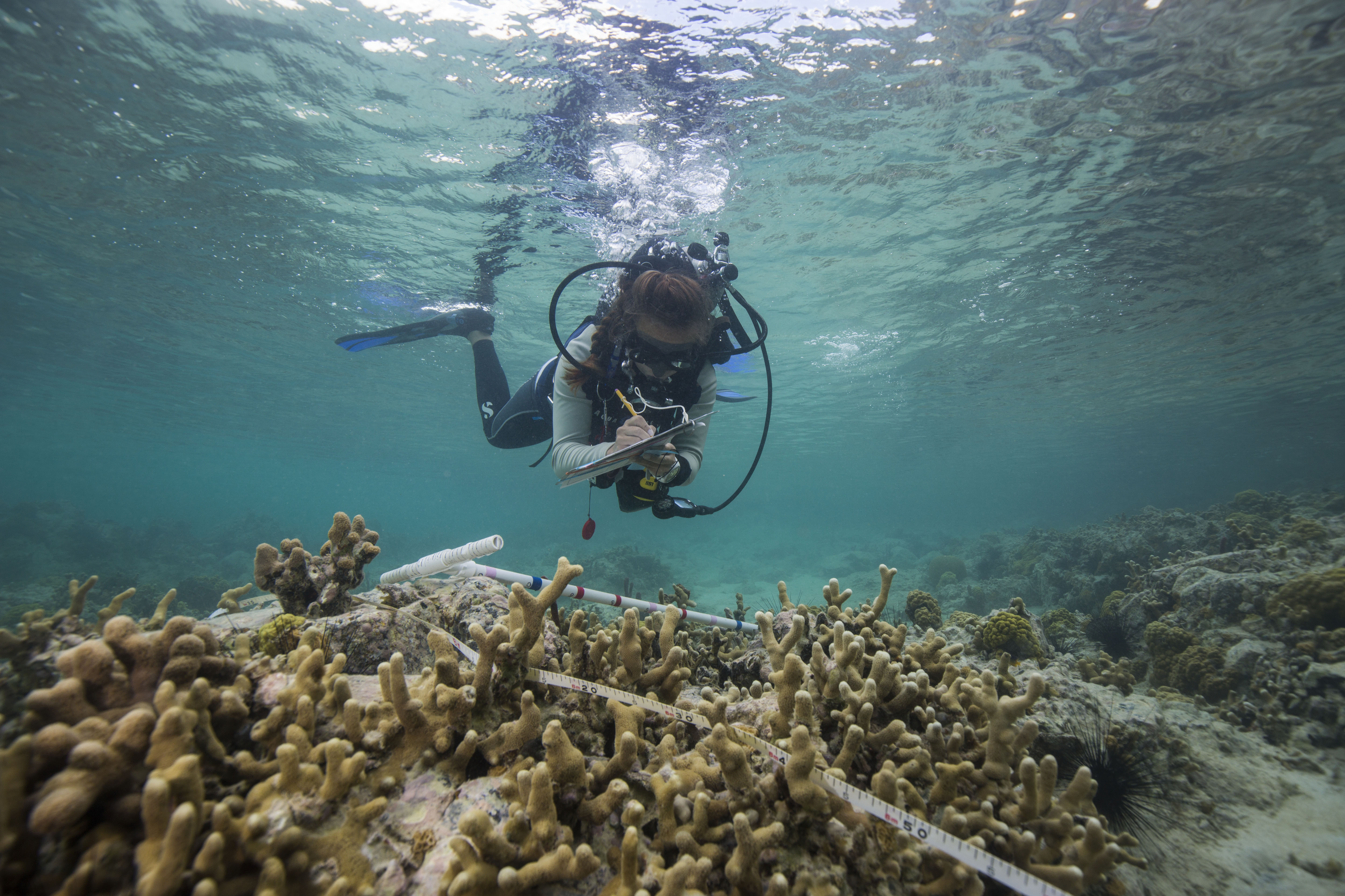
Virgin Islands National Park, encompassing 60% of the land area on St. John and about 9 square miles of the adjacent ocean, is a beautiful place full of tropical forests, historic ruins, and fringing coral reefs. Surrounding it is Virgin Islands Coral Reefs National Monument, adding an additional almost 20 square miles of protection to the reefs around the island. I was here for the second leg of the National Coral Reef Monitoring Program (NCRMP), a nation-wide effort to survey and keep track of the health of coral reefs. Lead by NOAA, this was a collaborative effort including groups like the NPS and University of Virgin Islands. This work was identical procedurally to what I worked on in St. Croix, as the survey methods must be the same in order to create comparable data. After my previous warm-up round a month before, these surveys collecting information on reef complexity, fish diversity, and coral health felt very comfortable and familiar. There was one big difference between the two for me though: in St. John, I collected much more data.
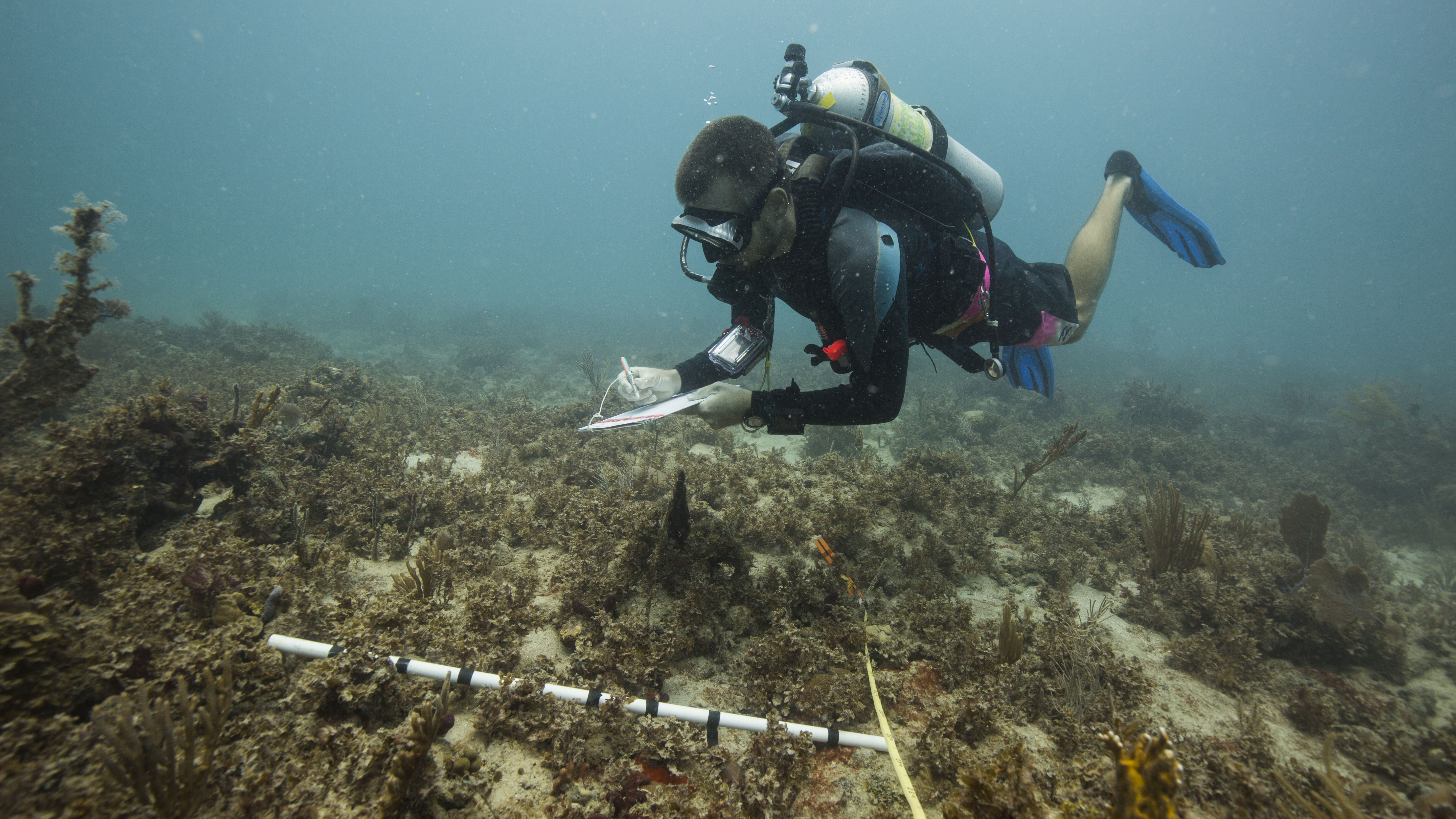
In St. Croix, I spent 3 of my five diving days photo-documenting the work at hand and shadowing to try and pick up the survey methods, only jumping into data collection on the last two days because the team was short a member. In St. John, I collected data from start to end – forcing me to data dive with a bulky camera strapped to my BC if I wanted to get any photos of the reefs. This was fun, as I like scientific diving and data collection, but did have one major downside. All of this fun data collection was paired with another, far less fun, task: data entry.
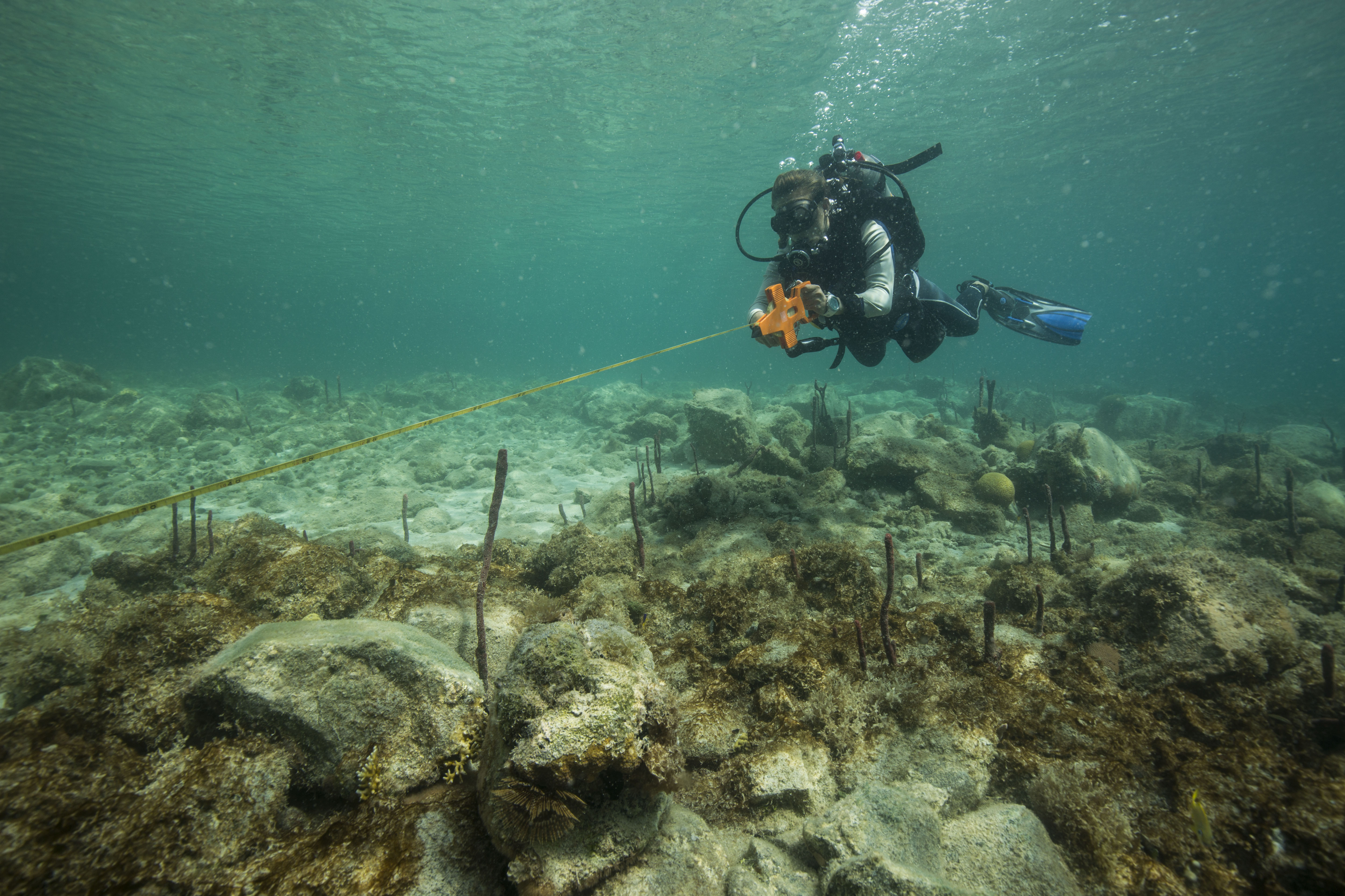
All that data has to go somewhere
All data entry had to be done by the end of the trip, so each day of diving 5-7 dives a day means 5-7 data sheets are waiting for you when you return home, tired after a long day of diving. Sure, you could wait to enter these until a little bit later in the trip but they’ll quickly pile up, creating an imposing stack of impending work. This data entry obligation was difficult to manage, with all the other internship duties I had along with dinner and other evening activities. To make matters worse, the survey type that I was doing, line-point intersect, was collecting information on percent cover of the benthic environment – meaning that I’d always have 100 points to enter, regardless on how barren the site was. Certain less-than-interesting sites gave the fish and coral surveyors a welcome break from the intense data collection, but the hapless LPI diver was doomed to work tirelessly.

Sometimes the tables were turned, and recording point after point of turf algae seemed preferable to counting and sizing hundreds of fast-moving fish
All of my gripes aside, this data entry is a key portion of the survey process – completely necessary if you are interested in doing any types of analysis or learning anything from all of these numbers that have just been produced. Additionally, doing it right after collecting it leaves little room for forgetting key information. It’s much harder to decipher messy underwater handwriting a month after it was written rather than a couple hours later.
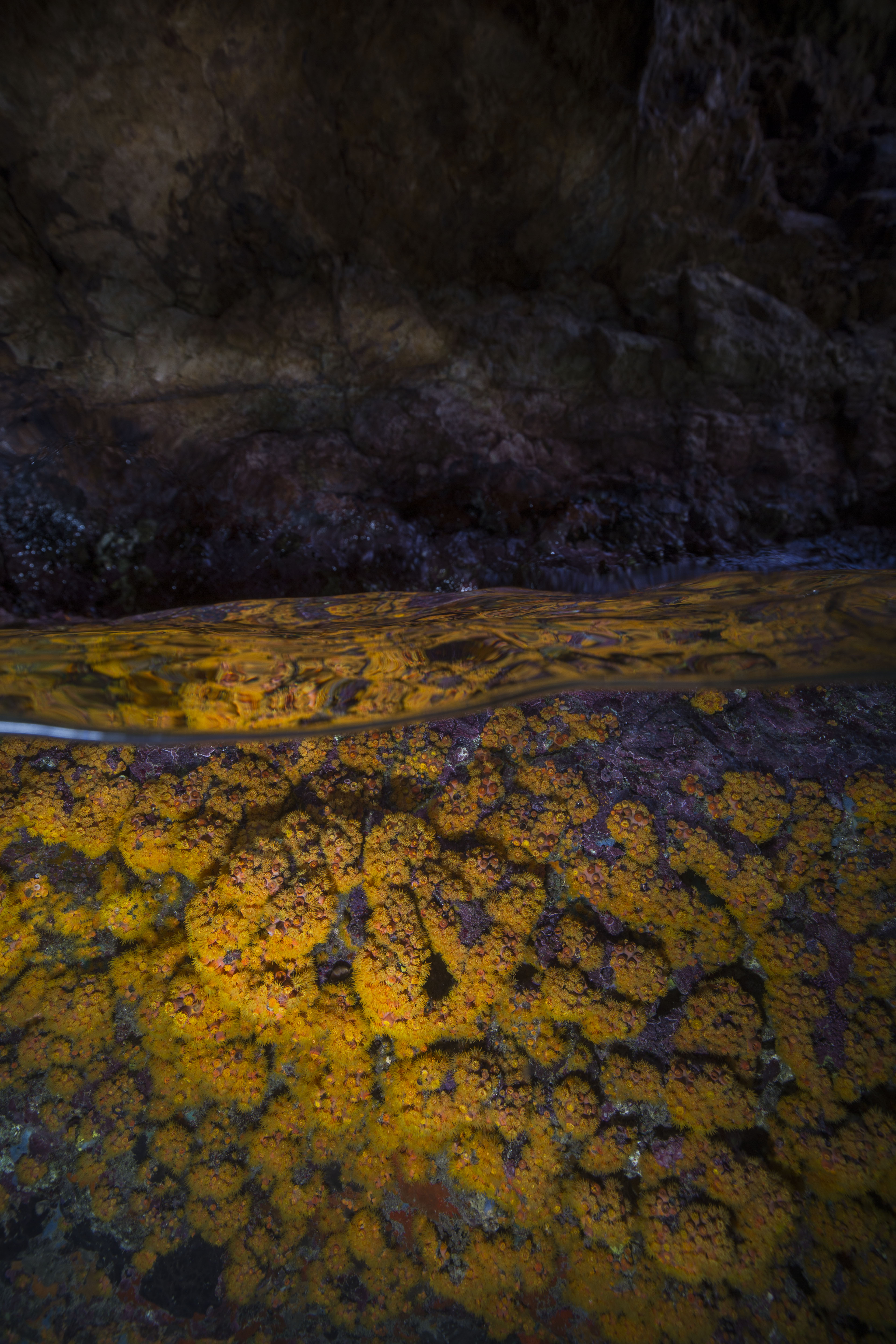
So what was all this survey data on? If you were to ask members of my vessel during the St. John NCRMP leg, you might get a lot of answers of ‘scrubble’, a lovely benthic habitat composed of sand and rubble (and often not much else). The protocol is designed to survey any type of habitat that could potentially harbor coral, including the ones that may boast one small coral colony in 50m of seafloor (we visited some of these). As long as there was a single piece of hard substrate, we’d survey it (and yes, that little rock over there in that seemingly endless sea of sand counts – we checked). The words ‘coral reef surveys’ may invoke beautiful mental images of expansive living grandeur, that isn’t always the case. Sometimes, you have to monitor the sites that are what I imagine it would look like if a coral reef sneezed and forgot to cover its mouth, or sites that have so much algae and so little coral that you’ll have to double check you aren’t diving in California. However, someone has to collect this data – after all, zeros are important data points too.
Sometimes the algae/coral balance was skewed a little bit more towards the algae than you’d like it to be
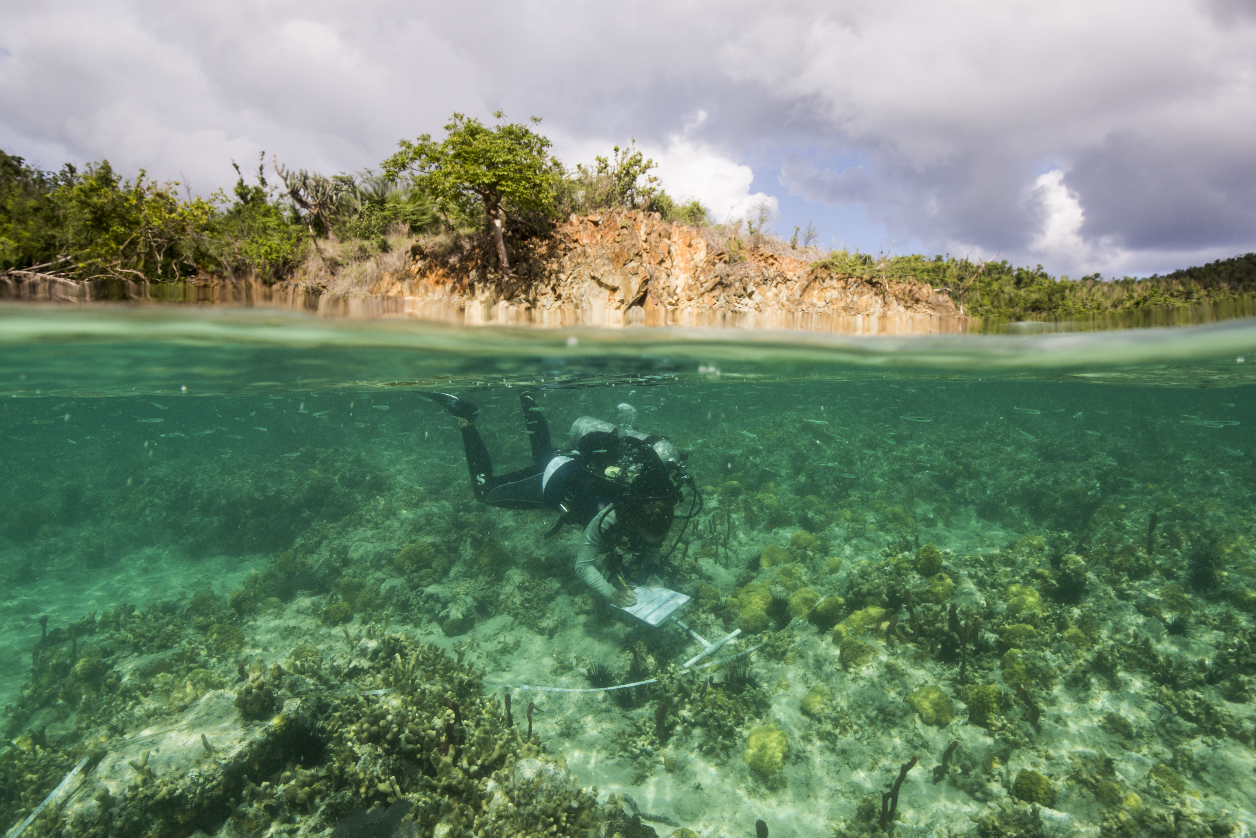
As with St.Croix, these were randomly selected GPS waypoints that were chosen based off of benthic maps created using bottom sounder data. This means that you’re often diving on sites that have never been visited before – and that no one really knows what type of habitat you’ll be dropping in on. Sometimes, that hard bottom that you (and the quickly growing dataset) have been pining for isn’t so hard after all. My team had more than our fair share of bounce dives, dropping in on large swathes of sand or seagrass and coming right back up. Sometimes, these seemingly-uneventful bounce dives would unearth thrilling sites: a school of hundreds of adult bonefish, tiny cryptic sargassum-dwelling invertebrates, or potentially my favorite sight of the trip – the largest palm tree I’ve ever seen. Sitting calmly on the dark ocean floor at around 90 feet deep, this submerged giant must have been over 70 feet tall.
While these soft-bottomed dives sometimes had fun surprises, the reefs were still much nicer
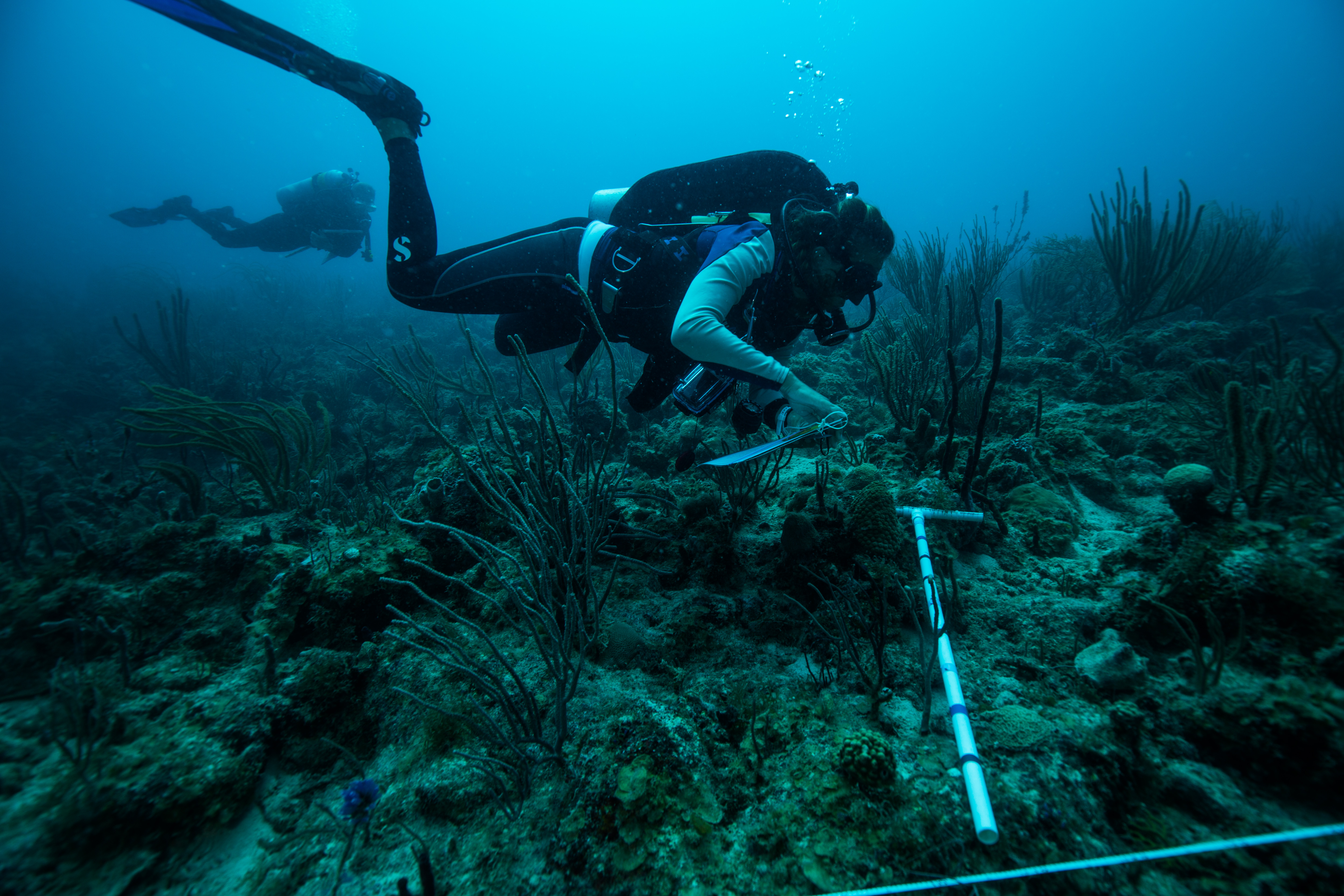
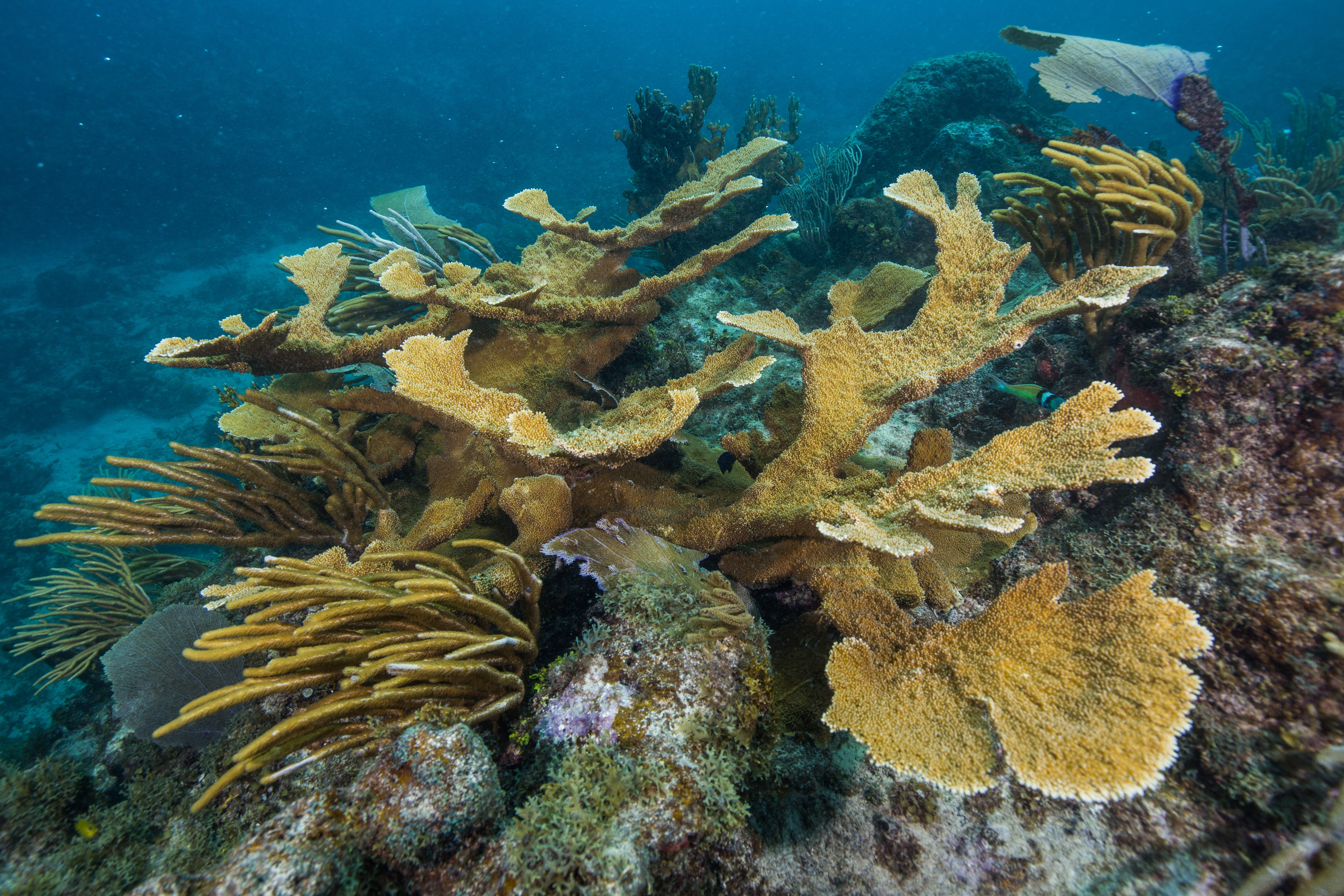
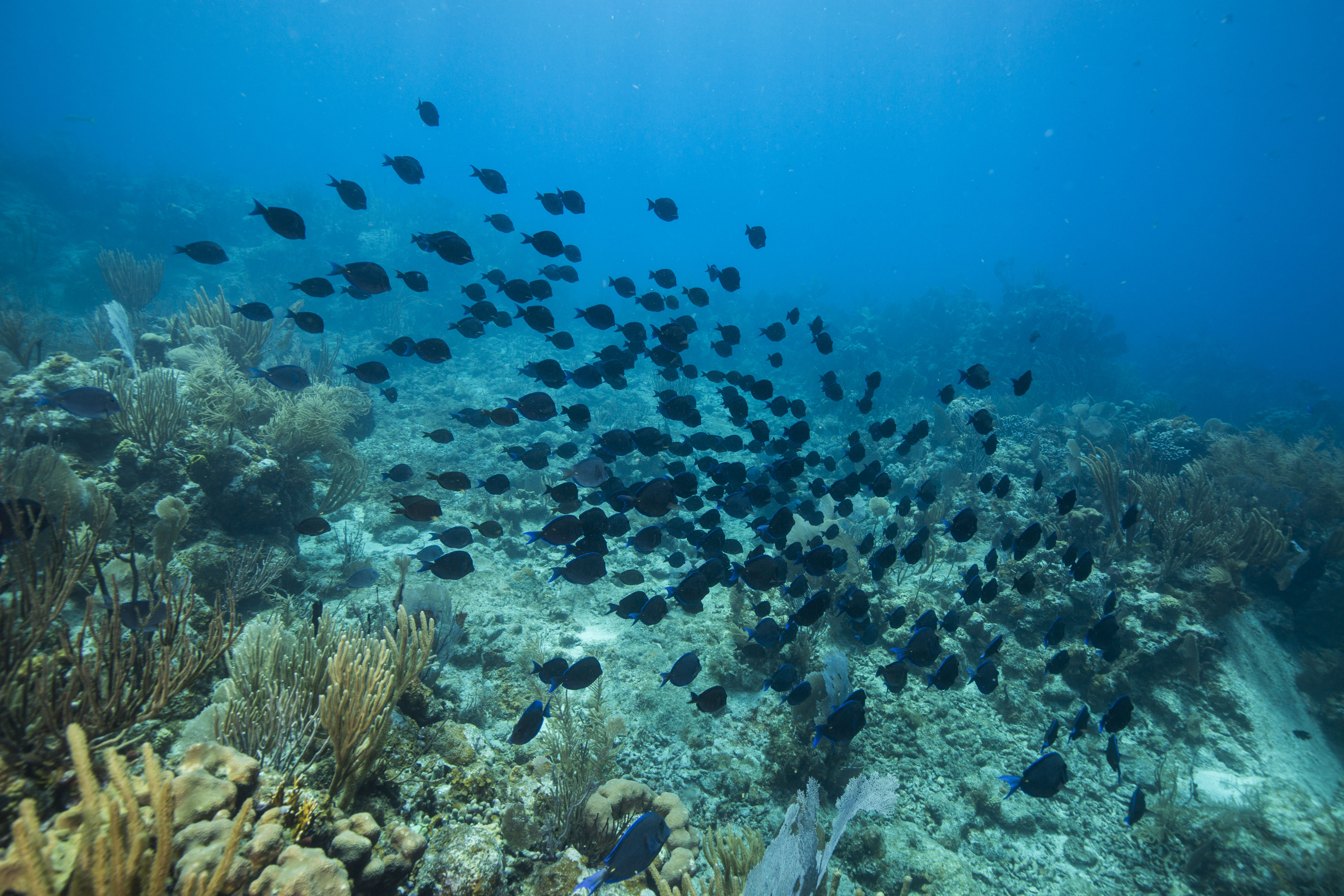
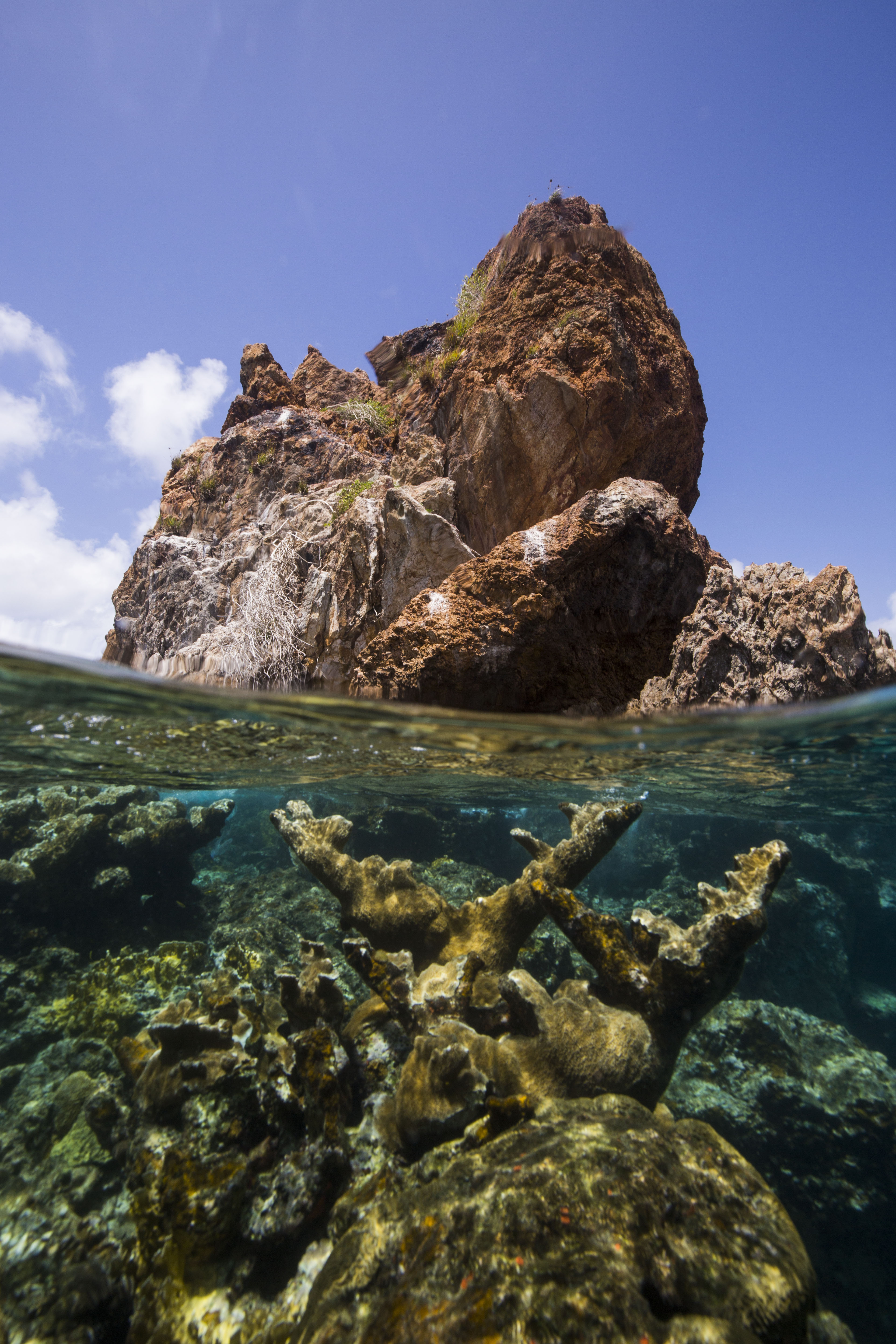
Despite feeling as though our team had somehow angered the gods who pass out the site survey assignments and were doomed to spend our days ticking off point after point of turf algae, we did still manage to visit some pretty spectacular sites. The Friday of our first week was the uncontested peak of the trip – visiting five aggregate and patch reef sites, with unparalleled visibility and surprisingly high coral cover. To top things off, our very first site was on the fringing reef, the reef furthest away from the islands and widely-thought to be the nicest around.
One of the nicer reefs we got to visit
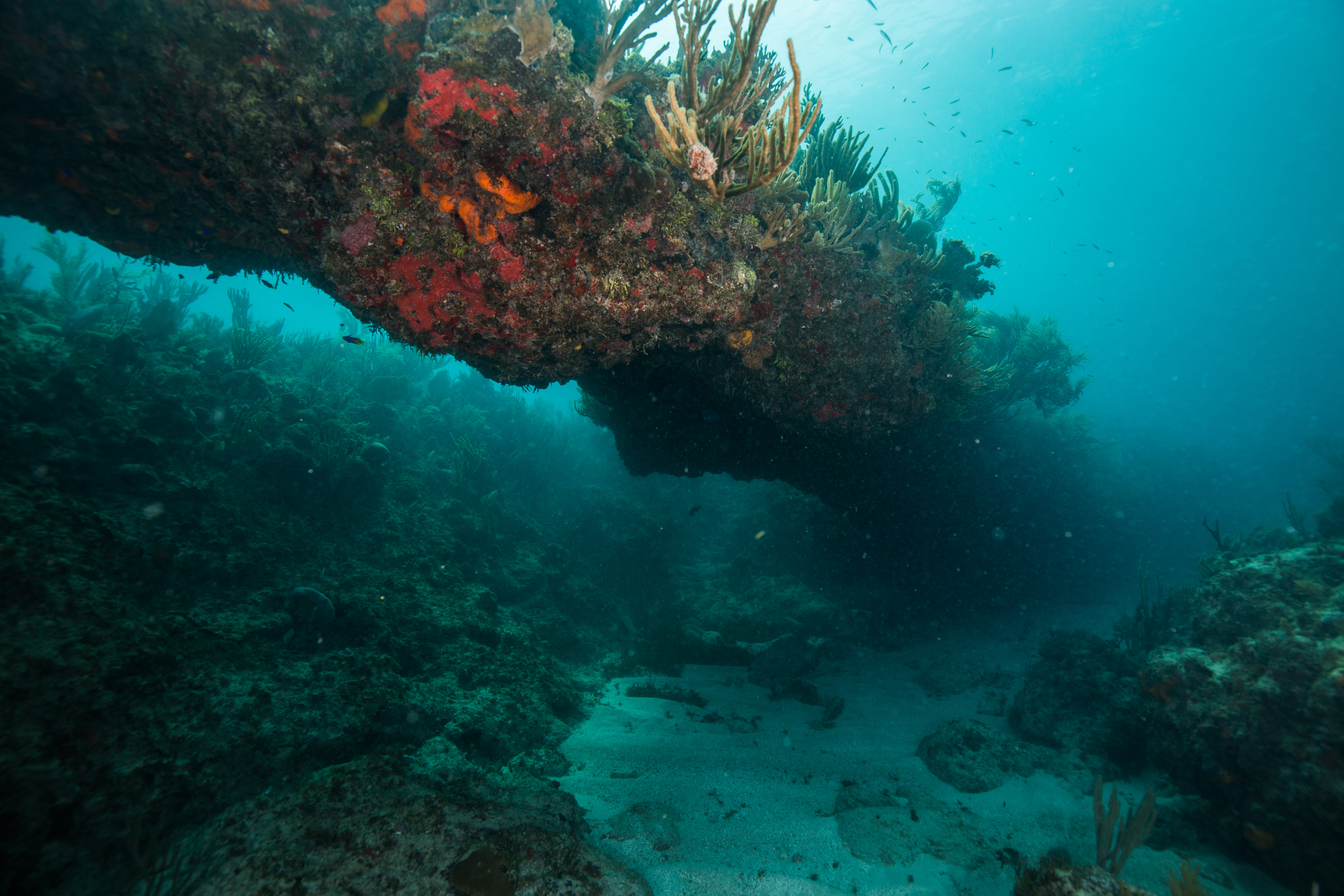
With not many observed instances of disease or bleaching by our team, these reefs seemed pretty healthy. However, it was pretty clear that they had recently been subjected to some wild, intense, storm-driven swells. Occasionally, we’d run into coral colonies that looked like they’d been bashed in by a couple of angry garbage trucks on a bender, huge chunks of growth split apart in ways that seem impossible to comprehend. We’d also run into other signs of storm damage as well. Entire trees underwater was a common one, unintentional visitors from an outside world who’ve turned into a semi-permanent reef feature. Fragments of roof was another one, forcing one to imagine just how strong winds must have been to rip this huge chunk of metal off of someone’s house and deposit it a quarter mile offshore. We also ran into the wreckage of what looked like a rather large ship, broken apart and scattered across the reef.
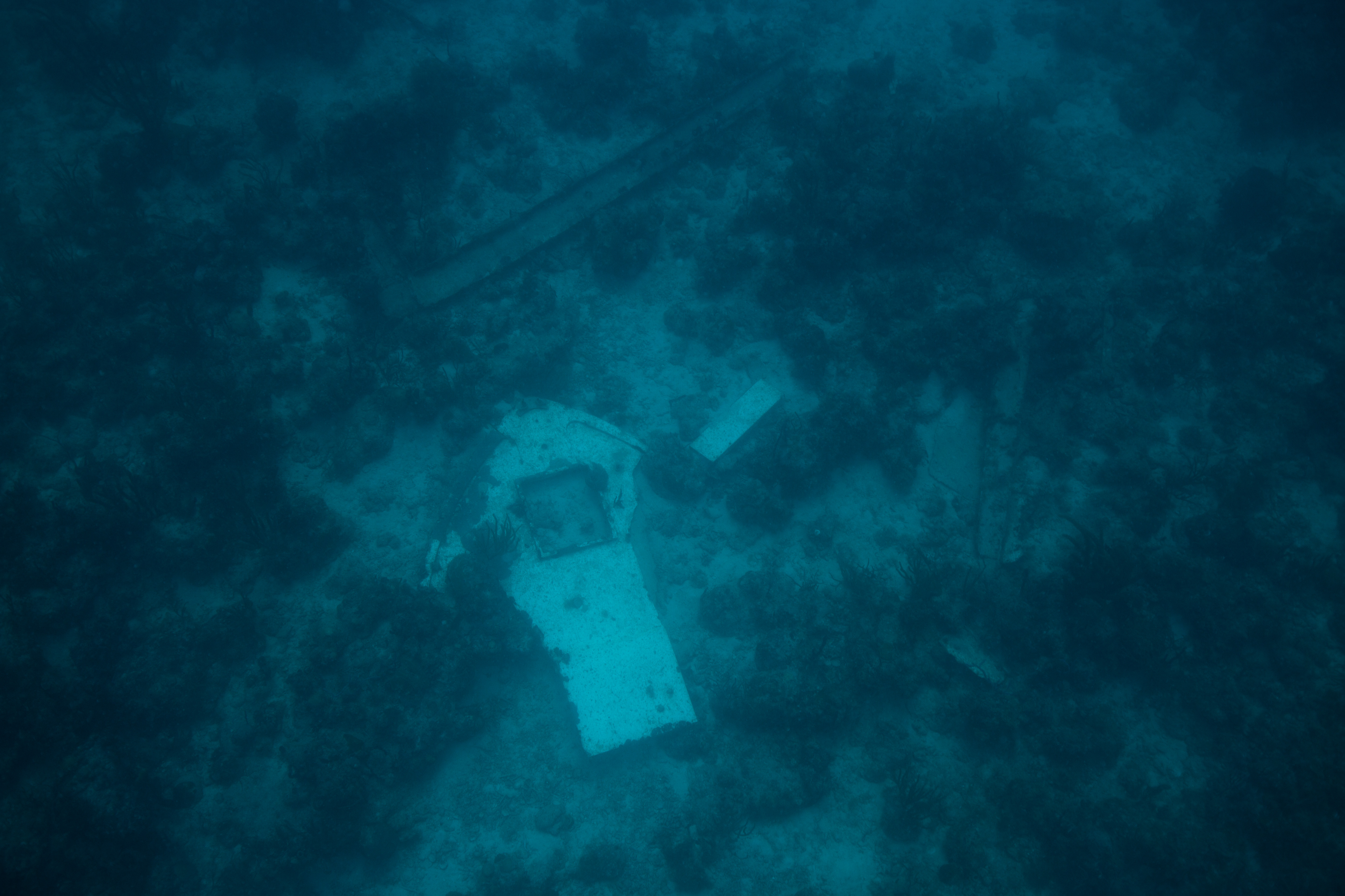
Remnants of an unfortunate ship
While not a huge amount of disease was observed, as it has relatively recently made its way to the Caribbean, this doesn’t mean that we didn’t take any precautions to avoid spreading it. This park was the most cautious out of all the ones I’ve been to in terms of taking preventative measures – they were promoting what they hope to become ‘the new rinse’. Consisting of soaking gear in a diluted bleach solution (less than 1%) and then rinsing in freshwater, this thorough procedure is designed to remove any possibility of disease transmission through diver’s gear. The Parks Service is attempting to popularize this procedure throughout the Caribbean, supporting local recreational dive operations in their transition by supplying the bleach, with hopes that it’ll become widespread.
With a lot of the surveying gear touching the bottom, disinfecting is a crucial precaution
This disease, stony coral tissue loss disease, has only recently been detected in the U.S. Virgin Islands but poses an incredibly dire threat. Affecting 22 different species of coral with a mortality rate from 66-100%, it poses to decimate Caribbean reefs. First making an appearance near Miami in 2014, this disease quickly spread through the Florida Keys and has recently made its way out to the Caribbean as well, putting reefs already in major distress from climate change under even more stress. Described by researchers as being comparable to an underwater Ebola, this disease is currently incurable and ripping through reefs, killing corals that are hundreds of years old in mere weeks. Scientists are forced to result to dire containment measures, physically removing infected coral colonies from the reefs in a last-ditch effort to stop the spread. The speed and intensity of this disease make it a very real issue, putting even more importance on the island-wide monitoring we were undertaking. With a wide distribution of sites surveyed, this program has a good chance of locating and identifying disease before it becomes too widespread.
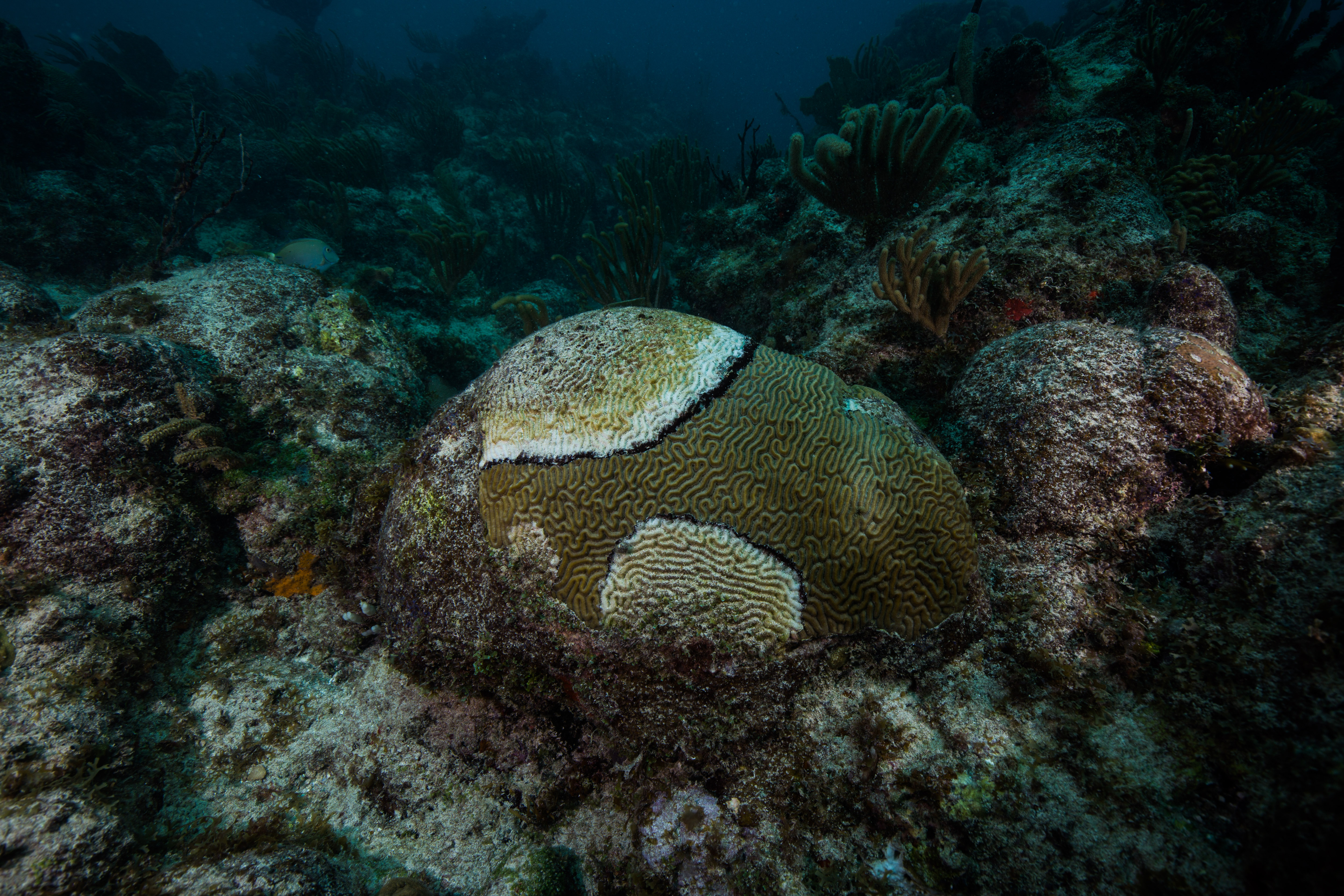
A diseased coral quickly losing living tissue – this may be a different disease, black band disease
Diving off of St. John, there’s a lot of boat traffic. Ferries travel around constantly moving between the many islands peppered through the area, private charters zip back and forth between beaches, and seemingly every other person on the islands has their own boat. This meant that we had to be extra vigilant when surfacing, especially as we managed to do a surprising number of sites in major boating channels. For some reason, vessels in this area don’t really seem to care much about dive flags – despite being clearly marked and obvious in the water, they’ll power right over them. Thankfully, the largest vessels (the ferries) weren’t very stealthy – their powerful, rumbling engine was audible even 90 feet down, and was hard to ignore when its booms resonated through your body.
Another hazard that we had to deal with was currents. While sometimes simply a nuisance, causing more exertion than desired, these had the potential to cause more serious issues. We had one memorable dive with such a raging current that I was almost unable to swim against it. The LPI diver has to swim into the current twice in the dive, once to reel out the transect and once more to collect their data, so I had to fight this angry stream of seawater twice over, exerting myself much more than I would have liked at depth to make the tiniest bit of headway. When we’d finally finished that dive and were able to stop fighting it, we noticed that our gas consumption and physical exertion weren’t the only things that this current had taken a toll on – it had also pulled down our dive float. Lying pitifully on the end of a suspiciously slack line at 85 feet down, wrinkled and compressed to half its size, our small buoy and handheld GPS combination had been yanked down to the depths by a whole lot of fast-moving water. With the help of a lift bag and a quick decrease in pressure, it happily returned to its former full and turgid state but was the subject of quite a few post-dive discussions in the days to come.
Strong currents really made us appreciate the dives without them
One final hazard was weather. Despite St. John rarely getting thunderstorms, we had quite a few during our monitoring trip. Often these storms would quickly materialize out of dark clouds without warning, surprising us in the middle of our day. We had one memorable dive where a lightning storm started while we were under – I remember the eerily calm surface of the water, the surface mottled with the impacts of thousands of raindrops and the occasional blast of illumination on the darkened reef from a flash of lighting.
Calm and serene underwater, cold and wet above
One small perk of doing all of these high-traffic, high-current, scrubble dives in the middle of the channel was a small novelty that I’m really pleased to be able to say that I’ve done – an international dive. With the close proximity between the USVI and the British Virgin Islands, it only made sense for a couple of these randomly selected points to fall right on the border. And sometimes, the transect happens to head across international lines, or a drifting safety stop takes you a little into someone else’s territory (it’s hard to see these borders underwater). While essentially meaningless, I got quite a kick out of these globe-trotting dives.
Some British fish
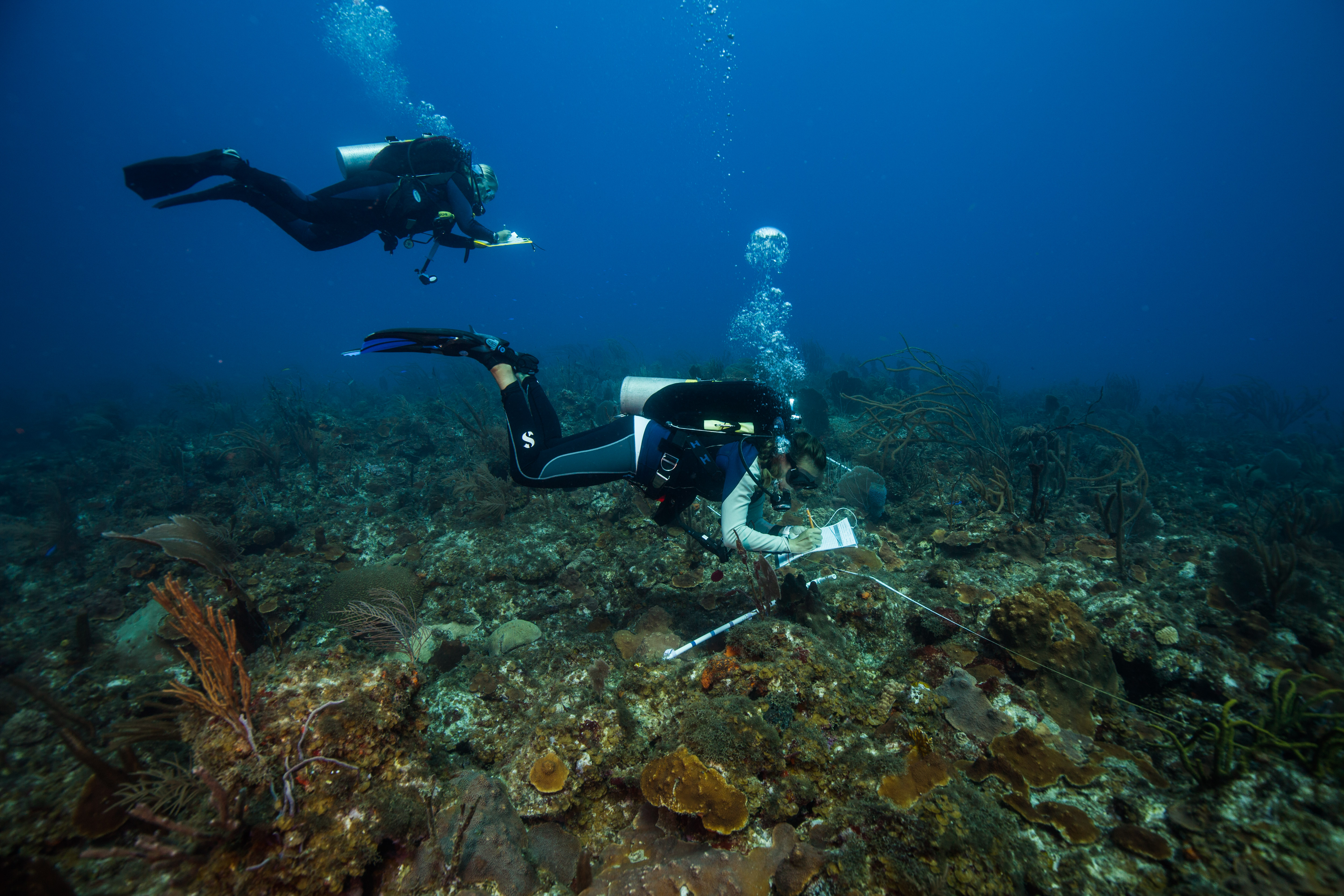
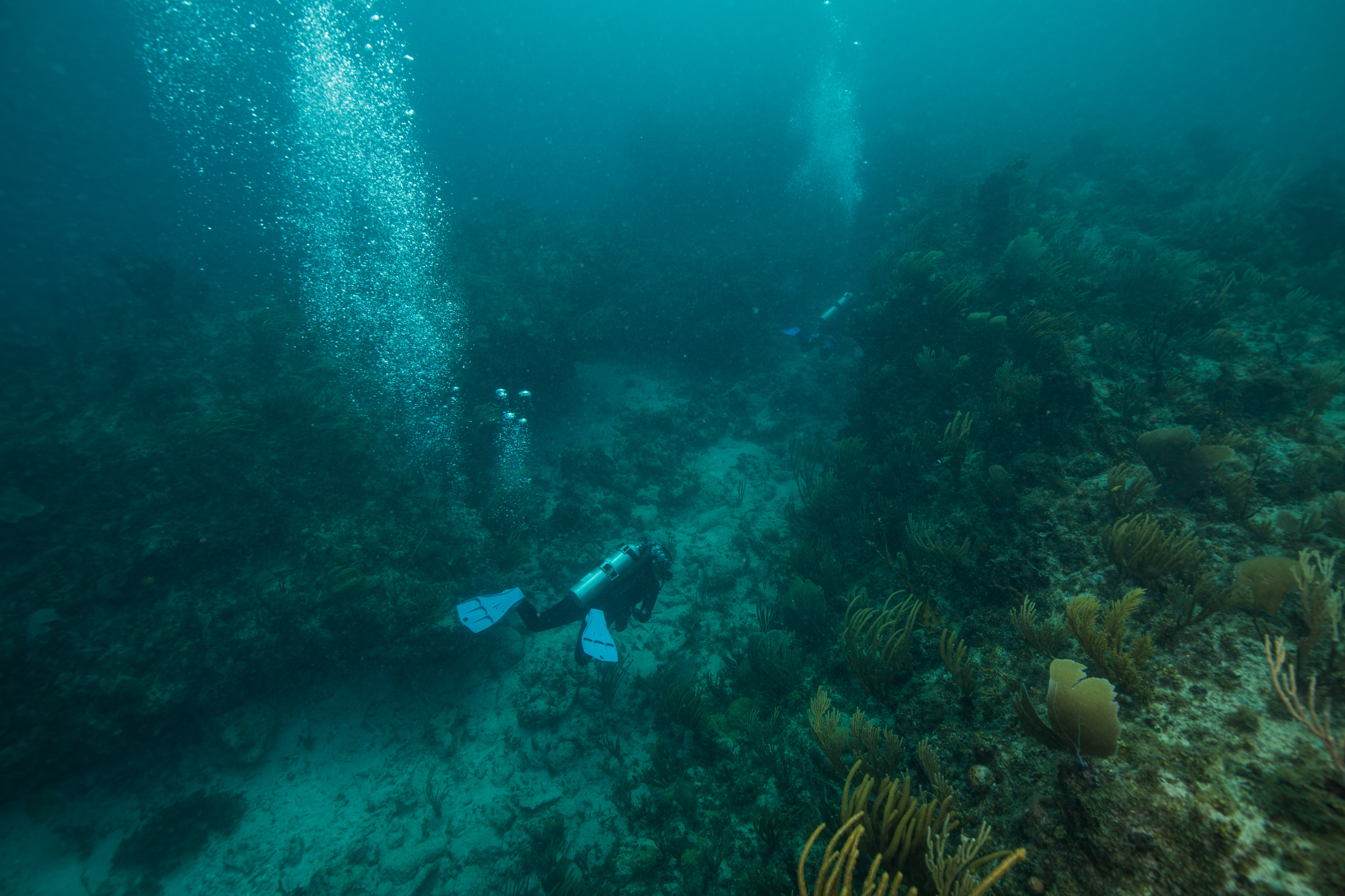
Like St. Croix, the dives for this program were fast and seemingly non-stop. Over the course of the two-week period, we quickly worked ourselves up to an average of 6-7 a day, occasionally even doing eight. Diving a range of depths and a mix of air and nitrox gases, high numbers of dives were achievable and safe – but sometimes lead to long days out on the sea.
Long days underwater are always worth it when you’re rewarded with sights like this
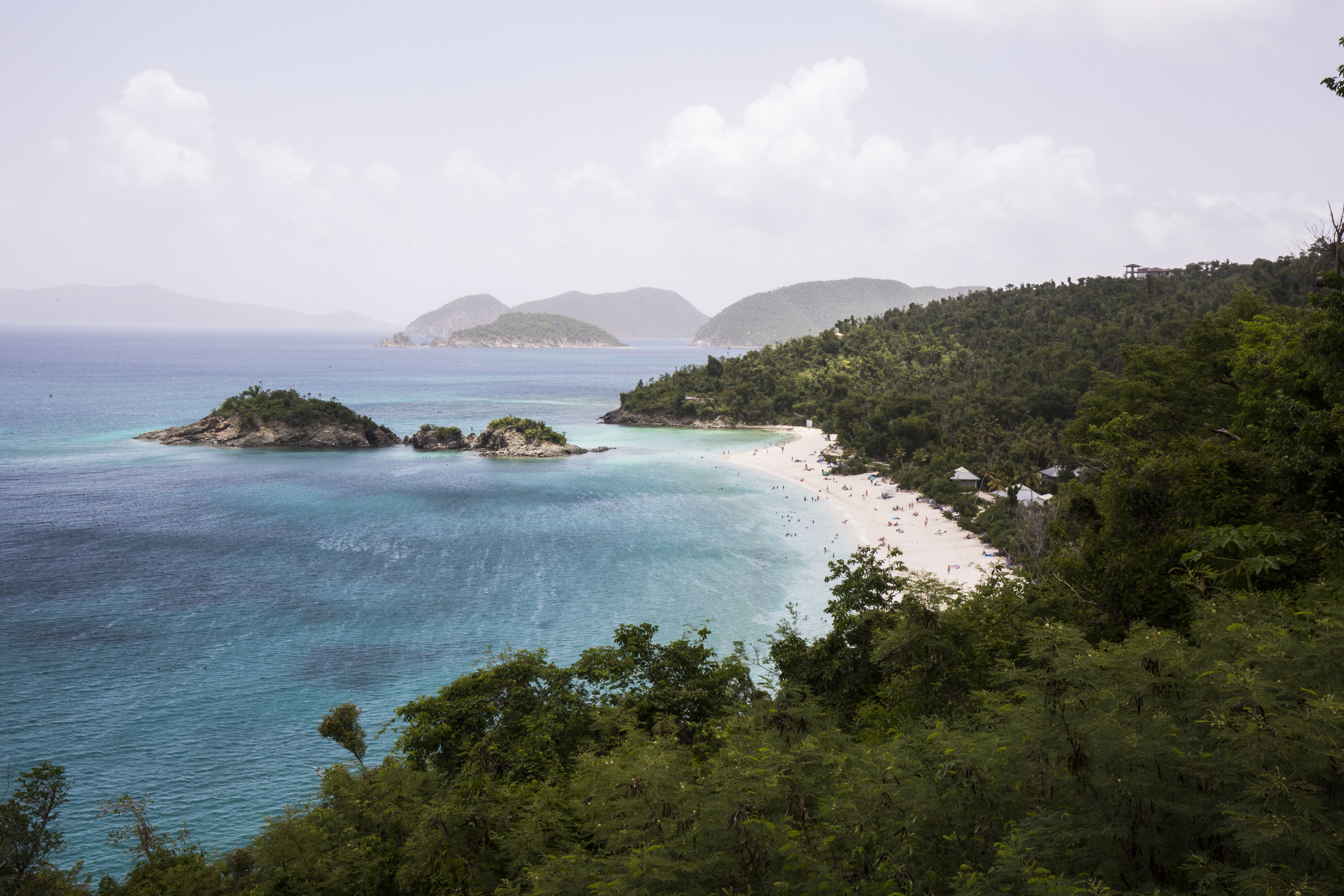
A huge perk of spending two weeks in St. John was that it gave me an entire weekend off between surveying to explore a bit more of the island. A huge amount of the island is National Park, encompassing a vast expanse of undeveloped forest and beaches. While lovely to see from the water as it really highlights the scale of the whole area, it was nice to get up close and personal as well. During time off I got a chance to see the sea turtles at Maho Bay, juvenile lemon sharks at Reef Bay, and even to take a quick visit to the British Virgin Islands. This was a really beautiful area that I’m glad I got a little time to see.
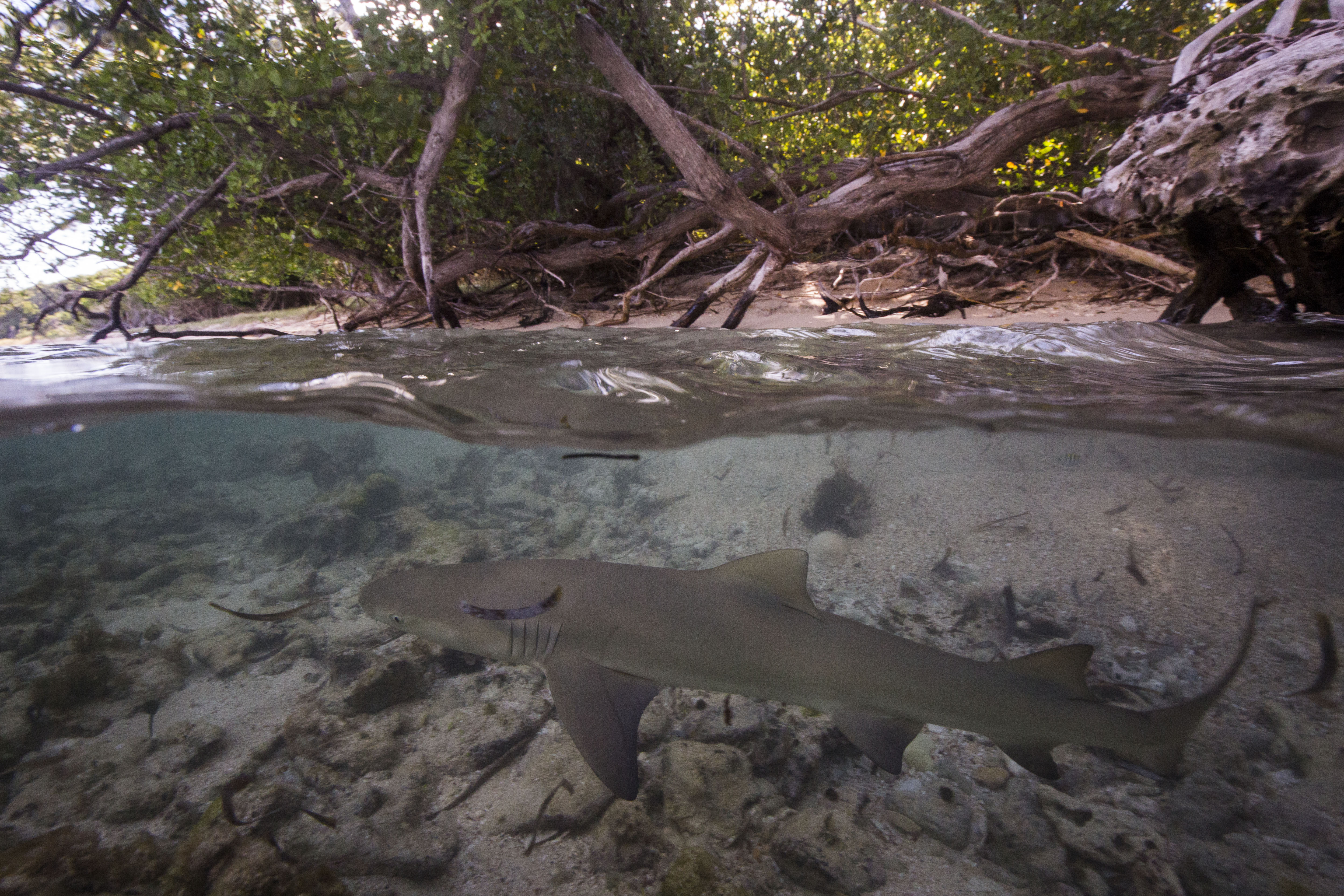
Juvenile lemon shark in the shallows at Reef Bay
I was happy to join on for another couple weeks of the National Coral Reef Monitoring Program as it’s such an important cause. At such a pivotal point for the fate of coral reefs it’s exciting to be on the forefront of the monitoring, collecting the data that will be used to inform policymakers about the ocean health. Additionally, I welcomed the opportunity to learn more about these reefs and the issues they face – all relatively new stuff to a cold-water diver like myself. After two busy weeks full of diving and data, I left the Caribbean for good. I was now heading to the opposite side of the country, to spend the remainder of my internship diving in a completely different ocean. It was time to say goodbye to the corals of the Caribbean and hello to the ecosystem that got me into diving – the lush kelp forests of California, at Channel Islands National Park.


Thanks for your report. I have done limited scuba diving. It was interesting to learn of all the obstacles you faced to get to the data you sought. I am glad there is work to monitor the coral. I hope the work has gone beyond it to figure out how to work with those who want to enjoy the ocean and may not realize there enjoyment is distorting what they value. Perhaps your blog posts, telling your story, are a way to do this.