Category Archives: 2021 National Park Service

Sarah Von Hoene

Sacrifice and Unfinished Scrapbooks — Pearl Harbor National Memorial


Eight Navy battleships sat in Pearl Harbor on December 7th, 1941, their captains and crew members unaware of what was to come early that Sunday morning. The men aboard started the day as they always did – with breakfast, morning duties, maybe a shower and a shave. Perhaps they were preparing for church service. Little did they know that a Japanese strike force consisting of 353 aircraft and 61 ships was headed to the harbor to launch a surprise attack that would become one of the deadliest events in U.S. history. Little did they know that many of them would die that day. 

The Pearl Harbor attack killed 2,403 U.S. citizens and wounded nearly 1,200 more in the span of a mere hour and 15 minutes. Of the eight Navy battleships anchored in the harbor, four of them sank – all were damaged. The USS Arizona was the most irreparably damaged ship out of the fleet, exploding violently after being hit by Japanese torpedo bombers. When the ship exploded and sank, over 1,000 crewmen and officers were pulled down to their watery graves with her. 

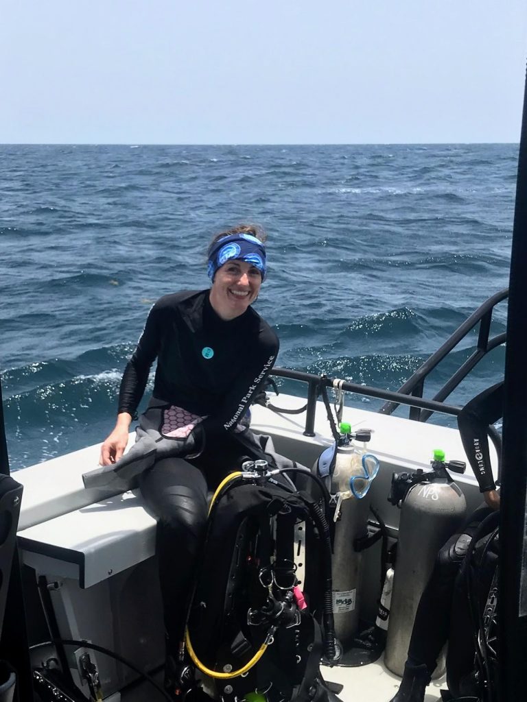
The 608-foot-long USS Arizona battleship remains sunken in Pearl Harbor. In 1962, the USS Arizona Memorial was constructed over the hull of the sunken ship and dedicated by the Pacific War Memorial Commission. The site serves as a national historic landmark, a poignant memorial, and a place for education and introspection. The National Park Service (NPS) operates the Pearl Harbor National Memorial (PERL), working in conjunction with the U.S. Navy to preserve and interpret the historical and cultural resources that are associated with Pearl Harbor and the December 7th, 1941 attack. To cap off an already incredible summer and internship experience, I headed to my last destination — Pearl Harbor — to experience the park and dive the USS Arizona wreck. 


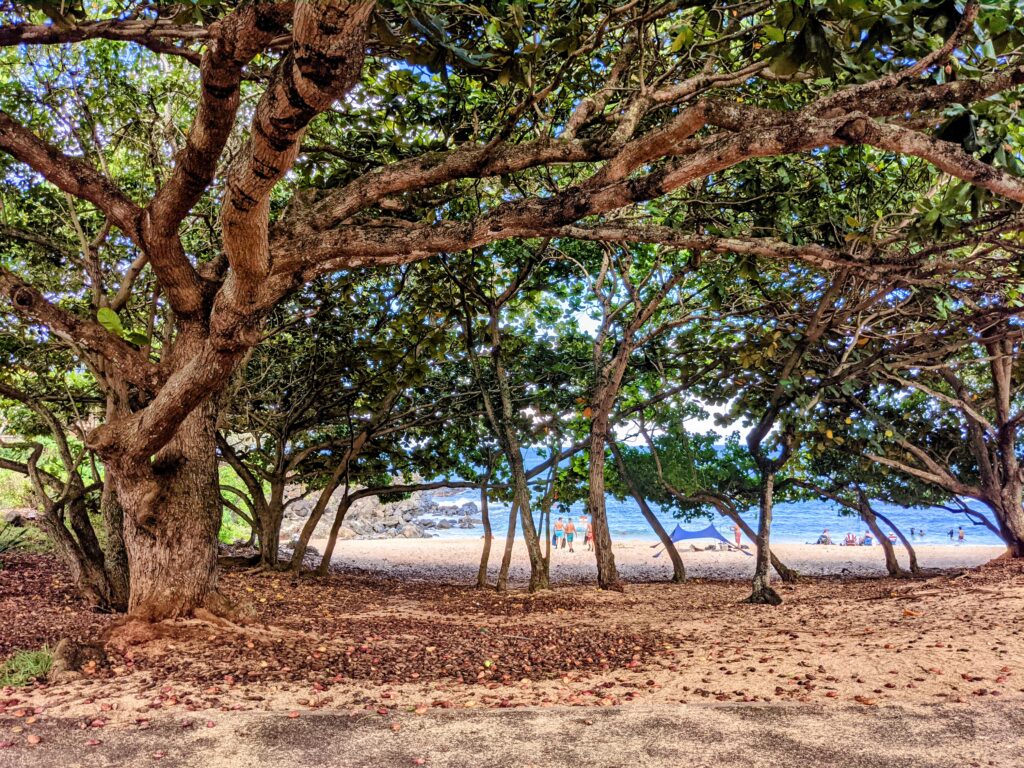
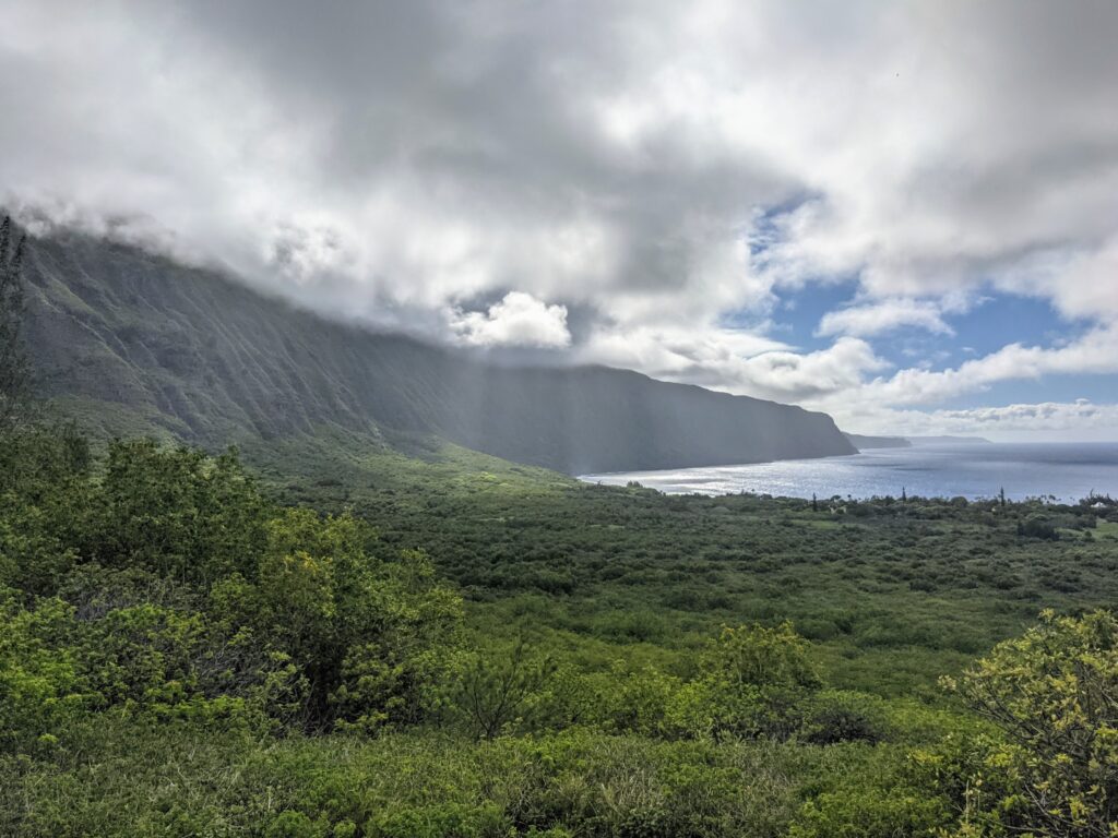
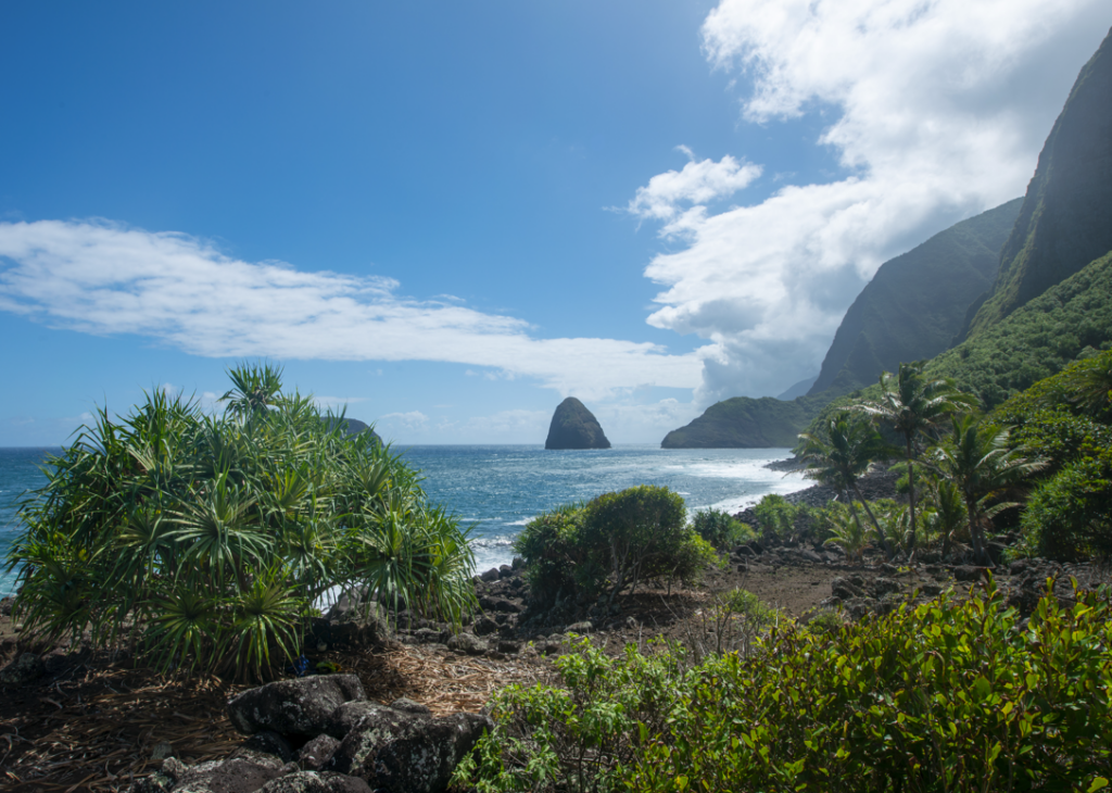
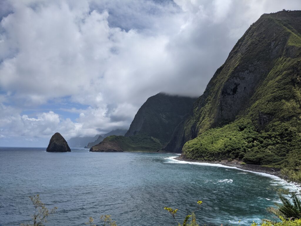
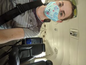
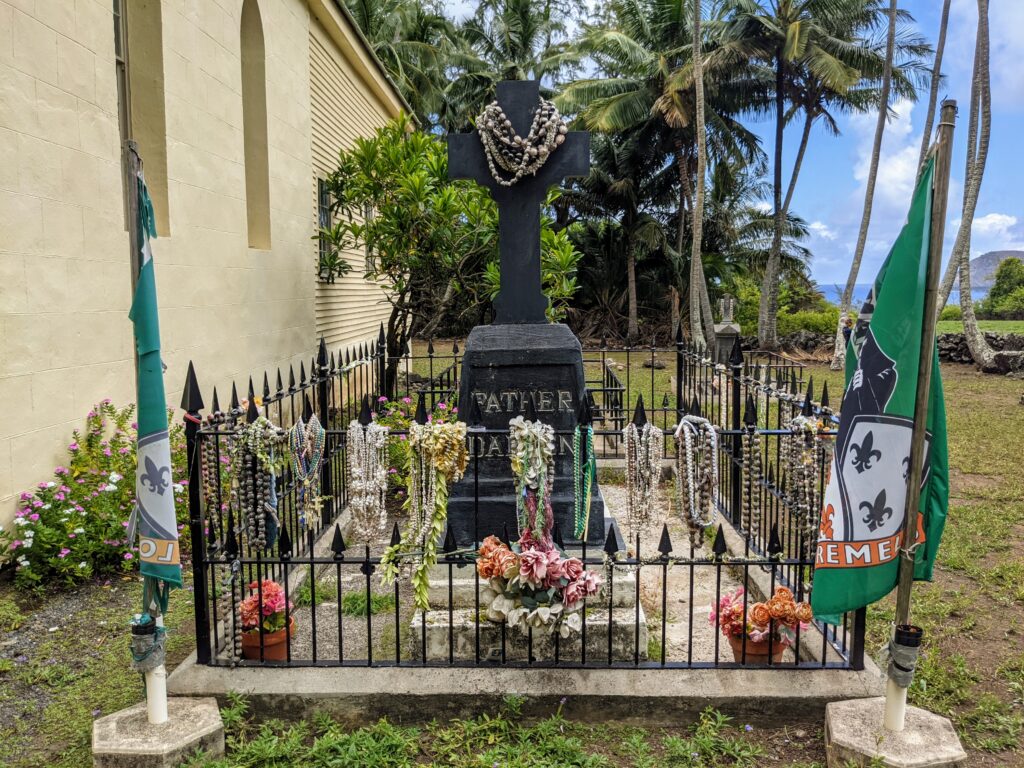
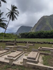
As I stepped aboard the small Cessna 208 that would fly me from Kalaupapa National Historical Park to Honolulu, I tried to prepare for the shift I knew I would inevitably face once I landed. I had grown somewhat accustomed to the remoteness and quietness of the Kalaupapa settlement. I hadn’t driven a car over 30 mph for a month and a half, let alone experienced traffic or a busy restaurant. I was very much looking forward to being back in the city, but it’s momentarily jarring to go from a remote place with limited resources to a bustling city with anything your heart may desire. Dan Brown, my PERL point-of-contact, had already anticipated this fact when he picked me up from the Honolulu airport. With keen interest, he asked me about my previous internship destinations as we drove to a Starbucks for breakfast. We chatted jovially until we walked into the coffee shop and I fell silent, staring in overwhelm at the display case and drink menu. It was going to take me a minute to get used to having diverse food options again.

Kelly Moore, the park dive officer at Kalaupapa, made me a beautiful fresh lei before I took off for Honolulu. Thank you, Kelly!

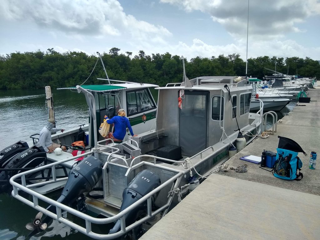
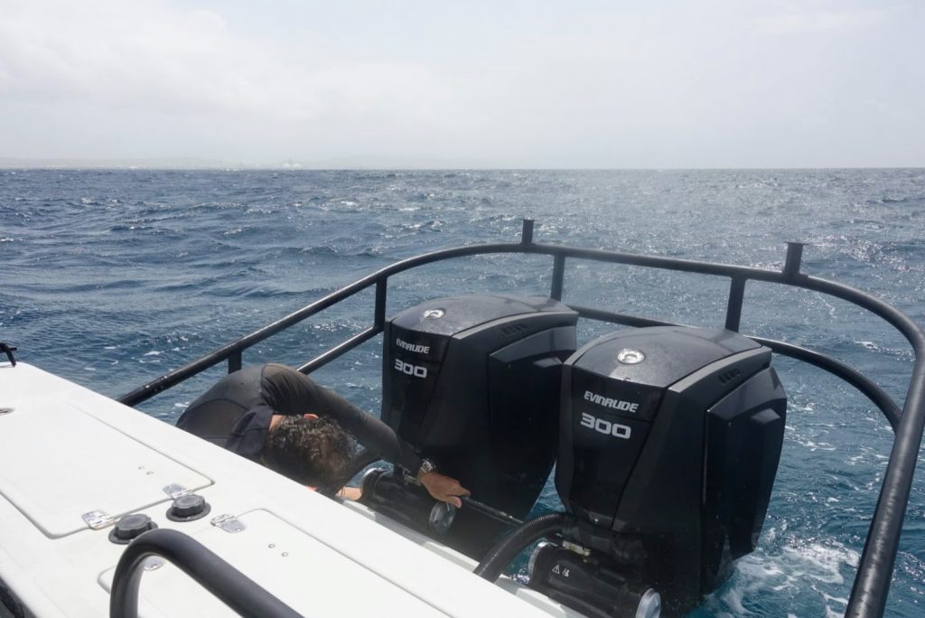
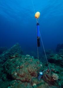
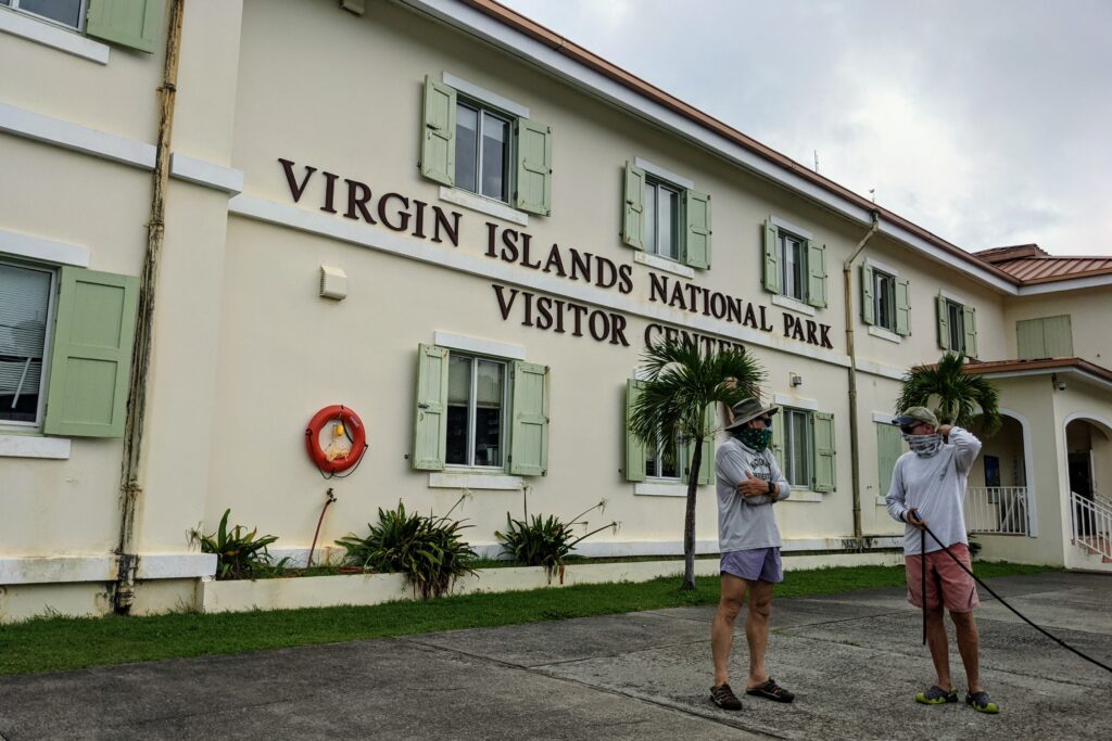
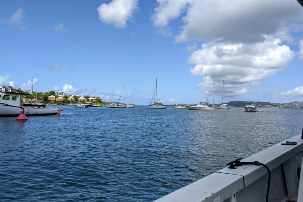
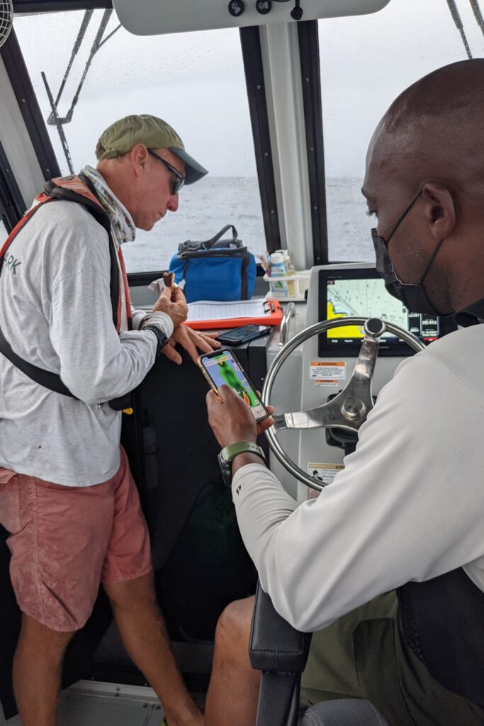
Caffeinated, fed, and eager for what the day would bring, Dan and I drove to the NPS dive locker at Joint Base Pearl Harbor-Hickam. The plan was to dive the USS Arizona that morning and switch out the two buoys that mark the bow and stern of the shipwreck. We were in a bit of a time crunch (Dan had afternoon obligations), so after chatting with Scott Pawlowski, PERL Museum Curator, we quickly put our equipment together and headed to the park visitor center.


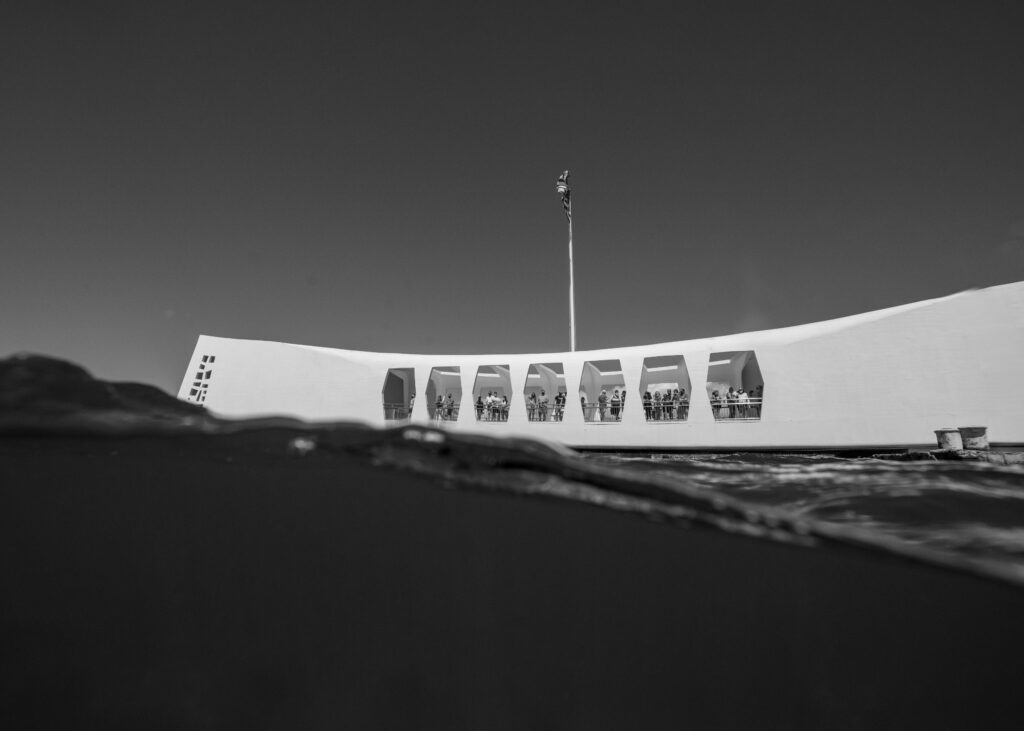
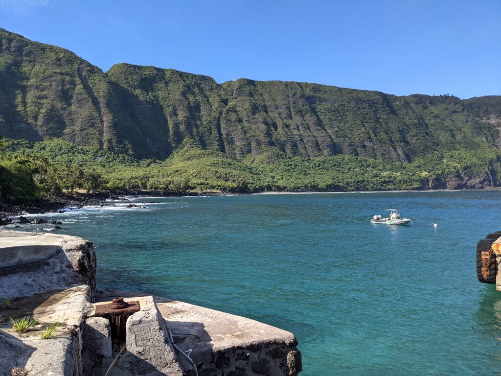
A Navy-operated boat shuttle takes visitors to and from the USS Arizona Memorial every 15 minutes for most of the day, but Dan and I were lucky to hop on the last boat before the Navy crew went on a lunch break. As we stepped onto the memorial, the last batch of visitors departed on the boat shuttle. For 45 minutes or so, we had the space to ourselves. I was mentally prepared to artfully dodge visitors while quietly snapping photographs in the background — still a great opportunity, but not quite the same as being there alone. Having the site practically to myself meant that I could take my time experiencing the memorial, paying my respects, and doing my best to capture its symbolic architecture and historical significance. I was extremely grateful for the stroke of luck.

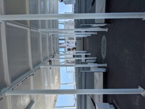
Dan and I got top-notch service on the empty boat shuttle out to the USS Arizona Memorial.

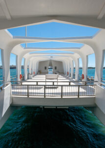
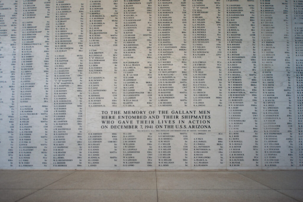
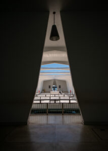
We walked into the USS Arizona Memorial’s entry room and stillness struck me. Despite a steady breeze gradually picking up from the northeast, the air felt calm and quiet. With no other visitors on site, it was practically silent. I stepped lightly, moving slowly across the memorial. The natural flow of the space leads visitors from the entry room to the assembly hall – the main open-air section of the memorial. The memorial’s architect, Alfred Preis, subtly incorporated a number of symbolic features into the structure’s design, particularly in the assembly hall. Seven large “windows” run along each side of the room, a nod to the date of the Pearl Harbor attacks – December 7th. Seven more windows are cut into the assembly hall ceiling to make a total of 21 windows, representative of the customary 21-gun military salute.

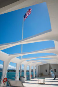
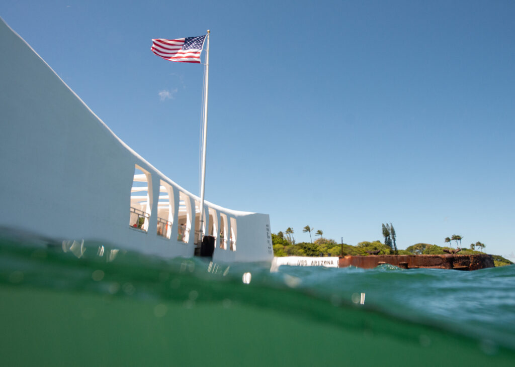
An American flag flies over the USS Arizona shipwreck and memorial.

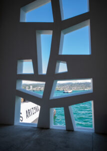
The memorial was built directly over the USS Arizona wreckage. On one side of the memorial is gun turret 3, one of the most visible protruding parts of the shipwreck. On the other side of the memorial, you can see the USS Missouri — one of the WWII-era battleships that is still seaworthy. Also visible are the large white mooring quays the run along the coast. These concrete quays were used to secure the battleships along Battleship Row when the December 7th attack occurred. Aside from the USS Arizona and USS Utah shipwrecks, the mooring quays are the only structures that remain from the Pearl Harbor attack.

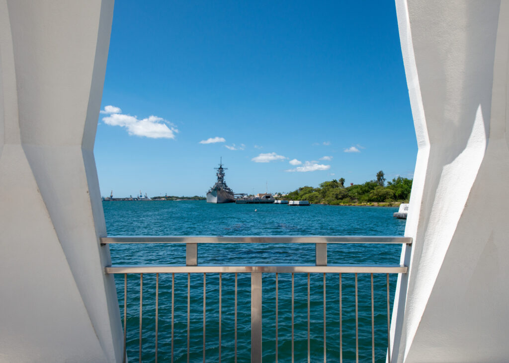
The USS Missouri in the distance. The large white structures are the concrete mooring quays.

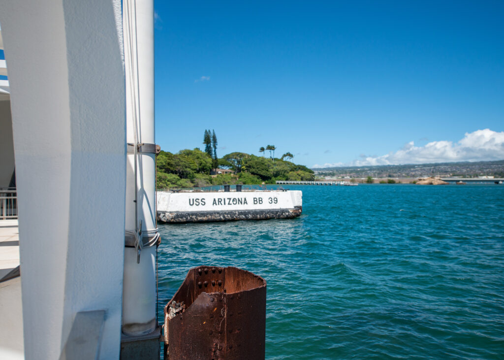
The mooring quay for the USS Arizona.

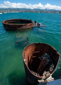
Memorial visitors can peer over the railing and see rusty remnants of the USS Arizona shipwreck protruding from the harbor water.

On the far end of the memorial is a rectangular, cut-out section of the floor, which allows visitors to look into the water below. The wreckage of the USS Arizona rests just under the surface. According to Dan, this feature of the memorial was created to give survivors of the Pearl Harbor attack an intimate space to connect with their fallen comrades. Many visitors drop flowers in the water as a way of paying their respects to those who remain entombed in the wreckage. 

I found myself staring over the railing and into the water below for quite a while. I knew that before too long I would be in the water myself, on one of the most significant dives of my career so far.

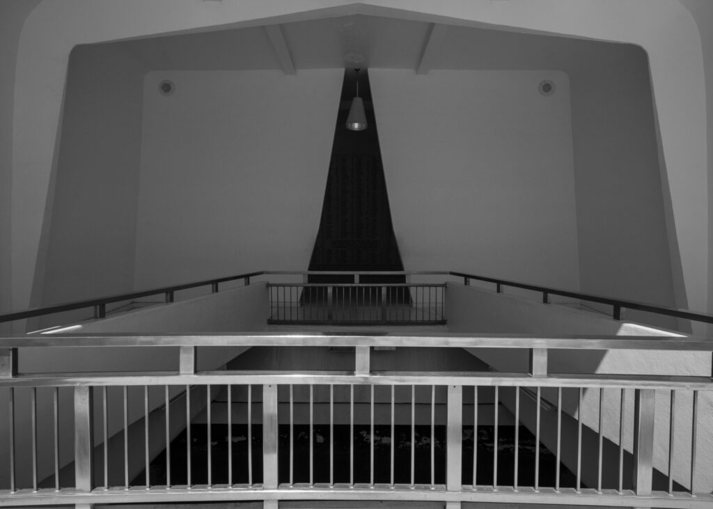
The natural flow of the memorial leads you over the resting shipwreck and into the shrine room, home of the Remembrance Wall.

The shrine room, the last room of the memorial, quietly demands reflection and reverence. For in it is the Remembrance Wall — a marble wall with the engraved names of the 1,177 sailors and Marines killed on the USS Arizona. It is a collective headstone for all who passed when the ship sank. In addition, two marble placards in front of the wall are engraved with the names of USS Arizona survivors who have since been interred with their fallen comrades. Each year, on December 7th, the Navy and NPS conduct a memorial service and ceremonious internment of recently deceased USS Arizona survivors. 

The Remembrance Wall is a headstone for brothers, husbands, sons, and friends. For many who have visited the memorial over the years, there is a particular name that sticks out amongst the towering columns of first initials, last names, and military ranks. That name is not just indicative of a man who died during the fall of the USS Arizona — it is the name of someone they shared life with, someone they had memories of. Someone they loved.

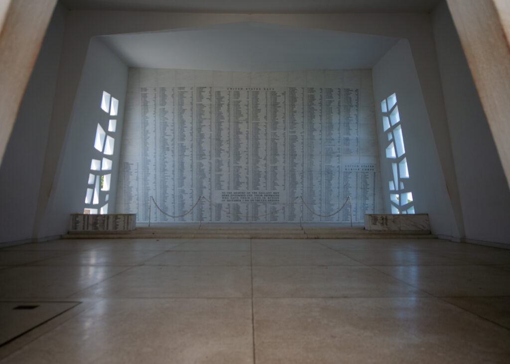
The Remembrance Wall. At the base of the stairs you can see the two placards that are continuously updated with the names of USS Ariona survivors who are interred with their fallen comrades.

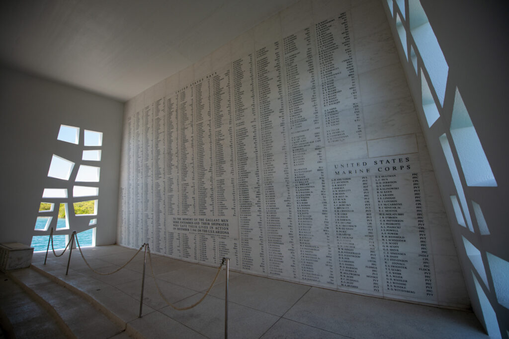
1,177 men, lost in one day.

Memorial architect, Alfred Preis, designed the Tree of Life sculpture to inspire contemplation of life, loss, and renewal.

It’s difficult to see a number — 1,177 — and truly comprehend how many people that equates to. The Remembrance Wall helped me visualize the immense loss of life that took place on December 7th, 1941.

Dan Brown walks through the opposing doorway on the other side of the USS Arizona memorial. To have the memorial to ourselves for an hour was absolutely surreal.


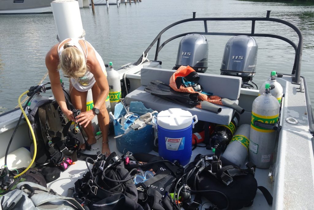
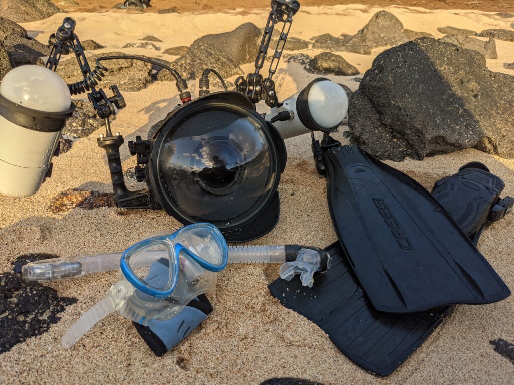
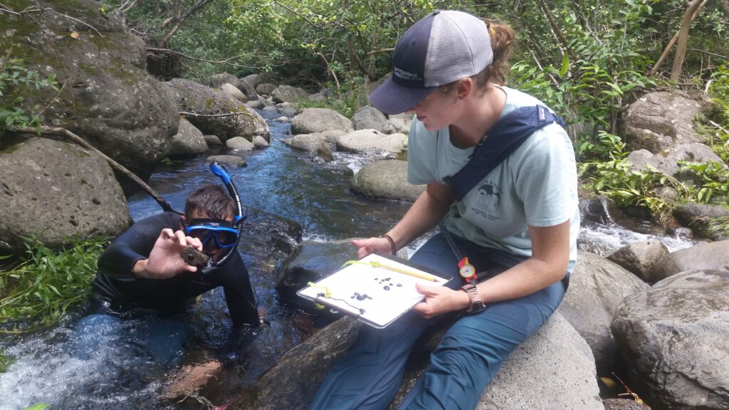
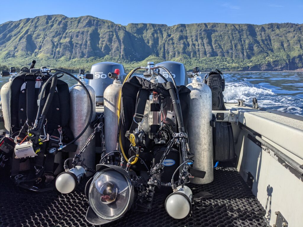
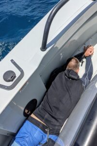
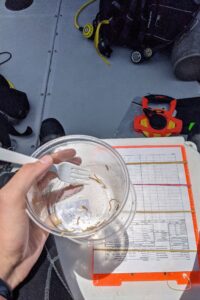
I was captivated by the memorial, but there was even more to be experienced underwater. It was time to switch gears. I carefully placed my camera in its underwater housing and Dan and I began setting up our dive gear on the dock. We didn’t have a ton of time, so we made the decision to hold off on replacing the marker buoys. I think Dan sensed how much I wanted to focus on photographing the wreck, too. I appreciated how accommodating he was, especially when we jumped in, descended, and I realized that my strobes weren’t flashing. We popped back up to the dock and I performed the careful operation of opening the camera housing and fiddling with the strobe connection wire, my arms wrapped in towels so I wouldn’t drip a single bead of water into the housing. Once everything was sealed and operational, we jumped back in and slowly descended once again.

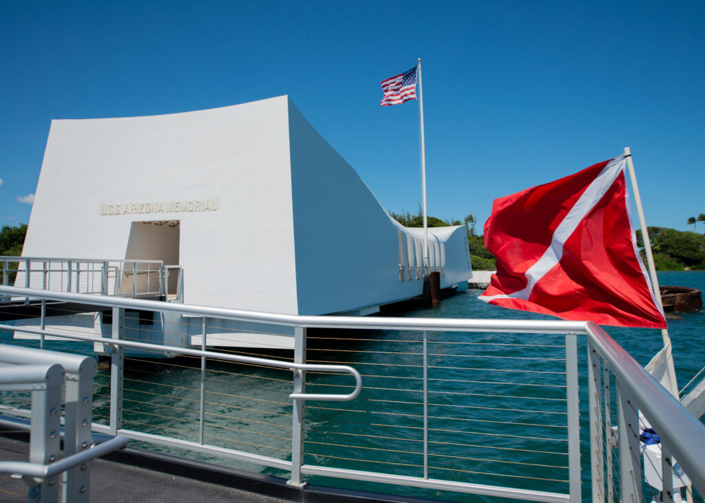
The diver down flag informed passing boats, memorial visitors, and tour guides that Dan and I were diving on the USS Arizona.

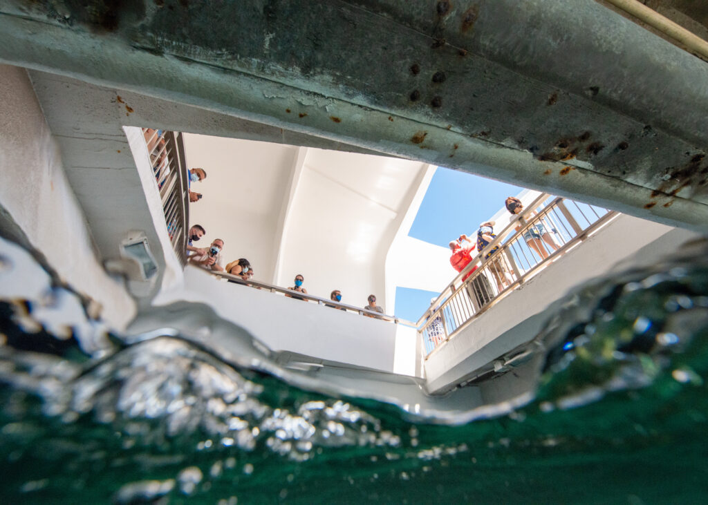
Visitors began to populate the memorial by the time Dan and I started our dive.

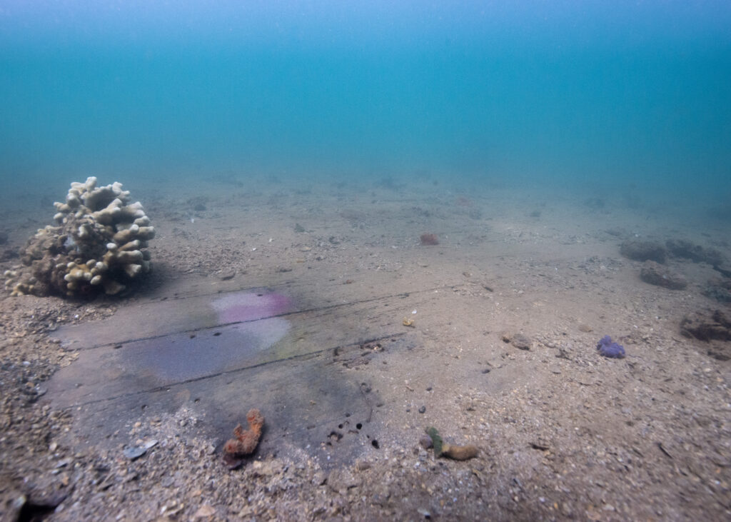
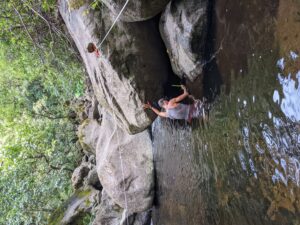
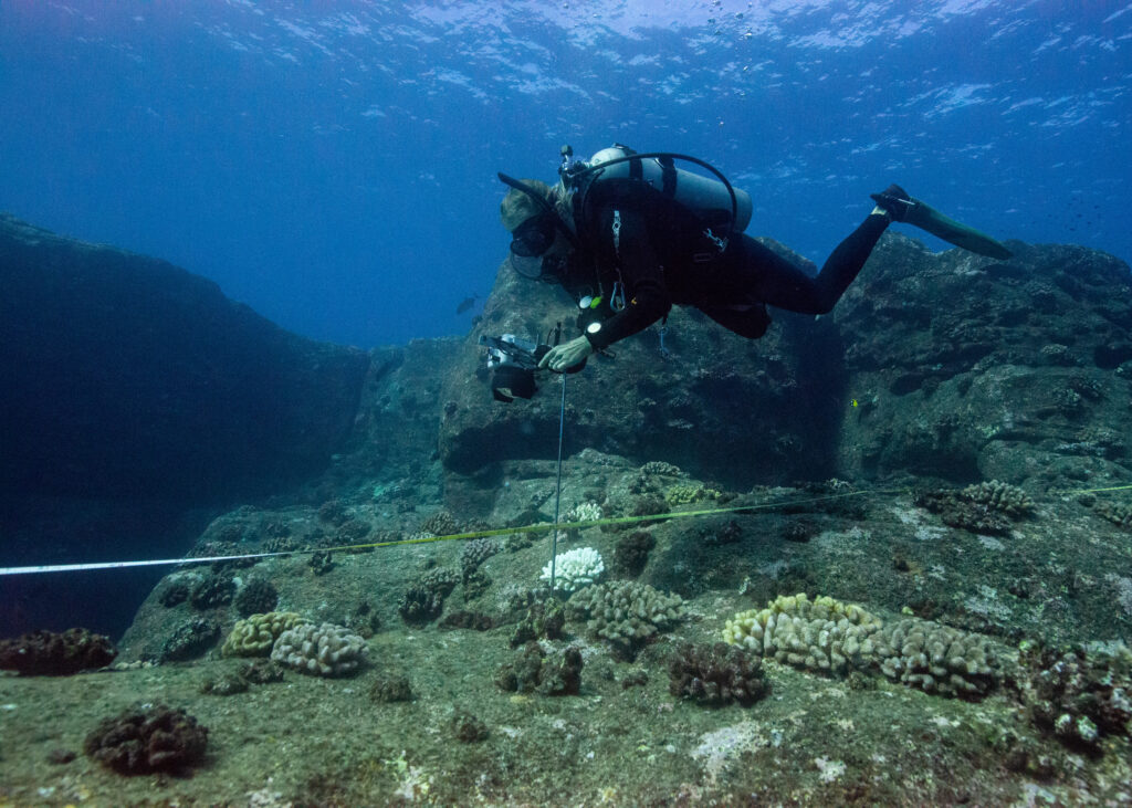
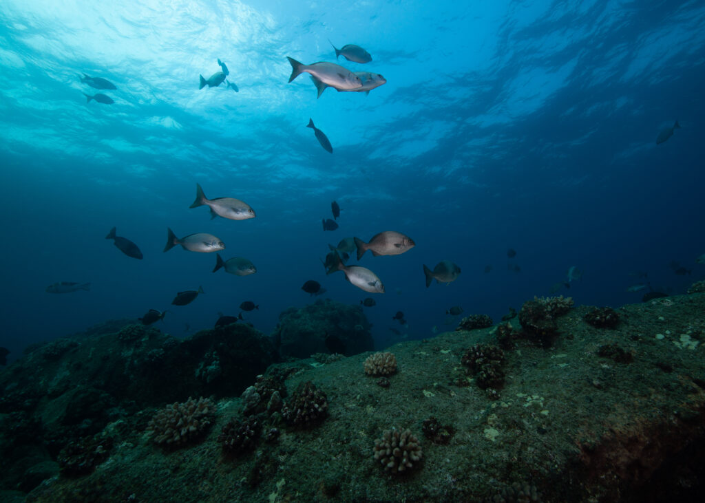
I had been told to expect low visibility for the dive, but I was pleasantly surprised to discover that I could, in fact, see further than my hand in the harbor’s murky green water. Dan led the way and I followed, stopping every few feet to take photos and process what I was looking at. I was diving on the USS Arizona shipwreck — something very few people have had the opportunity to do. I moved slower than I ever have on a dive, scanning every bit of the wreckage and looking for artifacts underneath the layers of algae and sediment.

In the same way that the NPS protects the hot springs and geysers in Yellowstone and the petrified wood in Petrified Forest National Park, the NPS closely monitors and protects the USS Arizona and the artifacts that remain on the wreck. It’s no easy feat — they are tasked with preserving, protecting, and interpreting this monumental collection of historical and cultural resources and leaving it unimpaired for future generations. The more time I spent in the park, the more I was impressed by how well the NPS has done just this. By preserving the USS Arizona and its associated artifacts, they have kept the story of Pearl Harbor alive.

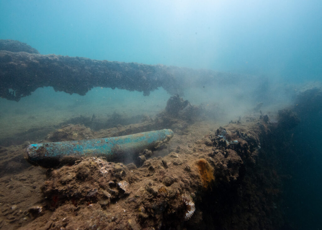
One of the USS Arizona’s mooring cleats remains on the deck of the ship.

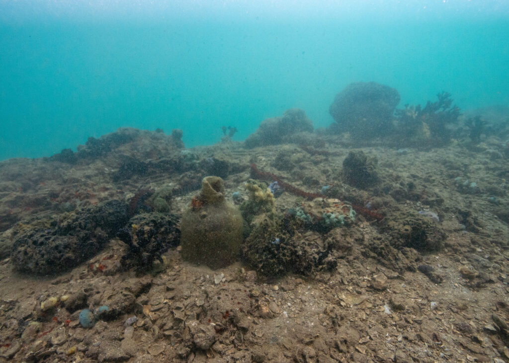
It was haunting to see old pitchers, bottles, and pots scattered across the deck of the wreck.

As I explored the wreckage, thoughts on the significance of sacrifice and the price of peace weighed heavily on my mind. I’ve been diving on shipwrecks before, but the USS Arizona is different. It isn’t just a shipwreck — it’s a mass grave. It is a physical touchstone of one the deadliest events to happen in U.S. history. Even more striking to me is the fact that the ship has been there, laying in the depths of Pearl Harbor, since 1941. My parents weren’t even alive by then. Pots from the ship’s galley lay untouched on the ship’s deck. Soda bottles. Shoe soles. Multiple staircases descend from the main deck into the depths of the wreck, railings still intact. As Dan and I explored it all, I distinctly remember noticing how quiet it was — hauntingly so. The reality of what I was exploring hit me when Dan pointed out the original teak decking of the USS Arizona, still clearly visible under a thin layer of sediment and debris. How many men were standing on this deck when Japanese torpedo bombers started firing from above?

The ship’s original teak decking.

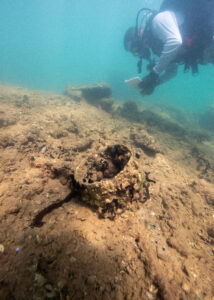
Dan Brown writes notes as we pass over an encrusted cooking pot on the ship’s deck.

Slowly, we made our way around the perimeter of the ship and to the bow. Dan was a fantastic guide, stopping to show me artifacts and features of the ship. At one point, he pointed to a small stream of brown bubbles rising up from a hole in the ship. 80 years after sinking, the USS Arizona continues to slowly leak oil. Some refer to the patches of oil that leak from the ship as “black tears”.

If you look closely, you can see the brown tinge of the oily bubbles as they slowly ascend to the surface.

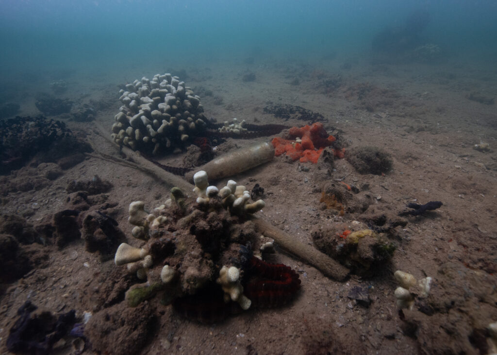
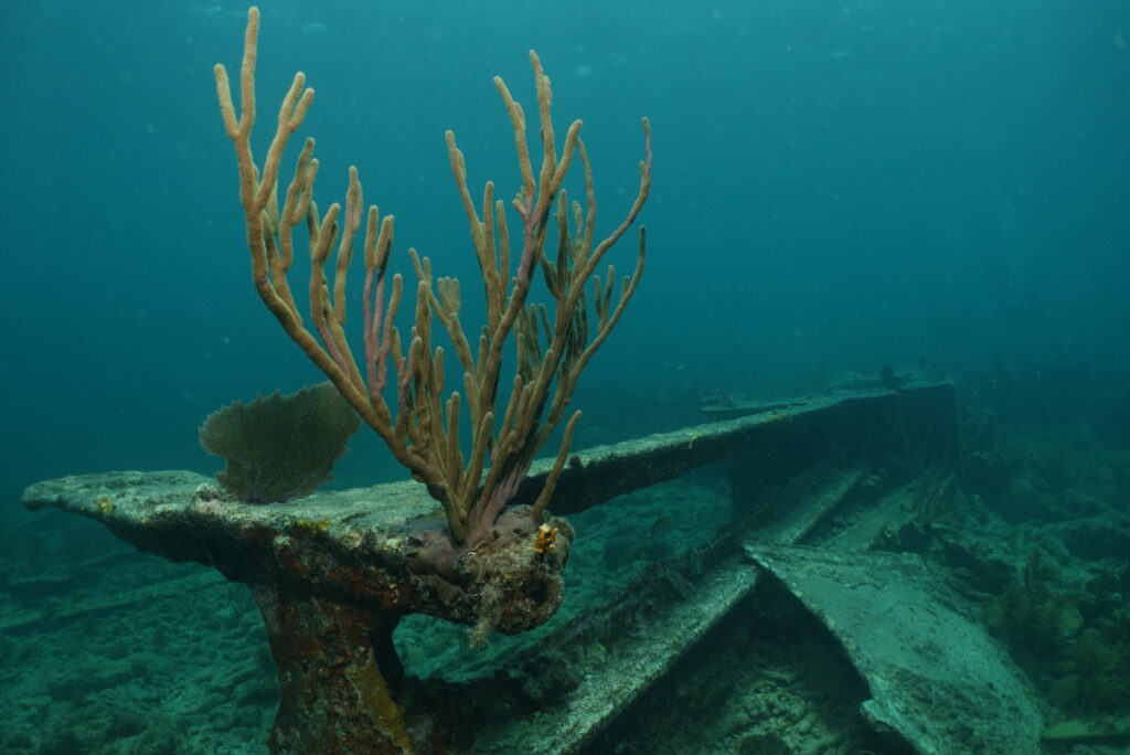
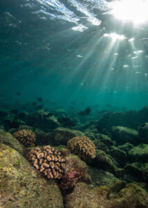
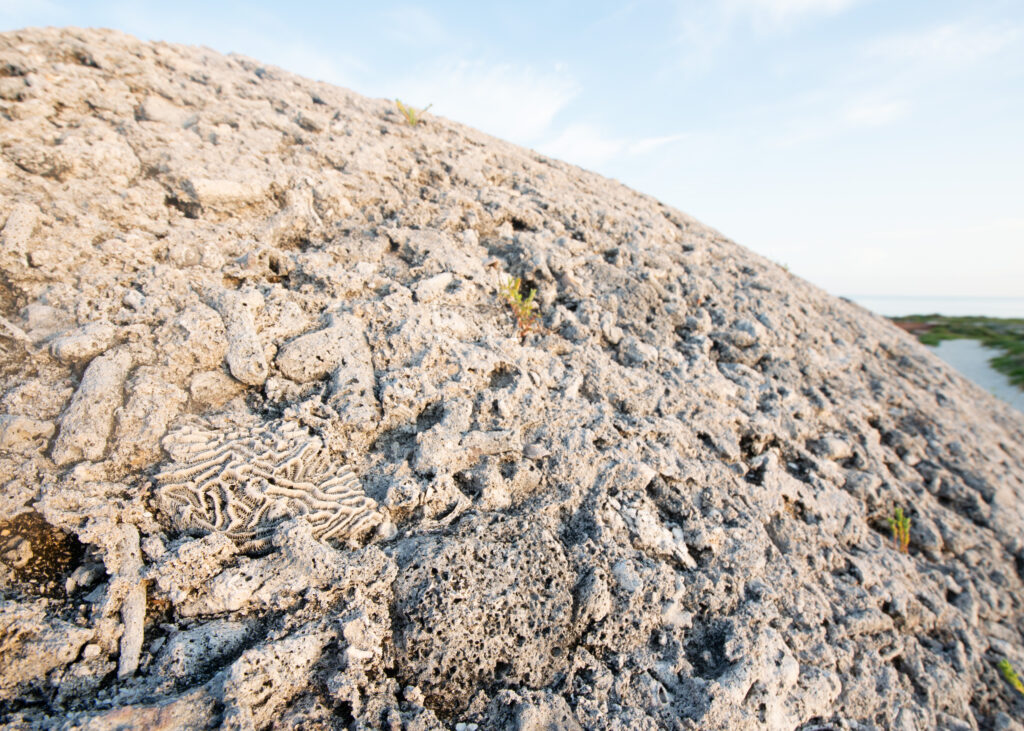
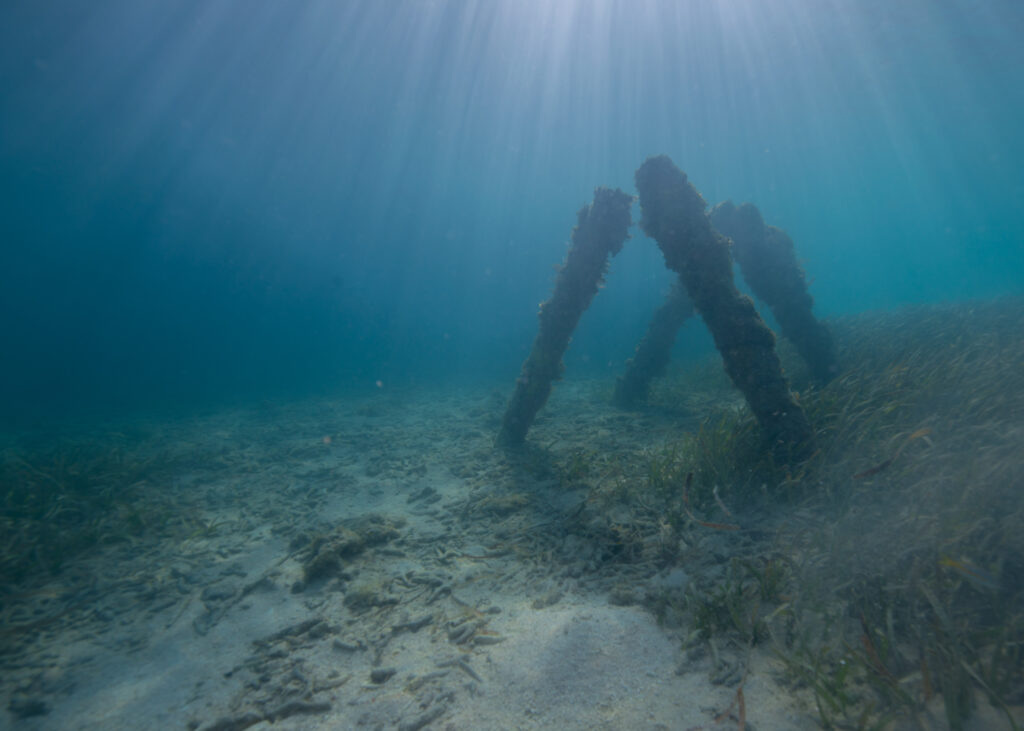
A glass bottle and debris intermixed with small patches of coral. The shipwreck acts as an artificial reef, providing corals with a substrate to grow on and serving as protective habitat for many fishes and marine creatures

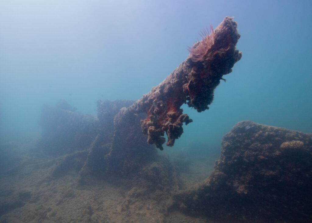
An anemone reaches out from the tip of the ship wreckage, filter-feeding in the water.

The end of an amazing dive is always bittersweet. On one hand, you don’t want to go back to the surface — you want to keep diving! On the other, the moment where everyone surfaces and can finally speak to each other is always exciting. Sometimes there’s so much to talk about, you don’t know where to start. Sometimes you’re at a loss for words, which is where I found myself as we climbed back onto the dock. Before we knew it, though, visitors were walking by and asking us what we were doing (“we’re going to be asked what we’re doing at least a dozen times”, Dan warned me earlier that morning). Talking to the memorial visitors knocked me out of my momentary speechlessness, and Dan and I remarked on the artifacts we noticed and the great visibility — “one of the top five dives I’ve done here,” Dan enthusiastically noted.

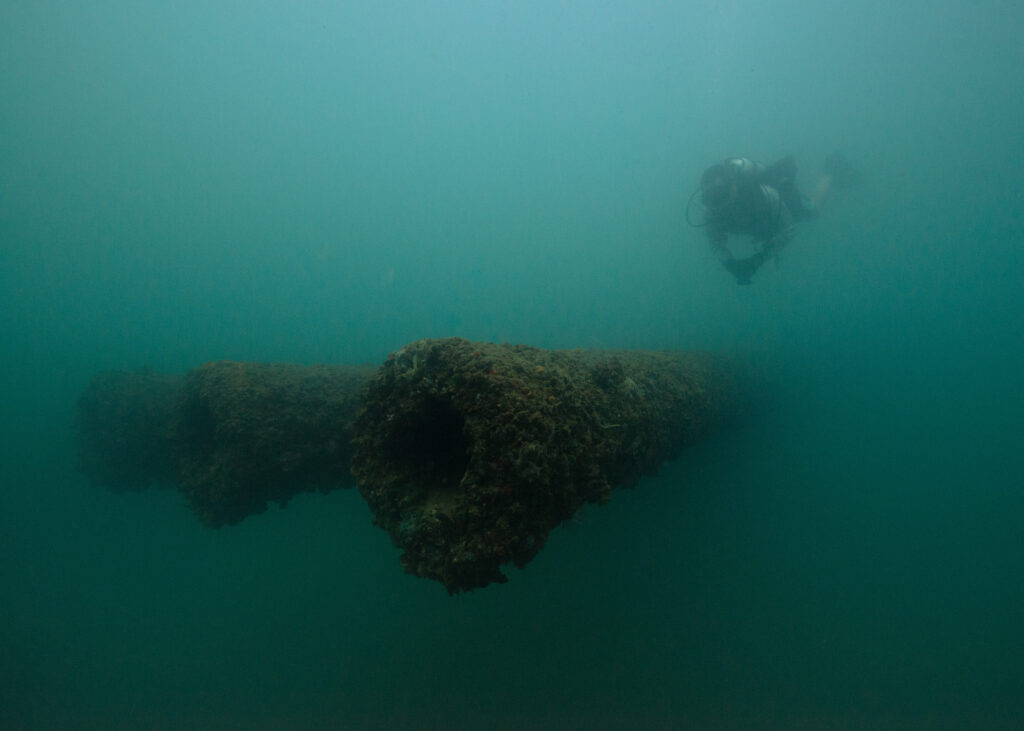
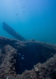
Dan Brown makes his way over the three 14-inch guns at the bow of the USS Arizona.

These guns are nearly 60 feet long — in low visibility, it’s nearly impossible to capture their grandiose presence.

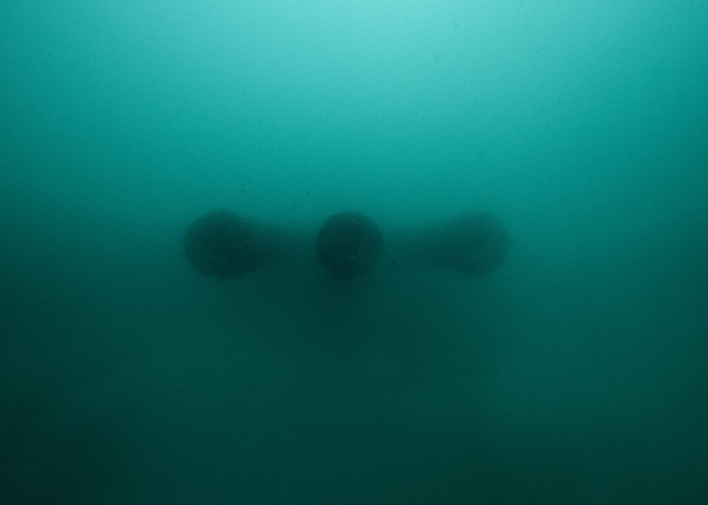
A shift in perspective.


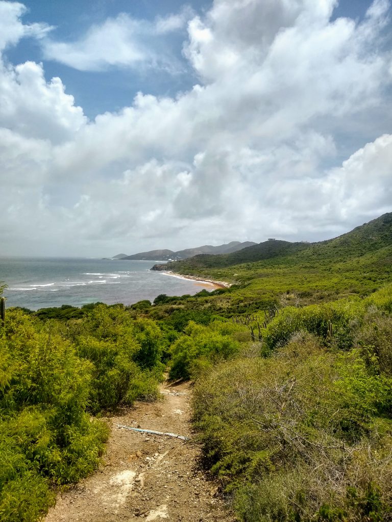
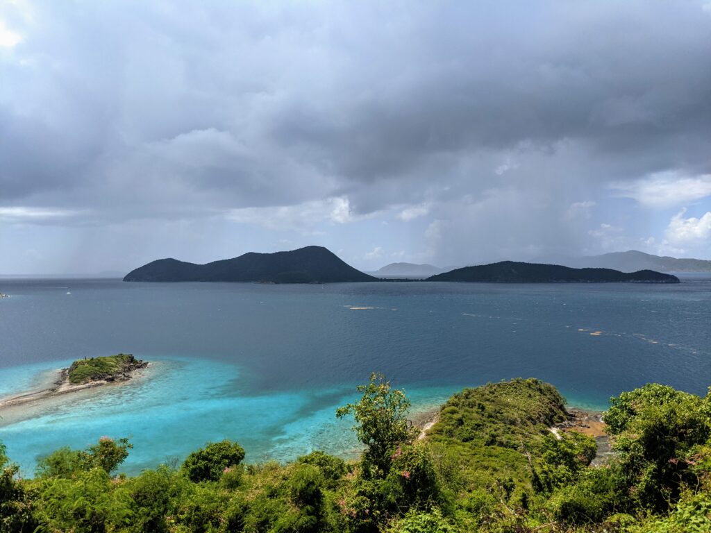
The following day was for topside exploring and seeing more of PERL. Dan and Scott Pawlowski invited me to come snorkeling with them on the north side of the island, an area I was eager to explore. One of my roommates, RB, was also new to Oahu and keen to join us. Dan picked us up mid-morning and we drove up the north shore to Three Tables beach, passing lush forests, food stands, and busy surf beaches along the way. We met Scott at the beach and chatted for a while before swimming out to the reef.

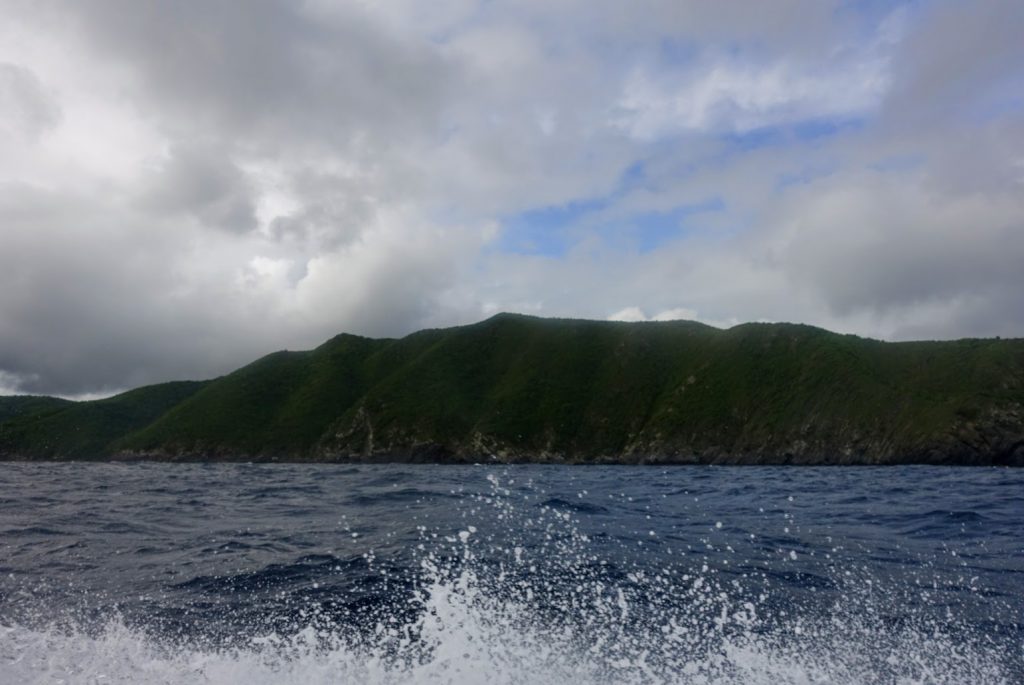
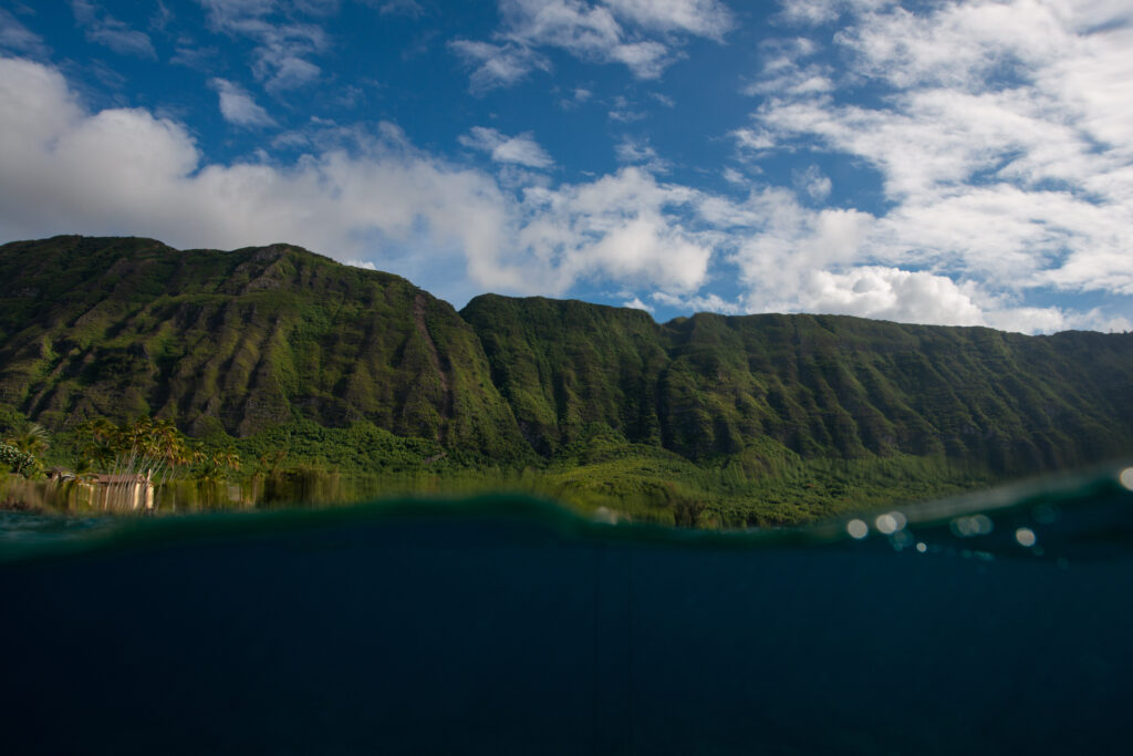
Beach views on the north shore of Oahu.

After the snorkeling excursion, RB and I drove to the PERL visitor center and picked up passes for the USS Missouri and the USS Arizona Memorial. RB hadn’t been to the memorial yet, and I wanted to get a few more shots while I had the chance. As much as I appreciated having the memorial to myself the other day, it was also a special experience to spend time there with other visitors.

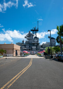
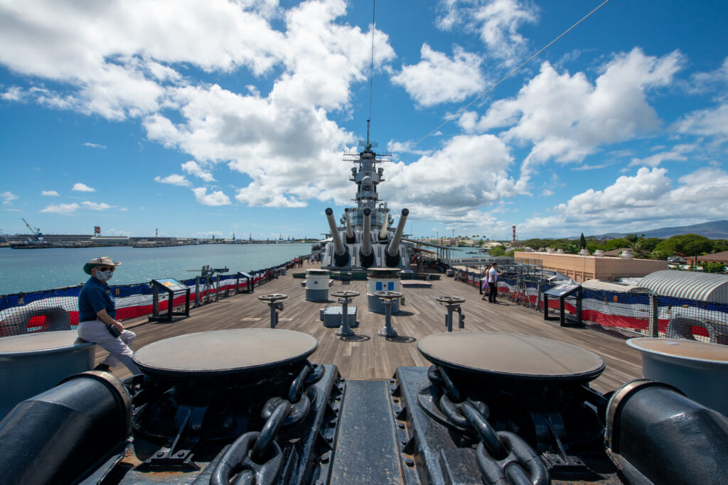
From there, we took a shuttle bus to the USS Missouri. The highly decorated battleship is most well-known as the site of Japan’s surrender in World War II. Nowadays, the ship has been turned into a museum of sorts — every few feet, there are informational displays that tell the story of the USS Missouri. We spent a while on the ship, peering into the many rooms onboard and reading about the battleship’s extensive history.

Approaching the USS Missouri.

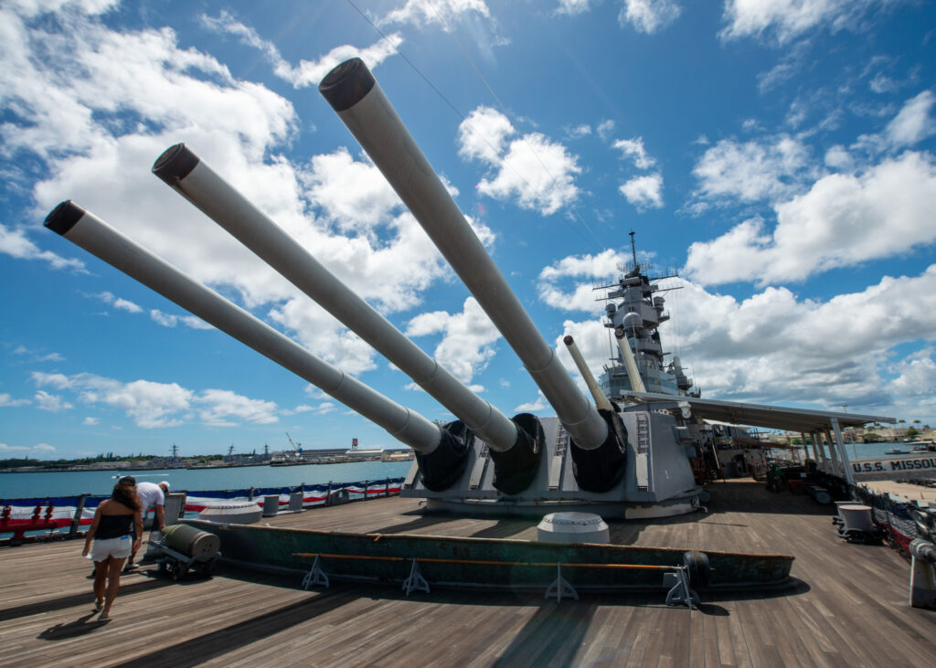
It was a good thing I had a wide angle lens with me. This ship is huge!

The USS Missouri — tour guide for scale.


On my last day in Hawaii, Scott and I met at the PERL visitor center for a tour of Ford Island and the PERL memorials that aren’t open for public access (Ford Island is still an active military base, hence the inaccessibility). Our first stop was the USS Utah Memorial. As I walked down the memorial’s white dock and looked at the vast landscape ahead, I couldn’t help but picture what the horizon must’ve looked like on that fateful day in 1941. Planes must’ve been flying overhead from every direction, relentlessly bombing whatever was below. In the case of the USS Utah, torpedoes struck the ship and caused it to quickly capsize. Most of the crew made it out alive, but 58 of the men onboard were killed in action. 

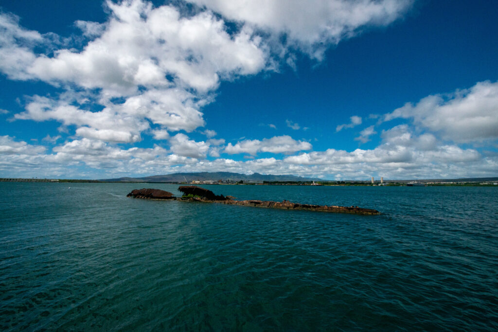
The USS Utah lies next to Ford Island. 58 of the ship’s crewmen were killed when the battleship was torpedoed and sank.

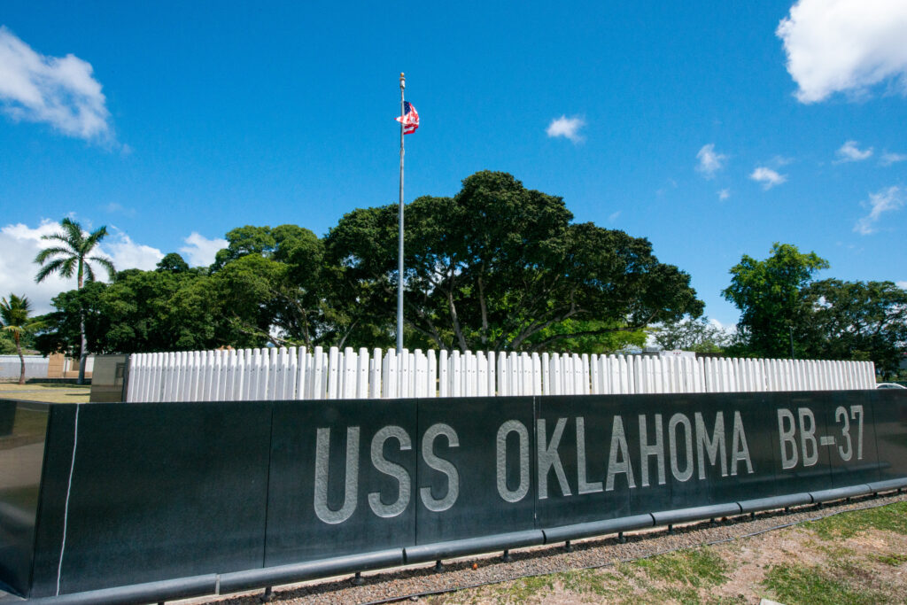
The second-greatest loss of life at Pearl Harbor occurred on the USS Oklahoma, affectionally referred to as “the Okie” by its crewmembers. The USS Oklahoma sank quickly on December 7th, 1941 — less than 15 minutes after the first torpedo hit Battleship Row. Within minutes, hundreds of men found themselves trapped under the decks, flipping upside down as water rose all around them. 32 men were retrieved from the wreckage in the next two days. 429 of their comrades never made it out.

The USS Oklahoma Memorial was designed with the U.S. Navy’s tradition of “manning the rails” in mind. The rows of white granite columns stand tall, emblematic of when Navy crews line the ship railings in dress whites when they return to port. On each of the 429 columns is the name of a crewman who was lost with the USS Oklahoma.

Each granite column of the USS Oklahoma Memorial has the name of a crewman who was lost on the ship during the Pearl Harbor attack.

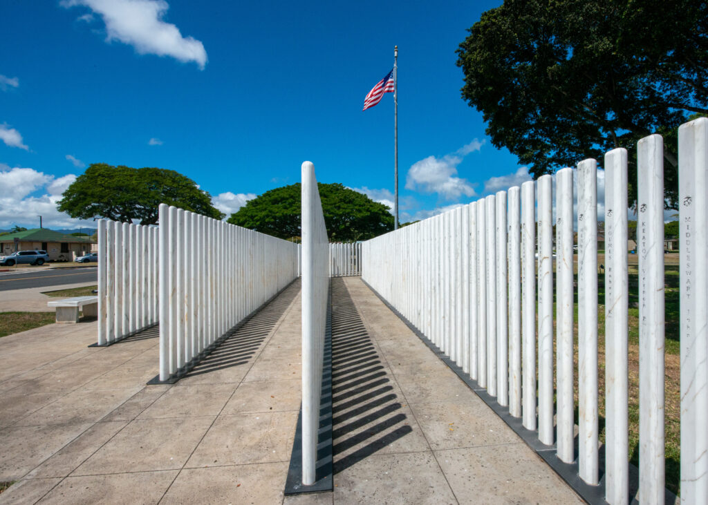
NPS routinely takes standardized photos of each column of the USS Oklahoma Memorial, which helps them monitor wear and tear and perform repairs when needed. Over the years, the granite can crack and degrade from the salty air and sunshine.


Every part of my PERL experience had its own respective impact. Photographing the USS Arizona Memorial and spending time in the shrine room helped me comprehend the mass loss of life that took place during the attack. Diving on the USS Arizona itself put the scale of the event into perspective. Viewing the other memorials gave me an appreciation for all the time, money, and effort that has gone into making PERL the educational and historic site that it is today. However, I don’t think I emotionally processed what happened at Pearl Harbor until I was in the depths of the museum collections building with Scott.

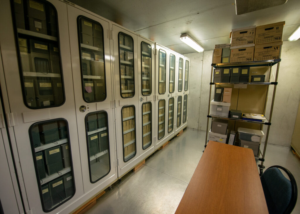
The museum collections building has rooms and rooms of artifacts, documents, and memorabilia that are related to Pearl Harbor and the 1941 attack.

Being the museum curator, Scott knows the story behind practically every artifact in the collection and has even stayed in touch with many of the families and individuals who have donated items. We took our time in each room as he showed me WWII-era swords with handles made out of shark skin and combat medic hats, rusty but still intact. Every piece had a story, and oftentimes Scott could tell me about the individual who brought the item in, where it was from, and exactly how it was discovered.

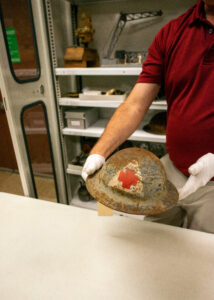
Scott presents a WWII combat medic’s hat.

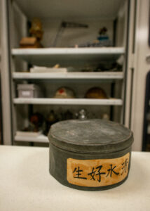
This Japanese hatbox belonged to a soldier who died in the Pearl Harbor attacks. Years later, his widow actually came to Pearl Harbor and was able to visit the collections building and see the hatbox for herself. Scott said there wasn’t a dry eye in the room that day.

We continued to work our way into the collections, moving from larger artifacts to smaller items, like medals and papers. I could’ve easily spent hours sifting through the pages and pages of carefully preserved newspapers. Seeing the old pages and dates put into perspective just how suddenly the month of the Pearl Harbor attack went from a typical December to a month of immense loss, grief, and trauma for the entire United States.

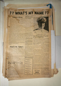
I could’ve easily spent hours sifting through the pages and pages of old newspapers in the PERL museum collections building.

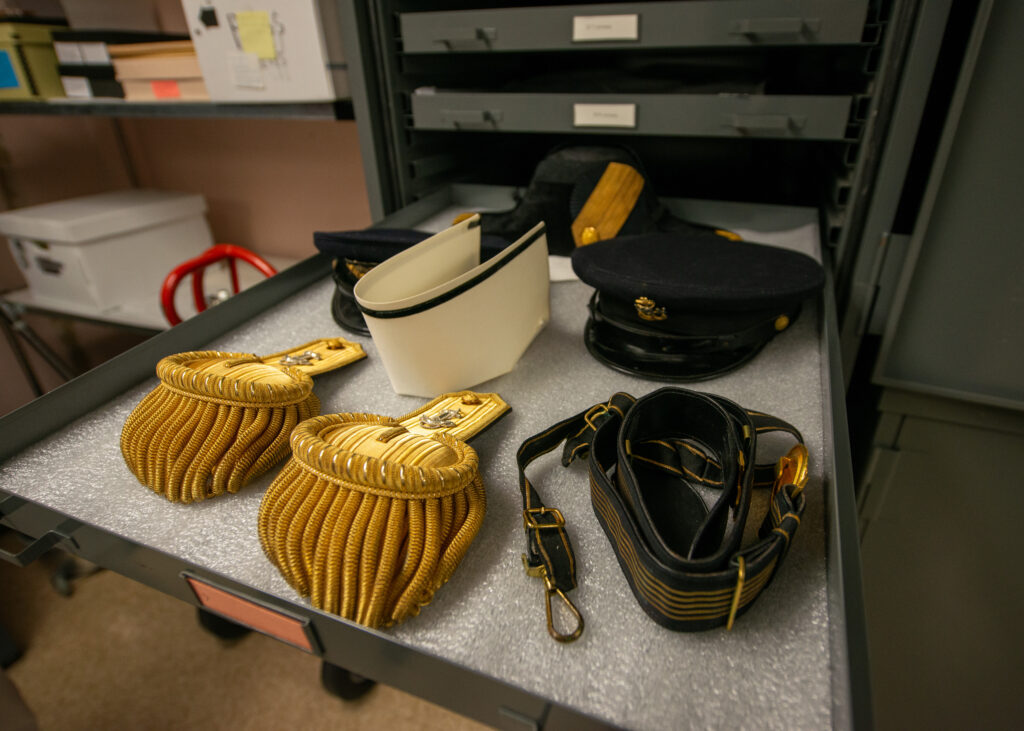
Carefully stored and preserved uniform pieces.

The last items Scott pulled out were old leather-bound photo albums, purchased by sailors when they arrived at new ports and filled with old photographs of their families, friends, and travels. As Scott carefully flipped through the pages with gloved hands, I was hit with a staggering wave of emotion. On December 7th, 1941, in less than two hours, the lives of so many men just like the ones in the photo albums ended. In a sudden and tragic moment of sacrifice, their lives became unfinished scrapbooks and uniforms that would never be worn again.

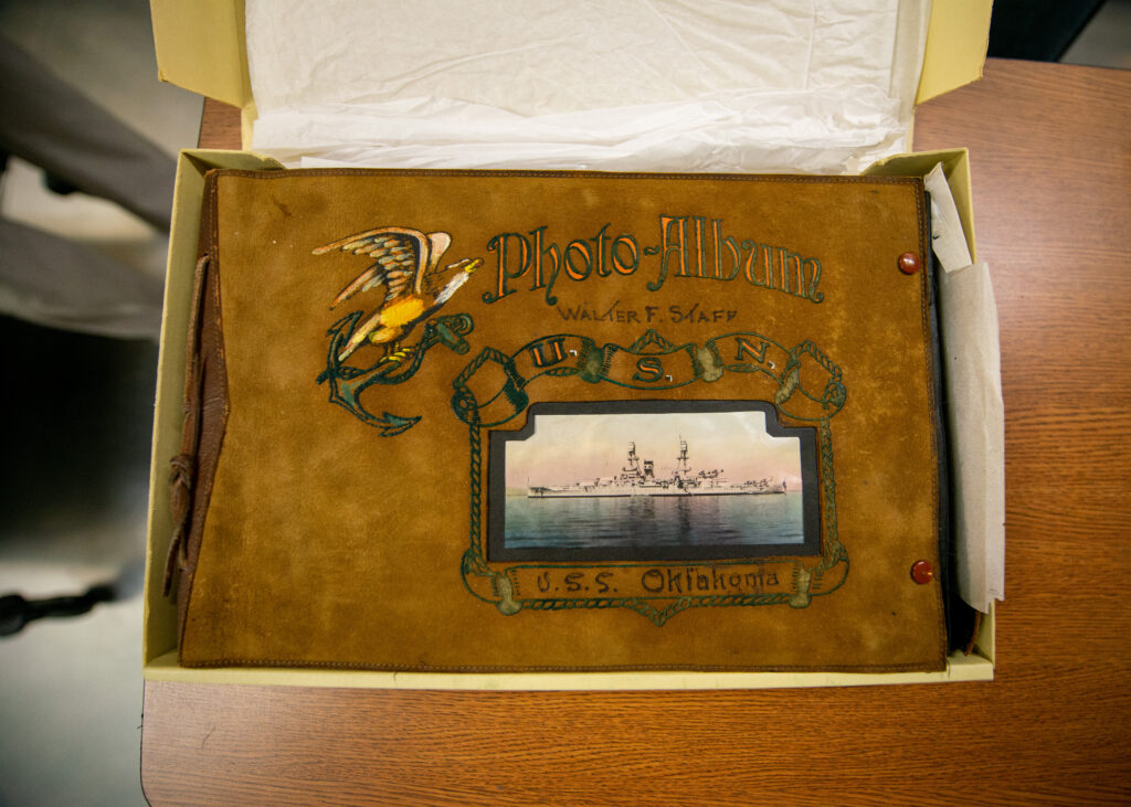
Walter F. Staff’s photo album from his time on the USS Oklahoma.

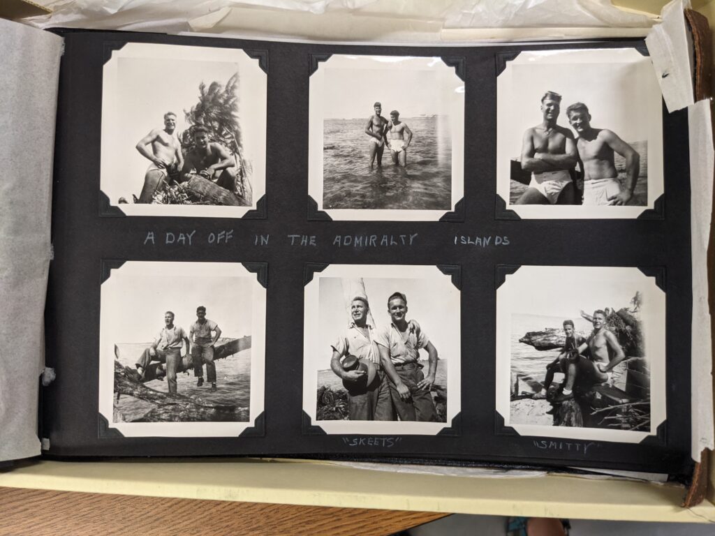
The sailors’ photo albums were filled with photos of their friends, families, and the new places they traveled to during their deployments.

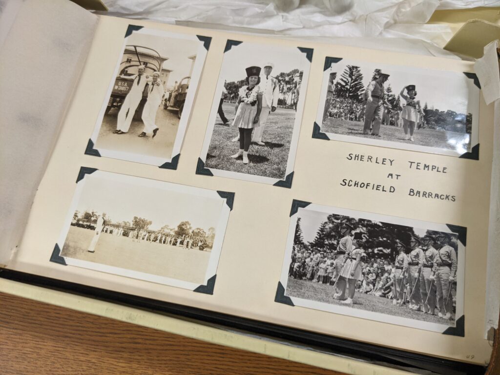
Flipping through the pages of sailors’ photo albums provided insight into their travels and the memorable events they partook in along the way.
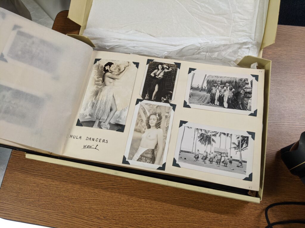
“Wow!”


Going to Pearl Harbor at the tail end of my internship and thinking about how precious life is – and how quickly it can be lost – reminded me just how important it is to embrace each day you get to live, especially if you’re lucky enough to spend those days doing what you love. I left Pearl Harbor feeling incredibly reflective and indescribably grateful to all those who made it possible for me to experience the national memorial in such an intimate way. A huge thank you to Dan Brown and Scott Pawlowski for generously sharing your time and showing me the historical and cultural resources of Pearl Harbor National Memorial. Thanks to Shaun Wolfe for finding me great accommodation while I was on Oahu, and to OWUSS and the NPS SRC team for providing unwavering support throughout my internship.

Lastly, thank you to those who have followed along with my journey and provided encouragement and kind words along the way — it has meant so much to me. If you’d like to read my final thoughts and reflections from my internship experience, keep an eye out for my final report. I hope you will continue to follow the journeys of future interns and support the efforts of OWUSS and NPS. There is no question that this experience has monumentally changed my life, in ways that I probably cannot comprehend quite yet. I look forward to taking what I have learned this summer and continuing to preserve, study, and document the incredible underwater resources of Earth’s oceans. 

Share

The Kalaupapa Chronicles Continue

Two weeks into my stay at Kalaupapa National Historical Park, I had already trekked through the Hawaiian backcountry, participated in survey dives around the peninsula, and assisted with helicopter operations in the park (read about all of those adventures in my previous two posts). Little did I know at the time, that was only the beginning of my Kalaupapa experience. The initial plan was to spend three weeks in Kalaupapa and then travel to American Samoa for another three weeks. However, American Samoa was only just beginning to allow people on and off the island, and it seemed risky at best to board a flight there (I was told I may not be able to get out if the government changed travel regulations again). 

Thankfully, Kelly Moore — park dive officer and marine ecologist — was able to finagle a few more weeks of housing for me in Kalaupapa. What was initially a three-week stay turned into a six-week stay — and it did not disappoint! I was lucky to participate in a number of projects that the Kalaupapa Natural Resources Division manages throughout the year: helping with the annual Barge Day, providing annual maintenance to the park’s weather monitoring station, surveying endangered Hawaiian monk seal populations, and even getting my Wilderness First Responder certification. 


BARGE DAY

Barge Day is Kalaupapa’s “Christmas 2.0”. Once a year, a monstrous shipping barge arrives at the park, carrying an entire year’s worth of non-perishable goods, fuel, building supplies, vehicles, and other large pieces of cargo, appliances, and machinery. Barge Day was originally scheduled for the first Saturday I was in Kalaupapa, but weather and other logistical issues delayed the barge’s arrival until a few weeks into my stay. When we received word that the barge was, in fact, arriving after weeks of being postponed, a rush of anticipation and excitement filled the air. New cars, fresh crates of soda and beer, and materials for the construction of a new dive locker were on the way!

On the morning of Barge Day, I biked across town to the natural resources office, energized and eager to witness the barge’s arrival. I noticed that sections of the road had been blocked off and residents had placed camping chairs out along the shoreline so they could watch as the huge vessel slowly made its way to the settlement. What started as a speck on the horizon eventually grew into the clear outline of a barge, and after a few hours, it was docked and ready to be unloaded.

The barge delivers crates, shipping containers, and boxes of non-perishable goods and materials, along with new cars and other pieces of machinery that are used in the park.

Unloading quickly began, and the settlement turned into a bustling hive of activity. Workers on forklifts zoomed around, dropping containers, pallets, and boxes along the side of the road for inspection. Kelly and I volunteered to help with inventory checks, so our tasks involved identifying each order and confirming that the correct type and quantity of each item made it to the settlement. We stayed busy for most of the afternoon, but got to enjoy some special treats throughout the day, like shaved ice and a delicious lunch. All in all, it was a fun community event to be involved in, and I was particularly happy to meet some of the residents that I had yet to interact with. It seemed like everyone came out to witness the event!

A pack of forklift operators gather, ready to move the next pile of unloaded goods.


WEATHER STATION MAINTENANCE

Average temperatures on the Pacific Islands are on the rise, and Hawaii has experienced a statewide decline in rainfall over the past two decades that is predicted to continue. Such climate projections come from models that are developed from existing weather data. All Pacific Island Network (PACN) parks have weather stations to help facilitate real-time tracking of weather conditions and provide data for climate modelers. 

One of Kalaupapa’s weather stations is on the east side of the peninsula in Makapulapai, just off a dirt road that runs along the coast. The tower of weather instruments and wires stands tall in a brush-filled field with the cliffside in the background. On the station is an anemometer to measure wind speed/direction, a rain collection vessel to measure precipitation, and other sensors to quantify relative humidity, solar radiation, and temperature among other parameters. One morning, Glauco, Kelly, and I packed up the truck and drove across the peninsula to do annual maintenance on the station. 

Kelly and Glauco trek through the bushes to reach the weather station.

Inside the weather station’s control panel is a computer that stores all the data collected by the station’s many instruments.

Tagging along for some of the land-based work that Kelly and Glauco conducted in Kalaupapa provided a lot of insight into just how many ways natural resources are monitored, surveyed, and managed within the park. Marine fish surveys are equally as important as freshwater invertebrate surveys, and monitoring the monk seal population in the park is just as valuable as monitoring the park’s weather trends. To truly gain a comprehensive picture of the state of Kalaupapa’s natural resources (or any ecosystem), one must consider the interconnected nature of ecosystems. By assessing as many ecosystem components as possible, we come closer to better understanding the many ecological relationships at play and the inevitable impacts of ecological change

After extracting the data and doing a system update, we needed to change out some parts. The tall tower on the station can be lowered to make for easy maintenance.

Glauco runs a new wire down to the tower’s control panel.


SEAL SEARCHING

There’s always that one character in an animated children’s movie that’s undeniably adorable (think minions from Despicable Me). They always have huge eyes and chubby cheeks and are usually made into stuffed animals because every small child wants to hug them (and because of consumerism, but that’s a different topic). Well, Hawaiian monk seals are Kalaupapa’s version of that movie character. 

Hawaiian monk seals are one of the most endangered seal species in the world. Endemic to the Hawaiian islands, the doe-eyed marine mammals are heavily protected by Hawaiian state laws, the Endangered Species Act, and the Marine Mammals Protection Act. Many of them make their way to the beaches of Kalaupapa NHP each year to pup and haul out (i.e. rest), and oftentimes the pups will return once they’ve matured. NPS and NOAA work together to monitor the seals, track and record new births, and vaccinate the seals against morbillivirus — a virus similar to canine distemper.

Glauco uses binoculars to read the ID tag on the fin of a sleeping monk seal. Monitoring and photos were conducted under NMFS Permit #22677.

I joined Glauco and Kelly on seal monitoring beach walks a few times during my visit to Kalaupapa. During my first one, I struggled to spot the seals as they lay stretched out and sleeping on the beach. From a distance, they look a lot like rocks. Over time, I became better at distinguishing their unique shape and light gray stomachs from afar. We walked along the beach, keeping our eyes peeled for seals. If we spotted one, the next step was to identify the seal and see if they needed vaccinations. Monk seal pups don’t have antibodies to protect them against morbillivirus, so pups are vaccinated in an attempt to prevent the disease from spreading and having substantial impacts on the population.

Glauco uses a commercial hair lightener to write a seal’s ID number on its back. This makes for easier identification in the future. Monitoring and photos were conducted under NMFS Permit #22677. 

Here, Kelly preps a vaccine syringe, which is administered from a distance using a tranquilizer pole.

These seal monitoring and management efforts are part of NOAA’s Hawaiian Monk Seal Recovery Plan, which aims to conserve monk seal habitat, reduce mortality factors such as disease, develop education and outreach programs focused on minimizing human disturbances, and facilitate seal monitoring during pupping and hauling out events. With only an estimated 1,400 individuals in the population, there is concern about whether the genetic diversity of the population can be maintained in the long term. Hopefully, the efforts of NOAA, NPS, and other partnering organizations will help assure the long-term viability of the monk seal species in the wild.

Most of the seals were heavy sleepers. We could ID them, photograph them, and apply the hair lightener without them waking up. We just had to cross our fingers that they wouldn’t roll over on their backs before the hair lightener had taken effect. Monitoring and photos were conducted under NMFS Permit #22677.

When doing monk seal surveys, it was important to keep a distance and avoid disturbing the animals. If the seals are severely frightened, they may not return to the area. Monitoring and photos were conducted under NMFS Permit #2267.

Knowing that there was so much marine life and activity going on underwater motivated me to snorkel and free dive as much as I could in the evenings and on the weekends. Camera rig and snorkel gear in hand, I’d jump into the water and venture out to see what was going on under the waves. I hoped to see one of the seals underwater and get some photos (from a safe distance), but it seemed like every time I had the camera with me the seals were nowhere to be found. Still, I’d stay busy taking photos of rays, lobsters, and the colorful corals scattered across the reef.

On one of my last days in Kalaupapa, I was swimming back to the wharf after snorkeling for a while and saw a grey figure move swiftly out of the corner of my eye. After weeks of snorkeling around Kalaupapa, I found myself underwater with a monk seal! The encounter was short-lived, but I quickly held up my camera to take a photo of it in the distance. The seal was gone before I knew it, although I immediately checked my camera and found that I had taken one single photo of it looking at me. I’m no wildlife photographer, but the experience made my day after so many weeks of wondering if I would have such an encounter. 

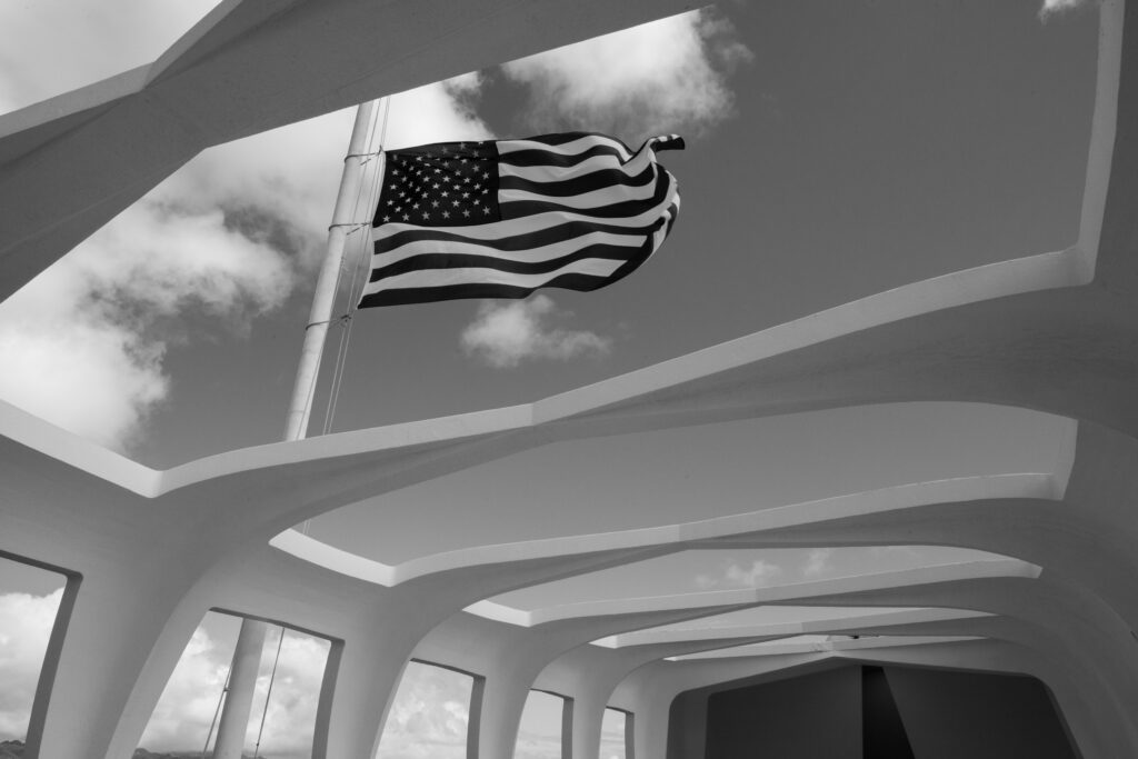
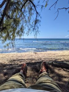
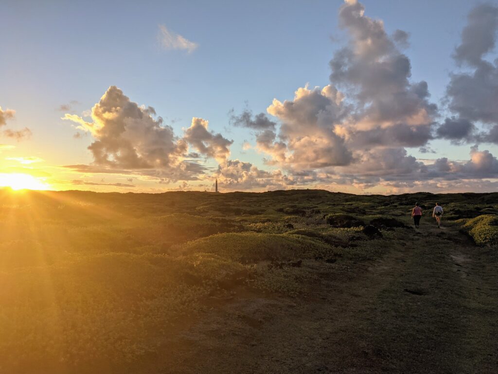
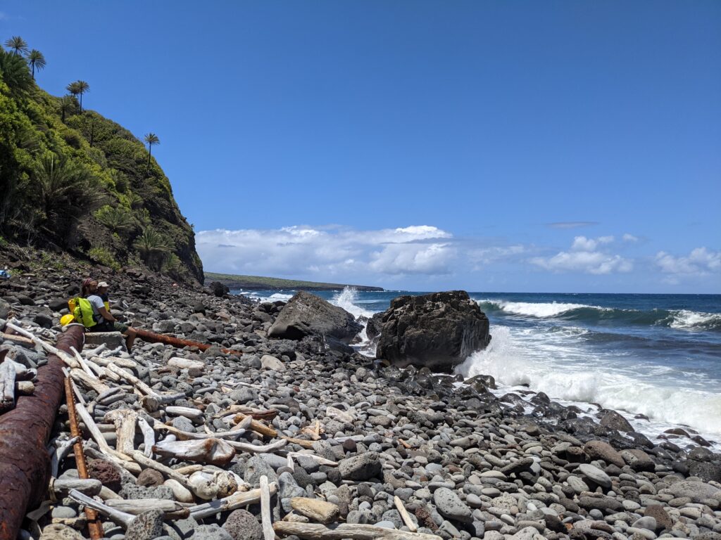
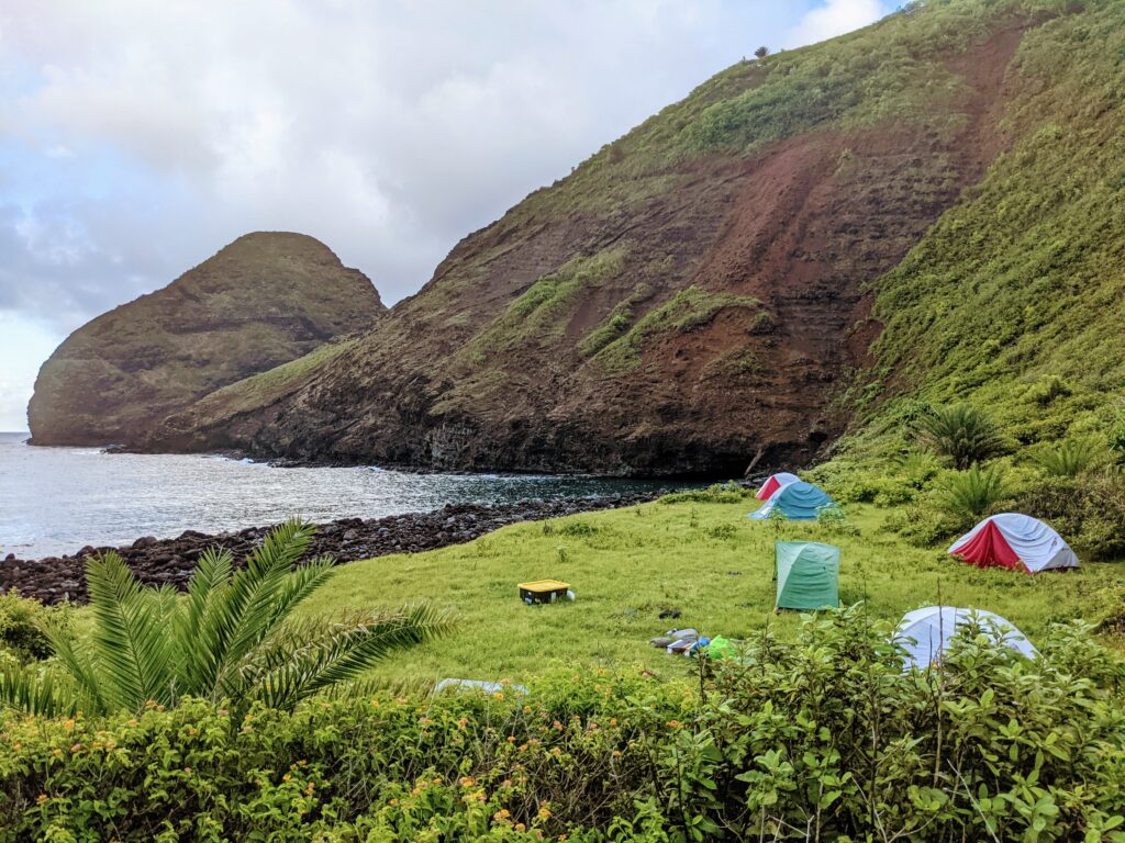
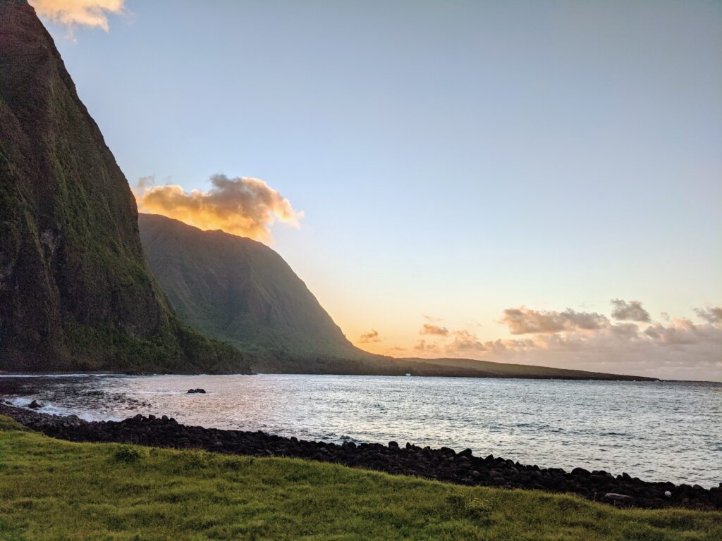
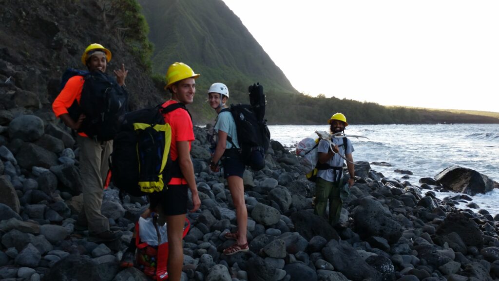
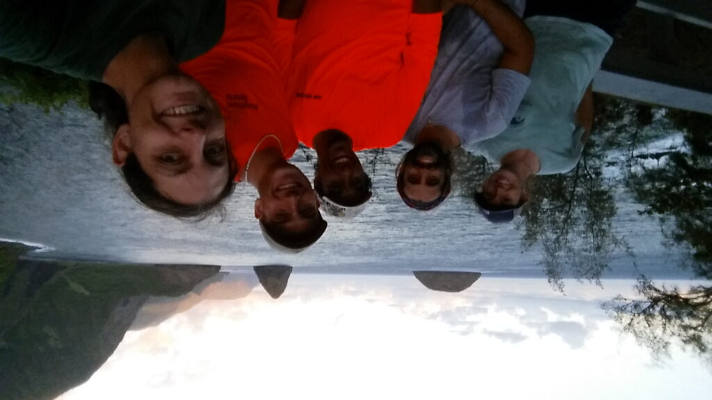
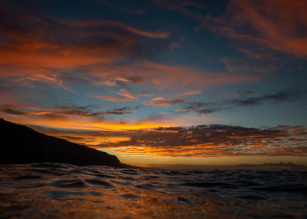
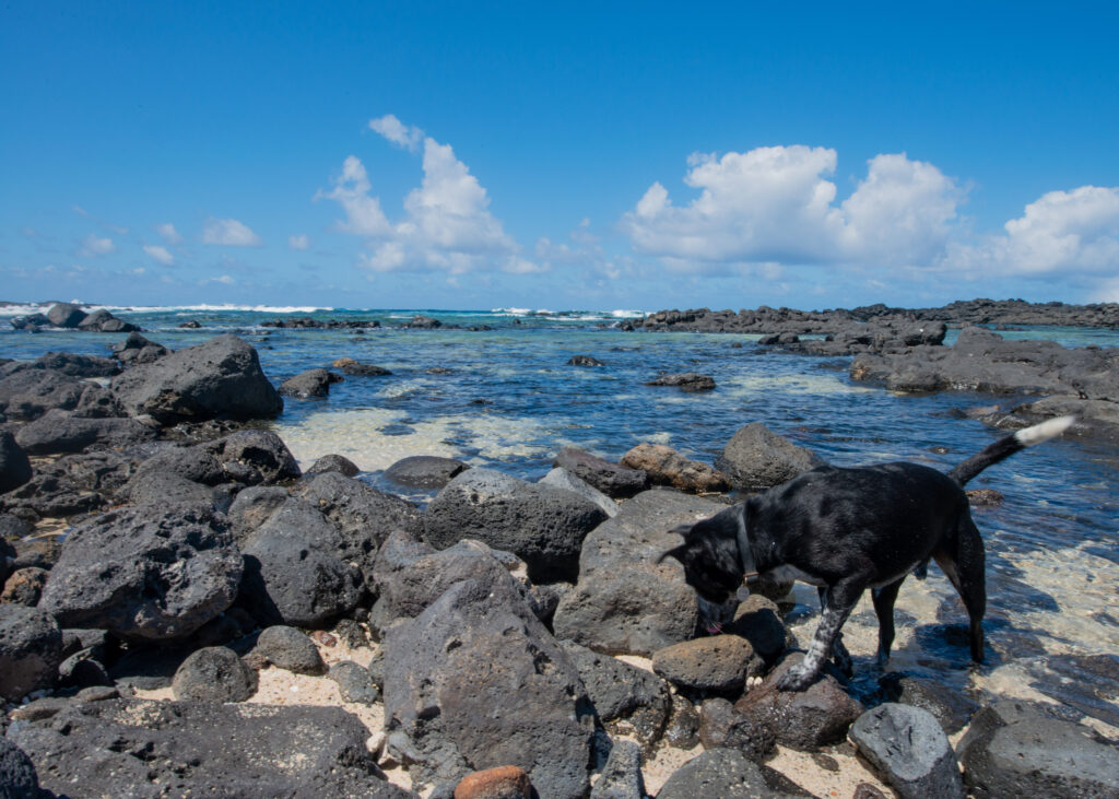
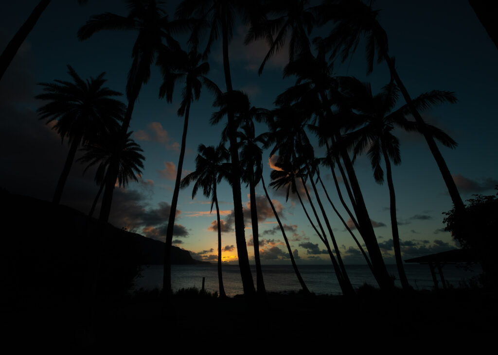
Lots of my evenings in Kalaupapa were spent enjoying the sunset from the beach and snorkeling with the camera.

Can you see it? A monk seal cautiously swims by me in the Kalaupapa wharf.


WILDERNESS FIRST RESPONDER

One of the most exciting parts of my time in Kalaupapa was getting my Wilderness First Responder (WFR) certification. The WFR course provides definitive medical training for those who work or recreate in remote, low-resource outdoor environments — and Kalaupapa is the epitome of such an environment. Kelly organized for a WFR instructor to come to the settlement and teach the course to about a dozen NPS and DOH employees, and I was lucky to jump in and take the course as well.

During my last 10 days in Kalaupapa, my coworkers and I learned how to handle a plethora of medical scenarios, from minor health issues to life-threatening medical emergencies. Someone’s blood sugar crashed while they were hiking? Solved with fast-absorbing sugar, fluids, and calories. Someone was in a car crash and fractured their femur? Time to make a traction splint and get them to the hospital ASAP. We covered snake bites, hypothermia, heart attacks, heat stroke, you name it. Each day involved hours of classroom lectures with hands-on exercises and surprise scenarios mixed in throughout the day. We never knew when we would hear someone yelling outside and have to grab our backpacks, rush outdoors, assess the scene, and put the skills we were learning in class to the test. Matt May, owner of 4Points Expeditions and our WFR instructor, brought along bruise paint and stick on wounds to make the scenarios slightly more realistic. Acting ability was a huge component of making a practice scenario realistic, too. In retrospect, I got as much practice keeping a straight face during scenarios as I did learning to tie splints and wrap bandages correctly — and I’m definitely better at tying splints.

A scenario victim waiting for extraction. If someone has a fractured femur, they won’t be doing any walking out of the accident scene.

On the last day of the WFR course we had our final scenario. Matt recruited community members to help him stage an accident scene somewhere on the peninsula, and our crew was told to open an envelope in the classroom at exactly 18:00 (doing the scenario in the dark made for an added challenge). Everyone paced around nervously in the minutes leading up to the big reveal, backpacks and headlamps at the ready. When it was time, we opened the envelope and read the scenario: two hikers had been reported missing after not returning from a day hike on the east side of the peninsula. We needed to conduct a search, locate the individuals, and provide any care they may require.

The operation went off without a hitch. We drove to the area where the hikers were last seen, conducted a search, and located the injured victims (plot twist — there ended up being five). Matt forewarned us that the final scenario could take hours for groups to complete, but in less than two hours we had extracted all the victims and were back at the cars. To our delight, Matt told us that we were one of the best groups he’d worked with. Go team NPS and DOH!

Teamwork is critical when handling emergency medical situations in the remote backcountry. In this case, there was one person to record notes, one to hold the victim’s head (in case of spinal injury), and one to see to the victim’s injuries.

Matt (center) assesses the well-crafted litter that our crew built during the final WFR course scenario.


SAYING FAREWELL

I’ve struggled to write something that fully encapsulates my six weeks in Kalaupapa. Like all national parks, Kalaupapa NHP has an incredible story behind it — a story of resilience, perseverance, and the power of the human spirit. This place, which was once overshadowed by dark realities of exile and disease, now serves as a site for preservation, education, and refuge for those who have called the peninsula home for decades. Living there demands reflection — for the challenges that come with living there today are nothing in comparison to what those who lived there before endured.

I learned a lot about myself in the last six weeks, and I learned even more about community. My fondest memories of Kalaupapa are not the ones where I got the camera shot I hoped for or saw something thrilling underwater. Rather, I remember when long-time Kalaupapa resident Johnny chased Kelly across town just to give her fresh mangoes from the tree in his yard because he knew how much she loved them. I remember how Glauco would give me a kind smile and words of encouragement when I was having a tough day, and I remember hiking all over the peninsula with Kelly, talking about life and work and relationships and everything in between. The moments of togetherness — sharing meals, snorkeling together, and going out of the way to help each other out  — are the moments I’ll remember.

Thank you to the entire community for welcoming me to the settlement, sharing your lives (and food) with me, and teaching me so much about Kalaupapa — what it once was and what it is now. I am incredibly thankful to have been able to spend as much time as I did on the peninsula, and it wouldn’t have been the same without everyone’s kindness, compassion, and generosity. Kelly and Glauco, I couldn’t have asked for better hosts and coworkers. And of course, a big thank you to OWUSS and the SRC for supporting me on this wild ride. Aloha, and until next time!


I will remember these Kalaupapa sunsets and evening walks with friends for a long time to come.

Share

Trading Dive Fins for Hiking Boots in Waikolu Valley


I was bushwhacking through the Hawaiian jungle, clothes still wet from the day before. The sweet yet pungent smell of fermenting guava permeated the humid air, and my boots squished as I stepped on one of the overly ripe yellow fruits littered on the ground. As I trudged, I looked closely at the overgrown trees and bushes, occasionally plucking a white ginger flower and sucking the sweet nectar from its stem. Slowly, the sound of running water grew louder and louder. We were almost there. 

It was my second week in Kalaupapa National Historical Park, and I was taking a break from dive operations and marine surveys. This week, I was helping the NPS Inventory & Monitoring (I&M) Pacific Island Network (PACN) with freshwater stream surveys in the steep forested Waikolu Valley. I&M has monitored Waikolu Valley’s water quality and freshwater habitats since 2006. Freshwater ecosystems are quite vulnerable to anthropogenic impacts (eg. land-use change, invasive species, eutrophication (i.e. excessive nutrient richness), and temperature changes). Collecting data provides insight into long-term trends in water nutrient levels and population dynamics of freshwater fish and invertebrates, some of which are endemic species that cannot be found anywhere else in the world. 

A view into Waikolu Valley from the mouth of the stream, where freshwater meets the ocean.

The opportunity to work with the I&M crew for a week meant trading out my fins for hiking boots and my Halcyon BC for a Kelty 50 liter pack. We were heading into the backcountry. I looked forward to the opportunity to see Kalaupapa from a different perspective. I didn’t have much idea of what to expect for the week, but I knew that I was in good hands. Glauco, the Biological Science Technician at Kalaupapa, also works with the I&M crew and had done the Waikolu Valley surveys many times before. Joining us was Anne Farahi, the Lead Aquatic Biological Science Technician, and two additional I&M technicians, John Benner and Esaac Mazengia. 

Glauco, Anne, and Esaac work on packing and prepping equipment in the office. With the unpredictable weather in Waikolu Valley, waterproof bags and sealed plastic crates are essential to keep things dry.

Rather than packing all of our gear, food, and surveying equipment out to our campsite, we had most of our belongings dropped off via helicopter. Kalaupapa NHP occasionally uses helicopters to complete park operations, and this week, they were used for gear drop off and to remove several massive super sacks of marine debris from one of the park’s beaches. On the first day of the project, Glauco and I hiked down to the beach with the debris and waited for the chopper to meet us. When it approached, Glauco caught the strap hanging from the chopper and secured a sack. Within seconds, the chopper lifted the sack and flew away to the other side of the peninsula. After a few repetitions, the beach was finally waste-free. Afterward, the rest of our crew — Anne, Esaac, and John — met us and we began the trek across the rock and pebble-dominated beach to our campsite at the mouth of the Waikolu Valley. 

Glauco, dressed in bright yellow to make him more visible for the helicopter pilot, watches the chopper fly in to pick up the large white super sacks of marine debris.

After heli-ops, we set out on our hike across the very rocky beach to Waikolu Valley. I only faceplanted once!

—  

The next morning, I awoke to the rhythmic sounds of waves crashing ashore and the slow trickle of sunlight into the valley. My 40-degree sleeping bag was plenty to keep me comfortable overnight, and I relished the warm air as I rolled out of my tent — a much more enjoyable experience than waking up shivering in the Colorado mountains (the backpacking experience I’m used to). I emerged from my tent and began my morning routine: breakfast, packing my daypack (and shaking the ants off of it), and getting dressed for a day in the forest and streams. By 8 a.m., we started our hike up into the valley. 

Our gorgeous campsite at the mouth of Waikolu Valley. In the mornings and evenings, we’d watch as wild goats played on the red cliffs.

The hikes to our survey sites were the epitome of bushwhacking

I already knew that Kalaupapa was rich with living resources. In the settlement, there were banana and mango trees on practically every corner. The sweetest, juiciest oranges could be plucked from trees on the outskirts of town, and on the avocado trees were some of the largest Haas avocados I had ever seen. On top of that, Kelly had shown me how to process coconuts to collect their meat and milk, and Glauco had shared his freshly caught venison with me during my first week in the settlement. Still, as we hiked through the Waikolu backcountry, Glauco and Anne opened my eyes to even more that Kalaupapa had to offer. Red ginger plants lined the trail and produced a fragrant, soapy liquid when their pinecone-shaped bulbs were squeezed — a perfect alternative for hand soap or shampoo in the Hawaiian backcountry. White ginger quickly became my favorite, as it reminded me of the honeysuckle bushes in my childhood neighborhood. The ginger roots, scuffed down to the yellow by wild pig and goat hooves and our own boots, peeked out of the ground as we walked through the forest. It seemed like everywhere I turned, there was something edible to be found. Coffee plants, guava and strawberry guava, taro, kukui nuts, bamboo, tea plants — they were all growing happily in the forest. 

John (left) and Esaac (right) try a Jamaican vervain flower. They really do taste like shiitake mushrooms!

The smell of fermenting guava will forever be ingrained in my sensory memory. It was great to pull one off a tree for a midday snack, though.

Glauco passes by an ancient mango tree alongside the trail.

Anne had done enough surveys in Waikolu to know each survey site by sight, and Glauco had a GPS to use for secondary confirmation that we were surveying the correct spots. Since I had never been in the Waikolu Valley before, I never really knew exactly where we were going or how long it would take to get there. In the mornings, the unawareness was nice — the hikes felt exciting and exploratory. Once we reached a survey site, the five of us would drop our bags on the side of the stream and get to work. We had a number of surveys to do at each site. Some were to assess water conditions, such as nutrient levels and streamflow. Other surveys involved assessing the Hihiwai population — Hawaiian freshwater stream snails. 

Glauco (left) and Esaac (right) use a FlowTracker to measure the water velocity of the stream. The FlowTracker is a highly precise tool that requires careful handling and lots of focus.

The lives that these tiny freshwater snails live are remarkable. Eggs about the size of sesame seeds are deposited by adult snails onto the sides of rocks in the freshwater stream, where they remain until they hatch. Once hatched, the larvae are quickly washed downstream and into the open ocean. Months go by as the larvae grow, and after about a year the young snails begin the pilgrimage of a lifetime — a march, in single file order, upstream and back into the valley. Their strong muscular foot allows them to cling to rocks and withstand the force of waterfalls as they move into the current of the stream. 

At each survey site, we would stretch a transect tape 30 meters downstream. Then, we would conduct surveys at certain points along the site transect.

John (left) and I conduct snail counts and measurements. John would hold a small square quadrat down on the stream bed and remove any snails he found in the quadrat. Then, I would measure each one and record the data. The trickiest part was placing the snails back in the stream. If they weren’t secured properly, the rushing water would quickly flip them over, leaving them susceptible to crayfish predation.

John conducts a pebble measuring assessment. Sometimes we were measuring large boulders or bedrock instead, as pictured here.

In addition to the snail population, we surveyed the freshwater fish populations at each site. In Hawaii, there are only five native species of freshwater fish. All five species are gobies — adorable little fish with huge upward-pointing eyes that spend most of their time resting on the bottom of the stream and looking for food. Between the fish, snails, and the crayfish that also called the stream home, there was a lot going on in such a relatively small amount of water. 


John holds a crayfish from the stream. These guys were curious — they loved climbing on our shoes or nibbling at our hands while we were working in the stream.


After each day of site surveys, we would pack up around 16:30 and trek back down to the mouth of the valley. As magical and enchanting as the morning hikes were, the afternoon hikes back to camp often made me feel like I was a character in Jumanji, trapped in the jungle and trying to find my way out. Mostly, I was just ready for dinner. Before I knew it, though, we’d get back to the campsite just in time to watch the sky turn pink and orange as the sun went down. And of course, dinner was always fantastic. 

Anne works her way through a very overgrown section of trail.

I’m not sure how a car got so far up into the valley — needless to say, it never got back out.

Jurassic Park vibes, anyone?

When it rains, beautiful waterfalls pop up all over the steep sides of the valley.

Sunset views from camp.

— 

The end of the week brought mixed feelings. I would’ve loved to stay at the campsite for a few more days — it truly was one of the best spots I had ever camped. At the same time, I desperately longed to put on dry clothes and shoes. Thankfully, the crew’s collective energy helped me push through the last day of surveys. After checking off four more sites, we packed our bags and trekked back across the beach. All in all, the week of surveys was a success. A huge thank you to Anne Farahi for leading our crew and sharing her immense knowledge of Hawaiian aquatic ecosystems with me. To John and Esaac — thanks for sharing your snacks (I’m a Belvita convert now), keeping the jokes flowing, and being awesome crewmates. Glauco — your venison mac n’ cheese is one of the best camp dinners I’ve ever had. Thank you for showing me all the incredible resources of Kalaupapa and for keeping crew morale high with great food and evening card games. Great crews make for great field projects, and I was lucky to be able to work with such fine folks during the week in Waikolu. 

Packing out after the end of a successful week of surveys. Falling rocks were a hazard as we crossed the beach, hence the hard hats.

Gotta end things with a crew selfie!

Share

Gaining Perspective in Kalaupapa National Historical Park

In some way or another, Covid-19 brought isolation into all of our lives. It’s been begrudgingly endured by some, greatly appreciated by others — but entirely unavoidable for everyone. I handled it much like everyone else probably (?) did… with some good days, when I reveled in the quiet comfort of my home, and some bad days, when I stared out the windows of my house feeling as though I was trapped in a fishbowl with my life on pause. Despite all the ups and downs, I hoped that experiencing so many months of pared-down social life would somehow benefit me when I began my internship. After all, I was scheduled to travel to some of the most remote national parks on the map. 

Kalaupapa National Historical Park is one of those parks. On the Hawaiian island of Molokai, the Kalaupapa Peninsula sits at the base of a 2,000 ft. sea cliff wall (“pali” in Hawaiian), separating it from the rest of the island. “Topside” Molokai is only accessible from Kalaupapa via boat, aircraft, or a steep 2.5 mile hike or mule ride up the sea cliffs. The history of the area is replete with vibrant Hawaiian culture and beautiful, bountiful land. However, due to its remote geography, Kalaupapa Peninsula’s history also has a dark side — one involving exile, disease, and forced isolation. 

An aerial view of the Kalaupapa settlement.

In the mid 1800s, Hansen’s disease, commonly known as leprosy, spread to the Hawaiian islands. With no treatment for the rapidly spreading disease, King Kamehameha V took drastic measures: the establishment of an isolation site on Kalaupapa Peninsula. Thousands of leprosy patients, primarily native Hawaiians, were ripped away from their lives and banished to the remote peninsula. After being dropped off on the rocky shores, the sick and exiled were left to their own devices. Facilities were minimal, resources were limited, and isolation was never-ending. 

One of Kalaupapa’s iconic viewpoints. This shoreline was where some leprosy patients were dropped off by boats in the mid-1800s.

By 1969, leprosy treatments were developed and patients were no longer contagious. After over 100 years, mandatory isolation laws were lifted and residents could choose whether or not to remain in Kalaupapa, which became a National Historical Park in 1980. Currently, there are less than 10 remaining patients in the Kalaupapa Settlement. State Department of Health and NPS employees make up the rest of the settlement’s population, which is typically around 80-100 residents. However, the park is particularly quiet nowadays, with closer to 35-40 residents. Due to current federal and state Covid regulations, visitors have not been allowed into Kalaupapa for over 18 months, and residents are not allowed to host visiting friends and family. As I packed my bags in the Virgin Islands and prepared to fly to Kalaupapa, I felt lucky to have the opportunity to work in the park, especially in the midst of the pandemic. 

The main road from the airport into the Kalaupapa settlement.

— 

After a full day of flying, I landed in Honolulu at 6:30 p.m. local time — 12:30 a.m. in the Virgin Islands. Sleep was brief (thanks, jet lag), and I rose early the next morning to start what I expected to be a hectic day. First, I dropped off my bags at a cargo transport company. The planes that fly passengers into Kalaupapa are small Cessnas, so I didn’t want to risk showing up for the flight with my 100+ pounds of luggage and not being able to load everything. After that, I rushed to the other side of town for a Covid test, which was required to enter Kalaupapa Settlement. My last errand before flying into the park was to visit the grocery store. Kalaupapa has a tiny grocery store, but it’s fairly limited and meant for residents only. Stocking up at Safeway before my flight was the best option. At this point in my travels, I was pretty tired of lugging around heavy bags and needed to watch my budget a bit more closely. I stuck to “backpacker style” ingredients in order to keep things light and cheap — beans, rice, tuna packs, you get the idea.

Errands were completed and I caught my flight to Kalaupapa with no issues. I had never been on such a small plane, nor one with so few people — just four humans and one dog. Jet lag was hitting hard, but the excitement I felt as we flew over Oahu and Molokai provided enough of an energy boost to keep me from falling asleep during the short flight. Slowly, the signature green sea cliffs that line the Kalaupapa Peninsula came into view, and I looked on in awe as the plane descended into the park. 

Onboard a Cessna 208 — much smaller than the planes I usually fly in.

When I landed at the airport — a quaint open air shelter and single landing strip — I was greeted by park dive officer / marine ecologist Kelly Moore and biological science technician Glauco Puig-Santana. After thanking them for picking up my three cases of gear and luggage that had been dropped off at the airport earlier, we drove into town to the NPS Natural Resources office. Glauco pointed out some of the buildings as we drove through town — the multiple churches, the patient care facility, and the post office, to name a few (admittedly there aren’t too many more). Once we arrived at the office, we immediately started discussing logistics, rules, and the diving plan for the week. 

A morning rainbow above town from my front yard.

The first order of business during my stay was to help Kelly and Glauco complete long-term sub-tidal monitoring surveys and water quality sampling of fixed and temporary sites around the peninsula. At each site, we were to first deploy a YSI water quality meter — it would be placed at depth for the first 10 minutes of the sample, then sent to the surface to collect an additional 10 minutes of data. During each dive, we would mark a 25 meter transect with a tape measure and take photos of the benthic substrate at each meter. For temporary sites, an additional rugosity survey needed to be done. This involved laying out a metal chain marked with meter measurements along the transect line and shaping it to the contours of the benthic substrate. If a site had a large number of boulders, that would equate to a higher rugosity measurement than a site that was purely sand or flat rock. Collectively, all of this data helps provide insight into the health of the reefs and water. The data are also used for identifying any significant ecological changes over time. 

A critical part of surveying involves assessing water quality. This YSI water quality monitor is weighed down at the survey site to collect data at depth, then sent up to the surface to collect a second round of data.

Kelly Moore takes benthic photos along the transect line of one of our survey sites. The long rod attached to the camera ensures that there is a standardized distance between the camera lens and the benthic substrate.

A number of people had expressed their excitement when they heard I would be working with Kelly. It took me very little time with her to realize that she is a powerhouse of a worker and a wonderful, genuine person. Our other team member, Glauco, is a jack of all trades who was constantly darting between dive ops, helicopter ops, visiting the patients in the care home, and helping with whatever odd things came up around the settlement. For such a small team, they got things done. They had a good rhythm — ideal when your team is normally only two people strong. I was eager to help, but their routine was so dialed in that it was initially challenging to know how to best assist. As the days progressed, we developed a steady flow to each morning. We’d load survey and dive equipment into the truck, make the necessary calls to initiate our dive plan and confirm that the hyperbaric chamber nearby was operational, and sit down for a group discussion and safety briefing. 

Glauco and Kelly go over dive sites and operation plans in the morning.

The isolated nature of Kalaupapa impacts every aspect of daily operations in the park, especially when dive operations are ongoing. Safety briefings are part of any NPS dive operation, but they were especially detailed in Kalaupapa, and for good reason. There are no medical services on-site, little cell service, and very few, if any, other boaters in the nearby waters. If anything were to happen while we were out, we would have to depend primarily on radio communication, which isn’t 100% reliable in the area. 

The steep sea cliffs towering over the settlement don’t exactly help when you’re trying to get cell service in Kalaupapa.

Once we talked through all things safety-related and confirmed that we were feeling good to dive, we drove down to the wharf where the NPS boat was moored. Because of the frequent swell and wave action, it usually wasn’t possible to tie up to the wharf without seriously risking damage to the boat. The best alternative was mooring the boat farther out in the water. This also meant taking an early morning plunge and swimming out to the boat, then driving it up to the wharf to load our gear. On particularly “swelly” days, we used large bins to float equipment out to the boat, pushing them in front of us as we swam. It sounds a bit ridiculous (and looked very ridiculous), but the NPS boat was to be protected at all costs!

The NPS has one boat in Kalaupapa NHP. It is treated like royalty! In such a remote area, it’s critically important to take good care of what you have — you don’t know how long it’ll take to get a replacement if something breaks.

Gear set up and ready to go on the boat — and with a stunning view in the background.

Before Kalaupapa, I had never been diving in the North Pacific. Honestly, I hadn’t done much diving in water below 80 degrees (I’m spoiled, I know). After our first day of surveys, I learned that staying warm throughout a day of Kalaupapa diving meant layering up with a long sleeve rash guard and leggings, a 5 mm wetsuit, and a hood. It was chilly, yes, but I welcomed the new dive experiences. After months of diving in the Caribbean, I was surprised to see so many different fish species and such a vastly different underwater environment. The seafloor was composed primarily of bedrock and massive boulders, along with scattered cauliflower and antler corals. Unicornfish, trumpetfish, and bright yellow tangs caught my eye as we worked underwater. I couldn’t help but feel thankful that I didn’t have to identify, count, and measure each one. As much as I enjoyed all the Caribbean fish surveys I’d done earlier in the summer, I greatly appreciated the change of pace. 

A batch of colorful cauliflower coral in the light.

A small school of chubs — “nenue” in Hawaiian — swim by. Sometimes you’ll see a bright yellow chub intermixed with the grey ones — the result of a recessive trait. Hawaiians believe the rare yellow chubs (referred to as queen nenue) are good luck.

A Crown-of-Thorns starfish overtakes a cauliflower coral.

The scenery both above and below water was absolutely amazing in Kalaupapa.

— 

When we weren’t diving, Kelly and Glauco were eager to help me feel at home and show me all that Kalaupapa had to offer. There weren’t many people around and we were certainly isolated, but there was a strong sense of community in the tiny settlement. By my second day, my fridge was stocked with groceries and freshly picked fruit from Kelly and a large bag of deliciously marinated venison from Glauco (the deer on the settlement are an invasive species, so the community consumes the by-products of permitted animal control efforts). In the evenings, people would get together for walks on the beach, snorkeling, or volleyball. Covid made it slightly more difficult to do things in groups, but everyone seemed to find a way to stay connected and keep spirits up. 

An evening past time: cracking coconuts! Kelly (left) uses a machete to whack off the outer husk, and Sydney (right) stabs the coconut onto a rebar pole in the ground to pry off the rest of the shell.

Getting to the actual coconut is not an easy task!

Another Kalaupapa activity: exploring the other side of the peninsula with Kelly and her water-loving dog, Thule.

I did my best to watch the sunset every evening.

As I adjusted to my new environment, I found myself constantly thinking of Kalaupapa’s storied history. It’s impossible to ignore when you’re there. Cemeteries, monuments, and memorials dispersed throughout the settlement encourage one to take a pause and think about the significance of the area. As Kelly pointed out during one of our evening hikes, the isolation of being in Kalaupapa during Covid could be difficult at times. But, it was incomparable to what the thousands of leprosy patients before us experienced. Each day, whether I was watching the sunset on the beach or enjoying the stunning views of the lush green cliffside, I appreciated the fact that I was in the patch of Hawaiian paradise by choice — a luxury that so many before me were not afforded. Curious to continue learning about and experiencing the park, I prepared for my next Kalaupapa adventure: freshwater stream surveys in Waikolu Valley. 

Father Damien is known for his dedication and devotion to the patients on Kalaupapa. He arrived on the island in 1873 and built houses, planted trees, organized schools, and most of all, provided hope, care, and support to those exiled to the remote peninsula.

A number of cemeteries have been established around the peninsula.


Share

An Unexpected Return: Coral Reef Monitoring in Virgin Islands National Park

One of my favorite pieces of advice I’ve received during my internship so far is to “maintain a rigid state of flexibility.” The cleverly paradoxical phrase, told to me by Brian Lariviere, serves as a reminder to wholeheartedly embrace a mindset centered around adaptability. It was a particularly useful piece of advice for the last two weeks, as I made an unexpected return to the U.S. Virgin Islands (USVI). This time, instead of flying to St. Croix, I ventured to St. John — home of Virgin Islands National Park. 

I was immediately intrigued by the USVI when I visited St. Croix for my first internship project — reef surveys for the National Coral Reef Monitoring Program (NCRMP). Nostalgia hit me as soon as I landed, and I found myself reminiscing about my island days on Koh Tao. I missed the slowness of island time. I missed palm trees. That feeling of constantly being sticky from humidity? Surprisingly enough, I missed that, too. The two weeks on St. Croix passed quickly, though, and I didn’t have a chance to explore the other U.S. islands — St. John and St. Thomas. When I left at the end of June, I didn’t know when I would return. Soon, I hoped, but it wasn’t initially in the cards for the remainder of my internship. 

five people on bow of boat in front of sandy beach smiling

The St. Croix NCRMP crew (from left): Jeff Miller, me, Kaya Carrión, Kristen Ewen, and Mike Feeley

The opportunity to return to the cluster of Caribbean islands arose when I was working with the NPS South Florida Caribbean Network (SFCN) crew during a recent project in Dry Tortugas National Park (DRTO). Coral biologist Jeff Miller and marine biotechnician Lee Richter mentioned a need for more divers to complete NCRMP surveys around St. John and I was already trained and eager to return to the USVI. It didn’t take long until I was testing my “rigid state of flexibility” by rebooking flights, changing car and Airbnb reservations, and preparing to leave DRTO a little earlier than expected. 


A few days later, I departed DRTO on the MV Fort Jefferson with the SFCN crew — Jeff, Lee, marine biologist Rob Waara, and intern Brandy Arnette. After the five-hour cruise back to Key West, we quickly shifted into scramble mode. The SFCN crew was trying not to exceed a 10-hour workday, but they’d already lost half of that to the ship journey alone. We still needed to unload gear and transfer it to our two vehicles, pull the SFCN boat out of the water (it had been towed by Fort Jeff), load it onto the trailer, and then drive up to Miami to store the boat. It was going to be a long day no matter what. To make matters more eventful, a torrential thunderstorm rolled through as we were transferring gear from the ship to the cars, leaving all of us soaked to the bone by the time we started the four-hour drive to Miami. I rode along with Lee and Rob in the truck pulling the SFCN boat. Traffic was surprisingly clear up the Keys and we were having a grand ol’ time, rapping to 90s hip hop and reflecting on the last week in DRTO. We were making good time — that is until Rob glanced at the boat trailer in the rearview mirror and announced, “looks like we’ve got a flat.”

Photo of boat on a trailer with two people standing next to it on the side of a road

Lee (left) and Rob (right) assess the damage.

Two men, one bending over and one kneeling, holding and inspecting a damaged car tire on the side of a road

“What could possibly be wrong?”

Up-close photo of a damage car tire.

I associate the word “shredding” with surfing, sensitive documents, and skateboarding — preferably not tires.

Fixing a flat tire on a loaded boat trailer is no joke. Two jacks, both raised to their max, provided barely enough lift to remove the shredded tire and replace it with the spare. Still wet from the rainstorm and now covered in dirt and grease, I think it’s safe to say that all three of us were pretty done with the day at that point. Despite our fatigue, with some coffee, snacks, and more 90s hip hop, we were able to finish the day in relatively good spirits (and without any further mishaps) and make it back to our respective homes for the night.

A day and a half later I found myself staring out a plane window, taking in the views of St. Thomas. Steep, rugged hills ran east to west across the island and colorful houses stood scattered throughout the hillside. The bright orange-red flowers of flamboyant trees provided further contrast against the island’s bright green foliage. Paired with the warm sunshine, turquoise waters, and pervasive humidity, it was a true slice of Caribbean paradise. I spent a bit of time on the island to catch up with friends, but my final destination was six miles across the water on the neighboring island of St. John. 


St. John’s white-sand beaches and warm blue waters caught the public eye in the 1930s, causing the tourist industry to take off on the sleepy paradisial island. By the 1960s, Virgin Islands National Park had been established, encompassing 60% of St. John and nine square miles of offshore waters. Virgin Islands Coral Reef National Monument protects an additional 20 square miles of open water and coral reefs around the island. Above water and below, Virgin Islands NP is a tropical wonderland, absolutely teeming with natural beauty and cultural history. 

The house I stayed in had a fantastic view of the main harbor in Cruz Bay.

Wonderland turned to wasteland on September 6th, 2017 — the first day of Hurricane Irma’s violent ravage directly through the USVI. For six days, Irma’s raging Category 5 winds and torrential rains ripped roofs from buildings, sunk boats, and washed away roads. After six days of Irma’s destructive spree, St. John’s landscape was not only in ruins, it was denuded of greenery. If a tree miraculously still stood, the leaves had blown away, altering the overall hue of the island from a lush green to a flat brown. Whatever remained was further battered by Hurricane Maria, another Category 5 storm that roared through only a week later. 

The damage was unquantifiable. People, infrastructure, forests, mangroves, coral reefs — everything suffered from the twin hurricanes’ devastating blows. Within the national park alone, 25 NPS facilities were markedly damaged or destroyed, including employee housing. Sections of shoreline around the island were significantly eroded. 90 vessels sunk or washed aground within the park’s waters and the coral reefs were smothered by loose sediment and debris. Additionally, the brute force of the hurricanes dislodged entire coral colonies — some of which weigh hundreds, if not thousands of pounds — and ripped apart corals that were hundreds of years old, killing them overnight. 

The national park’s reefs were in the very early stages of hurricane recovery when Stony Coral Tissue Loss Disease (SCTLD) was first spotted within park boundaries in 2019. SCTLD is a rapid, lethal waterborne disease known to infect at least 20 scleractinian (i.e. hard) coral species. It’s exactly what you don’t want to show up when a coral reef has only just started to stabilize after a devastating natural disaster. The resulting compounding damage has severely stressed the national park’s reefs over the last few years. 


Monitoring and surveying efforts are essential to understanding how Virgin Islands NP’s valuable reef ecosystems are responding in the wake of such severe stressors. For two weeks, I set out with Jeff, Lee, Natural Resources Manager Thomas Kelley, and Park Dive Officer Devon Tyson to conduct NCRMP surveys around St. John. NCRMP was established in order to collect data on reef composition, fish biodiversity, and coral cover. In the USVI, it’s a collaborative effort between NPS, NOAA, and the University of the Virgin Islands (UVI). The data collected from NCRMP provide collaborators with a comprehensive picture of Caribbean reef condition and are used to inform policymakers and researchers. 

Procedurally, the surveys were identical to what I did in St. Croix back in June. Not only that, we were working off of the same boat, Eddie Boy, and it was my third time working with Jeff and Lee. I still had lots to learn about the park and plenty to explore, but it was nice to be familiar with the workflow and some parts of my new environment. Plus, I always learned a lot and had a great time with the SFCN crew. 

Within a few hours of arriving at the park, we were out on the water and back to the NCRMP grind. Like the St. Croix surveys, our assigned sites were randomly selected GPS points based off of benthic maps. There was supposed to be hard bottom (suitable foundation for coral) at each site, but occasionally we’d dive down and see fields of seagrass or barren patches of sand. In that case, we’d head back up, climb onto the boat, and take off to the next site. Those dives aside, we managed to drop onto some super interesting patches of reef. We went all over — from shallow (sometimes too shallow) sites in protected bays to 90 ft. sites on the mid-shelf reef. This was an exciting aspect of NCRMP dives — you never knew what you were going to survey. 

View of ocean with multiple sailboats in the water

A view of the busy St. John marina as we ventured out for the day.

We covered quite a bit of ground (or should I say water?) doing NCRMP surveys. We saw St. John from practically every angle. As we boated from site to site, long-time St. John residents Thomas and Jeff regaled me with facts and stories about the island’s history, the establishment of the park, and some of the ongoing park issues, like removing large pieces of debris and boats that sank during hurricanes Irma and Maria. The conversations were eye-opening but short-lived, because before we knew it, we were at another survey site. We geared up, rolled off the boat (Jeff did an occasional flip), and descended underwater once again. The surveys were fast and intense. I was doing fish assessments, which entailed recording all observed fish species, their quantity, and their sizes. Once I finished recording fish data, I also recorded data about the benthic habitat, like the percentage of coral cover and whether or not any coral disease was present. Since SCTLD hit this area of the USVI a while ago, a lot of coral colonies were in the later stages of the disease or had already been killed. But, long-term monitoring efforts like NCRMP help track further spread of SCTLD and inform researchers about which reef sections around the island are most heavily affected.

Man laying facedown on a boat

Long days on the boat meant finding creative ways to sneak in a power nap. I preferred laying on the pile of warm aluminum tanks at the bow of the boat, but Lee opted for this comfortable (?) spot.

An important balance: filling out data sheets and fulfilling caloric needs.

The weather was splendid for the majority of our dive days, but it was the middle of hurricane season, so a storm here and there was to be expected. One night, I tossed and turned in bed while I listened to the wind howl and rain hammer on the roof as a small tropical storm came through. By the morning, the weather hadn’t totally cleared up, but the team was determined to try to survey a few sites — weather permitting. Jeff and Devon selected survey sites that were relatively close to the marina and we headed out on the choppy waters. We had just arrived at the first site when the rain and winds picked up and surface visibility became a concern. Our best bet was to wait it out for a bit and see if the conditions resolved. We checked the weather radars and snacked until the weather cleared up enough for divers to jump in.

A stormy day on St. John.

During the storm, Jeff (left) and Devon (right) kept an eye on the weather radar while we waited it out on the boat.

NCRMP dive days kept everyone busy. Devon, our boat captain, was always plugging site coordinates into the boat GPS, navigating to the next site, or keeping an eye out for surfacing divers while surveys were underway. For us divers, having a small crew meant that oftentimes all four of us were needed for each dive. If we went to a site that only needed one of the two assessments done (benthic or fish), two people would stay topside and provide support to the divers doing the survey by helping them with their gear and handing them the necessary equipment before they jumped in. A short 20-30 minutes later, the divers would surface and we would boat over to them, help pull their gear onto the boat, and get their take on the site condition and anything interesting they saw. Even if a site was algae-covered and generally non-exciting, Jeff, Lee, and Thomas would jokingly marvel at the end of the dive. “That’s some fantastic pavement down there,” Jeff sarcastically enthused. “Just incredible.” “Pavement” was the term for flat rocky hardbottom, often with a thin layer of sand and sparse coral coverage. Not the most thrilling, but still important to survey!

A brief detour on the boat ride back to the marina — one of the park’s channel marker buoys broke free and washed ashore on one of the beaches. We carefully boated close to shore and Jeff retrieved the stranded buoy.

Thomas (left) and Jeff (right) get the rogue buoy onto the boat.


In addition to monitoring projects such as NCRMP, NPS biologists are hoping to pursue more direct mitigation efforts in order to preserve and rescue select coral species that are threatened and/or highly susceptible to SCTLD. Last year, a proposal was submitted to collect samples of target coral species (ones known to be endangered and susceptible to SCTLD) within five NPS boundaries in the South Florida/Caribbean region. Once collected, the samples would be analyzed for their genotype (i.e. their unique genetic makeup). Having this data would open many doors for coral rescue and conservation efforts and provide insight into which coral species are more or less resilient to disease and other environmental stressors. 

Just last month, samples of pillar coral (Dendrogyra cylindrus) were taken from colonies in DRTO to be genotyped and preserved at a Florida museum. Pillar coral is a rare species that is currently listed as “threatened” under the Endangered Species Act. It is quite susceptible to SCTLD and has nearly been wiped out from Florida’s coral reefs. During all of my dives around St. John, I only encountered the species once. I remember Thomas enthusiastically beckoning me over to the small pinkish-tan colony protruding from the reef. Pillar coral is a hard coral, but during the day its polyps extend and sway in the water, giving it a soft and fuzzy appearance (it’s pretty cute if you ask me). I inspected the colony closely and watched the polyp tentacles grasping for tiny critters in the water while Thomas flagged down Jeff and Lee so they could also see the rare species. Once we surfaced from our dive, it was quite the topic of conversation. 

Interestingly, the pillar coral samples taken from DRTO came from a newly discovered colony within the park and could have a unique genetic makeup. An increase in pillar coral genetic diversity may improve the chances of successful restoration efforts in the future. Scientists could facilitate reproduction between colonies with greater disease resiliency and potentially replant samples back onto the reef. In places like Virgin Islands National Park, this type of mitigation may be necessary in order to help the coral reefs survive after such impactful disease and hurricane damage. 


I finished up my two weeks on St. John feeling thankful to have been involved in another round of critically important reef monitoring efforts. On top of that, I was inspired by the resiliency of the Virgin Islands National Park employees and the St. John community. The island has been through some immensely difficult challenges over the last few years, to say the least. Despite that, there’s a communal sense of perseverance that I really respected. 

Thank you to OWUSS, the SRC, and everyone else who helped make my trip the Virgin Islands National Park a success. I definitely couldn’t have pulled it off without the generous help finding accommodation from Lee and Devon. Thank you both! Thomas and Jeff — it was a pleasure diving with and learning from you both. And to all of the Virgin Islands NP staff who welcomed me, thank you for being such kind and supportive hosts. I hope to return soon. Now, it’s time to leave the Caribbean for real and check out the West Coast. Next time you hear from me, I’ll be writing from Kalaupapa National Historical Park. Until next time!

Off to the West Coast!

Share

Off-the-Grid and Off-the-Wall: Dry Tortugas National Park

“Prison or paradise? It’s up to you.” My eyes return to the blunt words as I peruse an old document titled, “Living/Working in Fort Jefferson”. The anonymously-written precautionary article, dated back to 1988, is pinned to a bulletin board in the galley of the Motor Vessel (MV) Fort Jefferson. However, the article doesn’t refer to living/working on the 110-ft. National Park Service (NPS) transport vessel. Rather, it discusses the realities of accepting an NPS position at Dry Tortugas National Park (DRTO), my next internship destination. What am I getting into? I nervously wonder as the ship makes its way across the calm blue waters of the Gulf of Mexico.

“Not many people get an opportunity to live in a 19th-century brick fort on a subtropical key.” It comes with some trade-offs, though, particularly communication and transportation difficulties.

It’s a wild feeling to stand on top of Fort Jefferson and see ocean as far as the eye can see in all 360 degrees.

DRTO has quite literally been paradise for some, prison for others. There’s no denying its incredible beauty — white sand beaches, picturesque sunsets, and captivating underwater features. The 100 square mile park, located 70 miles west off Key West, FL, is primarily underwater — seven small islands are scattered throughout the park, collectively adding up to only 143 acres (less than a quarter of a square mile). The other 99.75 square miles are open ocean and vibrant coral reefs. The park’s remoteness alone is confining, nevermind the diminutive acreage of land one can roam. However, the park’s minute size hasn’t prevented it from garnering a rich history and cultural significance. The second-largest island, Garden Key, is home to Fort Jefferson (yes, the same name is that ship that services the park) — a hexagonal fort built out of 16 million red bricks, making it the largest all-masonry structure in the United States. The fort was originally built in the mid-1800s as a harbor and outpost for ships passing through the Gulf of Florida and Straits of Mexico. During the Civil War, it served as a tool to blockade Southern shipping and detain over 2,500 prisoners.

A 300-pound rifled Parrott cannon sits atop Fort Jefferson. Rather than firing rounded cannonballs, rifled cannons shot pointed projectiles with much better accuracy.

In the lower left corner you can see the distinct grooved skeleton of a coral. When the fort was initially built, sand and coral were mixed into concrete and used as building material.

The fort was abandoned by the Army in 1875 and designated by President Roosevelt as Fort Jefferson National Monument in 1935. After an expansion in the 1980s, Congress officially redesignated the area as Dry Tortugas National Park.

The only way — one bridge crosses the fort’s moat (previously inhabited by a crocodile!).

The sun illuminates the archways of the fort.

Fort Jefferson is quite a masonry feat.

Nowadays, DRTO is known for its dazzling coral reefs, rich bird activity, and submerged historic shipwrecks. Until recently, the park was also the only remaining section of Florida’s coral reef system free from Stony Coral Tissue Loss Disease (SCTLD) — a water-borne, highly lethal infectious disease known to affect over 20 species of hard corals (I discuss the disease more in this blog post). Unfortunately, crisis arose in May 2021. During a routine survey, NPS divers observed the telltale white lesions indicative of SCTLD on 11 coral colonies within the park. DRTO responded quickly, forming a Coral Response Team of biologists to focus solely on coral monitoring and disease treatment. This week, I’m planning to assist the team as they work to slow the spread of the disease. 

A shallow seagrass field alongside the fort.

— 

With little to no internet access, cell service, and stores on DRTO, the logistical preparations involved in staying there are complex. Brett Seymour and Jim Nimz, both from the Submerged Resources Center (SRC), are joining me on this week’s trip. Together, we spend two days in Key West ironing out logistics and gathering the last supplies needed before we leave. The most time-consuming errand by far is the trip to the Publix grocery store. We need to buy everything we want to eat for the next two weeks. For someone like me — a snack-a-holic with a high metabolism who is practically incapable of resisting food-related cravings — this is anxiety-inducing. Brett’s wife, Elizabeth, has kindly organized meal-prepped dinners for us to bring, which reduces some of the grocery shopping pressure. I do my best to cover all the remaining bases — chips, chocolate, candy, coffee, soda, and sandwich fixings. Oh, and some apples and lettuce, too. Fruits and vegetables are important.

We trailered the SRC’s boat, Cal Cummings, from Biscayne National Park down to Key West.

A small portion of our food haul prior to heading to Dry Tortugas. There were many, many more carts.

Sunset in Key West — taken from my hotel room as I finished packing and using the internet while I had it.

The next morning, we convene at the Naval Air Station where MV Fort Jefferson is docked. The last few cases of gear and food are packed onto the ship by Captain Tim and Brian Lariviere, the ship’s boat engineer. I’m particularly excited to see some familiar faces when we arrive at the dock — Jeff Miller and Lee Richter from the South Florida/Caribbean Network (SFCN) are here! Jeff, Lee, and I worked together during my first internship project in St. Croix, USVI. We catch up with each other and I meet their co-workers, marine biologist Rob Waara and intern Brandy Arnette. The SFCN crew will be conducting benthic reef surveys and staying on Loggerhead Key, the largest island in the park. There are only two houses on the 49-acre island, both of which run solely off of solar power. The only other structures on the island are the Loggerhead Lighthouse and a small boathouse that’s literally split in half (i.e. unquestionably uninhabitable). It is the true epitome of a remote subtropical island paradise — or prison, if that’s not your thing. 

From left to right: Lee, Cameron, Elizabeth, and Chase prepare a game of Settlers of Catan in the galley of the MV Fort Jeff. I wish I could say I won, but Lee crushed us all.

Five hours go by on the ship. After a game of Settlers of Catan and a valiant attempt to catch up on blog writing (followed by a much-needed nap), I get restless. I’m pacing and glancing out the windows when a low-lying, dark stretch of land slowly appears on the horizon. The closer we get, the more I’m able to make out the features of the fort — the iconic red bricks, two-tiered casemates on all six walls, cannons lining the top, and a surrounding moat (currently dysfunctional due to Hurricane Irma damage). In short, it is like nothing I have ever seen before. During the first half an hour of unloading gear and touring the living quarters, I get a familiar feeling — the simultaneous rush of excitement, confusion, curiosity, and anxiety. Culture shock at its finest. I wouldn’t have ever expected to get such a feeling from visiting a national park, but DRTO is truly a park unlike any other. Within 30 minutes, the overwhelm settles and I unpack in my temporary home, a renovated apartment on the second floor of the fort. 

That tiny strip of black on the horizon? Welcome to Dry Tortugas National Park!

I thought my three boxes of food was a lot, but not compared to how much food is required to feed Brett’s family of four with two teenage boys!

As soon as I finish unpacking, I hear a knock on the door. “If you’re free, could you take some photos for us?” Lead park ranger Curtis Hall explains that he’s helping with Coral Camp, a youth program for aspiring marine scientists. He would love some photos of the camp experience and has heard through the grapevine that I’ve come with a decent camera setup. I’m stoked at the chance to explore, so I grab my camera bag and meet the group at the dock to head over to Loggerhead Key. I spend the next few hours photographing the campers as they learn how to track turtles and identify nests on the beach, snorkel the reefs, and explore the island. It’s my first time using the SRC’s underwater camera rig, and while I’m happy with my topside shots, the underwater shots are whacky. Instead of filling out the entire frame, the photos are small and circular. I can’t figure out what the cause of the peculiar framing is, but I try to work around it. When I get back to Garden Key in the evening and mention the issue to Brett, he quickly identifies the problem. Of the two lenses I have for the Nikon D800, I used the shorter of the two, which isn’t long enough to fill out the underwater camera housing. A rookie mistake, but I’m learning. I’m thankful to have Brett around as I get comfortable with the new camera.

The Loggerhead Lighthouse was built in 1858 to aid vessels navigating through the shallow waters around Loggerhead Key and Garden Key.


Sometimes the best way to learn is to just be thrown in. Curtis was eager to get a photo of the entire Coral Camp group underwater, but with a new-to-me camera setup and novice photography skills, it was much harder than I anticipated. Determined to produce a decent final product, I compromised and had half of the group sit on the wall of the fort’s moat. While I didn’t get any spectacular shots, it was a useful chance to improve my split shot skills.


Loggerhead Key: An isolated island paradise.

This is what happens when you don’t use the right lens in your underwater camera housing!

— 

What I’m really looking forward to is diving with the coral response team, but I learn upon arrival that I won’t be able to for at least a few days. Due to the combination of Covid-related housing rules and a recently damaged bathroom in one of the apartments, there’s a housing shortage on DRTO. Most of the biotechs are staying in Key West until there’s available park housing. Since the coral response team isn’t diving and I’m itching to get in the water, I convince the SFCN crew to let me join them on their survey dives for the next couple of days. Dad jokes and one-liners quickly recommence once I’m back on the boat with Jeff and Lee. Paired with Rob’s entertaining DJ skills and Brandy’s easygoing sense of humor, it’s a fun time on the water with this group. Plus, they have snacks galore on the boat. Cheese balls and cheesy jokes?! The SFCN crew knows how to speak my language. 

Rob Waara dances and wears shirts inside out like no one is watching.

This is what I get for accidentally leaving my rash guard on SFCN’s boat… I didn’t believe it when Jeff told me he got it on (apparently it took three people). Can’t argue with that photographic proof, though!

As mentioned earlier, SFCN is completing benthic surveys of the DRTO reefs. They’ve been monitoring and surveying these reefs for decades, so there’s a well-established protocol in place. The surveying process involves two teams — a setup team to prepare each site and a survey team to collect and record data. I’m jumping in with the setup team, Lee and Brandy. Our tasks are seemingly straightforward: descend on a site, find the site’s metal transect pins that are nailed into the benthic substrate, and run transect tapes from one pin to another. Once we’ve laid out all of the transects, Jeff and Rob will conduct the surveys and record data. 

Brandy and Lee finish running transect tapes across a survey site.

Finding the pins is the real challenge. We have laminated photographs with notes about each site, including the distances between pins and the compass bearings from the origin pin (placed in the center of the site) to the others. Sometimes the photographs include a distinct feature that leads us straight to the pin. Other times, the photos aren’t so helpful and we spend minutes swimming back and forth over the reef until someone waves or yells (Lee’s rebreather hoses channel sound quite effectively, so it’s easy to hear when he’s found a pin). Once we spot the pins, we roll out the transect tapes. At some sites, Lee replaces old Hobo data loggers — small submersible devices that collect water temperature data. From this data, researchers can assess the frequency of water temperature trends, particularly warm and cold water events suspected to cause stress to coral reef ecosystems. We make fairly quick work of the sites, although a lightning storm rolls through, forcing us to quickly head back to Loggerhead and hide out while it passes. All in a day’s work here at DRTO! 

The DRTO reefs are some of the healthier aggregate reefs I’ve seen in a while.

Lee uses photos and notes to determine which direction will lead him to the next transect pin.

After finishing our survey sites for the day, Jeff takes us on another dive to see something special: this massive Orbicella colony.

Jeff measures the diameter of the Orbicella colony. After consulting with another coral expert, he tells me that this colony is at least 200 years old. “This is what we need to protect,” he emphasizes.

Jeff and Brandy inspect the Orbicella colony.

Jeff points to a SCTLD lesion on a much smaller coral right next to the huge Orbicella colony. This will become a high-priority site for the coral response team. If they can treat the lesions, they may be able to prevent further spread of the disease onto any neighboring corals.

The SFCN crew drops me off at Garden Key at the end of the day and I eat dinner with Brett, his family, and Jim. While I’ve been diving with the SFCN crew the last couple of days, Brett and Jim have stayed busy surveying the DRTO reefs the “techy” way: with a high-resolution underwater camera system called the Sea Array. The large contraption consists of three cameras, a propulsion system, control panel, and sub-sea GPS navigation system. Essentially, the Sea Array uses photogrammetry technology to merge tens of thousands of digital images into a 3D visualization of underwater resources, like shipwrecks or coral reefs (if you’re interested in learning more about how the Sea Array, I encourage you to check out this engaging storymap). I’m eager to see the Sea Array in action and to continue working on underwater photography, so I ask to join Brett and Jim on the SRC’s boat, Cal Cummings, for a day. They agree, but they warn me that I’ll only be able to dive for about 45 minutes. Once the Sea Array is calibrated and ready to go, Brett and Jim use diver propulsion vehicles (DPVs) to cruise over the reef and complete their surveys. I’m a decent swimmer, but there’s no way I can keep up with them once the DPVs are turned on. On top of that, they use closed-circuit rebreathers, which allow them to dive for hours at a time — much longer than I could dive on my open-circuit system. 

Brett Seymour operates the Sea Array.

Nevertheless, I meet them the next morning and we boat out to one of the reef sites that still needs to be mapped. Brian, the MV Fort Jeff’s boat engineer, is captaining for us. He’s an expert boatman — he can fix an engine in a pinch, and his boats are as organized as a Michelin star chef’s kitchen. “Everything has a place,” he reminds me as he neatly tucks my scuba gear into a corner — a much better spot than the middle of the boat deck. Mise en place – everything in its place — is especially important on the boat today, seeing as the Sea Array alone takes up a third of the boat deck. Along with it are three large buoys that we place on the outskirts of the survey site. The buoys use GPS to track the Sea Array while underwater and relay location information to the Sea Array operator and the boat. We drop the buoys, carefully lower the Sea Array into the water, and make our way to a sandy patch on the seafloor where Jim and Brett set up. I start snapping away on the camera, and once the Sea Array is ready to go, Brett cruises over the reef a few times so I can take more photos. I’m trying to be better about taking lots of photos during these moments. “If there’s space on the SD card, why not use it?” Multiple photographers have reiterated this to me. It feels indulgent to hold the shutter button down and hear the click, click, click continue on, but you never know what exact moment will give you “the shot”. 

It’s difficult to convey just how large the Sea Array is.

Brett and Jim prepare the Sea Array for a reef survey. It’s not a quick task by any means — one site survey can take between three and four hours.

As the Sea Array cruises over this coral reef, it is capturing tens of thousands of images of the sea floor, which are compiled to create a highly detailed 3D map of the reef in its current state.

— 

On my last day, the coral response team makes it back to the park, and they’re ready to dive. I’m bummed to be leaving right after they arrive, but one day is still plenty of time to treat some corals. I’m spending the day with Karli Hollister, Rachel Johns, and Clayton Pollock. They have a priority list of sites that need SCTLD treatment. Tackling the disease is difficult due to its rapidly spreading nature, but by isolating diseased colonies there is a chance to halt disease progression. To do so, we use a mix of amoxicillin and Coral Cure Base2b, a specialized paste designed to adhere to coral. Rachel, a coral biologist and lead of the coral response team, shows me how to mix the paste and explains the application procedure. The Base2b paste adheres to coral skeletons, not living tissue. For it to adhere effectively, it must be applied directly to the lesion lines where the disease has already killed the coral’s tissue. Then, the amoxicillin antibiotic is slowly released into the coral.

An up-close shot of the antibiotic paste used to treat SCTLD. The white section is skeleton, but the top portion of the coral is still alive and could potentially be saved.

Karli Hollister (left) and Rachel Johns (right) work together to treat the lesions of a coral infected with Stony Coral Tissue Loss Disease.

The antibiotic paste must be worked into the lesion line where the already killed coral and healthy coral meet. When applied well, the paste can isolate the diseased portion from the healthy bit.

Karli Hollister treats an infected coral.

—-

By the end of my stay in DRTO, I’ve had the lucky opportunity to work with not one, but three different dive teams while in the park. Individually, each team has their own focus — from novel and large-scale photogrammetry efforts, to continued long-term reef surveying and monitoring, to targeted coral intervention and disease treatment. Collectively, however, each project shares the same overarching goal: to understand, preserve, and protect the valuable and unique underwater gardens of Dry Tortugas National Park.

In the 1850s, a ship filled with barrels of powder cement sank off of Loggerhead Key. As the wooden barrels degraded, the cement was activated by the water exposure and set in place underwater. You can snorkel and see dozens of these cement “barrels” in rows, the same formation they were on the ship.

A lush thicket of Acropora prolifera totally blew me away during my DRTO snorkeling adventures. So healthy, and so much of it!

Whether you’re diving deep or snorkeling in the shallows of DRTO, there is always something interesting to see.

Dry Tortugas isn’t the easiest place to live, but everyone (and everything!) there seems to find a way to be resourceful and thrive.

If I wrote about all the memorable moments I’ve had in Dry Tortugas, this post would easily become twice as long. So many people helped to make this an unforgettable experience. As always, a huge thank you to OWUSS and the SRC for making this trip possible. To the entire staff at DRTO — your dedication and passion are positively infectious. Thank you for making me feel welcome and sharing your work, stories, and time with me. I hope to see you all again one day! SFCN crew — thanks for the laughs, the snacks, and for making me feel like a part of your team once again. Always an honor to be on a boat with you fine folks. And to Brett, Elizabeth, and Jim — thank you for being exceedingly willing to feed me, help me, and go out of your way to maximize my opportunities during my internship. It has been a privilege to spend the last 10 days in such an incredible place with such wonderful people. 


My last Dry Tortugas sunset — for now!

Share

Learning a New Craft and Experiencing the Keys: Week Two in Biscayne National Park 

The national parks have always captivated me. How could they not? The inspirational views, the wildness, the vastness they never fail to mesmerize. Beyond their charismatic looks, the parks represent something special to the American people and the rest of the world. Their establishment and continued protection stem from the embodiment of an idea the idea that our country, especially its natural, historical, and cultural resources, belongs to each and every one of us. The national parks and monuments exist because American citizens before us believed in the unlimited value of natural places and were committed to preserving them “for the enjoyment, education, and inspiration of this and future generations” (National Park Service, 2021). 

To fulfill the mission of the National Park Service (NPS) requires an incomprehensible amount of organization, communication, collaboration, and plain ol’ get-your-hands-dirty work. As necessary as it is for me to shed light on the underwater research being conducted throughout the parks, I believe it’s equally important to acknowledge the countless individuals who serve as stewards for the NPS, working day in and day out to care for the resources on NPS lands and educate others about their significance. For every day of my internship, I’ve been lucky to work with NPS employees and collaborators who carry this responsibility with grace, assiduity, and enthusiasm. They are driven beyond belief and true motivators. As I start another week of my internship, my motivation and enthusiasm for serving the greater mission of the NPS only grow. 

— 

Now that the women’s Wounded Veterans In Parks (WVIP) project has ended, I’m heading back to Homestead, FL with Annie and Susanna. We’re continuing work in Biscayne National Park, but this week Annie and Susanna will shift back to SRC archeological projects, and I’ll jump in with the park’s natural resources team. After a fairly easy drive, free from too much Florida Keys traffic, we arrive at our Airbnb. The rest of the SRC team is here, and two archeologists from the NPS’s Southeast Archeological Center (SEAC). I’m eager to spend a week with this crew, as I’ve only talked to most of the SRC folks in passing at the Denver office. 

To everyone’s delight, the next day is a day off for the entire team. I’m certainly looking forward to buckling down with my laptop and getting caught up on a long list of logistical and administrative to-do’s. Before I get too sucked into my list, Brett offers to talk through his preferred workflow for importing, organizing, and editing photos in Adobe Lightroom (Adobe’s complex photo editing program). I’ve been hoping for this! I quickly accept. Lightroom overwhelms me, and the idea of weeding through 400 photos from last week’s WVIP project seems especially daunting (turns out, 400 photos are nothing for a weeklong project). 

Brett and I sit at the computer desk with my SD card from last week’s project and jump into the nitty-gritty. Susanna sneaks in as well and joins the conversation. In the span of three hours, the SRC photography power duo gives me a comprehensive lesson on how to organize photo libraries, edit images, and most importantly, how to tell stories in an underwater environment. Brett points out certain things about the composition, framing, and lighting of my photos that could turn an okay shot into an eye-catching, compelling image. I try to play it cool as he and Susanna compliment some of my photos in the mix. Knowing what they’re capable of as photographers, it means a lot to hear their words of encouragement. In the end, Susanna suggests that they ship out a complete rig from the Denver office for me to use a Nikon D800 with Aquatica housing and Ikelite strobes. I’m elated! They’re trusting me with a very expensive setup, and I’ll be able to take it to all of my upcoming destinations. 

Underwater housing for camera on desk

The Nikon D800 underwater setup. It’s a beast!

It’s an overwhelming experience, one I can’t really believe I’m living even as it’s happening. At the beginning of this internship, I expected writing to be my primary form of communicating underwater science to blog readers, friends, and family. Now, I’m learning an entirely new way to communicate science and ongoing research efforts. Little by little, Adobe Lightroom starts to seem more like a playground than a corn maze (albeit still confusing), and I find myself imagining shots that I hope to capture one day. 

After the day off, it’s back to early morning starts and busy dive days. The entire crew empties out of the house and carpools to Biscayne NP. Verdant palm fields and stagnant canals stretch alongside the flat, stick-straight road as we drive into the park. The land-based section of Biscayne is fairly small, so I quickly run into the natural resources team. For the next two days, I’ll be assisting Morgan Wagner and Jade Reinhart with Reef Visual Census (RVC) surveys (the same type of surveys I did in St. Croix). Morgan is a biological science technician and Jade is a University of Miami student working as a park research assistant. We get to know each other as we load up the boat, a 27-ft. Boston Whaler, with an assortment of gear: a lionfish canister and spears (just in case we encounter the invasive species on our dives), marine debris bags, clipboards and datasheets, and a camera to take photos at each survey site. 

Woman in boat writing

Morgan preps datasheets on the way to a survey site

A brief refresher on the RVC surveys: these surveys provide information on fish biodiversity, coral coverage, and reef distribution. We’ll be focusing solely on fish assessments this week, which includes recording all of the fish species we observe at a given site, along with their sizes and total abundance. After we load the boat, Morgan, Jade, and I don our personal flotation devices (PFDs) and headphones and jet to our first site. It’s a humid, sunny day, and I nearly give myself whiplash looking around at all of the different keys and mangroves scattered throughout the water. Morgan points out Adams Key, which used to be home to the old Cocolobo Club, a destination for a handful of presidents and many of the rich and politically connected. She continues the history lesson along the way. “That rock over there? Pirates used to tie their sails down behind it, which tilted the boat so others couldn’t see it. Then they’d jump out and ambush other boaters.” Thankfully, we make it to our sites pirate-free. 

Selfie of woman in sunglasses and hat

Necessary gear for being out on the water all day: Hat, sunglasses, sunscreen, and a PFD. The headphones are a nice way to muffle the wind and engine noise while we’re in transit.

Not every site is exciting. Sometimes they’re dominated by seagrass, or they’re mostly sandbeds with a few lonely corals and rocks. But, occasionally there’s a surprise. We drop down on the third site for the day and I kneel in the sand, recording a few small gobies and damselfish I see in front of me. Then, there’s a sudden movement in the corner of my eye. I glance up, only to be nearly smacked in the face by the caudal fin of a lemon shark! The shark swiftly disappears into the distance, and I’m left wide-eyed and laughing at the scare. It’s a fun element of being underwater. You never know what might emerge from the blue!

Women on bow of boat lifting rope

Jade fixes the boat’s anchor line with a new knot.

Storms move in during the afternoon, so we find ourselves dodging lightning and storm clouds as we make our way back to the park. Once we return, another surprise! While we were out doing RVC surveys, the SRC and SEAC crews were on their own boats, one of which is for anomaly jumping. High-resolution magnetic surveys are conducted throughout the park’s waters to identify anomalies areas with the presence of iron on the seafloor. The magnetometers used to conduct the surveys are incapable of discerning derelict traps or other garbage from potentially historical submerged shipwrecks, though. Therefore, the SRC archeologists dive at each anomaly site to determine whether it’s an area of historical significance or not. Most of the time it’s just a piece of garbage, but we find out once we dock our boat that the crew came across an airplane wreck today! Everyone is in great spirits as we unload the boats, rinse gear, and call it a day. 

Morgan, Jade, and I have another successful day of RVC surveys, and the following day I am placed with another crew of park biotechs and interns. Gabrielle Cabral, Zoe Dallaert, Cate Gelston, and John Ricisak, a collaborator from the Miami Dade County Department of Regulatory and Economic Resources, are heading out to collect illegal lobster, spider crab, and stone crab traps in Biscayne Bay. There are seasons for trapping each of these crustaceans, but at this time of year, the remaining traps in the water are illegal. To find them, we scout from the boat and search the water’s surface for floating buoys. Once we spot one, we drive over and use a long hook to grab the buoy line and pull the trap out of the water. These traps are heavy around 50 pounds so it’s easier when two of us grab the slimy, algae-covered rope and hoist each trap up together. After pulling up the trap, we open it up and free any creatures who have been stuck, careful not to grab them in order to keep our fingers intact. John tells us that stone crabs can easily cut off a finger with their large claw.

Boat with two people on it and ocean

Gabby and Zoe prepare to hook the buoy line of a derelict lobster/crab trap.

Pulling up a trap. We’ve already collected quite a few by mid-morning!

“What’s in this one?”

Lobsters and crabs wait to be freed back into Biscayne Bay

It’s a messy business, and we’re all quickly coated in green algae and murky brown slime from handling the traps. Regardless, it’s fulfilling work, and by the mid-afternoon there are towering piles of traps on the boat, making it nearly impossible to get to the bow. Offloading the boat takes a while with so many traps, and we then have to load them up into an NPS truck so they can be taken to the dump. The park just got a beautiful new truck, and the bed is literally spotless. Not for long, though! We manage to barely fit all of the traps from the day into the bed of the truck, and then spend quite a while rinsing down the truck to return it to its new, shiny condition. Park service equipment is put through a lot, but everyone tries their best to take good care of what they use.

All in all, this week is an exciting way to experience more of the Florida Keys, continue to explore Biscayne NP, and get to know the SRC crew. Although my fieldwork is separate from theirs, living together offers a unique opportunity to talk to everyone and to learn more about their jobs as underwater archeologists. Not only that, but I get to observe how their field crew operates together, something that I find particularly interesting as I jump into multiple crews throughout the park system. With field crews, everything suddenly becomes very close-knit, from conversations to physical spaces. In our case, the Airbnb is simultaneously operating as a gear locker, office space, and living space. The coffee table is covered in books about disappeared wrecks and reports of underwater historical and cultural resources. Gear bags and pelican cases take up an entire corner of the living room, and there are dive booties and miscellaneous gear drying on the patio furniture in the backyard. “Work” is always around, but people find ways to sit back at the end of the day and relax. AJ strums his guitar in the evenings on the back patio. David and I get wrapped up in conversations over coffee about travel, life, and his boisterous kids. In the evenings, Matt and Dave watch TV, switching between The Office and various movies. We go out for dinner a few nights, too, grabbing barbecue from a local joint in town and going out on another evening to celebrate Matt’s birthday. As eager as I am to head to my next destination, Dry Tortugas National Park, I’m going to miss hanging out with the SRC crew. 

To everyone who made my week a success, thank you. Morgan, Jade, Gabrielle, Zoe, and Cate thanks for letting me come along and showing me the Biscayne experience. You are all rockstars! A massive thank you to the entire SRC crew for truly making me feel like part of the team and for supporting my ambitions and hopes for this internship. Brett and Susanna, I cannot thank you enough for teaching me, encouraging me, and most of all, entrusting me with an SRC camera rig. I’m determined to break into the world of underwater photography now, and I couldn’t do it without the support from OWUSS and the SRC. I hope that I can hone my skills in the coming weeks and use them to share the beauty of the national parks and the scientific research and work being done within them. 


References:

  1. National Park Service U.S. Department of the Interior. (June 2021). What We Do (U.S. National Park Service).  https://www.nps.gov/aboutus/index.htm#:~:text=Follow%20Us-,Our%20Mission,of%20this%20and%20future%20generations.
     
Share

All Women, All Week: Marine Debris Removal in Biscayne National Park

two scuba divers looking at a derelict lobster trap underwater 
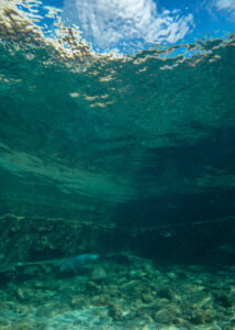
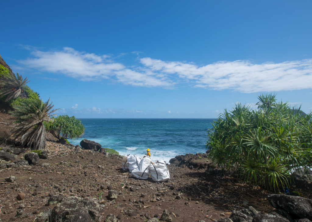
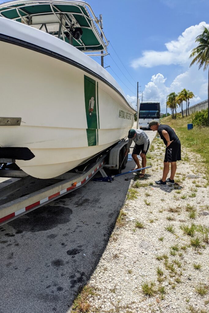
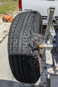
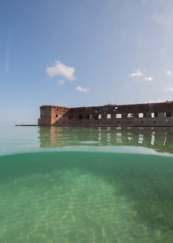
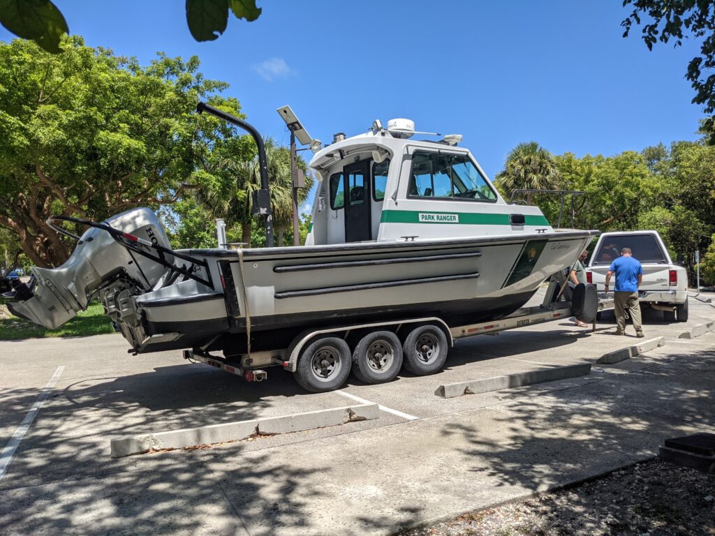
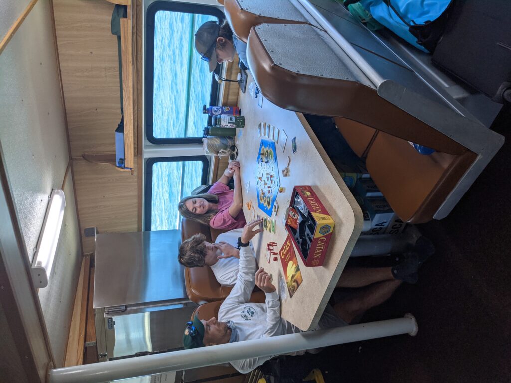
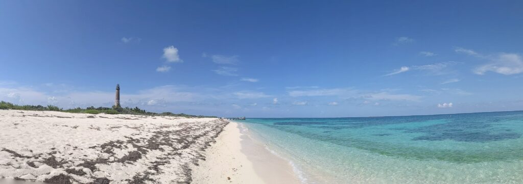
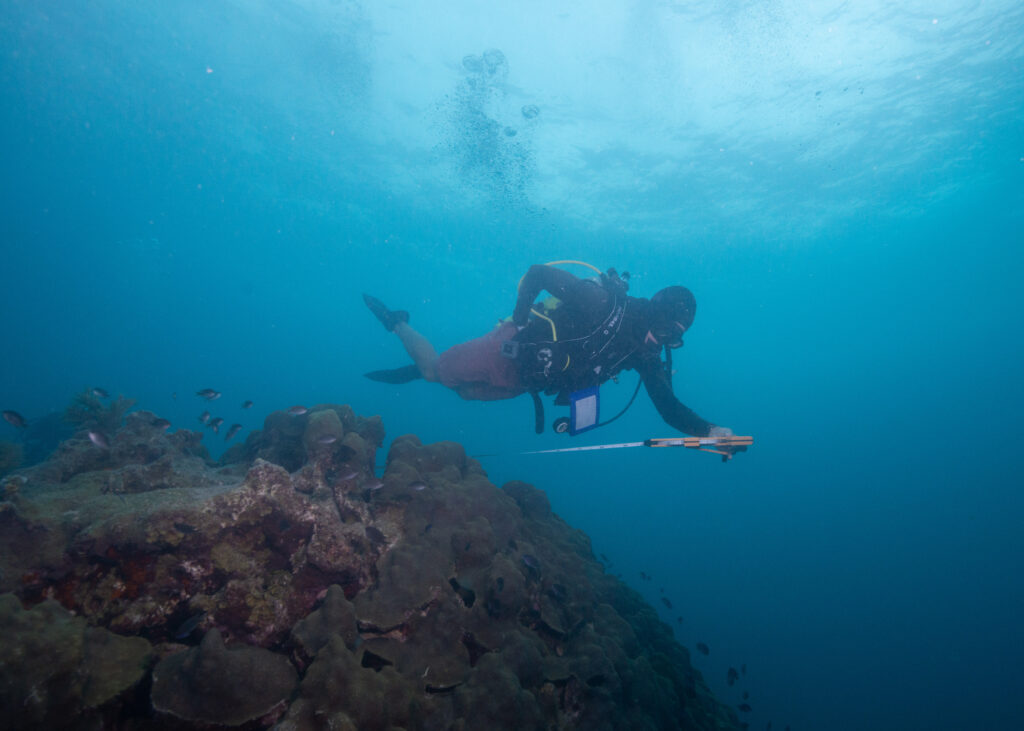
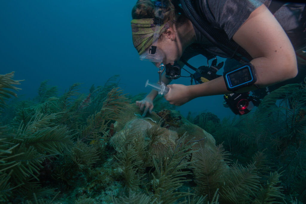
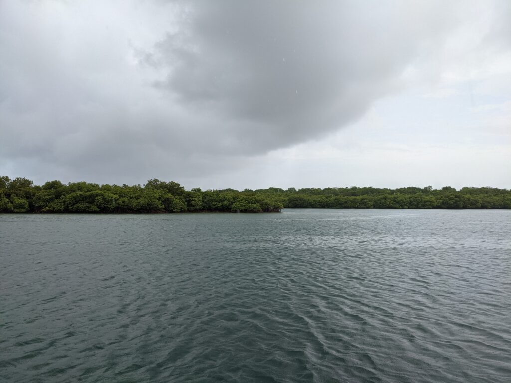
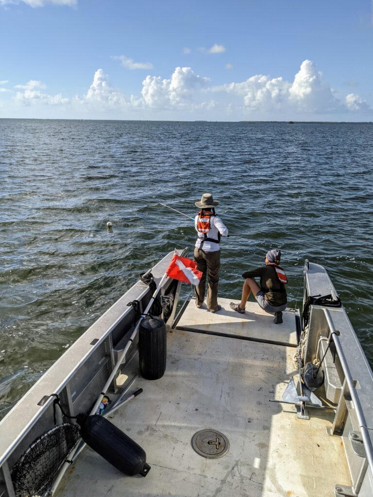
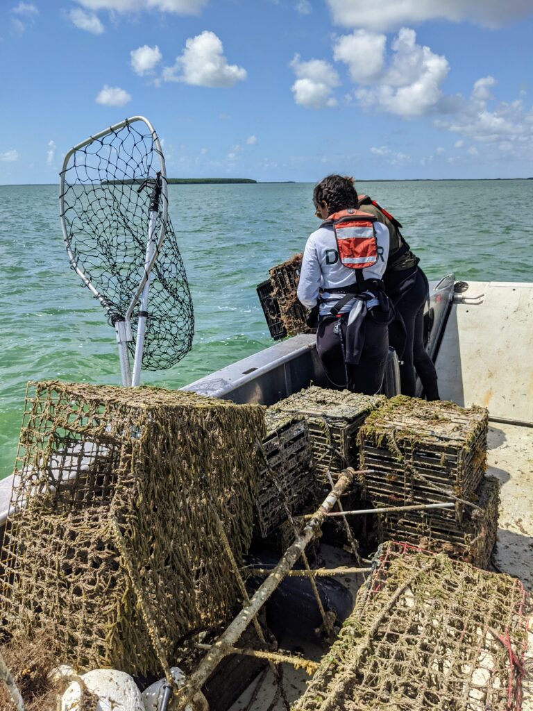
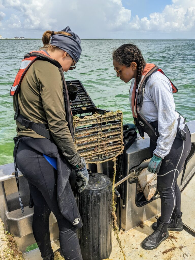
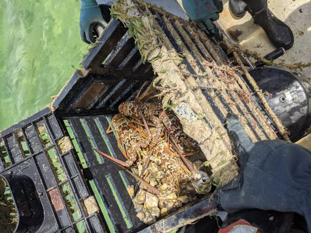
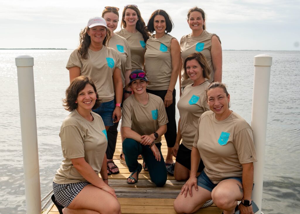
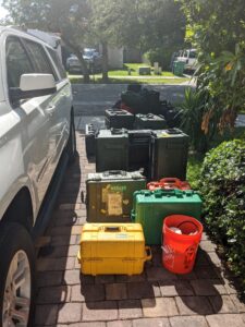
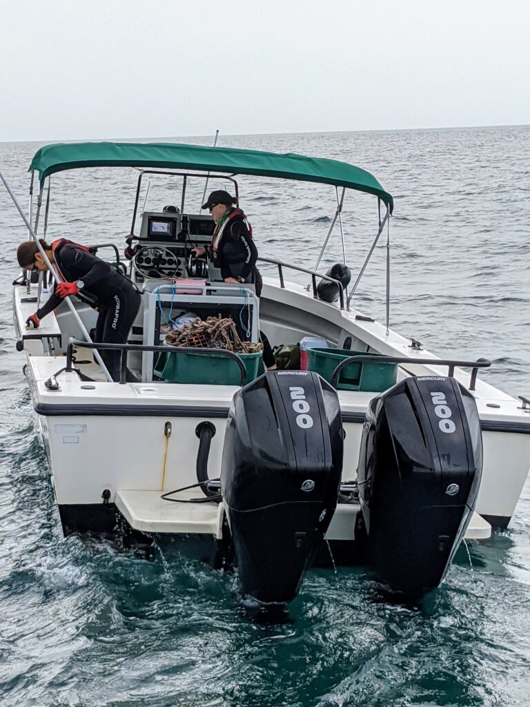
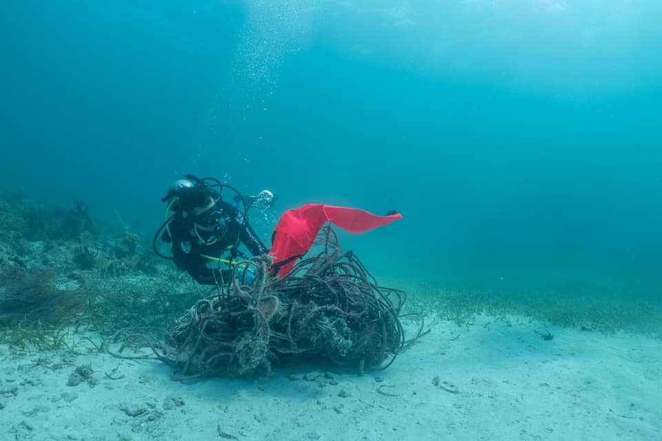
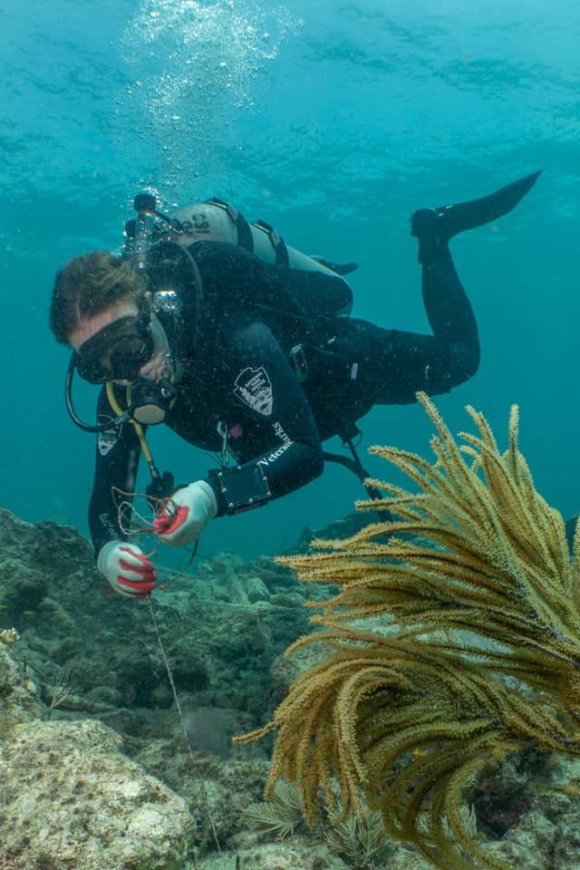
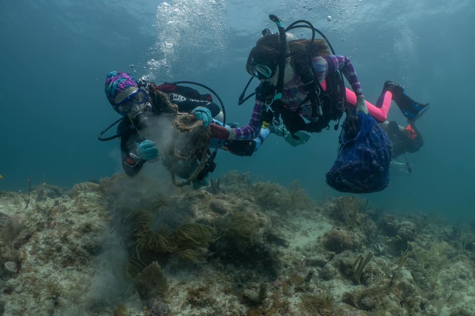
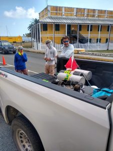
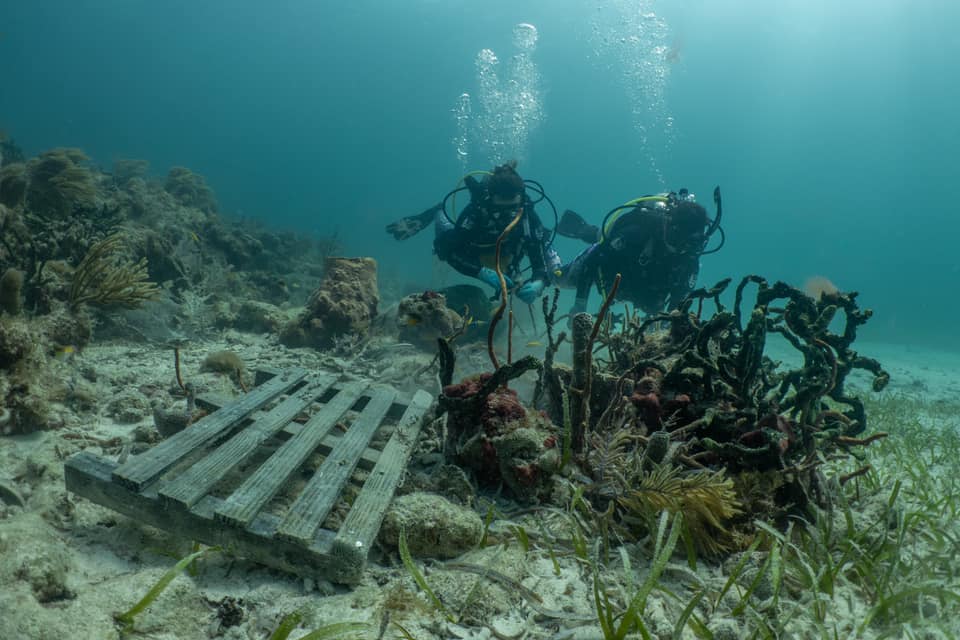
Biscayne National Park is a coastal haven of mangrove forests, coral reefs, and historical submerged shipwrecks. The 173,000-acre park in South Florida is 95% underwater, so marine debris removal is a priority for Biscayne’s natural resources team. This week’s project objective is to remove as much marine debris from the park as possible. The term “marine debris” encompasses a plethora of objects that are discarded in the ocean. Soda cans, car tires, monofilament fishing line, toilets (yes, toilets), nets, plastic bags, you name it. They’re tossed into the sea and can cause significant damage to coral reefs and marine life. Many of these items take decades, or even centuries, to degrade. When these harmful objects are left in marine ecosystems, they accumulate and pollute the ocean more and more each year.

This week’s project is extremely unique, and I can’t wait to get started. For one, the team consists entirely of women. Not only that, but five of the team members are military veterans from the Wounded American Veterans Experience Scuba (WAVES) program. The non-profit is a partner organization to the NPS Wounded Veterans In Parks (WVIP) program, which provides opportunities for veterans to volunteer with parks or programs like the Submerged Resources Center (SRC) and work alongside NPS divers on specific resource or maintenance projects. In addition to supporting the mission of the NPS, scuba diving offers countless therapeutic benefits due to the properties of an aquatic environment 一 the feeling of weightlessness, limited audio input, and less force of gravity. For military veterans, the freeing and relaxing nature of diving can further facilitate recovery from a number of service-induced injuries, from amputation to Post-Traumatic Stress Disorder (PTSD).

I’m excited to participate in such a unique experience for the veterans, and I’m particularly thrilled that we’re working as an all-female team. Personally, I’ve never done anything scuba-related with a fully female group. Most of my scuba instructors were men, and in my experience, men far outnumber women in the professional diving industry. Similarly, female representation in the armed services is small. Working in male-dominated work environments can have its challenges, especially when the job is fairly physically demanding. I’m hopeful that during the upcoming week, the women involved in the project will be able to work without feeling the need to “keep up with the guys”, an all-too-common pressure that many women feel in the workplace, especially in the armed forces.

The crew for the week! From left: Karen, Ashley, Annie, Abbie, myself, Linsay, Jess, Char, and Esme. Photo credit: Susanna Pershern

My internship schedule is packed until October, with the exception of a single week of downtime between my recent project in St. Croix and my upcoming assignment in Biscayne. I fly back home to Colorado for the off days. It’s a much-needed opportunity to catch up on writing, organize my photos, and repack for the next leg of my journey.

Come Saturday morning, I head to the airport to hop on a flight to Miami. I’m back in the groove of traveling (or so I think…), so I cruise through security and arrive at the terminal with plenty of time to spare. First, I sit down to reorganize my backpack. Airport security has a tendency to be suspicious of the wide-angle lens that fits on my underwater camera housing, so I typically pack the lens in the top of my bag before going through security and rearrange it prior to boarding my flight. After I reorganize, I grab breakfast, fill up my water bottle, and head to the gate.

The flight is nearly four hours long, so I’m planning to work after we take off. I fidget in my seat until the seat belt sign turns off. My morning cup of coffee has kicked in and all I want to do is put my headphones on, zone out, and catch up on blog writing. Eagerly, I jump up and reach for the laptop case in my backpack.

Strange. I can’t feel it. I dig deeper in the seemingly bottomless bag. It’s a laptop case, so it takes up a decent amount of space. At least, it does when it’s in the bag, which I quickly realize it is not. I immediately start mentally backtracking my steps. Within seconds, I know where my laptop is. It’s on the floor, next to a seat in the terminal. Gate B43. Well, it might be. Who knows at this point.

I’ve NEVER done this before. Sure, I’ve left the bathroom without picking up my cell phone, but I’ve always been quick to realize my mistake and turn around to grab it. Unfortunately, there is no option to turn around in this scenario. I’m rattled, but the situation is out of my control. I sit back into my seat, remind myself that it could be worse, and try to shake it off. I’ll handle it when I land.

Ultimately, there’s not much I can do to “handle” the lost laptop scenario. I file a report with lost and found and will just have to wait and see. Thankfully, the SRC crew is more than supportive when they hear about my predicament. SRC Chief, Dave Conlin, generously offers me the use of his personal laptop for as long as I need, and Matt Hanks, one of the team’s archaeologists, says he’ll check the lost and found in Denver when he flies out to meet us in a few days (the SRC men will be working on archaeological projects in Biscayne while we’re doing the WVIP project). It’s reassuring to feel like no matter what happens to the computer, I’m in good hands.

It’s Monday morning, and I’m piling into a packed-to-the-brim Suburban with Annie Wright, an SRC archaeologist, and Susanna Pershern, an SRC photographer. Annie is the project lead, and Susanna is documenting the project. Susanna and I are dive buddies for the week, so I’m looking forward to watching and learning from her. I wasn’t able to work on underwater photography much during my last project in St. Croix, but this week I’ll have plenty of opportunities to learn, practice, and hone my underwater photography skills. Having access to a professional makes for an even better situation!

Car and stacks of equipment next to the car

After loading the car, we drive to Key Largo and meet the women from the WAVES group. There are five veterans: Linsay, Abbie, Char, Esme, and Karen. Accompanying the group is Ashley, a WAVES scuba instructor, and Jess Keller, a former SRC archaeologist who now works at the University of Miami. At first, introductions are polite and somewhat reserved. I get the sense that everyone’s a bit nervous but simultaneously excited. I sure am! Our ten-woman group will be living together in an apartment above Quiescence Dive Services and diving together off a charter boat from Horizon Divers for the week. In other words, we’re going to be together A LOT. In my experience, I’ve found that there’s always an initial “sussing out” period when you join a fieldwork crew, especially when you don’t know anyone. You have to get a sense of everyone’s personalities, how they work, what their quirks are, etc… Usually, by day two or three, walls tend to fall down and people open up with each other more.

sunset and palm tree

The initial plan is to start diving on Tuesday, but a small tropical storm rolls through on Monday and continues into Tuesday, making the waters too rough for diving. The unexpected dry day is a good chance to prep my camera gear and get to know the group a little better. The veterans seem to be clicking with each other quickly, and I find myself being drawn into their conversations. There’s an unspoken sense of comradery between them that’s noticeable as they talk about their backgrounds, struggles, successes, and goals. They’re all incredibly eager to get in the water, and I can’t help but feel energized myself from the enthusiasm in the air.

On Wednesday, we’re able to go diving! The early risers, Char and Ashley, get up first and start the coffee. By 6:45, the apartment is bustling as everyone eats breakfast, makes lunch, and grabs essential items for the day. We load up the cars and shuttle down to the marina, where we meet our entirely female boat crew: Captain Dani, and mates Chelsea and Megan. The charter boat makes for a very relaxed run out to the dive sites. It’s spacious, comfortable, and moves with ease through the water (that’s all thanks to Captain Dani). It even has a head (boat toilet)! I try to remind myself that this will not be the norm for the rest of my internship. I’m used to schlepping tanks around, loading equipment onto the boat, and helping with mooring and docking, but because we’re on a charter boat, the captain and crew handle everything. I try to make good use of the extra time by experimenting with the camera and writing notes for my blog.

Captain Dani, left, and mate Megan.

Once we reach our first dive site, another boat appears with two more women aboard. Shelby Moneysmith and Vanessa McDonough are the SE Regional Dive Officer and Fishery and Wildlife Biologist, respectively, at Biscayne NP. They’re going to be meeting us at each dive site to assist with debris removal. Once they moor their boat to ours, Shelby and Vanessa don their snorkels, jump in the water, and swim over to our boat. They’re ecstatic to be participating in the project and give us a brief on the dive sites we’ll be visiting for the day.

Vanessa and Shelby met us every day to help with debris removal.

The team gets off to a fantastic start collecting debris. We’re on the lookout for monofilament lines, cans and bottles, fishing equipment, and whatever other debris we encounter during the dives. As we come across debris, each diver has a mesh bag that they can store it in for the duration of the dive. Larger objects, like derelict lobster traps, can be sent directly to the surface with lift bags. A lift bag is a piece of diving equipment designed to lift heavy objects from the seafloor. They’re made with airtight fabric and can be clipped to objects and subsequently filled with air from a diver’s second stage, pulling the object to the surface. Once a piece of debris reaches the surface, one of the boat captains drives over and pulls the object from the water. On the smaller side of things, monofilament fishing line is particularly important to find and remove. The small yet strong line can easily slice through soft corals and wrap around other marine creatures, like turtles and fish.

Jess Keller inflates a lift bag to pull a large pile of rope to the ocean surface.


Project leader, Annie Wright, pulls a monofilament fishing line up from the reef.

While the rest of the group is collecting debris, Susanna and I follow with our cameras. I desperately want to start snapping miraculous photos off the bat, but I quickly realize that this craft is going to take a LOT of practice. Thankfully, Susanna is patient with me and takes the time to give me suggestions underwater and answer my questions topside. At first, I feel flustered and clunky with the camera rig underwater. I’m not sure what to do with the strobe lights, how to manually adjust the camera settings correctly, or what to focus on in the first place. It’s overwhelming, but I quickly come to enjoy the challenges this new practice presents. Until recently, I had never been a fan of bringing a camera with me underwater. It always seemed impossible for me to adequately capture the colors, the activity, and the vastness of the underwater world. But, one of the biggest challenges of working in marine science is trying to effectively communicate issues and convey ecological change, and visual communication is an essential part of doing just that. So, I’m determined to do my best and figure it out.

It took me a few days to understand how to use camera strobes effectively. This was the first photo that was lit the way I envisioned!

Midway through the first day of diving, another boat appears on the horizon and moors up behind us. Pedro Ramos, the Superintendent for Everglade, Biscayne, and Dry Tortugas National Park, has been escorted out on the water by SRC Chief Dave Conlin and David Morgan, another SRC archaeologist. Like Vanessa and Shelby, Pedro dons a snorkel and swims aboard for a few minutes. He’s excited to meet the veterans and expresses his support and encouragement for the vets and the project.

As I talk to the vets more and listen to them converse with Pedro, I come to understand that having a mission is especially motivating to them. It makes sense, considering that they come from careers where everything is mission-oriented and objective-driven. To go out each day with the intention of locating and removing as much marine debris as possible gives all of us a sense of purpose, and an even more enjoyable sense of accomplishment when the day is over and there are trash cans full of debris on the boat.

The week progresses smoothly. I’ve abandoned any hope of retrieving my laptop from the Denver airport, but towards the end of the project, I’m not even thinking about it much since we’re having so much fun. I’m much busier both underwater and above water now that I’m working on photography. During each dive I scout around, looking for the veterans and snapping pictures of them pulling monofilament line off of corals and stuffing old glass bottles into their bags. Once we’re back home, I have to rinse the camera housing in freshwater, pull out the batteries to charge them (admittedly I forget this step a couple of times), and upload and organize the day’s photos on the computer. It requires quite an attention to detail, but I’m starting to find a rhythm.

Linsay and Abbie collect debris, stirring up some of the sediment on the seafloor

—–

It’s Friday afternoon, and the boat cruises back to the marina. I pull my phone out and am surprised to see that I have service (coverage is spotty on the water). Emails are coming through, and one catches my eye. It’s from the Denver airport lost and found. I’m not expecting any miraculous recovery updates, since it’s been nearly a week since I left the laptop in the terminal. But, to my disbelief and overwhelming joy, the email reads, “Lost article located…”. LOCATED! Absolutely giddy with relief and excitement, I run to the bow of the boat, where everyone is relaxing after the long day of diving. “They found my laptop!” I exclaim. Susanna jumps up, as excited as I am. “No way!” The rest of the team yells a collective “hooray!” as I dance around. Could this week get any better?!

—–

By the end of the week, it’s as if all of the women on the team have known each other for ages. We’ve laughed, cried, learned, and grown together. We’ve made an impact in Biscayne, and I think the project as a whole has made an impact on everyone involved. Overall, we collected 587 pounds of marine debris, from tiny lead weights to cumbersome derelict lobster traps. Just the monofilament line alone is enough to stretch across three football fields. On the photography side of things, I snapped nearly 500 photos during the project! I’m extremely happy to have made strides with my photography skills. It’s a lot harder than I anticipated, but the process of understanding the lights, camera, and my subjects in order to capture what I envision is totally addicting.

Our friends from the National Park Foundation joined us for a few days on the boat

There are so many people and organizations who made this week happen. The project wouldn’t have been possible in the first place without funding from the National Park Foundation and support from the SRC who created and manage the NPS WVIP program. Additional support came from the Women Divers Hall of Fame, an organization that recognizes women leaders and innovators in the diving community. To everyone involved, thank you. I truly hope it is the first of many all-female WVIP projects. I’d also like to thank Susanna Pershern for her patience, guidance, and encouragement as I work to improve as an underwater photographer. And of course, thank you to OWUSS and the SRC for making it possible for me to participate.

Next week, I’m staying in Biscayne National Park and working with the natural resources team on various projects. Check back in a bit for another week of adventures!


Share

If Coral Reefs Were Forests

NPS boat heading to sea from marina

Between long dive days, spending free time with the crew, and exploring the island, week two on St. Croix passes quickly. We continue conducting fish and benthic surveys for the National Coral Reef Monitoring Program (NCRMP) during the day, and the evenings become focused on data entry. On a good day we conduct around seven site assessments, and each site assessment needs to be entered into the National Oceanic and Atmospheric Administration’s (NOAA) online data system. Data entry can be tedious, especially when survey sites are particularly fishy (lots of fish species and measurements to enter), but it’s fun with the University of the Virgin Islands (UVI) and National Park Service (NPS) crews. On some nights, I hang out with the NPS guys. We all banter while Jeff prepares his nightly chicken and barbeque sauce dinner, and I bounce between checking out Lee and Mike’s underwater photos and entering data on my laptop. Other nights, I meet with the UVI group and finish data entry while listening to music, watching movies, and comparing our days on the different boats.

As the project continues, I find myself more and more elated to be diving again, especially after 2020, the year of jarring isolation. Scuba diving on a daily basis “fills my cup” — there is nothing quite like breathing underwater and being immersed in the ocean. It provides a sense of peace and perspective that has always been difficult for me to find above water. As soon as I descend, my senses settle with the quiet calm and I focus solely on the present moment. I can’t quite explain it, but I soak up the time underwater as we continue to survey the reefs. The more time I spend diving around St. Croix and working with the NCRMP team, however, the more I’m faced with an unsettling, somber realization.

At face value, this job may seem like a vacation of sorts, a lucky chance to spend two weeks on a Caribbean island and dive to my heart’s delight. However, for marine biologists (especially those working in the Caribbean), diving every day is not equivalent to a carefree vacation. In fact, it’s quite the opposite. Everyone involved in the NCRMP project comes from a marine science background. We all choose this field (or it chooses us, some might say), and from my perspective, everyone is incredibly passionate about what they do. That being said, having a deeper knowledge of coral reef ecosystems inarguably makes it more emotionally taxing to dive amongst the reefs because we cannot help but see what is happening — they’re dying. They’re being wiped out by diseases and bleached by warming waters. It’s impossible for someone who studies these delicate ecosystems to be ignorant of the ghostly white, ever-growing presence of bleached corals and the algae-covered skeletons that were once vibrant and thriving. Personally, I find it consuming my thoughts as I spend my second week on St. Croix. I feel a self-imposed pressure to make these blog posts lighthearted and cheery, but I also believe that the SCTLD outbreak in the Caribbean is a crisis, and it is incumbent upon me to write about the somber reality of being a marine biologist in this day and age. 

Brain coral with SCTLD damage

SCTLD takes over a brain coral. The white side has been killed by the disease. Photo credit: Dan Mele

In the last decade, Caribbean reefs have experienced unprecedented declines due to overwhelming stressors, from warming waters, to increased hurricane damage, to novel infectious diseases. These phenomena are global, but within the realm of the Caribbean, specifically, we’ve seen the rise of a new disease in particular. Stony Coral Tissue Loss Disease (SCTLD) has been wreaking havoc on the Caribbean reefs since it first appeared off the coast of Florida in 2014. SCTLD is a highly lethal, infectious disease known to affect over 20 species of hard corals, and it can quickly turn a diverse, bustling reef into a graveyard. The disease spreads rapidly — it can kill a hard coral within a month (note, some of these corals can be hundreds of years old) and spreads easily through the water column. 

Marine biologists have to deal with disease — it’s part of being a biologist. But SCTLD in particular is hitting hard, and not just underwater. Emotionally, it’s taking a toll on researchers and field techs in a way that I didn’t fully understand until coming to St. Croix. For one, it’s an unavoidable topic. It’s at the forefront of everyone’s minds because, frankly, it’s everywhere. Site after site, we jump into the water, descend to the seafloor, and witness the damage. Some corals show the early signs of infection: splotchy white lesions, indicating recently dead areas caused by SCTLD. Other coral bodies have been killed completely, leaving behind colorless, stiff skeletons. At a handful of dive sites, I can’t help but feel as though I’m floating through a mass graveyard, arriving too late to save anything and bearing witness to incomprehensible damage.

Scuba diver with SCTLD-infected coral in the foreground

A diver looks on at an infected coral. Photo credit: Dan Mele

After a long day, Jeff and I have a conversation about SCTLD as we’re driving the boat back to the marina. Jeff is a coral disease expert and has studied coral reefs since the mid-80’s. He’s been diving the reefs around the U.S. Virgin Islands since 1997 (nearly as long as I’ve been alive). I can’t even fathom how many hours he’s spent underwater, and for the last 25 years he’s been a firsthand witness to the Caribbean reefs’ changes. There’s a mixed emotional response from him as we talk about SCTLD and the state of the reefs in the U.S. Virgin Islands — a cocktail of exasperation, frustration, and sadness. I share these feelings with Jeff, and I find myself constantly wondering why other people don’t feel the same intense emotional response that Jeff and I do when we talk about the ocean and the future of coral reefs. We’re watching a natural disaster unfold before our eyes. Why aren’t more people talking about it? Why aren’t more people doing something about it? Where’s the sense of urgency?

I’ve lived in the foothills of Colorado for the last five years. Last summer, I watched three forest fires sweep through my local mountains within a week. When night fell, I would look west and see the glowing red and orange hues of flames dance and pulse on the mountainside. During the day, a dense cloud of smoke and ash hung in the sky. The fires were raging for weeks, forcing people out of their homes and destroying much loved recreational areas and trails. But, as soon as the fires appeared, the community was there. There were so many people driving into the mountains to try and help firefighters that public statements had to be released to tell people to stay home. There were fundraisers. There were donation events. There were news articles and updates every day. The community was watching the mountains they loved burn down, and they wanted to do whatever they could to fix it. 

I have to think that if the reefs around St. Croix were forests, and coral diseases like SCTLD were forest fires, the general public would be up in arms, donating money to rescue groups and rallying the community to help out however possible. If only they could see the reefs with their own eyes and understand SCTLD’s overwhelming presence, they would understand. Because this ecosystem lies beneath the waves and out of everyday view, though, many people struggle to understand that the same level of destruction that a forest fire imparts on a forest is happening to the coral reefs right this very second. 

Pillar coral with white lesions from SCTLD

SCTLD initially forms small white lesions on coral before eventually spreading over the entire structure. Photo credit: Dan Mele

This unfortunate reality is largely a result of barriers — barriers in communication and barriers in knowledge and understanding. A world-class photographer with a top-of-the-line camera system can take photos of SCTLD underwater. It’s taking photos that emotionally captivate and engage viewers that’s necessary, but challenging. Social science suggests that people consume information that aligns with their personal experience and worldview — in other words, people tend to care about the things that directly relate to their own lives. However, the majority of the population does not scuba dive. There’s a notable portion of the global population that has never even seen the ocean, let alone been in it. This leaves people like me, Jeff, and other marine biologists with a rather daunting challenge: conveying the urgency and significance of a massive problem like SCTLD to people who aren’t directly affected by it, and as a result, don’t really care. 

I’m always one to take on a challenge, but I can’t help feeling frustrated by how hard it seems to bridge the communication barrier between marine biologists and the general public. Sometimes our efforts seem like those of Greek legend Sisyphus, the man who was condemned by the gods to live out his eternal life rolling a large boulder up a hill, only to have it roll back down once he reached the hilltop. Realistically, we cannot fully erase the damage that SCTLD has done. As Jeff reminds our crew throughout the week, “you’re never going to see these reefs look like this ever again in your lifetime”. Despite that potential truth, as I work with the dedicated organizations and people involved in the NCRMP project, I am motivated by the fact that all of us still believe that the boulder is worth pushing. More so, they consistently push as hard as they can, day in and day out. They recognize that every bit of time, effort, and action matters when it comes to facing issues like climate change and SCTLD, and there’s an unspoken agreement amongst us as we move through the project: knowing that you can’t completely solve a problem does not mean that you shouldn’t continue to make the situation better. 

Close-up photo of a brain coral with a small white lesion from SCTLD

A close-up of an infected brain coral. Photo credit: Dan Mele

NOAA and the NPS are both driving forces in preserving and protecting areas like the Virgin Islands coral reefs, funding research efforts, and communicating the significance of protected areas to the public. They make missions like NCRMP possible. There’s also the University of the Virgin Islands (UVI), which has established a successful coral restoration program, where broken pieces of coral are collected from the reefs, grown and multiplied in their coral nursery, and planted back on the reef. All of the UVI grad students and lab techs involved in NCRMP are also heavily involved in the coral restoration program, and I can tell you that it’s in great hands. Meanwhile, The Nature Conservancy operates a coral laboratory and nursery on St. Croix, and has partnered with leading coral science organizations to tackle the Caribbean reef crisis with novel technologies and experimental techniques. Collectively, these organizations continue to do what they can to mitigate damage to ocean ecosystems, rebuild what’s been lost, and encourage further conservation efforts. 

As I pack my bags and prepare to depart from St. Croix, I continue to reflect on my experiences over the last two weeks. One of my primary goals when I began this internship was to share what I learn along the way in a thought-provoking, engaging manner — I want to close the communication gap between those with their boots on the ground and people who aren’t directly exposed to the ongoing issues and efforts in the national parks. This project has motivated me even more to do just that. Thank you to everyone from the NCRMP mission for welcoming me onto the team, sharing your thoughts and stories with me, and helping make the first project of my internship a success. Additionally, a big thanks to Dan Mele for allowing use of his photography in this post. Next stop: Biscayne National Park!

five people on the bow of a boat

Last day of NCRMP celebrations! From left: Jeff, me, Kaya, Kristen, and Mike

Share

Scientific Surveys, Seasickness, and Surprises in St. Croix

The journey begins! The first destination for my internship is St. Croix, one of the U.S. Virgin Islands. I’ve never been to any of the Virgin Islands, so prior to leaving Colorado, I take some time to research the region and brief myself on its history. The largest of the four U.S. Virgin Islands, St. Croix measures in at 82 square miles. Reading this, I expect it to seem absolutely massive in comparison to the eight square mile island on which I lived in Thailand! Additionally, St. Croix is home to not one, but three national park sites: Buck Island Reef National Monument, Christianstead National Historic Site, and Salt River Bay National Historic Park and Ecological Preserve. On land, there are 18th century buildings scattered throughout the Christianstead waterfront, the oldest being Fort Christiansvaern, built in 1738. The five historical structures provide a glimpse into aspects of government on St. Croix during Danish sovereignty, from the colonial administration, to the international slave trade, to the military and naval establishments. 

Downtown historic church

The historic buildings in downtown Christianstead offer a glimpse into St. Croix’s history and culture.

Danish Customs House

The Danish Customs House in downtown Christianstead

Underwater lies Buck Island Reef National Monument, the first designated Marine Protected Area (MPA) within the U.S. National Park Service. It wraps around two-thirds of St. Croix, and was dubbed by President Kennedy in 1961 as “one of the finest marine gardens in the Caribbean Sea”. Kennedy recognized the scientific, educational, and aesthetic importance of the area, and created the national monument in the hope of preserving its beauty and rich biodiversity for the benefit of the American people. Sadly, the reef has faced a number of challenges in recent decades. Invasive lionfish, hurricanes, disease, and coral bleaching events have all taken their toll. Currently, the biggest threat is Stony Coral Tissue Loss Disease (SCTLD), a lethal coral disease that has been spreading rampantly throughout Caribbean reefs since 2014. I’ve come across the disease before (during my thesis fieldwork in Cozumel, Mexico), and I’m nervous to see the extent of the damage around St. Croix.   

My two week assignment is to assist with the National Coral Reef Monitoring Program (NCRMP), a biannual survey that aims to assess ecological reef conditions such as fish species/composition/size, benthic cover (i.e. which substrates and organisms are present on the seafloor), and coral density/size/condition. Ultimately, the information gathered from NCRMP provides geographic and ecological context to inform and supplement local reef monitoring efforts, and aids general studies of tropical reef ecosystems. NCRMP covers a huge region, including Florida, Puerto Rico, USVI, and the Flower Garden Banks National Marine Sanctuary off the coast of Galveston, Texas. The goal, for our current purposes, is to assess approximately 150 sites around St. Croix during the next two weeks. Typically, the NCRMP team surveys closer to 250 sites, but we’re working with a skeleton crew this year due to travel restrictions for NOAA personnel who are normally involved. Still, there are around 20 people working on the surveys this year, coming from a handful of different agencies: NPS, NOAA, the University of the Virgin Islands (UVI), the Nature Conservancy (TNC), and the Virgin Islands Department of Planning and Natural Resources (DPNR). 

St. Croix Site Map

All of the sites to be surveyed around St. Croix and Buck Island are identified with a black dot. We will try to get to as many sites as possible in the next two weeks.

—–

It’s Saturday morning and I finish packing my bags, careful to weigh them so I don’t exceed the 50 pound limit per bag at the airport. I have a good feeling that the portable luggage scale I purchased is going to come in handy for the next few months. I try as best I can to cut the weight down, but I’m traveling for almost four months and need all my dive gear, running gear, underwater photography equipment, and of course, snacks. I end up with two 50 lb. bags to check and one carry-on that weighs around 25 lbs. Of course, I’m not thrilled by the thought of carrying my own bodyweight in luggage, but I reconcile my unease with the thoughts that  I’ll be both extra-prepared and have stronger shoulders by the end of the trip!

Luggage packed

I’ve had many people offer to “carry my luggage” for the duration of my internship. If only I could take someone up on it!

I have an overnight stay in Miami before my flight to St. Croix, and I’m incredibly thankful to have some help finding a place to crash for the night. Steve Barnett, the President of OWUSS, graciously connects me with Kenny Broad, an OWUSS scholar from the early 90’s. Kenny is now an accomplished cave diver, National Geographic Explorer, and professor with the University of Miami. He’s based in Miami and kindly offers me his guesthouse for the night, which I gladly accept. 

Plane window view

I snagged the window seat on my flight to Miami and caught some gorgeous views.

After a restful night in glorious air conditioning (thanks again, Kenny!), I head back to Miami International Airport to catch my flight to St. Croix. I know that NPS Dive Officer Mike Feeley, my point-of-contact for this project, is on the same flight as me, so I send him a slightly anxious text before boarding. “Hey Mike, just in case I have bad phone service when I land at STX, I’m wearing a grey hoodie w/ black pants and a blue backpack. Will find you at baggage claim. See you in a bit!” Mike texts back with a description of his outfit, but I’ve already been told that he’s quite tall, which ends up being the easiest way to track him down once we land in St. Croix. His height and broad frame sticks out amongst the sea of travelers, and the NPS hat he’s sporting confirms my suspicions that he’s the guy I need to find. Mike is a good-natured, pop music loving fish biologist/ecologist with extensive experience working in the Caribbean. We chat in the airport while we wait for our bags, and are soon greeted by the rest of the NPS crew, Jeff Miller and Lee Richter. Jeff is a coral biologist/disease specialist who’s worked with NPS for decades. Initially, he seems fairly straight-faced, but I’m quick to learn that he has an endless bank of puns and dad jokes that make him and everyone around him chuckle throughout the day. He’s also an impressive athlete, and is the first known person to swim 23 miles unassisted around St. John (one of the smaller Virgin Islands). Similarly, NPS marine biotechnician Lee Richter is an avid athlete and outdoor enthusiast with a seemingly endless supply of energy. Mike, Jeff, and Lee all work for the NPS South Florida/Caribbean Inventory and Monitoring Network, so they’ve spent a lot of time with each other, both underwater and above. They catch up with each other in the car, and Lee and Jeff are more than happy to give me tips on where to run as soon as I express my hope to continue training for some upcoming endurance races after I’ve completed the internship. 

The crew gives me a small tour of St. Croix, starting with the most important locale: the grocery store. (If you haven’t caught on, food plays something of an outsized role in my life.) Groceries are expensive here (welcome to island life), but they have most of the items you’d find in a grocery store stateside. We stock up on supplies and fill the bed of the truck with water, toilet paper, snacks, rotisserie chicken, and barbecue sauce (Jeff needs little more than chicken, barbecue sauce, and pita chips to fulfill his caloric needs). After the grocery store, we head to the condos we’ll be staying at. As we drive across the island, I remember my days on Koh Tao, and can’t help but compare the two islands in my mind. Koh Tao has roaming stray dogs, while St. Croix has free-ranging chickens everywhere. People drive on the left side of the road on both islands, but cars seem to be preferred over motorbikes here. As I continue to make mental note of the obvious differences, I feel an immediate, familiar calm to be back on “island time”. Once we arrive at the condos, I unpack my gear, chat with my roommate, and prep my dive bag for the next day. We’ll be diving first thing in the morning, and I can’t wait to jump in the water.

Groceries in the pickup

Dive gear and sustenance. What else do you need?

It’s Monday morning, the first day of NCRMP! Before heading out on the boats, the entire team meets for a project briefing at the NPS headquarters in town, located in part of the Christianstead National Historic Site, the Old Danish Customs House. The building was originally completed in the early 1840s, but underwent a complete restoration in 2010 after hurricane damage rendered it unusable. These days the first and second floors are dedicated to NPS park management. We all gather in the building and I eagerly meet more of the team. Most of the group consists of graduate students who are part of the Marine and Environmental Science program at the University of the Virgin Islands (UVI). They have a collective “quirky scientist” sense of humor that I love, but I embarrassingly can’t keep up with the banter. They’re obviously deeply knowledgeable about Caribbean corals and fish, and they throw around scientific names and references with such ease that it makes my head spin. Despite being a little overwhelmed, I’m thrilled to be surrounded by so many people who work in marine science—the atmosphere is filled with excitement and anticipation. We go over safety and logistical information, split off into three different boats, and start throwing gear in the trucks. 

Find Your Park sign at NPS HQ


Eddie Boy

Jeff and Kristen start loading up Eddie Boy, our ride for the next two weeks.

To my dismay, I’m told I have to stay out of the water because my dive-physical paperwork hasn’t yet been sent from the doctor’s office to the NPS. Trying to make the best of it, I plan to use the day topside as an opportunity to review survey protocols and study up on local fish and coral identification. I’m on the NPS boat, Eddie Boy, with Mike, Jeff, Alex Gutting, and Kristen Ewen. Alex and Kristen are both alumni from the graduate program at UVI, and continue to pursue coral reef research and fieldwork. Kristen is a Biological Science Technician and Dive Safety Officer for the St. Croix park, and shows a level of dedication to her work that I find quite impressive. She has wrangled rats (it’s a constant battle to keep them off of Buck Island), saved turtles, and helped rebuild coral nurseries around the island. Alex has also been pivotal in the island’s coral restoration efforts, and currently works for the Nature Conservatory as St. Croix’s Coral Conservation Coordinator. They’re both laid-back, proactive, and extremely knowledgeable about the local underwater ecosystem. I’m eager to learn from them and, more especially, to dive together. 

Alex setting up gear

Alex assembles her dive kit on the boat

After shuffling tanks and gear from truck to boat, our team takes off. The run to the first dive site goes quickly, but I soon notice things going wrong. A headache develops. My stomach starts to turn. I’m incapable of taking my eyes off the horizon without the feeling of nausea. The familiar, yet dreaded, feeling of seasickness begins to set in. 

I’ve dealt with seasickness before, but normally it subsides as soon as I jump in the water and head underwater. Today, however, I’m stuck on the boat for the day, and I have no other option but to fight it topside. Ultimately, I lose the battle. For the next few hours, I alternate between leaning overboard to provide food to the fishes, and laying in a corner of the boat deck with my eyes closed, listening to the rest of the crew jump in and out of the water. Thankfully, everyone is sympathetic. I feel significantly better once we get back to land. We spend the drive home exchanging war stories. In an attempt to mitigate my self-consciousness, Jeff tells a story about another intern. “This poor intern,” he starts, “we pick her up on her first day and take her to this local restaurant, great spot we think, and we all have dinner. The next day the food poisoning kicks in and we have to take turns jumping off the boat and swimming downstream for a few minutes to get everything out between dives. Just terrible.” I take a moment to appreciate the fact that I only had to deal with vomiting, and not other forms of GI distress. We stop at the store to stock up on Dramamine, and I cross my fingers for a more successful day tomorrow. 

Seasickness stinks

My favorite spot on the boat for the first two days of the project.

To my dismay, Tuesday isn’t much better. The waters around St. Croix are normally choppy, but even the most seasoned divers are getting sick today. Eight-foot swells knock the boat back and forth all day long. I manage to make it in for the first dive, but even with a healthy dose of the anti-seasickness pills, I’m not able to keep it together for the whole day. Back to the floor of the boat for me. 

The first two days are mentally challenging. Seasickness isn’t something you can just will away, even when you try your hardest. Once your inner ear starts disagreeing with your eyesight, the brain reacts with a burst of stress hormones, and suddenly you’re incapacitated—physiologically convinced that you’re in the spin cycle of a washing machine. I find it especially difficult to deal with seasickness when other people around me don’t have it. In this case, it makes sense that I am the sole victim, seeing as I haven’t been on a boat in the last year, while my crewmates spend many of their workdays out at sea. Despite knowing this, it’s tough to spend the first two days of the internship I’ve anticipated for over a year feeling absolutely awful and, to that end, incapable of diving or helping the crew. Is this how it’s going to be all summer? Am I not cut out for this? Anxious thoughts preoccupy my mind for much of Tuesday. I’m supposed to be working and contributing, not sitting on the sidelines. I worry that my crewmates are starting to question my abilities as much as I’m questioning myself. Desperately hoping to get past this, I try to draw from my ultrarunning experience and focus on problem-solving. What can I control? How can I fix this, going forward? 

On Wednesday, I’m determined to avoid getting seasick. I take one Dramamine in the morning (apparently three is overkill and makes things worse, as I learned yesterday), followed by a larger breakfast than usual. I bring lots of food and water for the boat, and I learn that the weather is supposed to be better today. At long last, I get to experience a full day of diving on St. Croix. Finally! We celebrate my revival and a day of calmer weather, and Mike begins to lead me through training. 

I can finally dive!

By the middle of the week, I’m up and about on the boat (and MUCH happier) thanks to the wonders of Dramamine.

NCRMP surveys are focused on two main types of data collection: fish surveys and benthic surveys. There are two people per team, and both assessments are required at most sites. One person stays on the surface to drive the boat, and the other four divers drop down to conduct the surveys. I’ll be doing fish surveys for the whole project, which involves recording all the fish species seen at a site. We take note of fish counts and sizes first. Next, we do a quick environmental assessment, which provides details on the type of site and the condition (anything from sand patches with dominant seagrass cover to aggregate reefs with healthy corals). Meanwhile, the benthic team assesses coral cover on the seafloor by laying out a transect tape and documenting which coral, algae, or seagrass species are touching the tape. These surveys typically take about 25-35 minutes, so there’s a lot of jumping in and out of the water all day. On a good day, we can hit six or seven sites. 

Kristen and Kaya

The crew: Kristen (left) and Kaya (right), both sporting their underwater themed leggings.

Jeff Miller

Jeff, ready to jump in.

Mike Feeley

Mike awaits the go ahead from Kristen to jump in. The dive flag buoy gets tied down underwater and helps the boat driver locate the team when they finish a dive.

It takes me a few dives to get used to the routine. Despite having watched everyone on the boat execute dives and discuss protocols for the first two days, I’m anxious about correctly executing the dive as I buckle the straps of my fins and sit on the side of the boat, ready to back roll off when we are on site. Because we need to survey specific coordinates for each dive site, everyone has to be ready to roll into the water as soon as the boat hits its GPS waypoint and the driver says, “Go divers, go”. There’s no lingering at the surface, as the current can quickly take you away from the designated site. Instead, we do a negative descent, an entry technique that involves squeezing all the air out of our BC before we jump in so that we start sinking as soon as we hit the water. I haven’t done this sort of entry much in the past, so it’s jarring to jump overboard and begin free falling through the water within seconds. I notice my heart rate shoot up during the first few descents, but I’m thankful for the opportunity to practice the entry method. Once we fall to the seafloor my heart rate calms, and I am back in my element.

Collecting data underwater

Kristen catches me in the middle of a survey as I record fish numbers and sizes. The red and white fish in the photo are squirrelfish. (photo credit: Kristen Ewen)

Clipboard underwater

Essential data collection equipment – clipboard, data sheet, and a pencil.

By Thursday, I’m elated that I haven’t experienced any further seasickness. Finally, I begin to feel like I’m hitting my stride. The crew is settling into a rhythm as well, and we all seem to have ways to boost morale and keep the collective energy up. Mike is the DJ of the boat (I push for 70’s rock, but today’s top hits win out) and Jeff provides clever puns and one-liners throughout the day. I bring along chips, gummy bears, or cookies to share every day. “Ah, the health food aisle,” Mike jokes when he finds me in the junk food section of the grocery store as we make our daily stop on the way to the marina. We have a long day, so snacks are crucial. Our sites are on the other side of the island, so we have to nearly circumnavigate the whole of the island. The run to the first site takes an hour and a half, but it’s a great chance to see the less populated and more wild areas. When I see the unpopulated Jurassic Park-esque green cliffs on the south side of the island, I wonder what it must’ve been like to discover the island in its original state, untouched by people. 

Ocean view from the boat

One of the UVI boats cruises back to shore at the end of a workday.

The untouched side of St. Croix

Untouched green cliffs on the south side of the island.

The day is going smoothly until Jeff notices that the dual engines aren’t moving in unison when he steers. I scan over the engines and realize that, to our collective panic, the steering system has broken. I’m able to grab the bolts that broke off before the ocean sweeps them away, and Jeff and Mike manage to fit one bolt back into place. It’s enough of a temporary fix for us to get back to the marina, but we have to cut our dive day short. 

Mike fixing boat

Mike works on a temporary fix for the boat’s steering system.

On Friday, Jeff has made dozens of calls to try and get Eddie Boy fixed, but a mechanic can’t look at it until mid-afternoon. Luckily, the NPS has another boat in the marina that we can use for the day. Kestrel is a small boat, with a firm “three points of contact” rule when it’s moving. It also has less cover, so most of us don our wetsuits pretty early in the day, as being doused with saltwater on the way to the first dive site is a given. It’s a beautiful day for diving until mid-afternoon, when a storm rolls in and gives us a heck of a return ride. I’m amazed that one pill in the morning can make eight-foot swells and churning waves somewhat fun—the joys of modern medicine! By the end of the day, however, and after a week full of unexpected ups and downs, the crew is ready for the weekend. Personally, I’m excited to catch up on writing, go trail running on the east end of the island, and to spend some time with the rest of the team I’ve yet to hang out with.

Landscape of St. Croix

I love the bright greens and blues of the island and its surrounding waters.

Share