Category Archives: 2010 National Park Service

Washington, DC

After my short stay at the Delaware Water Gap, I packed my bags and drove from Milford, Pennsylvania to Washington, DC. It was a decent drive and there wasn’t much traffic, but I was still thankful to have a GPS system to help me navigate the way. I was instantly aware of when I was approaching the city because traffic was thicker and there were fancier cars around me. When I entered the city, the traffic increased and I slowly rolled from light to light until finally making my way to my hotel.  Once I got there and unloaded my bags, it took me an hour to drive 5 miles to the airport to drop off the rental car. I felt liberated when I could finally travel the city either by metro or on foot.

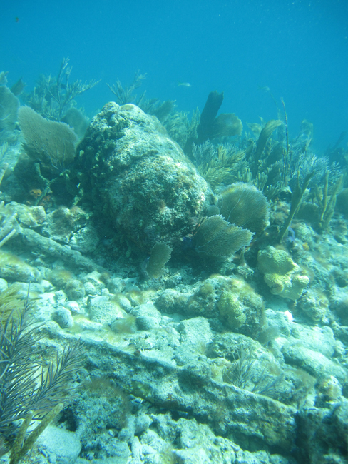
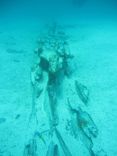
To my surprise, I was amazed by the number of people in the city and how they acted and dressed differently here. It was not because I had never experienced a big city before, because I have; but because it was the first time I had been somewhere so urban after spending time in highly remote areas this whole summer. The contrast between places I visited like Dry Tortugas, Kalaupapa, and Isle Royale to a big city like Washington, DC is stark and dramatic. My appreciation for isolation and untouched natural beauty has definitely increased over the past few months. However, I also realized that none of that isolated, natural beauty would be here if people in Washington, DC didn’t work for these fantastic natural and cultural wonders to be set aside, protected, and managed by the federal government for all to enjoy. After everything I had seen, it was hard to wrap my mind around the fact that I was actually here, at my last stop, to visit the national headquarters which is where all of the important decisions are made that affect National Parks.  

My first day, I headed over to the National Park Service headquarters on “Eye” street  to meet with Marine Resource Management Specialist, Cliff McCreedy. Then, Cliff and I took the subway over to the National Oceanographic and Atmospheric Administrations Headquarters where I gave a speech about my summer adventures to several different program directors there. After that, we took a quick lunch break and then headed back to the NPS headquarters building. I was invited to share my experiences in a “Brown Bag Seminar” in the Office of International Affairs conference room.  They are called “Brown Bag Seminars” because people bring their food to eat while they listen to speakers during their lunch hour.  After my speech, I sat down with Cliff and he explained his role in the Washington Office to me and told me about some key issues that are affecting the marine resources in National Parks and what he is doing to help manage them. Among other tasks, he provides technical assistance for outreach and education program development for ocean parks as well as parks in the Great Lakes. Also, he is the Natural Resource Representative on the NPS National Dive Control Board (NDCB.) The NDCB is the administrative council of regional dive officers and other representatives who make sure that the diving done within the park service is complying with safety standards and regulations as well as ensuring that park divers receive the proper training to become or remain certified park divers.

The following day I got to listen in on a conference call Cliff was having regarding ocean resources. Then, I walked past the White House on my way to the National Park Service Director’s Office to give my speech one last time as well as meet with key people who influence NPS policies.  After that, I went back to the headquarters on Eye Street and met with Public Risk Management Specialist, Sara Newman. She told me about the measures they are taking to keep employees and visitors safe in National Parks, which are inherently dangerous because they are in the wilderness and can be remote. Then, Cliff and I met with Wendy Davis, Servicewide Education Program Coordinator, in a conference call with Lynn Murdock, Interpretive Specialist Liaison. We discussed education in national parks and how to be more effective by connecting the public to the natural resources available to them. They are trying to go in a new direction by making more information available on the internet and also using films or live interactive video programs such as “Channel Islands Live” to inform people about their National Parks.

Ending my internship in Washington, DC was very beneficial to my understanding of the system in which all of the National Parks I visited operate under. Because of those who navigate the legal and political field of resource management and funding here in Washington, all of the world can enjoy the pristine natural beauty found in North America in areas that have been designated as National Parks. This internship as a whole has been so incredibly valuable to me and I feel tremendously fortunate to have experienced America’s underwater National Parks from the inside, by working and diving with the key experts in the fields of biological and cultural resources, maintenance, and law enforcement. Having seen all that I have, I feel proud to be an American and appreciate what our country has done to preserve our wild lands, lakes, rivers, and oceans to keep them pristine for future generations.

 Thank you to Cliff McCreedy, Jeff Olson, Sara Newman, Wendy Davis, Lynn Murdock, Jonathan Jarvis, and everyone who came to listen to my speeches about my internship!

Also, I would like to thank the Our World Underwater Scholarship Society and the National Park Service’s Submerged Resources Center for making this amazing opportunity possible for me.  This internship has surpassed even my highest hopes and expectations, and I feel so lucky to have been given the chance, funding, and support to make it all happen. You have changed my life by widening my perception of the United States, the National Park Service, and professional scuba diving.  Thank You!

Share

Deleware Water Gap National Recreation Area

After arriving in Allentown, Pennsylvania, I rented a car and drove to the headquarters of Delaware Water Gap National Recreation Area to meet up with Law Enforcement Ranger, Mike Croll. After he showed me the dive locker, he gave me a tour of the park while telling me about his job there. Mike has been working at Delaware Water Gap for over 20 years and has a wealth of knowledge about the resources and extensive experience working Law Enforcement in the park. The Law Enforcement division at Delaware Water Gap differs from other parks I’ve been to this summer because some of their rangers also work as park divers. These rangers are trained to retrieve lost bodies with the use of scuba. Some parks rely on external agencies for this, however, at Delaware Water Gap the logistical circumstances and response times of other agencies make it a necessary responsibility of the Delaware Water Gap dive team.

Since it is not the most pleasant job, the dive team members cope by focusing on the most important reason they are doing it: returning the missing person is essential for family and friends to have closure and start the process of grieving a death. While not everyone is suited for this job, it must be done for the sake of those who care about the person.  One of the more difficult things that Mike explained to me was that while they try to stay emotionally disconnected while searching for the body, they are also involved in notifying the families which requires a deeper level of compassion.

The following day I made a dive on the only cultural resource in the river, a boxcar that fell into the river from a train wreck at Kittatinny point. This also served as a checkout dive to familiarize myself with the river conditions. The water was clearer than at the St. Croix, and much warmer than Isle Royale, so I considered it to be a nice dive. Also, I was surprised by the amount of fish I saw while down there. On the next dive I practiced navigation in the current. I did this by taking a compass bearing on a point a little farther up river from where I wanted to end up on the opposite side of the river, and swimming towards it underwater. I was surprised at how accurately it worked even in a current and I was right on my target.

The next day, I participated in a training that was held for the divers to refresh their search and recovery skills.  Mike created a mock drowning scenario by dropping a dummy body in the river and acted as a witness. It was my job to interview the witness and get a “point last seen” in order to mark a place to begin searching. Mike told me that multiple witnesses are helpful, but the quality of information that the witnesses give is more important. For example, it would be a very traumatic experience for someone who was connected to the victim to watch the event take place, therefore their perception of the experience may be altered. However, someone unrelated who happened to see it may give better information. Factors such as the vantage point, currents, and other circumstances may also affect where the body may be found. However, the most important factor is the safety of the dive team. Since drownings often occur in swifter conditions, it is the crucial to evaluate the scene to determine whether or not is appropriate at that time to put divers in the water and conduct a search. Although it is important to find the person as quickly as possible, it is not worth risking the lives of the recovery team.

Also, divers use full face masks and two way communications like the ones used at the Channel Islands and the USS Arizona for safety purposes. The support team on the boat can speak with the divers to guide them in their search. Additionally, when the body is found, those on the boat are alerted and can prepare to bring it up. Another advantage to the mask is that it protects the divers against contamination from the person they are bringing up, who may have been in the river for an extended period of time.

After we marked the point last seen with a buoy, the divers swam to it and performed a search by drifting in the current while feeling along the bottom. Because the currents make entering and exiting the boat difficult with full scuba gear in deeper water, all of the dives were conducted from the shore. The divers found the dummy body on the third drift near the buoy, and brought it to the boat where we pulled it out of the water. If they had not found the body after a few drift dives, then systematic search patterns involving ropes would be used to comb the bottom of the river until an area could be considered “cleared” and the body was not there. If the body drifted significantly, this could be a particularly arduous task. Searching every surface of the bottom in a wide river in low visibility can take weeks and is discouraging for divers, especially while trying to help the family of the victim.

Although I learned that it is not necessarily something that I am cut out to do, I appreciate the courage of those who perform this service for the benefit of the people who need it most-the families who are mourning the loss of a loved one. My goal during this summer internship was to experience the diversity of diving that is executed by the National Park Service. Visiting the Delaware Water Gap taught me about a type of diving that I had not yet experienced, Law Enforcement diving. I would like to give a sincere thank you to Mike Croll, Bill Weber, Andy Olexon, Chris Kross, and Eric Lisnick for teaching me about the service that they do there.

Share

Isle Royale National Park

To make my way to my next destination, Isle Royale, I met Susanna Pershern from the Submerged Resources Center (SRC) at the St. Croix National Scenic River headquarters in Wisconsin. We drove to her brother’s house to meet with Brett Seymour and Tara Van Niekerk who pulled the trailer full of gear from the SRC headquarters in Denver, Colorado. The SRC team was on its way to Isle Royale to work with Woods Hole Oceanographic Institute (WHOI) to film shipwrecks in the park using special cameras that enable the production of 3-D videos. One thing I learned during my experience in Michigan was the amount of equipment it takes to run a complex operation such as filming something underwater. It only gets more complicated when it is in a remote location such as an island like Isle Royale or Dry Tortugas. Added to the dive equipment and camera equipment are personal belongings and 3 weeks of food for 8 people, as well as extra supplies that must also be brought along.  Once we had transferred our gear into the trailer, we hit the road for Houghton, Michigan and arrived there about 5 hours later. Dave Conlin, who had flown in from Denver, Colorado was already at the hotel when we arrived.  

The following morning we drove down to the dock with the trailer and put all the gear into carts that would be loaded on to the ship with an ATV before boarding. Then, we all headed to the grocery store to pick up food for the trip. While the rest of the crew was shopping for three weeks of food, I was only shopping for one week since I would be leaving the island that weekend to move on to my next destination.  As you may imagine, shopping for food for that amount of time and knowing that you will not eat anything other than what you bring is not an easy task. The SRC crew, Susanna especially, knows that it is easier to buy more than you think you will need and have extra instead not having enough and going hungry. I followed the same principle knowing any food I left behind would be used by the crew after I left. Once we bought all the groceries, we took them back to the dock to load them into more carts. Our perishables were stored in the refrigerator on the boat to ensure they did not spoil before we left.

The boat was supposed to take us out to the island the next day, but it was cancelled due to stormy conditions on the lake.  We went down to McLain State Park to look at the waves, and I was amazed how much Lake Superior looked exactly like the ocean. The water was the color of the sea and had waves that broke on the sandy beach. Plus, it was so vast it stretched as far as the eye could see along the horizon. However, the one and only thing that told me I was still not at the ocean was the fact that I could not taste the saltiness in the air and it did not have that same ocean smell. Even though the water is fresh, it can be just a perilous as the salty seas and heavy fog can make navigation difficult, especially with the lake’s unexpected shallows and many islands. This is why there are so many wrecks to be found in the lake.

By the next day, the weather had calmed down enough for the Ranger III to make her journey out to Isle Royale. It is about a five hour boat ride from the Houghton, Michigan shore to Mott Island on Isle Royale. The Ranger III moves fairly quickly for being the largest ship owned and operated by the National Park Service and it is very stable as well.

When we arrived, it was time to unload our gear from the carts that had been stored on the big boat into three smaller boats. These boats would bring us and our gear to our housing at Windigo on the west side of Isle Royale. Packing the gear in the boat in an organized manner while making sure the weight was distributed equally was important to make the 3 hour trip safely. When we got there, we loaded up a trailer attached to a tractor to bring the gear up to the house where we would be staying. When everything finally was unloaded, we sorted through it to find our own groceries and belongings. I made myself dinner then went straight to bed because I was so exhausted after the long day of boat travel, loading, and unloading of gear.

During my brief first encounter while moving from the mainland to the island, I was amazed by the natural beauty of Isle Royale. The air was so crisp, clean, and pure-it simply felt good to breathe. Also, the bright green foliage was lush, and I marveled at the different types of wildflowers. The wilderness is outstanding and like no other place I have ever seen in my life. I also noticed that visitors seemed well prepared. The campers who go there are seeking that fantastic wilderness experience, and are aware of the requirements to stay somewhere so remote. 

Due to its isolation, any medical emergency on Isle Royale could potentially be more dangerous because of the amount of time it would take to get to a hospital, or in the case of scuba diving injury or illness, to get to a hyperbaric chamber. So, the first thing we did the next morning was discuss the safety and emergency management plan for diving incidents for the park. Given the conditions of the lake and the remoteness of the island, caution and safe decision making are of utmost importance. We also discussed how we would be using Nitrox, which is compressed air with higher concentrations of oxygen. The air in our atmosphere contains 78% nitrogen and 21% oxygen.  However, Nitrox typically consists of 32% to 36% oxygen. Nitrox is used to extend dive times at mid range depths and reduce the amount of nitrogen that accumulates in the body tissues.  However, we used the same diving tables and bottom times that we would normally use for air, with the added safety of using of Nitrox. Since high concentrations of oxygen become toxic at certain depths, one critically important aspect of using Nitrox is setting a maximum operating depth, or the deepest you can safely go during a dive. Also, all tanks must be personally analyzed by the diver using that tank for him or her to know the concentration of oxygen before it is used on a dive. This is because higher concentrations of oxygen have shallower maximum operating depths, so if your mix is supposed to be 34% oxygen and it is actually 65% it would become lethal before you hit what you thought was your maximum operating depth.

We were asked to look for Zebra mussels while diving.  These are invasive in Lake Superior. If we did find a mussel, we were told to make a mental note of the depth, the water temperature, and the material onto which they attached. Another reason it is so important to film the underwater cultural resources now is because in the future, it is likely that the resources will be covered with Zebra mussels. This, for example, is happening on the archaeological sites in Lake Mead National Recreation Area as a result of the invasive Quagga mussels.

For our first dive, we did a “shake down” dive at the dock, where everyone got into the shallow water to make sure all of the gear functioned properly. Tara and I spent time getting familiar with our drysuits because neither of us had much experience in drysuits outside of the initial training. Also, Dave and Brett made sure their rebreathers, or closed circuit scuba systems which recycle exhaled air to make it breathable again, were working as well. The water was about 46 degrees Fahrenheit and hurt my hands and face until they went numb. The drysuit took some getting used to, but it was comfortable. I was amazed at the crystal clarity of the water; however, there was a layer of gelatinous silt at the bottom that created clouds cutting the visibility if it was disturbed. Mainly I saw logs and sticks, a few items visitors had dropped, and moose antler. However Paul Brown, Chief of Natural Resources, found a single adult zebra mussel. They believe that since it was an adult and no juveniles were around it may have fallen off of a boat and landed there. 

Our next goal was to do “condition assessments” for the shipwrecks the SRC and WHOI would be filming for the next two weeks. The purpose of a condition assessment is to go down and visually inspect an archaeological site to note any changes that may have occurred since the previous assessment.  The first wreck was SS America.  Even though there was no loss of life when this vessel sank in 1928, there is something incredibly eerie about seeing a ship underwater that is still intact with remnants of familiar things such as sinks and stairs. It was an unusual experience to swim down a staircase and out the side of a boat-something that I had never experienced before.

After we got back to Windigo, I got the opportunity to see a moose! Sometime in the early 1900’s moose immigrated to the island and continue to survive out there to this day. At this time of year, they are “rutting” which means that the males are actively looking for females to mate with and are seen more commonly on the island.

That night, I packed up my bags because I was leaving Windigo the next day to go to Mott Island, where I would be taking the Ranger III back the following day. However, I did get the chance to squeeze in one more dive before I left. When we docked at Mott Island and refueled the boat, we headed over to the wreck of Algoma to do another condition assessment. The Algoma wrecked in 1885 causing the largest loss of life on Lake Superior, 48 lives.  However, diving Algoma was not as spooky as diving America because it does not resemble a ship whatsoever, but rather consists of torn fragments of what used to be a ship. There were lots of interesting artifacts such as pieces of china that usually are not found on most wrecks because they typically have been picked clean by divers looking for souvenirs to take home. During this dive I was extremely cold. When I first jumped in and descended, I got a brain freeze. After that, I was comfortable for about the first five minutes before I started to shiver through my regulator and my hands become so cold I did they did not even feel cold anymore, they just stung badly. Even when I got out of the water, it took about 5 minutes for the blood to circulate back into my hands and for the pain to go away. I don’t know if I have spent too much time in tropical waters and have lost my cold tolerance or I have been too spoiled, but I must say that those who decide to jump in and submerge themselves in Lake Superior for more than 10 minutes are a tough breed of truly dedicated divers.

After our dive, we went back to the dock at Mott Island to greet the Ranger III and the crew from WHOI. After their gear was loaded up on the boats, they took the ride back to Windigo while I stayed at Mott Island to catch the Ranger III out the next day to be off to my next destination, the Delaware Water Gap.

Although I did not stay at Isle Royale long, I felt incredibly fortunate to have experienced a place filled with such pristine shipwrecks and wilderness. It was a unique opportunity that enriched my understanding of the diverse diving in the National Park Service.  It also gave me a newfound appreciation for all the hard work that goes on behind the scenes of a huge underwater filming project and for those who are willing to regularly dive in water that cold.

Thank you to Dave Conlin, Brett Seymour, Steve Martin, Val Martin, Susanna Pershern, Tara Van Niekerk, Dan Pontbriand, Paul Brown, Sean Curry, Marshall Plumer, Maryann Morin, Becky Kagan Schott, and John Roark.

Share

Saint Croix National Scenic River

When I arrived at the airport in Minnesota I received a warm greeting from Bob Whaley, Chief Ranger, and his wife Barb Griffin, the Superintendent’s Secretary, who are both park divers.  On Monday, we loaded up the pontoon with tanks and dive gear. Also, Bob showed me how to prepare the boat trailer for driving on the road and how to change the boat battery.

When we got down to the river to launch the boat, the color of the water surprised me-it looked like cloudy iced tea! The orange hue of the water comes from tannins that are leeched from the leaves that fall from the trees as they biodegrade in the water.  For the first time in months, I put my 2 piece, 7 millimeter wetsuit on again. I forgot how restricting it is because this was the first time I wore it since diving in warmer water. It worked well and I was not cold in the water, but it certainly limits mobility and feels clumsy on land.

First, we did a check out dive so I could familiarize myself with the river current and visibility. Another goal of this dive was to search for zebra mussels by picking up rocks and feeling around their edges. Once underwater, I understood why, prior to the dive, Bob explained to me how a Zebra mussel feels instead of how it looks. He described them as feeling like a loose tooth that will wiggle but won’t come off of the rock.  Even in only 4 feet of water the visibility was very low. I knew Bob was right by my side because I could hear him breathing through his regulator, but if I drifted more than 4 feet away from him, he became invisible. When we were less than 4 feet from each other, I would look for either his hand or his yellow regulator hose which were the only visible objects because everything else was dark colored and practically disappeared underwater.  Also, since I have never been diving in a river before I had to get used to the current. To me, it felt like a strong ocean surge that only pulled in one direction.  In swifter conditions, a device called “The Creeper” is used. They are not manufactured, but are known among river divers and scientists who need to stay in one place while working. Barb, a woman who built her own beautiful log house, welded up a fine creeper over the weekend that worked very well. Later during the week I joked that Barb probably sewed the dive flag herself, and she actually had. It seems to me that Midwesterners have more of a “Do it yourself” mentality compared to the rest of the nation.

Later that day, Law Enforcement Ranger Anna Snyder drove us to another site to dive along a retaining wall to look for more mussels. Luckily, we still found none. Mussels were discovered downstream but still have not been found farther up river. The dive team continues to monitor various places along the river checking for mussels to make sure they have not spread.

Next, I dove a known mussel bed looking for an endangered species of mussel.  As we worked along the bottom, every time I found a new mussel and showed it to Bob, we stood up in the 4 feet of water we were diving in and he told me its name. I was impressed by the wide variety of mussels and was humored by their creative names, such as the Monkeyface mussel, the Purple Wartyback, the Strange Floater, the Pistolgrip mussel, the Pink Heelspitter, or the Fat Mucket among others.  Out of the 42 known species found in the river, only two have disappeared. Part of this study is to discover why those mussels have disappeared, and why others are becoming endangered. We were looking for gravid Winged Mapleleaf mussels.  Gravid is a term used to describe mussels that contain fertilized eggs and are looking to lure in a host fish.

Winged Mapleleaf mussel reproduction is a very interesting process. After the males shed sperm into eggs on the gills of females are fertilized when the female siphons in water containing sperm. After fertilization, the female mussels store the developing larvae in their gills. The larvae must attach to the gills or fins of a specific fish in order to complete development, so the female displays the packet of larvae so it looks like the natural prey of the host fish. When the packet is bitten by the fish, the larvae inhabit the gills. Without harming the fish, the larvae grow in its gills and transform into juveniles. Then, they drop off and land on the river bottom where they mature into adults.

The next day Bob, Barb and I dove to look for invasive Zebra mussels again. For this dive, the river entry and exit were a little more challenging because the water was about 7 feet deep. To prevent from getting swept away, we jumped in holding on to the anchor line and descended along it. Then, we crept along the bottom with The Creeper, and surfaced along the anchor line as well. Bob and Barb completed the next dive while I explored on land to see a beaver dam.

The next day, Jon Putnam, acting chief of resource management, joined Bob and me to team up with the Department of Fish and Wildlife divers to return to the same site we visited before to continue to search for gravid Winged Mapleleaf mussels. We did find the right species of mussels, but none were gravid. However, it is still early in the season so it was proposed that they may not be fertilized yet.

The following day, a thunder storm rolled through so I took the opportunity to catch up on emails and paperwork, as well as plan the rest of my internship. I never realized how challenging it would be to keep up with that aspect of the program, but it is difficult because I have been in the field or traveling constantly. Also, I am often in remote locations with no internet and spotty cell phone coverage.  Luckily, I tied up everything until the end of my internship so I had airplane tickets to the final destinations and cars to drive to the places I would stay when I arrive.

On Friday, I acted as the surface support for Bob and Barb as they dove looking for either invasive Zebra mussels or endangered Winged Mapleleaf mussels.

The next day, I had the chance to attend the Minnesota State Fair to have a true Midwestern experience. It was a huge event with so many interesting things to see. I watched a demonstration on harvesting honey, saw an enormous 1,036 pound pumpkin, watched a chicken hatch and saw a calf that had been born hours earlier.  Also, I was amused by the “all you can drink” milk stand, and pretty much anything you can imagine fried on a stick, even Snickers bars and cheesecake! Yuck! I did have fried cheese curds though, which everyone told me is a must have at the fair. As odd as it sounds, they were pretty good! All and all I had a wonderful time at St. Croix, enjoyed the kindness of the people there, and appreciated the unusual experience of diving in the river looking for mussels.

Thanks to  Bob Whaley, Barb Griffin, Anna Snyder, Scott Yess, Phil Delphey, Jorge Buening, Jon Putnam, Woody Wimberely, Julie Galonska, and Mindy Coy.

Share

Everglades National Park

On one of my days off while interning at Biscayne National Park, I got an unexpected opportunity to take a two hour helicopter ride over Everglades National Park, which is not far from Biscayne. Having never been in a helicopter before, I could feel my heart race as we lifted off of the ground and into the air. The propeller spun with a choppy roar as I looked out the side, which had no doors, and felt the wind hit my face. The ride was smooth and didn’t feel as though we were going as fast as we were. It felt as though we were just floating through the air above the city below us which slowly turned to marshland as we ventured away from the airport.

 From what I had learned earlier, Lake Okeechobee sits at a higher elevation north of the Everglades and contributes to the unique ecosystem found below it. During the rainy season, it overflows and sends the water down to the lower elevation south of the lake. From there, it spreads out and covers the porous limestone ground while flowing to the sea, serving as the lifeblood to the Everglades. The marshes there looked like they were solid ground until the reflection of the clouds could be seen peeking through the blades of grass below us.  The freshwater sloughs and prairies were yellow in color which I learned was a result of periphyton, a type of algae mixture at the bottom of the food chain for all of the animals in this ecosystem.

 Areas of slightly higher elevation poke out from the water and are dry enough to allow trees to take root. These areas are known as tree islands and are shaped like tear drops from the air, a result of years of water flowing around them.

 As we flew west, the landscape began to change. The sawgrass marshes gave way to large stands of cypress tress, the namesake of Big Cypress National Preserve, which borders the Everglades to the north. Also, instead of the entire landscape being covered with water, there were more lakes which I was told are referred to as “Gator Holes.”

 Farther west, the rivers became defined and mangroves began to appear below us. Then we flew over the Gulf of Mexico in a district of the park called Ten Thousand Islands. Here, thousands of little spots of land were scattered just off of the coast. Flying above we saw pink spoonbill birds, eagles, and cormorants, as well as dolphins, sharks, and at least 20 alligators off the shore of one small island.

 On our way back to the airport we flew over the site of two wrecked airplanes, the result of a mid-air collision dating to the cold war.

 All and all, I was so impressed by the diverse landscape and ecosystems I managed to see in such a short amount of time. From above, the specialness of the Everglades was immediately evident and I became aware of how important it is for the National Park Service to protect this area and keep it pristine. Wow!

 Thank you so much to Keith Whisenant, Mike Barron, Henry Delvalle, and Paul O’Dell for an impressive once in a life time experience that was completely unforgettable!

Share

Biscayne National Park

Within 24 hours of arriving at Biscayne National Park, I had seen thunderstorms, an alligator, sea turtles, a manatee, frogs, blue crabs and the biggest spider I had ever seen in my life! Needless to say I was impressed by the landscape and amount of biodiversity I found in one small area. When we went out on the boat, I was amazed at the clarity of the water but also by how shallow it was. It made me understand why there were so many shipwrecks here when we had to slow down in our little boat in certain areas so we didn’t hit the bottom. Also, it stayed shallow for miles offshore. Once again I was back in the warm turquoise waters off of southern Florida and no longer needed to wear a wetsuit. The first week I was there I worked with Chuck Lawson, Archaeologist and Cultural Resources Manager, to survey the shipwrecks that were scattered about the park.  Chuck checks on the wrecks annually to look for any changes such as natural degradation or signs of looting as well as making notes of portable artifacts or any other significant details. 

The mission of the National Park Service is taken from the Organic Act of 1916 with the intention to “Conserve the scenery and the natural and historic objects and wildlife therein, and to provide for the enjoyment of the same in such manner and by such means as will leave them unimpaired for the enjoyment of future generations.” If Chuck finds any significant issues with a wreck, his goal is to change the management of the resources in order to be congruent with the mission statement and keep resources “unimpaired.” In order to protect the secrecy of the wrecks I have not labeled the photos, but during the week I surveyed the Leadbury Reef Wreck, the Fowey, Triumph Reef Ballast, Long Reef Cannon, Ring Wreck, Outline Wreck, the Lugano, the Mandalay, Erl King, Captain Ed’s Populo, Pacific Reef Wreck, Second Wreck, Alicia, Keel Showing Wreck, Arratooon Apcar, Fowey Rocks Barrels, Boxcar Wreck, and English China. I had never before in my life seen so many wrecks and structures at the bottom of the sea and looked at them with awe and wonder. There is something magical and mysterious about shipwrecks and it made me understand the thrill that comes with diving wrecks. For me though, the true thrill was to be able to dive and explore the wrecks and still see the structures and artifacts intact.

In 1979 there was a significant lawsuit involving the person who found and claimed salvage rights on the HMS Fowey. The National Park Service won the case claiming that since it was in Biscayne National Park it was public property and part of the United State’s heritage and should be managed in the best interests of the American people instead of being salvaged and sold for private profit.

The next week I took the National Park Service “Blue Card” Diver Annual Refresher Course in which certified park service divers have to run through a series of drills to keep their skills sharp and maintain their certification. The criteria included swimming 2,700 feet with a mask, fins, and a snorkel within 18 minutes, demonstrating three entries with SCUBA, buddy breathing, ditch and recovery, towing another diver, and rescuing and towing another diver for 25 yards. “Buddy breathing” is when one regulator is shared between two divers when one diver takes two breaths and passes it off and then exhales while the other diver takes their two breaths. Also, a “ditch and recovery” is when the diver removes all of their gear including their fins and mask, turns off their air, swims away while exhaling, and swims back to their gear to put it all back on. Holding your breath underwater while breathing compressed air at depth can have dangerous physiological consequences and doing so during the skills test will cause you to fail the refresher course. After the course was finished, the group searched for and captured invasive lionfish. Also, on one of the wrecks I dove the previous week we found an invasive lionfish and Chuck promptly removed it.

All and all I enjoyed the amazing weather at Biscayne and saw some great wrecks as well as refreshing my NPS diving certification. Thanks so much to Chuck Lawson, Shelby Moneysmith, Vanessa McDonough, Paul O’Dell, James Johnson, Amy Renshaw, Tom Strom, Doug Morrison, and Captain Bob.

To learn more about the ships that are part of the Maritime Heritage Trail in Biscayne National Park visit: http://www.nps.gov/bisc/historyculture/maritime-heritage-trail.htm

Share

Virgin Islands National Park

After hopping on the ferry to leave Dry Tortugas, packing up all of our gear and spending the night in a hotel, the SRC crew and I woke up bright and early to hit the road to get me to the airport. Our trip came to a halt when we got a flat tire on the boat trailer we were pulling. After spending some time finding the right tools to change the tire, we got a spare on the trailer and continued on our journey. I did not make my original flight to the Virgin Islands, but caught a later flight that same day. When I finally arrived on St. Thomas I caught a taxi to get to the ferry to St. John. Loaded in the taxi van with seven other people, we left the airport, scaling steep slopes and making sharp hairpin turns. I whispered to the person next to me, “Is he driving on the wrong side of the road?!” My fellow taxi travelers, who had been to the Virgin Islands before, explained to me that the left side of the road here is the correct side to drive on and it took them their third trip to finally work up the courage to rent a car and drive. Even after having spent a few days there, it still made my toes curl to drive with anyone as it seemed like they were turning into the lane which to me still represented oncoming traffic.

I found my hotel for that night and woke up the next day to do a checkout dive with Southeast Regional Dive Officer and Biologist, Thomas Kelley. He gave me a short tour of the town and told me about the differences of living on St. John compared to the continental United States. Between loading up the boat and surface intervals, he taught me all about the diving program and the mooring buoy system they have there.  First, I dove on a modern sunken sailboat, and then did two biological surveys around mooring buoys to see what was living down there. The water wasn’t quite as warm as in the Dry Tortugas, but I recognized several different species that I had seen the week before. There were several tarpon, corals, sea fans, and sponges that I remembered. However, this time they were the main focus instead of the setting.

The next day I dove with Christy McManus and Thomas to do fish and habitat surveys as outlined by the National Oceanographic and Atmospheric Administration’s protocols for “Rapid Habitat Assessments” and “Belt Transect Fish Censuses.”  This involved each of them rolling out a meter tape, counting fish, and recording habitat for different intervals along the tape for a designated period of time. 

The following day I snorkeled in the mangroves at Princess Bay in Hurricane Hole with biologist, Jimmy Herlan, as we observed the various substrates or bottom types that the hard corals were settling on. They included sand, mangrove prop roots, dead coral colonies, and volcanic boulders. We programmed each coral colony that we noticed into a GPS so one could use the coordinates to return and monitor them again in the future.  Also, we downloaded the data from temperature loggers that had been deployed the week before. I was impressed by the amount of color of the creatures living among the mangrove roots and how they served as a nursery for young fish and other species like sponges, corals, urchins, and pelicans.

On the weekend I explored the whole island, swimming in Cinnamon Bay and then hiking down to the salt ponds after driving over to the East End. During the drive I pulled off on some overlooks to see some of the most beautiful, serene white sand beaches with the clearest turquoise water I have ever seen in my life. 

On Monday, I met with the Superintendent, Mark Hardgrove, and learned more about his experience at the Virgin Islands National Park and his aspirations for the park’s diving program. Later, Thomas told me more about the procedures, standards, and regulations of the park diving program. Then, I drove down to the Virgin Islands Environmental Resource Station (VIERS) in Lameshur Bay to check out the Tektite museum. Project Tektite was an underwater habitat and research project conducted in 1969 and 1970 sponsored by the U.S. Navy, the Department of the Interior, the National Aeronautics and Space Administration and the General Electric Company. The project studied ocean technology and the physiological and psychological effects of the four people living at 43 feet deep in close quarters. I was amazed at the discoveries that were made and could feel the excitement that the “aquanauts” had created by reading the magazine articles posted in the museum. I was also grateful for all of those who had taken risks before me to learn about diving and to make it safer for future generations. I was also fascinated by the all female expeditions from Tektite II and was inspired by their achievements as well. After that I visited the Annenberg Plantation, which one of the 25 active sugar producing factories on St. John by 1780. Molasses and rum were also produced there. 

The next day, during a biological survey dive near the Tektite site, we found an invasive lionfish and put a marker by it. The lionfish markers they created were inexpensive, and easy to make, and carry in a BC pocket. They consisted of a wine cork attached to a piece of bright construction marker tape and a washer. Since lionfish tend to stay in the same area, this marker can be left underwater where the fish was spotted to make relocation easier for the diver removing the fish. The lionfish which is indigenous to the Indo-Pacific was introduced to the southern coast of Florida in 1992 and was discovered on St. John earlier this year. Lionfish can grow up to 9 or more inches a year, mature in less than a year, reproduce year round, are capable of laying 30,000 eggs every 4 days, and have toxic spines and no natural predators in the Atlantic.  Because of these factors, they are seen as a major threat to the ecosystems along the Atlantic coast. Eradication efforts such as the Caribbean Lionfish Response Program are in place to remove any lionfish that are discovered. However, if the lionfish are not controlled, losses in biodiversity and reductions in native fish populations are expected.

Earlier that day I met with Joe Kessler, the president of the Friends of the Virgin Islands National Park nonprofit organization, then I dove in Hurricane Hole to see the expansive chain mooring system the friends had raised funds for.  It consisted of underwater chains with safety springs connected to buoys at the surface and that act as a secure place for boats to tie up during hurricanes.

Then, we did a cultural assessment dive using the Voyager Eagle Compensatory Restoration Survey Protocol to document and mitigate harm to the coral reef by human, vessel, or debris contact. This was done by swimming in a standardized pattern that is tracked using a GPS system. Any debris on the reef is measured and recorded on a data sheet to be assessed later to determine the amount of “injury” it is inflicting. During that dive we did see some debris but I also saw the biggest lobster I had ever seen in my life, a sting ray, and a few sea turtles as well.

The following day I helped Thomas and Rafe Boulon, the Resources Management Chief at the park, with two successful lionfish capture dives. First, we went back to the Tektite site we had marked the day before, and then we went to another place where an additional lionfish had been seen. The lionfish were speared with a Hawaiian Sling and then bagged in game bag until they were brought up to the boat and then stored in a specimen bag with a label.

The next day I went out with Jeff Miller, Fisheries Biologist, and Andy Davis, Biological Technician to do different biological survey dives.  They rolled out meter tape and counted every juvenile fish they saw while swimming at a rate of 30 seconds for each meter for 100 meters. I swam behind them searching for lionfish but found none. The data gathered from the surveys is valuable for forming conclusions about adult fish populations and recruitment, but can also be used as a baseline for what the reefs were like before lionfish invaded, as lionfish will prey on the smallest fish first. On our way back to the harbor, we found four lobster traps that were located within the park boundaries. We recorded their GPS coordinates in order for Law Enforcement rangers to return and remove them later because trap use by recreational fishers is not permitted in the park.

Overall, I left St. John with the impression that is a unique and special place that has a group of dedicated people working to protect and manage the outstanding natural resources found there.  I would like to give a sincere thank you to Thomas Kelley, Rafe Boulon, Mark Hardgrove, Joe Kessler, Christy McManus, Jimmy Herlan, Jeff Miller and Andy Davis for making sure I had a fun and educational experience at the U.S. Virgin Islands National Park!

Share

Dry Tortugas National Park

“Let’s dive us up a shipwreck!”

My time in Dry Tortugas seemed to fly by. My days consisted of diving, eating, doing chores, and sleeping. To start it off, I stayed up until 4:00 am packing my bags in California then I drove to the airport for a long flight to Florida. Upon arrival, I discovered my bags had been lost in transit so I found my hotel in Key West and hoped they would arrive soon. Then, I walked to the grocery store to pick up some fresh fruit and vegetables for the Submerged Resources Center (SRC) crew because they had already been out on the island for a month and were running low on perishables. Since the island is a tiny, remote historical park with no stores, all supplies have to be brought in.

Luckily, my bags were sent on a later flight and delivered to my hotel in the middle of the night, just in time for me to leave at 6:00 am to catch a ferry to the island.  After checking in to the Yankee Freedom Ferry to Dry Tortugas I boarded with Melissa Memory, an archaeologist from Everglades National Park.  She was coming out to dive with the SRC team for the week as well. It was nice to have a travel companion on the 2 hour trip and to learn about the resources from her. Outside on the deck, I was surprised by the warm, unfamiliar breeze; the clear, shallow, turquoise waters; flying fish; and an occasional sea turtle.

When the island came into view, it was much smaller than I expected, but I was looking forward to diving, exploring, and living there for a week. Walls were built around the perimeter of the island comprising Fort Jefferson, complete with a moat and drawbridge. I thought a moat in the middle of the ocean was amusing, but it added an extra, medieval feeling of security. 

Dry Tortugas is located 70 miles west of the coast of Florida, along the edge of the main shipping channel between the Gulf of Mexico, the western Caribbean, and the Atlantic Ocean. This location brought a large number of vessels through the surrounding waters. Early on, Spanish explorers and merchants used the shipping channel to travel along the Gulf Coast.

The United States constructed Fort Jefferson in the mid 19th century as a military fortress, strategically placed in the Tortugas to protect the valuable shipping channel. Since the islands and reefs are low and flat, they were a navigational hazard to ships passing through the 75 mile wide straits between the gulf and the ocean. These high risk reefs create a natural “ship trap” and have been the site of hundreds of shipwrecks.

After stepping onto the island, I immediately dropped off my bags and grabbed my dive gear to set out on the boat with the crew. Driving out to the site I got acquainted with the SRC team, Dave Conlin, Tara Van Niekerk, Paul O’Dell, Bert Ho, and Art Ireland while learning about their research methods.

From 1993 to 1995, the SRC conducted remote sensing at Dry Tortugas, towing a magnetometer behind a boat over the reef within the park boundary. A magnetometer measures the intensity and direction of a magnetic field. Since most ships have a significant amount of iron on them, they show magnetic variations, or anomalies, in the data collected. Our job was to dive anomaly locations to inspect the ocean floor for shipwrecks or other significant archaeological finds.

We used GPS to locate anomalies. Once we were within 30 ft of the location, we threw a buoy marker overboard that was tethered to a dive weight with about 100 feet of line. Then, we descended down the line with a reel and performed a circle search pattern looking for anything interesting on the sea floor.

Often times, nothing was found because the object causing the anomaly was buried in sand or the device picked up natural magnetic changes in the earth’s field.  However, that’s why it is necessary to jump in the water and check out magnetic anomaly because they don’t always reveal the remains of a shipwreck or cultural materials.

There are over 40 known shipwrecks in the park, and while I was there we discovered 3 new anchors. Before I arrived, the SRC found 2 shipwrecks, 3 cannons, and anchors. In addition to diving and snorkeling to look at anomalies, we dove on known shipwrecks to monitor their condition and see if they were still intact and undisturbed. On one occasion, we went back to document the cannons and anchors they recently found. The team dove with tape measures and waterproof paper to sketch out the artifacts as I snorkeled around to see if there were any more items around.

I made three to six dives a day, and on each dive, before we hit the water, the chief of the Submerged Recourses Center, Dave Conlin, would call out, “Let’s dive us up a shipwreck!”

Diving in Florida was impressive. First of all, I’ve never been diving in only a bathing suit with no wet or dry suit, and I must say-it was so much more convenient. Having learned to dive wearing a two piece 7 millimeter suit with a hood, gloves, booties, and still shivering, it was refreshing to feel the water on my skin and still not be cold.  Also, it made rinsing gear and toting it around a breeze. I still love California diving, but there is something nice about warm water diving. Plus, when you come up from a dive the sun continues to keep you warm. I put on plenty of sunscreen but still ended up with a deep tan line in the shape of an “X” on my back from my swimsuit.

After a day of diving I also got the chance to walk on Loggerhead Island and climb up the brick tower lighthouse which was built in 1858 to warn incoming vessels of the dangerous reefs.  It was sweltering hot inside, but the view made it worth it

Also, on a dive, we encountered a lionfish, one of the most venomous fish, among some metal. I was slightly confused when I saw Dave chasing it until I remembered that a friend of mine who went to the Bahamas told me the lionfish are invasive and they are working on eradicating them.

The fish was removed, but we saw three more during a dive the next day. Dave captured another one, but only after it used him for shelter. After his close brush with the lionfish, we decided we needed the proper equipment to remove them safely and effectively.

The next day, someone reported a lionfish near the dock. Law Enforcement Ranger, Chris Ziegler, and I dove with scuba gear and nets to catch the fish and found not just one, but two. Unfortunately the holes in our nets were too big to capture the fish so the next day divers went back to that spot and removed the lionfish successfully.

Three enormous Goliath Groupers live under the dock at Dry Tortugas. I can honestly say I have never seen a fish so massive, they looked like cows underwater! After the unsuccessful lionfish hunt, we swam around under the pier to see if we could spot the grouper but they weren’t there. The water was so thick with tiny fish, I could hardly see! Also, the tarpon there were unafraid and I could swim right alongside them.

During the last day we packed gear, cleaned the living quarters, and Bert and I scrubbed the bottom of the boat. After that, I had some time to explore the fort and visitor’s center before I hopped on the boat back to Key West.

I would like to thank Dave Conlin, Art Ireland, Bert Ho, Tara Van Niekerk, Paul O’Dell, Melissa Memory, Chris Zeigler, Shauna Cotrell, and the Yankee Freedom Ferry crew for an amazing and unforgettable experience at Dry Tortugas National Park!

Share

Kaloko-Honokohau National Historical Park

Arriving on the Big Island, it was immediately clear that the island is volcanic. Looking from the airplane window, the ground was covered with a blackish-red, porous rock.  Also, when I walked out of the airport, I noticed it was overcast unlike any of the other islands. I was greeted by biological technician, Lindsey Kramer, who explained to me that it was “vog,” or volcano fog, that hung in the atmosphere. 

During my two week stay I dove with the Kaloko-Honokohau resource management team to do coral reef surveys as well as work on other projects. Kaloko-Honokohau National Historical Park was established in 1978 and preserves the coastal sections of two ahupu’a or traditional land divisions of Kaloko and Honokohau. This area of land extends from the upper slopes of the volcano down to the coast and out into the ocean.  It includes the Kaloko fishpond, which was constructed with lava rock and is an excellent example of traditional aquaculture as fish were raised in the pond to sustain the population. Most of our dive sites were located in Honokohau Bay or just outside of Kaloko fishpond.

For my first day of work Sallie Beavers, Chief of Natural and Cultural Resources, gave me a safety briefing and covered all of the emergency plans, rules, and fundamentals of the diving program and boat operations in the park. Later, we went out to the boat to make sure everything was prepared for diving and that the proper essentials and emergency supplies were onboard to go out on the water.

The next day I renamed and organized photos taken during previous surveys to get a better feel for the reef surrounding the park and the project itself.

The day after that, we took the boat out to collect water quality samples from various sites around the outside of the fishpond, harbor, and bay. To collect samples, we submerged a tube with spring loaded doors into the water. The doors would shut when a weight was dropped down the string attached to the device. This traps the water in the tube at the desired depth. We surveyed 16 different sites and collected samples from both surface water and deeper water. While we collected samples, a water quality analyzer was lowered into the water to collect information about ocean conditions such as salinity, turbidity, and temperature. Also, Lindsey and I managed to squeeze in a dive to survey the reef.

The methods they use to survey at Kaloko-Honokohau are very similar to those used by the researchers at Kalaupapa National Park, considering that they are part of the same Inventory and Monitoring project.  First, we used GPS to swim on the surface to the location area of the marker pins, and then we dropped down to the bottom to begin our search for the pins on the bottom. Sometimes we found them immediately, other times it took longer. At Kaloko-Honokohau, unlike at Kalaupapa, the pins had zip ties attached to them, which made them easier to spot. Once we found the first pin or the starting pin, we rolled out meter tape by swimming on a compass bearing in the direction of the ending pin, which was not always easy to find. When we located both pins, we clamped the line down and pulled it taut between the two pins in order to be able to compare photographs taken from the same locations year after year. Once the tape was rolled out, I replaced the old zip ties that were encrusted with living organisms.  Then, Lindsey swam along the transect line with a camera taking pictures every half meter while I moved along the line counting urchins. For the urchin counts, I swam along transect lines while holding a PVC pipe with tape in the center aligned above the transect line. Then, I counted all of the urchins that the pole went over. The pole served as a control for everyone to count urchins the same distance away from the meter tape without having variability among the observers.  I recorded the numbers of rock boring urchins, red spined urchins, black banded urchins, long spined urchins and crown of thorns sea stars onto a waterproof datasheet. After Lindsey finished going down the line, she took photos of specific areas of coral that were marked with cable ties. Next, she took photos of the landscape in the directions of north, south, east, and west to help locate the site next year. Then, I rolled up the meter tape to conclude that transect.  

I learned about the relevance of that data the next day when I had the privilege to sit in on a State of Hawaii Land Use Commission meeting with Sallie Beavers and Superintendent, Kathy Billings. The goal of Kaloko-Honokohau’s participation in the meeting was to ensure that developers and contractors monitor their pumps to see how much water they are removing from the ground. Also, the park wants to ensure that contractors properly contain waste to make sure it does not flow directly into the ocean to protect the reef and pools which lie within park waters. 

The sampling and surveying we are doing now represents the current status of the reef and pools and will be used as a baseline in the future. Since coastal development outside the park is going to continue in the years to come, resource managers at Kaloko-Honokohau are doing their best to protect the park resources from the negative impacts of urbanization. By following the “top to bottom” theory of the Hawaiian land distribution or ahupu’a, Kaloko-Honokohau National Park goes outside of park boundaries to protect what is inside the park. Only by managing the watershed above the park can they manage the reef and anchialine pools within the park. Since the groundwater is the life force for the ecosystems, any pollution or nutrients that go into the water directly affects the park. 

The development activity on the coast outside of the park pumps out groundwater that is essential for the anchialine pools in the park, which host rare life found in few other places on earth. Anchialine pools contain a mixture of ocean saltwater and fresh groundwater.  When the flow of freshwater into the pools is reduced, the salinity goes above normal levels and the water cannot support the precious life that depends on the brackish environment.  

 Also, coastal development produces waste which eventually flows into the ocean through the watershed process. This leads to an increase in nutrients and nitrogen which can potentially harm the reef. The reason we are counting urchins is because they are herbivorous, or algae eating species. Greater levels of nutrients support more alga, and if the urchins are not there to control the algae it can overwhelm the reef and kill the coral. If anything negatively impacts the urchin population, it could in turn damage the reef. If the urchin population is known and the reef is documented while it is still healthy, it will help scientists and resource managers understand future changes and take measures to protect the aquatic environment.    

The following day I did more water quality sampling, this time in the anchialine pools. Our samples were analyzed for nutrients, salinity, temperature, and oxygen, among other components, because the anchialine pools are a good way to assess the quality of the watershed to see what is flowing into the ocean. Also, we recorded other notable characteristics such as the tidal cycle, the surrounding vegetation, and whether or not there were endangered shrimp present in the pools. The landscape we trekked over to get to the pools was interesting as well and I got to see the different types of volcanic rock and patterns the lava flow had formed. I learned about the ‘a’? lava which was rough and chunky and the p?hoehoe lava which was smooth and to me resembled thick pudding that had been poured and cooled.  Also, we stopped to see the historic point of Queen’s Bath.

That weekend I took the opportunity to go with Lindsey and Derek to see Pu’uhonua o Honaunau or the “Place of Refuge” which was a significant sacred ground for ancient Hawaiians. It served as a safe haven for defeated warriors, non-combatants in times of war, and those who violated kapu or sacred laws, as no blood could be shed within its confines and crimes could be absolved there. I also got to see South Point, a green sand beach, and a black sand beach with sea turtles! I had a great time watching the landscape change as we drove around the island in and out of clouds of vog.

I dove every day the following week to do coral reef surveys.  We started at 7:15 AM and usually ended at about 6:00 PM. Each day we loaded all necessary gear into the truck, headed down to the harbor, hitched up the boat, launched it into the water, dove all day, then got the boat out of the water, rinsed it and all of the gear, put it all away, uploaded photos, and prepared for the next day. Needless to say, I realized how hard the employees at Kaloko-Honokohau work when they do these surveys.  Working several, 11-hour days in a row, while diving, certainly helped me sleep well at night. Also, even though the water was 80 degrees, spending so much time down there, I eventually got cold. We made about 4 dives a day which could last up to 80 minutes each. Since some of the sites were close together, we surveyed up to three sites in one dive, navigating in between them with prerecorded bearings. Overall, I thought the reef was beautiful and had a great time spending that much time underwater and diving with Lindsey. I also got the chance to see a Whitetip Reef Shark while I was diving.

On Friday, after a day of survey diving, we arranged to go on a charted boat to dive with Manta Rays at night. I had heard it was an incredible experience, but didn’t really know what to expect. We boarded in the evening and watched the dolphins swimming off the bow as the sun set. Once we arrived to the site, we got a brief lecture of the rules, received our dive lights, and then descended into the black night water. There were several other groups of divers at the bottom, all with their lights in hand. Also, there were many snorkelers at the surface. I was sitting down at the bottom with my light shining up, and then a giant manta ray swam a few inches over my head. I squealed with delight as I watched several more mantas circle gracefully overhead. They made giant loops, swimming so close they would almost touch you, then swooping up at the last second. It was a truly magical experience that I will remember for the rest of my life.  

The next day Lindsey, Derek, and I headed over to the Hilo side of the island to see Hawaii Volcanoes National Park. The park shows the results of at least 70 million years of volcanism and is home to two of the world’s most active volcanoes, Kilauea and Mauna Loa. I visited Kilauea and walked through the Thurston Lava Tube, and saw the sulfur banks and steam vents. After the sunset, looking out from the Jagger Museum, a bright orange glow was visible from the inside of the Halema’uma’u Crater. It was quite astonishing to see the molten hot lava which is the place of creation and destruction of the earth’s crust. All and all it was an amazing day to conclude an amazing stay on the Big Island. I can’t wait to visit again!

I would like to give a sincere thank you to Sallie Beavers, Lindsey Kramer, Russ Gillespie, Kathy Billings, Colleen, Derek Kiernan, Coral Reef Divers, and all of those who work to keep the National Parks in Hawaii beautiful.

Share

Kalaupapa National Historical Park

When I first arrived at Kalaupapa National Historical Park, I was greeted warmly and instantly felt a part of the small community. Shortly after I flew in, I was invited to play volleyball with several of the people in the town so I happily joined the game. The kindness and friendliness of the people in Kalaupapa is like none I have ever found. The group of nearly one hundred people is like one big ohana, or family.

My impression of Kalaupapa is of how I imagined Hawaii used to be before the cities were urbanized and technology intervened with the close connections between the people. Sometimes, today it seems we are too busy communicating with people through electronics that we don’t appreciate our neighbors or those who are directly in front of us. In Kalaupapa, there is no cell phone service and walking through the streets, people wave hello to each other or stop to chat. I was politely introduced to everyone I met and greeted with the Hawaiian kiss on the cheek. It was certainly a different feeling from being in Waikiki which is full of tourists who are just stopping in to see the sights. One of the first things I noticed after the breathtaking beauty and seclusion was the silence. It was so quiet; most of the time all that could be heard was the wind ruffling through the leaves of palm trees and the waves crashing on the beach.

As beautiful as it is, Kalaupapa was the setting for some tragic events in the past. First, well established indigenous Hawaiian communities living there were displaced in 1865 and people who had fallen victim to Hansen’s Disease, or leprosy, were forced to live there in exile. Over time, nearly 8,000 people were sent to Kalaupapa to live in isolation as Hawaii tried to control the spread of the largely misunderstood disease. In 1940, a cure was found for Hansen’s Disease which dramatically improved life for the patients by allowing them to hold jobs, attend sporting events, theaters, dances, and interact with others.  In 1976 Kalaupapa was established as a National Historic Landmark and in 1980 it became a National Historic Park to preserve natural and cultural aspects of the peninsula as well as protect the privacy of the remaining patients. As of today there are still 14 remaining cured resident patients. Despite the cultural history found there, I was in Kalaupapa to work with the Natural Resources Management team on their various projects.

The day after I arrived, we made a dive from the boat dock in the settlement to launch oceanographic equipment. The Acoustic Doppler Current Profiler or “ADCP” was tethered to the sea floor at a depth of about 60 feet in order to record ocean conditions such as currents, waves and temperatures. It will stay at the bottom of the ocean for the next 2 months. Then, it will be brought back up to the surface to be cleaned, downloaded, and redeployed. I was shocked and amazed at the visibility, I have never been diving such clear water. It was absolutely fantastic and made work and tracking my buddy much easier. It was certainly a change from diving in Pearl Harbor or at the Channel Islands!

Afterwards, we had to pack up the gear quickly to make sure it was rinsed and dried fast enough to ship it out on a plane that would be arriving shortly. If we didn’t get it on that plane, we would have to haul our dive gear up the 1,600 foot cliffs that surround the park in order to have it ready for us to dive the south shore the next week.  Those cliffs require some extra thought and logistical planning, and certainly make sure those who live in the settlement stay fit. The trail has 26 switchbacks and must be hiked anytime anyone needs supplies or food from the little town located on the “topside” portion of the island.

After we got our gear on the plane in time, we drove out to the weather station to change out all of the current equipment parts with new parts they had ordered. The job took a few hours to complete and there were many zip ties, wrenches, screwdrivers, and a lot of electrical tape involved. The weather station we were working on is part of a nation wide network of Remote Automated Weather stations, or RAWS which are used by the National Oceanographic and Atmospheric Administration. The information downloaded from the station gets posted on the internet for anyone to access.

The next day, I started off sorting through the invasive algae, Acanthophora spicifera, that had been collected during a removal. I removed other types of algae and sediment to be able to weigh the invasive algae. The data, consisting of algae weight and the amount of time it took to be collected is all recorded and entered into a database to gauge the infestation and eradication efforts of this non native species.

After that, marine ecologist, Eric Brown, and I went on a coastal walk to observe how the endangered Monk Seals are using the beaches as pupping grounds. They blend in so well with the rocks, it was difficult to spot them. However, we did see 3 big pups and a mom with a smaller pup. They monitor the sites weekly and record their tag numbers to see if they are returning to the same spots year after year.

The next day some friends of biology technician, Kim Tice, came into town to visit and I got to see more of the island. We had a good time visiting the old church in the original settlement cared for by Father Damien as well as swimming in a large tidepool, exploring caves, and looking at shells along a wide stretch of open beach. I was glad to have the chance to see such a beautiful area that so few get to explore.

The next day I worked on some paperwork, went snorkeling, jumped off the dock with my new friends, and that night we had a barbeque. It may have been the first Fourth of July I didn’t see any fireworks, however we did go out and look at the night sky. With the absence of bright city lights a remarkable number of stars were visible and wishes were made upon several shooting stars. To top it off we saw a bit of lightening on a distant mountain, so for me that counted as good show. I also had a deeper appreciation for the significance of the celebration after having dove the USS Arizona and USS Utah just days before. I certainly felt grateful for America’s independence and all those who have fought and died for our freedom.

The following day I hiked up the cliffs out of Kaluapapa and drove into the small town where we picked up groceries and tanks for the next day. That evening, all of the researchers met at a beautiful little rental house directly on the beach on the south shore of Molokai. The next morning we headed out early to survey the reef. We chartered a boat that was owned by Captain Joe Reich and made several dives a day. The information we were gathering is all part of the Coral Reef Assessment Monitoring Program, or CRAMP. Their goal is to have an inventory of several different sites that are based on their depth, wave exposure, conservation status, human use patterns, and land use and watershed properties. 

During our dives, Eric Brown and John Jokiel from Hawaii Institute of Marine Biology laid 100 meters of transect tape along a series of metal pins that had been glued in 10 years ago. Then, they went down with a map and attach markers to the start and end pins of each of the transect lines. Next, diver Randall Wantanuki and I rolled out 10 meters of transect tape between each of the pins for Kim Tice to swim over with the camera to take pictures of the coral cover on the ocean floor every ½ meter. After all of the lines had been photographed, Eric took photos of a quadrat placed over pins to get the exact same shot of a specific area of coral year after year. We repeated these at 10 meters and 3 meters for all of the sites.

I had a great time diving the reefs and seeing all of the fish and coral that were new to me. I was inspired and overjoyed to discover the sea life living in waters other than the ones I am used to diving. We got each survey site done on one tank so we spent 70 to 90 minutes on each site. Since we did about 4 sites a day, I got to spend a lot of time underwater. I was down long enough to experience my first underwater yawn, which was quite unusual.

The last few days we snorkeled on sites that were close to shore in about 3 feet of water. On one of the sites we took quadrat photos. For the shallow sites, we had to survey the quadrats early in the morning because the bottom was silty and would be stirred up by mid morning—it was hard enough to find the pins in good visibility let alone if we had to find them in poor visibility. I have never tried to find a needle in a haystack, but I have tried to find a pin in the Pacific Ocean. We located the general area with GPS coordinates but searching for them was quite a task considering the coral and pins tend to look exactly the same, especially when the pins grow into the reef and there are young mangrove stalks among them. Somehow we managed to find them all and finish the sites, concluding my stay on Molokai!

I would like to thank Eric Brown, Kim Tice, Paul Jokiel, Guy Huges, Randall Wantanuki, Riley Flanagan, Bobby, Kelvin Gorospe, Nikki Gorospe, Masoud Hayatdavoodi, Jake Heineke, and Captain Joe Reich for making my incredible experience on Molokai possible!

Share