Category Archives: Current Internships

Bricks and Bones: Dry Tortugas National Park

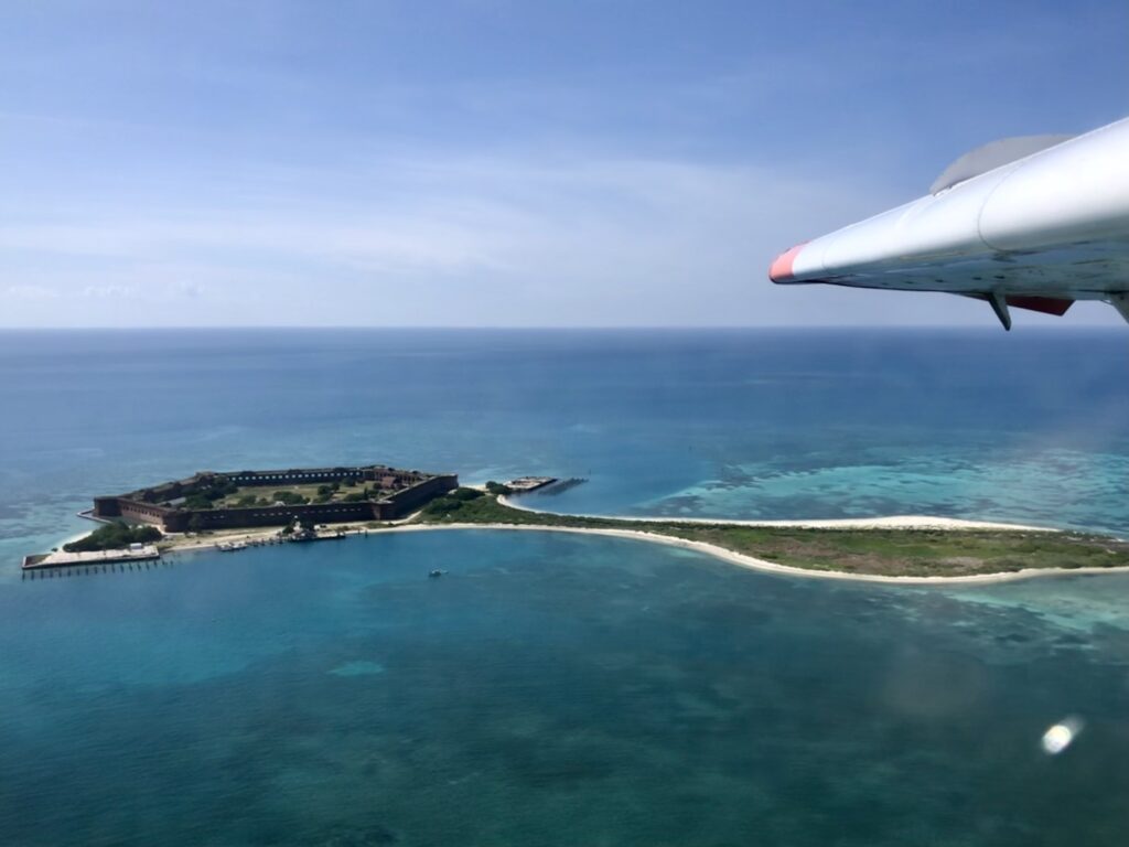
As we lift off the airstrip at Key West International Airport, the pilot chuckles to himself. He asks me, “Is this your first time?”. I respond with bulging, excited eyes, “How could you tell?”, my nose barely lifting from its position pressed against the passenger side window of the empty 10-seater plane. A low-altitude 45-minute flight takes us 70 miles west of the southernmost point of the continental US, displaying aerial views of sea turtles, dolphins, shipwrecks, glistening “quicksand” (rolling, underwater dunes, continually shifting under the strong tidal current), and the Marquesas Islands. Although the seaplane is not the only way to get to this park, it undoubtedly provides the greatest “wow” factor for first-time visitors. Upon arrival, we circle the park’s perimeter, my eyes locked on Fort Jefferson – the cultural focal piece of this park and the largest brick building in the western hemisphere. 

Aerial view of Fort Jefferson, located on Garden Key, as seen from the seaplane flying into Dry Tortugas National Park

I’ve arrived at the second park of my internship, Dry Tortugas National Park (est. 1935). Made up of seven small islands, it is one of the most inaccessible National Parks in the US. Due to its remote location, it can only be accessed by seaplane or ferry (both modes of transport are used by the park’s 120 daily visitors who enjoy a few short hours of swimming, sunbathing, birding, and picnicking before returning to Key West).

Fort Jefferson greets me as I step off the beached seaplane. With no land in sight for tens of miles, I ask myself, “why here?”. The fort was built to protect one of the most strategic deep water anchorages in North America, control navigation to the Gulf of Mexico, and protect the Atlantic-bound Mississippi River trade. I am eager to learn more about this massive masonry fort I will call home for the next two weeks, in addition to diving in the crystal clear blue-green water surrounding us.  

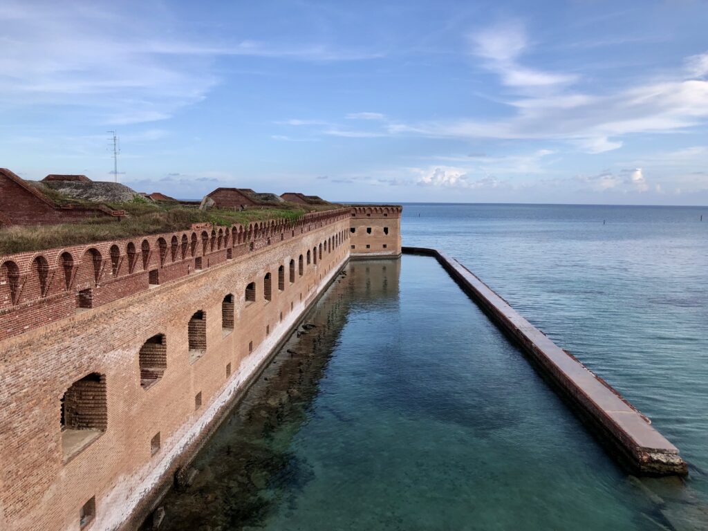
Beyond the fort’s walls stretches miles of uninterrupted water. The moat wall or counterscarp was damaged during Hurricane Irma in 2017 – the park is working to implement repairs soon

Construction of the fort began in 1846 and continued for 30 years. Each of the over 16 million bricks used to build this fort was brought over by small wooden ships from the far reaches of the Eastern US. Given its remote nature, the construction of this fort was no small feat – in all of its striking architectural precision and grandeur. At its peak, over 1,700 men were stationed here, placing a significant demand for basic resources that cannot be found here naturally. Over time, the name of the island evolved (initially Las Tortugas – which translates to “the turtles’ and eventually changed to Dry Tortugas), calling into focus the importance of sea turtles in the diet of its inhabitants. It also warns passing sailors of the lack of freshwater and alternative food sources.

During a walking tour led by the tourist ferry company, I learned that the fort was used as a military prison during the Civil War. It also held four men convicted of co-conspiring in President Abraham Lincoln’s assassination, including Dr. Samuel Mudd (who was instrumental in the fight against Yellow Fever that plagued the fort and was eventually pardoned from his sentence for his efforts in assisting sick patients).

Over time, I come to know new corners of the fort as they revealed their hidden secrets to me, often with the help of informal tours given to me by new friends and colleagues. From the bakery (which fed more than 400 people three times a day, known for its bread made of sticks, stones, flour, and sand) to Dr. Mudd’s cell (containing hand-carved water collection depressions in the ground), a cannon ball “cooker” (used to prepare hot cannon balls to fire at wooden ships), gun powder storage (signed with the names of ship captains who have visited the fort over the last hundred years), and remnants of Cuban chugs (makeshift boats used by immigrants who landed at the park over recent years), there is always more to uncover. With this growing cultural knowledge comes an increased awareness and appreciation for the historical significance of this fort from which we are conducting fieldwork. Each time I re-enter through the sally port (the one and only entrance to the fort’s interior) after a long, hot, salty, beautiful day underwater, I feel inspired and grateful for the opportunities I have been given to explore new places, perspectives, knowledge, and skills during this internship.

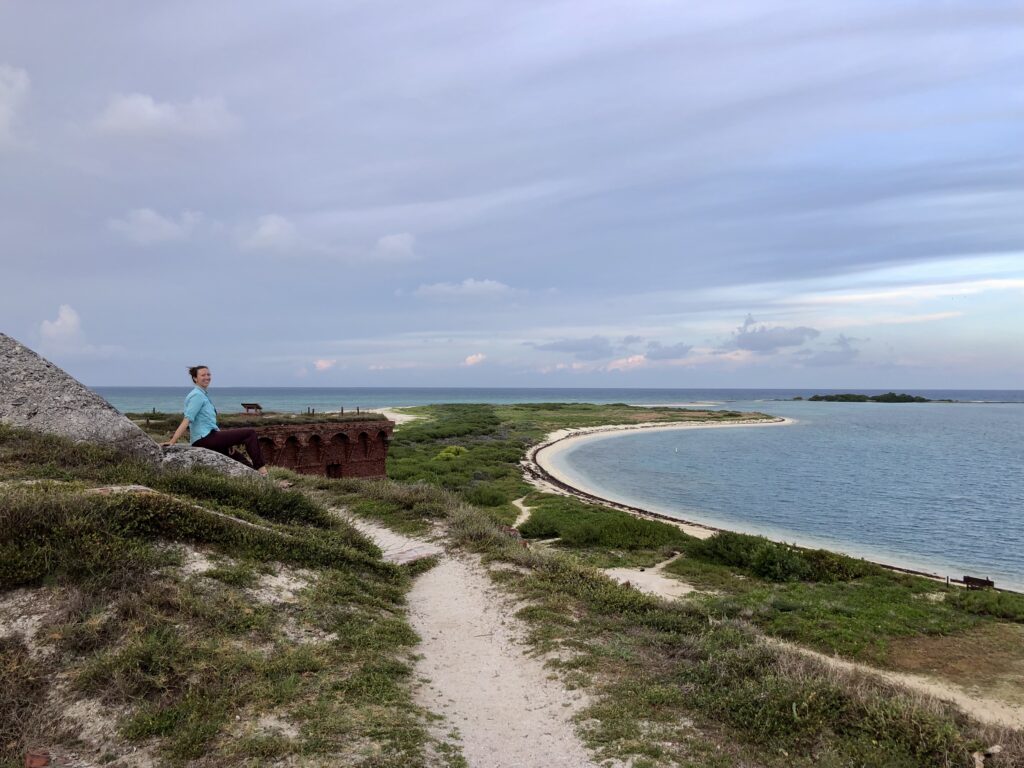
Overlooking Bush Key, which serves as nesting habitat for threatened bird species such as the Roseate Tern. Long Key (background) is the only documented nesting site for Magnificent Frigate birds in the continental US

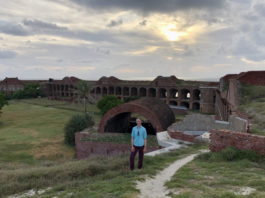
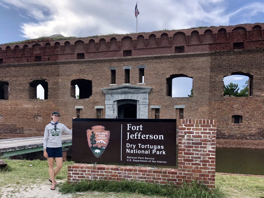
Me with the obligatory picture at the park’s welcome sign.

As an avid backcountry camper, hiker, and aspiring explorer of all things tropical and dream-like, you can imagine my excitement upon learning that park Fisheries Biologist Clayton Pollock has organized for me to be whisked away to neighboring Loggerhead Key for my first two nights. An even more remote key within the park, it is covered in stunning vegetation and sublime white sand beaches, which frame a 150-ft brick lighthouse constructed in 1856. Brett Koch (Law Enforcement Park Ranger) drops me off at the dock with a bag of food and a jug of water, where I am met by University of Miami MPS intern Maddie Johnson. We have now effectively doubled the population of this island (n=2!) since interns typically conduct fieldwork independently on this key (although radio communication and emergency procedures ensure assistance is always a call away). An afternoon snorkel, sunset beach nap, a good book, and a frozen pizza are all I need to acclimatize to my new surroundings (a routine that would quickly become my go-to each evening) and prepare for the busy days of fieldwork ahead.

View of Loggerhead Key upon returning from an afternoon snorkel at one of the park’s finest shallow reefs

Named aptly for the abundance of sea turtles on the island, we quickly get to work the following day conducting sea turtle monitoring surveys. This work contributes to a long-term database on turtle nesting activities and hatch success that Park Service biologists have maintained since 1980. At 7 am daily, interns patrol the 2-mile long beach, skillfully interpreting turtle tracks to identify species, the direction of travel, and nesting activity. Nests are marked with carefully positioned stakes and GPS points and then monitored for the next 50+ days (watching for signs of hatchling emergence – indicated by a soft depression in the sand above the nest) to inform excavation timing. Nests are excavated after the incubation period to determine clutch size, hatching success, and any inundation, predation, or damage to eggs. In addition to contributing to the long-term monitoring program, Maddie will use this data, in combination with shoreline profiling, as part of her Master’s project, which aims to model and predict the effects of sea level rise on turtle nesting habitats under climate change scenarios. 

University of Miami MPS intern Maddie Johnson excavates a loggerhead turtle nest. Egg cases and nest contents are removed, counted, and inspected for indications of hatch success and clutch size. Work conducted under FCW Marine Turtle Permit MTP#22-187.

Notice on Loggerhead Key marking nesting sites, reminding visitors to be mindful of disturbing nesting grounds and regulations enforced by the Florida fish and wildlife conservation commission

Patrolling the beach may sound like a relatively straightforward task, but in addition to the grueling conditions of a hot southern Florida summer day on a remote island with no running water, this island sees a tremendous amount of sea turtle activity (meaning it can take up to 7 hours to survey 2 miles of shoreline). To ensure accurate and meaningful data, interns must carefully document and decipher old tracks amidst the tens of new tracks created each night. Together, Maddie and I set a new record for the number of turtle activities recorded in one survey. We counted over 50 instances of false crawls (crawls where the turtle comes ashore but does not lay eggs in a nest), nesting, and abandoned egg chambers. I learned that although we counted 50 individual tracks, it doesn’t necessarily correlate to 50 individual turtles (considering that green sea turtles are very particular with nesting conditions and may come ashore several times in one night, over several days, before nesting). Nevertheless, these surveys indicate that Loggerhead Key is a crucial sea turtle nesting habitat that sustains a large population. 

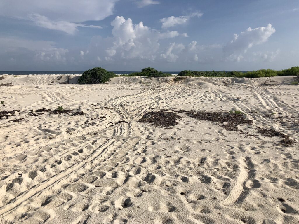
A “turtle highway” on Loggerhead Key. Following and interpreting these tracks becomes complicated as individuals overlap and tracks build up on the beach over time

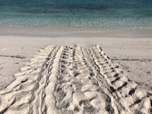
An incoming and outgoing track made by an adult female green sea turtle on Loggerhead Key

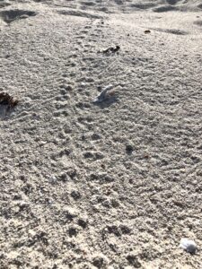
Tracks made by sea turtle hatchlings upon emergence from the nest, in the direction of the ocean on Loggerhead Key

By the end of the day, it wasn’t only the sun’s heat that had us wishing for a short, heavy rainfall, but the desire for nature to effectively provide us a “clean slate” for interpreting tracks by washing away previously surveyed tracks amidst the overlapping maze. I am not surprised to learn that many of the current NPS staff began as sea turtle interns. Given the challenging nature of the work, it surely speaks to the work ethic, organization, and diligence of researchers in this role, making them an excellent addition to many NPS field teams going forwards.  

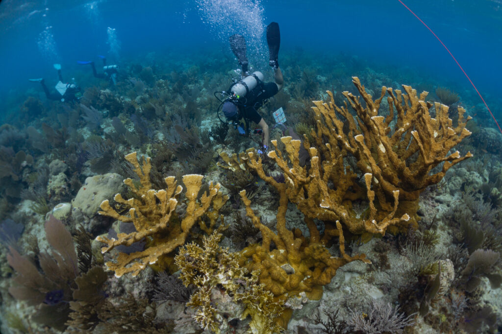
Next up, the Natural Resources team arrives, and I meet Coral Biologist Rachel Johns and Coral biological science Technicians Karli Hollister and Evan Hovey. Together with Fisheries Biologist Clayton Pollock, we will spend a week sampling corals for a collaborator, Prof. Erik Sotka, from the College of Charleston. This large-scale project aims to assess coral genotypes for multiple species in the Southeast Region (including Dry Tortugas National Park, Buck Island Reef National Monument, Virgin Islands National Park, Salt River Historical Bay and Ecological Preserve, and Virgin Islands Coral Reef National Monument) and develop SNP chips/protocols for rapidly assessing and comparing genotypes for existing and novel corals, with applications for coral restoration. Lucky for me, this project will take us to some of the most stunning dive sites in the park, as we aim to sample several reefs per day. 

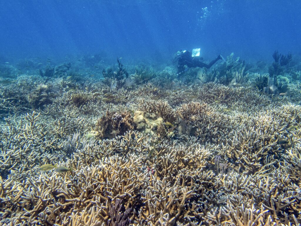
A thicket of Acropora cervicornis (staghorn) corals and study site for the ongoing coral genotyping project. Photo: Karli Hollister

Photo: Karli Hollister

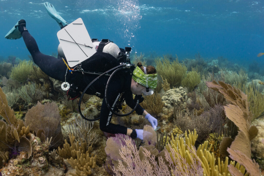
At first, collecting coral samples is a bit nerve-wracking (aiming to do as little harm as possible to the colony by carefully chipping off a 1cm piece). The work also involves juggling bags of tools, samples, a dive slate, scale bar, GPS tethered to a surface buoy, and camera underwater, often in shallow water with swell. However, by continually optimizing my gear setup, streamlining the sampling process, and becoming more comfortable with coral ID, I could effectively contribute to the team and start chipping away at the weeks’ worth of sampling they have ahead them.

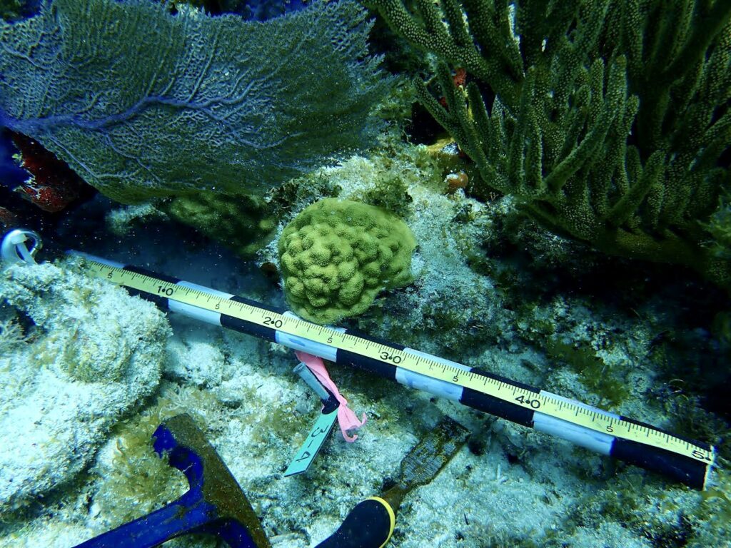
Each coral sampled is tagged and photographed for future research

Not without its hiccups, working in such a remote location presents challenges regarding safety considerations, everyday operations, and equipment supply. Something as simple as a lack of plastic bags or generic sampling tags can limit the speed at which a project progresses until the next team arrives to supplement needed equipment. Nevertheless, the long days in the field, hours spent preparing and troubleshooting protocols, and post-sample processing flew by with such a lively team – cracking jokes and blasting tunes during surface intervals and at the tail end of long days. 

As Clay, Rachel, Evan, and Karli depart the park and I await the arrival of a new field team, I use the transition as an opportunity to join visiting research ecologist and long-time US Geological Survey collaborator Dr. Kristen Hart on her team’s extensive turtle monitoring program. She is joined by several coworkers and collaborators, including Andrew, Haley, John, Bree, Amanda, and Brian from Cape Lookout National Seashore, USGS, Nova Southeastern University, and the University of Georgia. Together, we spend a night tracking nesting sea turtles on the nearby East Key by patrolling the beach every 30 minutes between naps under the stars. Nesting sea turtles are outfitted with a satellite tag to track their movements, flipper tags and Passive Integrated Transponders (PIT) for identification, and scute and blood samples for genetic and isotopic analysis. Dr. Hart holds the only permit to study sea turtles on this key (and she has been coming here for 15 years!). This information is used to gather baseline population data, delineate areas that may serve as inter-nesting, migratory, and foraging hotspots, and infer the trophic position of sea turtles within peninsular Southeastern Florida. 

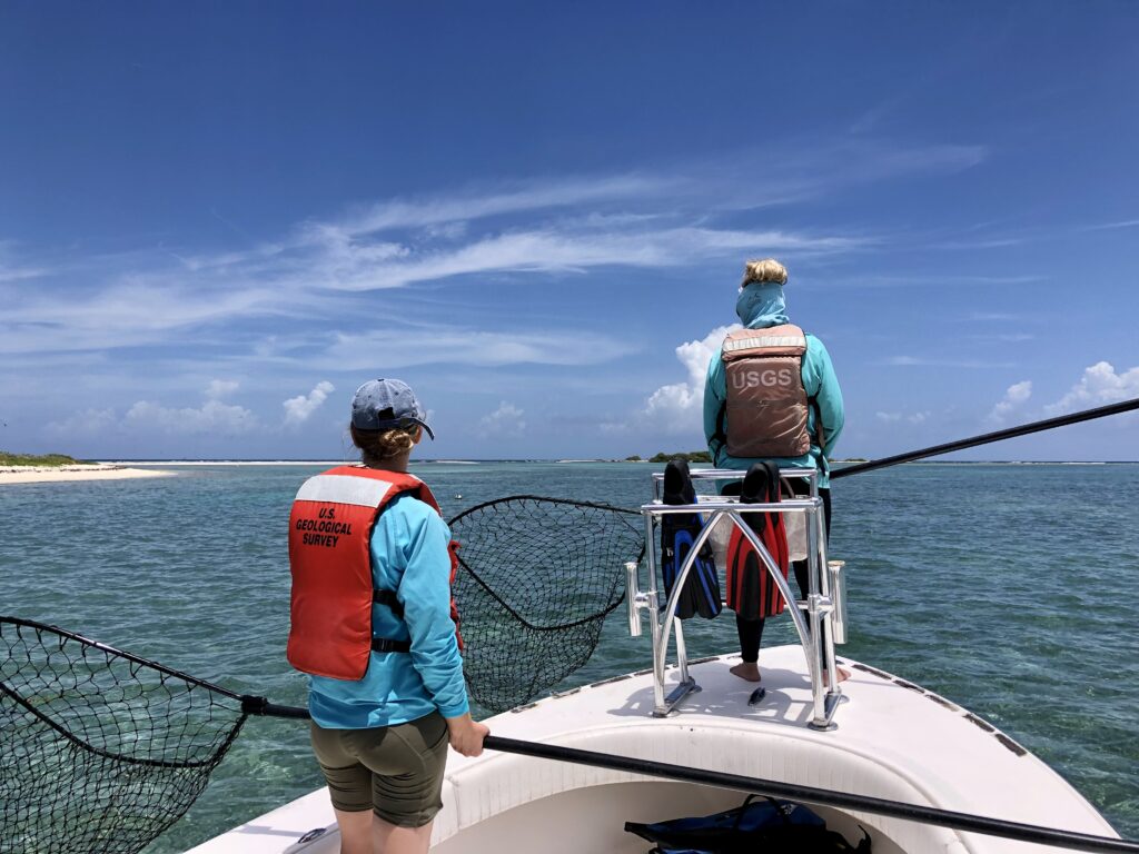
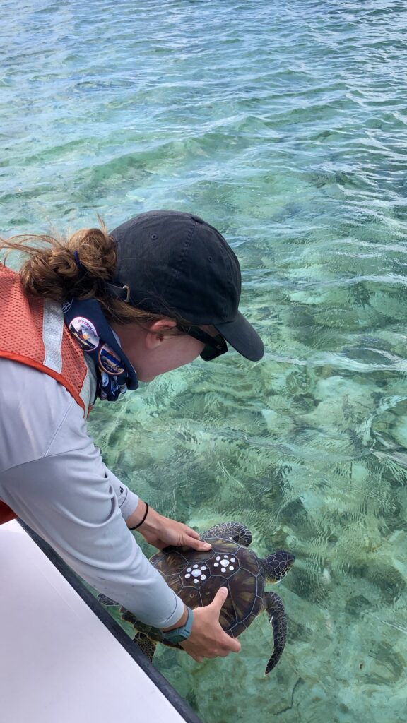
The following day is spent boating in slow circles around the shallow Garden Key Harbor while Dr. Hart and USGS Research Assistant Haley Turner stand at the bow with large dip nets at the ready. The goal for the day? To observe and catch juvenile green sea turtles for basic sampling and to understand the space use, relative habitat selection, and ecology of immature individuals. Many turtles we encountered were recaptures or resightings of individuals tagged in the previous years, speaking to the comprehensiveness of Dr. Hart’s work in the region. I settled into data collection while Kristen, Haley, and John did the challenging job of carefully catching these speedy youngsters. Having the opportunity to get up close with these resilient juveniles, I not only got to admire their brilliant shells and charismatic features, but also filled in many of my knowledge gaps regarding the life history, habitat usage, and behavior of this endangered species. 

USGS researchers Dr. Kristen Hart and Haley Turner watching for juvenile green sea turtles in the shallows of Garden Key Harbor

Releasing juvenile green sea turtles after sampling. Individuals are marked with temporary paint for identification within a given field season. Work conducted under NOAA permits

Once the next rotation of NRM coral team members arrives at the park, including Coral biological science Technicians Amelia Lynch and Melissa Heres, Park Dive Safety Officer Jordan Holder, and National Dive Safety Officer Steve Sellers, we prep to embark on a critical mission for the week ahead. Underwater, Dry Tortugas is facing its own epidemic – a lethal disease that turns fields of previously vibrant, healthy corals upside down, transforming them into dwindling skeletons of their former selves stripped of live tissue – a sea of bones. The culprit? Stony coral tissue loss disease (SCTLD). As the disease’s epicenter, SCTLD first appeared in Florida in 2014, spreading quickly and causing high mortality. However, it wasn’t until recently, in May of 2021, that SCTLD was reported in Dry Tortugas National Park. 

Armed with the best currently available science and practical knowledge on disease treatment and intervention, we spend the week delivering doses of antibiotics, in the form of a thick topical paste, to affected colonies. This is my first time coming face to face with a large-scale outbreak of SCTLD. I take a few moments underwater to acknowledge the mass mortality surrounding me. Applying the treatment is an intimate and quiet process. I gently press the paste into each nook and cranny of active lesions – outlining and essentially quarantining the region between bare bones (coral skeleton), sick tissue, and healthy. Treating an entire site within a day is challenging, even with a dive team of four. We must often opt to prioritize larger, more productive colonies for treatment, given our limited bottom time on open circuit diving equipment, leaving some colonies untreated. As a glimmer of hope, while scanning treatment sites, it is possible to see positive instances where the treatment has effectively controlled the spread of the disease within a colony. I send my well-wishes to the coral I have treated, which will likely need follow-up appointments, conducted by the hard-working team of NRM divers at the park for the foreseeable future.

Scientists are only beginning to uncover the detailed pathology of the disease and other phenomena impacting coral reefs today, including coral bleaching and restoration/heat-stress mitigation techniques. A standout in these efforts within Dry Tortugas National Park is research led by Dr. Ilsa Kuffner, USGS Research Marine Biologist, regarding the re-establishment of stepping-stone (i.e., crucial, reproductive, connected, restorative) populations to aid in the recovery of threatened, Acropora palmata (elkhorn) coral. This research, partially inspired by the recent discovery of new elkhorn patches within the park (beyond the previously documented single remaining site), uses an assisted migration experiment to assess coral survival, calcification, growth, and condition. Five different genetic strains of this species were planted across five sites (spanning 350 km) in Florida. Curiously, only in Dry Tortugas did all of the relocated corals survive, and not only that – but these individuals calcified approximately 85% faster than the few surviving corals transplanted to the upper Keys sites. With this information, Dry Tortugas may be a hope spot for re-establishing endangered elkhorn coral. Efforts are ongoing to restore a sexually reproductive, connected population, hoping to bring this species back from functional extinction, thereby promoting its regional recovery in the face of global climate change. 

Newly discovered Acropora palmata within Dry Tortugas National Park, a threatened species throughout its range. Photo: Karli Hollister

As the long days turned into short weeks, my time at Dry Tortugas has come to a close all too quickly. Each day, I smile as a rush of excited visitors pours off the ferry, often having booked a ticket to the park weeks or months in advance. Each night, quiet falls on the fort, as visitors depart and I find a new corner of the fort to tuck into as dusk turns into starry night. Life on Dry Tortugas in the present day is serene, comfortable, and full of beauty – undoubtedly a stark contrast to the challenging conditions of the previous century. 

I want to thank the DRTO NRM team and Dr. Kristen Hart for welcoming me into your field teams, providing new learning opportunities, helpful advice, and plenty of time underwater (and thanks to Karli Hollister for sharing photos and Amelia Lynch for the fantastic tour of the fort!). Thank you to Clayton Polluck for sharing your knowledge and experience with me (and providing an extended home away from home in Key West when life throws some curve balls…I am deeply grateful for your hospitality and support). Thank you to Curtis Hall for inviting me to speak at the Reef Relief summer camp (it was a pleasure to teach and learn from the excellent group of students this program hosts at the park each summer). Thank you to Cindy Hull for your help in Key West preparing for my visit to the park. Each of your time and generosity contributed significantly to my smooth integration and outstanding experience at Dry Tortugas. Finally, thank you to the National Park Service Submerged Resources Center and Dave Conlin for your hard work behind the scenes, and generous above-and-beyond support, making sure interns each year have nothing short of exceptional, unique, and highly valuable opportunities to experience and work in some of the finest parks the US has to offer.

As the summer progresses, I often reminisce on daydreams I had earlier this year, as my Master’s program was coming to an end – of either doing research, traveling, or diving upon graduation. Now, this internship has provided an unmatched opportunity to combine all three of these dreams, all wrapped into one, made possible by the support of NPS, OWUSS, and their collaborators. Standing in front of Fort Jefferson, a structure made not only of bricks but of bones of ancient corals; I feel proud to be a part of the NPS dive team and Park Service community, working to preserve fascinating and unique cultural resources while protecting and restoring the natural wonders it surrounds.

Share

PCR, Gels, and Qubit®, oh my!

As mentioned in my prior blog, the month of June was busy with diving as we completed our spring survey at 10 dive sites. A break from intensive field sampling presented the opportunity to do molecular work in the lab! I was excited to dive into preparing environmental DNA (eDNA) samples for sequencing after spending several weeks collecting and filtering water destined for eDNA analysis. To reiterate, the Rasher Lab’s project in the larger Maine-eDNA program is focused on studying “Species on the Move” within kelp forest ecosystems across the Gulf of Maine (GoM). This study pairs traditional ecological surveys with collections of eDNA water samples, during our dive surveys. Combining the two approaches will help us gain a better understanding of our rapidly changing kelp forests in the GoM, because eDNA may reveal the presence of newly arriving species in the ecosystem that are currently too rare to detect through visual counts.

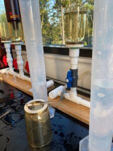
In our study, eDNA sampling consists of collecting six liters underwater at the dive site as well as three liters of water 1 meter below the surface. We take the water back to the lab and filter it immediately; the filter is then frozen for DNA extraction. This sample has a mixture of DNA from many organisms found in the environment, from bacteria and algae to the rarer fragments of DNA from fish, marine mammals, or sharks that may have swum through the area. Therefore, these samples contain a lot of information about the ecosystem – but finding the information you want requires a lot of lab work to ask the questions. I am going to discuss three different kinds of molecular work that we use to answer eDNA-related questions.

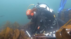
Me collecting water along the transect for eDNA analysis

Using eDNA to measure fish diversity

One goal of the study is to ask what fish species live in the rocky reef ecosystems along the coast of Maine. For example, how do fish communities in the GoM differ between those found in colder, northerly kelp forests vs. those found on warmer, southerly reefs? We start to answer this question by completing visual fish surveys, where we swim along transects and record the fish we have encountered. But if you have ever experienced a fish survey, you may realize it could take hundreds of hours underwater to see all the fish species. Now picture trying to do these fish surveys in a cold-water ecosystem with poor visibility, where few people have completed fish censuses before, and you’ll quickly realize that the fish surveys do not do justice to the fish diversity found in that ecosystem. So, we can ask our eDNA samples what fish are present by sequencing the fragments of fish DNA found in the water sample. To prepare the eDNA samples for sequencing, we use a process that includes PCR, PCR clean-up, gel electrophoresis, and Qubit®. The purpose of these steps is to amplify and isolate the fish DNA fragments from the eDNA sample prior to sending our samples to a company that conducts DNA metabarcoding, which will provide us with information of what species of fish are present in the environment.

Dara Yiu completing a juvenile fish swath survey at Metinic Island, midcoast Maine

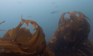
An example of poor visibility: a school of Pollock at Metinic Island seen only four meters away

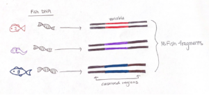
To effectively sequence the fish DNA, we need to choose a genetic “barcode”, which is a DNA marker where the associated gene sequence is unique for each species. A good barcode has two conserved regions that “sandwich” a variable section. The conserved regions are shared among all fishes, but not bivalves or crustaceans, and the variable region contains information to identify fish species. The sequence we target is called the “MiFish” fragment, and it fits the criteria extraordinarily well such that it has been used to assess fish diversity around the world.

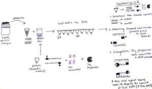
We start preparing our sample for analysis by setting up a chemical reaction that easily finds the fish DNA fragments and makes thousands of copies. This process is called a Polymerase Chain Reaction (PCR), which is the molecular tool we use to amplify the fish fragments in our eDNA sample. PCR has three main steps: denaturing, annealing, and extension. But prior to starting those steps, we use a MiFish gene primer set to maximize the detection of fish DNA fragments. Essentially, this primer set detects the conserved region of the MiFish sequence in the eDNA sample and “latches on” to the respective section of fish DNA. In the end, it is easier to sequence and differentiate thousands of copies of the fish DNA, so amplification is an important step in measuring fish diversity from eDNA.

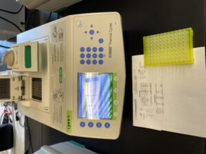
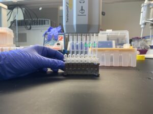
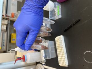
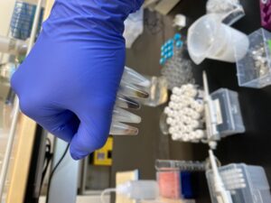
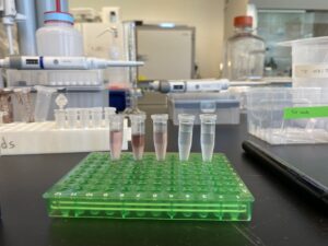
To set up this PCR reaction, first, I make a “Master Mix” which contains the following ingredients: primers that bind to the “conserved” sections of the barcode region, free nucleotides which are building blocks of DNA, and Taq polymerase – the enzyme that puts the blocks together and makes the new DNA strand. The amount of Master Mix created for each PCR is dependent on the number of samples that will be processed, and luckily a pre-programmed Excel sheet calculates the numbers! The Master Mix is then aliquoted into PCR tube strips and the eDNA sample is added too! All the PCR samples are then transferred to a thermocycler aka “Larry”.

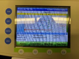
The thermocycler is programmed with an optimized temperature cycle for the replication of our fish DNA. First, the samples are heated which causes the DNA strands to separate. Next, the samples are cooled in an annealing process which allows the primers to bind to the DNA strands. Lastly, Taq polymerase extends new DNA strands by adding the free nucleotides (building blocks) after the primer sites, making copies of the MiFish fragments. These three steps are repeated many times which results in amplification of the fish DNA. So, the small amount of fish DNA that was in the original sample ends up being a much larger amount after PCR.

“Larry” the thermocycler

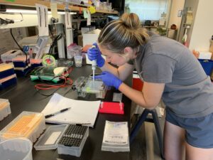
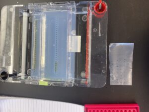
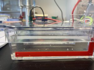
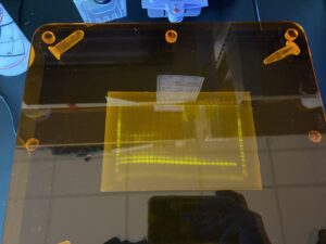
Once our samples come out of the thermocycler, the PCR is complete, and we must run a gel electrophoresis. Electrophoresis uses electrical charges to separate DNA fragments of different lengths. Because DNA is negatively charged, the positive charge on the bottom of the rig pulls the DNA towards it, and over time the smaller DNA fragments travel faster and farther through the gel. This results in the band formation of DNA in the gel. The purpose of gel electrophoresis is to visually determine if the sample contains fish DNA. I combine a small portion of DNA with a loading dye. This is repeated for all the samples. The first and last wells of the gel are loaded with a DNA ladder which provides a reference for DNA fragment sizes. Once everything is loaded into the wells, I attach the lid and turn on the machine which sends electrical charges through the gel.

Loading a gel!

What a gel looks like as it is being loaded!

The bubbles in the gel rig form when the gel is running!

After the gel is run, the bands created during this process need to be dyed again and we use a DNA stain called SYBR gold. The gel is placed in a Tupperware container in the dark as SYBR is light-sensitive, for an hour to “soak in” the dye for UV visualization.

Bands from the gel!

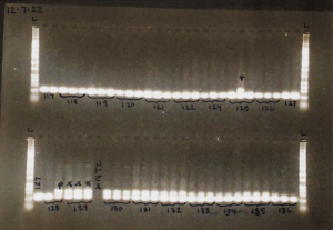
As you can see, there are multiple bands present on the gel, but consistently the bottom bands represent our fish DNA. We want our final sequenced samples to be as “clean” as possible, so the remaining fish DNA post-PCR is given to Dara Yiu, a PhD student leading this part of the project. She completes a clean-up process which aims to remove excess fragments that may have also been amplified by the MiFish primers. This is because the MiFish primer can also attach to some bacteria that may share similar DNA segments to fish. We run one more gel, and then the samples are almost ready to be sent for sequencing!

Clean-up process!

Example of a finalized gel!

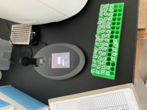
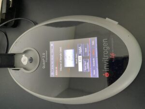
The last step before sending in the fish DNA for sequencing is to place them in a Qubit®. The Qubit® quantifies the amount (concentration [ng/uL]) of DNA in the whole sample based on a fluorescence emission. For example, the fluorescent dyes will emit a signal to the machine if it has bound to the target molecule, which in our case, is the DNA found in the sample. Because the Qubit® reads the DNA concentration of the whole sample, not just the fish DNA, the clean-up process is an important step.

Qubit® and samples

Close-up of Qubit® screen

Now the DNA samples are ready to be sequenced! We send them to a facility for DNA metabarcoding, which means the samples will be put into a sequencing machine that will read each DNA fragment. We will then match our sequences to a reference library (i.e., a database that contains the unique genetic signatures of each species that may be present in the GoM) to identify the fish species found at the rocky reefs where we collected our eDNA water samples.

Using eDNA to detect and quantify invasive species

After concluding fish molecular work with Dara, I learned two other variations of PCR: quantitative (qPCR) and droplet digital (ddPCR). These methods are typically used to identify a single species found in an eDNA sample and quantify the number of gene copes that are related to that species. Shane uses these methods to detect the presence of Dasysiphonia japonica (DJ), which is an invasive filamentous turf-forming red algae found in the southern Gulf of Maine, where kelp forests have largely collapsed in recent time.

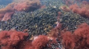
When DJ is well established in an ecosystem, it is easy to see. It creates a fluffy red carpet on the bottom, where it may outcompete other native algae species, like kelp, for space. As the GoM gets warmer, DJ appears to be rapidly moving north up the coast. DJ can spread quickly because it can reproduce when it branches fragment or when its spores are transported in the water column to a new location. By subjecting the eDNA samples to qPCR/ddPCR we can measure the precise amount of DJ DNA in our eDNA samples, to verify its presence and infer how much DJ is present in the environment. Due to the sensitivity of these methods, we may be able to detect the presence of DJ on these reefs before we see it on our SCUBA surveys.

One example of kelp loss in a southern Maine rocky reef ecosystem and as a result DJ turfs form carpets

Another example of examples of DJ turf formation

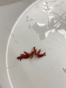
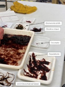
qPCR is a similar PCR process that replicates a targeted sequence of DNA; however, it is special because when the target sequence is present, it gives off fluorescence as the reaction amplifies the DNA. By measuring the fluorescence and relating it back to standards of known gene copies we can calculate how many strands of DNA were in the original sample. qPCR assays need to be designed so only the target species is amplified thus giving off fluorescence. In our case, I had to confirm that the qPCR would only amplify DJ DNA and not accidentally amplify other common red algae species found at our GoM rocky reef sites. To test this, I first extracted the DNA from four red algae: Polysiphonia, Euthora, Palmaria, and an unknown red tube alga. Next, we ran a qPCR with those samples using the DJ assay. Luckily, none of these species amplified during qPCR, so we have a good molecular tool to measure DJ DNA.

Crushed up algae for DNA extraction!

Once we confirmed the specificity of the qPCR assay to only target DJ, we will be able to use it as a tool to determine how much is present in the water at different rocky reef sites.

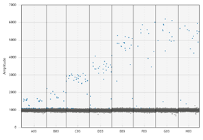
After I learned how to use qPCR, I was presented with the opportunity to learn droplet digital PCR (ddPCR); which is like qPCR in that they both target single species, but ddPCR is newer and has a higher sensitivity – in other words, it can detect lower quantities – therefore greater capabilities of tracing rare species occurrences. Because of the high sensitivity, ddPCR is most used in the medical field, for example with cancer research. ddPCR gets its name “droplet” because there are 20,000 nano droplets in each tube, so rather one tube containing a single reaction, each tube contains 20,000 nano reactions. This is what contributes to its higher sensitivity. These droplets will fluoresce (positive) when the target species DNA is present or will not fluoresce (negative) when the target is absent. These droplets represent how many copies of the target are present in a sample. With our goal of detecting potentially rare invasive species and their range shifts across the coast of Maine, we decided to use ddPCR because of its higher sensitivity over qPCR.

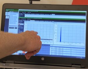
To effectively use ddPCR, Shane Farrell (a PhD student leading this part of the project) and I have been running a series of tests to determine analytically validate the precise sensitivity of the DJ assay. First, we needed to optimize the temperature the reaction is run at; this meant exposing the same sample to a temperature gradient in a thermocycler. This test produced a series of separations between positive and negative droplets. The temperature that produced the most separation between positive and negative droplets, with the least amount of “noise”, is the optimal temperature to run the ddPCR for the future assays. However, if the temperature is too low, the assay would not be as specific, so we chose 59.5 C as opposed to 57 C. The additional 2.5 C adds to the specificity of the assay. We also completed two other tests to understand the false positivity rate of our assay and determined the lowest amount of DNA we can accurately quantify in a sample.

The dots on the upper portion of the graph represent positive droplets, whereas the line of dots on along the bottom are negative. We chose the temperature being pointed to, as there were the least number of dots in-between + and –

After completing these tests that help us understand the limitations of our ddPCR assay, we will run 110 eDNA samples with the ddPCR to find out how much DJ is present at our study sites distributed across the GoM. We already know that DJ is abundant in the southern waters, but it is important to document the spread up the coast to the cold northern waters, where kelp is currently still abundant. Afterall, the Rasher lab is focused on “Species on the Move”. We will also be using ddPCR to track two other species whose ranges are shifting: Membranipora membranacea (lacy bryozoan) and Centropristis striata (black sea bass). Developing a solid understanding of ddPCR as a molecular tool will be beneficial to recognize the range shifts of species as they react to warming in the GoM.

I am super thankful for the numerous opportunities I have had to conduct molecular work with Dara and Shane. It is truly a unique experience to be part of projects in the upcoming world of eDNA, especially on work being completed in my home state. As the end of my internship approaches, I am excited to be part of the summer sampling season at the 10 dive sites as well as finishing the remaining fish surveys!

Share

Sharing the Underwater World with the Ocean Explorers Education Program

“You’re the people who count fish.” Or, “You guys work with corals, right?” These are two of the most common responses we get at REEF when we ask people if they’ve heard of us before. And while the first is mostly right, the second, not so much. It’s understandable though, the confusion on what exactly is done at REEF — I myself wasn’t exactly sure when starting my internship this summer (although I would quickly learn).

REEF stands for Reef Environmental Education Foundation, and is a marine conservation non-profit based in the Florida Keys, but with a membership of over 75,000 worldwide. REEF’s mission is to protect biodiversity and ocean life worldwide by actively engaging and inspiring the public through citizen science, education, and partnerships with the scientific community. This is mostly done through four main projects. The Volunteer Fish Survey Project (VFSP), the Invasive Species Program, the Grouper Moon Project, and the Ocean Explorers Education Programs.

I’ve had the opportunity to get involved in each of these programs this summer, but the one I’m most closely tied to is Ocean Explorers. This is our education program where we lead groups through immersive and hands-on activities centered around marine ecosystems. We work with all ages and experience levels, and tailor the program for each group’s needs.

As a Marine Conservation Intern, it’s my job to lead these events. My orientation at REEF was spent learning them inside and out in our on campus Interpretive Center (IC) with my fellow interns. There were four presentations total we had to learn: three about our other programs, and one about Florida Keys ecology. Hearing them for the first time, I was overwhelmed. I didn’t think I could ever learn them as flawlessly as our Education and Program Manager who was teaching them to us.

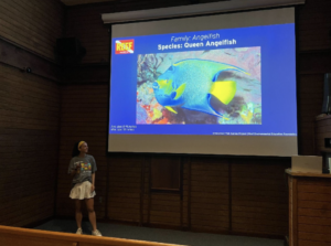
But when it came time to lead my first presentation of the summer, I felt confident and ready after all the practice I’d had. I was doing Fish ID, a presentation that goes through the most common fish you can see in the Florida Keys. It was for a group called Road Scholars, a tour group consisting of grandparents and their grandchildren. I found it fun to share my little tips and tricks for each fish, and see which ones they like the most (there’s many for the French Angelfish, including the yellow on its scales that looks like it has a french manicure, which are always hits).

Teaching Fish ID Presentation at John Pennekamp Coral REEF State Park (The trick to remember the Queen Angelfish is they have a crown on top of their head)

It was encouraging as the group became more engaged. These people were on vacation, and had never seen any of these fish, yet were excited and eager to learn. Afterwards, we did a mock survey with them of the fish we have on our walls, and it was awesome to see how much they remembered. Kids as young as 5 were identifying grunts, and reminding their grandparents of the names of the fish!

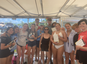
I’ve also done a few events with a program known as Road Less Traveled, made up of young teenagers. Fish ID with them was super fun, and they were all eager to guess the different families and full of questions about their behaviors and how often I see different fish. The best part though was I got to go out and snorkel with them after, so I could see for myself how much they remembered.

As soon as we got in the water, the kids were excitedly yelling amongst themselves about all the fish they were seeing — so many Sergeant majors and Yellow-tail snapper right at the surface! I’ve done Fish ID diving with a group as well, but snorkeling was a lot more engaging because the kids could ask me questions in real time, popping their head up to point out a specific fish or describe one they weren’t sure about. The boat debrief after was filled with more questions and what everyone’s favorite fish was, like parrotfish or the trumpetfish.

My awesome Road Less Traveled surveyors

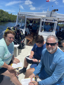
My surveyors from a Great Annual Fish Count dive

Fish ID is one of my favorite things to do with groups, mostly because I know from personal experience how much more fulfilling snorkeling and diving is when you know the different fish by name, instead of just passively taking in the different darting colors. Even when someone can only tell me the name of one fish that they saw, they always do it with pride and excitement, and I can tell they’ll remember that fish for a long time.

Fish ID is the most common presentation we give to groups, but we also do a lot of Lionfish, as well. With the same program but a different group, we had one day where we did a quick Lionfish talk, and then a dissection and our Fish Investigator activity. In the activity, I had 5 different fish that had been found in the stomachs of Lionfish, and the group had to figure out what species they were. It’s definitely tricky, because the fish are usually juveniles and mostly stripped of their colors, but the kids were great in scouring the Fish ID books and picking out different features to match. They also loved the dissection, completely fascinated by the different parts and their venomous spines.

Lionfish Fish Investigator Activity with Road Less Traveled

There’s been many more events like these throughout the summer, and they’re always the highlight of my week. Many of these people are just here on vacation, and are coming in with little to no knowledge about the ocean. I feel honored to have this role of bridging the gap between them and the marine world. We all rely on the ocean everyday, in so many ways we don’t realize, and these education programs are an amazing way to make it more accessible to people. The more people know about the ocean, the more people are inclined to help protect it.

And as much as I have taught others this summer, I have learned so much as well, from the REEF Staff and even from those I’m supposed to be teaching. I’m excited to share more of what I learned and my experiences with our other programs in my next blog posts!

Share

Humans in a blue world: Biscayne National Park

National Parks serve not only to protect and sustain the health of the environment but educate and engage people in the enjoyment and benefits of nature. In short, one might say from an anthropocentric point of view; that the overarching mission could be the conservation of nature for the perpetual education of and enjoyment by humans. As the birthplace of National Parks, the U.S stands out for its efforts and resources dedicated to the protection and preservation of the extraordinarily diverse ecosystems contained within its borders. From the deserts of Joshua Tree to the Arctic tundra of Denali, I am awestruck by the seemingly limitless opportunities to explore new and unfamiliar environments. With over 297 million visitors per year (to 423 individual parks), it is undeniable the importance of these protected natural spaces. However, the way that people use National Parks and learn about natural resources must be thoughtfully regulated and presented to ensure that future generations will be able to enjoy them for years to come. 

Just south of Miami, an unassuming park lies tucked away in the mangroves, with only 5% of its area appearing above water as land. Upon arrival, Biscayne National Park is made up of a visitors center with a parking lot about equal size. However, it only takes a few short minutes to realize, as you hear speedboat after speedboat passing by, that there is a tremendous number of activities to offer here; you just have to look beneath the surface.

Overlooking Biscayne National Park from the visitors center

Biscayne National Park was established in 1980 and is a hub for marine recreation. On a given day, the park’s waters (which make up 95% of the park) are a destination for boating, fishing, diving, birdwatching, snorkeling, kayaking, canoeing, and guided eco-adventures. On a clear day, you can see the Miami city skyline and surrounding industry – which seem only to stop right at the gates of the park’s entrance and contrast the mangrove-covered keys in the foreground. As I settle in, I can see that this park provides important access to south Florida’s stunning coastline for local visitors. It is home to some remarkable natural and cultural resources, for which the park is an educational platform. However, I was immediately curious about how human interaction and use of natural resources within the park are monitored and controlled to reduce human impact while promoting and sustaining the park’s use. Over the next two weeks, I will join Biscayne’s extensive marine monitoring and inventory program to understand how this is done.

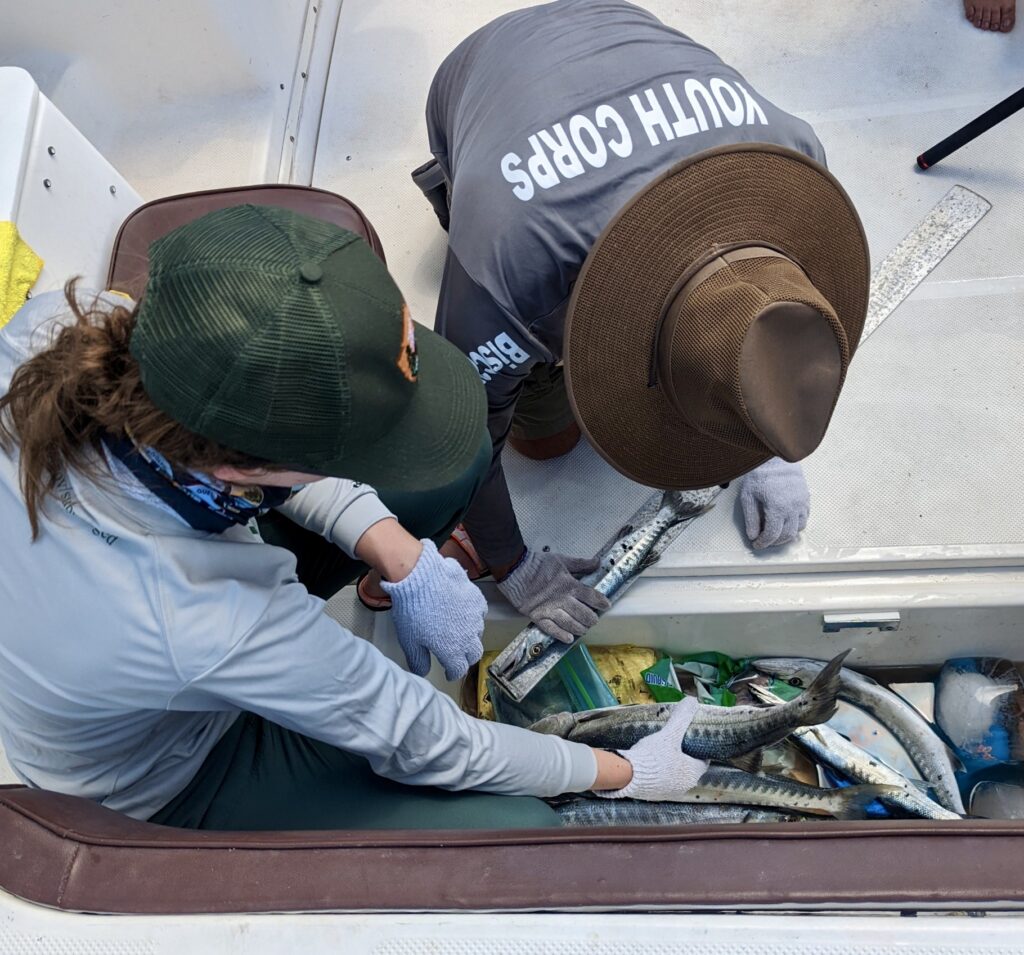
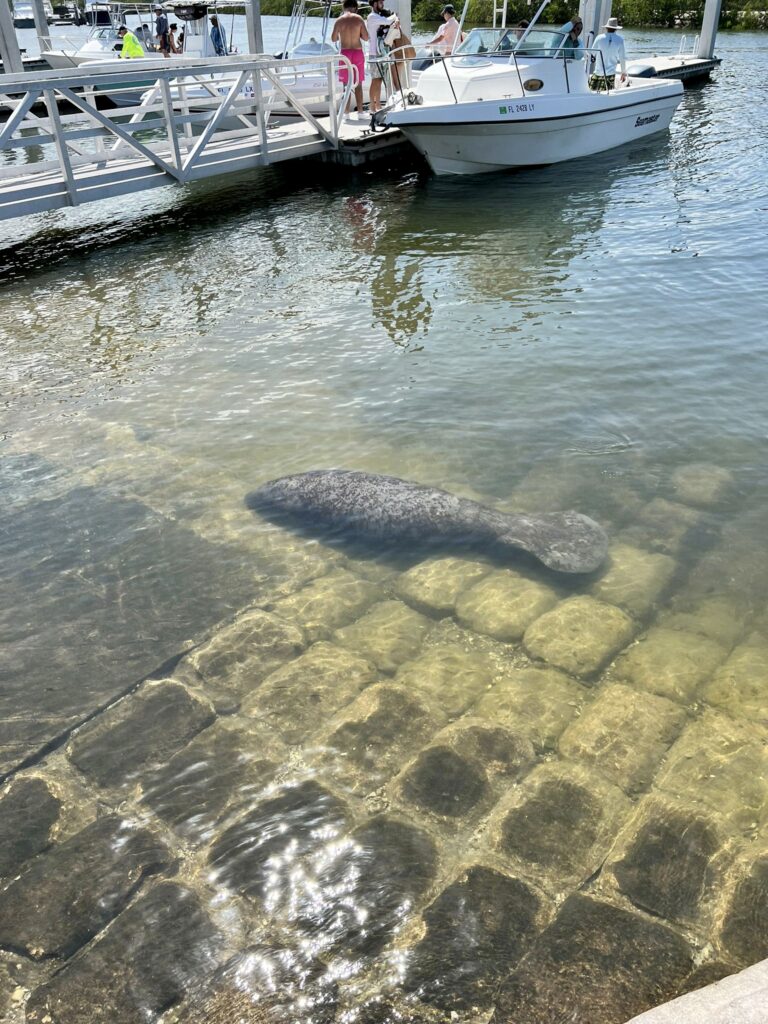
Wasting no time, I joined Mosaics in Science Diversity intern James Puentes and Latino Heritage Internship Program intern Nate Lima for recreational creel fishing surveys at the neighboring public marina as part of the Fishery and Wildlife Inventory and Monitoring Program. The overarching goal of this project is to engage anglers in collecting catch data through informal interviews, which will assist the development of sustainable fisheries regulations. Over several hours, we interviewed more than 40 anglers and collected catch data (e.g., species, size, location of catch, hours fished) as boats returned after a day on the water. In addition to meeting fishing enthusiasts and sharing awareness of the newest fishery regulations established within the park in 2020, it is here that I saw my first ever manatee! Taken aback by their size and constant presence in the marina, I can see just how vulnerable they are to propeller strikes (as several boats return from sea every 5-10 minutes and a cue of new arrivals are immediately launched just moments later). Seeing scars on their backs is a stark reminder of the delicate respect that nature commands in this shared space. A reminder that we are guests in their marine home. As part of the park’s biological monitoring team, our presence in the marina that day served not only to collect valuable data but to remind boaters to take care and do their part to preserve and protect the sensitive habitat and wildlife within the park.

Recreational creel fishing surveys with Biscayne National Park summer interns James Puentes and Nate Lima

Manatees graze at Homestead marina while weekend boat traffic passes ahead – calling into focus the human-wildlife interactions within the area and importance of education to prevent detrimental impacts. Photo: Nate Lima

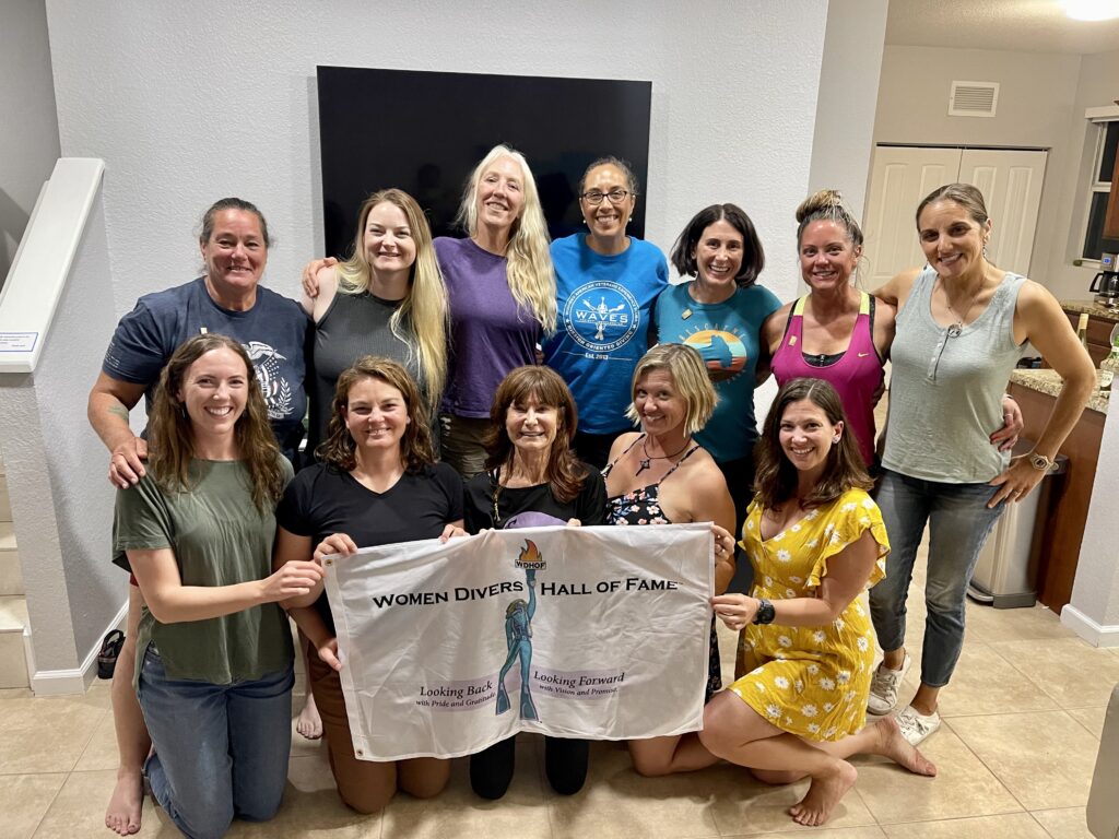
Next up, I had the unique opportunity to join an all-female team of divers from the Wounded American Veterans Experience SCUBA (WAVES) Project in collaboration with NPS, the National Park Foundation, and SoundOff films for marine debris removal. We were joined by an all-female crew from Horizons Divers, NPS SRC archeologist Annie Wright, University of Miami Dive Safety Officer Jessica Keller, and Women Divers Hall of Fame veteran mentor Caron Shake. After speaking with last year’s NPS SRC intern, Sarah Von Hoene, I was eagerly anticipating this project and excited for the rare opportunity to join an all-female team on the water. After introductions over a group dinner, I was once again struck by the fact that although we each have divergent backgrounds, this project has brought us together based on a set of convergent goals and commonalities with regard to love for the underwater world, desire to enact positive change and eagerness to participate in conservation missions by diving with a purpose.  

I set out on our first day, joining Biscayne National Park Biologists Vanessa McDonough and Shelby Moneysmith to meet the WAVES team at the dive site. As we exited the channel, into the bay, and beyond the keys, I’m caught off guard by the cheesy grin plastered across my face. My eyes fixate on my favorite color of blue amidst the vivid gradient in the water, a color I haven’t seen since my time as a Fisheries Resource Management intern with the University of Belize in 2019. Reflecting on my journey thus far, I remember not too long ago, as a recent HBSc graduate, when my ultimate goal was to somehow end up on a boat during working hours. I had no research experience, had barely seen the ocean for more than two weeks during my entire lifetime, and felt intimidated to break into such a seemingly oversaturated and competitive field. Now, I sit here dumbfounded, thinking: “Wow, I get to do this every day for the rest of the summer?” Let the fieldwork begin!

Over a week, the team collected 3,700 pounds of debris, including derelict lobster traps, fishing lines, hooks, and plastic waste. The mood on the boat was cheerful, full of inspired conversations about continued and future work to reduce marine debris and promote conservation. However, underwater, I felt heavy and somber. Particularly on the last day, when we moored up to an area frequently used by recreational anglers, I was overwhelmed and frustrated. Picking up fistfuls of monofilament while hoards of fishing boats float overhead, I could see the damage that years of debris build-up have caused as lines run through large barrel sponges and wrap tightly around branching corals. Lines left from recreational and commercial fishing (particularly the long, strong lines used to thread commercial lobster traps together), represent one of the biggest human impacts detrimental to marine conservation in the area. On a 45-minute dive, I covered no more than 20 square meters. The debris was that extensive. 

Piles of abandon trap ballast recovered from the depths of Biscayne National Park

Marine debris was sorted, weighed, and properly disposed of at the end of each field day

While I am proud of our efforts this week, I acknowledge that to find a long-term solution, the issue must be stopped at the source. Awareness is an essential first step in ridding the “out of sight, out of mind” principle that often applies to the marine environment, and each person that joins in the efforts has a positive snowball effect. With the privilege of working in and accessing the beauty of the underwater world comes the responsibility to start and continue the conversation on how we can protect this vital ecosystem.

Next, I had the opportunity to join the Habitat Restoration Program team, working with biological science technicians Gabrielle Cabral, Cate Gelston, and Laura Palma, and MariCorps NPS intern Sophia Troeh, for my first experience with coral outplanting, in support of the University of Miami’s Rescue a Reef restoration project. Together, we embarked on the ambitious goal to outplant > 1,500 Acropora cervicornis (staghorn) coral fragments. At the conclusion of the first day, I snorkeled over the site for an aerial view of our garden, struck by the somewhat unnatural appearance of the monoculture of coral fragments pinned to the reef by globules of cement. However, on the second day, we planted fragments amongst corals that had been outplanted the previous year. They were thriving and had quickly covered up the cement “scabs” on the reef, turning into beautiful, healthy corals. Although my role in this project was small (considering the tremendous efforts that go into collecting and raising these corals to be ready for outplanting), I got to reap the benefits of one of the most rewarding stages in the process – just as the many volunteers do through Rescue a Reefs extensive citizen science program. A rapidly expanding field, coral restoration may not be the solution to the climate crisis; however, it is a targeted mitigation tool we can use to preserve ecosystem function when the cost of doing nothing is increasingly severe.

Outplanting coral fragments at Biscayne National Park in collaboration with the University of Miami’s Rescue a Reef program. Photo: Gabrielle Cabral

Week two at Biscayne was dedicated to training above water – I would be completing the Marine Operator Certification Course under the supervision of Maritime archeologist Joshua Marano. Together, we went through boat orientation, operating systems/maintenance, navigation, communication, risk management, survival and rescue, fire suppression, marlinespike, trailering, boat handling, and anchoring. A jammed-packed and, at times, challenging course, these skills will be crucial for the internship going forward. I look forward to continually improving my boat handling skills with this “license to learn,” bringing forward necessary tools that will help me integrate into new field teams as I travel through parks this summer. 

Josh also took the time to introduce me to many of the park’s cultural resources, including artifacts from archaeological excavations that can be seen in the visitors center and stories from his experience at Biscayne over the years. Two wrecks, in particular, stand out for their significance within the park’s boundaries for reasons above and beyond pure historical value. First, the search for the Guerrero has drawn much attention to the park. It has also become a valuable educational, interpretive, and outreach tool, bringing volunteers and students from underrepresented communities to contribute to the uncovering and dissemination of the history of slave ships that have gone largely unwritten. Second, the HMS Fowey (wrecked in 1748 off the coast of Florida) represents an important landmark in the U.S shipwreck preservation case law. It was one of the first wrecks to gain attention federally and used as a case study in the establishment of protected archaeological sites, which were to be managed in the best interest of the public rather than privately salvaged and sold for profit.

Last up on the seemingly endless list of potential projects to join at Biscayne, I reunited with Biologists Vanessa and Shelby, and biological science technician Morgan Wagner, for a day of roving visual surveys (used to characterize and inventory fish biodiversity, abundance, and habitat type). As a fish identification enthusiast, I relished the opportunity to familiarize myself with the Florida Caribbean fish residents (and snap some photos) while getting a great overview of the diversity of habitats within the park during our six dives that day. 

Biscayne National Park biologist Vanessa McDonough surveying one of hundreds of sites they will do this year

After two short weeks, I can see that this park is managed by a hard-working and passionate team of employees, interns, and volunteers, who I had the great pleasure of working with. Thank you to Vanessa McDonough for facilitating, scheduling, and giving me the opportunity to learn from so many different people and projects during my stay. Thank you to my park roommates, James, Sophia, and Nate, for the friendly company, answering all of my questions, taking me for “emergency” food runs, and for welcoming me to the park on my first day with lionfish tacos and guac (!!) Thank you to Jessica Keller and Annie Wright for going the extra mile to include me in the WAVES project and socials (and showing me where to get the best key lime pie – which I proceeded to chip away at by the forkful after each field day). Thank you to WAVES and WDHOF team members Caron, Karen, Linsay, Char, Pat, and Maggie for the laughs, support, and conversations about our accomplishments and dreams – I hope to see you all again soon (fingers crossed for a DEMA reunion)! 

As humanity’s presence and impact continues to expand and reach new corners of the globe, the opportunity to work alongside like minded individuals in the exploration, preservation, and conservation of our blue planet is one that I cherish dearly. Thank you to everyone who made my first park an overwhelming success, and to SRC and OWUSS for supporting me in this journey.

WAVES team members celebrating their honorary induction into the WDHOF Associates membership, during a night full of laughter, tears, and celebration.


Share

New places and faces: the start of a grand adventure

It’s mid-March – a late weekday evening. I’ve returned home after a long day in the lab, refining the molecular assay I’ve been working on and troubleshooting for months as part of my Master’s thesis research. I take the evening to catch up with friends and family back home. It’s one of the only times of day I can reach them since they’re 8–10 hours behind my current time zone. Suddenly, my focus shifts as an email appears in my inbox. My jaw drops with a smile, and I immediately call a close friend on campus. She picks up, and I skip the greeting. All I can say is, “I just got a VERY exciting email.” I hadn’t even opened the message yet, but reading the subject line was informative enough. This was the email I’d be waiting for, hoping for, and dreaming of- I was going to be the 2022 National Park Service Research Intern for Our World Underwater Scholarship Society (OWUSS) and the National Park Service (NPS) Submerged Resources Center (SRC). 

Fast forward several months, through a whirlwind of late-night writing sessions, Master’s defense preparations, adjusting my graduation schedule, and soaking up my last bit of time in the Red Sea, I moved home after 2.5 years to squeeze in a short but sweet visit to my hometown, Thunder Bay, Ontario. A week after graduating from KAUST and returning to Canada, I find myself now in the hustle and bustle of New York City. It’s time for a new adventure to begin, and I’m here at the OWUSS 48th annual awards ceremony.

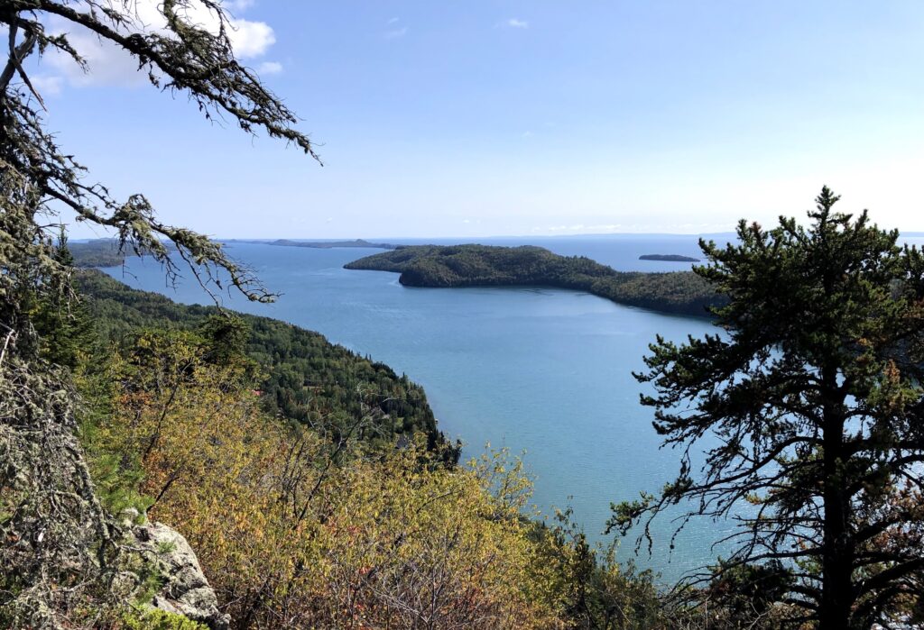
Looking over Lake Superior from my hometown Thunder Bay, Ontario. Even though the OWUSS NPS internship started in 2010, I will be their first Canadian intern.

Since 1974, OWUSS has provided support and opportunities for young people in underwater-related disciplines through scholarships and internships. These one-of-a-kind programs offer the chance to learn from a global network of leaders in the underwater world. Forty-eight years later, the annual awards weekend continues, this year marking the first time in three years that interns, scholars, alumni, board members, sponsors, volunteers, hosts, supervisors, and family come together to celebrate from all over the world. An event full of anticipation, energy, inspiring conversations, and new and familiar faces. It is spent sharing the latest updates from returning scholars and interns and welcoming the new class in preparation for their upcoming experiences. 

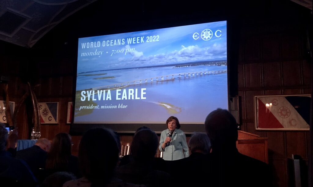
Most of the weekend’s events are hosted at The Explorers Club Headquarters. A truly one-of-a-kind venue – containing members and artifacts from numerous “famous firsts,” including the exploration and traverse of The North Pole, The South Pole, Mount Everest, Marianas Trench, and the Moon landing. I find these Headquarters quickly becoming “home base” for the week – even more so than our hotel. The atmosphere here serves to further heighten my excitement for the journey I will embark on over the next several months, during which I will travel to numerous national parks across the continental U.S. and Pacific Islands as a scientific diver. How could it not, when I find myself catching up on emails between presentations by Dr. Sylvia Earle, the United Nations Oceans Affairs team, and explorer Cristina Zenato while sitting next to the Apollo 11 Moon flag and Matthew Henson’s North Pole mittens.

Dr. Sylvia Earle, biologist, oceanographer, explorer, and President of Mission Blue, unveiling the latest updates in the efforts to establish a global network of marine protected areas, through local Hope Spots and raising awareness, access, and support for their conservation.

Conservationist, educator and explorer Cristina Zenato, delivering a powerful and passionate speech on how to inspire ocean stewardship and awareness.

The weekend proceeds with introductions and recognition of 2019, 2021, and 2022 interns and scholars through banquets, symposiums, and workshops. During the Saturday symposium, the audience has the great pleasure of viewing 2021 North American Scholar Jamil Wilson’s video presentation on Diving Through Adversity and 2021 European Scholar Arzucan N. Askin’s video presentation on the Depths of the Anthroposea.

Joining us in the audience is my immediate supervisor, Dave Conlin, Chief of the NPS Submerged Resources Center. He beams quietly while watching 2021 NPS Intern Sarah Von Hoene present her success and experiences last year. Although the spotlight is on the interns tonight, it must be acknowledged and celebrated that without Dave and the SRC team; their years of groundbreaking work in maritime archaeology; their strong working relationships turned deep friendships with NPS employees and collaborators across the country; and their dedicated action to lifting up young aspiring researchers and explorers, this internship would not be possible. For the past 12 years, in partnership with OWUSS, SRC has devoted tremendous time and resources to one individual per year to embark on this journey. Many of the NPS internship alumni are still active in OWUSS today and have launched successful careers in marine exploration, communication, photography, monitoring, and research. However, when praised for his support and achievements, Dave simply states, “I take no credit for my interns’ successes, just pride in their accomplishments.” This heartfelt sentiment is met with cheerful goosebumps. I feel them wash over me, along with an overwhelming feeling of gratitude to be placed in such generous and capable hands. I feel honored that NPS SRC and OWUSS have chosen to invest in my personal and professional growth and am inspired see alumni and volunteers continuing to pay it forward by devoting the time, energy, and resources required to keep these long-term programs running.

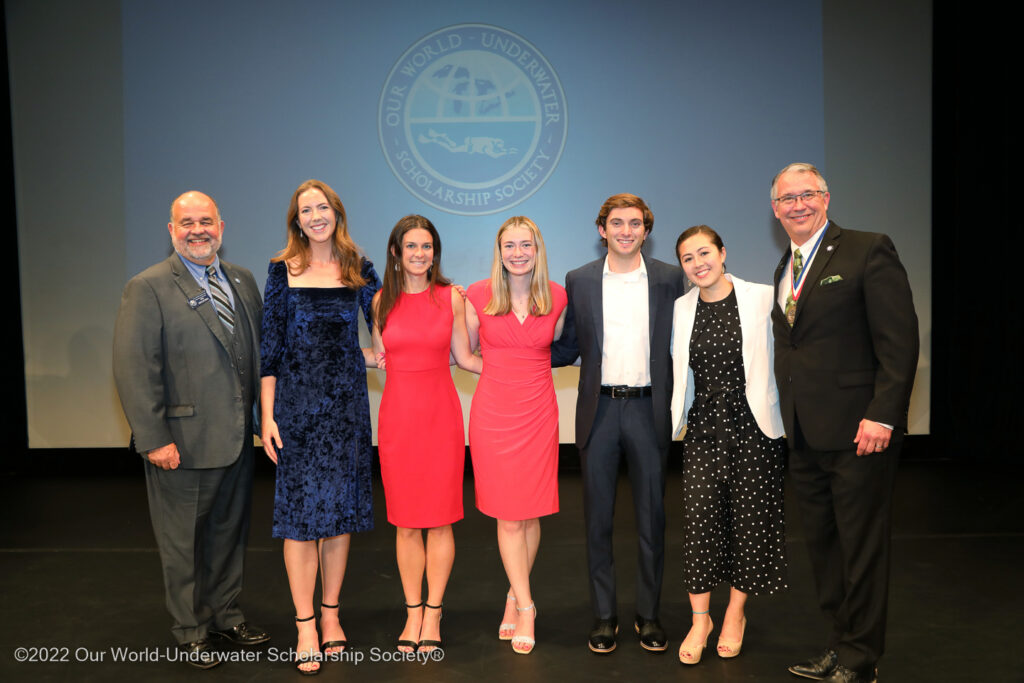
OWUSS Class of 2022 interns alongside President and 1990 Rolex Scholar Steve Barnett (right) and Chairman Vincent Malkoski (left).

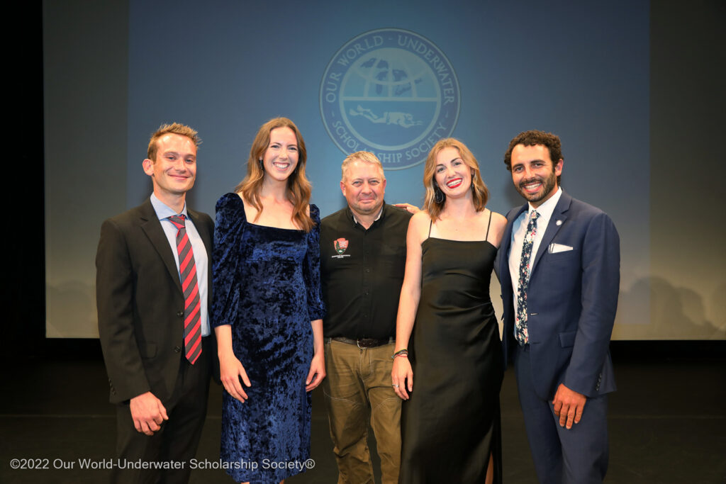
OWUSS NPS Submerged Resources Center interns (left to right: Michael Langhans – 2019, myself – 2022, Sarah Von Hoene – 2021, Shaun Wolfe – 2018) alongside NPS SRC Chief Dave Conlin (center)

For the first time, the OWUSS annual awards weekend now coincides with World Oceans Week, allowing scholars and interns to engage in panel discussions, workshops, presentations, mentoring, and networking events hosted by leading oceans organizations, researchers, and industry professionals. Overarching themes throughout the week include ocean governance, stewardship, and engagement; career coaching and personal branding; adaptive conservation and restoration; and blue economy innovation, to name a few. Thought-provoking points are raised about how the presence/absence of marine life dictates how/where we use/govern the ocean, the importance of quantifying recreational use of marine resources, understanding the political context of the science you are disseminating, the paradox of law without enforcement, and the future importance of interdisciplinary science. Regardless of the speaker, a common conversation emerges – that science is not finished until it is communicated. Reflecting on my experiences as a student and researcher at several universities, I note numerous examples of where academia often stops at 80%. During my time as an NPS intern, I hope to see firsthand how applied marine ecology, archeology, and photography are used to uncover, document, and directly communicate crucial information on natural and cultural resources to policymakers, stakeholders, and the general public. 

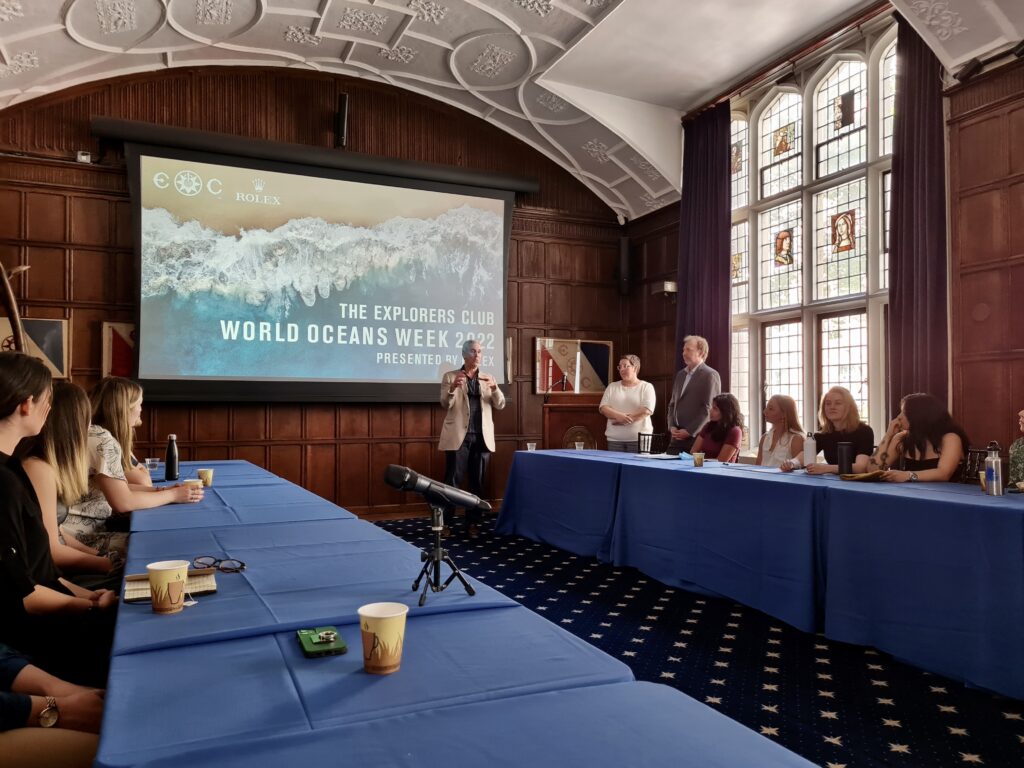
World Oceans Week at The Explorers Club Headquarters in NYC. OWUSS interns and scholars joined several workshops and panel discussions, including one on ocean governance, the blue economy, and oceans and climate change led by Valentina Germani and Francois Bailet of the United Nations.

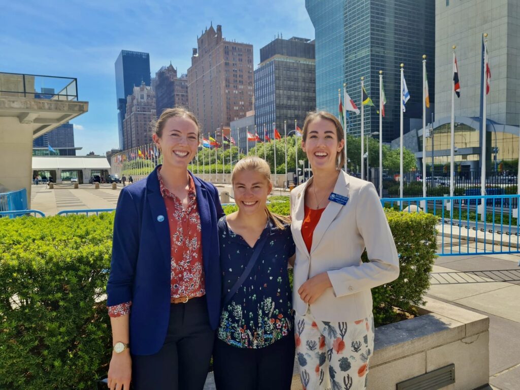
OWUSS interns and scholars were invited to join the in-person United Nations World Oceans Day hosted by the Division for Ocean Affairs and the Law of the Sea. I joined the event with 2019 OWUSS European Scholar Kim Hildebrandt (center) and 2022 OWUSS European Scholar Hannah Douglas (right).

After a week in NYC, I leave feeling inspired yet disconnected. I can’t help but notice how these concrete jungle walls detach us from the natural world, hindering our connection with nature by negatively impacting our accountability for the state of the environment in our own backyard, muffling our understanding of where our food comes from, and amplifying our reliance on instant communication and gratification within our daily lives. Right on cue, after a fast-paced week, I head to Denver, Colorado – home of the Submerged Resources Center. 

A small team with global reach, one only needs to walk a few steps into the SRC office to gain a sense that this is a remarkable group of individuals working to drive their accomplishments. For more than forty years, the NPS SRC has been operational and recognized as a global leader in maritime archeology. Using an interdisciplinary approach and advanced scientific diving, they serve to locate, document, interpret, and preserve cultural resources and provide advice towards their protection. At their Colorado headquarters, I had the great pleasure of meeting and learning from Brett Seymour (Deputy Chief, A/V specialist), Susana Pershern (A/V specialist), and archeologists Matt Hanks, David Morgan, Anne Wright, and Andrew (AJ) Van Slyke. Millie Mannering, the 2022 OWUSS Australasian scholar, is joining us for a week of basic training and final preparations before setting off on her year-long adventure. As the week unfolds, I recognize each person’s unique journey that has led them to this team. I value the unique opportunity that this internship entails, in addition to my duties as a scientific diver, to gain insight into shaping my own individualized career path as I face the transition from graduate student to young professional. 

NPS Submerged Resources Center Headquarters in Denver, Colorado. The entrance is line with underwater photography, magazine covers, and mementos of exploration.

During our first day at SRC, archeologist AJ Van Slyke introduced us to some of his current work. Our overarching goal for the day was to update a predictive map to inform and identify survey locations in search of the Guererro (a Spanish slave ship wrecked in 1827 near the Florida Keys while engaged in battle with a British anti-slavery ship, the HMS Nimble). Based on a comprehensive report AJ wrote, which compiles literature and historical records detailing the events leading up to and following the wreckage, we play out each version of the accounts step by step – somewhat like a board game. The goal is to identify areas of geographical overlap in each ship’s story; however, interpreting historical information often presents significant barriers, as units of measurement can be described as an “arrows reach” away or reference landmarks that may no longer exist or have a documented location. Combined with the variability and inaccuracies of personal reporting and the combined efforts of excavating, analyzing, and interpreting findings, I can see that SRC has their work cut out for them. Nonetheless, the overwhelming successes of SRC in locating and documenting ships in remote, challenging, and unpredictable environments speaks to their hard work, talent, passion, and ingenuity and serves to bring knowledge to both the local and global community on history that has been lost beneath the surface of our oceans for decades. 

OWUSS 2022 Australasian scholar Millie Mannering and I translating field notes into hand drawn maps of historical shipwrecks.

NPS Submerged Resources Center archeologist AJ Van Slyke and I updating a predictive map in search of the Guererro’s final resting place.

We also joined archeologist Anne Wright for a DAN Diving Emergency Management Provider course, where she took us through several training sessions, including basic Life Support (CPR/First Aid), neurological assessments, emergency oxygen for scuba diving injuries, and first aid for hazardous marine life. Although I have maintained First Aid provider and instructor certifications as a lifeguard over the past years, it was a welcome refresher to prepare Millie, SRC archeologist David Morgan and I for a safe and full summer of diving ahead. 

NPS Submerged Resources Center archeologist Anne Wright leading us through a refresher on Diving Emergency Management, including emergency oxygen for scuba diving injuries.

Lastly, it was time for us to complete the Blue Card certification required to dive with the National Park Service. Deputy Chief Brett Seymour took Millie and I through several unique sets of dive and fitness testing, including gas sharing, rescue tows, NPS bailout (jumping into the water, gear in hand, to be assembled and donned on the pool floor), and NPS ditch and recovery (doffing all equipment underwater, turning air off, swimming away, and returning to don your gear). Although many of these skills are not necessarily meant to mimic “real-life” situations, they gauge a diver’s composure and response to stressors underwater and demonstrate the ability to think critically in unfamiliar situations.

Just over two weeks after my internship has begun, and before I’ve even set foot on my first park, I am astonished by the experiences I’ve had and the new network I am a part of. SRC has given me all the tools I need to succeed and then some, and I leave Denver, dive gear in hand, ready to take the leap and kick start what I’ve been selected to do. I want to thank each member of the SRC for making me feel so welcome and for trusting me to represent this team during my internship. Thank you for being exceptionally friendly faces to greet in the office each day, for sharing your current projects with me, and for the friendly conversation over lunch at your favorite spots. Thank you to Dave and Michelle for opening up your home and family to me, for going above and beyond to provide the comfort of a home away from home, and show me the best of Colorado (including a trip to my very first (!!) U.S National Park, Rocky Mountain National Park). Thank you to my internship coordinators, Shaun Wolfe, and Claire Mullaney, for supporting me in the preparations for this summer. Thank you to past NPS SRC interns I was able to meet (including Garrett Fundakowski – 2016, Shannon Brown – 2018, and interns present in NYC) for your helpful advice and for welcoming me into the NPS OWUSS family with open arms and enough stoke to last a lifetime.

Over the next several months, I look forward to traveling to each new place and each new park, with fresh eyes – eager to listen and learn, and apply my skills where applicable. Over time, I hope that many of you reading this blog will become familiar faces, and I look forward to taking you along on this grand adventure. 


Share

Sorry Dolly, 9 to 5 is Boring

My journey as the 2022 American Academy of Underwater Sciences (AAUS) Mitchell Scientific Diving Intern for the Our World Underwater Scholarship Society (OWUSS) began May 16th as I ventured to East Boothbay, Maine. This summer, I am working at Bigelow Laboratory for Ocean Studies in Dr. Doug Rasher’s Lab where I am assisting Dr. Rasher as well as PhD students Rene Francolini, Dara Yiu and Shane Farrell (2018 Dr. Lee H. Somers AAUS Intern) with a project entitled “Maine-eDNA”. This 5-year project, funded by the National Science Foundation,  involves multiple Maine institutions, and aims to improve our understanding of Maine’s coastal ecosystems using molecular ecological tools. As someone who was born and raised in Maine, I was wicked excited to find out I would be participating in such a crucial project, especially one involving the ever-advancing world of eDNA.

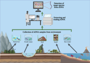
For those who do not know, eDNA stands for environmental DNA and this is a relatively new and upcoming molecular tool in ocean sciences and stands to transform how we monitor and understand global ocean ecosystems. An easy way I learned to understand eDNA, is for instance: if you have any furry or hairy pet, you always end up covered in their hair all the time. Anything that “sheds” off your body will have DNA – your entire genetic code. If you take a sample of dust from your floor, you will certainly find lots of DNA belonging to your furry animal, and plenty of human DNA as well. Of course, you don’t need DNA to know about you and your pets, but you may also find a small amount of DNA belonging to insects or rodents – which would show evidence of critters you may not see often but are secretly living in your house. In any body of water, the same process happens. For example, marine animals such as fish shed scales, mucus, or cells into their environment. So, analyzing eDNA – which is, in this instance, all of the DNA collected from a water sample – can be a powerful “forensics” tool to assess who lives in that habitat. Using eDNA is important because it allows scientists to collect information about the total biodiversity in the ecosystem by metabarcoding all the species (fish, algae, invertebrates, microbes etc.) at a location, as well as tell us about organisms that are too rare, small, or hidden to see with our own eyes.

Image by Liam Whitmore, University of Limerick, CC BY-ND (https://theconversation.com/environmental-dna-how-a-tool-used-to-detect-endangered-wildlife-ended-up-helping-fight-the-covid-19-pandemic-158286). Visual explanation demonstrating the flow of eDNA metabarcoding, which starts with the species from an environmental sample to DNA extraction, and results in a “barcode” for the species found in the sample.

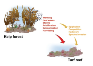
The Rasher lab’s project in the larger Maine-eDNA program, is focused on studying “Species on the Move” within kelp forest (rocky reef) ecosystems across the Gulf of Maine (GoM). Our goals are to track changes in species distribution (i.e. the loss of native species and the arrival of new species to the ecosystem), to study the ecological impacts of changing reef communities, and to develop models that help predict these species geographic range shifts. Now you may be wondering, why are the species moving? As a Mainer, I have grown up seeing the impacts of warming in the GoM, but what many people do not know is that the GoM is warming faster than 96.2% of the world’s oceans (GMRI 2021). Additionally, the Gulf of Maine Research Institute (GMRI) recorded the longest marine heat wave ever last year(2021), which lasted from April through most of August. Long story short, species are on the move in the GoM because of ocean warming and marine heat waves, which directly reduces the survival of kelp (a group of cold-water species that create forests) as well as cause the formation of red algae “turf reefs”.  Kelp and red algae are quite different – the loss of big, complex structures created by kelp may potentially lead to other changes in the flora and fauna on the rocky reefs across the coast. The transformation of kelp forests to reefs dominated by red algae may have consequences for important commercial species, as their larval and juvenile stages depend on kelp forests as refuge from predators.

Modified image from Filbee-Dexter and Wernberg in their article, “Rise of Turfs: A New Battlefront for Globally Declining Kelp Forests”. This depicts the direct (red) and indirect (yellow) drivers of a transition from kelp forest to turf reef (Filbee-Dexter and Wernberg 2018).

How are we collecting data to meet the goals of “Species on the Move” project? Through traditional ecological surveys and experiments in conjunction with eDNA analysis. That is where I come in and I get to be in the field collecting data and participating in lab work. As the title of this blog posts suggests, this summer (and science in general) does not involve an everyday 9 to 5 schedule. Instead, our field days are sometimes from 8 am to 11 pm! Each field day consists of going to one of ten study sites. We try our best to pre-pack the boat with gear, otherwise it is packed the morning of, and we try to leave the dock around 9 am.

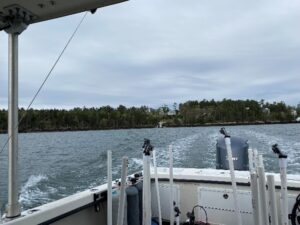
Pictured above (left) is the Bigelow vessel stern and in the opening of the trees on land is Bigelow Laboratory!

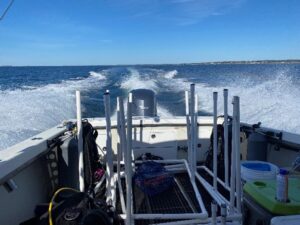
Pictured above (right) includes the PVC frames for squid pops which I’ll talk about below.

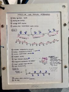
On the way to the dive site, we attach line with buoys to PVC frames, because upon arrival to the site all six frames are deployed overboard in a straight line, spaced 10 m apart. Each frame consists of four “squid pops” which are circular cut outs of dried squid. There are two on the top frame to entice fish to get an estimate of predation intensity and two on the bottom frame for invertebrate (e.g., crab, lobster) predation intensity, which we will later compare between sites that have healthy kelp forests to those where kelp has disappeared. Once all the frames are out, we anchor the boat at the GPS location for the dive site and get ready for the dives. Below is a written dive plan that does a great job at explaining what is required at every dive site. I will do my best to explain each dive 🙂

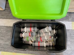
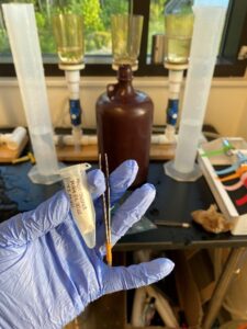
The first dive includes roving fish surveys, eDNA collection (using the syringes pictured above), and juvenile fish and microhabitat swath surveys. Basically, we take two 50 m transects and swim 100 m total, while collecting roving fish data. I also collect four syringes (totaling 2L) at two locations along the first transect and repeat the same process on the second transect. Then on the way back to the starting point, I assist Dara with juvenile fish swaths by spotting tiny fish for 15 m increments along the transect. All the above is repeated on the third and last for the last 50 m transect.

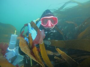
Me and my eDNA syringes in a kelp forest in northern Maine.

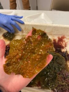
The second dive includes conducting eight quadrat surveys along a 50 m transect. Each quadrat survey includes assessment of percent cover of kelp and other algae found within the 1 m2 PVC frame, stipe counts of brown algae, counts of fish, as well as counts and percent cover of invertebrates (e.g., sponges, barnacles, etc.). In addition, within some of these replicate quadrats we collect metabolomic water samples and collections of microbial communities as part of Shane’s effort to understand how the loss of kelp forests impacts the chemical and microbial microenvironments of the reef. After Shane and Dara take estimates of algae cover, count animals, and collect water, I am responsible for harvesting and collecting all the algae within six quadrats, so that we can calculate an estimate of biomass. This involves collecting all kelp found in the full 1 m2 quadrat as well as collecting all other algae in a 0.25 m2 area of quadrat by hand. By collecting the kelps and algae’s it allows us to get precise measurements of the relative abundances of kelp and red algae species – and ID all the cryptic red algae species – which is important for tracking “species on the move” and for eDNA comparison. Some algae species must be viewed under a microscope in the lab or sent off to a facility to be genetically barcoded, to reveal their identity.

The last dive is used to finish the last quadrat survey, but most likely to collect any leftover gear or more algae.

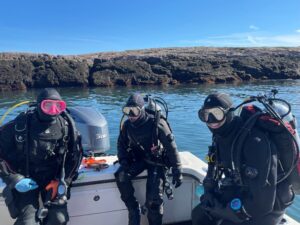
Left to Right: Me, Dara, and Shane before we entered the water for our third dive of the day!

After the dives, we collect the squid pop frames and head back to Bigelow, but the fun for the day does not end there. Once we get back to the lab, take everything off the boat, and clean/rinse gear, lab work starts! First, all the eDNA water samples are put through a filter and all the DNA from the water sample is then stuck to a piece of filter paper, which we save for analysis later.

Seawater from eDNA syringe in graduated cylinder is poured into the filter seen in background.

Filter paper with DNA from filtered seawater collected from Allen Island.

The last activity of a dive day is sorting, IDing, and weighing all the different algae collected from the quadrats! I took a phycology class my sophomore year of college, but I missed out on the lab portion due to COVID. So, this has been a great experience to apply what knowledge I have and of course learn more about algae! I have become familiar with many of the brown algae like Agarum and Laminaria, green algae like Chaetomorpha and Ulva sp, and red blade algae like Chondrus, Porphyra, Lomentaria, Palmaria, and Euthora. These species I have become very familiar with and I am able to identify them underwater too!

Agarum! Known for its holes which is believed to be an adaptation for fast moving water environments.

Lomentaria! Looks like a cactus 🙂

The filamentous branched and branched red tubes are more difficult to ID by just looking at them, so we usually examine them under the microscope. Dara has been a great resource for algae ID and she typically asks me what I think the algae is based on characteristics rather than telling me what the algae is under the scope. Some characteristics that are important for filamentous algae ID include cortication around the cells and pericentral cells.

Algae sorting!

So far, we have completed our spring survey at 10 dive sites, that range from turf reefs in the south to lush kelp forests in the north. For the following few weeks, I will assist the lab with some molecular work, learn about the process of preparing DNA samples for sequencing, and then prepare for the late summer round of diving. I am eager to share with everyone what I learn in the lab!

Share

Sacrifice and Unfinished Scrapbooks — Pearl Harbor National Memorial


Eight Navy battleships sat in Pearl Harbor on December 7th, 1941, their captains and crew members unaware of what was to come early that Sunday morning. The men aboard started the day as they always did – with breakfast, morning duties, maybe a shower and a shave. Perhaps they were preparing for church service. Little did they know that a Japanese strike force consisting of 353 aircraft and 61 ships was headed to the harbor to launch a surprise attack that would become one of the deadliest events in U.S. history. Little did they know that many of them would die that day. 

The Pearl Harbor attack killed 2,403 U.S. citizens and wounded nearly 1,200 more in the span of a mere hour and 15 minutes. Of the eight Navy battleships anchored in the harbor, four of them sank – all were damaged. The USS Arizona was the most irreparably damaged ship out of the fleet, exploding violently after being hit by Japanese torpedo bombers. When the ship exploded and sank, over 1,000 crewmen and officers were pulled down to their watery graves with her. 

The 608-foot-long USS Arizona battleship remains sunken in Pearl Harbor. In 1962, the USS Arizona Memorial was constructed over the hull of the sunken ship and dedicated by the Pacific War Memorial Commission. The site serves as a national historic landmark, a poignant memorial, and a place for education and introspection. The National Park Service (NPS) operates the Pearl Harbor National Memorial (PERL), working in conjunction with the U.S. Navy to preserve and interpret the historical and cultural resources that are associated with Pearl Harbor and the December 7th, 1941 attack. To cap off an already incredible summer and internship experience, I headed to my last destination — Pearl Harbor — to experience the park and dive the USS Arizona wreck. 


As I stepped aboard the small Cessna 208 that would fly me from Kalaupapa National Historical Park to Honolulu, I tried to prepare for the shift I knew I would inevitably face once I landed. I had grown somewhat accustomed to the remoteness and quietness of the Kalaupapa settlement. I hadn’t driven a car over 30 mph for a month and a half, let alone experienced traffic or a busy restaurant. I was very much looking forward to being back in the city, but it’s momentarily jarring to go from a remote place with limited resources to a bustling city with anything your heart may desire. Dan Brown, my PERL point-of-contact, had already anticipated this fact when he picked me up from the Honolulu airport. With keen interest, he asked me about my previous internship destinations as we drove to a Starbucks for breakfast. We chatted jovially until we walked into the coffee shop and I fell silent, staring in overwhelm at the display case and drink menu. It was going to take me a minute to get used to having diverse food options again.
Kelly Moore, the park dive officer at Kalaupapa, made me a beautiful fresh lei before I took off for Honolulu. Thank you, Kelly!

Caffeinated, fed, and eager for what the day would bring, Dan and I drove to the NPS dive locker at Joint Base Pearl Harbor-Hickam. The plan was to dive the USS Arizona that morning and switch out the two buoys that mark the bow and stern of the shipwreck. We were in a bit of a time crunch (Dan had afternoon obligations), so after chatting with Scott Pawlowski, PERL Museum Curator, we quickly put our equipment together and headed to the park visitor center.


A Navy-operated boat shuttle takes visitors to and from the USS Arizona Memorial every 15 minutes for most of the day, but Dan and I were lucky to hop on the last boat before the Navy crew went on a lunch break. As we stepped onto the memorial, the last batch of visitors departed on the boat shuttle. For 45 minutes or so, we had the space to ourselves. I was mentally prepared to artfully dodge visitors while quietly snapping photographs in the background — still a great opportunity, but not quite the same as being there alone. Having the site practically to myself meant that I could take my time experiencing the memorial, paying my respects, and doing my best to capture its symbolic architecture and historical significance. I was extremely grateful for the stroke of luck.
Dan and I got top-notch service on the empty boat shuttle out to the USS Arizona Memorial.

We walked into the USS Arizona Memorial’s entry room and stillness struck me. Despite a steady breeze gradually picking up from the northeast, the air felt calm and quiet. With no other visitors on site, it was practically silent. I stepped lightly, moving slowly across the memorial. The natural flow of the space leads visitors from the entry room to the assembly hall – the main open-air section of the memorial. The memorial’s architect, Alfred Preis, subtly incorporated a number of symbolic features into the structure’s design, particularly in the assembly hall. Seven large “windows” run along each side of the room, a nod to the date of the Pearl Harbor attacks – December 7th. Seven more windows are cut into the assembly hall ceiling to make a total of 21 windows, representative of the customary 21-gun military salute.
An American flag flies over the USS Arizona shipwreck and memorial.

The memorial was built directly over the USS Arizona wreckage. On one side of the memorial is gun turret 3, one of the most visible protruding parts of the shipwreck. On the other side of the memorial, you can see the USS Missouri — one of the WWII-era battleships that is still seaworthy. Also visible are the large white mooring quays the run along the coast. These concrete quays were used to secure the battleships along Battleship Row when the December 7th attack occurred. Aside from the USS Arizona and USS Utah shipwrecks, the mooring quays are the only structures that remain from the Pearl Harbor attack.
The USS Missouri in the distance. The large white structures are the concrete mooring quays.
The mooring quay for the USS Arizona.
Memorial visitors can peer over the railing and see rusty remnants of the USS Arizona shipwreck protruding from the harbor water.

On the far end of the memorial is a rectangular, cut-out section of the floor, which allows visitors to look into the water below. The wreckage of the USS Arizona rests just under the surface. According to Dan, this feature of the memorial was created to give survivors of the Pearl Harbor attack an intimate space to connect with their fallen comrades. Many visitors drop flowers in the water as a way of paying their respects to those who remain entombed in the wreckage. 
I found myself staring over the railing and into the water below for quite a while. I knew that before too long I would be in the water myself, on one of the most significant dives of my career so far.
The natural flow of the memorial leads you over the resting shipwreck and into the shrine room, home of the Remembrance Wall.

The shrine room, the last room of the memorial, quietly demands reflection and reverence. For in it is the Remembrance Wall — a marble wall with the engraved names of the 1,177 sailors and Marines killed on the USS Arizona. It is a collective headstone for all who passed when the ship sank. In addition, two marble placards in front of the wall are engraved with the names of USS Arizona survivors who have since been interred with their fallen comrades. Each year, on December 7th, the Navy and NPS conduct a memorial service and ceremonious internment of recently deceased USS Arizona survivors. 

The Remembrance Wall is a headstone for brothers, husbands, sons, and friends. For many who have visited the memorial over the years, there is a particular name that sticks out amongst the towering columns of first initials, last names, and military ranks. That name is not just indicative of a man who died during the fall of the USS Arizona — it is the name of someone they shared life with, someone they had memories of. Someone they loved.
The Remembrance Wall. At the base of the stairs you can see the two placards that are continuously updated with the names of USS Ariona survivors who are interred with their fallen comrades.
1,177 men, lost in one day.
Memorial architect, Alfred Preis, designed the Tree of Life sculpture to inspire contemplation of life, loss, and renewal.
It’s difficult to see a number — 1,177 — and truly comprehend how many people that equates to. The Remembrance Wall helped me visualize the immense loss of life that took place on December 7th, 1941.
Dan Brown walks through the opposing doorway on the other side of the USS Arizona memorial. To have the memorial to ourselves for an hour was absolutely surreal.


I was captivated by the memorial, but there was even more to be experienced underwater. It was time to switch gears. I carefully placed my camera in its underwater housing and Dan and I began setting up our dive gear on the dock. We didn’t have a ton of time, so we made the decision to hold off on replacing the marker buoys. I think Dan sensed how much I wanted to focus on photographing the wreck, too. I appreciated how accommodating he was, especially when we jumped in, descended, and I realized that my strobes weren’t flashing. We popped back up to the dock and I performed the careful operation of opening the camera housing and fiddling with the strobe connection wire, my arms wrapped in towels so I wouldn’t drip a single bead of water into the housing. Once everything was sealed and operational, we jumped back in and slowly descended once again.
The diver down flag informed passing boats, memorial visitors, and tour guides that Dan and I were diving on the USS Arizona.
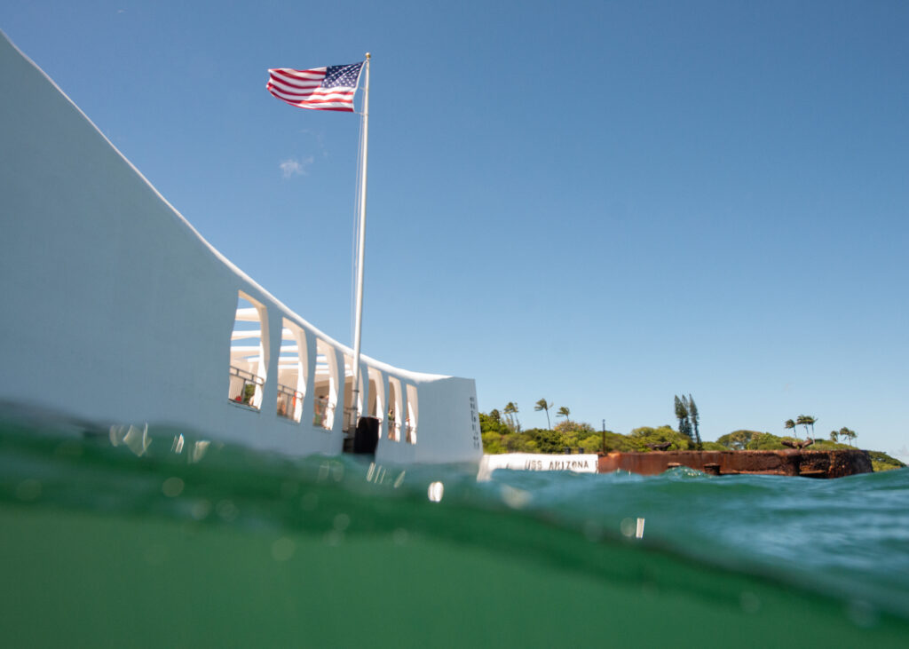
Visitors began to populate the memorial by the time Dan and I started our dive.

I had been told to expect low visibility for the dive, but I was pleasantly surprised to discover that I could, in fact, see further than my hand in the harbor’s murky green water. Dan led the way and I followed, stopping every few feet to take photos and process what I was looking at. I was diving on the USS Arizona shipwreck — something very few people have had the opportunity to do. I moved slower than I ever have on a dive, scanning every bit of the wreckage and looking for artifacts underneath the layers of algae and sediment.

In the same way that the NPS protects the hot springs and geysers in Yellowstone and the petrified wood in Petrified Forest National Park, the NPS closely monitors and protects the USS Arizona and the artifacts that remain on the wreck. It’s no easy feat — they are tasked with preserving, protecting, and interpreting this monumental collection of historical and cultural resources and leaving it unimpaired for future generations. The more time I spent in the park, the more I was impressed by how well the NPS has done just this. By preserving the USS Arizona and its associated artifacts, they have kept the story of Pearl Harbor alive.
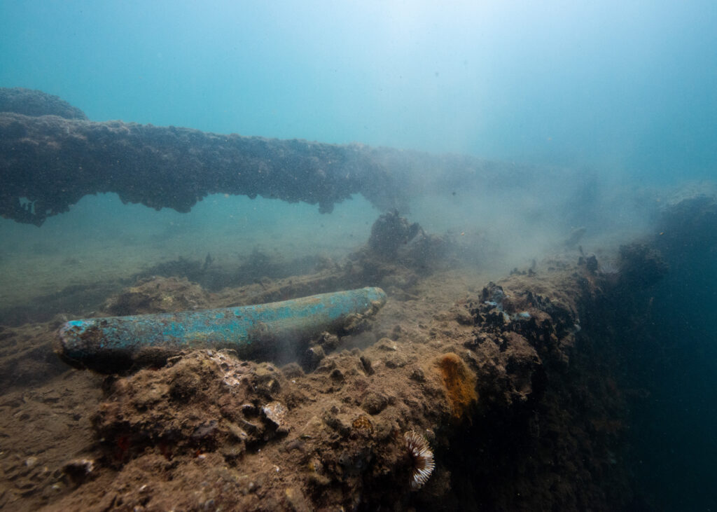
One of the USS Arizona’s mooring cleats remains on the deck of the ship.
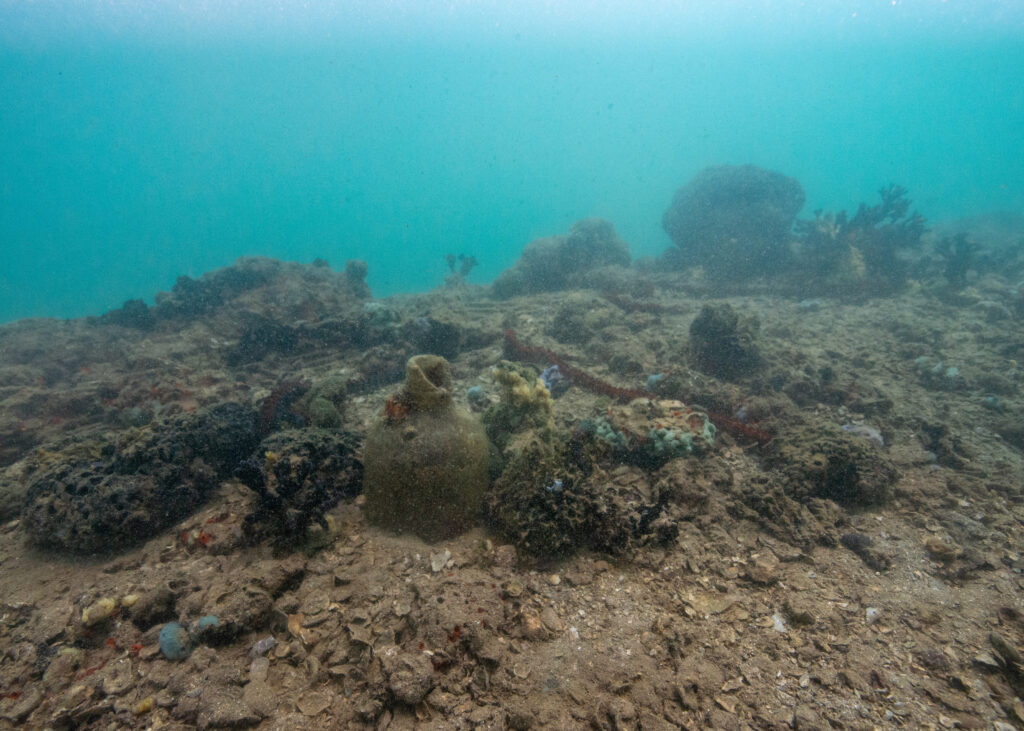
It was haunting to see old pitchers, bottles, and pots scattered across the deck of the wreck.

As I explored the wreckage, thoughts on the significance of sacrifice and the price of peace weighed heavily on my mind. I’ve been diving on shipwrecks before, but the USS Arizona is different. It isn’t just a shipwreck — it’s a mass grave. It is a physical touchstone of one the deadliest events to happen in U.S. history. Even more striking to me is the fact that the ship has been there, laying in the depths of Pearl Harbor, since 1941. My parents weren’t even alive by then. Pots from the ship’s galley lay untouched on the ship’s deck. Soda bottles. Shoe soles. Multiple staircases descend from the main deck into the depths of the wreck, railings still intact. As Dan and I explored it all, I distinctly remember noticing how quiet it was — hauntingly so. The reality of what I was exploring hit me when Dan pointed out the original teak decking of the USS Arizona, still clearly visible under a thin layer of sediment and debris. How many men were standing on this deck when Japanese torpedo bombers started firing from above?
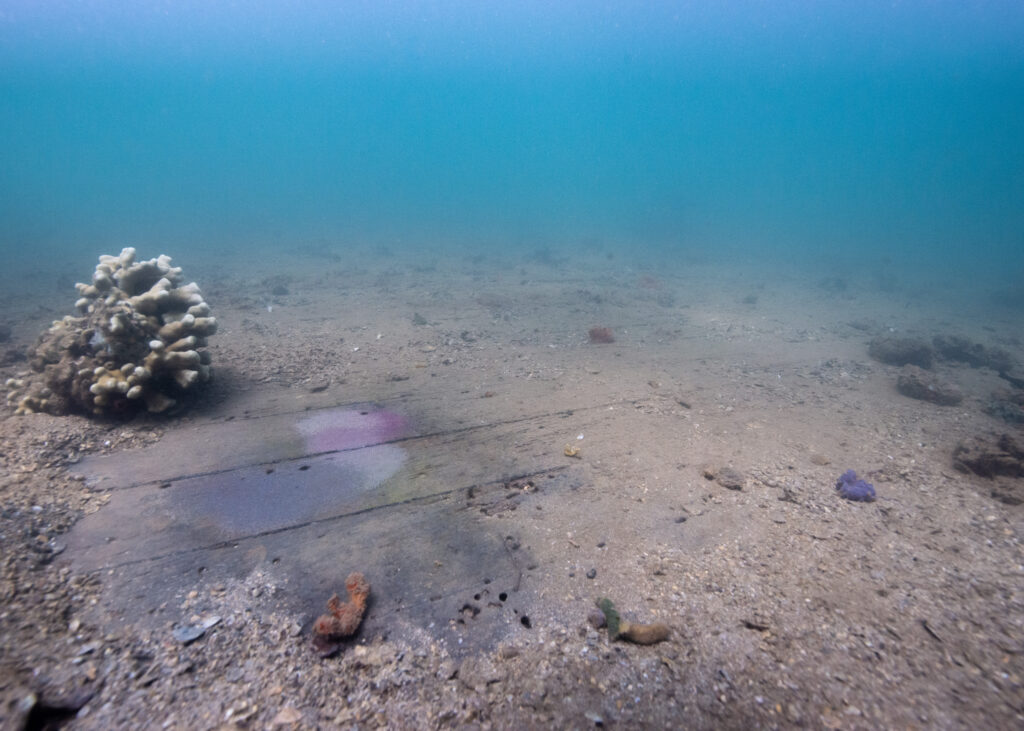
The ship’s original teak decking.
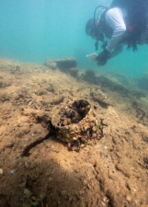
Dan Brown writes notes as we pass over an encrusted cooking pot on the ship’s deck.

Slowly, we made our way around the perimeter of the ship and to the bow. Dan was a fantastic guide, stopping to show me artifacts and features of the ship. At one point, he pointed to a small stream of brown bubbles rising up from a hole in the ship. 80 years after sinking, the USS Arizona continues to slowly leak oil. Some refer to the patches of oil that leak from the ship as “black tears”.
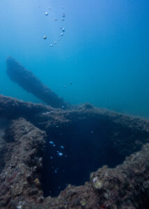
If you look closely, you can see the brown tinge of the oily bubbles as they slowly ascend to the surface.
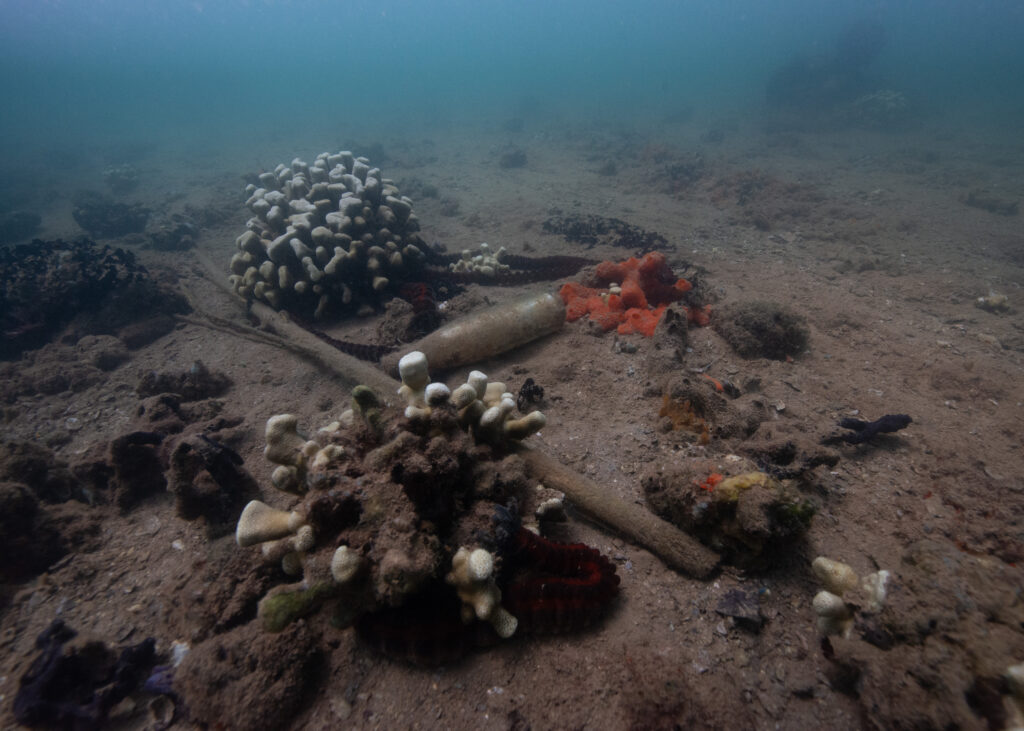
A glass bottle and debris intermixed with small patches of coral. The shipwreck acts as an artificial reef, providing corals with a substrate to grow on and serving as protective habitat for many fishes and marine creatures
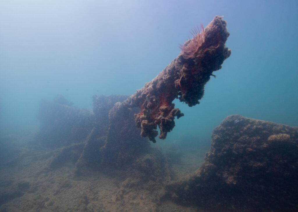
An anemone reaches out from the tip of the ship wreckage, filter-feeding in the water.

The end of an amazing dive is always bittersweet. On one hand, you don’t want to go back to the surface — you want to keep diving! On the other, the moment where everyone surfaces and can finally speak to each other is always exciting. Sometimes there’s so much to talk about, you don’t know where to start. Sometimes you’re at a loss for words, which is where I found myself as we climbed back onto the dock. Before we knew it, though, visitors were walking by and asking us what we were doing (“we’re going to be asked what we’re doing at least a dozen times”, Dan warned me earlier that morning). Talking to the memorial visitors knocked me out of my momentary speechlessness, and Dan and I remarked on the artifacts we noticed and the great visibility — “one of the top five dives I’ve done here,” Dan enthusiastically noted.
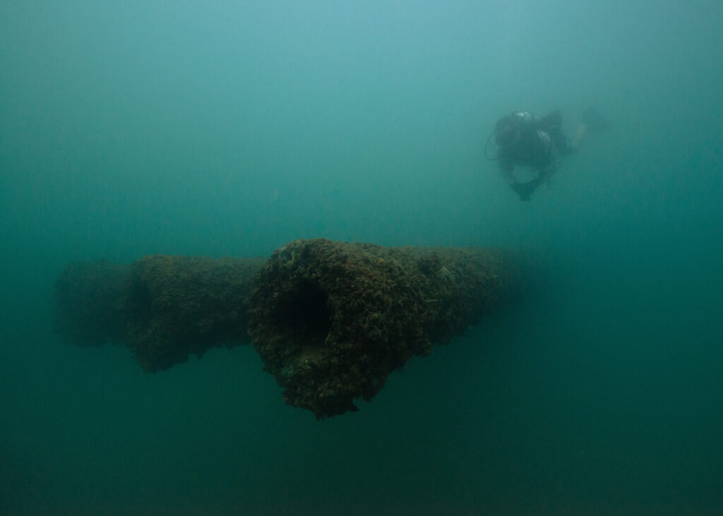
Dan Brown makes his way over the three 14-inch guns at the bow of the USS Arizona.
These guns are nearly 60 feet long — in low visibility, it’s nearly impossible to capture their grandiose presence.
A shift in perspective.


The following day was for topside exploring and seeing more of PERL. Dan and Scott Pawlowski invited me to come snorkeling with them on the north side of the island, an area I was eager to explore. One of my roommates, RB, was also new to Oahu and keen to join us. Dan picked us up mid-morning and we drove up the north shore to Three Tables beach, passing lush forests, food stands, and busy surf beaches along the way. We met Scott at the beach and chatted for a while before swimming out to the reef.
Beach views on the north shore of Oahu.

After the snorkeling excursion, RB and I drove to the PERL visitor center and picked up passes for the USS Missouri and the USS Arizona Memorial. RB hadn’t been to the memorial yet, and I wanted to get a few more shots while I had the chance. As much as I appreciated having the memorial to myself the other day, it was also a special experience to spend time there with other visitors.

From there, we took a shuttle bus to the USS Missouri. The highly decorated battleship is most well-known as the site of Japan’s surrender in World War II. Nowadays, the ship has been turned into a museum of sorts — every few feet, there are informational displays that tell the story of the USS Missouri. We spent a while on the ship, peering into the many rooms onboard and reading about the battleship’s extensive history.
Approaching the USS Missouri.
It was a good thing I had a wide angle lens with me. This ship is huge!
The USS Missouri — tour guide for scale.


On my last day in Hawaii, Scott and I met at the PERL visitor center for a tour of Ford Island and the PERL memorials that aren’t open for public access (Ford Island is still an active military base, hence the inaccessibility). Our first stop was the USS Utah Memorial. As I walked down the memorial’s white dock and looked at the vast landscape ahead, I couldn’t help but picture what the horizon must’ve looked like on that fateful day in 1941. Planes must’ve been flying overhead from every direction, relentlessly bombing whatever was below. In the case of the USS Utah, torpedoes struck the ship and caused it to quickly capsize. Most of the crew made it out alive, but 58 of the men onboard were killed in action. 
The USS Utah lies next to Ford Island. 58 of the ship’s crewmen were killed when the battleship was torpedoed and sank.

The second-greatest loss of life at Pearl Harbor occurred on the USS Oklahoma, affectionally referred to as “the Okie” by its crewmembers. The USS Oklahoma sank quickly on December 7th, 1941 — less than 15 minutes after the first torpedo hit Battleship Row. Within minutes, hundreds of men found themselves trapped under the decks, flipping upside down as water rose all around them. 32 men were retrieved from the wreckage in the next two days. 429 of their comrades never made it out.

The USS Oklahoma Memorial was designed with the U.S. Navy’s tradition of “manning the rails” in mind. The rows of white granite columns stand tall, emblematic of when Navy crews line the ship railings in dress whites when they return to port. On each of the 429 columns is the name of a crewman who was lost with the USS Oklahoma.
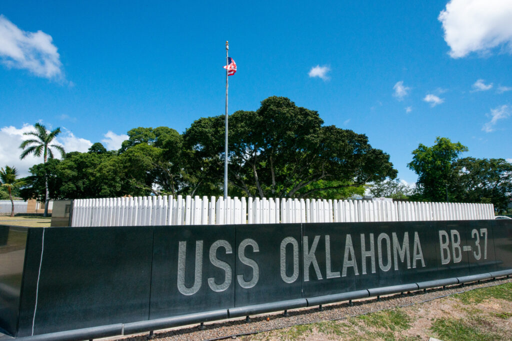
Each granite column of the USS Oklahoma Memorial has the name of a crewman who was lost on the ship during the Pearl Harbor attack.
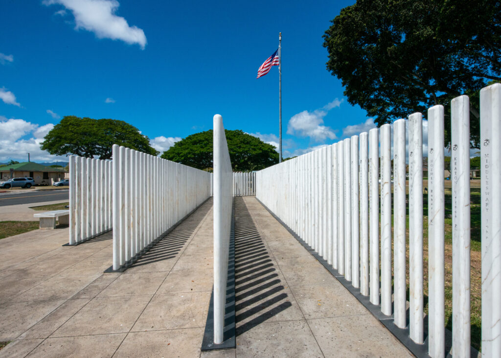
NPS routinely takes standardized photos of each column of the USS Oklahoma Memorial, which helps them monitor wear and tear and perform repairs when needed. Over the years, the granite can crack and degrade from the salty air and sunshine.


Every part of my PERL experience had its own respective impact. Photographing the USS Arizona Memorial and spending time in the shrine room helped me comprehend the mass loss of life that took place during the attack. Diving on the USS Arizona itself put the scale of the event into perspective. Viewing the other memorials gave me an appreciation for all the time, money, and effort that has gone into making PERL the educational and historic site that it is today. However, I don’t think I emotionally processed what happened at Pearl Harbor until I was in the depths of the museum collections building with Scott.
The museum collections building has rooms and rooms of artifacts, documents, and memorabilia that are related to Pearl Harbor and the 1941 attack.

Being the museum curator, Scott knows the story behind practically every artifact in the collection and has even stayed in touch with many of the families and individuals who have donated items. We took our time in each room as he showed me WWII-era swords with handles made out of shark skin and combat medic hats, rusty but still intact. Every piece had a story, and oftentimes Scott could tell me about the individual who brought the item in, where it was from, and exactly how it was discovered.
Scott presents a WWII combat medic’s hat.
This Japanese hatbox belonged to a soldier who died in the Pearl Harbor attacks. Years later, his widow actually came to Pearl Harbor and was able to visit the collections building and see the hatbox for herself. Scott said there wasn’t a dry eye in the room that day.

We continued to work our way into the collections, moving from larger artifacts to smaller items, like medals and papers. I could’ve easily spent hours sifting through the pages and pages of carefully preserved newspapers. Seeing the old pages and dates put into perspective just how suddenly the month of the Pearl Harbor attack went from a typical December to a month of immense loss, grief, and trauma for the entire United States.
I could’ve easily spent hours sifting through the pages and pages of old newspapers in the PERL museum collections building.
Carefully stored and preserved uniform pieces.

The last items Scott pulled out were old leather-bound photo albums, purchased by sailors when they arrived at new ports and filled with old photographs of their families, friends, and travels. As Scott carefully flipped through the pages with gloved hands, I was hit with a staggering wave of emotion. On December 7th, 1941, in less than two hours, the lives of so many men just like the ones in the photo albums ended. In a sudden and tragic moment of sacrifice, their lives became unfinished scrapbooks and uniforms that would never be worn again.
Walter F. Staff’s photo album from his time on the USS Oklahoma.
The sailors’ photo albums were filled with photos of their friends, families, and the new places they traveled to during their deployments.
Flipping through the pages of sailors’ photo albums provided insight into their travels and the memorable events they partook in along the way.
“Wow!”


Going to Pearl Harbor at the tail end of my internship and thinking about how precious life is – and how quickly it can be lost – reminded me just how important it is to embrace each day you get to live, especially if you’re lucky enough to spend those days doing what you love. I left Pearl Harbor feeling incredibly reflective and indescribably grateful to all those who made it possible for me to experience the national memorial in such an intimate way. A huge thank you to Dan Brown and Scott Pawlowski for generously sharing your time and showing me the historical and cultural resources of Pearl Harbor National Memorial. Thanks to Shaun Wolfe for finding me great accommodation while I was on Oahu, and to OWUSS and the NPS SRC team for providing unwavering support throughout my internship.

Lastly, thank you to those who have followed along with my journey and provided encouragement and kind words along the way — it has meant so much to me. If you’d like to read my final thoughts and reflections from my internship experience, keep an eye out for my final report. I hope you will continue to follow the journeys of future interns and support the efforts of OWUSS and NPS. There is no question that this experience has monumentally changed my life, in ways that I probably cannot comprehend quite yet. I look forward to taking what I have learned this summer and continuing to preserve, study, and document the incredible underwater resources of Earth’s oceans. 
Share

The Kalaupapa Chronicles Continue

Two weeks into my stay at Kalaupapa National Historical Park, I had already trekked through the Hawaiian backcountry, participated in survey dives around the peninsula, and assisted with helicopter operations in the park (read about all of those adventures in my previous two posts). Little did I know at the time, that was only the beginning of my Kalaupapa experience. The initial plan was to spend three weeks in Kalaupapa and then travel to American Samoa for another three weeks. However, American Samoa was only just beginning to allow people on and off the island, and it seemed risky at best to board a flight there (I was told I may not be able to get out if the government changed travel regulations again). 

Thankfully, Kelly Moore — park dive officer and marine ecologist — was able to finagle a few more weeks of housing for me in Kalaupapa. What was initially a three-week stay turned into a six-week stay — and it did not disappoint! I was lucky to participate in a number of projects that the Kalaupapa Natural Resources Division manages throughout the year: helping with the annual Barge Day, providing annual maintenance to the park’s weather monitoring station, surveying endangered Hawaiian monk seal populations, and even getting my Wilderness First Responder certification. 


BARGE DAY

Barge Day is Kalaupapa’s “Christmas 2.0”. Once a year, a monstrous shipping barge arrives at the park, carrying an entire year’s worth of non-perishable goods, fuel, building supplies, vehicles, and other large pieces of cargo, appliances, and machinery. Barge Day was originally scheduled for the first Saturday I was in Kalaupapa, but weather and other logistical issues delayed the barge’s arrival until a few weeks into my stay. When we received word that the barge was, in fact, arriving after weeks of being postponed, a rush of anticipation and excitement filled the air. New cars, fresh crates of soda and beer, and materials for the construction of a new dive locker were on the way!

On the morning of Barge Day, I biked across town to the natural resources office, energized and eager to witness the barge’s arrival. I noticed that sections of the road had been blocked off and residents had placed camping chairs out along the shoreline so they could watch as the huge vessel slowly made its way to the settlement. What started as a speck on the horizon eventually grew into the clear outline of a barge, and after a few hours, it was docked and ready to be unloaded.

The barge delivers crates, shipping containers, and boxes of non-perishable goods and materials, along with new cars and other pieces of machinery that are used in the park.

Unloading quickly began, and the settlement turned into a bustling hive of activity. Workers on forklifts zoomed around, dropping containers, pallets, and boxes along the side of the road for inspection. Kelly and I volunteered to help with inventory checks, so our tasks involved identifying each order and confirming that the correct type and quantity of each item made it to the settlement. We stayed busy for most of the afternoon, but got to enjoy some special treats throughout the day, like shaved ice and a delicious lunch. All in all, it was a fun community event to be involved in, and I was particularly happy to meet some of the residents that I had yet to interact with. It seemed like everyone came out to witness the event!

A pack of forklift operators gather, ready to move the next pile of unloaded goods.


WEATHER STATION MAINTENANCE

Average temperatures on the Pacific Islands are on the rise, and Hawaii has experienced a statewide decline in rainfall over the past two decades that is predicted to continue. Such climate projections come from models that are developed from existing weather data. All Pacific Island Network (PACN) parks have weather stations to help facilitate real-time tracking of weather conditions and provide data for climate modelers. 

One of Kalaupapa’s weather stations is on the east side of the peninsula in Makapulapai, just off a dirt road that runs along the coast. The tower of weather instruments and wires stands tall in a brush-filled field with the cliffside in the background. On the station is an anemometer to measure wind speed/direction, a rain collection vessel to measure precipitation, and other sensors to quantify relative humidity, solar radiation, and temperature among other parameters. One morning, Glauco, Kelly, and I packed up the truck and drove across the peninsula to do annual maintenance on the station. 

Kelly and Glauco trek through the bushes to reach the weather station.

Inside the weather station’s control panel is a computer that stores all the data collected by the station’s many instruments.

Tagging along for some of the land-based work that Kelly and Glauco conducted in Kalaupapa provided a lot of insight into just how many ways natural resources are monitored, surveyed, and managed within the park. Marine fish surveys are equally as important as freshwater invertebrate surveys, and monitoring the monk seal population in the park is just as valuable as monitoring the park’s weather trends. To truly gain a comprehensive picture of the state of Kalaupapa’s natural resources (or any ecosystem), one must consider the interconnected nature of ecosystems. By assessing as many ecosystem components as possible, we come closer to better understanding the many ecological relationships at play and the inevitable impacts of ecological change

After extracting the data and doing a system update, we needed to change out some parts. The tall tower on the station can be lowered to make for easy maintenance.

Glauco runs a new wire down to the tower’s control panel.


SEAL SEARCHING

There’s always that one character in an animated children’s movie that’s undeniably adorable (think minions from Despicable Me). They always have huge eyes and chubby cheeks and are usually made into stuffed animals because every small child wants to hug them (and because of consumerism, but that’s a different topic). Well, Hawaiian monk seals are Kalaupapa’s version of that movie character. 

Hawaiian monk seals are one of the most endangered seal species in the world. Endemic to the Hawaiian islands, the doe-eyed marine mammals are heavily protected by Hawaiian state laws, the Endangered Species Act, and the Marine Mammals Protection Act. Many of them make their way to the beaches of Kalaupapa NHP each year to pup and haul out (i.e. rest), and oftentimes the pups will return once they’ve matured. NPS and NOAA work together to monitor the seals, track and record new births, and vaccinate the seals against morbillivirus — a virus similar to canine distemper.

Glauco uses binoculars to read the ID tag on the fin of a sleeping monk seal. Monitoring and photos were conducted under NMFS Permit #22677.

I joined Glauco and Kelly on seal monitoring beach walks a few times during my visit to Kalaupapa. During my first one, I struggled to spot the seals as they lay stretched out and sleeping on the beach. From a distance, they look a lot like rocks. Over time, I became better at distinguishing their unique shape and light gray stomachs from afar. We walked along the beach, keeping our eyes peeled for seals. If we spotted one, the next step was to identify the seal and see if they needed vaccinations. Monk seal pups don’t have antibodies to protect them against morbillivirus, so pups are vaccinated in an attempt to prevent the disease from spreading and having substantial impacts on the population.
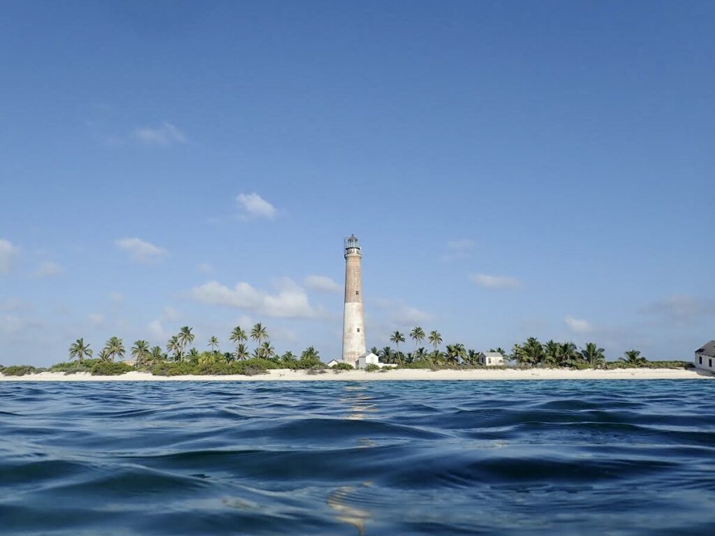
Glauco uses a commercial hair lightener to write a seal’s ID number on its back. This makes for easier identification in the future. Monitoring and photos were conducted under NMFS Permit #22677. 

Here, Kelly preps a vaccine syringe, which is administered from a distance using a tranquilizer pole.

These seal monitoring and management efforts are part of NOAA’s Hawaiian Monk Seal Recovery Plan, which aims to conserve monk seal habitat, reduce mortality factors such as disease, develop education and outreach programs focused on minimizing human disturbances, and facilitate seal monitoring during pupping and hauling out events. With only an estimated 1,400 individuals in the population, there is concern about whether the genetic diversity of the population can be maintained in the long term. Hopefully, the efforts of NOAA, NPS, and other partnering organizations will help assure the long-term viability of the monk seal species in the wild.
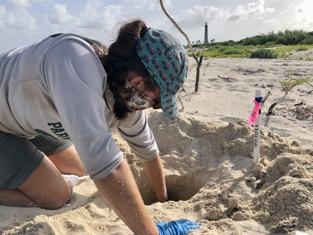
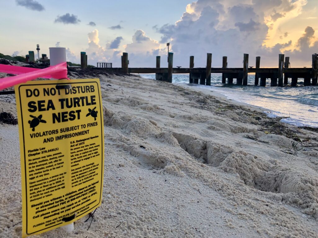
Most of the seals were heavy sleepers. We could ID them, photograph them, and apply the hair lightener without them waking up. We just had to cross our fingers that they wouldn’t roll over on their backs before the hair lightener had taken effect. Monitoring and photos were conducted under NMFS Permit #22677.
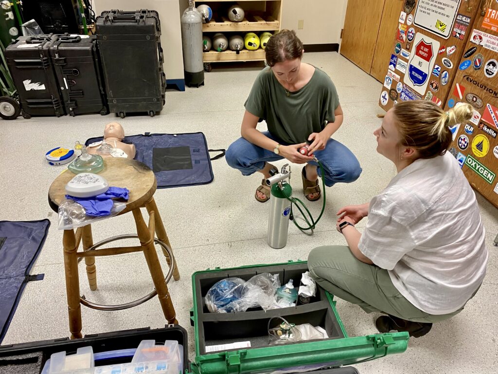
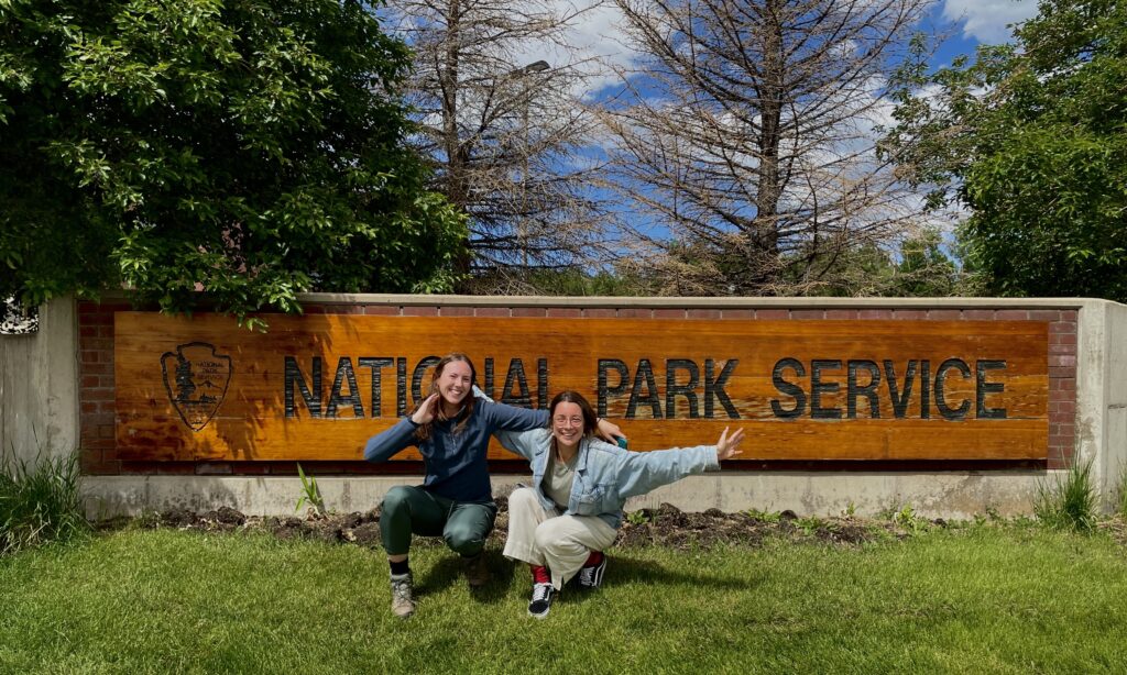
When doing monk seal surveys, it was important to keep a distance and avoid disturbing the animals. If the seals are severely frightened, they may not return to the area. Monitoring and photos were conducted under NMFS Permit #2267.

Knowing that there was so much marine life and activity going on underwater motivated me to snorkel and free dive as much as I could in the evenings and on the weekends. Camera rig and snorkel gear in hand, I’d jump into the water and venture out to see what was going on under the waves. I hoped to see one of the seals underwater and get some photos (from a safe distance), but it seemed like every time I had the camera with me the seals were nowhere to be found. Still, I’d stay busy taking photos of rays, lobsters, and the colorful corals scattered across the reef.

On one of my last days in Kalaupapa, I was swimming back to the wharf after snorkeling for a while and saw a grey figure move swiftly out of the corner of my eye. After weeks of snorkeling around Kalaupapa, I found myself underwater with a monk seal! The encounter was short-lived, but I quickly held up my camera to take a photo of it in the distance. The seal was gone before I knew it, although I immediately checked my camera and found that I had taken one single photo of it looking at me. I’m no wildlife photographer, but the experience made my day after so many weeks of wondering if I would have such an encounter. 

Lots of my evenings in Kalaupapa were spent enjoying the sunset from the beach and snorkeling with the camera.
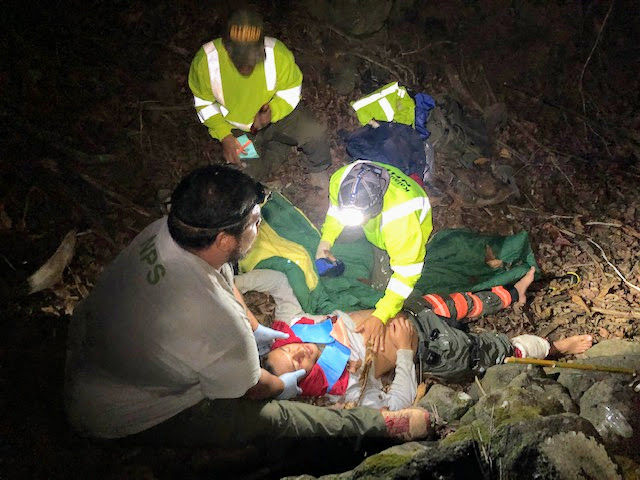
Can you see it? A monk seal cautiously swims by me in the Kalaupapa wharf.


WILDERNESS FIRST RESPONDER

One of the most exciting parts of my time in Kalaupapa was getting my Wilderness First Responder (WFR) certification. The WFR course provides definitive medical training for those who work or recreate in remote, low-resource outdoor environments — and Kalaupapa is the epitome of such an environment. Kelly organized for a WFR instructor to come to the settlement and teach the course to about a dozen NPS and DOH employees, and I was lucky to jump in and take the course as well.

During my last 10 days in Kalaupapa, my coworkers and I learned how to handle a plethora of medical scenarios, from minor health issues to life-threatening medical emergencies. Someone’s blood sugar crashed while they were hiking? Solved with fast-absorbing sugar, fluids, and calories. Someone was in a car crash and fractured their femur? Time to make a traction splint and get them to the hospital ASAP. We covered snake bites, hypothermia, heart attacks, heat stroke, you name it. Each day involved hours of classroom lectures with hands-on exercises and surprise scenarios mixed in throughout the day. We never knew when we would hear someone yelling outside and have to grab our backpacks, rush outdoors, assess the scene, and put the skills we were learning in class to the test. Matt May, owner of 4Points Expeditions and our WFR instructor, brought along bruise paint and stick on wounds to make the scenarios slightly more realistic. Acting ability was a huge component of making a practice scenario realistic, too. In retrospect, I got as much practice keeping a straight face during scenarios as I did learning to tie splints and wrap bandages correctly — and I’m definitely better at tying splints.

A scenario victim waiting for extraction. If someone has a fractured femur, they won’t be doing any walking out of the accident scene.

On the last day of the WFR course we had our final scenario. Matt recruited community members to help him stage an accident scene somewhere on the peninsula, and our crew was told to open an envelope in the classroom at exactly 18:00 (doing the scenario in the dark made for an added challenge). Everyone paced around nervously in the minutes leading up to the big reveal, backpacks and headlamps at the ready. When it was time, we opened the envelope and read the scenario: two hikers had been reported missing after not returning from a day hike on the east side of the peninsula. We needed to conduct a search, locate the individuals, and provide any care they may require.

The operation went off without a hitch. We drove to the area where the hikers were last seen, conducted a search, and located the injured victims (plot twist — there ended up being five). Matt forewarned us that the final scenario could take hours for groups to complete, but in less than two hours we had extracted all the victims and were back at the cars. To our delight, Matt told us that we were one of the best groups he’d worked with. Go team NPS and DOH!

Teamwork is critical when handling emergency medical situations in the remote backcountry. In this case, there was one person to record notes, one to hold the victim’s head (in case of spinal injury), and one to see to the victim’s injuries.

Matt (center) assesses the well-crafted litter that our crew built during the final WFR course scenario.


SAYING FAREWELL

I’ve struggled to write something that fully encapsulates my six weeks in Kalaupapa. Like all national parks, Kalaupapa NHP has an incredible story behind it — a story of resilience, perseverance, and the power of the human spirit. This place, which was once overshadowed by dark realities of exile and disease, now serves as a site for preservation, education, and refuge for those who have called the peninsula home for decades. Living there demands reflection — for the challenges that come with living there today are nothing in comparison to what those who lived there before endured.

I learned a lot about myself in the last six weeks, and I learned even more about community. My fondest memories of Kalaupapa are not the ones where I got the camera shot I hoped for or saw something thrilling underwater. Rather, I remember when long-time Kalaupapa resident Johnny chased Kelly across town just to give her fresh mangoes from the tree in his yard because he knew how much she loved them. I remember how Glauco would give me a kind smile and words of encouragement when I was having a tough day, and I remember hiking all over the peninsula with Kelly, talking about life and work and relationships and everything in between. The moments of togetherness — sharing meals, snorkeling together, and going out of the way to help each other out  — are the moments I’ll remember.

Thank you to the entire community for welcoming me to the settlement, sharing your lives (and food) with me, and teaching me so much about Kalaupapa — what it once was and what it is now. I am incredibly thankful to have been able to spend as much time as I did on the peninsula, and it wouldn’t have been the same without everyone’s kindness, compassion, and generosity. Kelly and Glauco, I couldn’t have asked for better hosts and coworkers. And of course, a big thank you to OWUSS and the SRC for supporting me on this wild ride. Aloha, and until next time!


I will remember these Kalaupapa sunsets and evening walks with friends for a long time to come.

Share

Trading Dive Fins for Hiking Boots in Waikolu Valley


I was bushwhacking through the Hawaiian jungle, clothes still wet from the day before. The sweet yet pungent smell of fermenting guava permeated the humid air, and my boots squished as I stepped on one of the overly ripe yellow fruits littered on the ground. As I trudged, I looked closely at the overgrown trees and bushes, occasionally plucking a white ginger flower and sucking the sweet nectar from its stem. Slowly, the sound of running water grew louder and louder. We were almost there. 

It was my second week in Kalaupapa National Historical Park, and I was taking a break from dive operations and marine surveys. This week, I was helping the NPS Inventory & Monitoring (I&M) Pacific Island Network (PACN) with freshwater stream surveys in the steep forested Waikolu Valley. I&M has monitored Waikolu Valley’s water quality and freshwater habitats since 2006. Freshwater ecosystems are quite vulnerable to anthropogenic impacts (eg. land-use change, invasive species, eutrophication (i.e. excessive nutrient richness), and temperature changes). Collecting data provides insight into long-term trends in water nutrient levels and population dynamics of freshwater fish and invertebrates, some of which are endemic species that cannot be found anywhere else in the world. 

A view into Waikolu Valley from the mouth of the stream, where freshwater meets the ocean.

The opportunity to work with the I&M crew for a week meant trading out my fins for hiking boots and my Halcyon BC for a Kelty 50 liter pack. We were heading into the backcountry. I looked forward to the opportunity to see Kalaupapa from a different perspective. I didn’t have much idea of what to expect for the week, but I knew that I was in good hands. Glauco, the Biological Science Technician at Kalaupapa, also works with the I&M crew and had done the Waikolu Valley surveys many times before. Joining us was Anne Farahi, the Lead Aquatic Biological Science Technician, and two additional I&M technicians, John Benner and Esaac Mazengia. 

Glauco, Anne, and Esaac work on packing and prepping equipment in the office. With the unpredictable weather in Waikolu Valley, waterproof bags and sealed plastic crates are essential to keep things dry.

Rather than packing all of our gear, food, and surveying equipment out to our campsite, we had most of our belongings dropped off via helicopter. Kalaupapa NHP occasionally uses helicopters to complete park operations, and this week, they were used for gear drop off and to remove several massive super sacks of marine debris from one of the park’s beaches. On the first day of the project, Glauco and I hiked down to the beach with the debris and waited for the chopper to meet us. When it approached, Glauco caught the strap hanging from the chopper and secured a sack. Within seconds, the chopper lifted the sack and flew away to the other side of the peninsula. After a few repetitions, the beach was finally waste-free. Afterward, the rest of our crew — Anne, Esaac, and John — met us and we began the trek across the rock and pebble-dominated beach to our campsite at the mouth of the Waikolu Valley. 

Glauco, dressed in bright yellow to make him more visible for the helicopter pilot, watches the chopper fly in to pick up the large white super sacks of marine debris.

After heli-ops, we set out on our hike across the very rocky beach to Waikolu Valley. I only faceplanted once!

—  

The next morning, I awoke to the rhythmic sounds of waves crashing ashore and the slow trickle of sunlight into the valley. My 40-degree sleeping bag was plenty to keep me comfortable overnight, and I relished the warm air as I rolled out of my tent — a much more enjoyable experience than waking up shivering in the Colorado mountains (the backpacking experience I’m used to). I emerged from my tent and began my morning routine: breakfast, packing my daypack (and shaking the ants off of it), and getting dressed for a day in the forest and streams. By 8 a.m., we started our hike up into the valley. 

Our gorgeous campsite at the mouth of Waikolu Valley. In the mornings and evenings, we’d watch as wild goats played on the red cliffs.

The hikes to our survey sites were the epitome of bushwhacking

I already knew that Kalaupapa was rich with living resources. In the settlement, there were banana and mango trees on practically every corner. The sweetest, juiciest oranges could be plucked from trees on the outskirts of town, and on the avocado trees were some of the largest Haas avocados I had ever seen. On top of that, Kelly had shown me how to process coconuts to collect their meat and milk, and Glauco had shared his freshly caught venison with me during my first week in the settlement. Still, as we hiked through the Waikolu backcountry, Glauco and Anne opened my eyes to even more that Kalaupapa had to offer. Red ginger plants lined the trail and produced a fragrant, soapy liquid when their pinecone-shaped bulbs were squeezed — a perfect alternative for hand soap or shampoo in the Hawaiian backcountry. White ginger quickly became my favorite, as it reminded me of the honeysuckle bushes in my childhood neighborhood. The ginger roots, scuffed down to the yellow by wild pig and goat hooves and our own boots, peeked out of the ground as we walked through the forest. It seemed like everywhere I turned, there was something edible to be found. Coffee plants, guava and strawberry guava, taro, kukui nuts, bamboo, tea plants — they were all growing happily in the forest. 

John (left) and Esaac (right) try a Jamaican vervain flower. They really do taste like shiitake mushrooms!

The smell of fermenting guava will forever be ingrained in my sensory memory. It was great to pull one off a tree for a midday snack, though.

Glauco passes by an ancient mango tree alongside the trail.

Anne had done enough surveys in Waikolu to know each survey site by sight, and Glauco had a GPS to use for secondary confirmation that we were surveying the correct spots. Since I had never been in the Waikolu Valley before, I never really knew exactly where we were going or how long it would take to get there. In the mornings, the unawareness was nice — the hikes felt exciting and exploratory. Once we reached a survey site, the five of us would drop our bags on the side of the stream and get to work. We had a number of surveys to do at each site. Some were to assess water conditions, such as nutrient levels and streamflow. Other surveys involved assessing the Hihiwai population — Hawaiian freshwater stream snails. 

Glauco (left) and Esaac (right) use a FlowTracker to measure the water velocity of the stream. The FlowTracker is a highly precise tool that requires careful handling and lots of focus.

The lives that these tiny freshwater snails live are remarkable. Eggs about the size of sesame seeds are deposited by adult snails onto the sides of rocks in the freshwater stream, where they remain until they hatch. Once hatched, the larvae are quickly washed downstream and into the open ocean. Months go by as the larvae grow, and after about a year the young snails begin the pilgrimage of a lifetime — a march, in single file order, upstream and back into the valley. Their strong muscular foot allows them to cling to rocks and withstand the force of waterfalls as they move into the current of the stream. 

At each survey site, we would stretch a transect tape 30 meters downstream. Then, we would conduct surveys at certain points along the site transect.

John (left) and I conduct snail counts and measurements. John would hold a small square quadrat down on the stream bed and remove any snails he found in the quadrat. Then, I would measure each one and record the data. The trickiest part was placing the snails back in the stream. If they weren’t secured properly, the rushing water would quickly flip them over, leaving them susceptible to crayfish predation.

John conducts a pebble measuring assessment. Sometimes we were measuring large boulders or bedrock instead, as pictured here.

In addition to the snail population, we surveyed the freshwater fish populations at each site. In Hawaii, there are only five native species of freshwater fish. All five species are gobies — adorable little fish with huge upward-pointing eyes that spend most of their time resting on the bottom of the stream and looking for food. Between the fish, snails, and the crayfish that also called the stream home, there was a lot going on in such a relatively small amount of water. 


John holds a crayfish from the stream. These guys were curious — they loved climbing on our shoes or nibbling at our hands while we were working in the stream.


After each day of site surveys, we would pack up around 16:30 and trek back down to the mouth of the valley. As magical and enchanting as the morning hikes were, the afternoon hikes back to camp often made me feel like I was a character in Jumanji, trapped in the jungle and trying to find my way out. Mostly, I was just ready for dinner. Before I knew it, though, we’d get back to the campsite just in time to watch the sky turn pink and orange as the sun went down. And of course, dinner was always fantastic. 

Anne works her way through a very overgrown section of trail.

I’m not sure how a car got so far up into the valley — needless to say, it never got back out.

Jurassic Park vibes, anyone?

When it rains, beautiful waterfalls pop up all over the steep sides of the valley.

Sunset views from camp.

— 

The end of the week brought mixed feelings. I would’ve loved to stay at the campsite for a few more days — it truly was one of the best spots I had ever camped. At the same time, I desperately longed to put on dry clothes and shoes. Thankfully, the crew’s collective energy helped me push through the last day of surveys. After checking off four more sites, we packed our bags and trekked back across the beach. All in all, the week of surveys was a success. A huge thank you to Anne Farahi for leading our crew and sharing her immense knowledge of Hawaiian aquatic ecosystems with me. To John and Esaac — thanks for sharing your snacks (I’m a Belvita convert now), keeping the jokes flowing, and being awesome crewmates. Glauco — your venison mac n’ cheese is one of the best camp dinners I’ve ever had. Thank you for showing me all the incredible resources of Kalaupapa and for keeping crew morale high with great food and evening card games. Great crews make for great field projects, and I was lucky to be able to work with such fine folks during the week in Waikolu. 

Packing out after the end of a successful week of surveys. Falling rocks were a hazard as we crossed the beach, hence the hard hats.

Gotta end things with a crew selfie!

Share

Gaining Perspective in Kalaupapa National Historical Park

In some way or another, Covid-19 brought isolation into all of our lives. It’s been begrudgingly endured by some, greatly appreciated by others — but entirely unavoidable for everyone. I handled it much like everyone else probably (?) did… with some good days, when I reveled in the quiet comfort of my home, and some bad days, when I stared out the windows of my house feeling as though I was trapped in a fishbowl with my life on pause. Despite all the ups and downs, I hoped that experiencing so many months of pared-down social life would somehow benefit me when I began my internship. After all, I was scheduled to travel to some of the most remote national parks on the map. 

Kalaupapa National Historical Park is one of those parks. On the Hawaiian island of Molokai, the Kalaupapa Peninsula sits at the base of a 2,000 ft. sea cliff wall (“pali” in Hawaiian), separating it from the rest of the island. “Topside” Molokai is only accessible from Kalaupapa via boat, aircraft, or a steep 2.5 mile hike or mule ride up the sea cliffs. The history of the area is replete with vibrant Hawaiian culture and beautiful, bountiful land. However, due to its remote geography, Kalaupapa Peninsula’s history also has a dark side — one involving exile, disease, and forced isolation. 

An aerial view of the Kalaupapa settlement.

In the mid 1800s, Hansen’s disease, commonly known as leprosy, spread to the Hawaiian islands. With no treatment for the rapidly spreading disease, King Kamehameha V took drastic measures: the establishment of an isolation site on Kalaupapa Peninsula. Thousands of leprosy patients, primarily native Hawaiians, were ripped away from their lives and banished to the remote peninsula. After being dropped off on the rocky shores, the sick and exiled were left to their own devices. Facilities were minimal, resources were limited, and isolation was never-ending. 

One of Kalaupapa’s iconic viewpoints. This shoreline was where some leprosy patients were dropped off by boats in the mid-1800s.

By 1969, leprosy treatments were developed and patients were no longer contagious. After over 100 years, mandatory isolation laws were lifted and residents could choose whether or not to remain in Kalaupapa, which became a National Historical Park in 1980. Currently, there are less than 10 remaining patients in the Kalaupapa Settlement. State Department of Health and NPS employees make up the rest of the settlement’s population, which is typically around 80-100 residents. However, the park is particularly quiet nowadays, with closer to 35-40 residents. Due to current federal and state Covid regulations, visitors have not been allowed into Kalaupapa for over 18 months, and residents are not allowed to host visiting friends and family. As I packed my bags in the Virgin Islands and prepared to fly to Kalaupapa, I felt lucky to have the opportunity to work in the park, especially in the midst of the pandemic. 

The main road from the airport into the Kalaupapa settlement.

— 

After a full day of flying, I landed in Honolulu at 6:30 p.m. local time — 12:30 a.m. in the Virgin Islands. Sleep was brief (thanks, jet lag), and I rose early the next morning to start what I expected to be a hectic day. First, I dropped off my bags at a cargo transport company. The planes that fly passengers into Kalaupapa are small Cessnas, so I didn’t want to risk showing up for the flight with my 100+ pounds of luggage and not being able to load everything. After that, I rushed to the other side of town for a Covid test, which was required to enter Kalaupapa Settlement. My last errand before flying into the park was to visit the grocery store. Kalaupapa has a tiny grocery store, but it’s fairly limited and meant for residents only. Stocking up at Safeway before my flight was the best option. At this point in my travels, I was pretty tired of lugging around heavy bags and needed to watch my budget a bit more closely. I stuck to “backpacker style” ingredients in order to keep things light and cheap — beans, rice, tuna packs, you get the idea.

Errands were completed and I caught my flight to Kalaupapa with no issues. I had never been on such a small plane, nor one with so few people — just four humans and one dog. Jet lag was hitting hard, but the excitement I felt as we flew over Oahu and Molokai provided enough of an energy boost to keep me from falling asleep during the short flight. Slowly, the signature green sea cliffs that line the Kalaupapa Peninsula came into view, and I looked on in awe as the plane descended into the park. 

Onboard a Cessna 208 — much smaller than the planes I usually fly in.

When I landed at the airport — a quaint open air shelter and single landing strip — I was greeted by park dive officer / marine ecologist Kelly Moore and biological science technician Glauco Puig-Santana. After thanking them for picking up my three cases of gear and luggage that had been dropped off at the airport earlier, we drove into town to the NPS Natural Resources office. Glauco pointed out some of the buildings as we drove through town — the multiple churches, the patient care facility, and the post office, to name a few (admittedly there aren’t too many more). Once we arrived at the office, we immediately started discussing logistics, rules, and the diving plan for the week. 

A morning rainbow above town from my front yard.

The first order of business during my stay was to help Kelly and Glauco complete long-term sub-tidal monitoring surveys and water quality sampling of fixed and temporary sites around the peninsula. At each site, we were to first deploy a YSI water quality meter — it would be placed at depth for the first 10 minutes of the sample, then sent to the surface to collect an additional 10 minutes of data. During each dive, we would mark a 25 meter transect with a tape measure and take photos of the benthic substrate at each meter. For temporary sites, an additional rugosity survey needed to be done. This involved laying out a metal chain marked with meter measurements along the transect line and shaping it to the contours of the benthic substrate. If a site had a large number of boulders, that would equate to a higher rugosity measurement than a site that was purely sand or flat rock. Collectively, all of this data helps provide insight into the health of the reefs and water. The data are also used for identifying any significant ecological changes over time. 

A critical part of surveying involves assessing water quality. This YSI water quality monitor is weighed down at the survey site to collect data at depth, then sent up to the surface to collect a second round of data.

Kelly Moore takes benthic photos along the transect line of one of our survey sites. The long rod attached to the camera ensures that there is a standardized distance between the camera lens and the benthic substrate.

A number of people had expressed their excitement when they heard I would be working with Kelly. It took me very little time with her to realize that she is a powerhouse of a worker and a wonderful, genuine person. Our other team member, Glauco, is a jack of all trades who was constantly darting between dive ops, helicopter ops, visiting the patients in the care home, and helping with whatever odd things came up around the settlement. For such a small team, they got things done. They had a good rhythm — ideal when your team is normally only two people strong. I was eager to help, but their routine was so dialed in that it was initially challenging to know how to best assist. As the days progressed, we developed a steady flow to each morning. We’d load survey and dive equipment into the truck, make the necessary calls to initiate our dive plan and confirm that the hyperbaric chamber nearby was operational, and sit down for a group discussion and safety briefing. 

Glauco and Kelly go over dive sites and operation plans in the morning.

The isolated nature of Kalaupapa impacts every aspect of daily operations in the park, especially when dive operations are ongoing. Safety briefings are part of any NPS dive operation, but they were especially detailed in Kalaupapa, and for good reason. There are no medical services on-site, little cell service, and very few, if any, other boaters in the nearby waters. If anything were to happen while we were out, we would have to depend primarily on radio communication, which isn’t 100% reliable in the area. 

The steep sea cliffs towering over the settlement don’t exactly help when you’re trying to get cell service in Kalaupapa.

Once we talked through all things safety-related and confirmed that we were feeling good to dive, we drove down to the wharf where the NPS boat was moored. Because of the frequent swell and wave action, it usually wasn’t possible to tie up to the wharf without seriously risking damage to the boat. The best alternative was mooring the boat farther out in the water. This also meant taking an early morning plunge and swimming out to the boat, then driving it up to the wharf to load our gear. On particularly “swelly” days, we used large bins to float equipment out to the boat, pushing them in front of us as we swam. It sounds a bit ridiculous (and looked very ridiculous), but the NPS boat was to be protected at all costs!

The NPS has one boat in Kalaupapa NHP. It is treated like royalty! In such a remote area, it’s critically important to take good care of what you have — you don’t know how long it’ll take to get a replacement if something breaks.

Gear set up and ready to go on the boat — and with a stunning view in the background.

Before Kalaupapa, I had never been diving in the North Pacific. Honestly, I hadn’t done much diving in water below 80 degrees (I’m spoiled, I know). After our first day of surveys, I learned that staying warm throughout a day of Kalaupapa diving meant layering up with a long sleeve rash guard and leggings, a 5 mm wetsuit, and a hood. It was chilly, yes, but I welcomed the new dive experiences. After months of diving in the Caribbean, I was surprised to see so many different fish species and such a vastly different underwater environment. The seafloor was composed primarily of bedrock and massive boulders, along with scattered cauliflower and antler corals. Unicornfish, trumpetfish, and bright yellow tangs caught my eye as we worked underwater. I couldn’t help but feel thankful that I didn’t have to identify, count, and measure each one. As much as I enjoyed all the Caribbean fish surveys I’d done earlier in the summer, I greatly appreciated the change of pace. 

A batch of colorful cauliflower coral in the light.

A small school of chubs — “nenue” in Hawaiian — swim by. Sometimes you’ll see a bright yellow chub intermixed with the grey ones — the result of a recessive trait. Hawaiians believe the rare yellow chubs (referred to as queen nenue) are good luck.

A Crown-of-Thorns starfish overtakes a cauliflower coral.

The scenery both above and below water was absolutely amazing in Kalaupapa.

— 

When we weren’t diving, Kelly and Glauco were eager to help me feel at home and show me all that Kalaupapa had to offer. There weren’t many people around and we were certainly isolated, but there was a strong sense of community in the tiny settlement. By my second day, my fridge was stocked with groceries and freshly picked fruit from Kelly and a large bag of deliciously marinated venison from Glauco (the deer on the settlement are an invasive species, so the community consumes the by-products of permitted animal control efforts). In the evenings, people would get together for walks on the beach, snorkeling, or volleyball. Covid made it slightly more difficult to do things in groups, but everyone seemed to find a way to stay connected and keep spirits up. 

An evening past time: cracking coconuts! Kelly (left) uses a machete to whack off the outer husk, and Sydney (right) stabs the coconut onto a rebar pole in the ground to pry off the rest of the shell.

Getting to the actual coconut is not an easy task!

Another Kalaupapa activity: exploring the other side of the peninsula with Kelly and her water-loving dog, Thule.

I did my best to watch the sunset every evening.

As I adjusted to my new environment, I found myself constantly thinking of Kalaupapa’s storied history. It’s impossible to ignore when you’re there. Cemeteries, monuments, and memorials dispersed throughout the settlement encourage one to take a pause and think about the significance of the area. As Kelly pointed out during one of our evening hikes, the isolation of being in Kalaupapa during Covid could be difficult at times. But, it was incomparable to what the thousands of leprosy patients before us experienced. Each day, whether I was watching the sunset on the beach or enjoying the stunning views of the lush green cliffside, I appreciated the fact that I was in the patch of Hawaiian paradise by choice — a luxury that so many before me were not afforded. Curious to continue learning about and experiencing the park, I prepared for my next Kalaupapa adventure: freshwater stream surveys in Waikolu Valley. 

Father Damien is known for his dedication and devotion to the patients on Kalaupapa. He arrived on the island in 1873 and built houses, planted trees, organized schools, and most of all, provided hope, care, and support to those exiled to the remote peninsula.

A number of cemeteries have been established around the peninsula.


Share