Category Archives: Past Internships

2017 AAUS/OWUSS Internship — Final Week in California

As the weekend quickly came to an end, the second week of class began. I was rested and ready to go! The second week of the course really dives into the training of different types of scientific procedures and processes that assist scientists in the field. Buddy teams are changed every day in order to help you not become accustomed to the same diver each time. With scientific diving, you may have multiple different buddies and it is helpful to learn how to approach this in training. In order to get all of the buddy teams on the same page, a short dive briefing was given by our instructor to explain the goal of each dive.

IMG_7355         Dive Briefing by Rich WalshSIO Pier

Truck with Scuba diving gear on SIO Pier

In addition, another safety measure before beginning your dive was a check in on the surface with your dive plan (planned time, depth, psi in, psi out, dive table letter group, etc.).

Check in

Check in before descending

I really looked forward to Monday because it would be my first time diving in a kelp forest. Originating from New England and never traveling to the West Coast prior to this course, I had heard about kelp forests. However, now was my chance to finally have a firsthand experience! This would also be our first day diving off small boats. At SIO, the process for using boats is a little different than most places. The system is used to minimize the time it takes to launch a boat. The boat ramp would add an hour to the procedure since it is located at Mission Bay Park, San Diego, California. The boats are launched off the pier, using a crane system to pick the boats up, bring them over the side of the pier, and then lowered into the water. Then each person has to climb down a 30 foot chain ladder to get on to the boat!

                   Ladder

Boats

Small boat procedures at SIO Pier

Tuesday broke the normal routine of dives in the morning and classroom in the afternoon. We had a deep dive and beach entry in the morning from La Jolla Shores and a night dive was planned for the evening. The deep dive was done in groups of four students and one dive instructor. We surface swam out to the canyon from La Jolla Shores and then descended and explored. While heading back, each member of the group had enough air left for us to swim underwater until we hit about 5 feet of water and were basically back at shore. The night dive was back off SIO pier. We were tasked with more search pattern practice for this dive, which became a lot more difficult at night!

Wednesday we were back at SIO Pier to put our search and recovery skills into action. On the first dive, we were to search and recover two chains (approx. 10 pounds) that were thrown off the pier. The catch was that we did not see them thrown, but another buddy team would have to explain to us their approximate location. On the second dive, we were to find a “spider” which is a large metal object that is used to hold various underwater data collection machines. The “spider” was weighted down with ~50 pounds, so we also had to put our lift bag skills into action.

IMG_7401

“Spider”

We then got to tour behind the scenes of Birch Aquarium, which is the aquarium at Scripps. Melissa Torres, who gave us the tour, is in charge of diving operations at Birch Aquarium and also an instructor for the course. We got to see the tanks that can be dove in, both behind the scenes and from the general public’s perspective.

Screen Shot 2017-07-12 at 7.40.59 PMDCIM100GOPROGOPR0109.JPG

Screen Shot 2017-07-12 at 7.40.49 PMDCIM100GOPROGOPR0103.JPG

IMG_7405

Birch Aquarium at Scripps

Thursday concluded the scuba diving portion of the course. We were back on the small boats and dove Mia’s reef, which is an artificial reef. Small boat diving utilizes the seated back roll entry. This course was the first time I used this skill, and it is a lot easier than I had originally thought! In addition, we were also diving NITROX after learning the classroom material. I had never dove NITROX previously, but there are many benefits to this certification, such as extending bottom time at deeper depths. The first dive we completed a transect, collecting counts and sizes of different kelp species. The final dive of the class was reserved for a fun dive! We got to explore the reef, but always keeping in mind good diving practices and the skills we learned throughout the course!

DCIM100GOPROGOPR0113.JPGScreen Shot 2017-07-12 at 7.40.32 PM

Small boat diving on surface

Often the conditions were not optimal during the course, but this forced us to perfect our skills with even more accuracy. For example, we had to deal with surge while trying to take measurements and maintaining neutral buoyancy. Conditions are one factor that you need to take into consideration while planning scientific dives. You need to be realistic about whether or not you can complete the task within the given conditions that day. If it is not feasible, you should reschedule when the conditions are more optimal for your plan.

DCIM100GOPROGOPR0135.JPGDCIM100GOPROGOPR0137.JPG

Small boat diving from depth

On Friday, the final day of the class, we took the final exam. This was a cumulative exam that covered all of the material from the course. This course is not only about scientific scuba diving skills, as much as it is about physically and mentally preparing yourself to complete the tasks at hand, even if you are exhausted. In addition, it is about adjusting to the conditions. California water is a brisk ~55°F and 5-25 foot visibility, something I had not dove very often.

Even with all these new skills to learn, there is always time to have a little fun!

IMG_7422

Getting towed by the Boat

IMG_3808

Getting fed pretzels

Class Picture

Class Picture after completing final dive: Left to right back: DSO Christian McDonald, Erika Sawicki (Me), Richard Walsh, Jim Behrens, Sho Kodera, Ben Frable, Irina Koester, Camille Pagniello, Anthony Tamberino, Tom Levi. Left to right front: Chad, Melissa Torres, Ellen Briggs, Pichaya Lertvilai, Megan Cimino, Kelsey Alexander

After 19 days in California and three different hosts who graciously let me stay at their homes, I am headed back home to Massachusetts for a couple weeks. My next adventure will begin at the end of July when I head to Savannah, Georgia to work with NOAA at Gray’s Reef National Marine Sanctuary. I am really excited to see what this opportunity presents and am ready to get started!

Share

Hello, my name is Erika Sawicki and this year I received the OWUSS-AAUS Dr. Lee H. Somers Scientific Diving Internship. I am from a small town called Wilbraham, Massachusetts and recently graduated from the University of New England in Biddeford, Maine with a double major in Ocean Studies & Marine Affairs and Environmental Science and a minor in Philosophy. I am extremely grateful for the Our World-Underwater Scholarship Society (OWUSS) and the American Academy of Underwater Sciences (AAUS) for their continued effort to create a positive and meaningful learning experience for me this summer.

After an interesting turn in events, I found out I would be completing my AAUS Scientific Diver Certification in La Jolla, California at the Scripps Institution of Oceanography (SIO) with Diving Safety Officer (DSO) Christian McDonald. One week later, I was on a plane across the country to Los Angeles… Next, I was greeted with the wonderful California traffic and a four hour drive to San Diego.

Boston                   California

              Massachusetts                            to                                          California

My first night in San Diego I was warmly welcomed by Faith Ortins and Jeff from Diving Unlimited International (DUI). I had the opportunity to take a tour of DUI and learn how a drysuit was made. It was really fascinating to learn that almost the entire process is done by hand.

DUIDUI2

DUI3DUI4

Diving Unlimited International 

For the rest of my time in California, I was warmly welcomed to stay at Mary and Sally’s condo. Sally Wahrmann is a member of the Women Diver’s Hall of Fame (WDHOF), with extensive knowledge and dive experience of the NE wreck Andrea Doria. After a couple of days of settling in and exploring the area, my Scientific Diver course began on Saturday (6/17). It is a two-week intensive course consisting of very long days, starting at 7:30 am and ending around 5:30/6 pm each day. In addition to our class, homework was required each evening.

Prior to enrolling in a Scientific Diver course you have to fulfill the pre-requisites, which include a medical exam, first aid and emergency oxygen certification, and a recreational SCUBA certification. The AAUS Scientific Diver course includes a minimum of 100 hours of training and 12 dives, along with a swim test, confined water checkouts, and open water checkouts. In addition to the Scientific Diver certification, at SIO you are able to receive Advanced Open Water, Rescue Diver, Oxygen Provider, and NITROX certifications during the course. I had previously received all but the NITROX certification, but it was a great opportunity to review this material. The class had a wide range of experience levels, but everybody worked together well.

Saturday was an introductory day filled with the swim test and snorkel skills in the pool, along with a swim out to the pier (1,090 feet) and free dive down to the bottom. On Sunday, we started to use our SCUBA equipment. The importance of buddy checks was stressed; no matter how much other planning is happening at the surface for your scientific procedures, a buddy check should always be included. Buoyancy is also an important skill that we practiced. As well, we practiced different scuba entries into the pool, such as the back roll (for small boats) and giant stride.

SIO Pool

Monday started in the pool with different stress tests, such as getting gear from the bottom of the pool. We also practiced rescues skills. In addition, we determined proper weighting with our exposure suits and beach entries. Proper weighting will help with your buoyancy control. On Monday, we also started classroom lectures. For the rest of the course, we had a classroom session every day, usually after our dives. Tuesday we practiced our rescue skills in the ocean, which made the whole process a lot more difficult. This was also our first dive of the course. It was used to practice basic skills and explore our main dive site (SIO pier) for the course. Wednesday was our final pool session; we got to practice different skills, such as lift bags, transect measurements, assembly of equipment blindfolded, etc. Although challenging, it was a lot of fun to experience all of these new challenges.

Screen Shot 2017-07-12 at 6.33.15 PM               Screen Shot 2017-07-12 at 6.33.05 PM

Pool

      A black piece of plastic was placed in our masks to make it impossible to see when completing the tasks.

Thursday started our new schedule of two morning dives, followed by a classroom session in the afternoon. Each day had a different focus for the dives. For example, Thursday we focused on rescue skills and rocky entries, while on Friday navigation and search patterns were practiced. During our class session, we practiced providing oxygen. We learned how to set up the oxygen kits and also got to experience what it is like to receive oxygen. Oxygen is a life-saving tool that is necessary to be on site for all scientific dives.

IMG_7365                   IMG_7367

                                              Oxygen Provider Practice

After a long and exciting seven days, the first half of the class came to an end. I was exhausted and really looking forward to some sleep over the weekend before the second week began!

Children’s Pool Beach, La Jolla California

Share

Biscayne National Park: Bumps in the Road

“Oh, hey!! Hi Shaun! Where are you?! Carousel 26? Ok, I’m at 23.” I try to interject, “I could meet you-” Jeneva Wright of the Submerged Resources Center (SRC) continues, “I’ll see you in a minute, running towards you now!” I’ve never met Jeneva, but I soon see a brunette woman with black-framed glasses, briskly jogging with a rolling bag. She’s going up the stream of a roaring river of weary travelers. She’s on the phone with someone else, “Tell them we’ll be there in 30 seconds! Tell them you’ll move if we aren’t there!” That must be Jeneva- she gives me a subtle head nod and now I’m joining her in the brisk upstream jogging.

We hop in a red SUV with a Louisiana license plate. The windows are rolled down. The South Florida humidity is in full effect, but since the sun is down it’s pretty comfortable. Jeneva starts chatting with the driver and introduces me. Enter Arlice Marionneaux, Biscayne National Park Intern. She is a tall and lean free spirit who is finishing up her Master’s degree at the University of West Florida. The three of us chat for a while getting to know one another as Arlice graciously drives us to the Submerged Resources Center house through a lightning storm.

The SRC house is a fairly spacious 2 bedroom mid-century house that the SRC team has rented out for their time at Biscayne. It is about 10PM, which is the unspoken bedtime for the house. The SRC team is excited to see us, but a bit groggy. Matt Hanks, a self described “closet ginger” (he has freckles and a red beard) and dirt bike aficionado, is the first to make conversation with me. Matt is my roommate in the house. Just like me, he is from California, loves salty popcorn, and is an expert in using an underwater magnetometer. Ok, I’m joking on that last point (he is an expert, but I have no experience with one). Matt and I stay up for a while longer hanging out in our room. I’m not sure if he was humoring me and my excitement or he actually wanted to stay up, but I appreciated it either way.


6:30 AM, time to wake up. 6:30 generally seems early to me, but today it feels particularly early since I woke up at 2:30 AM PST to catch my flight yesterday. “I emptied the bucket this morning, so we should be good for the day,” Matt says. Air conditioning is a way of life in South Florida and ours leaks slowly into the house.

“I got the saddest but most adorable note from Juan (the property’s handyman). It said ‘I’ve been working hard to come over and fix the ac, but my gout has been flaring up, I have been having trouble with my arthritis, my dentures broke, but I should be over soon to fix it. Trying, Juan,’” Jeneva tells us.

Jeneva then lays out the decision I have to make for the day: I could stay on-shore and take a tour of the facilities with some of the Biscayne staff and get settled into the house or I could go on the boat with the SRC staff towing the magnetometer looking for potential shipwreck pieces on the seafloor. Easy choice.

Me trying to get the shot and stay out of the sun! Photo credit: Susanna Pershern, Submerged Resources Center, National Park Service.

Me trying to get the shot and stay out of the sun! The buff on my face also doubles as mosquito protection. Photo credit: Susanna Pershern, Submerged Resources Center, National Park Service.

Matt and the SRC team give me some food for breakfast and lunch, I pack my things and prep for a day on the boat. While Jeneva is briefing the SEAC team (Southeast Archeological Center, more on them later) and the SRC team, I realize that I’ve never met anyone that embodies “bright eyed and bushy tailed” more than Jeneva. As project lead, her positivity and open communication keep her team pushing hard. She assigns me to be on the Cal Cummings (SRC’s flagship) with Matt and Susanna Pershern. I am quietly elated. I haven’t gotten to talk to Susanna much, but I am eager to get to know her. She is a photographer and as someone that hopes to focus the internship on imaging, I saw her as a potential mentor and friend.

Josh Marano, Archaeologist at Biscayne National Park, with a magnetometer on the Cal Cummings.

Josh Marano, Archaeologist at Biscayne National Park, with a magnetometer on the Cal Cummings. Photo credit: Jeneva Wright, Submerged Resources Center, National Park Service.

We fire up the “behemoth” SRC truck (a 3.5 ton extended cab dueley) and arrive at Biscayne National Park. The name “behemoth” was given to the truck by SRC team member, Bert Ho. Bert is from Tenessee, works on the water but hates beaches, and half-jokingly ends most of his sentences with “no one listened, but you all will soon realize that Bert is always right. Hey Shaun, put that in your blog!” (you made it Bert!) He is a quirky, but brilliant guy that can find solutions where others see problems.

Once at Biscayne, the mosquitos give us their morning blessings as we load the boat and I get a quick tour of the facility. Soon enough, we are under way, navigating through the mangrove-laced keys. When we arrived at the clear, coral-ridden waters of the southeast portion of the park, Matt starts the survey.

Boaters beware! Going outside these buoys that mark the channels between Biscayne Bay and the rest of the park could result in your boat becoming a nice hat for a coral reef.

Boaters beware! Going outside these buoys that mark the channels between Biscayne Bay and the rest of the park could result in your boat becoming a nice hat for a coral reef.

The survey involves towing the magnetometer behind the boat and then driving the boat at an idle speed in a very long zipper pattern. The magnetometer looks like a torpedo and senses electromagnetic fields that metal pieces have on the seafloor. It sounds easy enough, but keeping the boat in a straight line laid out by a GPS system can be a challenge- especially if you are in conversation. “I can’t drive if I’m talking, I’ll get off the survey line, never fails, “ Susanna tells me.

While Matt is driving the survey line, he tells me the story of the Guerrero and the Nimble, the ships that the SRC team is looking for at Biscayne National Park. The Guerrero was a Spanish pirate slave ship that forcibly took people from Africa and likely pillaged human cargo from other slave ships leaving Africa. The ship then set sail for Cuba. As it was passing through the Florida Straits, it was spotted by the British navy ship Nimble. The Nimble was looking for slave ships, since the slave trade was outlawed in both Britain and the US (though slavery was still legal in the US). As the Nimble fired warning shots ordering the Guerrero to stop for inspection, the Guerrero fired back. After a long cannon-filled fight, the Guerrero put up a latern in the middle of the night (signaling surrender), knowing that the British navy would honor maritime law. The Nimble ceased firing that night and the Guerrero ran, beginning a five-hour chase in poor weather. The Nimble was built for speed, and caught up to the Guerrero. The Guerrero was reckless in trying to escape and hit a reef at full speed. The collision tore the hull in half and toppled the masts. 41 of the 561 Africans on board drowned. The Nimble tried to slow itself, but ultimately ran aground onto a reef as well. The Africans that survived were either sold as slaves in Cuba or held in poor conditions in Key West, Florida until they were eventually shipped to Liberia years later (which was not their home country).

We are trying to locate these shipwrecks using the magnetometer to find metal pieces that may have been left behind. When the magnetometer gets a reading of metal on the seafloor (called an anomaly), we log a GPS point so that a dive team can investigate it. Throughout the day I get to know Matt better and get a chance to connect with Susanna. Susanna oozes artist. She can be reserved, but is overwhelmingly emotionally intelligent and caring. She practices her (minimal) French all day in hopes of learning it and warns me, “never bring a banana on the boat.” We also enjoy a laugh over her favorite internet music video spoof for the sparking water brand La Croix.

Susanna Pershern never goes anywhere without a La Croix sparkling water.

Susanna Pershern never goes anywhere without a La Croix sparkling water.


We arrive at the park to be greeted by a Biscayne intern named Andie Dowell, a bubbly Californian has her heart set on getting a PhD and eating strawberry ice cream. SEAC, SRC, Andie, and I load the boats for a day of anomaly jumping.

“Anomaly jumping,” as the SRC team calls it, is a blitzkrieg operation. Everything and everyone is constantly in motion. The captain yells out distances to the anomaly “100! 80! 60…” and is echoed the crew. Buoys are dropping, divers/snorkelers are jumping in, and we go onto the next anomaly before divers are pulled from the water. We spend no more than 20 minutes at any anomaly site. Most anomalies are junk metal, metal rods marking old biological survey sites, or derelict lobster traps. Perhaps the liveliest person on board of a lively boat is Jessica (Jess) Keller of the SRC team. Jess is a sparkplug of a woman and has the best sunglasses tan of anyone I know. She and I jump together quite a bit throughout the day.

Rachel Kangas, Florida Public Archaeology Network team member, throwing a buoy to mark an anomaly.

Rachael Kangas, Florida Public Archaeology Network team member, throwing a buoy to mark an anomaly.

I also jump with Eric Bezemek from SEAC. Eric is a tall and comical Midwesterner who loves the Detroit Red Wings hockey team. We develop team chemistry early on and have our hearts set on finding a cannonball and dub our team name “The Cannonballers.” We didn’t end up finding a cannonball, but we did find an outrageous number of derelict traps, to which we’d come to the surface and exclaim in our best Admiral Akbar voice, “it’s a trap!”

Sometimes I try to lighten the mood with a little algae crown. Ironically the algae I'm wearing is in the same genus of the most invasive algae we have in California. Photo credit: Susanna Pershern, Submerged Resources Center, National Park Service.

Sometimes I try to lighten the mood with a little algae crown. Ironically the algae I’m wearing is in the same genus of the most invasive algae we have in California. Photo credit: Susanna Pershern, Submerged Resources Center, National Park Service.

At the end of the day, we completed 31 anomalies (1 shy of the SRC record). When we pull in to the dock, there were a bunch of lionfish remains in the water. “Looks like they went out for lionfish, fish tacos tonight! You’ll be doing that soon enough,” Eric tells me.

Eric Bezemek looks closely at the GPS to find the anomaly buoy drop point.

Eric Bezemek looks closely at the GPS to find the anomaly buoy drop point.

The sun goes down and our doorbell is ringing every 10 minutes or so. Matt caught some fish earlier in the month that he is grilling up and team SEAC and a few Biscayne folks are joining in the festivities. Charlie Sproul from SEAC, a hospitable southerner with a proper drawl and a strange fear of visiting Australia, talks about what he brought to dinner. “My wife makes the best cheesey grits. That’s grits with sharp cheddar you know. Grits with gouda is grits with gouda, not cheesey grits, very different things.”

I get a call a few minutes into the lively discussion on sweet tea- it’s Claire Mullaney, the REEF intern of Our World-Underwater Scholarship Society ®. “Hi Shaun! I’m here, but I don’t know which house is yours!” REEF is based about 40 minutes south of Biscayne and we’d been speaking about meeting during the summer since the OWUSS banquet in New York City this past April. I find Claire and introduce her to the group. She already knows Jess- they met at an Indiana University alumni event.

With sizzling fish on the grill outside, everyone inside recognizes that Andie and I (the Californians) know the least about Southern culture. Charlie decides to start with the basics. “Sweet tea is sweet tea, ain’t nothing like it. There’s unsweetened tea with sugar and then there’s sweet tea, and they don’t even taste remotely the same.”


It’s 6:00 AM and the entire SRC house is (mostly) awake. No one is complaining but I know no one wanted to wake up this early. I am apologizing profusely because I’m diving with the Biscayne NPS dive team today and they start earlier than the SRC team. With a turn of the key, the behemoth is on the road. “Wait, I don’t have my phone,” I realize. Most days, it wouldn’t matter, but I’m not with SRC today and they may need to contact me. “No problem, we’ll go back,” Jeneva states. My mistake puts the team behind 15 minutes and makes me late to my first day with the Biscayne dive team. When you have to jump over 1,000 anomalies, every minute counts. Plus, how could I forget something so rudimentary to all millennials? This is not the impression I wanted to make on the SRC or the Biscayne team.

Shelby Moneysmith not only has the coolest name in the National Park Service, but is one of the coolest people you will ever meet.

Shelby Moneysmith not only has the coolest name in the National Park Service, but is one of the coolest people you will ever meet.

The first person to greet me at the dock is Shelby Moneysmith- a blonde, salty, and charismatic woman who is beloved by everyone that has every worked with her. Shelby, Mike (Biscayne NPS diver), and Vanessa (the head of Natural Resources at Biscayne) brief Elissa (a volunteer to remember for a future blog!) and myself on the day’s operations. Elissa and I are assigned to lionfish removal, which means using a short Hawai’ian sling to spear lionfish in the park.

Shelby Moneysmith recording data during a coral survey.

Shelby Moneysmith recording data during a coral survey.

The first 3 dives are fairly shallow and we don’t see any lionfish. That being said, the fauna is amazing and the coral is the healthiest I’ve seen in the park. I see lobsters, moray eels, octopus, and a nassau grouper (a rare find in the park!). The fourth dive we went deeper and all of us were going for lionfish. Vanessa and Mike go first. They shoot 21 lionfish. So naturally, Shelby, Elissa, and I are dead set on getting at least 22.

Once you shoot a lionfish, you, you have to be careful of its venomous spines. Game bags are lined with PVC pipe to help the hunter slide the fish into the bag without accidentally touching the spines.

Once you shoot a lionfish, you, you have to be careful of its venomous spines. Game bags are lined with PVC pipe to help the hunter slide the fish into the bag without accidentally touching the spines.

We descend on a small coral colony covered in lionfish. I have never speared lionfish before or had any success with a Hawai’ian sling. Vanessa warned me that the smaller fish are much harder to spear and Shelby admittedly doubted whether I’d be able to get the hang of the sling. However, my confidence builds quickly when my second fish is only 9 centimeters long. After a quick 11 lionfish rampage, we don’t find many others. We chalk it up to Vanessa and Mike stealing them all. Either way, we left the ecosystem in a better state than we found it and it was a win all around.

Filling cylinders with Jess Keller. Photo credit: Susanna Pershern, Submerged Resources Center, National Park Service.

Filling cylinders with Jess Keller. Photo credit: Susanna Pershern, Submerged Resources Center, National Park Service.

“So, exciting day…” Jeneva says, foreshadowing big news during our daily debrief. Before she can continue, Jess exclaims, “it was awesome! Last jump of the day after a whole lot of nothing, we found a shipwreck!” Jeneva interjected and clarified, “There is no way that we can say it is the Guerrero, but it is certainly historic.”

The one day I’m not with the SRC team, they find something! I am pretty disappointed that I didn’t get to partake in the finding and the post-finding elation, but I am happy for the team. This is why they are here and historic findings provide a boost of motivation and breathe new life into them.


Perfect front roll technique- hand over the mask! Photo credit: Susanna Pershern, Submerged Resources Center, National Park Service.

Perfect front roll technique- hand over the mask! Photo credit: Susanna Pershern, Submerged Resources Center, National Park Service.

It’s the morning time. Jeneva has her coffee, Susanna is packing away her daily La Croix, and I’m eating a big bowl of oatmeal. Claire is over to get briefed before heading out with us today to jump anomalies. Matt is particularly giddy this morning because it would be the first in-water day for him since the start of the project. That giddiness carries into the field. “That was definitely a bellyflop!” Matt says. He and I have some fun practicing useless but fun (and still safe, mom) water entries, such as the front roll, while finding anomalies.

Matt Hanks goes in for the bellyflop.

Matt Hanks goes in for the bellyflop.

In the evening, Jeneva and I go to the screening of the documentary about the Guerrero at park headquarters. The screening is an in-house NPS community event. It provides a chance for park employees that aren’t working on the project to see what it is all about and ask questions. The screening is held in the visitor center, which is lined with incredible historic artifacts retrieved from shipwrecks in the park. The under-the-sea themed building smelled like pizza and Mediterranean couscous while laughter and hardy conversations filled the room all night.

Once we get home, Jeneva starts working on her computer. The entire SRC team works extremely hard and no one outworks Jeneva. “You guys, I’m dying. I have so much work to do, can I please have a little colada?” Jeneva asks Jess. Jeneva has an addiction to coladas, a tiny Cuban sugary expresso shot that apparently have the same effect as 10 Red Bulls. Jeneva has been known to go overboard with the coladas, so the SRC team has a half-jokingly (but half-not-jokingly) banned Jeneva from coladas. “Well…” it seems she has caught Jess in a moment of weakness when Matt interrupts, “absolutely not! Jess, you aren’t going to give her any!” he says with a smile on his face. Then Jess plays bad cop, “No Jeneva, the coladas are staying in the fridge.” “Really?! Please! You guys, please!” Jeneva says with the smallest tear in her eye. “Oh look at her, we have to give her one- but just one!” Matt and Jess eventually agree.


Ahhh, this morning is an off day. That means I can finally catch up on my computer work. “I would go diving off of Key Largo in the Florida Keys National Marine Sanctuary if I were you, we are all going to be couch potatoes today,” Jeneva tells me.

A few calls later and Claire picks me up. So much for my computer work! We are off to dive a wreck and a beautiful coral reef…except traffic had other plans for us. Red brake lights line highway 1. The normal 30 minute drive to Key Largo takes about 2 hours with the incoming Fourth of July traffic. Luckily the shop was more than happy to put us on a later dive, though it meant forgoing the wreck dive.

A school of goatfish cruises by me on a dive in the NOAA National Marine Sanctuary of the Florida Keys.

A school of goatfish cruises by me on a dive in the NOAA National Marine Sanctuary of the Florida Keys.

In the water, Claire and I opt to stay away from the herds of divers on the reef. She preforms fish surveys for REEF while I try my hand at underwater photography. Susanna was kind enough to give me some tips on shooting in the clear and warm waters of South Florida before I left the house. “Expose for the water first, get it to be the deep blue that you want,” she told me. Patches of brilliant and healthy coral, schools of brightly colored tropical fish, and some megafauna as well (shark and a turtle!) act as my subjects. The camera is giant, cumbersome, and a little heavy. It is a more advanced system than I have ever used, topside or underwater. I felt like a baby using silverware for the first time when I used it in a pool in Colorado. In the ocean, it feels much more natural and easier to handle.

After a wonderful ocean-side dinner, I say my final goodbye to Claire and we wish each other well until we meet again at the Our World-Underwater Scholarship Society annual banquet in New York City next spring.


6:30 AM arrives and I awake to the sound of my vibraphone alarm tone on my phone. Another day of anomaly jumping and the prospect of finding something. I begin packing my dive gear and realize I don’t know where my secondary computer is. In the chaos of trying to find it, I forget my lunch and water at the house and only realize it once we get to the park. “No big deal. It’s a self-punishing mistake really,” Susanna says. Luckily, Andie was gracious enough to jump over to her house and grab some extra food and water for me. I beat myself up over this mistake though. This is my second mistake with the SRC team. I want to prove that I am field ready, that I have the capacity to contribute and be a team member. How am I going to do that when I can’t even remember water for the day? It seems like I’m proving to be pretty unprepared as much as the team tells me otherwise.


“Hi Shelby! Can I bring my camera out today?” I ask. “Do it! We’ll make space!” Shelby responds. Today we are doing 3 survey dives and a lionfish dive. We drop into our first dive and I start taking photos of Shelby immediately. Vanessa approaches us and shows us her slate. “Way too rough, quadrat won’t stay put, can’t do a survey here.”

New plan. We head to deeper water to do two lionfish dives. Shelby and I go first this time around and hope to outdo Mike and Vanessa to make up for our earlier blunder. Except, my magic from my first lionfish dive is gone. We drop down on a nice reef full of lionfish. After spearing the first fish I see, I have several frustrating misses. It takes me multiple attempts to get some of the fish throughout the dive. Luckily, Shelby spears many and we come to the surface with 11.

Shelby Moneysmith with a nice lionfish on her spear, helping us to a resounding win for the day over Mike and Vanessa.

Shelby Moneysmith with a nice lionfish on her spear, helping us to a resounding win for the day over Mike and Vanessa.

The next dive, I take my camera down. As soon as we get on the lionfish, I start taking photos. Shelby hunting under ledges, swimming with a lionfish on her spear, bagging lionfish. Any shot I can get, I take. I remember Brett’s words of advice, “I’ve never kicked myself for taking too many photos on a dive.” Every time I jump in the water with the camera, I can feel my comfort level going up exponentially controlling and using the system. I am still at the beginning stages of novice-hood, so every dive teaches me a lot about the camera.

Speared! Shelby swimming a lionfish back to the game bag.

Speared! Shelby swimming a lionfish back to the game bag.

I then hand Shelby the camera after making sure the exposure is properly set so she can get a couple shots of me hunting. We come to the surface with 8 fish this dive. Our 19 best Vanessa and Mike’s 13, and we are pretty happy about it. After weighing the fish back on shore, Mike filets a few. I take some home to the SRC crew and cook lionfish tacos that night for SRC, SEAC, and Arlice making sure to whip up some of the famous Catalina Island fish taco special sauce- a recipe I learned from my old friend Nate Erlandson on the island. Everyone indulges in the catch of the day and eats until they can’t.

"An iPhone is about as fancy as I get with cameras, I have no idea what I'm doing." Well Shelby, your shots turned out pretty well! Photo credit: Shelby Moneysmith, National Park Service.

“An iPhone is about as fancy as I get with cameras, I have no idea what I’m doing.” Well Shelby, your shots turned out pretty well! Photo credit: Shelby Moneysmith, National Park Service.


My time at Biscayne taught me a lot. Biscayne NPS, SEAC, SRC, and all of the interns couldn’t have been more kind and patient with me. They stood by me as I took my lumps, but this first stop was exactly that- taking a lot of lumps. I never felt completely in rhythm at Biscayne. It was an incredible experience and I met some amazing people, but I leave my first stop feeling like I could have done better. Maybe that is what first stops are for. Maybe I needed to work out the kinks. Maybe I’m being too hard on myself. A lot of people helped me to get to this point and I feel like I owe it to them, the National Park Service, and to myself, to do better. As I pack my things for my next stop in the Dry Tortugas, I think about how I can improve with a new crew, a new system, and a new location. While I’m proud of what I accomplished at Biscayne, I am looking forward to progressing further between the brick walls of Fort Jefferson at  Dry Tortugas National Park.

Most of the archaeology team from Biscayne. Front (L-R): Rachael Kangas, Claire Mullaney, Jeneva Wright, Jess Keller. Middle (L-R): Susanna Pershern, Me, Charlie Sproul, Matt Hanks. Rear (L-R): Josh Marano, Eric Bezemek. Photo credit: Rachael Kangas, Florida Public Archaeology Network.

Most of the archaeology team from Biscayne. Front (L-R): Rachael Kangas, Claire Mullaney, Jeneva Wright, Jess Keller. Middle (L-R): Susanna Pershern, Me, Charlie Sproul, Matt Hanks. Rear (L-R): Josh Marano, Eric Bezemek. Photo credit: Rachael Kangas, Florida Public Archaeology Network.

Share

Finding Family at OWUSS and the National Park Service

Hi all! Let me introduce myself. I am Shaun Wolfe, the 2017 National Park Service Intern for Our World-Underwater Scholarship Society®. I am 26 years old, from Los Angeles, California, and have spent the last 10 years on Catalina Island seasonally. Currently, I am a master’s candidate at the University of California, Santa Barbara’s (UCSB) Bren School of Environmental Science and Management. I am focusing on Coastal Marine Resources Management and Strategic Environmental Communication. I have a particular interest in marine conservation and using images to tell stories. In the professional world, I have worked in outdoor recreation, S.C.U.B.A. diving, and aquariums. When I’m not in class, underwater, or behind the camera, I enjoy traveling, playing the drums, and surfing the waves of the California coast.

I would like to preface this first blog with this: most of the photos below were unplanned and taken with an iPhone. Excuse the poor quality, next blog will be different!


It’s 3:00 in the afternoon in sunny Santa Barbara, California. Palm trees shake with the sea breeze on UCSB’s campus as they gaze towards Channel Islands National Park. I am walking down the shadowy stairwells of the Bren School when my creepy, but comical, ghostly ringtone plays. “Dave!!! I’ve been meaning to call you and catch up!” It’s my biggest mentor and one of my best friends, Dave Chan. Dave is an incredibly talented diver, loves Star Wars, and serves as the Director of Marine Science at the Pennington Marine Science Center on Catalina Island. He was the first person to take a chance on me in the underwater world when he hired me as an intern and has taught me much of what I know about diving, animal husbandry, and life in general. “You’ll never guess who I just got off the phone with!” he says as I begin to think who it could be. “Brett Seymour of the National Park Service (NPS)! They are down to you and one other person! I wouldn’t let them off the phone until they were sold on you,” Dave exclaims.

I couldn’t believe what I was hearing. I applied to be the National Park Service Intern with Our World-Underwater Scholarship Society® (OWUSS) after some encouragement from Kelly Moore, the Park Dive Officer at Channel Islands National Park. I applied because it was too good of an opportunity to not apply for, but I never thought I would hear back after sending in my application. Soon enough, all of my other references- Jose Bacallao, Sean Hastings, and Allison Horst- each contacted me and said they had been called.

I am trying my best to not get my hopes up. I still have a 50% chance of not getting the internship. That being said, I have already told most of my classmates about the news. Then, in my biogeochemistry lecture, I get the email stating I have been chosen to be the 2017 OWUSS NPS Intern. I can’t help but text the good news to my friends in the lecture hall. As soon as class gets out, I am swarmed by an outpouring of love, support, and congratulations from my classmates and administrators (particularly Dee White).


Two months later, I’m boarding my JetBlue flight to New York City holding a garment bag with a blue suit inside. I have never flown with a suit (or owned one for that matter) in my life, but this trip calls for fancy attire. I am coming to New York for the annual OWUSS banquet. After enjoying a cold sparkling water on board my red-eye flight, I take the A train into Manhattan, grab brunch with an old friend, and prepare for the night ahead.

At 5:45 PM, I meet the 2016 and 2017 OWUSS interns and internships staff in the lobby and we travel as a large herd to the event. When I arrive at the venue, I am greeted by my supervisors and mentors for the summer- Dave Conlin (a marine archaeologist) and Brett Seymour (a photographer and videographer). They are a perfect pair. Dave is the funny uncle who cracks jokes while meandering effortlessly from group to group in the room. Brett is a hip and stylish creative who is passionate, humble, and speaks with purpose. “Pretty awesome isn’t it? You’re part of the family now,” Dave tells me as we look out on the skyline. I spend the rest of the evening getting to know the OWUSS scholars, interns, and staff.

In the morning, I catch a rideshare to the Explorer’s Club with Claire Mullaney, the 2017 OWUSS Dr. Jamie L. King REEF Marine Conservation Intern. Claire is passionate about marine conservation, gets cold if the temperature is below about 85F, and has made it a life goal to make people want to visit the Midwest.

I admittedly didn’t know nearly enough about the Explorer’s Club when I applied to be a member months prior. The club and its members have been at the forefront of exploration around the globe (and solar system) since 1904. It’s headquarters are in a brownstone building in Manhattan and hold secrets and treasures from decades of exploration. I was in awe of the artifacts in the building- original blood-stained expedition maps from the first polar and eastern expeditions, game trophies from early western safaris to Africa, and Robert Peary’s sled he took on his first expedition to the North Pole. Walking the halls of the club is a humbling experience. Seeing photos of other members such as Teddy Roosevelt, Buzz Aldren, and Sir Edmund Hillary is enough to make anyone feel unworthy.

That evening we are treated to a formal dinner at the New York Yacht Club. The Yacht Club is an unbelievable venue. The walls of its ballroom are covered with models of hulls of boats that have partaken in the America’s Cup sailing race. Ornately decorated marble structures and dark wooden railings line the balconies. As I stroll around room, I see some nameplates that immediately pop out to me- David Doubilet, Jennifer Hayes, and Cristina Zenato.

I mention those names to Dave and Brett. “They are all good friends of mine, would you like to meet them?” Dave asks. I was shocked. These are heroes of mine, truly inspirational figures. They are all incredibly humble and I am taken aback by how willing they are to offer their help to me. Though I navigate the conversations fairly well, I have a moment of awe when David Doubilet, my favorite underwater photographer, uses me as an audience to test out his best Irish accent.

I had to ask David Doubilet and Jennifer Hayes for a photo after meeting them. This was taken post-Irish accent. So much photography experience in one photo! From L-R: Brett Seymour, Jennifer Hayes, David Doubilet, me.

I had to ask David Doubilet and Jennifer Hayes for a photo after meeting them. This was taken post-Irish accent. So much photography experience in one photo! From L-R: Brett Seymour, Jennifer Hayes, David Doubilet, me. Photo credit: Elizabeth Seymour.

Later on I speak to Chris Milbern, the 2016 OWUSS Rolex Scholar. Chris’ story is inspiring to me. He came into his scholarship year with concerns similar to mine, particularly about getting up to speed with a camera underwater. I approach him and ask if he’d be willing to send me some reference materials that he used when he was learning about underwater photography. To that he replies, “Well, you live in Southern California, right? Can you come to Palm Springs?”


“Is that you at the gate? Black car? Ok, just come straight on in, we are the house right at the first bend.” It’s the coolest day of the week at 98F in Palm Springs, California. Chris Milbern and his girlfriend Vera are just moving into their new house in the desert, but still offered to host me for the day. “Every camera system is totally different, but at least this will give idea of what you’re dealing with,” Chris tells me as he shows me the components to his system.

Chris takes me through the entire photographic process, from building an underwater camera rig to setting up the shot you want to making the shot happen. “The biggest thing is that you want it to look natural,” he states. Once Chris and I wrap up, I spend some time bonding with him and Vera. Turns out, Chris and I have more in common than diving. We have a common mentor in Mike Anghera (my original Diving Safety Officer), we lose our keys too frequently, and we both love stickers. I leave Palm Springs with two new friends and thank two of the most unreasonably kind people I’ve ever met.


Before I start visiting National Parks, I make a stop at the Submerged Resources Center (SRC) headquarters in Lakewood, Colorado (just outside of Denver). I land and am greeted by Dave and Brett, each with a rolling waterproof carry on bag in hand. “I love this truck. If you take care of them, they last forever. I think it will be good past 250,000 miles,” Dave tells me as we get into his Toyota Tacoma. On the way to his house, I tell Dave how much I appreciate him and Brett choosing me for the internship. “I haven’t always had people willing to help me and I’ve failed many times, not being able to get a job in the field,” I tell him. “It’s all about passing it forward. That’s why we are here,” Dave replies.

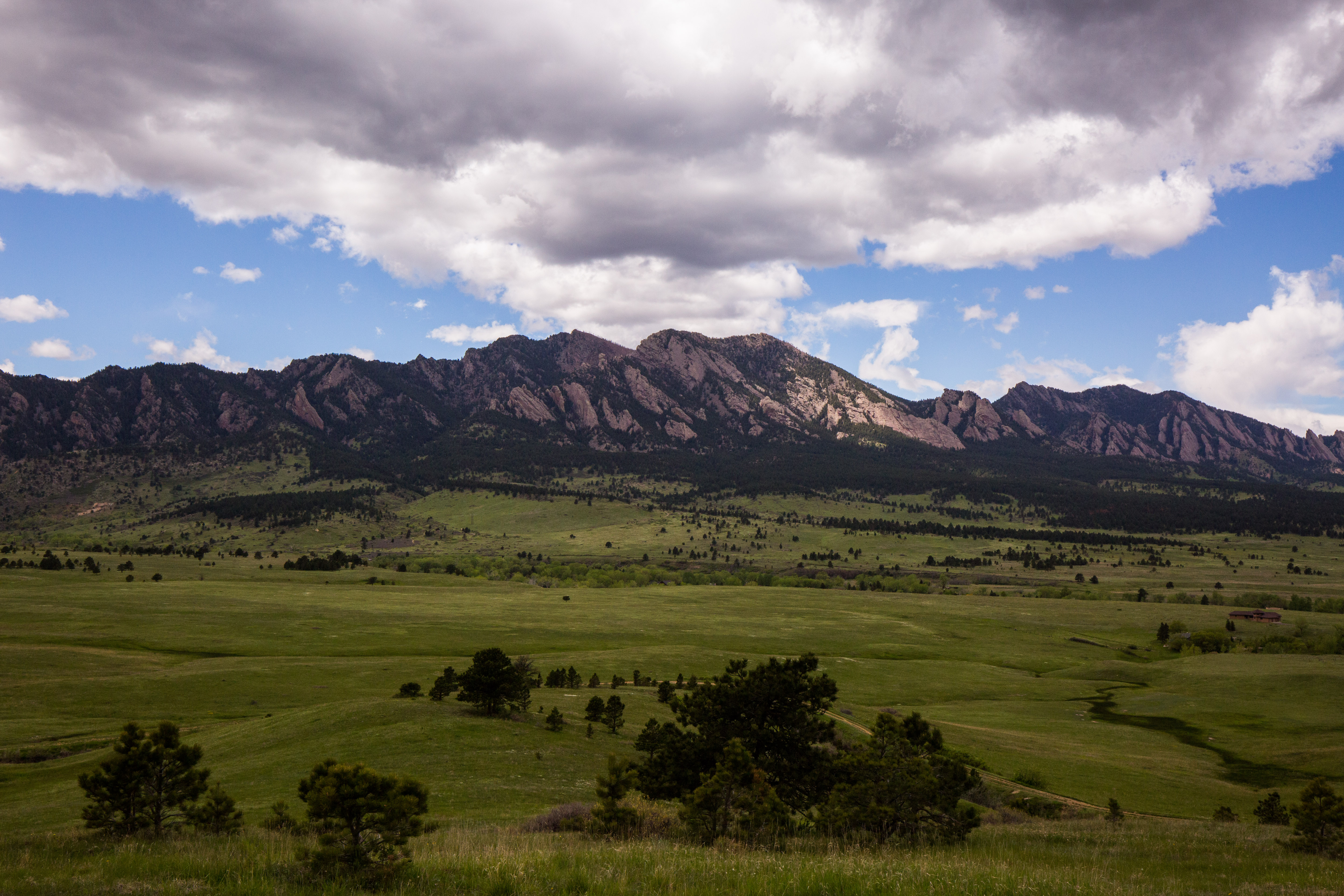
We arrive to Dave’s house, where I will be spending the weekend. It is situated in a quaint neighborhood that backs up to the Flatiron mountains in Boulder, Colorado. Dave and his wife, Michelle, graciously offered to put me up for the weekend at their place. The first person to greet us when we walk in is his dog Luc. Luc is a brown spaniel that loves chasing balls, has gorgeous brown eyes, and has the energy of about 20 dogs. Later that evening, I get to know Michelle. Michelle is a sporty, short haired woman who loves Ben Stiller films and is full of incredible stories. “We were at the US embassy Thailand. He didn’t have any identification on him, but we ended up getting a new passport and going out with the ambassador to a party that night!” she tells me about a guy she used to travel with in her younger days.

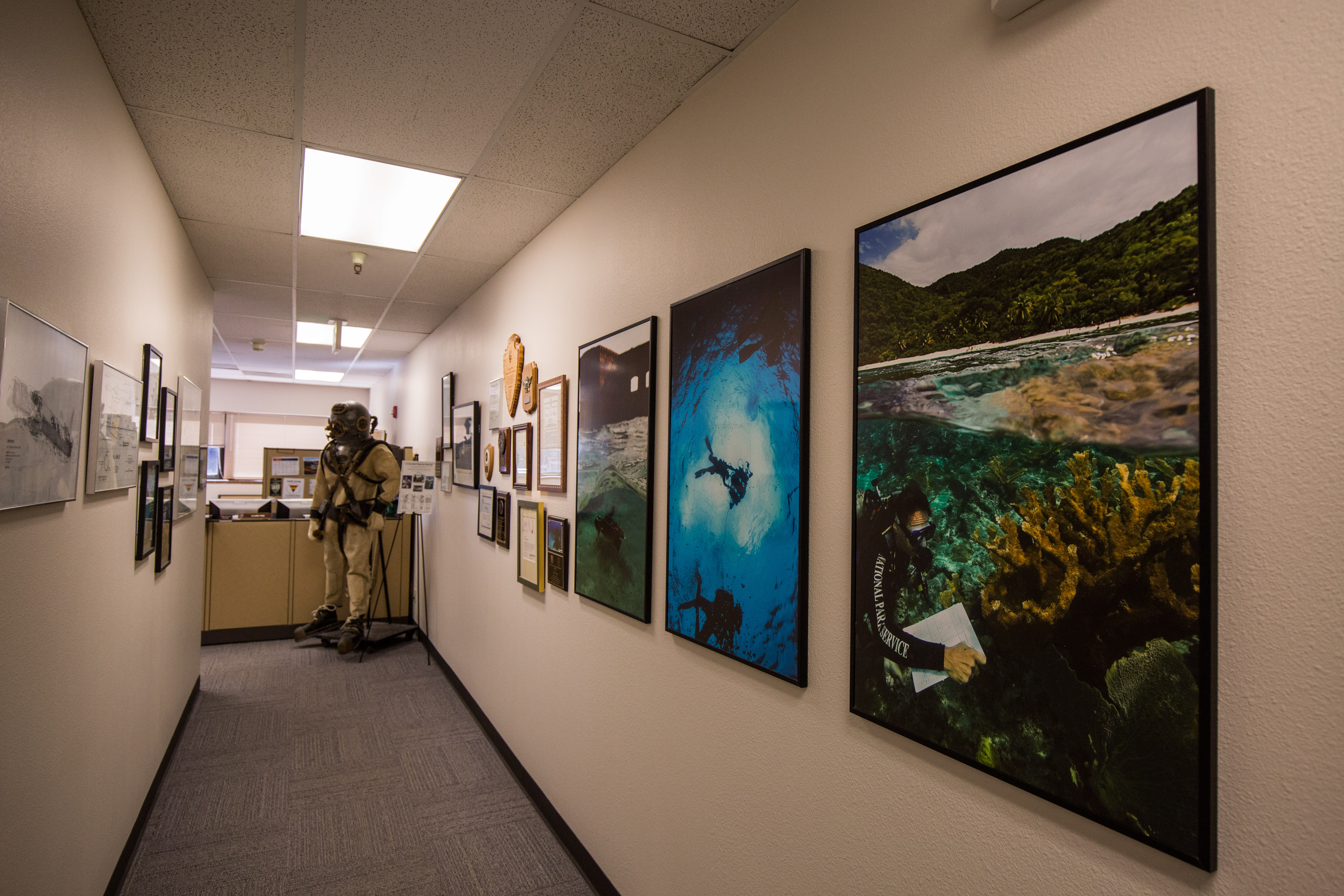
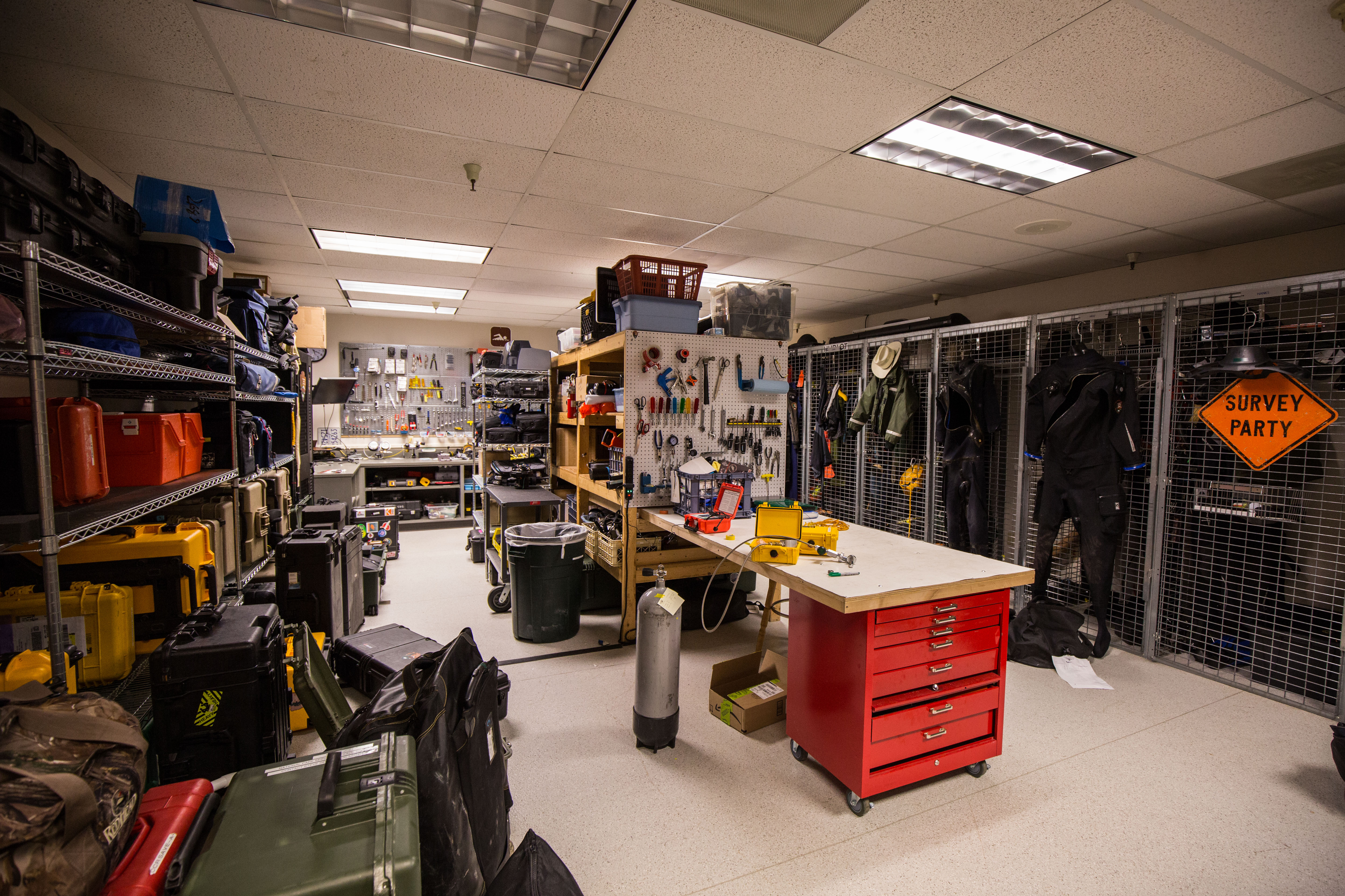
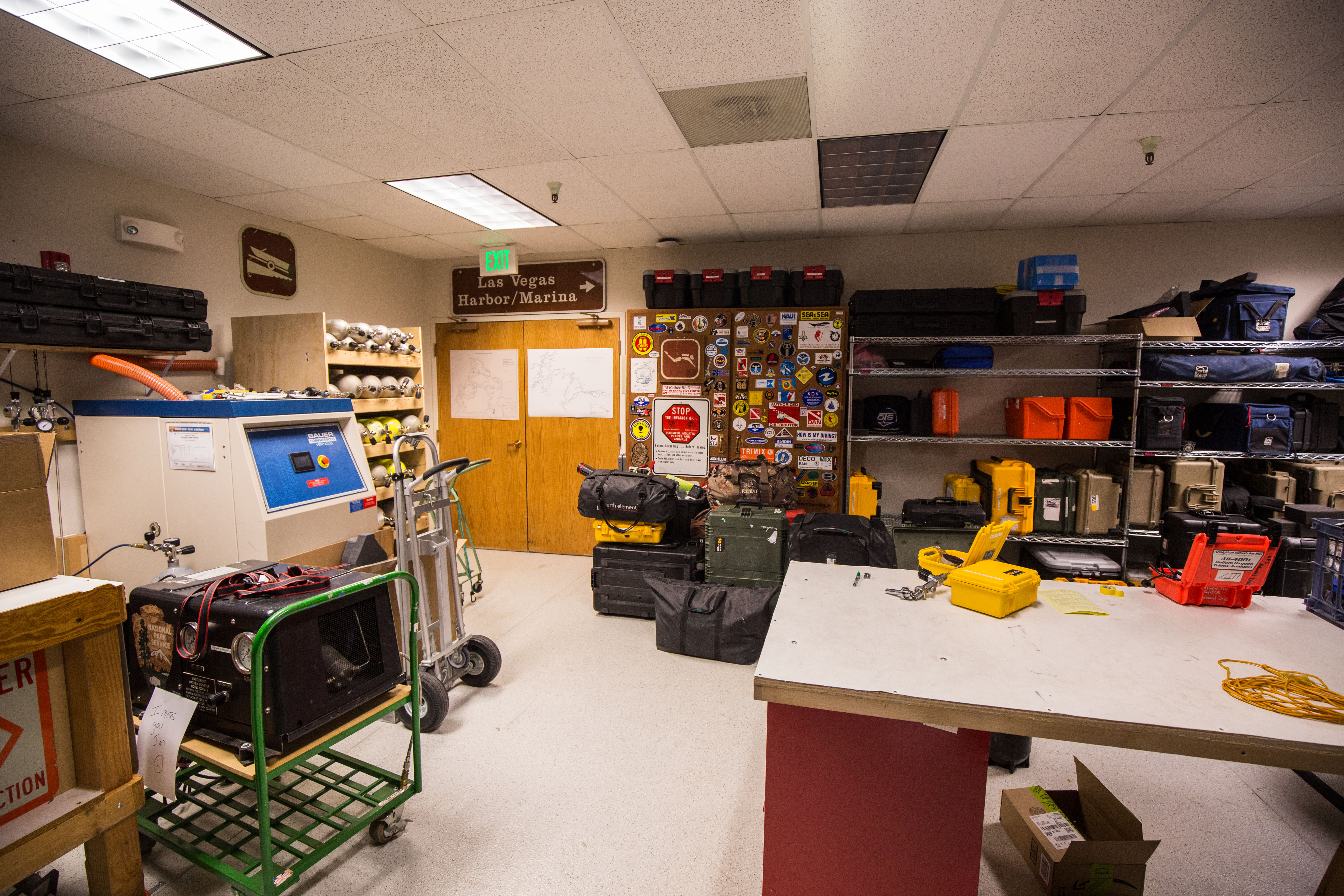
I spend most of the weekend at SRC headquarters. It is a sight to behold. The halls are lined with Brett’s photography and an original Mark IV US Navy diving suit greets you when you enter. The SRC diver locker, otherwise known as the “armory,” is filled with enough dive gear to make even the saltiest diver’s jaw drop- everything is top-of-the-line, from photography equipment to closed-circuit rebreathers. The thing that caught my eye more than anything else though, was how every piece of gear is labeled “National Park Service” or has the NPS arrowhead logo on it. The whole place just oozes with cool.

Brett gets to work pretty quickly giving me my gear for the summer. Exposure gear, dive gear, and photography gear. I try my best to keep up with everything he tells me about my new gear while also trying to manage my excitement. I can’t lie though, being handed a wetsuit that says “National Park Service” on it made me feel really cool.

The next day, Brett and I spend some time in a local dive shop pool. He wants to give me a chance to get the camera in the water. I am nervous and using all new equipment. When we get the camera in the water, it was much heavier than I expected and I have trouble keeping my trim (orientation in the water column) and buoyancy consistent. After fidgeting around with the shutter speed, aperture, ISO, and strobe power for a while, I get to the point where I am taking acceptable (albeit poor) photos. “That was good. The thing about underwater photography is, it’s simple. If you’re photos are too dark, open up the aperture a little bit,” Brett tells me. That simple advice stuck with me and was really comforting to hear as a novice.

That night, I go out to “Salt,” a hip and delicious restaurant that his home to many bearded men and decorated with distressed wood. Dave, Michelle, and I exchange travel stories and Dave tells me about when he was a ski bum in his 20’s. It is the perfect send off before I would leave for summer. Brett, Dave, and Michelle made me feel at home and brought me into their family.


The last stop I have to make before beginning my summer is to see Kelly Moore at Channel Islands National Park to finish my Blue Card certification (the certification needed to dive with NPS). Kelly is a true California beach gal who grew up on Catalina Island. She greets me that morning with a bright smile and asks, “have you ever seen the landing dock at Anacapa Island? No? Well, it’s the most exciting dive entry you’ll ever have!” Sure enough, I come to find out that the drop of about 10-15 ft between the dock and the water puts the “giant” in giant stride. On our first dive Kelly has me navigate to a giant swim-through arch underwater. It is surreal. I had never been to a swim-through arch before. I swam through it on my back, looking towards the surface, watching my exhaled bubbles climb the walls of the rocky arch.

Kelly Moore hops off the dock at Anacapa. This was originally a video, hence the strange cropping, but it was too big to upload to the blog!

Kelly Moore hops off the dock at Anacapa. This was originally a video, hence the strange cropping, but it was too big to upload to the blog!

After spending some time on the surface to watch a live-broadcast underwater educational segment (part of the Channel Islands Live program), Kelly asks me if I want to do another dive. “Last one off the loading dock is a rotten egg!” I respond. We explore some sea caves on the second dive and visit the memorial site of an NPS diver that passed away underwater in the cove. Near the caves, multiple California sea lions dance with us and buzz our heads, coming as close as just a few inches at times. When we get back to the mainland, I thank Kelly again for encouraging me to apply in the first place. She expresses her excitement for me and the journey ahead, “can you smuggle me in your suitcase?” she says jokingly.

My time with Kelly at Channel Islands reflected my time in Denver, Palm Springs, and New York City. Everyone has been exceedingly willing to help me and give me a chance, for which I am eternally grateful. Dave, Brett, Chris, and the entire OWUSS community have made me feel like part of the family. It is a tight-knit group, much like NPS, and one that I’m honored to be a part of. Seeing the camaraderie within OWUSS makes me all the more excited to begin my journey of exploring the National Parks this summer and joining the NPS family.

Share

PAGO PAGO – NATIONAL PARK OF AMERICAN SAMOA

npsablog-56

The last stop on my whirlwind adventure of an internship was American Samoa. Prior to booking the flights, I didn’t even know where American Samoa was, let alone anything about the island that awaited me on the other side of the 6-hour flight. I didn’t even know who was meeting me at the airport! Fortunately, when I landed in American Samoa the night of Friday, September 9th and made my way out of the airport, I looked so lost that I was approached by two strangers who turned out to be Biological Science Technicians Michele Felberg (the 2015 OWUSS North American Rolex Scholar!) and Paolo Marra-Biggs. While I was ecstatic that I was finally here – I have heard so many wonderful things about American Samoa throughout my journey – I was also exhausted from the long day of travel. As we drove to the village of Utulei, where I would be staying with Michele, darkness hid the island from view. Yet still, the sound of the waves hitting the shore along the coastal road and the palm trees faintly lit by the occasional streetlight seemed to taunt me in my tired and sleepy state.

The village of Utulei. The orange trim of my house for the month is barely visible above the trees.

The village of Utulei during the day. The orange trim of my house for the month is barely visible above the trees.

The next morning I woke up to the smell of Michele cooking a Welcome brunch for me. Soon Paolo, fellow park service employee Ian Moffit, and his girlfriend Nerelle, came over, donning me with a lei as they walked in. It was quite the welcome party! Following brunch, Paolo and Michele took me on a grocery run and gave me a brief introduction to the island.

Map of American Samoa

Map of American Samoa

American Samoa is the southernmost territory of the US at 14° south of the Equator, and it consists of five main islands and two coral atolls. Boasting a population of around 60,000, the big island of Tutuila is only slightly larger than Washington DC. Here, there is only one main road and it runs east-west along the length of the island, hugging the dramatic southern coastline. As we drove through what seemed to be taken from the pages of a travel magazine, beautiful blue water gave way to long stretches of sandy beaches on our left, while we passed by mountains flaunting lush green rainforests and towering over quaint villages on our right. The rest of the weekend was a blur of sensory overload as I took in the pristine natural beauty of my new island home, from wading in the shallow lagoon at Coconut Point to looking out over the village lights at night from atop Aoloau.

Coconut Point

Coconut Point

Coconut Point

Coconut Point

When I arrived at Park Headquarters in Pago Pago for my first day, we got straight to work. The National Park of American Samoa (NPSA) encompasses over 13,000 acres, of which, about a third are marine, which means the marine team is kept very busy! To start us off, Marine Ecologist, Tim Clark, called a morning meeting to discuss the weather forecast and to go over the plans for the week ahead. With the wind and waves holding steady over the next few days, our goal for the week was to tow-board the entire north side of the island looking for outbreaks of crown-of-thorns sea stars (COTS), a voracious echinoderm that feeds on corals.

For the past few years, the NPSA marine team has been monitoring a large-scale COT outbreak on the northern coast of the island. Although these sea stars are native to the Indo-Pacific, because they prey upon living corals, population surges can overwhelm and often decimate an entire reef. Thus, in an attempt to rescue the reefs here, the Park Service has undergone eradication efforts to control the population and return it to a natural level. They have gone on hundreds of eradication dives and killed thousands of COTS, all in hopes of restoring balance to the reef. So, our mission for the week was to determine the current status of the outbreak by locating and documenting the individual COT outbreaks along the coast.

After putting together a Float Plan, a document detailing our plan for the day as well as any and all complications that could arise, we headed to the warehouse to grab the boat and gather the gear. Within the hour we were on the water, launching out of Fagasa, and ready to towboard. Towboarding is a survey technique where two people are towed behind a boat while looking down at the reef. In this case, we were looking for signs of COT outbreaks.

Paolo and Michele being towed behind the RV Poge.

Paolo and Michele being towed behind the RV Poge.

Me towboarding

Me towboarding

Traditionally, in an area with a COT, one will see a gradient of discoloration on a stretch of reef, ranging from bone-white, where the most recent meal was, to a faded yellow, where algae has begun to grow overtop of the dead coral skeleton. However, this can be hard to spot from 60 feet above the reef and it took me awhile to develop a search image. Not every patch of bright white on a reef indicates the presence of a COT, as both coral bleaching and coral disease often leave behind a white coral as well. So, for the first few outbreaks, Michele would signal the boat to stop so that I could get a closer look and begin to distinguish COT scarring from bleaching and disease. In some instances, the outbreaks were worse than others and could last a few hundred yards or so, indicating the presence of multiple COTS. Soon enough, I began to recognize COT outbreaks and even found a few of my own!

Typical scarring from a crown-of-thorns seastar

Typical scarring from a crown-of-thorns seastar. Notice the gradient from bone-white to faded yellow.

When I wasn’t in the water, I was sitting on the back of the RV Poge, the park’s 28 ft Boston Whaler, and recording the data. Any time an outbreak was found, the towboarders would signal me to take a GPS point to mark the location of the outbreak while writing down both the depth and the intensity of scarring. While still keeping an eye on the towboarders, I couldn’t help but take in the spectacular views!

npsablog-53     npsablog-52

The village of Afono

The village of Afono

Over the course of the first week, we towboarded the entire north coast (over 30 miles!), both in and out of the park boundaries. You might think that staring at the ocean floor while being towed behind a boat for 8 hours a day, multiple days in a row, would get old, but it was possibly the best way to be introduced to the reefs of American Samoa! Through this process I was able to get a spectacular bird’s eye view of the vibrant reef and I was absolutely blown away by what I saw. Plate corals and fuzzy tabletop corals formed intricate multi-level terraces on the steep reef slope, while boulder corals the size of minivans loomed over small pink cauliflower corals, humorously juxtaposed. Home to over 250 species, the reef was alive with every combination of color, shape, and size of coral imaginable. Never before in my life had I seen such massive and diverse corals! And as an added bonus, while we were towboarding I got to see some charismatic megafauna, including countless green sea turtles, a pod of dolphins, and my first-ever blacktip reef sharks!

OLYMPUS DIGITAL CAMERA     OLYMPUS DIGITAL CAMERA

OLYMPUS DIGITAL CAMERA     OLYMPUS DIGITAL CAMERA

After we completed the towboarding, the next task was to take all of the data and compile it into a map so that we could visualize where the outbreaks were along the coast. After receiving a quick lesson from Paolo on how to import the data from the GPS into ArcGIS, Michele and I worked on creating a map of the towboard data. Once it was finished and we compared it to the map with previous years, it was evident that the number of outbreaks had significantly decreased. When we showed Tim, we discussed the next step and whether or not we needed to go on any eradication dives. Since the goal of the program is to return the COT populations to their natural levels and not eradicate them completely, we decided to forego eradication dives for now. Instead, Tim suggested we go on a few GSI collection dives to take care of the one or two larger sections of outbreaks.

COTS Outbreaks, 2014. Courtesy of the NPS

COTS Outbreaks, 2014. Courtesy of the NPS.

COTS Outbreaks, September 2016. Courtesy of the NPS

COTS Outbreaks, Sept 2016. Courtesy of the NPS.


GSI stands for gonadosomatic index. It is a measure of gonad mass as a proportion of total body mass and is used in many different species as way to determine sexual maturity. So, in addition to monitoring and controlling the COT outbreak, the NPSA marine team has begun collecting GSI data on the seastars in an effort to track their spawning cycle. But first we needed some COTS!

Michele checking the pO2 on our tanks.

Michele checking the pO2 on our tanks before heading out into the field.

With our new mission in hand, we headed into the field to collect a dozen COTS for GSI. With Ian captaining the RV Poge, we sped off to Fagamalo, an area with a concentrated outbreak. Paolo, Michele, and I excitedly assembled our rigs and geared up for the getting in the water. Because COTS are covered in long, poisonous spines, we wore protective gloves and wielded barbeque tongs on our dive in order to protect ourselves when removing the COTS from the reef. Once we splashed, we searched for a patch of reef with heavy scarring, indicating the presence of multiple COTS, and then descended, tongs at the ready. Not wanting to be vulnerable and exposed when predators are out, the nocturnal seastars tuck away in the cracks and crevices of the reef during the day. However, despite the COTS’s best efforts to hide, Paolo and Michele were pros at this and had gathered half of what we needed before I had even finished checking under my first rock. It only took a few more minutes for us to fill the collection bag with a dozen of the little buggers, two of which I collected on my own!

Paolo, Michele, and I ready to dive in!

Paolo, Michele, and I ready to dive in!

Paolo and Michele at work searching for those COTS

Paolo and Michele at work searching for those COTS


Michele inspects the full collection bag on our safety stop.

Michele inspects the full collection bag on our safety stop.

OLYMPUS DIGITAL CAMERA     OLYMPUS DIGITAL CAMERA

Making sure to keep them submerged in seawater, we brought the COTS back to the warehouse in order to take the GSI measurements. Wet weight, number of arms, and average diameter were all recorded before cutting each COT open. Then came the tedious task of sorting the red-orange tissues of the digestive glands from the paler yellow-orange tissues of the gonads using a pair of tweezers. Once the gonads were completely removed from the COT, they were weighed as well. Finally, before finishing up with a COT it was sexed by looking at the gonads under a microscope. On average, the whole process took about 40 minutes per COT, but the more fecund ones took a bit longer on account of the sheer amount of gonads needing to be separated (over 200g!).

Cutting down the arm of the COT to begin the dissection

Cutting down the arm of the COT to begin the dissection

Separating the gonads from the digestive tissue

Separating the gonads from the digestive tissue


Unfortunately, during my second week, the wind and waves picked up and kept us out of the field. However, there was plenty of work to be done back on land. While, Michele and Paolo planned for an upcoming outreach event at Coast Week, Ian and I kept busy at the warehouse as a lot of things needed maintenance. The backup compressor needed fixing, the boat trailer needed new brake pads, the RV Malie’s engine needed rebuilding, etc. Together, Ian and I checked each item off one-by-one. When we got to the engine, though, there was not much I could do to help, so I sat and watched Ian take the engine apart as I spliced lines to be used for moorings.

Fixing the backup electric compressor

Fixing the backup electric compressor

Ian removes the caliper in order to examine the old break pads

Ian removes the caliper to examine the old break pads


My first ever splicing job!

My first ever splicing job!

As the week rounded out, the wind and waves died down just in time for the culminating festival for American Samoa’s annual Coast Week. With the motto “A healthy coast is a wealthy coast”, the event is aimed at raising awareness for the natural resources the island has to offer and the environmental issues impacting those resources. The NPS, along with other government agencies and local businesses, ran educational tables as vendors sold food, village youth groups put on traditional performances, and South Pacific Watersports hosted competitive outrigger canoe races. With so much to do, the event was bustling the entire day. It was amazing to see the community come together to support the cause and have fun while learning about the environment!

Paolo and Michele running the educational NPS table at Coast Week

Paolo and Michele running the educational NPS table at Coast Week.

The NPS team took home the trophy at this year's Coast Week outrigger canoe races.

The NPS team took home the trophy at this year’s Coast Week outrigger canoe races.


The taupou, the daughter of the village chief, performs the sacred Samoan dance, the Taualaga.

The taupou, the daughter of the village chief, performs the sacred Samoan dance, the Taualaga.

The Utulei youth group performs a traditional dance with coconut shells.

The Utulei youth group performs a traditional dance with coconut shells.


At work the next week, we switched gears to fish-tracking. Much like the work being done in Kalaupapa, the project here at NPSA is also tracking fish with the use of acoustic tags and receivers. However, the NPSA marine program’s goal is to try to locate the spawning sites of large snappers and groupers that have been severely overfished, in order to inform policies to better protect them. Preliminary work in the park has been promising, so the project was beginning to pick up steam. At our Monday morning meeting, Tim set the mission for the week – expand the receiver array by installing 4 more receivers and tag more fish. In order to prepare for the next few days in the field, I checked to make sure that all of the acoustic tags were still working, inventoried the receivers, and set them up to start collecting data. With the receivers launched and ready to go and plenty of mooring lines already spliced, we were all set for installation.

With a preliminary receiver array already in place, we were aiming to fill in the gaps and expand the study area with these installation dives. When we got to a site, Tim and Michele would drop down with a mooring line and find a large, sturdy reef structure at about 80 feet. Once they did, Paolo and I would descend, guiding down a subsurface mooring buoy. This proved to be a difficult task as you can imagine due to the float’s buoyancy, but with the help of some heavy linked chain, we managed to swim it down gently. From there, we secured the line to the bottom and then to the buoy before releasing the chain, sending the buoy shooting into the water column. Since the study was intended to track benthic fish species, the receiver was placed at 40 feet off the reef and aimed down, hence the need for the buoy. Over the next two days, we installed 3 new moorings, replaced one that was fraying, and deployed 4 new receivers.

Paolo, Ian, Michel, and me pose for a picture in front of Pola Island before our receiver installation dives.

Paolo, Ian, Michele, and I pose for a picture in front of Pola Island before our receiver installation dives.

Tim preparing for the dive with his rebreather

Tim preparing for the dive with his rebreather

Paolo heads toward Mooring #8 to replace a frayed line

Paolo heads toward Mooring #8 to replace a frayed line

Red-footed boobies fly overhead as Tim surfaces from the dive.

Red-footed boobies fly overhead as Tim surfaces from the dive in front of Pola Island.

With that done, we spent the next day fishing for the groupers and snappers the study was targeting – specifically, the yellow-edged lyretail, Variola louti, and the two-spot red snapper, Lutjanus bohar. We started off in Tāfeu Cove, a protected bay in the Park where both species have been known to hang out. After an unsuccessful morning, with the only catch being a small untaggable parrotfish, we decided to head around to the other side of Pola Island where known feeding grounds are located. As we rounded the Pola, I got a bite. Following a bit of a fight, with an incision wound to show for it, I finally reeled in the feisty barracuda! While we ended the day empty handed, I was pretty stoked about reeling in both of the catches of the day, even if they weren’t what we were looking for.

I caught a barracuda!

I caught a barracuda!

On our way back to Fagasa to take the boat out of the water, Tim noticed the classic arched back of a humpback whale. We immediately stopped the boat to watch. A few hundred yards away, what looked like two or three whales were hanging out on the surface preparing for a dive. Just after they disappeared under the surface, a humpback majestically breached out of the water and landed with a spectacular splash. Our jaws dropped. I have never seen a whale breach before in real life and it was perhaps the most regal thing I have ever seen in the wild! Unfortunately, I was not camera ready, but I did manage to get a picture of one of the whale’s flukes to prove that we did in fact see whales.

The fluke of a humpback whale emerges as it dives down into the ocean.

The fluke of a humpback whale emerges as it dives down into the ocean.

On the weekends, when we weren’t working, Ian, Paolo, and Michele took care to show me a good time around the island. One weekend, we hung out on the secluded Larsen’s beach. The next weekend, we went on a hike through the rainforest in order to get to Massacre Bay, the site of a massacre that occurred when the French explorer LaPerouse landed there in 1787. Another time, we even got to take Ian’s sailboat out for a spin. Every weekend was a new adventure! I could tell you more, but I think the pictures speak for themselves.

Larsen's beach

Larsen’s beach

Massacre Bay

Massacre Bay


Climbing for coconuts

Climbing for coconuts

Leaving Larsen's beach.

Leaving Larsen’s beach.


The hike down to Massacre Bay.

The hike down to Massacre Bay.

The memorial at Massacre Bay.

The memorial at Massacre Bay.


Ian steers us out of Pago Pago harbor

Paolo hoists the main sail

Paolo hoists the main sail

On my final weekend in American Samoa, I was excited to get to experience the traditional cultural holiday known as White Sunday. Over the course of my month stay I have come to learn that, like many other Polynesian cultures, the Samoan people have at their core faith, family, and music. These traditional values are evident in many aspects of their life – from the period of daily afternoon prayer, called sa, to every Sunday being dedicated to spending time with the family, going to church, and preparing the traditional ground oven or umu. However, this Sunday was special. Akin to a Mother’s Day or a Father’s Day, White Sunday is a day dedicated to honoring children. As the name implies, all the kids wear white and some even get special outfits sewn for the occasion.

The children posing after putting on a beautiful White Sunday celebration.

The children posing after putting on a beautiful White Sunday celebration.

At the potluck meal after White Sunday mass, the children are served first.

A potluck was served after mass for the children.

A Church prepared for White Sunday.

A Church prepared for White Sunday.


I accompanied Nerelle and Ian to church that day and had an amazing time. I was immediately welcomed by the close-knit congregation and invited to celebrate the holiday with them. In true White Sunday fashion, the celebration was led by the children and featured all kinds of performances put on by the kids. It was a delightful way to end my last weekend in American Samoa!

Find your Park.

Find your Park. I know I did.

I would like to extend the sincerest of thank you’s to everyone who made my month in American Samoa so fun and memorable! Tim for providing the opportunity to come work for your beautiful park and for inviting me to join the marine team. Paolo, Michele, Ian and Nerelle for welcoming me with open arms and sharing with me your adventures and your homes. Adam, Shivaun, Alan, Sabrina, and Bob for the talks on the beach and the hikes through the rainforest. And last, but not least, Alex for sharing with me your friendship and showing me your take on American Samoa. You all made this experience something I won’t ever forget.

The sun sets over the International Date Line, with Western Samoa barely visible on the horizon. "Between here and there is tomorrow." ~ Paolo Marra-Biggs

The sun sets over the International Date Line, with Western Samoa barely visible on the horizon. “Between here and there is tomorrow.” ~ Paolo Marra-Biggs


Share

MOLOKA’I – KALAUPAPA NATIONAL HISTORICAL PARK

Kalaupapa National Historical ParkKalaupapa National Historical Park

On my way to Kalaupapa, I made a pit stop in Kona on the Big Island of Hawai’i to visit my cousin, David, and his wife, Katie. Though my stay was brief, I very much enjoyed a relaxing afternoon at the beach and a morning swim at popular snorkel site Honaunau Bay (aka Two-Step) with my family. Thanks guys for welcoming me to Hawai’i and taking me in for a night! But after spending just over 24 hours in Kona it was time to make moves towards Kalaupapa National Historical Park.

Me, Katie, David

Me, Katie, David

Two-Step, Hanounou Bay, Hawai'i

Two-Step, Hanounou Bay, Hawai’i


The 8-passenger, propeller plane left from Oahu just before sunrise. With just a half hour flight, we left behind the hustle and bustle of early morning Honolulu and entered a completely different realm. The park is located on the remote Kalaupapa Peninsula on the north side of the Hawaiian island of Moloka’i. Sea cliffs, the tallest in the world at over 3,000 feet, and the surrounding ocean isolate the peninsula from the rest of the island, a fact that played an important role in its history. Today, visitors to the park, like myself, must either walk down a trail along the cliff face from topside Moloka’i or fly in directly on a small, chartered plane operated by Makani Kai Airlines.

Kalaupapa National Historical Park

Kalaupapa National Historical Park

As the sun rises, Kalaupapa emerges into view on the horizon aboard the Makani Kai flight.

As the sun rises, Kalaupapa emerges into view on the horizon aboard the Makani Kai flight.

At the airstrip, I was greeted with an aloha by Marine Ecologist and Park Dive Officer, Eric Brown. After showing me to the historic Nurse’s quarters, my home for the next two weeks, Eric took me on a quick tour of the park, educating me on the extraordinary history of the peninsula.

Marine Ecologist, Eric Brown

Marine Ecologist, Eric Brown

In the mid-1800’s, Hansen’s disease, more commonly known as leprosy, began to sweep its way across the Hawaiian Islands. With no known cure and little knowledge of the disease itself, King Kamehameha V became fearful of the consequences of such an epidemic and exiled those afflicted with the disease to the Kalaupapa peninsula in 1865. Over the next hundred years, more than 8,000 patients with Hansen’s disease were torn away from their families and forcibly quarantined in the settlement on Kalaupapa under the Segregation Act. Early patients suffered not only from disease and the sorrow of separation, but also from food shortages, inadequate shelter, and a complete lack of medical care. Eventually, the generosity, charity, and effort of individuals, like Father Damien and Mother Marianne, brought major improvements to the lives of the patients. In the late 1940’s, the discovery of sulfone drugs brought about a cure for Hansen’s disease and the number of patients at Kalaupapa began to decrease as a result of the treatment. Finally, in 1969, the century-old Segregation Act was officially abolished.

Today, about a dozen cured patients have chosen to remain in the settlement and are allowed to come and go as they please. Here, they are continually cared for by staff from the Hawai’i Department of Health and members of their families. With a mission to preserve this solemn narrative for future generations, as well as protect the plethora of cultural and natural resources on the peninsula, Kalaupapa was established as a National Historical Park in 1980 and nowadays Park Service staff rounds out the population in the settlement at just under 100 people. As Eric’s tour progressed it became increasingly evident that the community here at Kalaupapa is extremely close-knit. Having been on the peninsula for less than an hour, Eric had already introduced me to about twenty residents! If this was any indication of how the next two weeks were going to go, I was excited to become a part of the Kalaupapa community!

A resident's home sits in front of a backdrop of Kalaupapa's infamous sea cliffs.

A resident’s home sits in front of a backdrop of Kalaupapa’s infamous sea cliffs.

Eric and I ended our tour at the Natural Resource Management Office just in time for the workday to begin. Here I was introduced to the rest of the Marine team – Maintenance Mechanic, Randall Watanuki, and Biological Science Technician, Sinefa Annandale. Together, we had a meeting to discuss the plans for my time here at Kalaupapa. This was my longest stay in a park to date and I was excited to get to experience multiple weeks of park operations at a single park. The first week of my visit, we would be finishing up the benthic marine monitoring surveys the team had started the previous week. And for the second week, visiting researchers from the University of Hawai’i were coming for a shark-tagging project! But first, there was one last freshwater site to be completed for annual water quality monitoring.

The Natural Resource Management Office

The Natural Resource Management Office

Without knowing quite what to expect, I hopped in the truck with Eric and Sinefa and we drove off to the eastern side of the peninsula. At a certain point the paved road of the settlement gave way to faint tire-tracks running through a meadow and leading up to the edge of a tropical rainforest. Machete in hand, Sinefa led the way into the dense growth. I followed behind Sinefa as he hacked away at sinewy vines and low tree branches. By far the coolest hike I’ve ever done, we trekked through the underbrush, blazing our own trail, and descended down 1,000 feet into Kauhako crater toward the freshwater lake sitting at the bottom. Though barely 300 feet across, the lake bottoms out at over 800 feet deep, making it, according to Eric, the deepest lake in the world for its surface area. As I collected and filtered water samples for lab analysis, Sinefa tested the water quality with a Sonde. The whole process only took 10 minutes and then we made our way back up the caldera walls, having to make use of ropes for the steeper parts of the ascent.

View from the start of our hike down into the Kahuako Crater.

View from the start of our hike down into the Kauhako Crater.

Sienna hacks at the shrubbery clearing a path.

Sinefa hacks at the shrubbery clearing a path.


Sinefa operates the sonde while I filter water samples from the lake.

Sinefa operates the sonde while I filter water samples from the lake.

We used ropes for the steeper parts of the ascent.

We used ropes for the steeper parts of the ascent.

Sinefa looks behind him, breaking the rule to never look down.

It got pretty steep!

Back at the office, Eric decided to make use of the last hour or so of the workday by performing my checkout dive. While it can get repetitive to prove my skills to each new park, it is crucial that these checkout dives be performed so that the park divers are aware of my composure and comfort-level underwater and I am aware of theirs. After going over the basic mask clearing and buddy-breathing skills, we had time for a quick lap around the dock.

Beautiful corals speckle the volcanic rocks of Kalaupapa's reef.

Beautiful corals speckle the volcanic rocks of Kalaupapa’s reef.

Kalaupapa’s underwater resources are vastly different from those I have seen so far on my trip. Large volcanic boulders scattered the reef slope, each with one or two individual coral heads growing on top. Compared to other reef communities I’ve seen where encrusting corals, sponges, or algae will fill in any and all exposed substrate on a reef, there appeared to be a considerable amount of open space just waiting to be occupied. However, while Kalaupapa’s percent coral cover and coral species diversity seemed relatively low, the community of fish that call these reefs home was vibrant and flourishing. Everywhere I looked – in the coral heads, under the rocks, up in the water column – I saw hundreds of fish. Huge schools of surgeonfish, unicornfish, and chubs swam alongside us, only to panic and swim away as a large barracuda came into view.


kala-160831-115-of-93

Eric swims over a collection of vibrant corals.

Corals speckle the large volcanic boulders of the reef.


A school of chubs swims alongside of us.

A school of chubs swims alongside of us.

The chubs panic and disperse as a barracuda looms nearby.

The chubs panic and split as a barracuda looms nearby.

Over the course of the next two days, Eric, Randall, Sinefa, and I went out on the boat and completed the last remaining sites for the benthic marine monitoring program. Every year, the Marine team visits a total of 30 sites around the peninsula and gathers data on coral cover, rugosity, and fish species. On each dive, Eric would lay down the 25m transect tape and perform a fish count, while Sinefa or Randall (whoever wasn’t on the boat) would follow behind and take photographs of the substrate at every meter, which be analyzed later for percent cover data. Finally, Eric and I would round up the dive, teaming up to take a rugosity measurement.

Randall swims the transect tape taking photographs of the substrate. Eric can be seen in the distance doing his fish count.

Randall swims the transect tape taking photographs of the substrate. Eric can be seen in the distance doing his fish count. Note the vast amount of bare substrate.

However, the work week was cut short due to incoming storms Hurricane Lester and Hurrican Madeline. On Thursday, the park service and the state employees had the day off in order to prepare for the storms. In the morning, everyone gathered at the town hall to hear from the Emergency Preparedness team about what to expect for the weekend. With Lester set on a B-line for the entire Hawaiian archipelago and winds estimated to be over 100mph when it reached Moloka’i, the settlement went into lockdown mode. The trail to topside Moloka’i was closed, in addition to all flights out being suspended for the next few days. Additionally, a storm shelter was being set up in the town hall for those who experienced any damage or power outage during the storms and needed food or shelter.

Hurricane Lester predicted path

Hurricane Lester’s predicted path.

With this in mind, Eric and I spent the day batting down the hatches at the office. We also moved the boat to a more secure mooring offshore and added extra lines for security. We debated moving the boat to the harbor on the other side of the island, but with the trail closed, Eric decided to play it by ear and make the decision as the storm got closer and its path became clearer.

Overnight, Madeline had stirred up the wind and dumped some heavy rains, the only damage being a small landslide and downed tree on the trail. The good news was that the Friday morning weather update showed Lester taking a more northerly route. While we were longer in the direct path, Moloka’i was placed under a Hurricane watch for high winds and rains throughout the weekend. So in anticipation of being locked up in our houses for the next two days, Tim Richmond, the Food Services Supervisor for the settlement, invited a bunch of people over for a potluck movie night. We watched Young Frankenstein as we indulged on a delicious dinner of spaghetti and Eric’s vegan meatballs. All in all, it was a fun bonding activity that made me really feel like a part of the Kalaupapa family.

Hurricane Lester veers away from the archipelago.

Hurricane Lester veers away from the archipelago.

The weekend passed by extremely uneventfully. For all of the hectic preparations, not a drop of rain or the slightest breeze made an appearance on Saturday or Sunday. So on Sunday, the trail opened back up and activity resumed in the settlement.

That Monday, Labor Day, was relatively quite in the settlement. I was used to pool parties, fireworks, and BBQs, which is why I didn’t initially question the bonfire-esque smell coming into my room at 1:30 in the morning. But at 2:00, I rolled over and immediately knew I was in trouble. The building, not 20 yards out my window was on fire. Screaming came from the adjacent rooms and it was evident Kylie, Jake, and Susan had awoken to the blaze out their window as well. Kylie ran to sound the settlement alarm as Jake radioed it in to the park Emergency Services. Together, we all ran from our building into the street. All we could do was watch as the kitchen burned. Soon everyone from the community was outside watching with us as others from the community fought the fire from two fronts. By the time we had noticed the fire, it was too late to save the state dining hall and the majority of the effort was spent controlling the fire and preventing it from spreading to other buildings or into the open field across the street. We were extremely lucky it had rained not an hour before and the grass was still wet.

kala-160907-419-of-689


 hi

A resident watches the historic building collapse.

 hi

Volunteer forces mobilizing to fight the fire.


While devastating to watch, it was amazing to witness an entire community come together in the face of this disaster. Everyone helped out, whether it was turning the hydrant on or getting water bottles to the firefighters, stamping out the embers in the adjacent field or holding the high-pressure hose. Just as the sun peaked over the horizon, the last ember went out. The next 24 hours was an emotional time in the settlement as everyone tried to go back to his or her daily schedules. I have to commend all of the brave souls who helped fight the fire and supported their fellow community members through this tragedy that destroyed such a historic building and a vital cornerstone for the settlement.

Volunteers fight the fire well into the night.

Volunteers fight the fire well into the night.

Jake carries the high pressure hose, one example of the community effort required to fight the fire.

Fighting the fire was a community effort.


A pan sits on the steps leading up to the remains of the historic state kitchen.

A pan sits on the steps leading up to the remains of the historic state kitchen.

After an exciting night started off my second week in Kalaupapa, two visiting researchers from the University of Hawai’i, Kosta Stamoulis and Alex Filous, flew in to continue work on a shark-tagging project. In order to track sharks, and other apex predators, acoustic transmitters are implanted into a cavity on the underside of the fish and a plastic tag is attached at the base of the dorsal fin. These transmitters emit a coded series of pings that are then picked up and recorded by acoustic receivers that are placed strategically around the reef. The array of receivers allows for the researcher to track the movement of the tagged fish as well as the time stamps of the movement. When compiled, this information can be used to identify feeding grounds, spawning sites, and habitat ranges.

Before we could get around to tagging any new fish, we had to collect the receivers and download the data from the last 6 months. We spent the next day and a half collecting receivers located all around the peninsula – even venturing over to the breathtaking eastern side of the peninsula! Some were located just offshore in a shallow, meter-deep lagoon where blacktip reef sharks have been known to hang out, while some were located 500 meters offshore at a depth of 70 feet. We were able to retrieve all but Receiver #7, which had broken off of its mooring presumably during a strong swell event and, after a 50 minute search effort, we determined that it was lost to the sea.

The eastern side of the peninsula had breathtaking views.

The eastern side of the peninsula had breathtaking views.

You might recognize the sea cliffs of Kalaupapa from the original Jurassic Park movie!

You might recognize the sea cliffs of Kalaupapa from the original Jurassic Park movie!

Once all the receivers were collected, the mornings were spent underwater redeploying the downloaded receivers and the evenings were spent on the boat fishing. This was by far the biggest fishing endeavor I have ever been on, as I’ve only ever fished in lakes, so I was a bit overwhelmed at first. We had bait rods and game rods; we were using live bait, so we had a flow-through bait tank to keep the bait alive in the back of the boat; and, not to mention, we had all of the equipment and gear to do the tagging. Baitfish seemed to be the limiting factor for all of our outings. Oftentimes it took us a while to locate the ‘opelu (mackerel scad) or akule (big-eye scad), but once we saw a huge school on the fish finder we would drop the lines, jig them up, and reel in the bait.

Our fearless captain, Randall.

Our fearless captain, Randall, leads us on a quest to find bait.

After stockpiling up some bait, Randall would drive us offshore a bit where Kosta and Alex would toss in their lines with the live bait thrashing about and wait. Sometimes they would bring up their lines only to find that a predator had taken a huge chunk out of the baitfish without their knowing. Other times the predators would make it known and put up a fight before somehow managing to get off the hook; they were taunting us. But by the end of the week, Alex and Kosta had reeled in four sizeable fish – unfortunately, none of them were sharks. Alex and Kosta each caught one ‘omilu (Bluefin trevally, Caranx melampygus) and one ulua (Giant trevally, Caranx ignobilis). Once they brought the fish on board, we would run a hose over the gills as they measured its size and inserted the two tags. And of course, we grabbed a picture before putting it back in the water. I didn’t catch any taggable fish. Instead my biggest accomplishment of the fishing trips was catching 3 ‘opelu on one line to save the day and allow the guys to keep fishing for a bit longer.

Alex struggles to reel in a big one!

Alex struggles to reel in a big one!

Inserting the acoustic tag into the ulua.

Inserting the acoustic tag into the ulua.


Kosta and Alex pose with an 89cm ulua.

Kosta and Alex pose with an 89cm ulua

Tagging the dorsal fin of an 'omilu with a plastic tag

Tagging the dorsal fin of an ‘omilu with a plastic tag.


The day before I left, Eric came over and invited Jake, a visiting archaeologist for Cultural Resources, and I along for a monk seal survey. Beginning at the northernmost tip of the peninsula, we walked along the rocky western shoreline in the hopes of observing monk seal activity. Hawaiian monk seals are one of the most critically endangered marine mammals in the world with fewer than 1,000 individuals left in the wild. The park has been monitoring their behaviour and tagging individuals to help track the population as well as determine habitat preference and seasonal behavioural dynamics. About an hour into our walk, we spotted two subadult monk seals basking on the sandy beach. Jake and I ducked into the tree line while Eric quietly approached to observe them and identify them based on their tags. It was amazing to get to see these endangered animals up close and know that the park is doing what it can to help document their behaviour and protect their habitat. And as if the two weren’t enough, we spotted and identified another two individuals, potentially a mating pair, hanging out just up the beach!

Eric walks the rocky shoreline on our monk seal survey.

Eric walks the rocky western shoreline of the peninsula on our monk seal survey.

Eric tries to identify the individuals without disturbing their day in the sun.

Eric tries to identify the individuals without disturbing their day in the sun.

Monk seals basking in the sun on the beaches of Kalaupapa.

Monk seals basking in the sun on the beaches of Kalaupapa.

Two monk seals playing in the sand.

Two monk seals playing in the sand.

Jake and Eric pause to record the identifications of the monk seals.

Jake and Eric pause to record the monk seal IDs.


Overall, the two weeks I spent at Kalaupapa were quite eventful. Kalaupapa is unlike any park I have been to as of yet. With a tragic narrative set at the base of majestic sea cliffs, Kalaupapa is truly a park of endurance and beauty. Its storied history has shaped the settlement into the quaint, close-knit family it is today and its isolation has helped preserve its wonderful natural resources from the vibrant fish communities to the fertile jungles. I am so grateful for having had the opportunity to experience all it has come to be.

Beautiful Kalaupapa

Overlooking the Kalaupapa settlement

I would like to extend a huge thank you to Eric, Randall, and Sinefa for making me an honorary member of the Kalaupapa Marine crew and allowing me to explore your beautiful park through a variety of experiences! Thanks to Kosta and Alex for imparting me with your wisdom and teaching me how to fish. And a big thank you to Tim, Jake, Kylie, Susan, Julia, Ryan, Emily, Claire, Meli, and the rest of the wonderful people at Kalaupapa who welcomed me with open arms into your community and into your family. Until next time!

A Kalaupapa sunset.A Kalaupapa sunset.

Share

VENTURA – CHANNEL ISLANDS NATIONAL PARK

chis-160826-5-of-23

On Friday, August 19th, I said goodbye to the Hawaiian Islands and hello to the California coast as I crossed back over to the mainland. I landed in LAX and caught a shuttle to Ventura Harbor where Park Headquarters is located for Channel Islands National Park. There, I was greeted by Marine Ecologist Joshua Sprague who led me to the park’s 58-foot research vessel, the Sea Ranger II, where I would be spending the weekend before joining the Kelp Forest Monitoring (KFM) team for a 5-day monitoring trip.

Ventura Harbor

Ventura Harbor

On Monday, after a day exploring the harbor and beach for myself, I awoke to the hustle and bustle of the crew arriving bright and early to prep the boat for the week ahead. Josh introduced me to Marine Biologist and Regional Dive Officer Dave Kushner, Captain Keith Duran, and Biological Technicians Katie Grady, Parker House, Keenan Chan, and Christy Santschi. As it turned out, I wasn’t the only visitor for the week. Ian Jacobson, the Dive Program Coordinator for local nonprofit LA Waterkeeper would be joining me in helping out the KFM team. After loading dive gear, survey equipment, and enough food to feed an army onto the boat, we were off to the Channel Islands for an intensive week of diving and field surveys in the kelp forests of Southern California.

As we motor out, the KFM crew prepares for the day of diving.

As we motor out, the KFM crew prepares for the day of diving.

The park itself consists of five of the eight Channel Islands – Anacapa, Santa Barbara, Santa Rosa, San Miguel, and Santa Cruz – and the water extending one mile offshore. Located at the confluence of cold northern waters being carried south by the California current and the warm waters coming up along the coast from the south, the Channel Islands boasts an exceptionally diverse marine ecosystem. In addition to bringing together both warm- and cold-water species and yielding a high biodiversity, the currents also produce a nearly continuous upwelling phenomenon, which brings nutrient-rich water up from the deep ocean, supporting a highly productive environment. Because of this, the park boasts some of the most pristine examples of kelp forests in California. In fact, when Channel Islands National Park was created in 1980, Congress specifically noted this and highlighted the park’s scientific value as a site for long-term monitoring.

Santa Cruz Island

Santa Cruz Island

Launched in 1981, the KFM Program is the longest established marine monitoring program in the National Park Service. Now in its 35th year, the KFM Program has grown from monitoring 13 permanent sites selected at the time of its formation to the now 33 sites located throughout the park. In 2005, the program doubled when 16 sites were added to better monitor the newly established Marine Reserves and to assess the efficacy of these reserves over time. Every year, each site is surveyed following the same detailed protocol and data are collected on over 70 species of algae, invertebrates, and fish. This long-term, multi-decade dataset has helped scientists understand the large-scale ecological patterns and processes at work in kelp forest communities that a five-year study would fail to detect. In addition, the data has allowed scientists to predict the larger trends in population dynamics of individual species and has informed various resource management strategies adopted by the state of California (including the establishment of marine reserves in 2002 and the closure of the abalone fisheries in 1997). Maintaining such an important and comprehensive dataset means that every summer, from May until October, the KFM team heads out on these 5-day monitoring trips every other week in order to complete surveys on all 33 sites.

KFM Site Map. Channel Islands National Park.

KFM Site Map. Channel Islands National Park.

On the way out to our first site, Josh explained the game plan of a typical day at a monitoring site. With a total of 12 different sampling techniques to perform and a massive amount of data to collect, each site typically requires 3 or 4 hour-long dives. Per person! And with a total of eight divers on board, there were a lot of moving parts to keep track of, especially with two of us being new to the program and the protocols. However, having done this countless times before, the KFM team ran like a well-oiled machine. When we pulled up to Anacapa Island at Site #13, Landing Cove, as soon as the anchor dropped, a team of divers entered the water. Their job was to lay the 100-meter baseline transect and take a video of the site. Once that was done, it was time for everyone else to hop in.

A view of the kelp forest from the surface.

A view of the kelp forest from the surface.

Looking down the 100-meter baseline transect as it disappears into the dense kelp forest.

Looking down the 100-meter baseline transect as it disappears into the dense kelp forest.

Not only was I new to the program and the protocols, but this was also my first dive ever in the California environment, let alone a thriving kelp forest biome. So all of the organisms were new to me. As such, I was paired with Dave Kushner for the day and told to just take in the ecosystem and observe the site while being his dive buddy.

Dave Kushner motions for me to follow him into the kelp forest.

Dave Kushner motions for me to follow him into the kelp forest.

When I first splashed into the water, I was immediately taken aback. I was not quite sure what I was expecting, but it was nothing in comparison to what I saw. I was surrounded by Giant Kelp (Macrocystis pyrifera), some easily over 40-feet in height. It was a bit overwhelming at first, but when I paused for a second, I noticed the calming rhythym of the fronds swaying majestically in the surge. Taking a deep breath, I followed Dave into the dense maze of kelp, trying not to get entangled. As we swam along, strange fish I had never seen before darted in between the kelp blades. In the distance, a bat ray (Myliobatis californica) glided by in the canopy and a sea lion swam just yards away, checking us out. Compared to the showy color scheme of a Caribbean coral reef, the Californian kelp forest had a much cooler color palette, filled with earthy tones and muted hues. That is, except for the Garibaldi damselfish (Hypsypops rubicundus), whose burnt orange added an occassional splotch of color to the landscape.


The sunlight dances as the kelp canopy sways in the surge.

The sunlight dances as the kelp canopy sways in the surge.

Giant Kelp (Macrocystis pyrifera)

Giant Kelp (Macrocystis pyrifera)

Bat ray (Myliobatis californica)

Bat ray (Myliobatis californica)


A sea lion comes by to check us out.

A sea lion comes by to check us out.

He decides we're not very fun and leaves us be.

He decides we’re not very fun and leaves us be.


At times the kelp forest can get so dense that you can't see more than a body length ahead of you. In these cases, you also need to be extra cautious about entanglement.

At times the kelp forest can get so dense that you can’t see more than a body length ahead of you. In these cases, you also need to be extra cautious about entanglement.

When we made it to the start of the baseline transect, Dave and I began working on 1-meter quadrat surveys. With a goal of determining abundance of certain sedentary indicator species, this sampling technique was primarily focused on algae and invertebrates. At regular intervals along the transect, I would set up two 1-by-1 meter quadrats, one on either side of the tape, and Dave would search for snails, sea stars, and other organisms within the boundaries and record the abundance. On our next two dives, Dave and I took band transects perpendicular to the baseline. Though conceptually similar to the quadrat surveys, this sampling technique was designed to determine the abundance of less common or clumped organisms, like endangered abalone species or rock scallops, and therefore encompassed a much greater search area. While Dave swam the 60-square meter sections collecting the data, he would point out different organisms so that I could begin to develop a search image of my own. Additionally, as he was doing the surveys, I took pictures of various fish, algae, and invertebrates so that I could look them up later and identify them for practice.

California's state fish the Garibaldi (Hypsypops rubicund) stands out dramatically in the kelp forest.

Garibaldi (Hypsypops rubicundus)


As we continued our way down the baseline doing more band transects, we crossed paths with other members of the team who were busy at work. Some of them were collecting size measurements on hundreds of urchins, while others were counting the number of stipes (think stems) of individuals of Giant Kelp. Nearby, Katie, attached to a surface supply of air, could be heard calling off data points into her full-face communication system for Keenan to record topside. With four dive pairs operating at once, the site was alive with a suite of scientific activity! Finally, after racking up over 26 hours (yes, you read that right – 26 hours!) of bottom time and rigorous data collection, we had completed the first site of the trip.

Hanging at 15 feet, the KFM has an oxygen bar you can breathe on for your safety stop. Definitely a treat after a long dive!

Hanging at 15 feet, the KFM has an oxygen bar you can breathe on for your safety stop. Definitely a treat after a long dive!

Coming up from the last dive of the day. Together, we had over 26 hours of bottom time on Day 1 alone!

Coming up from the last dive of the day. Together, we had over 26 hours of bottom time on Day 1 alone!


Throughout the rest of the week, we went to different spots off of Santa Cruz Island and repeated the day-long process of surveying a site. Our second site, Pedro Reef, was a stark contrast from where we were diving the day prior. Instead of diving on a beautifully lush kelp forest, we descended on an empty and exposed urchin barren. Located outside of the Marine Reserve, Pedro Reef serves as a prime example of how overfishing can have devastating cascading impacts on a kelp forest. Fishing pressures on predators like the California sheepshead and other apex consumers, allow sea urchin populations to boom unchecked. From there, elevated urchin populations graze on and mow down entire sections of kelp forests. To add insult to injury, the site saw a dramatic change from the previous year’s already dismal barren state. An invasive brown alga Sargassum horneri had taken over and covered practically every inch of available substrate.

An octopus hides in a crevice, surrounded by a field of the invasive Sargassum.

An octopus hides in a crevice, surrounded by a field of the invasive Sargassum.

At Pedro Reef, I was paired up with Katie and got to switch it up and implement different sampling techniques. For our first dive, I got to practice identifying the various species of fish I had studied the previous night by doing a Roving Diver Fish Count with Katie. Together we dropped down, each with our own dive slates and began swimming in a lane that spanned out 10 meters on either side from the baseline transect, counting every fish we saw. For someone who just learned about the fish of the southern California waters, I have to say that I was proud of my ability to at least identify all of the indicator species, even if I did have to write down descriptions of a few fish because I didn’t remember their names. On our second dive, Katie and I were designated to do the 5-meter quadrats. This protocol called for combing 1-by-5 meter segments on either side of the baseline and quantifying the amount of adult and juvenile Giant Kelp and Sargassum. As this site was overgrown with Sargassum, we spent well over an hour raking through the macroalgal carpet counting the individuals and determining their reproductive maturity. While tedious, this data will be very important for understanding long-term patterns and processes associated with urchin barrens and the cascading effects of overfishing. Plus, as a bonus, looking at the substrate so closely during the surveys revealed some colorful surprises!

Flabellina iodinea (Spanish shawl)

Flabellina iodinea (Spanish shawl)

Jorunna pardus

Jorunna pardus


On Wednesday, we changed it up and did something a bit different. We went to the backside of Santa Cruz Island, to Yellowbanks, a site that had already been surveyed earlier in the summer. Instead of doing the normal routine, we went to check on the Artificial Recruitment Modules (ARMs). Basically just stacks of cinderblocks inside wire cages, ARMs are an important part of the KFM program. All of the other sampling techniques the program utilizes are non-intrusive, meaning divers do not turn over rocks or reach inside crevices to look for organisms. However, since many young recruits and juveniles often take shelter in those protected spaces, a large and crucial demographic of creatures are overlooked in these surveys. By deploying the artificial 3-dimensional structures and thus providing shelter for juvenile organisms, the KFM team has created an artificial habitat for a comprehensive intrusive survey.

Young urchins find shelter in an ARM.

Young urchins and other juvenile organisms find shelter in an ARM.

On the first dive, each person picked an ARM and disassembled it, carefully removing each cinderblock and placing all of the indicator species found on, in, or under it into a giant mesh collection bag. After an ARM was completely disassembled, the goodie bags of sea creatures were brought back to the boat where their contents would be measured. On deck, everyone gathered around the bucket of creatures with a set of calibers and called out mesurements of urchins, sea stars, cowries, and snails to a data collector. The organisms were then returned and the ARMs reassembled.

chis-160825-99-of-131

The KFM program uses Artificial Recruitment Modules (ARMs) to conduct systematic intrusive surveys. With my collection bag in tow, I begin to disassemble an ARM and examine the contents.

A diver measures a Crowned sea urchin (Centrostephanus coronatus) with a pair of calipers. These urchins are quite fragile and are measured on the dive to avoid injury.

A diver measures a Crowned sea urchin (Centrostephanus coronatus) with a pair of calipers. These urchins are quite fragile and are measured on the dive to avoid harming the urchin.

A pile of purple sea urchins (Strongylocentrotus purpuratus) that have already been measured make up just a portion of the contents of a typical ARM.

A pile of purple sea urchins (Strongylocentrotus purpuratus) that have already been measured make up just a portion of the contents of a typical ARM.

Following our long days, whether they were spent diving for 3-4 hours or sitting hunched over a bucket of urchins, we would motor over to Santa Cruz Island, where we dropped anchor in Prisoner’s Bay for the night. Every evening, a different person on the KFM team cooked dinner for the group as the rest of us sat down and talked about the day. There was always a little bit of data processing and discussion to be done before work was officially over and dinner was served. Life aboard the Sea Ranger II was similar to that of the MV Fort Jeff out at Dry Tortugas National Park. While most people might find the cramped spaces or the lack of certain amenities like cell phone service or internet hard to handle, I had really come to enjoy life aboard a dive boat. Something about the daily schedule of dive, eat, sleep, repeat really clicks with me!

On Thursday evening, after spending the day surveying Scorpion Anchorage off of Santa Cruz Island, we had a visit from a surprise guest. The infamous Pike Spector, last year’s OWUSS NPS Intern, just happened to be spending his last week before heading back to grad school on Santa Cruz Island and came out to say hi to the KFM team. It was awesome to get to meet Pike and chat about his experience last year and the cool things he is doing now after his internship.

2015 OWUSS NPS intern, Pike Spector, paddles out to say hi to the Sea Ranger II and the KFM team.

2015 OWUSS NPS intern, Pike Spector, paddles out to say hi to the Sea Ranger II and the KFM team.

Thursday, August 25th, also marked the official date of the NPS Centennial. I could not think of a better to celebrate the Centennial than by spending the day diving in the kelp forests of Channel Islands National Park, all while taking part in the longest established monitoring program in the National Park Service! So while parks around the country were celebrating the Centennial with big parties and special events, we celebrated the best we could…by baking cookies!

Captain Keith jumps ship for a sunset SUP session.

Captain Keith jumps ship for a sunset SUP session.

Friday came all too quickly. Unfortunately, I had to sit out of the last day of diving because I was flying out of LA the following morning. That afternoon, we made our way back to Ventura Harbor and unpacked the boat from long week in the field. After saying goodbye to the KFM crew, I stayed overnight on the boat before catching an early morning shuttle to begin my weekend of travel to my next destination: Kalaupapa!

All packed up and ready to head back to the harbor.

All packed up and ready to head back to the harbor.

The KFM crew: (left to right) Parker, Christy, Katie, Keenan, Ian, Josh Sprague, me, Dave Kushner, Captain Keith

The KFM crew: (left to right) Parker, Christy, Katie, Keenan, Ian, Josh Sprague, me, Dave Kushner, Captain Keith

I had an absolute blast diving with the KFM crew and living on board the Sea Ranger II! I really have to commend the crew for the commitment they show for their work. I have to admit that that one week exhausted me. And to think they do it dozens of times in a summer season! I also want to extend the sincerest of thanks to the entire crew for welcoming me into your family for the week and for incorporating me into such an important monitoring program! Another huge thanks goes out to Parker and Josh, who let me borrow their cameras when I flooded mine. (Without them, this would have been a pretty borring blog.) I had such a fantastic time! I’ll definitely be back!

Sunset on the beach in Ventura Harbor.

Sunset on the beach in Ventura Harbor.

Share

2016 AAUS Lee Somers Internship – Final blog!

This is my last blog! During the 8th week of my internship I was finally able to do some scientific diving! I drove from Savannah, GA to Pensacola, FL where I met up with some folks conducting lionfish trapping research. Dr. Steve Gittings from NOAA National Marine Sanctuaries designed a non-containment trap which will hopefully be used in the commercial fishing industry to catch lionfish from depths too deep for recreational scuba spearfishing. Spearfishing is currently the only way to catch lionfish which means that the lionfish in shallow waters are being culled. However, the fish in deeper waters are still able to reproduce and repopulate the shallow reefs consuming a lot of small fish and invertebrates. Steve has been working to create a trap that can be deployed, attract lionfish, and catch the fish only as the trap is pulled up. The trap is comprised of a Fish Attraction Device (FAD) inside a frame with a curtain net. Our first task was to assemble four of the curtain traps for deployment.

trap-and-fish

Dr. Steve Gittings, Alex Fogg, Dr. Scott Noakes and I along with Bryan and Anna Clark, the founders of Coast Watch Alliance worked until late Sunday preparing the traps.  Coast Watch Alliance provided us with lodging on Pensacola Bay and coordinated with Escambia County to transport the traps to an offshore site approximately 18 miles offshore.    During the following week, we spent 3 days diving off the Pensacola, FL coast deploying and monitoring the traps. Our dive site was in about 110ft of water and there were 4 chicken coops which had been sunk by fishermen to attract fish. There were 3 coops grouped together, and a single coop about 50ft away. On the first dive we counted about 100 lionfish on the 3 coops and 50 on the single coop. We deployed 4 traps next to the 3 coops: 2 traps within view and 2 traps about 100ft from the first two that could not be seen from the coops.

hydrophonelionfish

Overall, the traps were very effective. Throughout the week we “caught” about 65% of the lionfish at the site. Instead of bringing the traps back to the surface, Alex caught the lionfish associated with the traps by spearfishing. Since the traps are non-containment traps until they are pulled out of the water, we visually inspected the traps for potential bycatch and found none. We noticed that the fish were attracted to the traps immediately, but the frame and FAD were too close together and the lionfish were mostly around the trap, rather than inside of it. However, this was considered a great first run of the full-sized traps since it pulled the lionfish away from the reef site. Steve has been working with smaller versions of the traps in Little Cayman for a couple of years. Several new design modifications are being considered and will be tested on the next trip to Pensacola. My advisor, Dr. Scott Noakes, was also recording the noises near the 3 chicken coops using a hydrophone. He is hoping to identify some of the in situ noises that lionfish make to better understand how the lionfish communicate and what attracts them to the reefs. I truly enjoyed this dive trip! It was incredible to work on lionfish research with this group of scientists.

Additionally, during our time in Pensacola, we met with various people to promote the research and the consumption of lionfish. We met with Fred Garth from Guy Harvey Magazine to explain how these traps could be transformed into a commercial fishing device. We also met with Edible Invaders, the company that created Lionfish Dip, which is being sold in stores and restaurants in Pensacola, FL. Humans are considered the only predator to lionfish in the Atlantic, so it is important that consumers know that this is a safe fish to eat, even though its spines are venomous. Also, by creating a demand for this fish, it will drive removal of lionfish from the reefs where they are decimating the native fish and invertebrate species populations.

the-crew

My last two weeks at Skidaway Institute of Oceanography were relatively mellow. I continued to work at the UGA Marine Extension Service Aquarium (MarEX Aquarium). Most of the work an aquarist does involves feeding fish or cleaning up after them. The MarEX Aquarium focuses on education, but they are also involved in some research as well. I cleaned various tanks while working there. Cleaning the tanks involves siphoning out about 60% of the water and using a vaccum siphon to clean the gravel without removing it. The fun part of tank cleaning is getting to redecorate the tank after it is clean. I have included a photo of the seahorse tank after I cleaned and redecorated it. I was also able to weigh the one year old loggerhead turtle, Lefty. The turtles are fed based on their weight, which is why it is important to monitor their growth. There are two different methods of feeding in the aquaria, broadcast or target feeding. Broadcast feeding is when the food is sprinkled throughout the tank for the fish to eat and target feeding is when food items are given to a specific organism. Usually target feeding is done by sticking the food on the end of a pole and placing the food directly in front of the organism, which is how the gar, lobster, eel, terrapins and lionfish were fed. Other methods involve using tongs, which is how the turtles eat, or by training the organism to come to a tray to eat, which is how the bonnet head shark was fed. I really enjoyed feeding activities at the aquarium, but sometimes the fish that are target fed are picky and will not take the food and that can be frustrating. My sister came to Savannah for the last couple of days of my internship and The MarEx Aquarium allowed her help with some behind the scenes tasks. I am really thankful that I got to work with Devin and Lisa at the MarEx Aquarium this summer; it was a lot of fun.

My sister and I drove back to Colorado on the 7th of August. This internship was not what I had expected and I learned that diving off the coast of Georgia can be difficult due to sea conditions and boat availability.  However, I did get an excellent opportunity to experience coastal living and participate in several marine related projects at Skidaway and MarEx.

I am looking forward to presenting about this internship at the AAUS 2016 Symposium in Rhode Island! I will be starting a Master of Marine and Environmental Affairs program at the University of Washington in a couple of weeks. I am very grateful for this opportunity through Our World Underwater Scholarship Society and the American Academy of Underwater Sciences!

Share

OAHU – WWII VALOR IN THE PACIFIC NATIONAL MONUMENT

img_4850

When I landed in Honolulu on the night of Friday, August 12, it was great to be greeted by the familiar face of SRC Archaeologist Jessica Keller. As we drove to where we’d be staying, Jess and I had a chance to catch up on how things had been going for the past two months. It was clear that I hadn’t been the only one having fun traveling the country and diving. After working with minority youth in Biscayne National Park to document a shipwreck with the Youth Diving With a Purpose program and a trip up to Grand Teton National Park for her EMT-B refresher course, she arrived in Oahu last week to help Brett out with a documentary filming project on the USS Arizona Memorial. When prompted about how her first dive went on the shipwreck that sparked her interest in marine archaeology, she struggled to find the words to describe the experience. Her response made me that much more eager for the week ahead!

The following day, Brett, Jess, and I headed over to Pearl Harbor to get some underwater filming done, but first we needed tanks. As I am not a federal employee, I couldn’t get on to the joint Navy-Air Fore Base where the park gets their tanks, so they dropped me off at the Pearl Harbor Visitor Center to wander the museum exhibits and displays.

Outside, missiles, bombs, anti-aircraft artillery, and other artifacts were on display along an interpretative walking tour route that paralleled the harbor. I stopped at the Waterfront Submarine Memorial and walked past the anchor from the USS Arizona on my way to the galleries, Road to War and Attack. Timelines and newspaper clippings pieced together the events that lead up to the Attack on Pearl Harbor, while personal possessions, hand-written letters, and other artifacts brought life to those that were there that day and dioramas, photographs, and audio-visual recordings evoked a series of emotions from those of us not present on December 7, 1941. I am really glad that I got the opportunity to walk through the galleries prior to my time out on the memorial in order to gain a deeper understanding of the significance of the work we would be doing that week.

When Brett and Jess arrived with tanks, we met up with Scott Pawlowski, Chief of Cultural and Natural Resources for the monument, and headed over to the USS Arizona Memorial. As we approached the memorial, the American flag fluttered in the wind. Pieces of the ship were visible protruding from the surface of the water. The modern memorial straddled the mid-deck of the USS Arizona, like a bridge, connecting the past with the present. Its sleek white design gave the memorial an air of serenity while still demanding solemn respect.

The USS Arizona Memorial straddles the mid-deck of the ship.

The USS Arizona Memorial straddles the mid-deck of the ship.

Inside, the entry opened up to the assembly room with a series of seven windows on either side, reminding visitors of the date of the attack, and allowing viewers to look out toward the bow or the stern. A viewing well cut through the floor offering a view of the sunken decks that sit just below the surface. At the far end, a marble wall bore the names of the 1,177 sailors and marines who lost their lives on the USS Arizona during the Japanese surprise attack on Pearl Harbor. Leis and flower arrangements lined the floor, placed by visitors and family members to offer their respects for the fallen. With nothing to give, I sat on the floor of the shrine and read off each individual name engraved on the wall as my way of paying tribute to the men who lost their lives that day.

The United States flag flies high over the memorial.

The United States flag flies high over the memorial.

OLYMPUS DIGITAL CAMERA

The shrine room.

Drops of oil, considered the tears of the fallen, continue to trickle out of the vessel and leave a colorful slick on the surface under the memorial.

Drops of oil, considered the tears of the fallen, continue to trickle out of the vessel and leave a colorful slick on the surface under the memorial.


Back on the dock, we geared up for our dives. Brett and Jess were going to dive the stern of the ship to film some video clips, while Scott was going to lead me around the ship on an orientation dive. With a full-face mask communications system, Scott was able to talk to me as we swam around the ship’s main deck. Below the surface, the water was murky and the visibility was barely 10 feet. When the ship finally emerged into view, I was filled with a reverent sense of awe at seeing the famous vessel up close and underwater, a perspective few people get to experience.

OLYMPUS DIGITAL CAMERA

Brett follows Jess as they head to the stern of the ship, disappearing into the murky water.

The bow of the USS Arizona

The stern of the USS Arizona

Bowls, light bulbs, Coca-Cola bottles, a shoe, and a cooking pot were scattered across the deck. Once used by those who called this vessel home, they sit there today in the same place they have been sitting for 75 years, now overgrown by algae and coral. We peeked into the open portholes, into the rooms of admirals and first class officers, into the past. I could visualize a sailor in his room – the rotary phone on the desk, the open dresser, the mirrored vanity cabinet above the sink – but a thick layer of sediment covered the floor and a fish swam casually in the cabin.

An old shoe sits untouched on the mid-deck, recalling the past and the crew of the USS Arizona.

An old shoe sits untouched on the mid-deck, recalling the past lives of the crew of the USS Arizona.

Peering down into an open hatch on the top deck, it's easy to imagine the hustle and bustle of the hundreds of men who called this ship home.

Peering down into an open hatch, it’s easy to imagine the hustle and bustle of the men who called this ship home.


OLYMPUS DIGITAL CAMERA

Brett peeks into a porthole, illuminating the former sleeping quarters for one of the crew members.

OLYMPUS DIGITAL CAMERA

Corals and various algae have overgrown the old wiring on the deck.

OLYMPUS DIGITAL CAMERA

In some places the floorboards of the deck are still visible, offering a glimpse into the ship’s former condition.


One can’t help but notice the remarkable juxtaposition between life and death. Home to a plethora of marine life, the USS Arizona has become a part of the natural ecosystem. Fish swam amongst the corals. A seahorse hung on to a sea cucumber for support. Sponges and feather duster worms lined most metal surfaces.

OLYMPUS DIGITAL CAMERA

Smooth seahorse (Hippocampus kudos) & Lion’s Paw Sea Cucumber (Euapta godeffroyi)

Nudibranch (Hypselodoris infucata)

A Nudibranch (Hypselodoris infucata)

OLYMPUS DIGITAL CAMERA

Juvenile Razorfish

OLYMPUS DIGITAL CAMERA

Unknown Sponge

Feather-duster worm (Sabellastarte sp.)


As we continued to make our way towards the bow of the ship, the forward guns from turret No. I began to materialize. Staring down the three 60-foot barrels as they disappeared back into the muddy water offered a glimpse of the formidable capability of these powerful machines. Further forward, the deck suddenly dropped out and the steel hull peeled back like a banana. Known as the blast peel, this was where the bomb pierced the battleship within the first few minutes of the surprise Japanese air raid. I couldn’t begin to imagine the devastating power it took to rip apart inches of solid steel like paper, but seeing the chasm in the body of the ship and the scattered shrapnel made the tragic events of December 7 more tangible.

OLYMPUS DIGITAL CAMERA

The blast peel.

OLYMPUS DIGITAL CAMERA

Scott swims through the blast zone.


Despite this, I came up from the dive renewed. I felt honored to have been given the opportunity to dive on such an important piece of American history and I was filled with a sense of excitement for the work week ahead.

Looking up at the viewing well from down below

Looking up at the viewing well from down below

OLYMPUS DIGITAL CAMERA

My first dive on the USS Arizona!

Over the course of the week, I got to be a part of the large-scale collaborative research operation coordinated by Brett and Scott. Collectively, they brought together an extremely qualified international team of engineers and scientists and hundreds of thousands of dollars of equipment in an effort to learn more about the USS Arizona. With the goal of evaluating the condition of the shipwreck, the operation had several components.

Early in the week, eTrac Inc. came out to the memorial in order to map the exterior of the ship. Specializing in hydrographic surveys, Mike and Greg of eTrac Inc. brought out a Remotely Operated Vehicle (ROV) with onboard multibeam and sidescan sonar systems to do the job. From land, Greg maneuvered the small inflatable catamaran with a remote controlled motor. Watching the live feed of the sonar data appear on his computer, Mike guided Greg as he made his passes over the shipwreck, making sure there were no sections of the vessel left unscanned. After post-processing the data, to account for wave action, wind speed, etc., the generated data will be compared to the data from a previous scan in order to see if there have been any major changes in exterior structure of the wreck. While, no visible structural collapses have occurred, the USS Arizona has a slight tilt to port and any change over the last few years could be calculated by comparing the data sets and would be pertinent to know for maintaining the structure and memorial.


Preliminary image following post-processing the sonar data. This gives you a great view of the layout of the ship (bow is bottom left). The light yellow area below the red of the forward guns of the No. I turret is approximately where the bomb impacted the ship, exploded, and brought it down.

Preliminary image following post-processing the sonar data. This gives you a great view of the layout of the ship (bow is bottom left). The light yellow area below the red of the forward guns of the No. I turret is approximately where the bomb impacted the ship, exploded, and brought it down.

OLYMPUS DIGITAL CAMERA

Mike and Greg operate a catamaran that carries the sonar equipment with a remote control while Brett films.

OLYMPUS DIGITAL CAMERA

Mike looks at the data collected from the preliminary pass of the shipwreck. Multiple passes are required for the most accurate data.

Dave Conlin flew into town on Wednesday and brought with him two water quality sondes for some sampling both inside and outside the wreck. With significantly different conditions, such as decreased light levels and reduced water flow, the interior of the ship would be expected to have different water chemistry than the exterior of the ship. From this data, underwater archaeologists like Dave and Jess, could estimate the corrosion rate of the structure as a whole as well as note any differences between the interior and the exterior structures. This data is extremely important for the protection of this historic place and will provide information on how best to preserve it so that future generations can continue to visit and pay their respects.

However, in order to first get the sonde inside the ship, Dave enlisted the assistance of Amanda and Sam from Deep Trekker and their portable ROV. About the size of a basketball, Deep Trekker’s ROV could easily fit in some of the open hatches on the main deck. From the dock, Dave and I watched over Sam’s shoulder as she directed the ROV, equipped with a 270-degree camera, towards the shipwreck via a handheld remote control. After a few tries, she managed to maneuver the ROV and sonde down the hatch to the 3rd and a few meters into a passageway. The sonde was then left to collect data for a few days, along with the one on the exterior.

Dave Conlin and Sam with Deep Trekker launch the ROV.

Together, Dave Conlin with the NPS and Sam with Deep Trekker launch an ROV.

Deep Trekker's ROV examines a hatch before descending.

Deep Trekker’s ROV examines the hatch before descending.


The next day, Scott brought USS Arizona survivor Don Stratton and his wife out to the memorial. He is one of the 5 living survivors remaining. Before he walked onto the memorial, he stopped and saluted his fallen crew. Then the crowd parted, let him pass, and erupted in applause. He continued making his way to the shrine room, stopping to salute the ship every few feet. When he entered the shrine room, the memorial fell silent. He scanned the wall of 1,177 names. These names meant more to him than to any of us in the room. They were his crew, his friends, his family.

OLYMPUS DIGITAL CAMERA

Don Stratton, 94, stands alongside the 1,177 names of his shipmates from the USS Arizona who died on Dec. 7, 1941 during the attack on Pearl Harbor.

When he stepped away, we escorted him back to the Ranger Room where he and his wife took a seat and talked for a bit with Brett and I. We talked about the weather, the flight, his kids and grandkids. I described how it felt to dive on his ship and he told me the story of how he survived, climbing hand over hand across a length of rope suspended over the fire to a nearby ship, his body covered in burns. Before he left, Brett explained to him the project the NPS was working on and invited him to come and watch when we were going to send the ROV into the USS Arizona. He was excited for the opportunity to get to see his ship again. As we shook hands, a solemn feeling of honor rushed over me as it finally set in who he was and what the USS Arizona and December 7 means to him. It was absolutely delightful to meet and talk with Don.

OLYMPUS DIGITAL CAMERA

Brett converses with Don Stratton and his wife about the work the NPS is doing here at the USS Arizona.

On Friday, the main attraction arrived to the dock. Specifically for this project, Brett had commissioned the Woods Hole Oceanographic Institute (WHOI) and Marine Imaging Technology (MITech) team of Evan, Marianne, Billy, and Mike to build a custom ROV to penetrate the USS Arizona. Previous expeditions into the battleship with ROVs had been limited because of the problem that arose from pulling a tether (the wires and cables required for operation) behind the ROV. Imagine walking around your house with the garden hose. Inevitably you have to yank on the hose because it gets caught on the corner of the house. Similar scenario here, other than the yanking can damage the tether and the shipwreck itself. To avoid this issue, the WHOI team designed the first ever self-spooling ROV – meaning an ROV that can carry its tether with it and drop it as it goes, much like a trail of breadcrumbs.

OLYMPUS DIGITAL CAMERA

The custom-built ROV was designed to be self-spooling in the hopes of allowing it to penetrate further into the shipwreck than anyone has ever been or seen before.

Unfortunately, during the in-water test, various technical difficulties presented themselves. Quick fixes on the deck would correct one problem but cause another. The cameras didn’t rotate, the lights didn’t turn on, the thruster wasn’t working, and the buoyancy was not quite right. Finally, after a few rebuilds and more in-water tests, it appeared that the WHOI team would be spending all night attempting to locate and fix the problem.

OLYMPUS DIGITAL CAMERA

Evan rewires the ROV to fix the problem encountered during the first float test.

OLYMPUS DIGITAL CAMERA

Evan and the WHOI / MITech team prepare for the second float test with Brett in the water filming.


As you can see, the research operation was quite complex. To add icing to the cake, a production team from Story House Media Group was filming all of the week’s proceedings for a PBS documentary they will be producing for the 75th Anniversary of the Attack on Pearl Harbor which will air on November 23.

OLYMPUS DIGITAL CAMERA

Storyhouse Media Group filming the Park’s research operation for an upcoming PBS documentary.

OLYMPUS DIGITAL CAMERA

Filming the WHOI / MITech team troubleshooting the ROV after the failed float test.


Unfortunately, a Kelp Forest Monitoring cruise at Channel Islands National Park had to pull me away mid project. So I never got to see whether or not the ROV got up and running and if Don got to see his ship again. I guess I’ll just have to wait until the documentary comes out…

Sunset on the memorial.

Sunset on the memorial.

I would really like to thank my SRC family – Brett, Jess, and Dave – and Scott Pawlowski for diving with me and sharing with me your passion for the history of the USS Arizona. Thank you also to Brett’s wife, Elizabeth, and their kids, Chase and Cameron, for keeping me updated on all the Olympics happenings I missed while we were at work. And a big thank you to WHOI, eTrac, Deep Trekker, and Story House crews who welcomed my inquiries and got me involved in the entire production. This was truly a unique experience!

Brett and the WHOI team

Brett, Dave and the WHOI / MITech team.

Share

Oregon – Crater Lake National Park

Brett and I made it back to Denver on Friday, July 29th. In Wisconsin, plans had changed and my visit to Kalaupapa had been pushed back, leaving an opening in my schedule for the following two weeks. Graciously, the Conlin’s and their ever-energetic dog Luc agreed to house me while we sorted things out in the meantime.

Luc and I pose for a picture on our hike at Silver Dollar Lake with Dave and Michelle and their friends.

Luc and I pose for a picture on our hike at Silver Dollar Lake with Dave and Michelle and their friends.

Brett reached out to a few parks and fortunately Crater Lake National Park (CRLA) had a monitoring project they could plug me into for that time. Only problem was that diving in Crater Lake necessitated the use of a dry suit, as water temperatures can get into the low 50’s/high 40’s. For my non-diver readers, a dry suit is different than a wet suit in that it maintains a pocket of air inside the suit with its tight wrist and neck seals, allowing the diver to remain dry and stay warm. However, this adds an additional pocket of air for a diver to worry about throughout the dive and thus requires additional training to use. Since I have never used a dry suit before, I spent two days with Dave learning about the intricacies of diving dry and practicing the new skills in the local pool. Dave said I picked it up quickly and looked great in the water, clearing me to dive dry at Crater Lake.

That Wednesday, I caught a flight out of Denver to Medford, Oregon. After figuring out my first-ever car rental and stopping at the grocery store to pick up some food for the upcoming week, I got on the road and made my way to CRLA. On both sides tall conifers towered overhead, intermittently opening up to spectacular views of neighbouring cliff faces and distant mountains. I had never been to the Pacific Northwest so I was reveling in the new eye-catching landscape surrounding me.

CRLA-160821 (9 of 145)     CRLA-160821 (6 of 145)

After pulling over at every lookout on the highway to stop and gawk at the majestic scenery, I finally made it to the Crater Lake Science and Learning Center. There I met up with David Morris who gave me a quick tour around the facilities and showed me the nearby residence where I would be staying for my time at CRLA. He also informed me about the Bybee Fire that was burning on the west side of the park, closing the West Rim Drive and a portion of the Pacific Crest Trail. While Park Headquarters had been placed under a Level 1 Fire Evacuation Notice, he told me that it merely meant “Be Ready” for a potential evacuation and that if an evacuation was necessary we would have plenty of notice. With that, I unpacked my bags and settled in.

CRLA-blogphotos (101 of 3)

The following day, I made my way down to the Ranger Station to find Aquatic Ecologists Scott Girdner and Mark Buktenica. As we were going over the plan for my time in the park, we realized that my gear had most recently been used in Lake Superior, another body of freshwater, and were thus worried about the potential for the introduction of invasive species. That being said, my dive gear had to be decontaminated to kill any little organisms trying to hitch a ride to Crater Lake. Unfortunately, that put me out of diving for the day, but that didn’t stop me from joining them out on the water. With my gear soaking in a salt bath, Mark, Scott, and I, along with seasonals Kristin Beam and Sarah Moffit, set out for a busy day on the lake.

The Lake crew has possibly one of the best commutes to work on the planet. Leaving from the office, we took a 40-minute drive along the East Rim. At the first bend in the road, I let out an audible gasp as the lake emerged from a gap in the trees. Tucked away at the base of the caldera, a large crater formed by the collapse of a volcano, sat a serenely smooth body of water. The lake was nothing like I could have imagined. It was so resplendent, so vast; yet in an instant it disappeared behind the rock face. In a wild game of hide-and-seek, the lake would come in and out of view as we made our way to the Cleetwood trailhead. This mile-long trail serves as the only route to access the shore of the lake. So with our bags in tow, we hiked down, each switchback more picturesque than the last, until we had descended 1,000 feet and reached the water. Then we all hopped aboard the Nueston, the park’s primary research vessel, and motored over to the boathouse on Wizard Island to gas up and grab the dive gear.

Hiking Cleetwood Trail is the last leg of the Lake Crew's scenic daily commute.

Hiking Cleetwood Trail is the last leg of the Lake Crew’s scenic daily commute.

We pass by Phantom Ship, the smaller of the two islands in Crater Lake on our way to the boathouse on Wizard Island.

We pass by Phantom Ship, the smaller of the two islands in Crater Lake on our way to the boathouse on Wizard Island.

The smoke from the Bybee Creek Fire appears to be coming out of the top of Wizard Island.

The smoke from the Bybee Creek Fire appears to be coming out of the top of Wizard Island.


Out on the water, I could not stop marveling at the lake’s deep sapphire color. Soon the running joke of the trip became my dumbfounded response to “What do you think of the lake?” All I could mutter was “It’s just so blue.” The color comes in part due to the fact that there is very little particulate matter suspended in the water. Isolated from any surrounding rivers or streams, the lake’s primary input is precipitation. With no incoming streams to bring in sediments, organic materials, or chemical pollutants, Crater Lake is known for it’s exceptional clarity. With an average Secchi disk clarity reading of 30 meters or about 100 feet, it is by far the best visibility in any of the parks I have visited or will visit for my internship. In fact, the water is so clear and so clean that you can drink it. Anytime you wanted water, you would just dip your Nalgene into the lake and take a sip. It’s quite tasty too!

OLYMPUS DIGITAL CAMERA     OLYMPUS DIGITAL CAMERA

Even though my dive gear was being decontaminated back at the office, we stuck to the plan and began the benthic surveys to look for newts and crayfish in the lake. The surveys were 10-minute time-constrained surveys in which one would swim along, turn over rocks, and count the number of each species. Mark and Kristin were up first, diving in to do their surveys at 60 feet. Obviously feeling bummed by having to sit the day out and extremely eager to get in the water, I jumped in anyway with just my bathing suit to see what it was like. Though, initially quite shocking, it was tolerable for a few minutes. But after my toes starting going numb, I hopped out. While we waited for them to complete their dive, Scott and Sarah filled me in on the background on Crater Lake’s unique aquatic ecosystem.

Back in the early 1900’s, in order to bring greater recreation to the lake, six species of fish were stocked in the lake. However, the fish populations soon crashed due to a lack of prey. Thus, the signal crayfish (Pacifastacus leniusculus) was introduced in 1914 as food for the stocked fish. Nowadays, almost 100 years later, crayfish populations are booming and they have drastically expanded their territory along the shoreline. Unfortunately for the native Mozama newt (Taricha granulosa mazamae), a subspecies of rough-skinned newt only found in Crater Lake, the crayfish have proven to be aggressive competitors for both habitat and food. In fact, in areas of the lake were crayfish are present, the densities of benthic invertebrates, like the aquatic insects that compose the majority of the newts’ diet, have been found to be reduced by as much 80%. Additionally, in a series of experiments performed by the Park Service, crayfish were observed directly preying on the newts.

OLYMPUS DIGITAL CAMERA     OLYMPUS DIGITAL CAMERA

OLYMPUS DIGITAL CAMERA     OLYMPUS DIGITAL CAMERA

So every year for the past ten years, the Lake crew has performed these surveys to monitor the distribution and relative population dynamics of these two species. In addition to the depth surveys Mark and Kristin completed that first day, the Lake crew also does surface snorkel surveys every half-mile along the shoreline and we would be starting that the following week.

A view of Wizard Island and Crater Lake from the Rim Drive.

A view of Wizard Island and Crater Lake from the Rim Drive.

With the weekend off, one of the first where I wasn’t either working or travelling, I decided to spend some time getting to know Oregon. I spent Saturday exploring the park, driving the rim, stopping at the overlooks, and going on a few hikes. On Sunday, I went on a leisurely three-hour drive through beautiful Oregon up to Eugene to visit my friend Pat Lyons, my professor from my semester abroad in the Caribbean where I studied tropical marine biology. It was amazing to get to catch up with him and hear about his next move to a college down in LA and tell him all about my internship and what I’ve been up to.

It was great to catch up with my mentor and friend, Pat Lyons!

It was great to catch up with my mentor and friend, Pat Lyons!

On Monday, Mark and Scott were stuck in the office doing paper work, but Kristin, Sarah, and I spent the day out on the lake. Up first we had to check the crayfish traps. Another component to the Lake crew’s crayfish monitoring efforts is a tagging program. Every week a trap full of crayfish is pulled up from a depth of 50 meters and each is tagged with a fluorescent tag. The crayfish are re-released at depth and at the end of the summer a multi-depth trapping effort will be made to see how the crayfish move along the lake bottom. When we pulled up the trap, we counted a season record of 63 crayfish! Two of them had previously been tagged earlier in the year, but the remaining crayfish were injected with the pink elastomer tag. I even got to inject a few dozen myself!

The fluorescent pink elastomer injection allows the Lake crew to tag the crayfish as a part of their long-term capture-recapture study.

The fluorescent pink elastomer injection allows the Lake crew to tag the crayfish as a part of their long-term capture-recapture study.

Getting my hands dirty injecting the pink elastomer tag into a few dozen of the crayfish we trapped.

Getting my hands dirty injecting the pink elastomer tag into a few dozen of the crayfish we trapped.

Pulled up from a depth of 50m, this bucket full of crayfish are just waiting for their tag.

Pulled up from a depth of 50m, this bucket full of crayfish are just waiting for their tag.


In the afternoon, we began the surface snorkel surveys. Wearing a dry suit (and a thick onesie underneath) made the water much more tolerable. On the first site, maybe 20 rocks in, I saw my first one. A newt. With a few more newt sightings and zero crayfish, I was feeling happy after the first site. The second site was the same. Go newts! I thought. But by the third site, the handful of newts had disappeared completely, and dozens of crayfish took their place. The next five sites, each had more crayfish than the last. We were only eights sites in and I was beginning to see how severe and how dismal the outcome was looking for the newts.

Kristin and Scott call us in after our 10 minute surface snorkel survey.

Kristin and Scott call us in after our 10 minute surface snorkel survey.

The next day, we recruited the likes of Fish Biologist Dave Herring and his seasonal Bull Trout Crew, consisting of Ian Ralston, Kevin Howells, and Joe Lemanski, as well as Botanist Jesse Sikora. With a total of 10 people, we were able to split up into two boats and divide the sites up to get them done quicker. A majority of the sites were even worse in terms of crayfish than the day before. Numbers were often in the hundreds and newts were few and far between. Occasionally, there would be a site here and there that would have none of either, but while it did mean less counting, it was by no means a good sign. After dropping Dave and Jesse off at Cleetwood trail to head back home for the night, we met up with the other boat and learned they had had a similar experience.

Ian flips over a rock during the surface snorkel survey.

Ian flips over a rock during the surface snorkel survey.

Ian scans the cliff face looking for any exposed newts or crayfish as he swims along during the survey.

Ian scans the cliff face looking for any exposed newts or crayfish as he swims along during the survey.


That night, the Bull Trout and Lake crews joined up for a campout on Wizard Island. Scott, Mark, and Sarah prepared a delicious elk stir-fry for us to enjoy as we sat on the docks laughing in good company. As the sun began to set, some of us hiked up to the top to get a better view. All I can say is Crater Lake did not disappoint.

Our sleeping arrangements for our campout on Wizard Island.

Our sleeping arrangements for our campout on Wizard Island.

Hiking up Wizard Island in time for the sunset.

Hiking up Wizard Island in time for the sunset.

CRLA-160821 (43 of 145)

CRLA-160821 (63 of 145)

But perhaps the best view came after the sun went down and the moon came out. With barely any light pollution, the stars at CRLA were beyond breathtaking. Yet to add icing to the cake, it just so happened that the Perseid meteor shower was beginning to pick up. So as we lay in our sleeping bags on the dock listening to the quiet lapping of the water with hundreds of stars shining overhead, a few meteors streaked across the night sky. I watched for hours before finally falling asleep.

CRLA-160821 (124 of 145)

The following day, it only took us an hour to crank out the last seven sites of the surface snorkel surveys. After finishing them up, we decided, since we spent all that time decontaminating my gear, to do another set of diving surveys. So I joined Scott and Mark to document the surveying process and just enjoy my dive in Crater Lake. At the site, we saw both newts and crayfish. In fact, we saw a newt in the claws of a crayfish. We swooped in just in time to save the little guy!

Getting ready to go on my first dry suit dive ever and my first dive in Crater Lake.

Suiting up for my dive in Crater Lake.

OLYMPUS DIGITAL CAMERA

Survived my first dry suit dive!

Mark and Scott in the middle of their survey.

At 45 feet, Mark and Scott kick up sediment as they turn over rocks looking for newts and crayfish.

OLYMPUS DIGITAL CAMERA

Mark saves the newt being attacked by the crayfish.


Diving is always a whole other world for me, but I must say diving in Crater Lake was on a completely new indescribable level. Thank you to Mark and Scott for inviting me into your diving operations and giving me the diving experience of a lifetime. And thank you to the entire Lake crew team for sharing with me the magic of Crater Lake!

Until next time!

Share