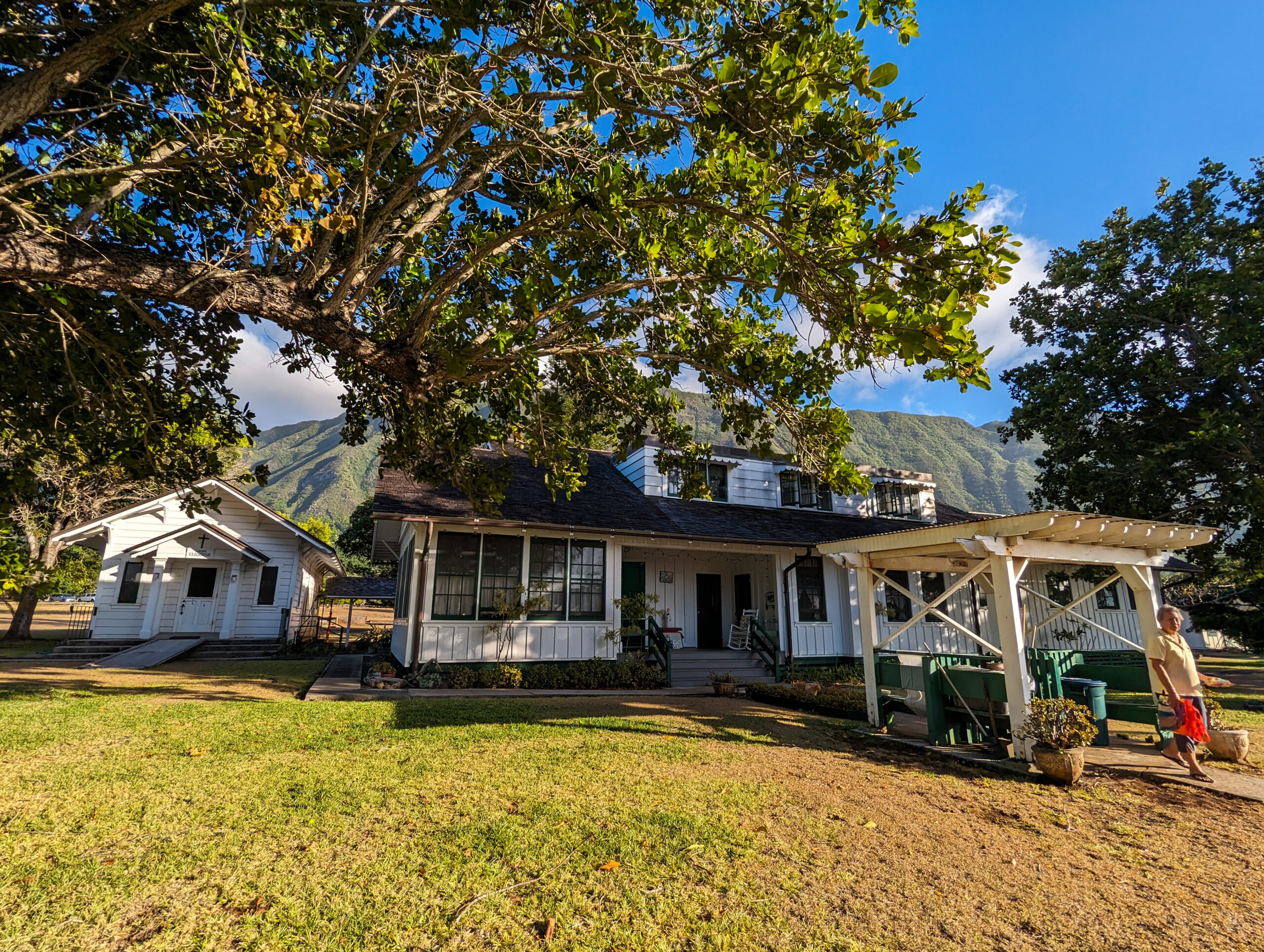
You can tell Kalaupapa is nearing a transition. As a park designed around supporting the Hansen’s disease patients, with only 4 of them left in the settlement, there is of course talk about what will happen to this place after they are gone. There are many stakeholders already at the table: National Park Service, Department of Hawaiian Home Lands, and Hawaii State Department of Land and Natural Resources. Whatever happens, the science being done by the marine program is invaluable and the continuity of marine resource management should be an essential aspect of the future mission. A quarter of Kalaupapa National Historical Park exists underwater. This park is one of four in the Pacific West Region that include coral reefs within their boundary, and therefore, was included under the 2000 U.S. Coral Reef Initiative. Reef-building corals, which are sensitive to environmental degradation, are a good indicator of overall health for the nearshore marine ecosystem. Doing this internship in a summer of record-breaking climate extremes, I feel it is imperative now more than ever to maintain these long-term monitoring datasets to understand how climate change is impacting our marine ecosystems and underwater resources.
Kelly Moore, marine ecologist is back in the settlement and Dr. Sheila McKenna, marine ecologist and program lead for the Pacific Island Inventory and Monitoring Network has arrived in Kalaupapa. I will be joining them and Glauco Puig-Santana the biological technician, for the yearly benthic surveys and fish counts. These surveys are conducted at parks in Guam, American Samoa, the Big Island, and here. The 17 years of data from Kalaupapa has shown that the nearshore fish communities are some of the healthiest in the main Hawaiian Islands, with the second highest fish biomass of the Islands found around Kalaupapa. Also, Kalaupapa corals may be more resilient to climate change as seen from 2015 data when there was a Pacific-wide coral bleaching event from increased seawater temperatures. Corals at Kalaupapa experienced little to no bleaching compared to corals at Kaloko-Honokōhau National Historical Park on the Big Island which experienced mass bleaching and die-offs.
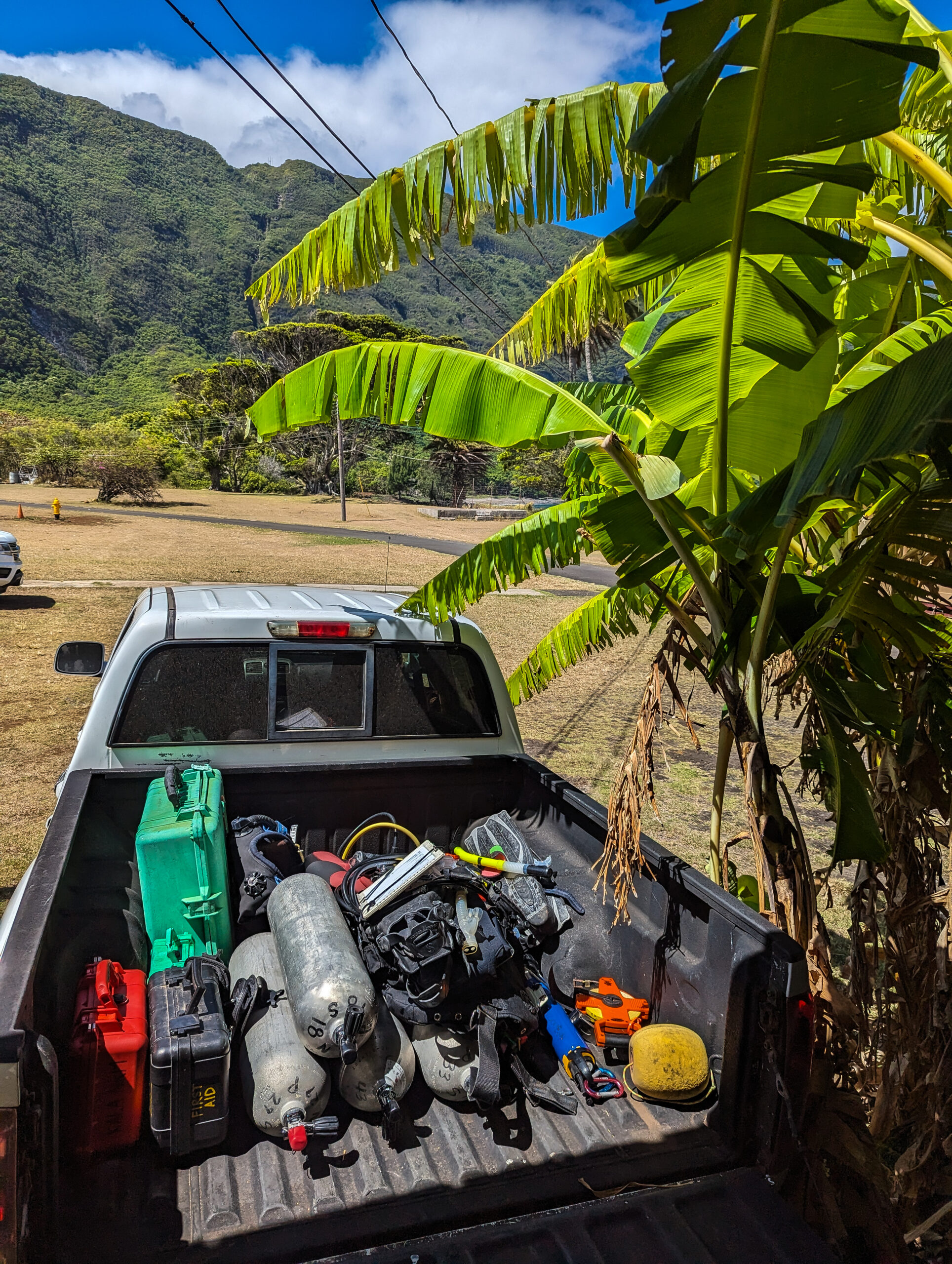
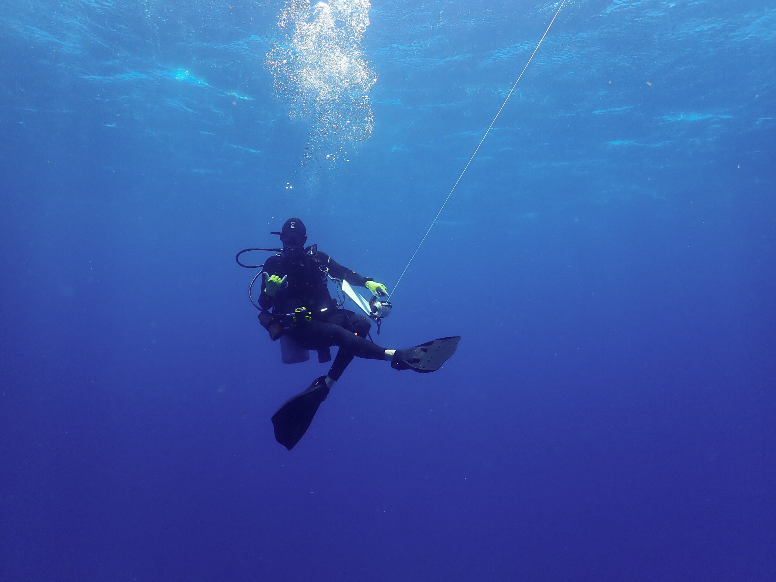
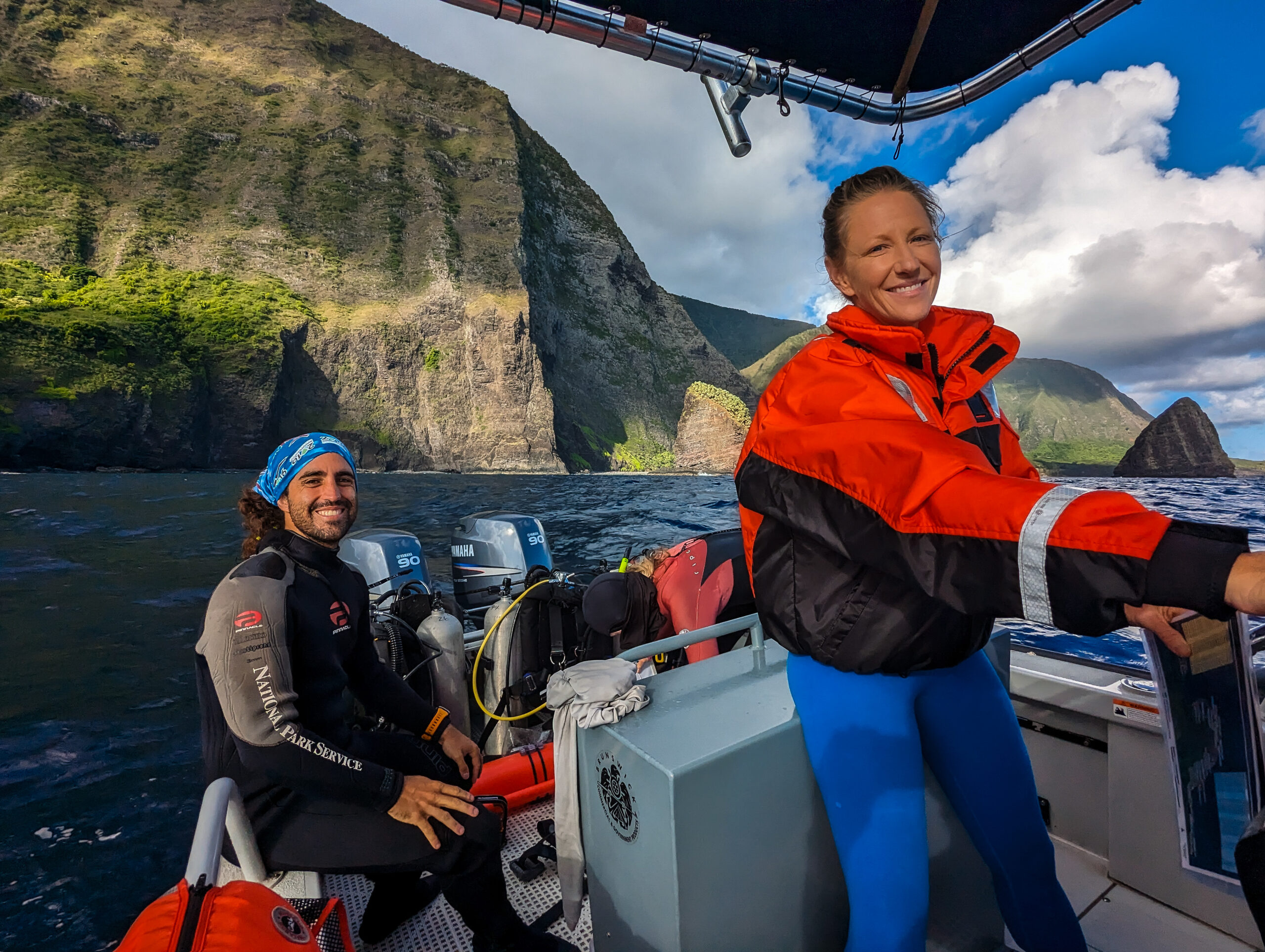
I am excited to start diving here but Kalaupapa is very remote and resources are limited, so safety is of paramount importance. We spend a day going over the Job Hazard Analysis, Diver Emergency Evacuation Plan, Standard Operating Procedures, and the general protocol for doing the I&M surveys. Every day before we do any diving, we will also conduct a GAR (Green, Amber, Red- a sort of shorthand for risk during operations) as a risk assessment tool.
Unfortunately, now that the team is assembled, the weather doesn’t want to cooperate. The forecast is looking pretty windy the whole week and next week it will be gusting 40 knots with a small craft advisory. Hoping the forecast will change, we plan to start diving at sites on the settlement side of the peninsula, the leeward side.
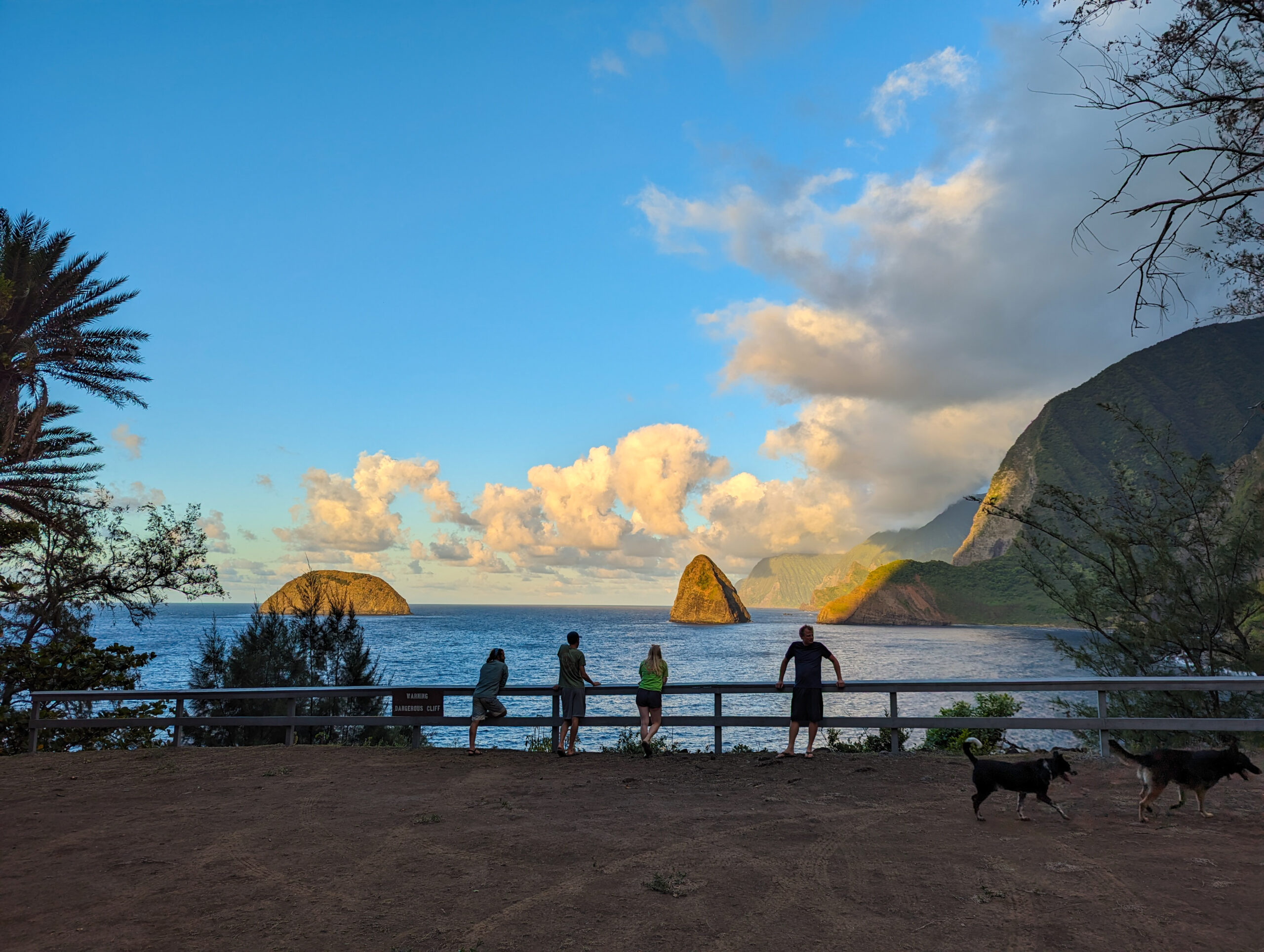
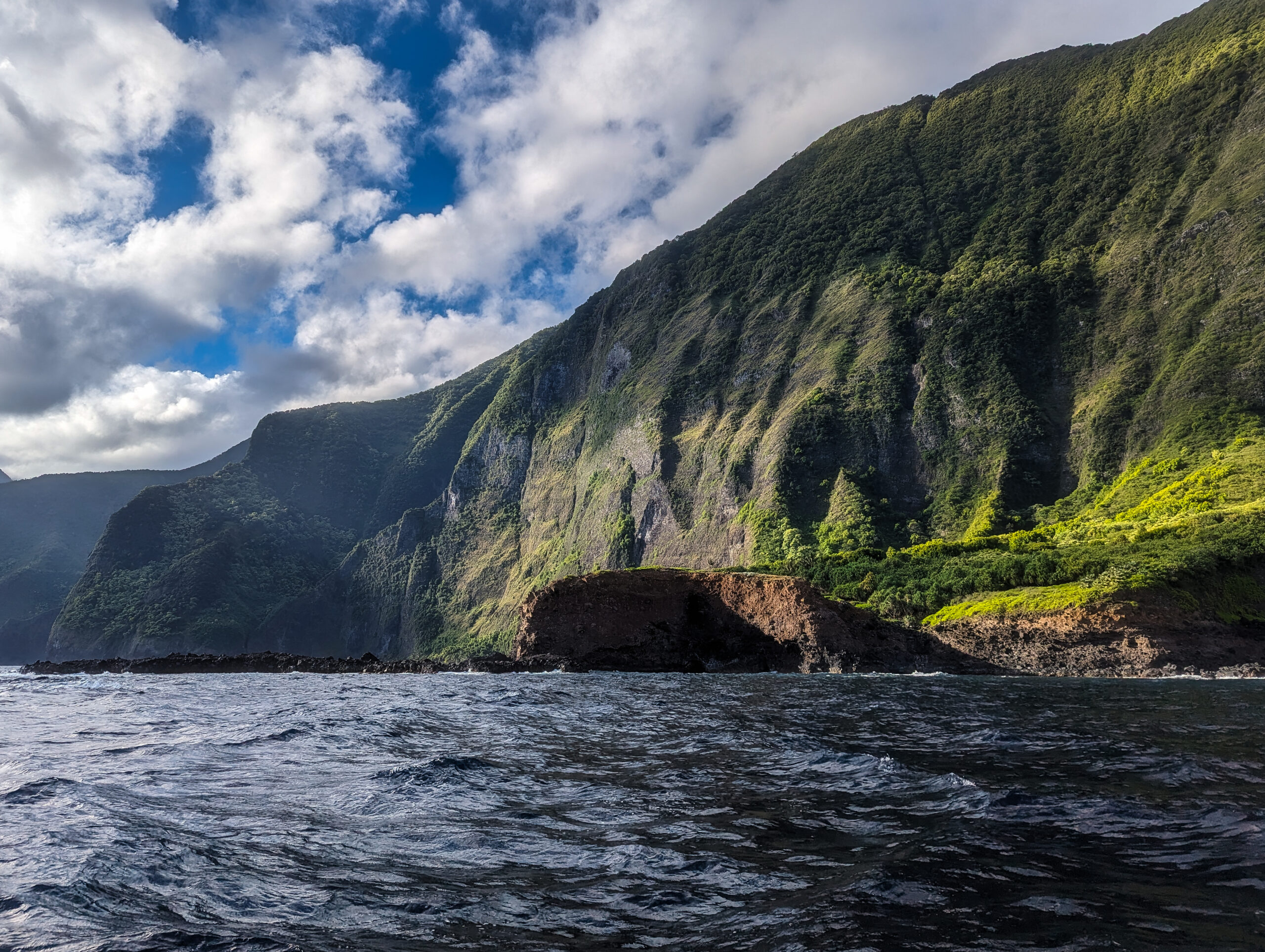
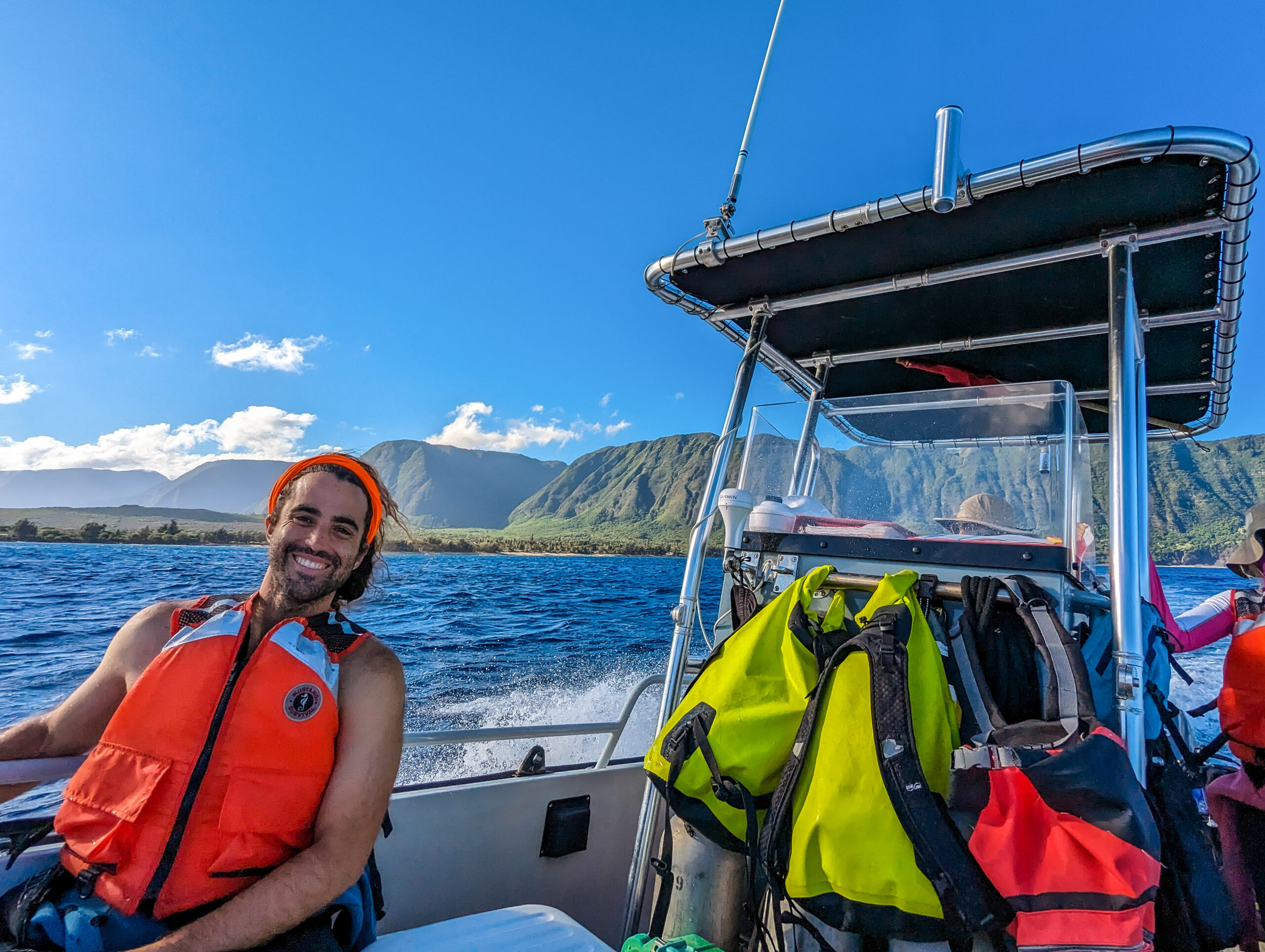
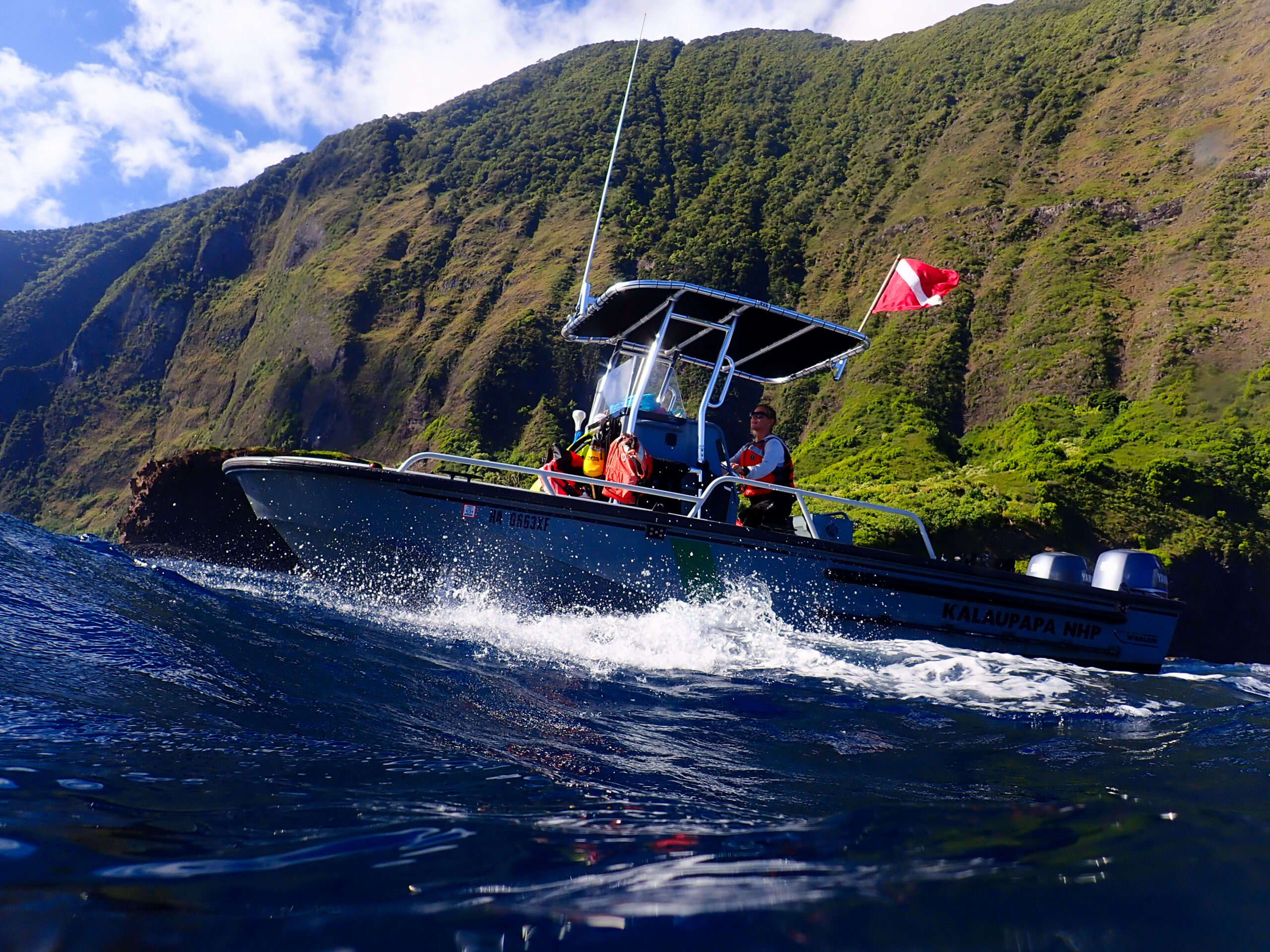
I ride my bike down to the Natural Resources Management offices at Bay View Homes to meet the team at 6 a.m. and do the GAR. We load up gear and tanks and head down to the pier where the NPS boat, the Kala 2 is moored offshore. Even though we are working on the leeward side, I soon realize this doesn’t mean calm conditions. We are immediately in some big ocean rollers as we motor to the west end of the park. It’s a lot to take in, the wind, the rocking of the boat, the massive green cliffs behind us, and the deep blue-colored water all around. Tossed around on board, it’s a relief to get underwater, much more peaceful.

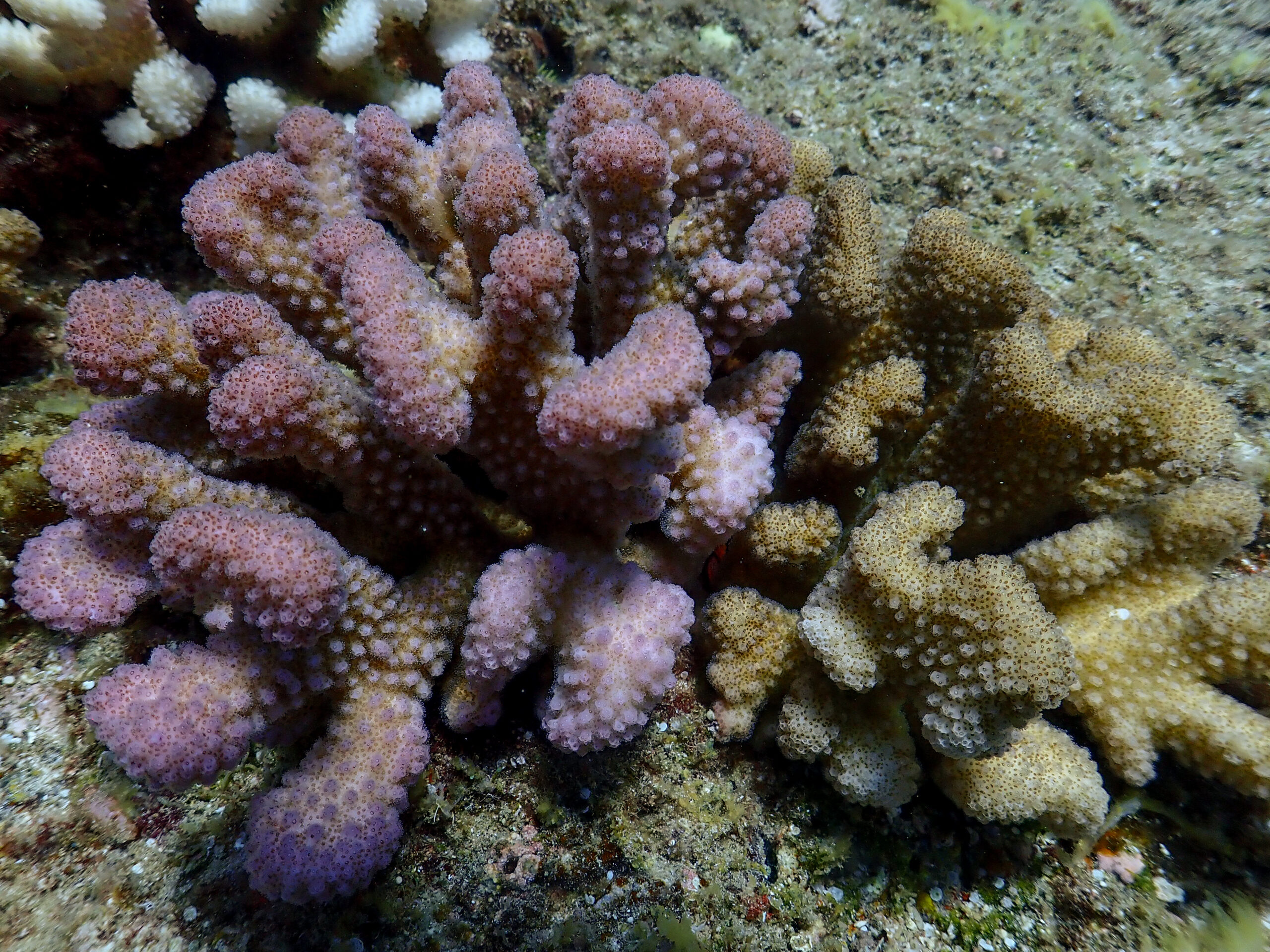
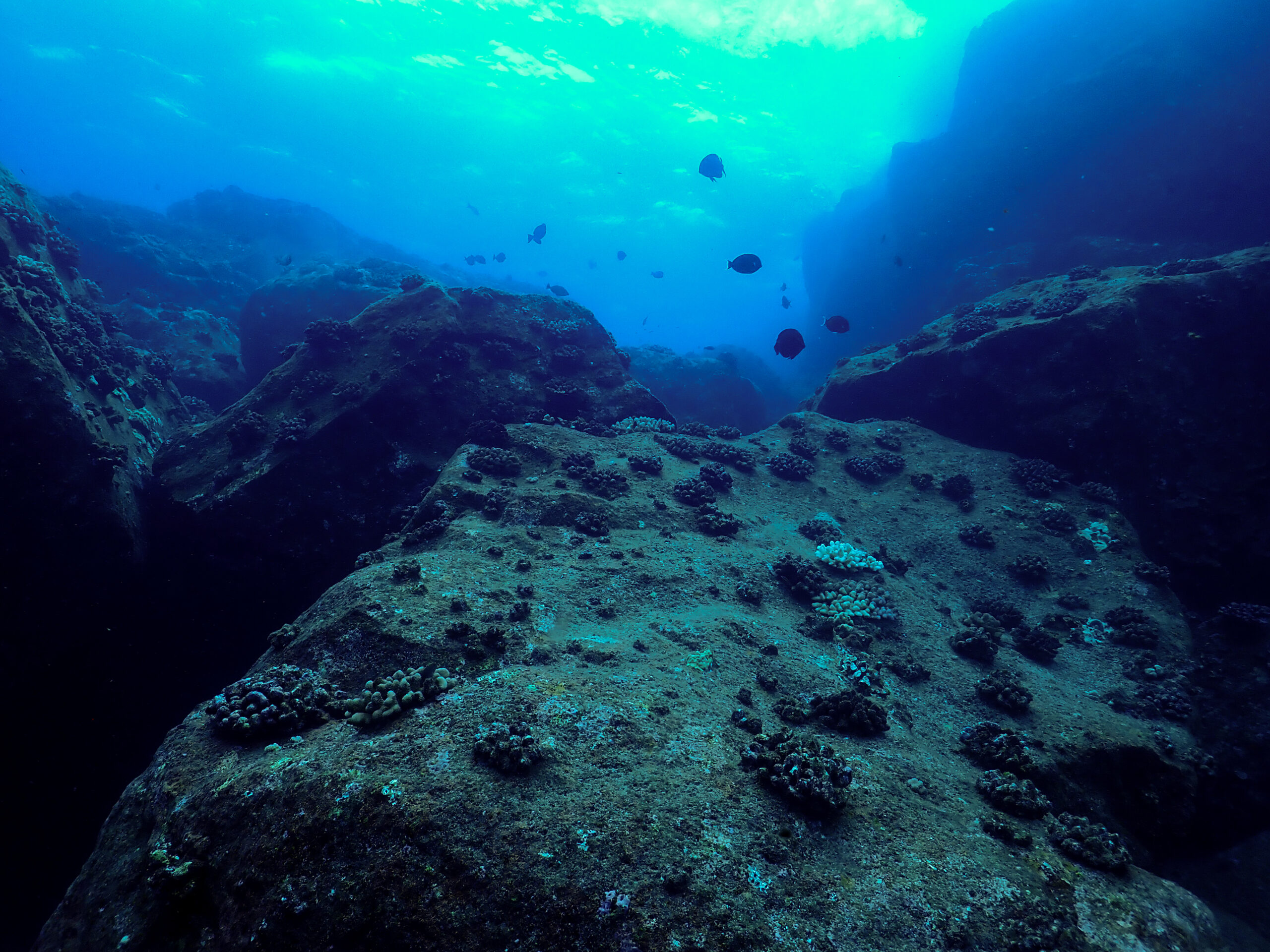
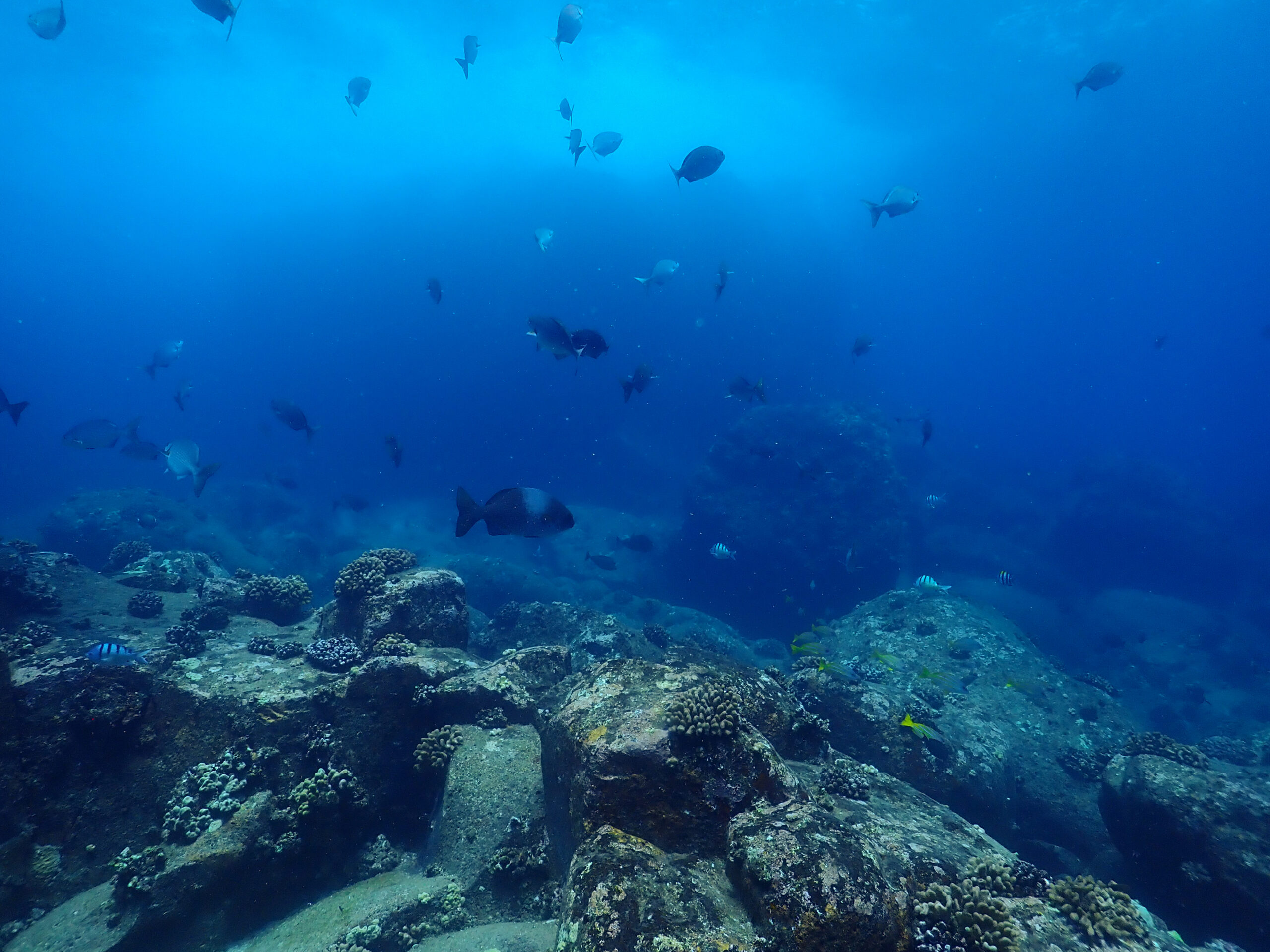
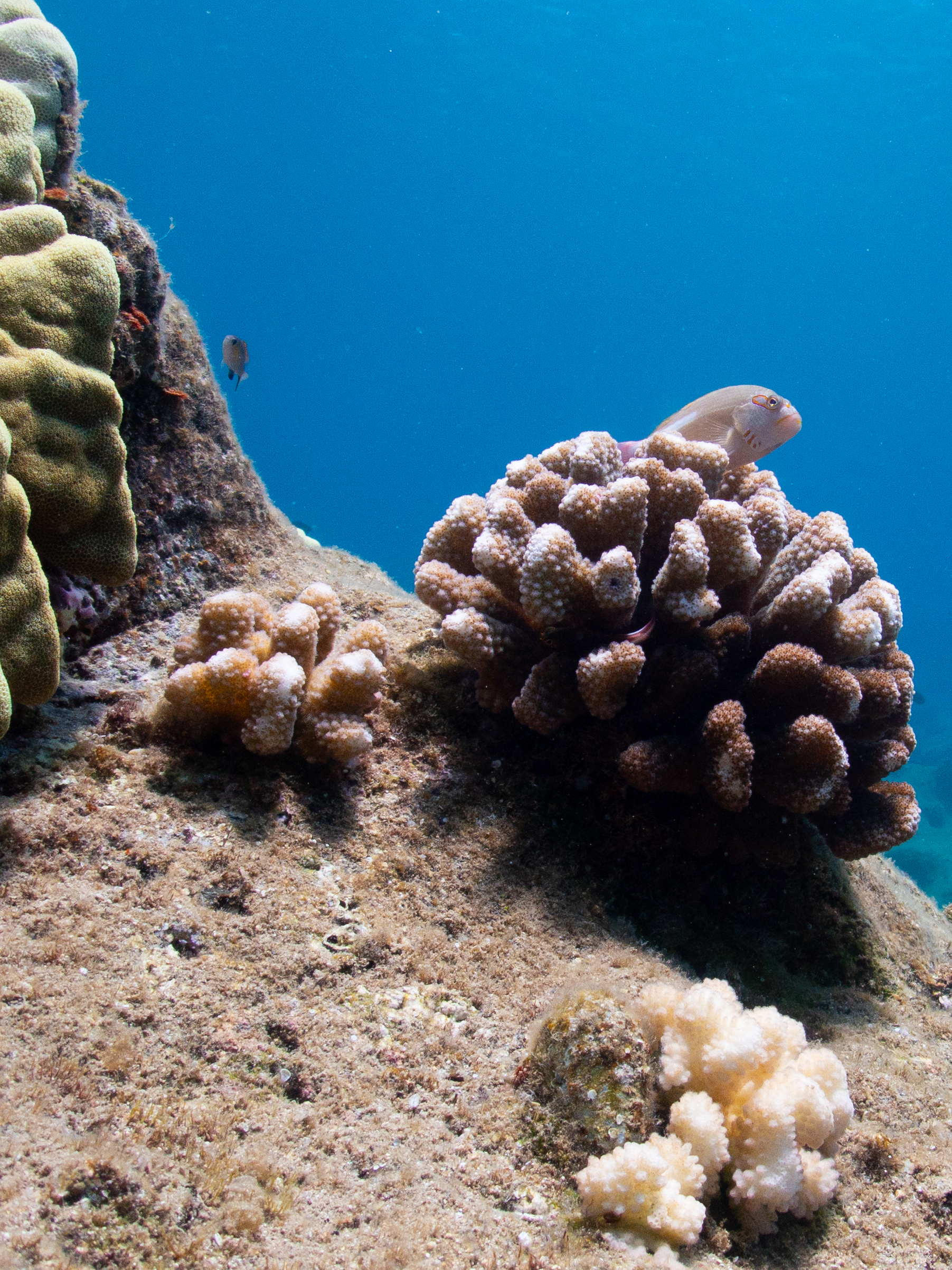
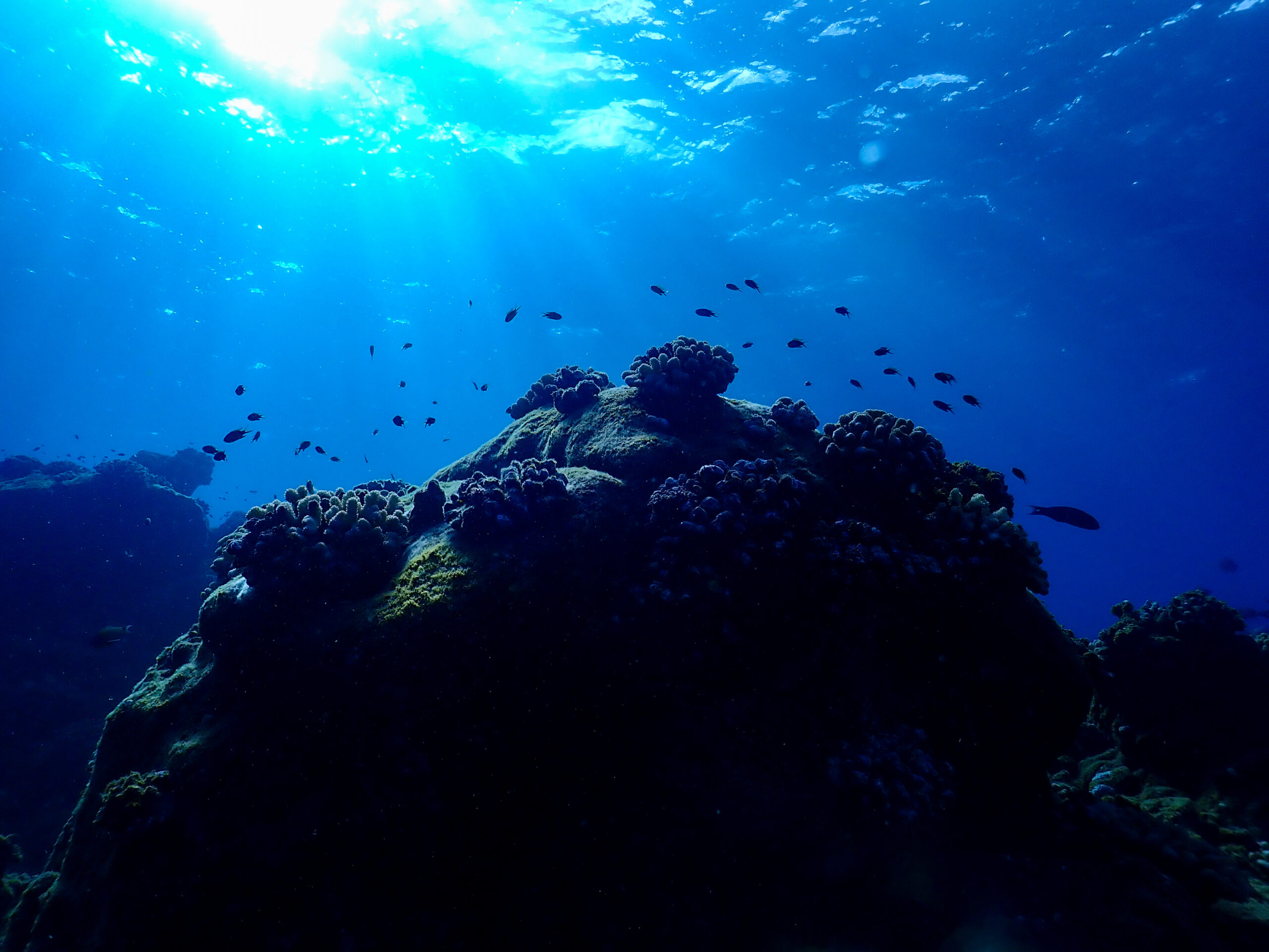
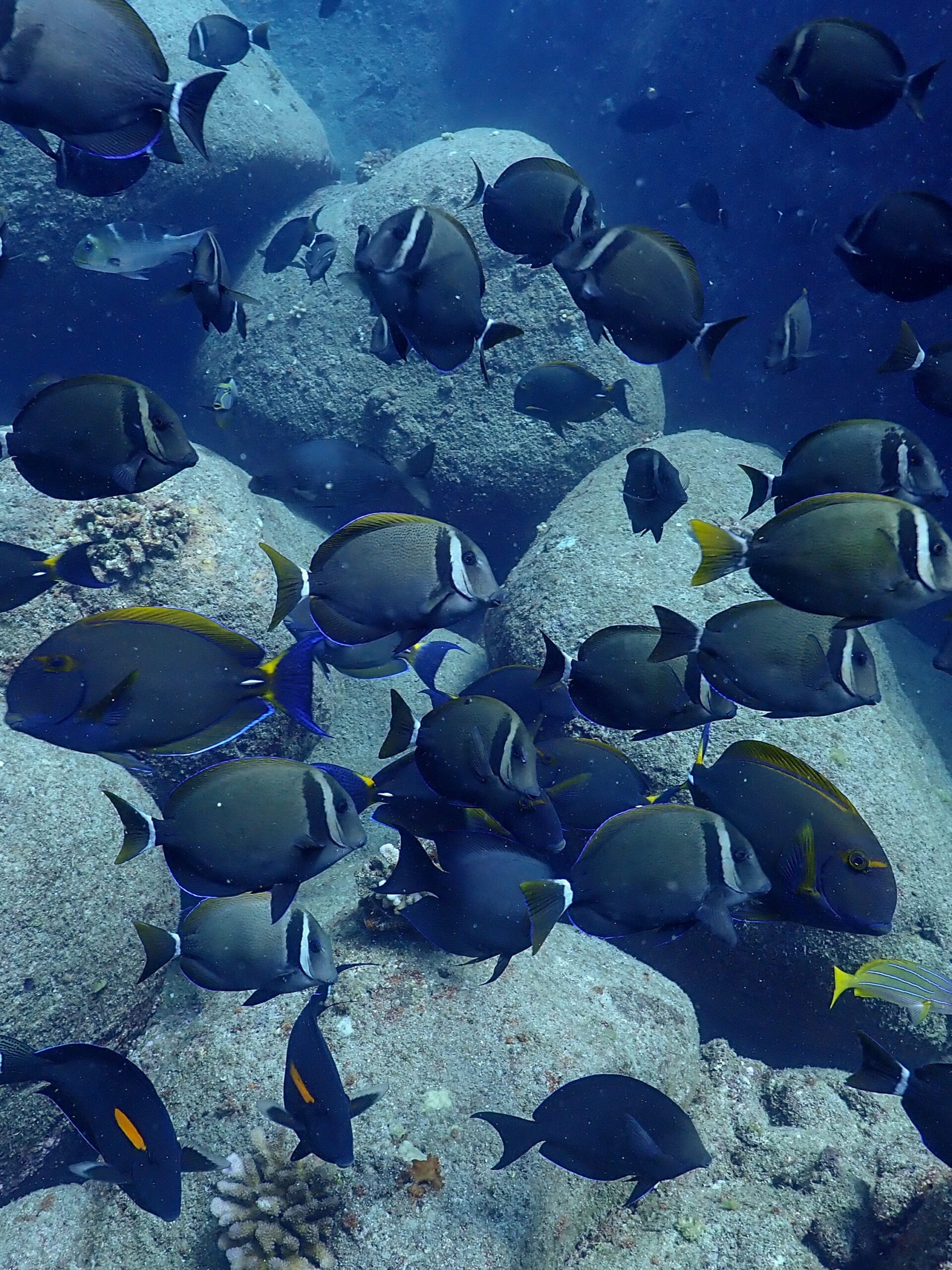
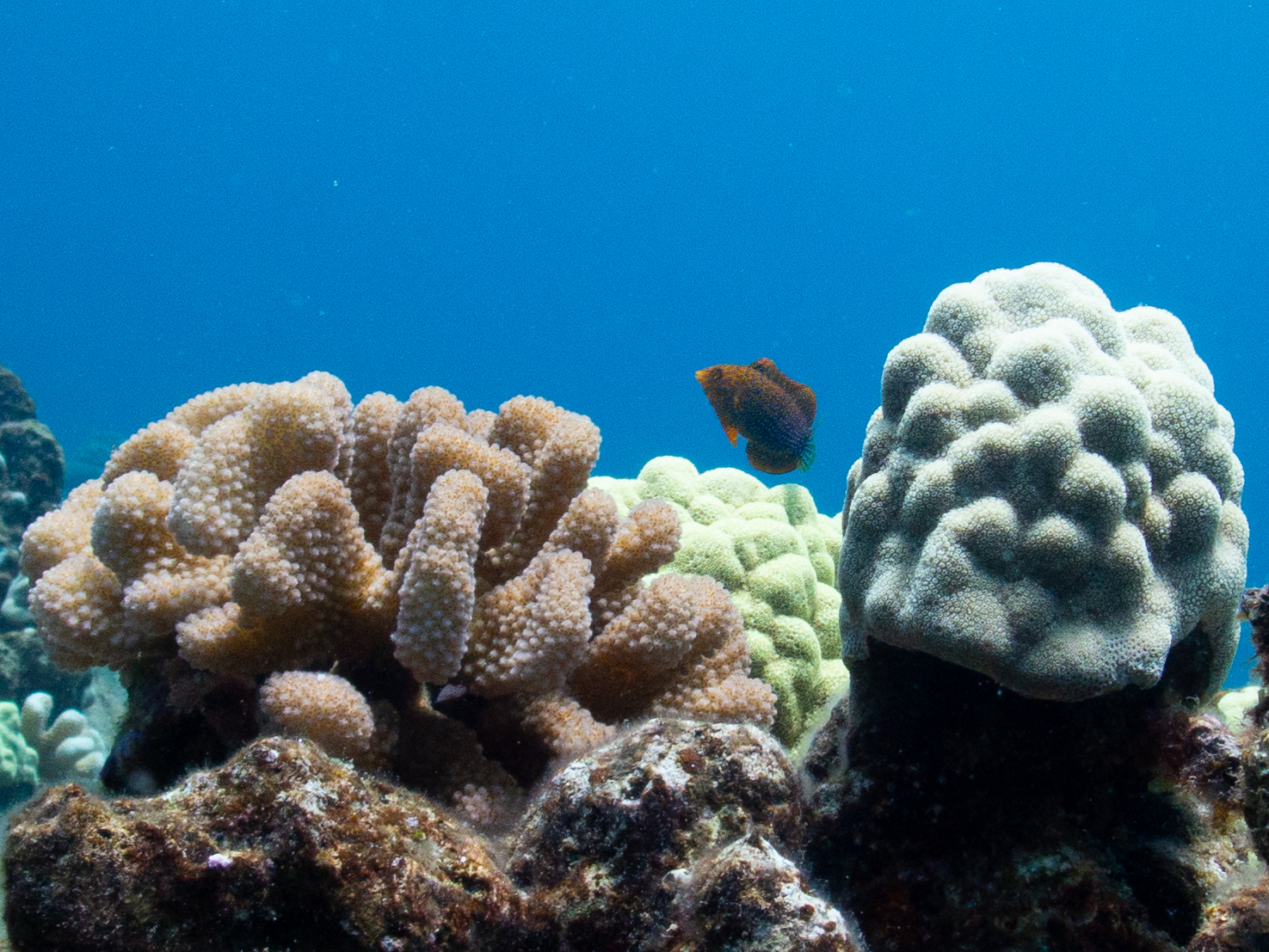
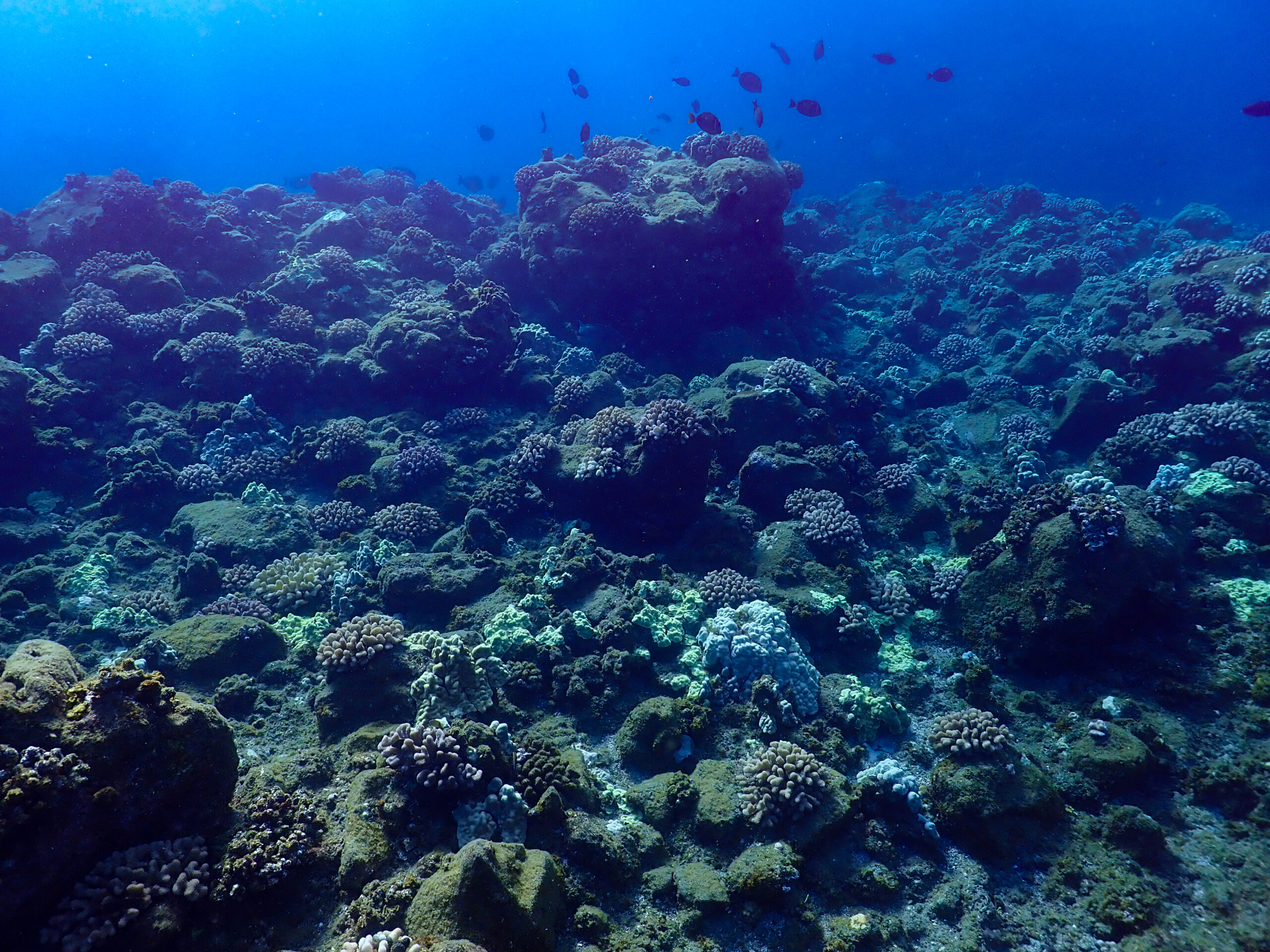
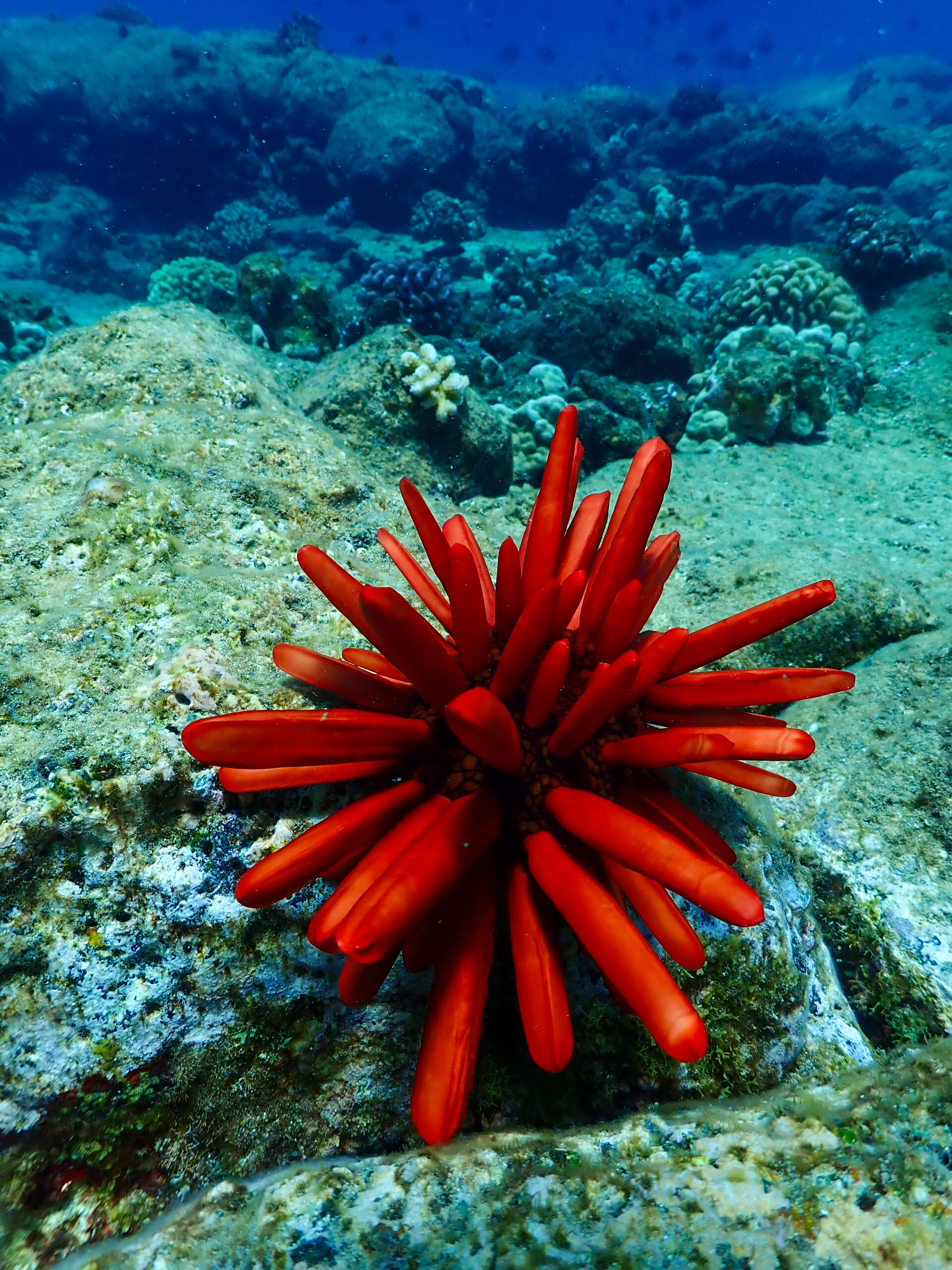
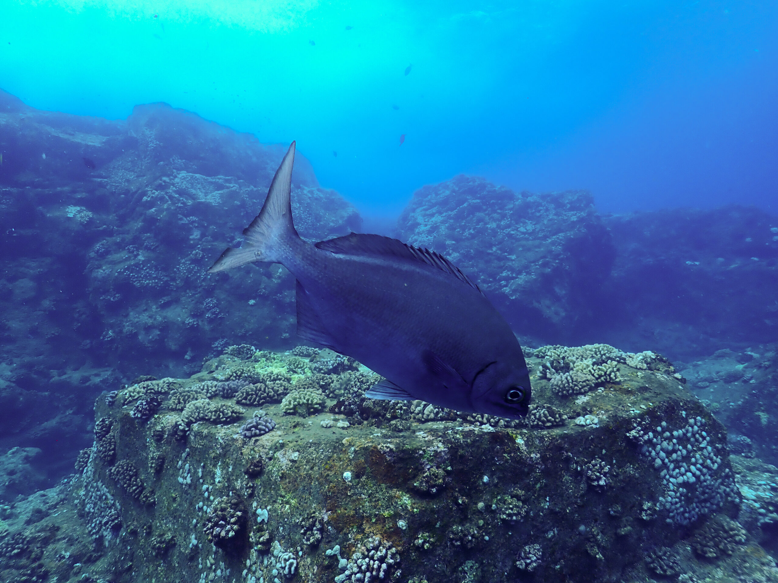
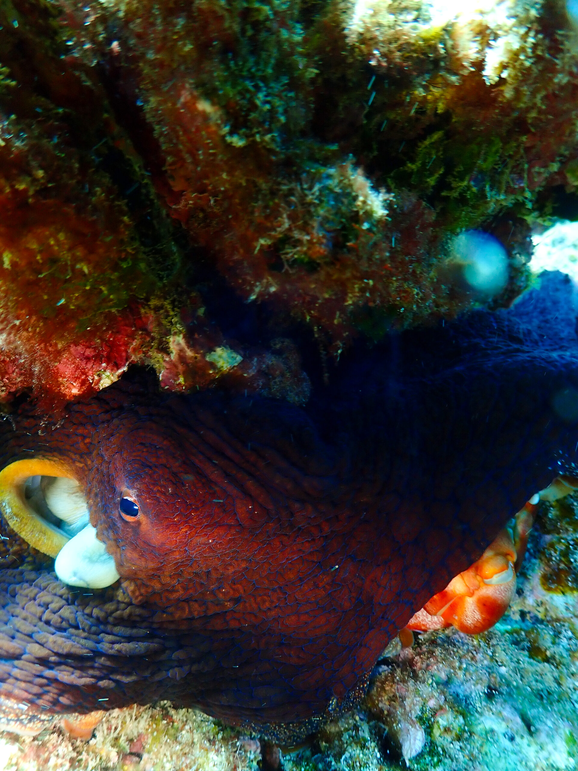
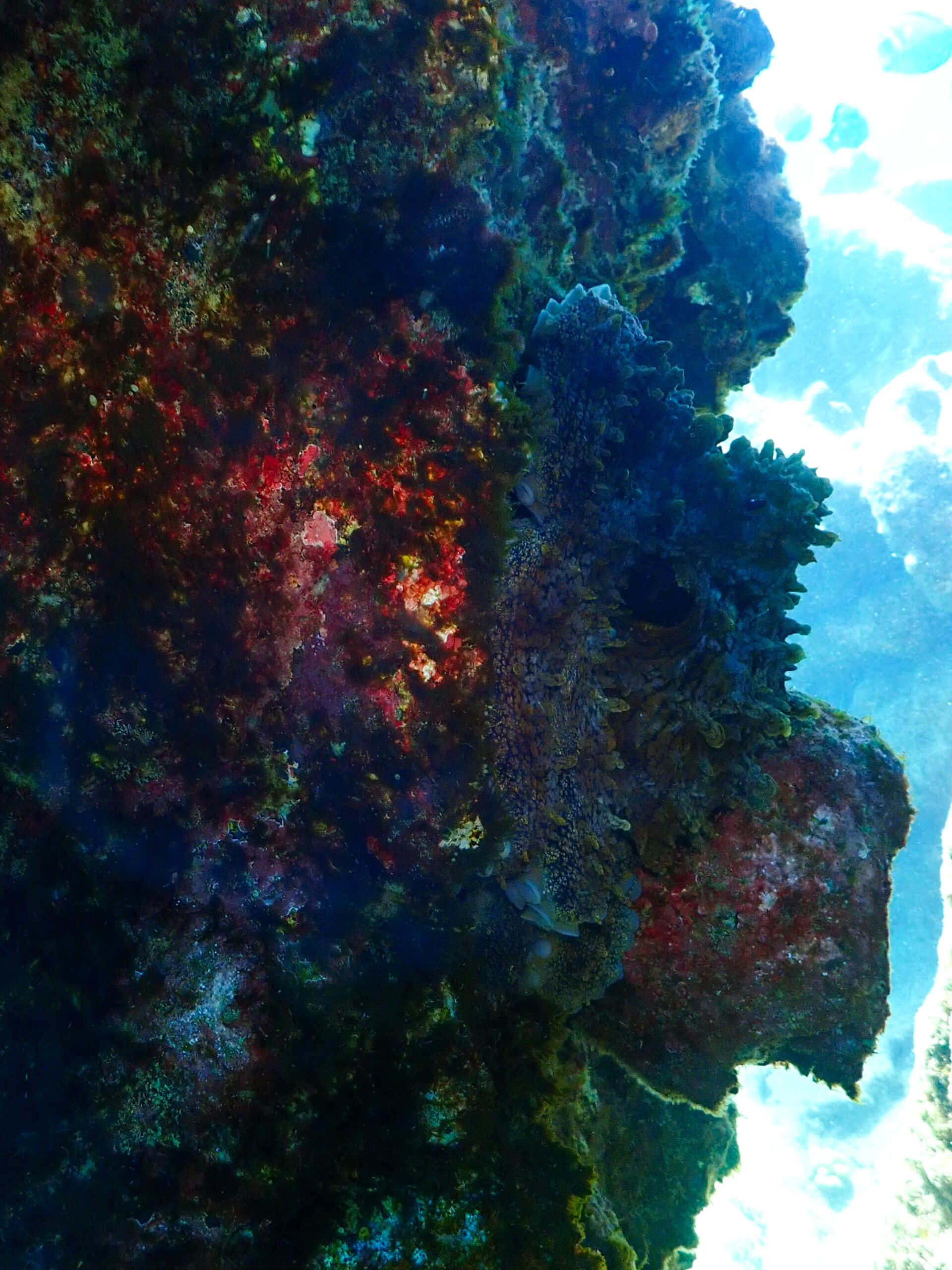
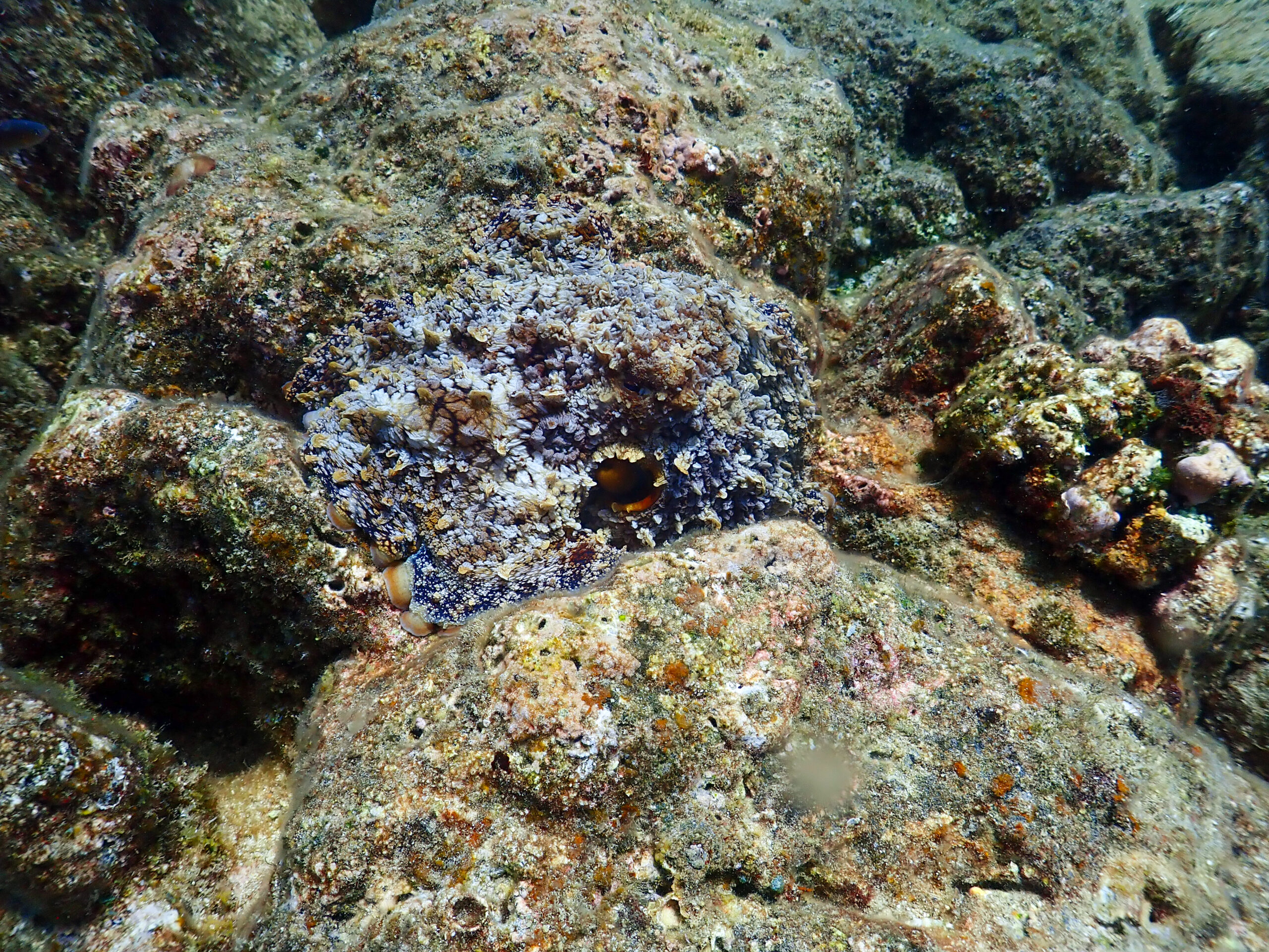
I had just gotten used to the gorgonians, sea fans, and reef fish of the Caribbean so this unique giant volcanic boulder habitat feels alien. I see unicornfish with bright orange scalpels and streamers on their tail, manini, surgeonfish, bullethead parrotfish, and wedgetail triggerfish. Little bouquets of cauliflower coral decorate the massive boulders. Their color varies from creamy yellow to brown to fluorescent pink. If you peek closely at the corals you will see the Hawkseye fish, eels, and inverts hiding between its branches. There are other corals that are bone white, and you can usually find the crown of thorns sea star in the vicinity responsible for devouring it.
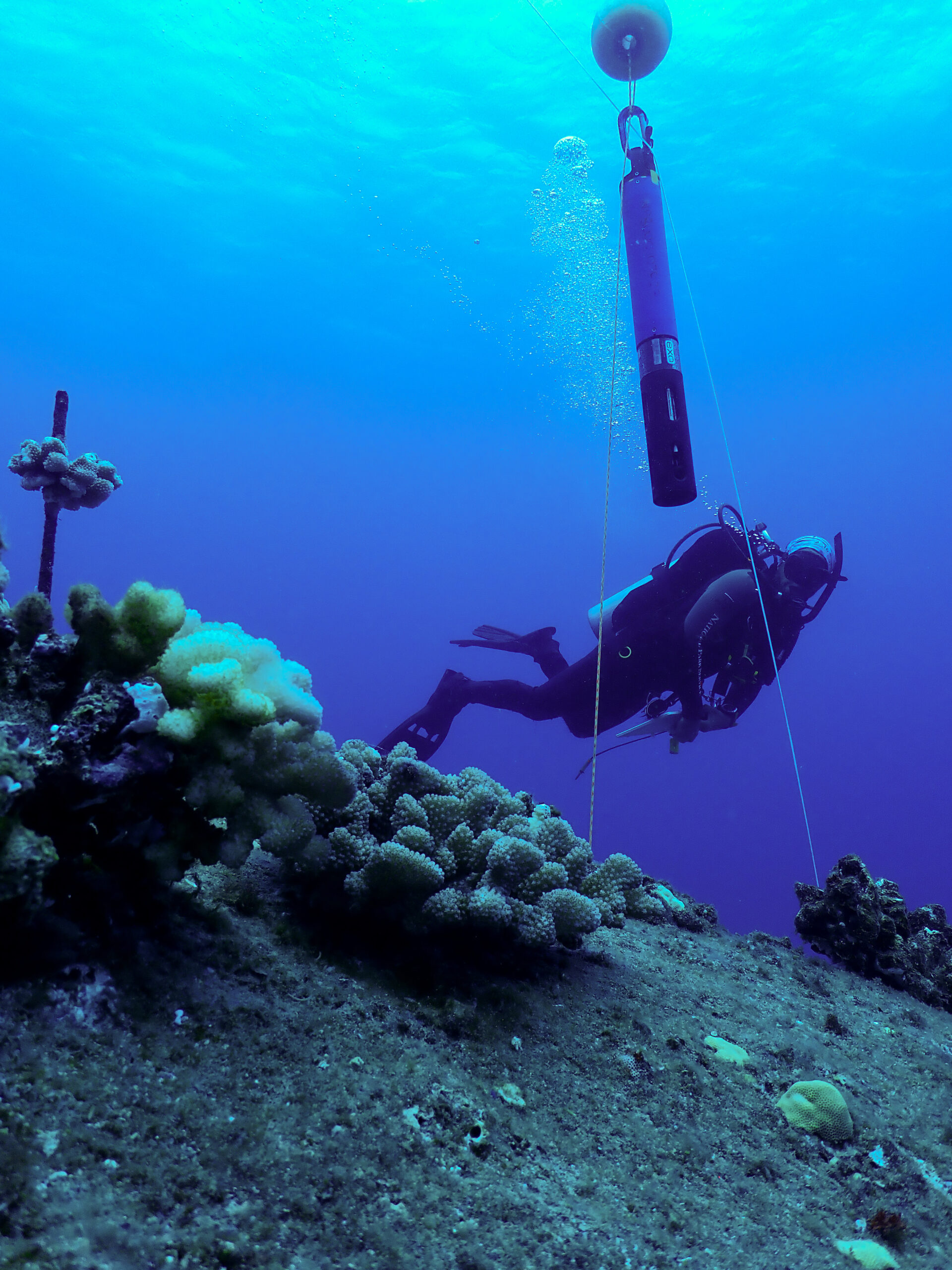
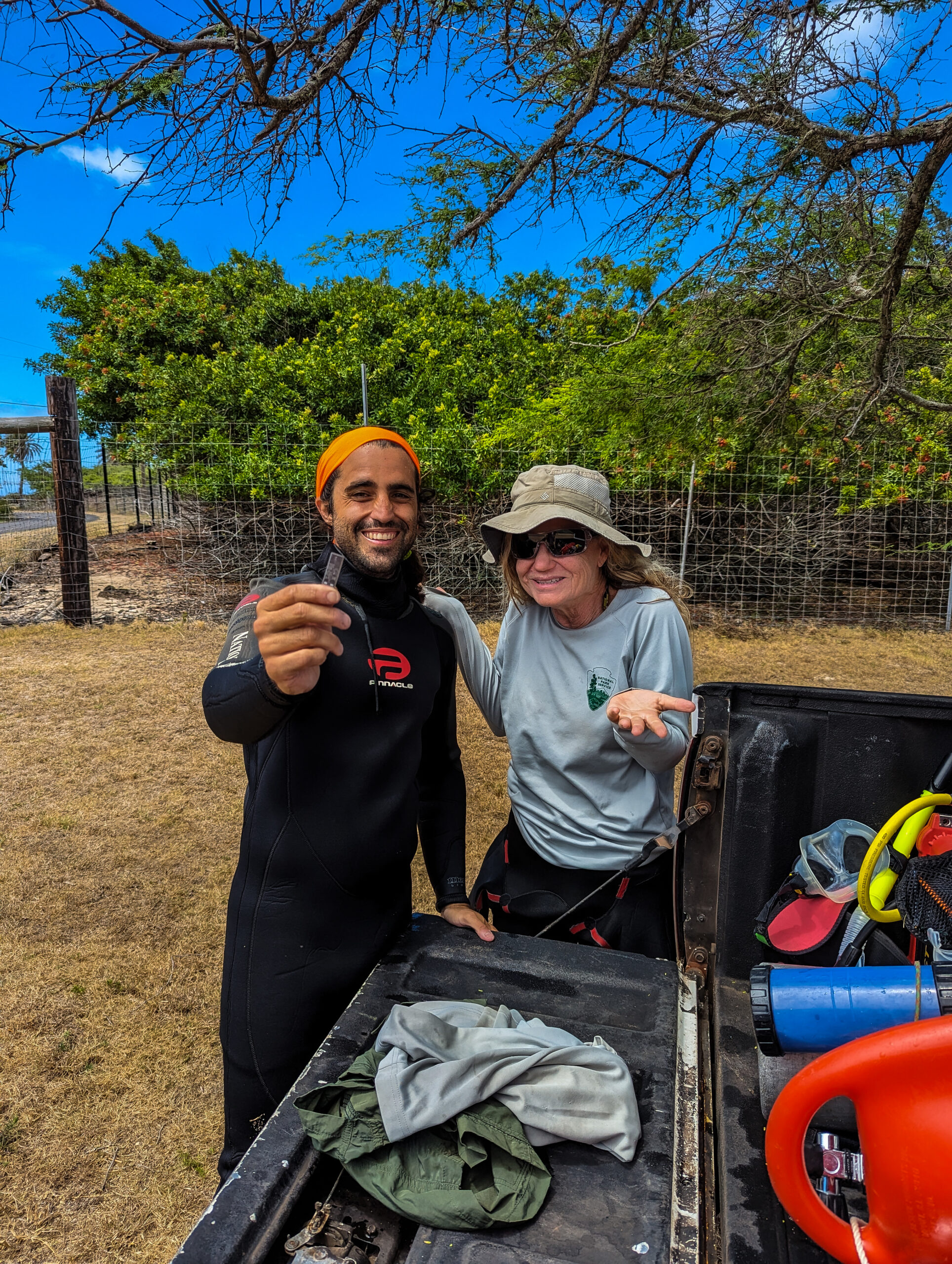
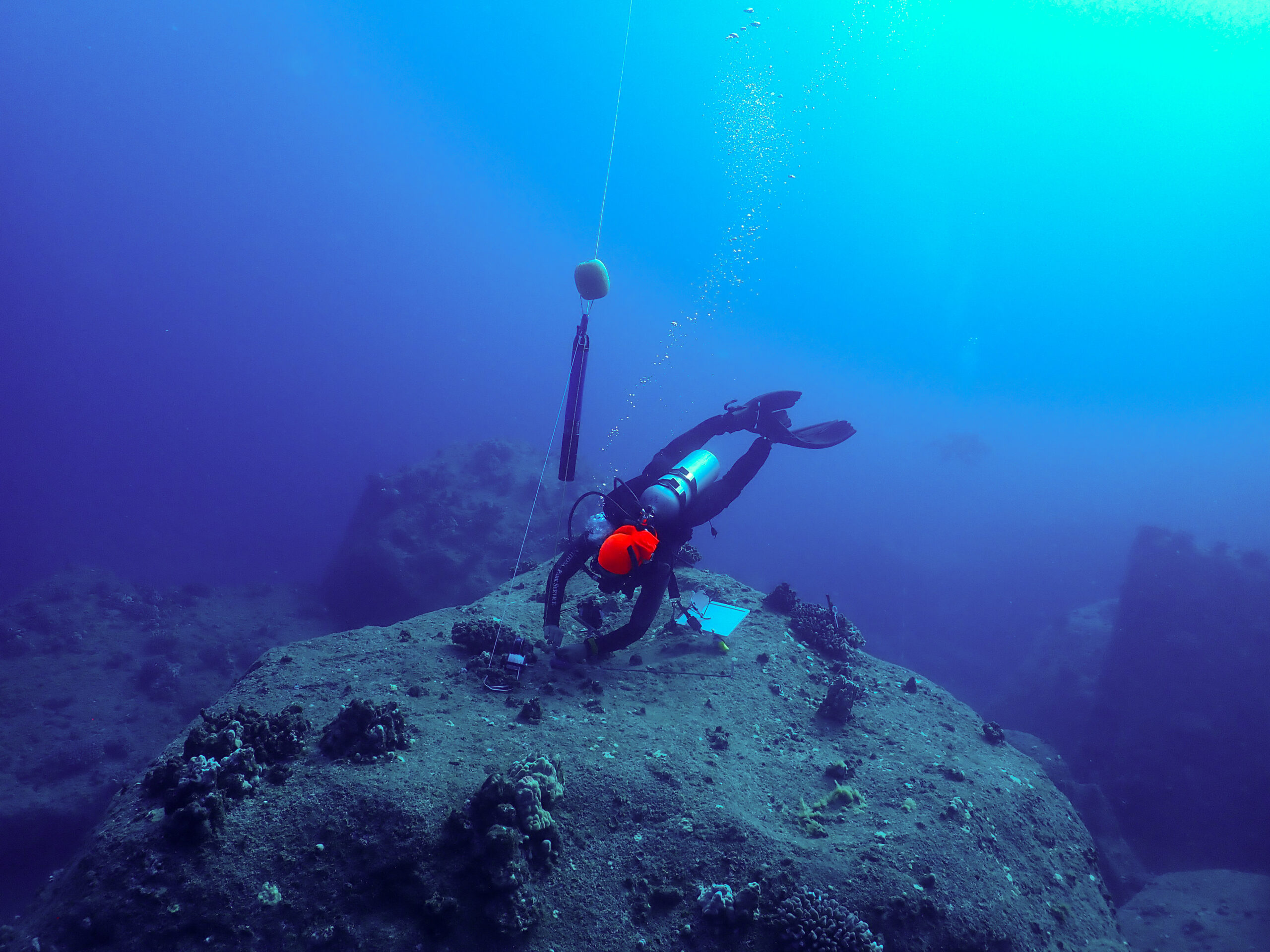
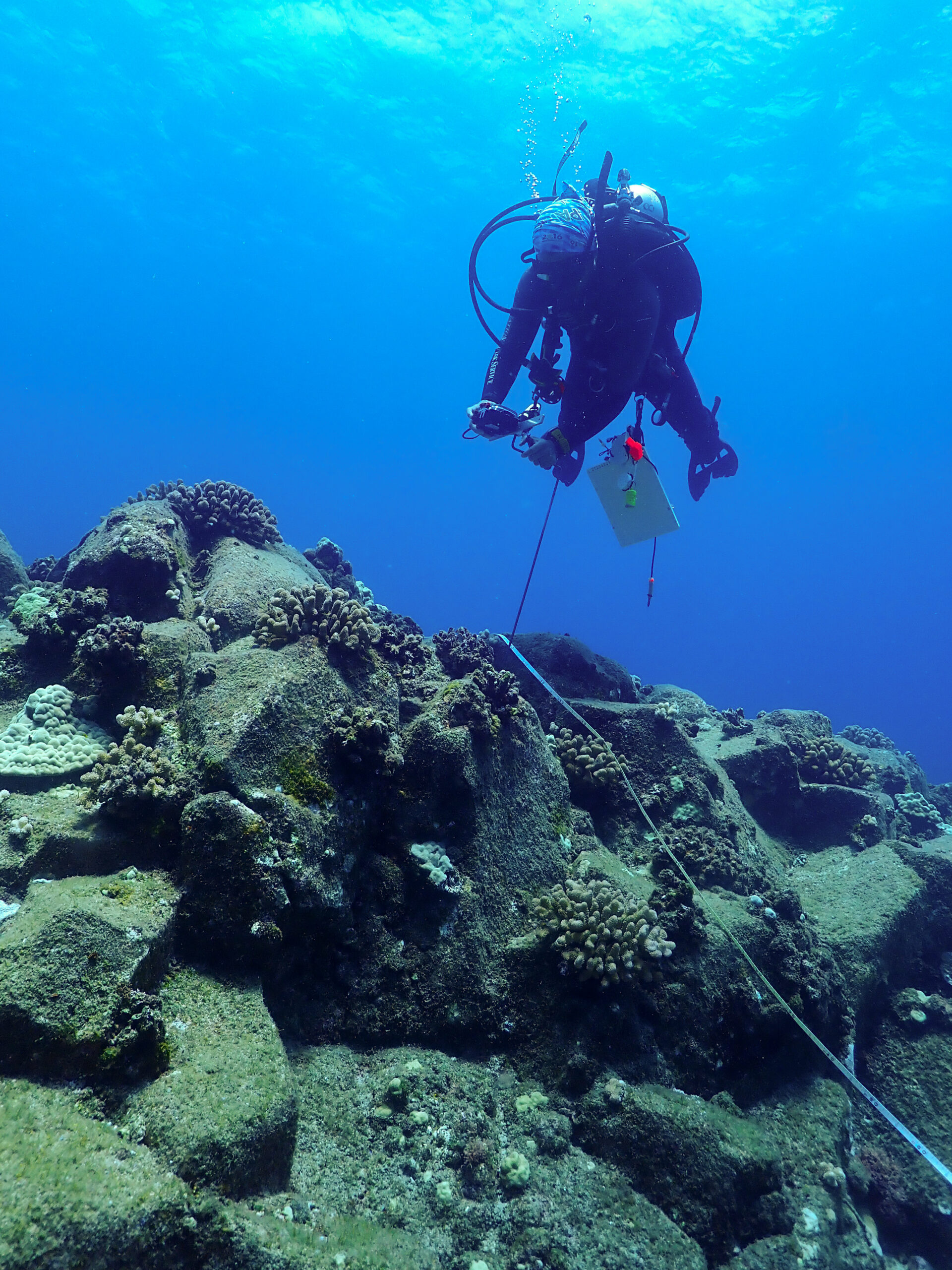
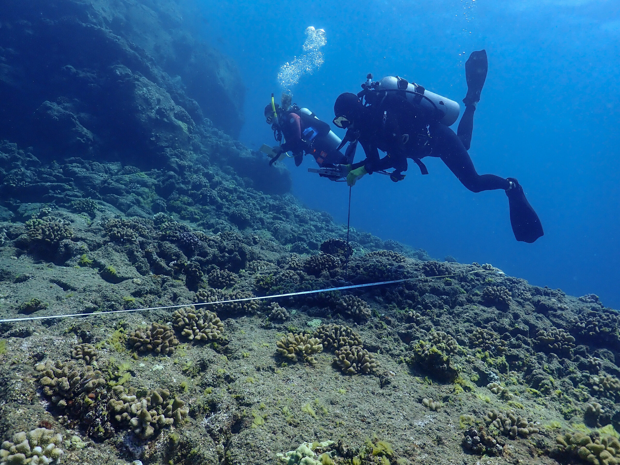
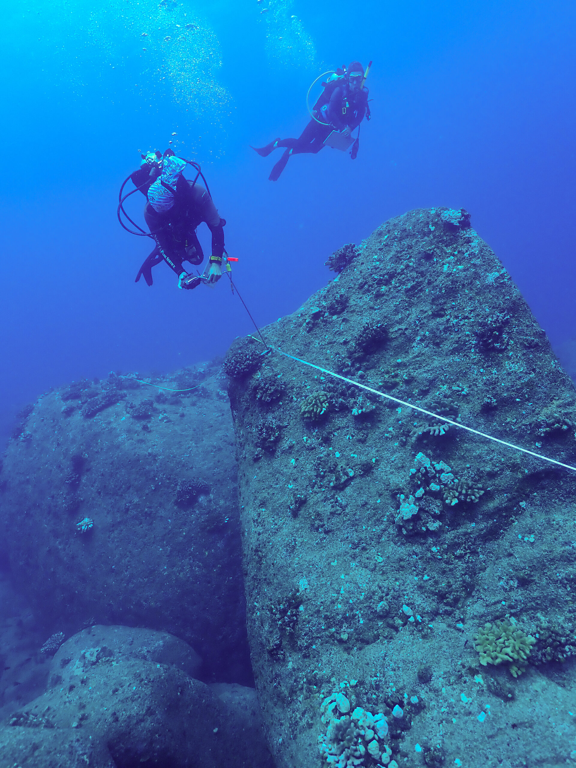
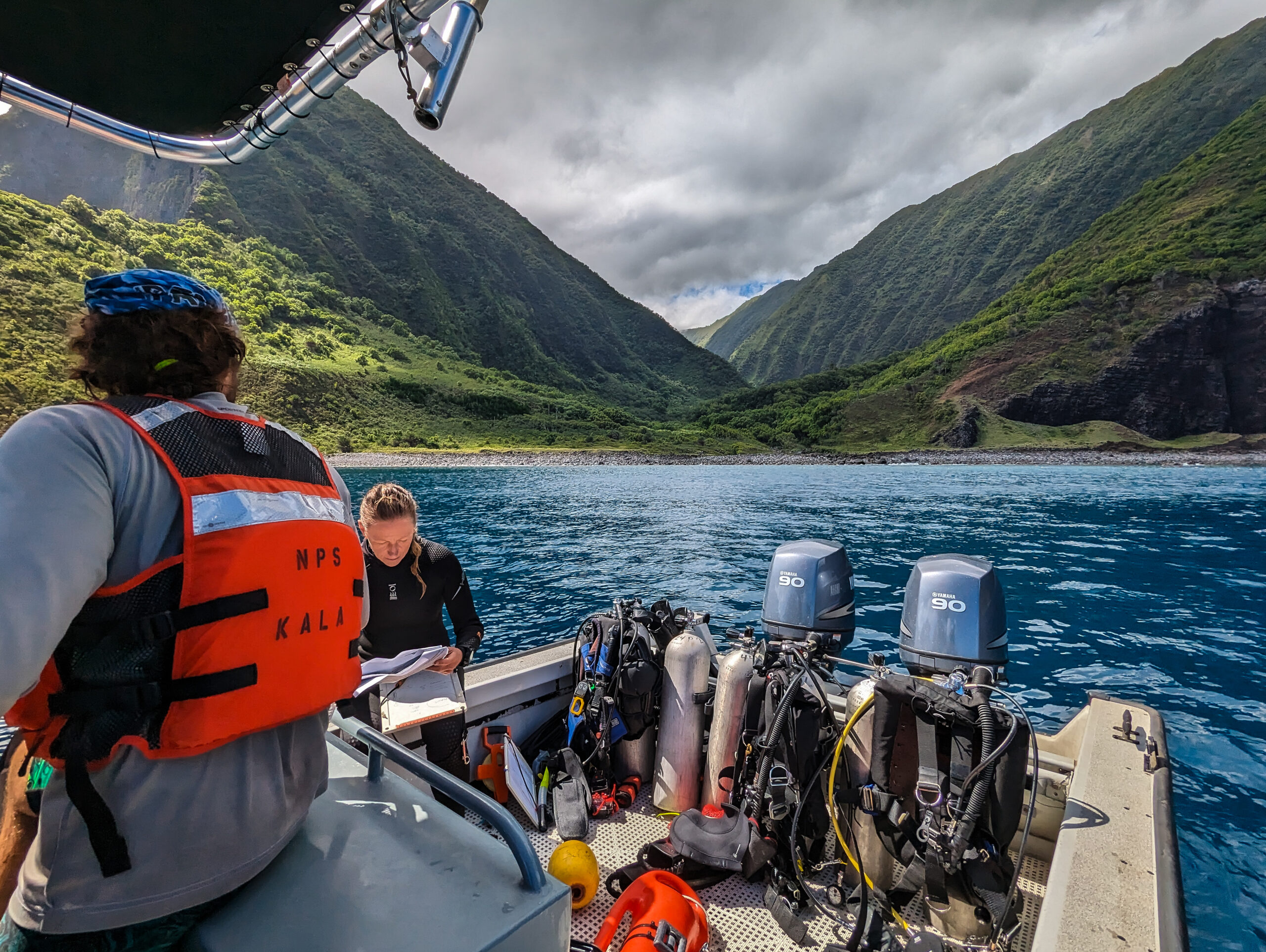
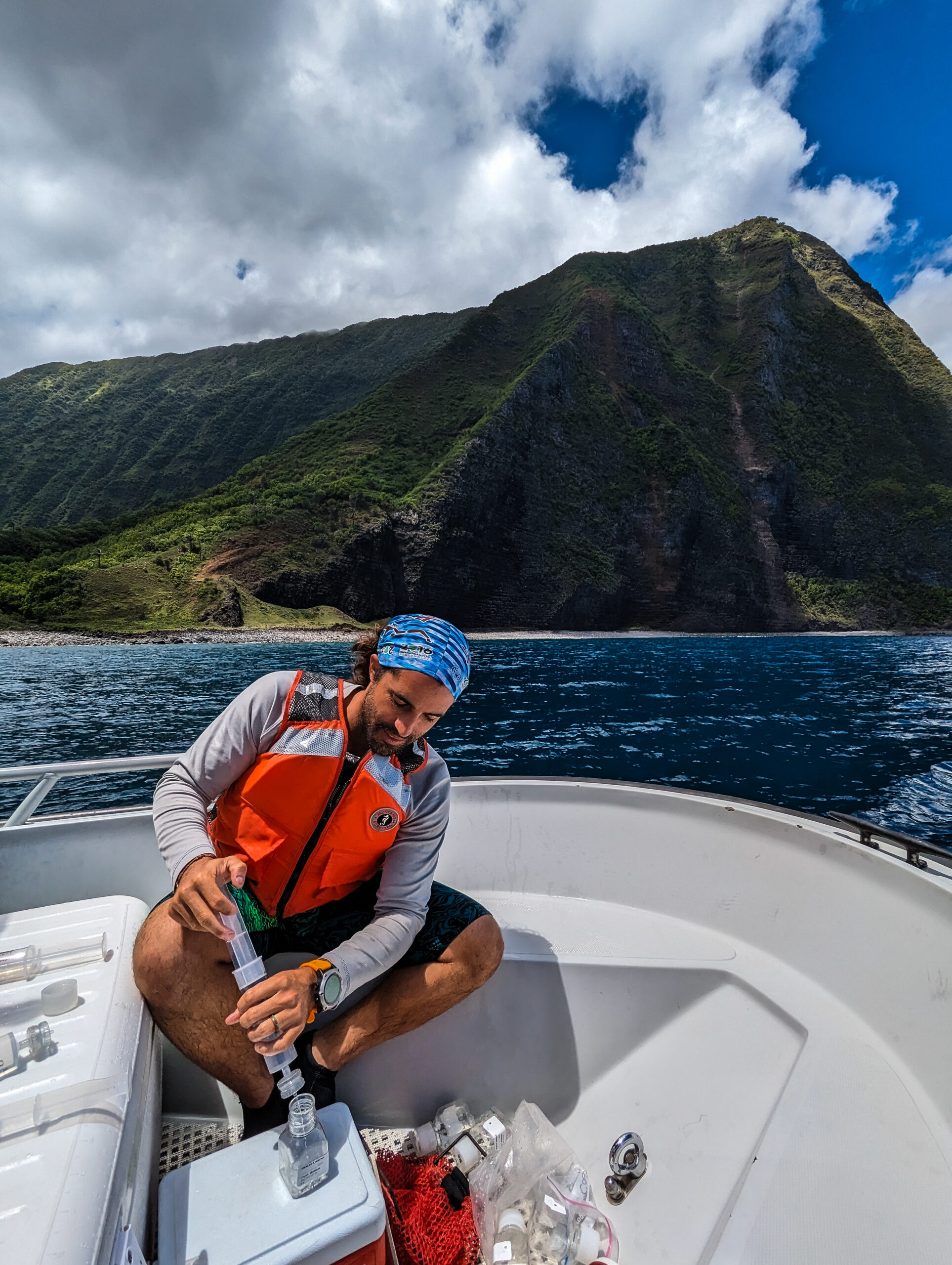
I dive with Sheila and Glauco first and just observe the survey. There are 15 fixed sites that are surveyed every year and marked with a start and end pin. Once we find the start pin, Sheila starts the survey and swims the transect IDing and measuring all fish she encounters on the line transect. In the meantime, Glauco is stationing the sonde to collect water quality at depth for 10 minutes before releasing it to the surface to collect another 10 minutes worth of water quality at the surface. Data includes water salinity, pH, temperature, and dissolved oxygen. At some sites, we also bring syringes to collect water samples at depth to look at nutrient levels. After Sheila has completed her fish survey, Glauco will take benthic photoquadrats every meter along the transect which will later be analyzed to determine bottom cover.
Once we are on the surface, if it is a water quality site where we collected water at depth, we will also collect surface samples with a Niskin bottle. Then we filter the surface and deep samples to later be analyzed for nutrient levels. Something that would be better suited for a lab environment, I chuckle as I filter samples on a violently heaving boat with spray whipping me in the face and waves breaking over the bow.
After the first dive, we take lunch closer to the settlement and out of the wind. We do another dive closer to the point of the peninsula, still on the leeward side. I take the benthic photos this time. On this dive, we see a male Hawaiian monk seal just sitting on the bottom, he makes a low, guttural, growling vocalization. Hopefully, Kirby Parnell will pick it up on her soundtrap that we deployed last week. The seal gives us the side eye occasionally but seems uninterested until he comes and visits us on our safety stop. He cruises below us and checks us out, so cool.
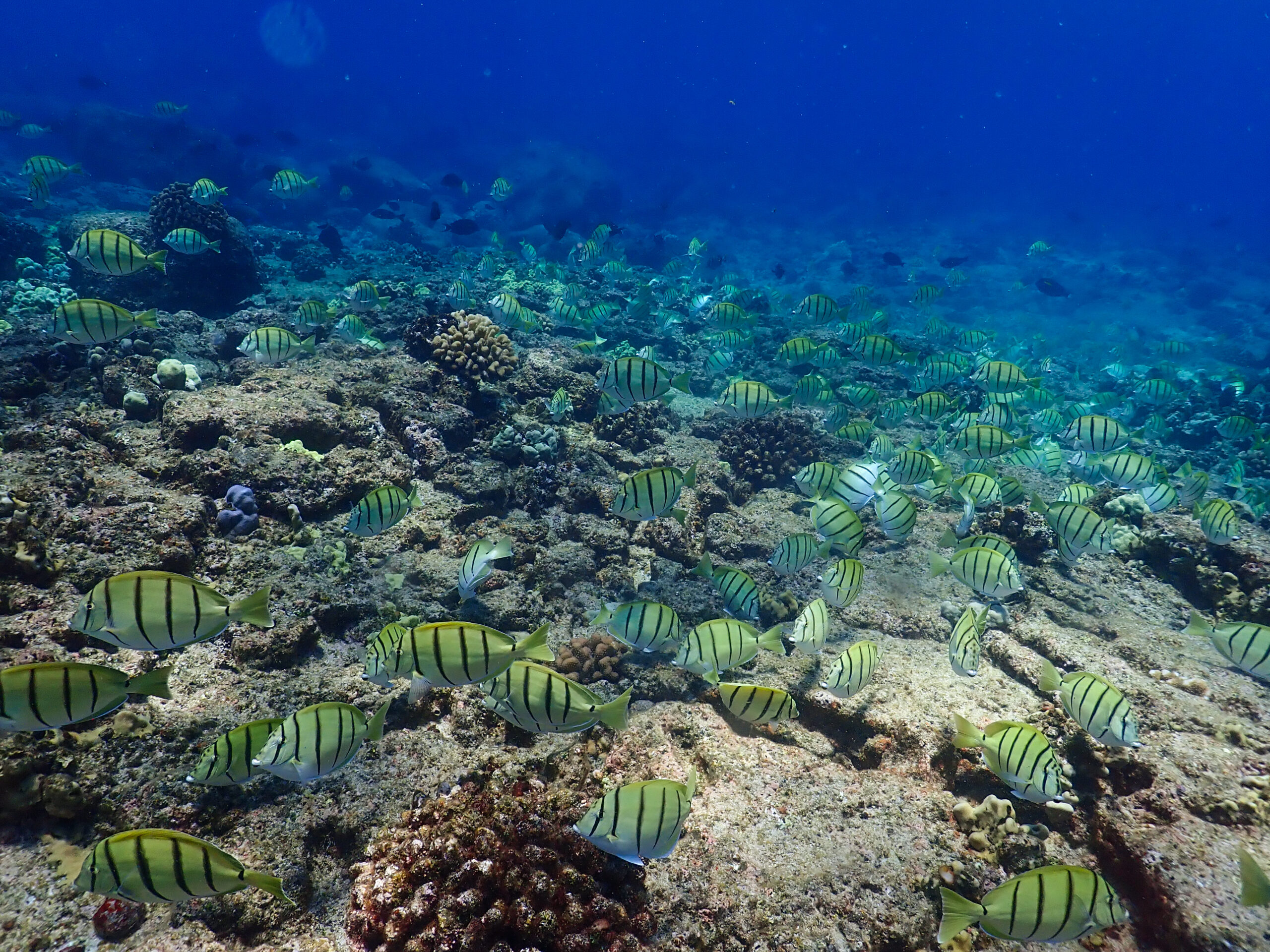
The next day, it is still very windy and we attempt to go around the point but we don’t make it very far. Too many waves over the bow, it’s just a little too hectic, so we turn around to do our last sites on the leeward side. More beautiful giant amphitheaters of rock and boulder. Sheila gave me a little fish ID lecture and I start to learn some species and look out for them like the endemic Macropharyngodon Geoffroy or Thalassoma duperrey. I really like seeing the different colorful life stages of the Hawaiian Hogfish and the yellowtail wrasse!
When we wake up today the wind isn’t too bad and there is no small craft advisory so this may be our only chance to get to some of the sites on the windward, eastern side of the park.
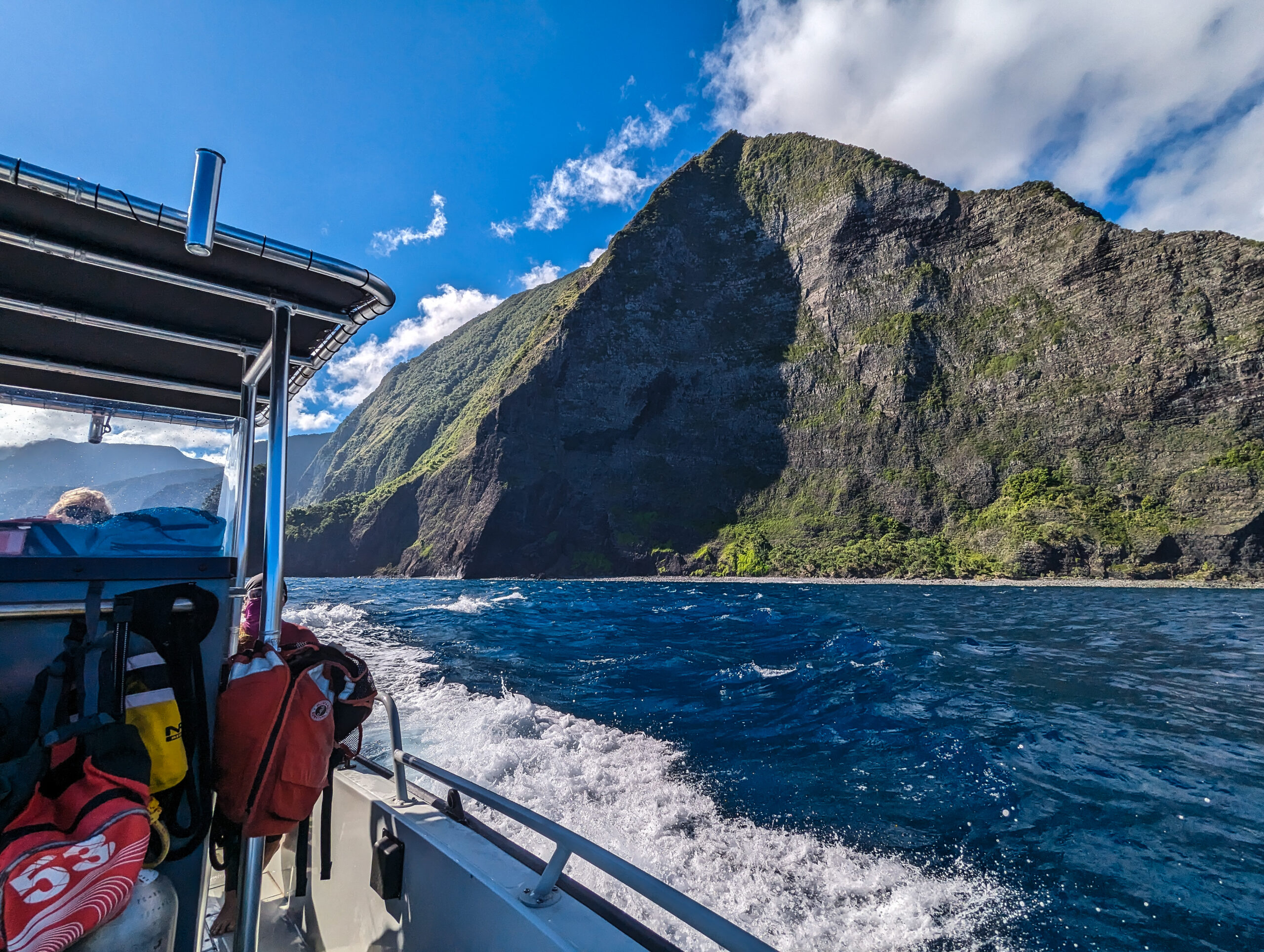
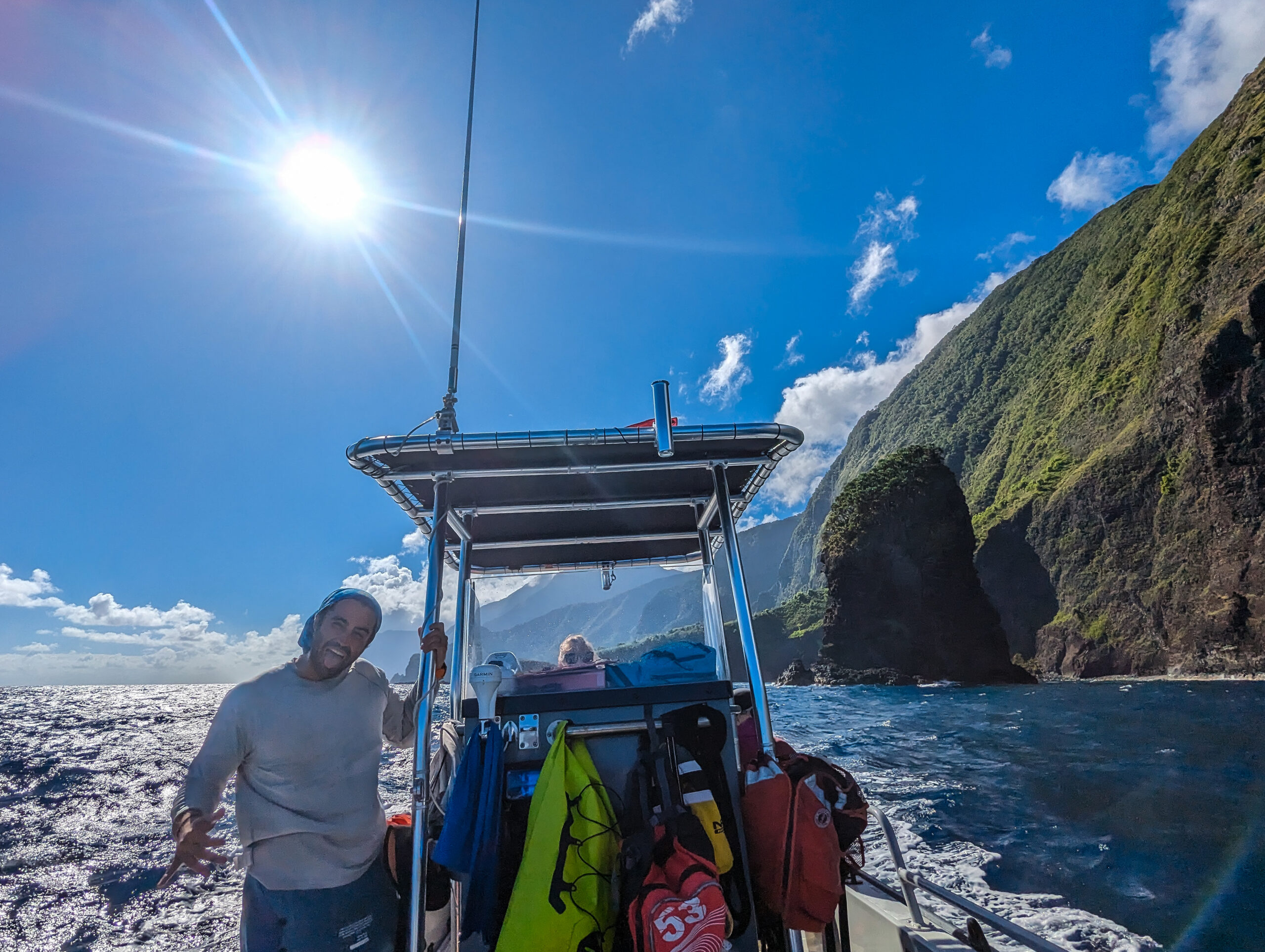
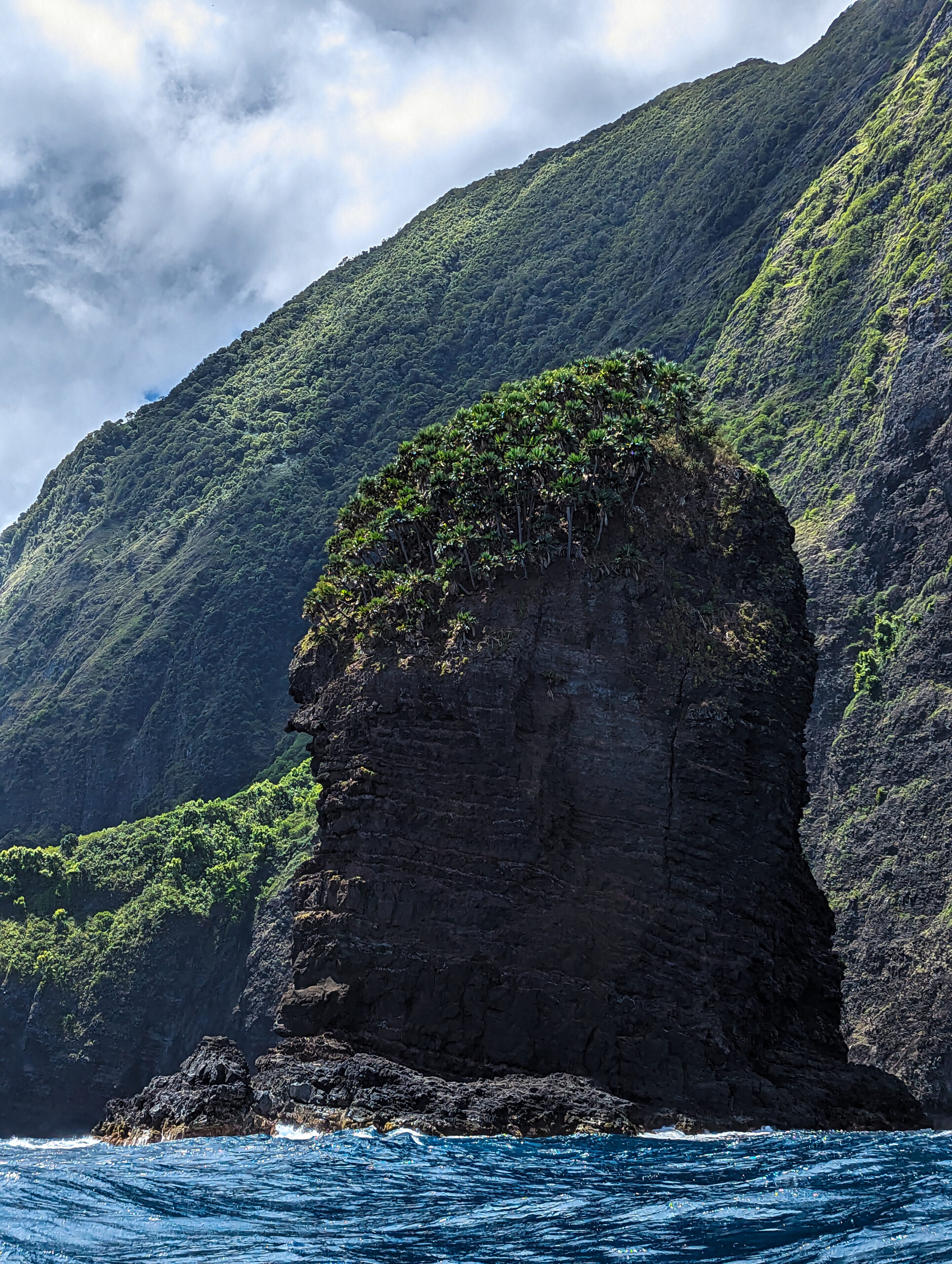
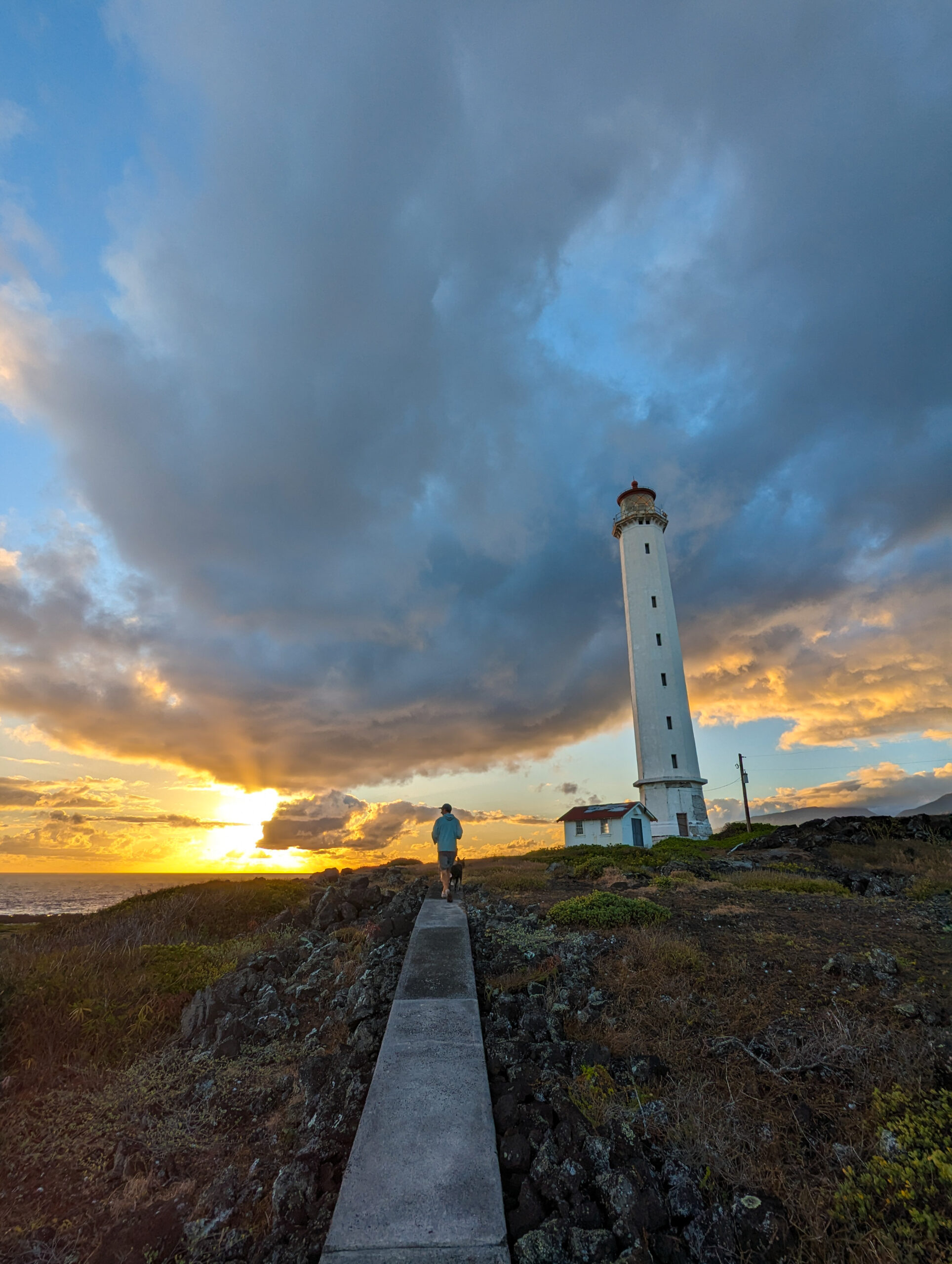
We take off from the pier in the early morning. The morning sun makes for some amazing lighting and shadow on the pali as we cruise offshore and look towards the lighthouse and cliffs. We make it past our turn-back point from yesterday and continue through to barf boulevard. The northern point of the peninsula catches the brunt of big swell but also bounces it back offshore from the solid basalt shoreline, creating a fun avenue of backwash that has led to being christened barf boulevard, it’s not for those who get seasick easily. We pound through that, Kelly, expertly operating Kala 2 in some fun conditions. The north shore of Molokai is a sight to behold from the water. Totally awe-inspiring. We’ve made it through some of the worst water so why not continue on to the eastern extent of the park and survey sites? We move towards Waikolu Valley and Okala Island. Behind Okala is Huelo islet, a tiny vertical sea stack fully covered in loulu palm. A beautiful native Hawaiian fan palm, this is the only natural occurrence of the palm left in the wild. The palm used to cover the islands’ coastlines and one can look at Huelo to get a glimpse of a Hawaii coastline before humans and rats. Glauco tells me the palms survive here because the cliffs are too steep for rats to climb. We are graced with some tropicbirds, white with a long tail. The pali is overwhelming this close, a little to the east, the cliffs rise to 3000’.
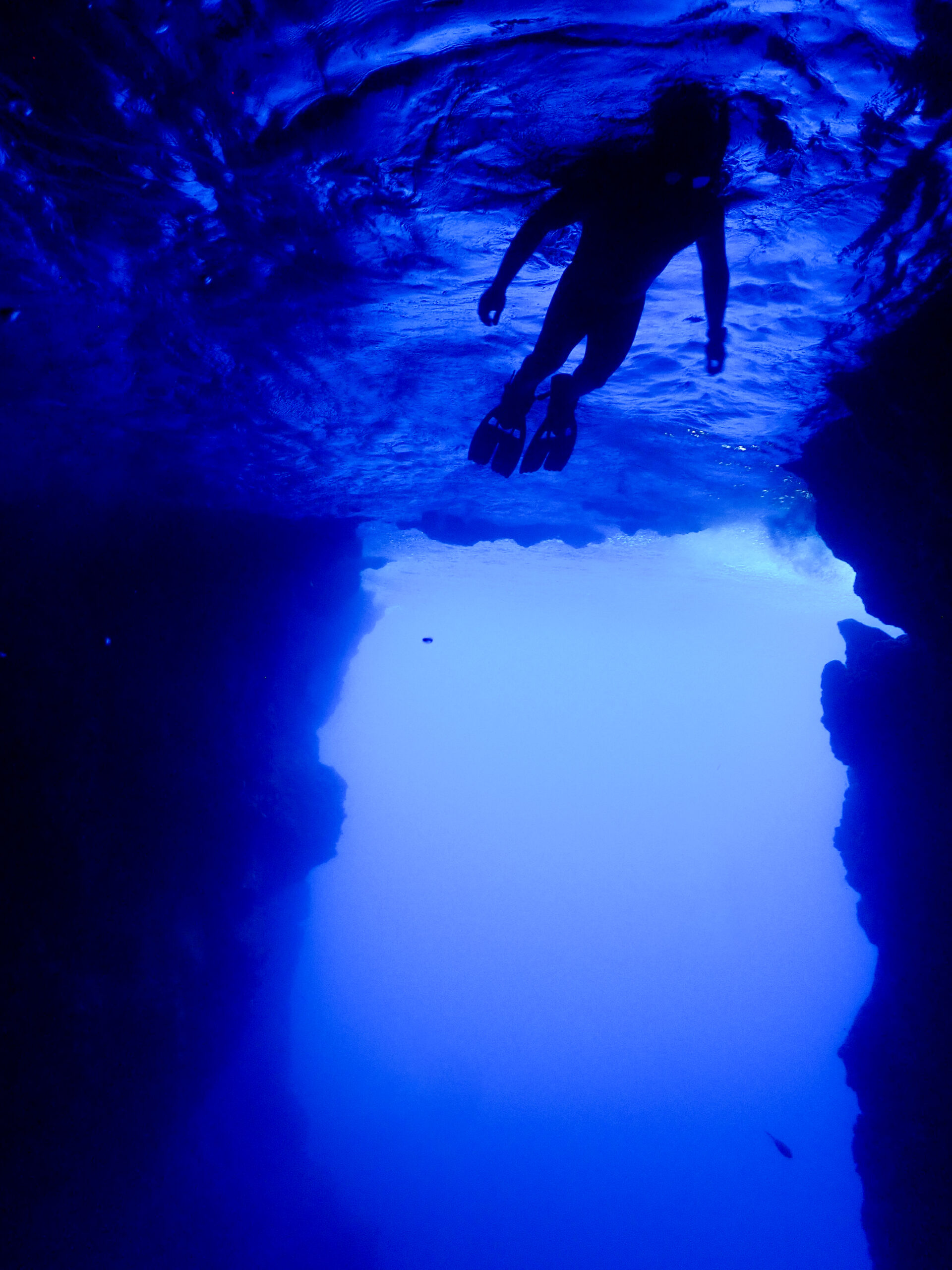
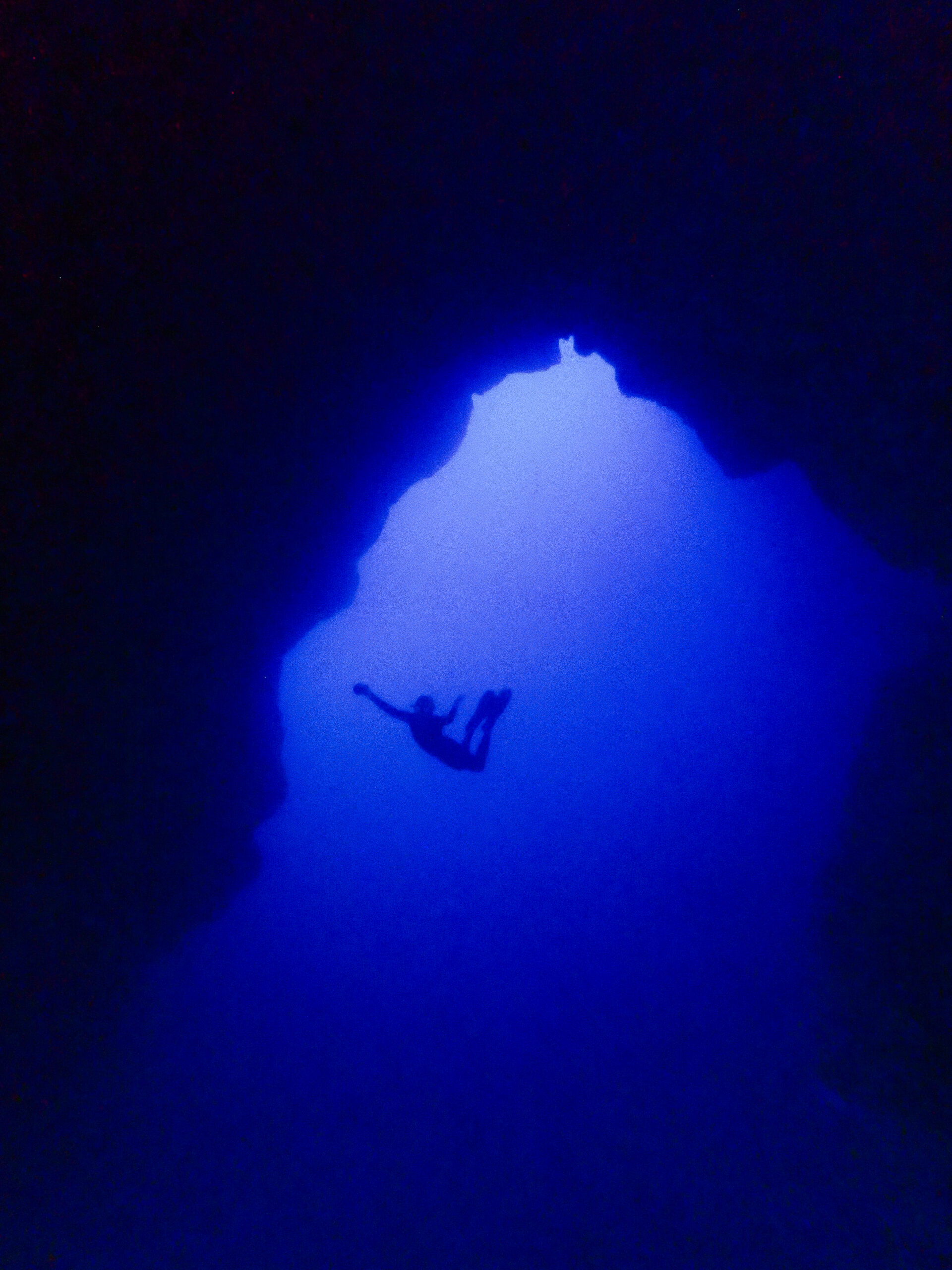
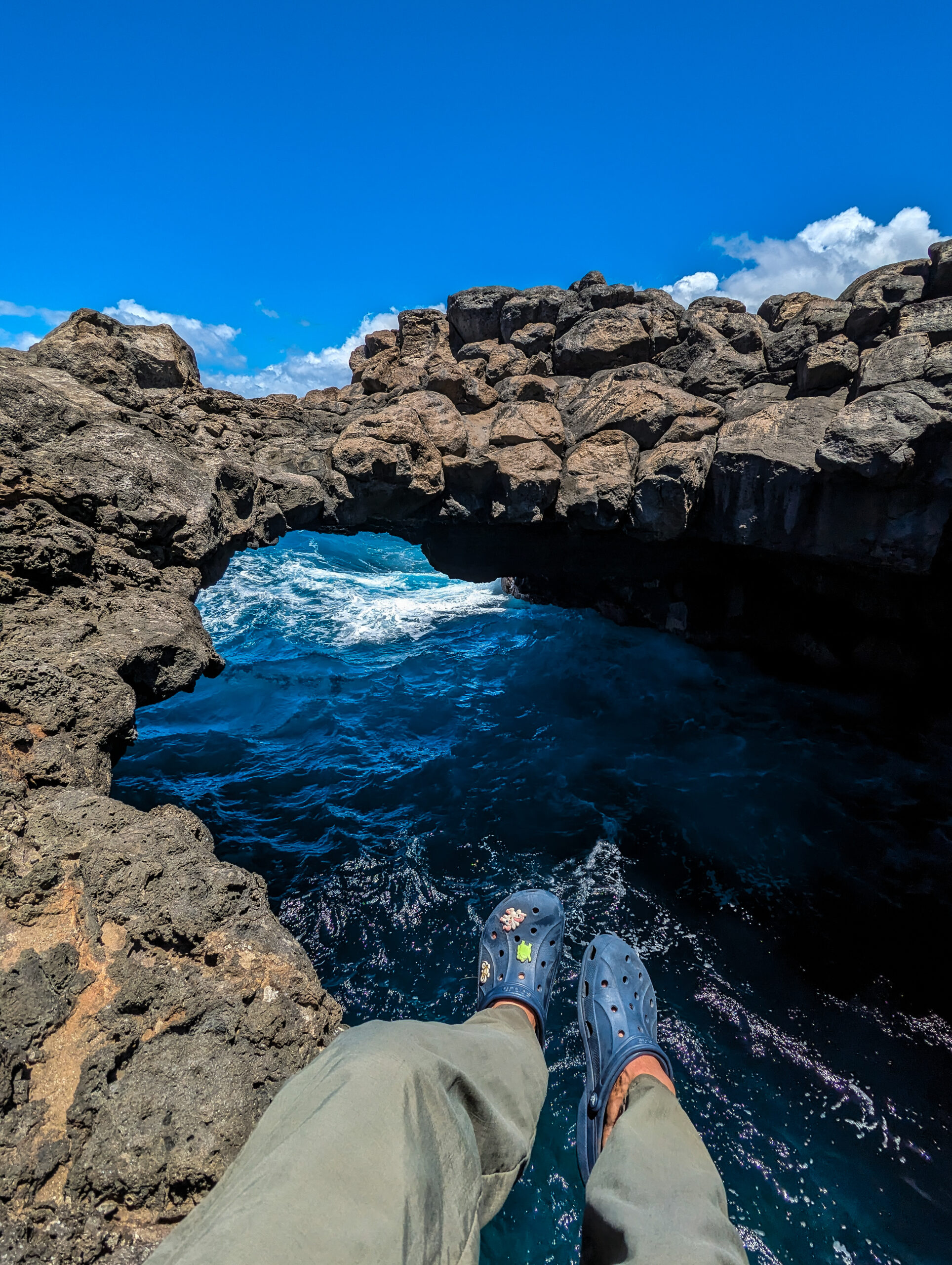
Sheila, Glauco, and I do a dive survey, and afterward for a little relief from the wind while we run water samples, Kelly drives us back to Waikolu where we will be protected by a headland. On the way, we run the channel between the headland and Okala island, Kelly says “We should show Grif the cave, don’t know if we’ll get another chance, are you up for a little snorkel?” The cave is spitting with the swell, sucking in and out. Glauco jumps in with me and shows me the way. An arch runs through the whole island, in the middle is a pocket of air where we can surface. I’m losing it, this place is so cool. You can see the sandy bottom, 80’ below. On either side of the arch, blue light is coming through. My ears are popping as the cave breathes in and out. I am ecstatic.
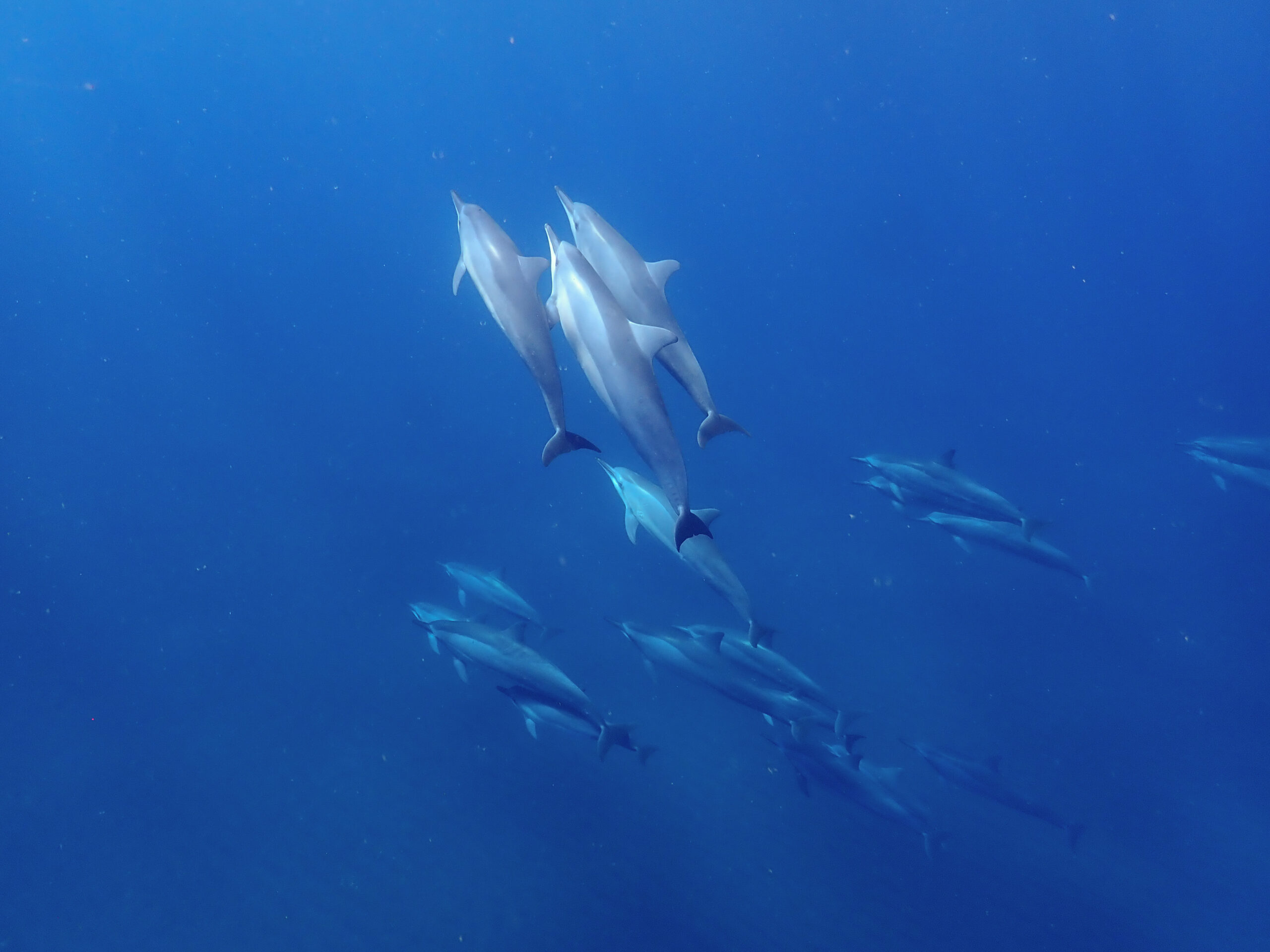
As we are doing water quality in the lee, we are graced by a pod of Spinner dolphins as they flip around with the beautiful backdrop of Waikolu and swim under our boat. We finish up three sites for the day and as we cruise back to the other side I look back at the pali. Truly, an unforgettable day.
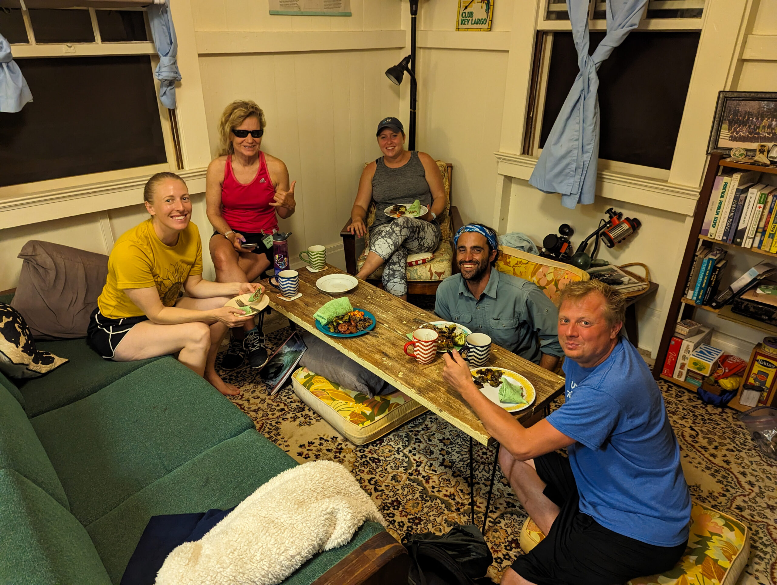
I feel honored to dive with this crew. Logistics and resources are a hassle out here and I’m an extra on this team, so I really appreciate the effort to take me out and give me the opportunity to experience the science being done here in this incredible environment.
In the end, the rest of the time Sheila is in Kalaupapa there is a small craft advisory so no more boat operations. We only get one more day to survey the east side, but without Sheila, so no fish survey, just benthic and water quality at three more sites. The weather is rough today (surprise surprise) and it makes for some exciting filtering at barf boulevard. We hit a site at the most northern end of the peninsula which might be one of my favorite sites. You can see the wave action smashing the shore above while we are surveying down in the boulder field. I see three giant trevally zoom past near the surface. When we finish up for the day and are returning to the settlement side, we motor past a large shark, skimming the surface near where we had dived earlier. Kelly and Glacuo said it looked like a good-sized Tiger shark. I would have loved to have seen that shark underwater!
Kelly and Glauco are an impressive team of two running all things marine at Kalaupapa as well as taking on many other responsibilities in the park and community. I am blown away by their work ethic and humbled by the generosity shown to me during my stay at Kalaupapa. I hope they get some more help soon so they can continue doing an amazing job monitoring and managing the underwater resources.
For the rest of my time in Kalaupapa, I get to learn a little more about the history. A brief tour of the cultural resources office and its many artifacts; archaeological items like Hawaiian fishing weights, adzes, and poi pounders. As well as more modern artifacts and items significant to the history of Hansen’s disease at Kalaupapa.
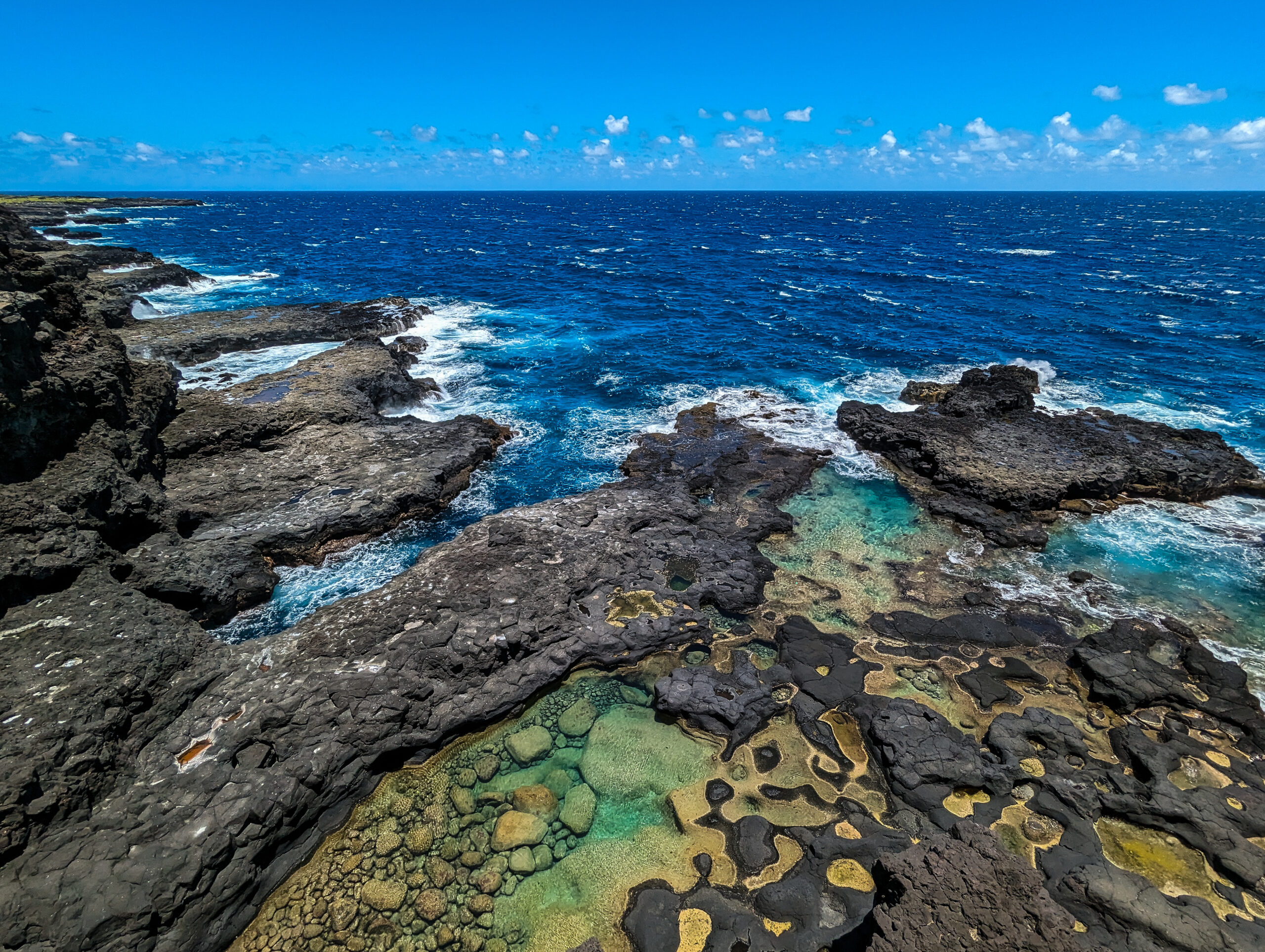
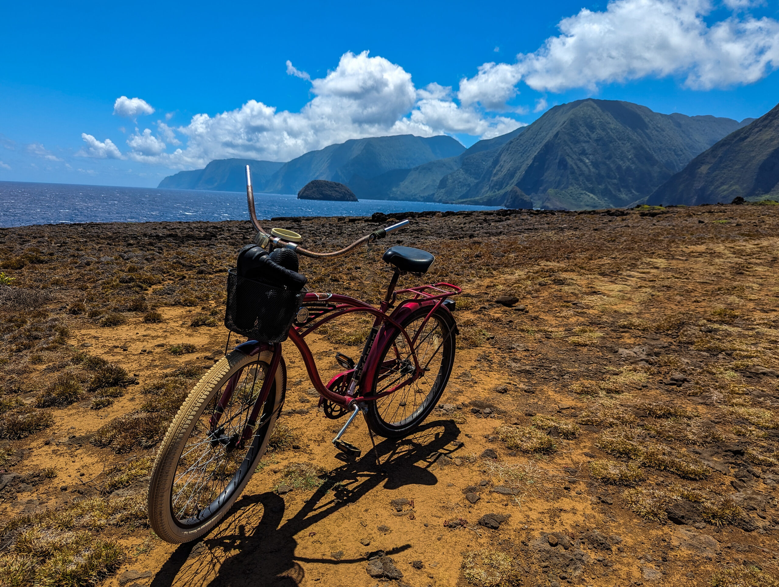
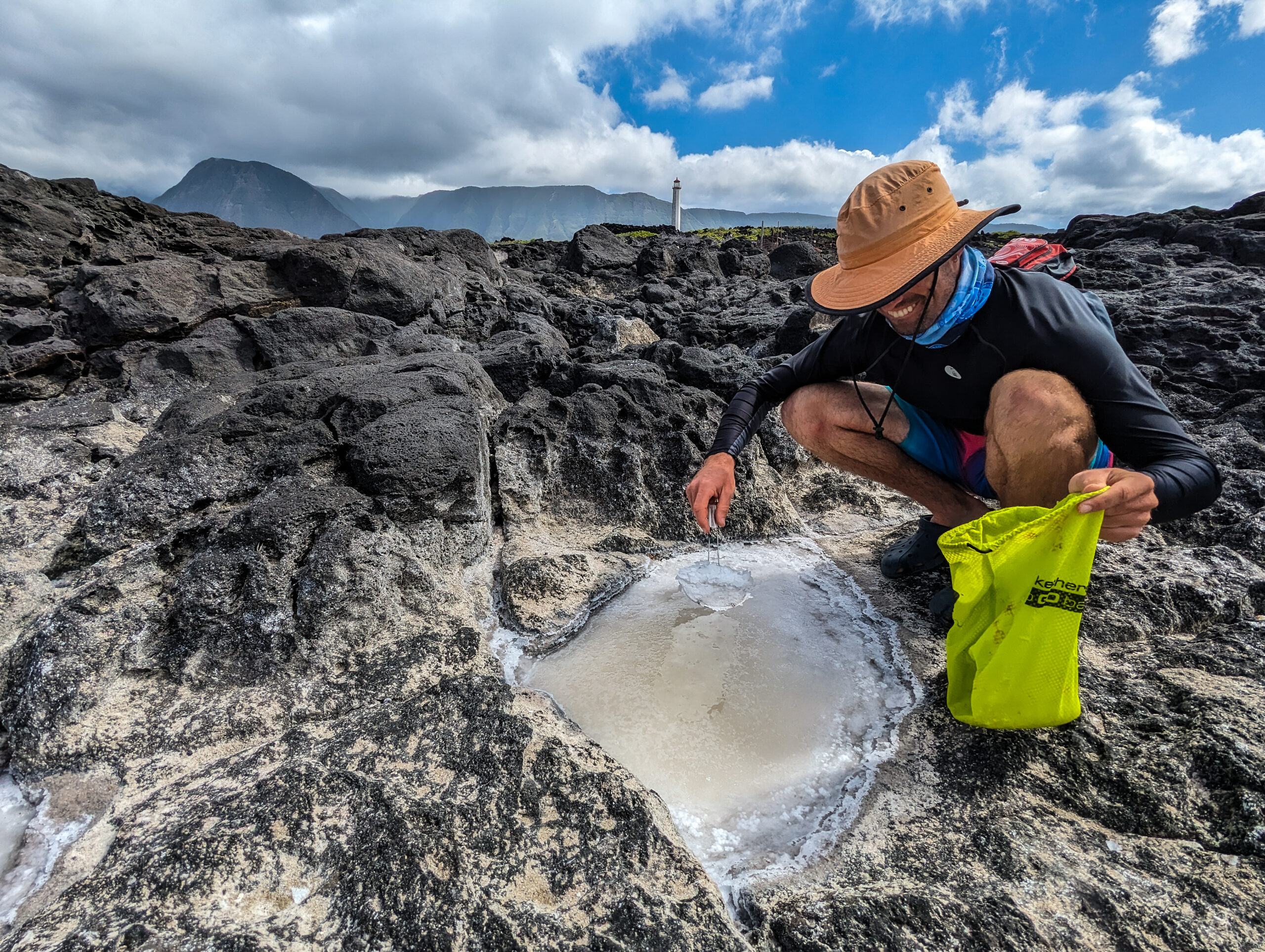
Glauco, Hannah (Glauco’s partner), Sheila, and I get a day to ride our bikes around the peninsula. I upgraded my bike to the Huffy with white rims and a basket. A little rough on the rocky path with the single-speed beach cruiser but it didn’t get a flat tire. A pretty wild landscape, wind frothing up the blue water, clouds moving quickly through the sky, columnar jointed basalt covered in tidepools, and the remnants of lava tubes honeycombing the shore creating caves, arches, and tunnels. Glauco shares how on this side of the peninsula, rock walls were built to create wind turbulence behind them, helping collect moisture from the constant wind to grow sweet potatoes by the Native Hawaiians. We enjoy a snorkel in the tidepools protected from the swell and Glauco shows us how to collect sea salt from the tidepools.
Glauco invites us all to a nice family dinner, invasive species surf and turf, Tahitian prawns, and axis deer tacos. Hannah makes a breadfruit dish and lilikoi ice cream, what a treat. Rosemary lemonade made from plants in the settlement.
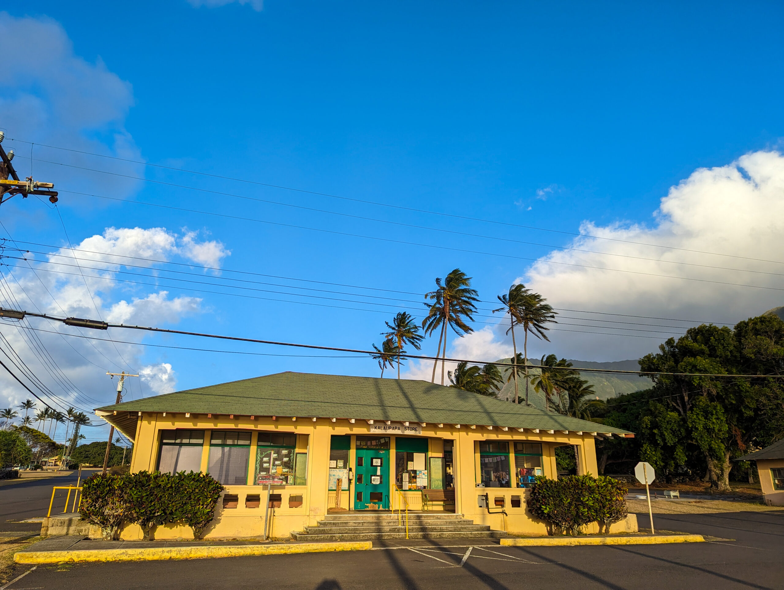
I get one last snorkel in and feel lucky to spot three octopuses and a queen nenue, a chub that is bright yellow instead of its usual grey, a rare coloration. An auspicious fish for sure. I will miss riding my bike at night while tons of axis deer bark and gallop past, sweating using Glauco’s blunt machete to open coconuts, the excitement when I see Snickers bars are back in stock at the general store, eating the sweetest papaya and mangoes, talking to the sisters of St. Francis, playing volleyball and pickleball with the community and definitely watching the monk seals roll around, sneeze and be weird in the nearshore.
However, this isn’t going to be my last time in Kalaupapa as I thought it would be. I am excited to hop over to Kaloko-Honokōhau on the Big Island for a week, but my plans after that fell through and Kelly was kind enough to invite me back to Kalaupapa to help out with their Inventory and Monitoring stream survey in Waikolu Valley. So, I am looking forward to coming back.
Thank you so much, Kelly and Glauco for being so welcoming, kind, and generous. And thank you always to the Submerged Resources Center and the Our World-Underwater Scholarship Society.