Author Archives: Griffin Hoins - 2023 NPS

About Griffin Hoins - 2023 NPS

2023 NPS

Channel Islands National Park

I’m happy to be back on the West Coast. I am in Ventura, California to join the Kelp Forest Monitoring (KFM) team at Channel Islands National Park for one of their 5-day kelp cruises. As one of the parks I hoped to visit most during my internship, I’m very excited to get the opportunity to dive here.

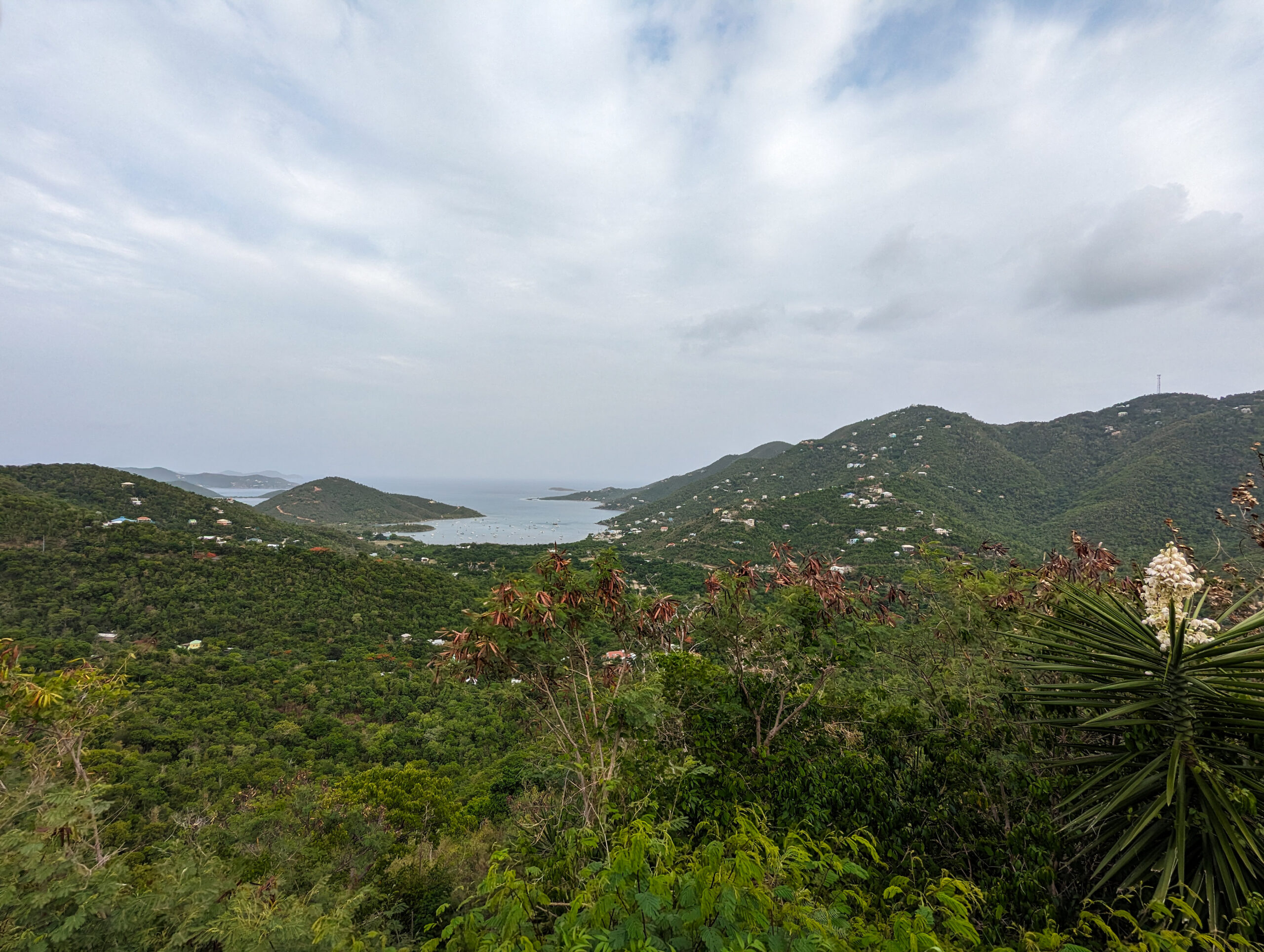
1/3 of southern California’s kelp forests are found within the Channel Islands National Park and Channel Islands National Marine Sanctuary. The southern California coastline is one of the most productive on Earth and the islands are located at a confluence of currents; experiencing a mixing of both warm-water currents from the south and cold-water currents from the north supporting an incredible abundance and diversity of marine life.

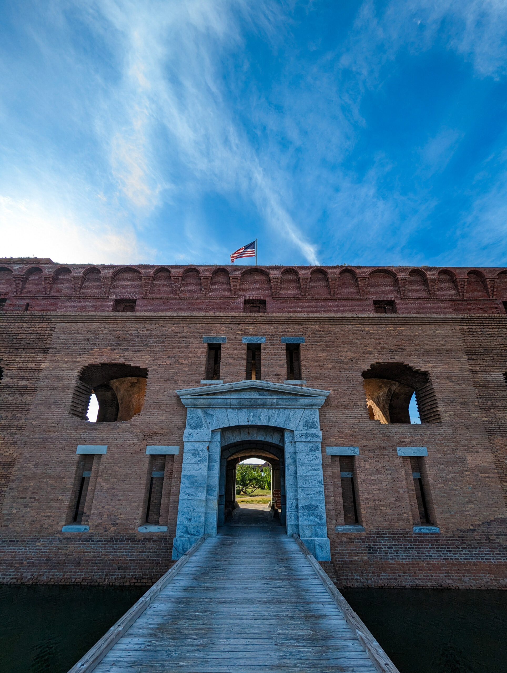
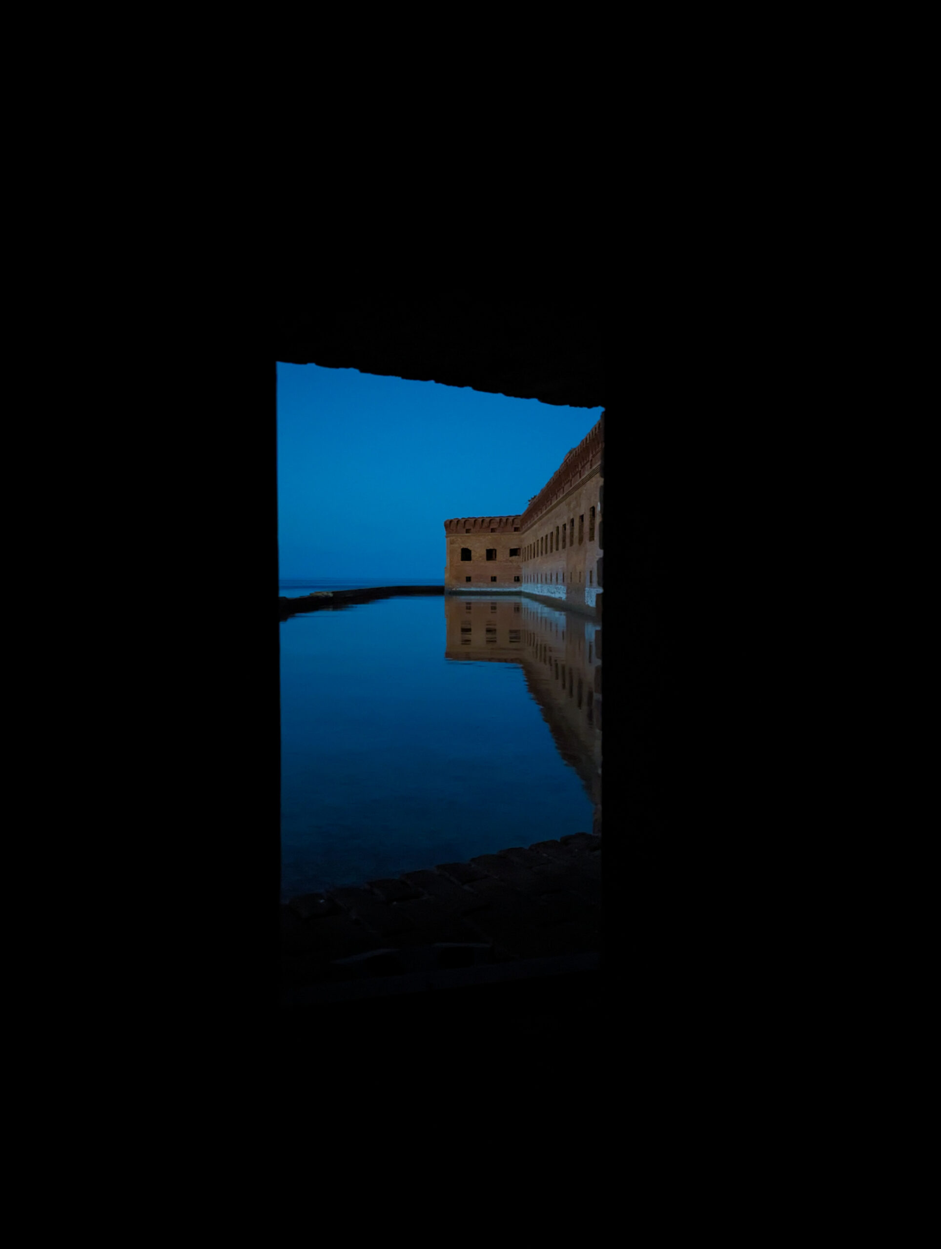
The Channel Islands National Park is made up of 5 of the 8 Channel Islands that sit off the southern California coast. It’s crazy to me that the park is one of the lesser visited parks in the country despite its proximity to one of the largest metropolitan areas in the US. Despite its low visitorship, Channel Islands is not immune to the many anthropogenic impacts on the marine world, one of the largest here being the pressure of commercial and sport fishing. Channel Islands has been monitoring the kelp forest ecosystem since 1982. The long-term dataset helps determine the status and health of the Channel Islands kelp forests, document the types of changes occurring in the marine environment, and develop management strategies to protect the kelp forest ecosystem.

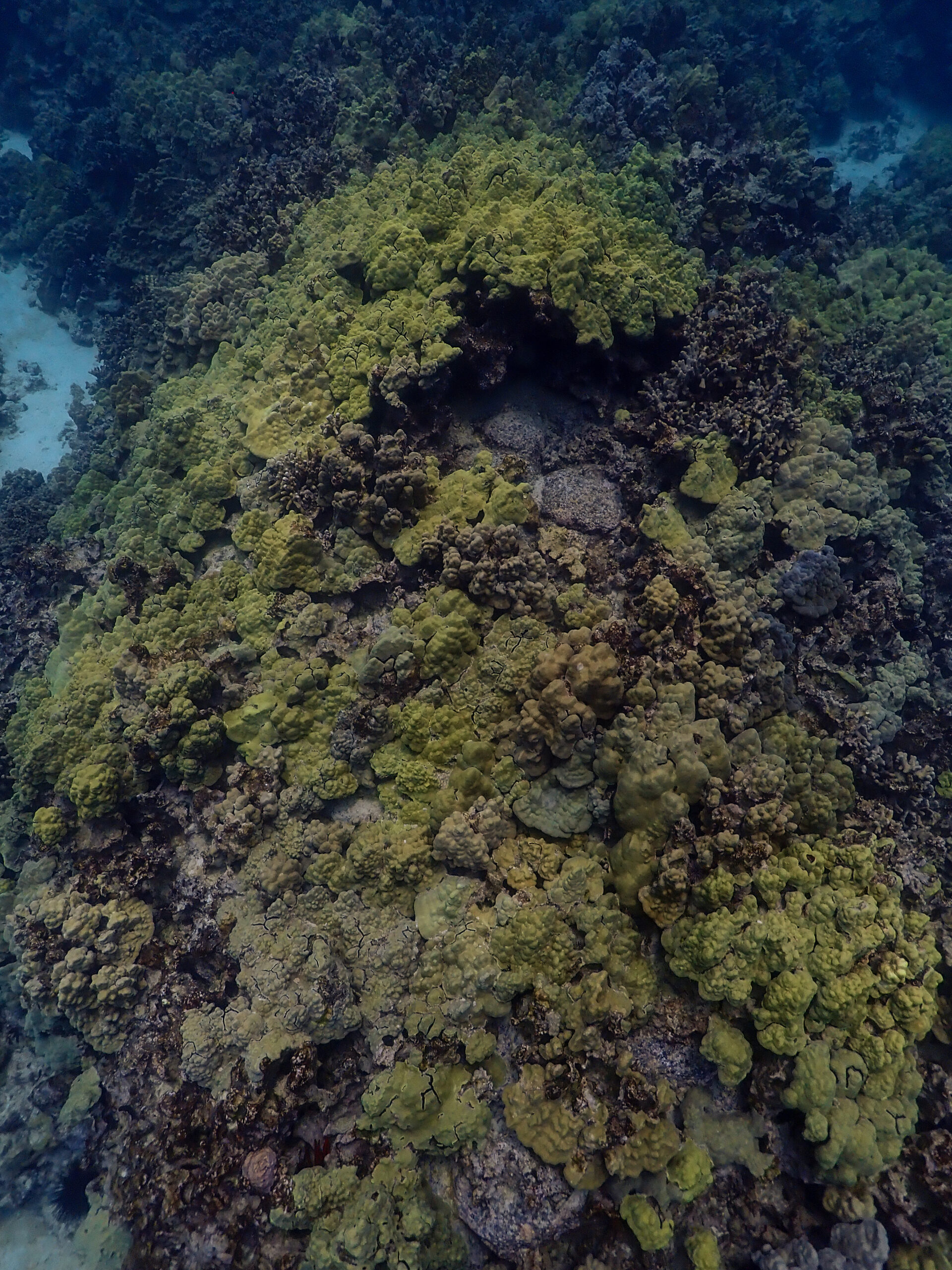
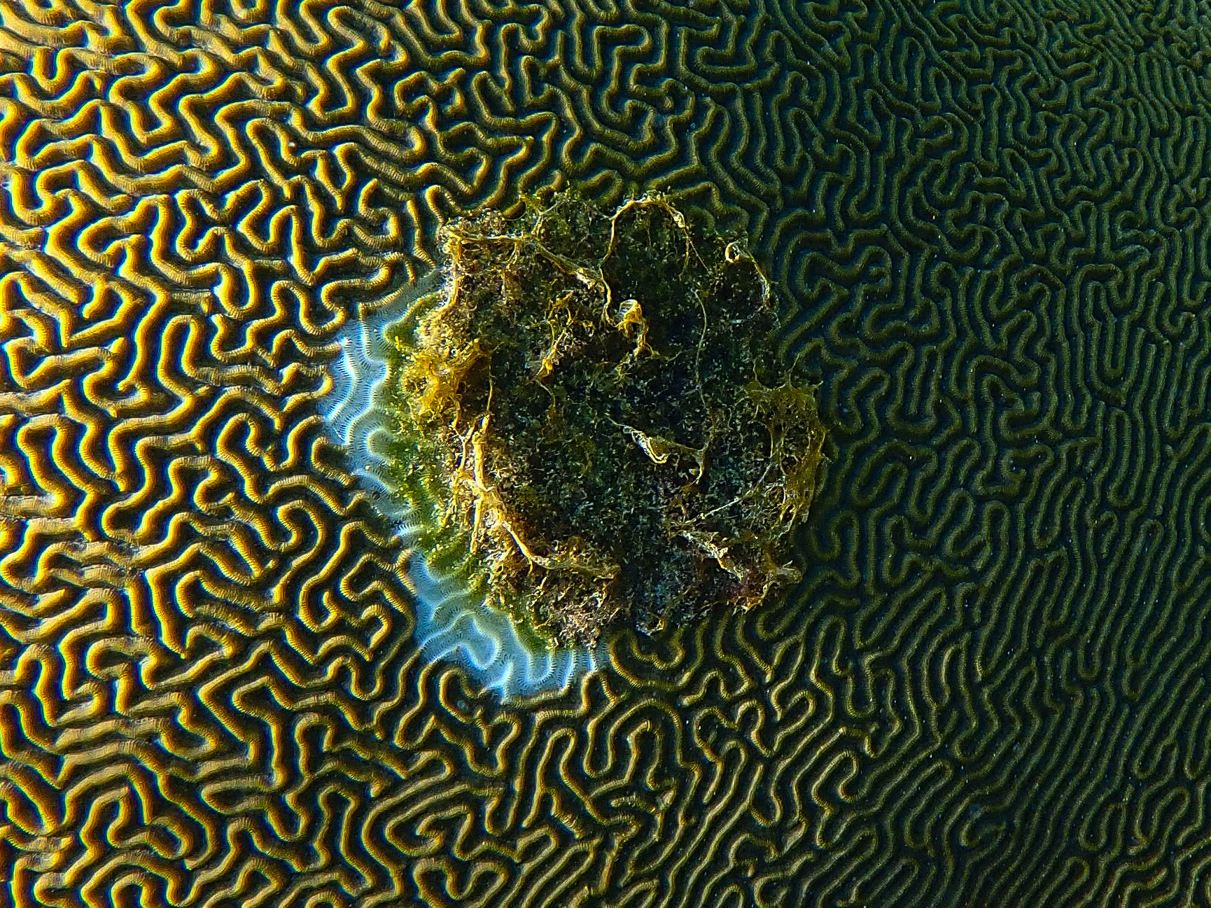
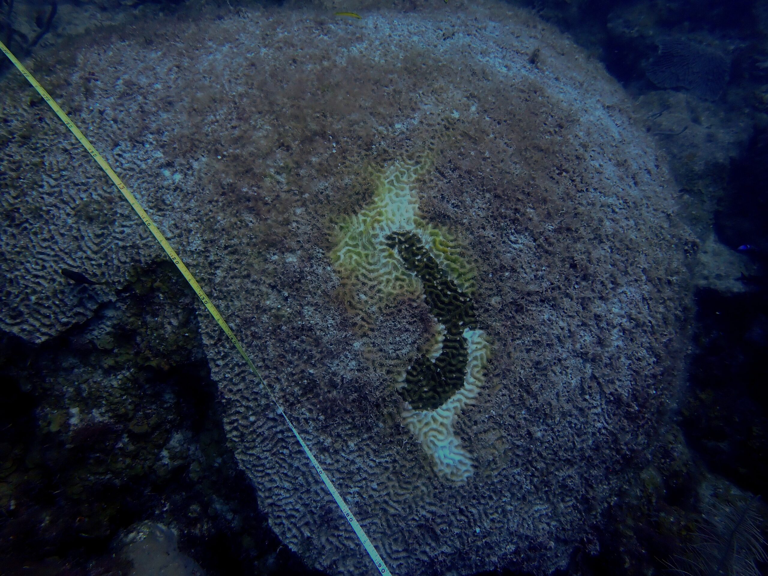
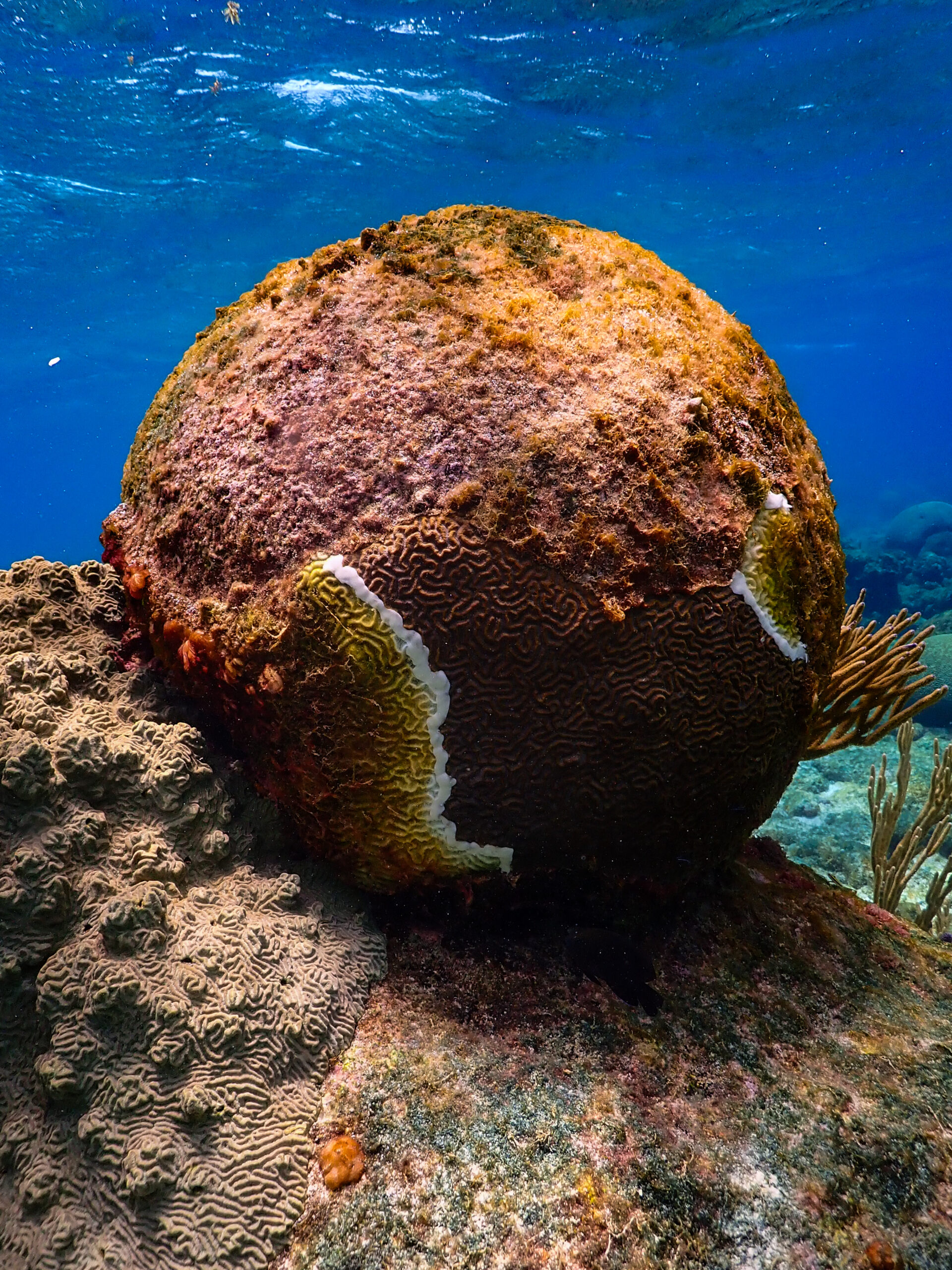
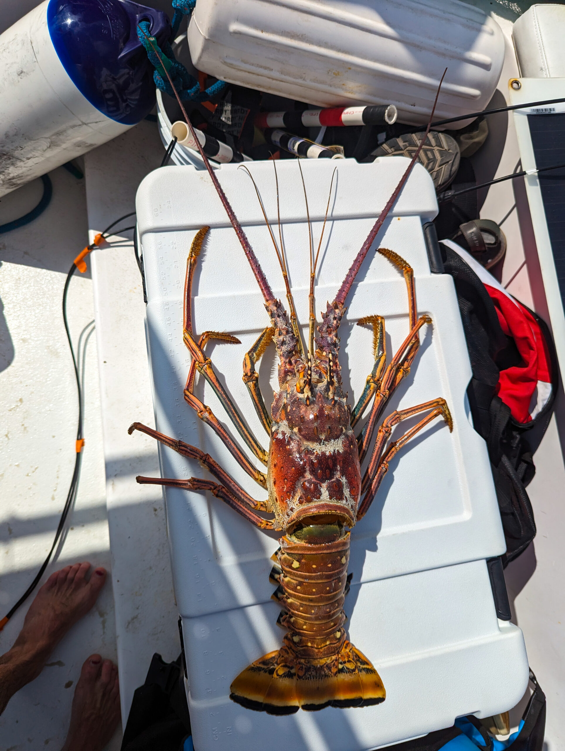
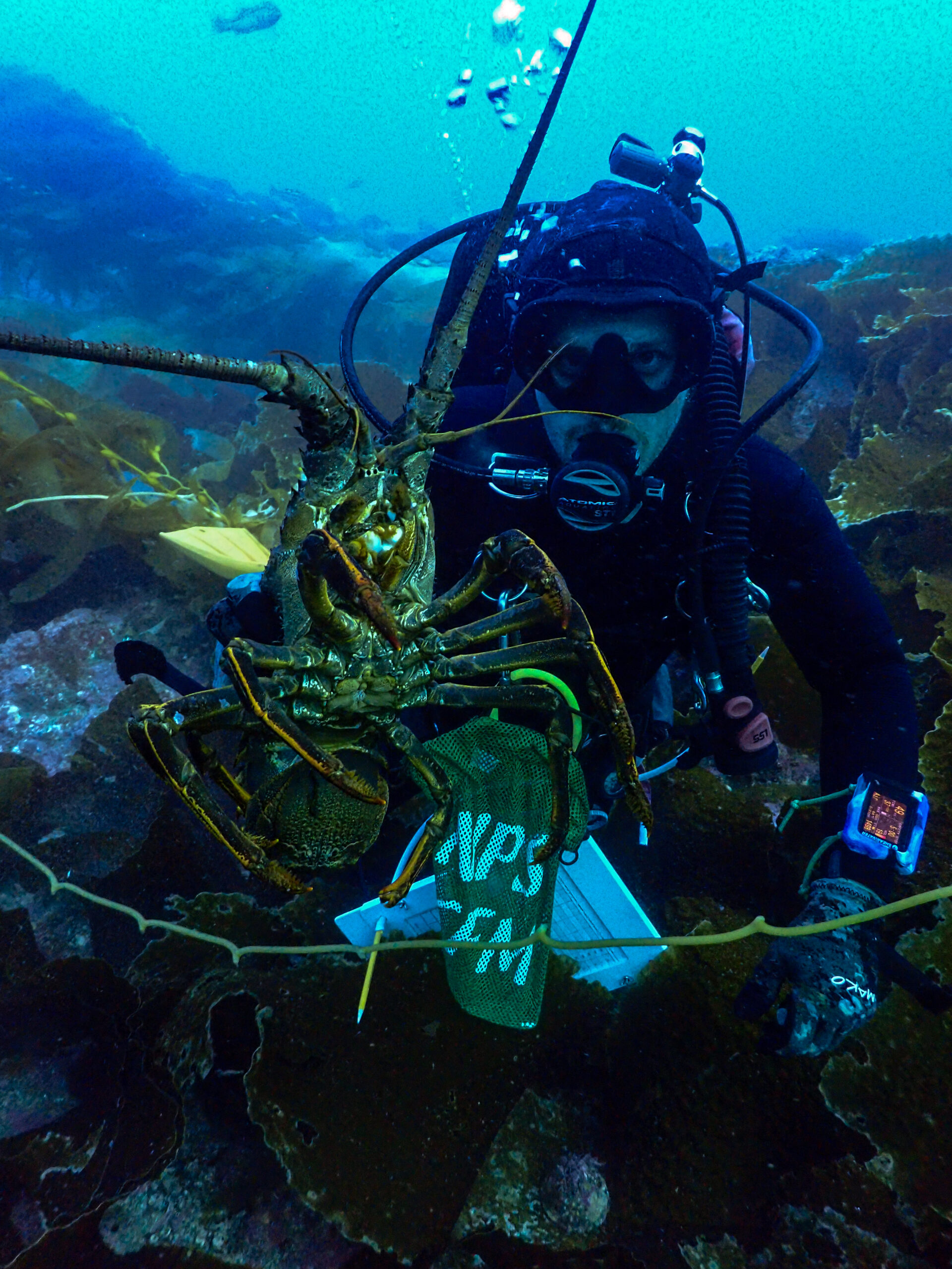
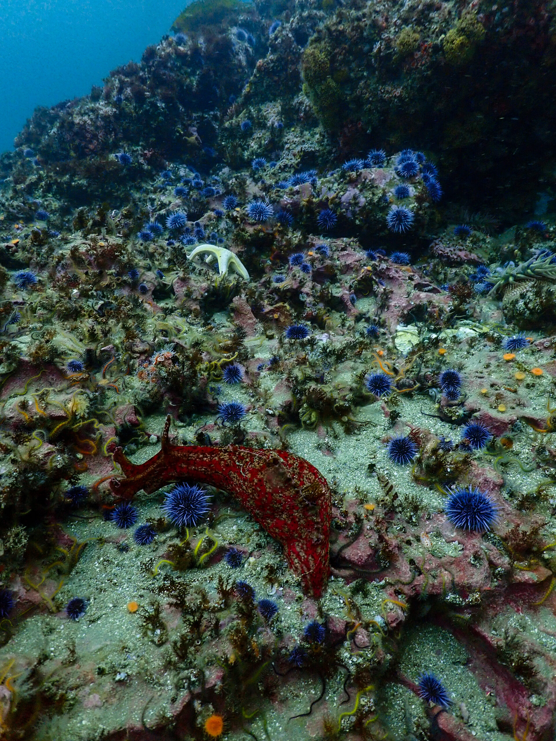
Sea otters were eradicated from the Channel Islands long before the park existed, but since the inception of the park, data has shown the population of abalone, rockfish, and spiny lobsters declining dramatically from overfishing. More recently, sunflower stars have all but disappeared from California due to sea star wasting syndrome. The loss of these species has a cascading effect on the whole ecosystem, disrupting the balance. All of this can be seen from the data collected by the Kelp Forest Monitoring crew over the last few decades. One of the most significant changes is the boom in purple sea urchin populations because of the loss of keystone predators like sea otters, sunflower stars, lobsters, and California sheephead. The out-of-check populations of urchins can overgraze a kelp forest easily, leading to urchin barren sites with relatively low species diversity and low biomass.

I mention all of this just to prove how important a long-term monitoring dataset can be. Using data from the parks, California closed the commercial abalone fishery in 1997. Information collected by KFM was instrumental in establishing marine reserves in 2003, placing nearly 20% of park waters into state marine protected areas thus granting complete protection from fishing and extractive activities. A 2008 review of data demonstrated positive trends in these new marine reserves including greater overall biomass and larger body size of species like the spiny lobster. All goes to show that data is needed to hold humans accountable for our out-of-proportion impact on the planet and our obligation to protect the places we have set aside as national parks.

Harbor seal.

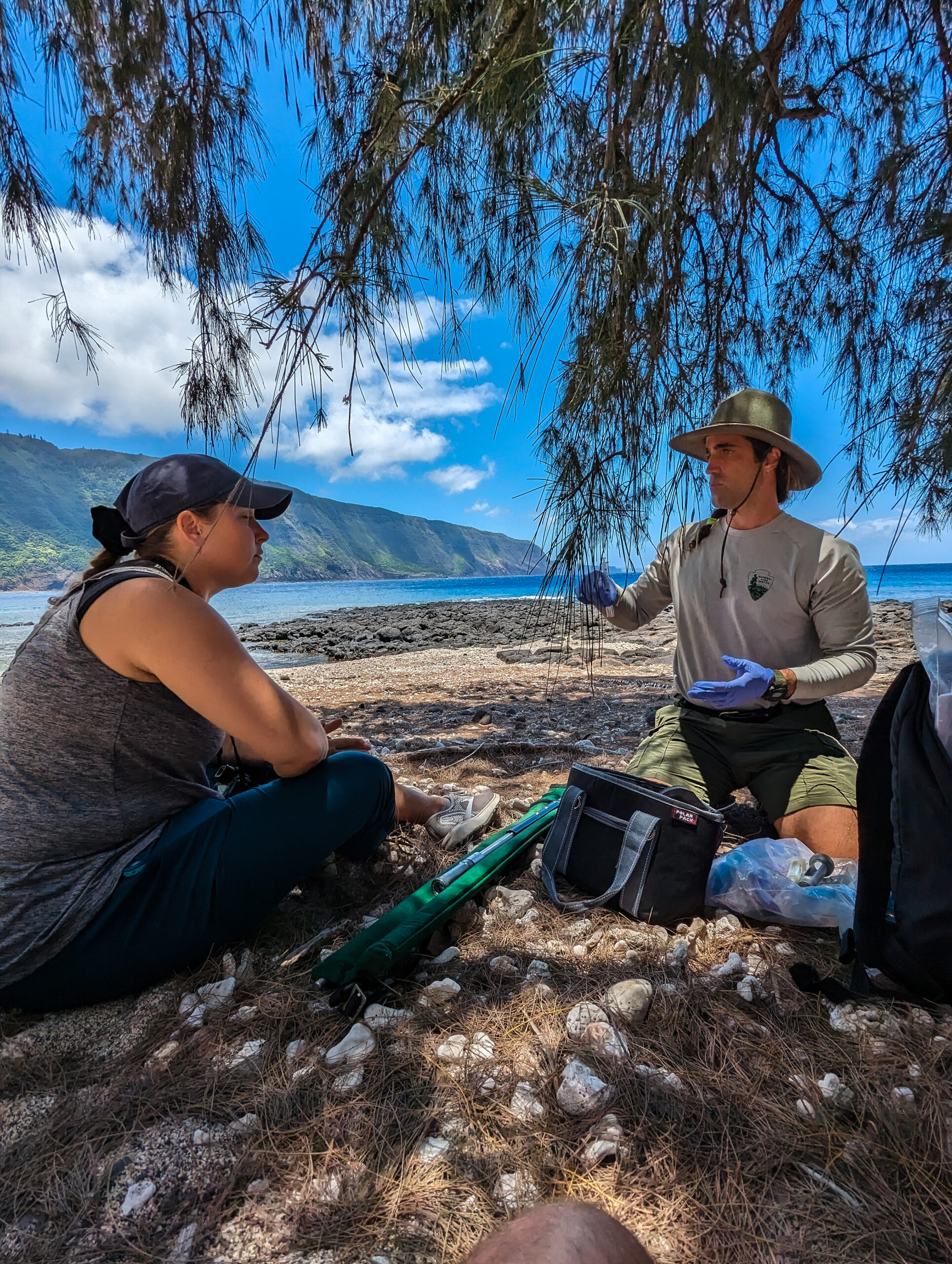
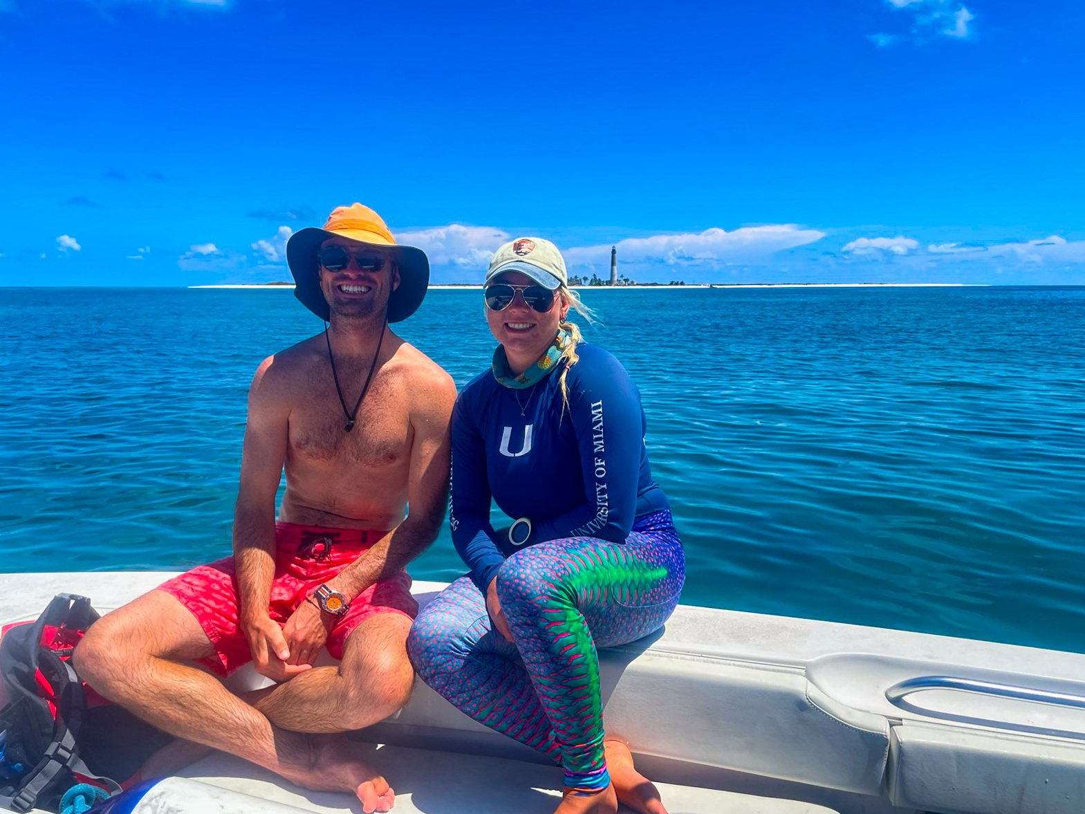
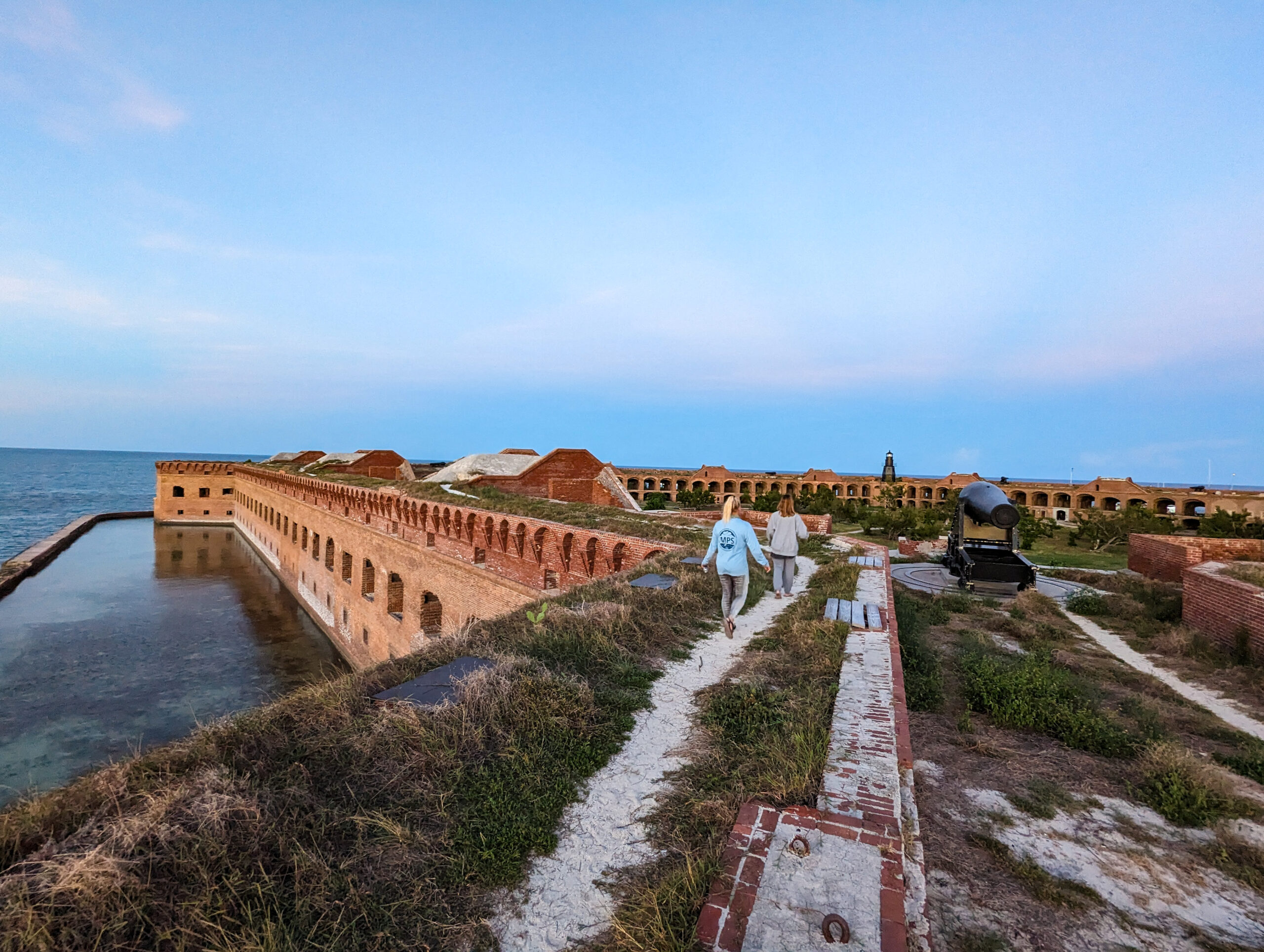
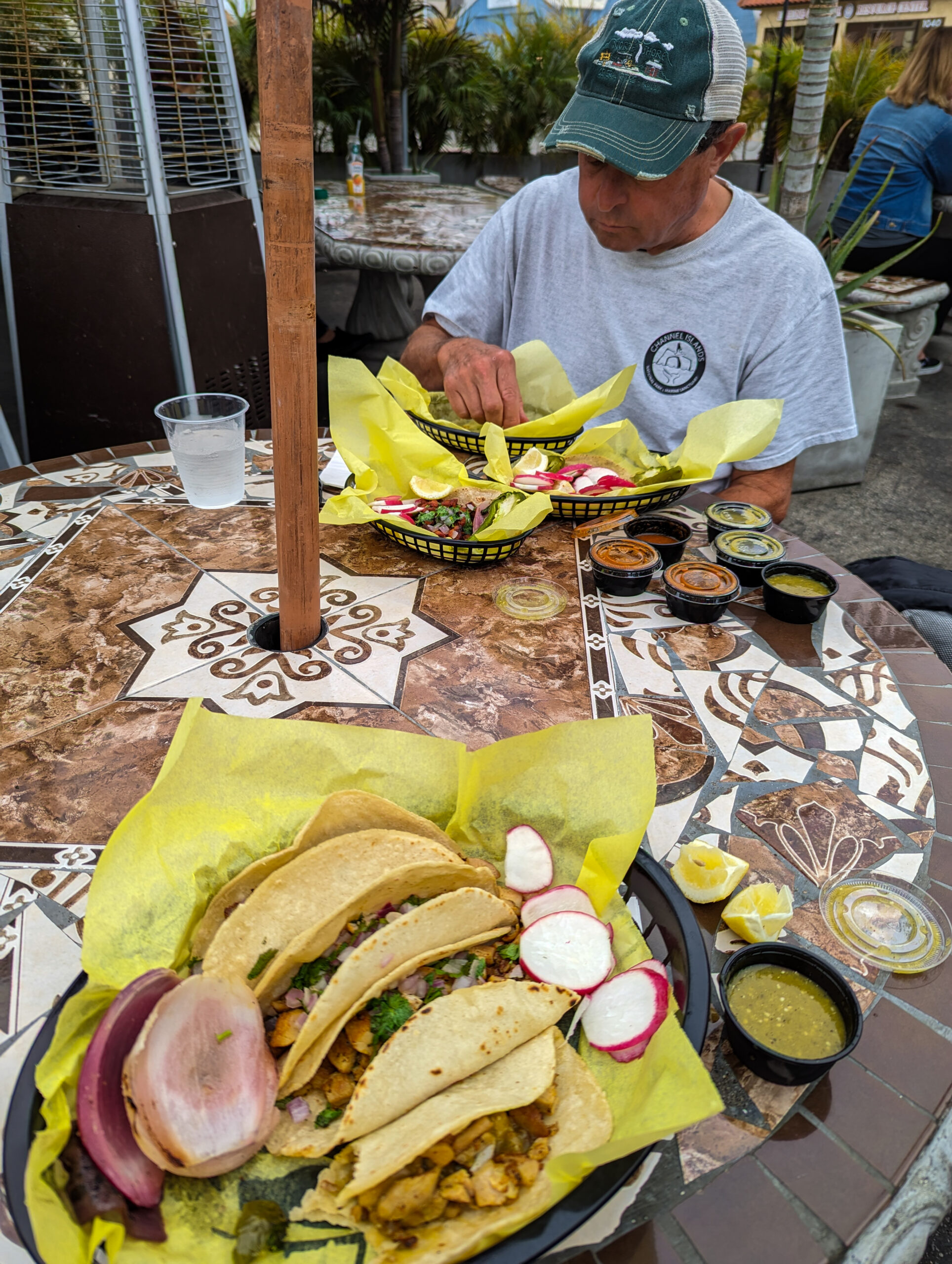
I’ve come a few days early to Ventura so Kelly Moore was kind enough to set me up to stay with Dave Begun, a retired NPS ranger and diver for the live dive program at Channel Islands. Dave gives me a full tour of the area with bike rides to tacos, a trip to Santa Barbara, and a cruise on Island Packers out to Anacapa, one of the Channel Islands. Before the Anacapa trip though, I get a couple of days of office time with the KFM crew to meet everyone and study up on the many survey protocols.

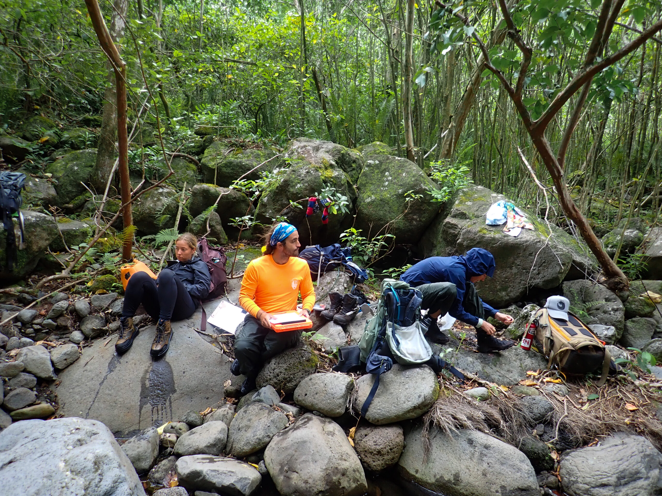
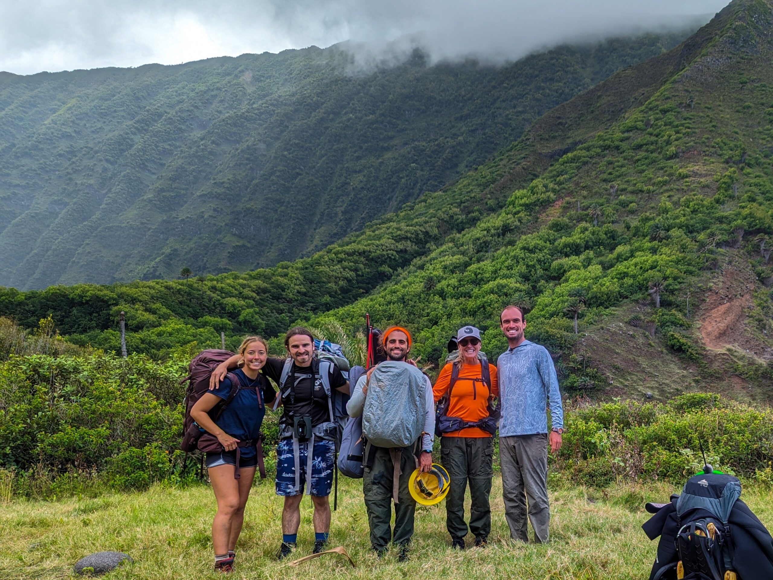
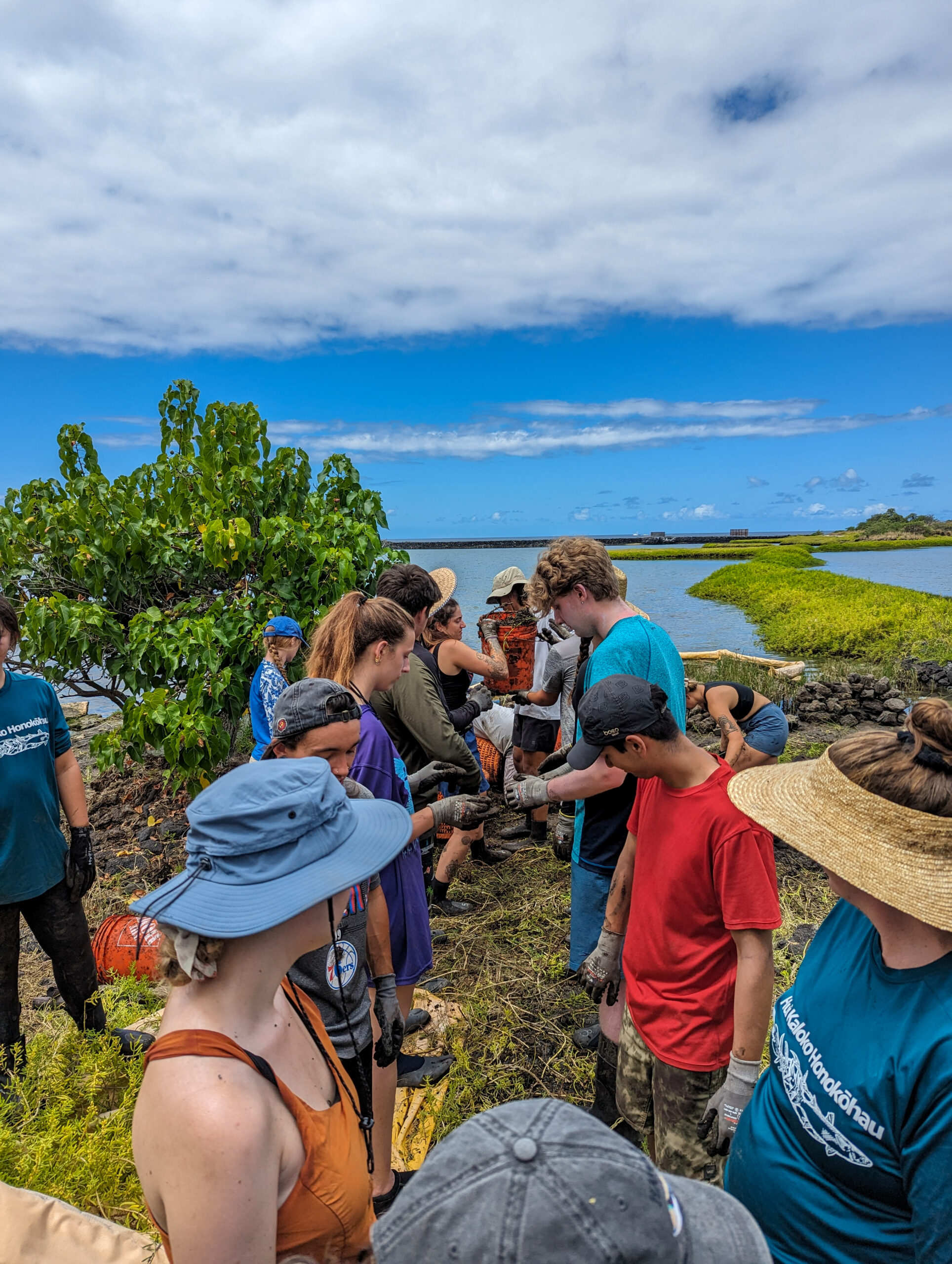
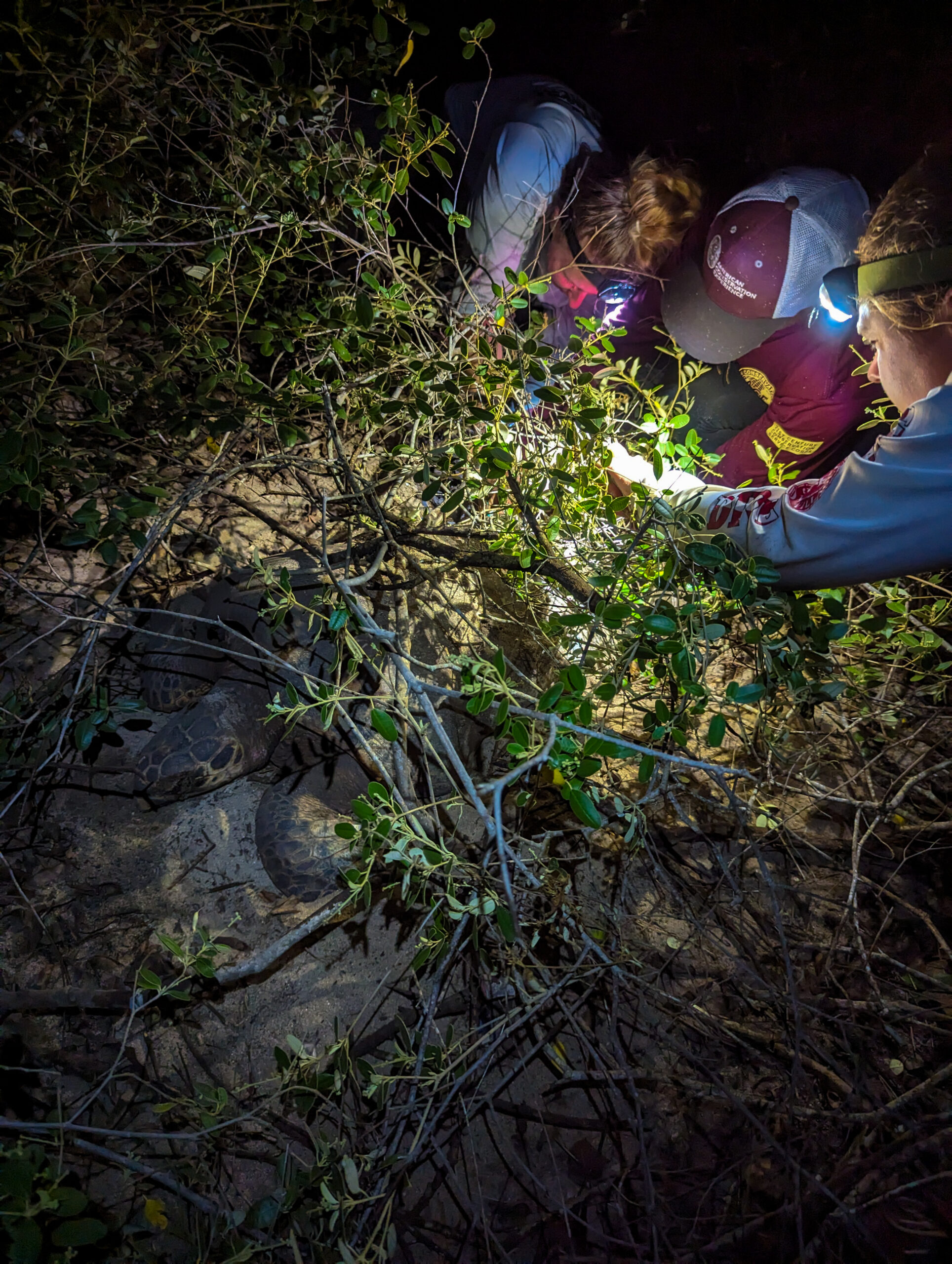
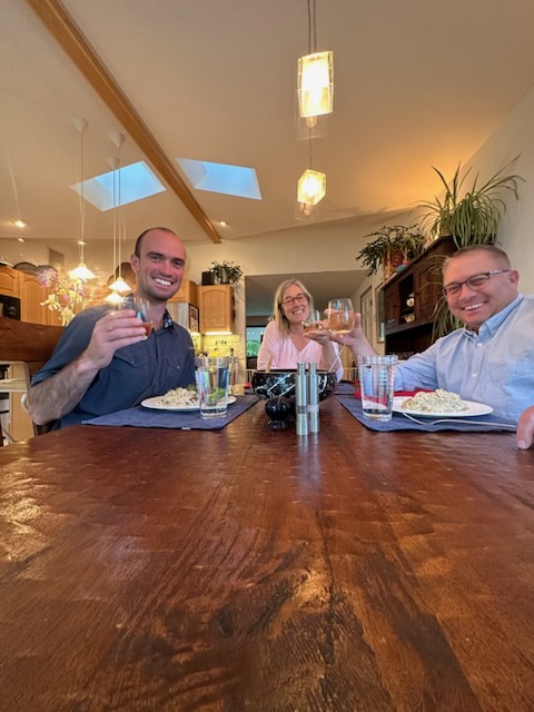
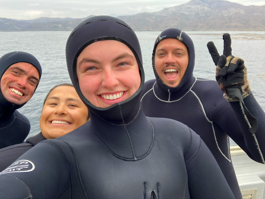
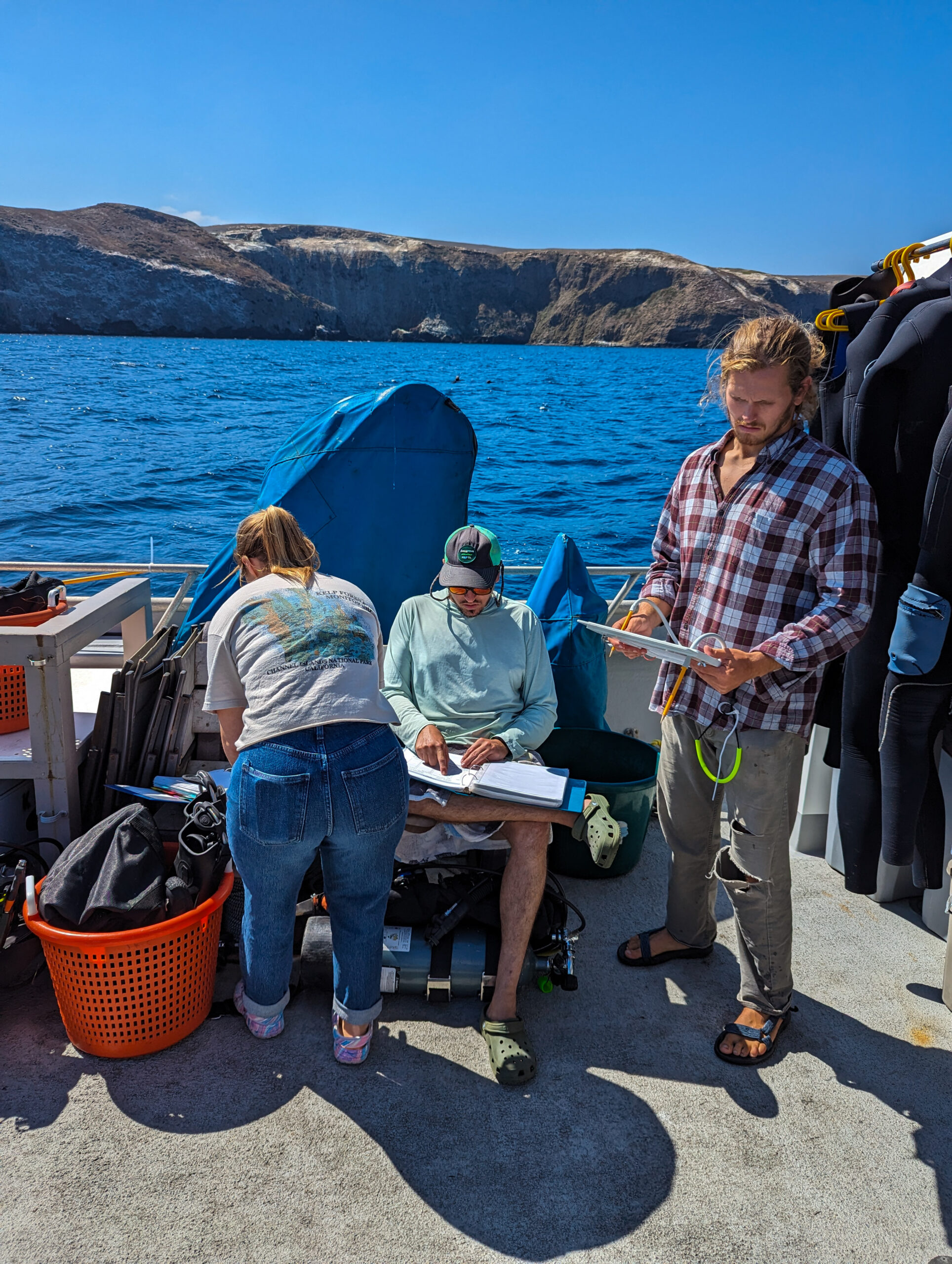
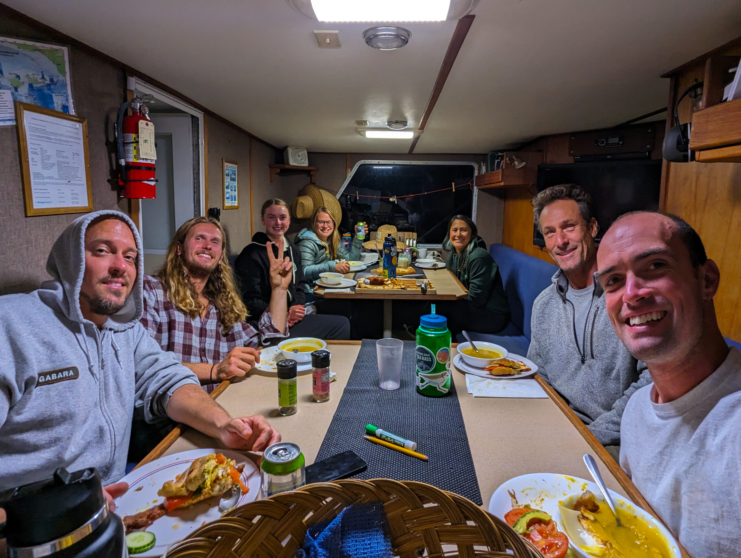
I head to Ventura Harbor to meet up with Dr. Scott Gabara, marine ecologist for KFM. Super easy-going and friendly, he welcomes me to the team and introduces me to Katie Mills-Orcutt, Ean Eberhard, and Emalia Partlow. Two of their regular divers are out this week so it’s a good week for me to be here to help. The office atmosphere is relaxed and good-natured. I can immediately tell what a solid crew they have. Especially since it’s the end of a hard 6-month field season and the jokes are still flying.    

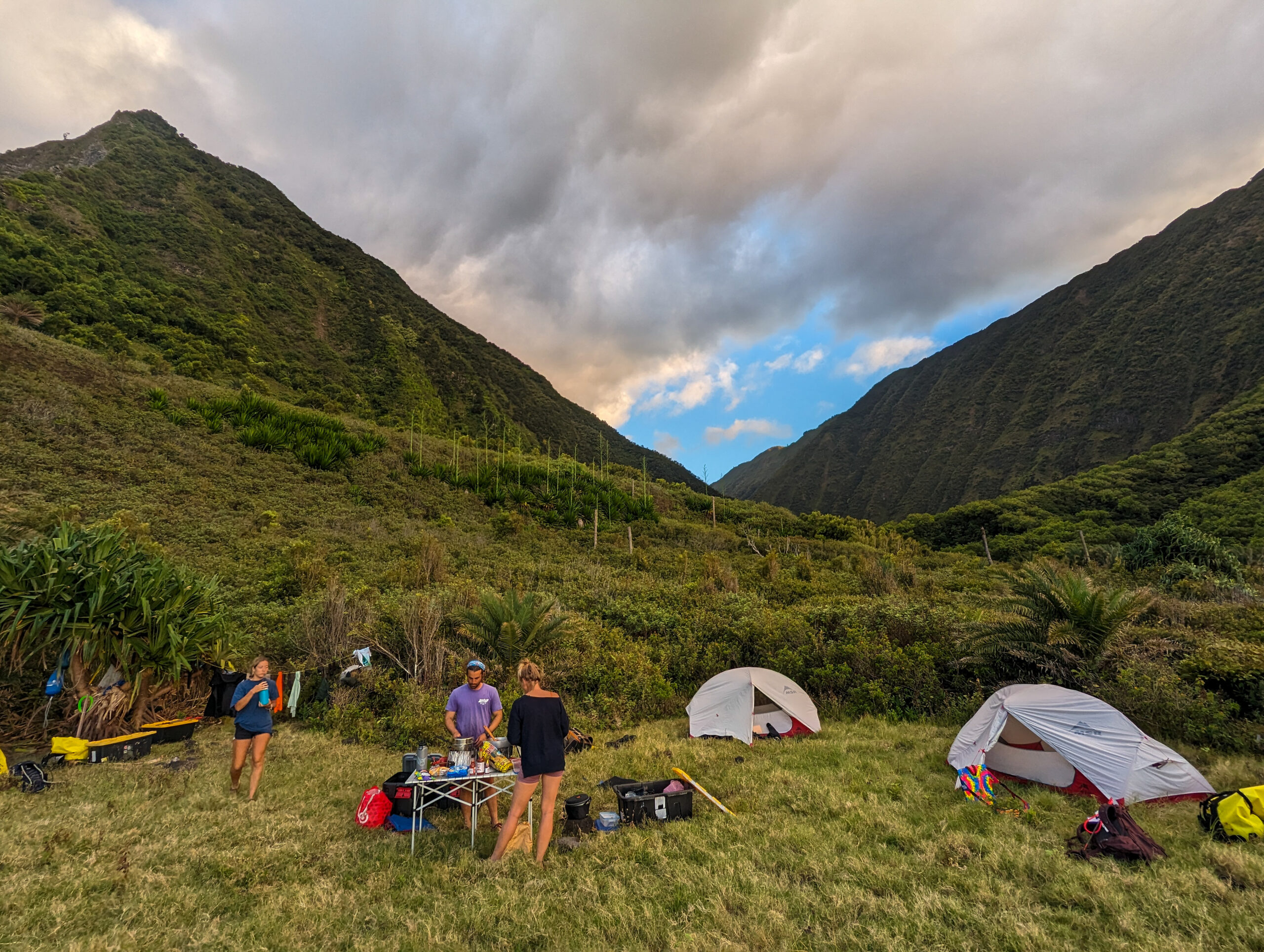
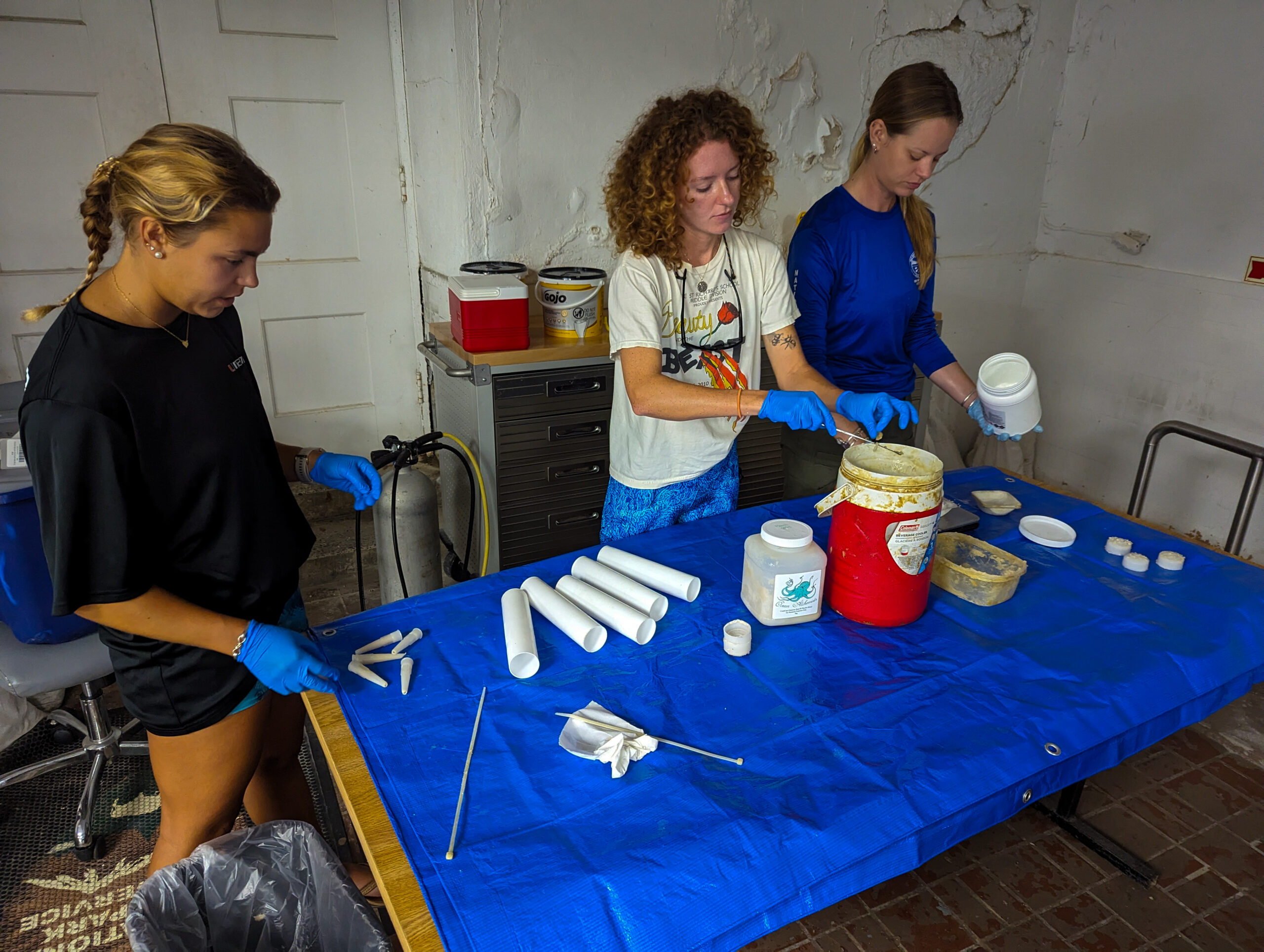
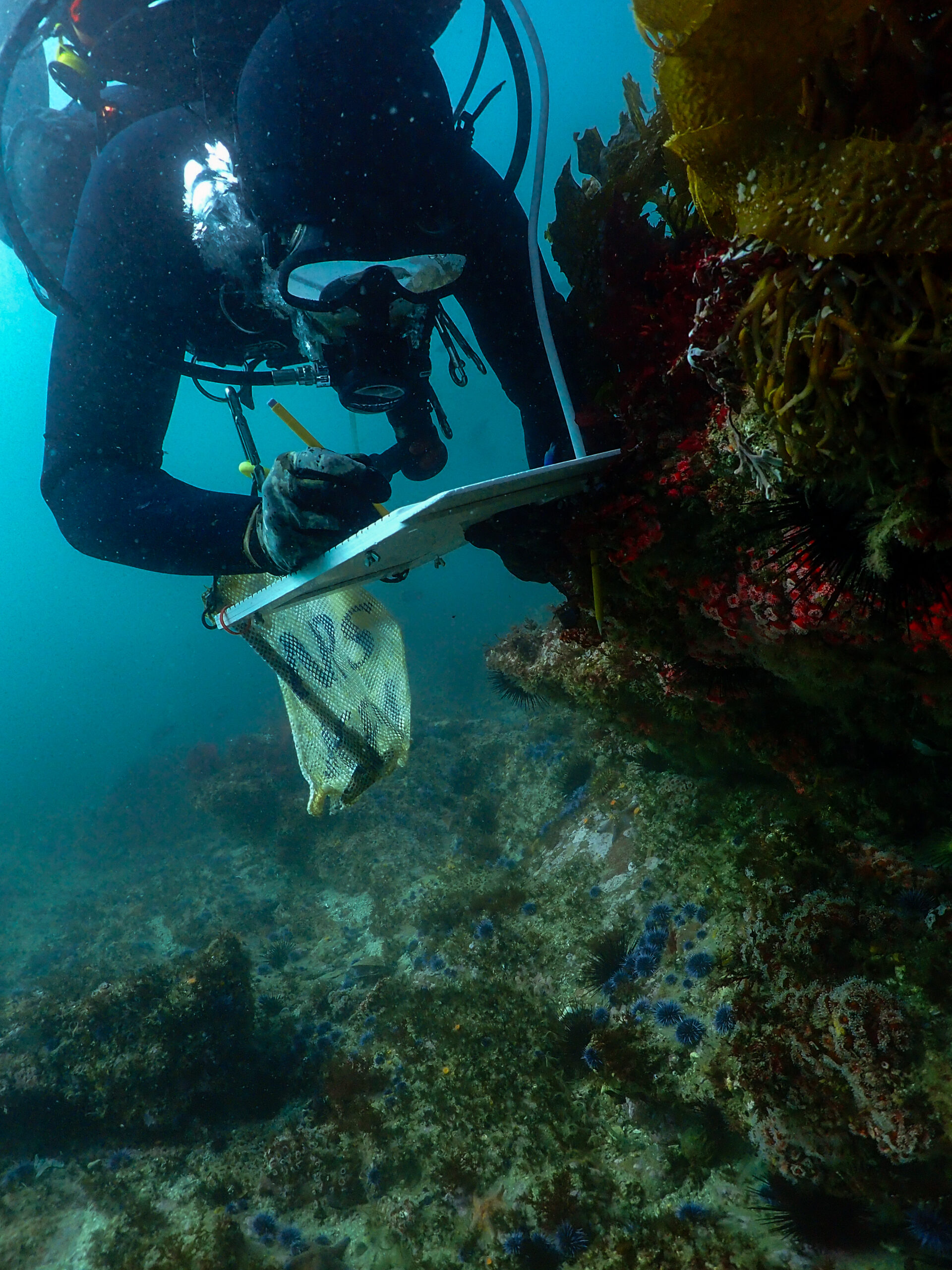
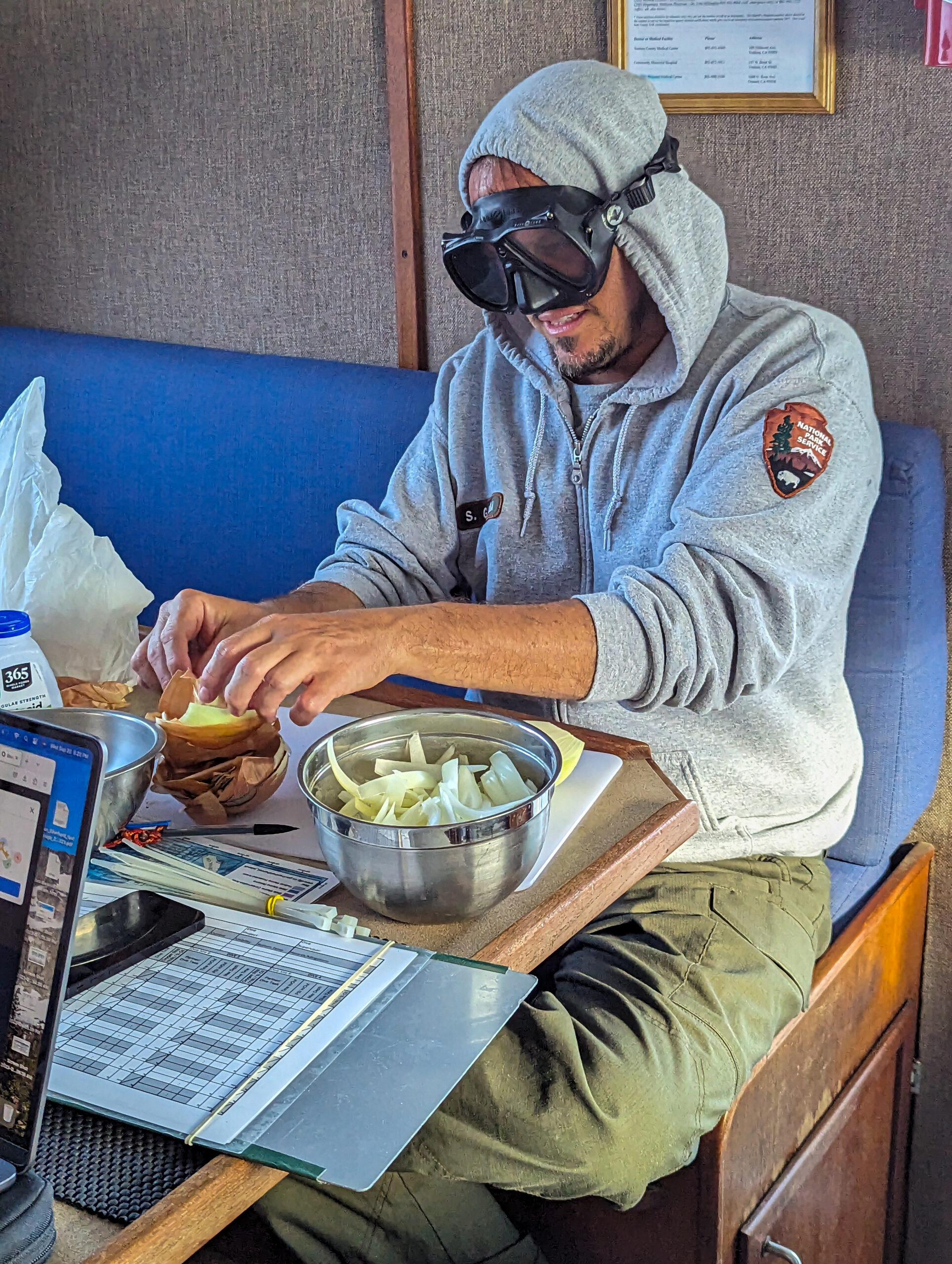
The kelp cruise starts on Monday, so I have a few days in the office to learn as many Channel Island species as possible and get an idea of how the protocols work. I can tell you this will be some of the most comprehensive surveying I’ve ever been a part of. The team collects large amounts of data at each of their 33 sites to get a full picture of the subtidal community structure and dynamics. The sites are large, 100-meter transects. Many dives are required to collect all of the information. They collect size and abundance data for 70 categories of algae, invertebrates, and fish that are indicators of ecosystem health. While I’m reading up on the protocols, the rest of the team is entering their last week’s cruise data into the database. Data recording is thorough with transcriptions double, triple, and quadruple checked for accuracy. One last task is provisioning for the week and I join Emalia on Friday to hit up Trader Joe’s.

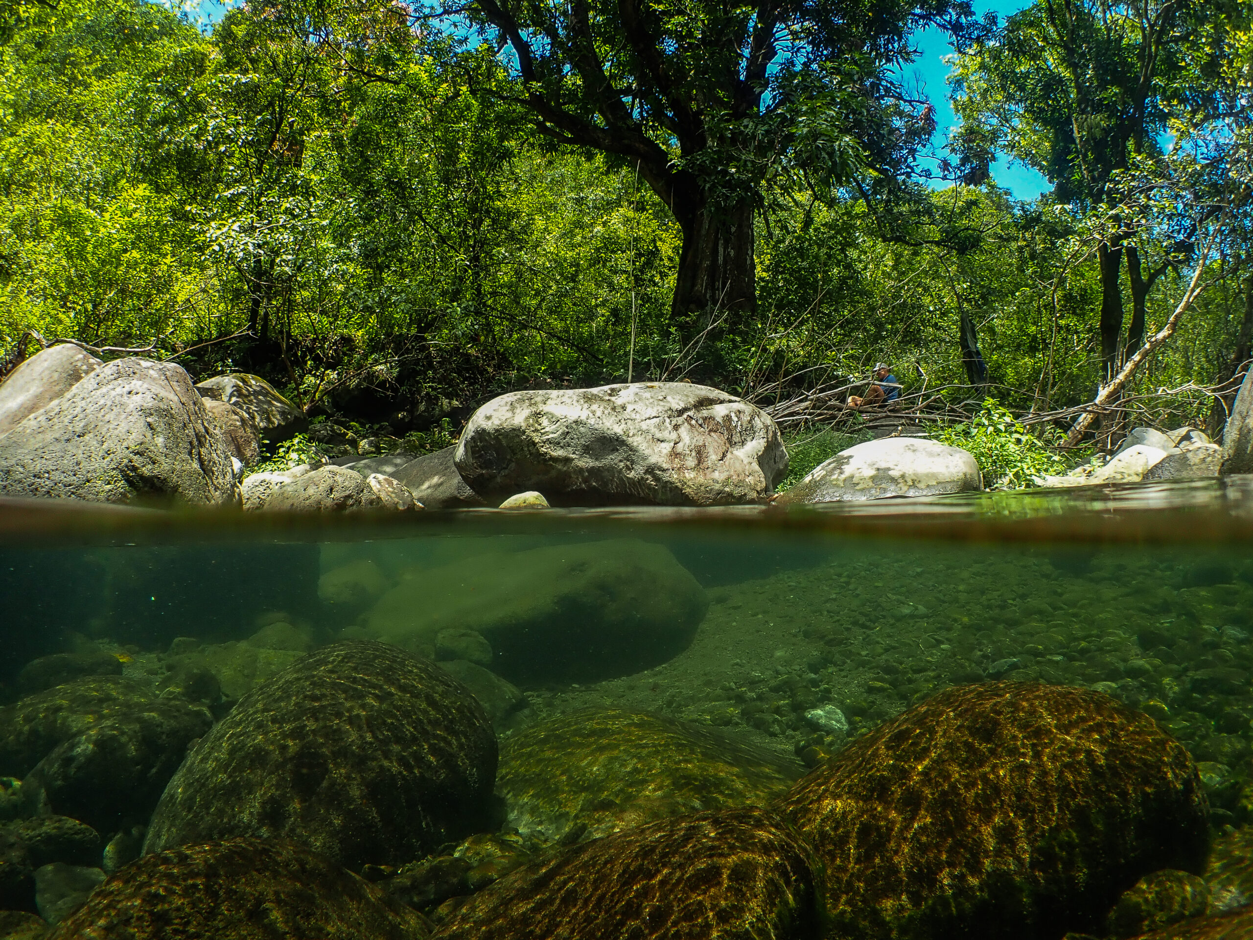
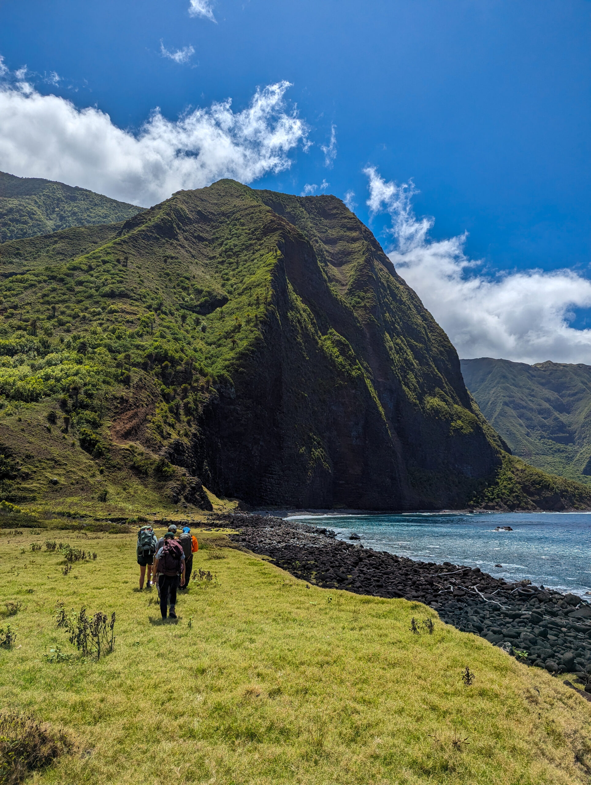
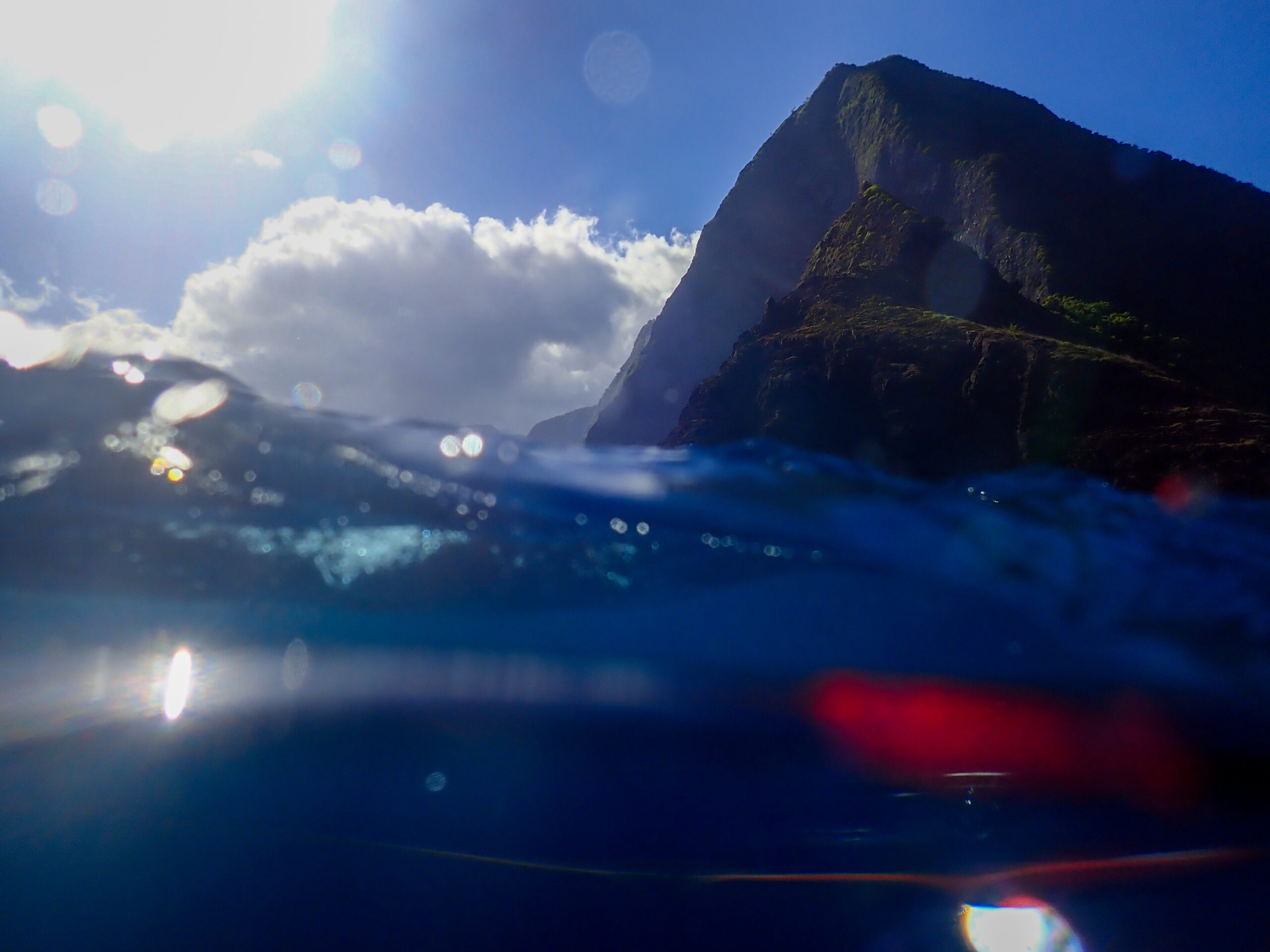
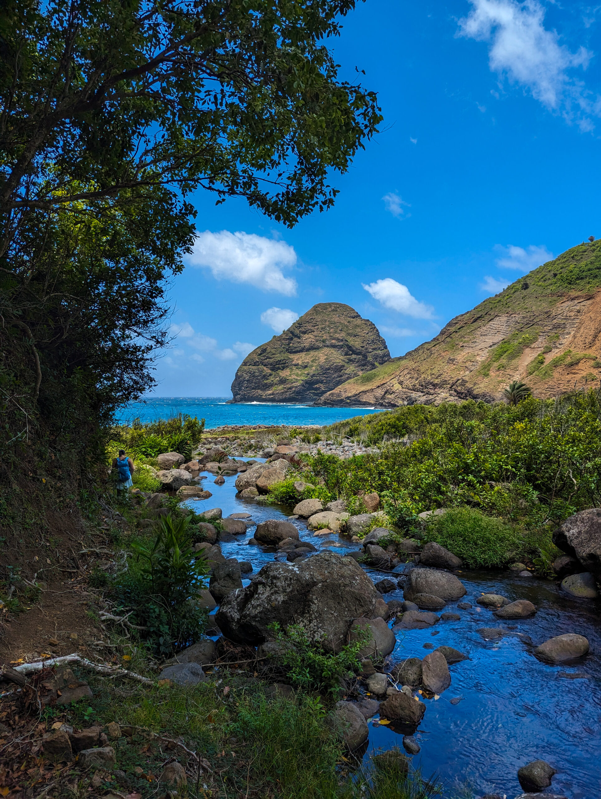
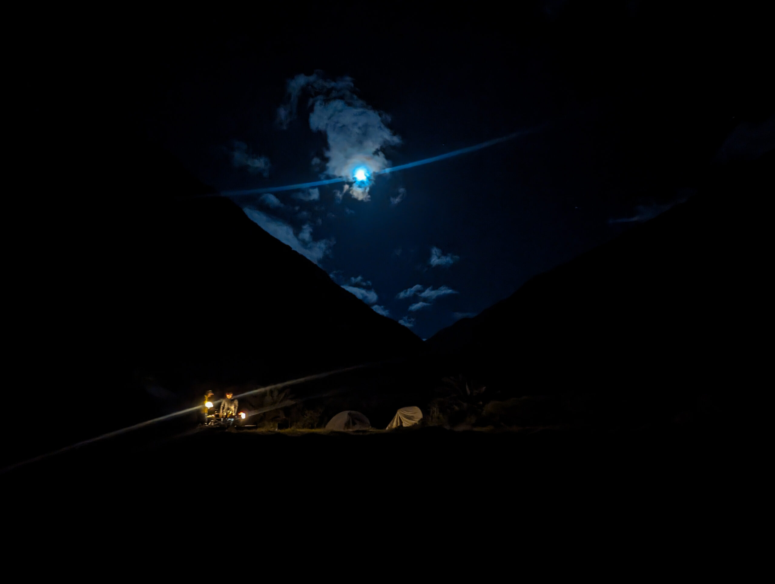
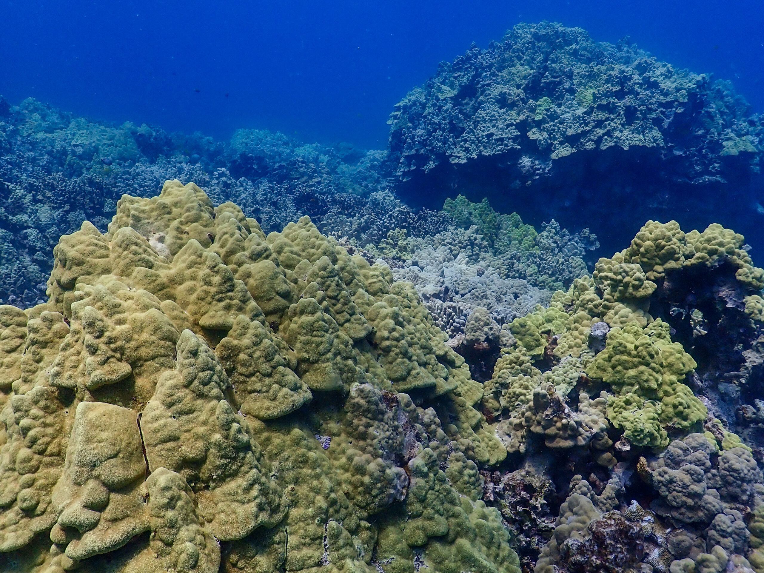
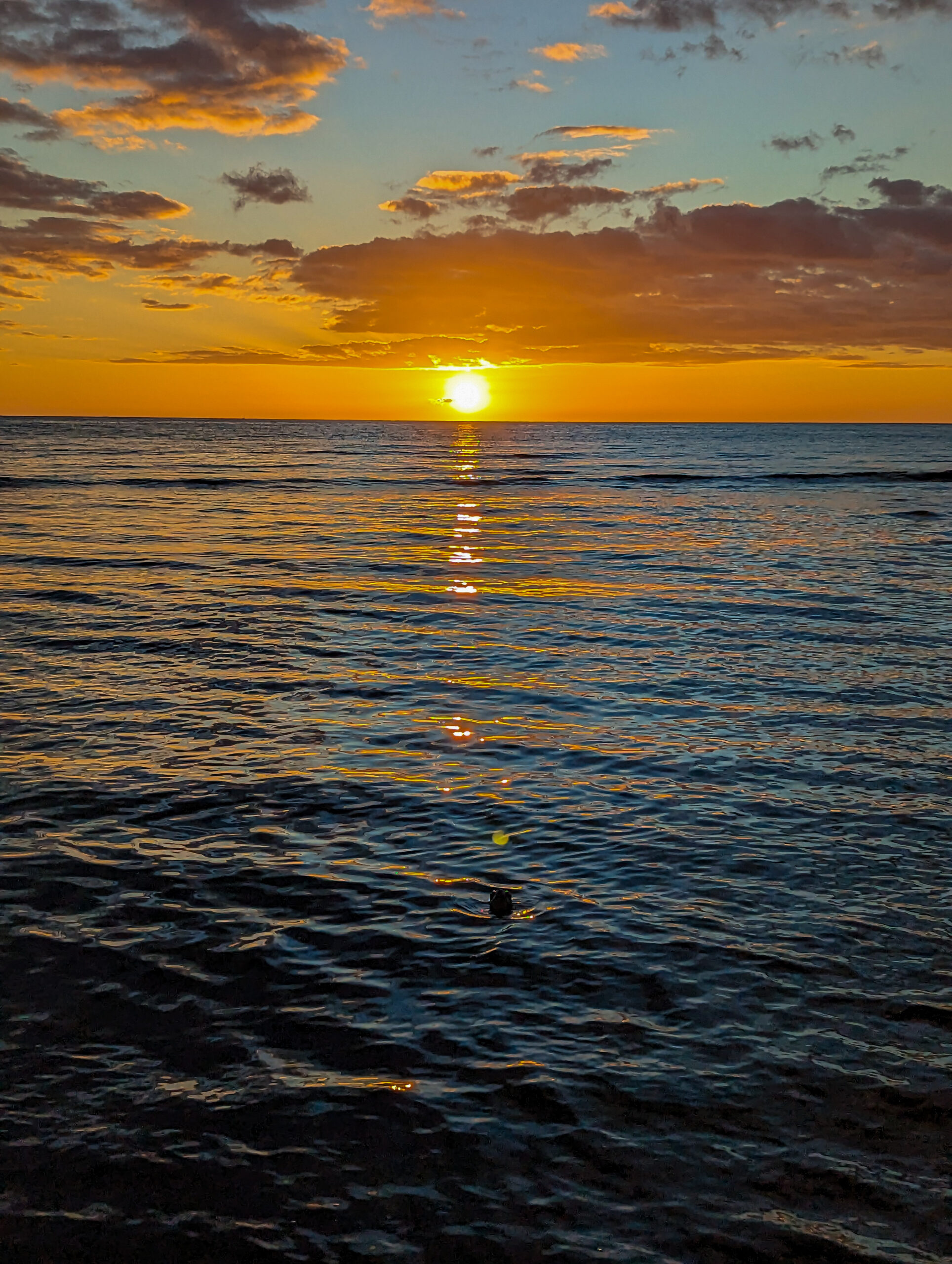
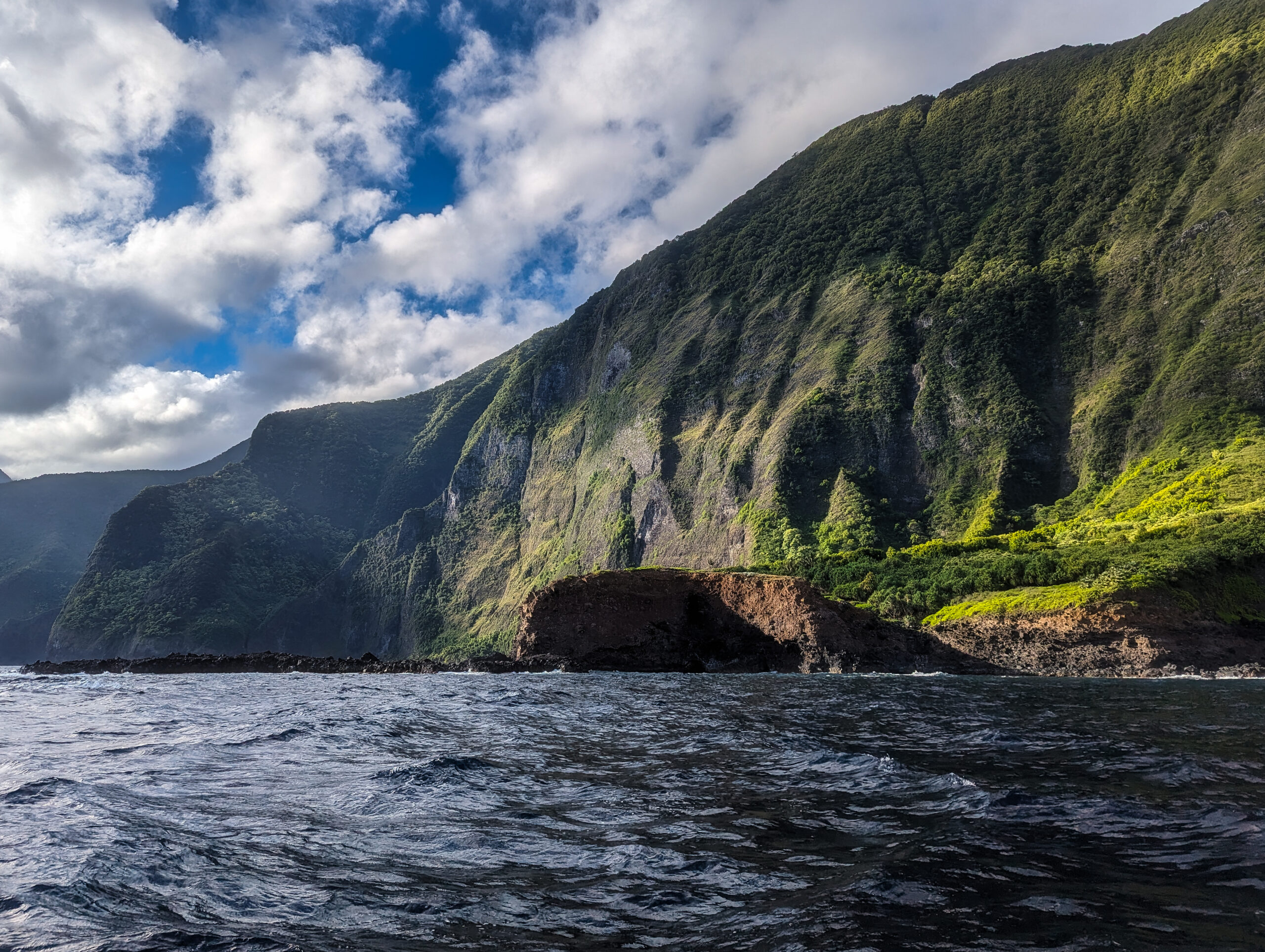
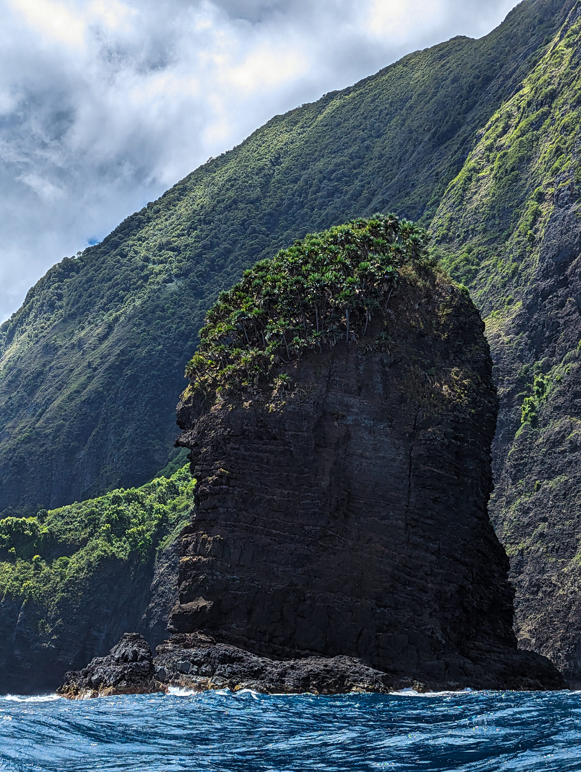
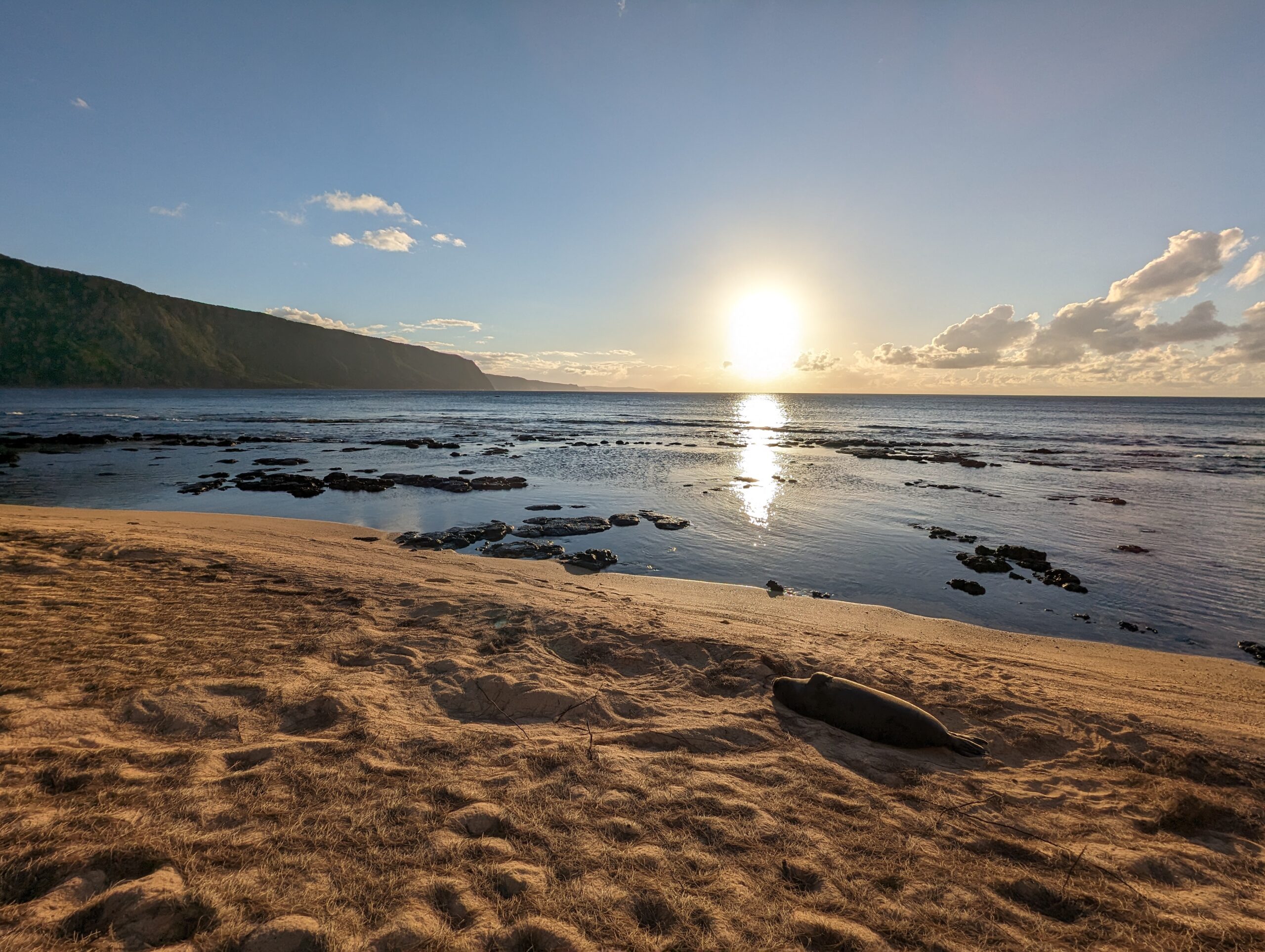
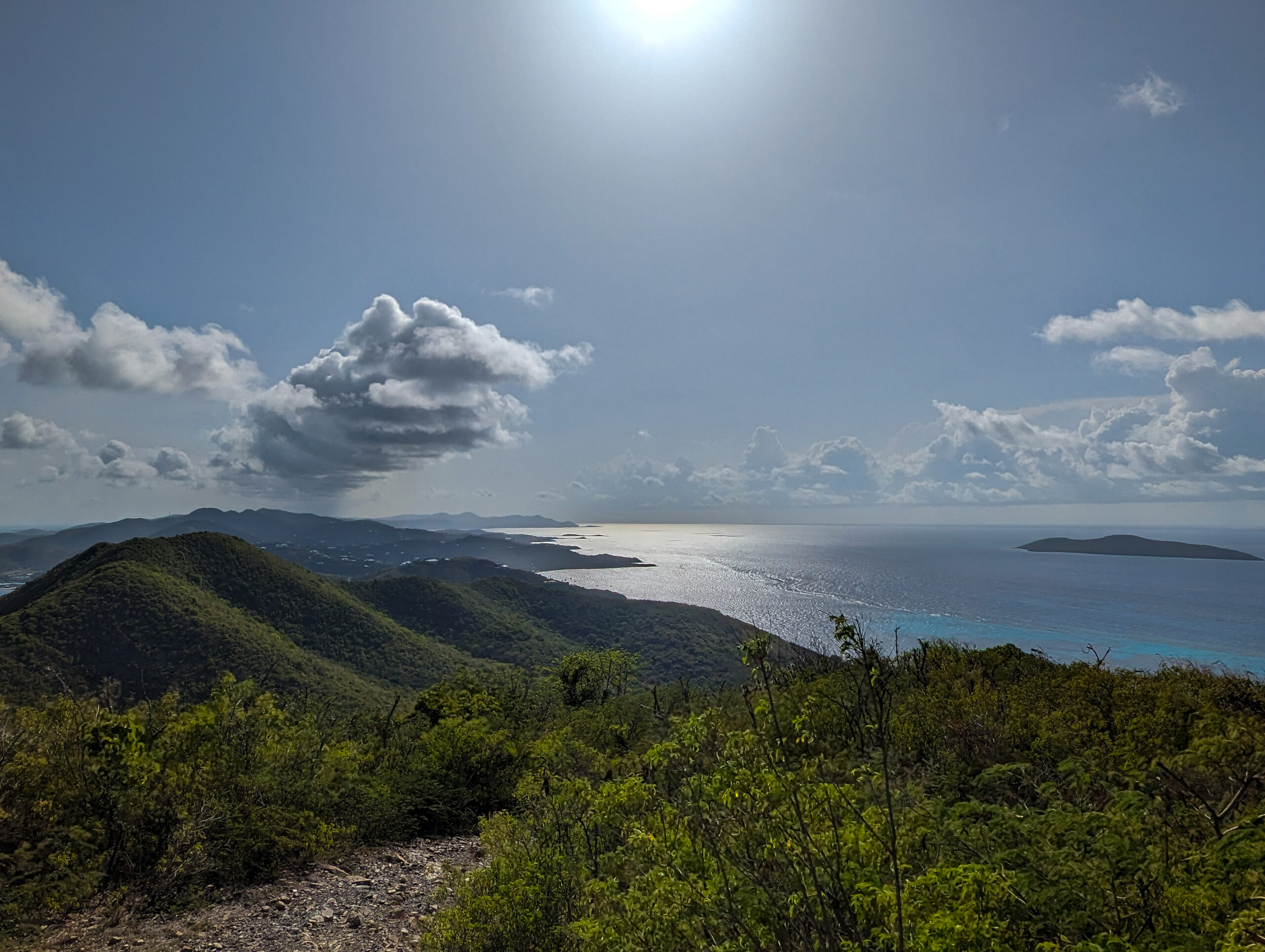
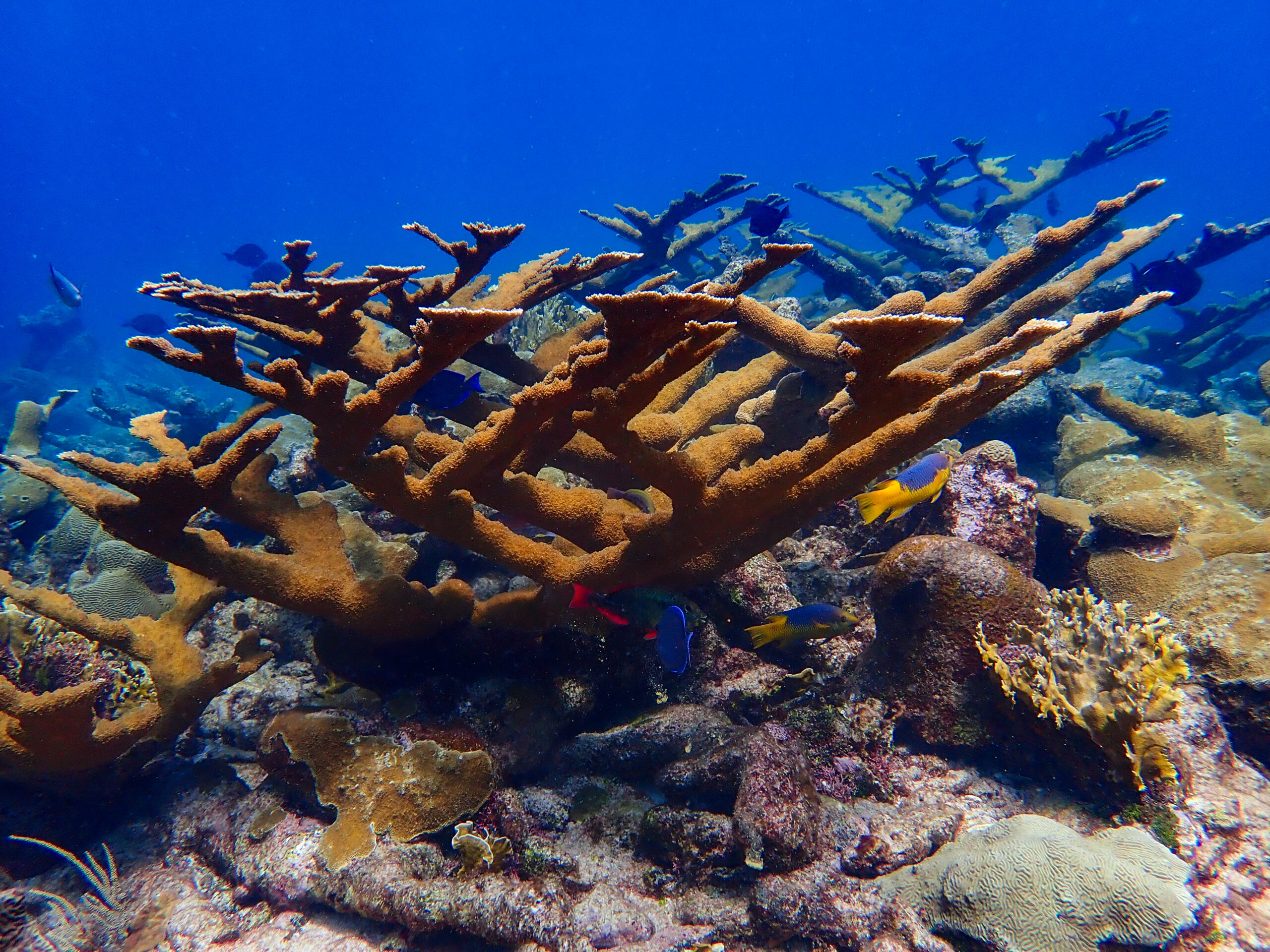
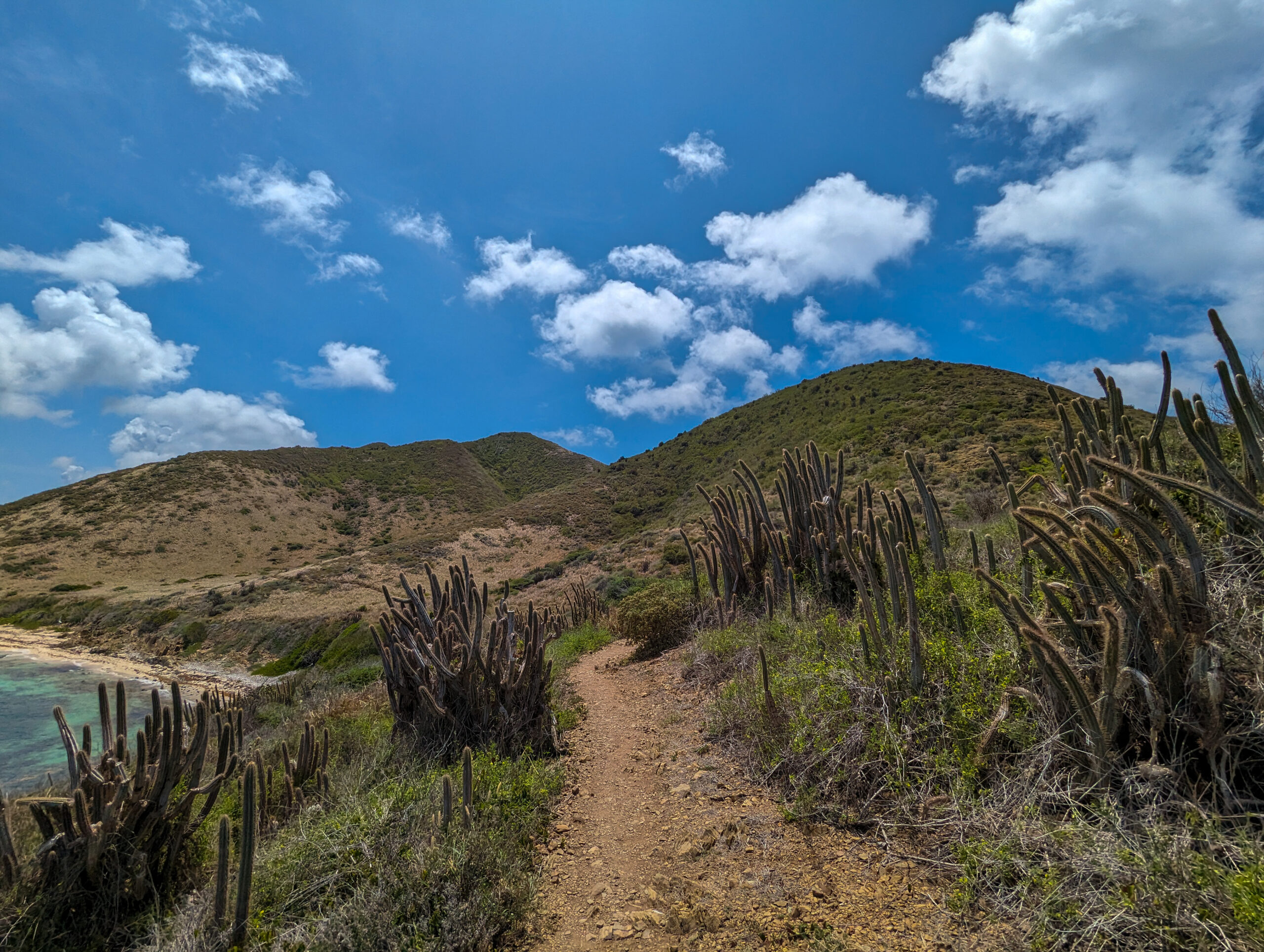
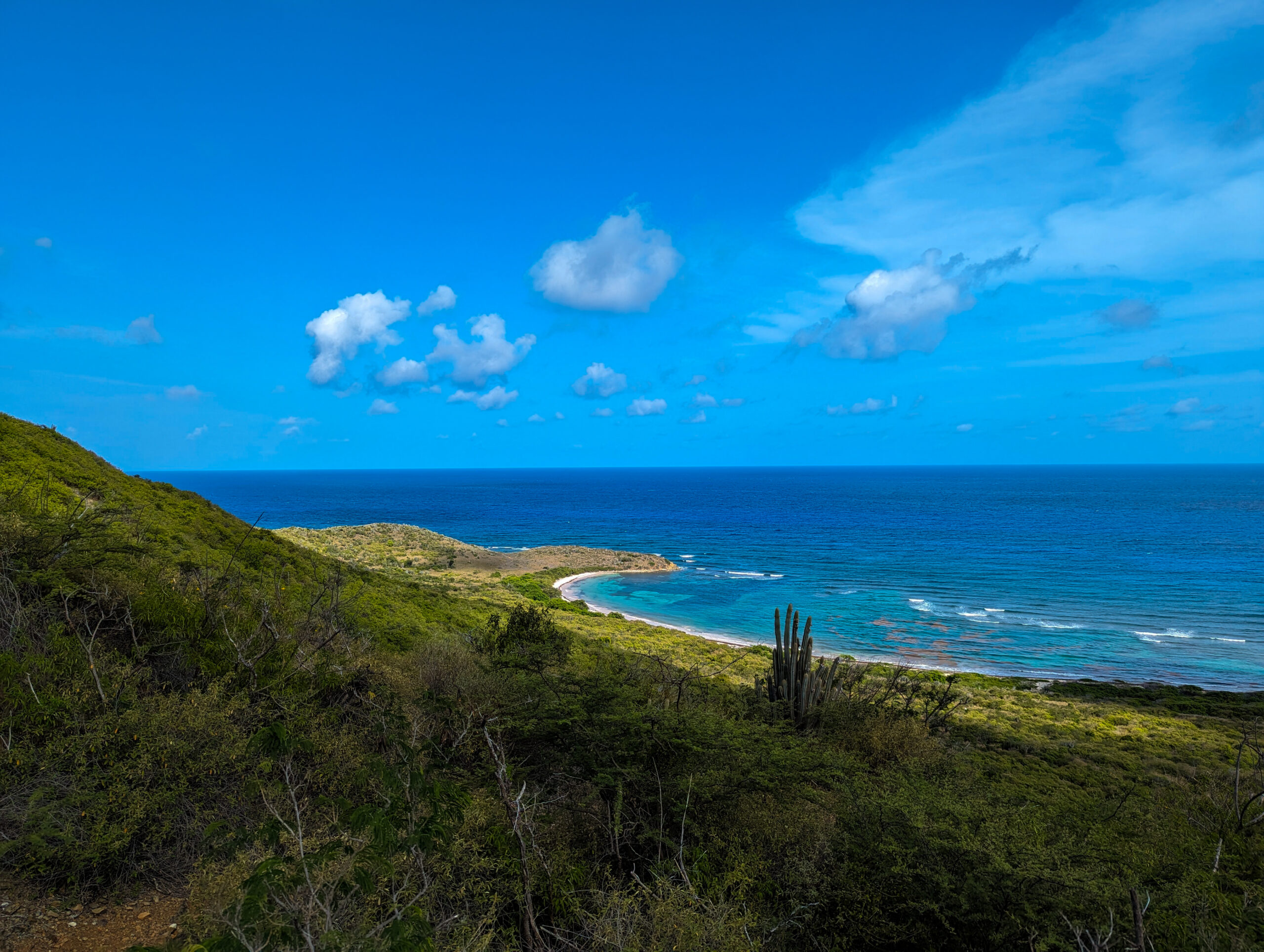
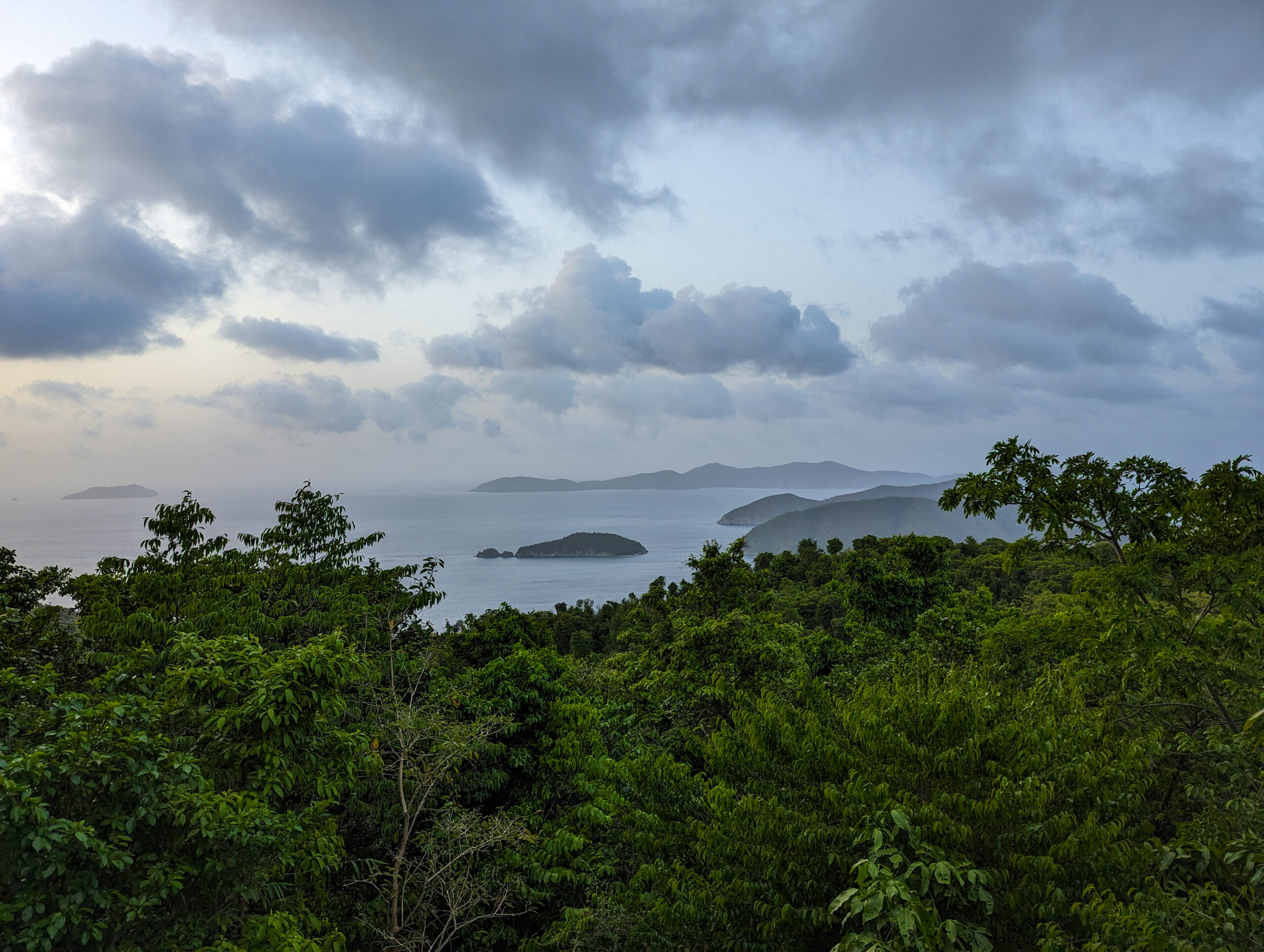
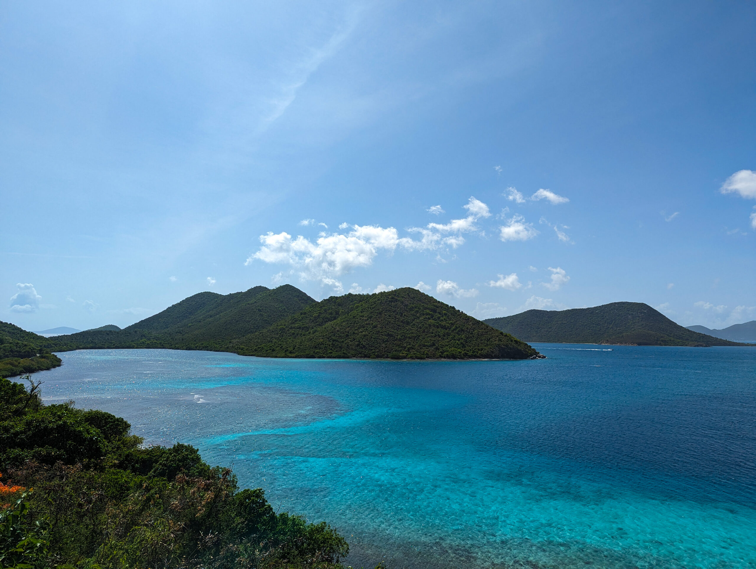
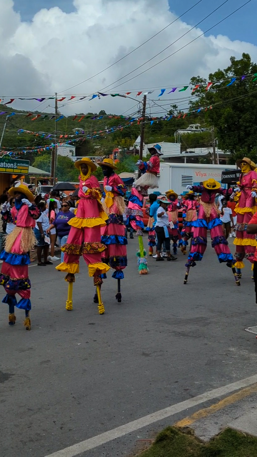
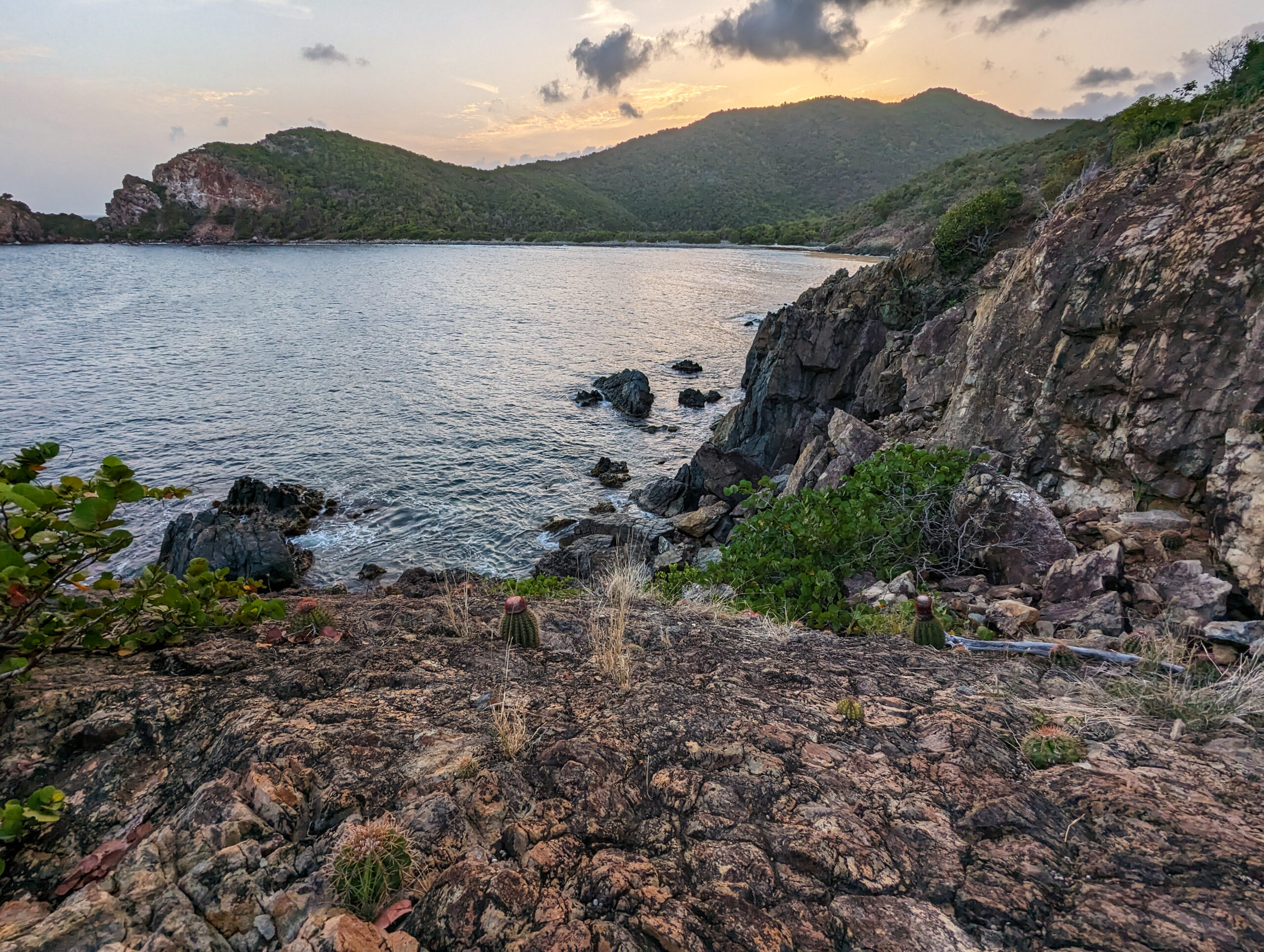
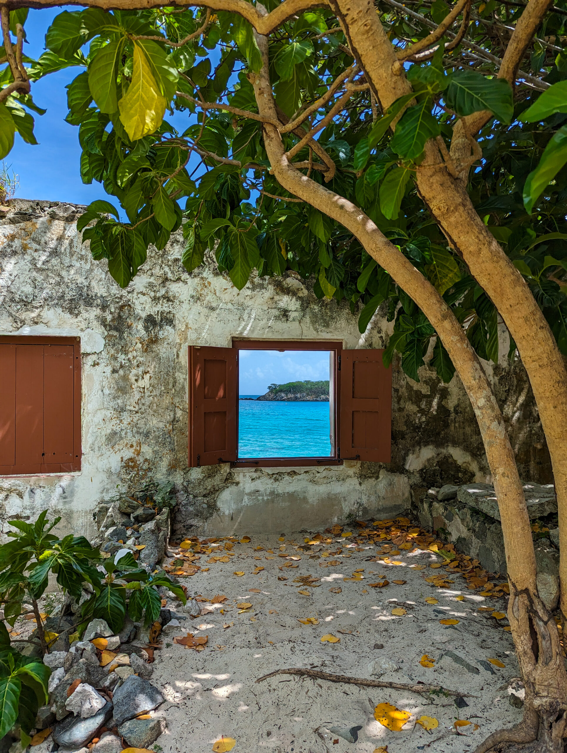
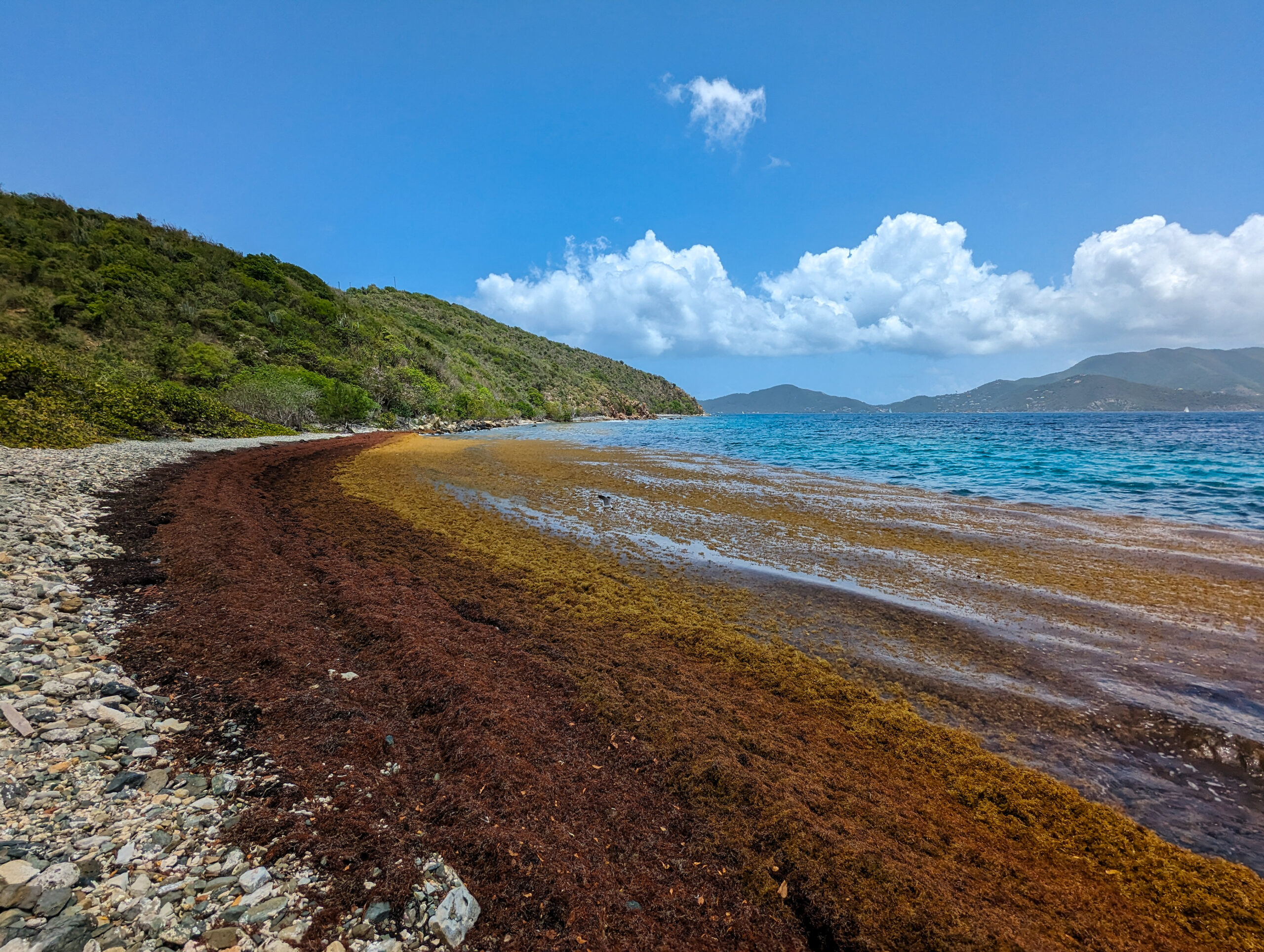
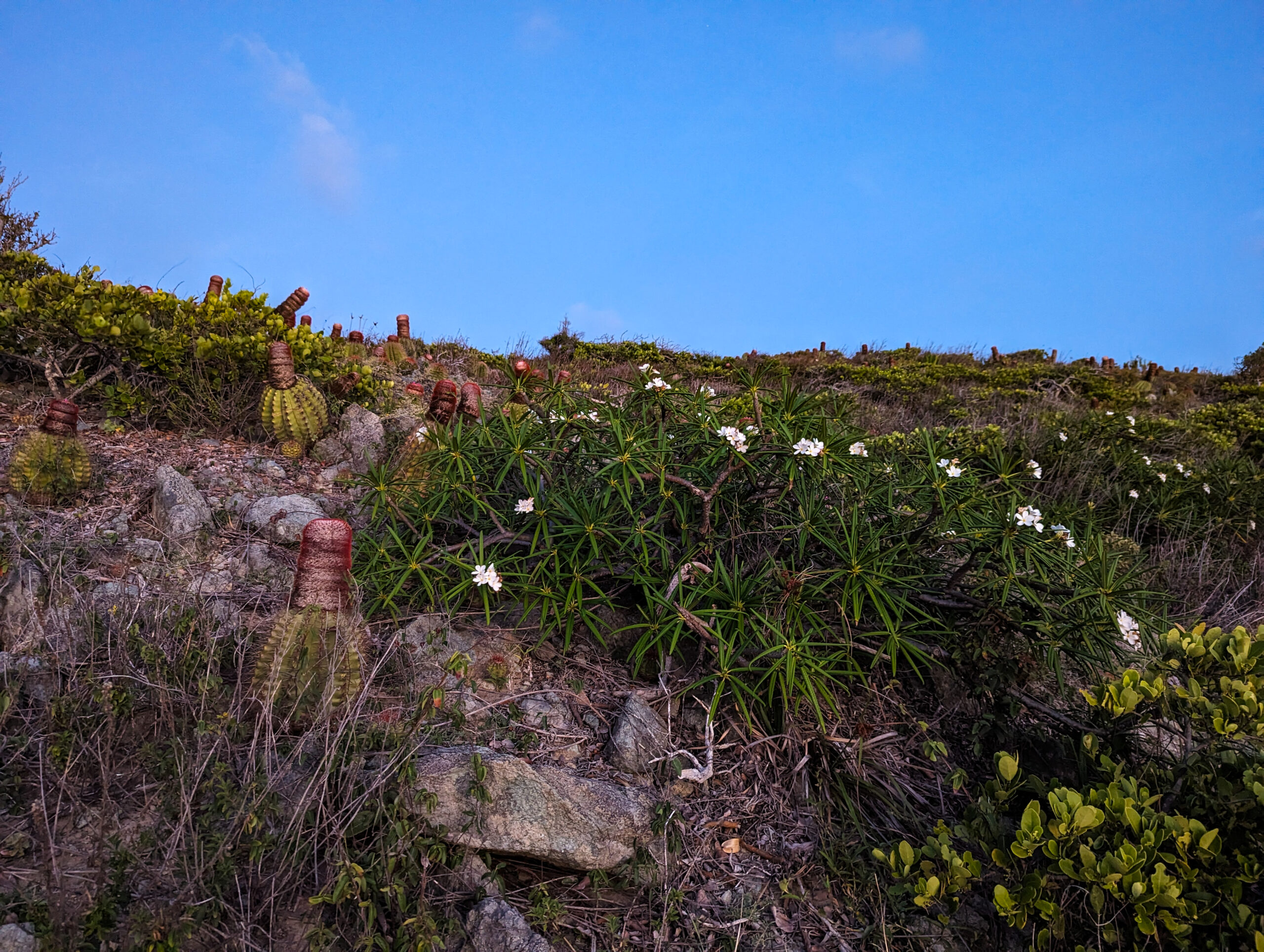
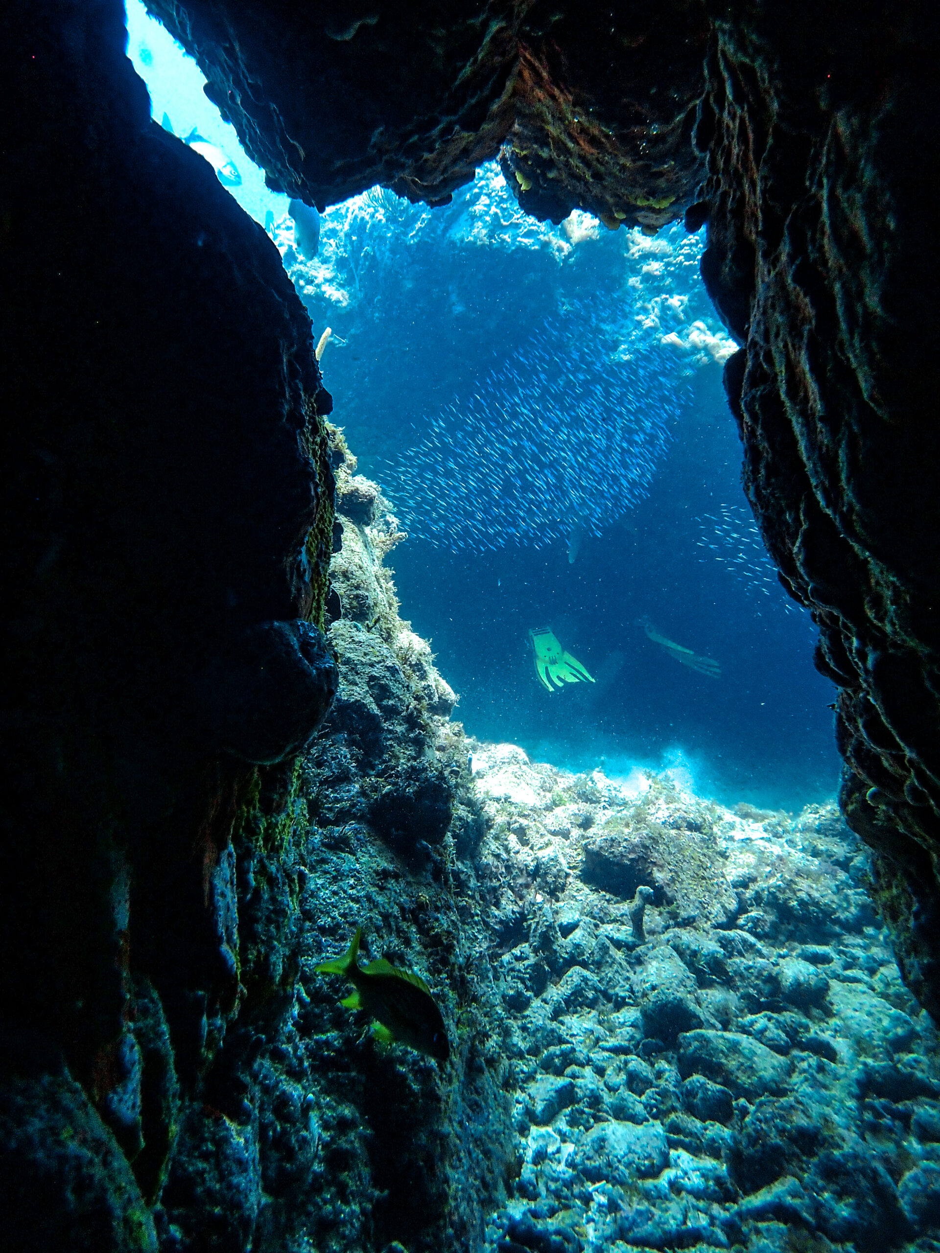
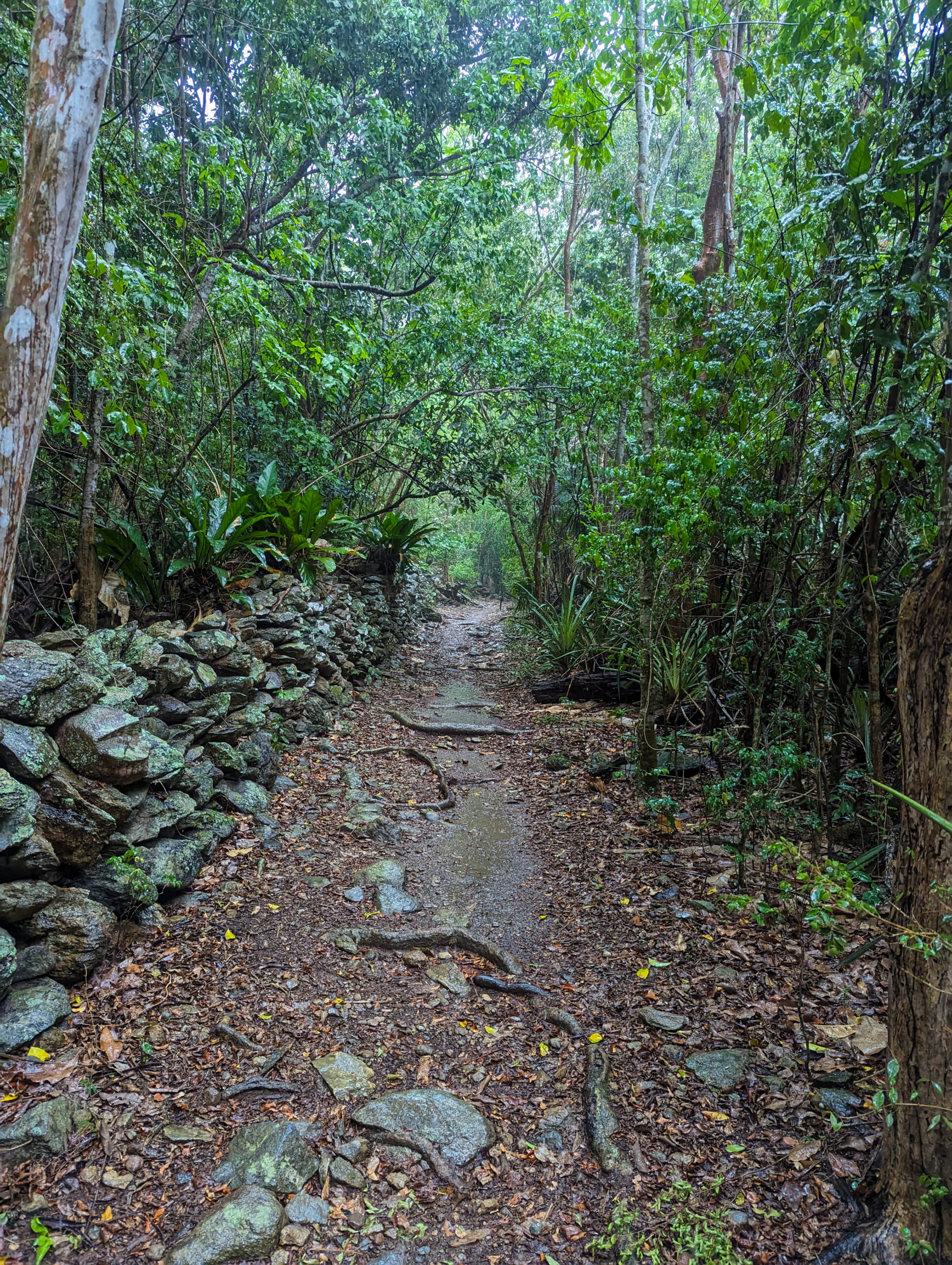
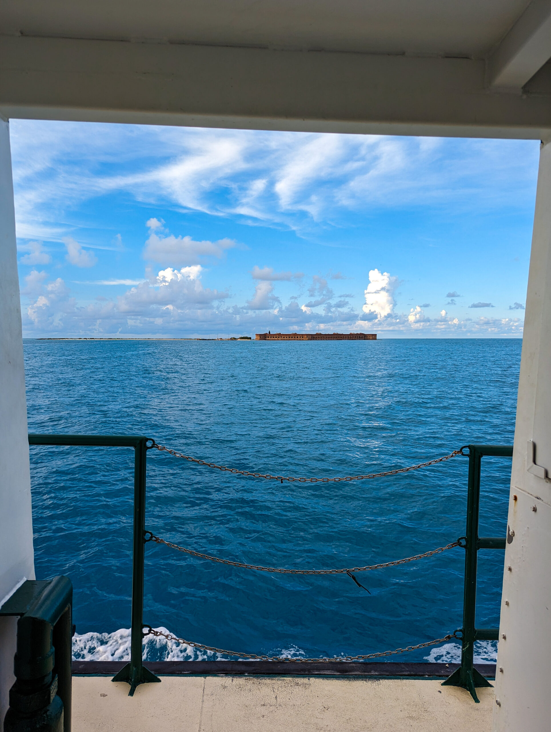
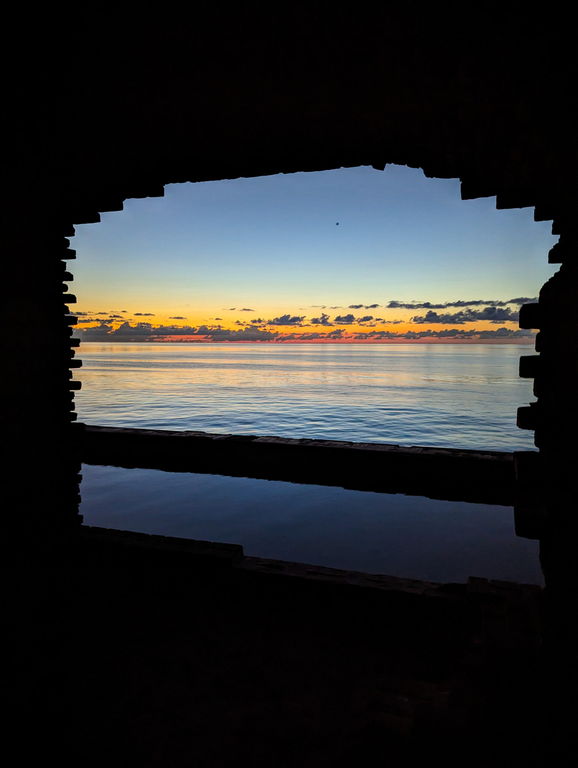
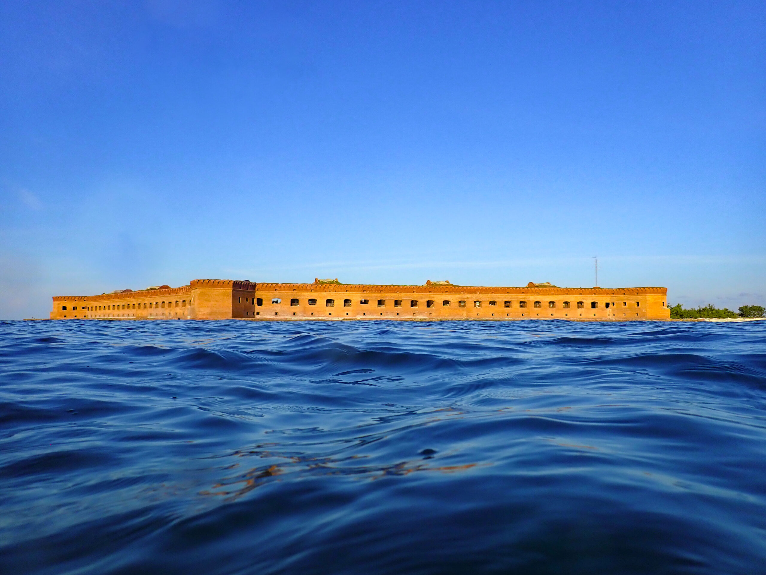
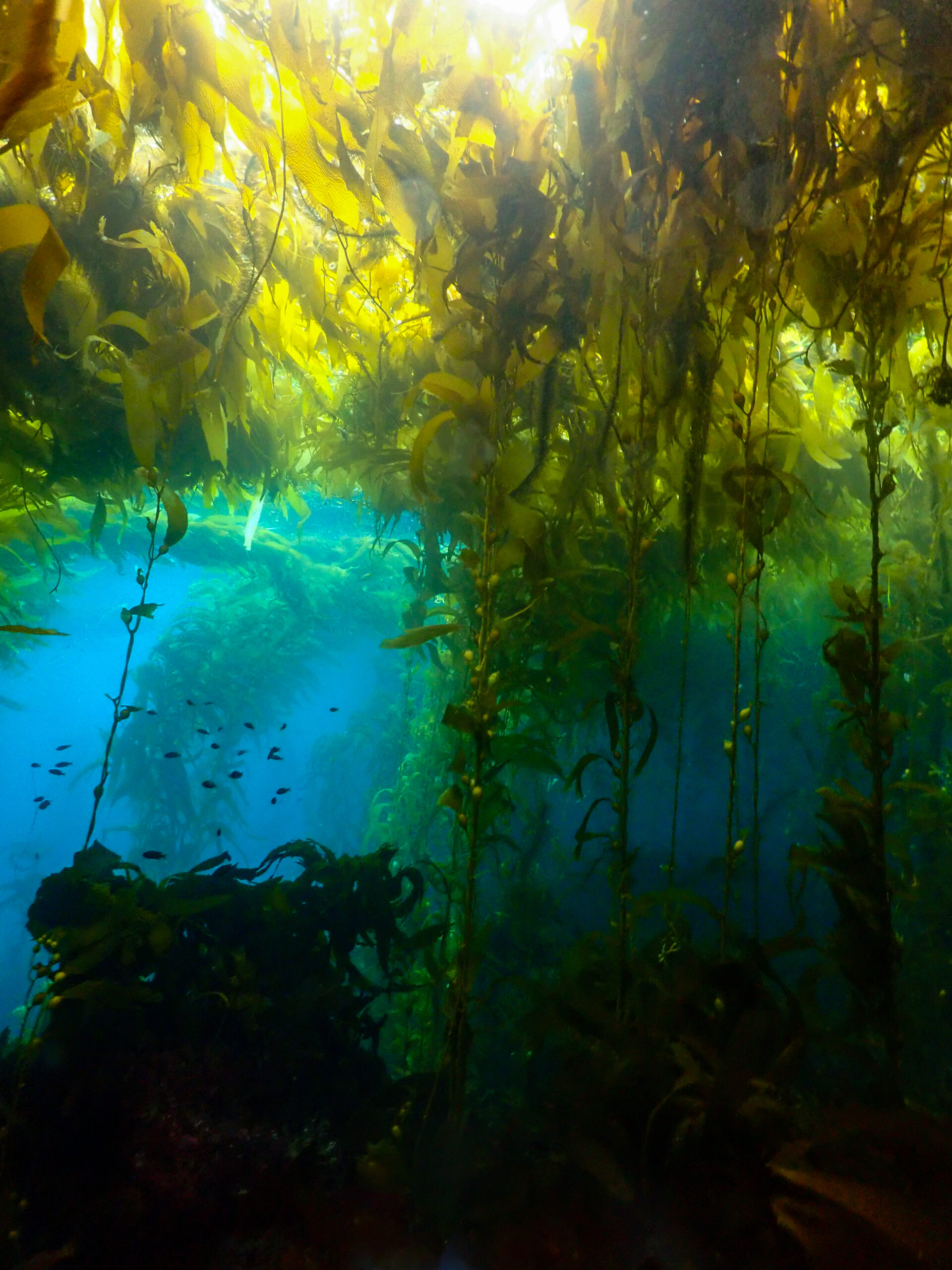
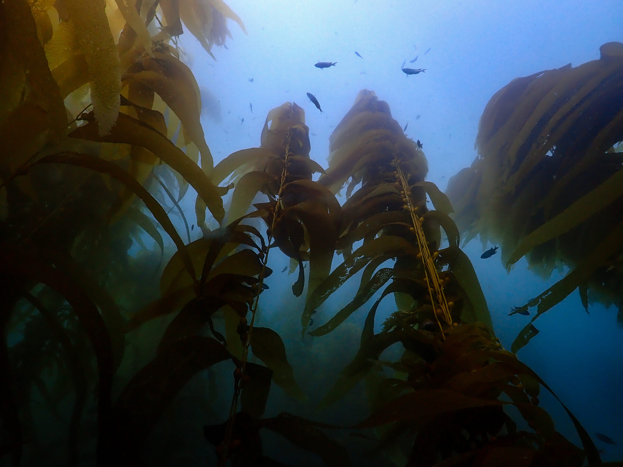
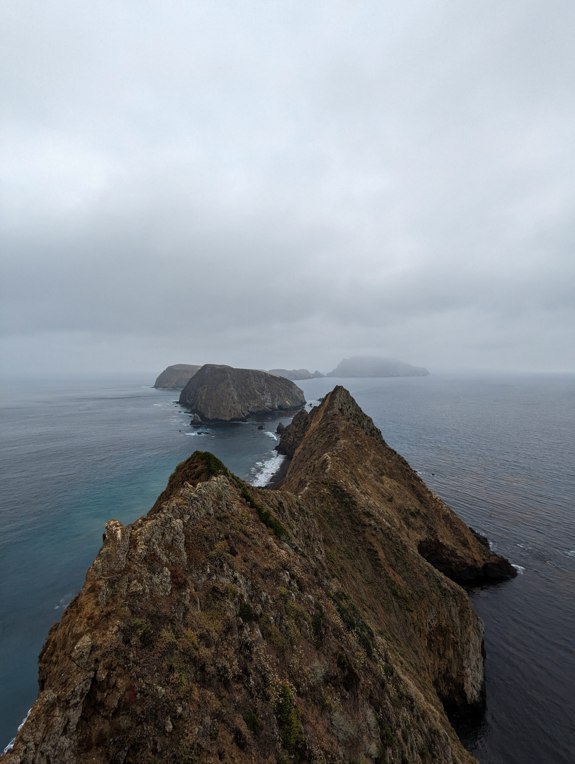
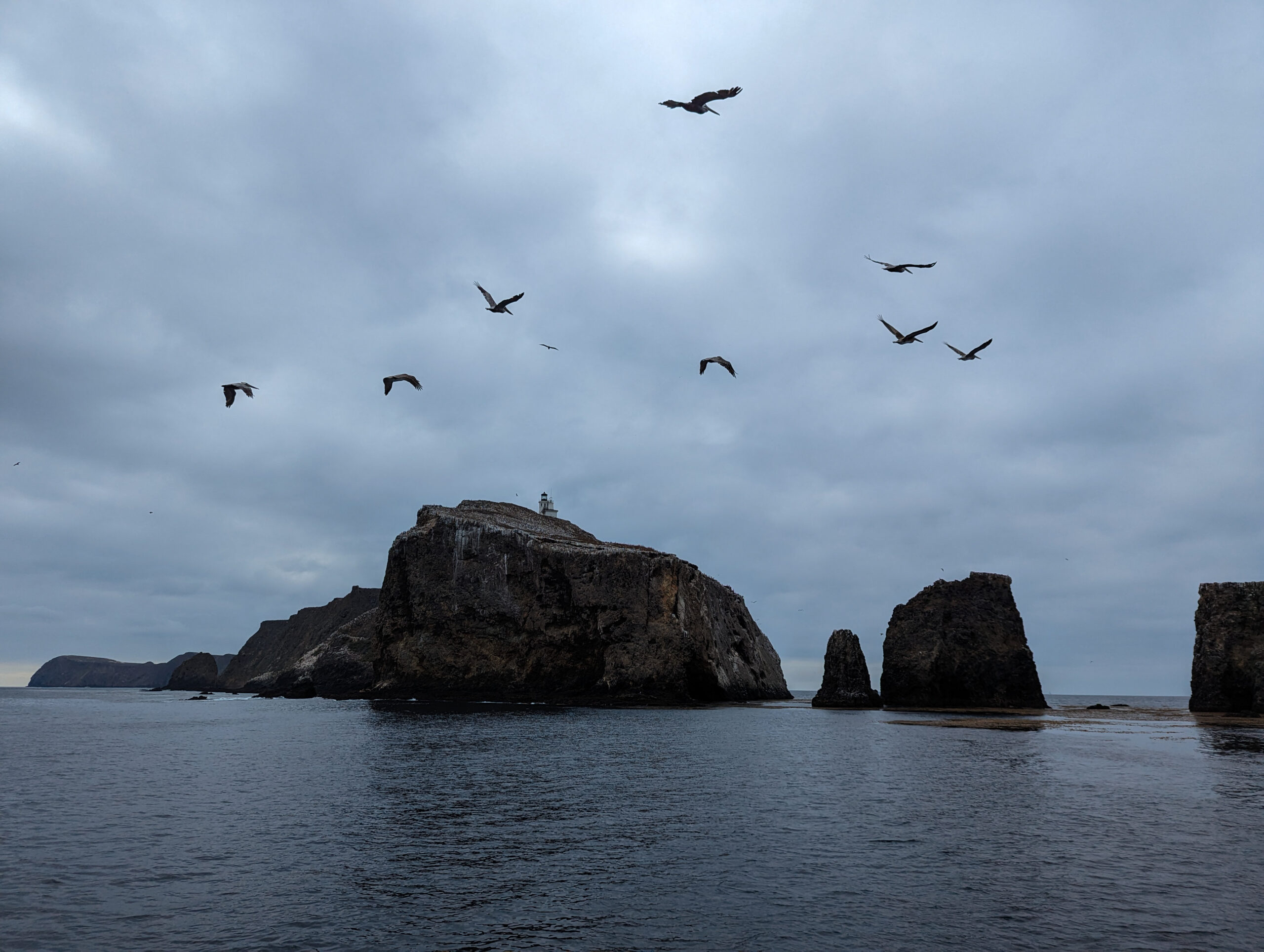
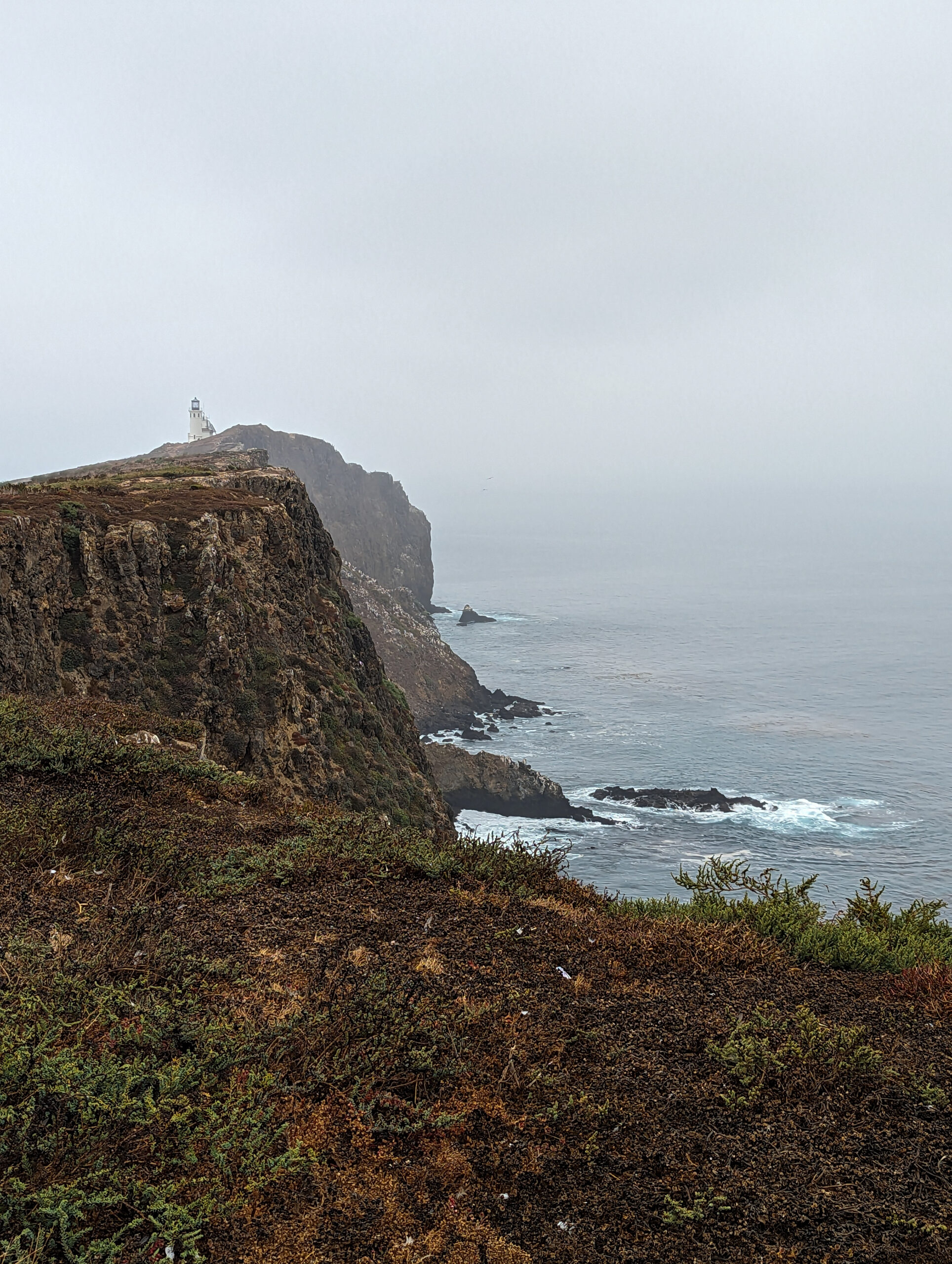
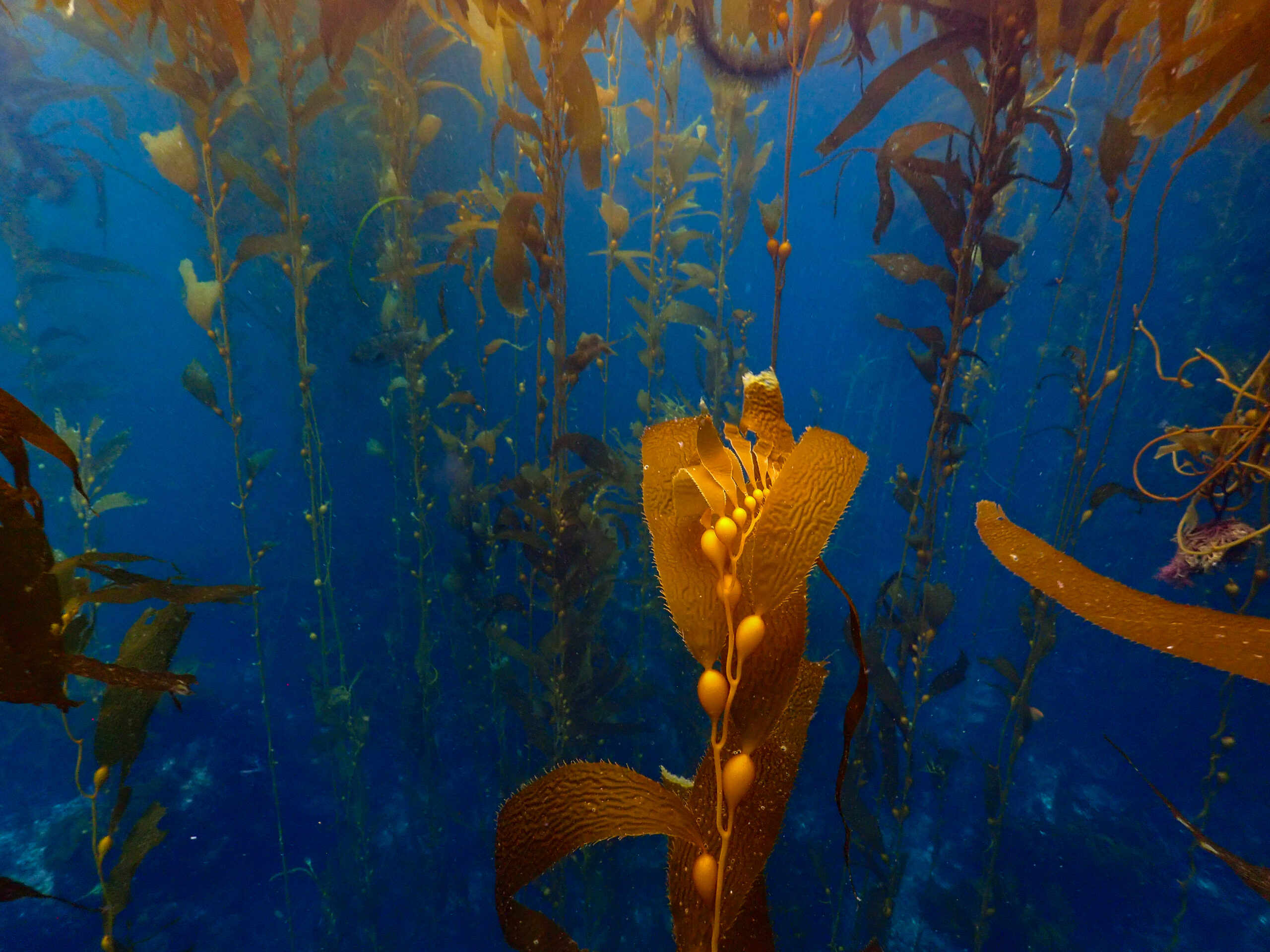
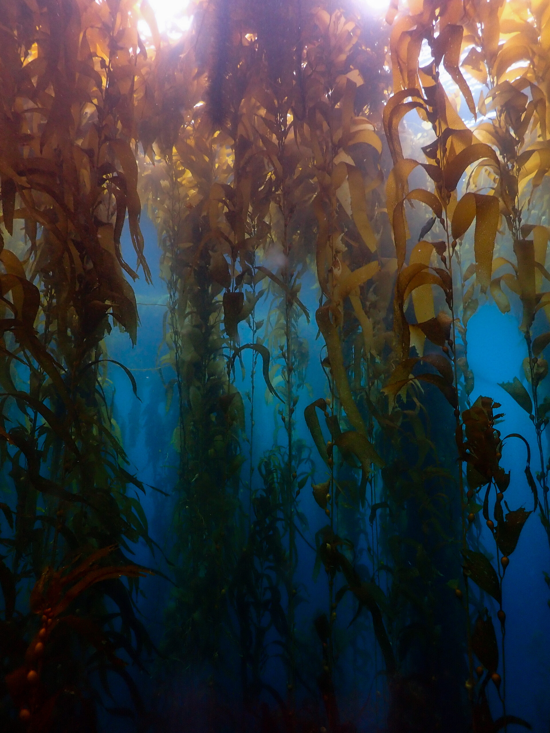
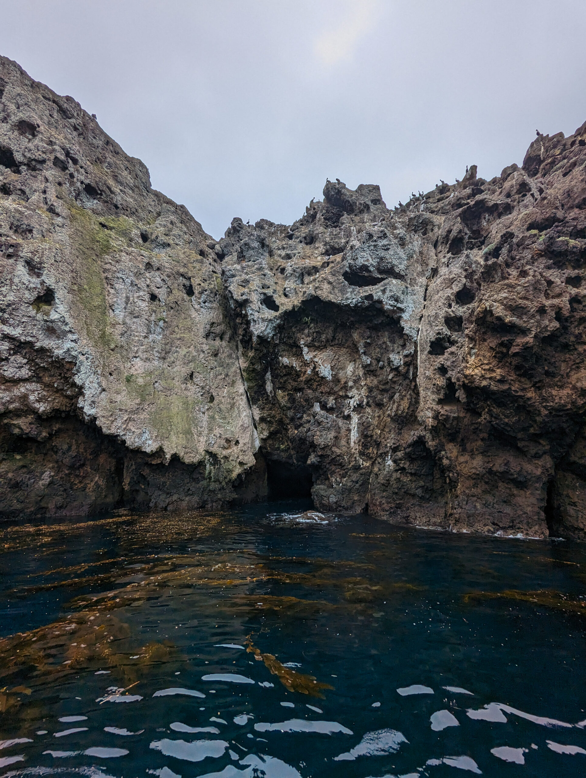
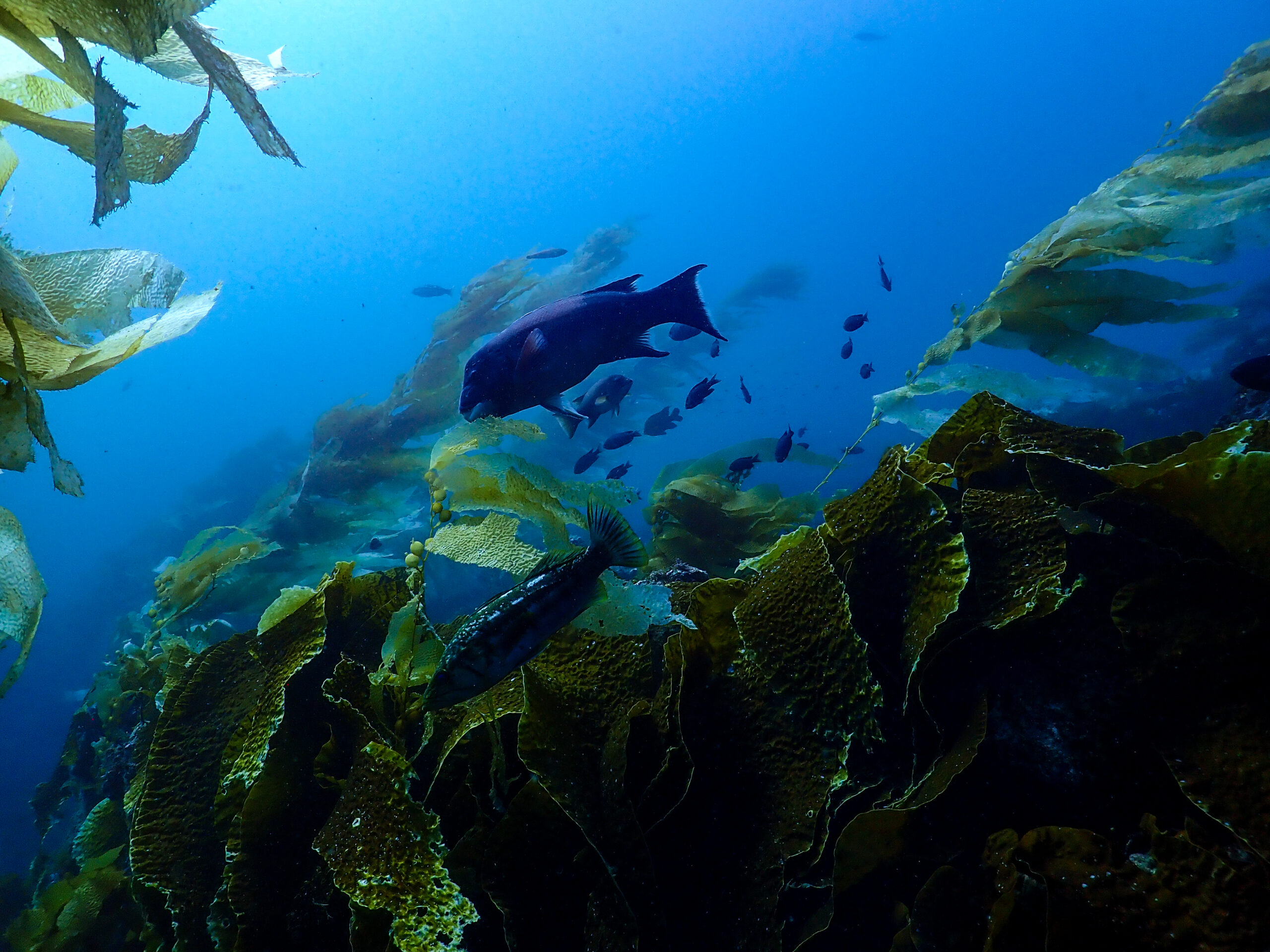
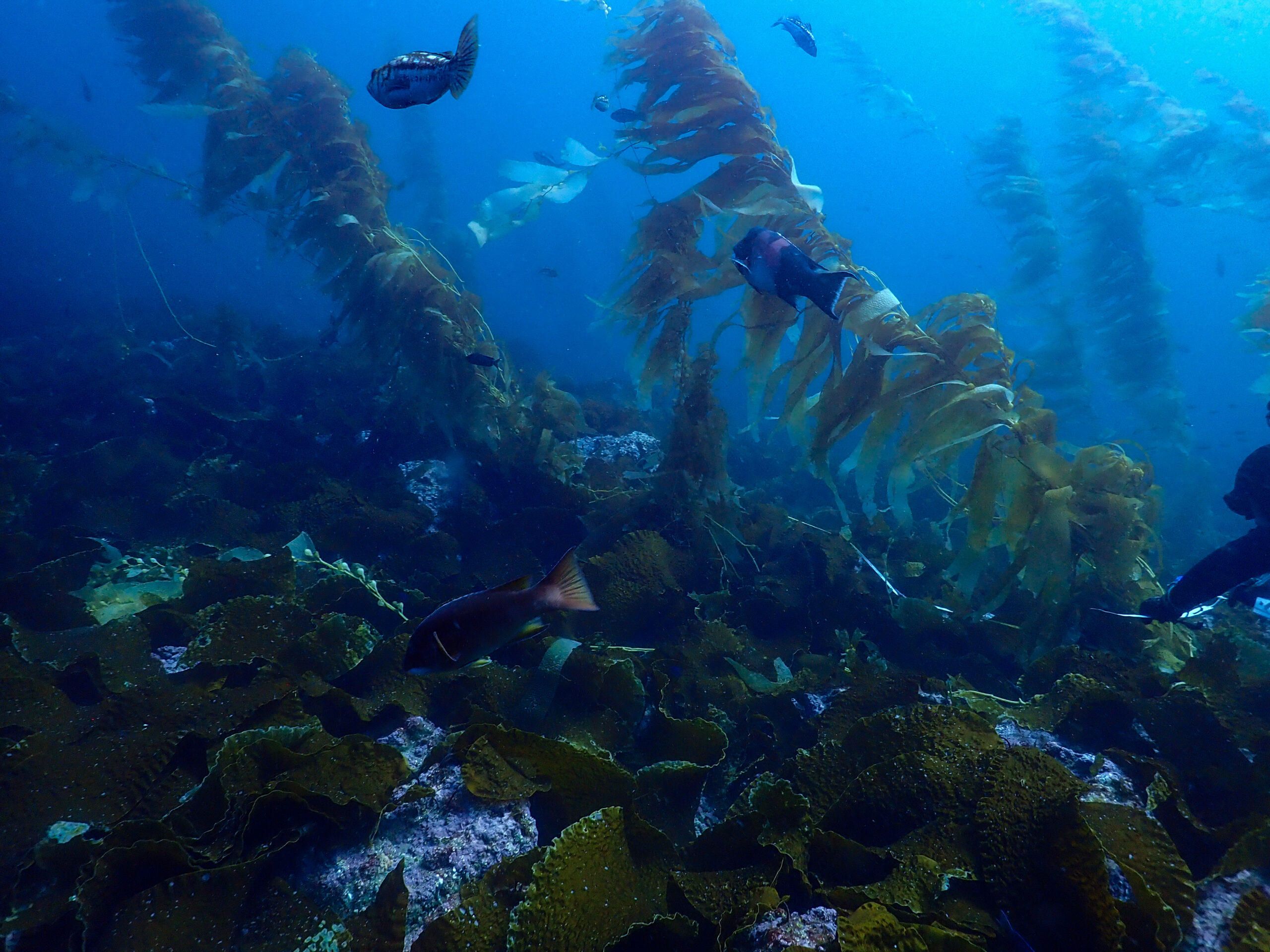
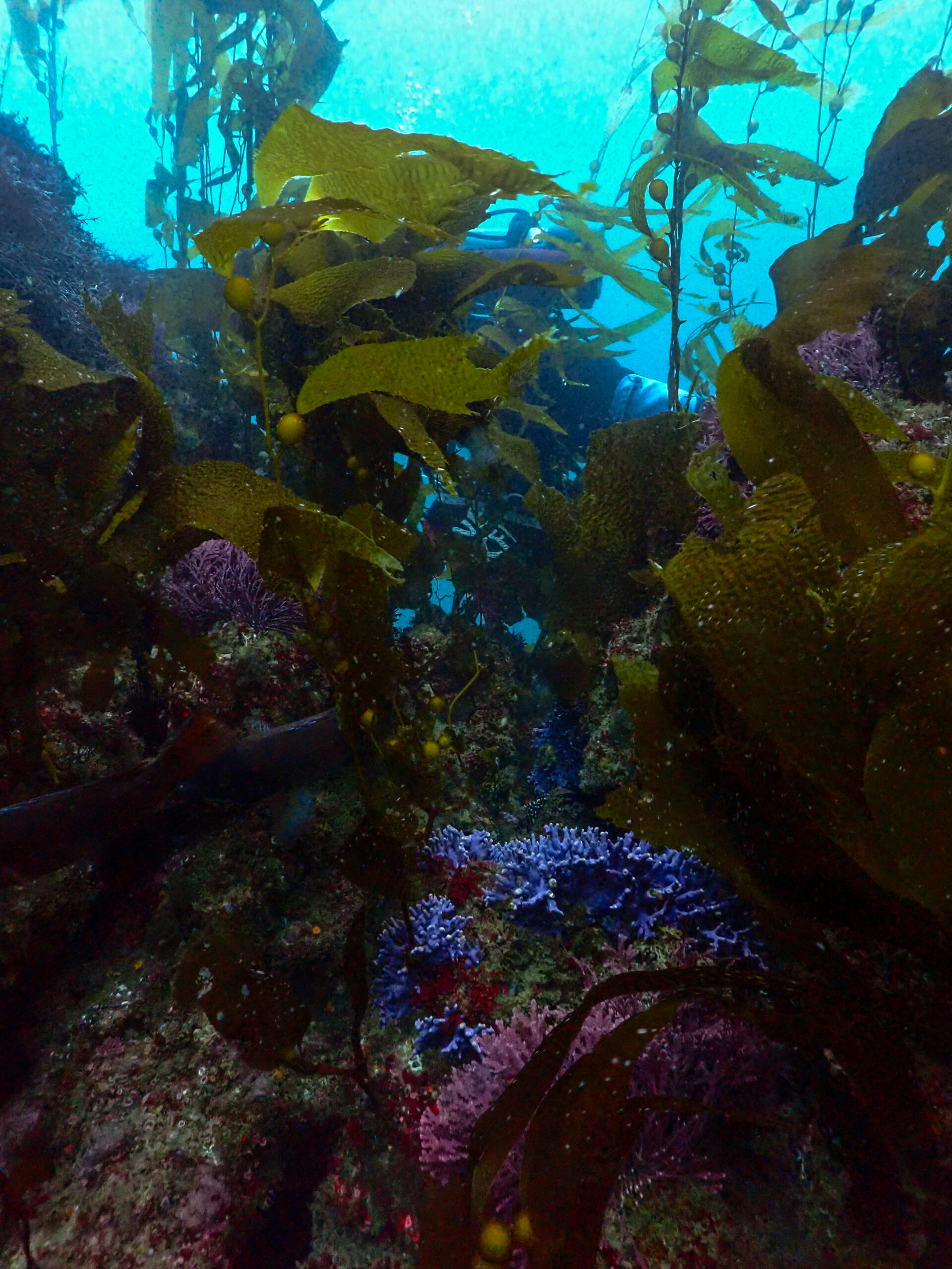
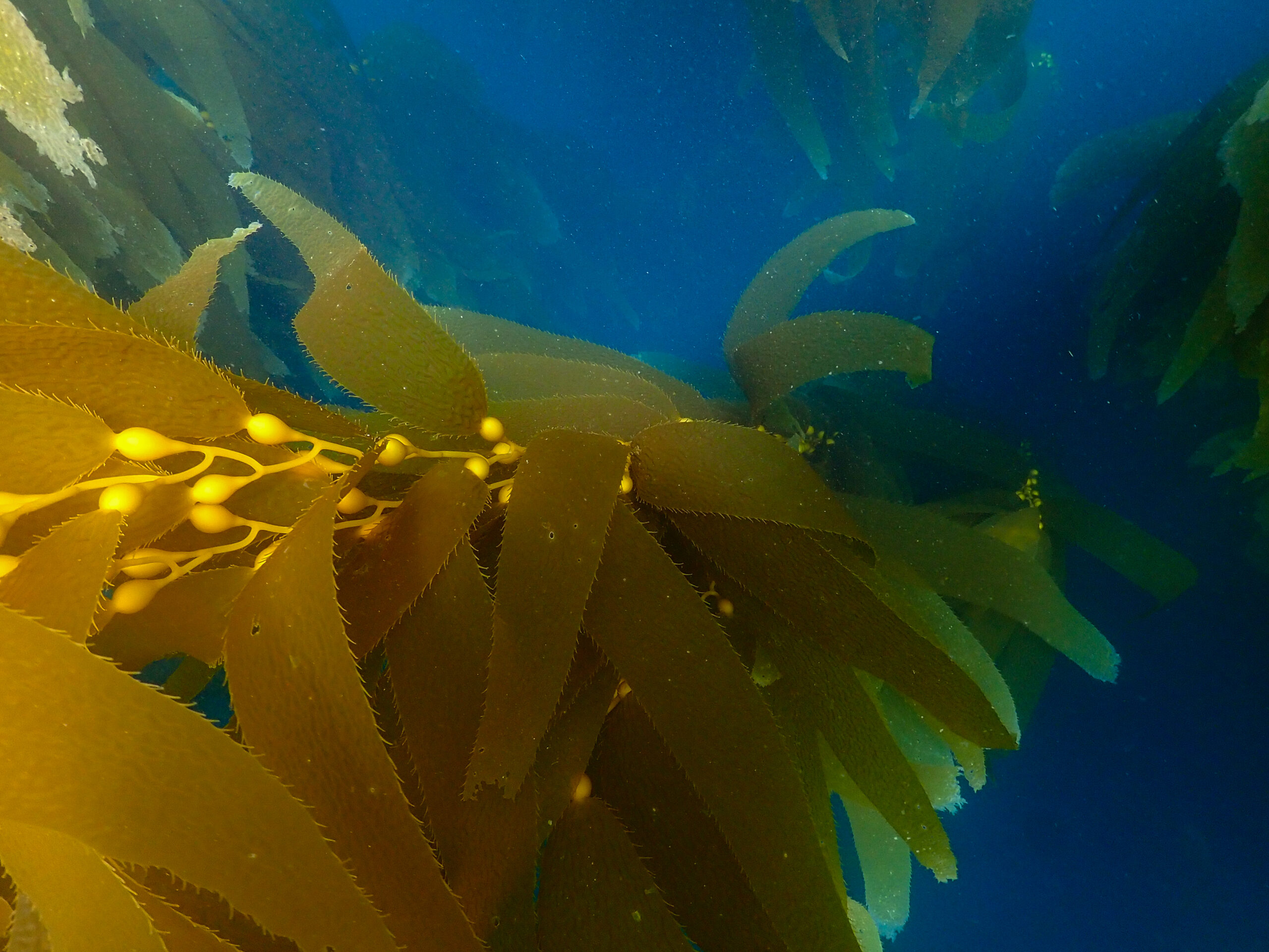
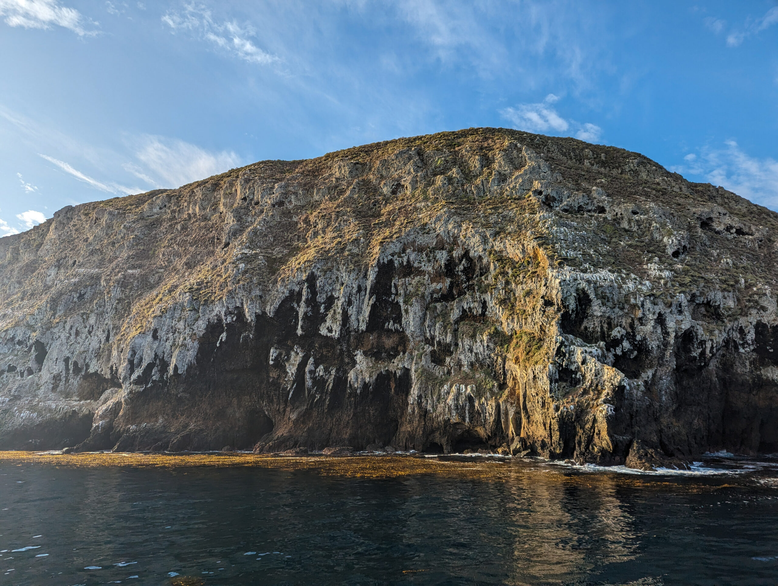
Over the weekend Dave and I go out to Anacapa. It’s a foggy day and a 12-mile journey on Island Packers out to the closest of the Channel Islands, through the Santa Barbara channel and past the oil rigs. Finally, the small volcanic island of Anacapa comes into view, tall cliffs lined with brown pelicans looking down on us. The boat pulls into the landing cove, full of Macrocystis pyrifera (Giant Kelp). I love comparing the different ocean colors of my internship, the bright sky blue of the Caribbean, the deep royal blue of Hawaii, and now the emerald green of Southern California.

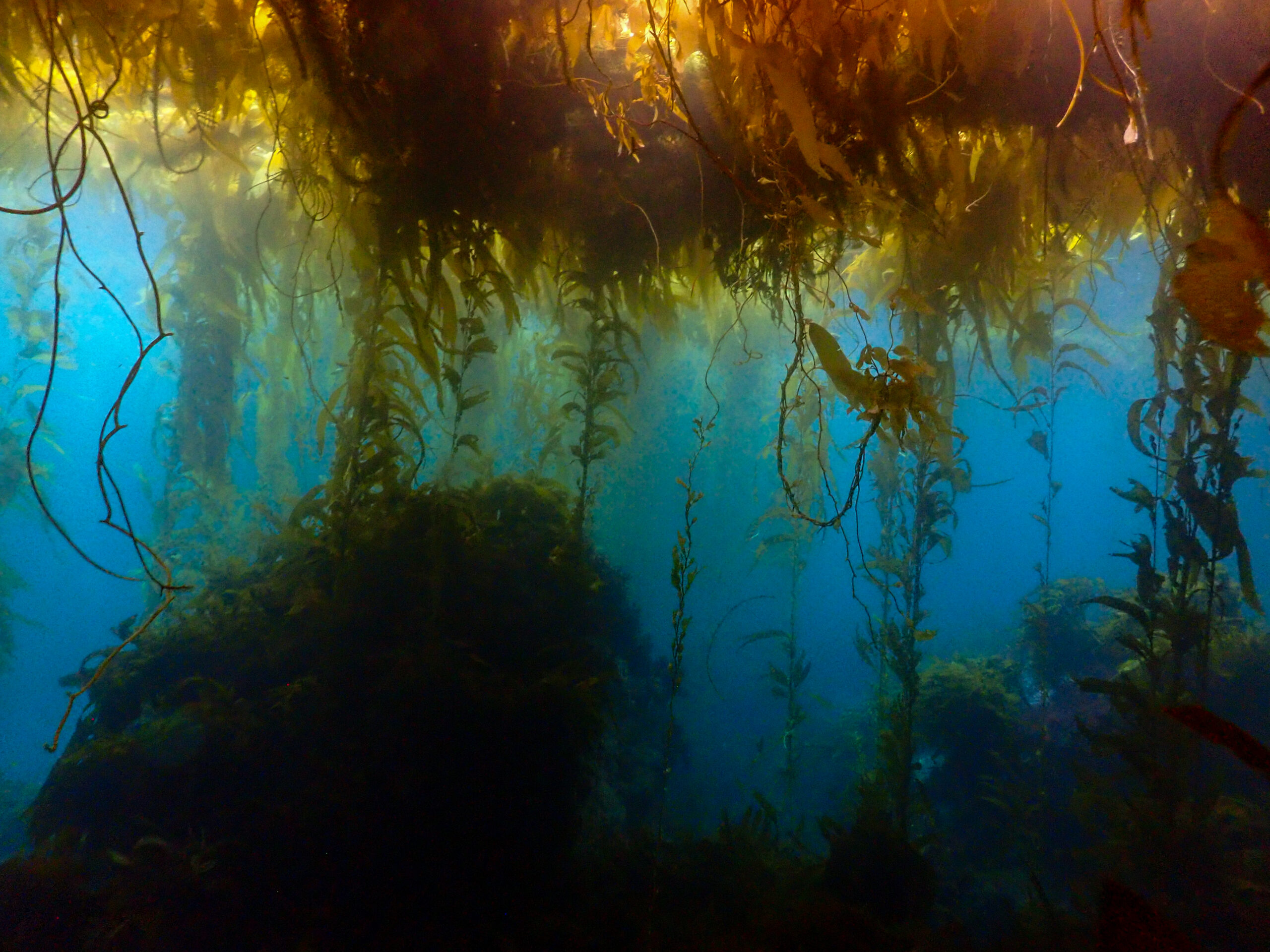
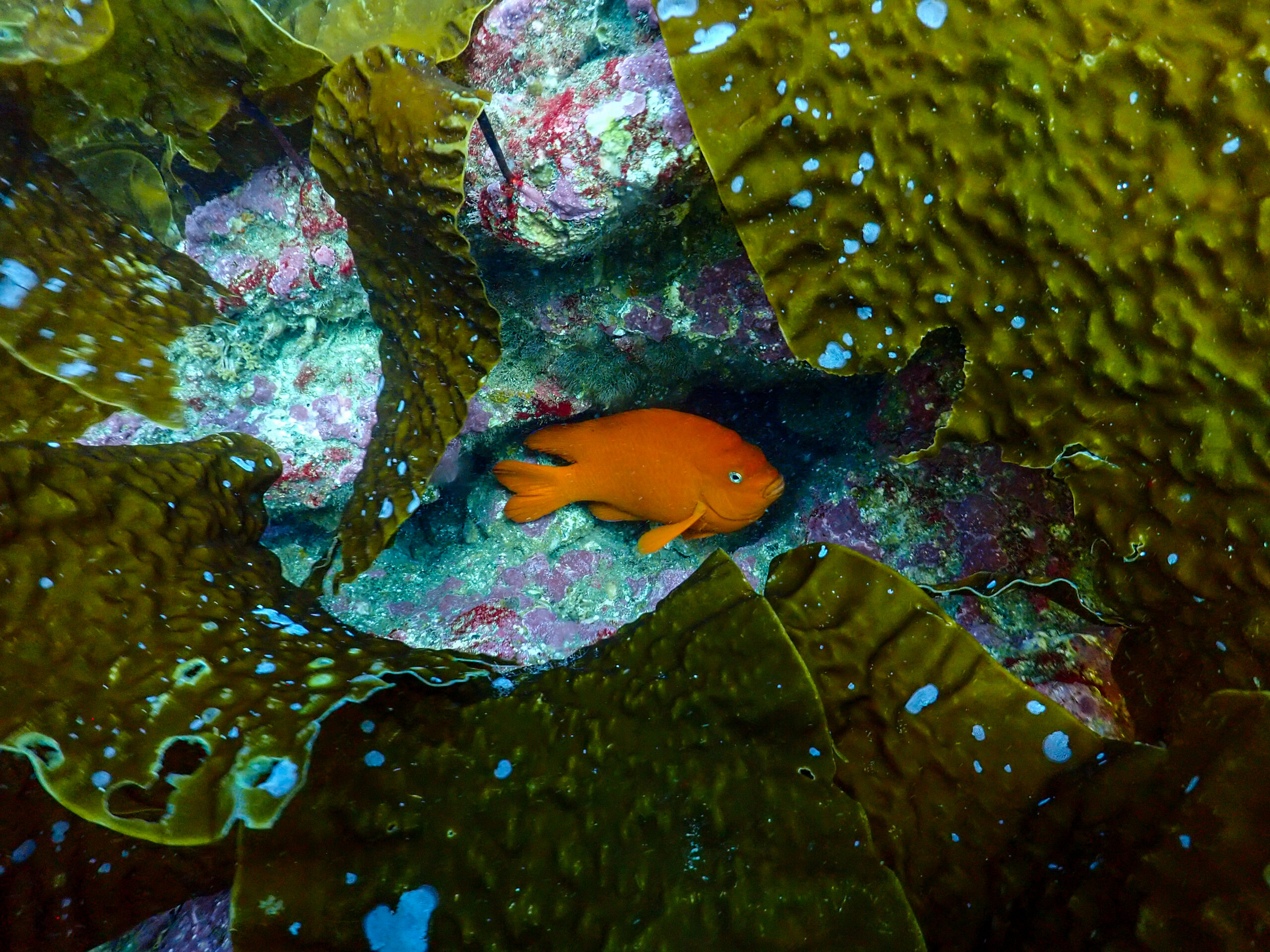
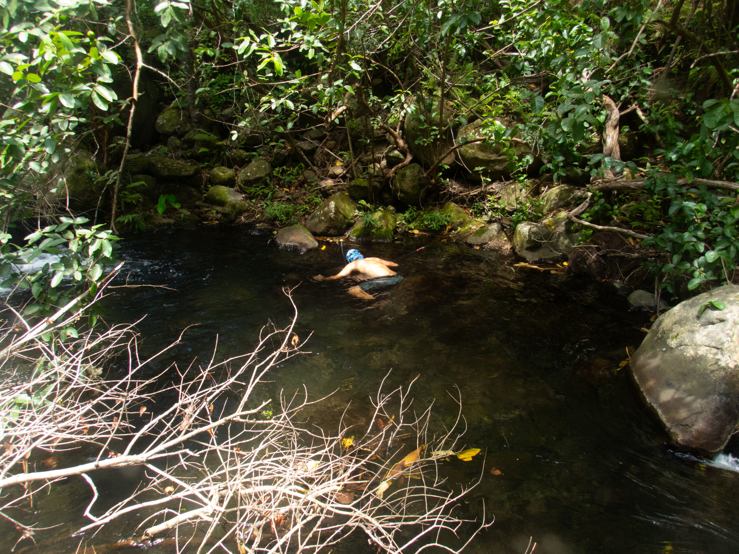
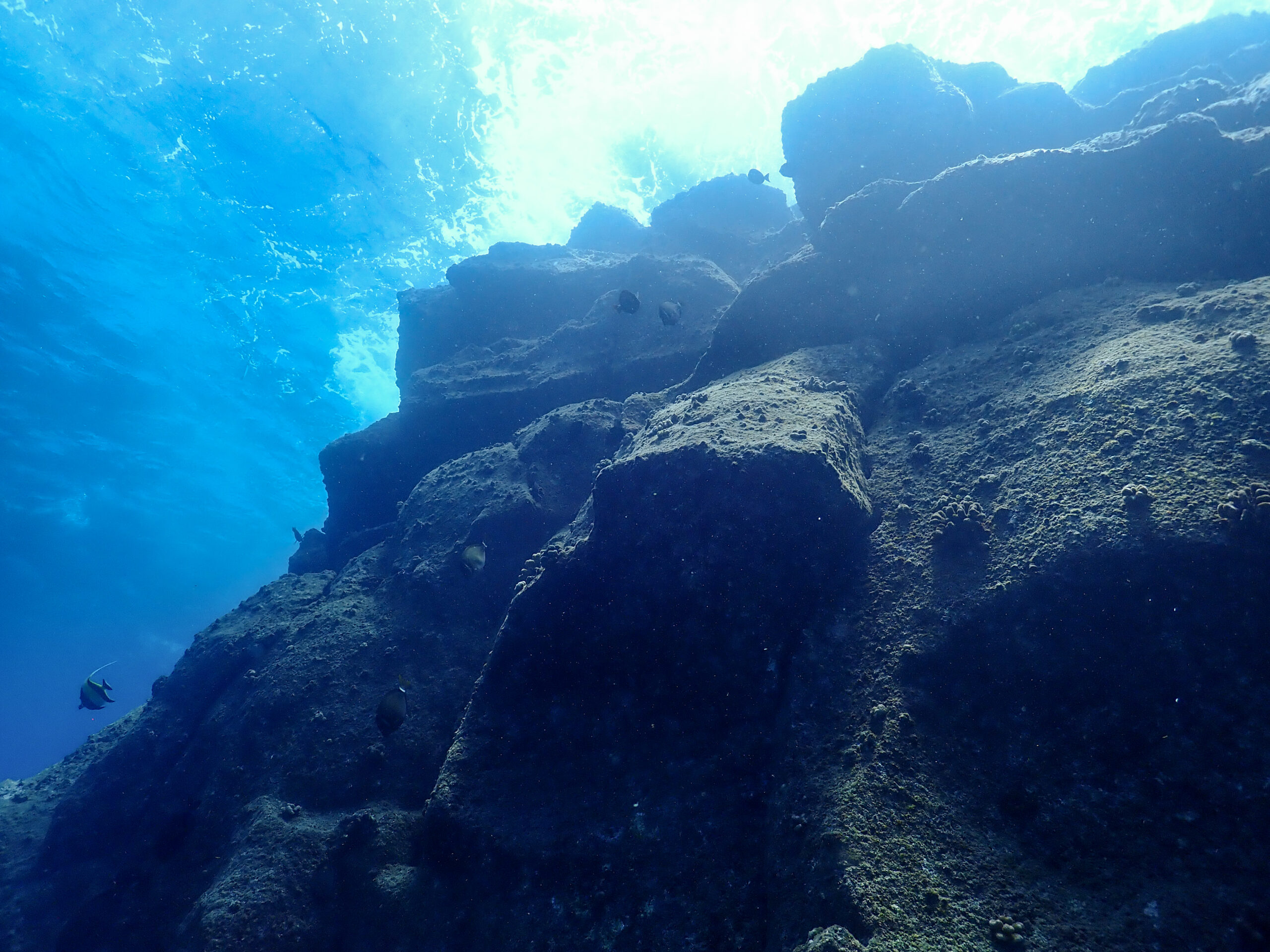
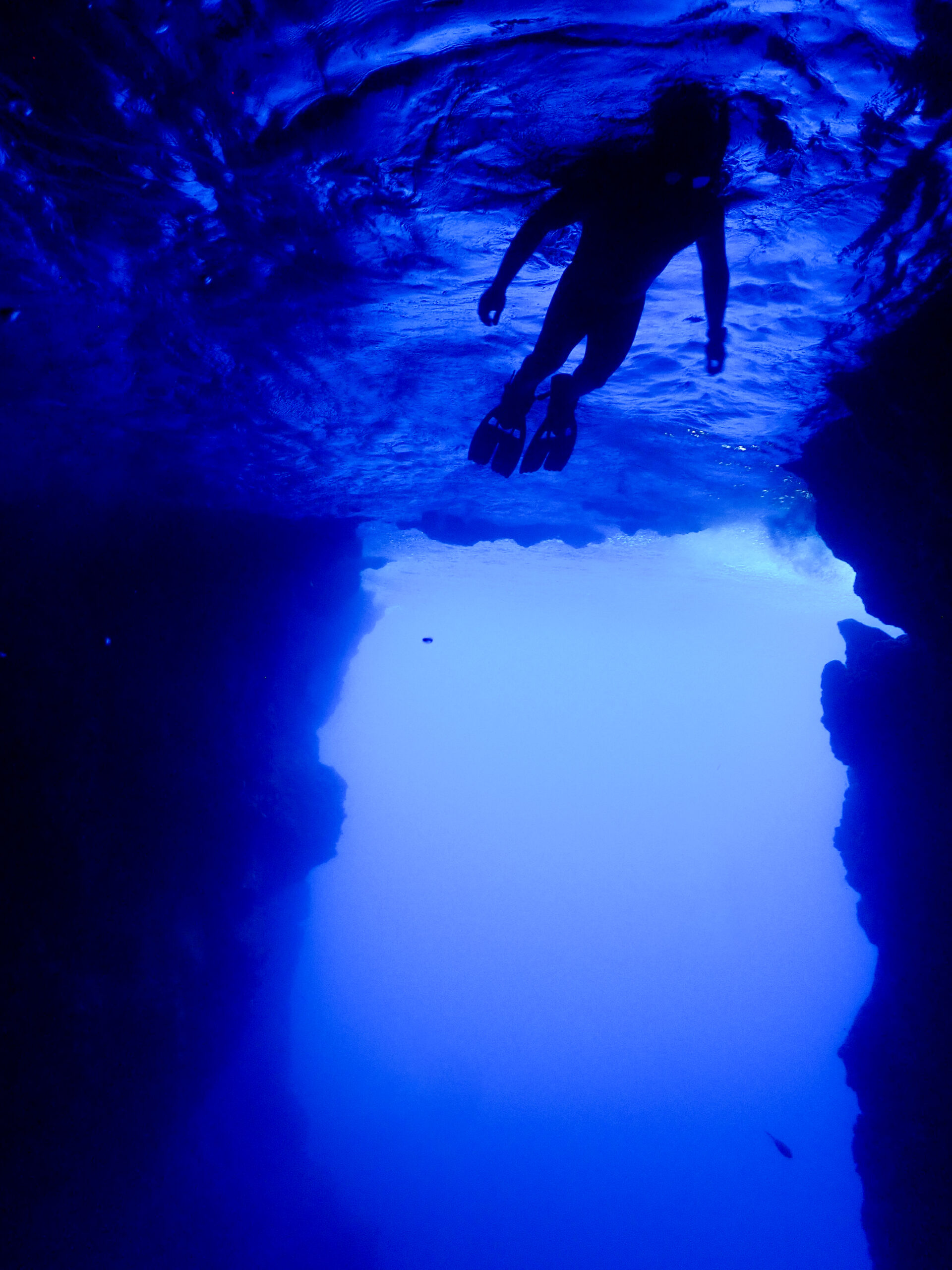
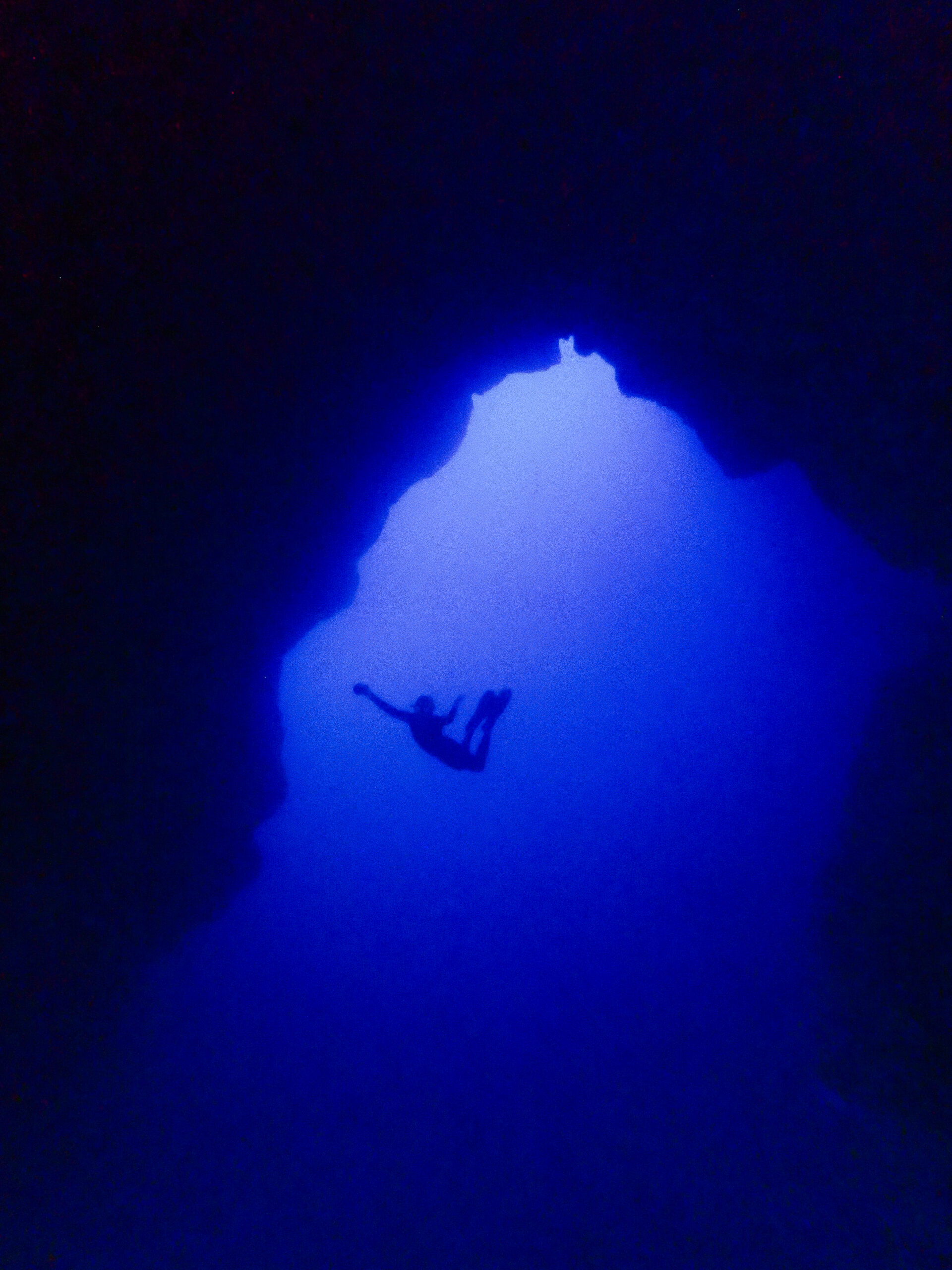
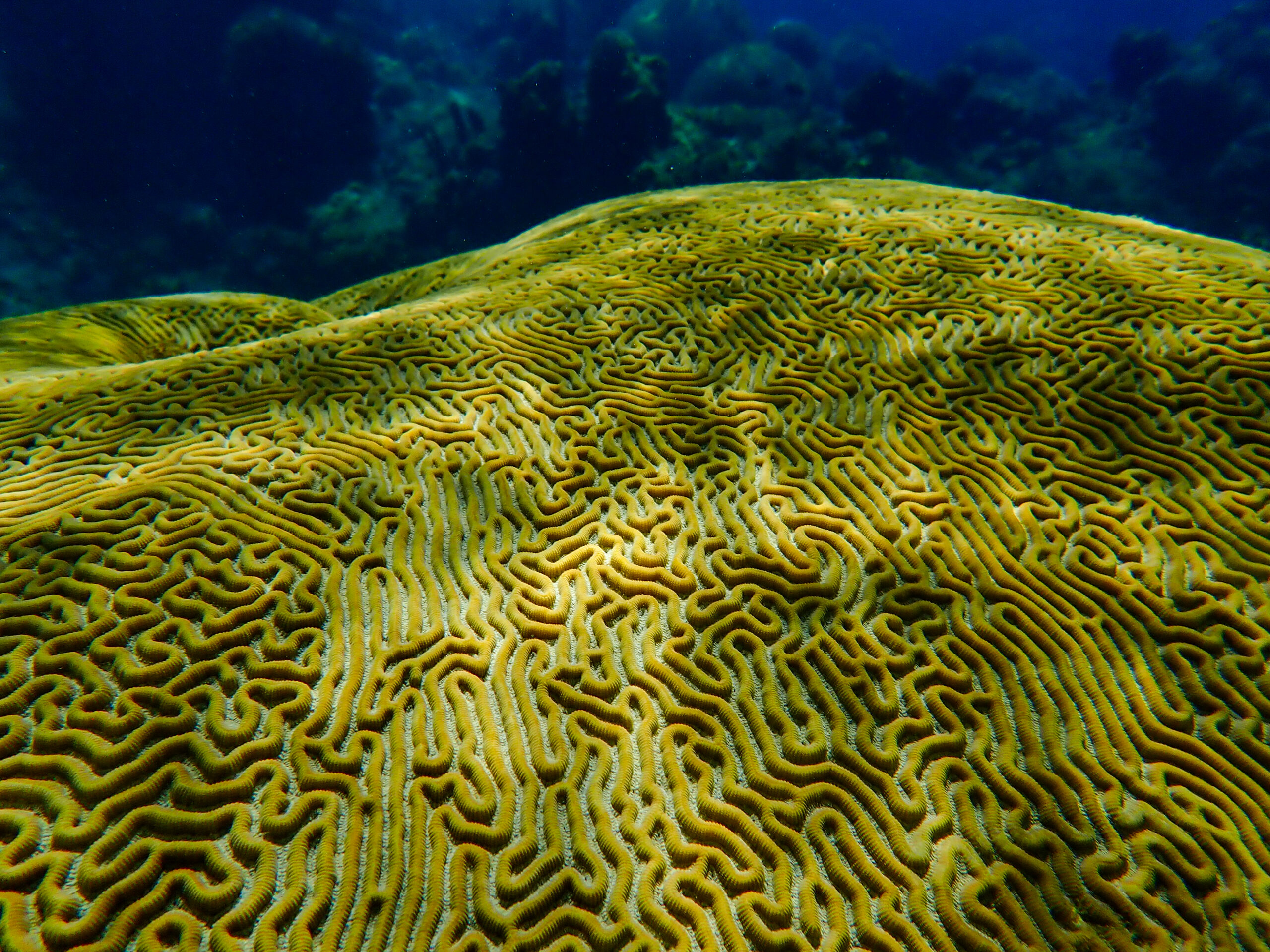
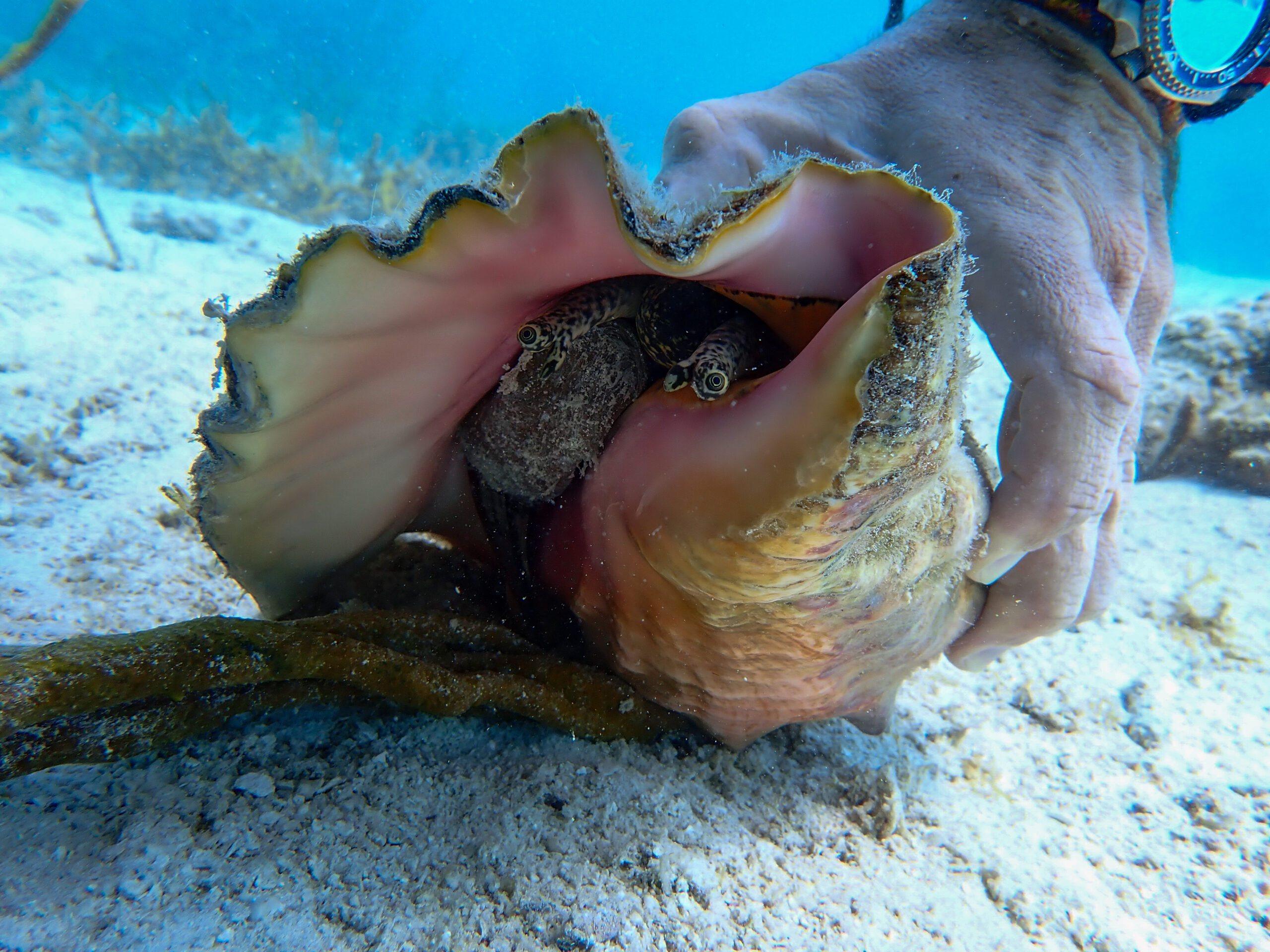
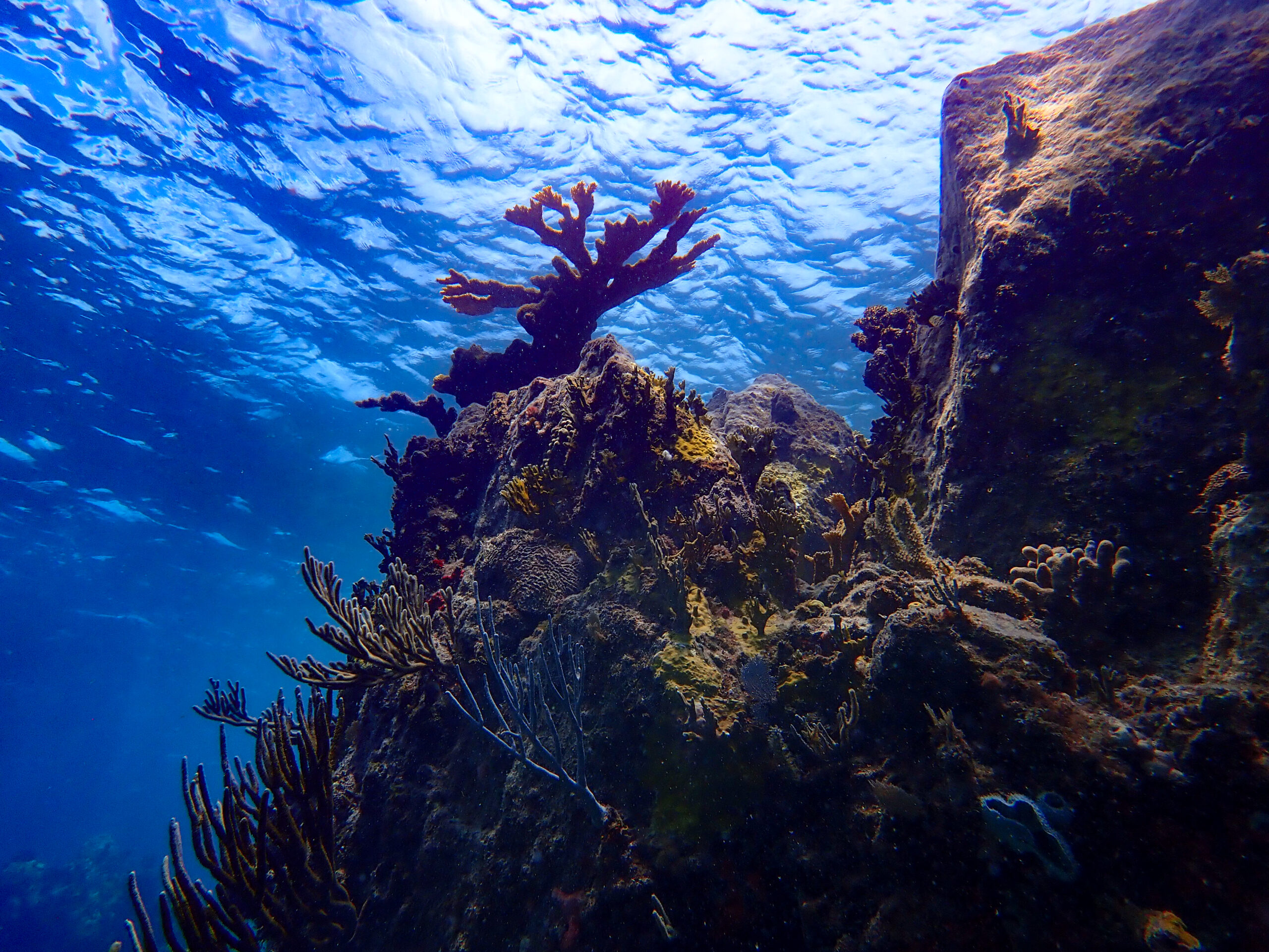
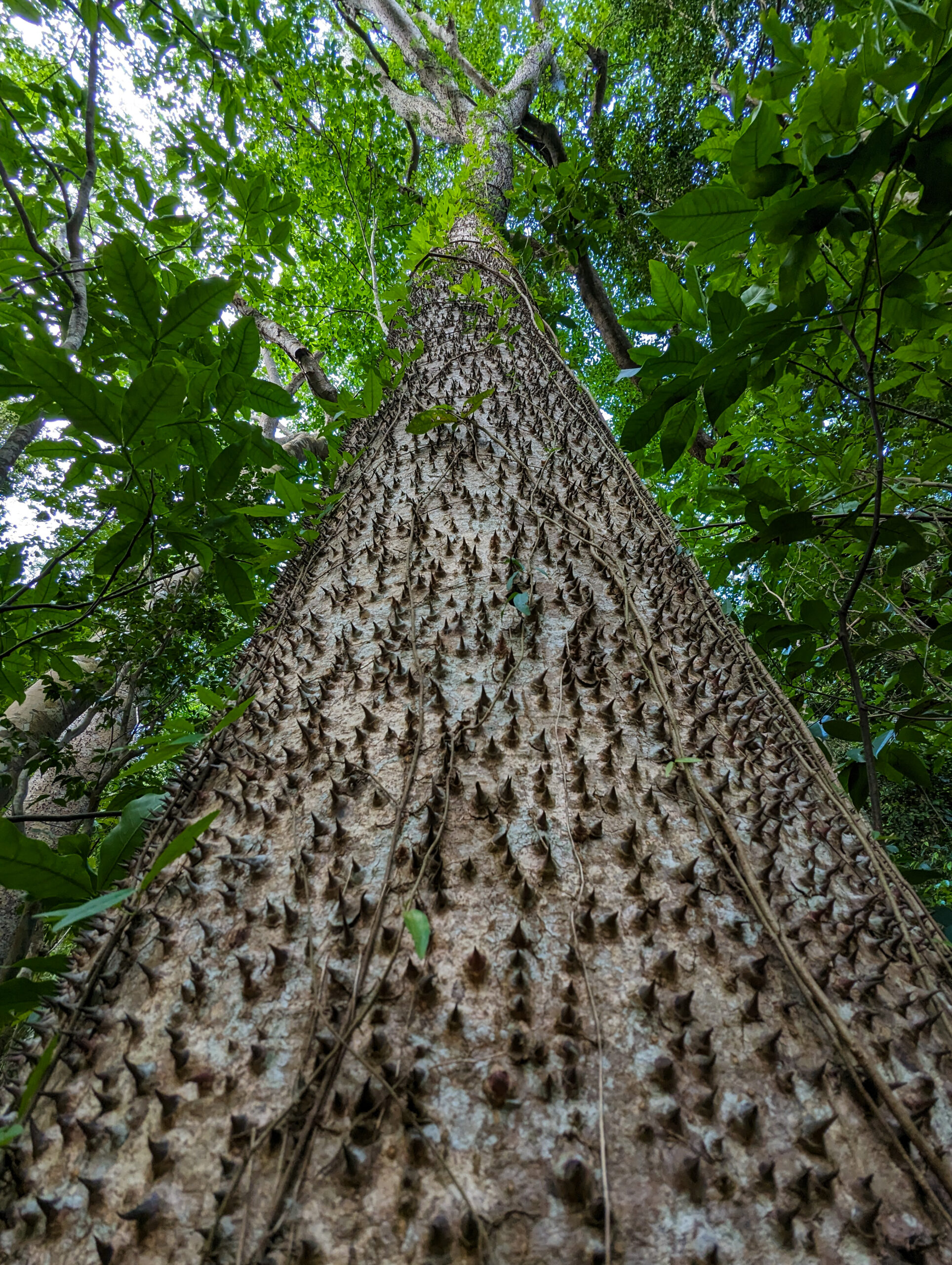
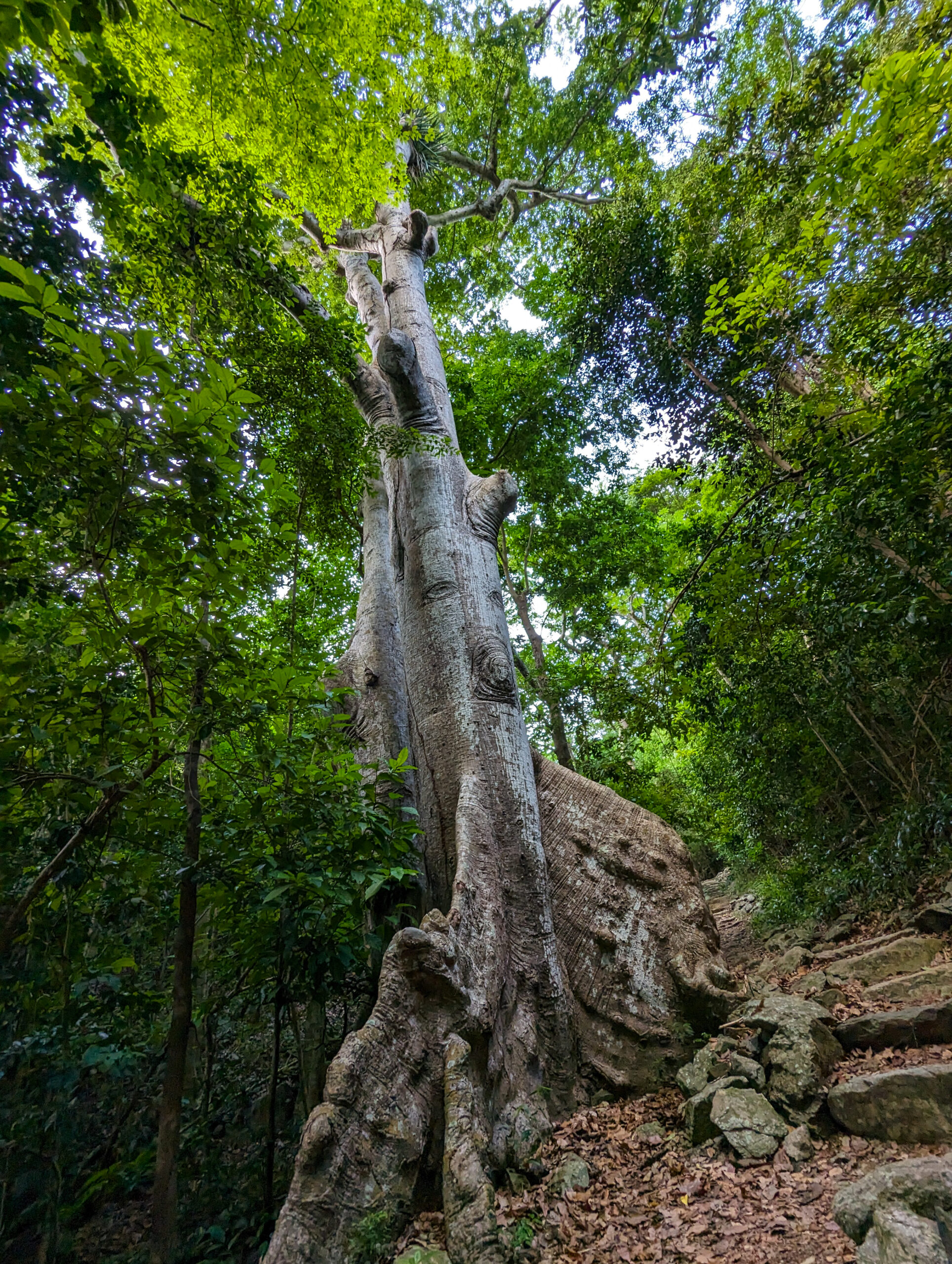
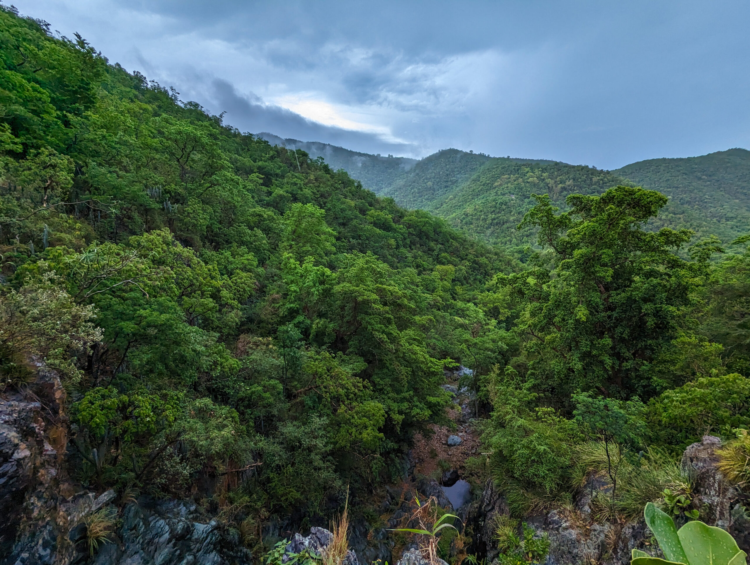
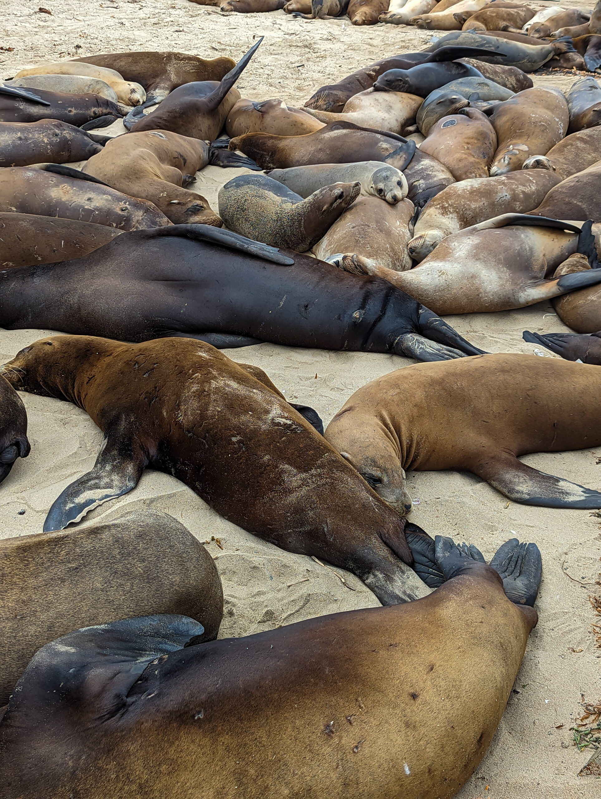
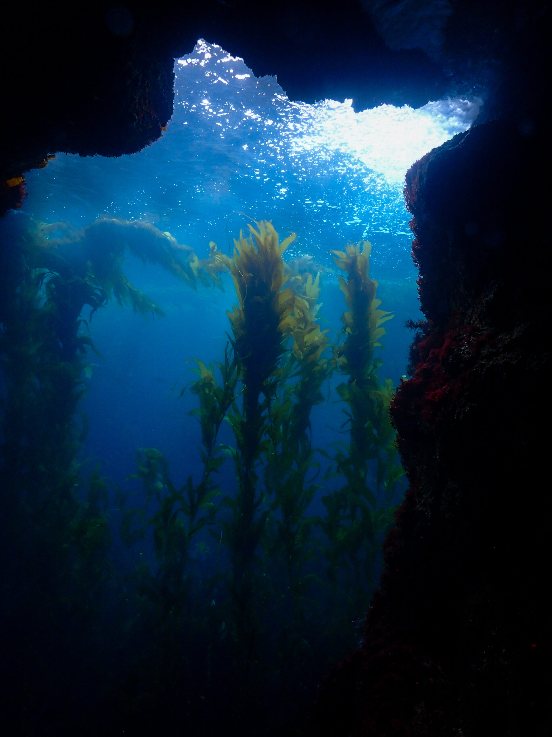
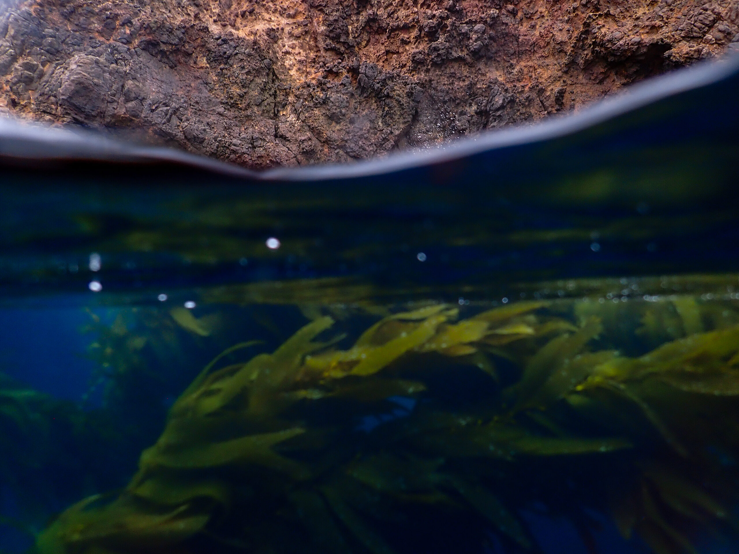
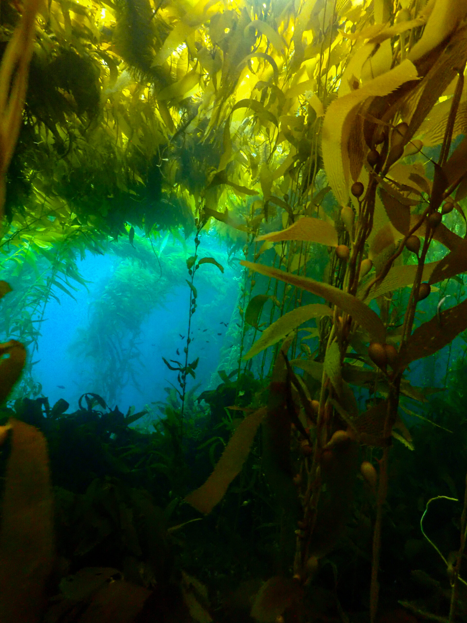
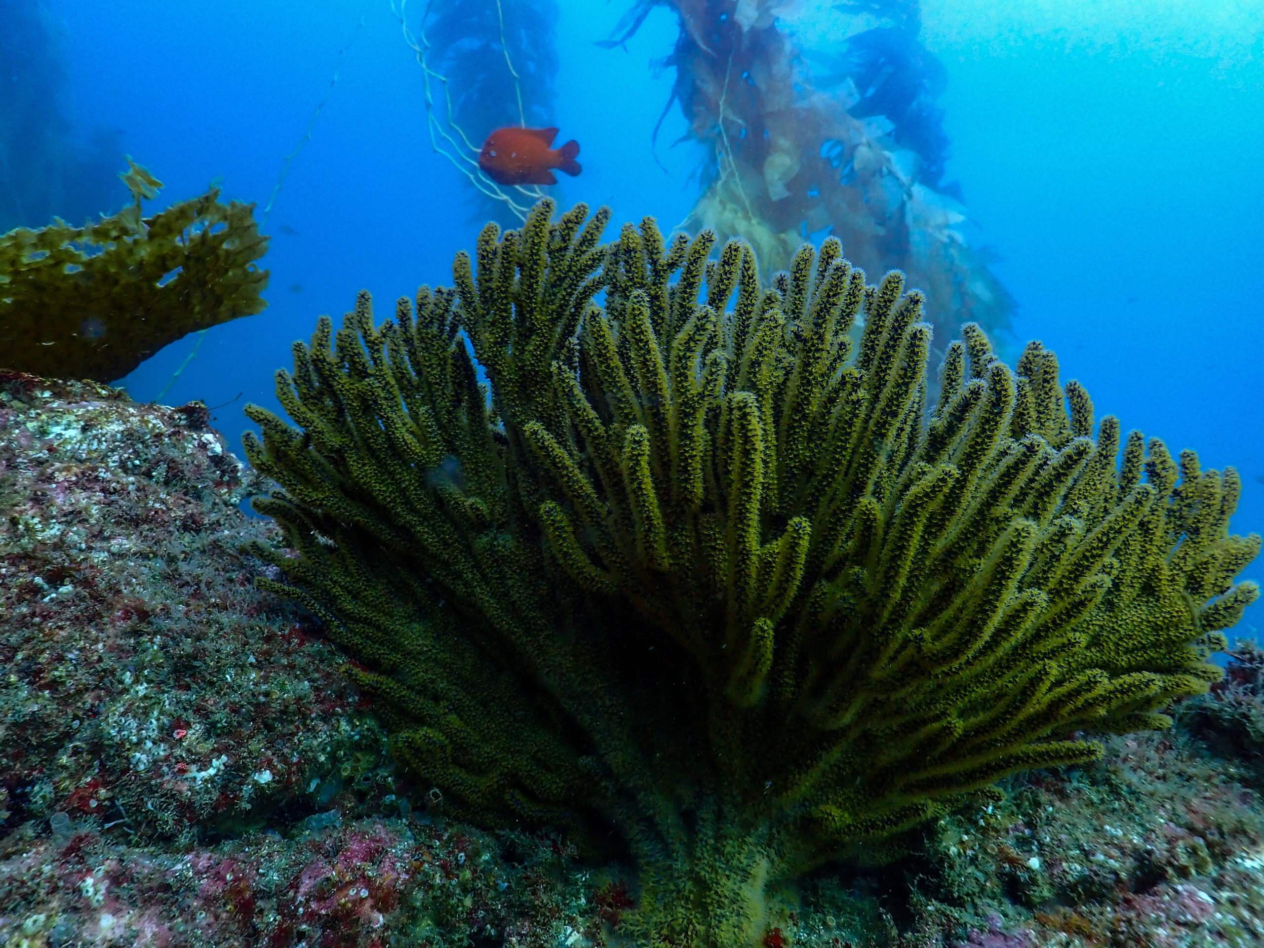
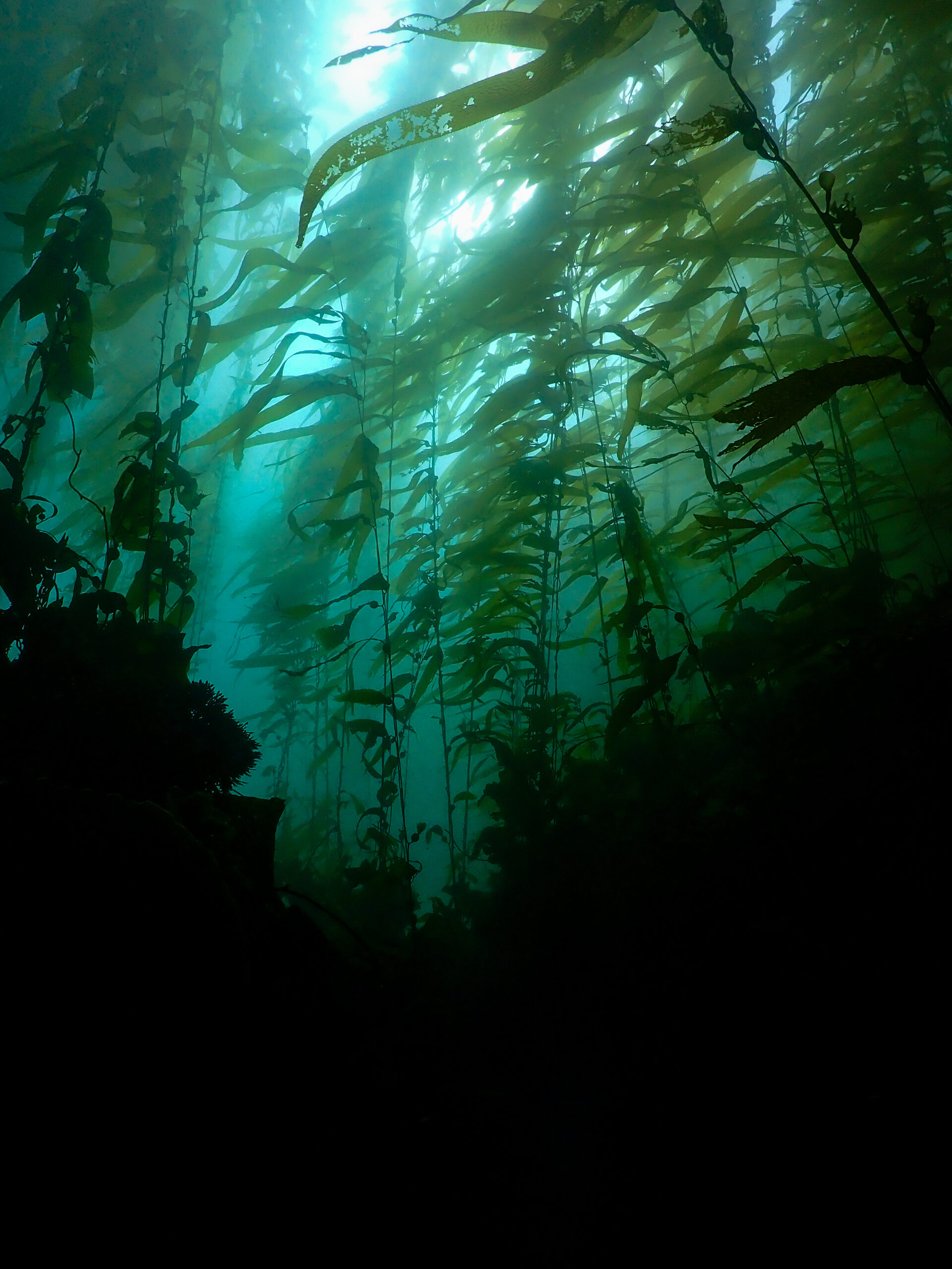
The fog horn blares continuously as I wander the small island, watching the sea lions body surf far below. Dave told me to bring my snorkel gear, so I hop in the water at the landing cove as soon as I finish my hike and am immediately mesmerized by the undersea jungle. A thick canopy of kelp blots out most of the sunlight, only letting streaming light beams down through the crystal-clear water. Little fish hide within the vertical foliage, the rocky bottom is made up of dark brown Laminarian macroalgae, bright green surfgrass, and red algae. I see my first bright orange Garibaldi. The water temperature isn’t as bad as I thought it would be. I could stay in here for hours but the boat is coming back to pick us up. One last treat on our journey back. Right off of Anacapa, we come across a massive school of bluefin tuna feeding. I’ve never seen anything like it, streamlined torpedoes breaking the surface almost too quickly to see. The charter boat captain says in their 40 years of coming out here they’ve never seen this before. Maybe it has something to do with this year’s El Niño bringing in warm water.

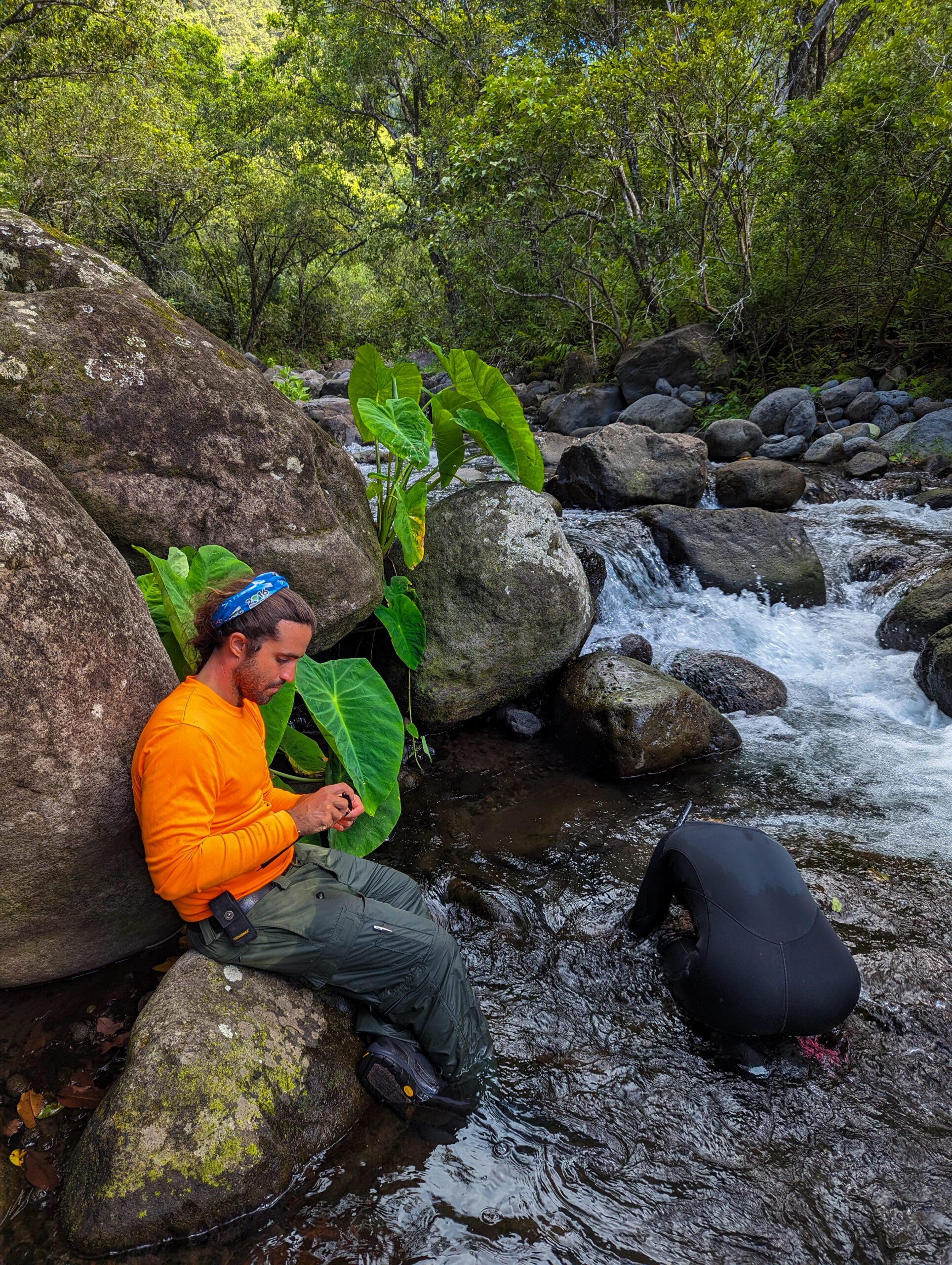
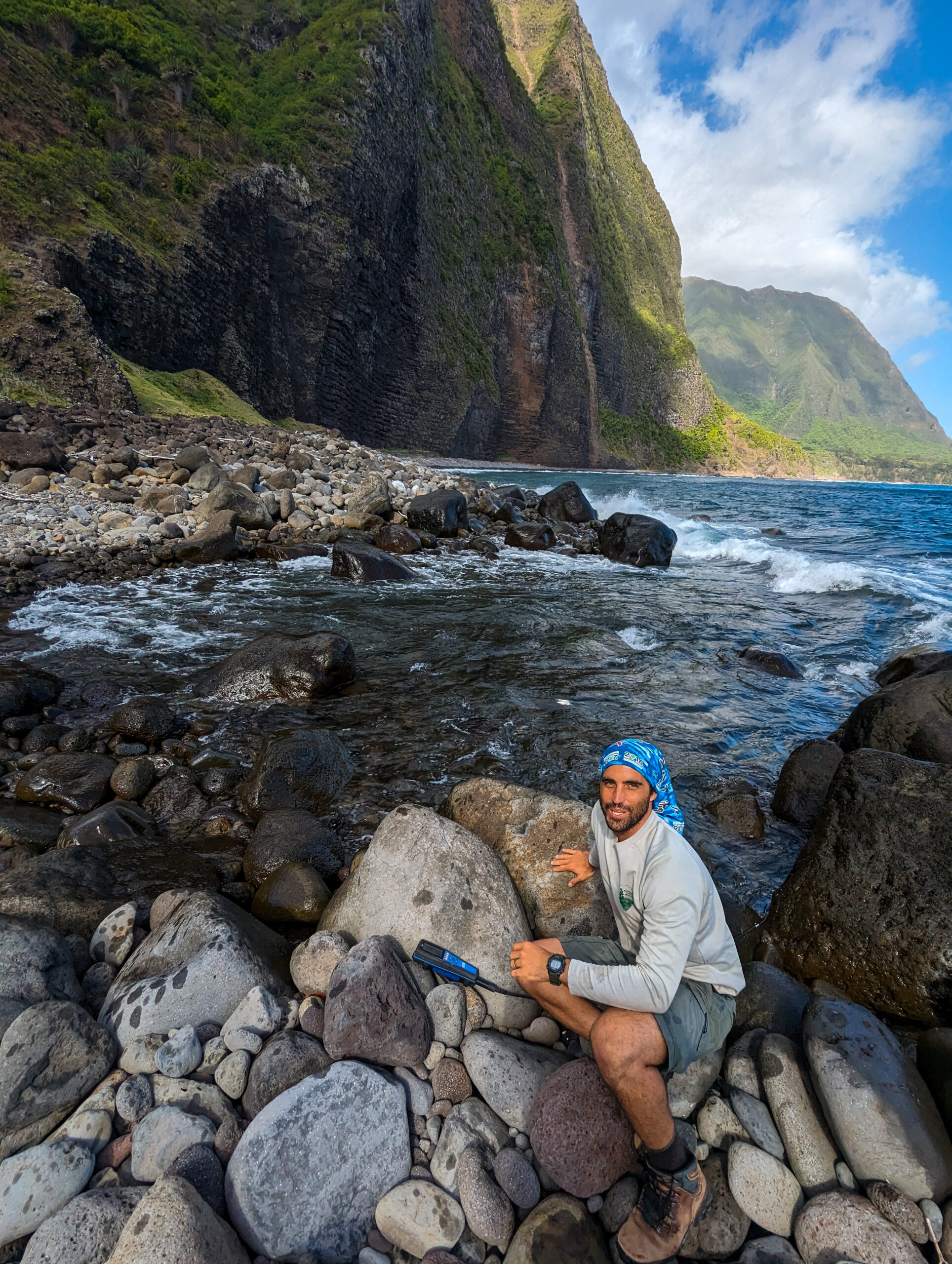
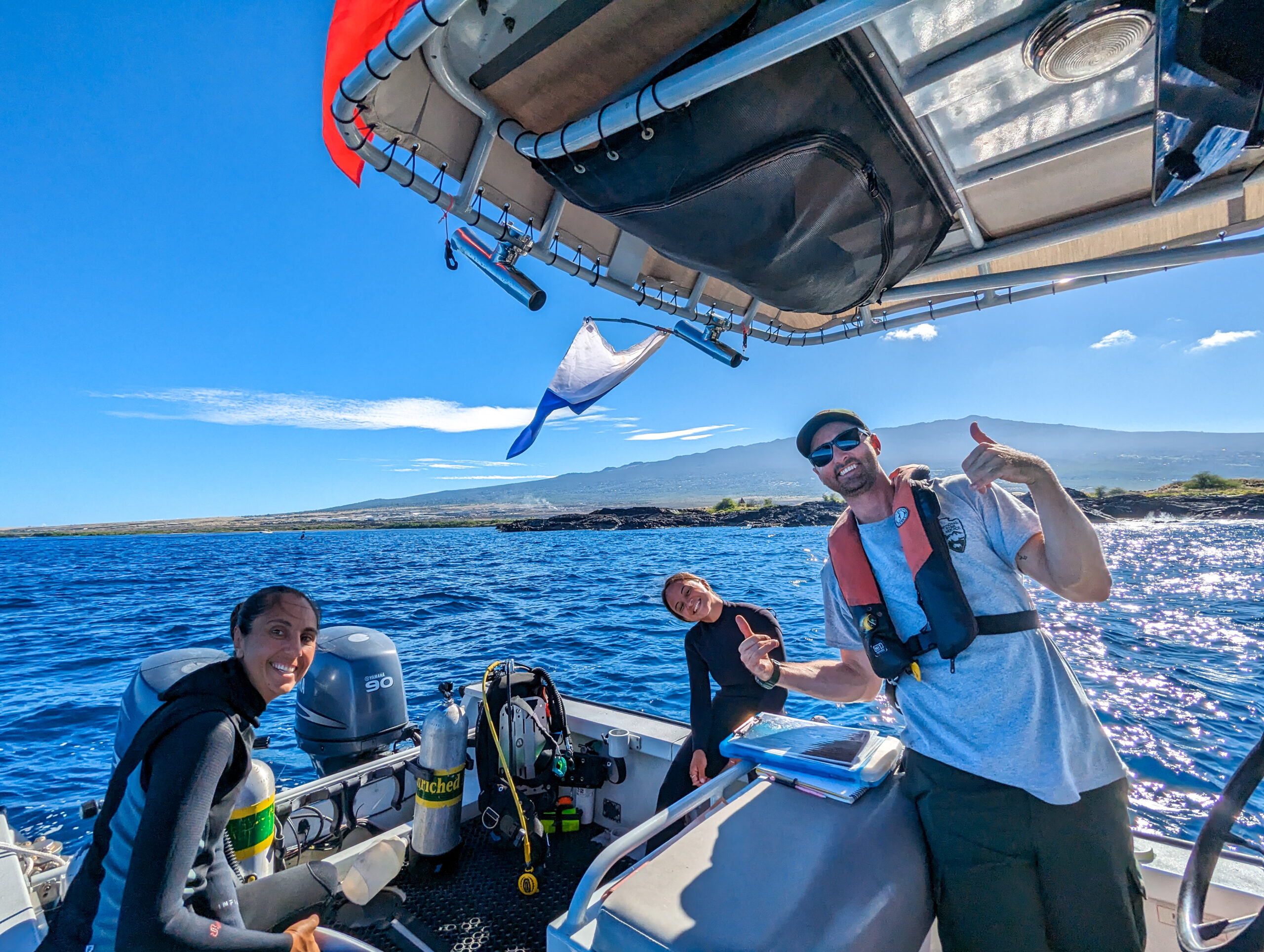
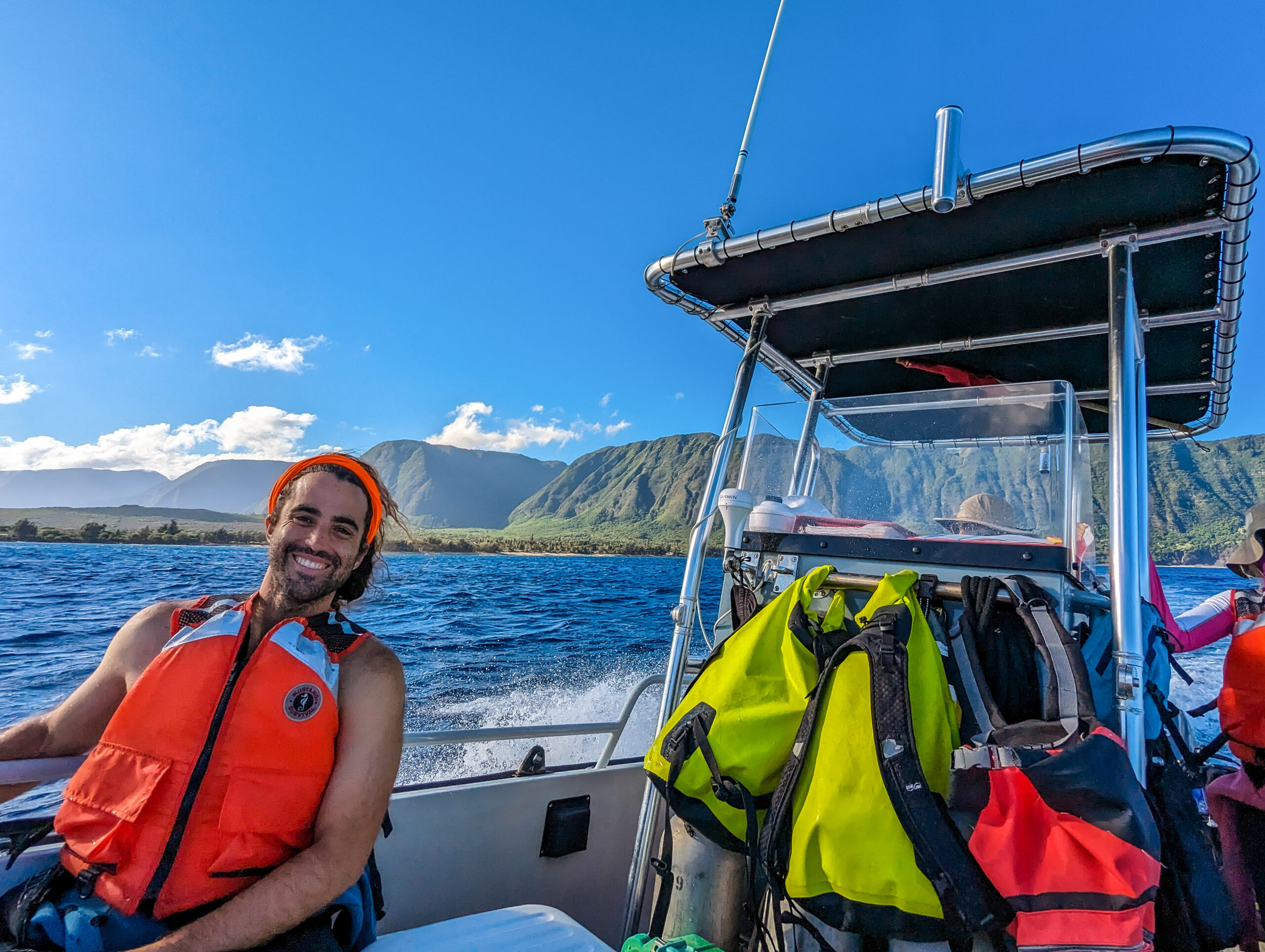
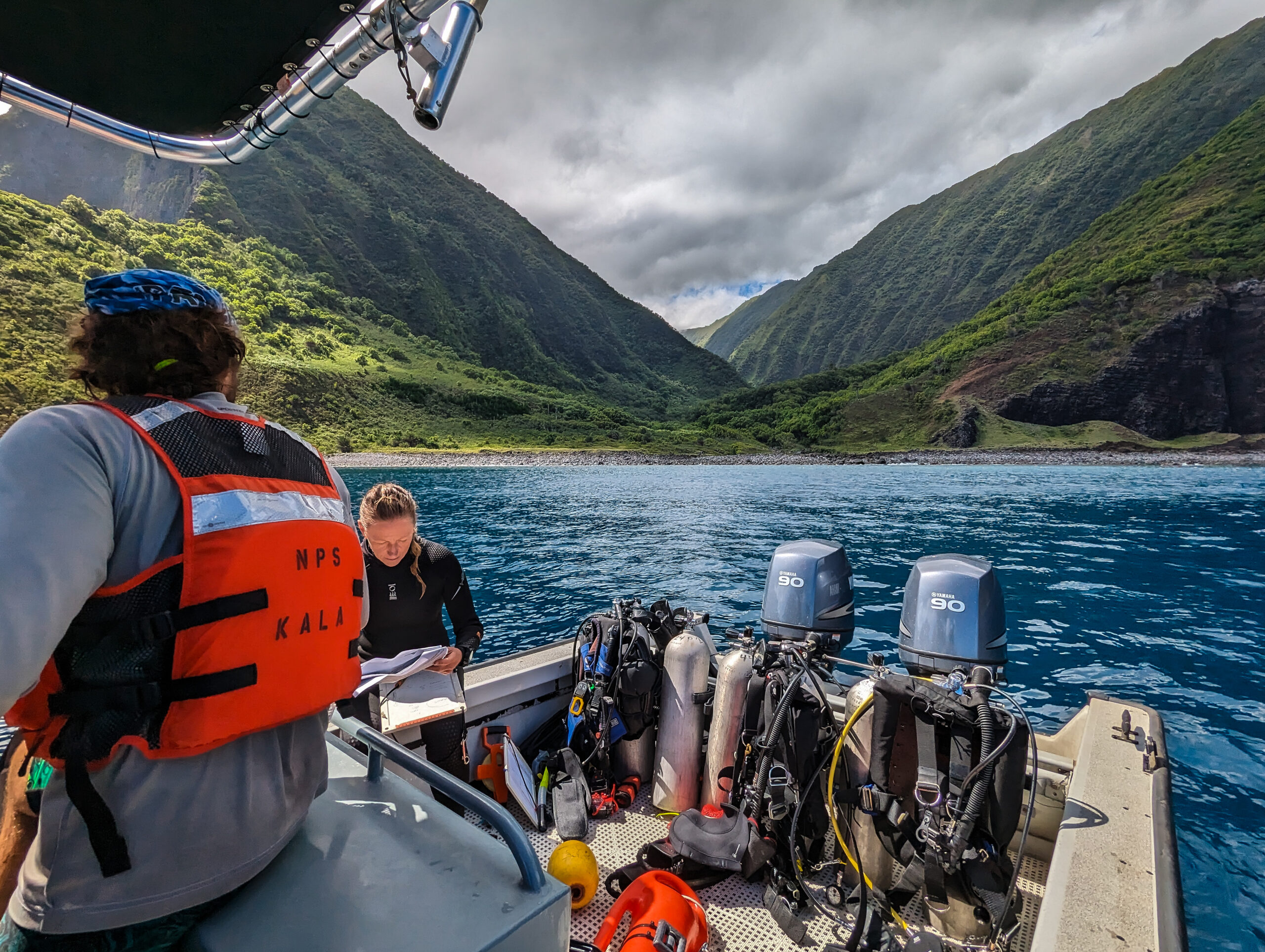
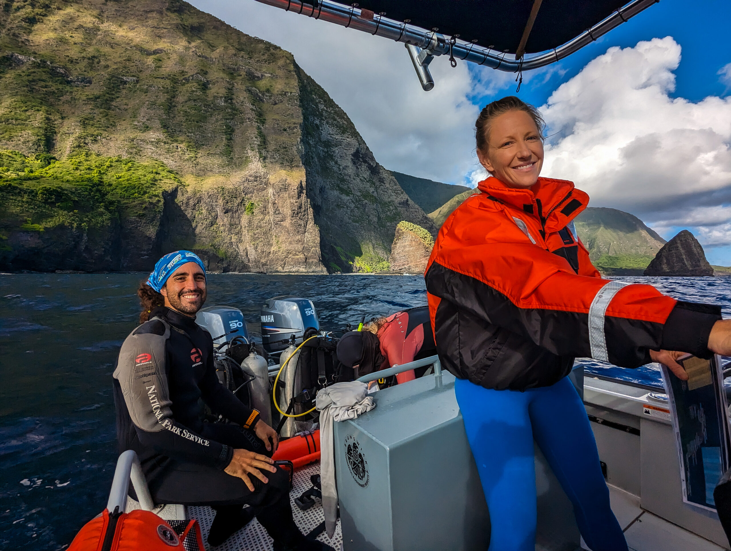
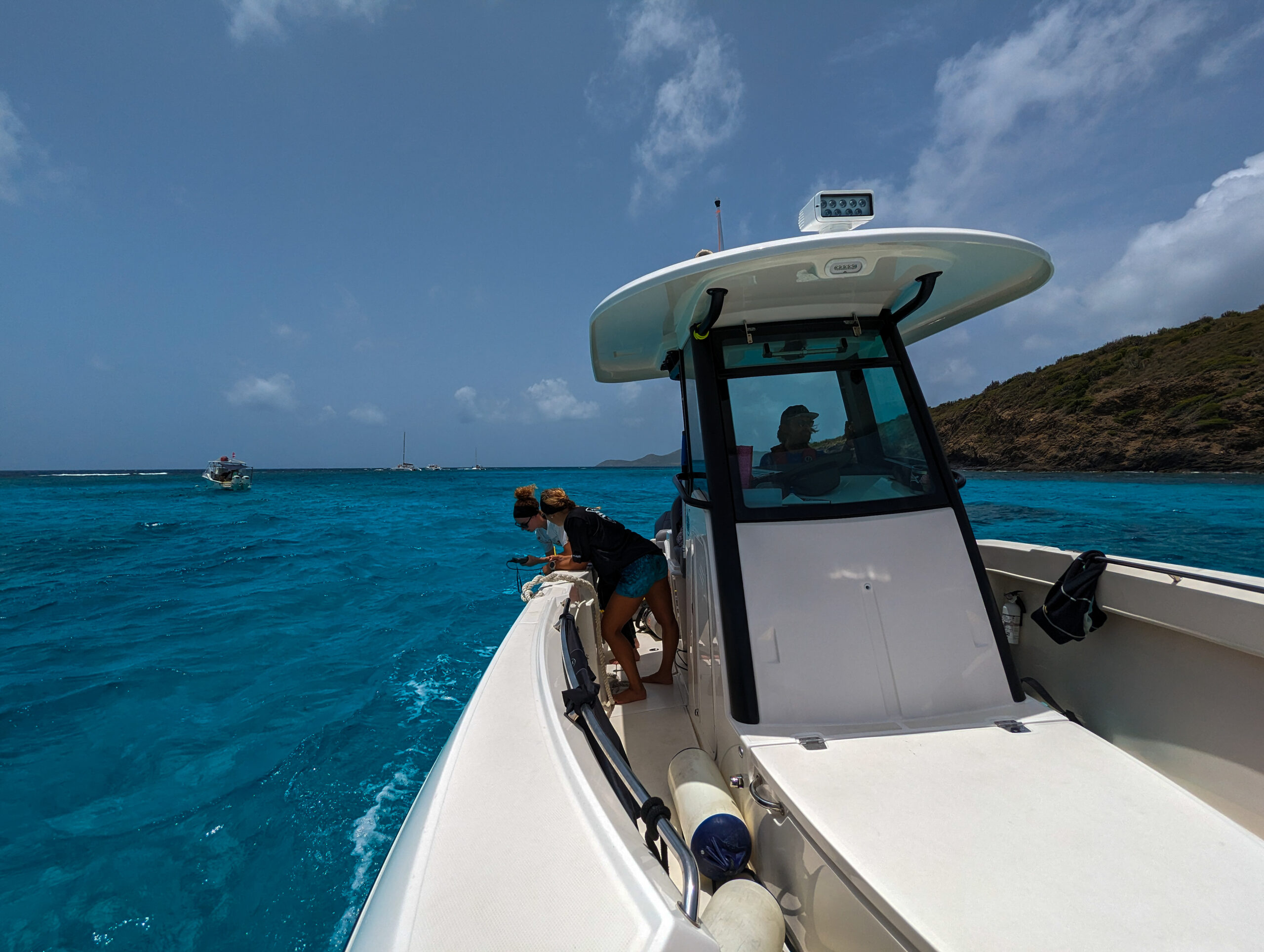
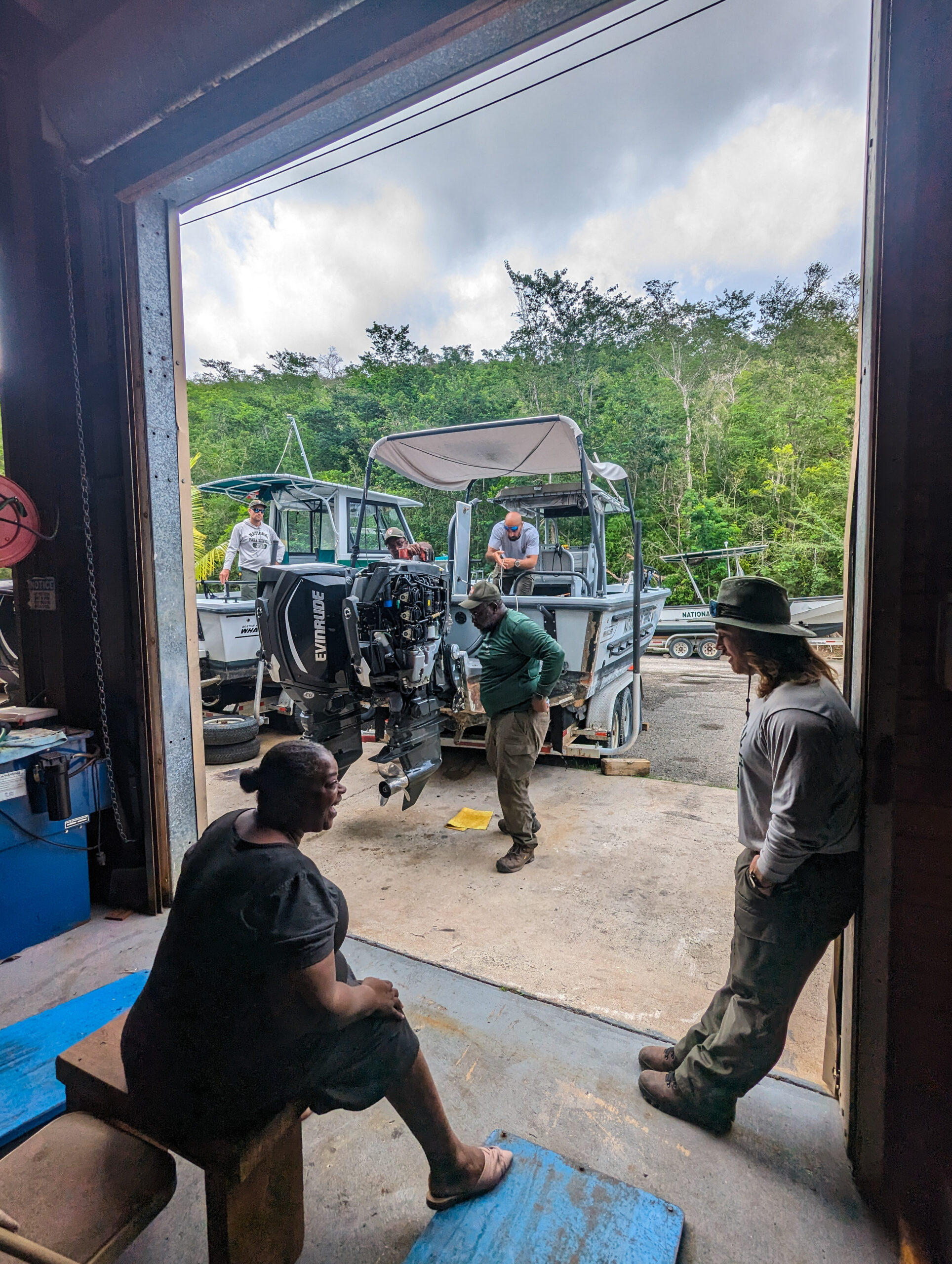
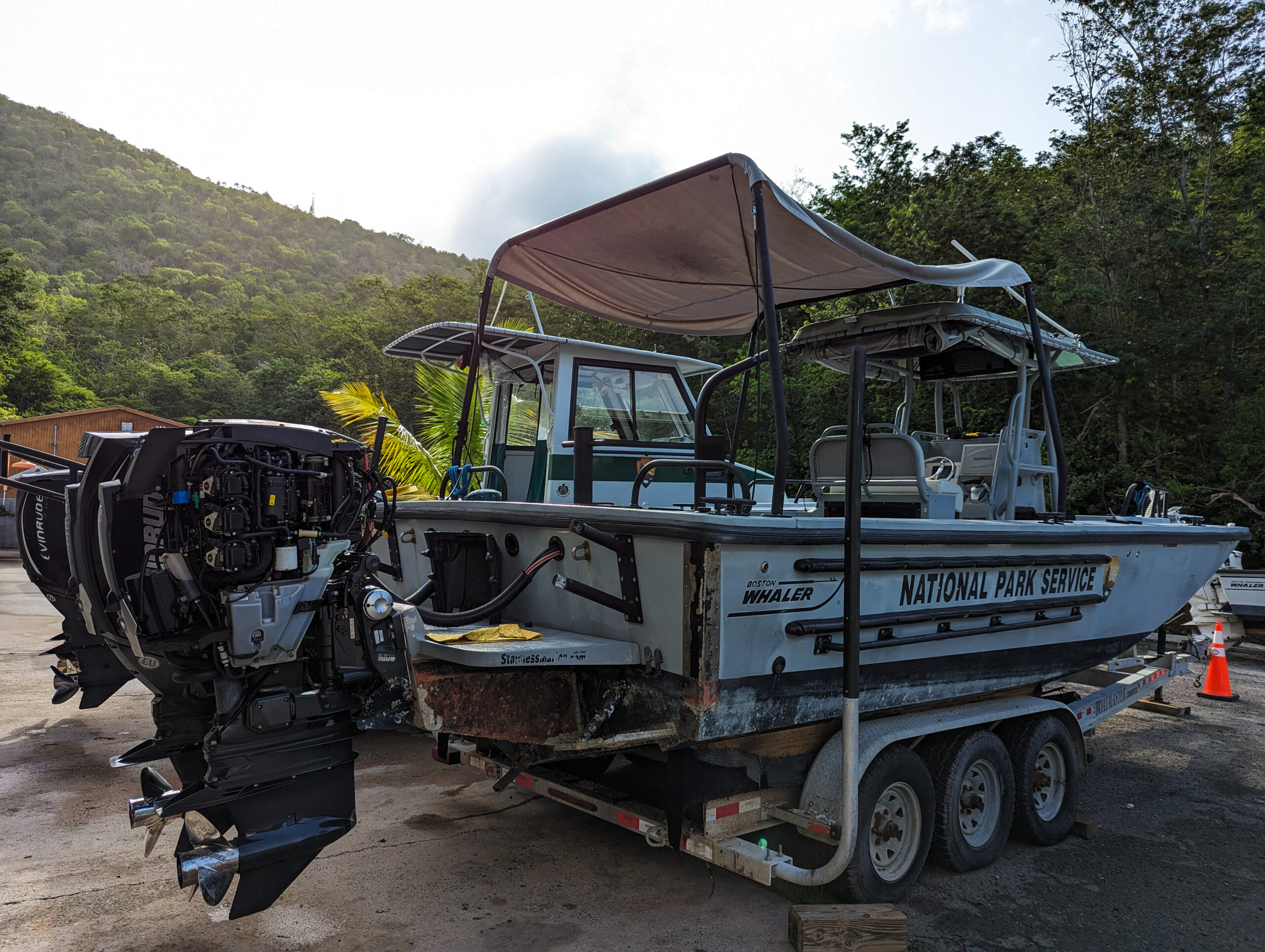
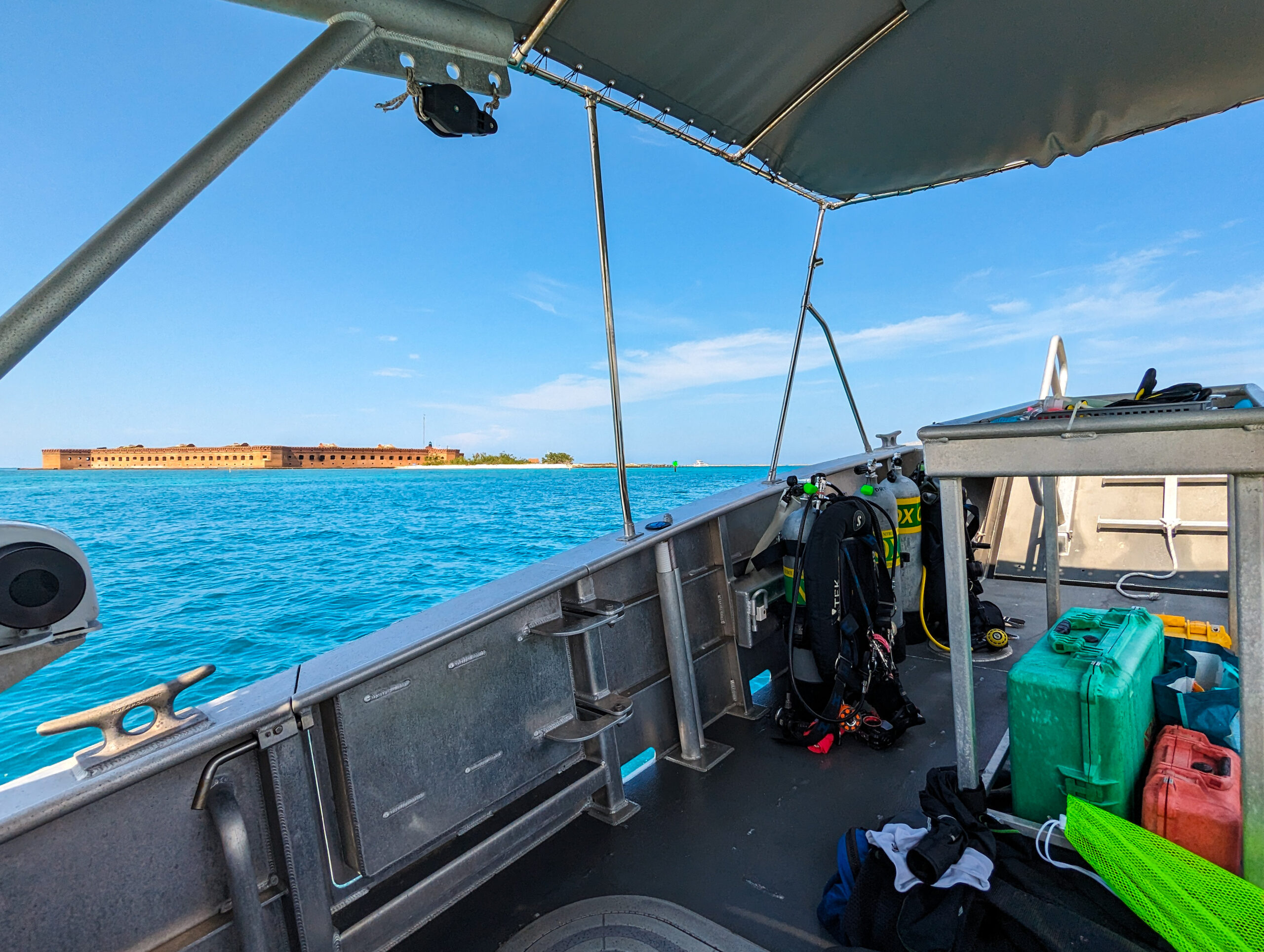
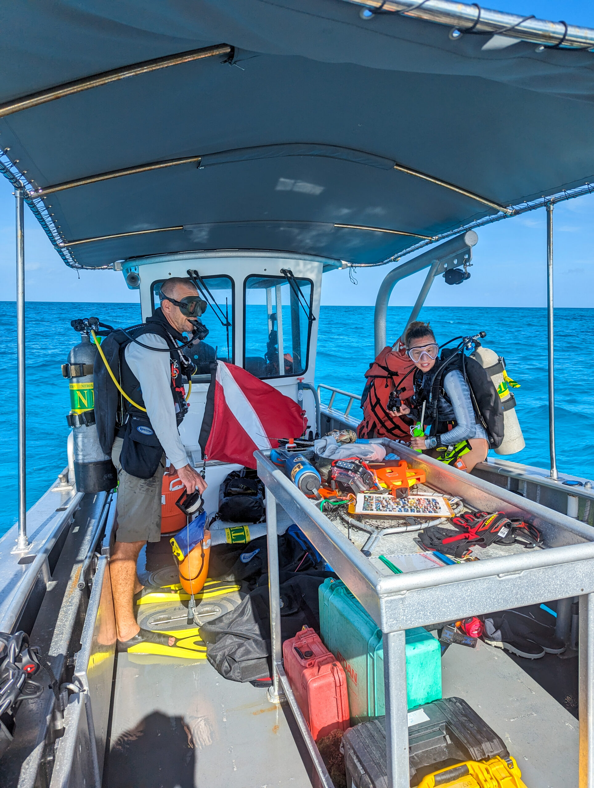
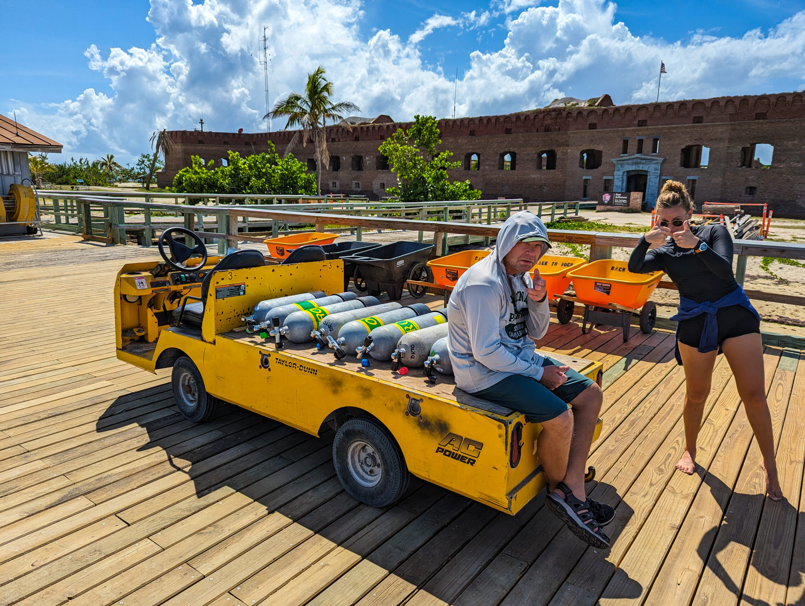
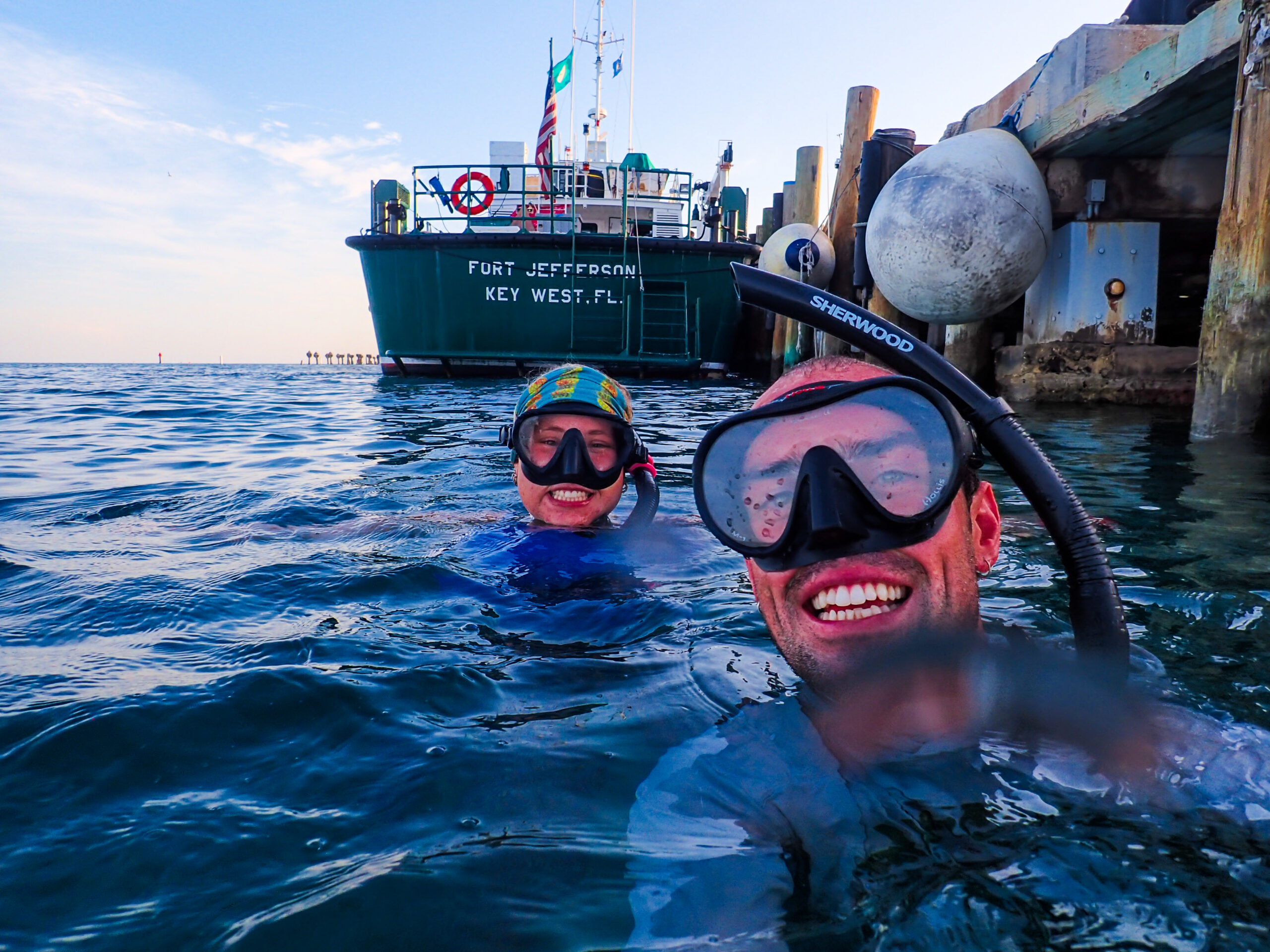
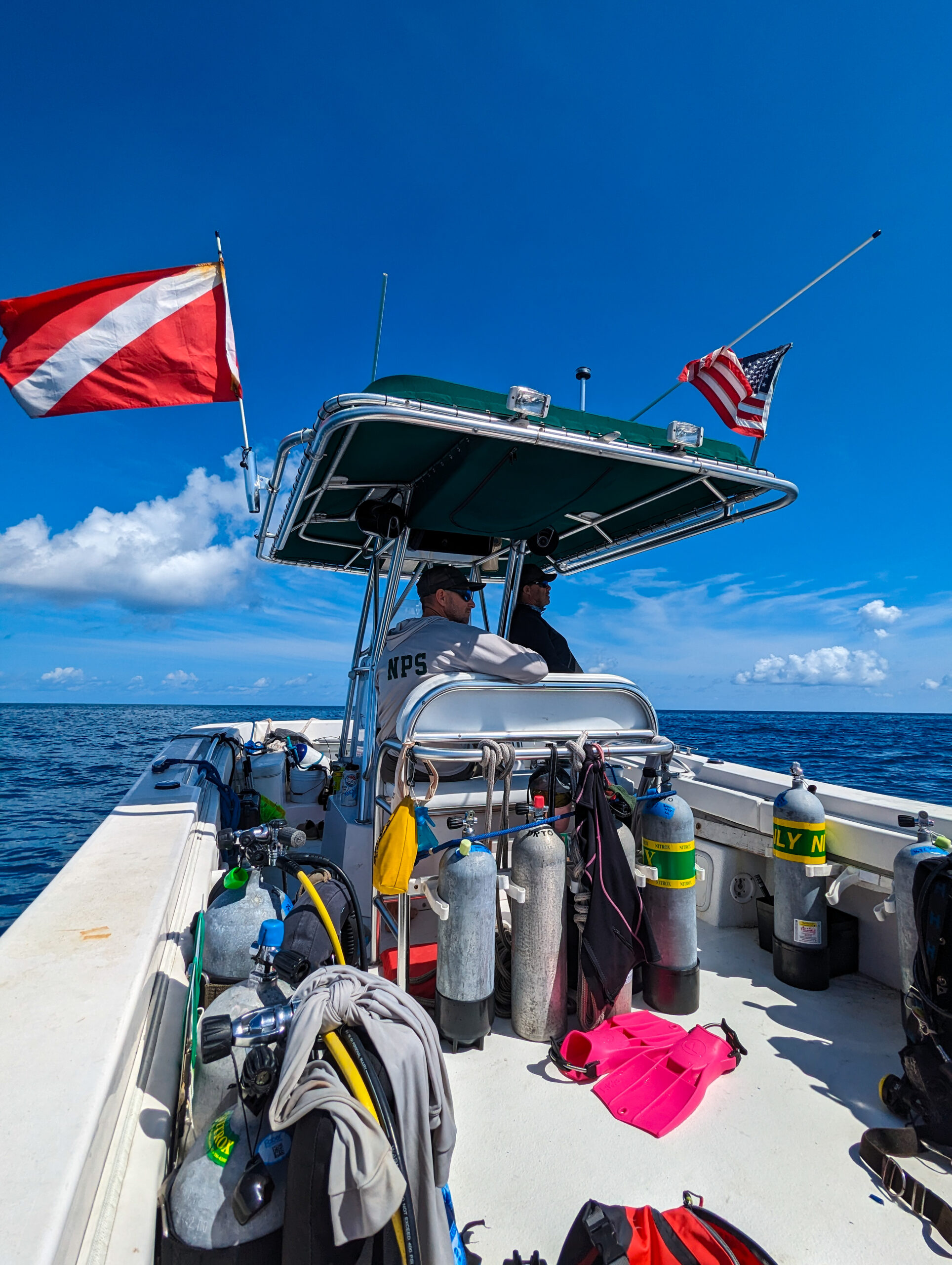
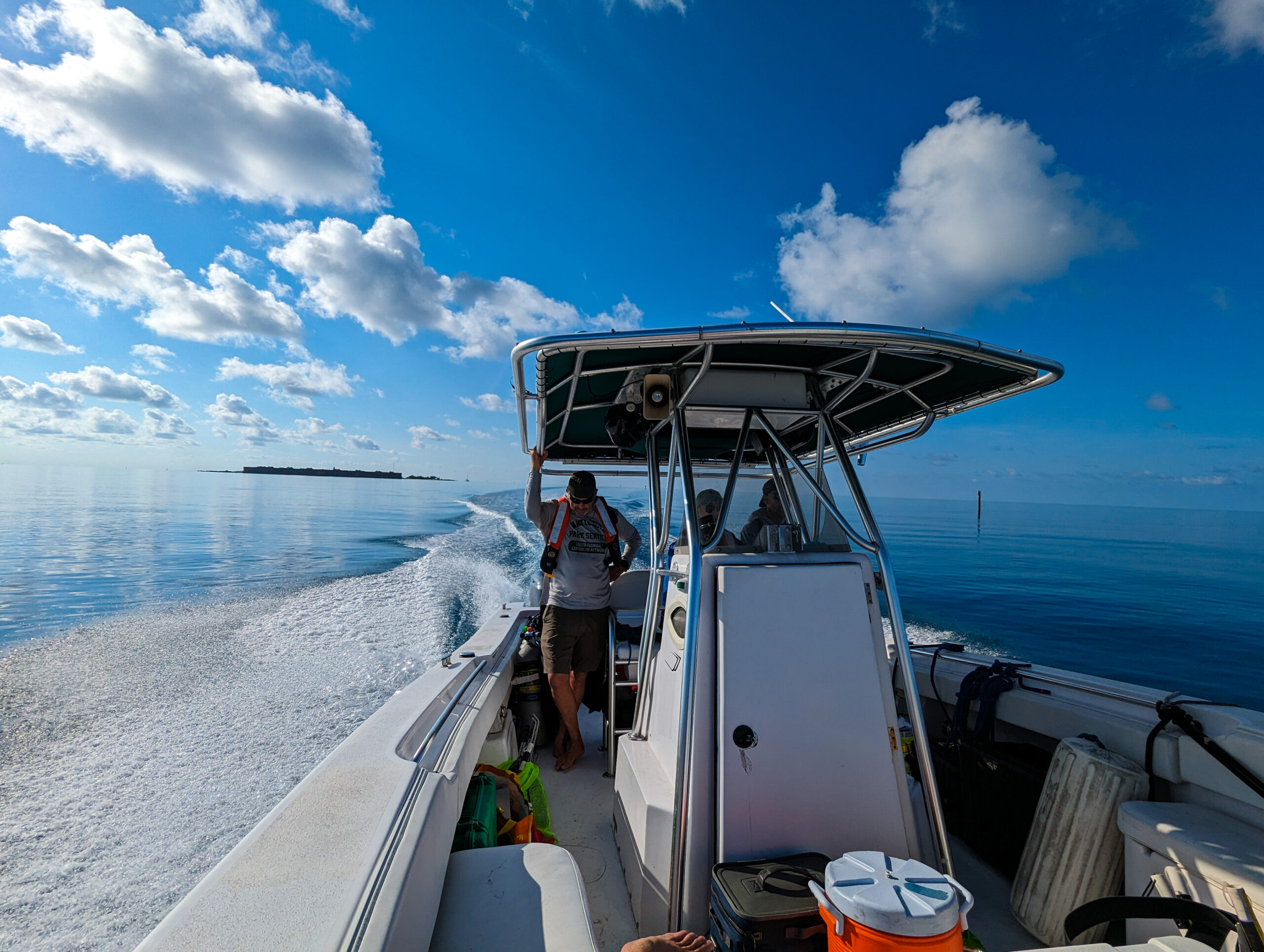
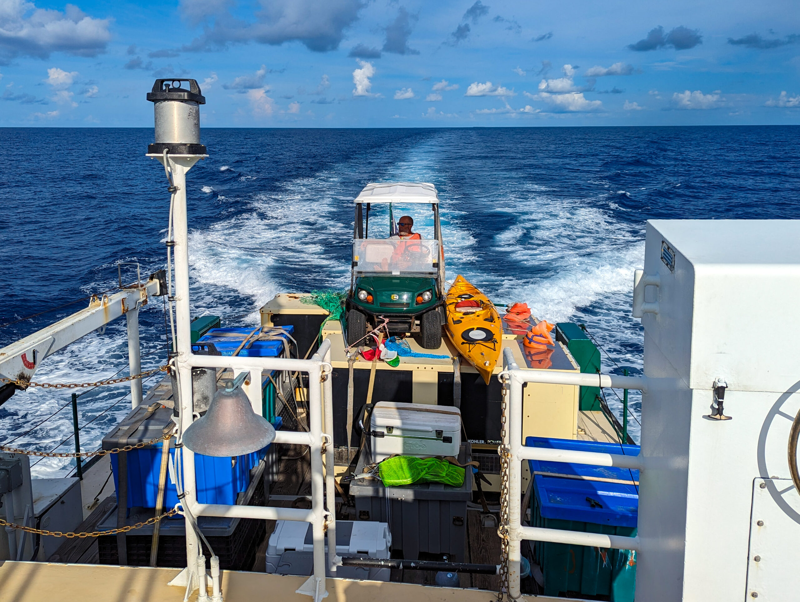
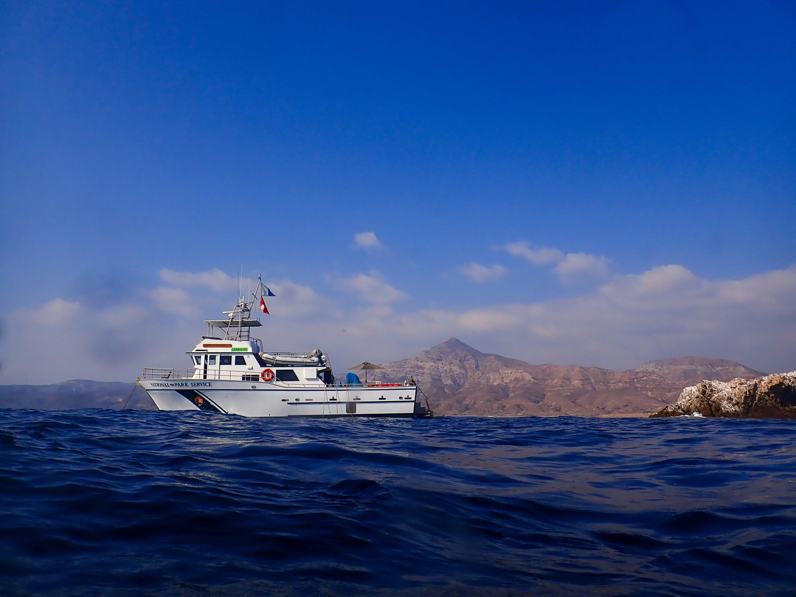
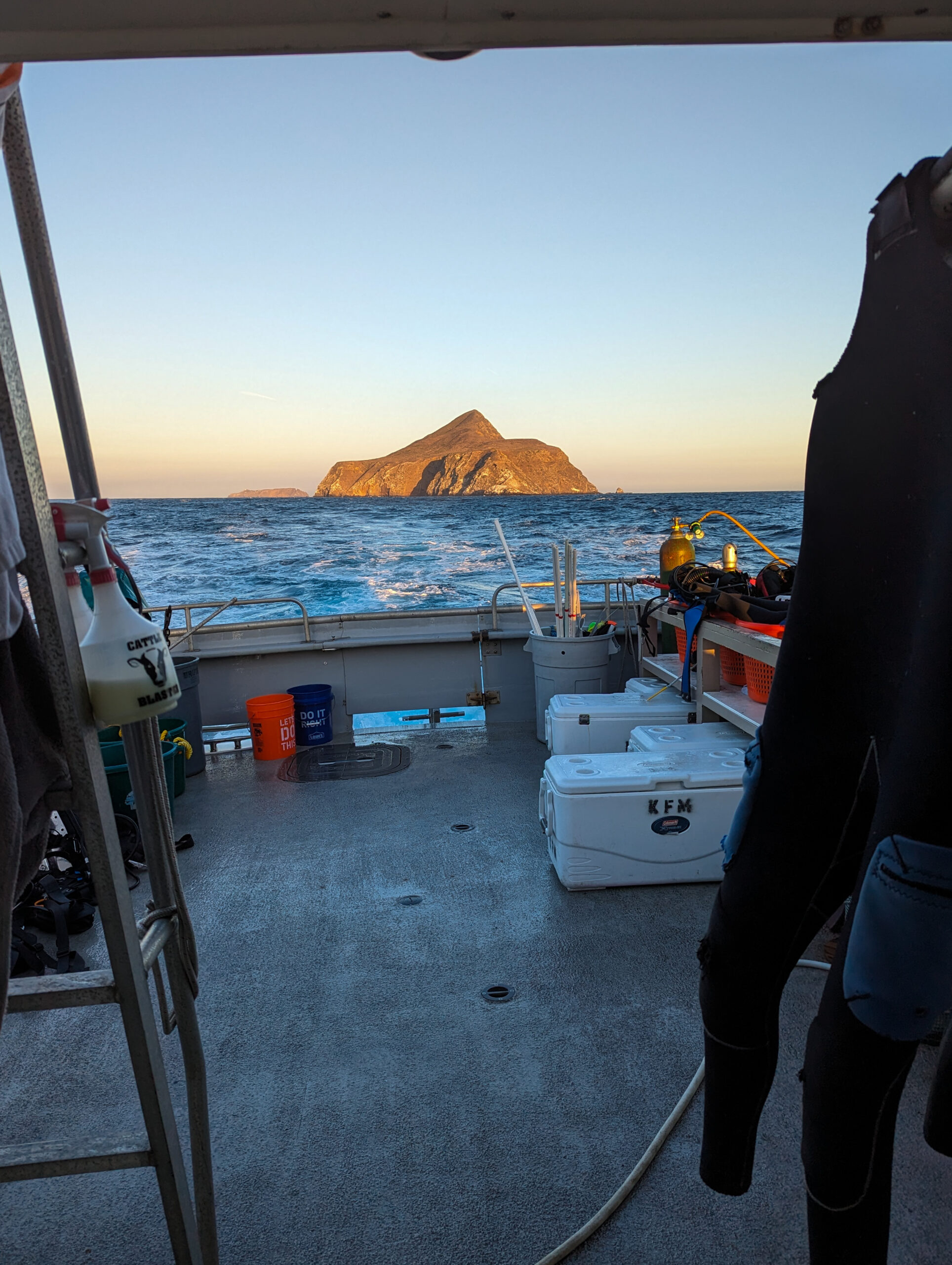
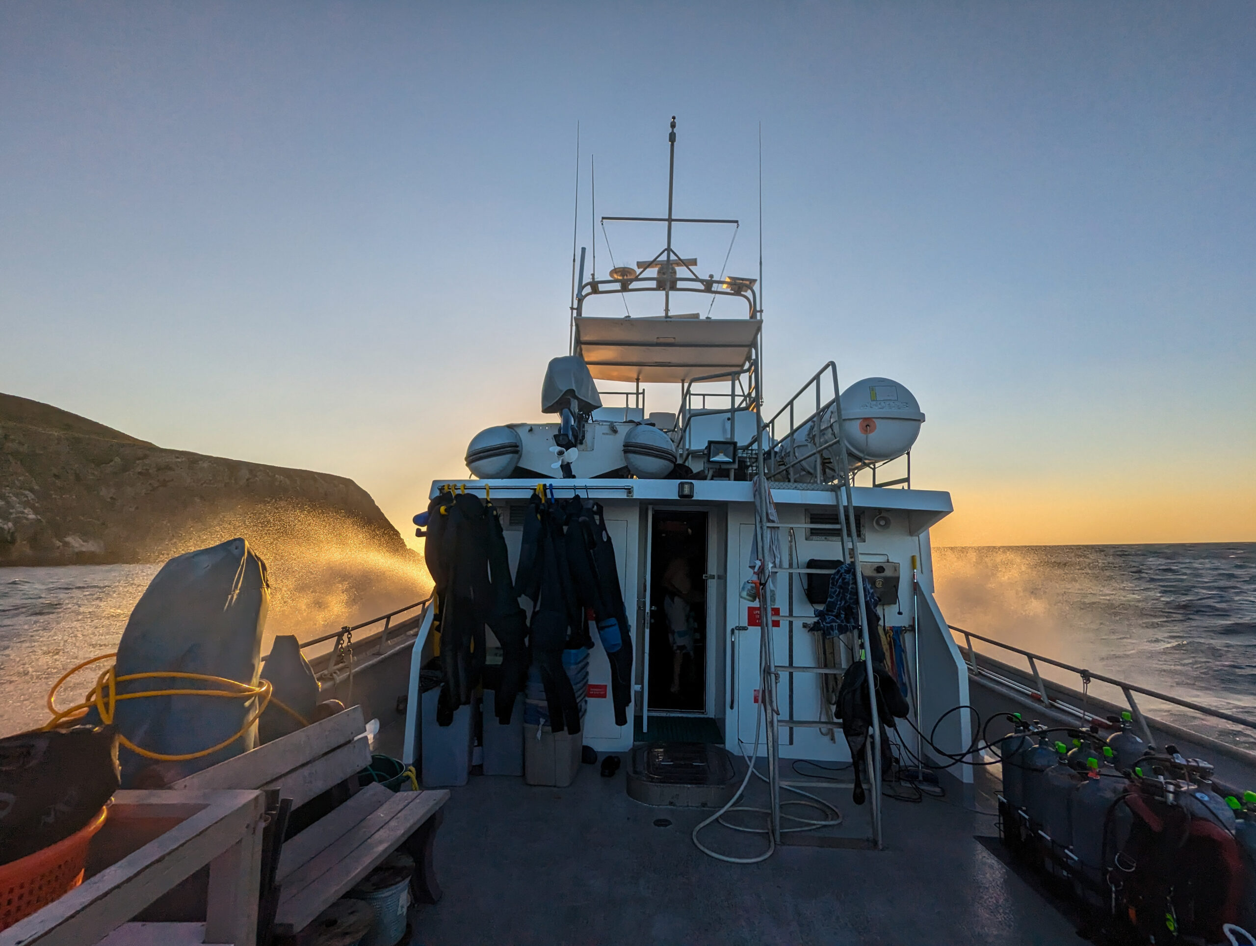
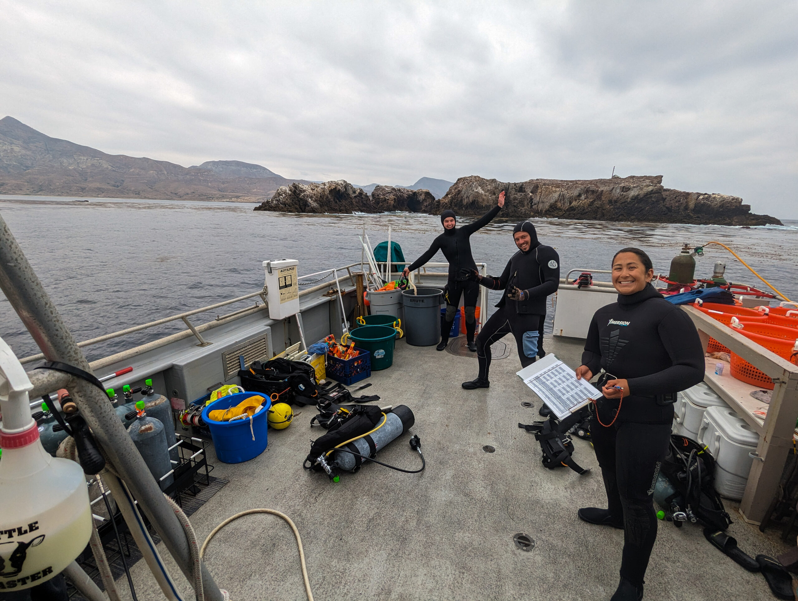
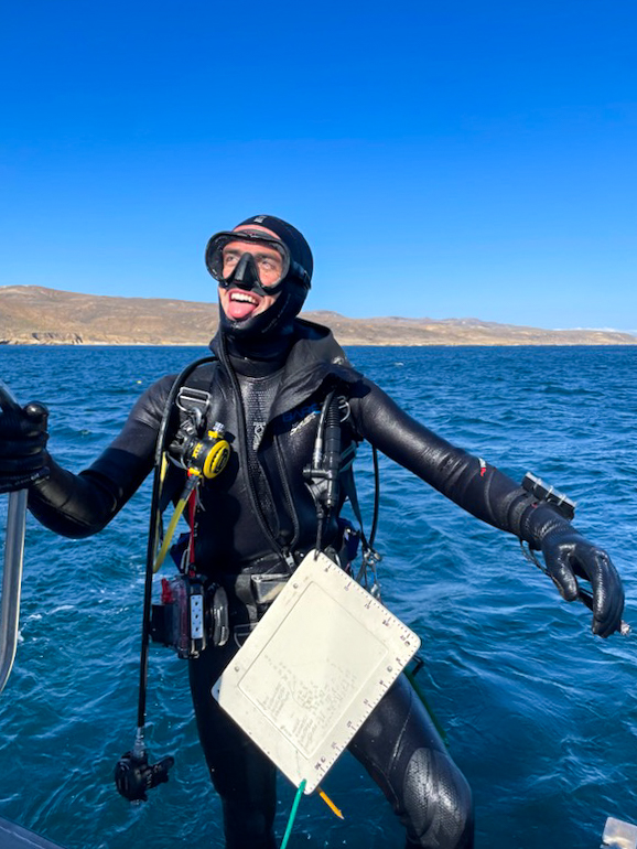
It’s Monday and the kelp cruise starts today. Unfortunately, I never sourced a drysuit or 7mm so I’m just working with my 5mm and Scott’s extra 7 mm jacket. As we are loading up the boat in the morning, I meet Keith Duran, the captain of the 58-foot Sea Ranger II where we will be living for the next five days. Frankie Puerzer, a diver from a lab at UCSB has also joined for the week.

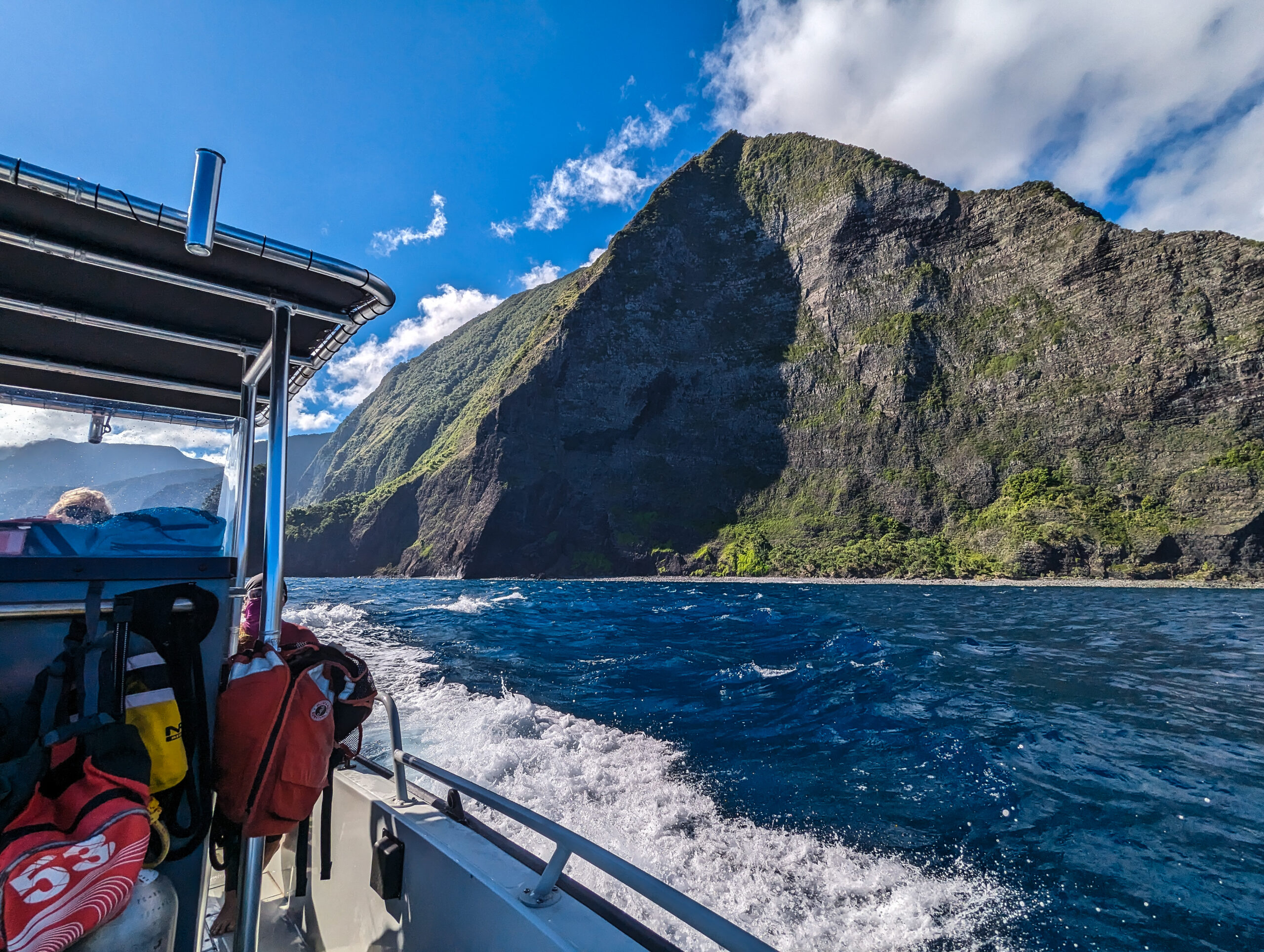
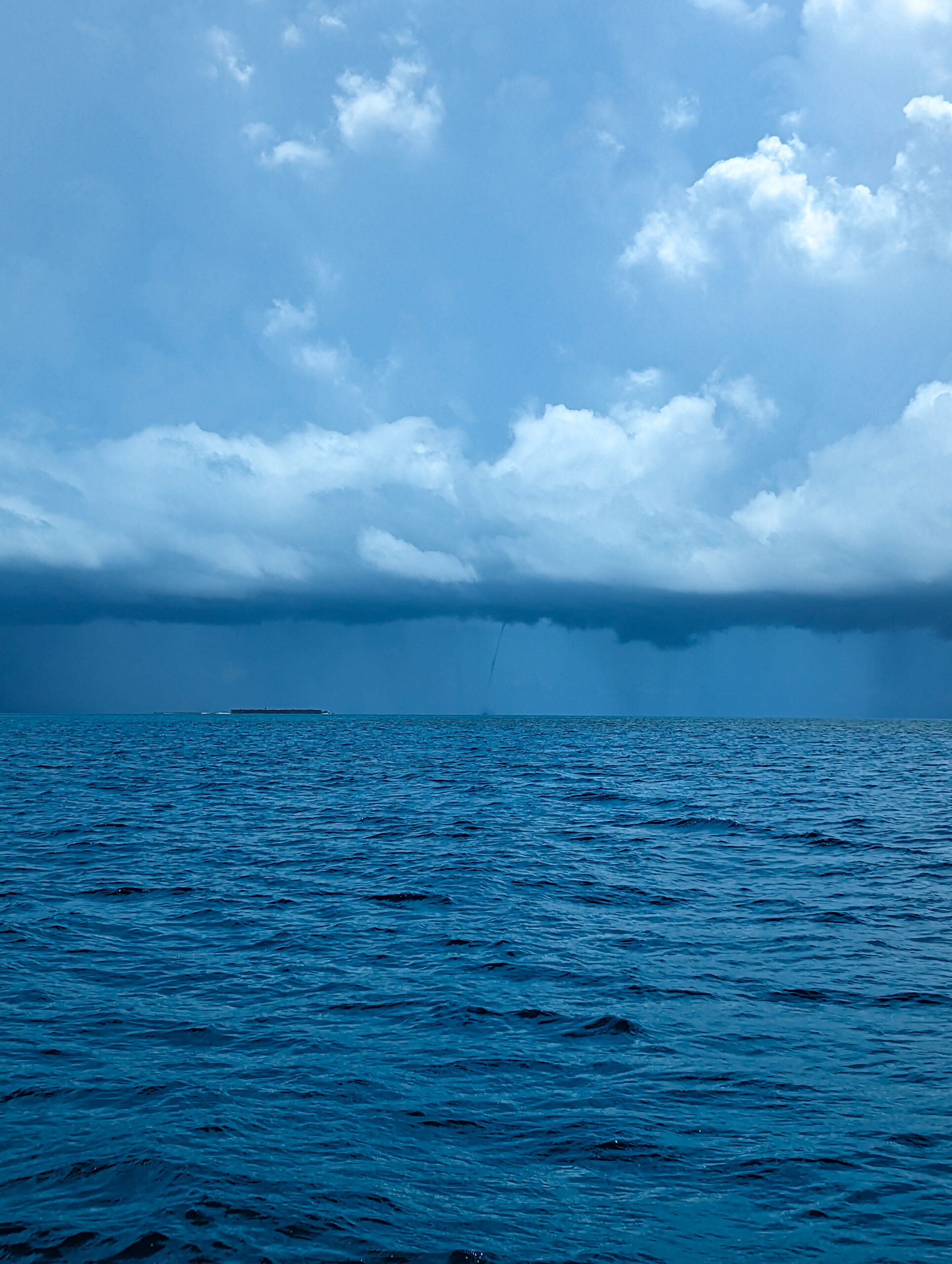
Being at the mercy of the weather means that the dive schedule isn’t finalized until the day of the cruise. The season is from May through October and some of the more difficult sites are left just because the weather hasn’t cooperated. However, this week is looking relatively calm and we should be able to dive some of the southern exposed sites. We will start with a relatively close site off of Anacapa for our half-day today.

Sea Ranger II.

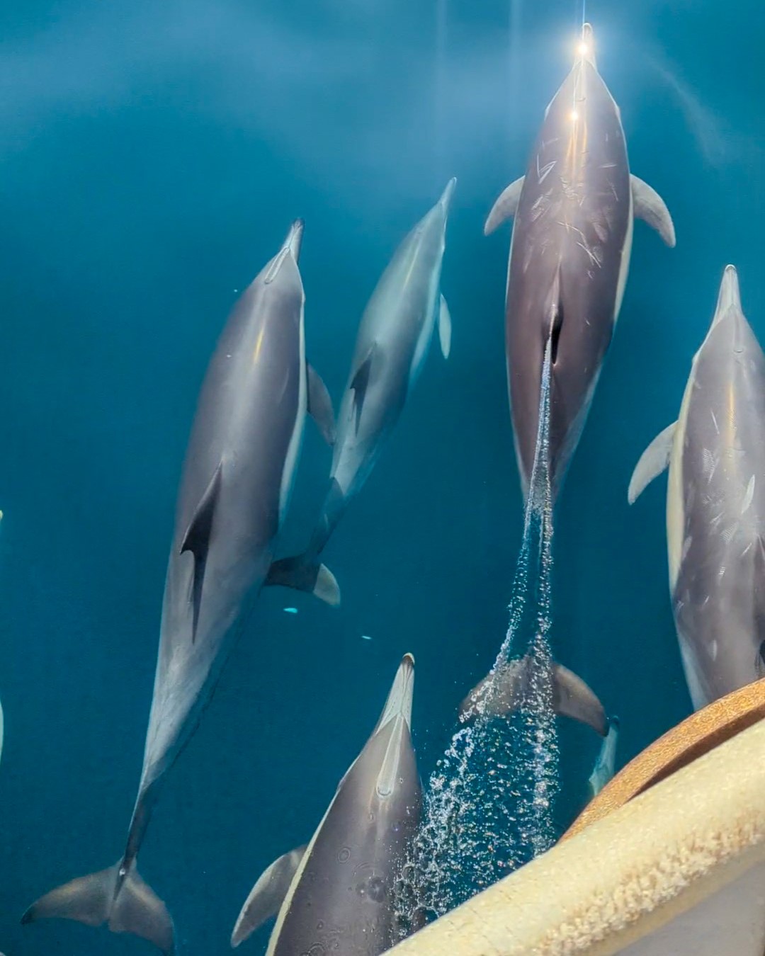
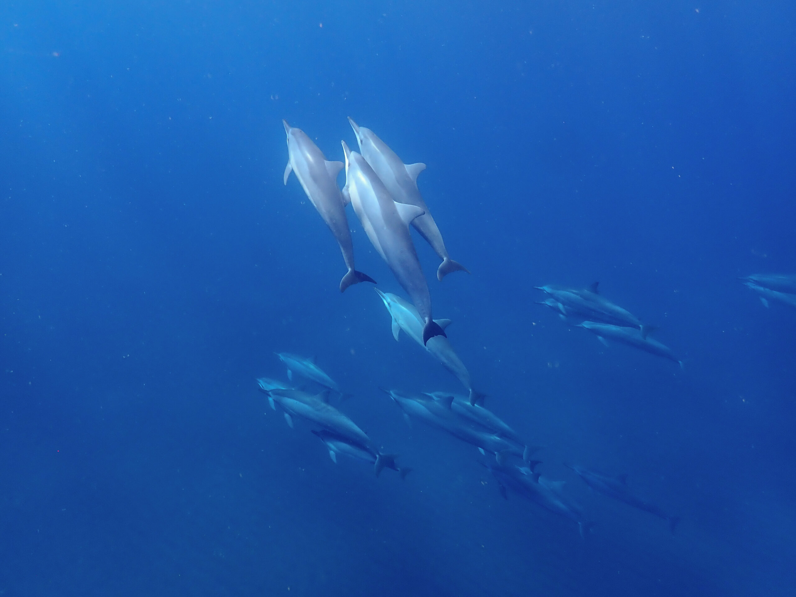
The trip out is sunny and calm and we are visited by some bowriding dolphins. I can hear their high-pitched vocalizations. We talk about the plan in the cabin, but I’m easily distracted by the dolphins I can see out the windows jumping on either side of the boat. Our first site is going to be Black Sea Bass Reef off of middle Anacapa. The birds are going crazy right now. Pelicans are diving like mad.

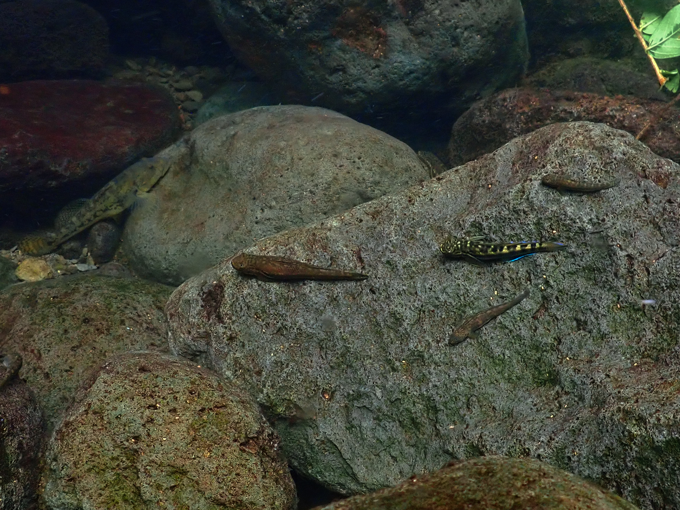
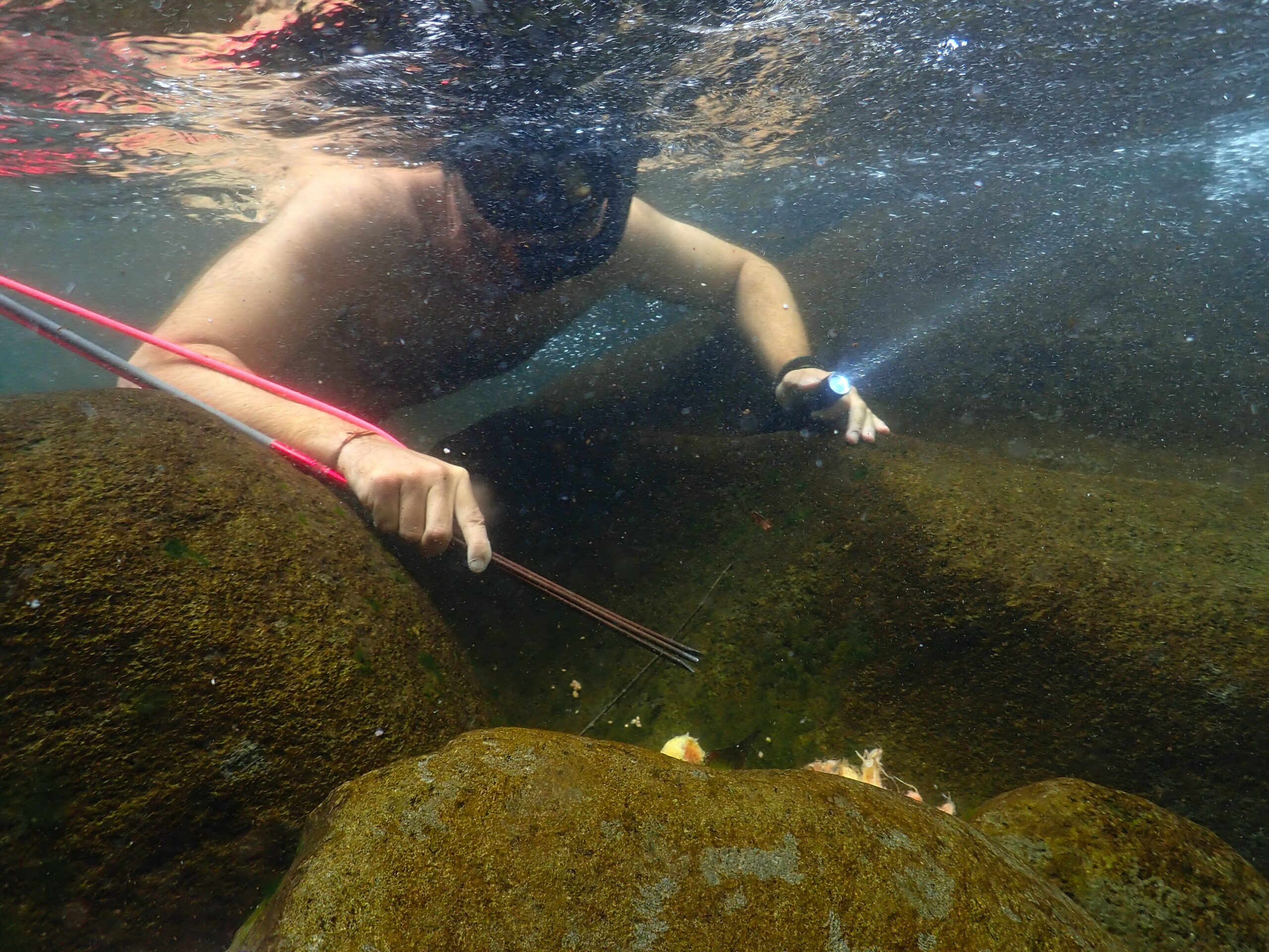
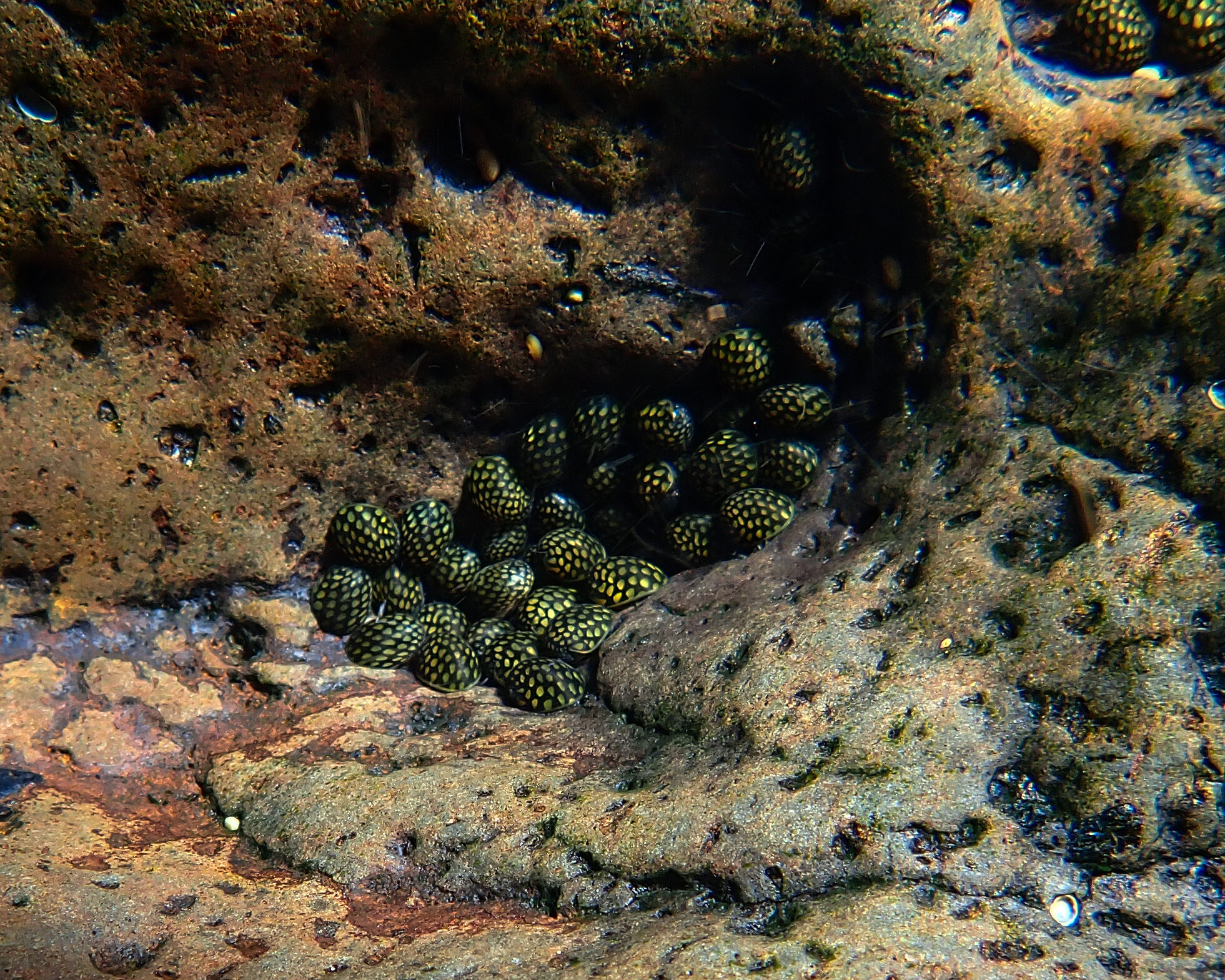
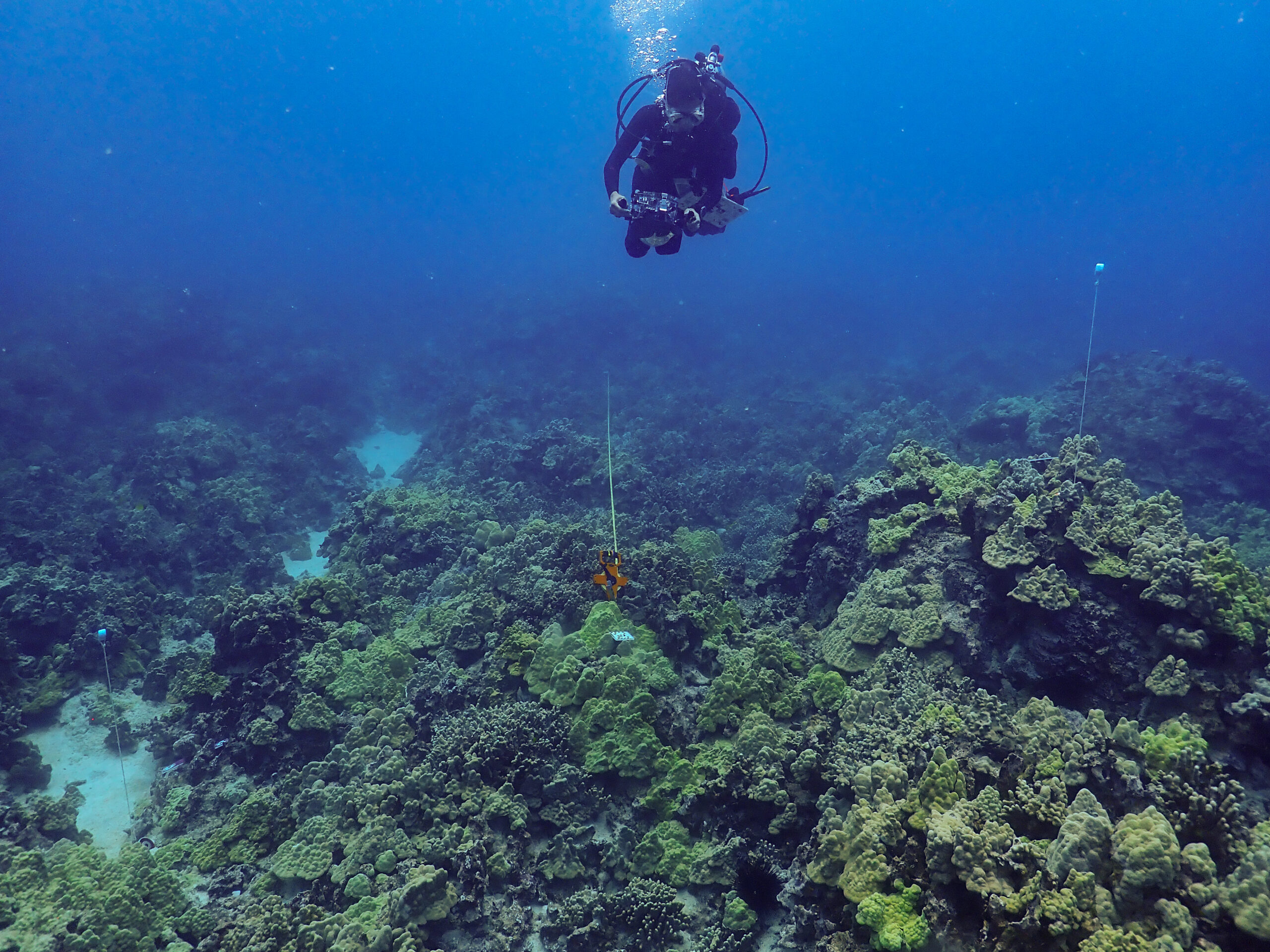
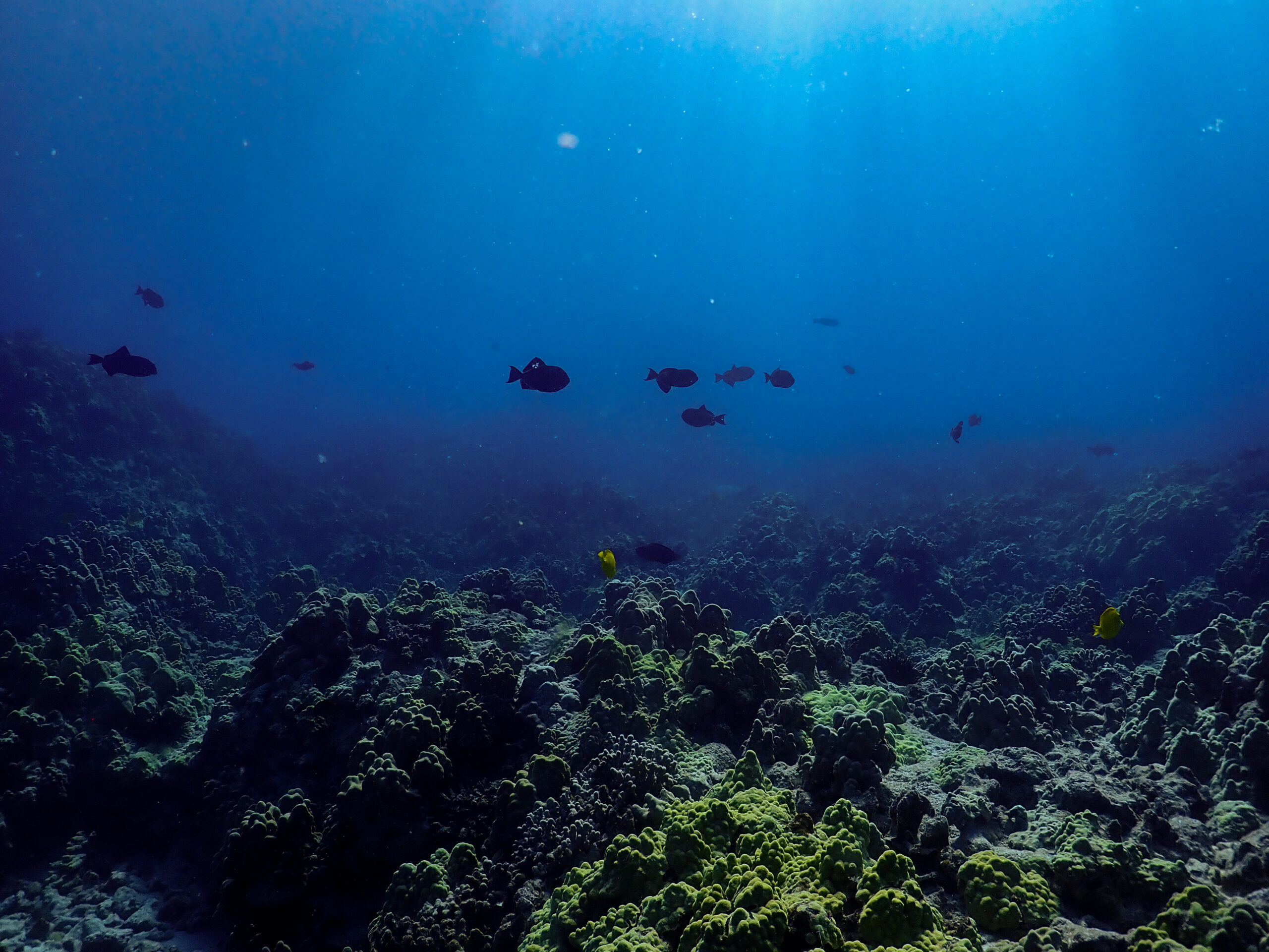
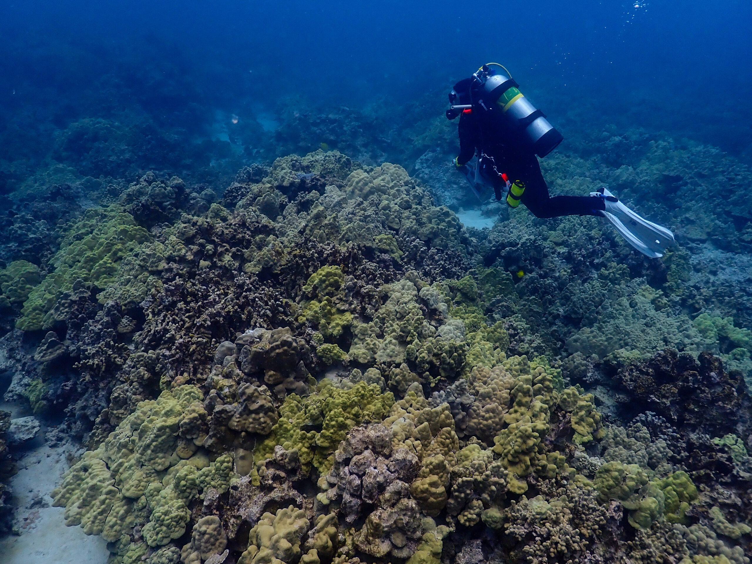
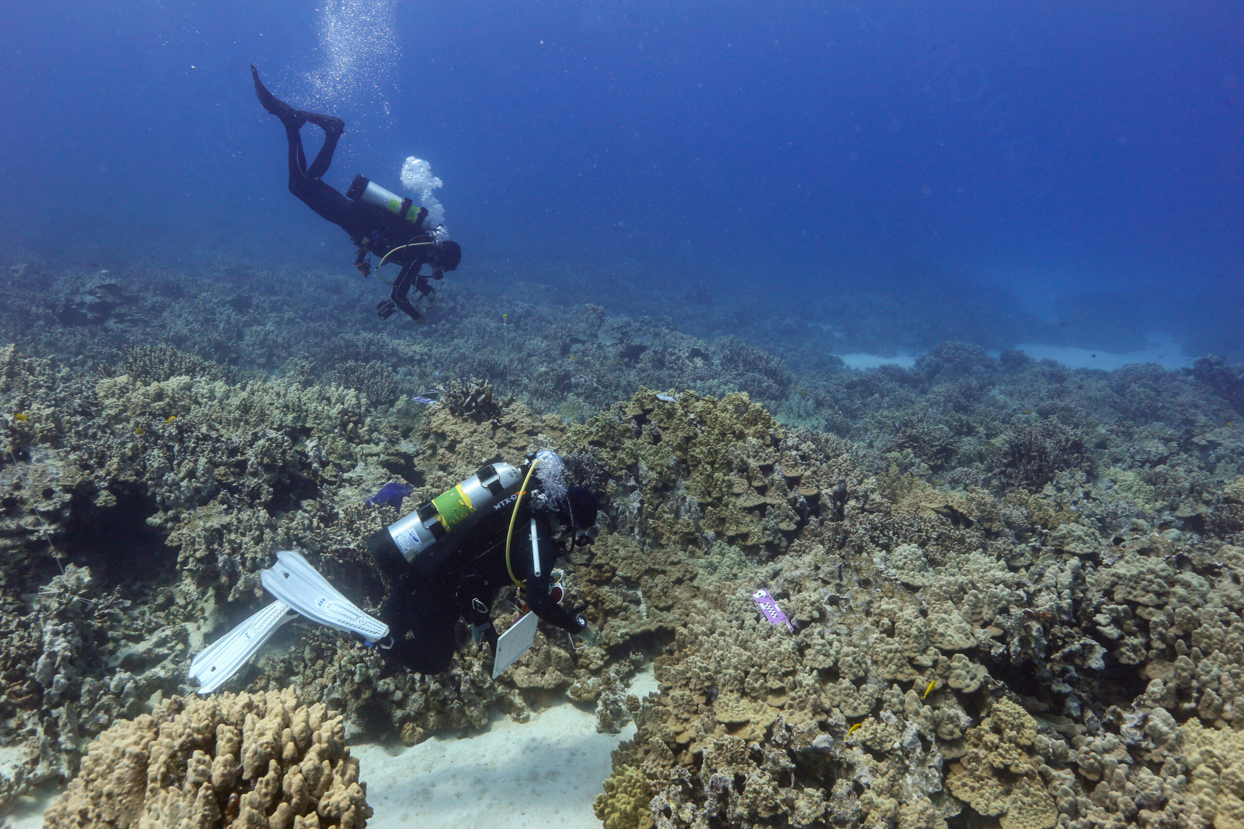
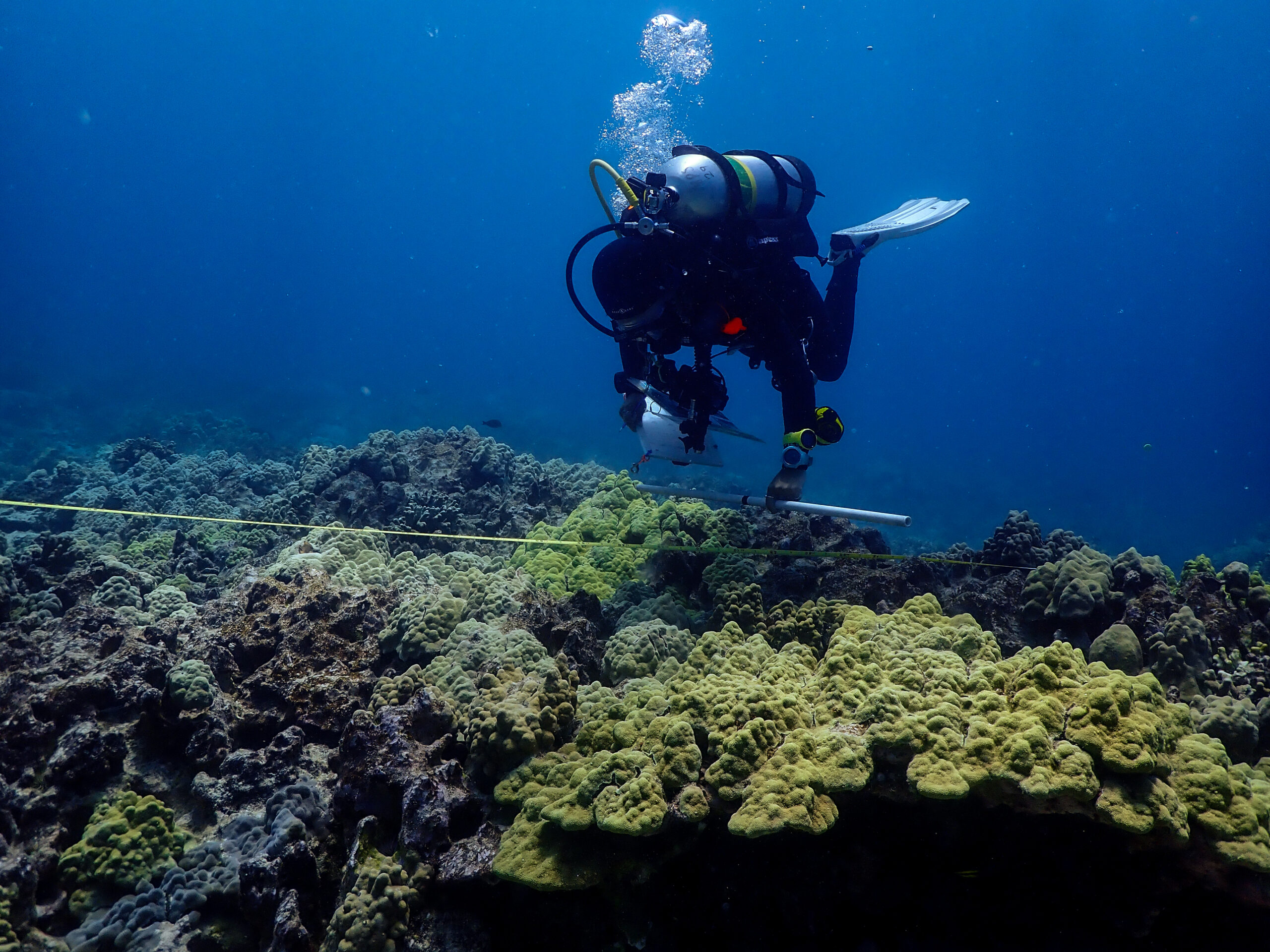
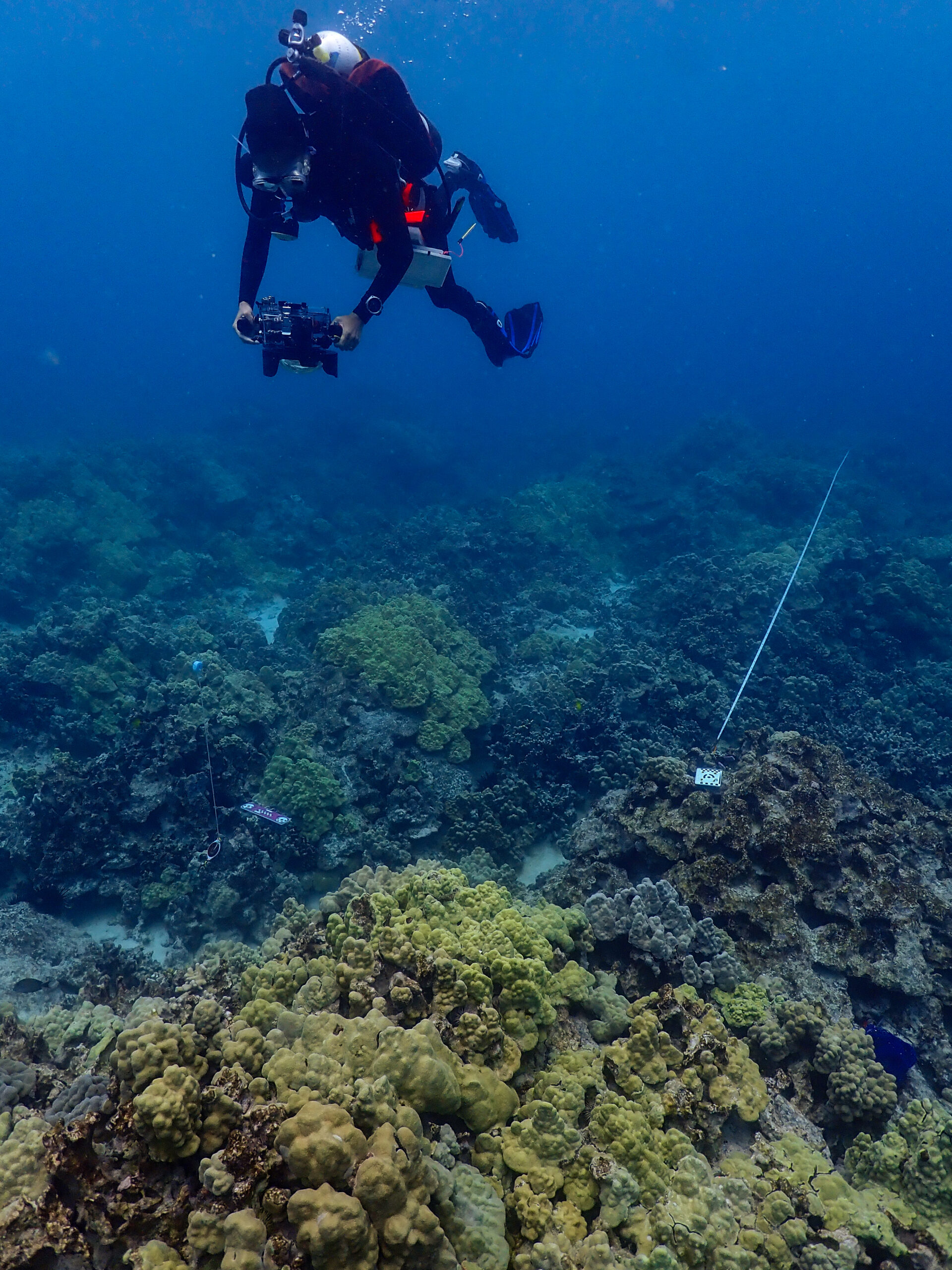
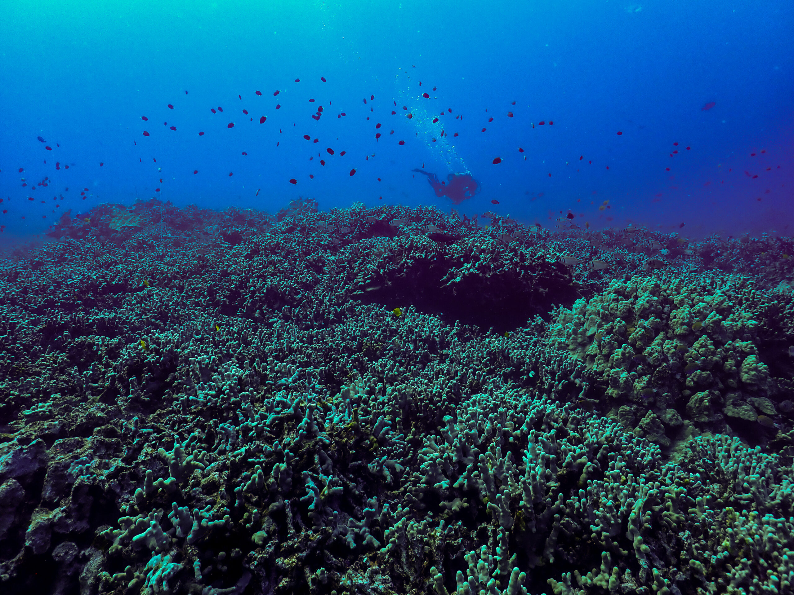
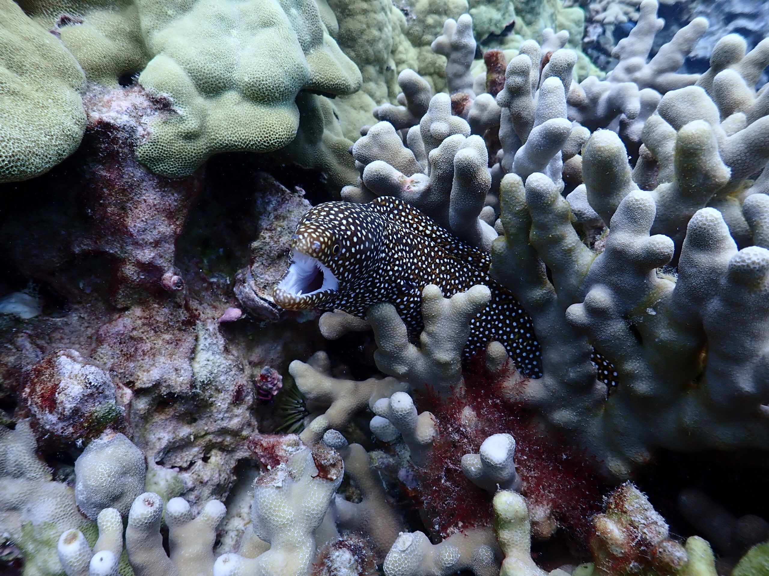
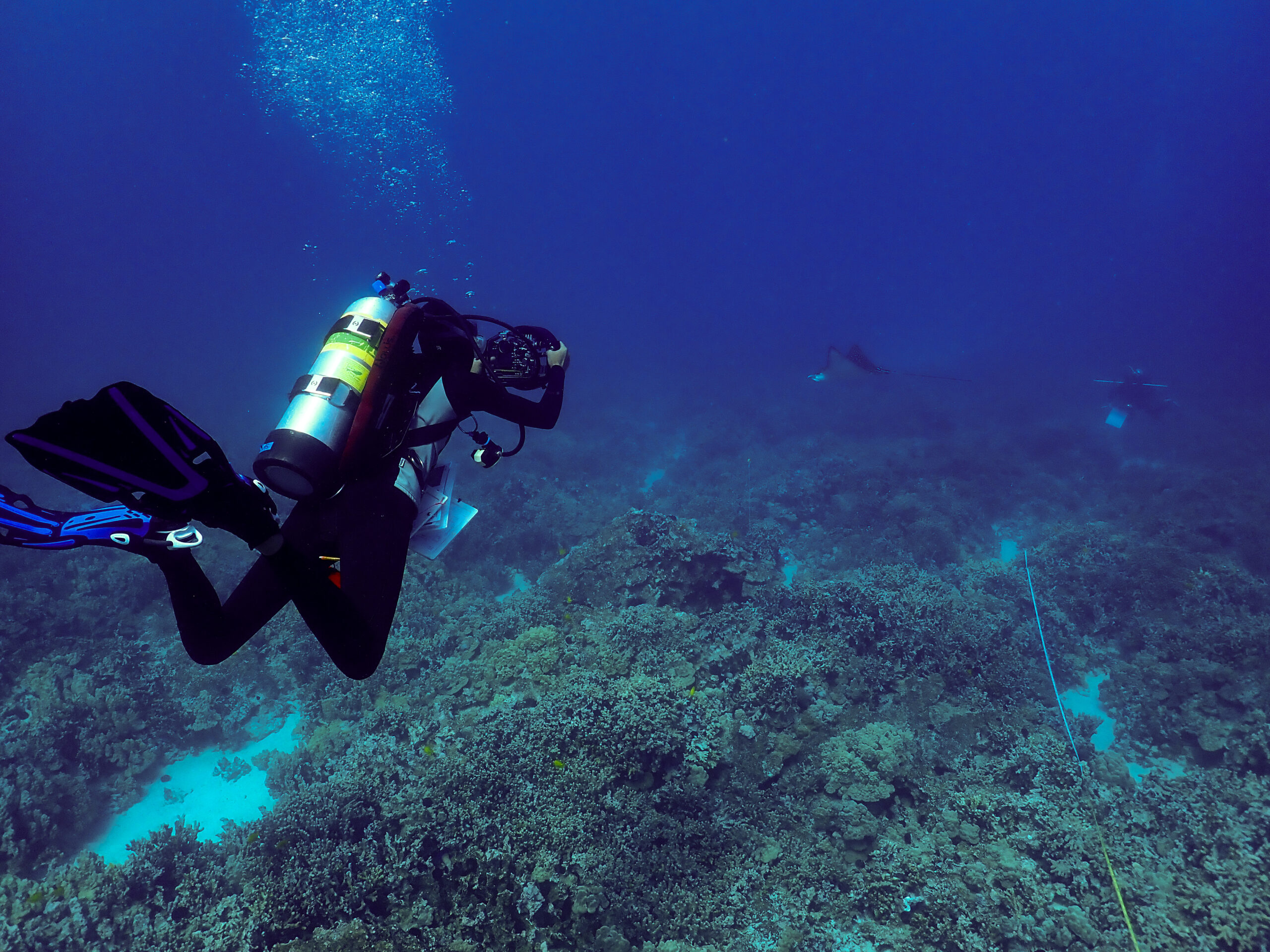
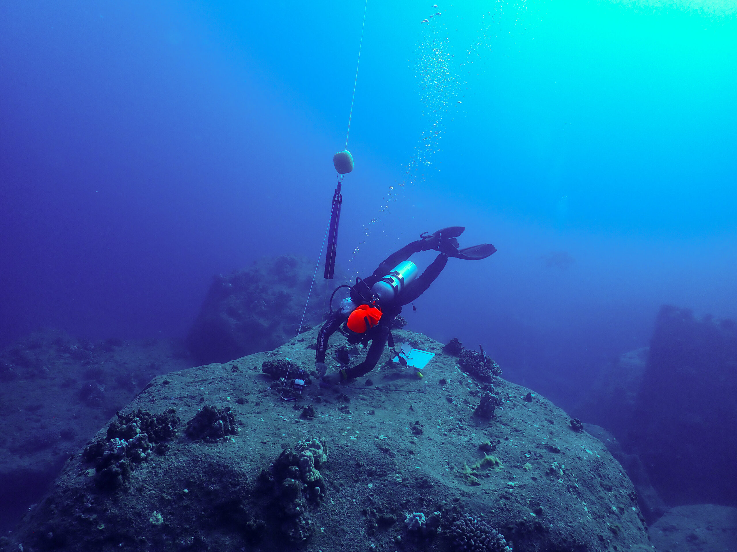
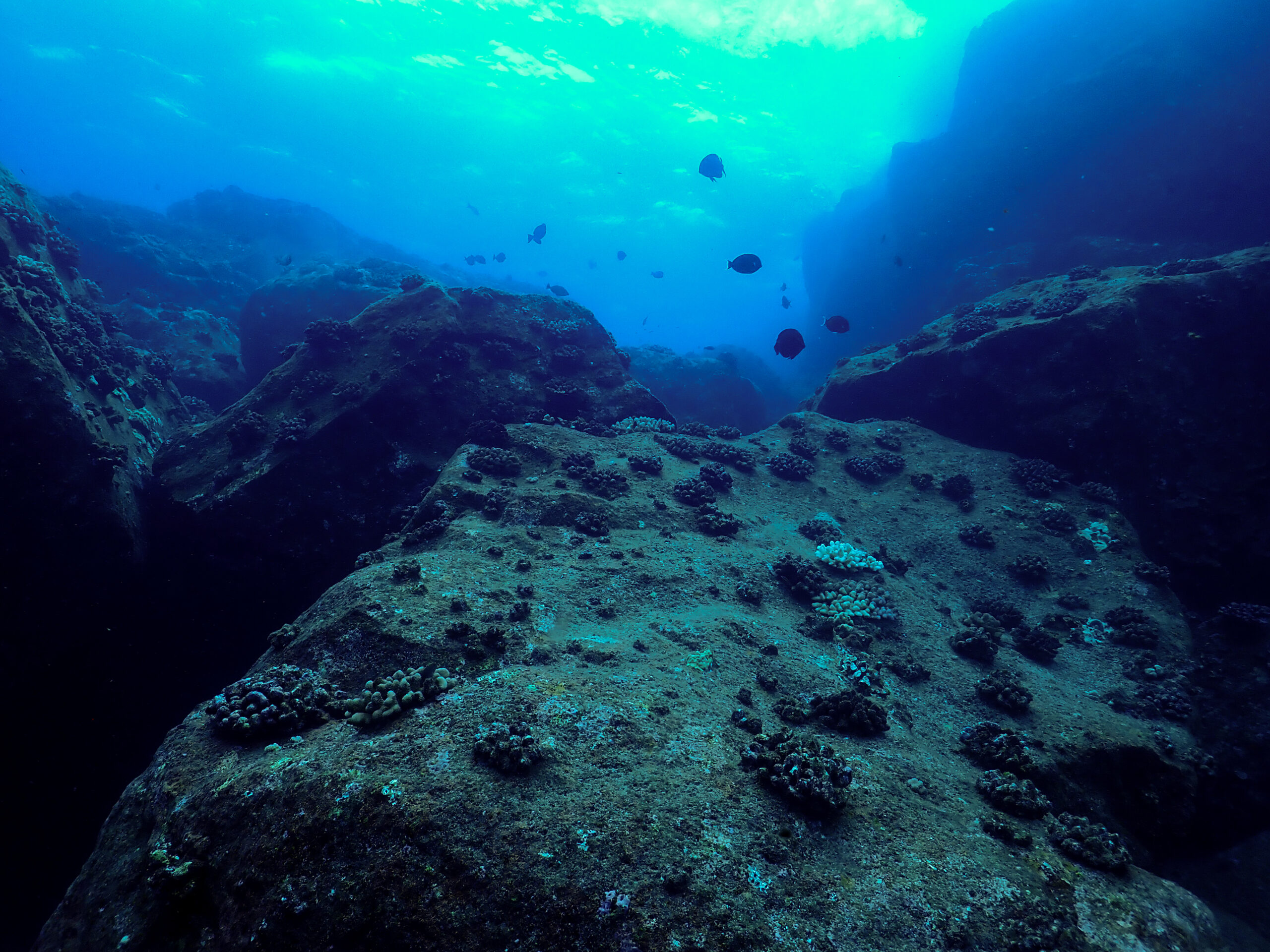
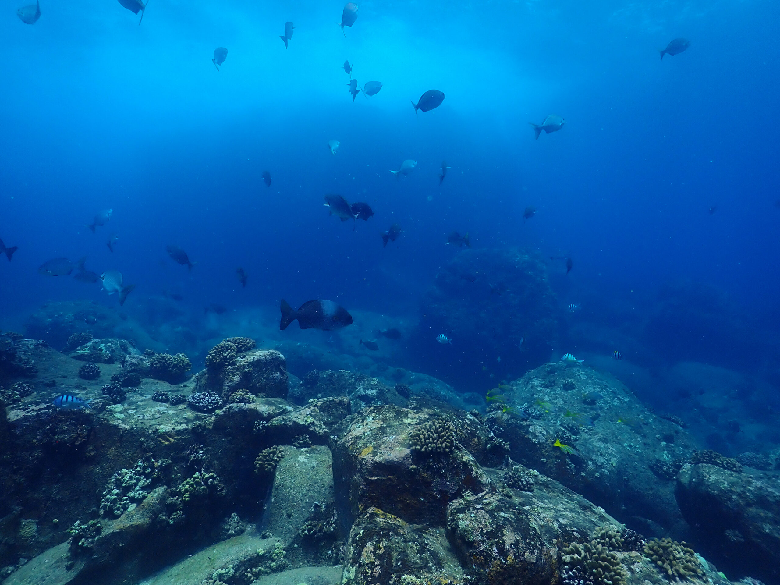
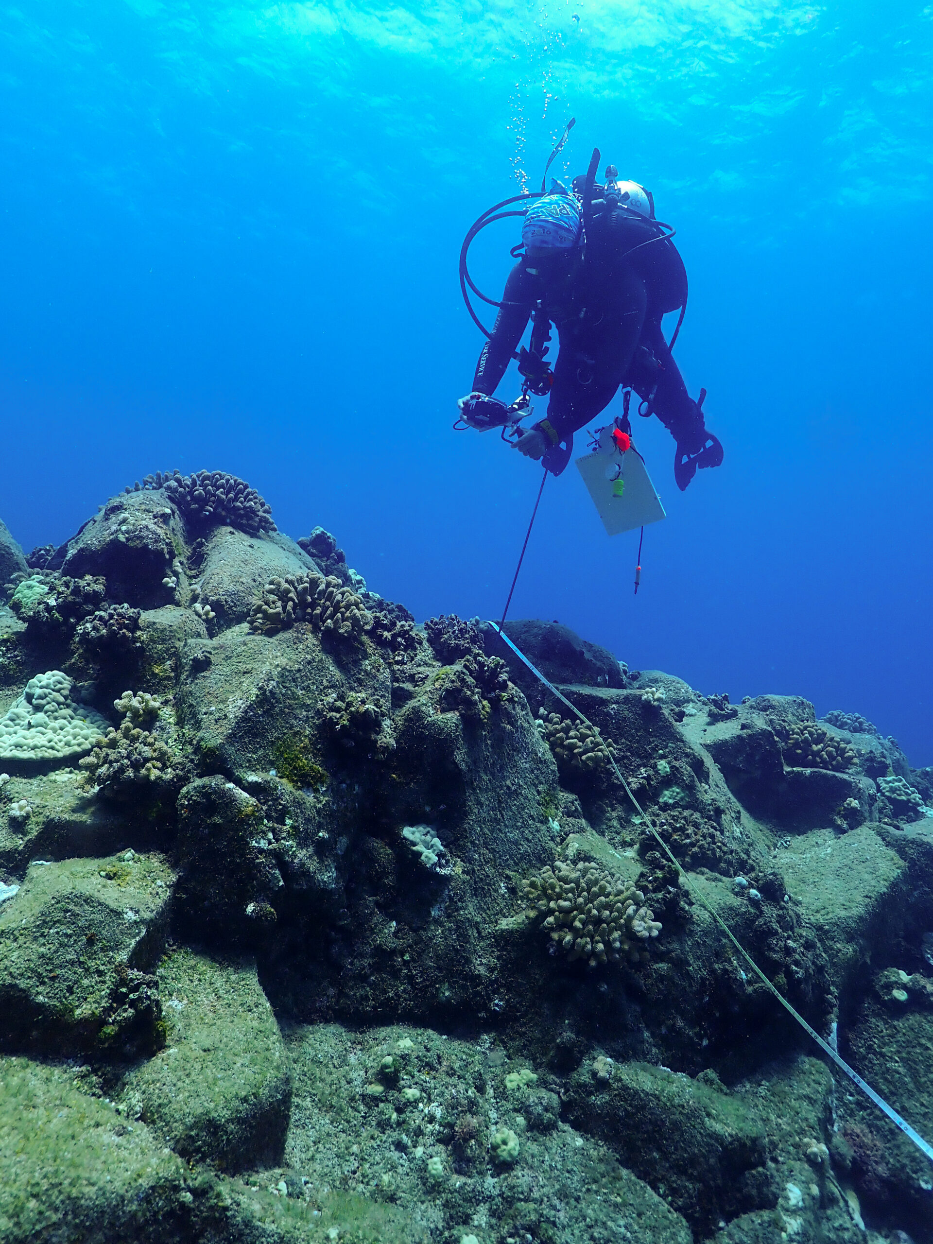
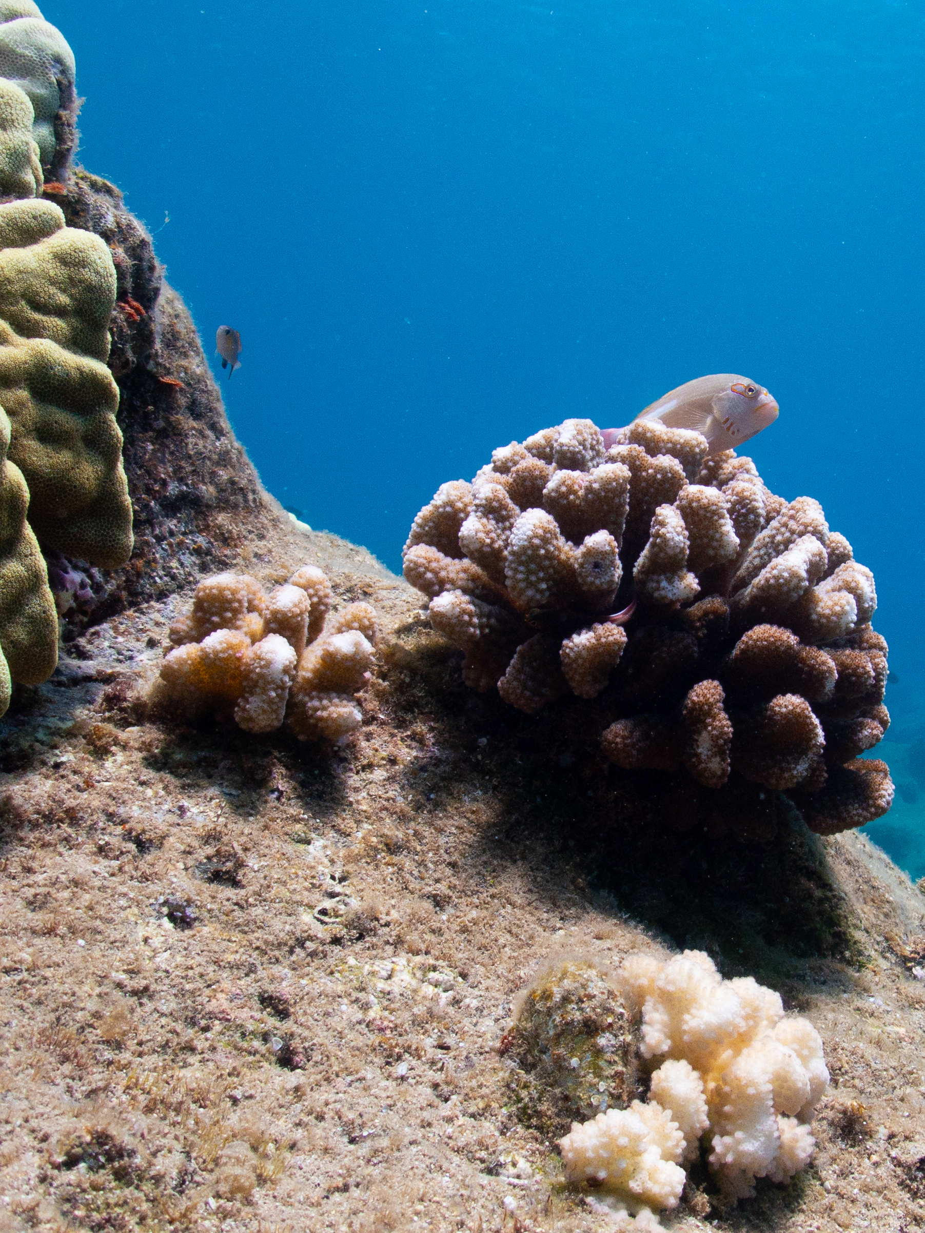
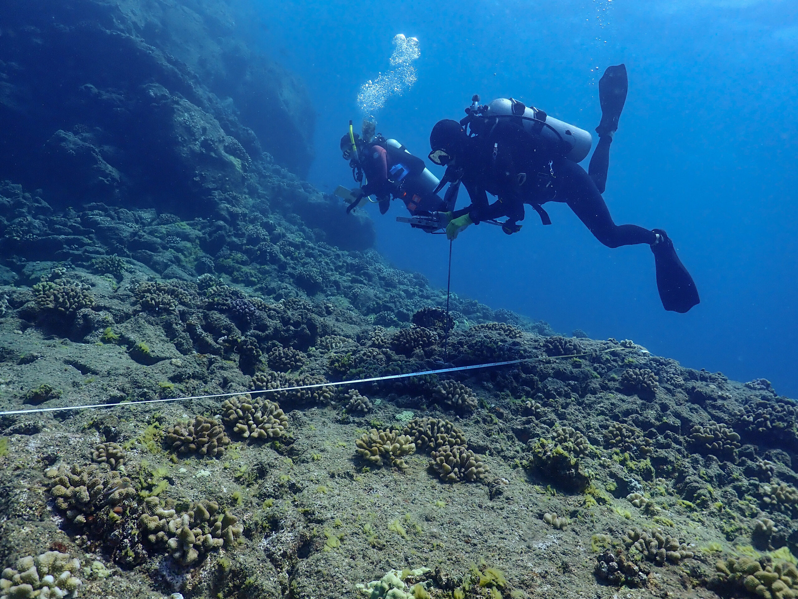
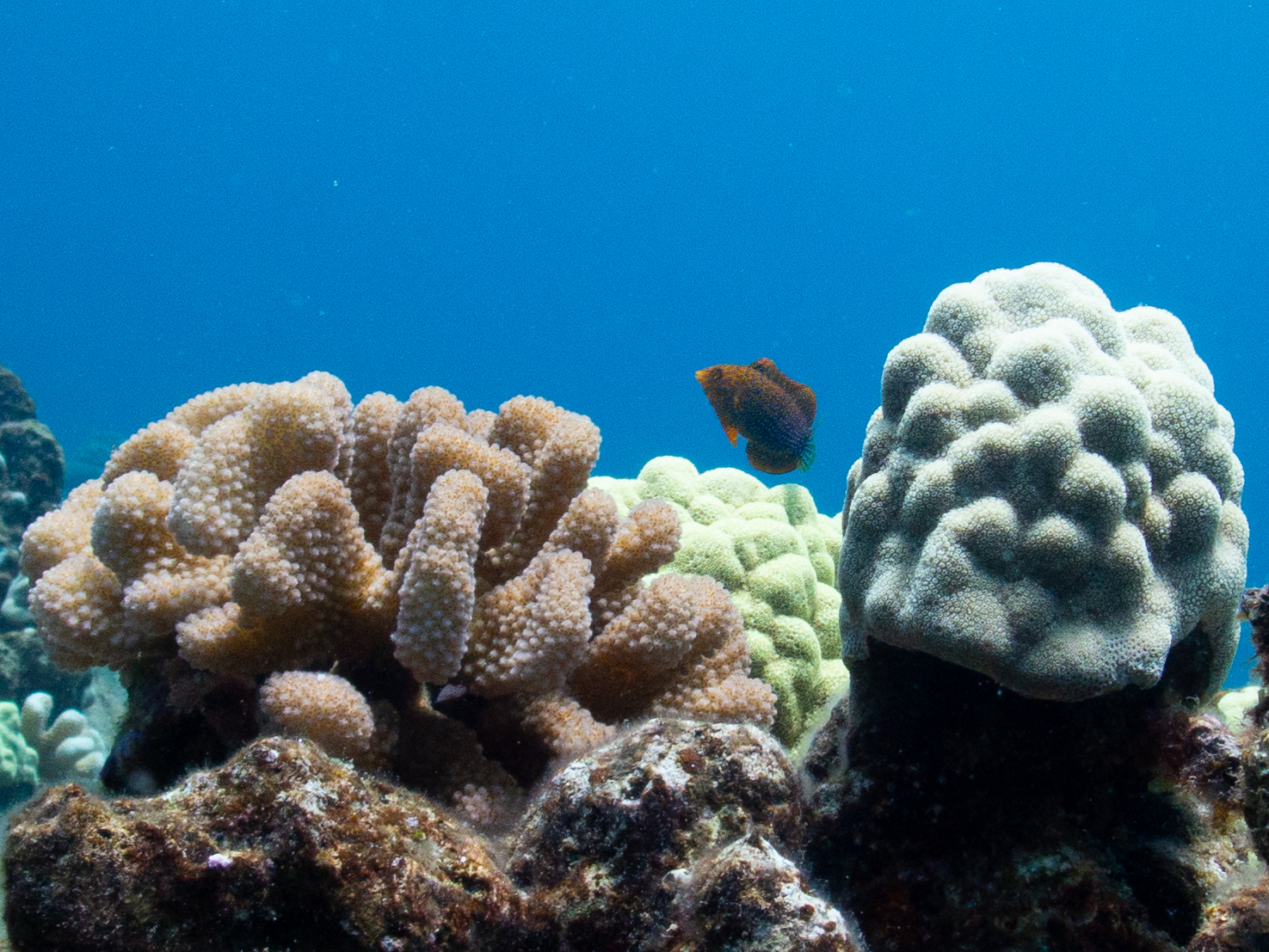
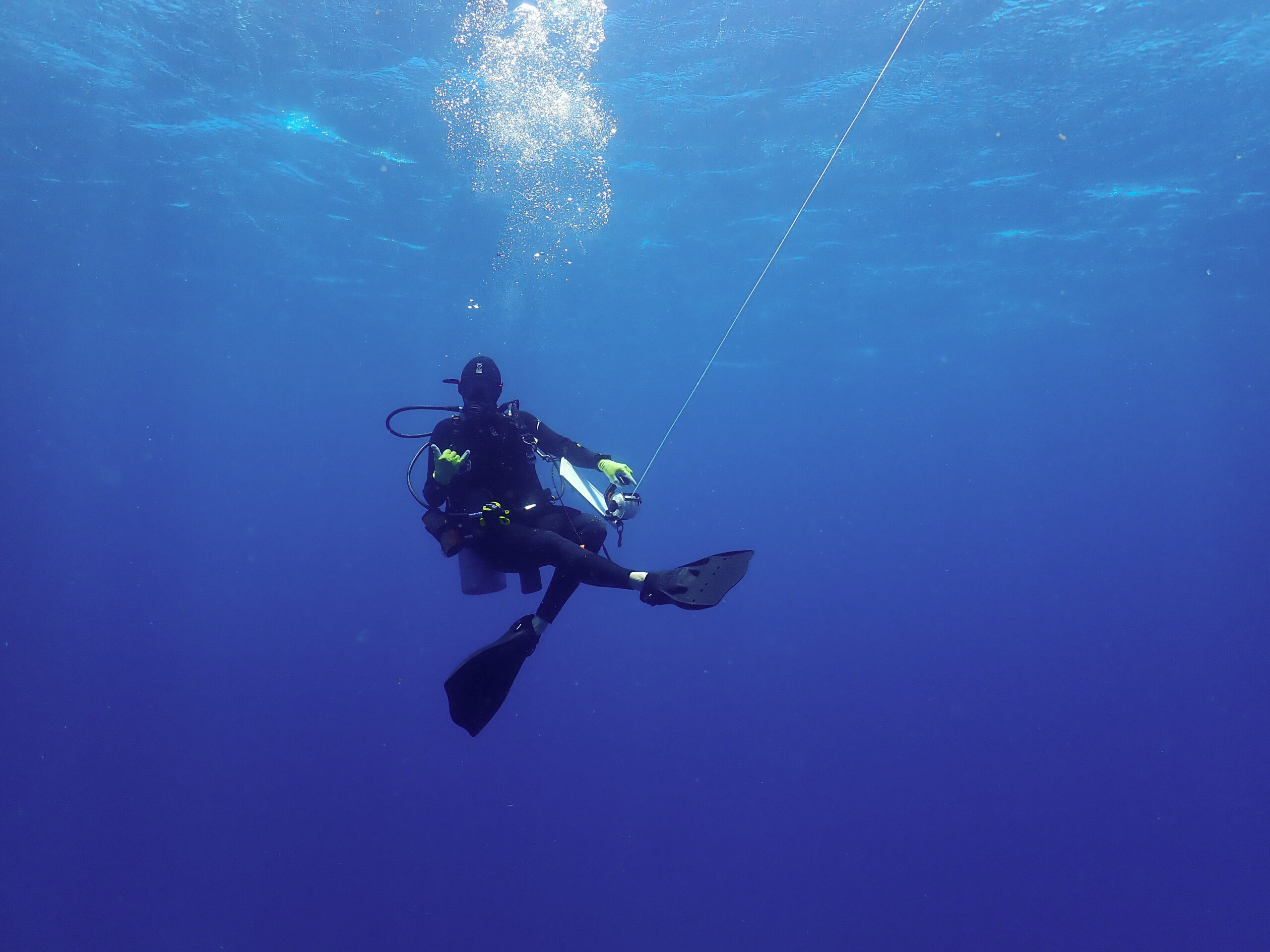
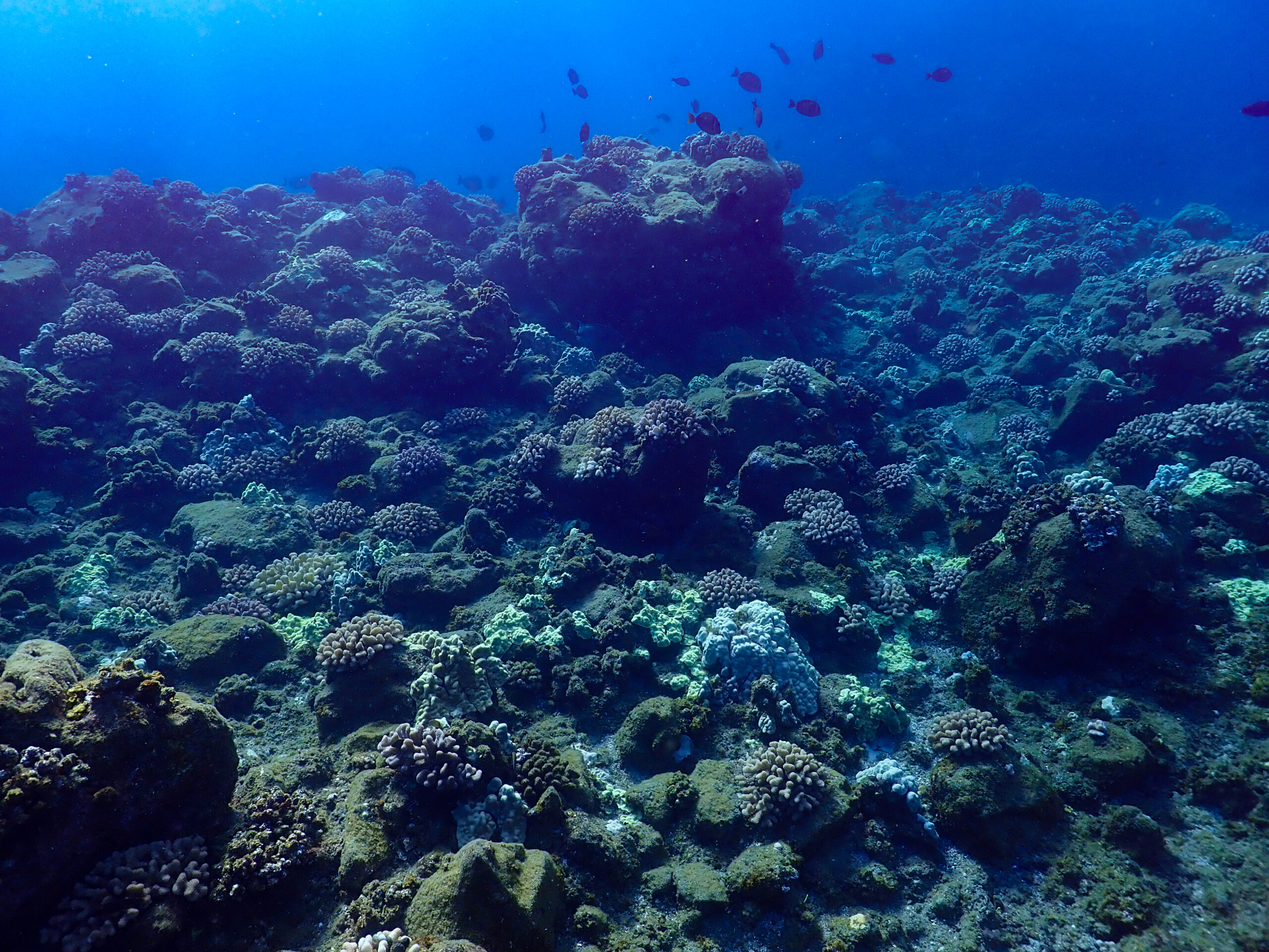
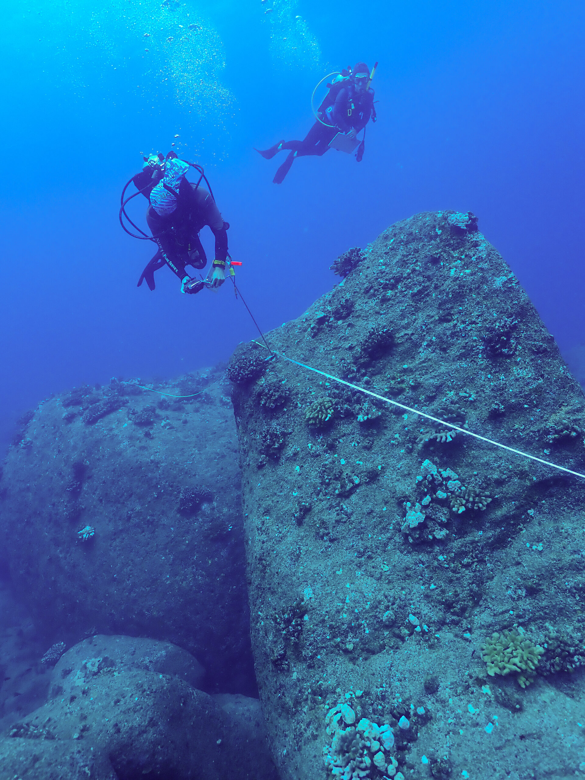
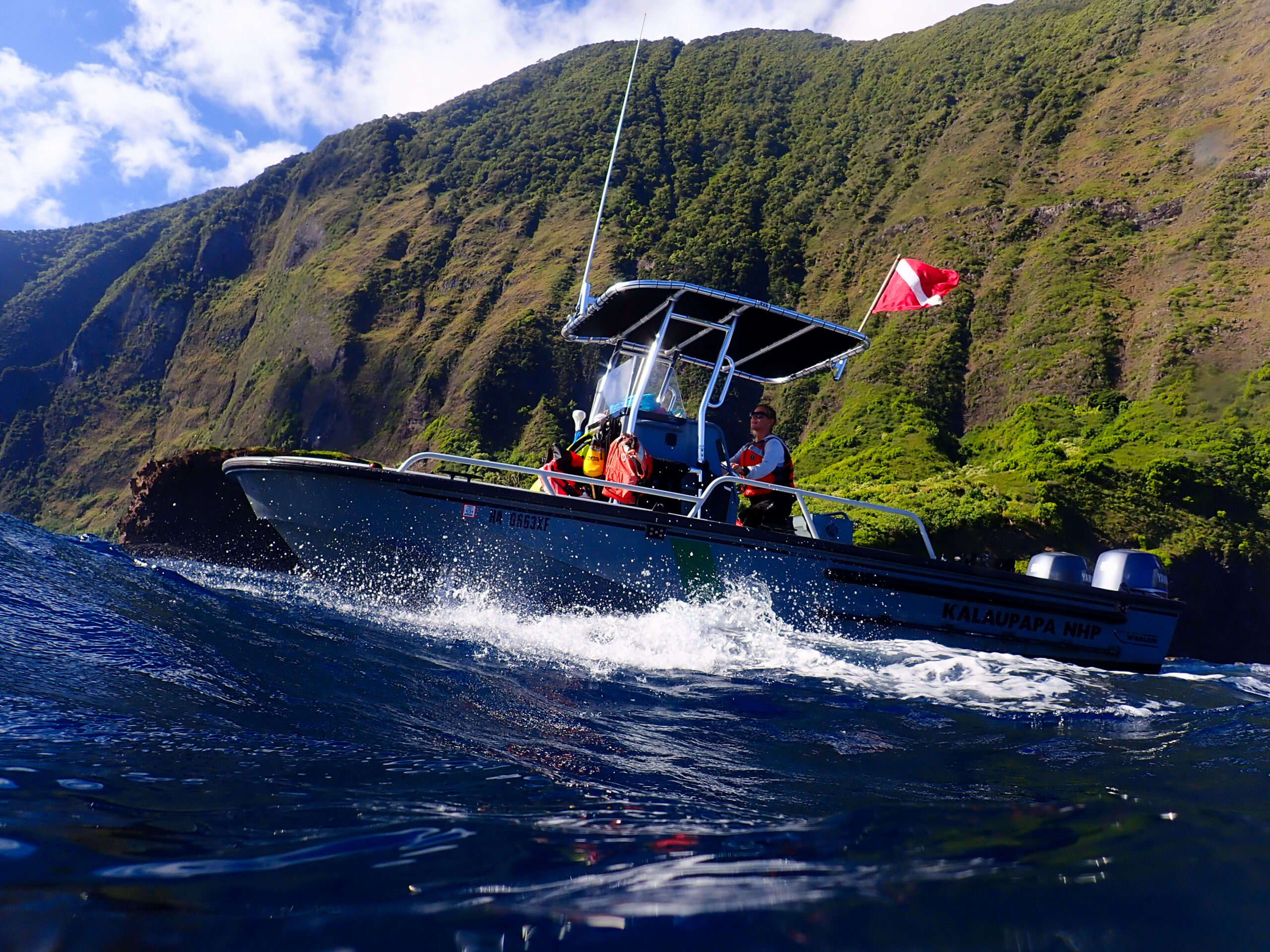
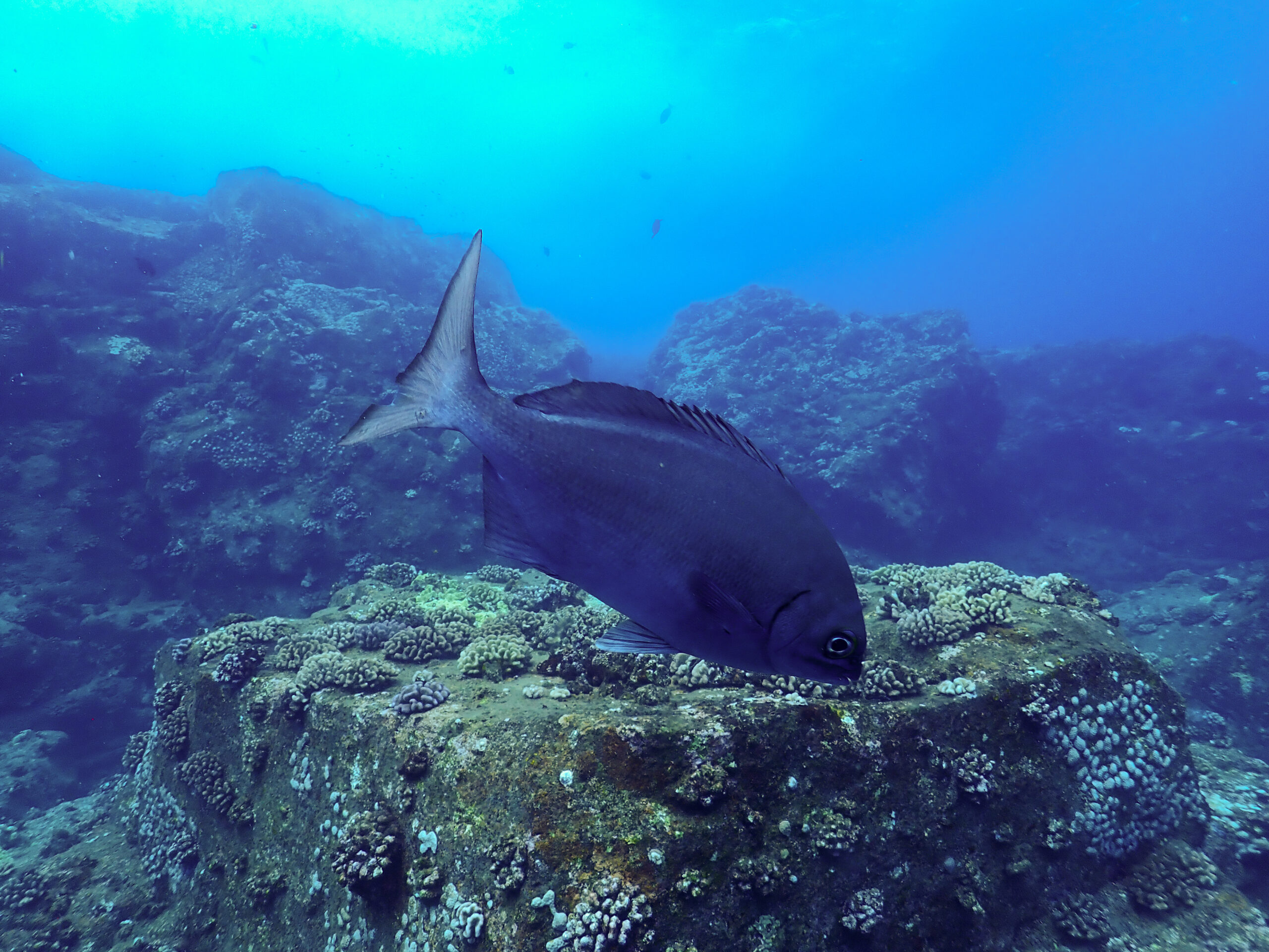
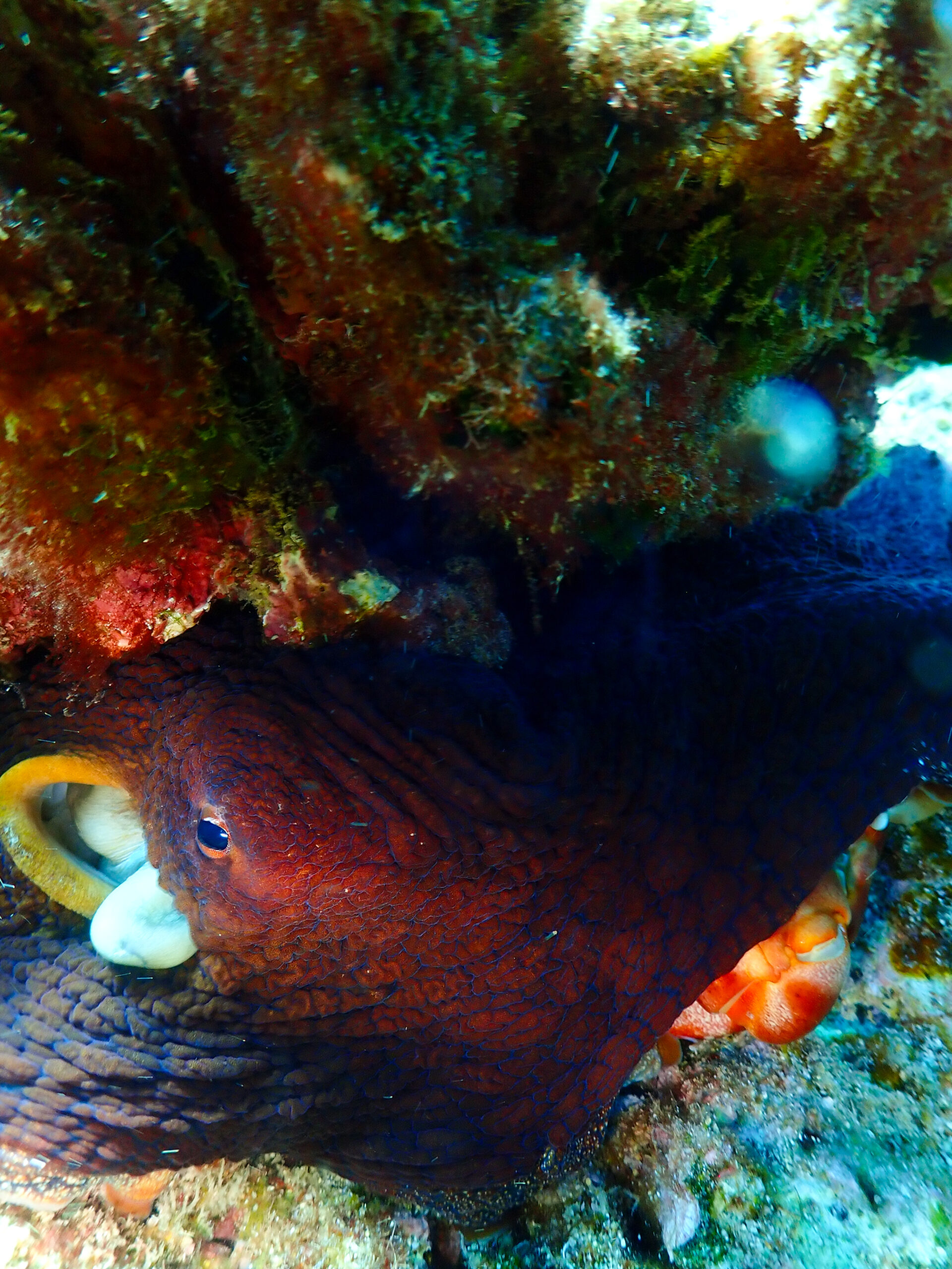
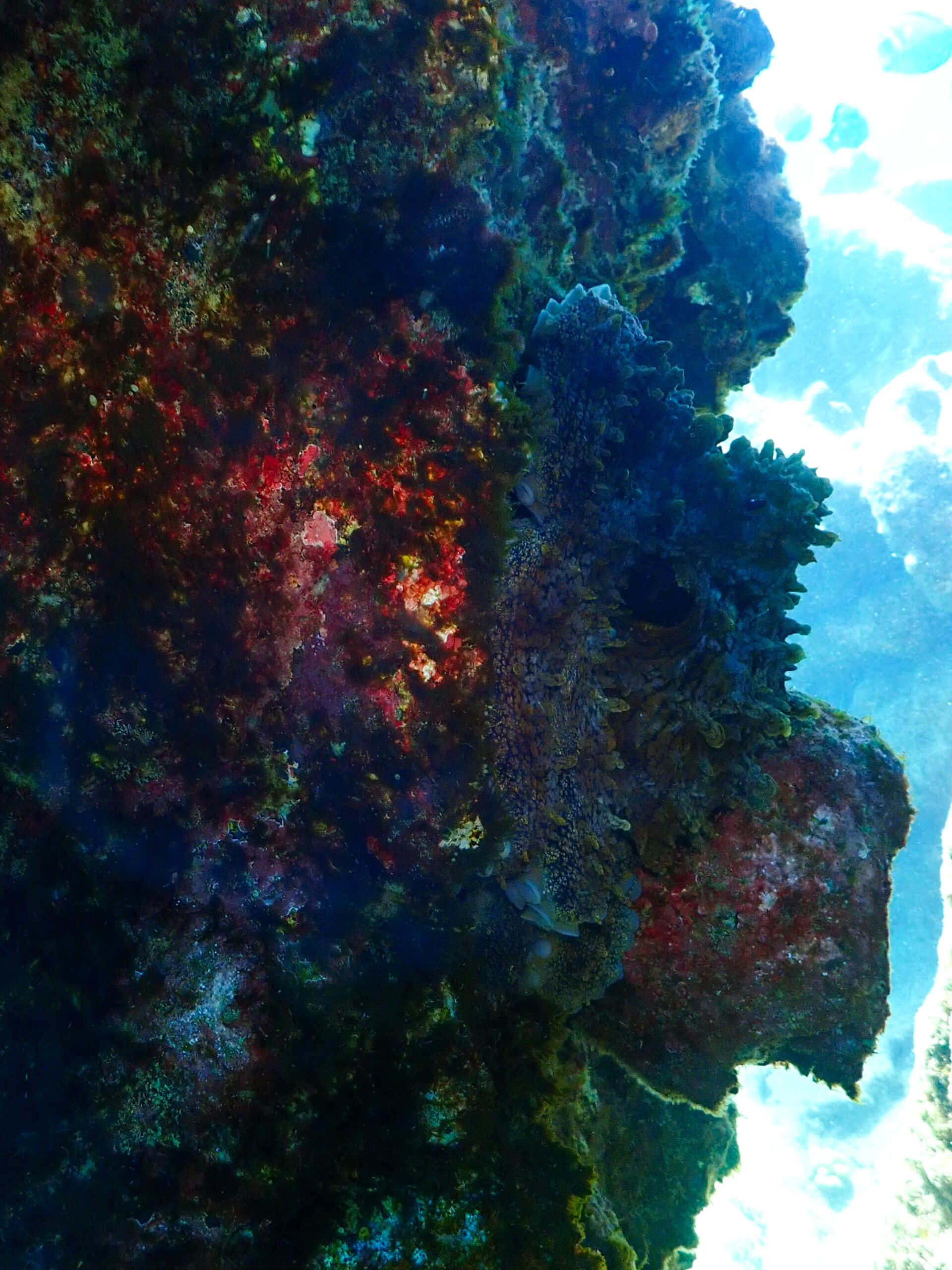
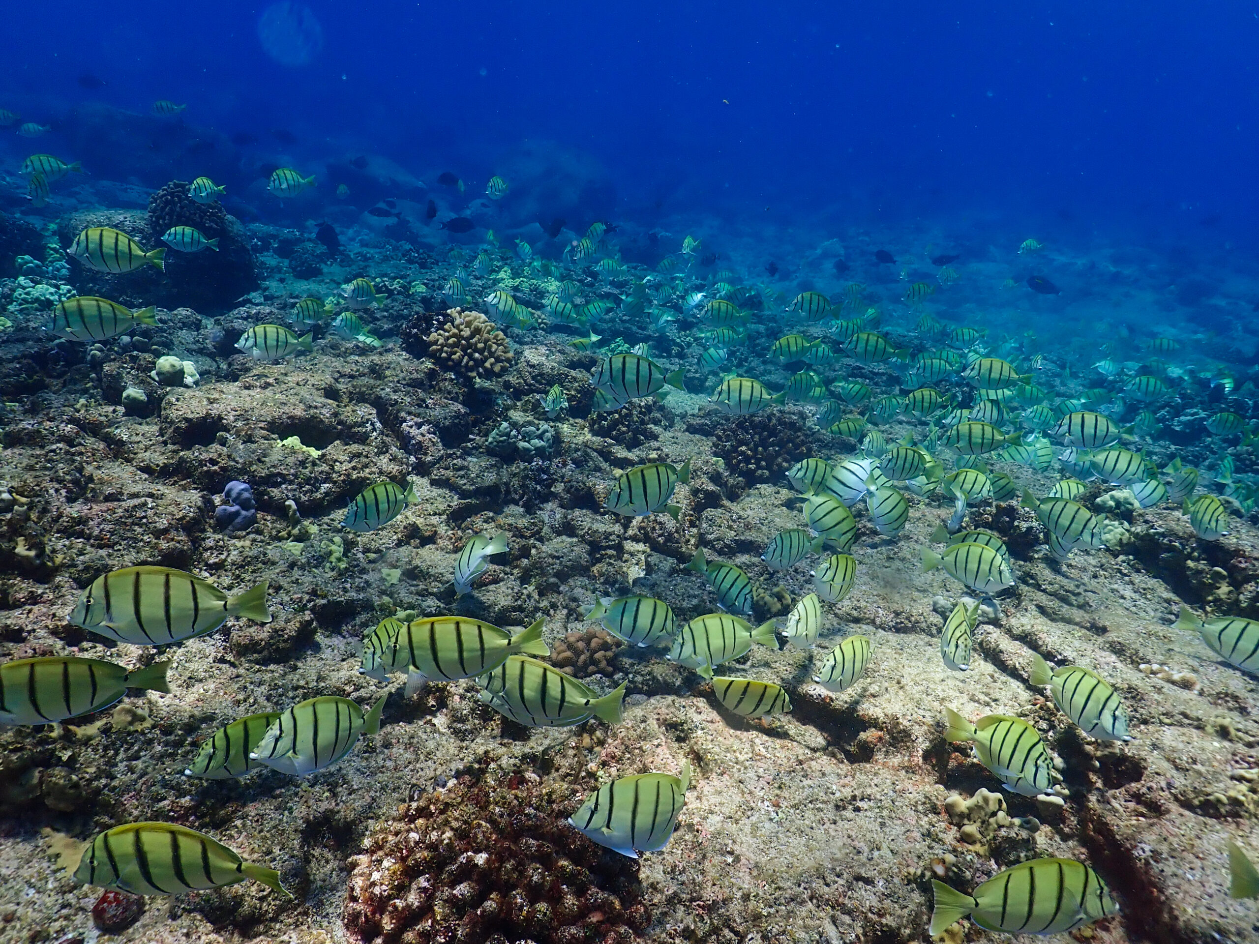
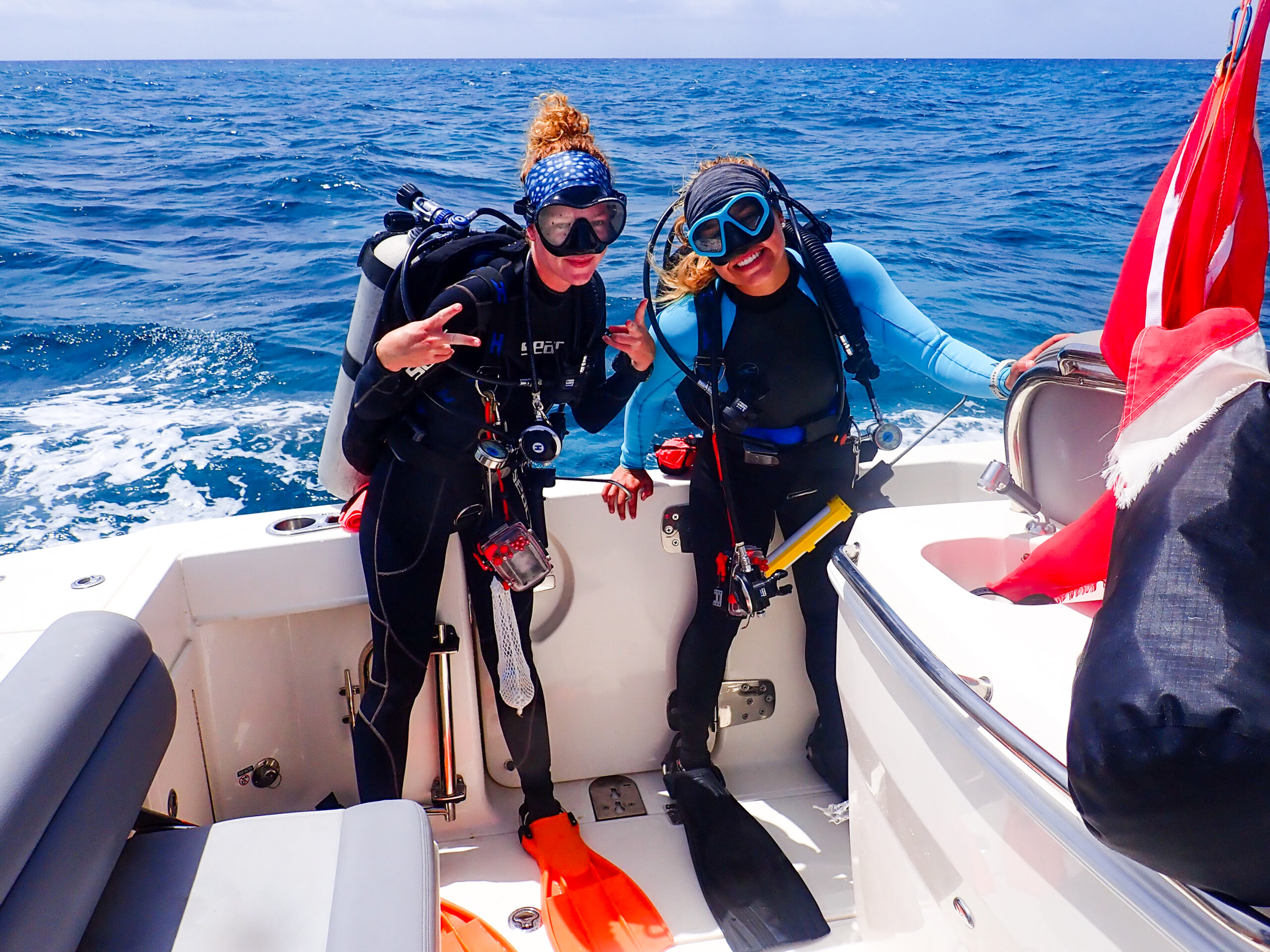
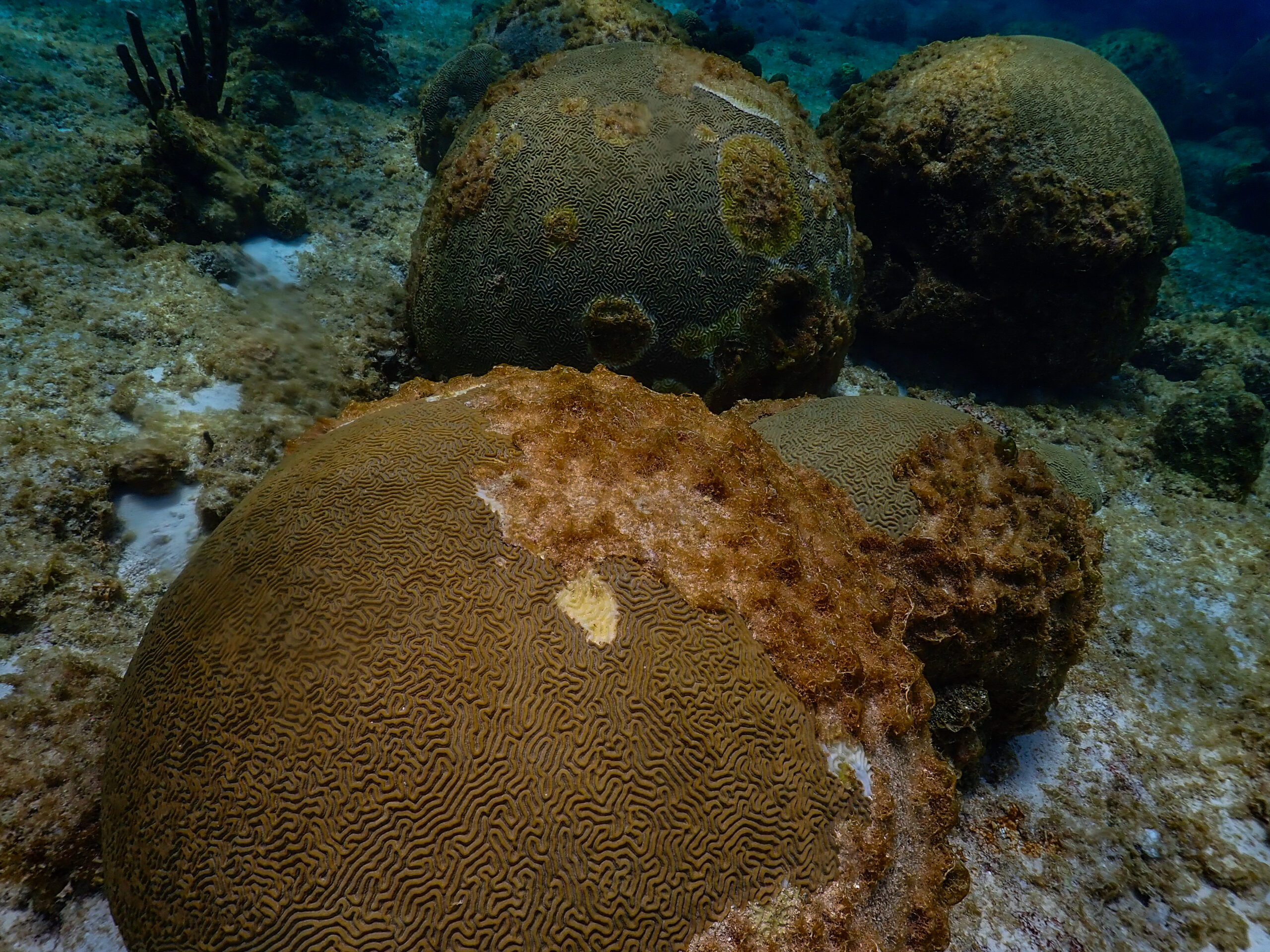
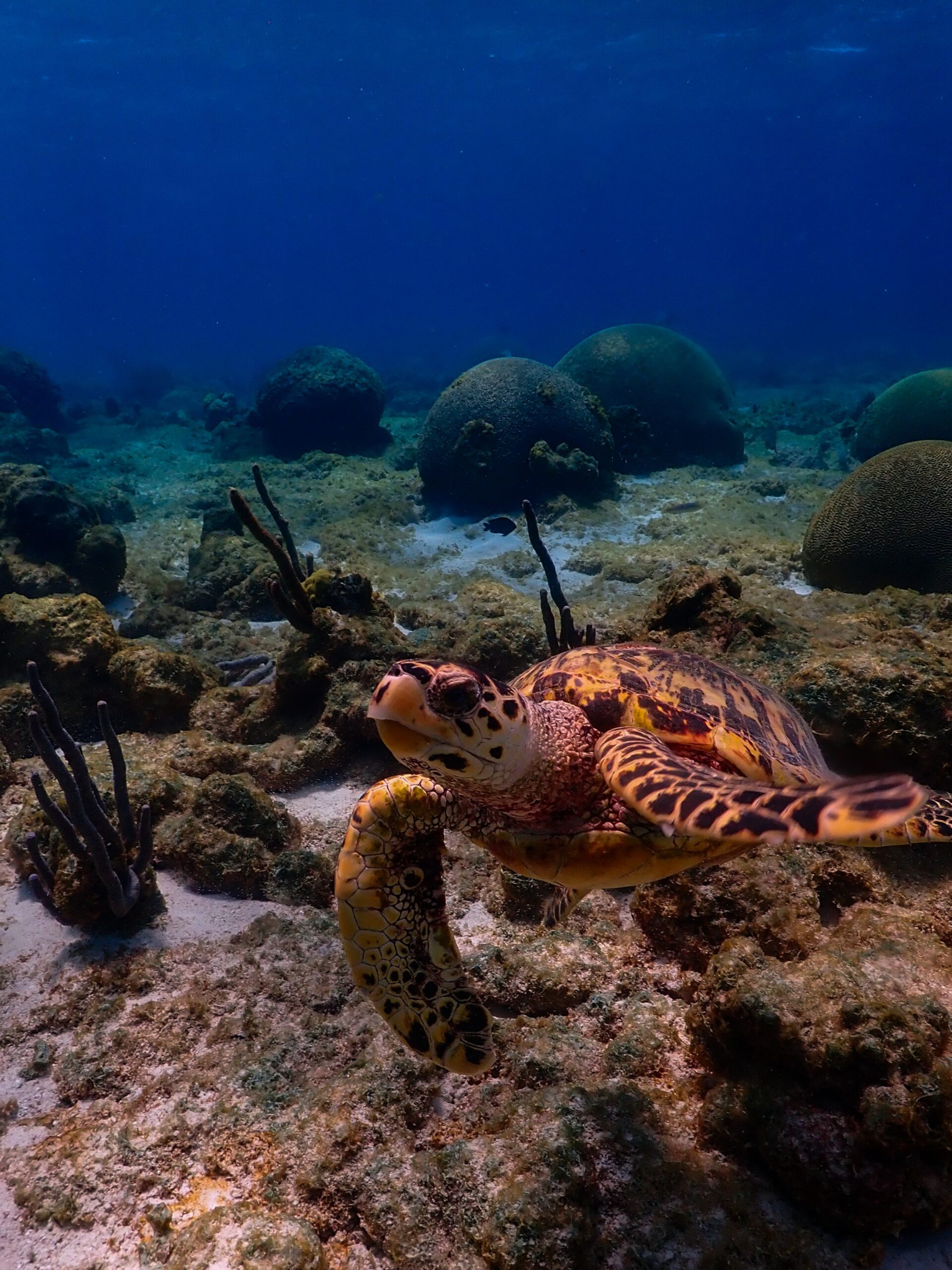
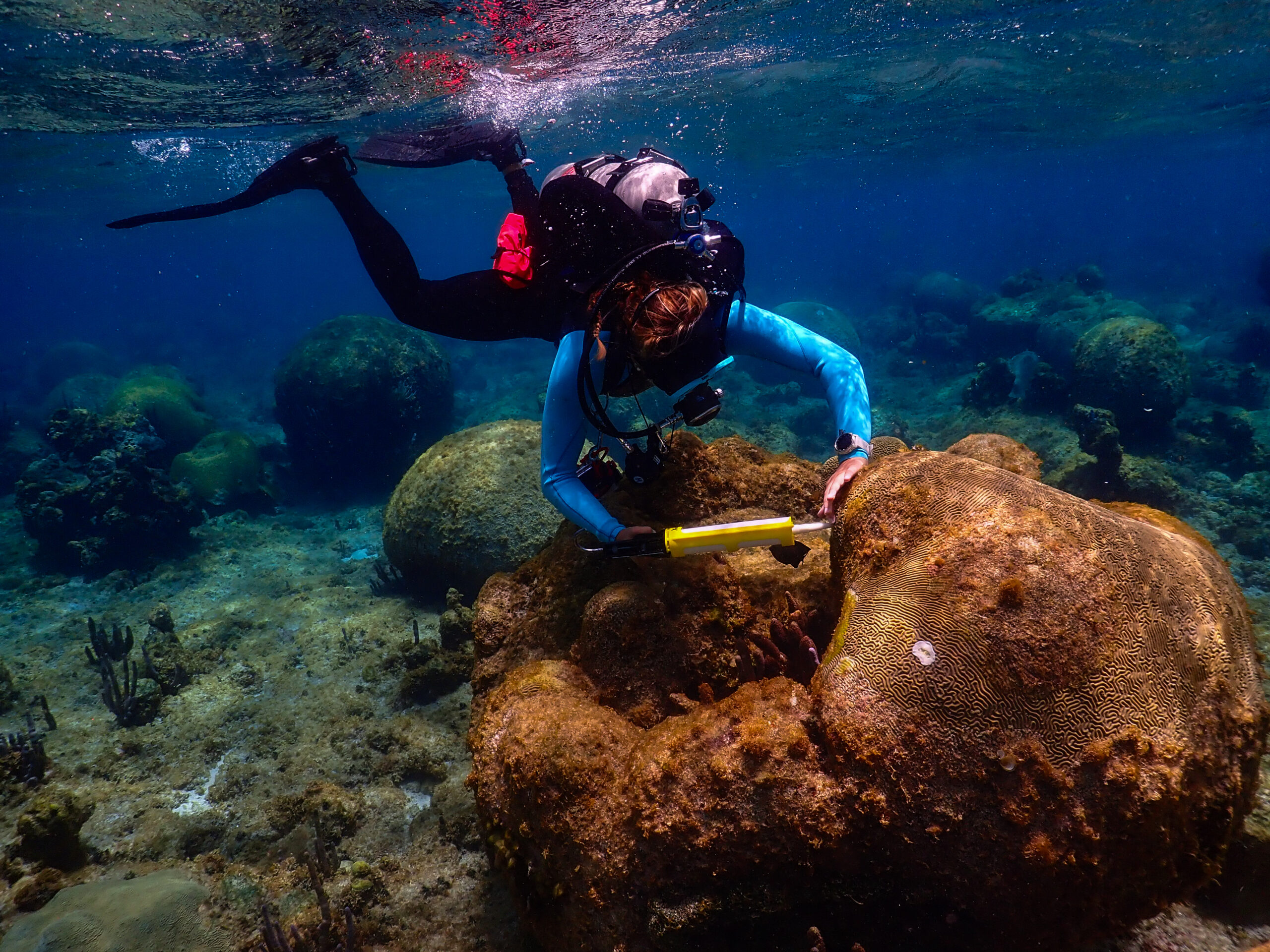
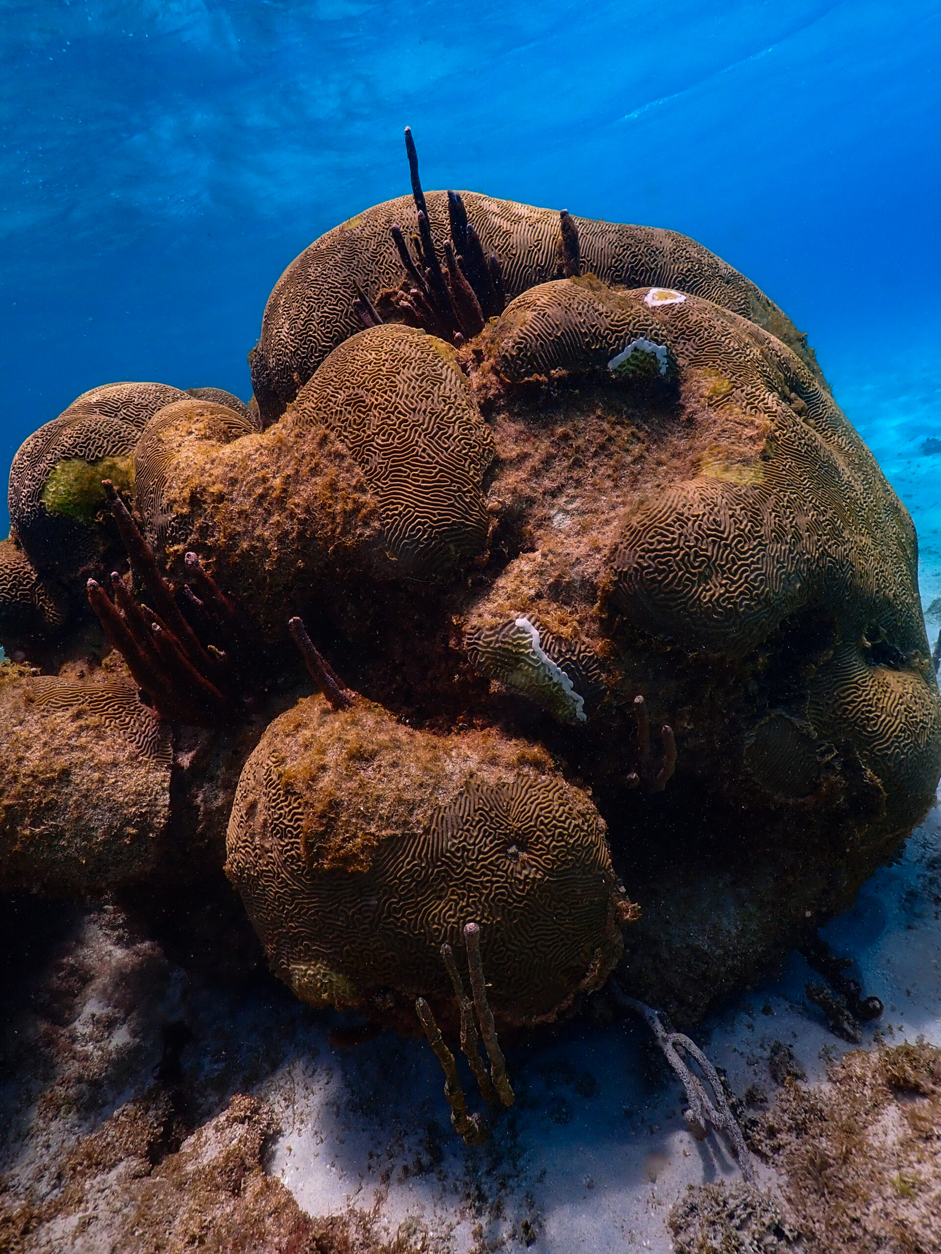
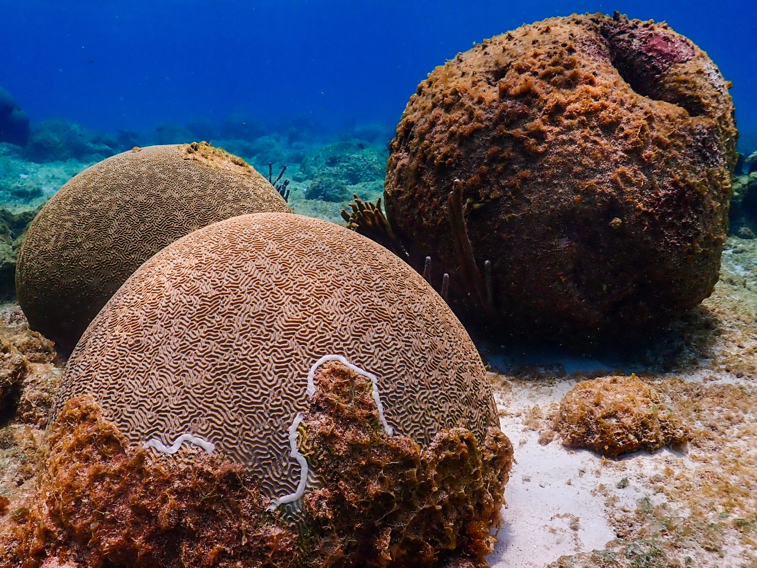
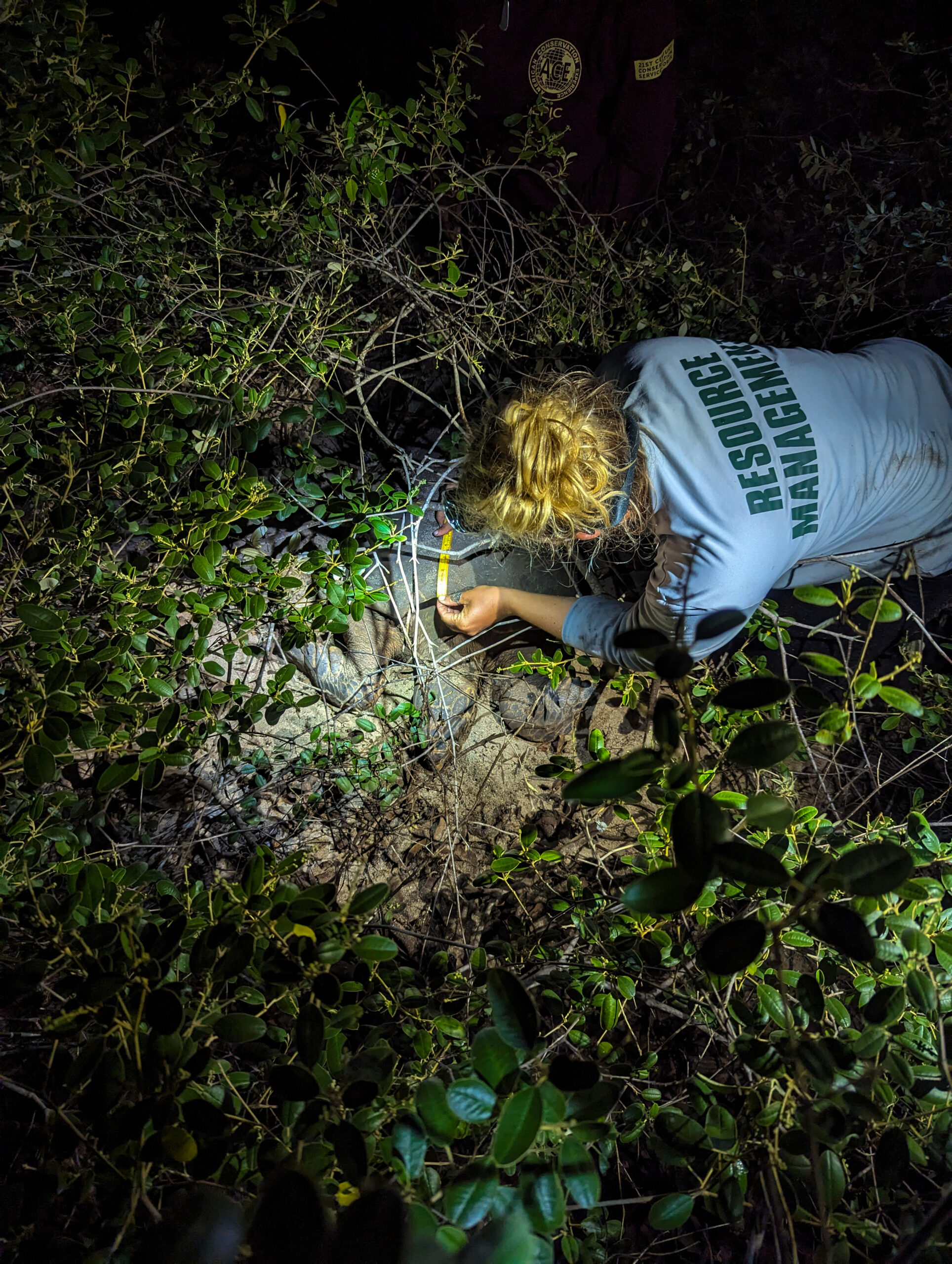
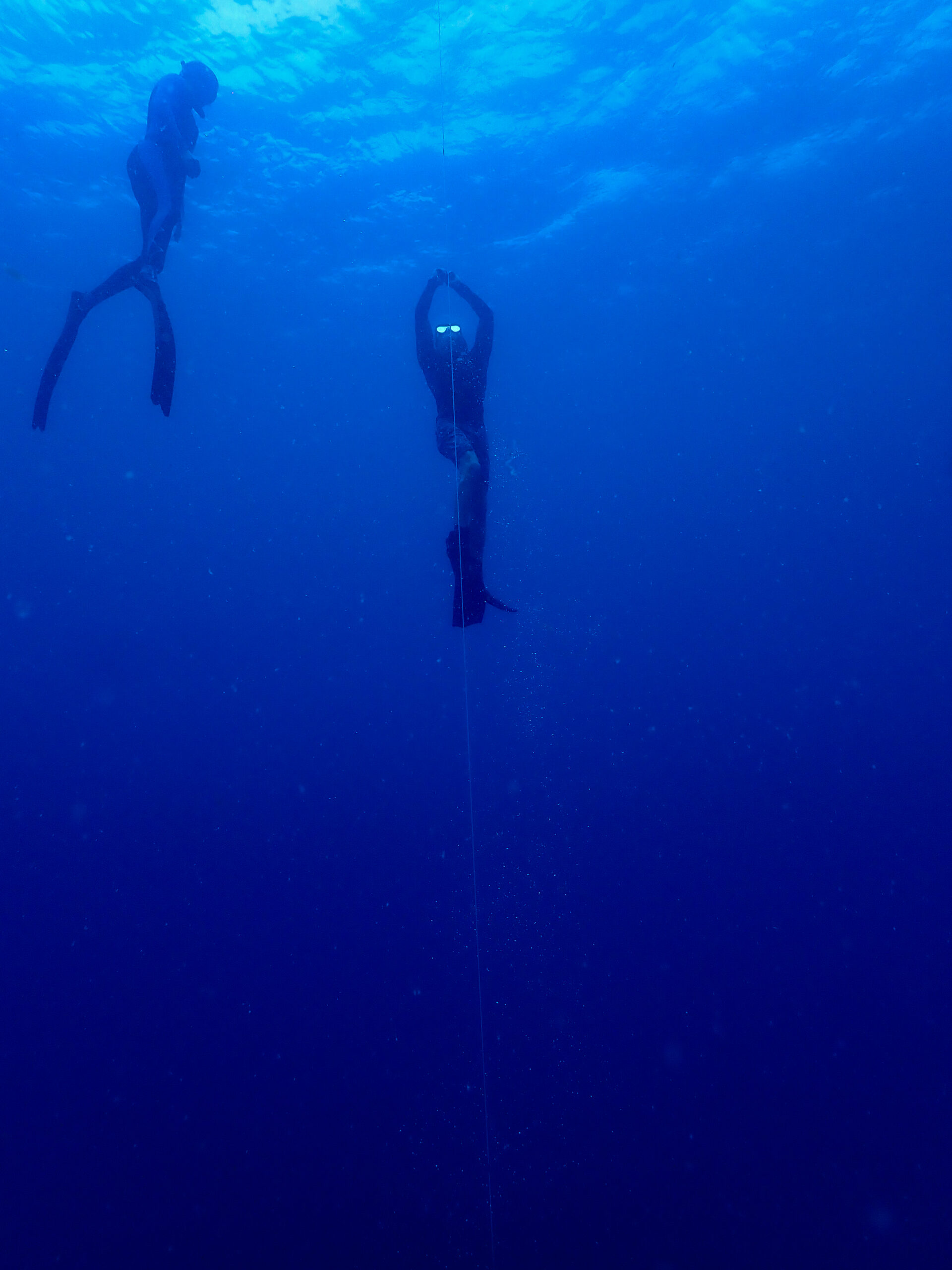
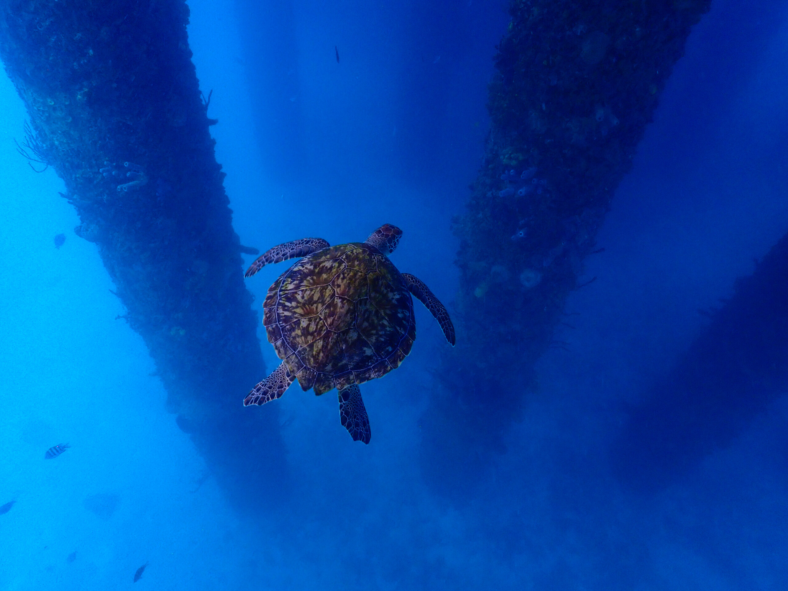
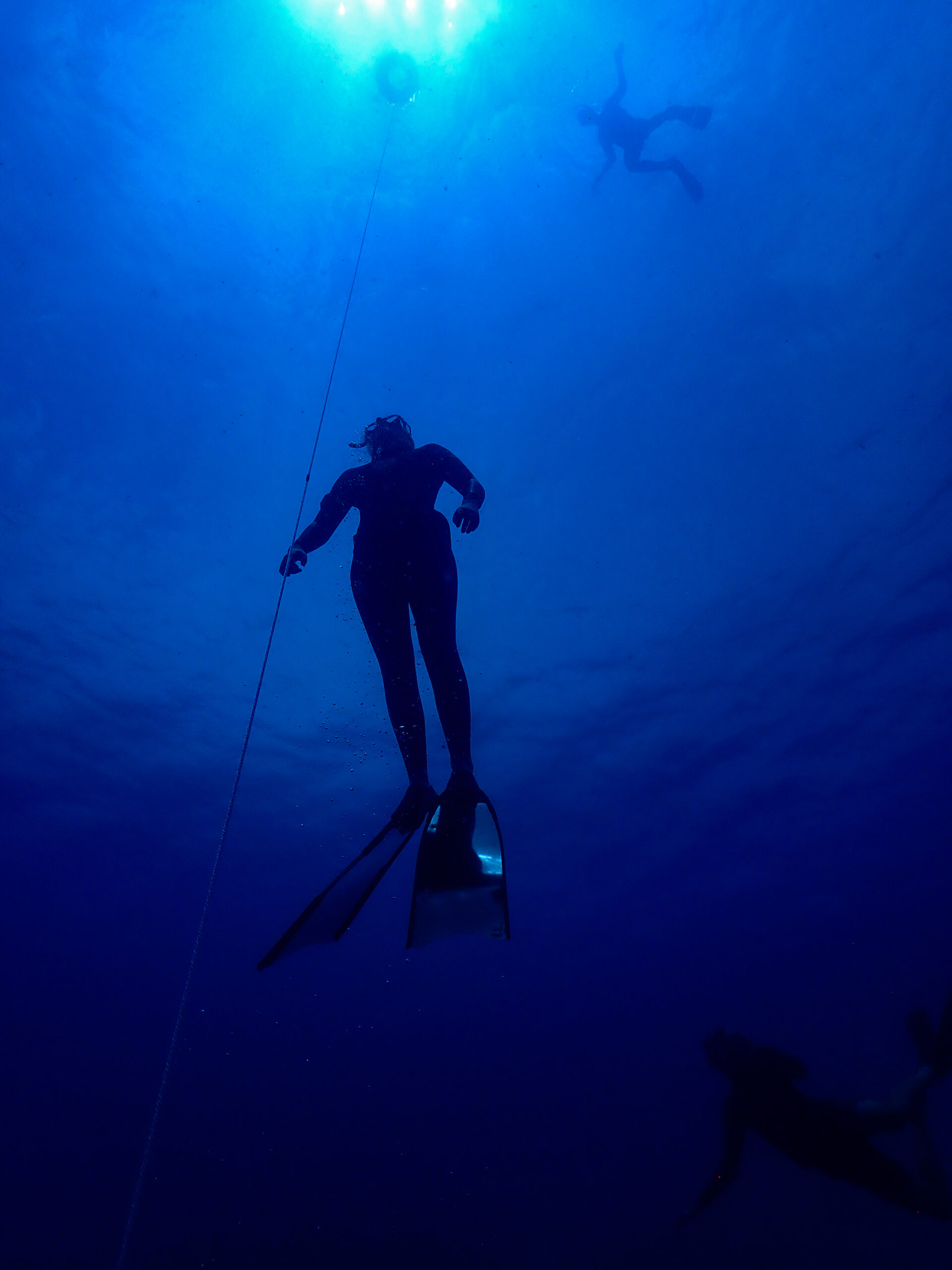
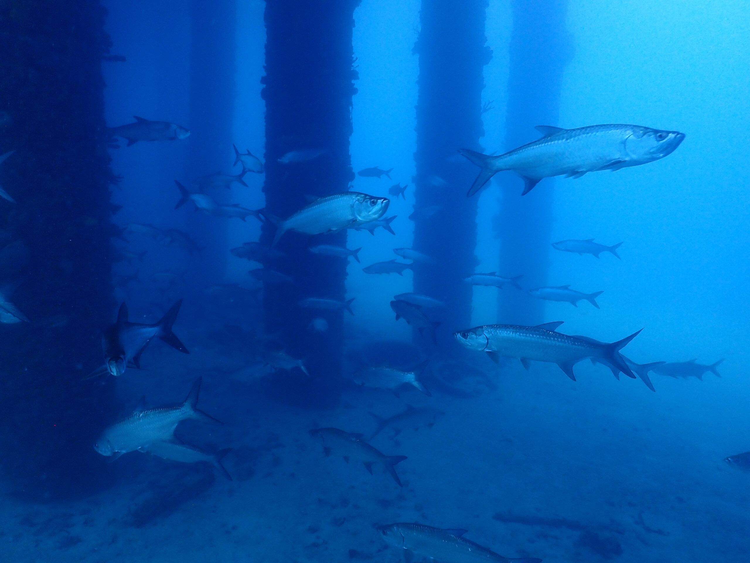
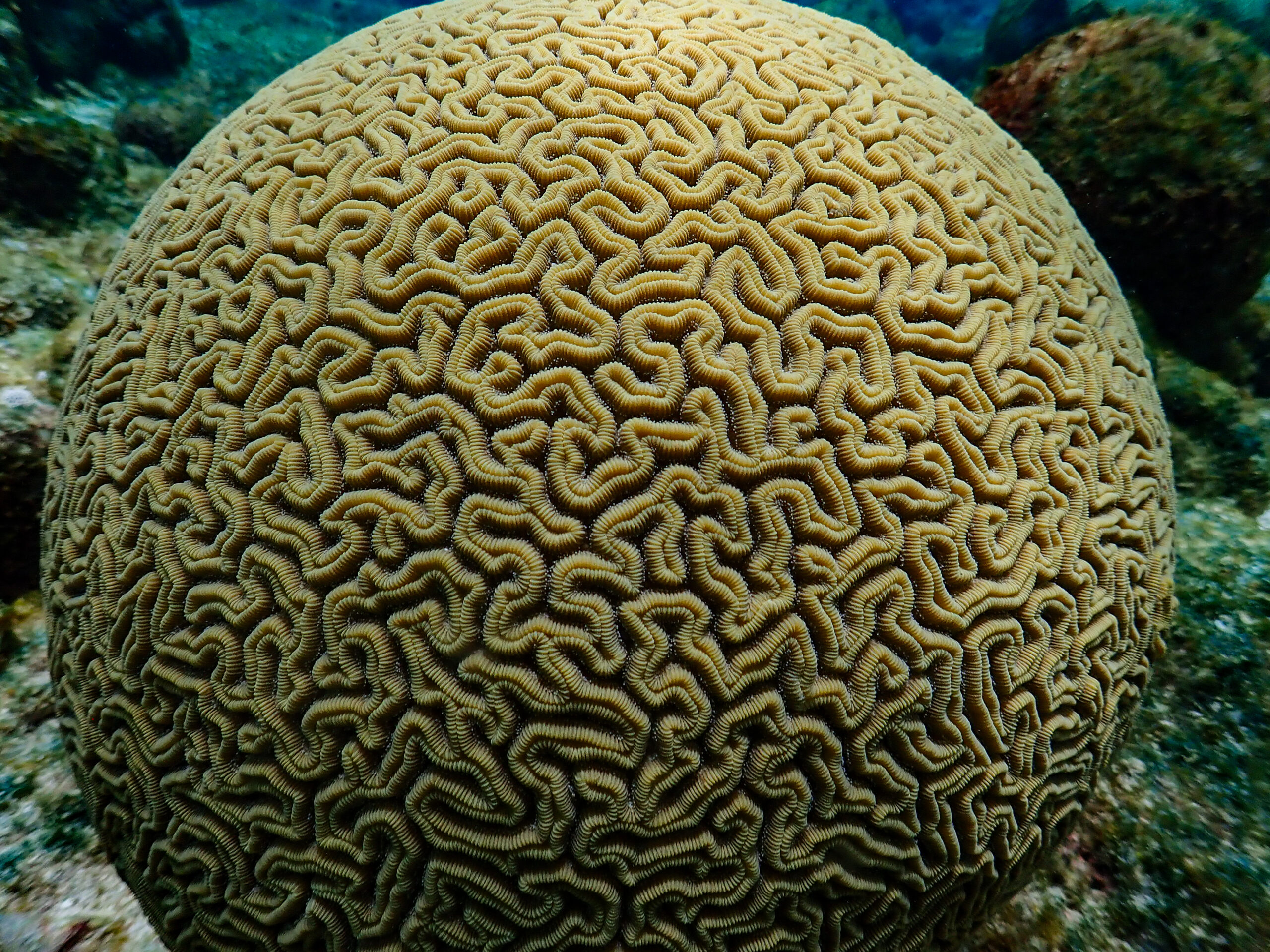
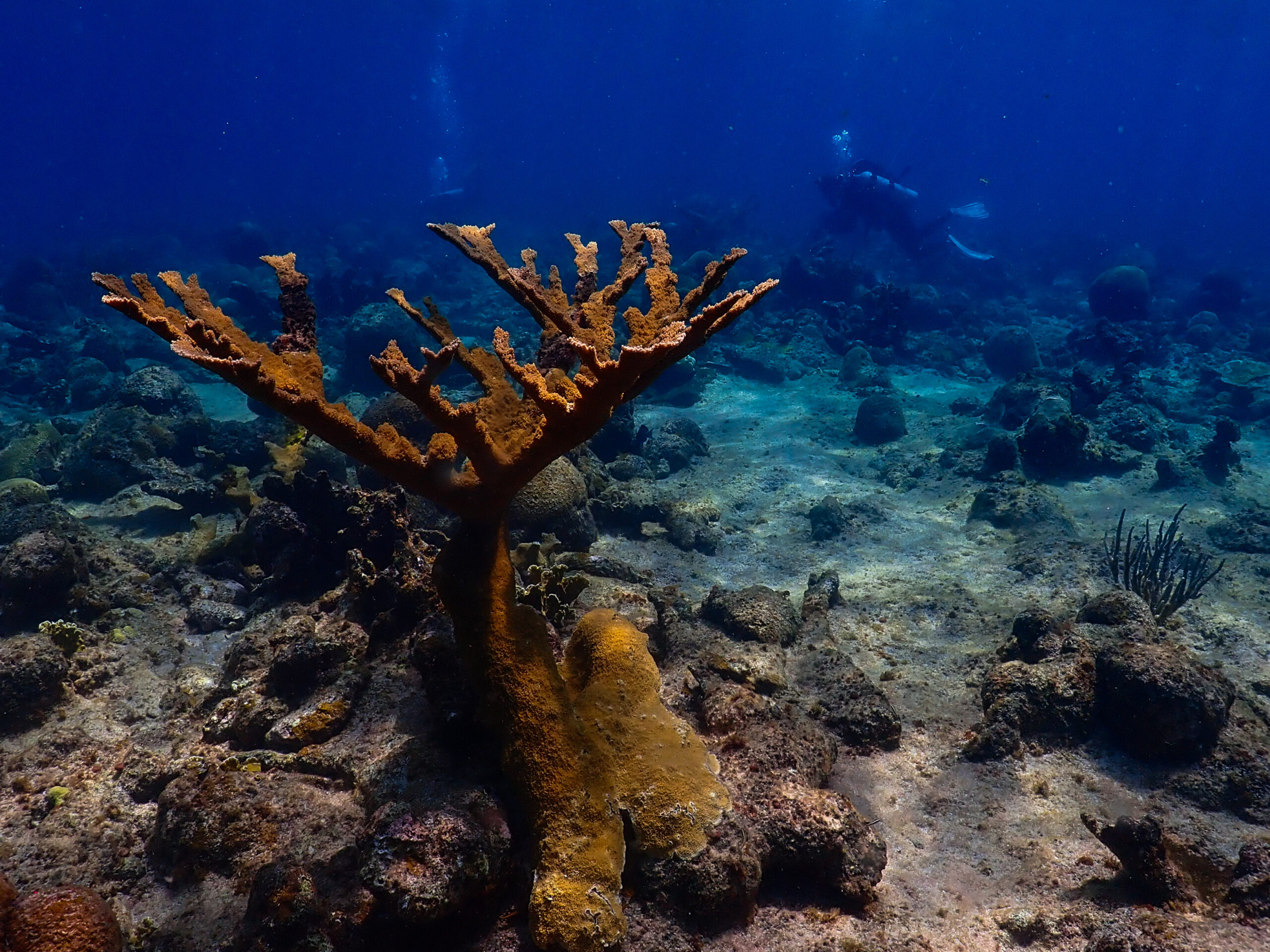
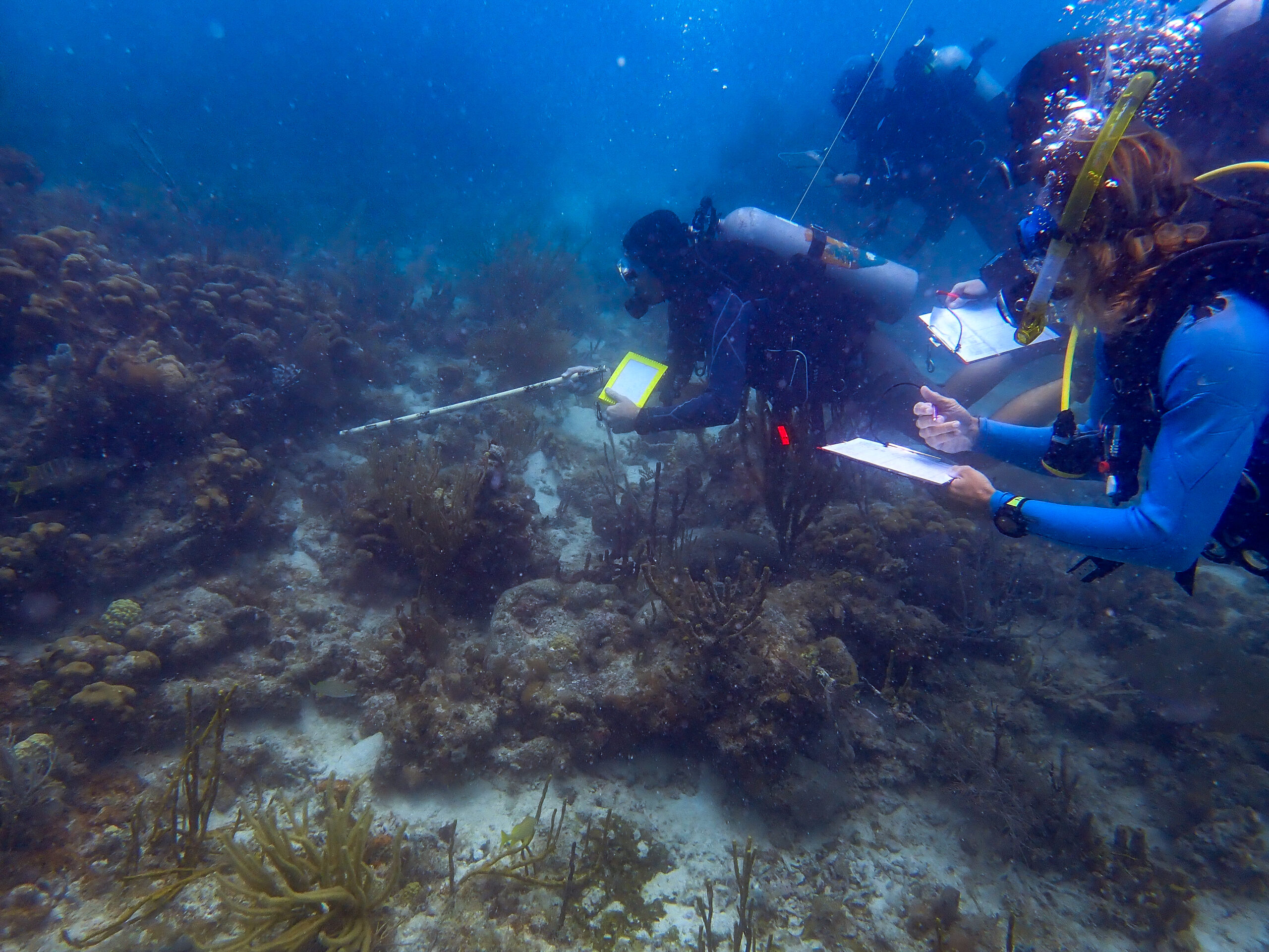
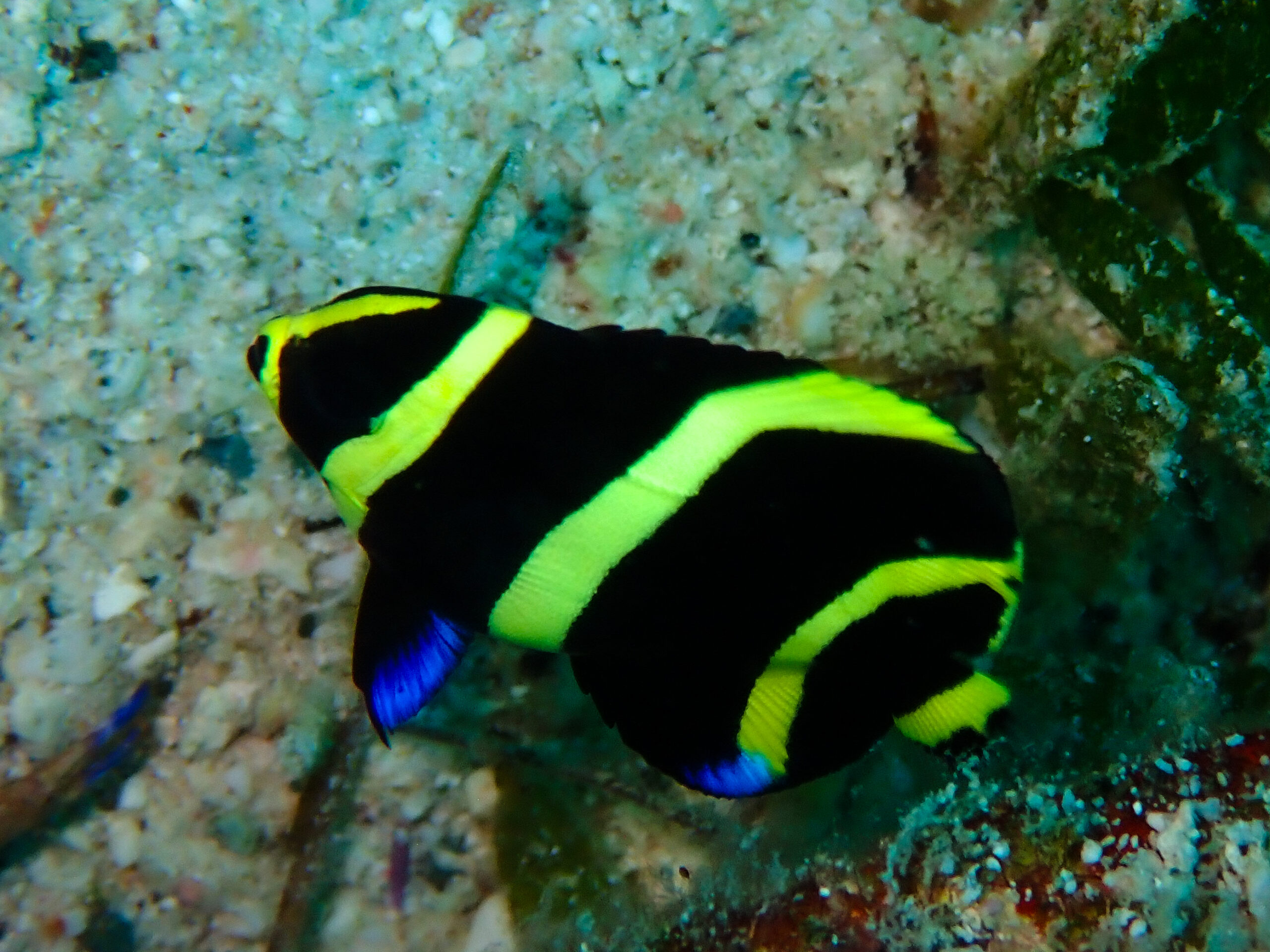
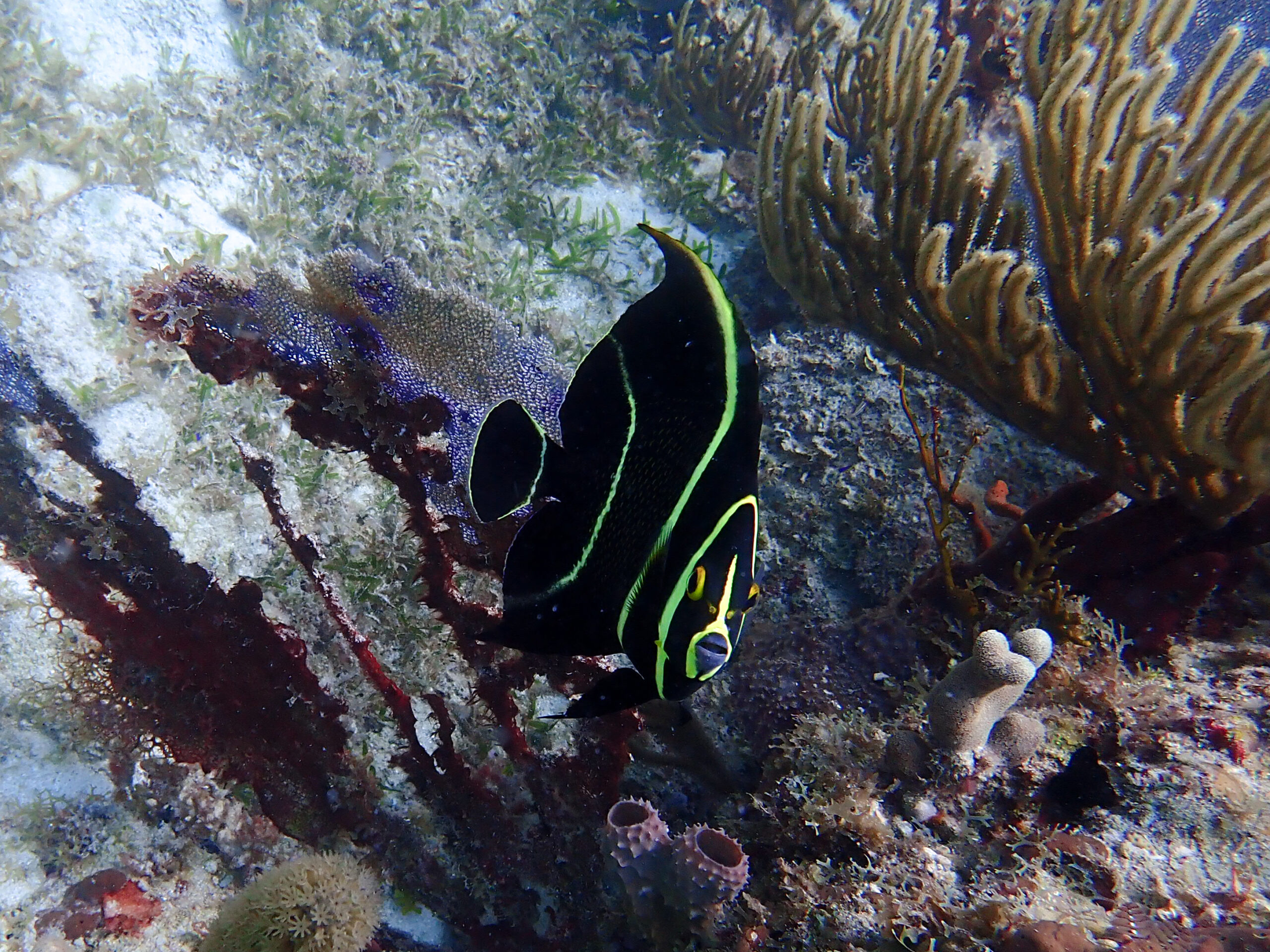
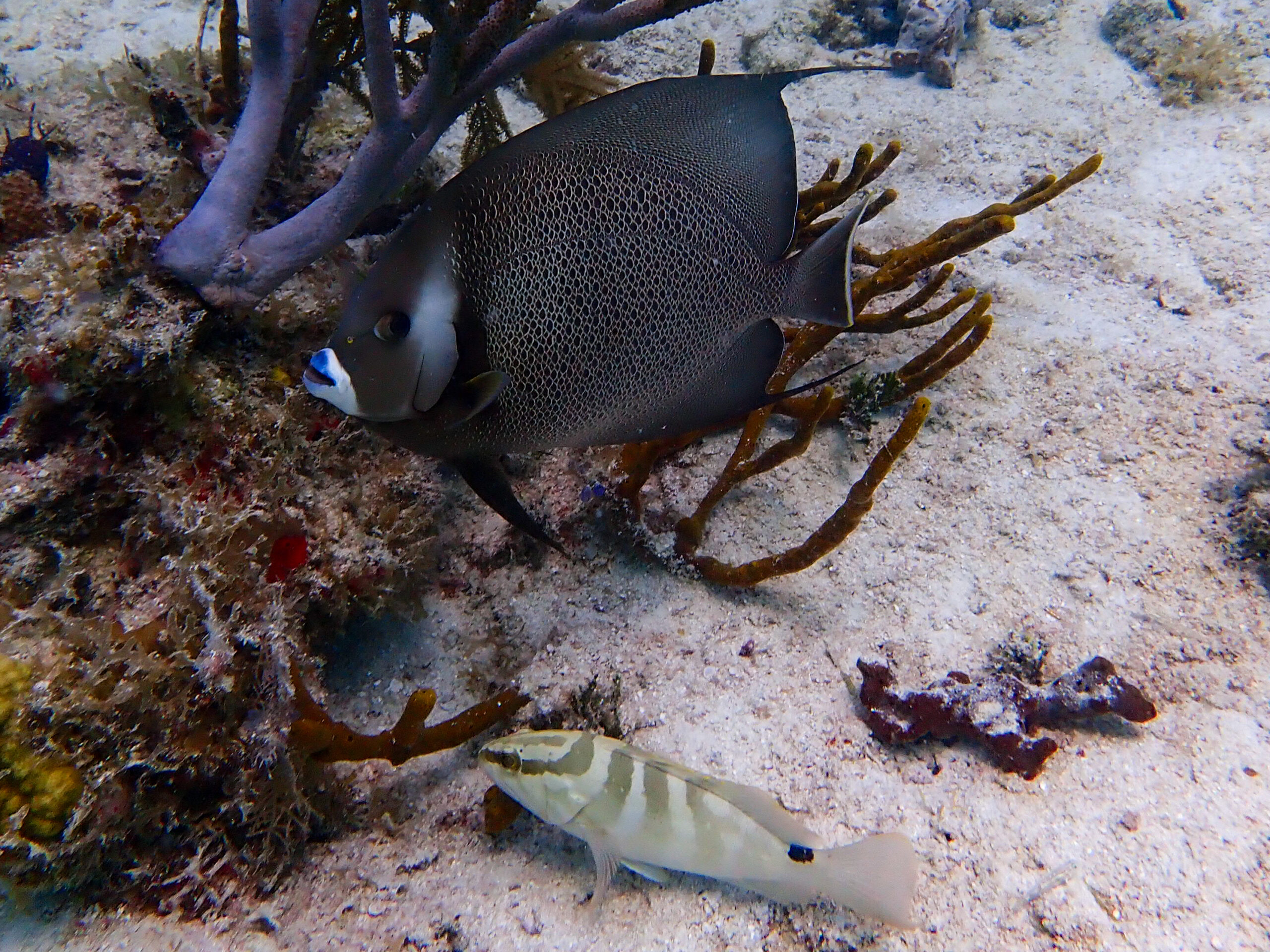
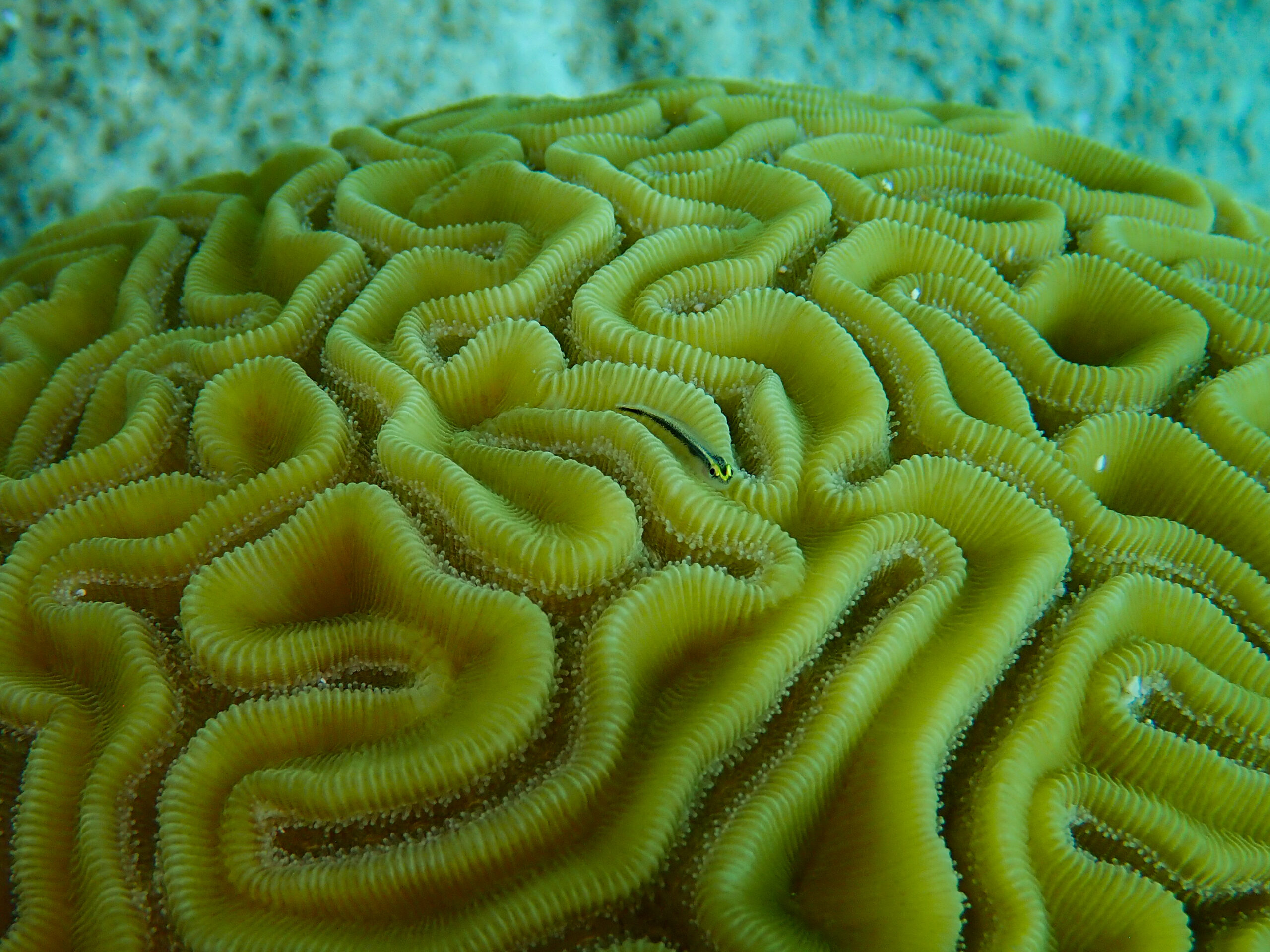
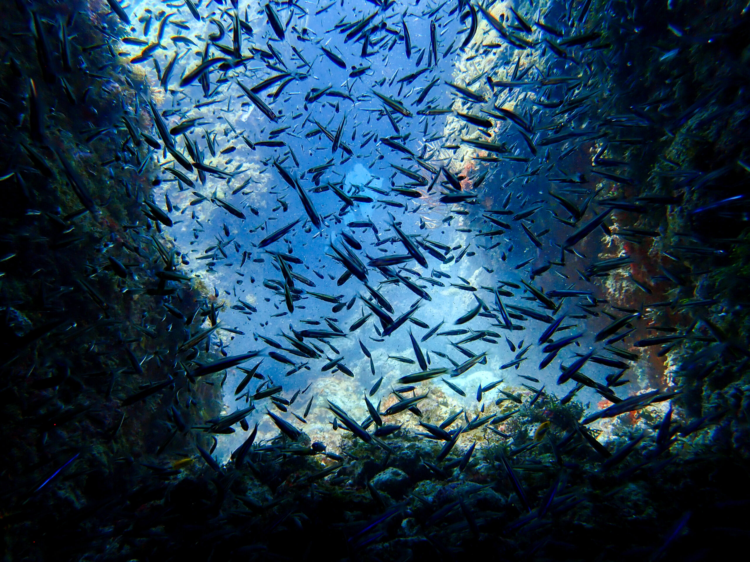
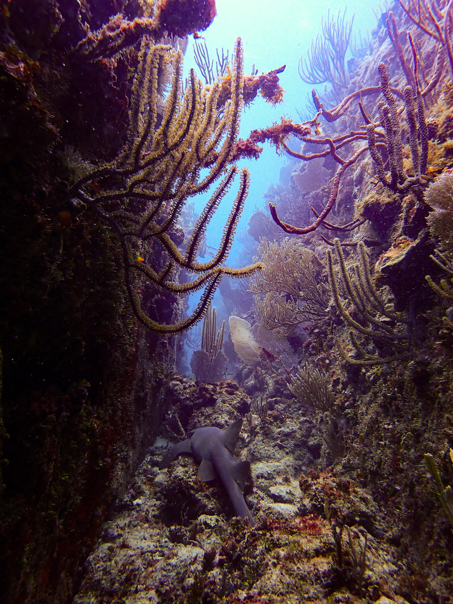
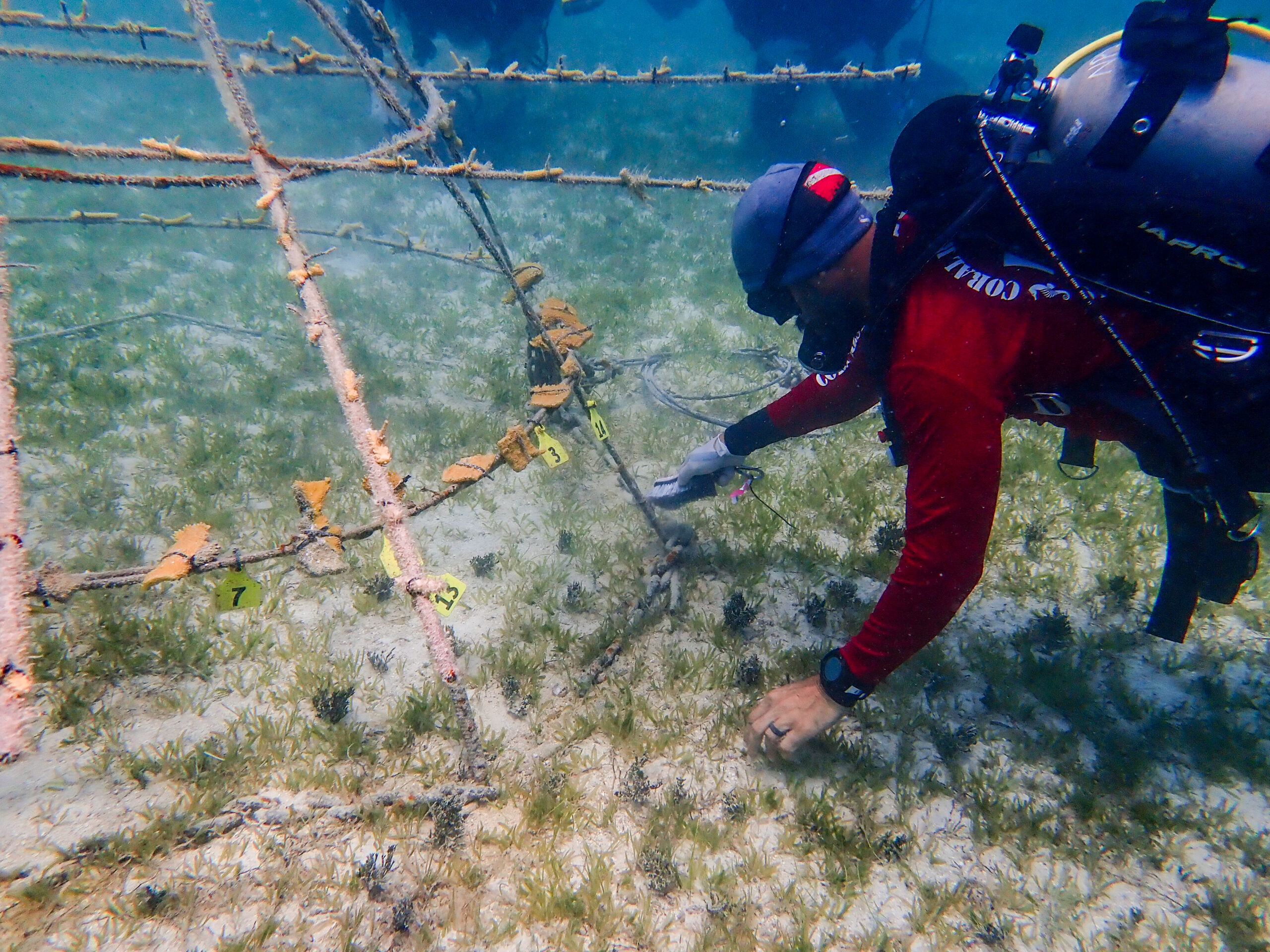
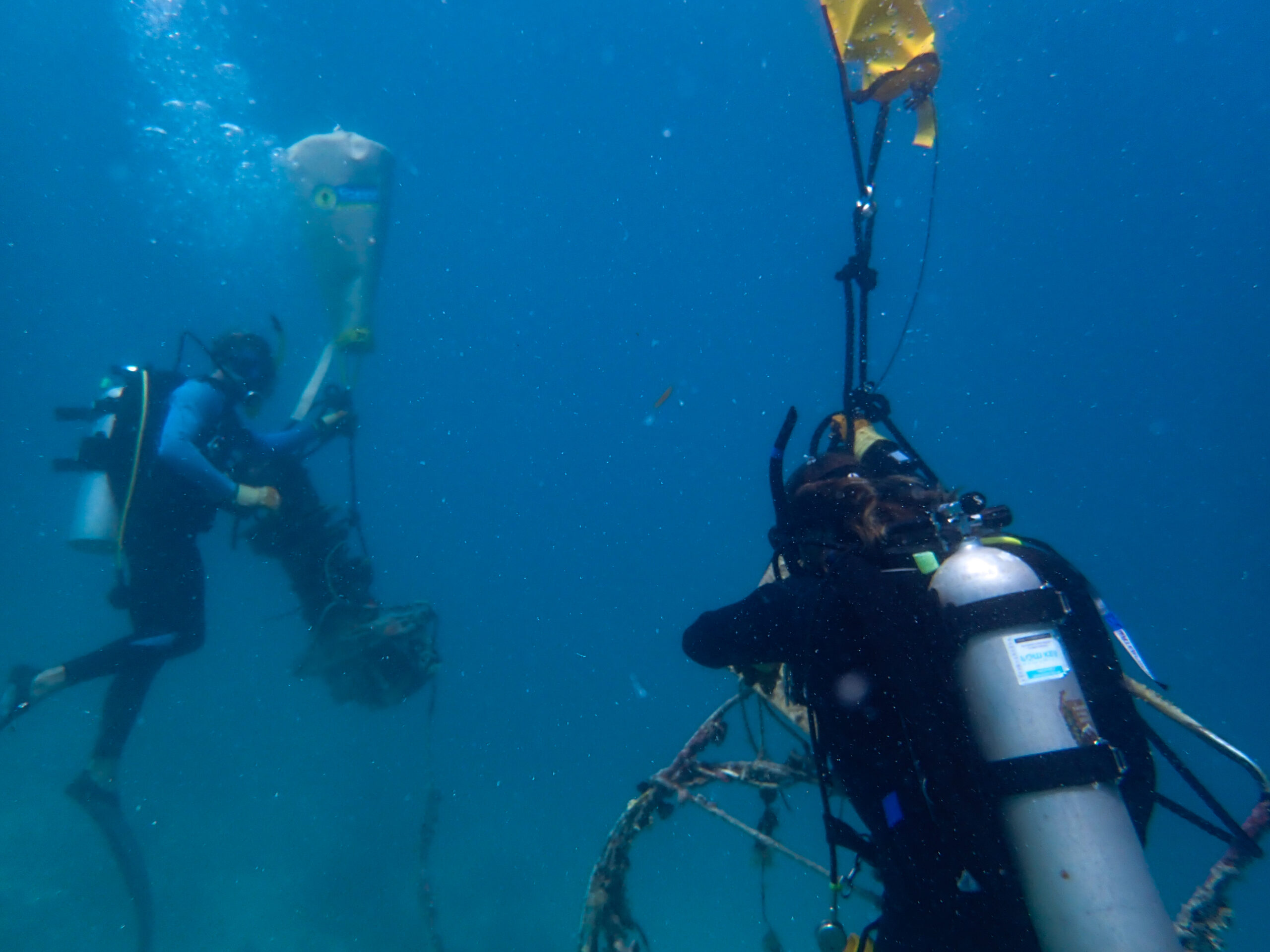
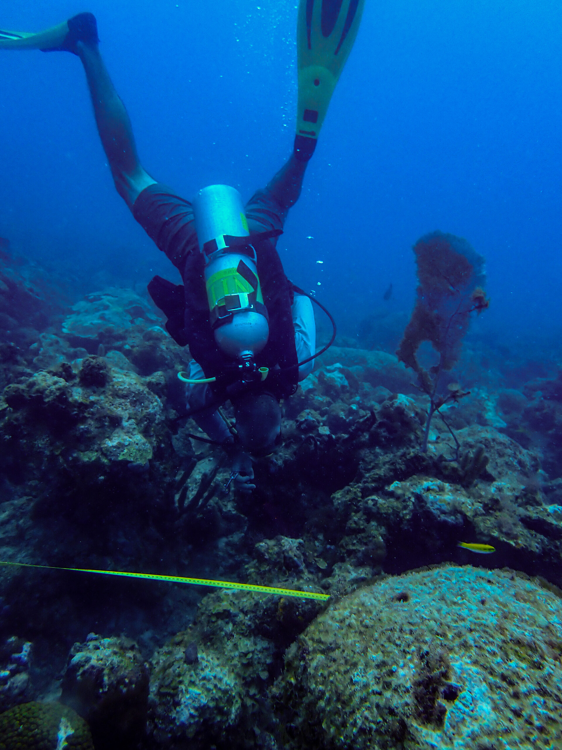
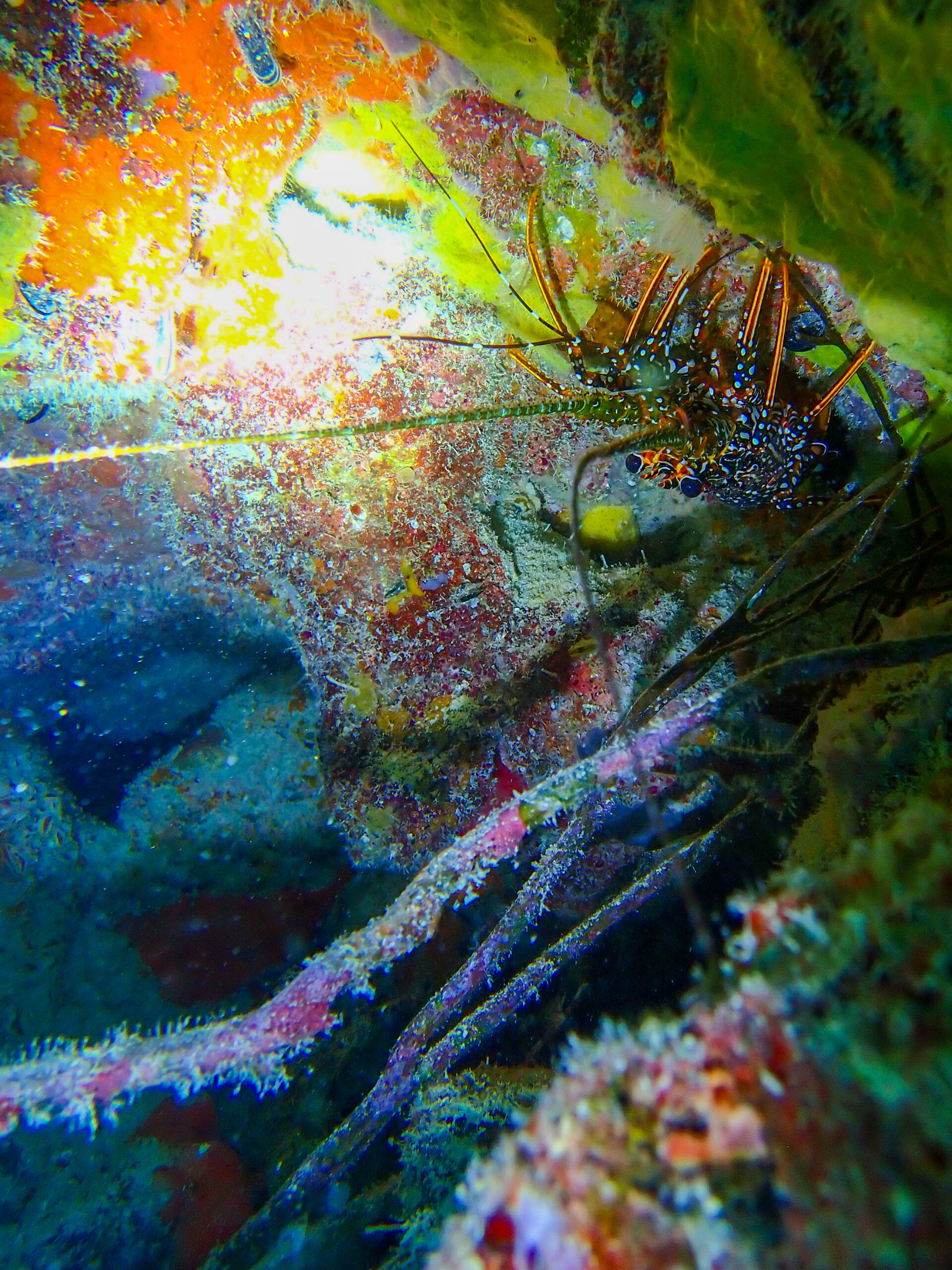
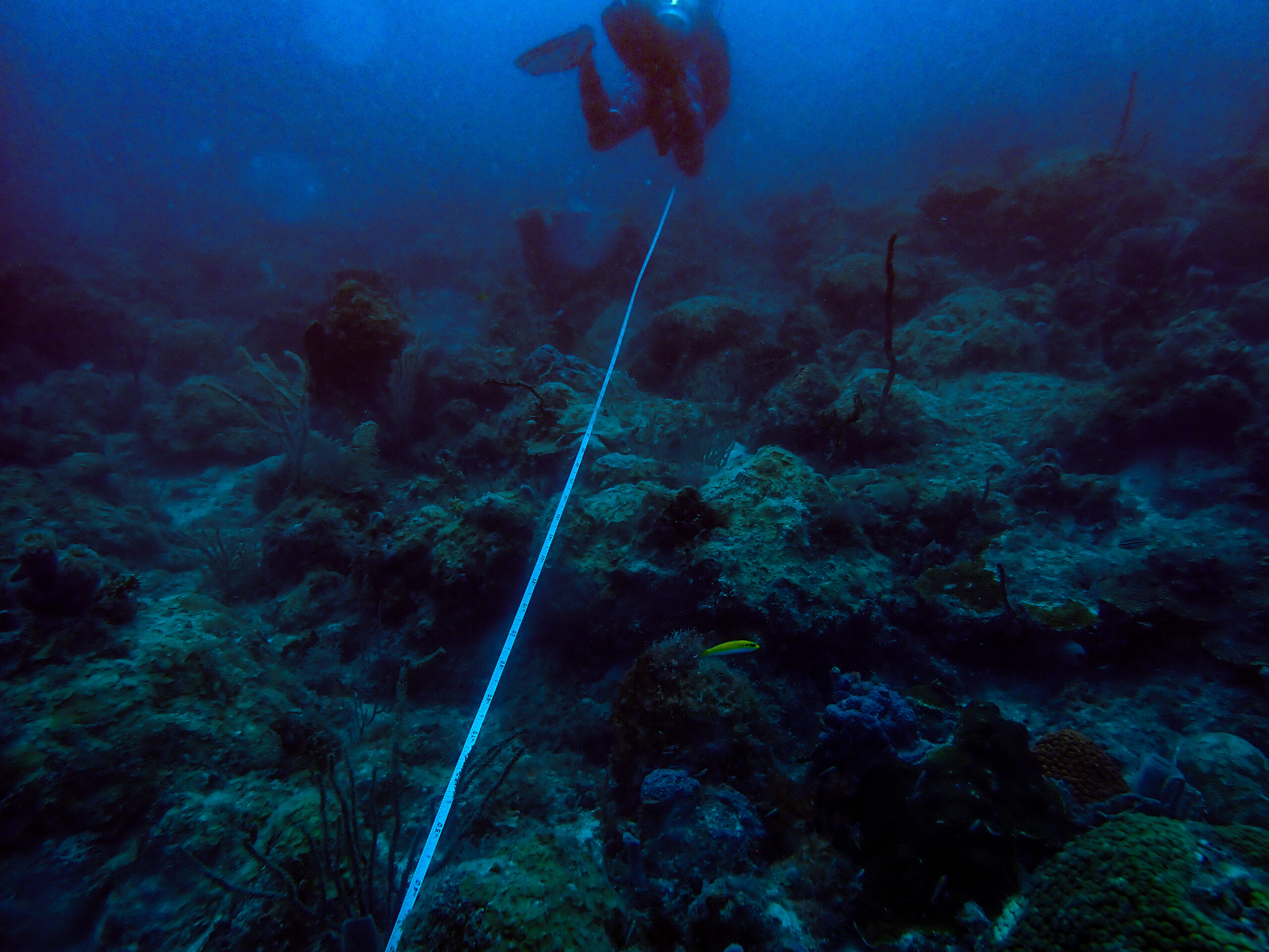
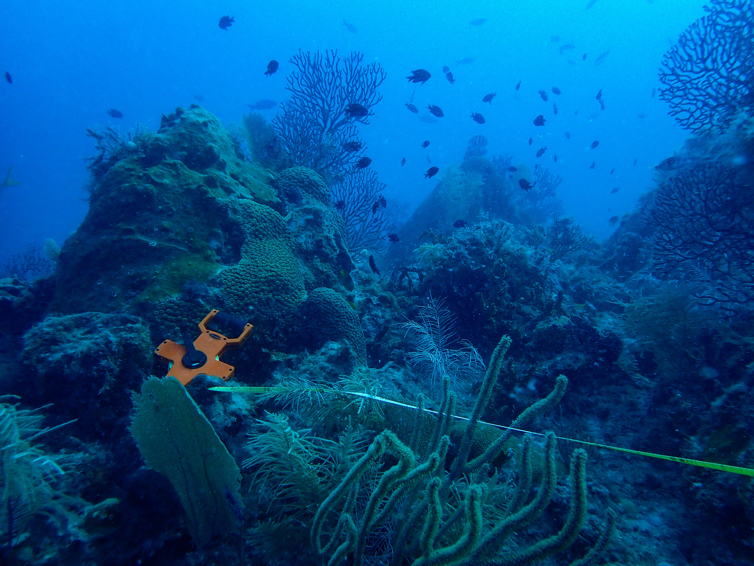
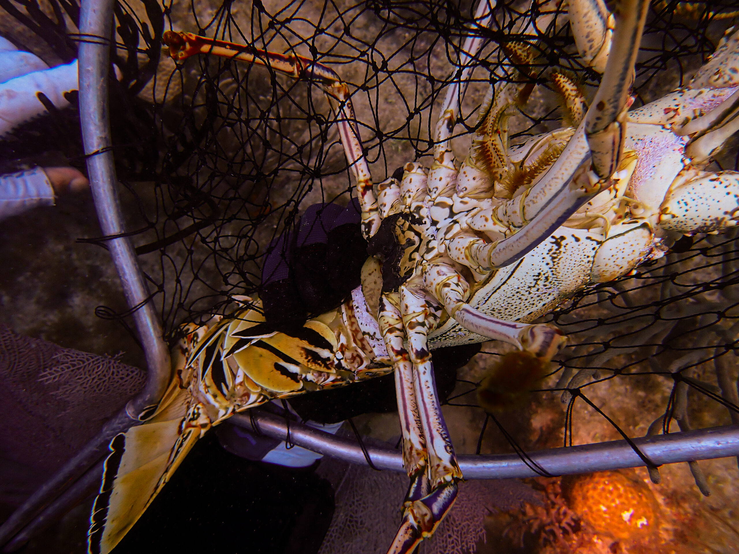
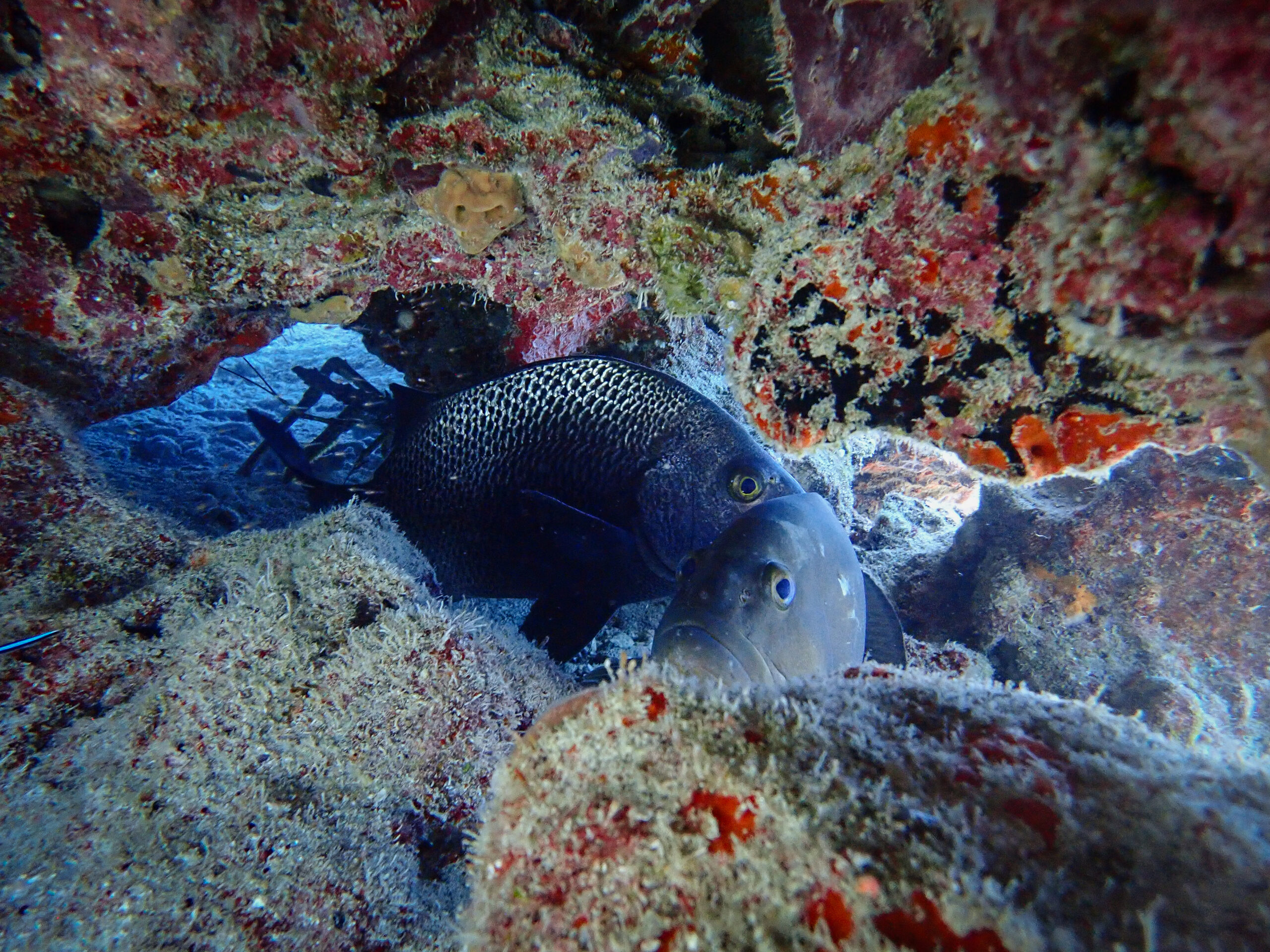
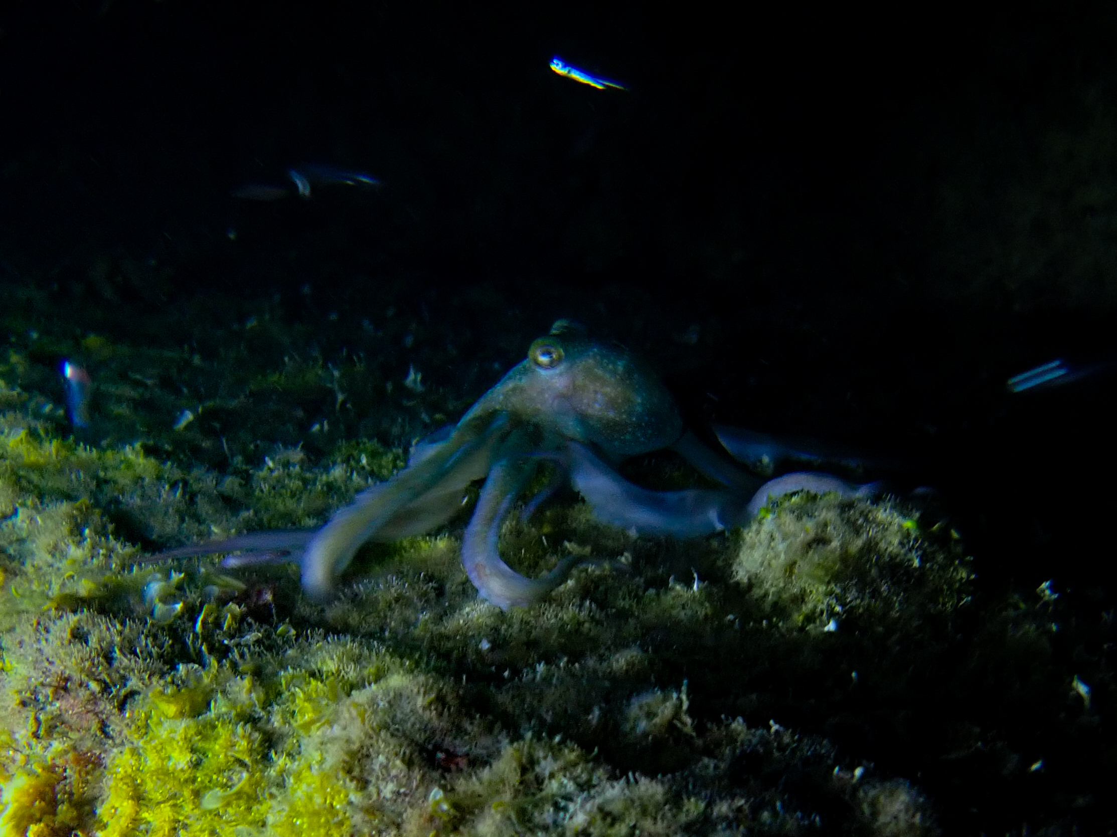
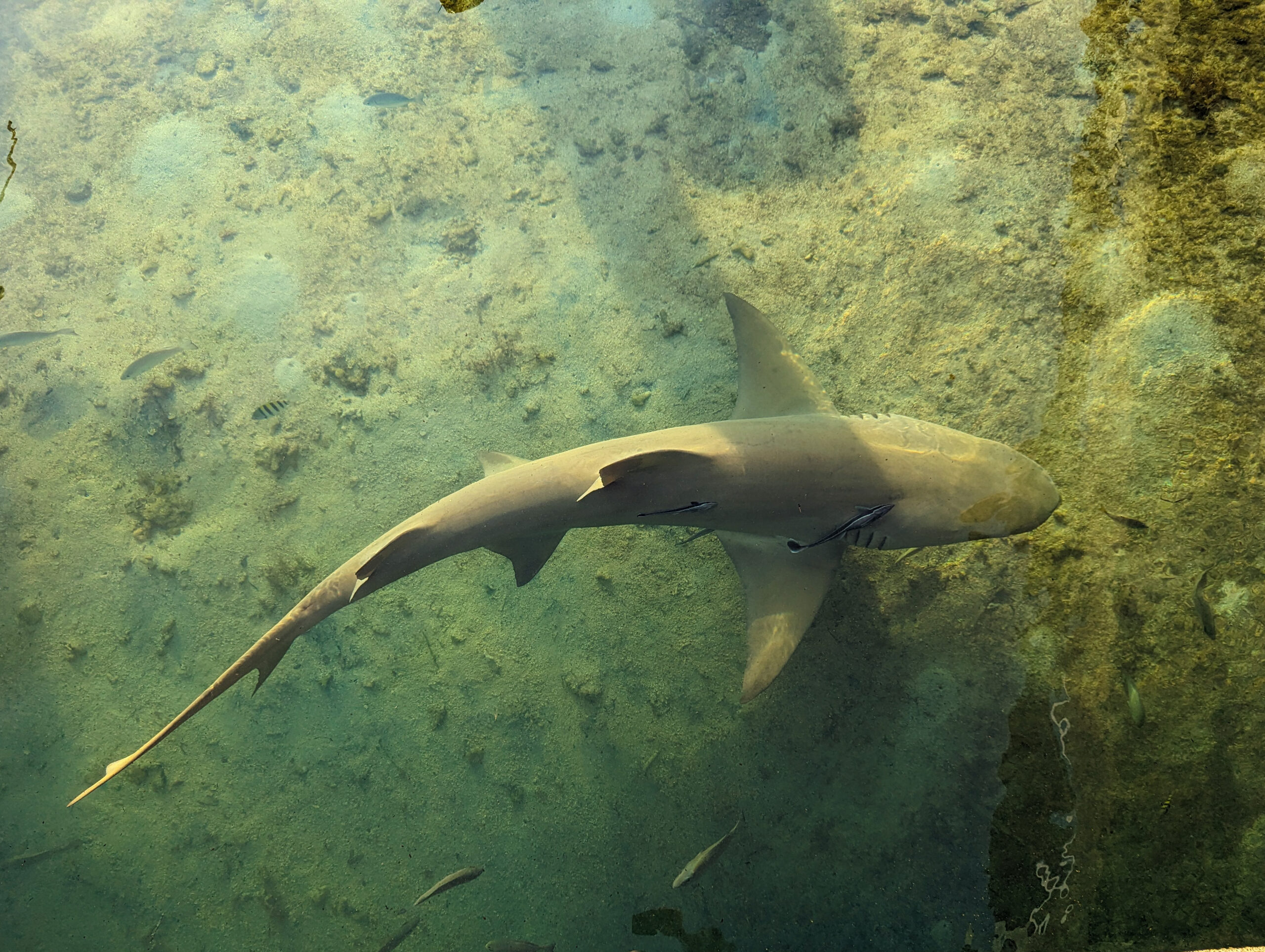
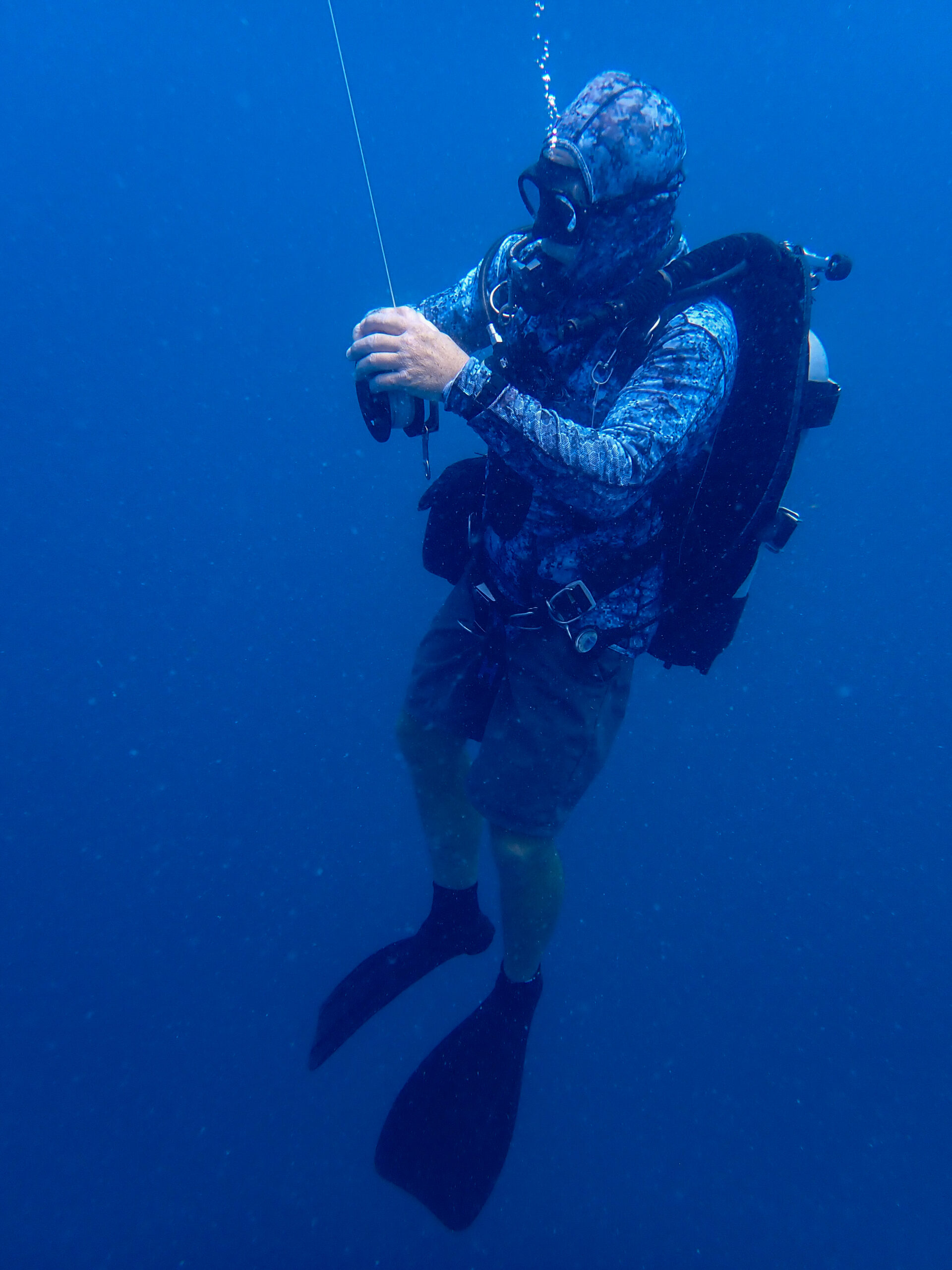
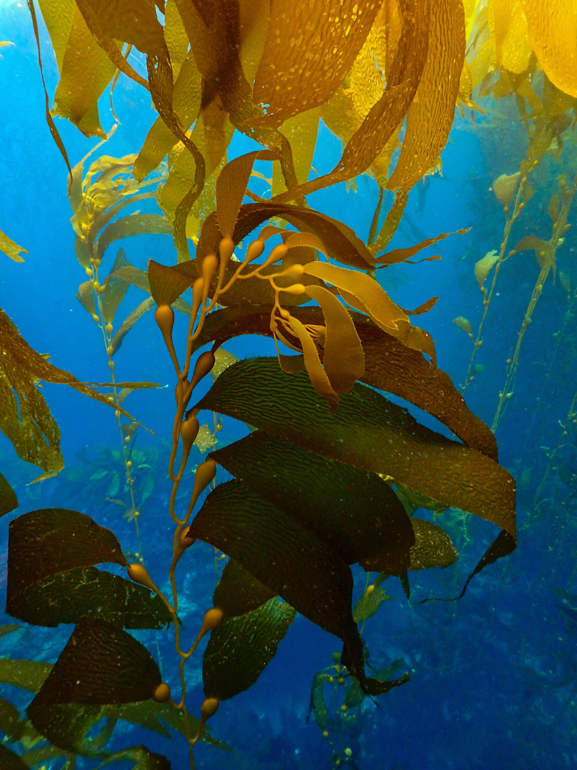
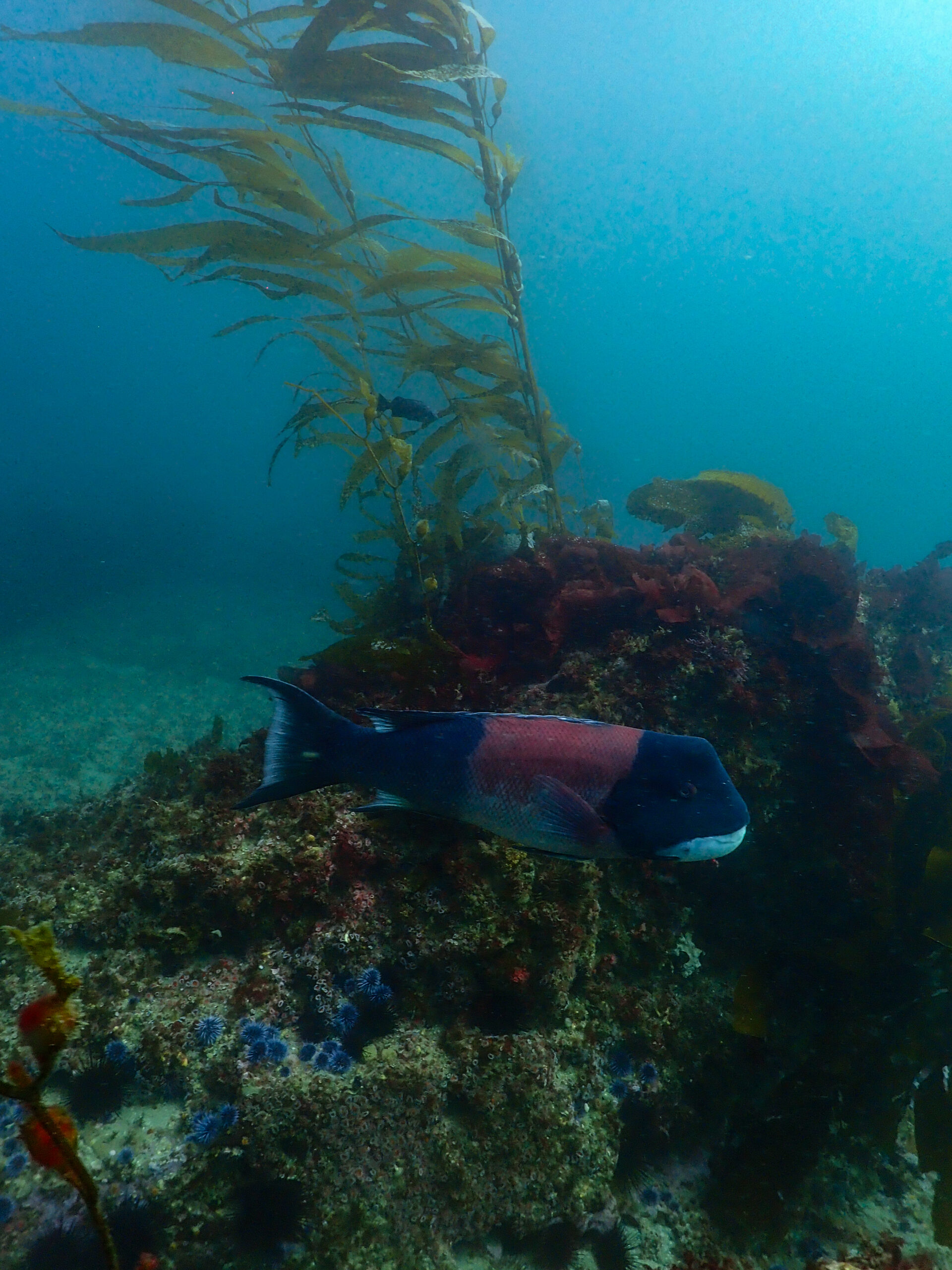
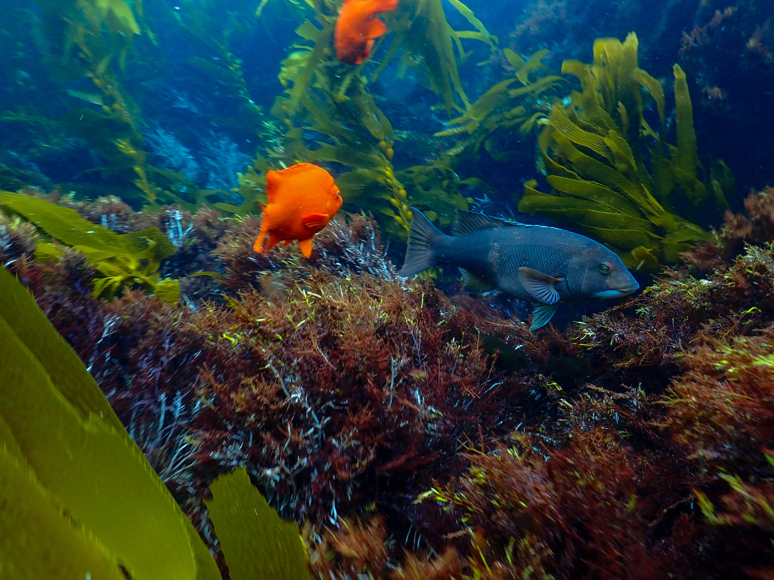
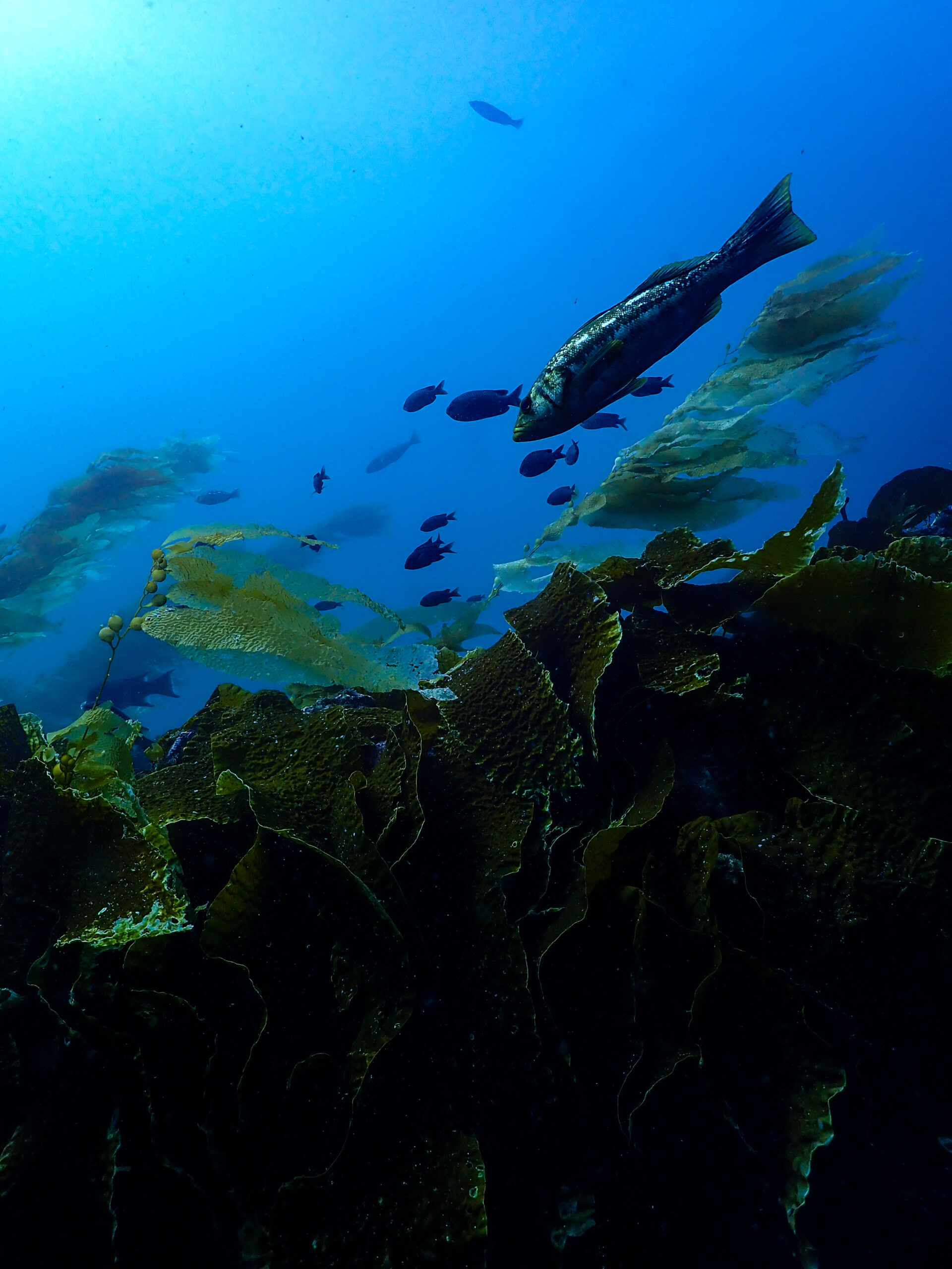
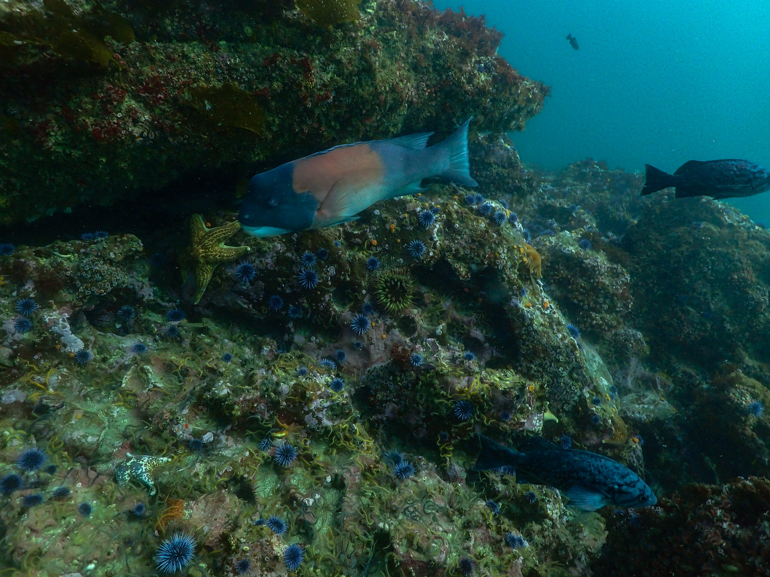
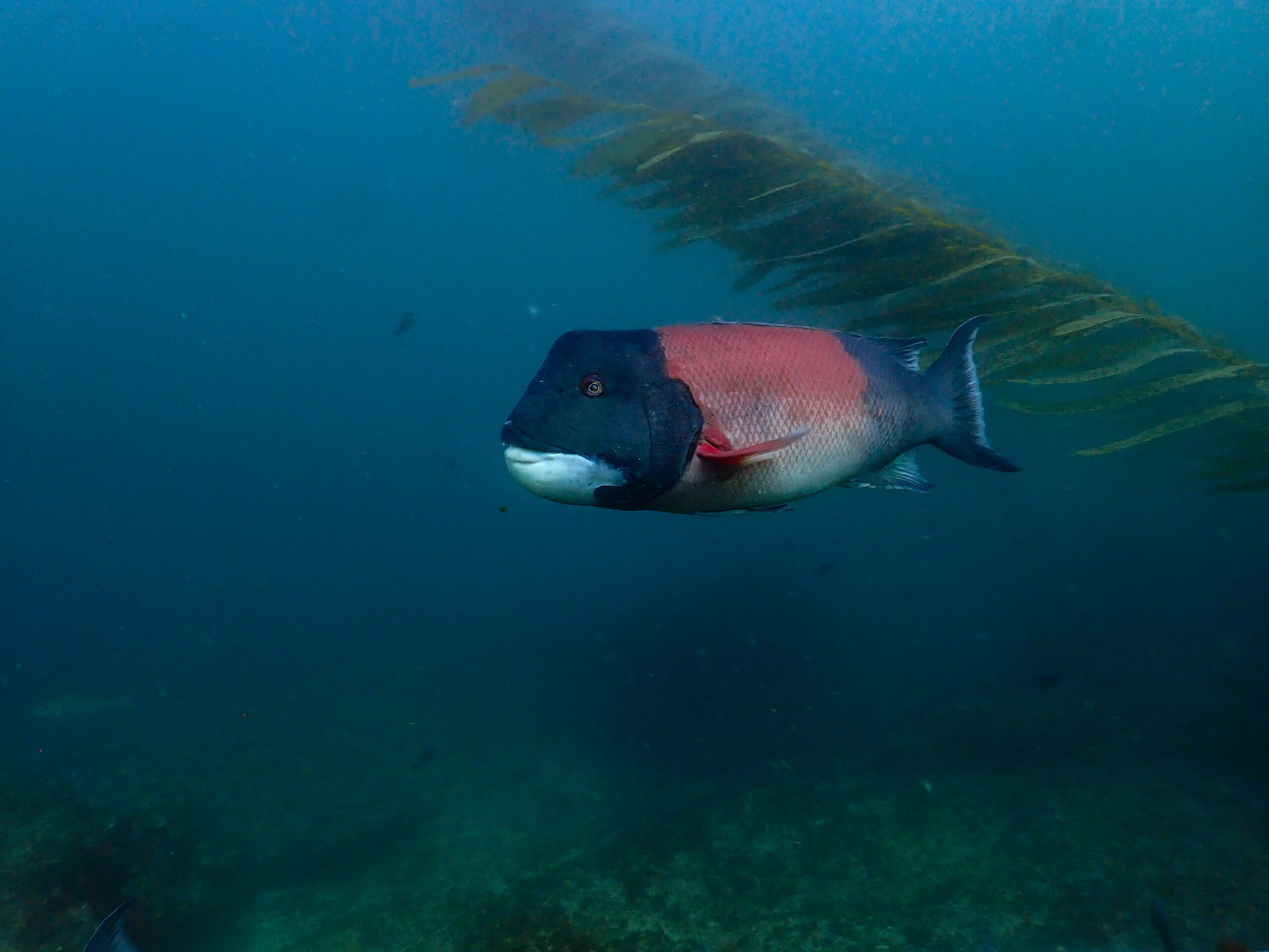
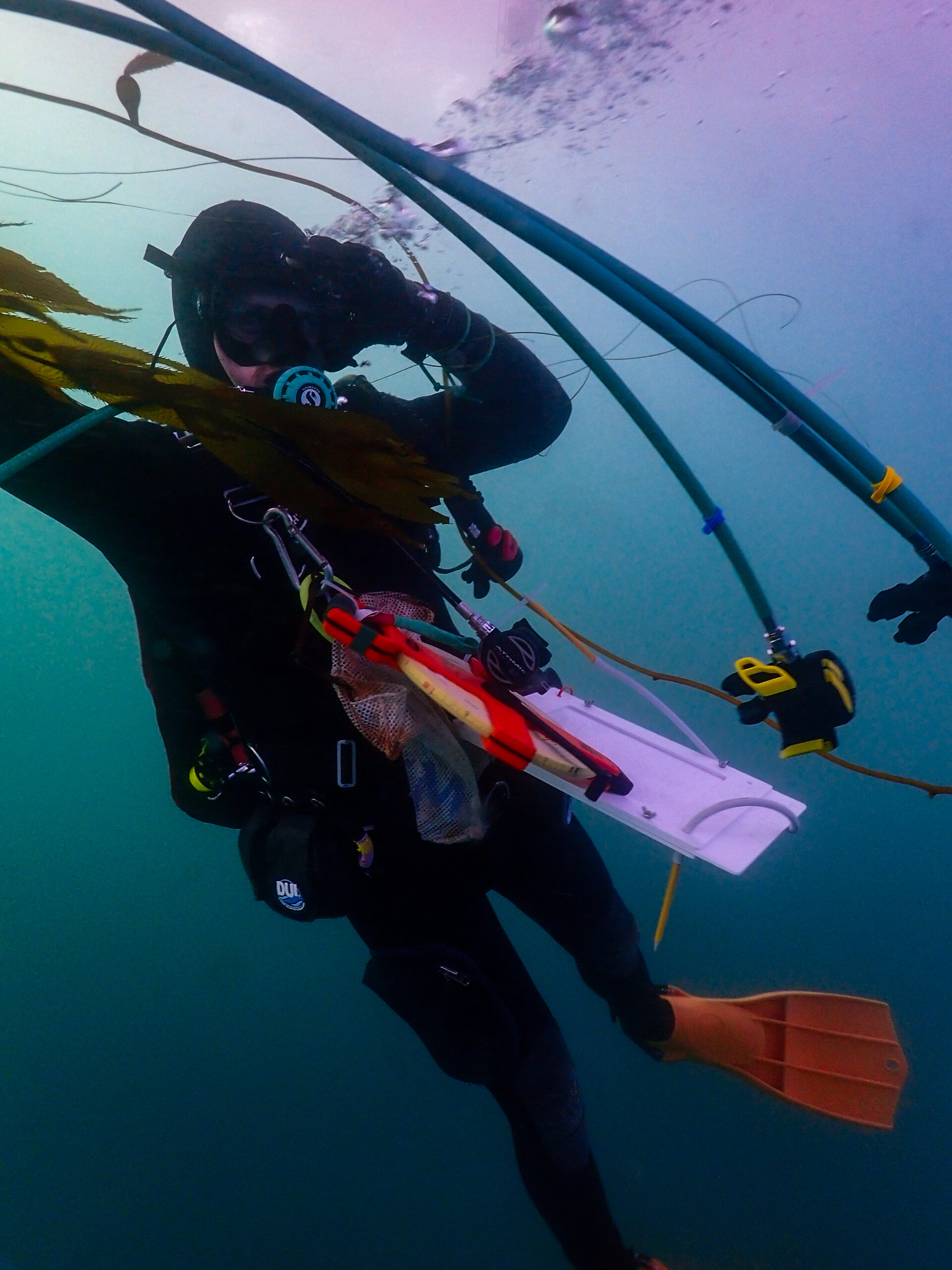
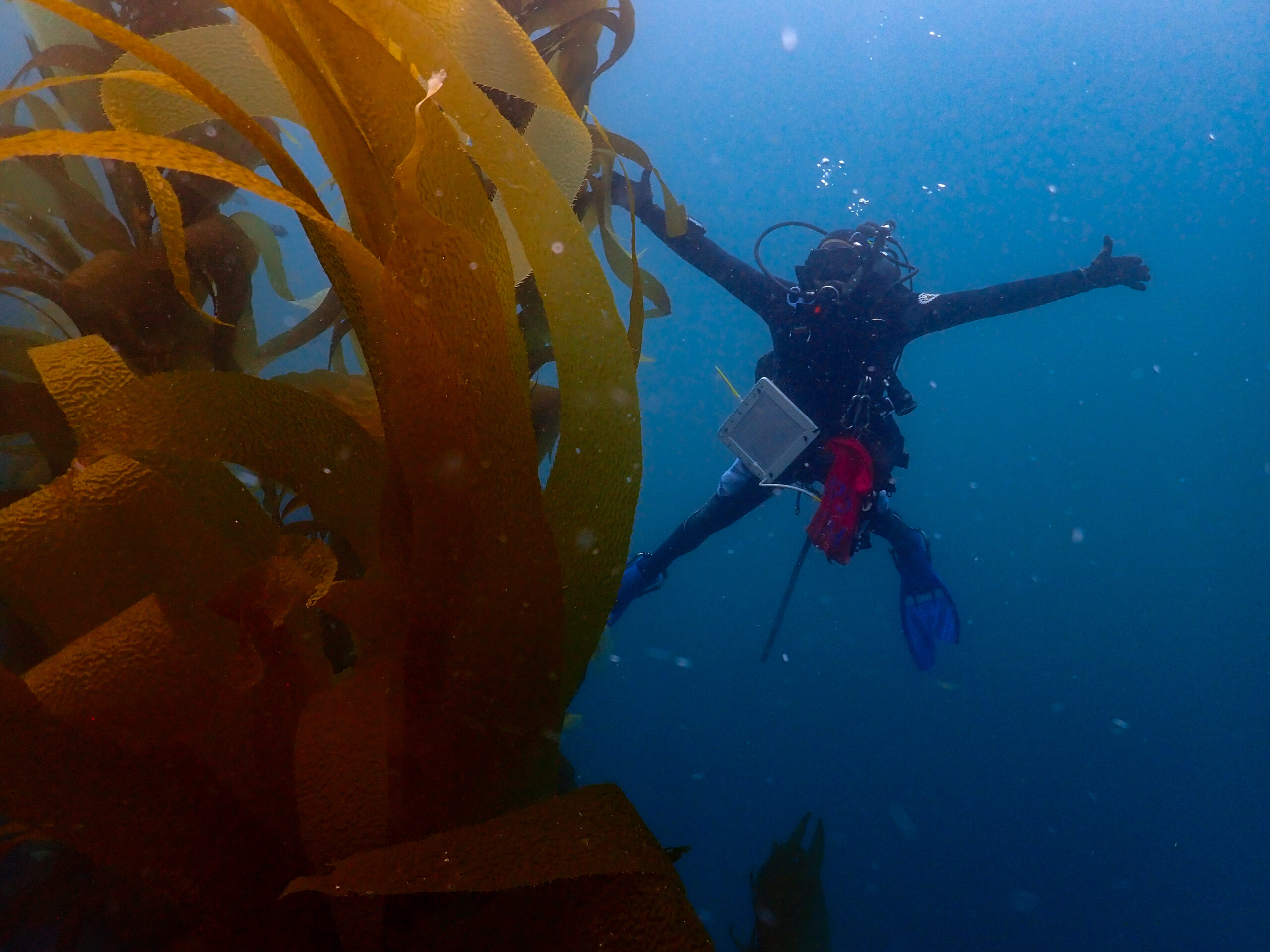
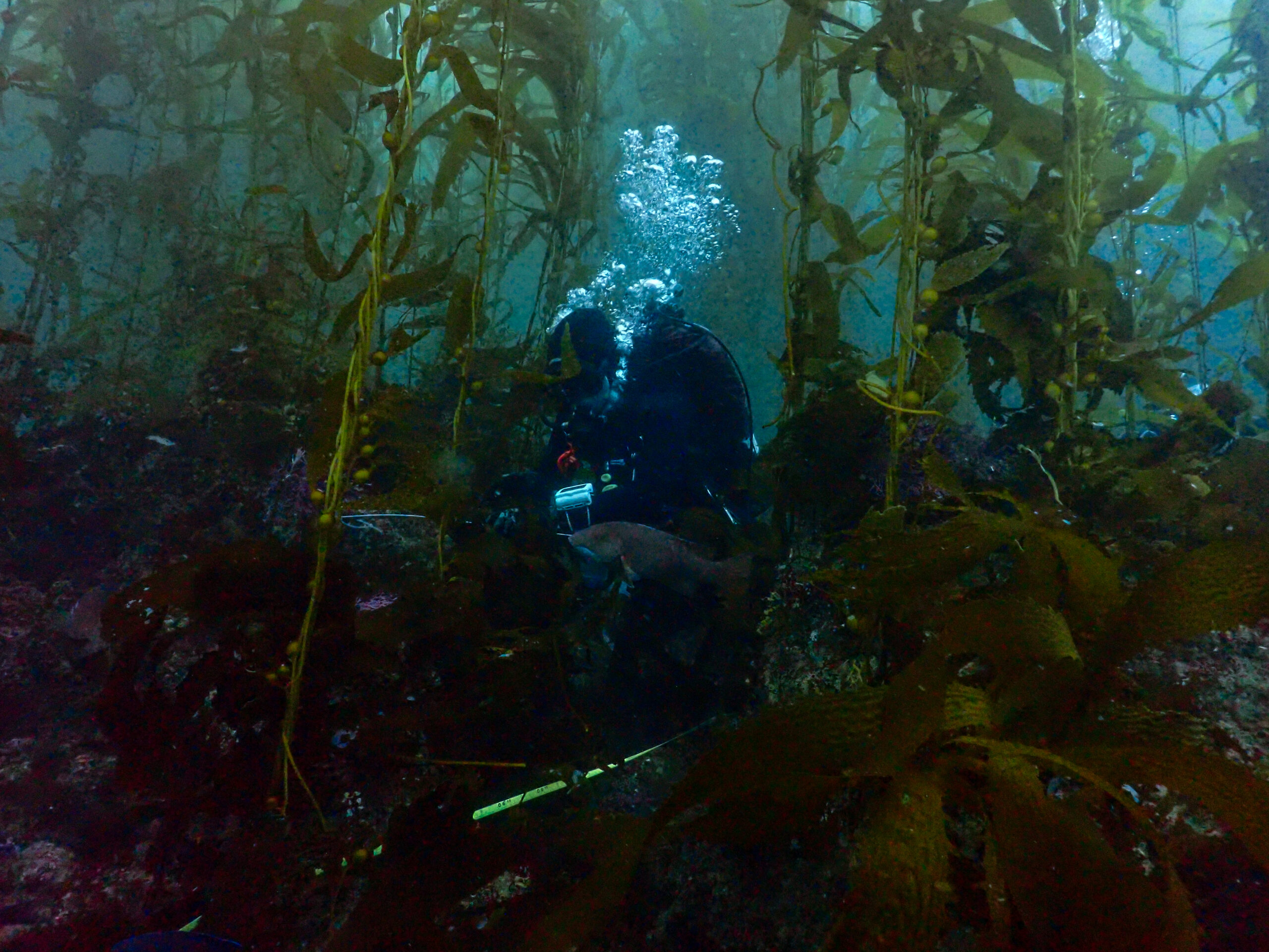
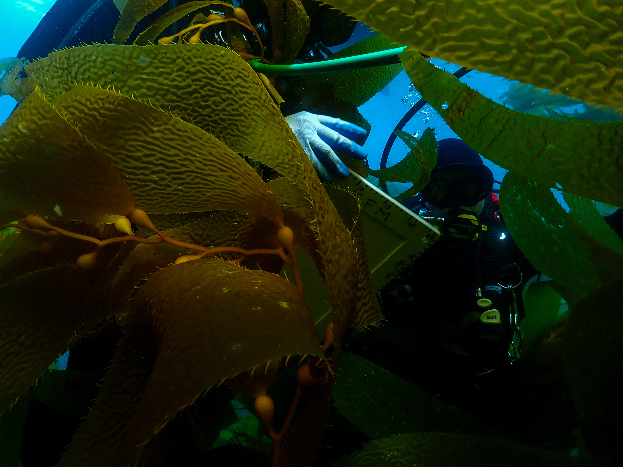
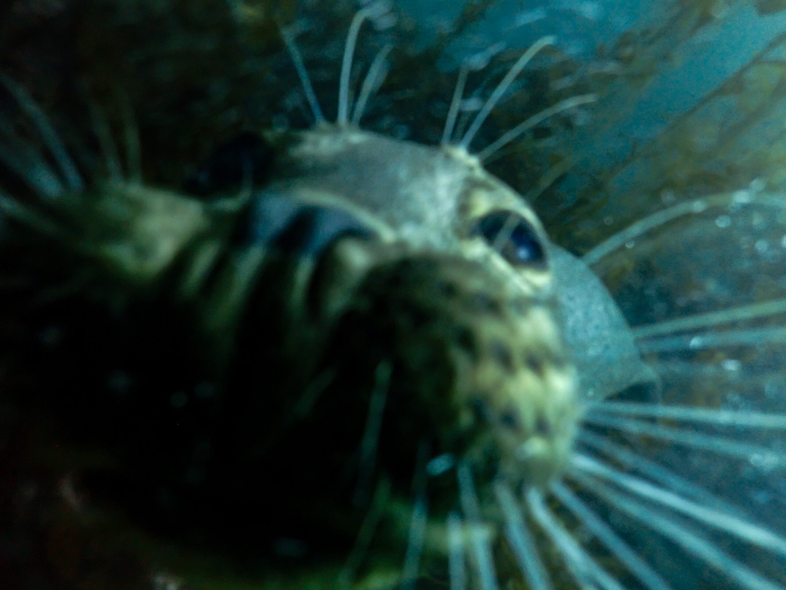
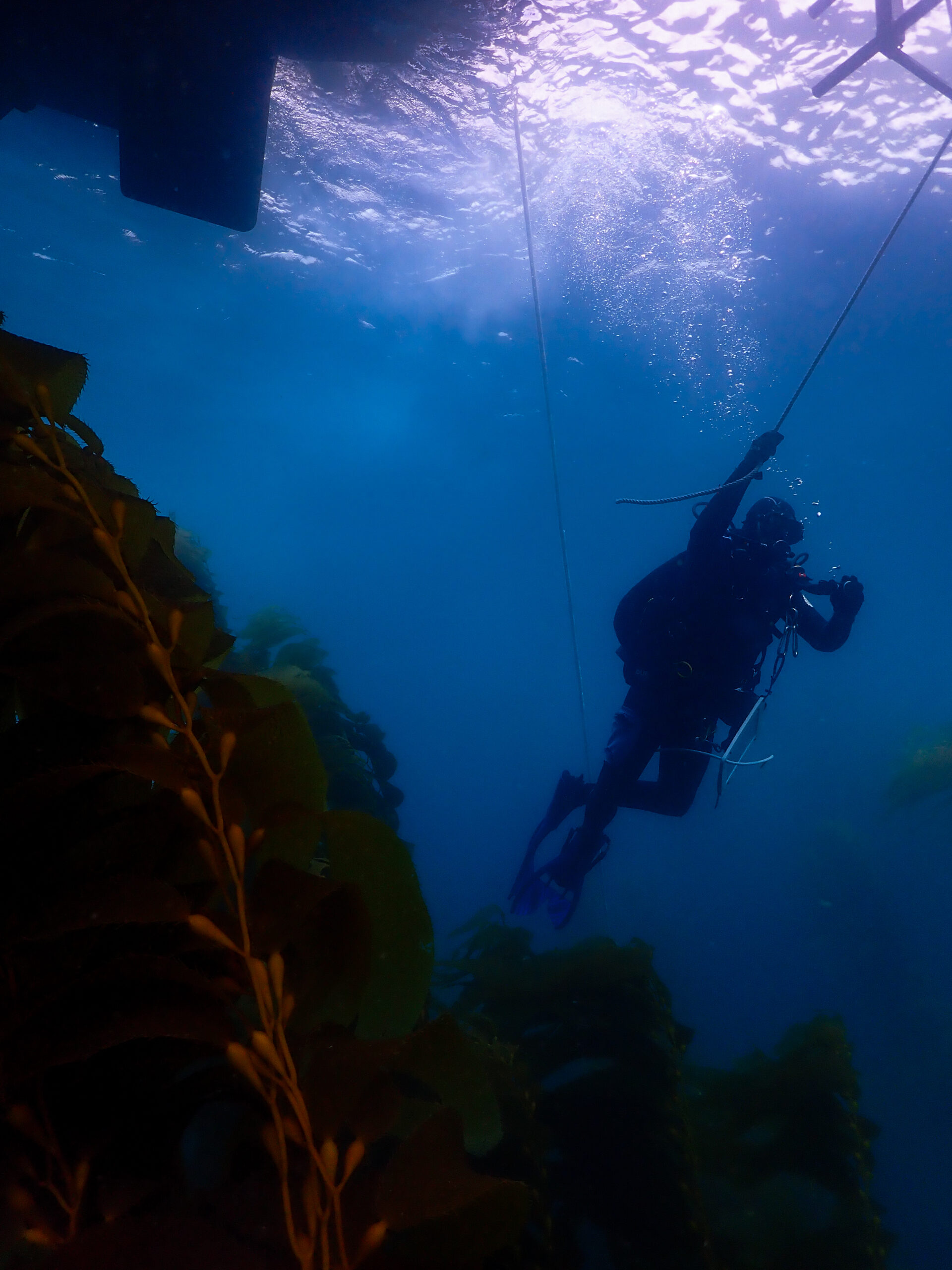
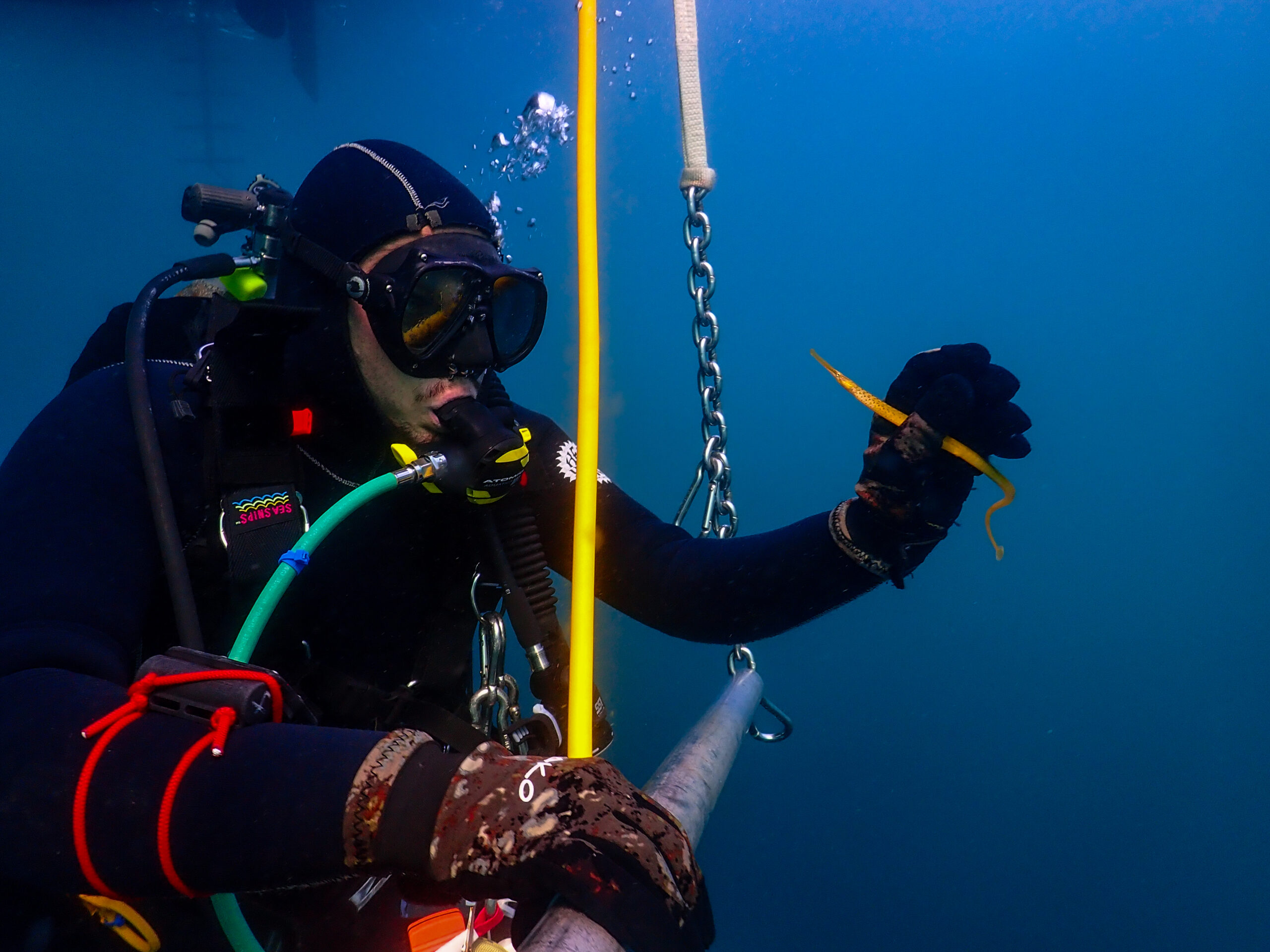
Keith and the team are a well-oiled machine. They set the bow anchor and stern anchor so we are situated near the middle of the transect. Scotty and Katie slather up their 7mm wetsuits in mane and tail and jump in to locate the fixed lead line marking the site, run the 100-meter transect, and do the video recording. I’m shadowing Ean today while Emalia and Frankie are doing the same protocols, just on the opposing side of the transect. Our first dive is a roving diver fish count survey. This is a method for estimating fish species density, abundance, and diversity. I find it quite ambitious because we’re surveying the entire water column of 2000 square meters in 30 minutes, identifying and counting all fish we see. We jump in and I am overwhelmed by fish. Ean is pointing out as many as he can. Senorita, blacksmith, kelp bass, kelp perch, sheephead, and opal eye. On the bottom, black-eyed gobies and island kelpfish. Bat rays cruise past large white sea bass in the distance. I love it because it’s like a mix of cold-water WA species with a smattering of brightly colored warmer-water species like Garibaldi. Unfortunately, I did not see the black sea bass. Not much Macrocystis but the bottom is blanketed in Laminaria. We finish the dive with the 5-meter quadrat surveys which are density estimates for species like Macrocystis, Pisaster giganeteus (giant sea star), and Pisaster ochraceus (ochre sea star). All dives finish off with a 15-foot safety stop at the oxygen bar where regulators are set up to breathe 100% oxygen. A good way to stay fresh throughout the long dive week.

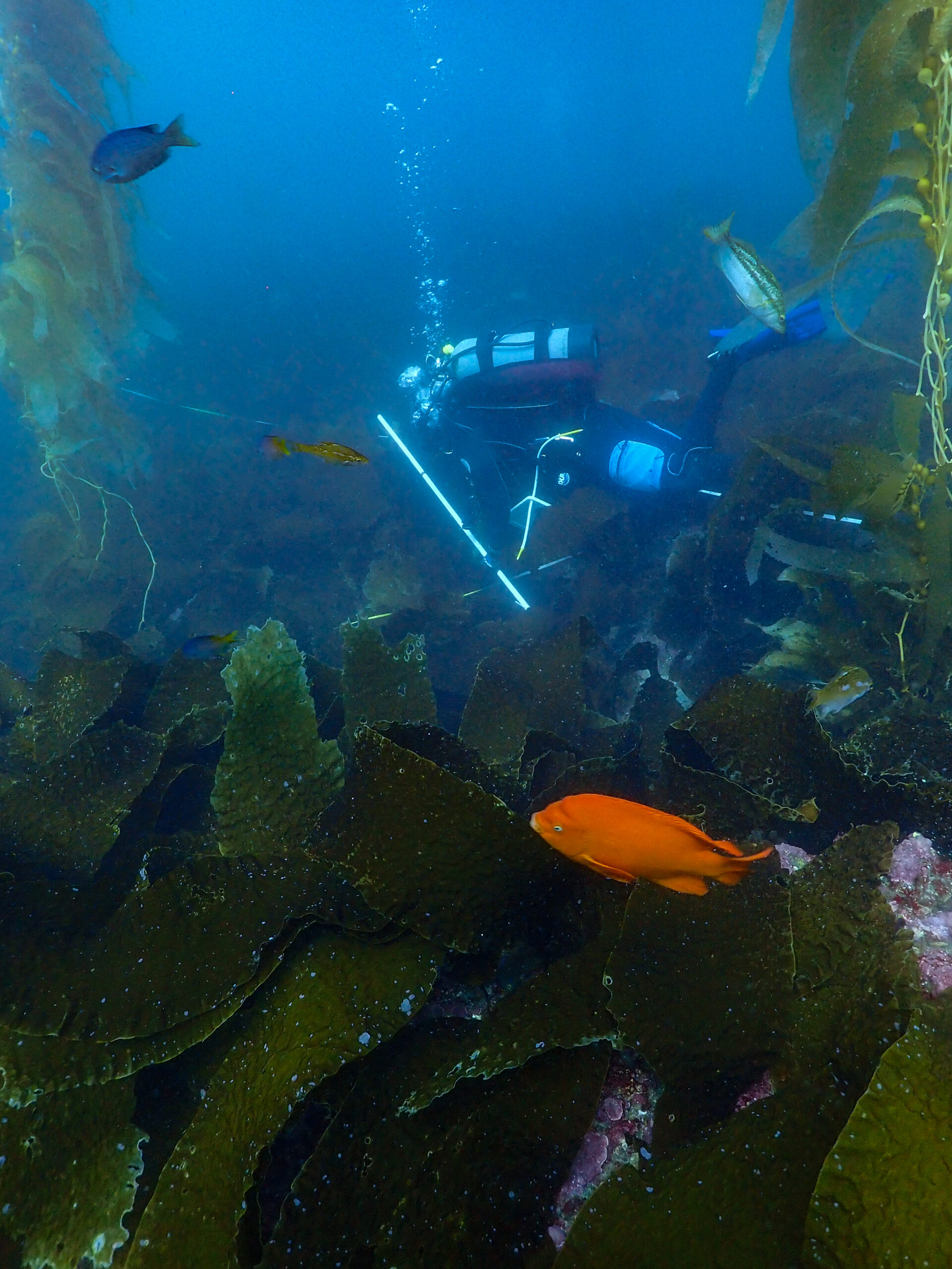
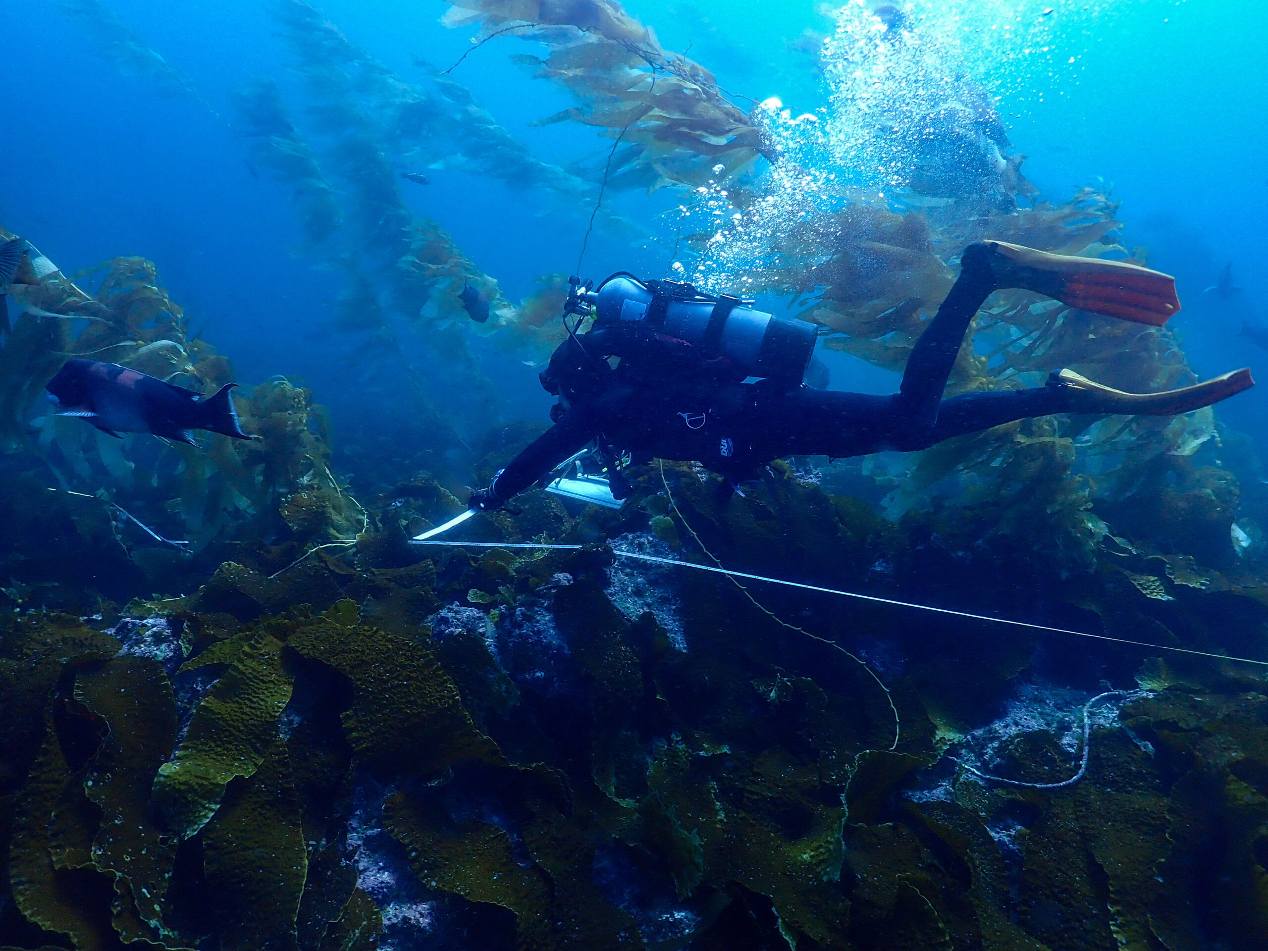
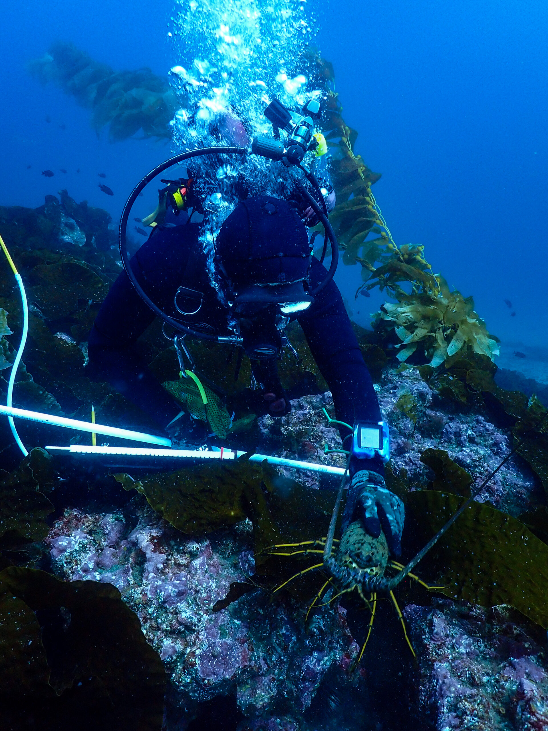
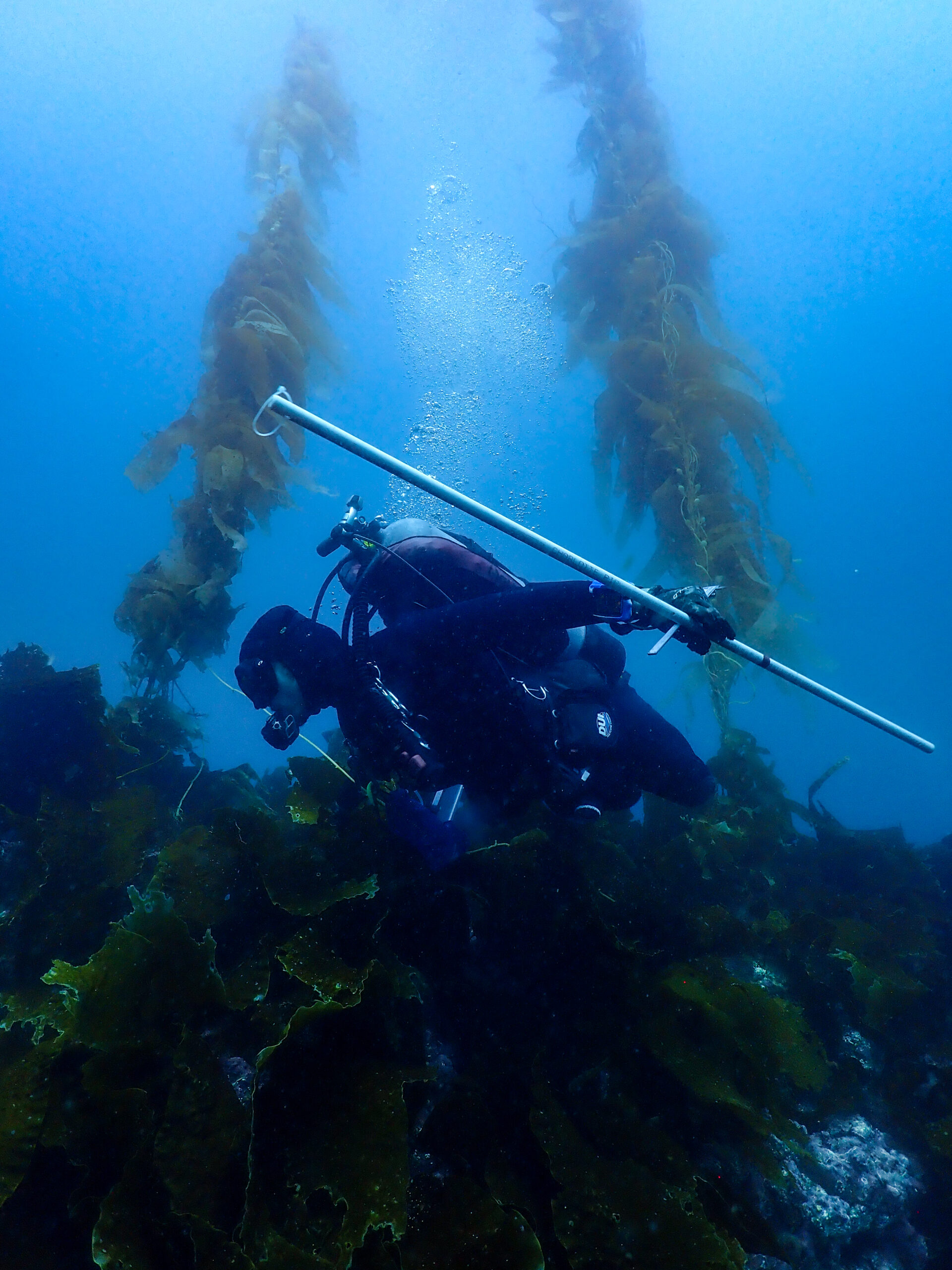
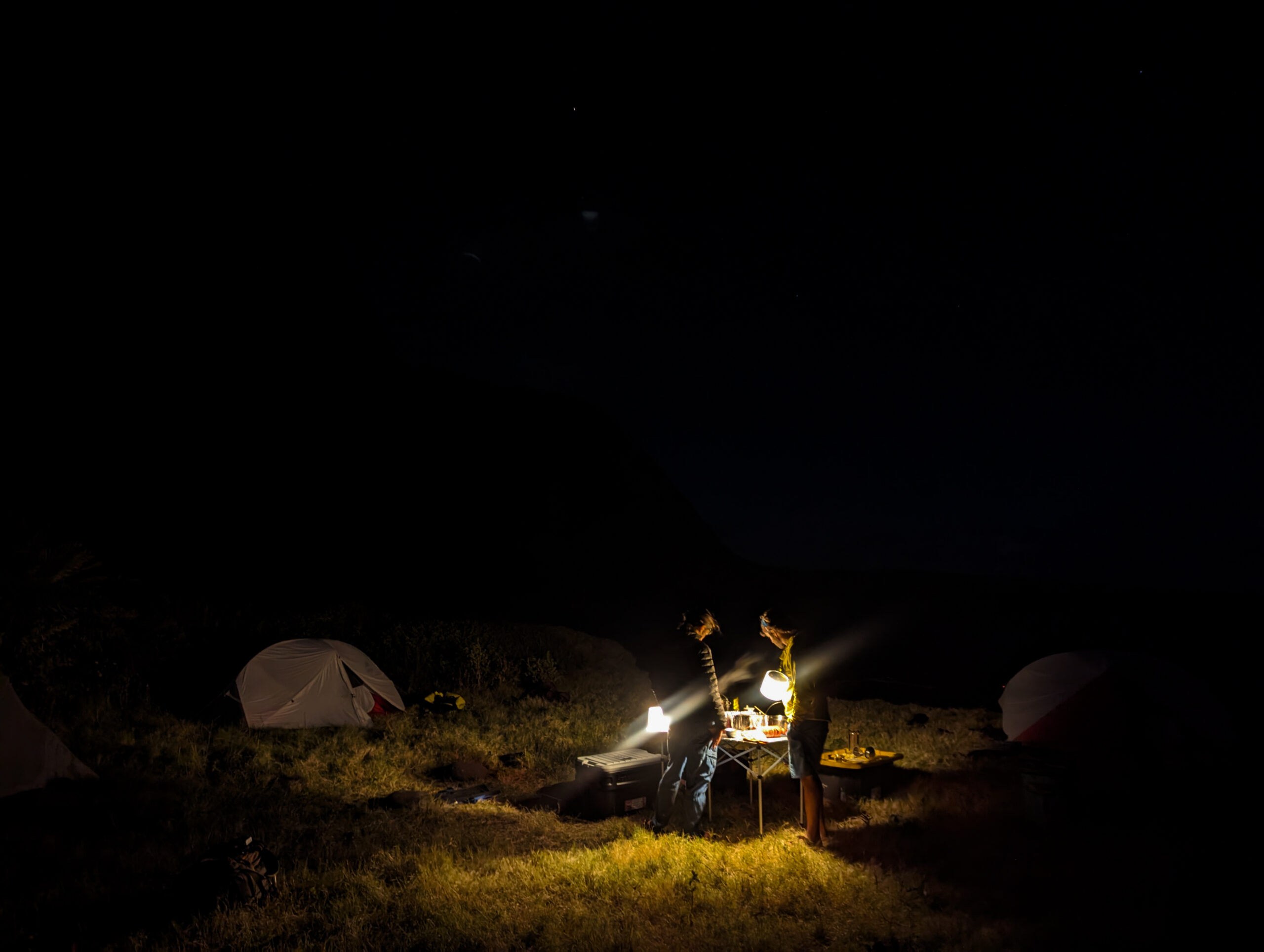
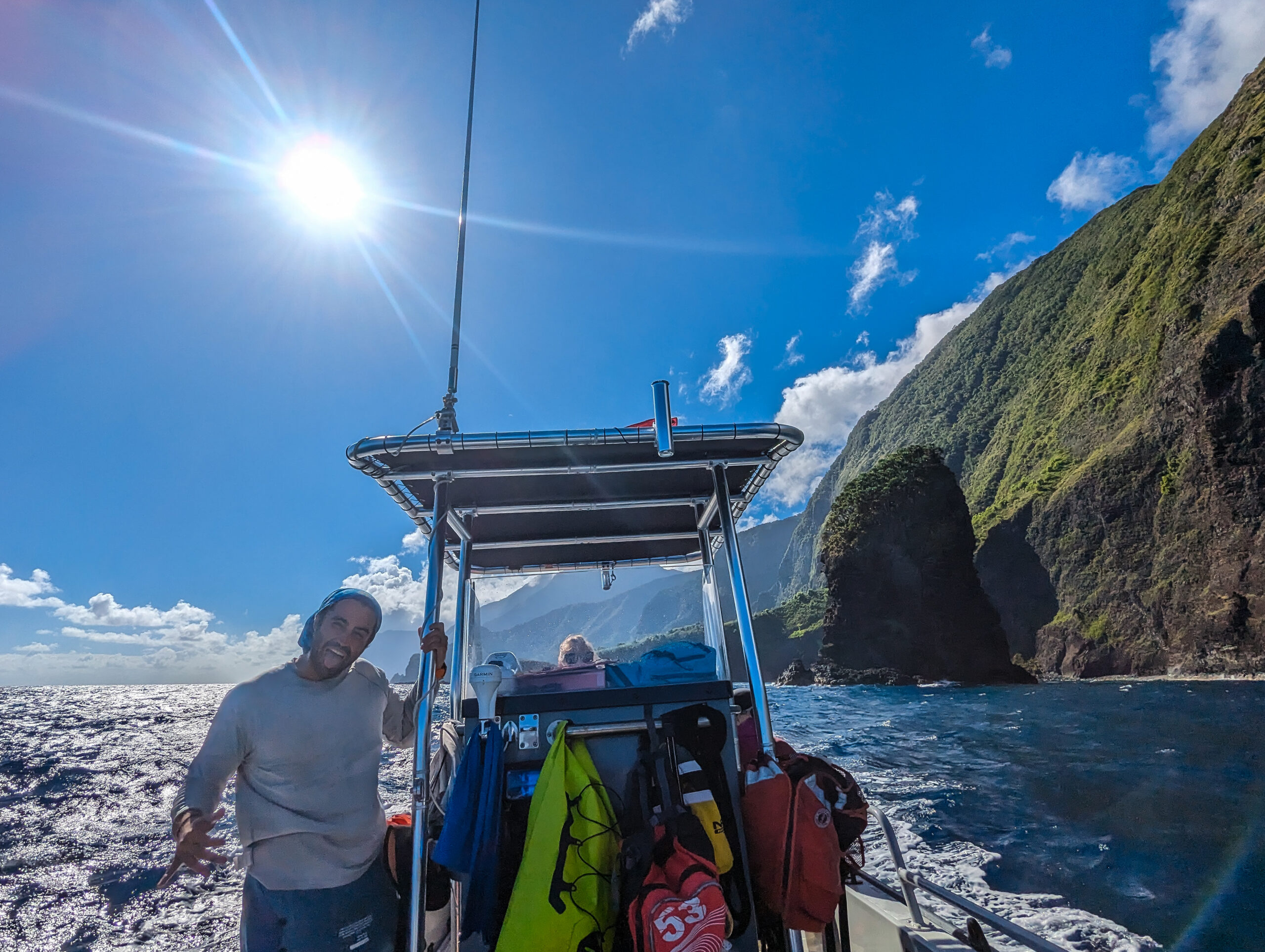
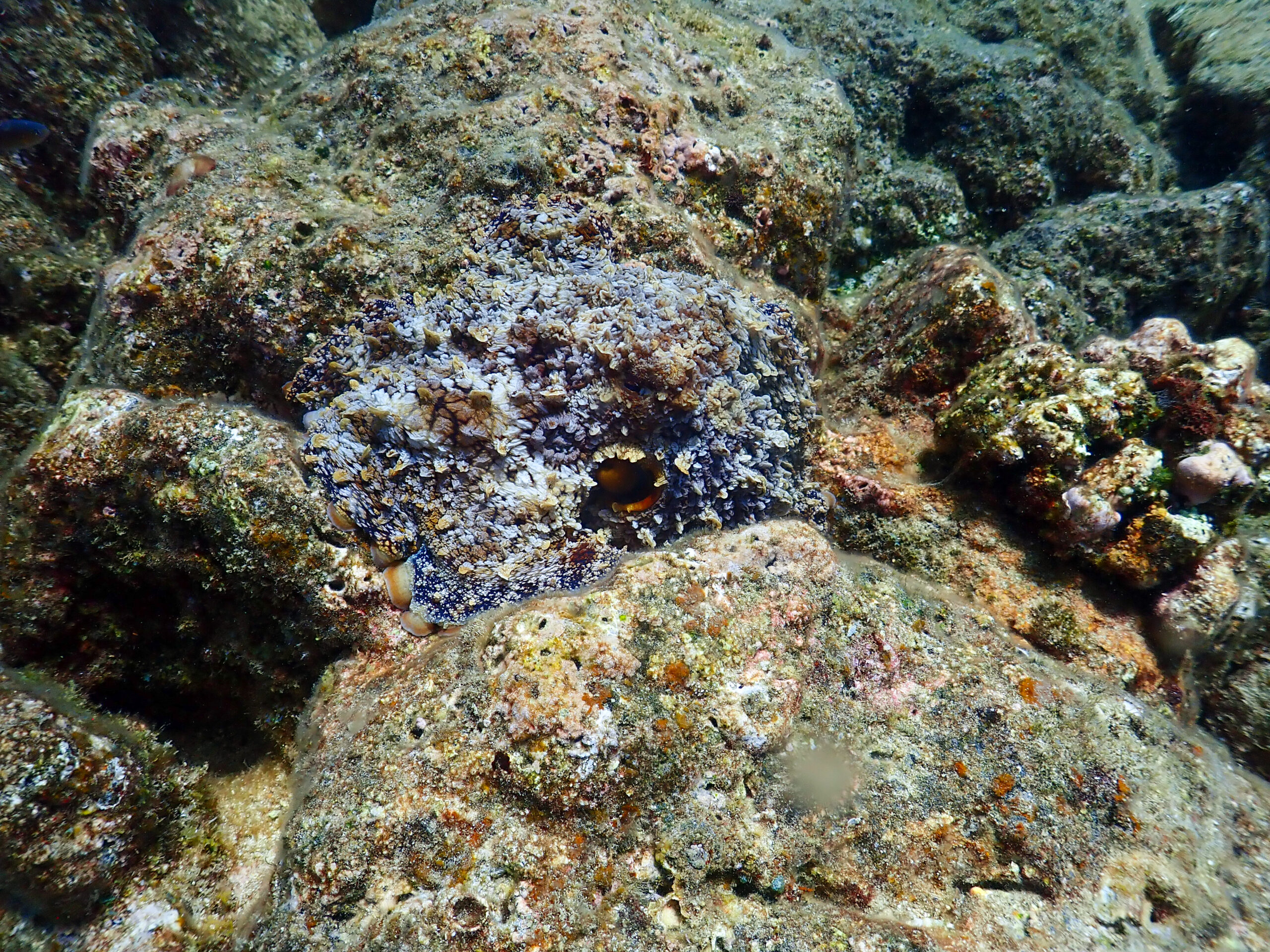
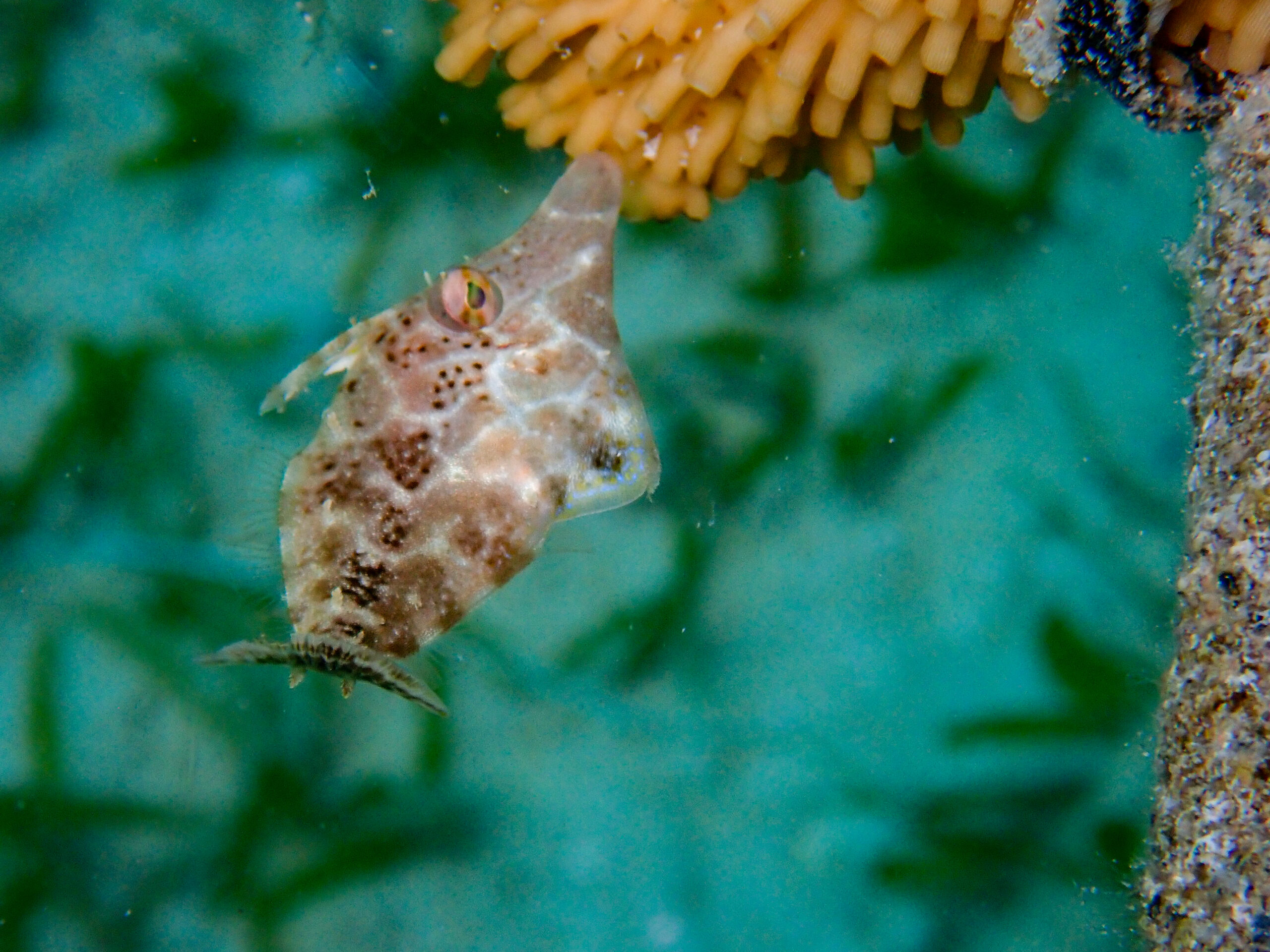
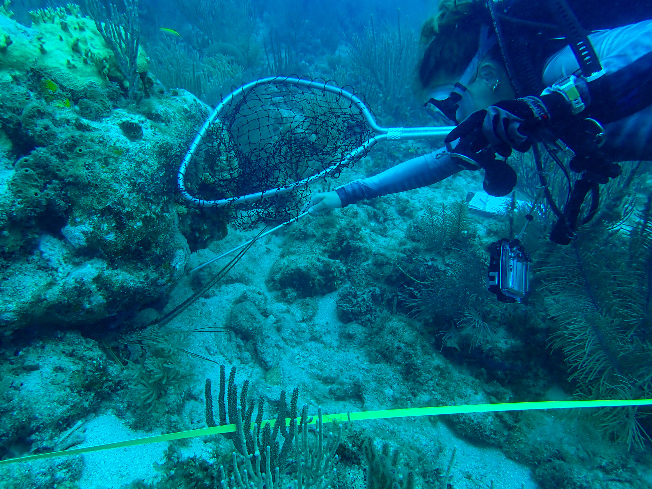
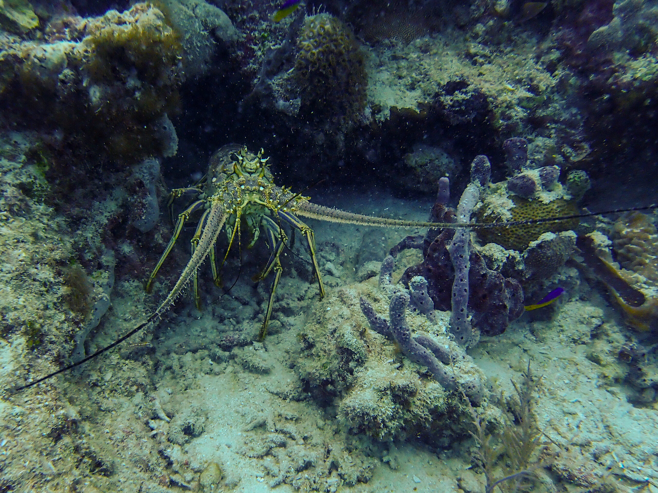
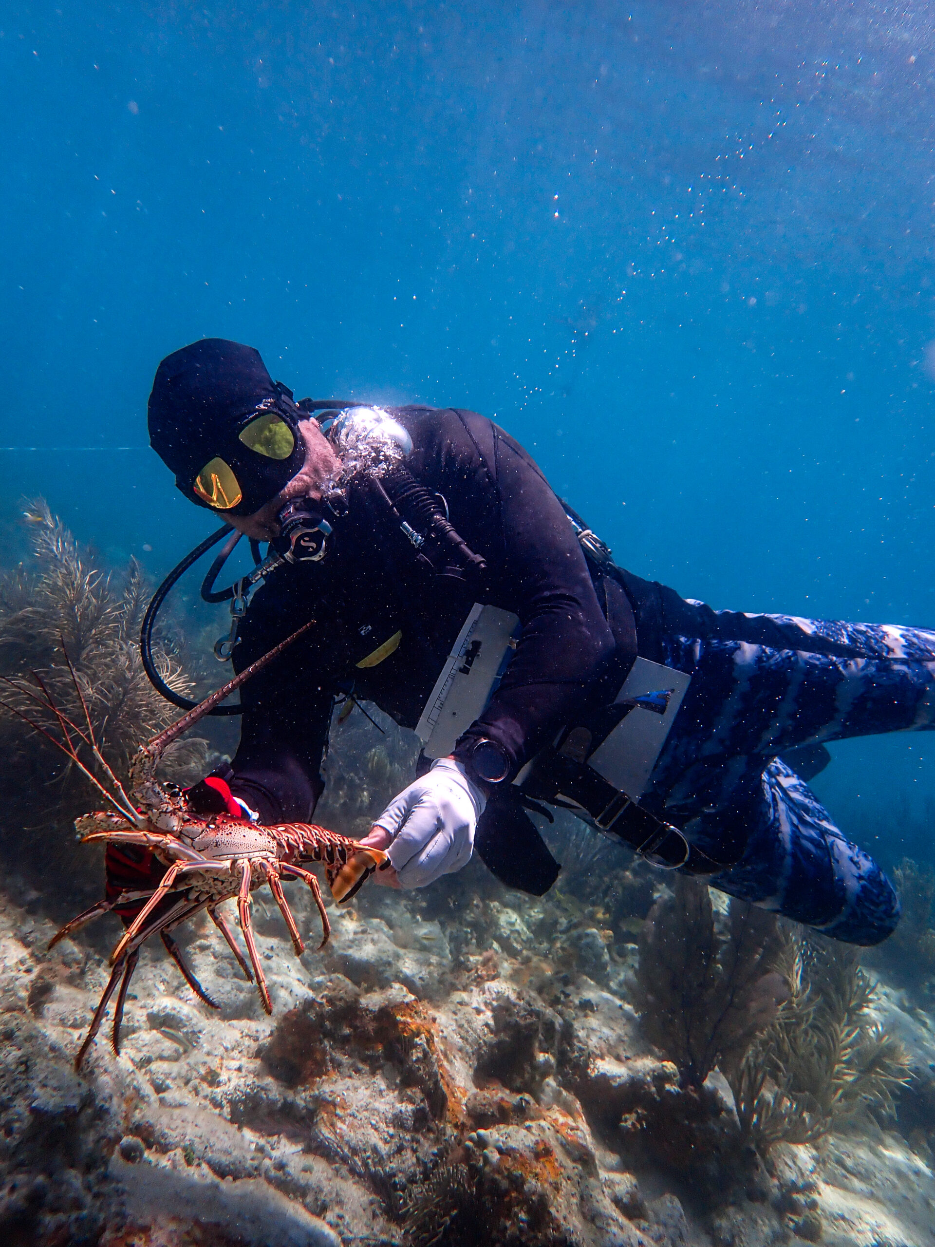
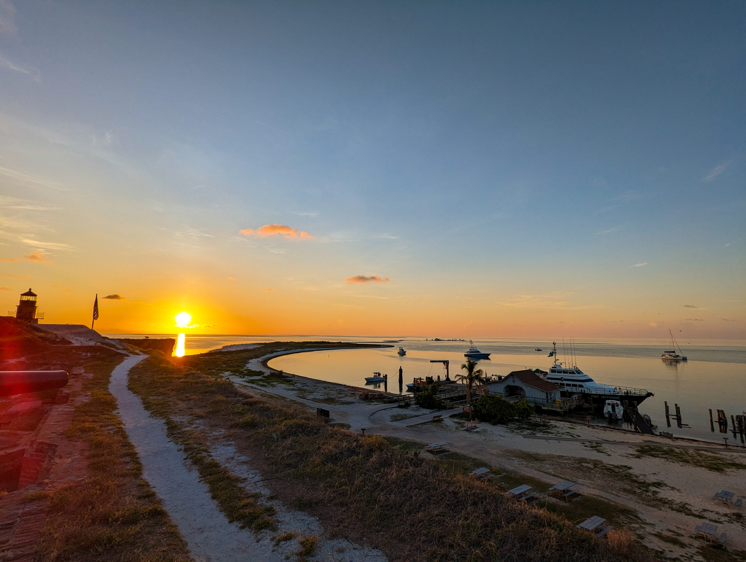
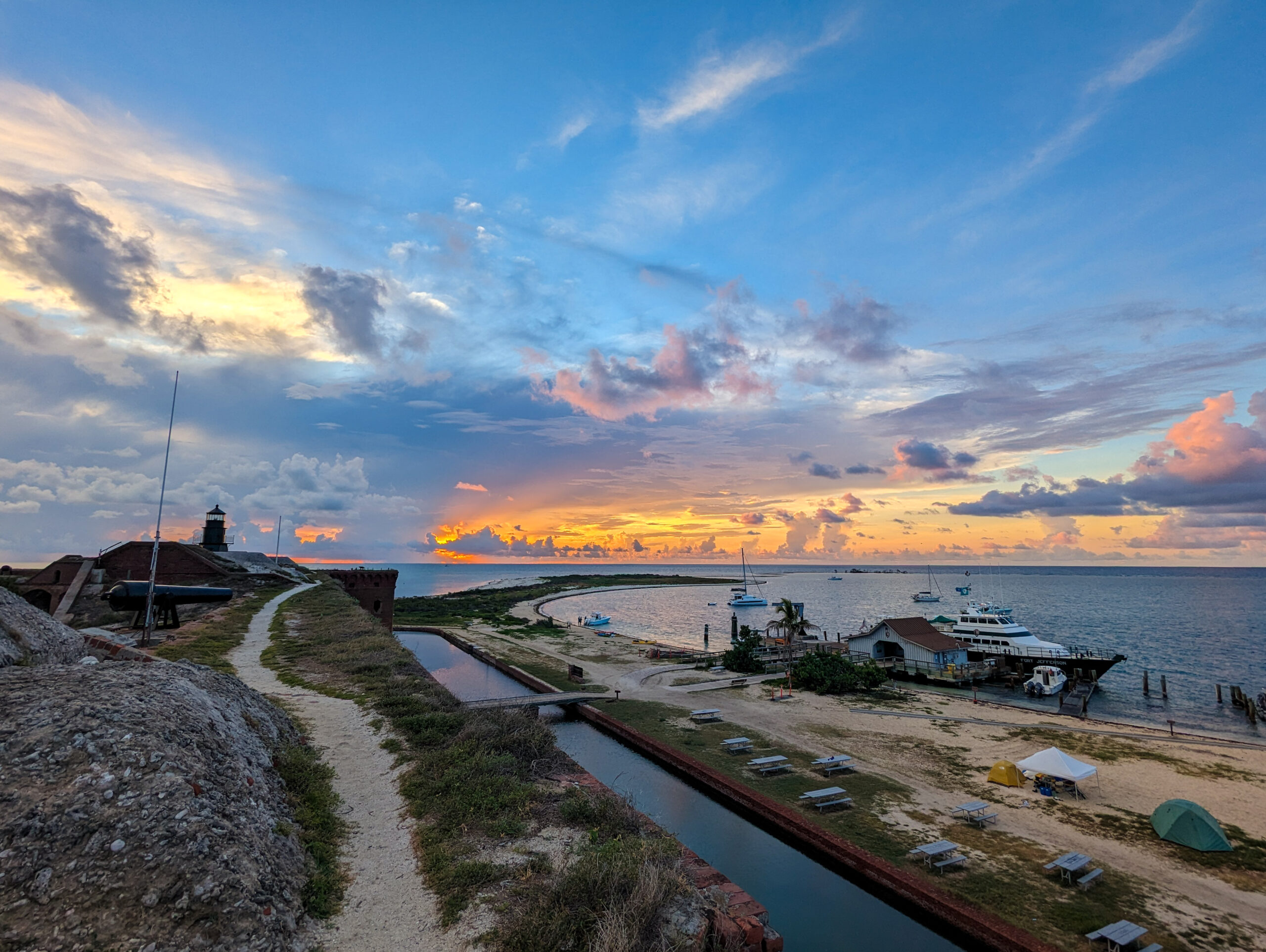
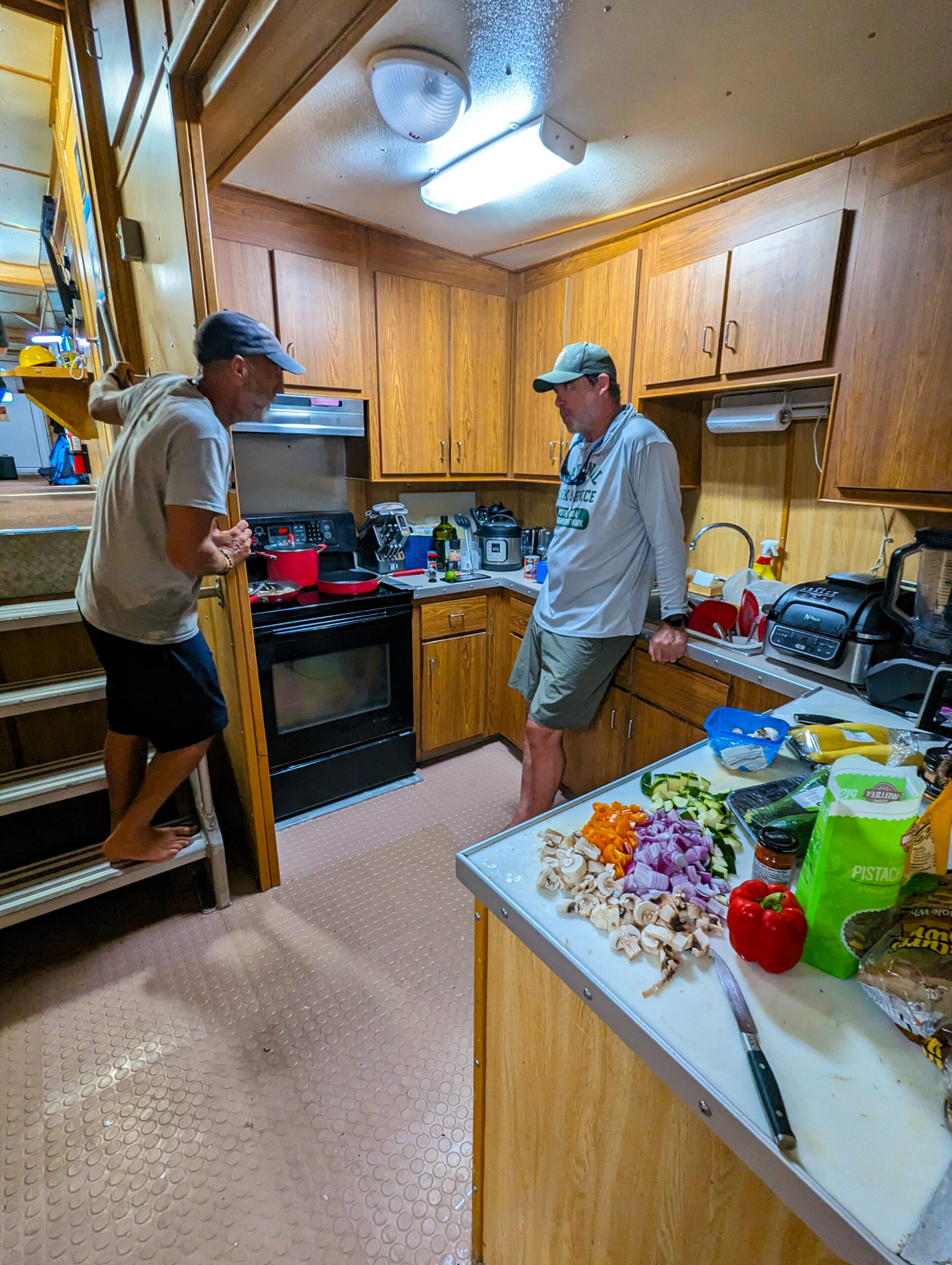
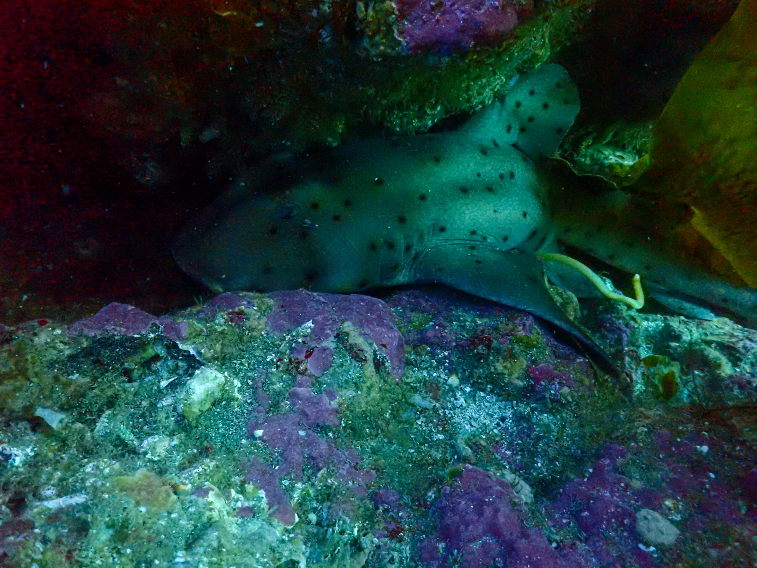
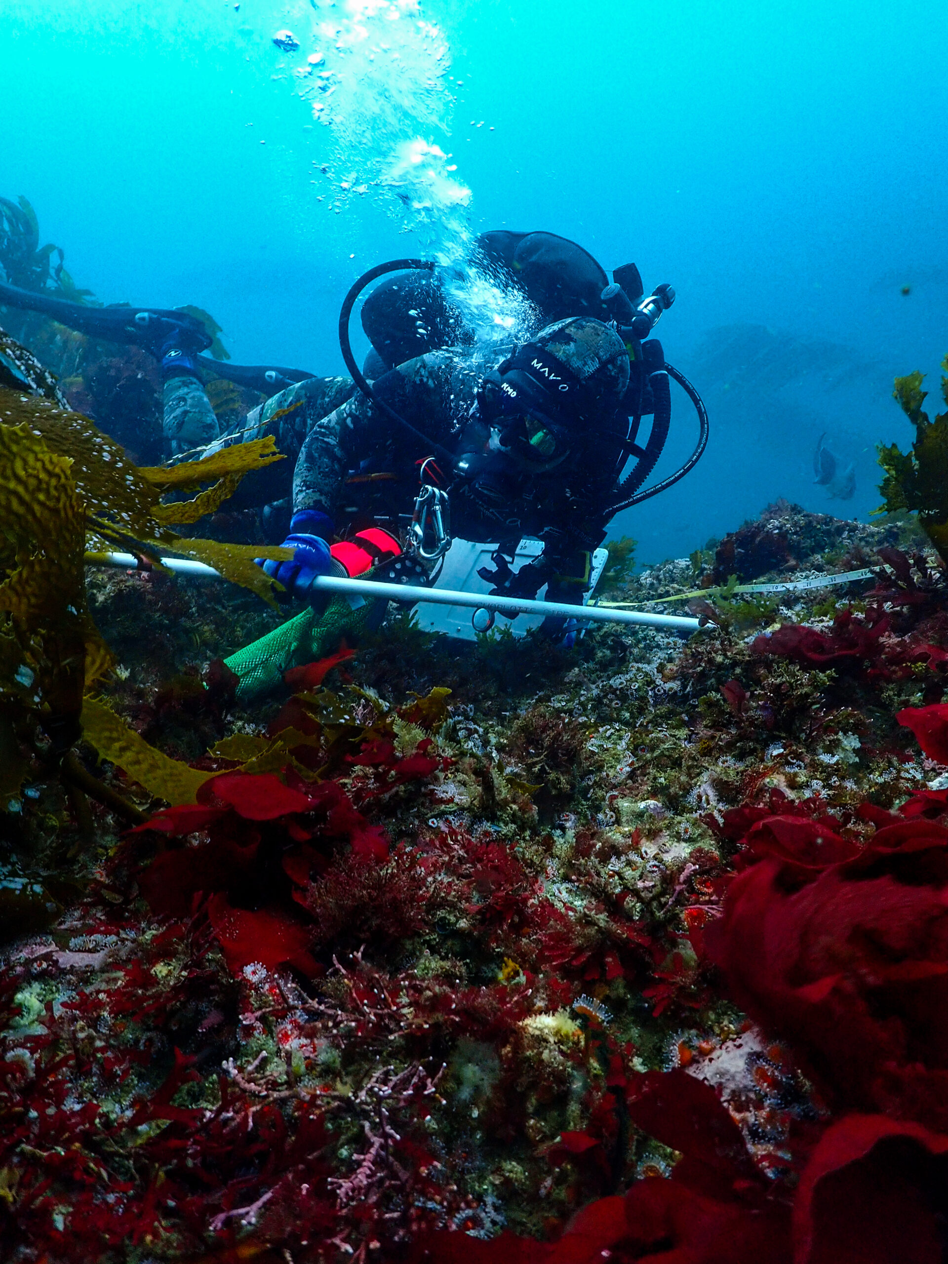
Next dive, I’m shadowing Ean again on a different protocol. Band transects are the main protocol for estimating densities for many of the invertebrates that KFM monitors. 12 bands on each side of the 100-meter transect. A 3-meter band, 10 meters out from the main transect. Emalia is on the other side doing the same thing. It’s taking a long time to check under all of the Laminaria. Ean is looking for abalone, giant keyhole limpets, sea stars, urchins, gorgonians, lobsters, orange puffball sponges, and scallops. Ean is finding the occasional Kelletia whelk to measure. We only finish 3 bands. On the surface, the waves are getting rough and the sun is going down. A quick change of plan, not enough time to finish the site today so we’ll scrap the bands and do them another day. One more dive and my job is to count all the stipes of the giant kelp in my half of the 100-meter site. Frankie points out a colorful juvenile treefish and we find a horn shark wedged between a rock. The dive finishes and we motor through the waves and setting sun over to Smuggler’s Cove on Santa Cruz where we will anchor for the night. Katie makes quiche for dinner and we have a full spread of ice cream options for dessert. Lights off at 9.

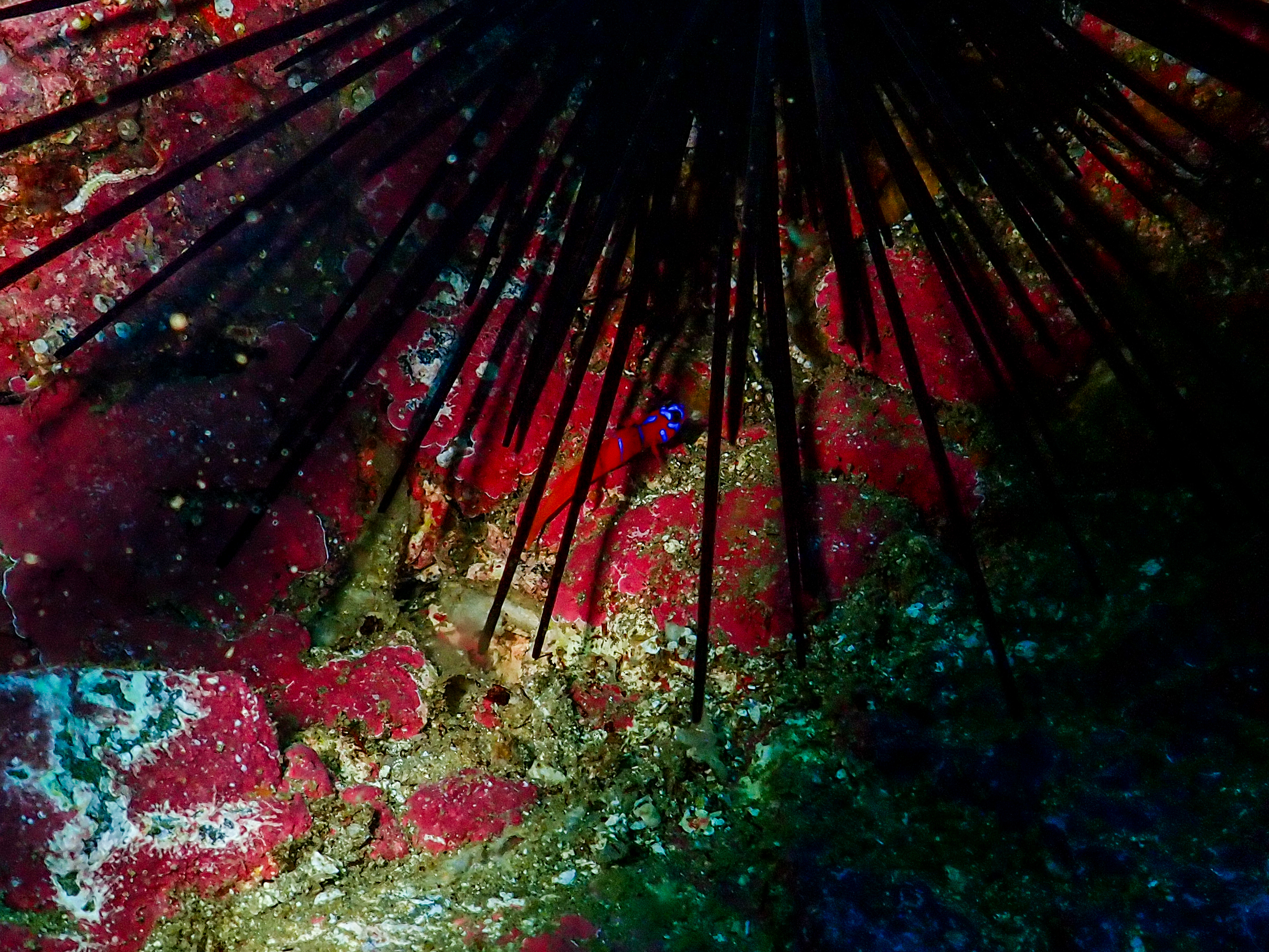
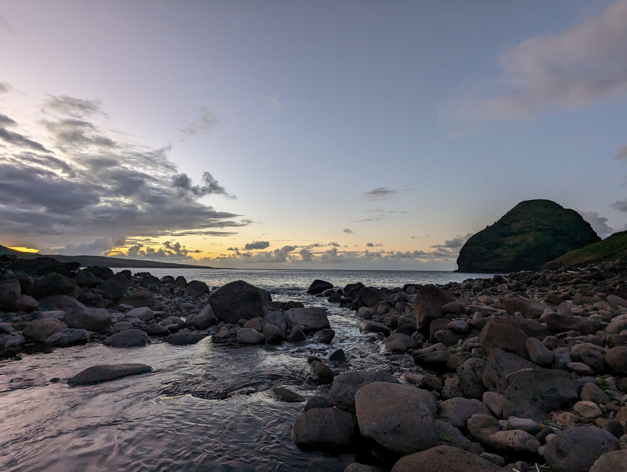
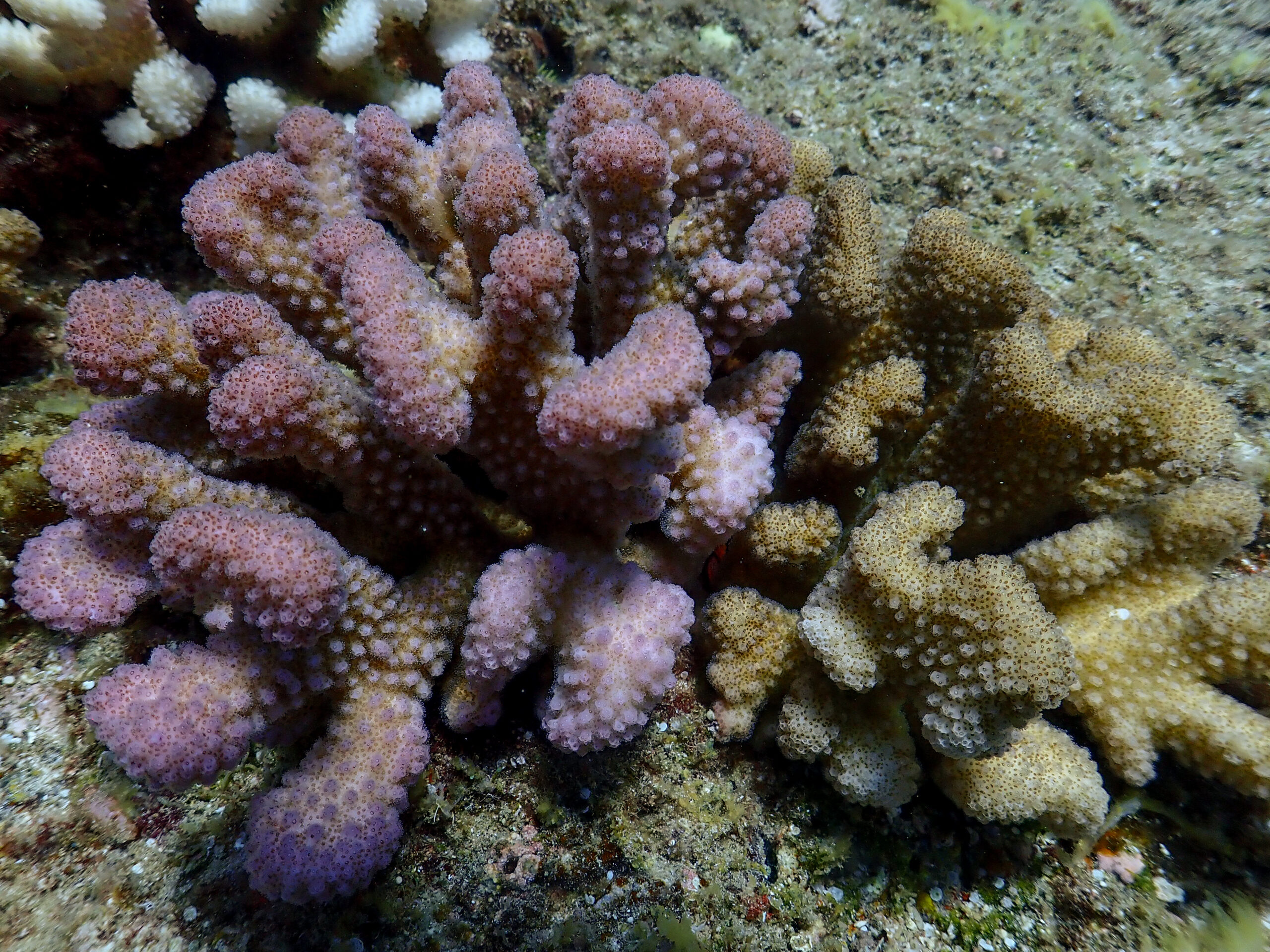
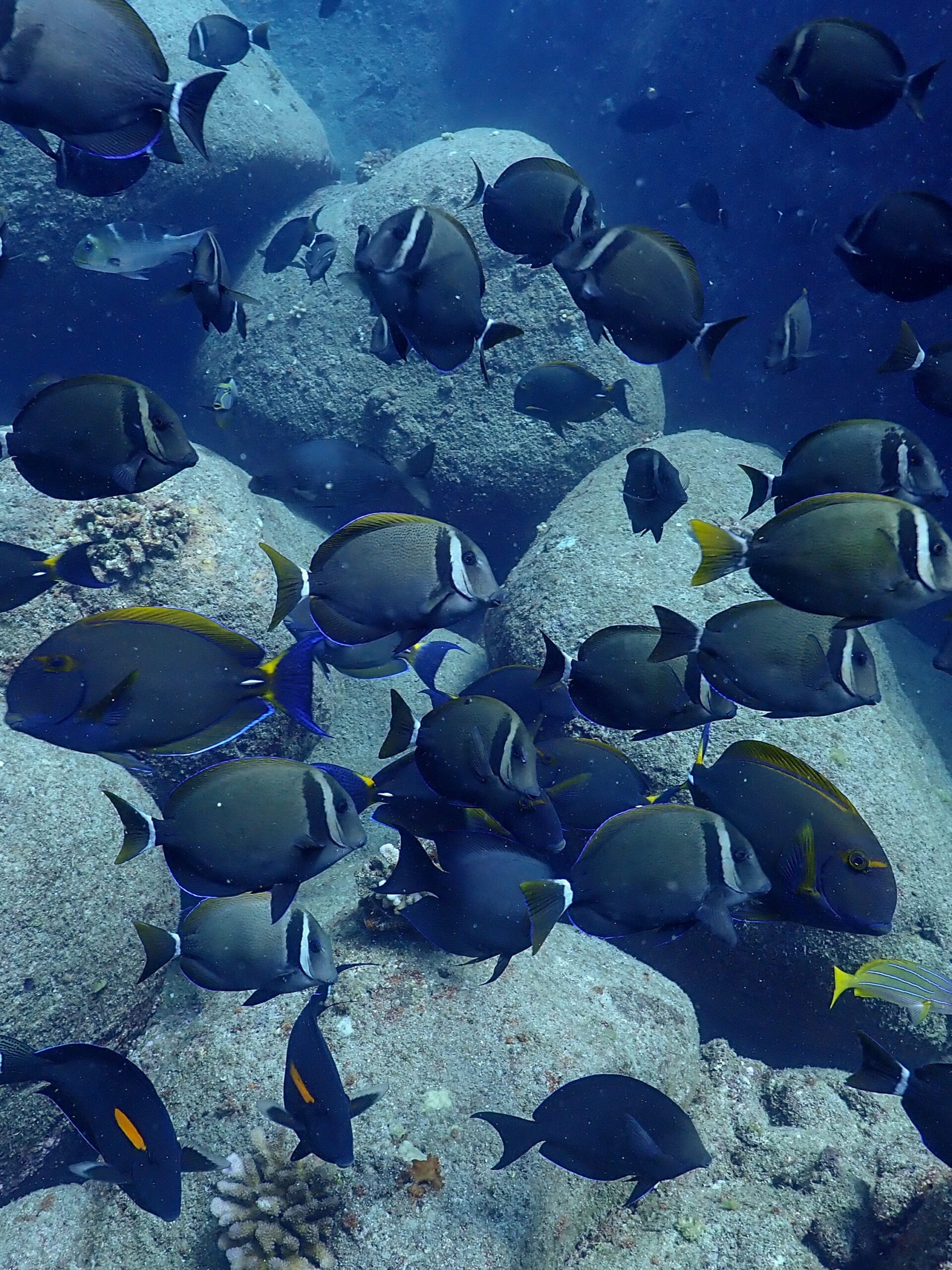
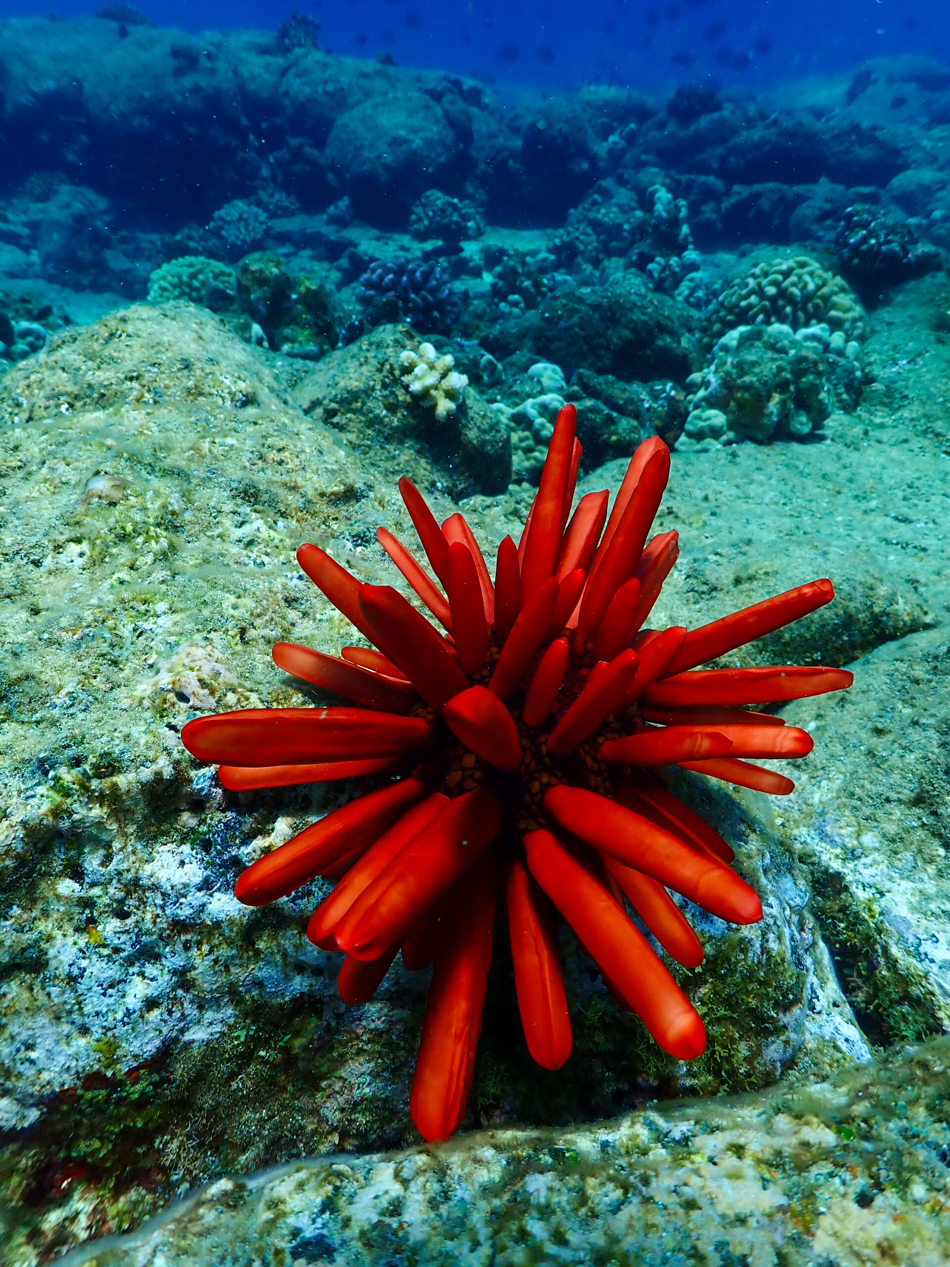
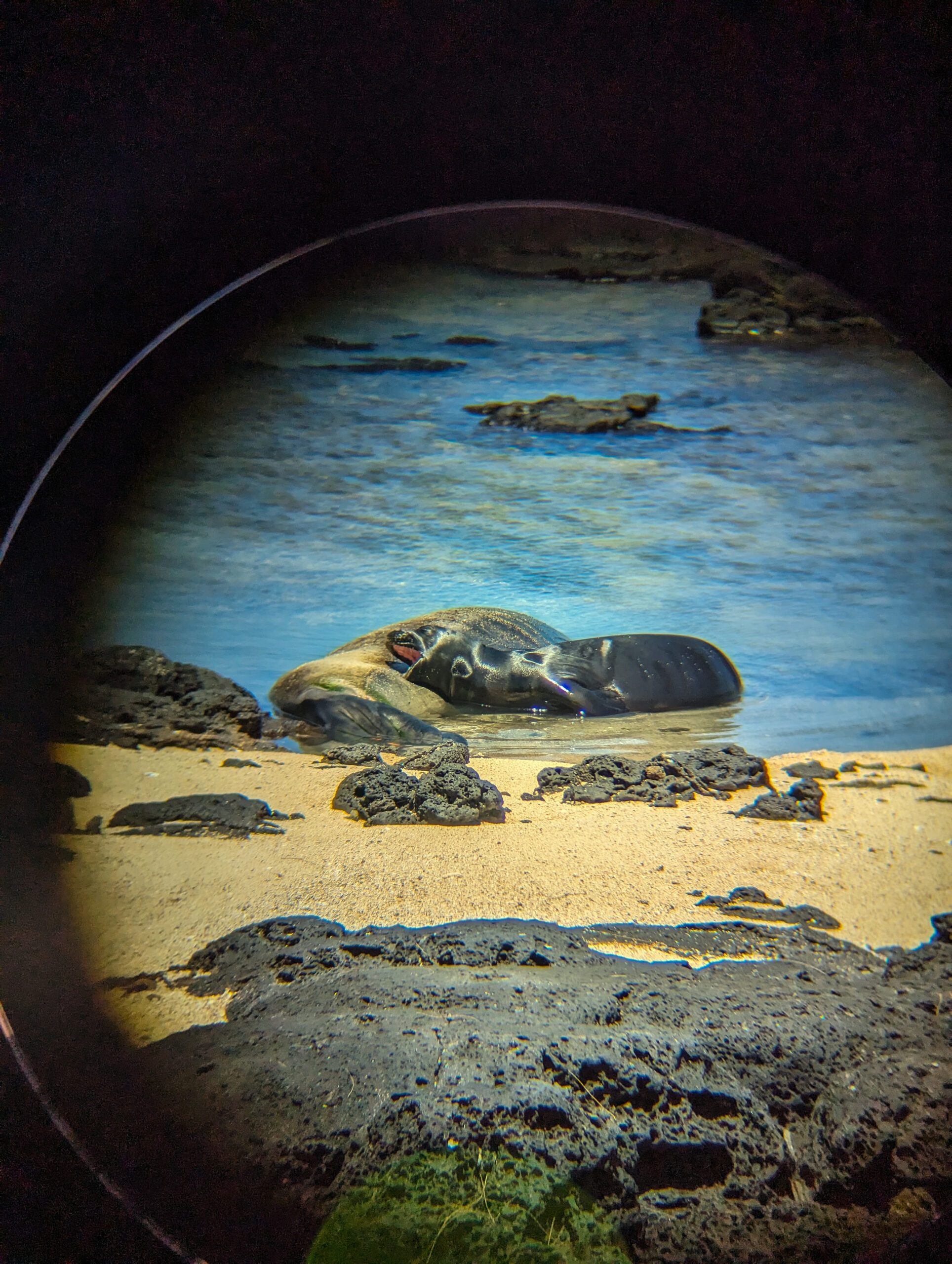
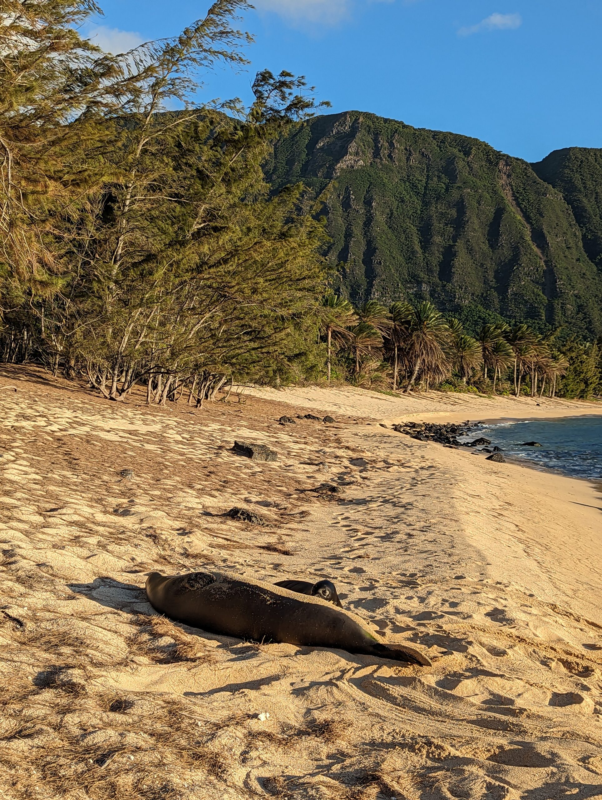
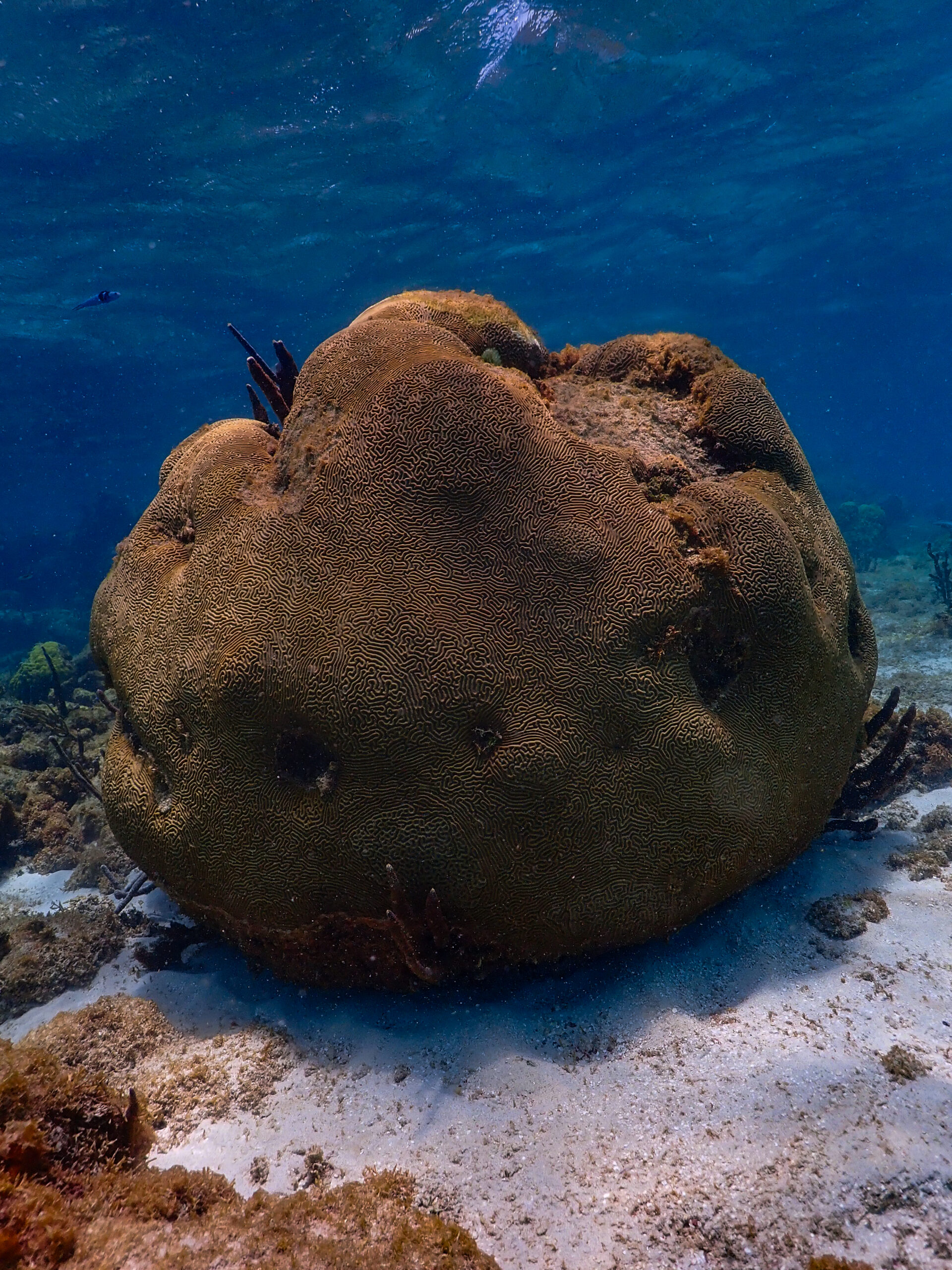
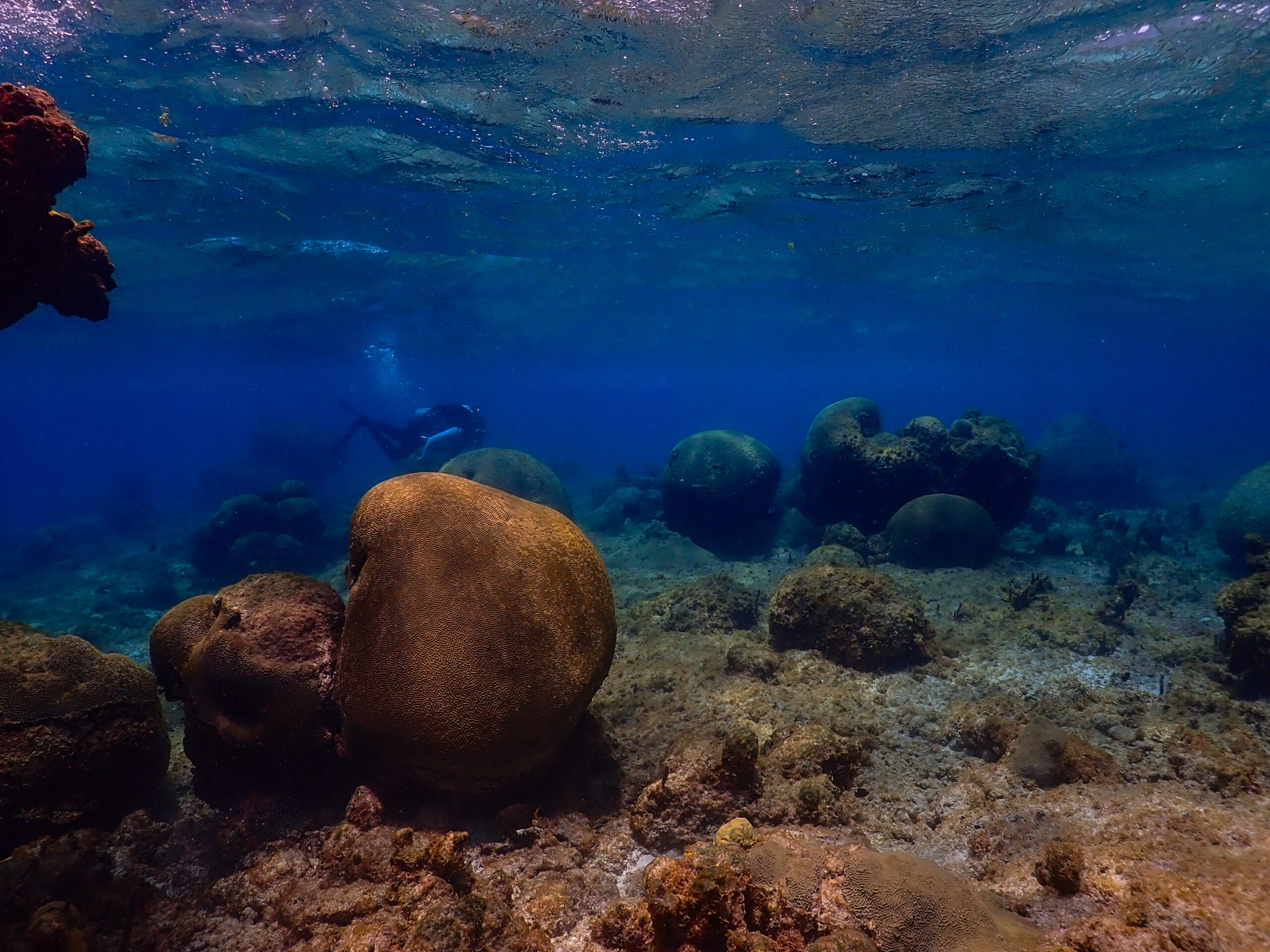
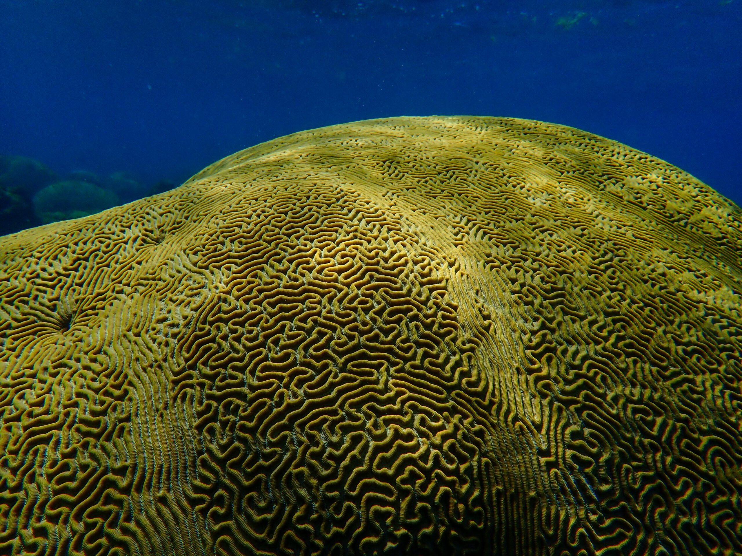
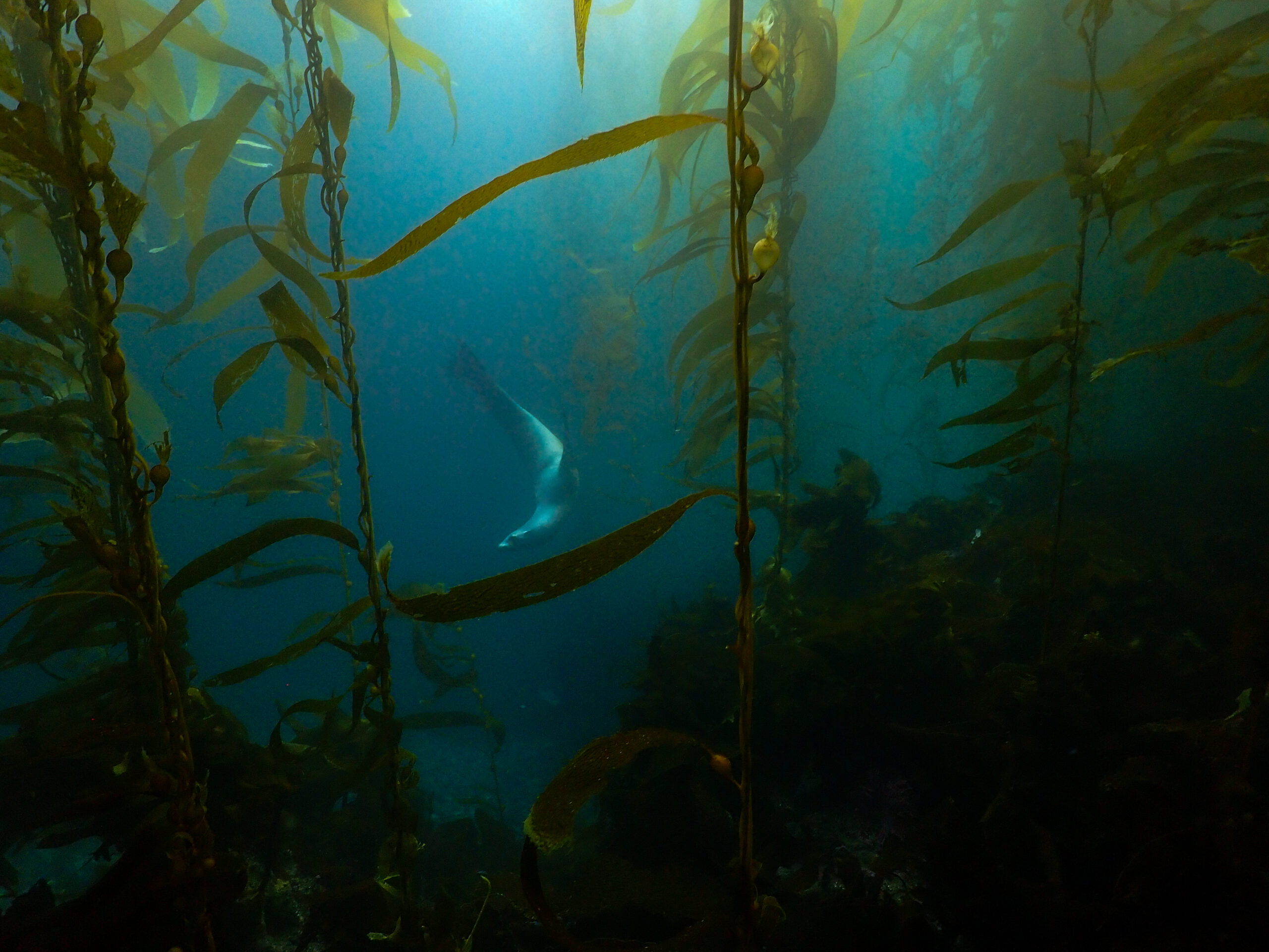
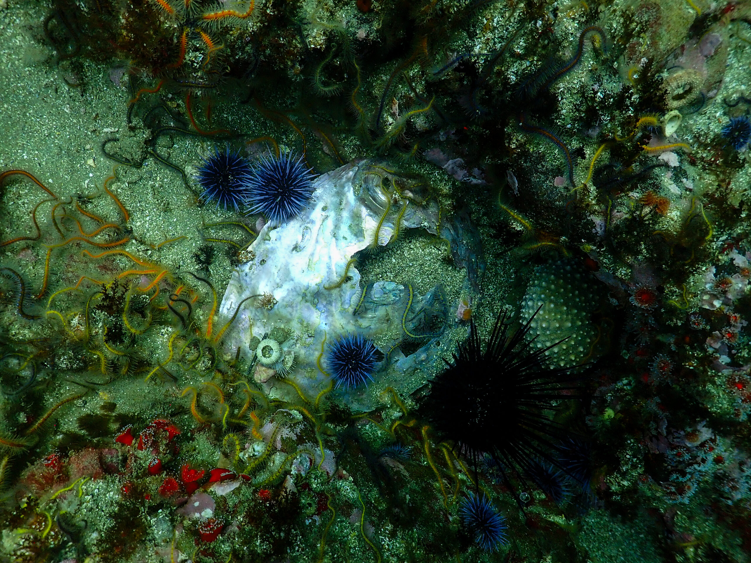
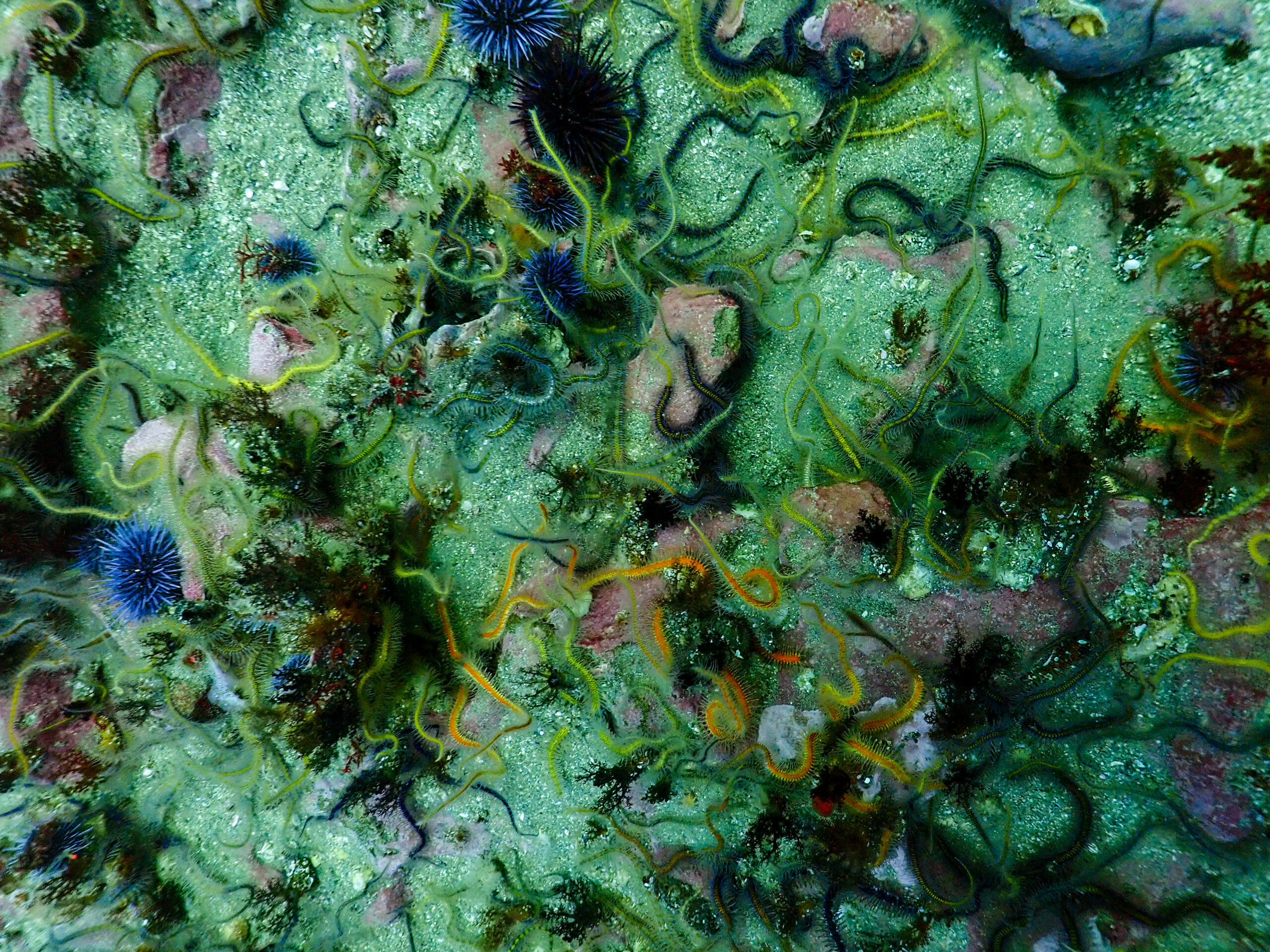
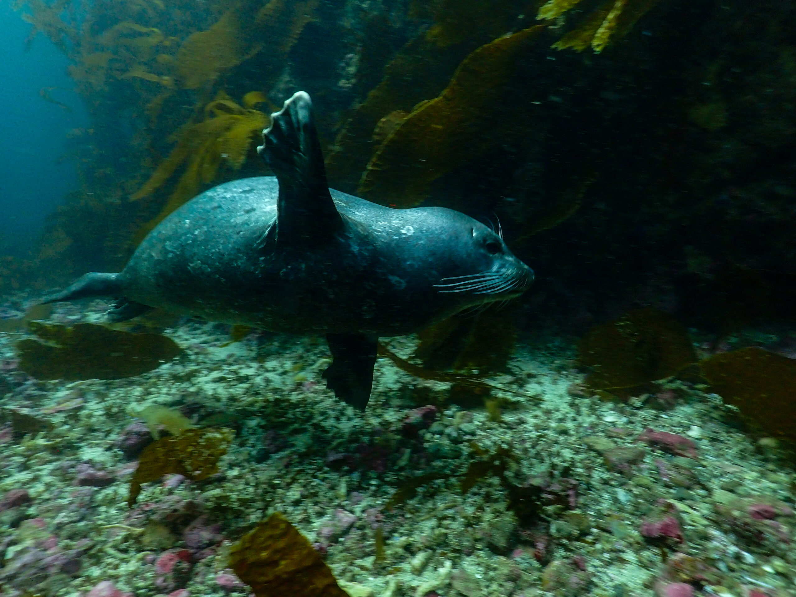
We have a long motor this morning as we cruise all the way to Santa Rosa Island along the south side of the very long Santa Cruz Island. We make it to Johnson’s Lee South but the current looks like it’s ripping, so we give it a couple hours to calm down. Male elephant seals battle on the beach. We get some late afternoon diving in. I dive with Ean and we start with roving diving fish count surveys again. A lot of blue rockfish and other rockfish species this time. This site is stunning but very different from the last one. First off, it’s much colder, 55 degrees as compared to 65 at Anacapa yesterday. The colors are beautiful, tons of purple sea urchins, bat stars, anemones, and brittle stars waving their little arms in the current.

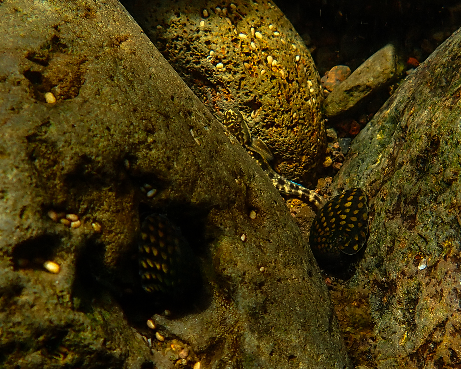
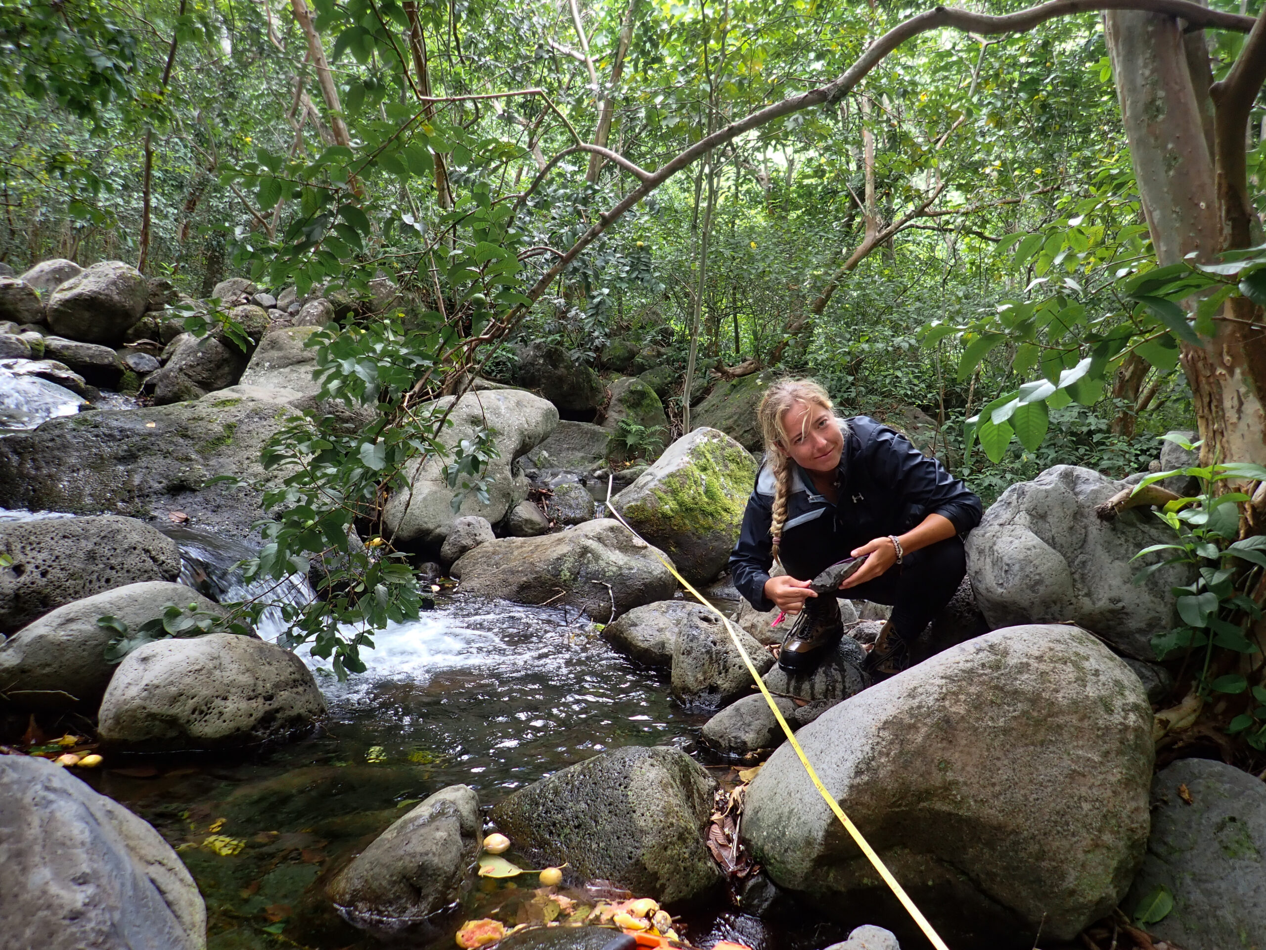
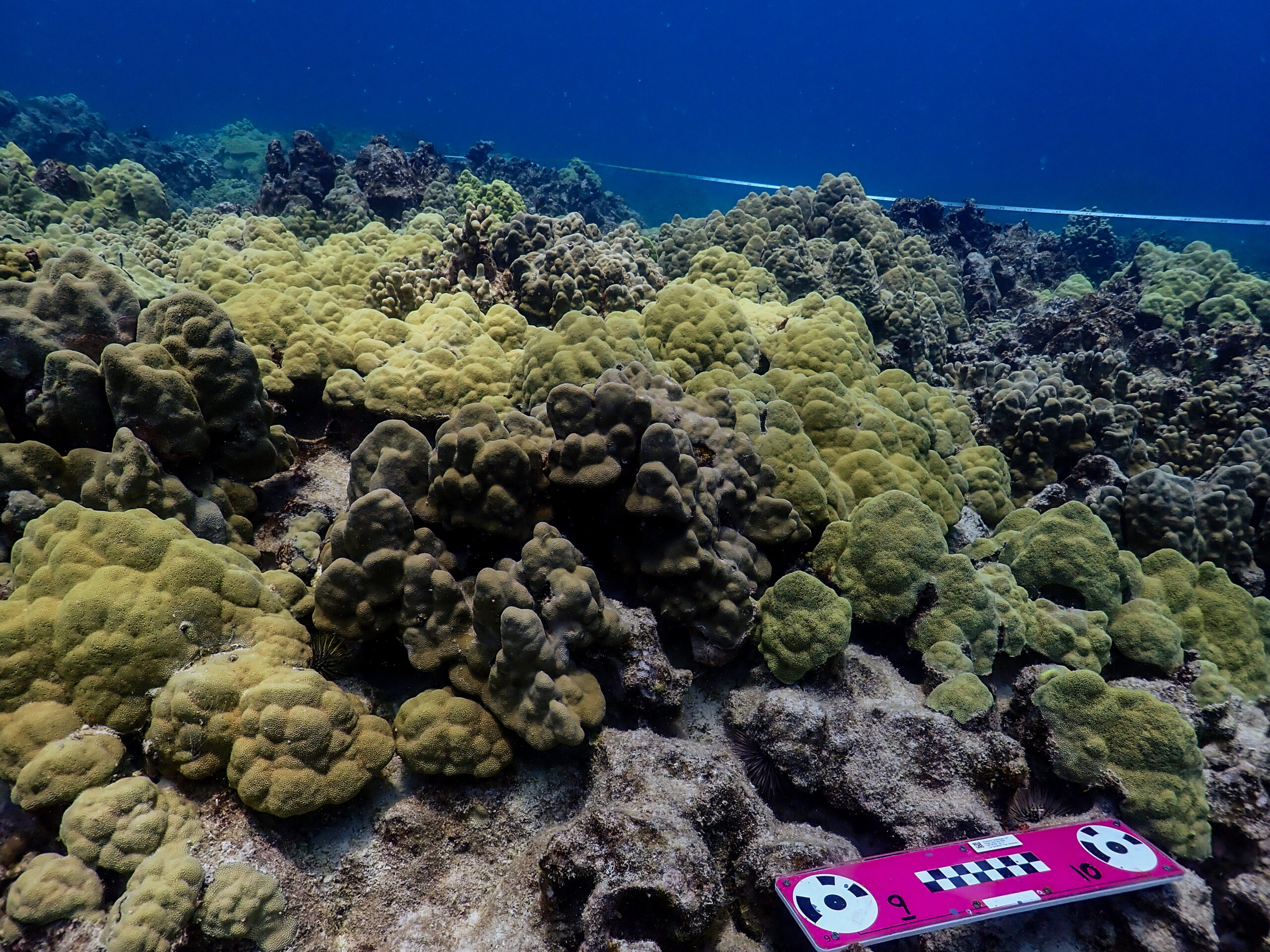
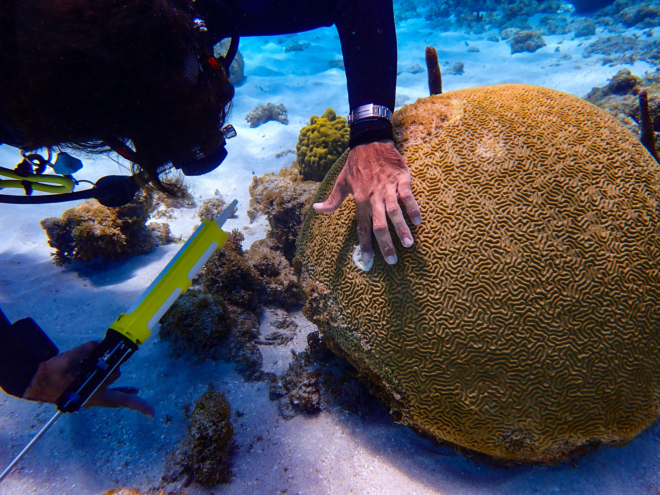
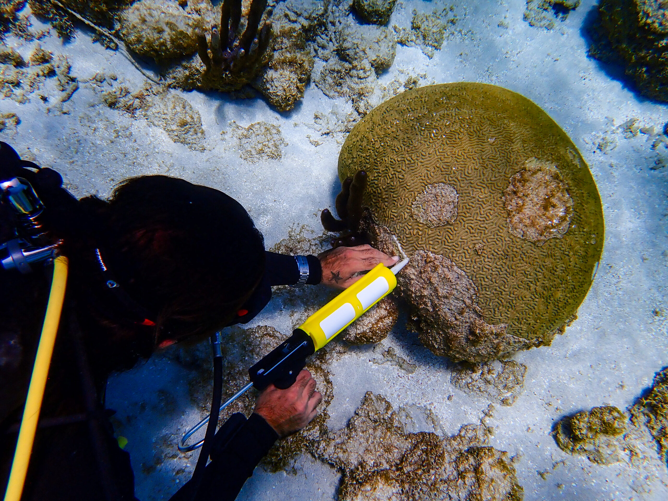
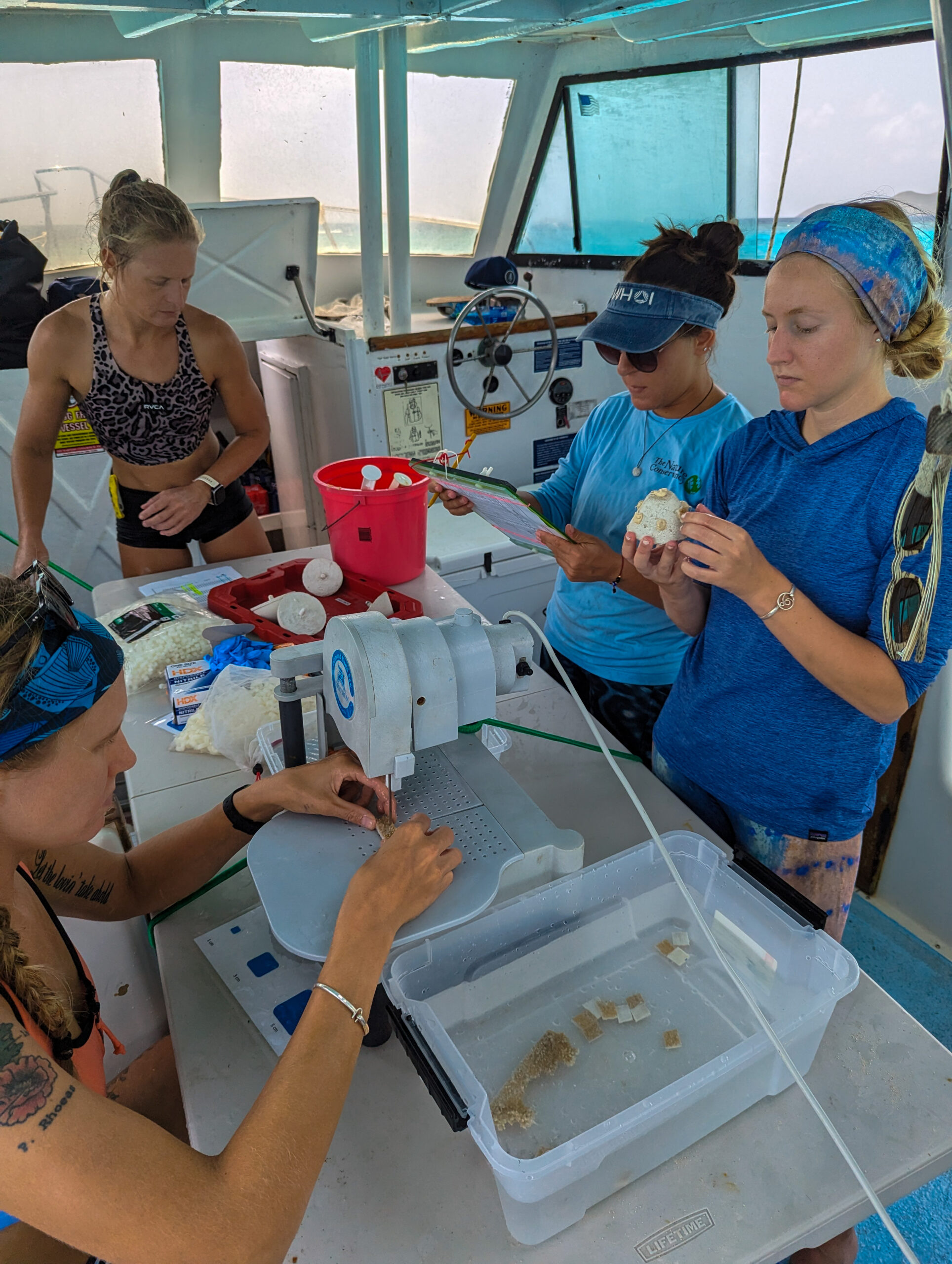
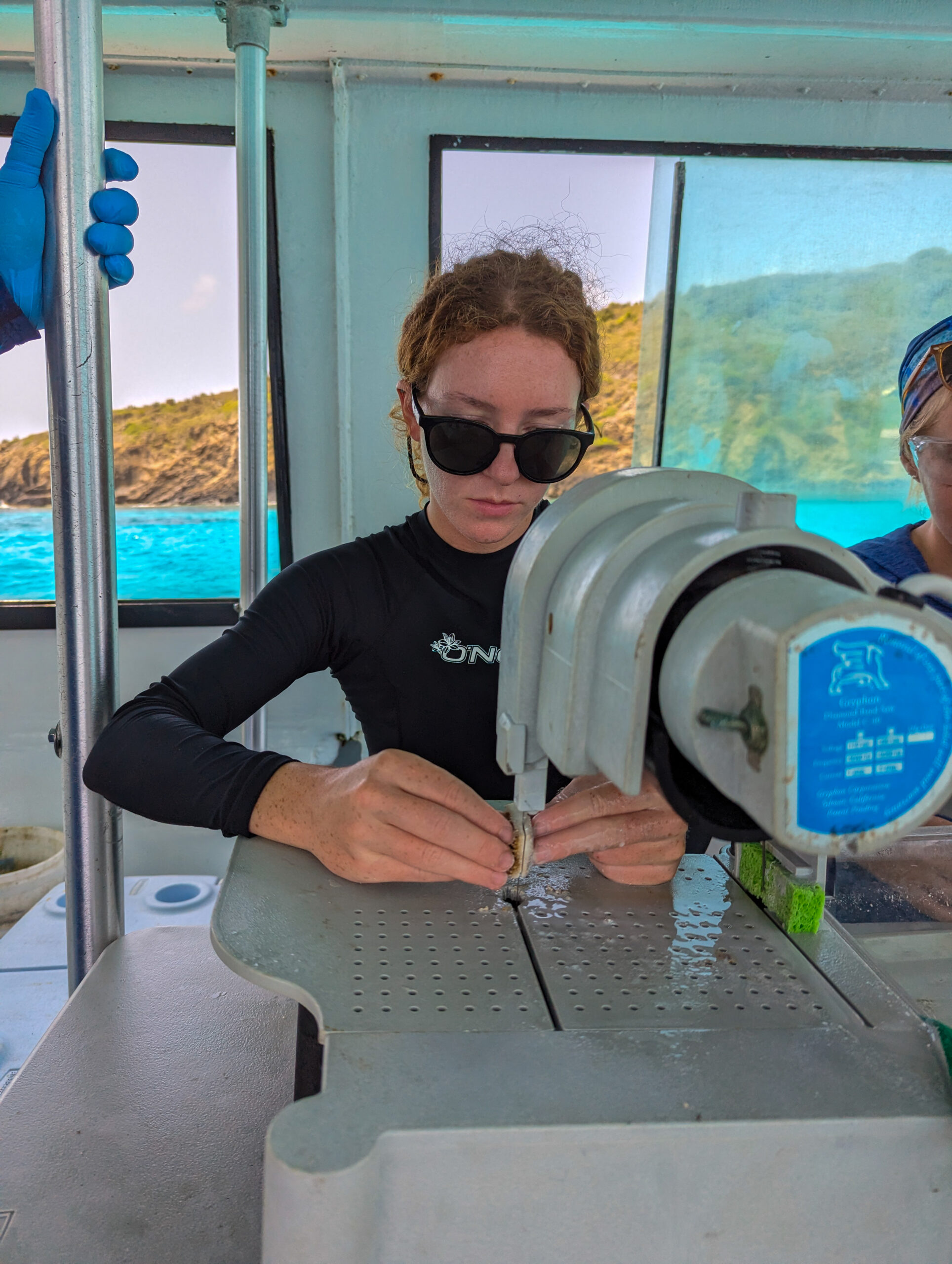
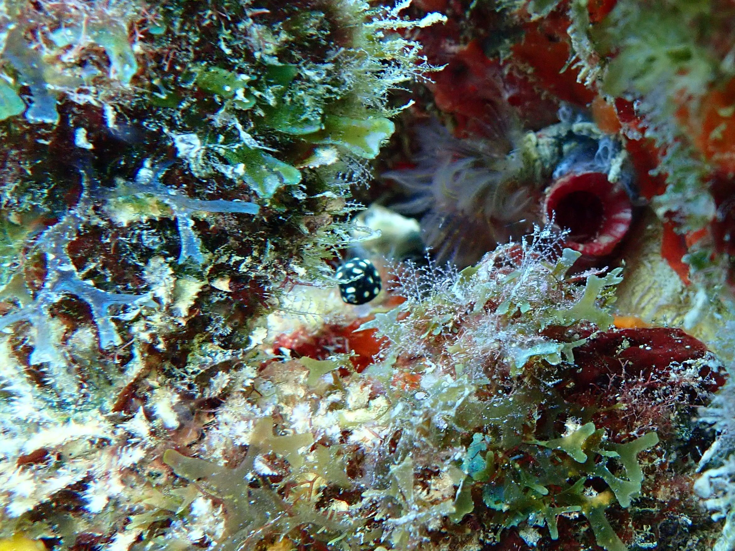
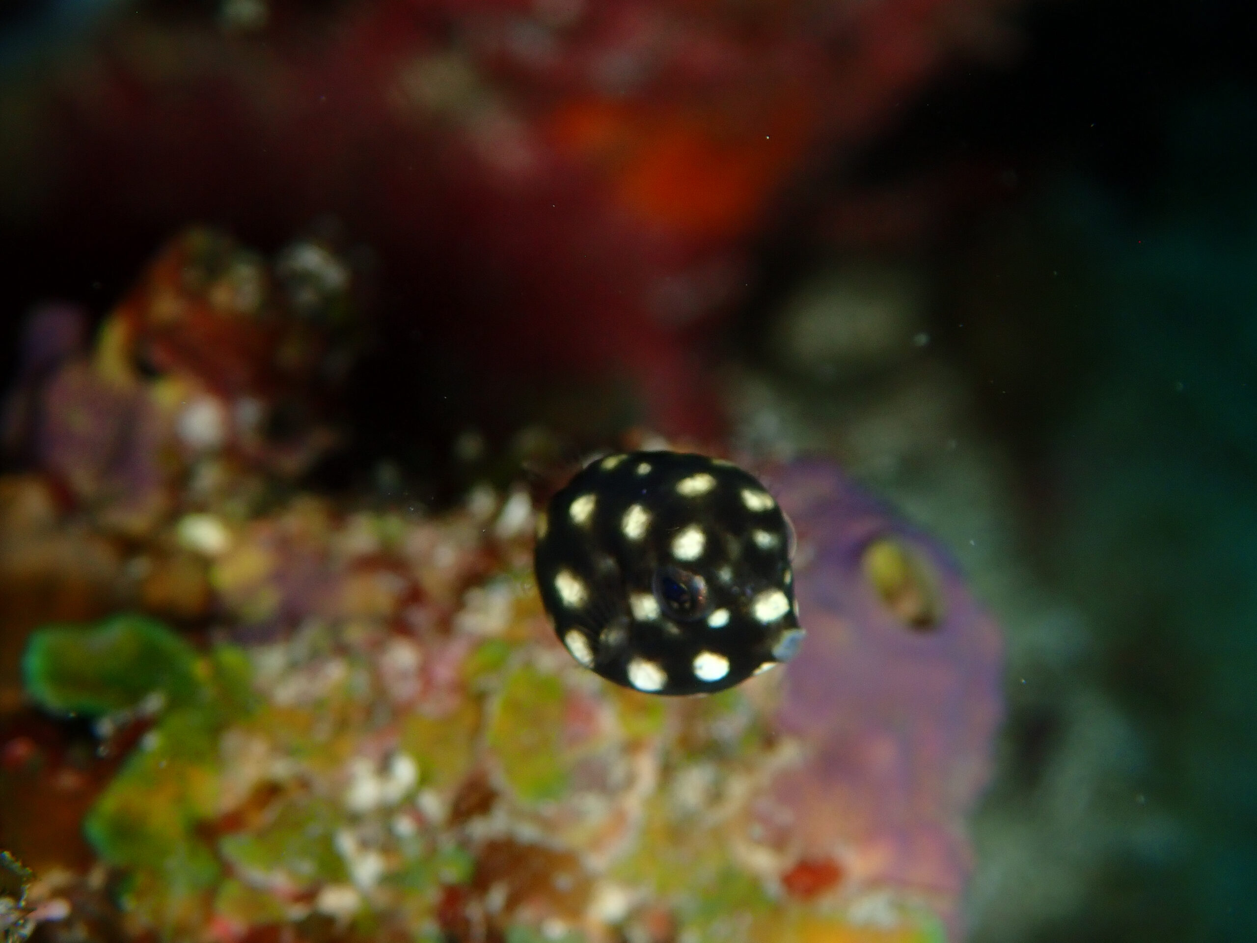
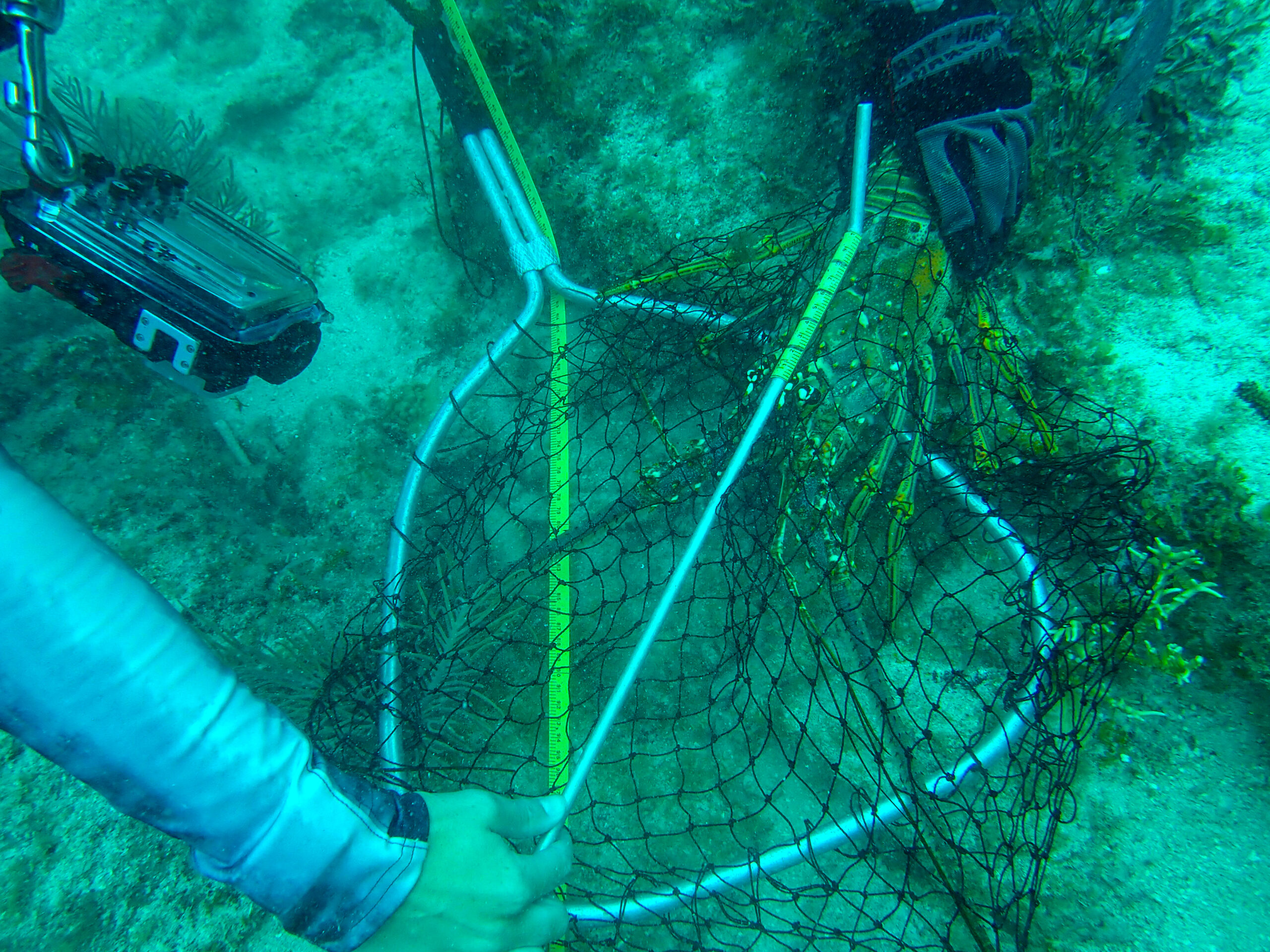
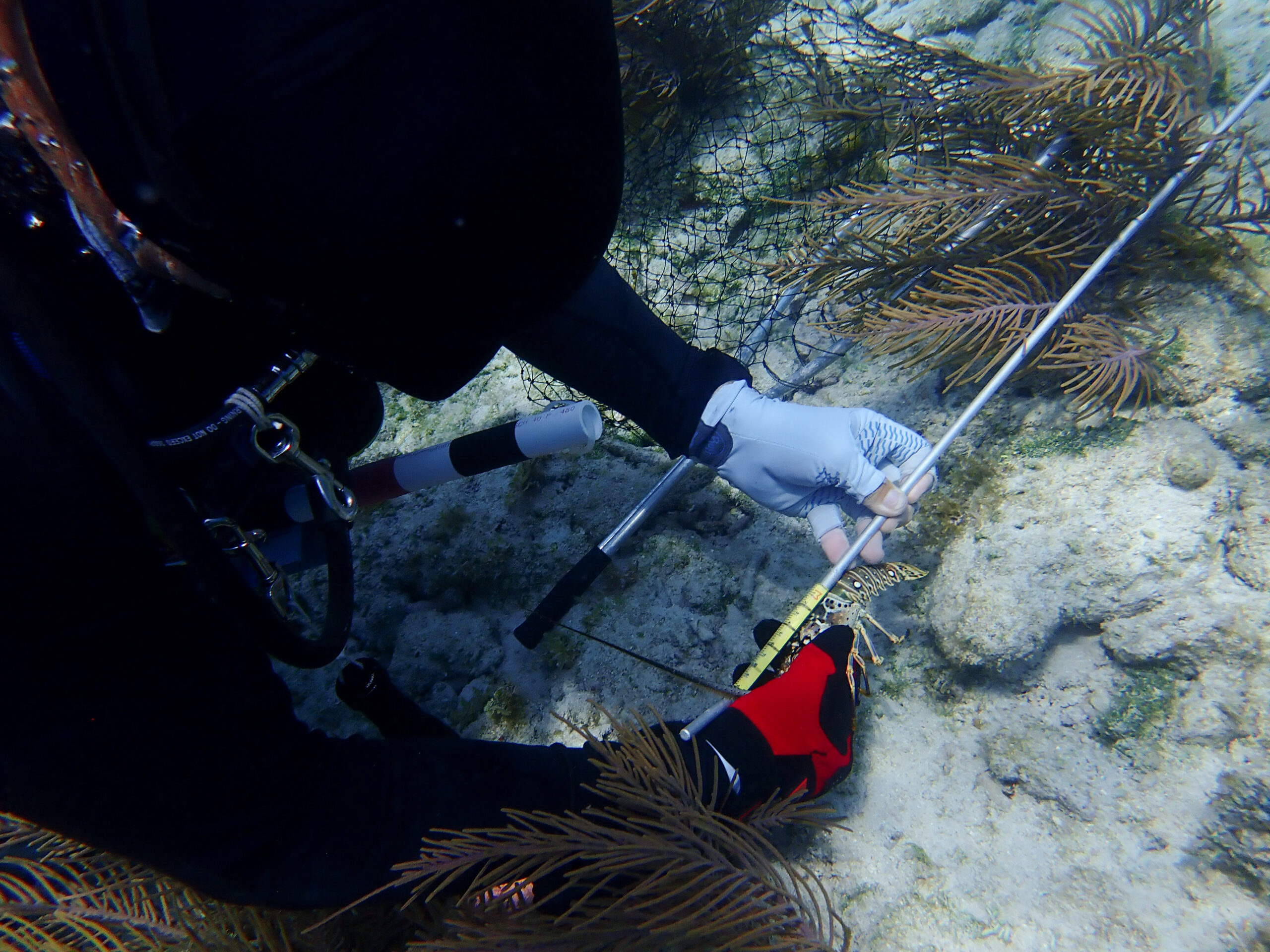
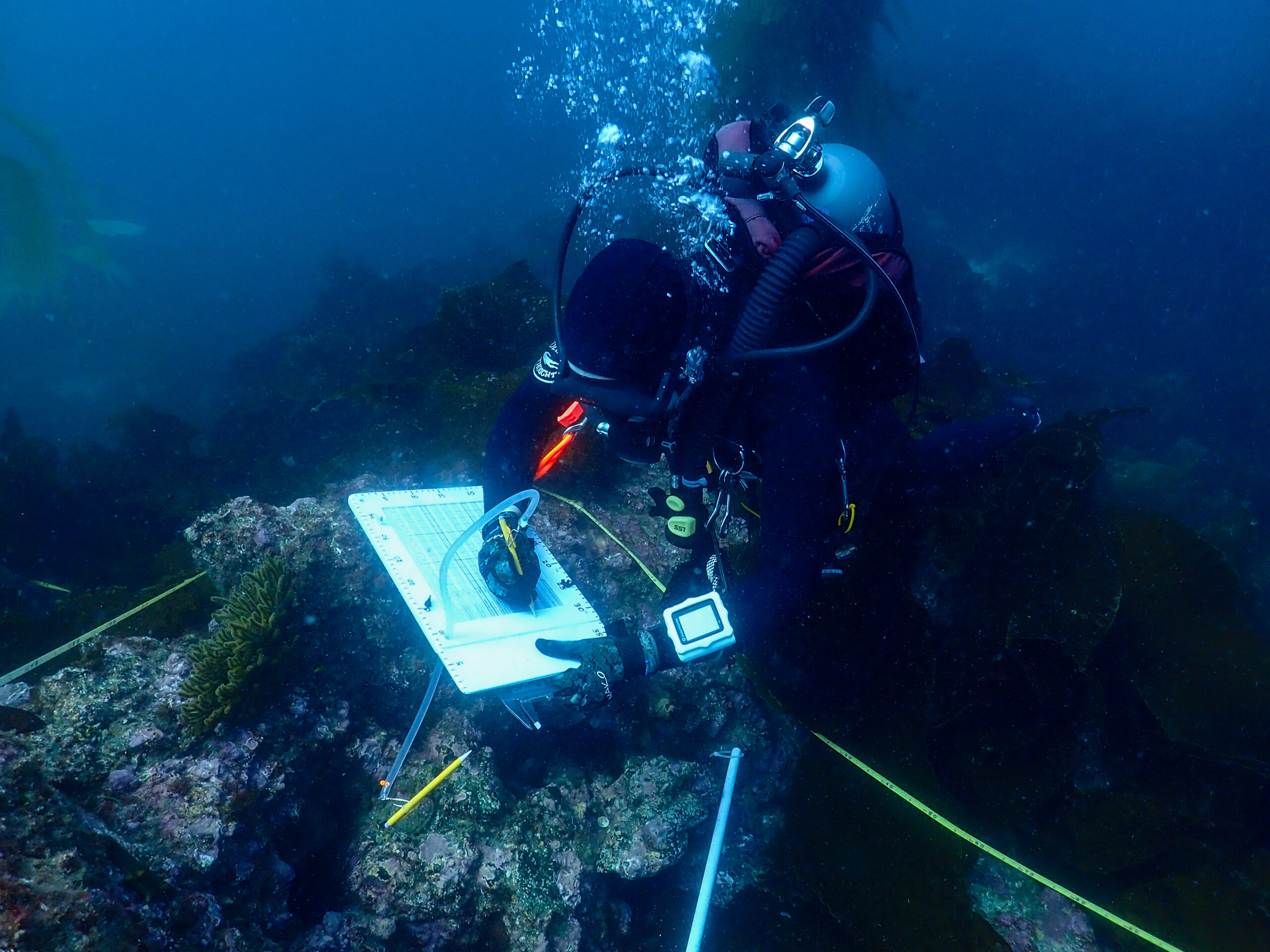
After counting fish, I am searching for and measuring rock scallops and bat stars as part of the natural habitat size frequency distribution surveys. The aim of these surveys is to quantify the size frequency distribution of certain invertebrates. The measurements can be used to calculate biomass, and detect differences between islands or even inside and outside of marine protected areas. For most invertebrates, we are trying to get 60 individuals at a site, so I’m searching for 30 scallops and 30 bat stars, and the other diver on the other side of the transect will get another 30 of each. On the next dive, I’m measuring Kelletia whelks. I see Spanish shawl sea slugs, giant keyhole limpets, orange puffball sponges, fields of anemones and so many big sea hares! That’s it for today, current is picking up again and we barely make it back to the O2 bar. Emalia makes sushi bowls for dinner and I stuff my face. We anchor closer to shore.

Ean recording data.
California sheephead.

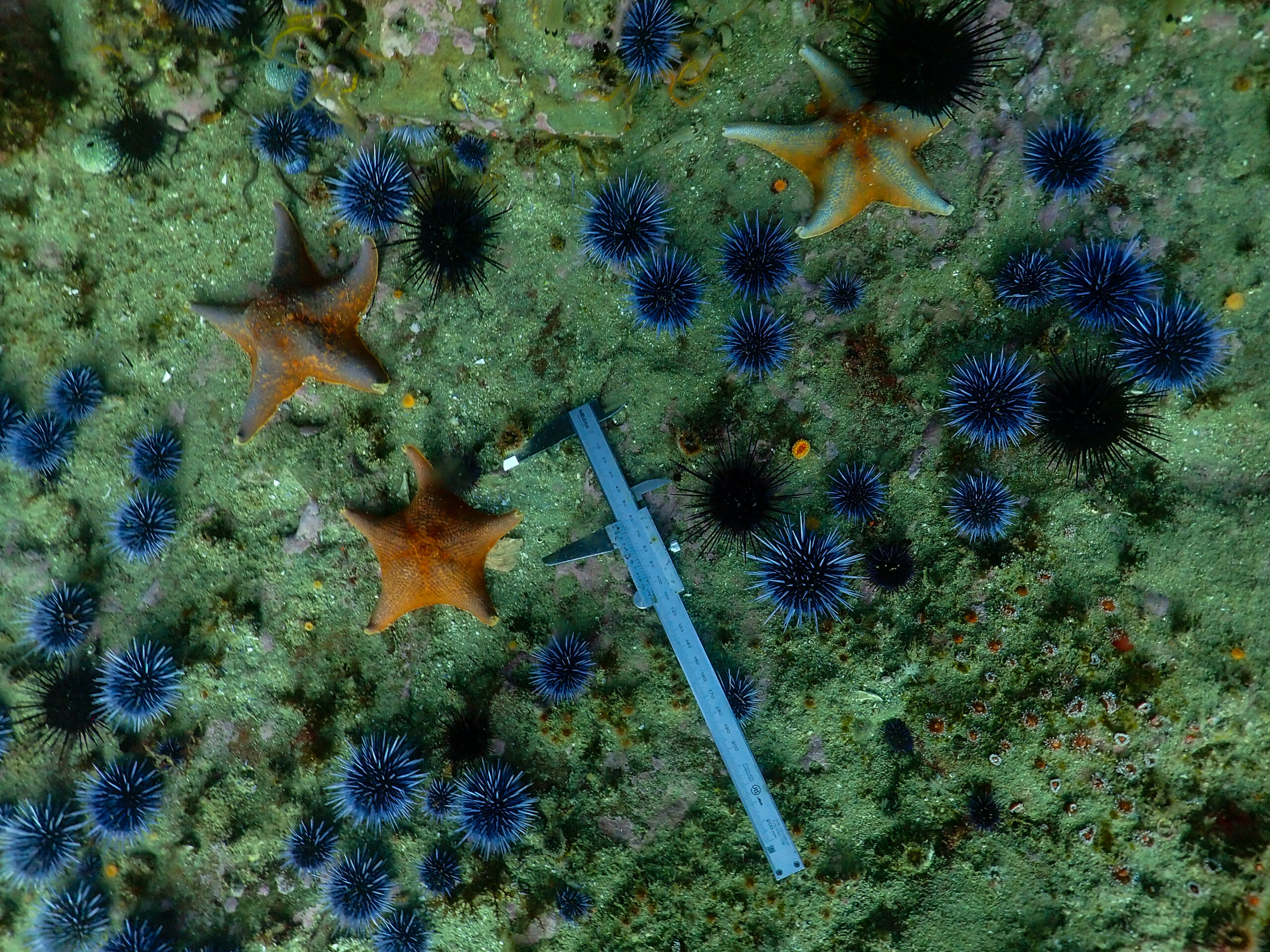
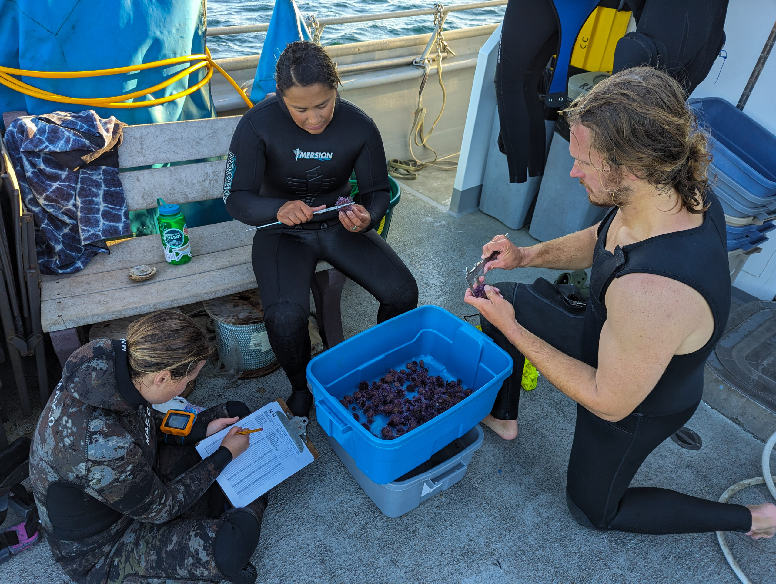
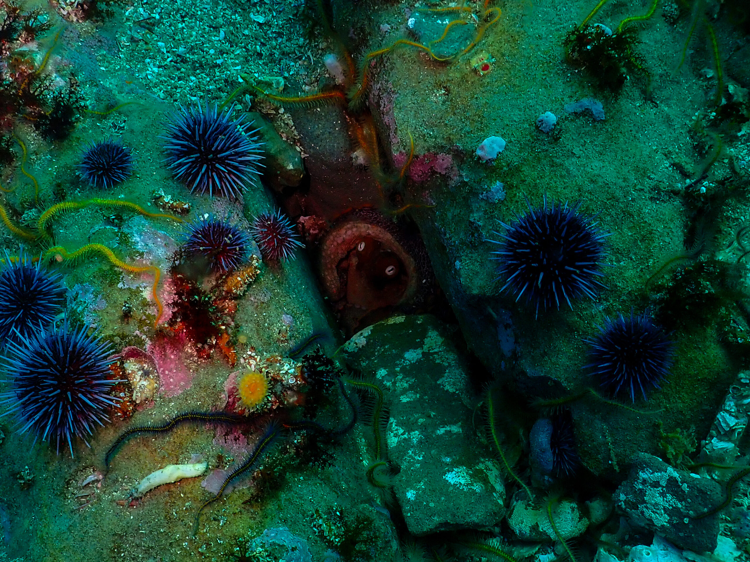
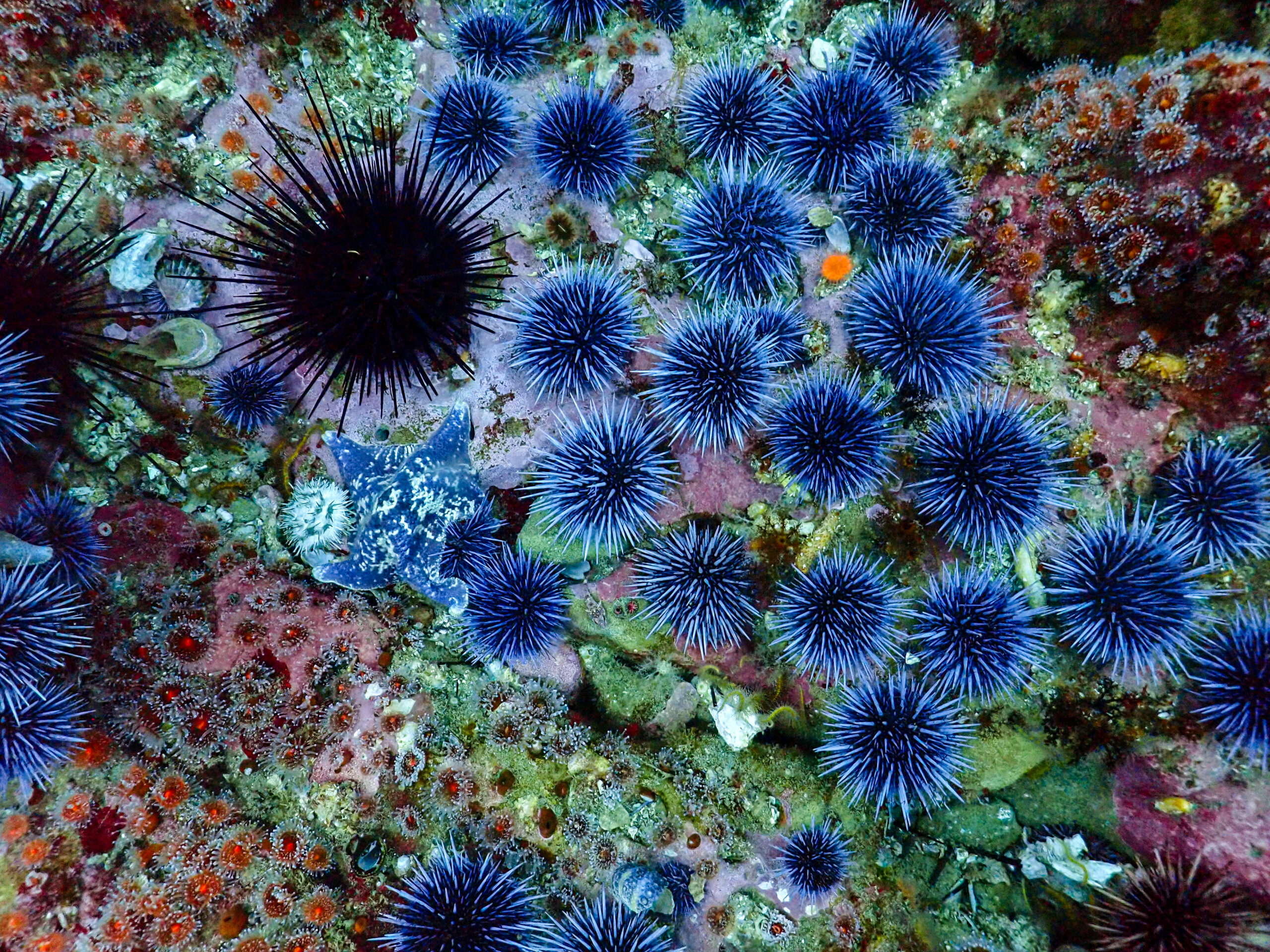
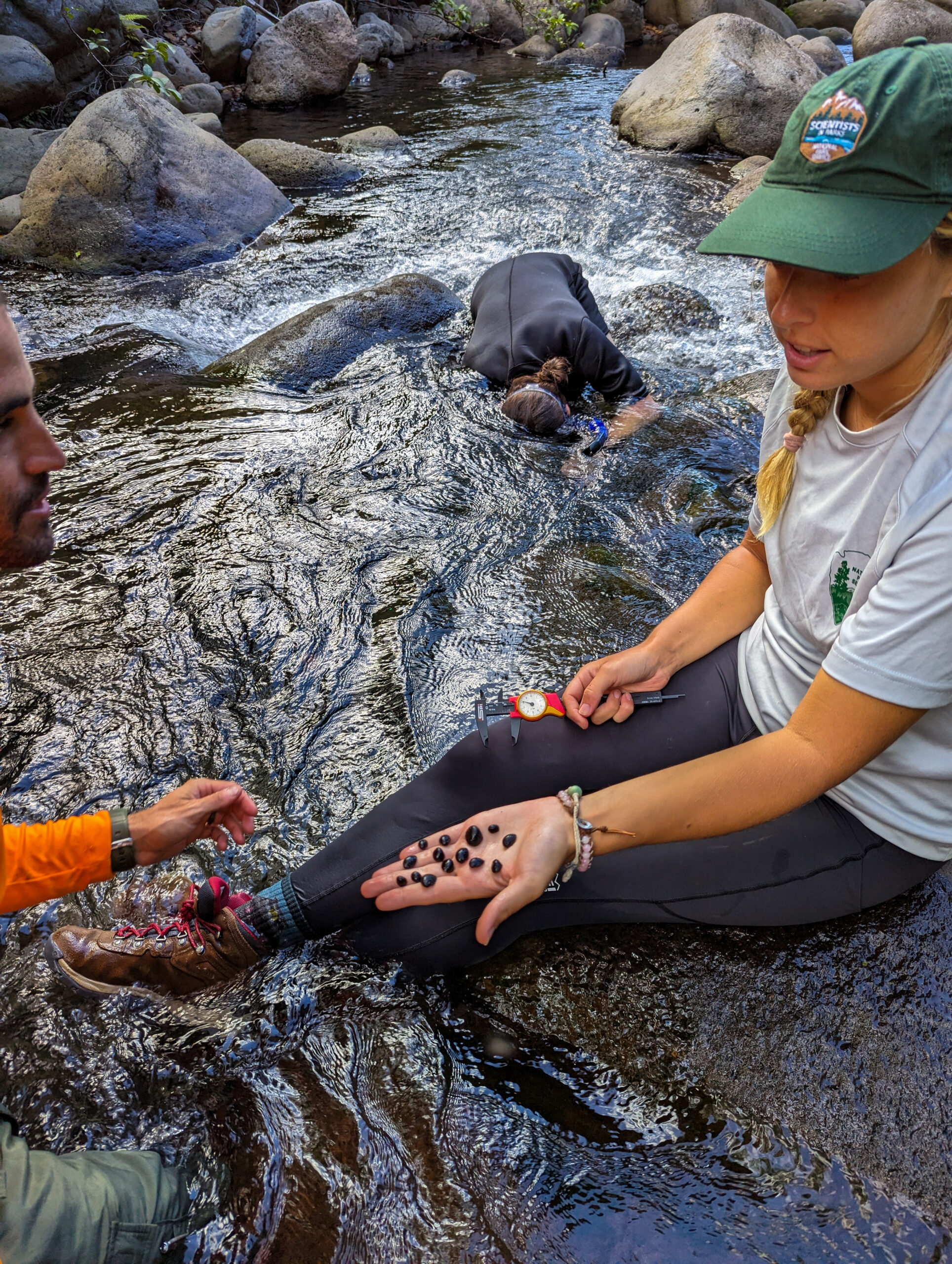
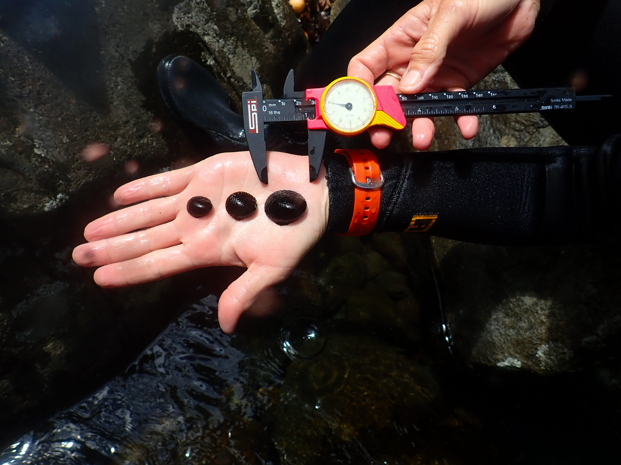
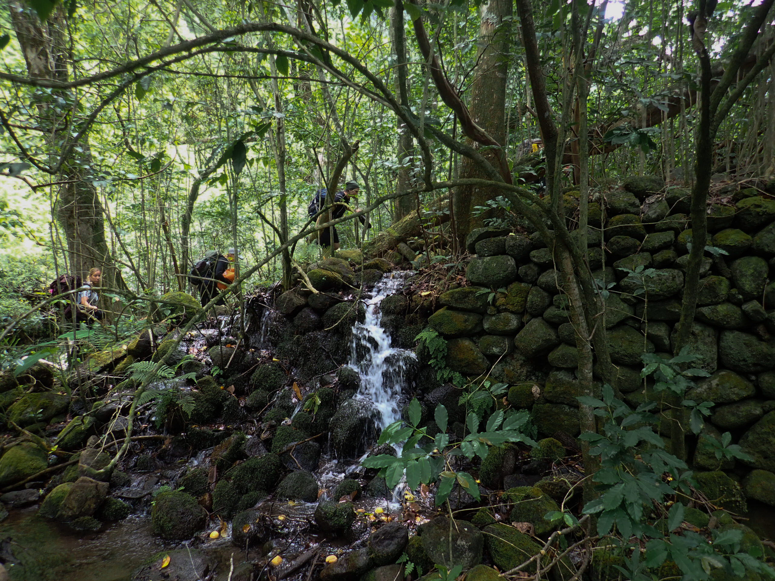
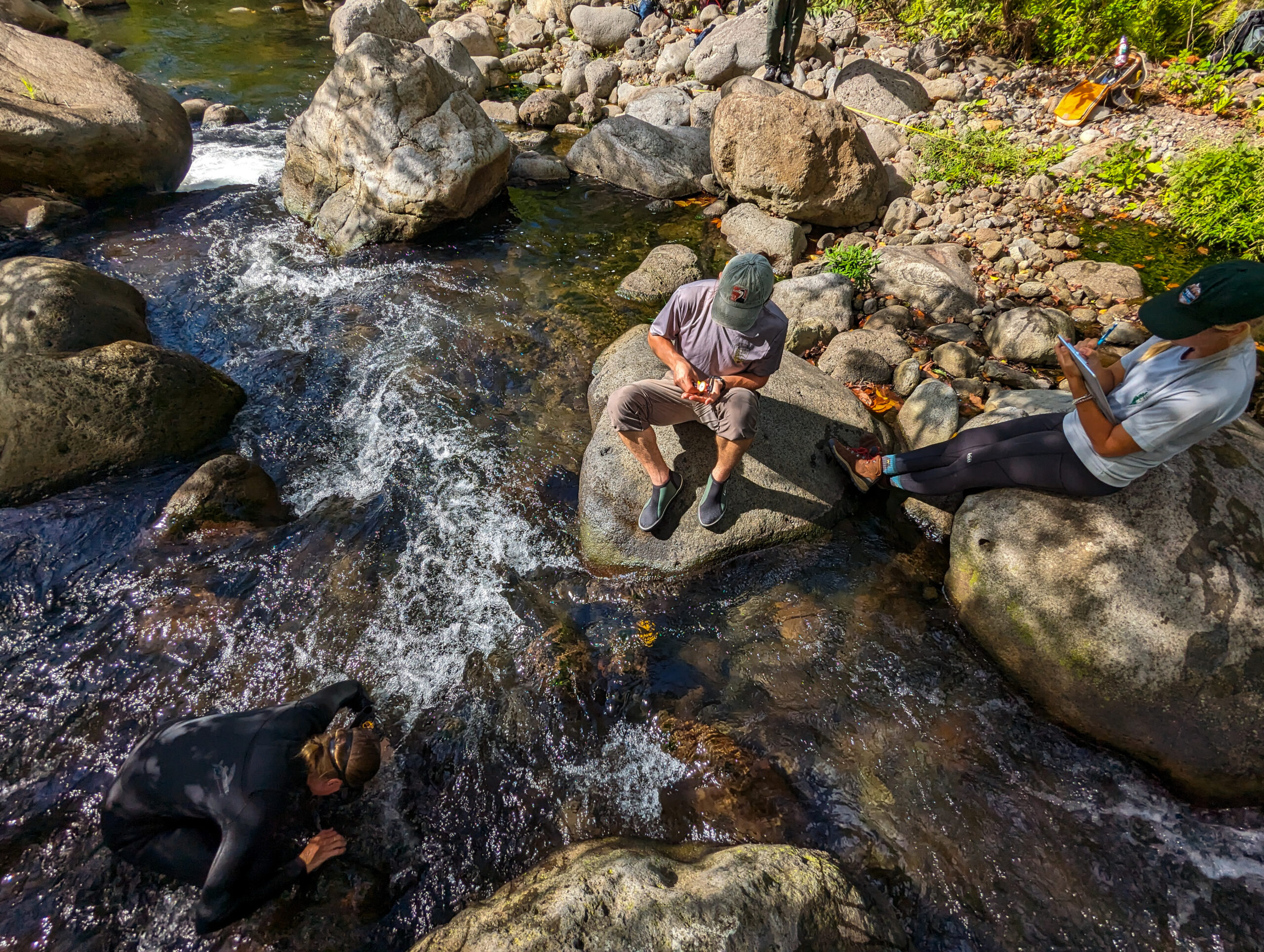
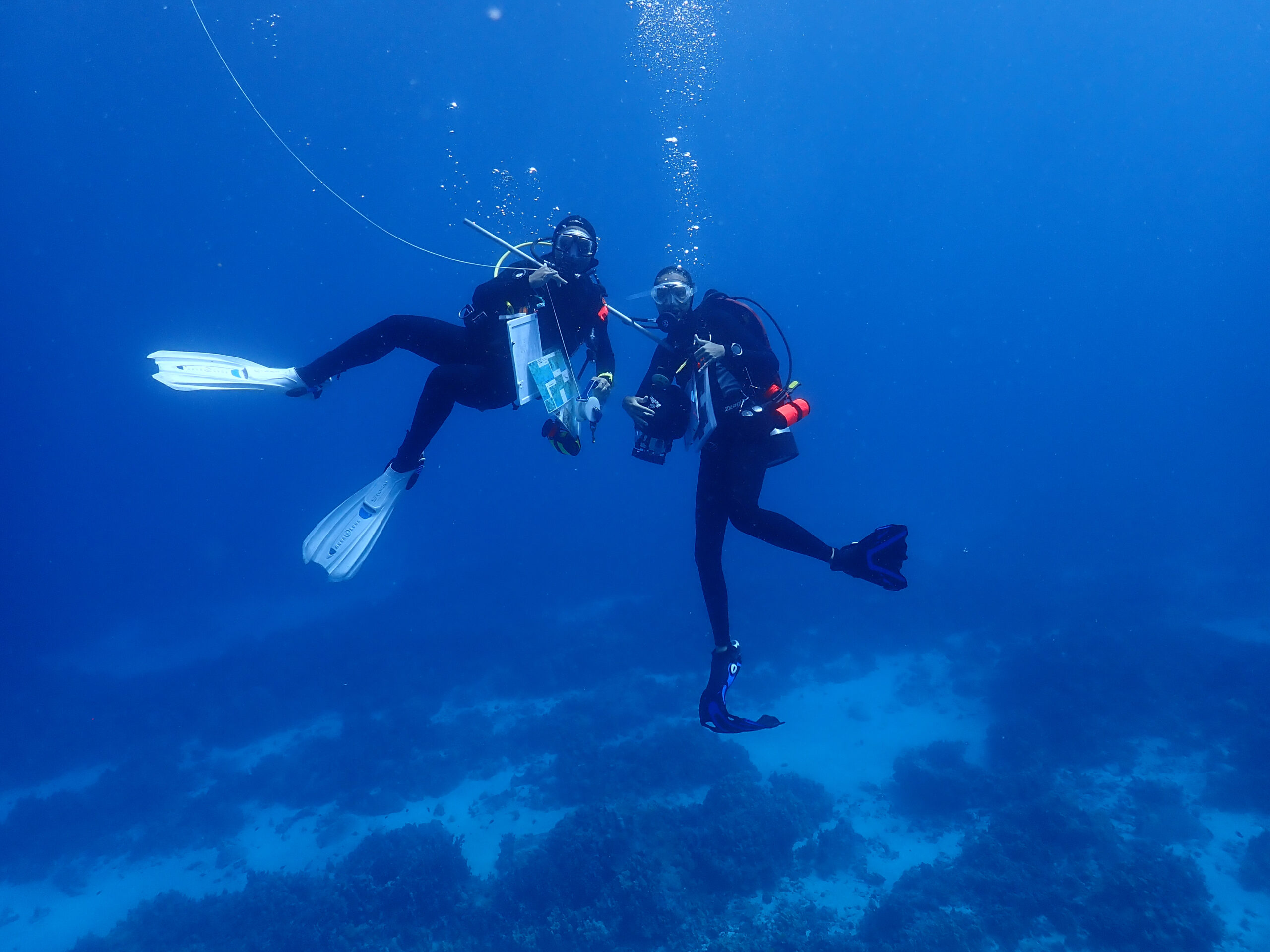
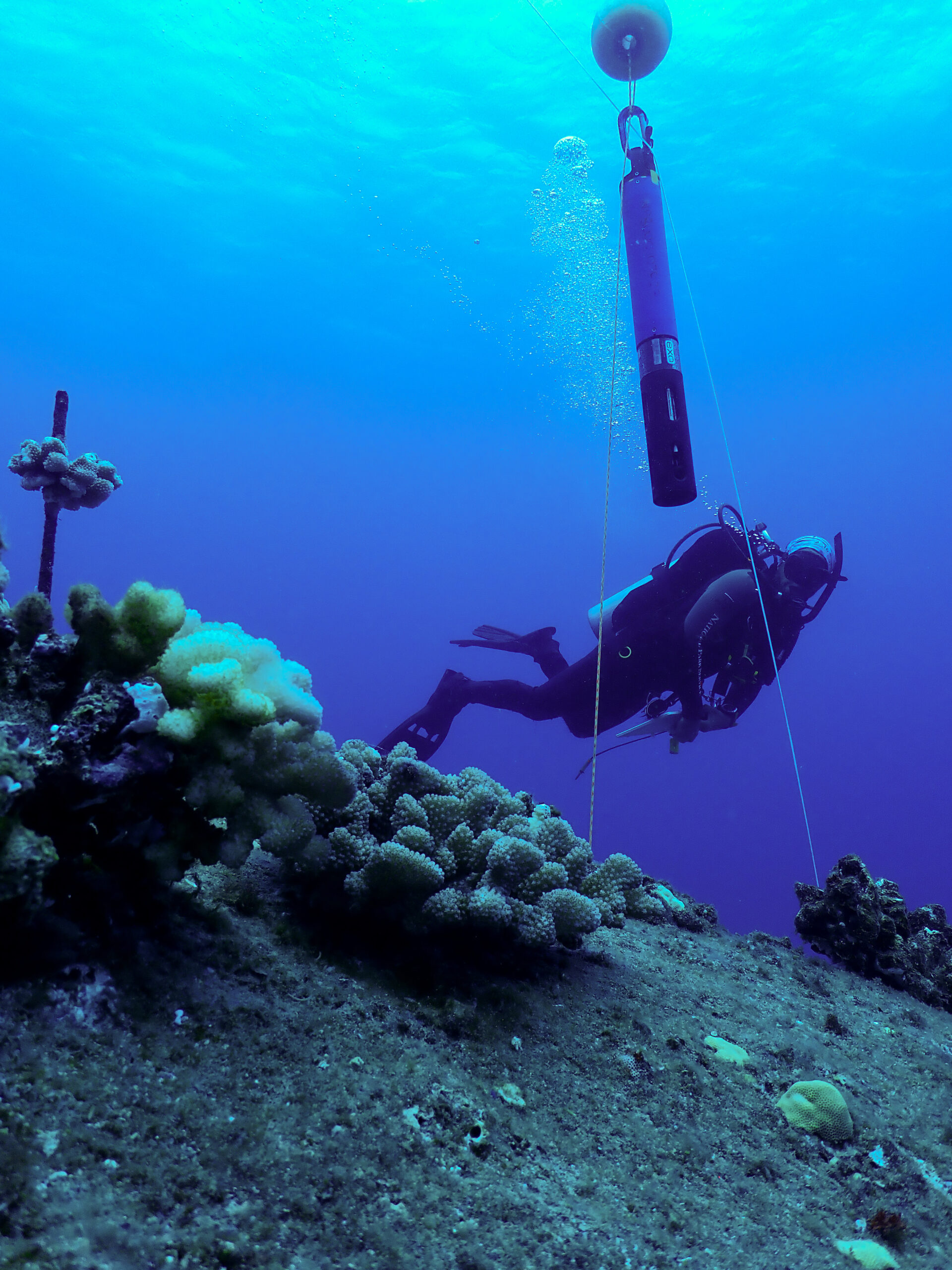
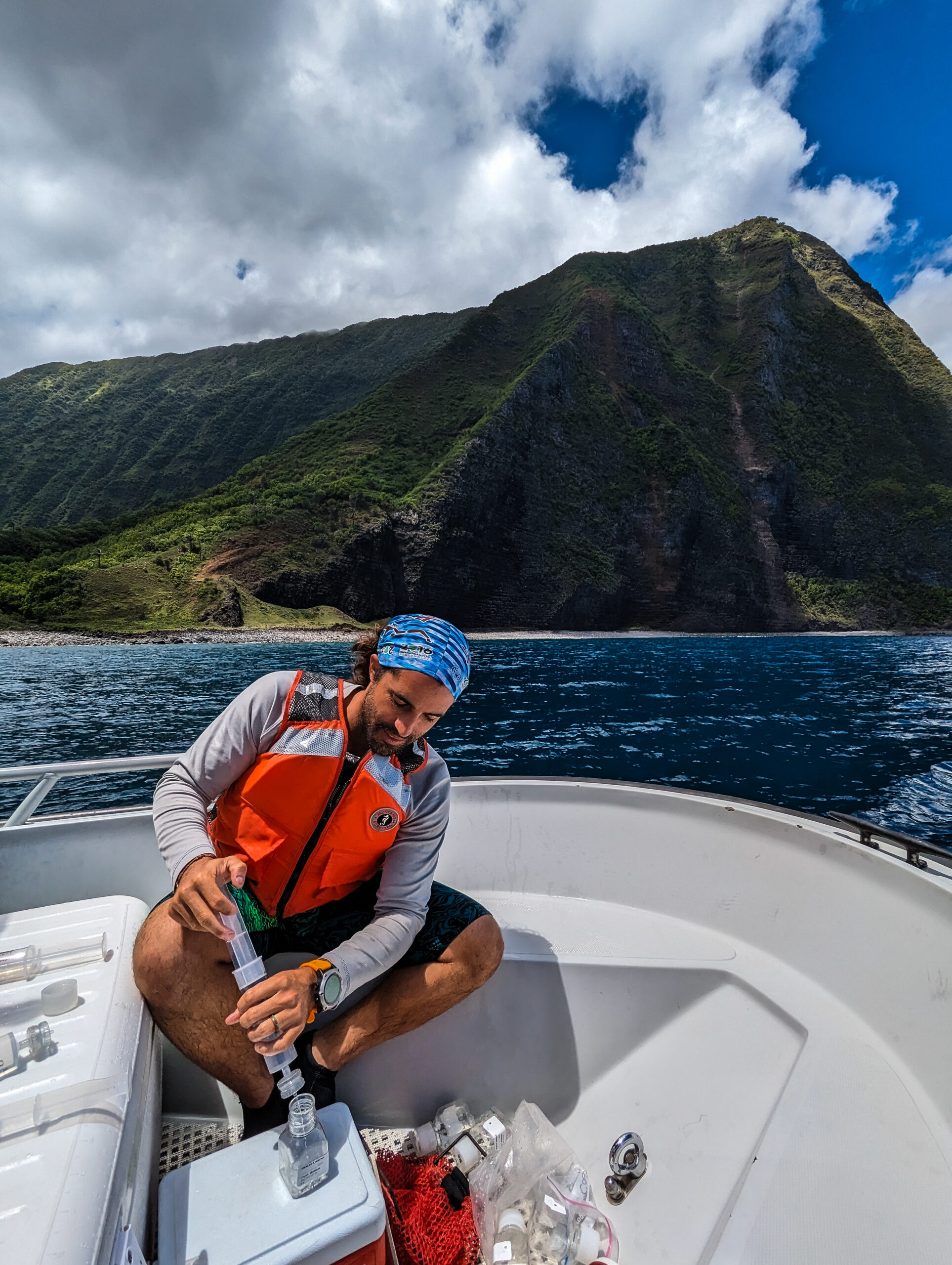
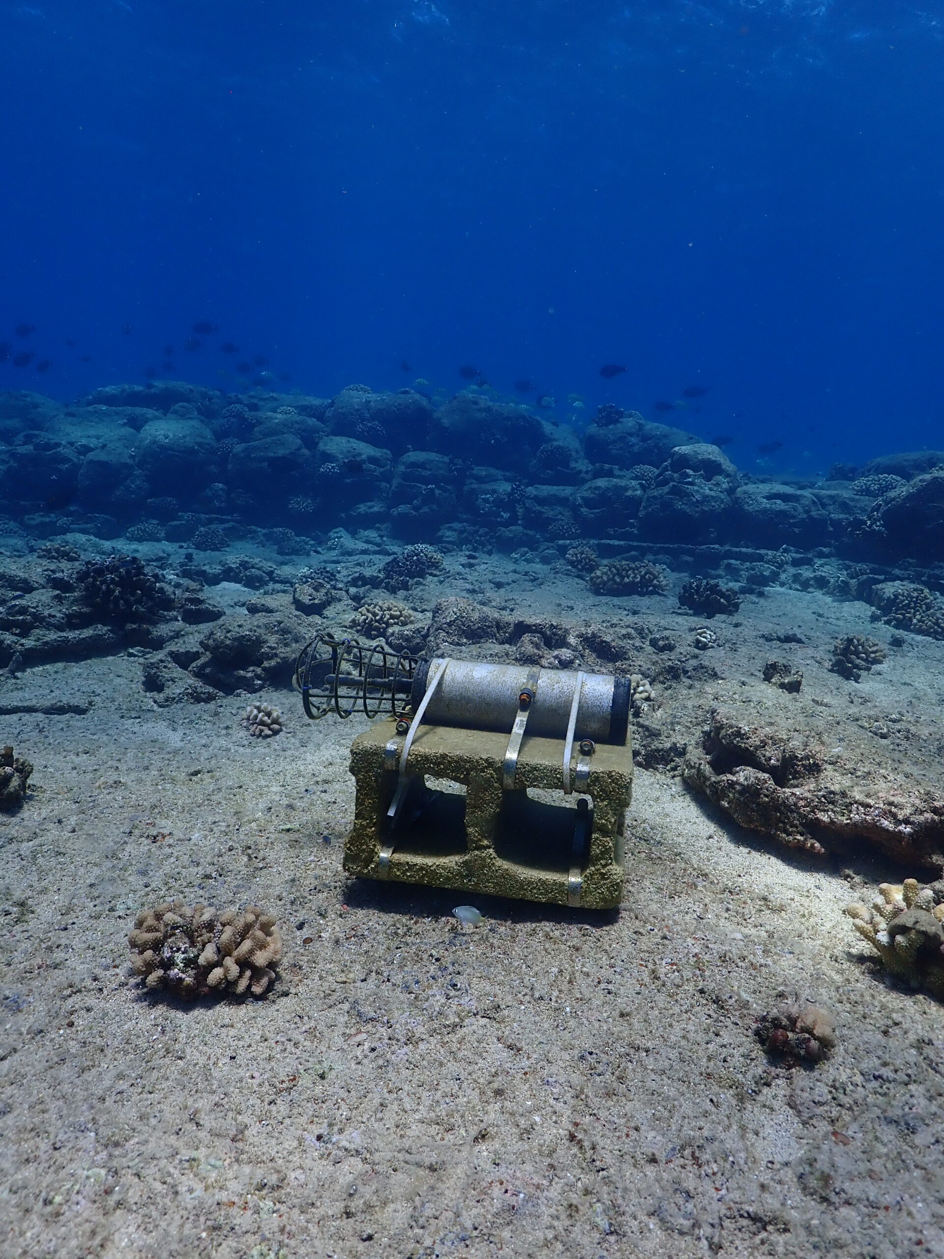
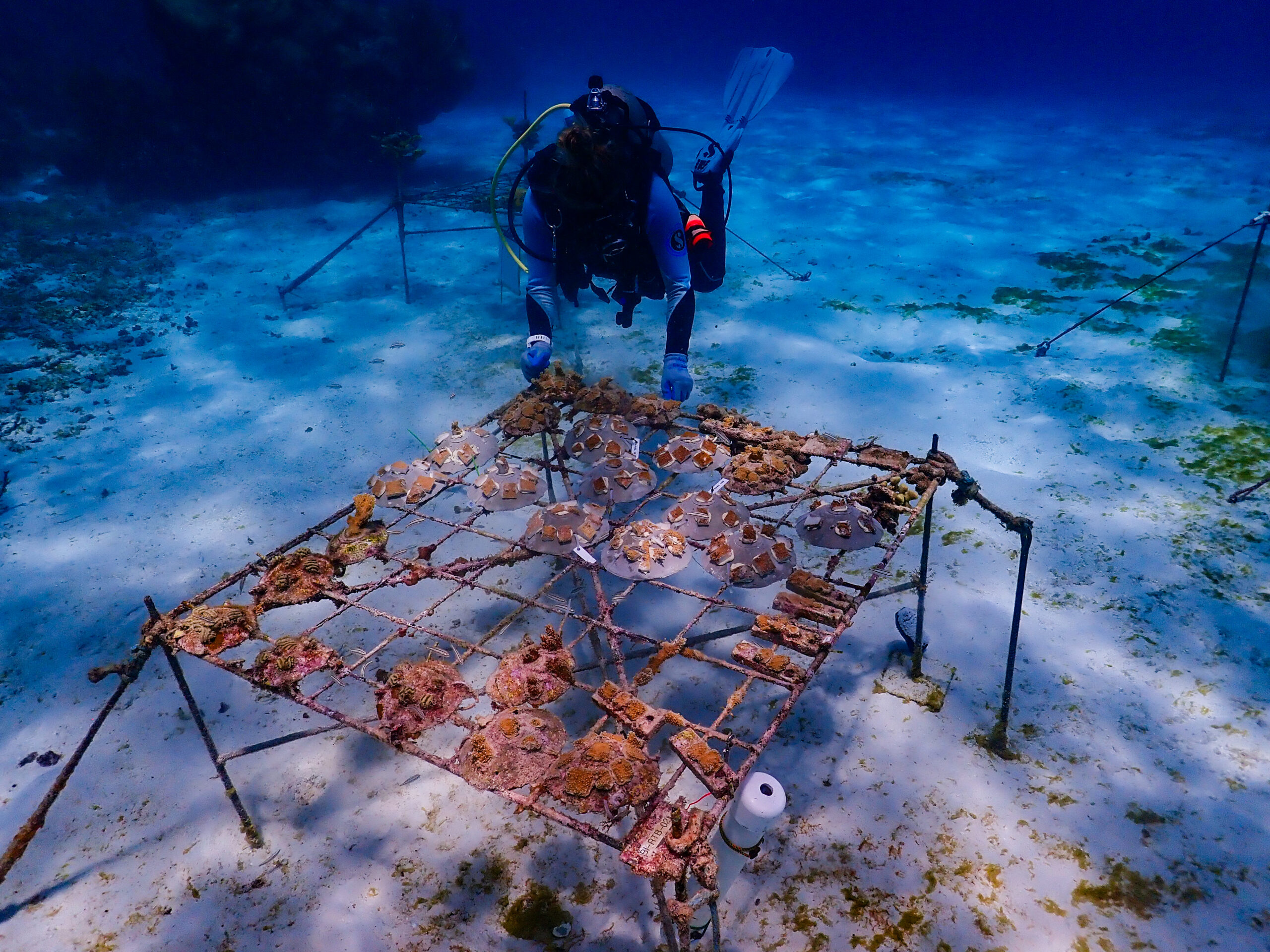
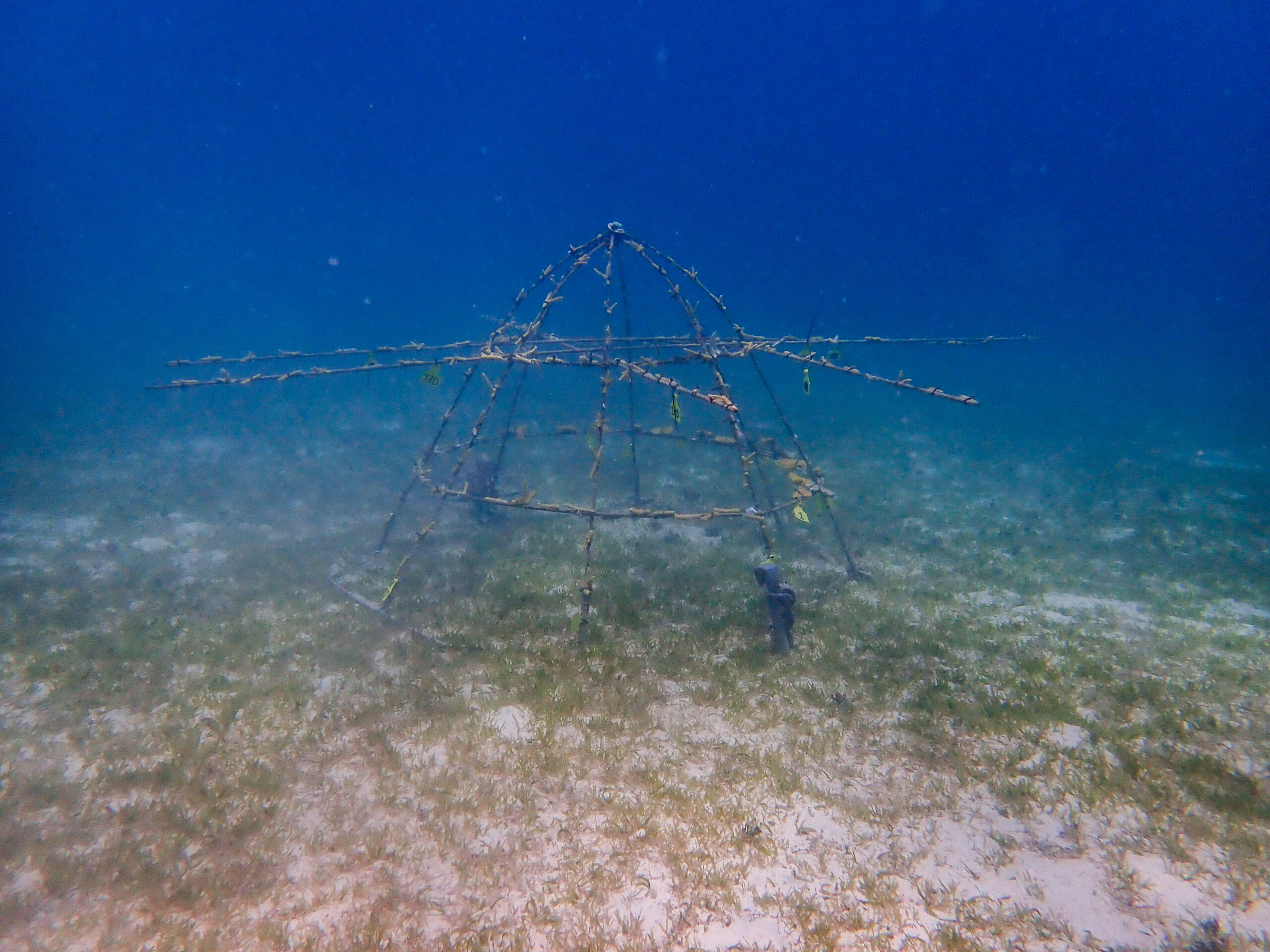
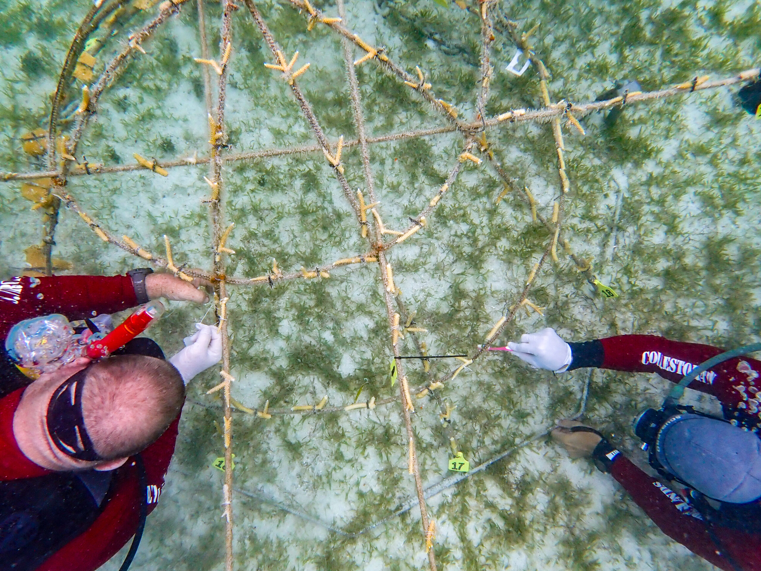
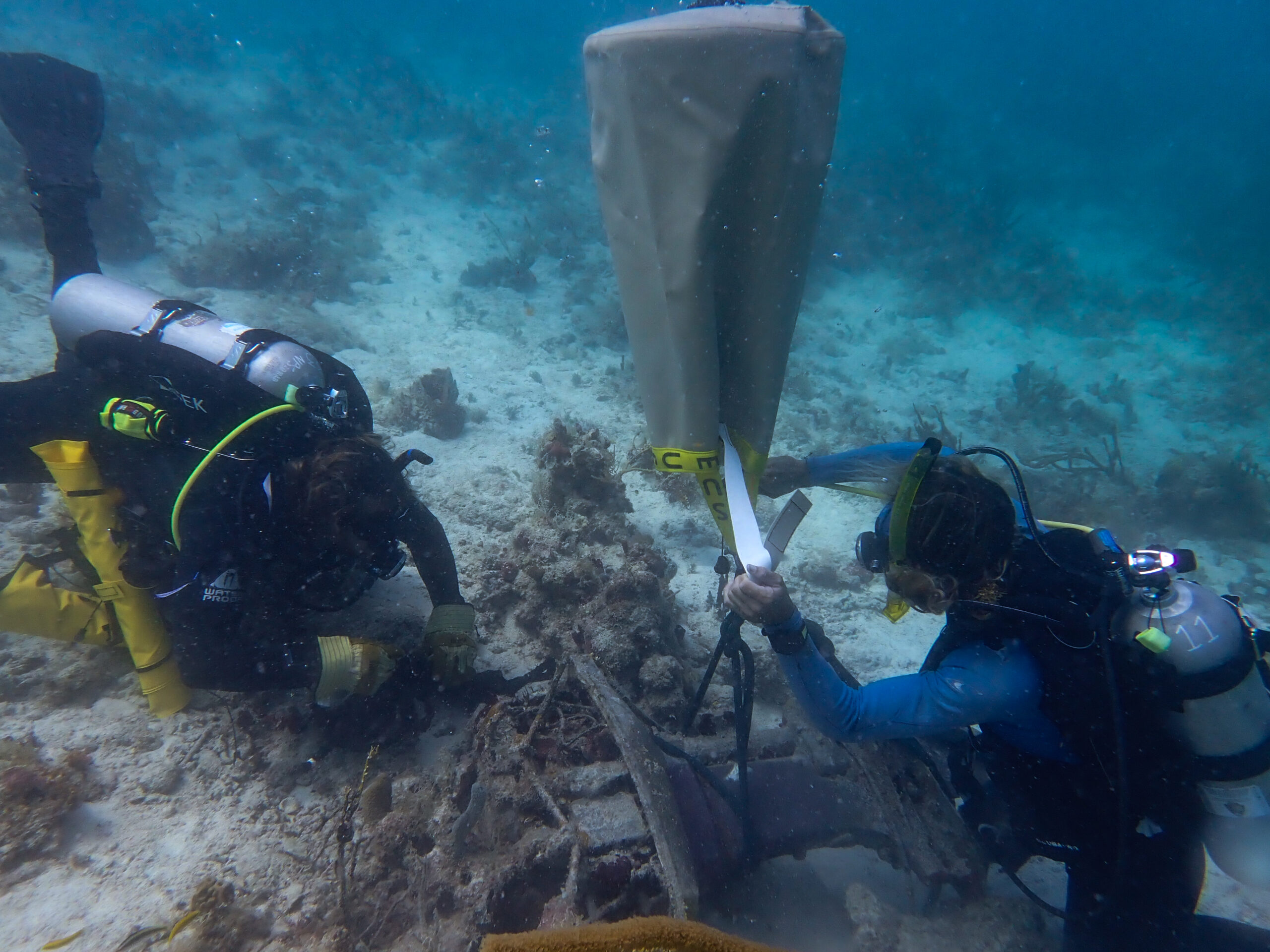
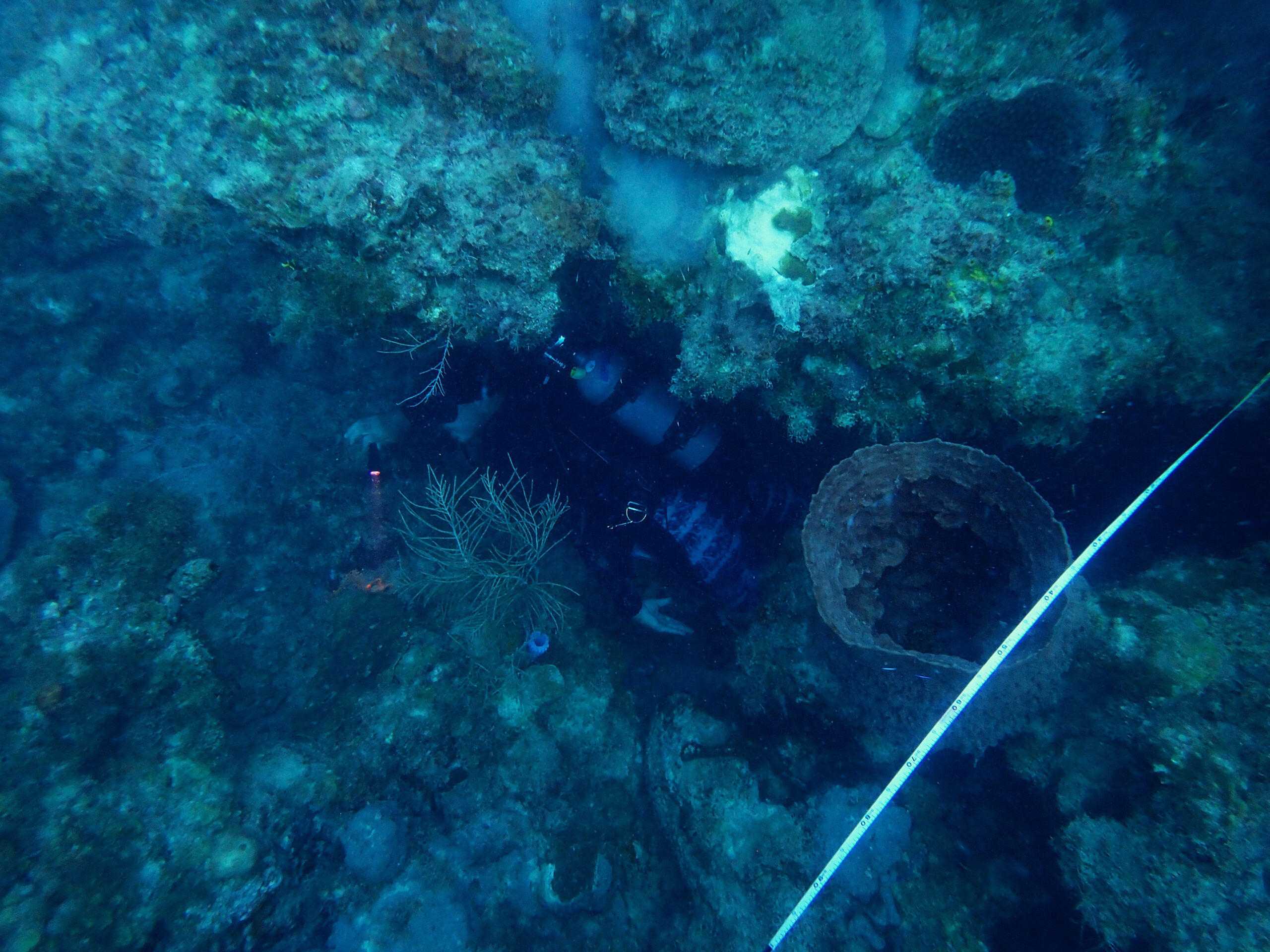
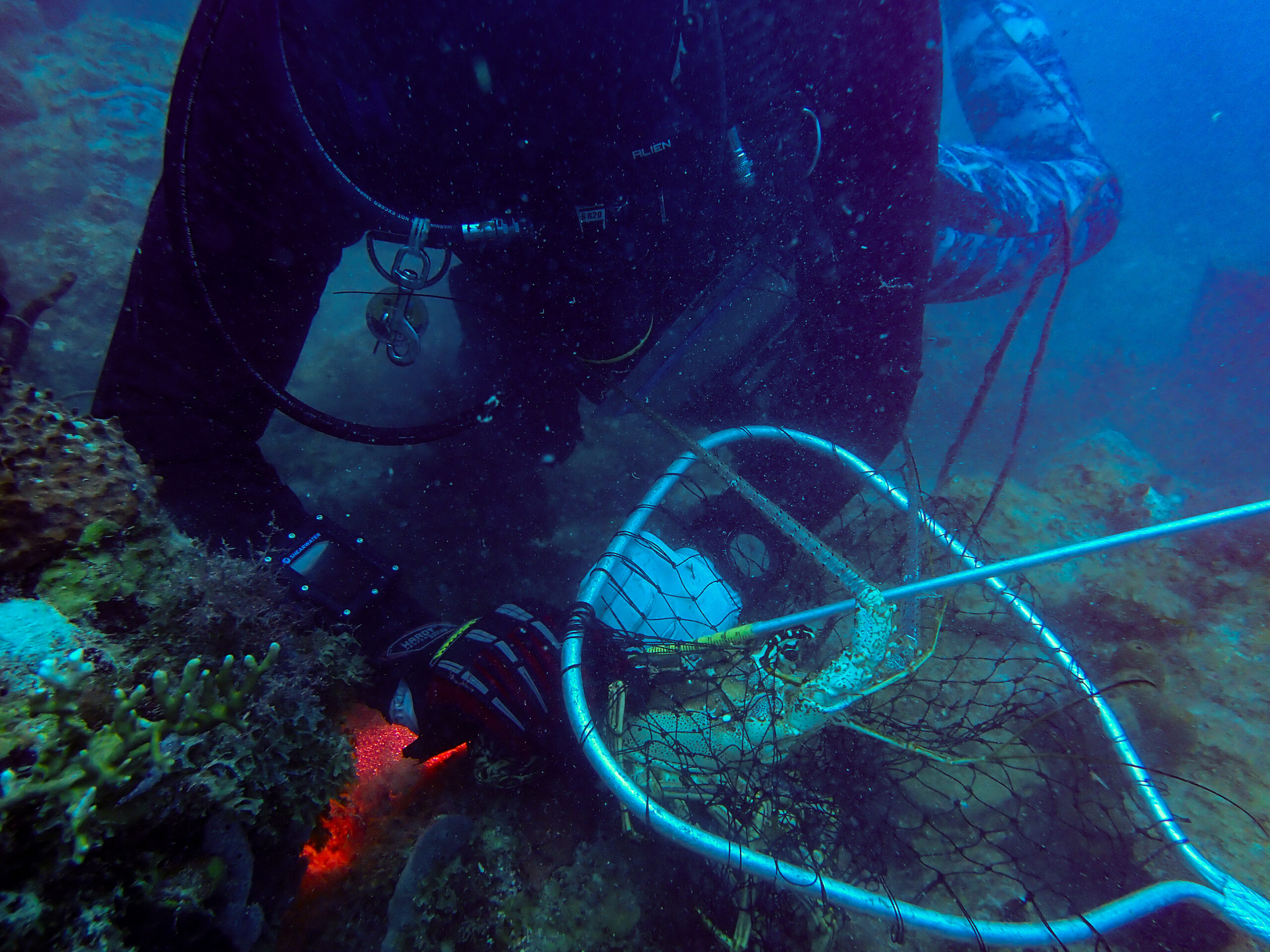
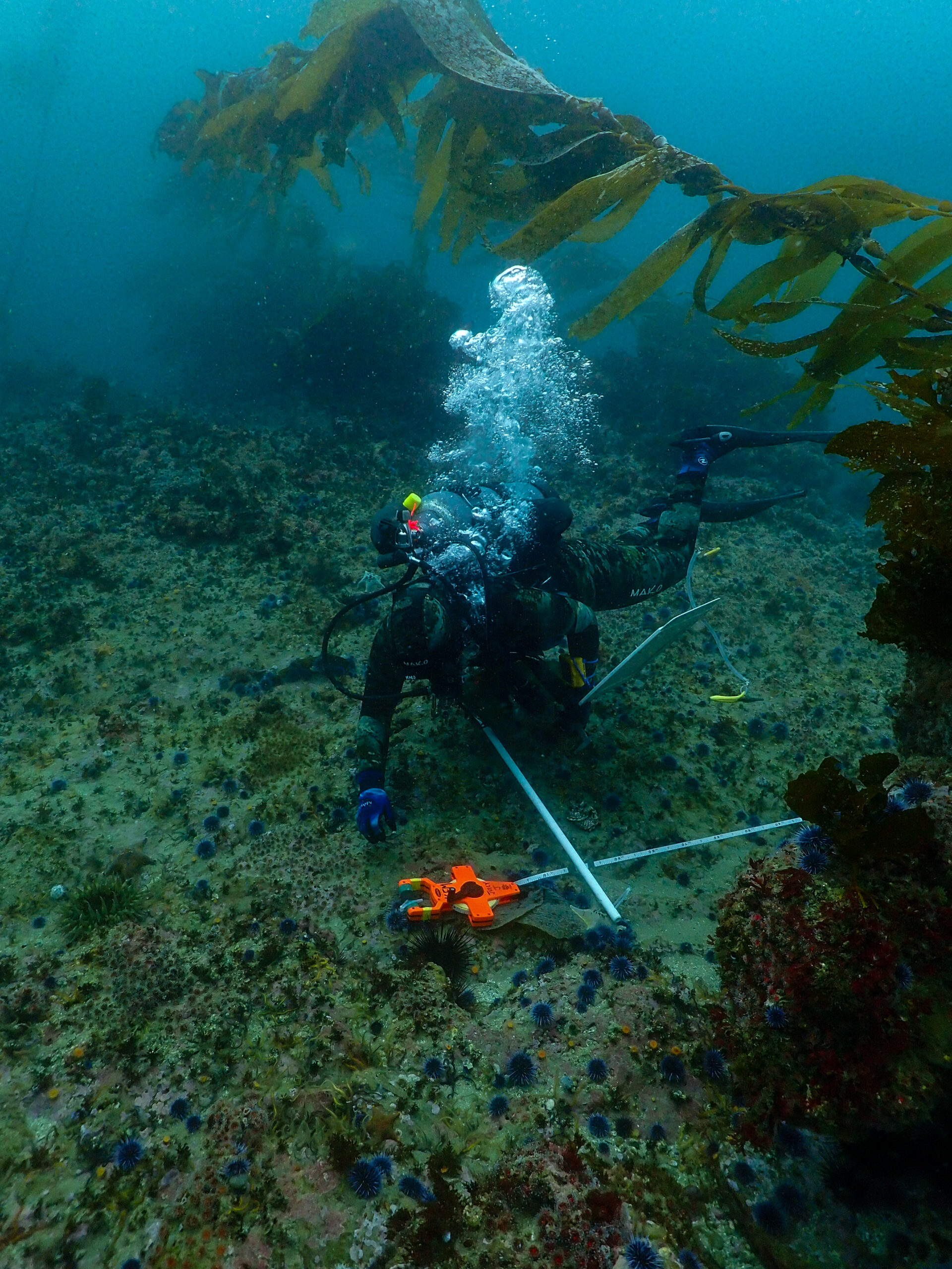
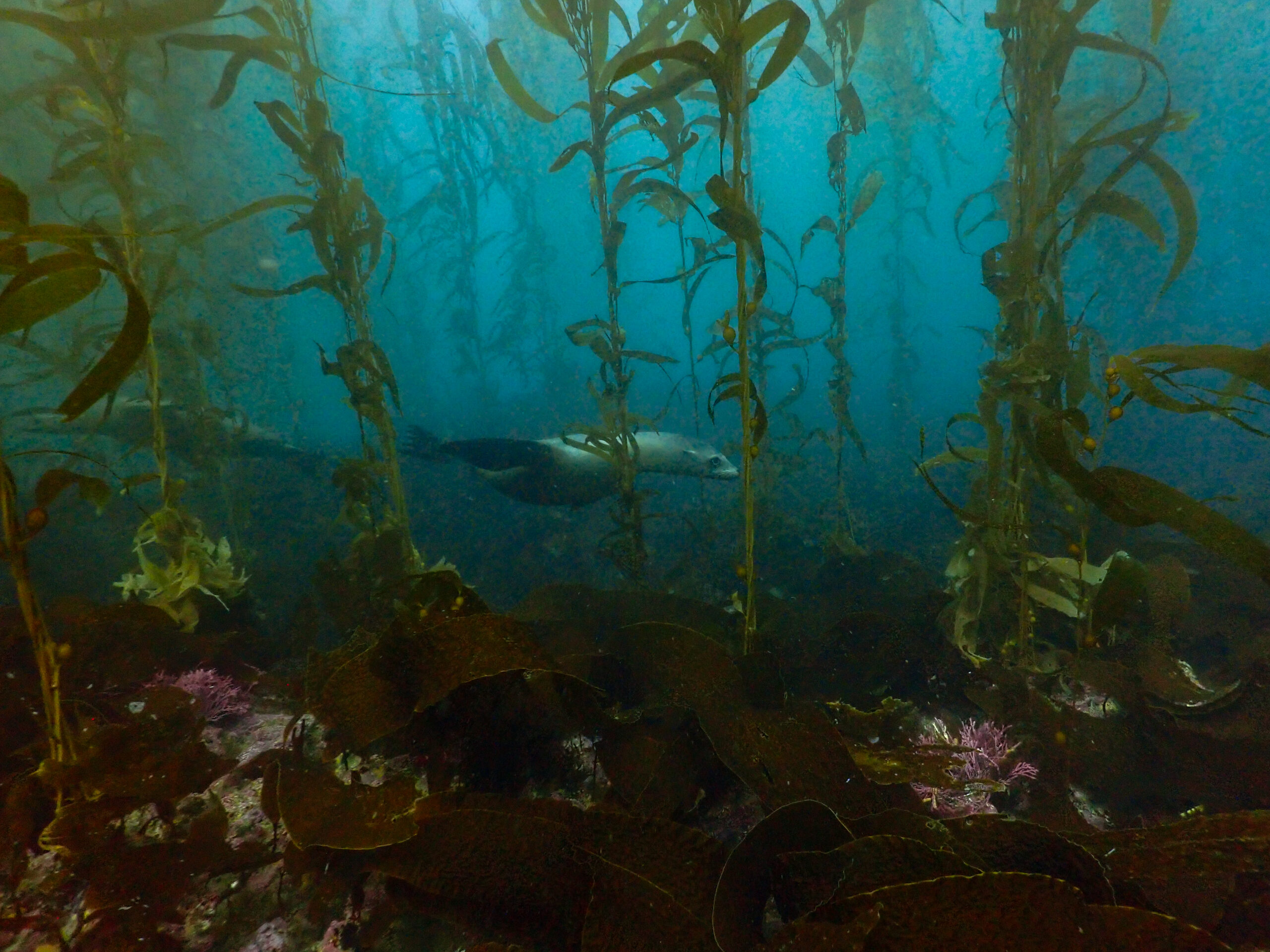
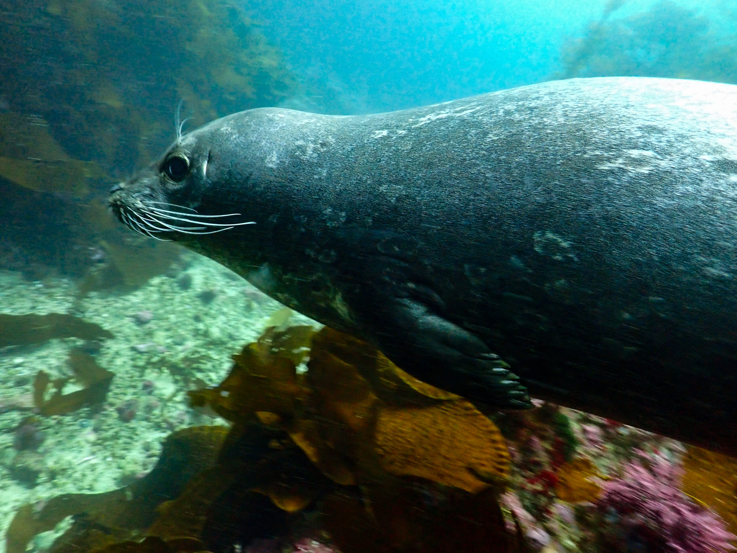
In the morning we finish Johnson’s Lee South. I’m diving with Katie today. As she does bands, I’m collecting 100 red sea urchins in my mesh bag of the 200 needed for the natural habitat size frequency distribution. It’s more efficient to measure 100 urchins on the deck during the surface interval rather than underwater. I’m also measuring any Pisaster giganteus and counting Macrocystis stipes on the offshore side of the transect. The sea lions have come to play and they twirl around us gracefully, occasionally startling me when I see one hurtling towards me out of the corner of my eye before it banks away. I am very impressed by the amount of data that the crew collects and the number of species that they need to know. I’ve only mentioned a few of the protocols that I’ve been helping with but there are many more including artificial recruitment modules which are used to assess recruitment of invertebrates. Basically, a tool to see what organisms and how many have moved into an artificial habitat that is created at a site with a cage and bricks. The crew already completed the counts for the artificial recruitment modules at this site on a different dive week.

On the surface, I flush my wetsuit with the hot water hose and top my tank off with the air compressor. I dump my mesh bag of urchins into a bucket and grab calipers to measure them all. On the next dive, I have to collect some more red urchins to hit my 100 count and some white urchins to finish all of the natural habitat measurements. The sea lions are still swimming around but the current is getting much stronger. We finally finish all of the protocols and the site is complete. Back on the boat, with snacks and tea, we sit in the cabin and do one last species list, ranking the prevalence of every single species present at the site. We also double-check the data sheets. Since we can’t do any other sites today we chill out and eat snacks in the sun on the back deck. I make a red curry for dinner in the little galley.

Katie working on bands.

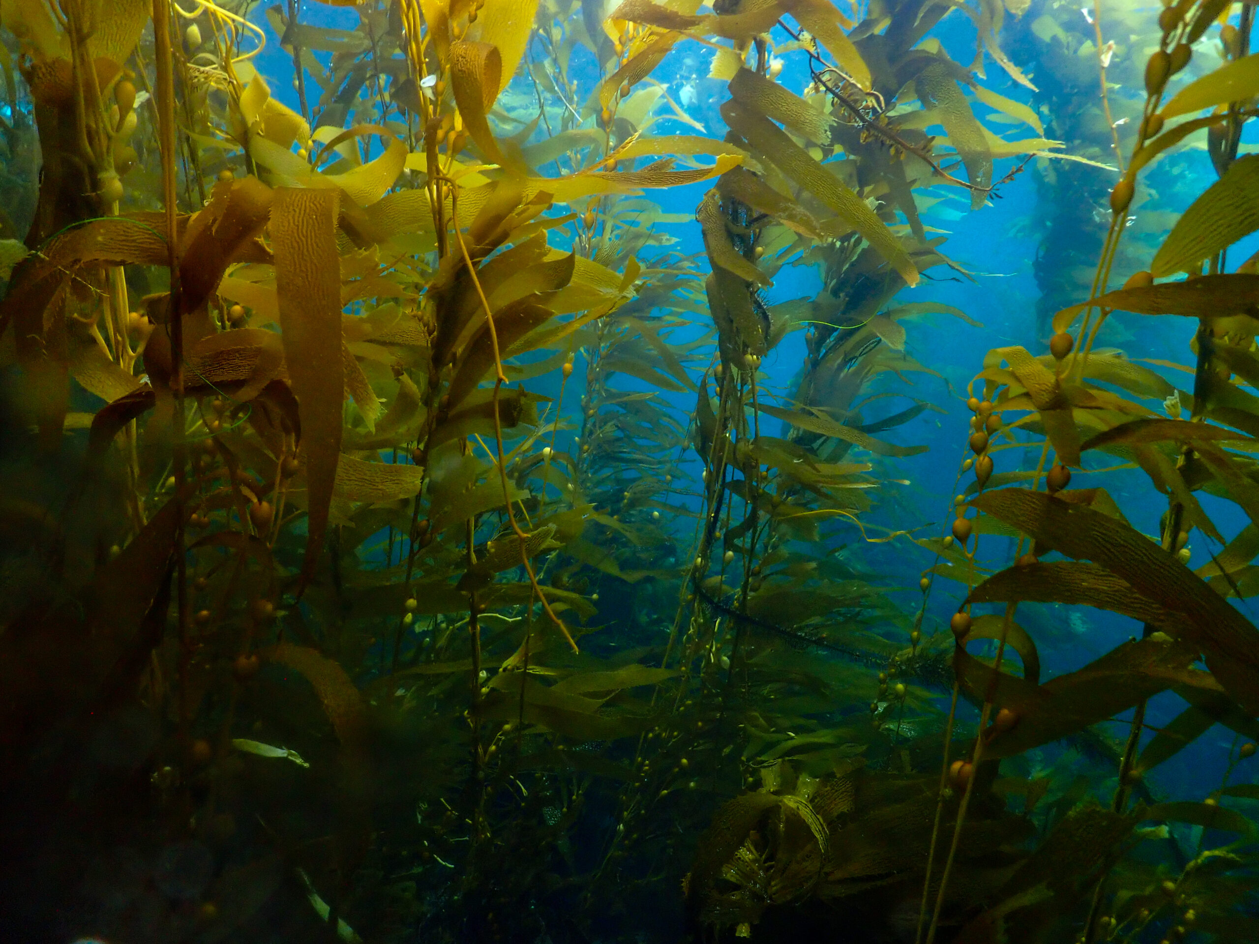
It’s Thursday and we’re heading to Gull Island today off of Santa Cruz. I’m excited because the other site option was an urchin barren. Gull Island is a complex kelp forest and sounds much more interesting to dive. Obviously, it’s important to get data from urchin barren sites as well as kelp forest sites to see the massive differences but selfishly I want to dive the kelp forest because I know it’s going to be stunning. I’m diving with Scotty. First dive, he is doing 5-meter quadrats inshore while I’m counting stipes and measuring Crassadoma (rock scallops). There is so much Macrocystis, the site is dark and rugose. I easily get my 100 kelp counts and I watch Ean get surrounded by sheephead trying to eat the urchins he is collecting. I finish my scallop measurements and help Scotty finish his Megastraea undosa (wavy turban snail) measurements. I still haven’t seen an abalone, and the others have only found a few. I do get to see Stylaster californicus, a purple hydrocoral, usually found in deeper colder water. This is one place you can find it shallow in the Channel Islands. So cool. On the surface, I eat Scandinavian swimmers (gummy candy) and get covered in kelp flies. I dictate data to Katie who records it for me.

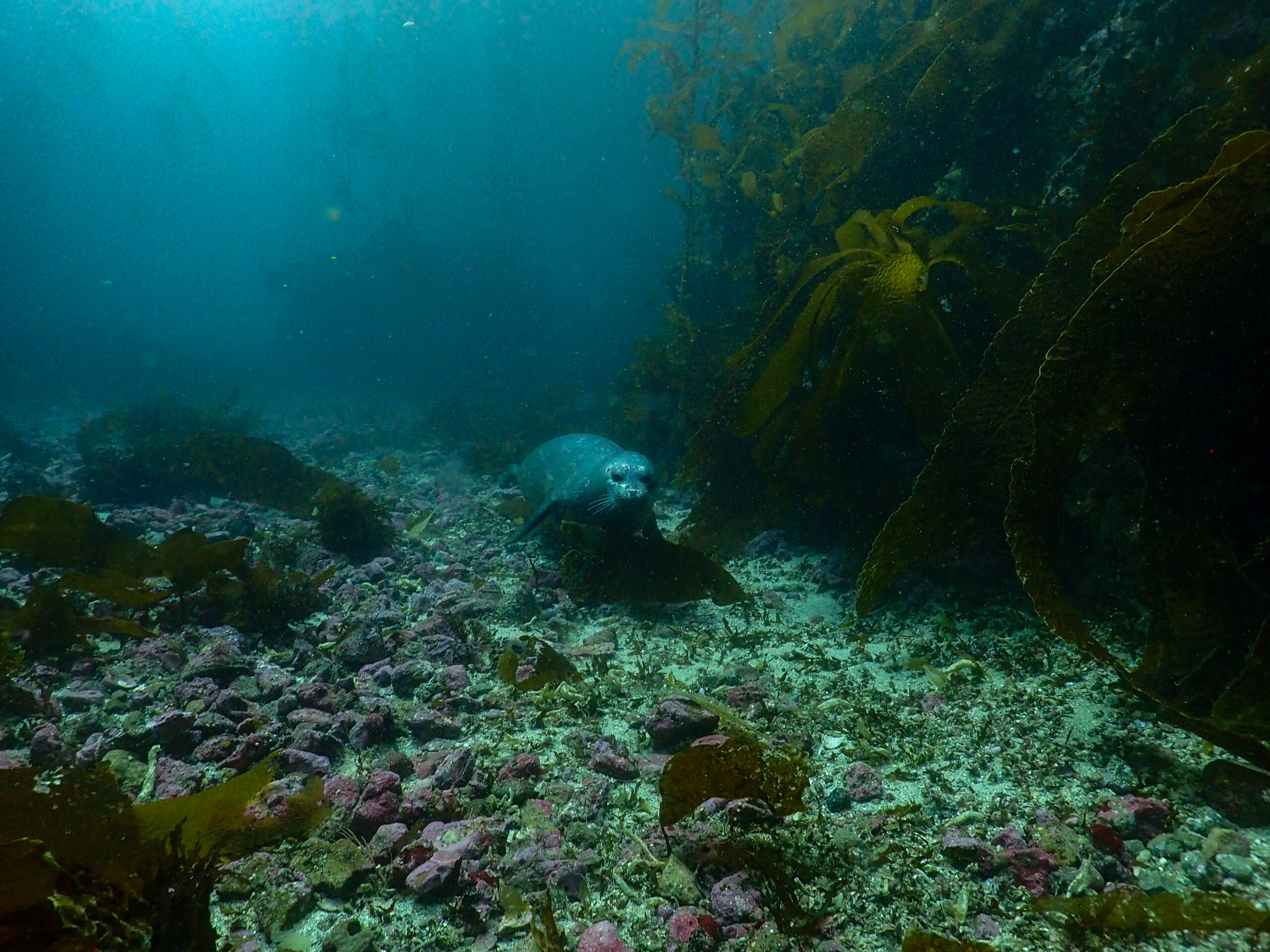
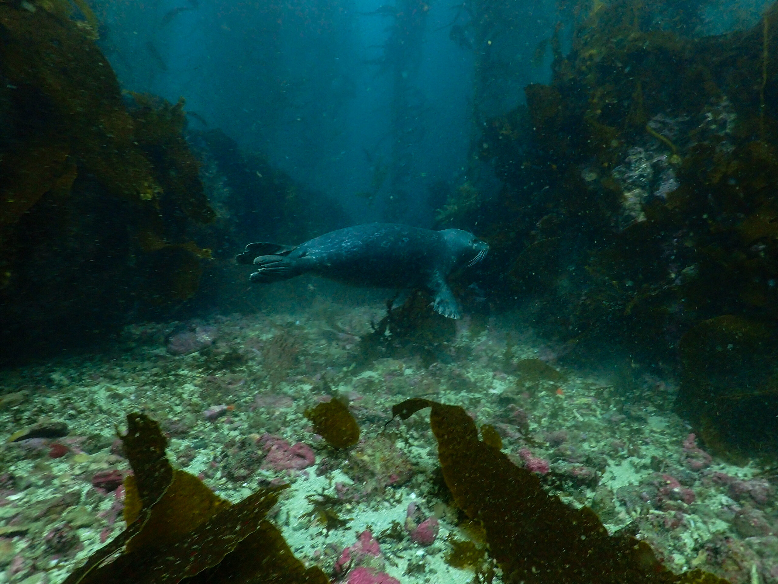
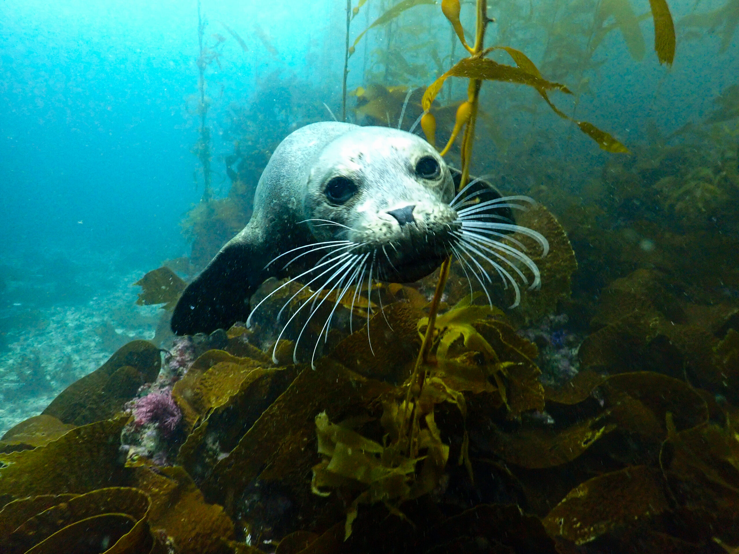
Next dive, Scotty is doing bands and I’m measuring snails, urchins, gorgonians, and stars. I’m more confident now with my identification so I’m getting some more responsibilities. On our side of the transect, we have a sand channel between the rock outcroppings and in the channel I have the most amazing moment with a harbor seal. Over the course of the dive, the seal repeatedly comes back and boops my camera lens or my mask with their snout. When I’m head down in the kelp, they’ll poke my head until I pay attention to them. The seal glides around so relaxed; it is really special to be face-to-face with this beautiful creature. Meanwhile, sea lions are zipping through the kelp, not being chill at all, but still very graceful.

Flying harbor seal.
Lost in the kelp.

Another dive looking for the same species to finish up the transect. I don’t find many Tegula snails, red turban snails, or bat stars so I don’t hit my mark of 30 each. Scotty finishes bands and then we reel up the 100 meter tape and attach the lift bag to the stern anchor. The site isn’t finished, there are a couple more protocols that need to be completed but they’ll come back and finish it on the next cruise. We motor back to Smuggler’s Cove for the night. Such a great crew, there are lots of laughs at dinner. Ean makes butternut squash soup.

Dinner on the Sea Ranger II with Scotty, Ean, Emalia, Katie, Frankie, Keith, Griffin.

It’s the last day of the cruise and we’re finishing Black Sea Bass Reef. I’m sad the week is already over. What an amazing ecosystem, and amazing crew. Thank you so much Scott and crew for taking me in and sharing your knowledge and trusting me to help out with your surveys. Kelp Forest Monitoring has been a highlight of my internship.

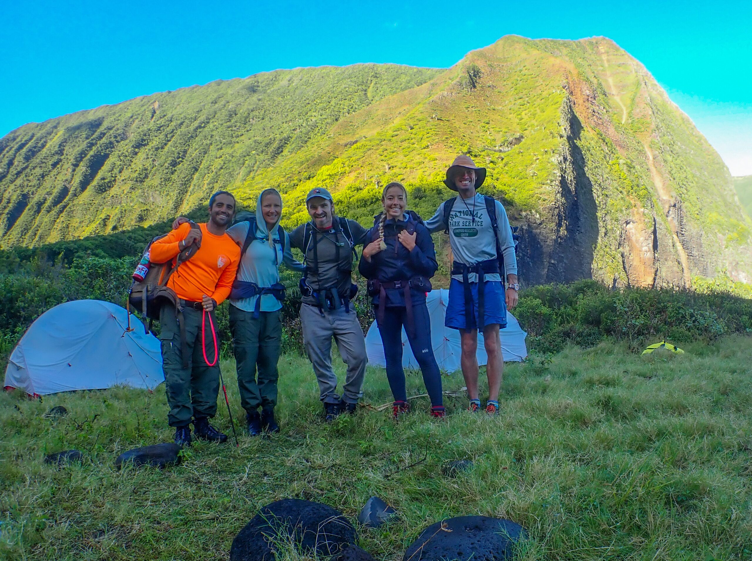
Thank you Submerged Resources Center and Our World-Underwater Scholarship Society for setting me up with all of the amazing experiences this summer.

Share

Pearl Harbor National Memorial

USS Arizona Memorial

I would like to write a short thank you to Scott Pawlowski, the museum curator at Pearl Harbor National Memorial. It looked like I wasn’t going to be able to visit Pearl Harbor on my internship, but Scott was kind enough to take two days out of his busy schedule to set me up with some awesome experiences around the memorial. I have visited the park in the past, so it was great to get the insider NPS perspective from Scott who shared his knowledge and passion. The NPS works alongside the US Navy to preserve and interpret the historical site associated with the attack on Pearl Harbor.

On my visit, Scott introduced me to a Chief Master Diver John Hopkins with the Mobile Diving and Salvage Unit 1, the Navy’s premier diving and salvage force. Imagine Navy SEAL caliber divers who are also trained in commercial deep-sea salvage operations. A type of diving that I cannot even begin to imagine. Next, Scott showed me a bit of his world, a behind-the-scenes look at the museum and archival collection. On that day someone donated some potential artifacts from USS Oklahoma which is exciting because not many artifacts exist from that ship. USS Oklahoma was lost at the attack on Pearl Harbor. Every item Scott pulled out, whether a Japanese hat box or a fragment from USS Arizona had a poignant story linked to it and I loved hearing that history.

On my second day, I was able to visit the USS Arizona Memorial, USS Missouri, USS Bowfin, and Pearl Harbor Aviation Museum. At the end of the day, I joined a tour of Ford Island to also visit the Utah and Oklahoma memorials. Too much to experience and learn about in a lifetime let alone all in one day. Nonetheless, a powerful day of learning and contemplation. Scott, thank you for going out of your way to show me a snapshot of operations at the park. I appreciate the effort and I wish I could have spent more time.

Now, I am leaving Hawaii after almost a month and a half and am on my way to Channel Islands National Park.

Share

Kalaupapa National Historical Park Part 3

I’m back in Kalaupapa! My plan to head to the National Park of American Samoa after Kaloko fell through leaving me with an open schedule for the next week. Kelly Moore and Glauco Puig-Santana were kind enough to invite me back to the peninsula and join them for the yearly Pacific Island Inventory and Monitoring Network stream surveys in the easternmost valley of the park. Waikolu Stream is isolated, extremely beautiful, and relatively untouched. The entire watershed is protected within park boundaries, a critical habitat for some of Hawaii’s unique endemic freshwater species. Since 2009, the network has monitored fish, invertebrates, stream flow, and water quality in Waikolu. In 2021, scientists took this data to the state of Hawaii to prove that too much water was being diverted from the upper valley for agriculture on topside Molokai, resulting in a large section of the stream drying out in the summer. The state eventually approved new instream flow standards to return water back to Waikolu and sustain the stream’s endemic biodiversity. Pretty cool to see data collected by the park inform management and ultimately conservation. I am very excited to join the survey team, do some backcountry camping, and work in a freshwater habitat.

Waikolu valley.

The team is made up of Kelly, Glauco, and two interns Addisen Antonucci and Noah Hunt who fly in from Hawaii Volcanoes National Park. We were also supposed to be joined by Anne Farahi, the lead aquatic biological technician who usually collects all the freshwater fish data. Unfortunately, she cannot make it, so we will continue with the surveys without any fish data this year. While Glauco organized most of the equipment already for our trip, we spend a day packaging up all the camping gear, food, survey instruments, and personal gear which we put in dry bags and coolers. We load all the gear into a cargo net that will be flown out to our campsite by helicopter.

Stream crew: Glauco, Kelly, Noah, Addisen, me.

Our hike out to Waikolu is only a mile along the beach, but it’s all on basalt cobble and boulders that tend to roll no matter how big they are. We are all wearing hard hats because we are walking right under a massive sea cliff that has consistent rockfalls. You can feel the energy of the ocean as it sucks the cobble off the beach with every outgoing wave.

The mouth of Waikolu is framed by tall sea cliffs on either side. We hop across the stream and set up camp in a nice flat spot tucked up against the headland. It is likely a built terrace from early settlers because, of course, native Hawaiians lived in this valley. We will see evidence of rock walls and terraces all the way up the valley. Long before the state was diverting freshwater from this stream, Native Hawaiians were diverting it for their taro patches. This was also the original source of fresh water for people sent to Kalaupapa. The community gets its water from another valley nowadays, but the old, rusted water pipes are still present running along the beach. At first glance, one would assume the valley is untouched but of course, people have been altering this area for as long as they have been here. It is still absolutely breathtaking, and I have to take a second every now and then just to look up and admire our surroundings. We set up camp and make sure to really stake everything down because the wind whips through here.

After we set up camp, we hike a short way up the stream to our first survey site. There are more than 15 sites from the mouth of the stream to about 3 miles up the valley. At each site, we are surveying hihiwai (snails), mapping stream habitat type, estimating substrate size, testing water quality, and measuring the flow of the stream.

We follow an overgrown trail, weaving our way through the jungle foliage, the sun streaming down through the canopy, and the deeply spined green cliffs peaking through. Glauco points out shampoo ginger and the white ginger flowers that we pick and suck on for a bit of nectar. He navigates us to the site with a GPS and then runs a 30m transect tape the length of the stream. The stream is small and gentle, usually only a foot or two deep. A volunteer taro has found a spot to live. I join Kelly to learn how we are going to be surveying the hihiwai. As soon as I dip my masked face underwater, I am taken aback by the number of creatures. The crystal clear, cold water is filled with colorful gobies, hihiwai, and prawns.

Tahitian prawn.

Kelly and I get to work ‘snailing’. To conduct these surveys, 10 spots are selected randomly along the entire 30 meters. At each spot, a 1/16m^2 quadrat is placed in the stream and Kelly with her mask and snorkel sticks her head underwater to find all of the hihiwai in the quadrat, pop them off the rocks, and hand them to me. I measure the diameter of the hihiwai with calipers and return them to a spot in the stream where they can reattach before getting swept away by the flow or eaten by a prawn. We measure all adults and count all spat in the quadrat and in an opposing quadrat we count all eggs. The eggs look like little sesame seeds attached to the rock. The hihiwai are endemic to Hawaiian streams and have really beautiful speckled shells.

After learning how to snail with Kelly, I join Addisen to learn how we estimate substrate size or what we call ‘pebbling’. At the beginning, the middle, and the end of the 30 m transect, we run another tape perpendicular across the stream, measure the width of the stream, and then divide to get 20 distinct equally spaced points. At each point, we will reach into the stream and measure the longest diameter of the rock under that point. It can be anything from a 5mm pebble to a 500cm boulder. As we pebble, we also use a densiometer to collect riparian canopy cover.

While snailing and pebbling are going on, Glauco is using a stream tracker to measure water velocity. He is looking for laminar flow to get accurate measurements. At some sites, we are also doing water quality, just like we did on the dive surveys. We have the sonde device that measures pH, salinity, dissolved oxygen, etc. and we also take water samples to be processed for dissolved nutrients later.  

Back at camp Glauco makes rice and beans and veggies for dinner and we sit around in our camp chairs and enjoy the sunset. I sleep with my rainfly off because it’s beautiful and I’m hopeful it won’t rain. Well, I end up getting soaked and I scramble to get my rainfly on in the middle of the night when it starts to pour.  

I get an exceptional view of the pali when I wake up and unzip my tent. I have coffee and oatmeal and load up for our daily hike up the valley. We bring our wetsuits, snorkel gear, felt-soled neoprene booties, flow-meter instruments, water quality testing gear, pebbling tools, and the three-pong sling if we have extra time to catch some invasive Tahitian prawns.

Starting the hike from camp.

We follow the trail through the kukui tree grove, past the strawberry guava trees, the ginger fields, and the hao. The first two stream crossings I attempt to keep my feet dry. By the third, I have given up and accept that my shoes and feet will be wet all day.

We come upon a giant mango tree obviously planted from a previous habitation. It’s hard to imagine what this valley used to look like before all the non-native plants moved in. The guava has especially taken over, it’s almost a guava forest monoculture. And there is fruit everywhere, it litters the jungle floor, rotten and fermenting, squishing under our feet. Even the stream is full of it and I watch the prawns nibble on it. I’m not really complaining though because I think I end up eating more than 10 guava a day.

Working on the stream is peaceful. It’s fun putting on a wetsuit in the middle of the jungle and sliding through the pools and riffles. If we complete the sites for the day and have some extra time, I’ll snorkel around and look at the gobies and Glauco will spear prawns. The gobies are called ‘o’opu. Most of the species are endemic and some are extreme climbers, known to climb 420ft waterfalls. I watch them suction from rock to rock and hang out in the rapids.

Back at camp, Kelly and I do a little snorkel out towards the channel between Okala Island and the headland. We startle a turtle napping in a naturally carved bowl in the rock. After another filling and delicious dinner, we do dishes in the stream. I enjoy my evening bath at the mouth of the stream, looking up the valley and at the stars and out at the crashing waves.

We are checking off sites as we move farther up the valley each day. I spend the next few days pebbling with Addisen. We do about 3 sites a day. Next to the trail, we see rock walls and terraces from earlier times. At lunchtime, I gnaw on a block of cheese and eat guava. As we hike through the jungle, I’m nervous when going through the muddy pig wallows because of leptospirosis. I’ve gotten it before on the Napali coast on Kauai and it was absolutely awful.

Kelly and Noah search for hihiwai while Addisen waits to measure them.

Today, we are going to our farthest site, above the dam that the state put in, about three miles up the valley. It is exciting that at our highest site above the dams, we are still finding hihiwai. It is crazy to think about the journey these snails have been on to get here. The hihiwai are anadramous. Eggs will hatch in the stream, larvae will wash out into the ocean, and after about a year they will begin their journey back up the stream. Truly remarkable. Also, since there are no invasive Tahitian prawns above the dams, we finally see some of the native shrimp. The sad thing is that it feels like we’ve finally left our jungle paradise. The dam and tunnel infrastructure is unsightly and the people working on it have left trash everywhere. The abundance of fish we found below the dams is not here. On our trip back to camp, Noah and Glauco harvest some taro root and leaves to cook up for dinner. We all knew taro had to be cooked to remove the oxalate crystals but we clearly didn’t cook it long enough because we ate some and we all got tingly throats. The irony of us haoles failing to cook taro properly and paying the price is not lost on me.

I had an incredible week working with this crew to survey the beautiful, fragile Waikolu stream. I loved doing fieldwork that included camping and hiking in the jungle. I hope that the data we collected can be used to continue to protect the endemic species that call this place home. Now, a brief stopover on O’ahu and Pearl Harbor before I head to my final internship destination, Channel Islands National Park.  

Thanks one last time to Kelly and Glauco for being the most gracious hosts and allowing me to work with them at Kalaupapa for almost a month! I had a wonderful time and learned so much. Thank you SRC and OWUSS for supporting me on my journey.

Bye, Kalaupapa.
Share

Kaloko-Honokōhau National Historical Park

Kaile’a surveying the reef using photogrammetry.

On my stopover on Oahu, I meet up with Shaun Wolfe, 2017 OWUSS NPS intern, who graciously hosts me for the night. We paddle up Kahawai Nui, do a little waterfall hike, and volunteer for a Maui fire relief donation center. He sends me off to the Big Island and my next national park destination, Kaloko-Honokōhau National Historical Park. I fly into Kona, pick up my rental car, and head to my hostel. I will be meeting the park divers tomorrow morning at the office.

Kaloko-Honokōhau is a cultural and natural park focused on preserving ancient Hawaiian culture. The park protects two fishponds, a fish trap, burial sites, settlement ruins, and the marine nearshore. Nowadays, the park feels like a refuge encircled by development. A relatively small area, it is surrounded on three sides, a resort to the north, an industrial complex to the east, and a busy working harbor to the south. The reason this area is protected is because a group of Hawaiian elders in the 70s recognized the importance of preserving the area and its historic land use, and had a desire to perpetuate native Hawaiian heritage and culture. They approached Congress with a proposal and plan for management, and the park was created. 

Currently, the resource management team is working to monitor the nearshore marine environment, restore the ancient fishponds, and re-establish native Hawaiian plants. Another major focus is allowing the native Hawaiian community to reconnect with traditional practices.

I meet Kaile’a Annandale, biological technician (but basically acting marine ecologist since she is running the entire marine program), and Lily Gavagan, a summer dive intern from UH Hilo. I’m jumping right into diving with them, so I get the rundown of what we’re doing as we drive to the park to pick up the boat and Jackson Letchworth, terrestrial biologist and boat driver for the day.

Kaile’a, Lily, and Jackson!

The park is conducting its yearly benthic surveys at sites in park waters to monitor the status of the marine environment. It is important to have robust data to track trends and better inform management of the resources. This is especially important here where they are surrounded by urbanization, and in the past have dealt with pollutants and wastewater entering the nearshore from coastal development. The method for data collection is a bit different from other surveys I have taken part in this summer. Kaile’a uses a really cool technology called photogrammetry, where photos taken of the reef are stitched together to create high-definition, 3-dimensional maps of the survey site. A versatile tool: data collection is precise, fast, and non-invasive. There is a lot less human error. For coral reef monitoring you can overlay years of data to track changes. You can compare the coral growth rate at a site, how a disease has impacted the reef, or how the coral may be recovering. You can get precise quantification of surface area, surface relief, and volume. It can also just be a nice visualization of the reef.

Here is a photo of a site model. You can see different coral species and even urchins. This photo doesn’t do it justice because when you can interact with it as a 3-D model and zoom in, it’s pretty amazing.

We launch the boat from the Honokōhau Harbor which is full of dive boats and fishing boats, both charters and commercial. At the mouth of the busy harbor, we are greeted by a pod of spinner dolphins. This body of water, dubbed Kona Lake is in the lee of the Big Island, with generally calm conditions so it’s very different than diving at Kalaupapa.

It’s my first dive all summer where there is pretty decent coral coverage. I’m impressed but when I surface and tell Kaile’a, she has a different perspective after diving here for many years. As I talked about in my last blog, there was a coral bleaching event here in 2015 that led to a massive die-off of coral, especially cauliflower coral. The cauliflower coral is highly susceptible to heat stress and bleaching and hasn’t recovered in West Hawai’i. There are healthy-looking Porites species though, and a lot of small and juvenile fish since they have plenty of habitat for hiding.

Just like Kalaupapa, there are rebar pins denoting the start and end of transects. However, these pins are much harder to find in the canopy of coral. We actually take a reem of photos with us underwater to orient ourselves. The photos are of the pins from each cardinal direction. Kaile’a is an expert at finding them, I just get massively turned around. Then it’s a fun puzzle after we finish the site to navigate to the next site underwater with just the bearing and distance from the site we just finished.

Searching for the pins.

When we find the right pins, Lily swims the transect tape out 10 m. She then swims two passes over the transect counting urchin species including wana, collector urchins, and rock-boring urchins that are within a half meter on either side of the tape. In the meantime, Kaile’a and I are laying out the corners of the rectangular survey site, 2 meters from the center. The photogrammetry program will pick up the scales which will orient the 3-D model with known lengths. Kaile’a swims the rectangular site taking many photos of the bottom to get a lot of overlap which is necessary for good resolution. We get two dives in, haul the boat out, rinse it down, and finish the day.

Lily counting urchins in a meter-wide band.
Kaile’a surveying a benthic site.

Our next day has no diving but Kaile’a takes us to explore some of the terrestrial aspects of the park. When you look around Kaloko-Honokōhau, you wonder why Native Hawaiians would have settled here. The a’a lava that makes up the landscape is sharp, inhospitable, and seemingly barren. The secret lies in the presence of cool, brackish water pools that form in the lava fields near the ocean called anchialine pools. Anchialine pools are fed by subsurface groundwater and seawater which means they will rise and lower with the tides. Some will disappear entirely if the tide is low enough. These pools provided enough fresh water to support settlement here. Anchialine pools are only really found on the west coast of Hawai‘i Island. There is a small red shrimp endemic to these pools that has a lifespan of 15 years!

Native Hawaiians possessed in-depth knowledge of their natural environment and demonstrated great ingenuity in adapting to this seemingly inhospitable environment rather than trying to dominate it. Hawaiians oriented their land-sea use patterns to the water cycle. Their land divisions, called ahupua’a extended from the mountain to the sea. The regions are all connected. The ahupua’a provided everything the people needed to live off the land; resources from the sea, the lowlands, and the uplands. I think it is a wild coincidence that Kaile’a learned her ancestors are from the Kaloko ahupua’a and here she is in the present day stewarding the same land.

Kaile’a drives us down to the Kaloko Fishpond. Fishponds are a simple yet highly efficient form of fish farming. The two fishponds in the park were once the largest along the Kona coast and Kaloko pond was supposedly a favorite of King Kamehameha I.

To make a fishpond wall, stones are dry-stacked without the use of mortar to enclose the mouth of a small bay. The porous lava rock allows seawater to circulate and freshwater springs trickle in from the land, to create brackish conditions. Ponds were either stocked with juvenile wild-caught fish—such as striped mullet and milkfish, or the fish enter naturally through sluice gates. The gates allowed small fish to pass in and out but trapped those that lingered in the pond and grew too large. Fishponds ensured a dependable food source.

Fishponds fell into disuse as colonization altered life on the islands. Now the park is working to repair the stone wall and rehabilitate the pond in collaboration with a local community group. Today, there is a university class here and we will all be clearing invasive pickleweed. Restoration efforts are underway to once again enable Kaloko fishpond to be managed and used for aquaculture. Although the restoration team has a long-term vision of harvesting fish from the pond and improving food security for the community, the work is also about reconnecting with culture and the land through traditional resource management. Kaile’a points out the freshwater springs all around the fishpond, cold, clear freshwater. It’s nice seeing collaboration between the federal government and indigenous communities to accomplish a shared vision of preserving culture, tradition, and resources.

Unfortunately, around the park, more groundwater is being captured and pumped by development. With the excess extraction of freshwater, anchialine pools and the fishpond are becoming too saline to support the brackish species that depend on them.

Back to diving the next day, I start my day off with a bullet coffee with local Kona beans. Jackson and I talk about how the park decides which plants to focus their restoration efforts on: native plants that were here before Polynesians arrived, or culturally significant plants like taro and breadfruit (ulu) that were brought here by the waves of Polynesians but are non-native. Definitely interesting to think about. We launch the boat in the harbor and head out for my last day of diving with the team. I really want to see Laverne today. She is the resident tiger shark that roams this area and divers and boaters often see her, sometimes even in the boat harbor. Unfortunately, she doesn’t make an appearance, but we catch our stride as a dive team and get 5 sites completed on one tank by navigating between them underwater. I’m definitely the weak link because I don’t think Kaile’a or Lily actually breathe when they’re underwater. A good dive day, I’m happy I could help this team get some more dive surveys in this season.

A short but amazing week here at Kaloko-Honokōhau. It was a pleasure diving with such a solid crew of kind and hard-working individuals. Thank you Kaile’a, Lily, and Jackson for being so great and sharing your park with me! I loved my time at Kaloko and I really look forward to coming back and exploring more of the Big Island someday. Thank you Submerged Resources Center and the Our World-Underwater Scholarship Society.

Share

Kalaupapa National Historical Park Part 2

Sunset with the NPS boat Kala 2
Riding my bike around the settlement.

You can tell Kalaupapa is nearing a transition. As a park designed around supporting the Hansen’s disease patients, with only 4 of them left in the settlement, there is of course talk about what will happen to this place after they are gone. There are many stakeholders already at the table: National Park Service, Department of Hawaiian Home Lands, and Hawaii State Department of Land and Natural Resources. Whatever happens, the science being done by the marine program is invaluable and the continuity of marine resource management should be an essential aspect of the future mission. A quarter of Kalaupapa National Historical Park exists underwater. This park is one of four in the Pacific West Region that include coral reefs within their boundary, and therefore, was included under the 2000 U.S. Coral Reef Initiative. Reef-building corals, which are sensitive to environmental degradation, are a good indicator of overall health for the nearshore marine ecosystem. Doing this internship in a summer of record-breaking climate extremes, I feel it is imperative now more than ever to maintain these long-term monitoring datasets to understand how climate change is impacting our marine ecosystems and underwater resources.

Underwater at Kalaupapa.

Kelly Moore, marine ecologist is back in the settlement and Dr. Sheila McKenna, marine ecologist and program lead for the Pacific Island Inventory and Monitoring Network has arrived in Kalaupapa. I will be joining them and Glauco Puig-Santana the biological technician, for the yearly benthic surveys and fish counts. These surveys are conducted at parks in Guam, American Samoa, the Big Island, and here. The 17 years of data from Kalaupapa has shown that the nearshore fish communities are some of the healthiest in the main Hawaiian Islands, with the second highest fish biomass of the Islands found around Kalaupapa. Also, Kalaupapa corals may be more resilient to climate change as seen from 2015 data when there was a Pacific-wide coral bleaching event from increased seawater temperatures. Corals at Kalaupapa experienced little to no bleaching compared to corals at Kaloko-Honokōhau National Historical Park on the Big Island which experienced mass bleaching and die-offs.

I am excited to start diving here but Kalaupapa is very remote and resources are limited, so safety is of paramount importance. We spend a day going over the Job Hazard Analysis, Diver Emergency Evacuation Plan, Standard Operating Procedures, and the general protocol for doing the I&M surveys. Every day before we do any diving, we will also conduct a GAR (Green, Amber, Red- a sort of shorthand for risk during operations) as a risk assessment tool.

Unfortunately, now that the team is assembled, the weather doesn’t want to cooperate. The forecast is looking pretty windy the whole week and next week it will be gusting 40 knots with a small craft advisory. Hoping the forecast will change, we plan to start diving at sites on the settlement side of the peninsula, the leeward side.

I ride my bike down to the Natural Resources Management offices at Bay View Homes to meet the team at 6 a.m. and do the GAR. We load up gear and tanks and head down to the pier where the NPS boat, the Kala 2 is moored offshore. Even though we are working on the leeward side, I soon realize this doesn’t mean calm conditions. We are immediately in some big ocean rollers as we motor to the west end of the park. It’s a lot to take in, the wind, the rocking of the boat, the massive green cliffs behind us, and the deep blue-colored water all around. Tossed around on board, it’s a relief to get underwater, much more peaceful.

Kelly and Sheila stoked to do some diving.

I had just gotten used to the gorgonians, sea fans, and reef fish of the Caribbean so this unique giant volcanic boulder habitat feels alien. I see unicornfish with bright orange scalpels and streamers on their tail, manini, surgeonfish, bullethead parrotfish, and wedgetail triggerfish. Little bouquets of cauliflower coral decorate the massive boulders. Their color varies from creamy yellow to brown to fluorescent pink. If you peek closely at the corals you will see the Hawkseye fish, eels, and inverts hiding between its branches. There are other corals that are bone white, and you can usually find the crown of thorns sea star in the vicinity responsible for devouring it.

I dive with Sheila and Glauco first and just observe the survey. There are 15 fixed sites that are surveyed every year and marked with a start and end pin. Once we find the start pin, Sheila starts the survey and swims the transect IDing and measuring all fish she encounters on the line transect. In the meantime, Glauco is stationing the sonde to collect water quality at depth for 10 minutes before releasing it to the surface to collect another 10 minutes worth of water quality at the surface. Data includes water salinity, pH, temperature, and dissolved oxygen. At some sites, we also bring syringes to collect water samples at depth to look at nutrient levels. After Sheila has completed her fish survey, Glauco will take benthic photoquadrats every meter along the transect which will later be analyzed to determine bottom cover.

Once we are on the surface, if it is a water quality site where we collected water at depth, we will also collect surface samples with a Niskin bottle. Then we filter the surface and deep samples to later be analyzed for nutrient levels. Something that would be better suited for a lab environment, I chuckle as I filter samples on a violently heaving boat with spray whipping me in the face and waves breaking over the bow.

After the first dive, we take lunch closer to the settlement and out of the wind. We do another dive closer to the point of the peninsula, still on the leeward side. I take the benthic photos this time. On this dive, we see a male Hawaiian monk seal just sitting on the bottom, he makes a low, guttural, growling vocalization. Hopefully, Kirby Parnell will pick it up on her soundtrap that we deployed last week. The seal gives us the side eye occasionally but seems uninterested until he comes and visits us on our safety stop. He cruises below us and checks us out, so cool.

The next day, it is still very windy and we attempt to go around the point but we don’t make it very far. Too many waves over the bow, it’s just a little too hectic, so we turn around to do our last sites on the leeward side. More beautiful giant amphitheaters of rock and boulder. Sheila gave me a little fish ID lecture and I start to learn some species and look out for them like the endemic Macropharyngodon Geoffroy or Thalassoma duperrey. I really like seeing the different colorful life stages of the Hawaiian Hogfish and the yellowtail wrasse!

When we wake up today the wind isn’t too bad and there is no small craft advisory so this may be our only chance to get to some of the sites on the windward, eastern side of the park.

We take off from the pier in the early morning. The morning sun makes for some amazing lighting and shadow on the pali as we cruise offshore and look towards the lighthouse and cliffs. We make it past our turn-back point from yesterday and continue through to barf boulevard. The northern point of the peninsula catches the brunt of big swell but also bounces it back offshore from the solid basalt shoreline, creating a fun avenue of backwash that has led to being christened barf boulevard, it’s not for those who get seasick easily. We pound through that, Kelly, expertly operating Kala 2 in some fun conditions. The north shore of Molokai is a sight to behold from the water. Totally awe-inspiring. We’ve made it through some of the worst water so why not continue on to the eastern extent of the park and survey sites? We move towards Waikolu Valley and Okala Island. Behind Okala is Huelo islet, a tiny vertical sea stack fully covered in loulu palm. A beautiful native Hawaiian fan palm, this is the only natural occurrence of the palm left in the wild. The palm used to cover the islands’ coastlines and one can look at Huelo to get a glimpse of a Hawaii coastline before humans and rats. Glauco tells me the palms survive here because the cliffs are too steep for rats to climb. We are graced with some tropicbirds, white with a long tail. The pali is overwhelming this close, a little to the east, the cliffs rise to 3000’.

North shore Molokai.
Kelly and Glauco plan the next dive with Waikolu Valley in the background.

Sheila, Glauco, and I do a dive survey, and afterward for a little relief from the wind while we run water samples, Kelly drives us back to Waikolu where we will be protected by a headland. On the way, we run the channel between the headland and Okala island, Kelly says “We should show Grif the cave, don’t know if we’ll get another chance, are you up for a little snorkel?” The cave is spitting with the swell, sucking in and out. Glauco jumps in with me and shows me the way. An arch runs through the whole island, in the middle is a pocket of air where we can surface. I’m losing it, this place is so cool. You can see the sandy bottom, 80’ below. On either side of the arch, blue light is coming through. My ears are popping as the cave breathes in and out. I am ecstatic.

As we are doing water quality in the lee, we are graced by a pod of Spinner dolphins as they flip around with the beautiful backdrop of Waikolu and swim under our boat. We finish up three sites for the day and as we cruise back to the other side I look back at the pali. Truly, an unforgettable day.

Spinner dolphins.
Thank you, Kelly and Glauco.

I feel honored to dive with this crew. Logistics and resources are a hassle out here and I’m an extra on this team, so I really appreciate the effort to take me out and give me the opportunity to experience the science being done here in this incredible environment.

In the end, the rest of the time Sheila is in Kalaupapa there is a small craft advisory so no more boat operations. We only get one more day to survey the east side, but without Sheila, so no fish survey, just benthic and water quality at three more sites. The weather is rough today (surprise surprise) and it makes for some exciting filtering at barf boulevard. We hit a site at the most northern end of the peninsula which might be one of my favorite sites. You can see the wave action smashing the shore above while we are surveying down in the boulder field. I see three giant trevally zoom past near the surface. When we finish up for the day and are returning to the settlement side, we motor past a large shark, skimming the surface near where we had dived earlier. Kelly and Glacuo said it looked like a good-sized Tiger shark. I would have loved to have seen that shark underwater!

This chub photobombed me.

Kelly and Glauco are an impressive team of two running all things marine at Kalaupapa as well as taking on many other responsibilities in the park and community. I am blown away by their work ethic and humbled by the generosity shown to me during my stay at Kalaupapa. I hope they get some more help soon so they can continue doing an amazing job monitoring and managing the underwater resources.

For the rest of my time in Kalaupapa, I get to learn a little more about the history. A brief tour of the cultural resources office and its many artifacts; archaeological items like Hawaiian fishing weights, adzes, and poi pounders. As well as more modern artifacts and items significant to the history of Hansen’s disease at Kalaupapa.

Glauco, Hannah (Glauco’s partner), Sheila, and I get a day to ride our bikes around the peninsula. I upgraded my bike to the Huffy with white rims and a basket. A little rough on the rocky path with the single-speed beach cruiser but it didn’t get a flat tire. A pretty wild landscape, wind frothing up the blue water, clouds moving quickly through the sky, columnar jointed basalt covered in tidepools, and the remnants of lava tubes honeycombing the shore creating caves, arches, and tunnels. Glauco shares how on this side of the peninsula, rock walls were built to create wind turbulence behind them, helping collect moisture from the constant wind to grow sweet potatoes by the Native Hawaiians. We enjoy a snorkel in the tidepools protected from the swell and Glauco shows us how to collect sea salt from the tidepools.

Glauco invites us all to a nice family dinner, invasive species surf and turf, Tahitian prawns, and axis deer tacos. Hannah makes a breadfruit dish and lilikoi ice cream, what a treat. Rosemary lemonade made from plants in the settlement.

Family dinner with Hannah, Sheila, Kirby, Glauco and Kevin.

I get one last snorkel in and feel lucky to spot three octopuses and a queen nenue, a chub that is bright yellow instead of its usual grey, a rare coloration. An auspicious fish for sure. I will miss riding my bike at night while tons of axis deer bark and gallop past, sweating using Glauco’s blunt machete to open coconuts, the excitement when I see Snickers bars are back in stock at the general store, eating the sweetest papaya and mangoes, talking to the sisters of St. Francis, playing volleyball and pickleball with the community and definitely watching the monk seals roll around, sneeze and be weird in the nearshore.

However, this isn’t going to be my last time in Kalaupapa as I thought it would be. I am excited to hop over to Kaloko-Honokōhau on the Big Island for a week, but my plans after that fell through and Kelly was kind enough to invite me back to Kalaupapa to help out with their Inventory and Monitoring stream survey in Waikolu Valley. So, I am looking forward to coming back.

Thank you so much, Kelly and Glauco for being so welcoming, kind, and generous. And thank you always to the Submerged Resources Center and the Our World-Underwater Scholarship Society.

Share

Kalaupapa National Historical Park Part 1

Kalaupapa peninsula.

My first stop on Oahu is Foodland so I can get a poke bowl. I am on my way to Kalaupapa National Historical Park on Molokai. I thought I was prepared by previous interns on what to expect from the flight in, but it is jaw-dropping. The north shore of Molokai is made up of towering sea cliffs, some of the tallest in the world– 2000’ straight to the water. At the base of the cliffs is a small sea-level peninsula jutting out into the Pacific, my destination, the Kalaupapa peninsula. On the flight, I can see a small settlement on the more protected western side, and at the northern end a lighthouse and runway. The Pacific Ocean batters the basalt shoreline and the constant easterlies keep the climate comfortable. Glauco Puig-Santana, the NPS biological technician meets me at the airstrip. I get the rundown on how life works here in Kalaupapa. We drive slowly around the settlement where I will be staying for the next three weeks.  

Kalaupapa has a storied history. The peninsula was inhabited by Native Hawaiians for at least 800 years. There is evidence of settlement everywhere. Ahupua’as, heiaus, and taro terraces demonstrate the deep connection with the land and these sites remain some of the best-preserved archaeological sites in the Hawaiian islands.

This is only part of the history. In the 1800s, leprosy, or Hansen’s disease was spreading throughout the Hawaiian Islands. A mysterious and feared disease, it was ravaging the population of Hawaii, and the government saw only one option, to isolate people with the disease to stop its spread.

Kalaupapa is remote and inaccessible. Cut off from ‘topside’ Molokai by the pali (cliffs), there is just one switchback trail connecting the peninsula to the rest of the island and to travel here by water is not much easier. Difficult to get to and at the same time, difficult to leave. In 1865, legislation was passed and approved to acquire Kalaupapa as the location for the forced segregation of Hansen’s disease patients. The Native Hawaiians still living on the land were displaced, and in 1866 the first group of 12 patients was literally dropped off, with no help or plan for how they were going to sustain themselves.

Over the next 100 years, more than 8,000 Hansen’s disease patients died at Kalaupapa. The forced isolation tore families apart and children were separated from their parents. The lack of respect for these people is a demonstration of humans’ great capacity for darkness when we lose compassion and are overcome by fear. However, at Kalaupapa, one can reflect on people’s capacity for lightness as well. There were those who came to Kalaupapa despite the fear of the disease, kokua or helpers, who chose to go into isolation with their family members and build a functioning society. Father Damien and Mother Marianne Cope came to Kalaupapa and worked to create decent living conditions and promote dignity. A community was created and existed for the next 100 years.

I think it’s ironic that we now know this mysterious disease that terrified people of the ages is the least contagious of all known communicable diseases. You must spend prolonged time, months to years with someone with the disease to contract it. On top of that, 95% of the population has a natural immunity to Hansen’s disease.

A cure was discovered in 1941 but it wasn’t until 1969 that the isolation ban was lifted. Patients then had the option to stay or leave, and for those who stayed, the community as it stands today was shaped around their needs and the best way to support them. Kalaupapa operates a little differently than most national parks. The NPS administers the site alongside the Hawaii Department of Health. The primary mission is to protect the lifestyle and privacy of the patient community.

There are only four patients left living in the settlement. The rest of the community is made up of DOH and NPS employees. A total of about 60 people work here, but over my three weeks, I only see a handful of people each day.

Cemetery on the way into the settlement.

The settlement is quiet, on the drive from the airstrip Glauco and I pass tall coconut and date palms and hundreds of grave markers. The settlement nowadays has a church, general store, post office, community hall, and residences. Life is lived at a slower pace here and treading lightly is important.

Glauco shows me to the old nurse’s quarters, a wood-framed house with a lanai where I will be living. He generously welcomes me with a fruit basket of mango, papaya, soursop, avocado, and mountain apples.

I am in Kalaupapa to help the marine program complete their Inventory and Monitoring benthic surveys. A quarter of the park is underwater and it is a spectacular volcanic boulder habitat that supports some of the healthiest nearshore fish communities in the main Hawaiian islands. However, this first week, Kelly Moore the park ecologist is off-island, so I won’t be diving until she gets back. This means that I get to explore some of the other natural resources teams’ responsibilities.

Hawaiian monk seal.

My time at Kalaupapa overlaps with Kirby Parnell, a Ph.D. student from UH Manoa, studying Hawaiian monk seal vocalizations. Hawaiian monk seals are endemic to the Hawaiian archipelago and extremely endangered with a population of only about 1600 individuals. The beaches at Kalaupapa are one of the most important pupping beaches in the main Hawaiian Islands, if not the most important. The NPS works with NOAA to monitor the seals under National Marine Fisheries Service (NMFS) Permit# 22677.

Glauco, Kirby, and I spend our days surveying for monk seals, IDing them from afar with binoculars as they bask on the black basalt rocks or nap on the beach. It has been a low year for seal pups, there have only been 6 pups born here this year as compared to 12 last year. I watch the moms and pups float upside down in the shallow pools or sleep with their heads underwater, blowing bubbles. It is very cute. There are three newly weened pups which means we will be tagging them and vaccinating them this week. Tags include flipper tags and a PIT tag. The vaccination is for morbillivirus.

Kirby is also here to deploy a sound trap underwater that will be recording sounds for the next month or so and will pick up seal vocalizations in the area.

Looking for monk seals.

We get a chance to tag our first weened pup today. Ultimately, we want to stress the seal as little as possible so we go over the plan meticulously. Glauco will be restraining the seal, I will be helping restrain the rear, and Kirby will be tagging and vaccinating. We sneak up on the pup sleeping in the sand and work quickly and efficiently. The seal definitely doesn’t appreciate it as she snorts, snarls, and tries to bite Glauco. All goes to plan though and we are finished in a few minutes and can leave the seal alone.

Black sand beach.

Today, I have the sweetest papaya for breakfast. Glauco and I head over to the black sand beach to patrol for sea turtle tracks. We do this most days. The surveys are in partnership with the State Department of Land and Natural Resources. Unfortunately, it has been a couple years since any turtle has nested here but it is still important to keep checking just in case.

Afterward, Glauco and I go to the old, rusty single-pump gas station and wait in line to fill up. The station is open once or twice a week for a few hours so it’s not uncommon for everyone to get their allotted fuel of six gallons when they can. We fill up the vehicles and the cans for the boat.

Kalaupapa has a Remote Automatic Weather Station (RAWS) that monitors atmospheric conditions. One day, Glauco and I head out to replace some of the instruments that are due for servicing. The station measures wind speed, precipitation, temperature, humidity, and solar radiation. The weather data collected is used in wildland fire management, climatology, resource management, etc. The data from the station has shown that average and maximum air temperatures at Kalaupapa since 1993 have increased. Also, 2022 was the second driest year on record since 1993.

Another project going on in the park is marine debris collection. We head out past the cattle guard and Kauhako crater. There are more archaeological sites and we drive through a non-native forest full of non-native axis deer to Kalawao on the eastern side of the peninsula. The original settlement was here, but it eventually moved because this side is more inhospitable, with more wind and rain. All that is left are two churches and a graveyard. I get my first look down the eastern side of Molokai and its breathtaking– green valleys dropping into the blue water, and sea stacks offshore. For our marine debris collection, we find a beach on the eastern side. We collect a good amount of debris on the rugged basalt coastline. Of course a lot of Styrofoam and fishing floats. We collect and categorize it and the data is shared with NOAA.

During my time on the peninsula, Glauco lends me a beach cruiser to ride around. I like roaming, collecting mangoes or tamarind from the trees, and taking new roads to get back home. Glauco and I go help Uncle Johnny harvest his banana trees one day. I make sure to stop in the general store when it is open to say hi to some of the residents and get my daily allotted candy bar. While the food is only for residents, visitors can purchase one candy bar/day.

The settlement.
Very excited to catch this dragon fruit blooming. The flowers bloom once a year from sunset to sunrise. Loved seeing the giant white blossoms in the moonlight but unfortunately there were no bats or moths to pollinate them.

After a week, it’s time for me to get some more groceries so Glauco and I wake up early on Friday to hike up the Pali trail. The trail goes to topside and is a couple miles of switchbacks with about 1500′ elevation gain. On “topside,” I make it to a market in town to pick up some groceries which I will hike back down to the settlement.

On the trail back down to the settlement. I carried the eggs in my hands so they wouldn’t break in my backpack.

My time on Kalaupapa has been amazing and I haven’t even started diving yet. I’m really looking forward to the next adventure exploring the 25% of the park that is underwater. Please check back for the next blog where I will be helping out with the Pacific Island Inventory and Monitoring Network benthic surveys.

Thank you Glauco for hosting me this entire week and going above and beyond to make my first week in Kalaupapa amazing. And of course, thank you to the Submerged Resources Center and the Our World-Underwater Scholarship Society for making this experience possible with your support.

Sunrise over Kalaupapa.
Sunset with sleeping monk seal.
Share

Treating coral disease at Buck Island Reef National Monument – Saint Croix, USVI

Symmetrical Brain Coral (Pseudodiploria strigosa) at Buck Island Brain Garden.

Kristen Ewen, biologist and natural resources program manager on Saint Croix, picks me up from the seaplane terminal. It’s afternoon on a Tuesday so we’re going straight to Sion Farm and park housing so I can get settled in. I will start work with the NPS divers tomorrow. I get a glimpse of the colonial Danish neo-classical architecture of Christiansted, pastel-hued buildings, thick walls to keep them cooler, and arcaded covered sidewalks. The NPS office is in the historic Danish West India and Guinea Company Warehouse. Christiansted was the capital of the Danish West Indies and Saint Croix was booming in the late 1700s because of sugar cane and slave labor. On the drive to Sion Farm, Kristen tells me about some of the work that is going on in the natural resources department. They just finished up a long week of mangrove restoration. The season has begun for the Buck Island sea turtle nesting program and I may get the chance to join one night for a survey. I will mainly be working with the divers doing coral disease treatment around Buck Island, and at the end of the week we will join The Nature Conservancy divers to help with their coral restoration in the park. How cool!

Historic Christiansted: Customs House in front with the steeple building and the Danish West India & Guinea Company Warehouse in the background.

On Wednesday I meet Rachel Brennan and Rico Diaz, the biological technicians, and Katie Owens and Nicole Rotelle, the two University of Miami interns. I will be working with these four divers for the next week and a half, treating corals at Buck Island Reef National Monument for Stony Coral Tissue Loss Disease (SCTLD), a lethal affliction that affects over 20 coral species. Caribbean corals are afflicted by a variety of different coral diseases, including white plague, white band, and black band to name a few. SCTLD is of particular concern because while the other diseases can be virulent, they are not nearly as lethal, have as wide of a range, or have as rapid a transmission rate. A coral colony with SCTLD can develop multiple lesions that rapidly spread across their tissues at a rate of more than one inch/day, leaving behind a stark white coral skeleton. Corals die over the course of weeks to months. The mortality rate is 99% for some coral species it infects. SCTLD first appeared in Florida in 2014. Since then, it has spread throughout the Caribbean and appeared at Buck Island Reef National Monument in 2021. Many aspects of the disease are still unknown. There has been an upwards of 60% decline in coral cover on some reefs due to SCTLD.

Heavily diseased brain corals at Buck Island, the coral in the middle has black band disease as well as SCTLD.

The NPS divers are working tirelessly to halt the progress of SCTLD and minimize its impact in the park. Their primary focus is preventing diseased coral colonies from dying by applying an antibiotic paste. This treatment has proved to halt the progression of the disease and boasts up to a 75% effectiveness rate on some coral species. So far, the NPS divers have treated 6, 818 corals!

Turtle at Brain Garden.

I could write quite a lot about why the loss of corals is significant. However, I’ll just keep it short and sweet. Everything is connected. If coral reefs die, humans die. We are not separate from our environment. We rely on the ecological services provided by ecosystems like coral reefs. I understand how it’s hard for people to understand the ecological crisis going on underwater. It is out of sight and out of mind for most people. There is no smoke in the air, it doesn’t appear to be affecting your day-to-day. That’s why it’s important to share the science and educate. I wrote last week that the water temperature in the Keys was over 90 degrees. Well, this week it is over 100 degrees, many reefs are experiencing mass bleaching and it isn’t even the hottest part of the season.  

It may seem like an insurmountable problem and our positive actions seem so minuscule in the grand scheme of things, but I do wholly believe that everyone’s tiny individual efforts can and will add up to change our future. So let’s start by saving the corals we can save.

Yay! A relatively healthy and large brain coral!

At the NPS office, we collect our treatment gear, pile into the truck, and head to Green Cay and the park boat Le Tigre. Most of the trips out to Buck are in some pretty good swell. Saint Croix is constantly windy as the easterlies or trade winds are usually ripping through here. On our journey out to Buck, we are heading almost directly east, so right into the wind and waves. Turtle watch is important since a lot of turtles are in the area and especially at this time in the season they will be mating on the surface. We skirt around the east of the island and enter the northern lagoon that is protected by a barrier reef.

Okay, I know I’ve said every location so far has had amazing visibility but this one might take the cake. This lagoon is a popular snorkeling and diving site, and where the NPS has been doing the most coral treatment. The site we are focused on today is called Brain Garden. I dive with Rico so he can show me how best to apply the paste and identify the disease. The antibiotic paste is a mixture of amoxicillin and Base2B, which resembles coral mucus. The paste is applied on active lesions creating a barrier between the dead skeleton and live tissue. It is applied underwater with caulking guns. Most corals we will treat at this site will be brain coral species as they are susceptible to SCTLD. It is pretty clear when you find active lesions. On a coral colony, you can see live tissue and then a defined edge where tissue transitions to a bone-white skeleton. You can tell it is a fresh lesion because the bare skeleton has yet to be colonized by algae. Soon, algae will start growing where there is no live coral anymore.

Nicole applying the antibiotic paste.
Brain Garden.

I just imagine I’m on the bake off and I’m piping something for Paul Hollywood, so it must be perfect. Unfortunately, it’s not as easy as it seems. We’re in shallow water and the sea state is rough from the constant wind. This means we’re getting pulled back and forth through the water with the wave action. The paste will immediately be lifted off the coral with the current if it isn’t applied with pressure. My first attempt leaves a lot to be desired. I’m getting pummeled by the swell and damselfish are bothering me and poking at the paste that is streaming from the coral. Okay, not great but pretty quickly I get the hang of it. We treat until we run out of paste, focusing on corals that have the majority of their tissue left, but I can’t help but give some of these devastated colonies a little line of protection to potentially give them a chance at survival.

For me, this dive is devastating. Coming from a land of old-growth forests, some of our most important habitats, where trees are 1000s of years old, I can’t help but see this as the loss of old growth at Buck Island. These brain corals grow at about 3.5 mm/year. When you see colonies that are 6 feet in diameter, do the math- they’re old. Brain corals can live up to 900 years. Here, they are being wiped out in months. SCTLD only arrived in 2021 and a lot of these elders around me are completely gone. It’s absolutely heartbreaking. I know nature is resilient, and maybe even brain corals will rebound here but still, it is hard to wrap my head around the loss.

Hopefully, these two huge corals on the left fare better than their neighbor.

The next day, we are on the outside of the barrier reef on the north bar. It’s another tricky day of applying paste to brain corals with the constant swell running over the reef. Though it is also the first time I’ve seen large elkhorn coral, Acropora palmata, since being in the Caribbean. Some beautiful, giant, branching elkhorn. They’ve been hit by their own diseases, a big one in the 80s that wiped out 90% of the population. Then of course, while their branching structure provides amazing habitat, it doesn’t do well in hurricanes. The good news is that they are relatively fast-growing, compared to the brain corals and SCTLD does not affect them. I love watching the schools of blue tangs, the colorful stoplight parrotfish, the queen triggerfish, and the sea whips swaying back and forth in the current.

Tonight, I join the sea turtle nesting program on their beach patrols of Buck Island. Leatherbacks, Hawksbill, and Greens all nest on Buck. Globally, sea turtle populations have declined by at least 95% since the 15th century because of overexploitation. Here on Buck Island, Kristen and her team are working for the recovery of nesting sea turtles. The program is one of the longest-running sea turtle programs in the world, with over three decades of monitoring and rigorous data collection to assess the status of populations. On the island, endangered Hawksbill sea turtles have made a dramatic recovery, going from 12 nesting females in 1987 to over 500 more recently.

It’s a half night tonight so we are only going out from 6pm to around 11pm. We see some Green sea turtles mating at the surface on the way out. The team starts with a day patrol, checking out tracks to gauge turtle activity since the last visit. As we move down the beach, a line is drawn in the sand above the high tide line to keep track of old tracks surveyed and any new tracks that appear. These guys are experts at deducing activity from the turtle tracks. I learn Hawksbills make comma swishes with their flippers and Greens, look more like tire treads as they push together with their flippers moving through the sand. On this patrol, we don’t find any new nests, but Kristen’s team excavates an old nest and recovers two hatchlings still alive that are released into the water. Now it’s dark and we are using red lights to survey the beach. A couple of hours later, on the north beach, an old Hawksbill momma comes up to nest. Since she is not tagged the team is going to wait for her to dig her nest and then tag her. It takes her a while to find a suitable spot. We sit quietly in the dark. Once she starts laying, it’s lights on and all action. I guess turtles go into a trance-like state when they’re laying so they aren’t phased by the activity. Data is collected, she is tagged, measured and a biopsy is collected. I’m useless at this point because the turtle team has got it down, so I just get to enjoy the beautiful endangered prehistoric creature. She finishes laying, covers her nest, camouflages it, and heads back out to sea. Congratulations turtle momma!

On our way back to the boat we find another Hawksbill who had just laid and is heading back out to sea. So cool! I’ve never done anything with turtles before, so this whole experience was very exciting for me. Kristen and her team of interns and community youth are legendary and such hard workers, coming out multiple days a week 6pm to 6am taking care of nesting sea turtles on Buck Island. Thanks for letting me tag along.

Old hawksbill sea turtle laying eggs while Kristen and her team collect data.
Sam Orndorff, one of the Nature Conservancy coral scientists.

Nearing the end of my time on Saint Croix, I get the chance to join The Nature Conservancy (TNC) coral team for a joint coral fragmenting mission with the NPS. TNC has partnered with the national park to do coral restoration at Buck Island. One of the freedivers I met over the weekend, Alex Gussing, Coral Conservation Coordinator for TNC, explains the project. They have pieces of Acropora palmata growing on tables at their nursery in the lagoon at Buck Island. We will be taking those larger pieces and fragmenting them into small pieces with a bandsaw on board the boat. These fragments from the same genotype will be glued to a cement dome. What TNC has found is that the small fragments with the cut edges grow more quickly and after a couple of months all of the little fragments will have fused together. Basically speeding up coral growth and boosting restoration, these corals can then be placed back on the reef. They are also experimenting with different sizes of fragments to see what works the best. It’s a full day on the boat with a cool crew doing cool work. I get to try a range of jobs from gluing the fragments to the cones, using the bandsaw to fragment, and then swimming the fragmented coral cones back out to the nursery site. I will be interested to check back in a couple of months to see how the fragments are doing in the nursery. Thank you TNC for inviting me out to join you!

TNC crew fragmenting Acropora with a bandsaw and gluing the fragments to a cone.

Finally it’s my last day of coral treatment with NPS here on Saint Croix. We take the park boat Kestrel out and visit a new site for me. Since it’s in about 40 feet of water, there are some different species than the ones we’ve been treating in the shallow lagoon. A lot of big star coral colonies, another species highly affected by SCTLD.

BUIS has been a busy 10 days full of coral conservation work–all new experiences for me. I am inspired by the coral heroes in the NPS and TNC who are working hard to protect threatened ecosystems on Saint Croix and in the Caribbean. It has been a pleasure to work with and learn from so many amazing ocean advocates in my time at Dry Tortugas, Saint John, and Saint Croix. I’m sad to leave the Caribbean but am excited to travel halfway across the world to my next national park on Molokai, Hawaii. Thanks again Kristen, Rachel, Rico, Katie, and Nicole for including me in your dive work at Buck Island. And of course, big thanks to the OWUSS and the SRC.

Brain coral.
Share

Virgin Islands National Park – Saint John, USVI

View from Saint John.

I walk off the plane on Saint Thomas, into the hot air, and am excited to see how hilly the island is. A welcome change from the flatness of the last two weeks in Florida. I will be spending the next three weeks in the U.S. Virgin Islands (USVI); a place I know almost nothing about but am excited to learn all I can about the culture, people, and incredible national parks located here. My first stop is the Virgin Islands National Park (VIIS) on Saint John. I have eight and a half days, unfortunately, because of Carnival, holidays, and the work week schedule which means I only have three and a half days with the NPS staff. Add the fact that their dive boats are out of commission and it’s clear I definitely arrived at an inopportune time, so I would like to thank Thomas Kelley for going out of his way to make sure with the little time there was that I got a great sampling of the work they are doing in the park. The rest of my time on the island I explore the awesome national park trails.

Mary Creek from Annaberg plantation.

It just so happens that I am on the same flight as Lee Richter who lives on Saint John. Lee and I catch the taxi to Red Hook and hop on the next ferry to Cruz Bay. Saint John is the smallest of the three main U.S. Virgin Islands and the least populated. 60% of the island is national parkland which I think is pretty cool. Lee generously offers to drop me off at the Inn at Tamarind Court in Cruz Bay which is where I will be staying for the next couple of days before my park housing is finalized. Lee has a perfect island-style blue beater car, no AC, just windows down. We head uphill out of town to where the NPS Resource Management office is located. From up on the hill, you can see the many islands peppering the surrounding waters, half of them being the British Virgin Islands. The wind is a constant down here and I am jealous of all the sailboats I see cruising around. Lee gives me a quick peek at the beautiful white sand beaches on the north shore and provides some locals tips on where I should go hiking. He’s been more than helpful, and I don’t want to take too much of his time because he still hasn’t seen his wife or pup. He drops me off back in Cruz Bay. The roof over my room gets pummeled by mangoes all night. I go look for the ripe ones to eat.

It will be a couple days before I meet my point of contact Thomas Kelley, the Natural Resources Manager at VIIS. He is off the island until the 5th and July 4th is of course a national holiday. However, this means I get to experience some of Carnival on Saint John. July 3rd is Emancipation Day and a holiday in the U.S. Virgin Islands. It commemorates the day in 1848 when a enslaved people rebelled on Saint Croix demanding freedom, and the overwhelmed Danish governor declared their emancipation. The evening is filled with musical performances by West Indian artists. The old Jamaican band Third World did an amazing rendition of Con Te Partiro by Bocelli.

I meet up with Sarah Von Hoene, the 2021 NPS intern who lives on Saint Thomas and works in coral restoration with the University of the Virgin Islands. July 4th is the culmination of Carnival festivities. I watch the whole parade which takes more than five hours. Steel pan bands, Mocko Jumbies, trucks rigged with massive sets of speakers blasting Soca music. I eat some salted fish, a local dish, from Gwen’s place. She also gives me some conch soup which is very tasty but I feel guilty about it since I know their populations are in trouble and the fishery is not managed well.

On Wednesday I connect with the two VIIS biological technicians– Karl Teague and Basil Bsisu. We drive to Annaberg, along the north shore. At Annaberg, we check the culverts between the mangrove wetlands and the ocean because they were only relatively recently cleared of storm debris from the hurricanes in 2017 and they want to know if they are still functioning. Something I start to notice on Saint John is that everything is in some form of recovery from the hurricanes of 2017. Two category 5 hurricanes struck Saint John within a two-week period in September 2017. Reefs and corals were wiped out, most trees were toppled over and denuded of all their leaves and some people were without power for months. The recovery has been long and arduous. The largest red mangrove wetland on Saint John is at Annaberg. An endangered species, it was nearly wiped out by the hurricanes, so while checking the function of the culverts may seem like a menial task, it is all part of the island’s recovery and restoration.

I learn from Karl that the park doesn’t have much biological diving work right now, but he shares some of his ideas for conch surveys and mesophotic reef surveys that he hopes could be implemented in the future. Before we head back to the office, we swing by the NPS maintenance area to check in with Peter Laurencin, the park mechanic. Peter has a quick wit and also has his hands full right now. The VIIS has four boats to use for dive operations and unluckily, all four of them are out of commission.

Outboard troubles at the Maintenance area.
Outboard woes.

I finally get to meet Thomas Kelley and he plans for me to see as many different aspects of park operations as possible in the short time I have left on the island. I learn that most of their diving consists of maintenance diving. There are a ton of moorings in the park that need constant maintenance so there is a lot of splicing work and shackle swap outs. However, not having access to a boat this week limits the diving we can do. That means I get to tag along with the biological technicians and see some of the other data they collect– whether it’s Sargassum surveys or water quality sampling.

Thomas gets me set up with a vehicle and park housing which is amazing. Even though Saint John is a small island, my house is almost the farthest you can drive from Cruz Bay at 12 miles. The trip still takes almost 45 minutes because of the switchbacks and steepness of the roads. It takes some quick learning to drive a left-hand drive car on the left-hand side of the road and try not to be squashed by the water trucks and taxis on the blind corners. I pick up groceries in town at Dolphin Market. People warned me about food prices in the USVI but I am still shocked.

I take Centerline Road out of Cruz Bay to Coral Bay before heading even more south to Mandahl where my house is located, right on a salt pond with Grootpan Bay on the other side of the pond. I didn’t expect such a drastic change in environment, but here on the south side, it is rugged, dry, and shrubby with cactuses. I’m excited to finally see more of the island. I was starting to feel a little uncomfortable in Cruz Bay, seeing a little too much ignorance and disrespect from visitors to this beautiful place. Yes, it may be a US territory but that doesn’t mean you should come in and try to change it to fit your culture or comfort level. The lack of awareness or care was unfortunate so it’s good to get out and see some other parts of the island.

Coral Bay.
Europa Bay.

Today, Lee is leading a Fish ID training for the NPS divers to prepare for NOAA’s National Coral Reef Monitoring Program (NCRMP) later in the summer. NCRMP is a monitoring program designed to support the conservation of coral reef ecosystems. Lee, Thomas, Basil, Karl, and the park intern Enzo Newhard, and I swim out from shore at Annaberg and drop on the reef to look for fish. I’m quite impressed with the visibility. For this practice session, Lee will point out a fish on the reef and we will write down what we think it is and our estimate of size before he confirms what the fish is. I’m happy that I get a couple of the obvious ones, Queen Angelfish, Blue Tang, Gray Angelfish, Nassau Grouper, and Bluehead Wrasse. However, I’m sorry to say that most of the fish I do not guess correctly. When it gets to the parrotfish or gobies or damselfish, I struggle a lot. The second dive is more practice for an actual NCRMP survey and since I will not be in Saint John for the survey I just keep practicing my fish ID and taking photos. Also, I had no idea that a conch has such human-like eyes. After the dive day, I head out to Lameshur Bay, for a little afternoon hike out to Europa Bay. I enjoy the air plants settling on everything, seeing the native Plumeria and its sweet-smelling flowers, and my new favorite cactus, the Turks head cactus.

Lee points out a fish for the NPS crew to identify.
Adult Gray Angelfish and Nassau Grouper.
Trunk Bay.

Basil generously comes in on a Friday (his day off) to take me on one of their Sargassum surveys. We’re collecting data so that in the future if something needs to be done about the Sargassum on the beaches, the park has collected enough data to support their decision for taking some sort of action. This could be the case if an abundance of Sargassum is consistently affecting beachgoers and swimmers at a popular beach. It ends up being a nice tour of all the pretty NPS beaches on the island (which Saint John has a lot of). We first cruise the north shore, where the most popular tourist beaches are: Hawksnest Bay, Trunk Bay, and Maho Bay. I think my favorite beaches might be Little Cinnamon Bay and Francis Bay. After the north shore, we head east and check out Hurricane Hole and Haulover. North Haulover is the first beach we find significant Sargassum clogging the beach and water, though there are no visitors on the beach. We eat mangoes whenever we find a tree and I try Stinking Toe, a fruit from the West Indian Locust Tree, which despite its terrible name I thoroughly enjoy. It ends up having a creamy banana flavor.

Basil conducting a Sargassum survey at Francis Bay.
A lot of Sargassum on Haulover beach.

On our tour of the island beaches, Basil and I talk about some current issues facing the park on Saint John. Lack of community involvement, residents misplaced fear of land grabbing by the NPS, local people getting priced out, and rich people trying to buy and develop more. It’s a complex situation.

After the beach cruise, I visit some of the sugar mill plantation ruins which are all over the island and park. Most of the sites have the remains of the windmill used to crush the cane and the room where the juice was concentrated through heating and evaporation in kettles and then left to crystalize. Molasses and rum were other products produced at the plantations. Saint John was the site of one of the earliest and longest slave revolts in the Americas. In 1733, Breffu an enslaved woman from Ghana led the rebellion against the plantations and the enslaved controlled the island for nearly eight months before French troops from Martinique were brought in with enough firepower and soldiers to end the rebellion. It took 114 more years for slavery to be abolished in the Danish West Indies.

Windmill at Catherineberg.
Reef Bay sugar mill was the last operating mill on Saint John.

Lee invites me out on an awesome night hike to Ram’s head, another great park hike, with his partner and friends. The island is beautiful and standing on the headland at night you can just make out the glow of Saint Croix far to the south. The next morning we all go to Kiddel Bay for a dive. The bay has craggy, canyon-like formations. Lee takes us through some sweet swim-throughs with colorful sponges and tunicates. Later on in the dive, he beckons me over to point out the cutest fish I have ever seen. It looks like a hovering little polka-dotted box, the size of a pee. It’s a juvenile smooth trunkfish. Lee is leaving tomorrow to go back to Dry Tortugas to work with the SFCN on their coral surveys. I can’t thank him enough for all of his help and for sharing a bit of his home with me while I’ve been on Saint John.

Kiddel Bay.
Fish tornado in a swim through.

I attempt a big park loop hike from Lameshur Bay out to Reef Bay and L’esperance. I get caught out in the rain and absolutely soaked to the bone. I go to the petroglyphs, carved by the Taino between 600 and 1500. I love the fat raindrops on the pool of water and contemplating the ancient culture that sat in this same spot and carved these unique images. I decide to bushwhack up the gut above the waterfall and then regret it pretty quickly. It is still raining, the boulders are deadly slippery, the pools are filling up with water and there are plenty of spiky plants like the catch n’ keep, that tear at my clothing. I end up turning around and still sodden, I squish my way back to Lameshur and my house. I do eventually get back to this hike another day and accomplish the loop from the jungle to the beach and back up into the jungle. I love identifying all of the new trees I’ve discovered like the Sandbox, Bay Rum, Kapok, and Turpentine trees. It’s wild to imagine the island in the 1800s when it was stripped of native vegetation and covered in sugar cane fields.

View from the gut above the petroglyphs.

Today, Sunday, Thomas set me up to dive with the Caribbean Oceanic Restoration and Education Foundation (CORE) at Annaberg. CORE is a non-profit partner of the park that has set up an experimental coral gardening nursery site. We are going to go check on it and clean it of algae since if left unchecked the algae can smother the small coral fragments. I learn from CORE members about the difficulties of supporting the growth of fragmented coral and how this is CORE’s first attempt. There is a lot of trial and error, like what is the best structure and material to grow coral on. CORE is growing the genus Acropora which is one of the fastest-growing corals in the Caribbean and as its highly branching it is an important complex habitat for many other species. It has been devastated in the US Virgin Islands by disease and hurricanes.

Tiny juvenile filefish hanging out with Acropora fragment.

One last dive today, I get a taste of some of the work diving they do here as Karl, Enzo and I head to Annaberg to use lift bags to bring an outboard and center console off the reef. I have never used a lift bag before so it is interesting to see the process and help clean up the park as well.

My time on Saint John is short and sweet. Before I fly out today, Thomas has me go out with Basil and Karl to collect water at the main north shore beaches for water quality sampling. I am so grateful to Thomas for introducing me to a range of park work in the short amount of time I had here. I really appreciate all the effort to share the awesome work your team has going on. Everyone was so welcoming and I appreciate Karl, Basil and Lee going out of their way to share their work, time, and stories. A beautiful and unique park, I hope more people get to experience and appreciate this national park. Now, I’m on a short flight just 20 minutes south to check out diving on Saint Croix. 

Saint John.
Share

Wrangling lobsters with the South Florida Caribbean Network – Dry Tortugas National Park

Fort Jefferson.
Caribbean Spiny Lobster.

It’s like stepping outside into hot orange juice. The Florida humidity is thick and muggy. I’ve spent time in humid places before but for some reason, I feel like I’m going to melt here.

I’m in Florida to join the South Florida Caribbean Network (SFCN) dive team; A group of NPS scientists who inventory and monitor natural resources in Biscayne, Dry Tortugas, and the US Virgin Islands.

Dr. Mike Feeley of the SFCN has invited me out on their 10-day trip to the Dry Tortugas National Park (DRTO) to conduct lobster surveys. The SFCN has long-term data on coral reefs, seagrasses, and fishes in the Florida and Caribbean parks, but these lobster surveys are a new addition to their dataset, and this is the first year they are surveying in the Dry Tortugas.

The Caribbean spiny lobster (Panulirus argus) is one of the most economically important fisheries in Florida. Dry Tortugas has been a no-take zone for lobster since 1974, today the lobster is under substantial recreational and commercial fishing pressure, including within park boundaries further north in the Keys at Biscayne National Park. The SFCN is hoping to gather data on population density, size, and biological condition of adult Caribbean spiny lobsters. The data collected by the SFCN will then be used to inform park managers of the status of spiny lobsters within their park boundaries and evaluate any potential management actions.

My first day in Florida and immediately I connect with the SFCN crew in Miami, catching a ride with Mike Feeley and Lee Richter as they trailer the 27-foot power cat, Twin Vee, down the Keys. Rob Waara and the two SFCN University of Miami interns Allison Kreyer and Davis Richmond are provisioning for our journey, and we will all meet up in Key West.

It is my first time in the Keys. Atlantic Ocean on one side and Florida Bay and Gulf of Mexico on the other. I notice the painted fish murals, oversized marine creature sculptures, and abundance of anything fishing related. We make a stop at Denny’s café and I get to experience my first real Cubano and café con leche. We then drive the 7-mile bridge and I keep an eye out for the mini deer that inhabit Big Pine Key.

There are thousands of lobster pots lining the road on the way down. Lee explains how they have a “mini-season” where for two days at the end of July before the commercial and recreational fishery opens, the Keys are overrun with upwards of 50,000 people looking to catch lobster. This blows my mind. How could this ever be sustainable? Lee describes how the Keys are situated at this perfect location for lobster recruitment. Larval lobster get sucked up from the rest of the Caribbean by the Gulf Stream and settle in the good juvenile habitat in Florida Bay which is protected from lobstering. Then, as they get older, they migrate out to the deeper reefs. This is one reason why it will be interesting to compare data from Biscayne (legal to lobster in some parts) and Dry Tortugas (illegal to lobster). 5 hours later we arrive in Key West with its pastel-hued wooden Victorian/Caribbean-style houses.

The crew is staying at the Naval base at Trumbo Point where the park boat M/V Fort Jefferson is docked. I had planned to stay with them, but my US passport isn’t acceptable identification and I’m not allowed on base. Mike helps me find a decently priced place in Key West right off Duvall St. A bit of a hassle but the free happy hour wine at the hotel makes up for it. We go out for pizza dinner as a crew. The next morning after another few hours of trouble, Mike manages to get me on base, and once onboard the Fort Jefferson, we shove off, heading 70 miles west out into the Gulf to the Dry Tortugas National Park. Fort Jefferson is a 110-foot park boat used to transport staff and supplies between Dry Tortugas and Key West. It will be our home for this trip, the mothership. We are towing the 27′ Twin Vee behind, she will be the runabout during the dive days. Brian Lariviere is the one-man captain and crew on this voyage.

It takes us four hours to make the crossing to the Tortugas. After leaving Key West there is the occasional mangrove-covered key and then nothing on the horizon but a brown booby chasing flying fish disturbed by our wake. Davis spots it first, a lighthouse on Loggerhead Key and then the low-lying unnatural structure on Garden Key. Fort Jefferson itself, a 19th-century brick-work fort. The channel circles around the west side of the key and we dock on the south. NPS folks lounge in the shade, ready to catch dock lines; boys fish off the pier, frigatebirds, and terns are circling overhead and it is hot. Rob Waara and I get in the water with our scuba gear to complete the open water portion of my Blue Card certification. I’m in swim trunks and a rash guard, it feels unnatural coming from diving in the Pacific Northwest. We submerge and immediately see a lemon shark. It’s a quick dive, I complete the tasks and climb up the ladder on the Twin Vee. “Dude, how’d you miss the Goliath?” Rob asks with a grin. “What!?” I jump back in with my mask. Sure enough, a goliath grouper is just hanging out right under the Twin Vee. I’m frothing, this place is rad.

It’s day one of surveys and Lee gives us the briefing. The SFCN wants to hit more than 100 sites in the next 10 days. The sites are randomly selected and they can be anywhere there is potential lobster habitat. This means some sites are 80 ft. deep with towering, complex structures while other sites are in 10 feet of water with low relief hardbottom and rubble. On each dive, we will be surveying two side-by-side 15m diameter plots. Each diver is responsible for searching for lobsters in their half of the circle and collecting abiotic data such as rugosity and percent cover of substrate for the whole survey area. Once a lobster is found, we estimate its size before we try to capture it with a tickle stick and net. We learn later in the week that this works best with help from your dive buddy. If we successfully capture the lobster, we can collect actual measurements of the carapace and more biological data such as if it’s a female with eggs.

Davis catching a lobster.

These first couple of days we are joined by DRTO divers Karli Hollister and Amelia Lynch. Since there are eight of us, we split the crew between two boats. I am in the Munson, the DRTO dive boat, with Lee, Karli, and Davis. We head to Pulaski shoal to find some lobsters. I submerge and am immediately distracted by all of the fish, gorgonians, and sponges. For the last couple of years all my diving has taken place in the Pacific Northwest so I’m feeling a little spoiled to be diving with no weight, no dry suit, and the ability to see more than five feet in front of my face.

Luckily on this first dive, we find a lobster and all get the chance to practice capturing it. I learn that with the tickle stick, you want to get it behind the lobster and give them some gentle pressure on their tail so they slowly walk forward out of their hidey-hole, and then you can get the net behind them. If you’re too aggressive they may take off backwards with their powerful tail and you might not get the chance to catch them again as they move deeper into their cave.

It’s a daily fun surprise to see what kind of habitat we’re going to get as we explore all over the park. We’re out on the water from about 9 to 4 every day. While the Munson crew is cruising with six to eight dives, the Twin Vee crew is busier, getting in ten dives a day. Some days I catch a couple lobsters, other days I don’t see a single one.

It’s so difficult for me to not get distracted by all the fish on our dives. I feel lucky to have Lee, the fish expert, to answer all my questions. You can almost count on having a friendly red grouper every dive hanging out and checking out what’s going on, trying to eat the juvenile lobsters you’re trying to measure. The SFCN crew tells me that I won’t see big fish like the ones here down in the Virgin Islands.

On our second day, Lee and I have an incredible site with dense coral coverage, which also makes it difficult to search. We’re upside down, peaking under the ledges and shining our lights deep into the caverns. Lee points out a beautiful spotted spiny lobster (Panulirus guttatus) which we are also counting in our data. They are much harder to spot as they always seem to be as deep as possible in their cave and holding onto the ceiling.

Mike showing off his catch.

Day four and we’re hitting our stride and have a couple of logistical successes. Brian fixed the water maker on board the Fort Jefferson, and the Makai, the other research vessel supporting the DRTO divers is rafted up to Fort Jefferson; she has an air compressor on board and fills all of our tanks with Nitrox which will help us hit more of our deep sites.  

Sunrise at the fort.
Another amazing sunrise.

On day five, Karli and Amelia go back to Key West, and Mike, Rob, Lee, Davis, Allison and I are all on the Twin Vee for the rest of the trip. The Munson crew is now in the big leagues. Mike gives us the morning briefing, dive plan, and point of contact on DRTO and Davis gives us the weather. As a PNW boy, these tropical storms are fascinating to me. You can see the thunderheads form when you’re out on the water and today we got a good one. Halfway through our dive day an ominous wall of darkness and rain in the east forms and starts heading towards us and the fort. Mike checks the live weather forecasting and sees a blob of red and lightning bolts. “That’s not good” he says, and we speed back to the fort watching a waterspout form and touch down in the distance. So crazy. We make it back to the dock as the wind picks up and the lightning and thunder arrive. I love the color of the dark sky and the churned-up green water, no longer that tropical blue.

Water spout next to Fort Jefferson.

After a full day of dives, when we return to the dock, Rob and Allison usually go fill tanks while the rest of us organize data sheets, rinse gear, and prepare for the next day. In the later afternoon, only NPS staff and campers are left on the island and this is when I get to wander the Fort and snorkel the moat wall.  

Fort Jefferson was built between 1846 and 1875 to protect the shipping channel between the Gulf of Mexico, the western Caribbean, and the Atlantic Ocean. Supply and subsidence problems and the Civil War delayed construction and the fort was never completed.

Rob and Davis transporting tanks.

I would say Dry Tortugas is inhospitable for humans. Any place where you must bring in fuel to run generators in order to run AC for people to survive is a harsh environment. I feel like I’m always getting too much sun and not enough water. It’s even too hot to fill SCUBA tanks in the middle of the day as the air compressor will overheat.

I wander the different levels of the fort imagining the massive undertaking and slave labor it took to lay each one of these bricks. While it’s too hot for me, some of nature has found its niche and a way to survive. I love the Buttonwood trees that fill the inside of the fort, they’re so gnarled, I wonder how old they are. Right next door is Bush Key with its constant cacophony that is hard to ignore; the only significant nesting colony of sooty terns and brown noddies in the continental US. After dark, Brian loans us interns a blacklight and we go hunt for scorpions in the bricks of the fort. Allison and I also go for a night snorkel around Garden Key and the moat wall to see basket stars and octopus. Brian set up an outdoor shower on the deck. There is something really special about taking a cold shower in the warm night air with the stars, loud birds, boat generator, and flashes of lightning all around in the distance.

Allison and I snorkeling around looking for the Goliath groupers.

It’s day seven and Brian gets us going with his good morning playlist. We’ve gotten into a good rhythm; we will get nine dives a day on the Twin Vee and the weather is behaving. We have multiple days of glass out on the water which means the 90-degree air temperature is that much hotter and it’s a relief to jump into the 86-degree water. The Twin Vee bumps the tunes on the surface intervals, I made the mistake of changing the channel from the Dave Matthews Band while Mike was enjoying them, he was shocked (sorry Mike). Snacks also become very important. I look forward to the Wickle pickles on my sandwiches and the frozen peanut butter m&m’s for when we finish the day.

Loggerhead Key.

“Let’s get them bugs!” becomes our mantra. I really enjoy the dives on the west side of Loggerhead Key. There are some deep, murky dives with big rocky formations. It becomes known as Mordor. You see lots of fish and the occasional Goliath grouper. It is sad to see the massive coral heads covered in algae and biofilm. Mike points out brain corals, 100s of years of growth now dead, wiped out by coral disease just within the last few years.

Lee and Mike on a surface interval.

Day nine and Mike and I have our most lobster-heavy dive of the trip. Bug City is on a rock wall. The outside edge of our cylinder plot was around 65 feet deep where the wall hit the sand and then the other edge of the cylinder was in 35 feet of water. It’s murky and the wall is full of caves that you can’t see the end of. In total, Mike and I find 12 lobsters on this dive. It was exhilarating. Mike found a large lobster molt that we brought back to the surface and added to our other mascot, Larry the lobster, created by Lee from the foil of our sandwiches. A fisherman gives Brian a bucket full of yellowtail and Brian generously shares his fish with us. Lee and Rob filet, while the Goliath groupers and Lemon sharks come to snack at the cleaning station. We have a nice big family dinner. All week we have been sharing dinner duties. Davis, Rob and Allison make a mean Thanksgiving dinner and Brinner (breakfast dinner). Lee does burritos and Mike ‘cheffed’ it up with his first red curry. Tonight Rob makes an awesome ceviche and Brian uses his Ninja to fry up some fish with a mix of TJ’s hippie chick seasonings. The big lobster molt is our center dining piece.

Family dinner pictured L to R: Josh Marano, Lee Richter, Davis Richmond, Mike Feeley, Allison Kreyer, Rob Waara & Brain Lariviere
Brian surveying his kingdom on the way back to Key West.

I catch one last sunset from the top of the fort; watch the tarpon patrol the outside of the moat wall, the Frigatebirds coasting overhead, the sooty terns serenading with their cacophony of voices. In total, we dived 106 sites and recorded 131 lobsters. At first glance, the lobster population density looks similar to Biscayne, but the lobsters in the Dry Tortugas appear to be a much larger average size. We’ll see after the data is analyzed. This is an amazing national park and one I didn’t even know existed before I got this internship. To be able to work with the SFCN and conduct surveys that will have an impact on lobster management in the future has been a dream. Such a solid team of professional, hard-working divers who also know how to keep it light and fun. Mike, thank you so much for inviting me on this trip and to take part in some of the amazing work you do in the national parks. Rob, Lee, Davis and Allison, thank you for taking me into your dive family. I had so much fun working and learning from all of you. Thank you Brian for your hospitality and letting us take over your boat for ten days. And thank you OWUSS and the SRC for providing the support to make all of this happen. I had the most amazing time in the Dry Tortugas National Park and I can’t wait to keep exploring the Caribbean! Check back for the next blog as I head to St. John in the US Virgin Islands.

As I am writing this, I’m thinking about the fragility and the resiliency of this amazing ecosystem. A week after I was at Dry Tortugas the Florida Keys recorded their highest sea temperature on record with multiple days in a row of water temperatures above 90 degrees.

Lee and Mike catching the mother of all lobsters.
Share

Getting situated with the Submerged Resources Center in Denver, Colorado

It’s my second week of the NPS internship and I’m in Colorado to prep for my adventures. I visit the Submerged Resources Center (SRC) to get outfitted with the dive gear I will need for the different parks and to get my certifications and training in order to be qualified as an NPS diver.

The SRC is located near Denver, Colorado. For some background, the SRC started as a group of archaeologists in the late 70s working for the Park Service who became divers in order to access and protect submerged archeological sites such as Native American traces in the southwest which had been inundated by the creation of Lake Powell and Lake Mead. After the completion of the project, the Park Service saw the value in having a talented group of underwater archaeologists who could document and interpret cultural resources in parks around the country; so, the SRC was formed.

The SRC is one of the most experienced, skilled, and technically adept dive teams in the NPS system. They work everywhere from backcountry lakes to Pacific atolls, basically anywhere parks with underwater resources are in need of assistance with discovery, documentation, and management.

Upon arrival, I am of course nervous to meet everybody. This team devotes a lot of time and resources to one intern each year and that kind of generosity is overwhelming for me. On top of that, I will basically be living with the boss for the entire time. I get picked up at the Denver airport by Dave Conlin – he’s driving a speedy blue Audi and immediately puts me at ease. He is easygoing, easy to talk to, and obviously proud of the work he and his team accomplishes. Dave and his wife Michelle are gracious hosts and make me feel at home at their house, which is located at the base of the Flatirons in Boulder. We enjoy a night out at a brew pub for a burger and beer and end up talking about skiing.

On Monday, I head into the SRC office with Dave. The office is lined with some of Brett Seymour’s photography, shipwreck maps, and historical books on shipbuilding, sea battles, and ancient cultures. To be honest, my original dream job before going down the biological route was to be an underwater archaeologist. So, I am very excited to be here and to potentially work with this team at some time over the next few months. I get to meet Brett Seymour, Deputy Chief of the SRC, photographer, and my other internship coordinator as well as Jim Nimz, dive operations specialist, and archaeologists David Morgan and Matt Hanks. Later in the week I meet archaeologist, Anne Wright (a fellow crew member on the tall ship Adventuress!). Everyone is extremely friendly, welcoming, and just plain excited for me. They are a tight-knit family, their jokes are quick and light-hearted.

Brett Seymour showing me some of his photogrammetry work.
Matt Hanks (L) and David Morgan (R).

My first task is working with Jim Nimz to get kitted out. I love putting together a pile of awesome dive gear. Rashguards, a 3mm and 5mm wetsuit, and a drysuit will hopefully cover all the water temperatures I’m going to experience. Jim then throws in a bunch of NPS SRC swag to wear on my internship. Dave also generously puts together a save-a-dive kit for me from McGuckin’s hardware so I will be prepared for anything whether it be in the middle of the Pacific or the Caribbean. Thanks to tips from previous interns I bought a luggage scale and have gotten my dive bag to weigh almost exactly 50lbs. I will check that and then take a backpack and a small waterproof bag as a carry-on. I think I packed pretty well, but this is still more than I have ever traveled with before.

Just some of the awesome swag and gear I got loaded up with in Denver!

Next up is the Blue Card exam, a test all NPS divers must take. Jim organizes my swim test in the pool. It humbles me. I’ve never been an especially strong swimmer; I have little body fat and frankly – sink like a stone. Add to that, the elevation of Denver compared to my sea-level home and I am immediately winded. While the swims are terrible, I enjoy the bailout, and ditch and recovery skills. For the bailout, you put all your dive gear in your arms, jump into the pool, sink to the bottom and put all of your gear on. For the ditch and recovery, you take everything off while on the bottom of the pool, including your mask and regulator, turn off the air on your cylinder, swim away a bit and then come back; turn your air back on and put on all of your gear.

My last duty before I leave Colorado is to renew my First Aid and CPR training. Jim provides a DAN Diving First Aid course for me. Thank you, Jim, for taking care of all my training this week.

Hiking in the Flatirons.

My time in Colorado is coming to an end and I want to express how grateful I am to the SRC. Thank you for creating and supporting the coolest internship in the world. I am blown away by your generosity and I am humbled by your encouragement. I hope to see more of you this summer. Thank you to the long line of accomplished NPS interns who came before me and left a strong legacy. Your successes have provided the infrastructure for us new interns to be invited back year after year to dive programs in the NPS. Thanks to all of you past interns I got to meet before my internship who shared their experiences and excitement. Hailey Shchepanik, Sarah Von Hoene, Shannon Brown, Shaun Wolfe, and Pike Spector. And thank you so much Dave and Michelle for the hospitality this week and for including me in all your family and neighbor dinner parties. You made me feel like part of your family. It made me happy to throw the ball for your cute cocker spaniel, Maya, even though she never brought the ball back. And I enjoyed all the movie nights- especially the feel-good classic we watched.

Dinner with Michelle and Dave.

I am so excited to visit some unique places in this world that I never would have gotten the chance to see without this internship. I am starting off my adventure in Florida to work with an inventory and monitoring dive team from the Caribbean region who is heading to the Dry Tortugas to count some lobsters! Stay tuned for more adventures!

Share