Category Archives: Current Internships

Motions of Pearl Harbor

After a restless red eye from American Samoa, I found myself on another tropical island in the Pacific. Honolulu, Hawaii, on the island of Oahu, is a bustling city sprawling from the foothills of the Ko’olau Mountains to the blue waters of the south coast. Even at 5:30am traffic is backed up and people are already going about their day. Bleary-eyed and overwhelmed I felt like a fish out of water in this mad city. However, I made my way to the park office later that morning and met the staff of the Valor in the Pacific National Monument in Pearl Harbor. I received a greeting equally as warm as the one I got in Samoa and instantly felt right at home.

After getting established at the visitor center I was given a “passport” to some of the attractions at the park. I met up with Naomi Blinick, the 2011 OWUSS/NPS intern, who is currently working for VALR. We toured a retired WWII submarine, the USS Bowfin, and explored the features and exhibits of this historic park. While every child in America knows the story of what happened in Pearl Harbor the morning of December 7, 1941 few people know the stories of the men and women who were there that day, and the subsequent months as the US’s involvement in the Pacific began.

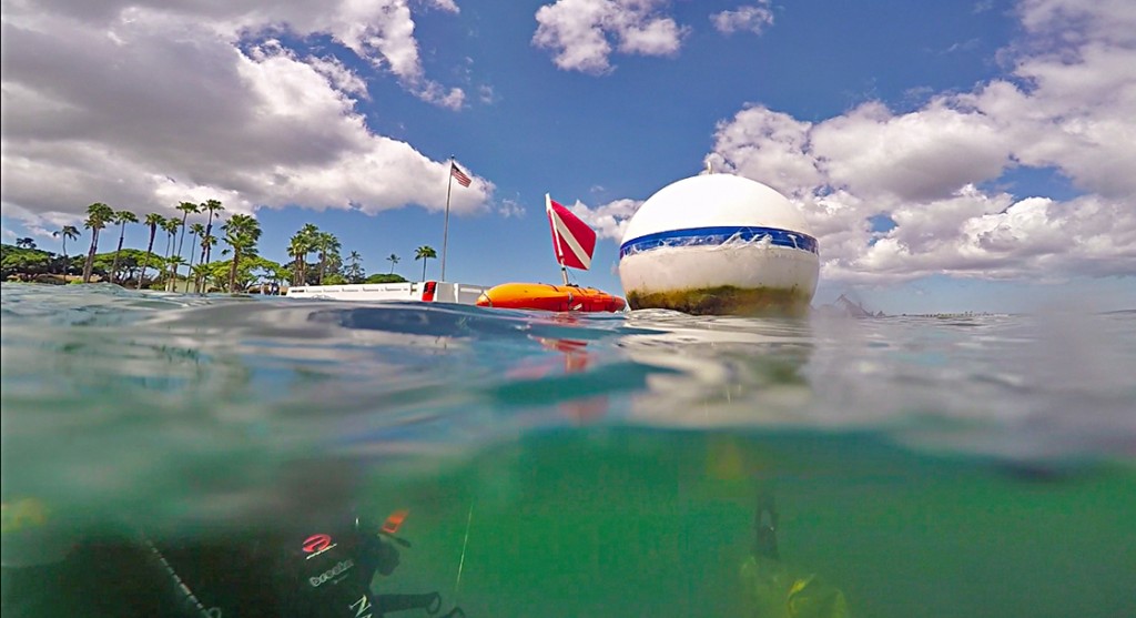
All of these thoughts were bouncing around in my brain as I took the ferry over to the USS Arizona’s memorial. Moored over the sunken battleship the memorial serves as a testament to those who were lost, and those who survived the brutal and sudden attack almost 75 years ago. My visit to the memorial was especially meaningful as I was planning to dive the Arizona the next morning. But, much like in American Samoa, I would soon learn how sudden events could rearrange even the best­-laid plans.

The next morning (Thursday May 28) I met with Scott Pawloski, VALR’s Park Diving Officer, and Naomi, at around 0800 to load up the park’s Boston Whaler. Just as we were unloading the gear from the Park’s van the first ferry shuttling visitors to the memorial came charging back to the visitor center. The captain of the ferry told us that something had happened to the landing on the memorial, and that he couldn’t dock the ferry. We dropped what we were doing and sped out across the harbor towards the monument to see what had happened.

(PHOTO by US Navy Sailor)

(PHOTO by US Navy Sailor)

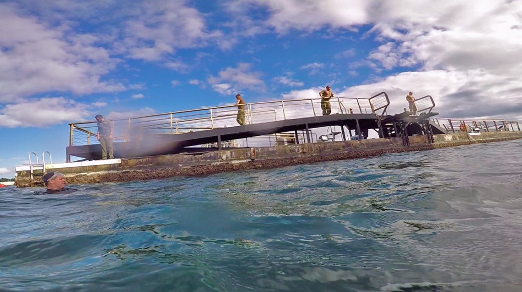
Just moments before we got to the visitor center that morning the floating hospital ship, USN Mercy, was being escorted from its dock adjacent to the monument and the visitor center. Though the final report is unclear, apparently either the Mercy or one of the tugboat-escorts hit the monument’s dock. As we came up to the monument things looked far from good. We were greeted by twisted steel, broken concrete and the landing platform approximately 30ft away from where it should have been. All thoughts of diving were out of the question; at this point damage control was everyone’s main priority.

As we headed back to the visitor center I could see the concern on Scott’s face. He has a strong connection to the monument and knows the Arizona like the back of his hand. Back at the visitor center you could cut the tension with a knife. Although Hawaii exists in a perpetual stare of “island time”, the Park Office, and Navy Command, sprang into action. I did my best to stay out of the way as phones rang and people moved about. The circumstance weren’t exactly good, but I was very impressed by the quick and thorough action and communication the Park Service and the Navy shared over the next few days.

However, the main reason that the Mercy had to move that morning was because the USS Carl Vinson was making its way to Pearl Harbor. Scott had somehow arranged for me to ride along in one of the 4 Tiger tugboats that would be escorted the absolutely massive aircraft carrier to its dock. Although still concerned about the morning’s events, I was thrilled to see first hand how four 100’ tugboats (miniature by comparison) could help escort such an enormous vessel. Of course, they did so with ease and efficiency.

The Navy’s Carl Vinson as seen from Tiger Tug #4.

The Navy’s Carl Vinson as seen from Tiger Tug #4.

It’s hard to imagine that Tiger tug is 100 feet long! Four Tigers escorted the Carl Vinson to its dock next to the visitor center.

It’s hard to imagine that Tiger tug is 100 feet long! Four Tigers escorted the Carl Vinson to its dock next to the visitor center.

That afternoon, back at the visitor center the mood at the office was somber, but things were already happening. I made plans with Naomi to do a resource orientation dive on the USS Utah for the next morning. The Utah was one of three ships that the military was unable to raise after the attack on Pearl Harbor. Sitting on her side, leaning at about 45degrees, only part of her hull breaches the water. She is located on the other side of Ford Island, away from the visitor center and from the typical commotion found at the National Monument.

Before our dive on the Utah Naomi gave me a topside orientation. Here you can plainly see how tilted over the battleship is.

Before our dive on the Utah Naomi gave me a topside orientation. Here you can plainly see how tilted over the battleship is.

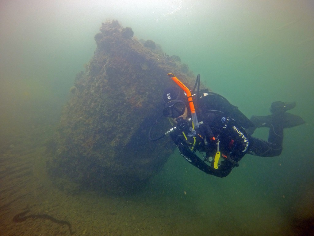
Naomi and I about to descend on the Utah.

Naomi and I about to descend on the Utah.

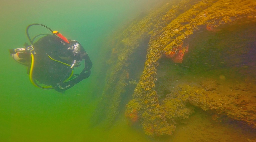
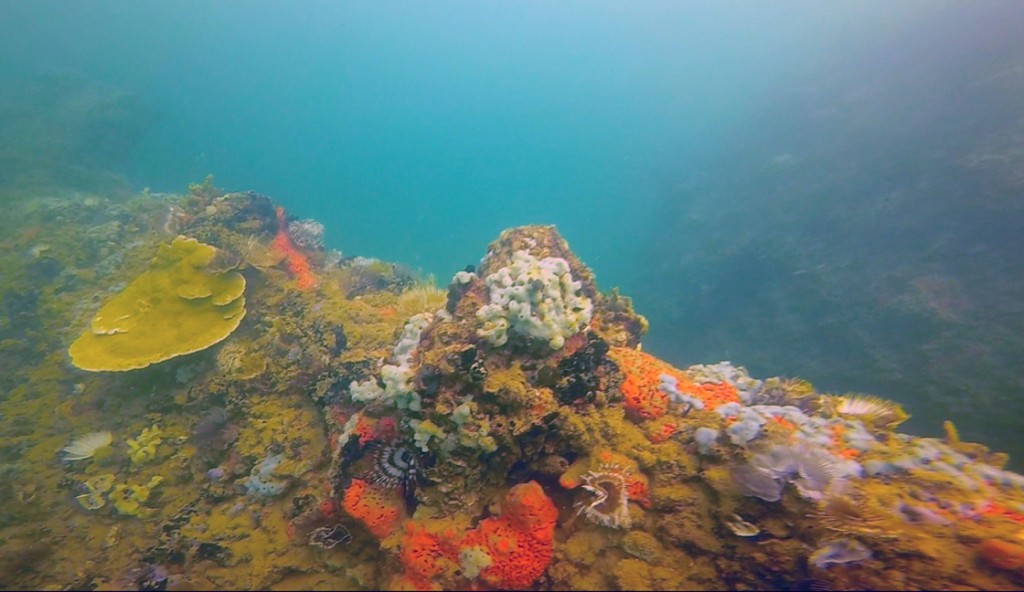
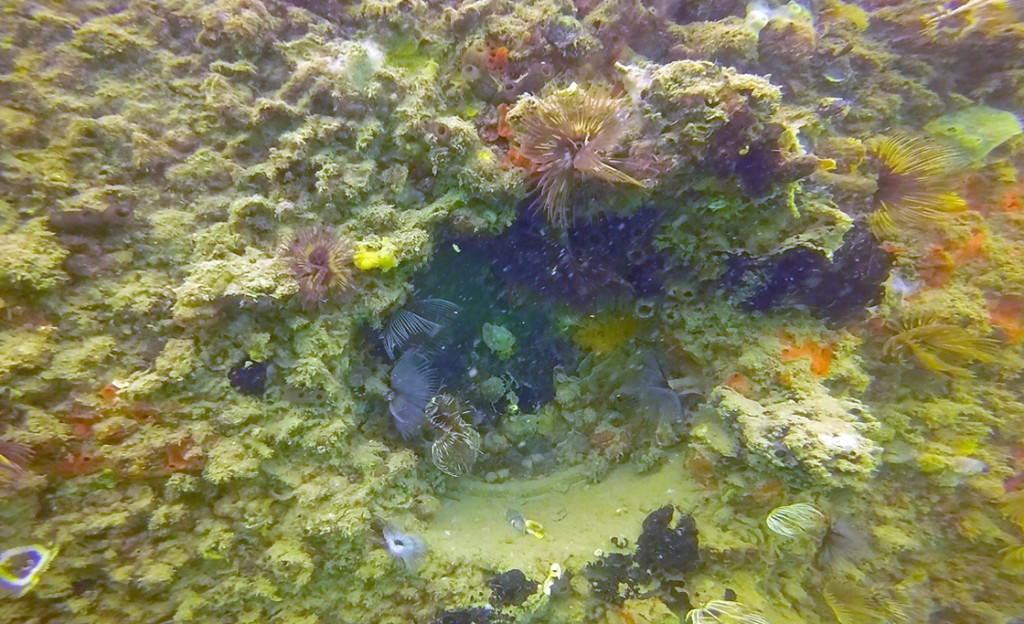
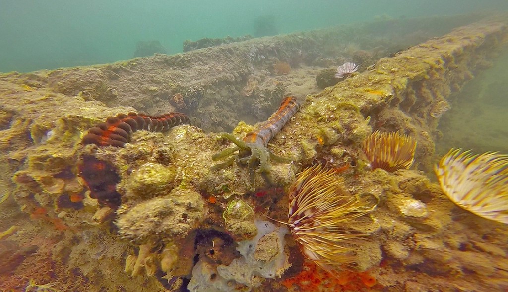
Naomi and I toured the wreck, and it was unlike any dive I’ve ever been on. Though the visibility is typical better than the Arizona it was still only about 15’ at best. After sitting on the bottom of the harbor for almost 75 years the battleship is fouled with an impressive array of marine fauna. Most of the ship’s features are unrecognizable, only certain structures like the gun turrets give away the true nature of the substrate. Though I have been on dives with a similar feel, every so often some aspect of the ship would reveal itself, and would I get a very eerie feeling.

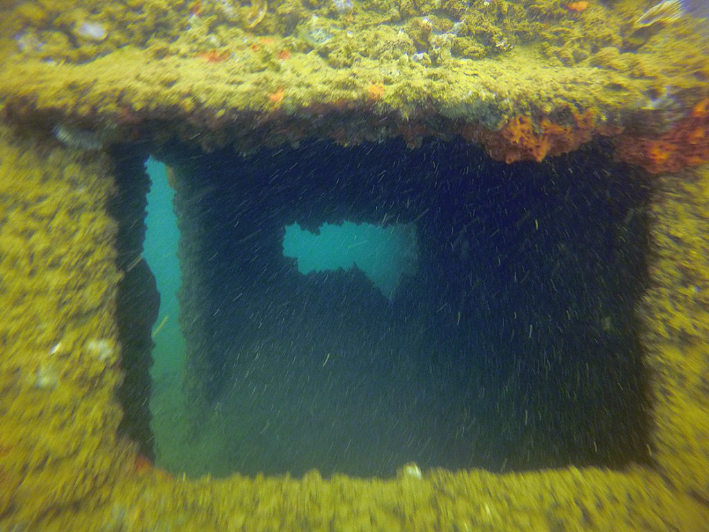
Leading down to the ship’s interior, this hatch has remained open  ever since the Utah was sunk.

Leading down to the ship’s interior, this hatch has remained open
ever since the Utah was sunk.

After the dive I returned to the visitor center, just in time for Scott to motion me over to the Park’s Whaler. He told me to jump in and we sped over to the memorial. The Navy never sleeps; already there was a topside engineering crew and a subsurface salvage crew working on the memorial. It was the latter that Scott wanted me to meet. The Mobile Diving and Salvage Unit 1, or MDSU 1, is one of the best diving operations in the business. It was a rare treat to see these guys working in the silty, oily water surrounding the memorial.

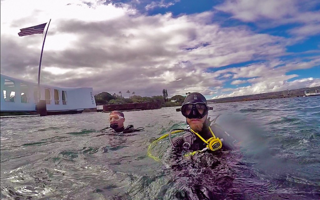
As part of a consolation for missing the Arizona, Scott offered to take me on a fun dive to one of his favorite beaches that Friday. However, as Friday chugged along we had to push the dive back further and further. Scott was moving from meeting to meeting trying his best to get the maintenance work on the memorial moving as quickly and efficiently as possible. By some stroke of good fortune I found myself in the Ranger Office listening in on a meeting with the Park’s superintendent, the head ranger, the head of interpretation, Scot, and a consultant. The good news was that the Navy crews were doing their best, but time was not on their side. The superintendent looked at Scott and told him that he needed to do a survey of the Arizona in the next few days to make sure the artifacts and ship were intact, if Scott deemed the conditions safe enough. I could see the gears turning in Scott’s head, and without missing a beat he passed me a sticky note across the table. The note said, “We’re diving the Arizona” and, this being my last day at the park, I knew he meant now.

In our hast to survey the Arizona we sped by the USS Carl Vinson.

In our hast to survey the Arizona we sped by the USS Carl Vinson.

Taken as Scott and I descended on the Arizona. Here we’re looking at the visitor center moored over the ship.

Taken as Scott and I descended on the Arizona. Here we’re looking at the visitor center moored over the ship.

With a speed the dead opposite of “island time” we rallied our gear, briefed the dive, and within 45 minutes of leaving the Ranger Office we were speeding to the memorial, having just gotten last minute clearance from the Navy’s harbor patrol. We had just one hour to survey the wreck and get out of there. Scott tasked me to film the dive, and anything he indicated, so he could write a report of what we found. The dive lasted less than 30 minutes, but still it was an amazing experience. Visibility was less than half of what it was on the Utah, which intensified the spookiness of the dive. The Arizona makes herself known to the lucky few divers who get a chance to circumnavigate the wreck. As we swam in a counterclockwise sweep we got momentarily lost in a slit­ out, examined the ship’s artifacts, and saw a school of juvenile ulua, or Bluefin trevally Thankfully there was a light wind, which kept the oil (still leaking out of the ship at about 1L/day) away from us.

A school of juvenile ulua swim over the deck of the Arizona.

A school of juvenile ulua swim over the deck of the Arizona.

Just as quickly as everything ramped up were already on our way back to the visitor center. Although I didn’t have much time in Hawaii, the pace was certainly faster than in Samoa. After saying goodbye to Scott and VALR, I was able to spend my last day in Hawaii on Oahu’s North Shore. Though only active in the winter, the waves of the North Shore are a mecca for every surfer; it was amazing to see the places imprinted in my brain from countless movies and magazines in real life. “Island time” takes over on the North Shore, and it seems I was able to catch my breath after such an exciting week. But now I am trading out tropical Pacific islands for the cold and murky waters of Arizona’s Glen Canyon National Park, after one more solid day of travel of course.

Waimea Bay

I’d like to say thanks to Naomi Blinick for helping me out and showing me the Utah, and Scott Pawlowski for all of his help and patience. And also a big thanks to my friend Astrid Letiener, who was able to give me a couch to sleep on for the week after my housing fell through at the last minute!

Mahalo, and thanks for reading!

Share

Sweet Samoan Rain

When I stepped off the plane on the night of May 11th and breathed in the wet, heavy air, I instantly knew I was truly in another world. After 17 hours in the sky, 3 time zones and as many layovers, I had left the snow covered ground in Denver behind for a chance to explore the tropical island of American Samoa. Though my eyelids drooped, and my shoulders felt heavy, my mind reeled from the sensory overload provided by the humid stormy night.

American Samoa truly is another world. Like many people from the States the name “American Samoa” held an air of mystery, partly because it seems that almost no one from back home knows where this place is. Located about 14º south of the Equator, slightly west and south of Hawaii, American Samoa is hardly more than a series of dots in the vast emptiness of the South Pacific.

When I landed in American Samoa I had no idea what expect, or even who was going to meet me at the airport. As it happens, a good friend of mine from Santa Cruz has been working for the Park Service in American Samoa for almost a year. I was very grateful to see the long lost face of Ian Moffitt at the airport. Although it was exhilarating to finally be here, the adrenaline of almost missing my connection in Honolulu to the once-weekly flight to American Samoa was slowly fading, I was truly thankful when we pulled up to the interns’ house late that night.

A few of the interns entering the water at Amalou, the first place i got to dive

A few of the interns entering the water at Amalou, the first place i got to dive

The National Park of American Samoa (NPSA), covers over 10,000 acres and approximately 4000 acres of it is underwater. The dive team certainly has it work cut out for it. The NPSA dive team has undertaken many different scientific studies and projects related to the conservation of the National Park. Most recently they are spearheading an island-wide effort to help control the outbreak of the Crown-of-Thorns Sea Star, a voracious echinoderm that preys primarily on the living tissue of coral reefs.

We hit the ground running at 7:30 am on my first day and I was glad to hear we were headed into the field. After a week in Denver, and over a day of air travel, I finally felt in my element again. Loading tanks, prepping gear and heading out into the field I felt an instant connection with the 4 other interns. I couldn’t contain the smile on my face as we speed out of the Fagasa bay in the Park Service’s open deck Boston Whaler on the way to the field site. The crystal clear waters and dense island flora clinging to the rocky coastline immediately blew me away; the island’s steep cliffs drop vertically into the sea and make for a very dramatic boat ride.

an image of the coral reef (taken at about 45')

an image of the coral reef (taken at about 45′)


Much to my chagrin I had to wait 24 hours after flying before I could don my scuba gear with Park Service, so I contented myself to snorkeling and free diving around the team as they completed their inventory and monitoring surveys. Never before have I been able to swim in water so warm and clear

I couldn’t wait to dive with NPSA for the next two weeks, but unfortunately the weather had other plans. After that Tuesday the island was battered by harsh winds and incessant rain, making field operations all but impossible. The NPSA dive team doesn’t get much downtime, so when the weather is uncooperative they have to make the most of it. I was tasked to assist with the maintenance issues that typically accompany field operations. Normal wear and tear on boats, scuba gear and field equipment is further compounded by American Samoa’s constant humidity and moisture. Needless to say we had our work cut out for us.

Another reef shot (probably amalou in about 35ft of water)

Another reef shot (probably amalou in about 35ft of water)

However, as the week rounded out the weekend showed promise for nicer weather. With hope rising we set out on a relatively calm Saturday morning to try our hand at diving on the North side of the island. Because American Samoa is ringed by fringing reefs, scuba diving is best planned around high tide. As we waited for the tide to rise we snorkeled in some of the most amazing tide pools I’ve seen. Vibrant corals and hardy algae cling to the volcanic walls of Vatai tide pools, nestled above the crashing surf.

After swimming in bathtub-like waters for an hour or two we hiked back up to the car and drove down the road to Amalou, where I would finally get to dive on the reefs that had tantalized me all week. Though the rest of the dive team complained about the poor visibility (only about 60ft!) and the relatively “cold” water, I could barely contain my excitement. Getting to dive in 82º water, in just board shorts and a rash guard, for over an hour is something I won’t soon forget. Though the reefs have been impacted by overfishing, I was blown away by the size and color of the coral found along the steep reef slopes. Massive Porites dwarf even the largest natural structures I’ve ever seen in a kelp forest. The various forms and colors of Acropora are like something out of a Dr. Seuss story. The rest of the dive team casually cruised the reef; this was their day off after all so they too could enjoy the wonders the reef had to offer.

During our surface interval, as we planned for a second dive, I heard talk that Ian was planning on skipping the second dive in search of surf-able waves, an activity also best planned around a high tide. Back home in California one rarely has to choose between surfing and diving, the ability to pursue either activity typically precludes the other. Needless to say, I jumped at the chance for a “perfect day”. In a refreshing change of pace we found the closest surf break to be entirely sheltered from the wind. We traded waves by ourselves for an hour as the sun serenely set behind the mountains of American Samoa. And I didn’t even have to change out of my board shorts! I could get used to leaving my neoprene at home.

Typical American Samoan transportation with Kersten Shnurle, another NSPA intern

Typical American Samoan transportation with Kersten Shnurle, another NSPA intern

While Sunday was no different than any of the other days that week, we decided to brave the weather and climb the steep trail to Mt. Alava, the second highest point on the island. Because it was one of the intern’s birthdays, a large group of eager hikers set out to brave the 3 hour long hike to the top of the mountain. Like something out of Jurassic Park, primeval fog obscured the all but the trail in front of us. The trail winds across the spine of the island’s mountains, the shifting clouds provided us with brief glimpses of the coast below.

The rest of the workweek proceeded much like the last; rain and wind lashed the coast and kept us high and dry in the office. Again, I jumped in with the “maintenance crew” doing repairs and preventative care on the field support equipment. I quickly realized how much I have taken for granted how easily accessible parts and tools are back on the mainland. On an island that is infrequently visited by cargo ships even the simplest of repairs can be thrown off if a single nut or bolt can’t be purchased. Needless to say I was thoroughly impressed with the resourcefulness and positive attitude the dive team constantly maintains.

As luck would have it Saturday looked like the weather might break, at least for a couple of hours. We loaded up the gear and drove the length of the West Road. Winding first south, then west and eventually north we drove past villages, rainsqualls and idyllic beaches pounded by heavy surf. No one had their hopes up as we rounded through the final mountain pass and dropped into the little village at the end of the road. Like something out of a fairytale the little bay of Fagamalo opened up before us; we were greeted by blue skies and calm water. Ecstatic, we geared up and jumped in the water, after obtaining permission from the village chief of course.

Schooling reef fish (ID still unknown) taken at Fangamalo in about 50ft sea water

Schooling reef fish (ID still unknown) taken at Fangamalo in about 50ft sea water

After surface swimming across the fore-reef, we dropped down into crystal clear water over an immaculate coral reef. Because Fagamalo is bordered by a marine protected area, or MPA, to the north, the reef was teaming with wild arrays of fish and invertebrates. While swimming past the massive 3-dimensial coral structures, examining reef fish and their bright colors, I finally met the antagonist of the NPSA marine program, the Crown-of-Thorns Sea Star. A voracious coral predator, these fast moving sea stars are as dangerous as they are beautiful. Ringed by poisonous spines they are hard to remove, and given certain conditions can turn a vibrant coral reef into a bleached graveyard. While scientists are still debating about the cause of recent outbreaks, there is evidence that they are becomingly increasingly abundant on coral reefs across the Indo-Pacific. Although the dive team’s main assignment is their removal, they are naturally found on coral reefs and it was certainly exhilarating to see a few on our dive.

 A school of sweetlips swims over the reef at Fangamalo. Sweetlips are one of the target species for the fish tracking project

A school of sweetlips swims over the reef at Fangamalo. Sweetlips are one of the target species for the fish tracking project

The Crown-of-Thorn Seastar, the NPSA dive team's current antagonist. Though they've been able to control outbreaks inside the national park, CoTs remain an issue on less managed reefs

The Crown-of-Thorn Seastar, the NPSA dive team’s current antagonist. Though they’ve been able to control outbreaks inside the national park, CoTs remain an issue on less managed reefs

As we drove home through the rain I was able to reflect on my previous underwater foray. Though these last two weeks in American Samoa didn’t turn out quite as expected, but I am anything but upset. Saturday’s dive alone made up for a frustrated week of uncooperative weather; it takes months of preparations to properly execute field operations and I was more than happy to help out in any way I could.

I won’t soon forget American Samoa, its gregarious people, and the oppressive tropical weather that makes this place so beautiful. And I certainly won’t forget the openhearted generosity of the NPSA staff. I would like to thank Dr. Tim Clark, NPSA’s marine ecologist, and especially the dive-team, aka the “Tim-terns” that housed me and showed me ropes over the last two weeks; Kersten Shnurle, Paolo Marra-Biggs, Karen Bryan and of course Ian Moffitt. Now I’ve got to pack my bags and head north, to the island of Oahu to explore the WWII Valor in the Pacific National Memorial.

Fa’afetai!

Share

A Wet Week in Denver

Hi everyone, my name is Pike Spector and I have the honor and privilege of being the 2015 National Park Service (NPS) Our World Underwater Scholarship Society (OWUSS) Intern.

I can still remember the day I received the call with this momentous news. When feverishly applying for this internship (for the fourth time) I didn’t think I had even the slightest chance, and yet here I am.

My week began late last Sunday night (5/3) when I flew into Denver from my home in Los Angeles. A storm was rolling in and I remember being astounded at how flat the landscape looked, the mountains were obscured by clouds, which mimicked my distracted mind. When I left LA I frantically packed everything I thought I might need for 3.5 months of traveling. My journey will take my from Denver to America Samoa, Hawaii to Arizona, California to Oregon, Miami to the Keys, and the US Virgin Islands to DC. How on Earth could I plan for all that knowing I will be armed to the teeth with SCUBA gear?

All of these thoughts, and more, were buzzing around my in head as the plane landed in Denver. I was nervous, as Dave Conlin, the Chief of the Submerged Resources Center, had offered not only to pick me up, but to also host me for my week in Denver. I didn’t know what to expect of my time in Denver, let alone the staff of the SRC. However, Dave and I immediately fell into a groove of conversation as we headed back to his home, where I got to meet is wife Michelle and his very energetic dog Luc (my new best friend for the week).

Luc Ball

The next day I carpooled with Dave to the SRC’s headquarters where I got to meet the team and tour the facilities. Everyone was incredibly accommodating, kind and helpful. I really didn’t know what I was supposed to be doing, and felt shy about asking for help. However, everyone made me feel right at home. After a casual lunch, the pace was set for my week in Denver. Brett Seymour, the SRC Deputy Chief and Diving Safety Officer would be my “handler” for the next few months connecting me with NPS divers, researchers, and incredible opportunities as I travel through the NPS. Over the next 4 days I rushed around the city, from doctor’s appointment to medical testing center, all the while getting my files straightened out. The National Park Service and the SRC takes SCUBA diving very seriously, and they want to make sure that their divers are in perfect health before they are allowed in the water.

Which leads me to my first big challenge in Denver – skills and fitness testing. Unlike many training agencies, the NPS has a slough of swim and fitness tests along with stressful SCUBA skills that are evaluated before divers can be certified with an NPS Blue Card and cleared to dive. I was apprehensive; I knew the altitude (nearly 5,500ft) would affect my performance and I wanted to make sure I did my best. And no added pressure, but others in the SRC would be joining me in the pool to do their annual recertifications! The first thing that caught my attention was how cool the team was about diving. In my experience an air of arrogance can occasionally accompany diving professionals. None of the SRC batted an eye or looked down upon me for asking questions about their diving repertoire or their gear. However, I have never seen a team of divers look more comfortable in the water, or more at ease during the “stress-testing” procedures of the NPS’s Blue Card exam. Everyone made the skills look easy, and I know I have a lot to learn before I am on their level. As for the immediate future, I passed all my Blue Card tests and am cleared to dive with the NPS.

With so much travel in front of me, I knew I was going to be loaded down, but the SRC goes through great lengths to make sure that their divers have the utmost safety equipment at their disposable. While the SRC might take on an air of casualness in and around the office, they take diving operations very seriously.Shark Tank

Sand Tigerss

Shark View

In the past, previous interns have come into this program with a little bit of underwater photography skill. Let’s just say that my photography skills, aquatic or otherwise, are passable, at best. So this year I was given a GoPro to use for the summer. In order to test my action-cam skills I got to close out my week in Denver at the Downtown Aquarium on a dive with Brett and an instructor in the 400,000 gallon shark tank. What an incredible experience! To date, my diving history has been written in the kelp forests of California; never before have I seen such magnificent creatures in person in the water. I look forward to *hopefully* seeing some of these magnificent sharks, sawfish and bony fish in the Parks I will be visiting this summer.

But for now, I will have to find creative ways of repacking my gear for streamlined travel. Tomorrow, 5/11, I will leave behind Denver (and its late season snow storm) for the tropical waters of American Samoa.

Share

Diving into the Past- Valor of the Pacific

My arrival in Honolulu followed two hours of driving out of Crater Lake, a delayed flight and 5 hours of flight time. Nonetheless, I was transfixed as our plane touched down on Oahu- this was my first time in Hawaii, and I was eager to explore. The sun set behind the mountains as our plane touched down on the tarmac, putting a bow on a perfect arrival.

IMG_0011

The view of Pearl Harbor from the plane

Once I collected my bags I met with Scott Pawlowski, the Chief of Cultural and Natural Resources in the park. The World War II Valor in the Pacific National Monument is dedicated to telling the story of the events at Pearl Harbor, most notably the surprise military attack by the Imperial Japanese Navy against the US Naval Base on December 7, 1941.The “day that will live in infamy” now lives on in the park in the form of the USS Arizona memorial, the USS Utah memorial and the USS Oklahoma memorial, as well as in other park resources.

Scott and I headed into Honolulu for a late dinner, and discussed my role in the park for that week. When I worked with Brett Seymour of the Submerged Resources Center in Yellowstone and Dry Tortugas, I had watched him utilize a photographic technology called Recap 360, which uses still photographs to produce 3D models. Scott has had experience with the technology, so we determined that with his help I would attempt to produce 3D models of certain features on the USS Utah and USS Arizona.

A few days later, I realized that producing 3D models in Pearl Harbor was easier said than done. The harbor is an estuary, which means that both fresh and salt water mix in the harbor. Large amounts of silt and nutrients accompany the fresh water, resulting in green, murky water. Not the best conditions for taking photos! My subjects were a hatch on the USS Arizona and a gun turret on the USS Utah.

Valor-DUW-140901-141A gun turret on the USS Utah

Valor-DUW-140901-97A gun barrel on the USS Utah

Valor-DUW-140902-102A hatch on the USS Arizona

My first few models were disappointing. The murky water and my novice skills resulted in patchy, half-formed caricatures of the subjects. Luckily Scott was able to diagnose the problem, and with advice from him and Brett I was able to make some progress. In order to capture each and every angle of the subject, the photographer has to utilize a “snail pattern,” photographing from bottom to top in a circular fashion. Each photo must have significant overlap with the preceding and following photograph, and any breaks in the pattern will cause errors with the software.

UntitledAfter two days of unsuccessful modeling, Scott and I set out on my third and final day of diving to model a hatch on the USS Utah. This hatch is particularly significant because survivors of the Attack on Pearl Harbor can choose to have the ship be their final resting place when they pass away, and it is through this hatch that their remains are interred. I was determined to do this model justice as a way to pay my respects to those who serve our country.

The third try was the charm, and with patience, timing and lots of photographs I was able to create a 3D model of the hatch. You can view a video of the model below, or view the model directly by clicking here.

With the diving and imagery done for the week, I decided to explore a bit of Pearl Harbor before my departure to the next park. I hopped on a bus and took a trip to a nearby mall, where I enjoyed some delicious Japanese Ramen at a restaurant that Scott had taken me to earlier in the week. Asian cuisine is king in Hawaii, and I was only too happy to sample the flavor fusions!

0904141842 (1)

I spent my last day in the park visiting the USS Oklahoma memorial. The ship suffered extreme damage from torpedoes during the attack, and was too damaged to return to duty. The ship was eventually sold for scrap and mercifully sank on it’s way to California. The memorial is located on Ford Island, and has 429 marble posts to mimic the naval tradition of “manning the rails,” a naval tradition whereby crewmen and women gather to salute a distinguished vessel or individual. Walking among the memorial was a somber experience.

As I reflected on the week’s experiences, I realized that Valor in the Pacific was unlike any of the parks I had visited thus far. Being able to dive on shipwrecks that were the final resting place for over a thousand officers and crewmen was an incredibly humbling and reflective experience. The day that will live in infamy will also live on in my memories of this incredible park.

Valor-DTS-140905-112

Share

The Wonders of Dry Tortugas

I met up with the Submerged Resources Center (SRC) folks at the end of my stay in Biscayne National Park. The SRC and the Southeast Archeological Center (SEAC) folks were wrapping up their work documenting several wrecks. The SRC and SEAC had teamed up for their archeological work in Biscayne as well as for our upcoming project in Dry Tortugas. With the completion of their project in Biscayne, we loaded the suburban, hitched up the Cal Cummins and began the drive to Key West!

0801140823d

Our destination in Key West was The Fort Jefferson, a ship stationed at the Key West Coast Guard Station. The name for the ship comes from the fort on Dry Tortugas National Park, which is the Fort Jefferson, so to avoid confusion we referred to the ship as the Fort Jeff. I hadn’t spent much significant time on a ship this large; with three engines and two generators, this was definitely a big ship! The rest of our travel day was spent unloading the vehicles, loading up the Fort Jeff and hitching our boat, the Cal, to the Fort Jeff for towing purposes. I was geeking out by all of the Coast Guard ships at the dock, which were beautifully lit by the sunset.

0801141925

That night we stayed on the Fort Jeff, and I fell asleep to the gentle rocking of the ship. In the morning we were joined by Dave Conlin, Brett Seymour, and David Morgan of SEAC. With that our numbers were complete, and we began the four-hour trip to Dry Tortugas National Park!

DRTO-DTS-140810-35

Andres Diaz, the Principal Investigator for the project, outlines tasks and chores for the trip.

Our goal for this project is to survey, stabilize and photograph two wrecks, the Cement Barrel site and the Single Deck site. Both sites had been surveyed and mapped in the mid ’90s, however hurricanes and time have deteriorated the wrecks, necessitating further mapping and documentation.

Our arrival at the park was met by excitement all around- the Dry Tortugas is so remote that it was the first time that some of our company had seen it, myself included. For others it had been years since they’d last visited. After unloading and organizing our gear for the next day we got to explore the park, which felt like stepping back into the past. You could almost hear the call to muster from the grounds!

Fort Jefferson Light

M/V Fort Jefferson at dock in the harbor

The parade grounds of Fort Jefferson

The next day was splashdown day, as we set sail to perform site assessments. The first diving day of each project is generally used to scope out the site and to get a feel for the diving in the park. The weather was a little choppy for our first day of diving, but the dives were spectacular. Because of the park’s inaccessibility the wildlife is able to thrive unmolested, resulting in huge schools of fish congregating over the wrecks. Plus, Dry Tortugas is a wreck mecca, with gorgeous wrecks just minutes from the park.

One of Dave’s pithy sayings is “the weather you have today is the weather you’ll wish you had tomorrow.” That was true for our second day on the water, because the following morning I woke up at three a.m. to the ship rocking back and forth. A squall blew through, and we delayed our diving operations until noon.

Once the weather cleared up we were joined by Jasmine Baloch, an intern at the park and University of Miami graduate student who specializes in lionfish removal. Brett, Jasmine and I hopped aboard the Cal, or the “art boat,” as it was dubbed by the rest of the team. Since we had two boats to use for the project, Brett and I were able to focus on photographic research on the Cal, while the rest of the team did their archeological work on another boat, the Parker. My main task was to be Brett’s dive buddy as he took still images for a reverse photogrammetry program that would create 3D models. After Brett was done I would hop back in the water with Jasmine to photograph the same wreck myself.

A red grouper hides underneath the Single Deck site, one of the wrecks documented for the project.

Over the following few days we were also joined by Kayla Nimmo, a Biological Science Technician at the park, Chris Muina, another lionfish intern and University of Miami graduate student, and Elissa Connolly-Randazzo, a Student Conservation Association (SCA) intern. Chris and Elissa made spearing lionfish look easy, and it was great to meet and chat to other young professionals in the marine science field.

Even though I was exhausted at the end of each day, I tried to make the most of my time at the park by watching the sunset or snorkeling in the late afternoon. There was a trio of goliath groupers living underneath the dock, so one evening I went snorkeling with Jess to try to coax them out for a photo. They were only too happy to oblige! Curious, the huge groupers swam right up to us; they had nothing to fear, as the largest one was larger than us!

SRC Archeologist Jessica Keller stares down a Goliath Grouper

DRTO-DUW-140807-216

DRTO-DUW-140807-263

And if my experiences thus far weren’t awe-inspiring enough, the highlight of my visit to Dry Tortugas happened the morning of my departure from the island. I woke up at 5:30 a.m. and joined Kayla, Jasmine, Chris and their University of Miami advisors to watch sea turtle nesting monitoring on East Key, a small island near the fort. Kayla goes to East Key every three to four days to check on the Loggerhead nests, and the Lionfish and SCA interns monitor the nests as well. By keeping a detailed log of when each nest was laid and by monitoring each nest for tracks, Kayla and the interns are able to know when each nest hatches. After they’re certain that a nest has hatched, they dig up the nest to count the number of eggshells and look for any stragglers that didn’t make it out.

Chris Muina counts turtle eggshells in the early morning on East Key.

Baby Loggerhead turtles emerging from the nest.

It was such an incredible experience to watch Chris, Jasmine and Kayla dig up the baby sea turtles, especially knowing that without their help the remaining stragglers wouldn’t have made it to the ocean. Seeing the turtles emerge from their nests will be a memory I hope to keep forever! That, combined with the gorgeous wrecks in the crystal clear water made Dry Tortugas a magical place to visit.

The sea turtle monitoring program at Dry Tortugas National Park is conducted in accordance with Florida Fish and Wildlife Conservation Commission (FWC) marine turtle permit #0187.  All species of marine turtles are either threatened or endangered and it is illegal to harass, harm, pursue, hunt, shoot, wound, kill, trap, capture, or collect these or other protected species.  Please contact the primary permit holder, Kayla Nimmo (Kayla_Nimmo@nps.gov) with any questions or concerns.

Share

Lionfish, Morays and Manatees, Oh My!

My time in Biscayne National Park began with some rocky travel. First I had to return from Yellowstone National Park, which was an adventure in and of itself. Brett, Koza and I dropped off Brian Skerry in Jackson Hole to catch his flight, and then we made the nine-hour drive back to Denver. By the time we stopped at the office to switch out my drysuit for my wetsuit it was already almost midnight! I got a few hours sleep back at Dave and Michelle’s, then packed up my things and went to the airport.

Two flights, a rental car mix-up and an enormously large headache later I arrived in Biscayne National Park. Being back in the South and hearing cicadas again felt like putting on a comfortable sweater- albeit a hot and humid one! I met my awesome flatmates Jeneva Plumb Wright, an intern with Cultural Resources here in the park, and JT, a fellow southerner doing a three-month maintenance stint in the park. And with that I unpacked, prepped my gear for the next morning and fell asleep.

In the morning I met up with Dave Conlin, who had flown to Biscayne a few days earlier. He was assisting a program called Youth Diving with a Purpose, or YDWP. The program is made up of a diverse group of students from different schools, states and even countries, and all of them gain exposure to underwater archeology through the program. Excited to see their work, I splashed down with Dave Conlin, David Gadsby, an archeologist with the National Park Service, and Chuck Lawson, the Cultural Resource manager at the park, and started photographing the intrepid young archaeologists.

BISC-DUW-140715-09

Dave having fun with some seaweed!

The site the YDWP program was working on this year is called Captain Ed’s Wreck.The ship lies in about 20 feet of water, and is about 11 miles offshore. According to Josh Marano, a Biscayne National Park archeologist, the ship was from the mid 19th century, and was a sailing cargo vessel. The name came from a concessionaire captain, Captain Ed, who discovered the site and led snorkel trips there- he notified the Park Service of the site and the wreck still bears his name.

The water was an absolute dream to dive in, especially after diving in the 40 degree Fahrenheit water of Yellowstone Lake. Even more exciting than the lovely water temperature and excellent visibility however, was the excitement of the kids in the Youth Diving with a Purpose program. Their enthusiasm was infectious, and after each dive I was eager to get back in the water to photograph their work. It was a challenge to compose a picture with 20 young archeologists diving around the site, but after a few dives the students fell into a rhythm, and it became easier to isolate them photographically to compose a shot.


The students had a chance to show-off their newfound diving and archeological skills when Brian Carlstrom, the superintendent of the park, visited the site. Dave Conlin acted as tour guide and showed Brian where the masts of the wreck used to be, as well as other archeological points of interest. The students shared their work with the superintendent and wrapped up their last day of diving!

BISC-DUW-140717-50

Superintendent Brian Carlstrom (left) gives the “ok” to a student archeologist.

Once YDWP concluded I joined the Southeast Archeological Center (SEAC) on their project documenting the Long Reef Cannon Site in the park. The SEAC team included David Morgan, the director of SEAC, Thadra Stanton, the Principal Investigator of the project, Charlie Sproul, a Museum Specialist and Meredith Hardy, an archeologist. The SEAC team was also joined by several members of the SRC, including John Bright, Jessica Keller and Susannah Pershern. Chuck Lawson, Josh Marano and Jeneva Wright of Biscayne National Park also contributed to the project, making it a collaborative effort across different groups of the National Park Service. It was great to see so many different organizations working together!
It was also great to learn more about underwater archeology. Since my main focus is in underwater photography (pun intended) my archeological skills aren’t quite up to snuff. Joining the SEAC/SRC/Biscayne team on this project gave me an opportunity to learn more about the process of documenting an archeological site.

After spending a few days working on the Long Reef Cannon Site I transitioned to working with ongoing projects in Biscayne National Park. One project I was excited to work on was the Lionfish eradication and research project. Lionfish are an invasive species whose population has exploded in the last decade. The invasive fish are voracious eaters, and their fast rate of reproduction makes them a threat to many native reef fish. Each year the park hires interns to conduct research and help eradicate the invasive species; I worked with this year’s grad student interns: Megan Davenport, Michael Hoffman and Kristian Rogers.

BISC-DUW-140722_1-05

My first day with the Lionfish team was a little bumpy; I made the mistake of having coffee on an empty stomach before going diving- mistake number one! The weather was a little stormy, and to top it off my regulator malfunctioned, although thankfully it happened before the dive and not underwater. Hyped up nerves, a rocking boat and intense heat resulted in my first bout of seasickness. Ugh!

                                                                                    The stormy weather while returning to the dock. 

Thankfully we had better weather the next day, and with my newly found “sea legs” I was able to join the lion fish team both on the boat and underwater. Kristian, Mike and Megan definitely made using the speargun look easy- my two attempts went wide. I only hope that the poor fish ended up as another fish’s dinner!

BISC-DUW-140722-170

Kristian spearing a large lionfish.

Jeneva and I also had the opportunity to “fillet” some lionfish for dinner. I use the word fillet generously, as it was more like a butchery. Apparently there’s only so much you can learn from a Youtube video!

BISC-DUW-140722_1-102

Jeneva braces herself for the smell.

I also got to spend some time monitoring sea turtle nesting sites in the park. Shelby Moneysmith, the regional Dive Safety Officer and a park biologist, Katie Fisher, a biological technician, and the Fish and Wildlife interns Kelsy Armstrong and Nicole Rodi and I all piled on the boat and went to Elliot Key to look for turtle nests. Looking for turtle nests was like being a detective; we had to interpret the turtle tracks to see if and where the sea turtle laid her eggs. We had a particularly busy day for turtle activity with plenty of false tracks and possible nests.

The high point of my time in Biscayne was a chance manatee encounter while doing sea turtle monitoring. All I needed was for someone to shout “Manatees!” and I was over the side of the boat with my camera. I was actually so excited that I flung my hat, sunglasses and other items all across the boat in my haste to get in the water! It was my first time seeing manatees, and snorkeling with the gentle giants was just amazing. Plus they made great models!


Later in the day we also went on two dives to do reef visual counts, or RVCs. Katie and Shelby explained to me that RVCs had been performed in the park and surrounding area for years, and have been done by different organizations at the local, state and federal level. This has yielded a huge dataset that shows biologists the “big picture” about fish populations in the area. One of the more interesting things we saw on our RVC dives was a beautiful green moray eel, who was  obviously hamming it up for the camera.

BISC-DUW-140729-57

Say cheese!

My last adventure in the park was to assist with Lobster Mini-Season, an annual dive derby to catch Caribbean Spiny Lobsters. This was a great opportunity to work with a different side of the park; law enforcement officers, biologists, rangers and volunteers all came together to help assess the mini-season’s impact on the lobster population in the park.

BISC-DTS-140730-06

My role was to interview the captain of each boat to find out where, how and how long each boat was  fishing for lobster. It was definitely a hectic experience when we had boats coming in constantly, but I really enjoyed interacting with visitors to the park.

Visiting Biscayne National Park was a rush of different people, projects and experiences. My favorite part of my experience thus far has been meeting the passionate, kind and knowledgeable people that work at each park. If the people I’ve met so far are any indication, then I’m in for a treat as I make my way across the US. Next stop: Dry Tortugas!

Share

Yellowstone 2.0

Our first trip to Yellowstone concluded with some amazing technology. Mark Hardy, co-owner of a company called 3D at Depth, joined us in the park for the last few days of our project. Apparently the inability to pack light holds true for underwater technology as well, as Mark was accompanied by several pelican cases of gear!

3D at Depth specializes in the underwater application of a scanning technology called lidar which illuminates a target with a laser then analyzes the reflected light. The resulting data set is called a “point cloud” image. Whenever the laser hits the subject of interest it creates a point, and then millions of points combine to form the final image.

BoatScreenShot2

MergedPicScan

For the Yellowstone project, our target was a rowboat that had been sunk in front of Lake Hotel in the early 20th century. Although Lidar is still a relatively new technology it is rapidly becoming the industry standard in the architectural and engineering world due to its accuracy.  3D At Depth is perfecting the technology in the subsea, or underwater environment, particularly in the oil and gas industry world wide. The SRC has partnered with 3D At Depth to explore how the technology can be utilized to both map historic shipwrecks and educate the public through 3D models. Because this particular laser scanner was depth rated to 3000 meters (thats 9,842.52 feet!) it was pretty unwieldy and extremely heavy, so getting it off and on the boat was quite a process! YELL-DUW-140625-44YELL-DUW-140625-45YELL-DUW-140625-31

In order to get a 360 degree scan of the rowboat we had to scan nine times each from different angle. This meant that Brett and I would hop in the water, move the scanner, and then surface while the scan was underway. 30 minutes later we’d be back in the water to move the laser again! I broke a new personal record with six dives in one day, although all of them were only to 25′ and relatively short dives. You can check out 3D At Depth profile of the Yellowstone scanning project by clicking the 3D At Depth logo below (opens new window).

3dSubseaLidar-Horizontal-weblogoYELL-DUW-140226-009 0626141315aYELL-DUW-140226-025

After the scanning was complete our work in Yellowstone was done. We packed up the trailer and left it ready for the next trip a week later, and then began the nine-hour trip home. Being back in Denver meant having a week off to relax and prepare for the next Yellowstone trip. The whole Submerged Resources Center Staff was in town (which rarely happens) so it was the perfect opportunity for a staff photo, taken by yours truly. It was a great opportunity to meet everyone, and catch up on different projects that had been ongoing around the country.

SRCStaff2014s

Being in Denver also meant I had the opportunity to explore some of the quirkier aspects the city had to offer. Jessica Keller, one of the SRC archaeologists, took me to play a game of underwater hockey. The game is played in eight feet of water, and each player holds a miniature hockey stick to move the puck around the pool and into the opposing team’s goal. After watching a couple YouTube videos I was pretty nervous, as underwater hockey players seemed as competitive and aggressive as real hockey players!  But once I got in the water my nervousness vanished, and I even managed to score two goals! According to the players I was a “natural,” which I thought was pretty funny for such an unusual sport. It must have been all of that club swimming growing up! (Thanks Mom).

Hanging with a Yeti!

Hanging with a Yeti!

After underwater hockey Jess and I went back to her place, where we had some delicious ribs barbecued by SRC archaeologist and grill master John Bright. I’m a recovering vegetarian, and those ribs were the best (and only) I’ve had in seven years! Our food adventures weren’t done there; the next day John and Jess took me to one of their favorite restaurants, the Sherpa House in Golden, Colorado. It was an all-you-can eat Tibetan café, so needless to say I ate all I could!


So with high spirits and a full stomach I was ready for my second trip to Yellowstone. On this project, the SRC was collaborating with National Geographic Magazine and their underwater photographer Brian Skerry to image the geothermal features in Yellowstone Lake. Apparently National Geographic is dedicating an entire issue of the Magazine to Yellowstone National Park in the Fall of 2015 in anticipation of the NPS Centennial anniversary which happens in 2016. Through the SRC’s relationship with Senior Photo Editors at National Geographic they were able to offer up a rarely seen side of Yellowstone, its underwater world, and support this project along with the Park. I researched Brian’s work in college, and even had one of his books signed at the Boston Sea Rovers Film Festival a few months earlier. I was a little worried that I would be too awestruck to speak intelligibly, but luckily he was kind, humble and a great person to learn from. Turns out that earlier in his career he was the recipient of an Our World Underwater Scholarship Society internship as well, which I thought was pretty neat.

photo

Me helping prep Brian’s gear!

The other members of our troop included the SRC’s Deputy Chief and Photographer Brett Seymour, who was on the first Yellowstone trip last week, and Volunteer In Parks (VIP) Jim Koza (known to us simply as Koza) who is a retired NPS’er with nearly 40 years experience running boat and dive operations in and around the NPS. I rounded out the foursome, and after we arrived in Yellowstone Brian started the task of unpacking his nine Pelican cases and prepping his gear.

Saying goodbye to the Mahn!

Saying goodbye to the Mahn!

Koza and I boarded the Robert E. Mahn for an orientation provided by former Lake District Ranger Rick Fey. Rick was a fount of knowledge for all things boat-related, and showed Koza and I the ins and outs of the Mahn. We were taking the boat around the lake when the port engine unexpectedly shut off! Koza maneuvered the boat back to the harbor using only the starboard engine, and then he, Rick and a couple maintenance guys checked out the engine. I didn’t understand all of the lingo about the “outdrive engine,” but at the end of the day we had to find another boat to use. Luckily enough the Maintenance department in the Lake Region generously lent us one of their boats, and we were back in business on the Warwood.

Notice the white knuckles?

Notice the white knuckles?

My role on this trip was to assist Brett and Brian on their dives and act as camera assistant (handing in and retrieving cameras and lights, last minute vacuum seals, etc.), deckhand, and Dive Supervisor. This was a great opportunity, as I was able to pick up all sorts of useful skills, such as tying knots. Koza is an absolute knot guru, and so I learned the clove hitch, square knot, grapevine knot, Prussik knot, bowline, sheepshank, sheetbend, alpine butterfly knot, anchor bend and figure eight knot. Whew! I also got some more practice at driving a boat, as well as “parking” it! It was a little bumpy, but practice makes perfect.

One of the most important things I learned on this trip was to back up my work on an external hard drive. One night while mooching internet at the Ranger station my hard drive suddenly shut down. My pleas to my laptop went unanswered, and my photos from Yellowstone were lost. It was very upsetting to lose the photographs and all my files, but as Brett said, it’s better to have that lesson learned sooner in both my internship and career rather than later! Now I’ve established a nightly back-up to an external hard drive, just in case.

We had some very special guests join us while diving on Yellowstone Lake: Yellowstone Superintendent Dan Wenk, and Chief of the Yellowstone Center for Resources Dave Hallac both joined us for a morning dive. It was a beautiful day with a calm lake, and their visit was a great opportunity to meet the people running the park! We also had former Chief Ranger and Regional Dive Officer Bob Whaley join us for a day; he started the dive program at Saint Croix National Scenic Riverway in Wisconsin/Minnesota and it was great to hear about his dive programs accomplishment with invasive species on the St. Croix River.

YELL-DTS-140712-001

From left to right: Brian Skerry, Dan Wenk, Brett Seymour and Dave Hallac

And of course, I can’t forget the fantastic advice I received from Brian! He encouraged me to get involved in the marine science community, and use photography to tell scientific stories. My favorite thing he said regarding underwater photography was when he said to “take photos that makes that person sitting in a dentist’s chair stop and read the captions.” His advice and encouragement was fantastic motivation to push myself professionally and photographically, and I can’t wait to see where this summer leads me!

YELL-DTS-140712-021

Me, Brian, and Brett at a thermal feature in Mary Bay of Yellowstone Lake

YELL-DTS-140712-085

Surface support for Brian and Brett


Share

Welcome to Jellystone!

“Welcome to Jellystone!” was our first official welcome into Yellowstone National Park. We rolled in on Monday evening, after a nine-hour drive from Lakewood, Colorado. Our team for this project includes Andres Diaz, an underwater archaeologist, Brett Seymour, an underwater photographer and Deputy Chief, Dave Conlin, the Chief of the Submerged Resources Center and myself.

Tuesday morning dawned bright and early and we started preparations for our two-week project. Brad Ross, the Lake District Ranger gave us a tour of the Bridge Bay Marina, and took us on a short trip on the lake in the Robert E. Mahn, the boat we will be using for our diving operations. We also met Pat Bigelow, a Fisheries Biologist in the park. She outlined some areas of interest for us to survey using the side-scan sonar. The rest of the day was spent preparing the trailer and the boat for operations.

0616140812b

Wednesday was our first day in action, and we woke up to a thin coat of snow covering the dock. We had planned to spend the first half of the morning scanning, and then the afternoon diving, but scanning took up most of the day. Our main focus in Yellowstone is photographing and mapping a natural phenomenon called spires, which are large cylindrical growths formed by bacteria that are 11,000 years old. The spires are found in the north-west area of Lake Yellowstone, and are 10-30 feet high. By scanning the spires with the side-scan sonar we were able to get prices GPS locations for each spire, as well as map the underwater topography of the area. The process for surveying is interesting, however not particularly exciting, as you’re basically driving a boat back and forth in a series of lines as you tow the sonar and collect data. Dave put it best when he said “If you’re doing it right, sonar surveying is boring.” We also scanned some sunken rowboats in front of Lake Hotel which we’ll be photographing and diving near later in our trip. Once our surveying was concluded we brought the boat back to the marina, and wrapped up our day with dinner and some “Moose Tracks” ice cream for dessert. I think they should be called Bison Tracks, but regardless, it’s never too cold for ice cream!

0618140859a

Brrr…

The next day was “splashdown,” as we braced the cold water for a morning dive. I’ve used drysuits in the past, but it’s truly a different beast when you’re diving professionally versus recreationally. For example, who knew that the zipper on your thermal goes on the front!

0619141015

A new fashion statement?

I tried to prepare mentally, but the 38 degree Fahrenheit water was quite a shock. I had “brain freeze” for a few minutes after we descended, but luckily I was soon distracted by beautiful scenery. We dove in the West Thumb Geyser Basin, which was home to thermal vents both on land and underwater. We came across quite a few “bubblers,” which were small areas of the bottom that were emitting gas bubbles. Even more exciting were the two cavernous holes in the bottom of the lake, which were covered in bright green algae and releasing water at a toasty 48 degree Fahrenheit. We descended into one of the holes, which went about 10 feet below the bottom. It was definitely an otherworldly experience!

YELL-DUW-140621-65

Geothermal vents promote algal growth, which blankets construction materials from a destroyed dock. 

We finished up our surveying by scanning some areas of interest provided by Pat Bigelow and the Fisheries and Aquatic Resources department. Lake trout are an invasive species in the lake, and threaten native Cutthroat trout. The Fisheries and Aquatic Resources team records and analyzes the amount of fish caught in certain areas, so we scanned a few locations where they had caught large amounts of the invasive trout. The best part about scanning was I got to try my hand at driving the boat! All went smoothly despite a few navigational hiccups (I blame the wind.)

0618141326d

Andres (left) and Dave pulling up the sonar towfish. 

Once surveying was complete we began focusing more on the photography aspect of our trip. We began diving on the spires, which were a little deeper at around 50 ft. Because the spires are deeper than the geothermal vents, the visibility was quite poor, and any careless fin movement stirred up clouds of silt. It was a great challenge to control buoyancy, not stir up silt, and still get good photos. It took a couple tries, but with some great tips from Brett I finally got a few good shots! One of the humbling aspects of diving among the spires, besides their otherworldly appearance, is the fact that I’m one of approximately 30 people to have seen them in person. The nearest scuba support is in Jackson Hole, and the lack of scuba support combined with the cold water makes diving the spires a nightmare for recreational divers. It makes me feel even more fortunate to have this amazing opportunity!

YELL3

Me next to the spires! (Photo by Brett Seymour)

We also photographed a number of rowboats in front of Lake Hotel. These rowboats were used to ferry visitors and guests of Lake Hotel, and were sunk in the early 20th century.

YELL-DUW-140621-14

Diving in Yellowstone definitely requires a steep learning curve. Some challenges included getting familiar with a drysuit again, dealing with mask flooding, and trying to find the boat anchor in silted out visibility. Oh, and have I mentioned the cold? Every day there’s a new curveball and something else to become familiar with. A lot of people at the park think that what we do is glamorous, and as the photo below shows, it’s anything but!

0620141503c

Diving means every day is a “bad hair day!”

Of course, crazy hair and difficult diving conditions become minor concerns when surfacing from a dive with this view. Good thing I’ll be coming back next week!

0620140956a


~Yasmeen

Share

The View from Here

By Sarah Barchus
Dive No.: Week Four (Five dives)
Location: Zone Four

Time in: 9 am
Time out: 5 pm

Total Bottom Time: About 40 hours

Depth: Rebreather required during redesign

Starting Air Pressure: At the halfway mark
Ending Air Pressure: Not out of steam yet!

Exposure Protection:
˙ Business Casual
˙ Thinking cap
˙ Self-confidence
˙ Lifting brace (braced for moving)

Weight: Pockets heavy with change

Temperature:
Air: Warmer in zone four!
On the surface: Warmer due to increased walking for meetings
Bottom line: I’m warming up to it

Conditions:
˙ Fresh water (Closer to the cooler)
˙ Salt water (The taste of change)
˙ Shore (Set foot on new grounds)
˙ Boat (Moving the mooring)
˙ Waves (Riding it out)

Visibility: New view from here

Comments:
This week the dive group weighed anchor, moving from the Zone One cubicles to
the Zone Four clusters. This is part of the restructuring and remodeling process
occurring within Bonnier Corporation.

We are now quite a distance away from our senior editor Patricia Wuest; we
almost need a map in order to find her office again to attend meetings. While I do
exaggerate, a bit, we really did bring a map to one of the meetings this week.

Screen Shot 2013-08-12 at 6.30.46 PM

This map is the layout for the magazine that we will eventually send to the printer.
Right now it is in what I will call the “cartographer’s critique” because we are
marking it up for changes. The “map” is a sheet of paper with rows of boxes
numbered by page: Single boxes represent the covers, and pairs of connected boxes
signify page spreads. Smaller squares overlaying the boxes represent ad placement.
It kind of looks like a game board, and in a way the mapping process is a game, like
a puzzle. We have to figure out where to fit articles amid the ads. Not only do they
have to fit physically, but also conceptually.

Speaking of concept, we selected several mock-ups for the upcoming issue’s cover
this week; it was neat to see the options and give my opinion on the picture that will
persuade people to pick up the magazine.

Patricia brought out a copy of Scuba Diving’s first issue on Friday.

Screen Shot 2013-08-13 at 7.37.25 PM

That cover, with a woman photo-shopped to improver her (a-hem) “assets” and her position in relation the dolphins…well, let’s just say our covers have greatly improved since June 1992. Scuba Diving’s art director, Monica Alberta, needed the issue for a
timeline she’s creating for the Dive Group’s end-of-year Special Issue Publication
(SIP).

Scuba Diving’s photo editor Elly Wray — Elly is a professional underwater
photographer who does awesome work — will photograph the gear article in this
first issue, to show ScubaLab’s first gear test on the timeline. ScubaLab is the testing
facility for the magazine and conducts all-important testing on dive gear.

The dive group continues to work on our idea for for the SIP – a much larger puzzle
than mapping since we won’t have all of the pieces in (we’re waiting to find out
what new gear will be featured) for a while yet. The team is putting together the
ScubaLab part of the SIP — in addition to creating the timeline, the SIP will have tips
on purchasing and maintaining dive gear.

The waiting game continues as restructuring and construction remains in the
beginning stages for the Bonnier Dive Group. Add that to the shifting circumstances
in the magazine industry and it seems like the list of things that are changing is
endless.

Another endless list is the one of the “to-do” variety. On mine this week were a
couple of dive briefs and another online article as well as the all-essential fact checking. New to me was something called “Listings.” Simple, yet important, the Listings page in Sport Diver mentions our partners around the world featured in that particular issue, and help maintain our symbiotic relationships. As professional
relationships are crucial for career success, I am happy to continue building mine
with Bonnier Corporation in the last two weeks of my internship.


Share