Kaloko-Honokohau National Historical Park

Arriving on the Big Island, it was immediately clear that the island is volcanic. Looking from the airplane window, the ground was covered with a blackish-red, porous rock.  Also, when I walked out of the airport, I noticed it was overcast unlike any of the other islands. I was greeted by biological technician, Lindsey Kramer, who explained to me that it was “vog,” or volcano fog, that hung in the atmosphere. 

During my two week stay I dove with the Kaloko-Honokohau resource management team to do coral reef surveys as well as work on other projects. Kaloko-Honokohau National Historical Park was established in 1978 and preserves the coastal sections of two ahupu’a or traditional land divisions of Kaloko and Honokohau. This area of land extends from the upper slopes of the volcano down to the coast and out into the ocean.  It includes the Kaloko fishpond, which was constructed with lava rock and is an excellent example of traditional aquaculture as fish were raised in the pond to sustain the population. Most of our dive sites were located in Honokohau Bay or just outside of Kaloko fishpond.

For my first day of work Sallie Beavers, Chief of Natural and Cultural Resources, gave me a safety briefing and covered all of the emergency plans, rules, and fundamentals of the diving program and boat operations in the park. Later, we went out to the boat to make sure everything was prepared for diving and that the proper essentials and emergency supplies were onboard to go out on the water.

The next day I renamed and organized photos taken during previous surveys to get a better feel for the reef surrounding the park and the project itself.

The day after that, we took the boat out to collect water quality samples from various sites around the outside of the fishpond, harbor, and bay. To collect samples, we submerged a tube with spring loaded doors into the water. The doors would shut when a weight was dropped down the string attached to the device. This traps the water in the tube at the desired depth. We surveyed 16 different sites and collected samples from both surface water and deeper water. While we collected samples, a water quality analyzer was lowered into the water to collect information about ocean conditions such as salinity, turbidity, and temperature. Also, Lindsey and I managed to squeeze in a dive to survey the reef.

The methods they use to survey at Kaloko-Honokohau are very similar to those used by the researchers at Kalaupapa National Park, considering that they are part of the same Inventory and Monitoring project.  First, we used GPS to swim on the surface to the location area of the marker pins, and then we dropped down to the bottom to begin our search for the pins on the bottom. Sometimes we found them immediately, other times it took longer. At Kaloko-Honokohau, unlike at Kalaupapa, the pins had zip ties attached to them, which made them easier to spot. Once we found the first pin or the starting pin, we rolled out meter tape by swimming on a compass bearing in the direction of the ending pin, which was not always easy to find. When we located both pins, we clamped the line down and pulled it taut between the two pins in order to be able to compare photographs taken from the same locations year after year. Once the tape was rolled out, I replaced the old zip ties that were encrusted with living organisms.  Then, Lindsey swam along the transect line with a camera taking pictures every half meter while I moved along the line counting urchins. For the urchin counts, I swam along transect lines while holding a PVC pipe with tape in the center aligned above the transect line. Then, I counted all of the urchins that the pole went over. The pole served as a control for everyone to count urchins the same distance away from the meter tape without having variability among the observers.  I recorded the numbers of rock boring urchins, red spined urchins, black banded urchins, long spined urchins and crown of thorns sea stars onto a waterproof datasheet. After Lindsey finished going down the line, she took photos of specific areas of coral that were marked with cable ties. Next, she took photos of the landscape in the directions of north, south, east, and west to help locate the site next year. Then, I rolled up the meter tape to conclude that transect.  

I learned about the relevance of that data the next day when I had the privilege to sit in on a State of Hawaii Land Use Commission meeting with Sallie Beavers and Superintendent, Kathy Billings. The goal of Kaloko-Honokohau’s participation in the meeting was to ensure that developers and contractors monitor their pumps to see how much water they are removing from the ground. Also, the park wants to ensure that contractors properly contain waste to make sure it does not flow directly into the ocean to protect the reef and pools which lie within park waters. 

The sampling and surveying we are doing now represents the current status of the reef and pools and will be used as a baseline in the future. Since coastal development outside the park is going to continue in the years to come, resource managers at Kaloko-Honokohau are doing their best to protect the park resources from the negative impacts of urbanization. By following the “top to bottom” theory of the Hawaiian land distribution or ahupu’a, Kaloko-Honokohau National Park goes outside of park boundaries to protect what is inside the park. Only by managing the watershed above the park can they manage the reef and anchialine pools within the park. Since the groundwater is the life force for the ecosystems, any pollution or nutrients that go into the water directly affects the park. 

The development activity on the coast outside of the park pumps out groundwater that is essential for the anchialine pools in the park, which host rare life found in few other places on earth. Anchialine pools contain a mixture of ocean saltwater and fresh groundwater.  When the flow of freshwater into the pools is reduced, the salinity goes above normal levels and the water cannot support the precious life that depends on the brackish environment.  

 Also, coastal development produces waste which eventually flows into the ocean through the watershed process. This leads to an increase in nutrients and nitrogen which can potentially harm the reef. The reason we are counting urchins is because they are herbivorous, or algae eating species. Greater levels of nutrients support more alga, and if the urchins are not there to control the algae it can overwhelm the reef and kill the coral. If anything negatively impacts the urchin population, it could in turn damage the reef. If the urchin population is known and the reef is documented while it is still healthy, it will help scientists and resource managers understand future changes and take measures to protect the aquatic environment.    

The following day I did more water quality sampling, this time in the anchialine pools. Our samples were analyzed for nutrients, salinity, temperature, and oxygen, among other components, because the anchialine pools are a good way to assess the quality of the watershed to see what is flowing into the ocean. Also, we recorded other notable characteristics such as the tidal cycle, the surrounding vegetation, and whether or not there were endangered shrimp present in the pools. The landscape we trekked over to get to the pools was interesting as well and I got to see the different types of volcanic rock and patterns the lava flow had formed. I learned about the ‘a’? lava which was rough and chunky and the p?hoehoe lava which was smooth and to me resembled thick pudding that had been poured and cooled.  Also, we stopped to see the historic point of Queen’s Bath.

That weekend I took the opportunity to go with Lindsey and Derek to see Pu’uhonua o Honaunau or the “Place of Refuge” which was a significant sacred ground for ancient Hawaiians. It served as a safe haven for defeated warriors, non-combatants in times of war, and those who violated kapu or sacred laws, as no blood could be shed within its confines and crimes could be absolved there. I also got to see South Point, a green sand beach, and a black sand beach with sea turtles! I had a great time watching the landscape change as we drove around the island in and out of clouds of vog.

I dove every day the following week to do coral reef surveys.  We started at 7:15 AM and usually ended at about 6:00 PM. Each day we loaded all necessary gear into the truck, headed down to the harbor, hitched up the boat, launched it into the water, dove all day, then got the boat out of the water, rinsed it and all of the gear, put it all away, uploaded photos, and prepared for the next day. Needless to say, I realized how hard the employees at Kaloko-Honokohau work when they do these surveys.  Working several, 11-hour days in a row, while diving, certainly helped me sleep well at night. Also, even though the water was 80 degrees, spending so much time down there, I eventually got cold. We made about 4 dives a day which could last up to 80 minutes each. Since some of the sites were close together, we surveyed up to three sites in one dive, navigating in between them with prerecorded bearings. Overall, I thought the reef was beautiful and had a great time spending that much time underwater and diving with Lindsey. I also got the chance to see a Whitetip Reef Shark while I was diving.

On Friday, after a day of survey diving, we arranged to go on a charted boat to dive with Manta Rays at night. I had heard it was an incredible experience, but didn’t really know what to expect. We boarded in the evening and watched the dolphins swimming off the bow as the sun set. Once we arrived to the site, we got a brief lecture of the rules, received our dive lights, and then descended into the black night water. There were several other groups of divers at the bottom, all with their lights in hand. Also, there were many snorkelers at the surface. I was sitting down at the bottom with my light shining up, and then a giant manta ray swam a few inches over my head. I squealed with delight as I watched several more mantas circle gracefully overhead. They made giant loops, swimming so close they would almost touch you, then swooping up at the last second. It was a truly magical experience that I will remember for the rest of my life.  

The next day Lindsey, Derek, and I headed over to the Hilo side of the island to see Hawaii Volcanoes National Park. The park shows the results of at least 70 million years of volcanism and is home to two of the world’s most active volcanoes, Kilauea and Mauna Loa. I visited Kilauea and walked through the Thurston Lava Tube, and saw the sulfur banks and steam vents. After the sunset, looking out from the Jagger Museum, a bright orange glow was visible from the inside of the Halema’uma’u Crater. It was quite astonishing to see the molten hot lava which is the place of creation and destruction of the earth’s crust. All and all it was an amazing day to conclude an amazing stay on the Big Island. I can’t wait to visit again!

I would like to give a sincere thank you to Sallie Beavers, Lindsey Kramer, Russ Gillespie, Kathy Billings, Colleen, Derek Kiernan, Coral Reef Divers, and all of those who work to keep the National Parks in Hawaii beautiful.

Share

Kalaupapa National Historical Park

When I first arrived at Kalaupapa National Historical Park, I was greeted warmly and instantly felt a part of the small community. Shortly after I flew in, I was invited to play volleyball with several of the people in the town so I happily joined the game. The kindness and friendliness of the people in Kalaupapa is like none I have ever found. The group of nearly one hundred people is like one big ohana, or family.

My impression of Kalaupapa is of how I imagined Hawaii used to be before the cities were urbanized and technology intervened with the close connections between the people. Sometimes, today it seems we are too busy communicating with people through electronics that we don’t appreciate our neighbors or those who are directly in front of us. In Kalaupapa, there is no cell phone service and walking through the streets, people wave hello to each other or stop to chat. I was politely introduced to everyone I met and greeted with the Hawaiian kiss on the cheek. It was certainly a different feeling from being in Waikiki which is full of tourists who are just stopping in to see the sights. One of the first things I noticed after the breathtaking beauty and seclusion was the silence. It was so quiet; most of the time all that could be heard was the wind ruffling through the leaves of palm trees and the waves crashing on the beach.

As beautiful as it is, Kalaupapa was the setting for some tragic events in the past. First, well established indigenous Hawaiian communities living there were displaced in 1865 and people who had fallen victim to Hansen’s Disease, or leprosy, were forced to live there in exile. Over time, nearly 8,000 people were sent to Kalaupapa to live in isolation as Hawaii tried to control the spread of the largely misunderstood disease. In 1940, a cure was found for Hansen’s Disease which dramatically improved life for the patients by allowing them to hold jobs, attend sporting events, theaters, dances, and interact with others.  In 1976 Kalaupapa was established as a National Historic Landmark and in 1980 it became a National Historic Park to preserve natural and cultural aspects of the peninsula as well as protect the privacy of the remaining patients. As of today there are still 14 remaining cured resident patients. Despite the cultural history found there, I was in Kalaupapa to work with the Natural Resources Management team on their various projects.

The day after I arrived, we made a dive from the boat dock in the settlement to launch oceanographic equipment. The Acoustic Doppler Current Profiler or “ADCP” was tethered to the sea floor at a depth of about 60 feet in order to record ocean conditions such as currents, waves and temperatures. It will stay at the bottom of the ocean for the next 2 months. Then, it will be brought back up to the surface to be cleaned, downloaded, and redeployed. I was shocked and amazed at the visibility, I have never been diving such clear water. It was absolutely fantastic and made work and tracking my buddy much easier. It was certainly a change from diving in Pearl Harbor or at the Channel Islands!

Afterwards, we had to pack up the gear quickly to make sure it was rinsed and dried fast enough to ship it out on a plane that would be arriving shortly. If we didn’t get it on that plane, we would have to haul our dive gear up the 1,600 foot cliffs that surround the park in order to have it ready for us to dive the south shore the next week.  Those cliffs require some extra thought and logistical planning, and certainly make sure those who live in the settlement stay fit. The trail has 26 switchbacks and must be hiked anytime anyone needs supplies or food from the little town located on the “topside” portion of the island.

After we got our gear on the plane in time, we drove out to the weather station to change out all of the current equipment parts with new parts they had ordered. The job took a few hours to complete and there were many zip ties, wrenches, screwdrivers, and a lot of electrical tape involved. The weather station we were working on is part of a nation wide network of Remote Automated Weather stations, or RAWS which are used by the National Oceanographic and Atmospheric Administration. The information downloaded from the station gets posted on the internet for anyone to access.

The next day, I started off sorting through the invasive algae, Acanthophora spicifera, that had been collected during a removal. I removed other types of algae and sediment to be able to weigh the invasive algae. The data, consisting of algae weight and the amount of time it took to be collected is all recorded and entered into a database to gauge the infestation and eradication efforts of this non native species.

After that, marine ecologist, Eric Brown, and I went on a coastal walk to observe how the endangered Monk Seals are using the beaches as pupping grounds. They blend in so well with the rocks, it was difficult to spot them. However, we did see 3 big pups and a mom with a smaller pup. They monitor the sites weekly and record their tag numbers to see if they are returning to the same spots year after year.

The next day some friends of biology technician, Kim Tice, came into town to visit and I got to see more of the island. We had a good time visiting the old church in the original settlement cared for by Father Damien as well as swimming in a large tidepool, exploring caves, and looking at shells along a wide stretch of open beach. I was glad to have the chance to see such a beautiful area that so few get to explore.

The next day I worked on some paperwork, went snorkeling, jumped off the dock with my new friends, and that night we had a barbeque. It may have been the first Fourth of July I didn’t see any fireworks, however we did go out and look at the night sky. With the absence of bright city lights a remarkable number of stars were visible and wishes were made upon several shooting stars. To top it off we saw a bit of lightening on a distant mountain, so for me that counted as good show. I also had a deeper appreciation for the significance of the celebration after having dove the USS Arizona and USS Utah just days before. I certainly felt grateful for America’s independence and all those who have fought and died for our freedom.

The following day I hiked up the cliffs out of Kaluapapa and drove into the small town where we picked up groceries and tanks for the next day. That evening, all of the researchers met at a beautiful little rental house directly on the beach on the south shore of Molokai. The next morning we headed out early to survey the reef. We chartered a boat that was owned by Captain Joe Reich and made several dives a day. The information we were gathering is all part of the Coral Reef Assessment Monitoring Program, or CRAMP. Their goal is to have an inventory of several different sites that are based on their depth, wave exposure, conservation status, human use patterns, and land use and watershed properties. 

During our dives, Eric Brown and John Jokiel from Hawaii Institute of Marine Biology laid 100 meters of transect tape along a series of metal pins that had been glued in 10 years ago. Then, they went down with a map and attach markers to the start and end pins of each of the transect lines. Next, diver Randall Wantanuki and I rolled out 10 meters of transect tape between each of the pins for Kim Tice to swim over with the camera to take pictures of the coral cover on the ocean floor every ½ meter. After all of the lines had been photographed, Eric took photos of a quadrat placed over pins to get the exact same shot of a specific area of coral year after year. We repeated these at 10 meters and 3 meters for all of the sites.

I had a great time diving the reefs and seeing all of the fish and coral that were new to me. I was inspired and overjoyed to discover the sea life living in waters other than the ones I am used to diving. We got each survey site done on one tank so we spent 70 to 90 minutes on each site. Since we did about 4 sites a day, I got to spend a lot of time underwater. I was down long enough to experience my first underwater yawn, which was quite unusual.

The last few days we snorkeled on sites that were close to shore in about 3 feet of water. On one of the sites we took quadrat photos. For the shallow sites, we had to survey the quadrats early in the morning because the bottom was silty and would be stirred up by mid morning—it was hard enough to find the pins in good visibility let alone if we had to find them in poor visibility. I have never tried to find a needle in a haystack, but I have tried to find a pin in the Pacific Ocean. We located the general area with GPS coordinates but searching for them was quite a task considering the coral and pins tend to look exactly the same, especially when the pins grow into the reef and there are young mangrove stalks among them. Somehow we managed to find them all and finish the sites, concluding my stay on Molokai!

I would like to thank Eric Brown, Kim Tice, Paul Jokiel, Guy Huges, Randall Wantanuki, Riley Flanagan, Bobby, Kelvin Gorospe, Nikki Gorospe, Masoud Hayatdavoodi, Jake Heineke, and Captain Joe Reich for making my incredible experience on Molokai possible!

Share

World War II Valor in the Pacific National Monument- Pearl Harbor

December 7, 1941: The day that will live in infamy, the day that Pearl Harbor was attacked. That day during the bombing, 2,390 were killed and 12 American ships sank. All but three of the ships that sank were recovered and returned to duty. The USS Arizona and the USS Utah rest where they fell, and are still submerged in Pearl Harbor. The USS Oklahoma sank offshore in the Pacific in an attempt to tow it to California to be salvaged for parts.

Now, the National Park Service works with the United States Navy in order pay tribute to those who lost their lives in the attack and to teach others about this important period in time that brought America into World War II, led to more death, and eventually, to victory.  The USS Arizona memorial was constructed in 1961 to honor those who died in the attack on Pearl Harbor, including the 1,777 crewmen lost from the USS Arizona.  It serves as a symbol of remembrance to the ultimate sacrifice those brave men made for our country’s freedom.  Today, the National Park Service conducts about fifty research and cultural dives a year to monitor and maintain these sunken ships.  

The dive program here is much different from other diving programs in the National Park Service because of the direct relationship between the NPS and the Navy and also because the diving takes place on war graves. These are sacred sites that require respect and reverence. Also, since the USS Arizona is property of the US Navy, it alters the logistics of the diving done there. The National Park Service must inform and seek approval for all diving operations they conduct to make sure they do not interfere with anything the Navy has planned.

While I was visiting this park, I helped write up a dive plan to be approved by the superintendant of the Memorial and by the Navy. It included information such as the number of divers, emergency contacts, safety plans, and dive times, profiles, and objectives.  Also, since the dive program here has recently experienced turnover of some important staff, I used the guidelines stated in the official National Park Service Diving Manual to draft an outline for hiring new National Park Service scuba divers onto a dive team.

After getting familiar with the administrative and planning projects, I helped gather our gear to prepare for our dive the next day. The divers at this park use full face masks, similar to the ones used by the underwater naturalists at the Channel Islands National Park during their Live Dive programs. However, at this park they are used for safety purposes due to low visibility and other hazards. With the masks, divers can communicate with each other and someone stationed at the surface during the dive.

My first dive was on the USS Utah. In 1944 after several attempts to raise the ship had failed, the Navy decided to leave it where it sank with the 58 bodies of the crewmen still inside. To this day, it remains on its side just off of the north end of Ford Island in Pearl Harbor. Right before we got into the water that day a large ship on the dock next to the Utah was launched.  It stirred up the water significantly so during the dive I followed volunteer diver, Mike Freeman, very closely as we were working in about 5 feet of visibility. The goal of this dive was to clean up buoy lines and to check and inventory the urns.  Survivors of the bombings who were members of the crew on the USS Utah or the USS Arizona on December 7th, 1941 are given the right to have their ashes placed in the hull of their ship after they pass. The dive was truly a unique experience that evoked sadness for those who lost their lives, but I just wish I could have focused on more of the ship, instead of not losing my buddy in the silt.

Later that day I managed to get the chance to ride along on a Navy tug boat. It was admirable to see the organization and leadership of the crew on the ship and the tugboat drivers. Everyone worked together to get the huge ships moving gracefully in and out of tight spots on the dock. One boat was even parked right alongside another boat. I was quite impressed.

That weekend during my off time, I went snorkeling around the island and did a tour of the USS Arizona Memorial, the USS Bowfin Submarine Museum, the Battleship Missouri Memorial, and the Pacific Aviation Museum.  The USS Arizona Memorial is a frequently visited site with more than 1.4 million people from around the world coming to pay tribute each year.

On Monday, a Lieutenant that I met on the tug boat gave me a tour of the USS La Jolla, which is an active Navy nuclear submarine. It was neat to see the inside of the sub and I was amazed at the amount of equipment and people they can fit into such tight quarters. I love being underwater, but can’t imagine diving down in a space that tight for up to three months with no windows. Those who manage to do so certainly have a lot of courage and mental strength.

After that, I got the opportunity to ride in a boat with two Navy photographers to watch the aircraft carrier, USS Ronald Reagan, come into Pearl Harbor. It was a once in a lifetime opportunity that truly made me feel proud to be an American. Sailors dressed in their traditional white uniforms lined the deck, saluting as they came in while helicopters circled above and tugs surrounded the massive ship. Being on the water in the middle of it all with the USS Arizona in view was quite a sight that I will remember for the rest of my life.

The next day I dove the USS Arizona. The memorial above the ship is reserved for quiet contemplation out of respect for those who died for America. Diving the Arizona makes for a different kind of dive because it is in a sacred and public place so it is essential to not disturb or take away from the visitor’s experience. Our goal for the dive was to clean the buoys and their lines of marine growth in addition to picking up items the visitors dropped from the Memorial.  We pulled up to the far end of the dock in a navy boat and quietly assembled our gear before rolling in. Coming up to the surface after the dive, I was speechless. I am still at a loss for words to describe the power of emotion that I felt on such a historically important site that serves as the final resting place for so many men. However, I will try to describe my experience the best I can. It definitely gave me chills to go underwater and see what remained of the ship in the warm Hawaiian waters. I could not stop thinking about the young men whose names are engraved on white marble just above me in the memorial—those aboard the ship who had so much life ahead of them, who had it taken away so early. I thought of all those who have fought and died in or lived through wars and what they endured.  It was an especially powerful experience after working on a military base for the past week, gaining respect for how the Navy operates in order to keep our country safe.  It was an incredibly eerie feeling to shine my light through an open porthole and see the remnants of ordinary, everyday things, such as a light bulb, for example. It made their lives so real to see it, imagining how they served together, walked on the wooden deck, laughed, and bonded. It made me think of a different era, of how things were then and how my grandparents lived. It also made me proud to be an American and gave me a strong desire to live my life to the fullest in order to give back as much as I can to my country and the world in a positive way.

All and all, while working with the National Park Service at the USS Arizona Memorial I was fortunate enough to have gained memories that will hold high honors with me until the day I die. It is with my deepest gratitude that I thank all of those who served and died for the freedom of our country, the NPS dive team Scott Pawlowski and Mike Freeman, the United States Navy, Lieutenant McKethan, Arthur Kropp, William M. Billups, and all of those who made this internship and these experiences possible for me.

Share

Lake Mead National Recreation Area-Diving in the Desert

It is hot here! Or at least much hotter than what I am used to. It was 95 degrees Fahrenheit which is cool weather for those native to Nevada. The first day I was here it was the running joke that I thought it was hot out because it gets to be about 120 degrees Fahrenheit when it really warms up. Still, I managed to get sunburned through multiple applications of waterproof SPF 70 sunscreen. I was wondering how anything survives out here, and then I learned about the Quagga mussels which have completely taken over everything in Lake Mead. After diving in the lake, I saw for myself that Quagga mussels are definitely the most abundant creature down there and cling to any available hard surface, littered trash and all.  Due to the warm water temperature of the lake and abundant sunlight, these Quagga mussels are thought to reproduce year-round instead of just seasonally, as in other areas of the country.  Research is still being done, but this may be one of the factors contributing to why they have been so successful here and able to spread throughout the lake in just 3 years.

Lake Mead is a reservoir that was created by the construction of the Hoover Dam in 1936, and it became the first National Recreational Area in 1964. Today, the Lake Mead dive team conducts a wide range of diving operations here. They are involved in maintenance dives such as moving docks, recovering sunken boats and cars, and setting anchors. They conduct biological research with the endangered Razorback Suckerfish and Bonytail Chubs as well as the invasive Quagga mussels.  Also, they participate in body recoveries and Remote Operated Vehicle (ROV) operations in addition to surveying underwater cultural resources.

During my time at the lake I helped out with biological and cultural research. For the first day of diving, Boat Captain Tom Culler took us out to a floating platform at a site called Rufus Cove.  Park divers Bryan Moore, Ross Haley, and I used a device that downloads data from temperature loggers that have been tethered to a chain at intervals from the surface to a depth of 50 feet.  The information gathered will be used to determine the tolerance of the mussels at different temperatures. Then, on the second and third dives we went down to gather small rocks that will be sealed with a glossy acrylic paint to be used as an educational tool and visual representation to help curtail the spread of the mussels. Also, we gathered more mussels off of another chain to be sent to Texas Christian University in order for them to conduct research about temperature requirements for reproduction.  These mussels had to be packed up and sent overnight in order for them to arrive there alive. Bryan Moore found that sending them in water actually killed them, so we put them in a cooler filled with wet burlap to make sure they survived.

Since this is my first time diving in a lake I had to get used to a few things. First, there is a significant thermocline. The water is about 73 degrees Fahrenheit at the surface and drops about 10 degrees at around 25 feet deep. At about 50 feet deep the water temperature is around 55 degrees Fahrenheit. The dive team wore two piece 7mm wetsuits to stay warm at depth, but since I was frying most of the time out of the water, I just wore half of the 7mm suit I wear in California and warmed up quickly at the surface. I wasn’t used to all of the silt either; I went to touch the bottom and ended up submerging my forearm in gelatinous goo. However, one nice thing about diving fresh water is that you don’t have to rinse your gear out afterwards, and it also dries quickly in the hot air!

On the second day we made a dive in Lake Mohave on some artificial habitats that had been set up for game fish to live in. The water was much clearer and we observed the structures to see if the fish were using them. We saw largemouth bass, bluegill, green sun fish, carp, and catfish. Also, we checked to see if Quagga mussels were colonizing on the structures as well, which they were. Next, we went to another part of the lake in Cottonwood Cove to survey the underwater cultural resources located there. The walls of an old gold mill were located underwater there and we checked to see the deterioration and how the mussels had affected the site.

That day, one of the divers, Ross Haley, who serves as the Wildlife Branch Chief for the Resource Management division, got a call to help out at Dry Tortugas in Florida and left the next day. Dry Tortugas National Park is preparing for potential impacts from the Gulf of Mexico oil spill and as a resource advisor, Ross will help to organize cleanup and wildlife resources projects.

On my last day, I got the chance to go to University of Nevada Las Vegas to work with graduate lab assistant, Scott Rainville, to see what is being done with the mussels we collected. They had quite a few specimens stored there for conducting research. I helped contribute to a project that looks at the size and health of the mussels according to their depth and location. They can also see how often they are spawning by checking how many adults and juveniles are in the population. After isolating the mussels from the rocks, we sorted them into piles according to size and then got exact shell length and width measurements using calipers of at least 6 mussels from 12 different size groups. Then, we removed the meat from the shells and put them into separate piles to be dried and weighed. This information will be used to determine the health and nourishment of the mussels by how much meat they have inside.  Next, I rinsed the rocks and poured the water through a filter. The contents from the filter were then put under a high power microscope to look for small juvenile mussels. The images from the microscope were displayed on a computer monitor and special software was used to measure the shells of even the tiniest mussels. 

In Lake Mead, the infestation of Quagga mussels seems to be beyond the point of eradication. The main goal now is to prevent the spread of Quagga mussels to other bodies of water. Boats that are moored in the marinas must be decontaminated before leaving as they may potentially have adult mussels, which can live up to 30 days out of the water, attached to them.  Those who bring their boats in for the weekend will most likely only have a few larval mussels that will die before they could get to another lake. Still, it is important for them to clean, drain, and dry their equipment before leaving in order to ensure that the invasive mussels do not contaminate other lakes.   

To learn more about the invasive Quagga mussel visit: www.nps.gov/lake/naturescience/zebramussel.htm

Thank you to Bryan Moore, Ross Haley, Tome Culler, and Scott Rainville

Share

Channel Islands National Park-Anacapa Island

My first day diving at Anacapa Island in Channel Islands National Park was beautiful. The water in the landing cove had cleared up significantly from last week and was a few degrees warmer as well, which really made a difference. I participated in two Channel Islands “Live Dives” and a pre-dive to search for animals to be shown in the programs.

The Channel Islands National Park’s “Underwater Video Program” was established in 1985 and has been showing Live Dives to the dock at Anacapa Island for 25 years. In 1995, the program started being broadcast to the visitor center in Ventura. This summer it finally went live to the internet with the assistance of a partnership with the Ventura County Office of Education. Live Dives are interactive programs shown in real-time, where a dive team can expose the wonder and diversity of the kelp forest that few people see.

The Live Dives are part of a bigger program at the park- Channel Islands Live. Through live interactive hikes, dives, and webcams, Channel Islands Live can connect people to their resources at the Channel Islands National Park from the mainland or from a computer. As the Channel Islands are one of the less frequently visited national parks, the program is designed for people all over the world to see the isolated beauty located on the islands, even if they are not able to visit them. To learn more about Channel Islands Live visit: http://www.nps.gov/chis/planyourvisit/channel-islands-live-nps.htm.

The first diving program of the day was directed towards a group of fourth graders from Haycock Elementary School, who had come to the visitor’s center in Ventura to learn about the kelp forest ecosystem. Also, students from Hathaway Elementary, who were visiting the island for the day, watched the program from the dock at Anacapa. Naturalist, Andrea Mills, taught visitors about the kelp forest while underwater with the aid of a microphone-equipped full face mask and a waterproof ear piece which she use to hear questions from her audience. She was filmed by volunteer diver, Bill Kendig, as her program was broadcast to the visitor’s center auditorium on the mainland, to the dock at Anacapa Island, and on the internet. Andrea explained the interconnectivity of the animals and habitat in the kelp forest. She described the roles of consumers, producers, and scavengers in relation to several kelp forest animals such as urchins, sea stars, lobsters, kelp and fish that she saw there. During this dive, I played the role of the “Research Diver” using a quadrat located on a transect line to record the species I saw on a waterproof slate as the students in the visitor center did the same with their own slates.

The next dive was a live program for the general public broadcast to the park’s mainland auditorium and on the internet. During this dive, I tended the camera cable to make sure camera operator, Dave Stoltz, didn’t get tangled in the kelp. I also brought in a large sheep crab for Andrea to show on camera during the program. The crab managed to pinch me hard enough to break my skin through my glove, but it was worth it for the visitors in the auditorium to see that crab magnified on a 10 foot screen, looking like a giant sea monster. Monica Baker, volunteer naturalist on the island, and Ranger April Rabuck, in the visitor center, facilitated questions asked by the audience during the program.

While all of the other divers took the boat back to the mainland that evening, I stayed on the island because they were scheduled to come back out to dive the next day. However, their boat was canceled due to rough weather in the channel. Another school group from Haycock Elementary had come to the visitor center that day and was expecting a Live Dive. So, I ended up setting up the camera and microphone to give them a live introduction to the prerecorded Live Dive where I showed them the Landing Cove and answered a few questions. Luckily, I have already worked at this park for two years and was familiar with the island and the camera equipment! It was a first for me, and I also did another introduction for the general public program at 2:00.

Later that day, during an inspection of the stairwell, a maintenance worker noticed corrosion on part of the frame support on the only staircase leading up to the 200 foot cliffs on the island. Due to safety concerns, they closed the whole island until further inspection.  I was disappointed that I would only get to dive one day out of the three days I had planned, but I was more concerned about how I would get home in time to continue with my internship. Stranded out on the island, I never really felt that alone because I was accompanied by over 10,000 western gulls that use the island as a nesting ground in the summer. They did their best to make sure there was never a silent moment.

The next day with the help of Ranger Dave Begun, I luckily managed to hop on a “Non- landing North Shore Wildlife Cruise” of Anacapa offered by boat concessionaire, Island Packers. Unfortunately, the Live Dives and Live Hikes on Anacapa Island have been cancelled temporarily but pre-recorded programs still can be watched online at http://www.nps.gov/chis/planyourvisit/archived-programs.htm

Thank you to Dave Stoltz, Andrea Mills, Bill Kendig, Tim Jones, Dave Begun, Monica Baker, April Rabuck, and the Island Packers Vanguard crew.

Share

Channel Islands National Park-Kelp Forest Monitoring

After discovering I had been chosen as the 2010 Our World Underwater Scholarship Society National Park Service Intern, the long planning process began.  Phone calls, emails, and paperwork flew as I rushed to get applications, gear, funding, and logistics squared away for my summer adventure.

Finally it all began with a four day long Kelp Forest Monitoring (KFM) trip at my home park, Channel Islands National Park.  The Kelp Forest Monitoring Program is the longest established monitoring program in the National Park Service and has taken inventory of the kelp forests around the Channel Islands since 1982. 

The KFM crew surveys each of the program’s 33 sites around the five northern Channel Islands once a year using up to 11 different monitoring techniques to determine the health and status of the kelp forest ecosystem within Channel Islands National Park and National Marine Sanctuary. Sixteen of the KFM sites were established between 1982 and 1986. An additional 16 sites were established in 2005 to be able to compare differences inside and adjacent to four of the new Marine Protected Areas that were designated in 2003.  

Marine Protected Areas (MPAs) are specific zones where it is prohibited or restricted to take marine life.  These zones are created to serve as nurseries and sanctuaries for species that are often subject to commercial or recreational fisheries and to protect natural ocean resources for future generations.   The Channel Islands National Park has been an excellent example of ocean stewardship with their enforcement and monitoring of these protected areas.  To learn more about Marine Protected Areas at the Channel Islands visit http://channelislands.noaa.gov/marineres/main.html.

Data collected from the Kelp Forest Monitoring program has been useful in understanding kelp forest ecosystem changes and some of the impacts of harvesting marine species. The National Park Service KFM program  has found that certain species targeted for fishing, such as lobsters, sea cucumbers, sheephead, red urchins, and kelp bass, are larger and more abundant inside the MPAs than outside in areas where fishing is allowed.  The MPAs encompass approximately 20% of park waters, which means that fishing is allowed in 80% of the park.

Within the four days we surveyed four sites, “Graveyard Canyon,” “Southeast Sea Lion,” and, “Southeast Reef” at Santa Barbara Island and “Landing Cove” at Anacapa Island.  All of the monitoring sites are marked by permanent 100 meter transects made of weighted nylon line which are bolted to the bedrock so that they can be easily relocated each year.

To monitor each site, a 100 meter measuring tape is rolled out along the permanent line. Divers complete their work within 10 meters on each side of the meter tape. Different techniques are used to assess the abundance and distribution of target species. Methods include the use of band transects, random point contacts, videotaped transects, size frequency measurements, roving diver fish counts,  1 meter and 5 meter quadrats.

Mainly, I conducted roving diver fish counts, 5 meter quadrat surveys, and size frequencies for urchins and giant kelp.  Roving diver fish counts consist of swimming along the transect line for 30 minutes counting every fish seen and recording it on a slate. During 5 meter quadrat surveys I counted the number of giant spined stars, adult and subadult species of giant brown kelp and an invasive species of Sargassum from Asia  that were located within 1 meter of the transect line. For size frequencies I measured urchin test diameters with calipers and giant kelp base (holdfasts) diameters with a meter stick in addition to counting the number of kelp stipes or “stems.”

I found that as a researcher, it is absolutely crucial to be able to identify species accurately because if a mistake is made, it not only affects the data for that year, but also the entire 28 year data set that continues to grow each year. This means a day’s work didn’t just end with diving. Each evening after collecting data the crew meticulously went over the data sheets, verified counts, and clarified any potential species misidentification. We even went on a dive specifically to catch a juvenile “mystery fish” that was difficult to identify underwater.

David Kushner, lead marine biologist, only selects experienced divers since they may be doing up to six dives a day in conditions that are often cold and surging with low visibility.  At Santa Barbara Island in a moderate surge I found myself clinging to rocks as I tried to measure holdfasts with my meter stick underwater.  Also, the 54°F water at Anacapa Island Landing Cove left me shivering in my two piece 7mm wetsuit. Some of the crew doubled up on gloves, hoods, and wore vests under their suits for extra insulation during their long cold dives.

This trip gave me my first taste of research diving and gave insight into the experience required to identify species, tolerate difficult diving conditions while conducting research simultaneously, and to be part of a boat crew. Thanks to researchers David Kushner, Kelly Moore, Sonia Ibarra, Josh Sprague, Eric Mooney, Stephan Whitaker, James Grunden and boat captain / diver Keith Duran.

Share

2010 NPS Intern

The National Park Service Submerged Resources Center and the Our World Underwater Scholarship Society are pleased to announce that the first NPS Our World Underwater scholarship intern is Brianne Billups of Camarillo, California.

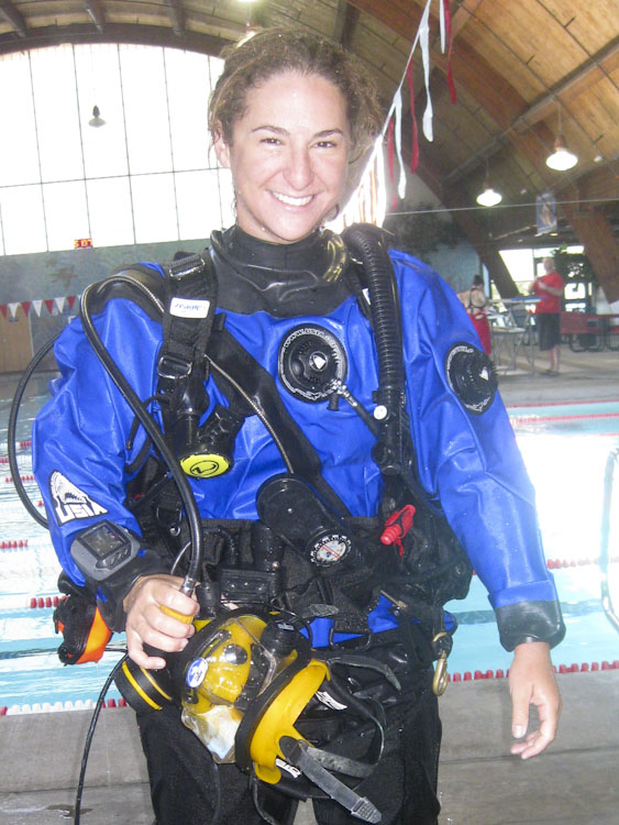
Brianne is 21 years old and is currently employed as an Interpretive Park Guide at the Channel Islands National Park. She is a Certified National Park Service Scuba Diver and a PADI Certified Rescue Diver. In the summer time, she participates in the “Live Dive” underwater video program which is held at Anacapa Island. Also, she teaches school groups and the public about the Channel Islands and the marine life found there. She is interested in education, outreach, marine biology and ecology.

Brianne is a transfer student from the Ventura County Community College system and maintained a 3.78 Grade Point Average. She earned a Certificate of Marine Studies from Oxnard College and published a scientific research project on the survival and settling patterns of Red Abalone, (Haliotis rufescens,) called “Larval Competency of Red Abalone.” She also completed a nine day internship with the Coastal Marine Biolabs in the spring where she extracted DNA from local rockfish species and uploaded sequences from a specific gene from the fish to the Barcode of Life Database.

Following her internship with the National Park Service, Brianne will be attending the University of California Santa Barbara’s College of Creative Studies Undergraduate Biology Program in the fall to do research on marine life.

Brianne will have three months to travel throughout the National Park System to see and experience firsthand how the oldest non-military diving program in the federal government manages its underwater heritage for future generations.

Share