Virtual Online Memorial Event for Dr. Glen Egstrom

You’re Invited to Dr. Glen H. Egstrom’s Virtual Online Memorial Event*

Access Link: https://youtu.be/NKUyZBOhY0o

Sunday, July 12, 2020
1:00pm PDT/4:00pm EDT – 2:00pm PDT/5:00pm EDT

Premiering the Tribute Movie – “A Life Well Lived”

The family of Dr. Glen H. Egstrom humbly invites you to a virtual, online
memorial to celebrate his life and contributions. “A Life Well Lived” movie
tribute by Emmy award winning filmmaker Adam Ravetch will be premiered.

Scheduled Remarks

• Opening Remarks    James A. Corry
Director Emeritus, Our World-Underwater Scholarship Society®

 • Adam B. Ravetch    “A Life Well Lived”

 • Mark V. Bensen
Nonprofit and Philanthropy Consultant
1974 Rolex Scholar, Our World-Underwater Scholarship Society®

 • The Egstrom Children 
Gail Egstrom Clarke
Eric “Buck” Egstrom
Karen J. Egstrom

 • Elvin W. D. Leech, MBE
Chairman, Our World-Underwater Scholarship Society®

• Donna W. Egstrom

• Closing Remarks    James A. Corry

View Glen Egstrom’s Written Tribute: Dr. Glen H. Egstrom

Memorial gifts towards the Dr. Glen H. Egstrom Diving Safety Internship can be made here.
You can designate the Egstrom Internship as you are completing your donation.
Please use “Add special instructions to the seller” to do this.

Share

Glen H. Egstrom, Ph.D., Biography

Glen H. Egstrom, Ph.D.

Founding Director, Past Chairman of the Board, and Director Emeritus

October 16, 1928 – October 7, 2019

“A Life Well Lived”

October 16, 1928 dawned as just another day in America.  Just a week earlier, the New York Yankees had swept the St. Louis Cardinals 4-0 to win the World Series.  American troops had been home from the trenches and battlefields of World War I for about ten years. Calvin Coolidge was the President of the United States, and though Americans had no clue what was about to befall them, the start of the Great Depression was just one year away.

However, this date was going to be very memorable for any number of folks who lived in Jamestown, North Dakota, a little town perched at the confluence of the James and Pipestem Rivers–population 8,000.  Jamestown was founded in 1872 to support a major Northern Pacific Railway repair yard near its James River rail crossing.  Known as the “Pride of the Prairie,” Jamestown is home to the National Buffalo Museum.

This date started unremarkably for electrician Milford Egstrom and his wife, Emily, who managed the Jamestown Bus Terminal and provided 24/7 taxi dispatching for the town; but by the end of the day, their lives would be changed forever with the arrival of their first child, Glen Howard Ole Axel Egstrom.  The extra middle names, Ole and Axel, were airplane pilots and best friends of Milford but were quickly jettisoned by Glen in young adulthood!  The entire family was delighted with Glen’s arrival, and his eight-year-old aunt, Norma Deloris Egstrom, was especially pleased.  Within 15 years, Glen and his family would have cause to be very proud of his “Aunt Norma” who grew up to become the famous singer and actress, the inimitable Miss Peggy Lee!

Glen grew up hunting and fishing the lands and waterways surrounding Jamestown, especially the James River and its associated James Reservoir, a 12 mile stretch of three interlocking lakes that had been formed by the Jamestown Dam.  Glen became a standout high school athlete in football, basketball, and baseball, garnering all-state honors.  Glen, an accomplished swimmer, also became a very popular local lifeguard.    

After high school, Glen headed for the University of North Dakota (UND) intending to play collegiate football.  During his freshman year, he severely damaged a knee.  The university brought a renowned orthopedic surgeon from the Minneapolis Lakers into North Dakota to repair Glen’s knee, but he never played football again and turned his attention to becoming a serious basketball athlete.  In the Spring of his sophomore year, Glen was taking a physical education class and was paired in a game of badminton with Donna Wehmhoefer. They soon started dating and were married shortly after their college graduation in 1950.

The newly married Egstroms headed to Tracy, California, where they both had obtained teaching positions in the local middle school.  They started their new jobs at the end of the Summer in 1950 just a couple of months after the start of the Korean Conflict. It took only until the Spring of 1951 for the Jamestown draft board to catch up with Glen and draft him into the U. S. Army.

Glen graduated as a Private from boot camp, during which he received Trainee of the Week honors from Major General Robert B. McClure.  He was sent immediately to the first Antiaircraft Artillery Officer Candidate School (OCS) and graduated with an officer’s commission and orders to Korea to serve as a platoon leader with the 3rd Infantry Division supervising field artillery. A few months after arriving in Korea, Glen was detailed to the U. S. Air Force 6147th Tactical Air Control Squadron and flew 28 combat missions as a Forward Air Controller in a T-6 aircraft providing close air support, aerial observation, and artillery spotting.  

While Glen was in Korea, Donna moved to Los Angeles and took a position as a Los Angeles County social worker.  1LT Glen Egstrom was released from Korea, placed on inactive duty and joined Donna on October 16, 1953 in Los Angeles.  Ultimately, he was honorably discharged from the Army Reserve with the rank of Major on July 26, 1965.   Glen decompressed from the stresses of war by heading to the Los Angeles beaches every day to surf and play beach volleyball.  In January, 1954, he enrolled in a Master’s program at the University of California – Los Angeles (UCLA) and was quickly hired as a teaching assistant (TA).  Within a short period of time, Glen became a player/coach on the UCLA Men’s Volleyball Team eligible, because he had not played volleyball at UND.  In 1956, armed with $25 of university funding and uniforms he borrowed from the UCLA Bruins Men’s Basketball team, Glen lead his team to Seattle where they won the national collegiate volleyball championship. 

Glen completed his Master’s degree at UCLA in 1957 and while he continued to be employed as a TA at UCLA, completed his Ph.D. at the University of Southern California (USC) in 1961 and was subsequently hired as an assistant professor of kinesiology at UCLA.    

During this time, Glen continued to love any activity related to the water and kept up the ocean swimming and surfing in Southern California while teaching at UCLA.   His foray into scuba diving was particularly interesting.  Aunt Peggy Lee was married for a brief period to actor Dewey Martin, who obtained some of the first regulators and scuba equipment that Jacques-Yves Cousteau sent into America via René Bussoz of Rene’s Sporting Goods in Westwood, California. These self-contained underwater breathing units he called “Aqua-Lungs.”  Dewey’s contract with the movie studio prohibited him from any dangerous activities, including scuba diving, and “Uncle Dewey” gave his double-hose regulator and twin cylinders to Glen in 1957.  While all this was happening, Glen and Donna were busy growing their family with the addition of daughter Gail (1954), son Eric known as “Buck” (1957), and daughter Karen (1961).  All three were quickly introduced to their parents’ love of the water and two became certified divers.  Gail qualified as a scuba instructor, Karen shared Glen’s love of sailing, and Buck became incredibly skilled at surfing and foil surfing.

Glen had become the faculty sponsor for the UCLA Skin and Scuba Club and asked the Los Angeles County Scuba program, considered to be the first scuba training program in the United States, to conduct a basic certification course at UCLA.  Once certified as a diver, Glen undertook the arduous Los Angeles County Underwater Instructor Certification Course in 1964 to become a certified instructor and graduated with the Outstanding Candidate Award.  He served as its President 1967-1970.  In 1964, Glen was appointed the UCLA Diving Officer, a position he held until 1992.   Glen was notorious throughout the diving community for his nine-month scuba instructor training course (ITC) at UCLA.  One observer of his ITC was quoted as saying, “Egstrom ain’t training scuba instructors; he’s training university diving officers!”  His scientific and recreational diver training program at UCLA was highly acclaimed, graduating hundreds of divers and instructors who themselves continue to make considerable contributions as part of Glen’s legacy.

In 1966, Glen became a member, instructor and instructor trainer with the National Association of Underwater Instructors (NAUI) and maintained his membership for life.  Glen served as NAUI’s president from 1970-1975 and held a variety of leadership/advisory positions from 1970-1995.

During this period, Glen served as a reserve deputy sheriff with the Los Angeles County Sheriff’s Department, their Diving Safety Officer, and an active member of the Sheriff’s Reserve Marine Company 218. Glen retired in 2004 with the rank of Captain.

Over the years, Glen provided exemplary leadership to many other organizations, especially during their formative years.  Organizations such as the American Academy of Underwater Sciences (AAUS), American College of Sports Medicine, Council for National Cooperation in Aquatics, Divers Alert Network (DAN) , Human Factors and Ergonomics Society, National Science Foundation’s Office of Polar Programs, Marine Technology Society,  National Spa and Pool Institute (NSPI) and the Undersea and Hyperbaric Medical Society (UHMS) all benefitted from Glen’s leadership and counsel.  The organization to which he was most committed was the Our World-Underwater Scholarship Society® which he helped found.  To this special group, he provided enduring leadership and instilled within it his lifelong commitment to “investing in people.”  His natural leadership gifts allowed Glen to create, build, and serve communities that continue to help people safely experience the underwater world.  

Glen was the ultimate “people collector,” and anyone invited to his Mar Vista dining table was thrilled to be part of so many loving, thoughtful, and provocative discussions that often lasted late into the evening.  Many were additionally thrilled to have been invited to dive with Glen earlier in the day–only to discover that dinner was dependent upon what they harvested from the sea!

The reader is encouraged to read the reference material below to appreciate Glen’s voluminous awards and publications, but he was especially proud of his collaboration with his good friend, Arthur J. Bachrach, PhD, in their publication of the definitive work, Stress and Performance in Diving.  One of his greatest joys was conducting humorous and famously creative seafood cooking workshops with Dr. Bachrach.

Glen retired from UCLA in 1994 and was awarded the status of Professor Emeritus – Kinesiology in the Department of Physiological Sciences.

It is difficult to fully explain anyone’s life and contributions, especially a life so wonderfully complex and multidimensional as Glen’s.  Though deeply committed to family and friends, Glen had a singular mission in life– to introduce, share, and teach people to safely explore the underwater world he so loved and to train others how to instruct and safely conduct those same in-water activities. This personal mission helped focus his considerable talents with a clarity and passion few others ever achieve.

At Glen’s core was a huge and generous heart called to service; first in Korea as an Army officer and later, to serve so many important communities including his family, friends, academic colleagues, fellow diving instructors, his students, and indeed all those he believed had potential to make a real difference in the world. He had a primal instinct to keep those around him safe, especially those he identified as needing special help to become confident in the water.  He spent a lifetime working to understand and solve problems associated with diving fitness, performance, and safety.  He tested, analyzed, developed, innovated, and reported on nearly every aspect of how diving/aquatic equipment and aquatic facilities and locations could be made safer.  He worked tirelessly to make aquatic instruction of all varieties and the creation and review of safety standards a more scientific, professional, disciplined, and rigorous undertaking. 

Throughout his life, Glen loved being a member of a team and simply being underwater.  As he traveled the world teaching, learning, and exploring, he retained his fascination with nature and the wonders of our place in that world which he had nurtured in those boyhood explorations of the James River. To his students and colleagues, he often voiced his awe of the human capacity to create and to evolve.  He lived his life with courage and passion, and all of humankind’s explorations of the aquatic world are forever safer because of Glen’s contributions and body of work. 

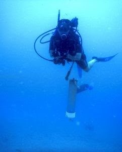
Those who experienced Glen’s exemplary leadership, many of whom built their careers under his tutelage and mentorship, share a powerful image of this man in his element.  He is standing in the breaking surf, in full scuba gear, a speargun in one hand, and a “diver down” float in the other—looking over his shoulder with that familiar, compelling expression that said, “You comin’?  Follow me!” 

In honor of Dr. Egstrom, the board of directors of the Our World-Underwater Scholarship Society® voted unanimously on June 5, 2020 to establish the “Dr. Glen H. Egstrom Diving Safety Internship.”

The Egstrom family is grateful for the outpouring of tributes to Glen and expressions of sympathy to the family.  They also appreciate memorial gifts to the Dr. Glen H. Egstrom Diving Safety Internship administered by the Our World-Underwater Scholarship Society®.

REFERENCES

International Legends of Diving – Glen Egstrom Bio

Journal of Diving History – Glen Egstrom Tribute by Dan Orr

Xray Magazine – Glen Egstrom Tribute

Los Angeles Times – Glen Egstrom Obituary


Share
Link

Since we are unable to get together in New York City this year, we hope you will join us for our virtual event.

Saturday, June 6th,
4pm EDT – New York
3pm CDT – Chicago
1pm PDT – Los Angeles
9pm BST – London
10pm CEST – Berlin
6am AEST (Sunday, June 7th) – Sydney

We’ll have video messages from our returning 2019 Scholars and Interns.
We will also check in with some of our alumni to see what they have been working on, and we’ll hear from Dr. Joe MacInnis who will provide us with some inspirational words.

We will wrap up the presentation with an announcement of the new Society Interns and Rolex Scholars who will start their experiences in 2021.

If you are unable to join us at the scheduled time, the event video will be available following the event.

https://youtu.be/01PNRBkw3s8 

Share

COVID-19 Effects on the Our World-Underwater Scholarship Society®

Due to the unprecedented circumstances of the coronavirus (COVID-19) pandemic, the Our World-Underwater Scholarship Society will defer the 2020 Rolex Scholarships and the 2020 Internships until Summer 2021. Additionally, the Society’s annual Symposium and Rolex Awards Ceremony, scheduled for June 6, 2020, in New York City, will be moving to an online, virtual event.

The decision to postpone was not easy, especially having just recently selected three new Rolex Scholars and five new Interns. However, the Board of Directors of the Society recognizes the seriousness and continually evolving nature of the pandemic; therefore, the Board decided it would be irresponsible and potentially unsafe to send Scholars and Interns out into the world at this time. All have agreed to defer appointment until 2021, and a formal announcement of the 2020 Scholars and Interns will be released soon.

Each year, the Our World-Underwater Scholarship Society hosts an annual weekend to honor and celebrate the Society’s returning Scholars and Interns, as well as to appoint new Scholars and Interns for the upcoming year. This year, the annual weekend was moved to June to coincide with World Oceans Week.

Given the current travel and stay-at-home restrictions, as well as social distancing guidelines, the Society must cancel this year’s in-person events. In its place, we will hold an online, virtual event, or possibly multiple events. Exact details are still in development, but we still hope to have presentations from the returning Scholars and Interns as well as the world premieres of the films from the 2019 Rolex Scholars.

It is always a great pleasure to bring the Society ‘family’ together each year in New York to renew friendships, celebrate our Interns and Rolex Scholars, and acknowledge the efforts of our volunteers. We, as a Board, are disappointed that we cannot meet in-person this year. However, though we may not be able to gather together, we can assemble apart and present an opportunity to allow people to join in from around the world.

It is more important than ever that we celebrate success while we recognize the challenging times we are all facing.

I look forward to celebrating with you all soon.

Steve Barnett
President
1990 Rolex Scholar

Share

Coming to an End


After departing the tropical islands of Hawaii, I knew I had one last leg of my internship before it was all over – a visit to the Department of the Interior (DOI) in Washington D.C. to tell a bit of my story to the folks working in the Washington offices of the NPS. Now I had never before been to D.C., so along with some high-level DOI/NPS presentations I had a bit of sightseeing planned.

I was scheduled to do two lunchtime presentations in the Department of the Interior, one general for anyone who wanted a little midday entertainment and another a little more exclusive one for some of the assistant directors. Before arriving, I had to undertake the difficult task of consolidating my 4.5 month internship into a 45 minute presentation. This proved to be a bit of a challenge for me, especially when I wanted to include all my favorite photos, but something I managed to complete eventually.  After a couple days of sightseeing, where I visited the monuments and museums of the National Mall, I met up with my contact on the inside of the Department of the Interior, Cliff McCreedy.

Myself and Cliff McCreedy outside the Department of the Interior

Cliff, who works for the NPS as a Science and Stewardship Coordinator, has been the Washington contact for the OWUSS NPS interns for a while now. He gave my presentation a quick overlook to make sure it was up to par and then gave me a brief tour of a bit of the DOI offices before the presentations. Not necessarily a superb public speaker myself, I was a bit nervous to be presenting to all of these Washington employees, especially some of the Associate Directors who I was told would be coming. However, these audiences were a delight to present to. Everyone seemed interested in the content and had lots of thoughtful questions to ask. I was happy to be able to show a short video of some of my dive highlights to the audience as well, which was also well received. You can see that video here if you’re interested.

I’m happy to have had this opportunity to present a summary of my internship to some of the NPS employees who don’t get to go out into the field much – it’s a nice way to share some of the science and programs that the Washington branch of the NPS works to support and manage. Summarizing my experiences over the past few months also helped me reflect on it myself and take it all in. It’s been a wild journey of a summer. Over the course of my internship I did 201 dives, adding up to 138.36 cumulative hours underwater (almost 6 days!), in waters around the country ranging from 36-90 degrees Fahrenheit. Across these dives I got to experience a diverse array of the science, maintenance, and outreach that occurs in the waters managed by the NPS – experiencing stuff that was wildly new to me and stuff that was comfortably familiar. I travelled more than I ever had in year, flying up to 15 separate flight lets and staying in 24 different lodgings. This was a learning experience in itself, and I got more than my share of newly discovered travel tips and learned a lot of what not to do. Alongside all this, I think the most impactful part of my summer for me was my growth as a photographer. That was a big personal goal throughout my internship, and thanks to the support of the Submerged Resources Center, Our World Underwater Scholarship Society, and the many Parks and affiliated groups I worked with, I’m proud to say I’ve learned and grown a huge amount. Over my internship, I created over 665 GB of photos and videos, including some of my favorite images to date. This is not something I take for granted, and I am immensely grateful for the opportunity provided to me. After this summer and the experiences I undertook, I finally feel as though I can pursue underwater photography as a full time career, something that I never really imagined would be possible and that I am very excited to follow through with. This experience undoubtedly changed my life for the better, so thank you so much to all who helped make it possible. I’d like to extend a final thank you to you, the reader, who may have been following along with the blogs from the beginning or may have just joined in at the end. I appreciate the support throughout this journey and hope you tune in the upcoming years to follow the adventures of my predecessors. Now, I look forward to the future, which is much brighter and more laden with opportunities than I could have imagined.

Share

Franziska Elmer: Influential Scientific Diver and Mentor to OWUSS Interns

At the Our World-Underwater Scholarship Society’s 45th annual meeting, held in New York City in May, four of the five incoming OWUSS interns for Summer 2019 discovered a common connection: a tie to diving and passion for science that could be traced back to work with Dr. Franziska Elmer.

2019 OWUSS Interns (Left to right) Ben Farmer, Abbey Dias, Kyra Jean Cipolla, and Liza Hasan at the 2019 OWUSS annual event.

“Fran” is a professor and research mentor who is known by students for her work at CIEE Bonaire and School for Field Studies Turks and Caicos (SFS TCI). Fran is from Switzerland and has her Ph.D. in Marine Biology from Victoria University of New Wellington (New Zealand). Her focus is on coral recruitment and calcium carbonate budgets, as well as on the macroalgae Sargassum sp. She is currently a professor of Marine Ecology at SFS TCI and uses 3D modeling to study coral reefs and hurricane damage. She is also working with other SFS TCI faculty in collaboration with the world-renowned biochemical algae lab at Greenwich University in London to find possible products that can be made from sargassum such as fertilizer and biofuel. The floating sargassum rafts accumulate near the TCI and wash up on the beaches, which can cause harm to existing seagrass ecosystems. The ultimate goal is to use the sargassum for biofuel in the TCI and reduce the importation of fossil fuels to the islands.

Fran also has an interest in the infection of reef fish by the dermal parasite Scaphalocephanus expansus and is monitoring the parasites present in the TCI.

Franziska “Fran” Elmer, Ph.D.

Abbey Dias (DAN/OWUSS Dive Safety Education Intern) and Kyra Jean Cipolla (Dr. Lee H. Sommers AAUS Scientific Diving Intern) met during their semester abroad studying marine science in the Turks and Caicos at the School for Field Studies. There, they took Fran’s Marine Ecology class and were both part of her research team studying topographic complexity of corals and biodiversity using 3D photogrammetry.

“Fran is one of the most fun people to work with on land and underwater. She is innovative and pays close attention to detail. She taught me how to write my first full-length scientific paper, how to make ‘nice cream’ out of frozen bananas, and multiple different ways to make a meal out of sargassum! Her ingenuity and commitment to conservation are inspiring. She supported me when I wanted to design my own research project and provided me with the guidance and encouragement I needed for it to succeed.” – Abbey Dias

“Not only does she teach science well, she is a model at marine conservation and an advocate for sustainability. During the semester that I spent with Fran, I could tell she really wanted her students to do well, and she always communicated with us about opportunities, new research technologies and techniques, and gave us great advice on how to be effective scientists. She definitely helped me grow as a marine scientist, and I wouldn’t have succeeded as the AAUS Scientific Diving Intern without knowing and learning from Fran.”—Kyra Jean Cipolla

Fran (bottom right in pink) diving with students Abbey (in blue) and Kyra (blue fins) in South Caicos, Turks and Caicos, to conduct coral reef research during Fall 2019 at the School for Field Studies.

Liza Hasan (AAUS Mitchell Scientific Diving Research Intern) and Ben Farmer (Dr. Jamie L. King REEF Marine Conservation Intern) also knew each other previously through their study abroad program at CIEE Bonaire.

“[Fran’s] mentorship on my coral disease research project is what truly sparked my passion for marine research and fieldwork… She showed me how to be an intense researcher that gets a lot of things done, while also staying passionate about what you believe in, and having fun doing it. I could not have asked for a better mentor to direct me into the world of tropical marine science, and I am overjoyed to be rejoining her again in Turks & Caicos in the fall, this time as a Waterfront Assistant. She was one of the people that inspired me to stay involved with the education abroad world, and I am very excited to work alongside her soon!”—Ben Farmer

“Dr. Elmer inspired us all with her personal testament of what the pristine marine world looks like through her experiences on the Palmyra Atoll. I was inspired by Dr. Elmer to seek out interesting field positions and educational experiences far and wide after learning about the previous positions she has held. It was Dr. Elmer who suggested that my fellow CIEE students and I apply for internships through Our World-Underwater Scholarship Society. It is no coincidence that four of Dr. Elmer’s students across two different study abroad programs have received Our World-Underwater Scholarship Society internships. Not only is Dr. Elmer dedicated to research and conservation, but she is dedicated to her students.”—Liza Hasan

Fran (peeking out from the middle of the back) preparing to dive with students Liza (far left) and Ben (far right) in Bonaire.

Aside from scuba diving and marine science, Fran is passionate about art and environmental conservation. She is currently working to fund the purchase of a device that will turn plastic waste into useful items such as flower pots for the small island of South Caicos, where the SFS center is located.

This upcoming year, Fran will take a climate change sabbatical which will allow her to develop a number of projects. The first is to begin project management of offshore sargassum harvesting research for carbon sequestration and biofuel sources. Then, she will then bike 1,800 miles across seven countries while documenting environmental projects taking place along the Danube river, starting in Germany. Finally, Fran will organize the Caribbean section of the Global Coral Reef Week symposium, and increase accessibility to students and the general public.

Abbey, Kyra, Liza, and Ben would like to thank Fran for her hard work teaching students like us about the importance of marine ecosystems and ocean conservation. Fran’s influence on these interns has been incredibly important to their interest in pursuing careers in marine science and advocating for the protection of our ocean.

Kyra Jean and Fran on the last day in TCI.

Abbey and Fran on the last day in TCI.

Ben and Fran working together in TCI.


Share

Remembering the Fallen – Diving the Wrecks of the Pearl Harbor Memorial

The USS Arizona Memorial from Ford Island

December 7th, 1941, marks the most devastating attack on American soil in history. Early that fateful Sunday morning a surprise attack by Japanese fighter planes struck the Pearl Harbor Naval Base near Honolulu, Hawaii, and inflicted catastrophic damage. In under two hours, these fighters managed to destroy or damage almost 20 American naval vessels, over 300 airplanes, destroy airfields and support structures, killed over 2400 citizens and wounded around 1000 more. Out of all the casualties, almost half of them were from the USS Arizona, a battleship that was struck by an 1800-pound bomb. Detonating in its powder magazine and bringing down the ship with over 1000 crewmen inside, this vessel is one of the only two who still remain in their final resting places. Nearly 78 years later, as my small propeller passenger plane circled over the harbor waiting for clearance to land, I looked down on the hull of the Arizona, silhouette barely visible under the brown harbor water, and wondered what I’d see down there. I had heard stories from others who’d dove the wreck in the past, but still couldn’t really prepare myself for what was to come.

The USS Arizona Memorial from the sky

I was only visiting Pearl Harbor National Memorial for a few days, the first to do some diving and the next two for some other projects. On the morning of September 11th, Dan Brown,  Park Diving Officer, picked me up from my AirBnb and took me on base. Pearl Harbor is a massive military base, which was pretty flabbergasting to me. I hadn’t really realized they came this big, and was amazed to see all of the housing, speciality stores, and amenities that were hidden inside. Dan took me to the Parks dive locker, where I met Scott Pawlowski, Curator and diver for the Park. After some quick introductions, we gathered all of our gear and drove out to Ford Island to get to work installing new buoys on the USS Utah. The Utah is the second of the two vessels that remains sunken in the harbor, after recovery efforts on it failed. This ship, a retired battleship that had been converted to a target ship, was struck by torpedoes on December 7th and capsized, taking around 58 crewmembers with it. Recently, one of its marker buoys had drifted off, creating a submerged hazard that nearby boaters could collide with. I was to accompany Dan and Scott as they replaced the existing buoy and added a new one, while photographically documenting the swaps so they could use the photos to train new employees.

The USS Utah, with the memorial in the background

We arrived at the Utah right after a 9/11 memorial was wrapping up. As the final staff members picked up the last chairs and tables, we dragged our dive gear across the grass and started gearing up. Now, the significance of diving in Pearl Harbor on 9/11 wasn’t lost on me – visiting the site of the most deadly attack on US soil 18 years after the second most deadly attack certainly made things a little more intense. I also had no real idea what to expect. I’ve dove on a couple wrecks before, including ones with a loss of life, but none this substantial and with such a historic impact on my country. I was expecting a quiet, low-vis wreck dive didn’t know what it would be like doing that on these historic sites.

Swim-through on the USS Utah

Unlike the Arizona, the Utah is not nearly as much of a tourist site. It doesn’t have a huge memorial built over the wreck or get visited by thousands of people a day, instead sits on the other side of Ford Island near a quiet field in front of a memorial pier, making for a softer and more reflective experience. We took advantage of this more secluded nature and jumped on a visitor-less window to suit up and swim out towards the wreck. Just breaching the surface in front of the pier, rusted shards of the hull and the side of the deck jut out to the water make this wreck seem dynamic and even more aged than it is. We drop into the water and I follow Dan and Scott to the stern. The ship is now laying on her side, making for a disorienting dive as you swim along it, especially in low-visibility conditions. Eager for photos, I made a couple quick stops to capture something before realizing that I was quickly losing sight of my buddies in the murk. It took a lot of self-restraint and careful, watchful navigation to not get lost here. After a little bit of swimming, we arrived on the stern, the anchoring site of the recently escaped buoy. Here, I got into position and snapped away as Scott masterfully tied in a new buoy. After a couple minutes and a lot of shutter actuations later, I found myself swimming back along the heavily listed deck towards the bow. 

Scott securing the buoy to the wreck

On the return, navigation was a little easier as it was now my second time making the trip, but I still noticed things I hadn’t seen before (and still had to utilize the entirety of my self-restraint to not fall behind taking photos). I passed stairs plunging below deck, swam past windlasses and marveled as giant 15-foot guns materialized into view before me. This was a bit ship, and the murky waters just added to the mystique of the experience. New, mysterious things would appear in-front of you as you swam along, giving you seconds to take in and process them before the next round of surprises would appear. Before I knew it we were back at the bow where we had started, and Scott and Dan went right to work switching out the last buoy.

Dan replacing the remaining buoy on the USS Utah

Our dive on the Utah was a quick one, as Scott was flying later and had to be out of the water in time for a sufficient surface interval. This fast-paced timeline, along with the fact that I had work to do and didn’t want to disappoint, meant that I didn’t really think much of the history of the ship while I was diving on it. For the Utah that realization came later while I was standing on the memorial pier after changing out of my dive gear. Looking at the rusted remains that rise out of the water and the bronze plaque commemorating the fallen, I thought about what it might have been like to go down with that ship, to be trapped below deck when it capsized that dreadful Sunday morning. A frightening thought, and something that I knew would be on my mind later when I’d be diving the Arizona.

One of the guns on the USS Utah

After a quick lunch with Dan, we set off to our prep point for the Arizona dive. This would be different for a few reasons. The Arizona gets many more visitors than the Utah, with more than 1300 a day visiting the memorial, so we had to try our best to not be distracting (which is tough, as SCUBA divers are incredibly interesting to many people). We had a different task – this time I was to photograph marine life on the wreck, for the NPS to use in creation of outreach materials – so I had to put my head in a different place and prepare myself mentally for a new job. It’s a larger vessel, about 100 feet longer than the Utah at 608′ total length, meaning we had to be more attentive to navigation. Finally, we had a time constraint – the Navy had some sonar tests planned at a nearby dock, so we had to be out of the water before those started.

The bow of the Arizona in murky harbor water

With all of this information swimming around our heads, Dan and I swam out to the marker buoy on the bow as stealthily as possible and dropped in. Visibility was slightly better here, shifting between 5-12 feet, so I quickly got to work and started snapping away at anything alive. Photos of biological life are my favorite types of photos to take but I knew I still had to work hard to capture compelling images of it in low visibility, especially when most of the life is encrusting invertebrates. The hull of the ship is completely covered in life of all kinds, as hard structure in a silty harbor environment attracts many different species. Sponges, tunicates, bryozoans and corals adorned the deck and structures and turned them into a multicolored array of life. These organisms, while intricate and beautiful, are a bit hard to glorify with a wide-angle lens (which I had equipped), so I focused on juxtaposing them with the wreck itself for greater impact.

While swimming along the deck of the Arizona, it really became clear just how large this ship is. Resting face-up in a sea of mud, diving this sites wasn’t nearly as disorienting as the Utah, and travelling along it allowed for a full comprehension of exactly what you were on. Seeing some of the large, intact structures that remain on the ship, like the huge barrels of the 14-inch gun turrets, was a stark reminder of what you were on – a battleship.

As I was photographing life on the wreck, I also took some time to capture snapshots of little reminders of what occurred here. Unlike the Utah, the Arizona still has a lot of artifacts from the crew who used to live there. Its ‘gentle’ descent to the harbor bottom likely assisted in this, so some items still lay on its silent decks. During our dive we passed things like a pitcher in what used to be the galley, or the remains of an unlucky crew member’s boot.These served as a solemn reminder of the tragedy that occurred here years ago, and that the past occupants of these silty decks, despite the years in between and occupational differences, were just as human as I am.

Interspersed with moments of reflection and focused shooting, I was hit with tinges of panic relating to a very pertinent issue for me in that moment – I was working with critically low camera battery. After our Utah dive, I had forgotten to turn my camera off, which normally is a non-issue as it automatically goes into a battery-saving sleep-like mode. However, a recently developing sticky shutter problem that I was battling caused the camera to stay active the entire surface interval, draining my precious battery-life and threatening to cripple my ability to work. This, unfortunately, was not an issue I noticed until I had descended into my dive, starting off with a pitiful 24% battery. I was now stricken with a difficult dilemma – trying to conserve my battery long enough for it to last the entire dive, while also wanting to photograph everything I saw on this once-in-a-lifetime dive. This was especially stressful as I again wanted to deliver on my task to produce good images of the life on the wrecks, and shooting incredibly conservatively to sustain a dying battery isn’t always the best way to do that. Thankfully, fate worked out in my favor and I managed to stretch the battery to last the whole dive (with a whole 4% to spare at the end too).

Stairs going below deck on the USS Arizona

When we reached the stern of the ship, we visited two locations that were especially somber to me. The first one was seemingly innocent – the empty turret where some of the rear guns used to lie – but has a different use today. As we dropped down into this cylinder, somewhat reminiscent of a large smoke-stack, we were met with a large deposit of fine silt with a rope descending into it. This, as Dan signed to me, was where survivors of the bombing can choose to be laid to rest. Out of the 1512 crew members on board, around 300 of them survived the attack. If they desired, their cremated remains would join those of their crewmates in the Arizona itself, and the way in was through that silt. The remains would be lowered below deck through a hole in the base of the turret in an elaborate ceremony. Being in such close proximity to a way into this ship, which effectively is a tomb for the 1000+ people who went down with it, as well as thinking of what it must have been like for the survivors, who lost so many of their friends and chose to be buried with them, made this a very meaningful moment. The other location was the portholes on the side of the ship. Unlike the silt in the remains of the turret, these portholes were literal windows into the ship, glimpses into the dark insides of a deep tragedy. It was odd looking in these and thinking that no one has been inside these rooms in almost 80 years, and that the last time they were occupied something absolutely terrible happened. Furthermore, there was an ebb and flow of water coming in and out of these portholes. Out of place in an otherwise calm harbor, this must have been caused by slight currents moving through the hull of the ship, travelling the maze of passages inside. To me, this dynamic movement made the Arizona seem alive in a way I hadn’t seen before. I thought about what the current had passed by on its journey through the ship, how it had brushed past things that hadn’t seen the light of day in decades.This flux of water in and out of the ship seemed to compliment the sentiment around the memorial. Despite being entombed in the vessel indefinitely, the memory of these lost sailors was still very much intertwined with the outside world, with sentiments constantly coming and going with the tides.

A porthole on the USS Arizona

Coming up from the dive, I had a lot on my mind. Along with lots of questions for Dan that I just couldn’t figure out how to communicate to him underwater, I had also just dove on what is essentially a mass grave. I’m not naturally a somber person, but it came pretty easily here. Looking past the loss of life, its also a pretty cool dive, so I was a bit excited. Diving on a battleship itself is a rare opportunity, but diving the one whose sinking essentially kickstarted the US’s participation in WWII  – a pretty incredible chance to explore a historic site in a way that only a really select few are able to. Still buzzing from that dive, I headed home that night eager to look through my photos and to log my dives. I had a lot to write down.

The rope on which remains of the Arizona survivors are lowered into the ship

The next day I met Dan at the visitor center and started to look through my photos with him. We wanted to select a few shots of life on the wrecks, identify the life, and then to create some informational material for visitors. I had edited and picked some selects the night before, but the identification proved to be a more difficult task than initially thought. Almost all of the selects I had chosen were of invertebrate life, as the few fish I had seen on my dives hadn’t been agreeable subjects. Invertebrates, to those from a non-biological background, can be a bit difficult to identify sometimes. While family and genus are sometimes easy, locking down the exact species can often be pretty tough, sometimes requiring time-intensive keying out or even a microscope to pick out defining features. To make this even more difficult for us, we didn’t have an ID book on hand and had to resort to internet guides. Thankfully, quite a few of the species were common ones, and we had the assistance of local experts like Eric Brown via email, so we were able to lock down a couple IDs for the outreach project. After this, I helped Dan with a few errands around the base. This was a cool opportunity to see more of it, still very exciting for me as I’d never spent much time on any base before, let alone one this size. It was thrilling to drive along and see huge battleships moored beside the road, and Dan did an excellent job showing me some of the historic sites the base had to offer.

The USS Bowfin

On my final day at PEARL, I did some sightseeing. Scott was nice enough to hook me up with a Pearl Harbor Memorial Sites Passport, which includes admission to the Arizona memorial as well as three of the other historic sites on base : the USS Bowfin, the USS Missouri, and the Pearl Harbor Aviation Museum. This was a long day of tourism, but was a highly educational experience. It was nice to learn more about the war and the event that started it for the US, certainly put the last couple days in a bit of context. I thought the Memorial and it’s associated museums did an excellent job portraying the attack from both sides – the US and the Japanese. They included eyewitness testimonies from veterans from both countries, highlighting above all that this was a human war, hurting people from each land, not just a faceless enemy murdering for pleasure. I also found touring the USS Missouri very interesting. The battleship where the treaty ending the war was signed, the Missouri is open for visitors to go inside and explore its halls and rooms. This put the Arizona in a new light for me, as it revealed just how huge that ship really is. It’s hard to comprehend while swimming along the deck how much of the ship is closed off and hidden away, buried under mud and impossible to see, but walking the never-ending halls of the Missouri opened my eyes to the immense area below deck where most of the life on these ships really took place.

The USS Missouri

Visiting the Pearl Harbor Memorial was a very impactful experience for me. Diving on and seeing these historic sites in person is powerful and hard to describe. The memorial does an excellent job of honoring those who passed. Despite having passed decades ago, these lost crew members still influenced the hundreds of visitors who view the memorial every hour, people who come to learn and pay their respects. Their sacrifice, whether or not it was in defense of a mutual belief between the crew and the tourists who come, was a human sacrifice. They lost their lives defending something that was dear to them – their country, their freedom, their families. It doesn’t matter whether or not people viewing the memorial agree with US foreign policies or even agree with the US’s position in the war. Everyone can emphasize with giving your life to protect what you stand for.

The names of the fallen in the Pearl Harbor Memorial

Leaving Pearl Harbor was significant to me for one more reason – it marked the last park in my summer of adventure. After a short week off, I would be flying off to DC for some final presentations, before ending this wild internship. While sad its all coming to an end, I think PEARL was a fitting end to this journey. Starting off, I learned how the NPS works to preserve submerged archaeological treasures, then how they monitor and protect biological resources. Travelling to Kalaupapa, I saw how they protected historic sites to ensure sensitive past transgressions aren’t quietly swept under the rug, and at Pearl Harbor I saw how they preserved and honored the memory of those who gave their lives for our country. Feeling as though I had experienced a diverse array of the places and resources that the National Parks Service works to preserve, I now felt ready to go to DC and share what I’d experienced.

The USS Arizona Memorial

Share

An Isolated Paradise -Marine Monitoring at Kalaupapa National Historic Park

Kalaupapa National Historic Park is one of those places that you can tell is special from the moment you get there. Isolated from the rest of the Hawaiian Islands by towering sea cliffs and from the rest of the world by thousands of miles of open ocean, this small peninsula was once a colony for people with Hansen’s disease (or leprosy), reminding us that even the most beautiful places can be a prison. Under orders from King Kamehameha V of Hawaii, victims of this disease were snatched up from their lives with little to no notice and indefinitely interned on this remote peninsula. Facilities were minimal and compassion was almost entirely absent. The patients were left to live in isolation, unable to have any type of physical contact with visitors, from 1866 until the end of mandatory isolation in 1969.

Bay View Housing, formerly for the patients but now occupied by NPS employees

Since the cure of the disease, the settlement has become a much happier place, with some of the patients choosing to stay on what is now their home despite the lifting of travel and visitation restrictions. Around 9 patients still live on the settlement, with the rest of the residents being employees of the NPS or the Department of Health, who remain on site to maintain and support the park and patients.

My visit to Kalaupapa wasn’t always in the books. Due to personnel changes in the park (the long-time marine ecologist, Eric Brown, moving to a new position in American Samoa), I was told that I wouldn’t be able to visit during my internship as the annual marine surveys wouldn’t be taking place. While in Channel Islands National Park, I met Kelly Moore (who is taking the Kalaupapa marine ecologist position) and learned that the surveys were back on the schedule and were going to take place right after my time on the islands ended. After some quick arrangements with various parks service folks, I found myself on a flight out to Hawaii just two days later, eager to join up with a new team.

My ride into the settlement

When the strict isolation laws of Kalaupapa were let up, the governing of the peninsula was turned over to the patients. In order to retain control of the land that is now the only home that most of them know, they set up some rules to ensure that it remained a happy place for themselves. These rules include ones like no children under the age of 16 (as historically children weren’t allowed on the settlement and any birthed there were taken from their mothers as soon as they were born, so children spark unpleasant memories for some patients), a strict limit on the number of visitors allowed, and an escort required for all visitors outside the settlement grounds. The last rule was the first one that I noticed, as I wasn’t allowed to leave the airport until my park sponsors were there to pick me up.

The peninsula and settlement from the sky

Landing on Kalaupapa’s airstrip in a small, 8 person passenger plane, I walked across the tarmac and picked up my luggage to be greeted by Sheila McKenna, marine ecologist with the Pacific Parks Inventory and Monitoring,  and Glauco Puig-Santana, a biotech working for both Pacific Parks I&M and Kalaupapa. From there, we rode into town and met Eric Brown and quickly began to orient ourselves on the survey protocol. We had a lot of sites to get done, around 20, and a short window to complete them all so we got right to work.

Pre-dive setup

Following a typical I&M protocol, these surveys were straight forward. Eric Brown, a seasoned Kalaupapa surveying veteran, handled the fish counts, while a buddy (either Sheila, Glauco, or myself) would cover the benthic photoquadrats to determine bottom cover. Temporary sites, ones that were randomly selected each year, had an added survey type – rugosity measurements. This required another diver, who would work with Eric to reel out and lay down a rugosity chain while the benthic diver finished their photoquadrats. This chain was reeled out along the transect line and laid flush with the bottom, following all contours. Once it reached the end of the transect, the length of chain laid out would be counted to give a measure of benthic complexity. The more chain was laid out over the 25m transect line, the more complex the rugosity was.

The team laying down a rugosity chain on transect

Permanant sites, ones without rugosity, were alot easier and faster than the temporary ones. With only fish counts and benthic photoquadrats to complete, the work went by pretty quickly. Working as a photoquadrat diver was a pretty good deal too. You’d have to wait for Eric to get some headway on his fish counts before starting, which gave you a little time to look around and enjoy the site. I took full advantage of this free time and took my fill of photos.

Glauco Puig-Santana taking some benthic photoquadrats

Another important part of the surveys, something that happened at both temporary and permanant sites, was water quality measurements with a sonde. A sonde is a multiparameter that collects data with six user-replaceable sensors, collecting a wide variety of data, ranging from conductivity and temperature to turbidity. This high-tech piece of equipment would be used to compare subtle biotic and abiotic differences between sites and see how they might influence biological life.

The sonde working away taking measurements

For the first couple days our team consisted of Eric, Sheila, Glauco, myself, and Randall Watanuki. Randall, a long-time employee of Kalaupapa, covered the boating as he was highly experienced with it and had a recent injury that kept him from diving. We started off with some easy sites close to town, on the leeward side of the peninsula. Kalaupapa is subject to high winds, making the leeward and windward sides of the peninsula have drastically different weather.

Randall Watanuki, our expert boat operator

Shortly after knocking out a couple easy protected sites, we got a weather window allowing us to venture over to the exposed side. This area is rarely visited by anyone due to its remote location and exposed nature, so it hosts some of the finest diving on the peninsula. It also has some very dramatic views of the sheer sea-cliffs and assorted islands. The north shore of Molokai has some of the highest sea-cliffs in the world, which made a lovely backdrop for some fieldwork.

Those are some serious sea cliffs

The diving in Kalaupapa NHP was beautiful and different from anything that I’d done before. Unlike a lot of the rest of the state, there aren’t any aggregated reefs surrounding the peninsula, but instead lots of scattered individuals of cauliflower and antler corals. This is a low, but relatively stable, coral cover and is pretty healthy, with a low frequency of disease and bleaching. The seafloor is a lava boulder habitat, composed of primarily large chunks of bedrock and huge scattered boulders, making lots of sharp relief and fun diving. While the corals and rocks are cool, the fish life is what makes Kalaupapa really shine. It boasts a high fish abundance and biomass, the highest in the main Hawaiian Islands. With very little fishing pressure, these fish are free to thrive without fear. These waters were also incredibly clear, with some of the best visibility I’ve experienced.

Hidden on the far side of the peninsula was an incredible treat. Underneath one of the few islands dotting the clear blue waters was an awe-inspiring structure – a massive underwater arch, allowing for a swim-through underneath the island itself. Around 70 feet tall and 30 feet wide, this was a truly unique experience unlike anything I’d done before. I had heard about this from past interns and was sincerely hoping I’d have a chance to visit it myself, and thankfully Eric found some time at the end of a long survey day to take us over. Our trip through this arch was made even more special by a visit by two turtles, who gracefully glided around the opening. It really was a dive to remember.

Each dive day was meticulously planned out by Eric Brown. The high potential for rough weather meant we had to take full advantage of good windows to visit the exposed side. Winds could quickly whip up a small craft warning, preventing us from using the boat and from working efficiently. Even when conditions were below that threshold, swell could prevent us from working. It wasn’t really the diving that was hard to do in rough weather, it’s all pretty calm when you’re underwater, but more so the water quality measurements. Certain sites required water samples to be taken from a variety of depths, which typically took about 20-30 minutes of sitting on the deck carefully collecting and securing the samples. This work was easy enough in calm weather, but much more difficult when the small boat is being thrashed around by 3-4 foot waves. We ended getting almost all of our sites done before a small craft warning came through, forcing us to visit our last 3-4 from shore with a little swim (up to 800m offshore).

Glauco collecting a water sample

While out on the water, we visited some of the finest lunch locations I’ve ever been to. Whether it was a view of crystal clear water and seabird-doting islands, sea caves and sea arches, or seasonal waterfalls, each day brought on a new lunchtime treat.

An unforgettable lunch by a waterfall

One thing that struck me about this park was how safety-conscious they were. Every morning before going out we all gathered and discussed potential hazards, changes from previous days, and risks to make sure everyone was comfortable and on the same page. We were very careful to have extreme redundancy in terms of communications, bringing 4-5 different ways to contact help if needed. This park was also the best in terms of all the units I’ve visited in terms of using PFDs. As soon as you got back on the boat after a dive, PFD time. Stepping on the boat from the dock? Hope you’ve got your PFD. These precautions are all understandable when considering the remote location and the proximity of any potential help. The Park only has one vessel (the one we’d be using) so any assistance would have to come from elsewhere, the closest spot being on the other side of the island. Safety had to be a big concern.

Sleeping monk seal, shot under NOAA/NMFS Permit #16632-02

Alongside all of the marine monitoring, I was able to help out with a more land-based survey as well – monk seal walks. I joined Glauco for a couple treks along the coastline, searching for, identifying, and counting any monk seals that we came across. These endangered seals have taken a liking to the Kalaupapa peninsula and have chosen to return here often to pup, making it the number one pupping location in the main Hawaiian Islands. Since 1997, 123 pups have been born on these beaches – a substantial amount considering their small population size of around 1400 individuals, only around 300 of which live on the main Hawaiian islands. I really enjoyed getting to go along with Glauco and get an up-close glimpse of these seals, who spent their afternoons slumbering like logs on the beach. We got lucky on a couple of our dives and were greeted by some underwater, so it was cool to see them on land as well.

Staying in Kalaupapa for almost three weeks I had ample time to explore around, which was great as there was a lot to see. Just being a Hawaiian Island means it comes with some inherent beauty, but this peninsula had a lot more than blue water and nice beaches (although it did have a lot of those too). Travelling around with Glauco, who made sure to show me all the cool spots, I was able to see some of the treasures that Kalaupapa has to offer – lava caves, sea arches, sea caves with seabird rookeries in them, historic buildings, sea cliffs, and a small lake inside a crater with the greatest depth to surface area ratio of any lake in the world (814 feet deep and 160 feet wide). I took my camera all over with me, taking in the stunning sights and beautiful views.

All of the work that we were doing really highlighted some of the difficulties of being such a remote park unit. Eric told me that, despite the size, the NPS employees for Kalaupapa are the costliest out of any park unit simply because of the expenses of shipping out all the necessary supplies. With no roads leading in or out of the park as the peninsula is flanked by steep sea-cliffs, all supplies must be either flown in on small passenger planes or brought in on a ship. A supply barge comes once a year with various foods, supplies, and equipment, and is a major event for the town.

The settlement and its adjacent sea=cliffs

As well as being remote, Kalaupapa is a small park with an even smaller dive team, so some things ran a little bit differently than other places I’d been to. The compressor where tanks were filled is shared with the town’s fire station. Having only one park vessel meant that help is often very far away. Fueling that vessel is another challenge – the Park’s only fuel source is a small gas station, which is only open one day a week, meaning fueling consists of waiting in a long line as everyone fills up, filling up 6-8 gas cans, and then swimming them out to the boat’s mooring. Lots of things take a couple extra steps. A small team complicates these marine surveys even more, as there are only really two full time Kalaupapa employees who dive. This makes the help of the Pacific Parks Inventory and Monitoring that much crucial, as they not only send out someone to help with the surveys (Sheila McKenna), but also fund a joint biotech with Kalaupapa and the Pacific Parks unit to assist with work like this (Glauco Puig-Santana). This collaboration is crucial to getting the necessary work done.

The size of the town is another thing that really makes this place special. It’s small. Small enough that everyone knows each other, making for a really tight-knit community. Spending a little under three weeks there, I just brushed the surface of how close of a bond this is. Weekly volleyball games, game nights, movie nights are times for the town to catch up and enjoy each other’s company. Travelling around with Eric, who before recently leaving for a new job had spent years living here, I saw how not a single person went by him without saying hello and catching up a bit. Even to me, an outsider, everyone was very welcoming.

Near the end of my time at Kalaupapa, it became apparent that there was interest to see some of the videos I had taken during our survey dives. Pretty much everyone who lived in the settlement had never really seen the marine environment in depth, anything past a quick snorkel near the jetty. There’s a wild and beautiful ecosystem down there right off the coast, but rocky cliffs and rough weather make them pretty inaccessible if you don’t have a boat. With a little arranging from Glauco, we setup a little marine presentation for the town. Eric was to give a quick talk on the state of the marine program and environment, while I would create a short video highlighting their underwater backyard. While taking some time to complete, this video was very well-received and much of the community came up to me afterward to express their wonder towards what lies just offshore. It was a very fulfilling experience, being able to give back a bit to the community that was so welcoming to me, and I’m glad I was able to share a bit of what I’ve been lucky enough to see. This video, if you’d like to see it, can be found here.

In a little under three weeks, we were able to knock out the entirety of our survey sites, making excellent time with a nice clear window of weather. With the marine work winding down for the year, I had to move on. I had one final park left for me on this internship, one that I knew I’d remember for a long time. Pearl Harbor National Memorial, where I’d join their dive team to visit the USS Utah and USS Arizona.

Share

Exploring Submerged Forests at Channel Islands National Park


Santa Cruz Island

Kelp forests are a magical place. An incredibly productive ecosystem packed full of biological life, these temperate underwater forests are an absolute delight to dive in. The image of towering kelp is what initially inspired me to pursue diving, so I was understandably excited to visit one of California’s finest kelp forest diving locations: Channel Islands National Park.

I was visiting Channel Islands to join up with their Kelp Forest Monitoring (KFM) team on one of their week-long monitoring trips. This program, which has been surveying the islands for 38 years now, is one of the longest running monitoring programs in the NPS. Visiting sites all around the five islands that make up Channel Islands National Park, the KFM team collects a huge amount of data to assess the health of this diverse ecosystem and to aid in management decisions.

The island areas closest to ports are heavily impacted by fishing activities. Despite 20% of the Park’s water being closed to fishing, sport and commercial fishing are allowed in the remainder of the Park and is the greatest impact on the marine environment there. The Park’s islands make up around 3% of the California coastline yet account for 15% of all California commercial marine fisheries landings. Unique ocean conditions mix warm and cold water currents around the islands, making them an incredibly diverse location for marine life – more than 2000 marine species live in the area. Such an abundance of life in a place so close to millions of people needs to have some type of monitoring keeping an eye on it, and that’s where the KFM team comes into play.

In order to effectively monitor and gather information on the complex environments, the KFM team collects a litany of data to monitor fish, invertebrates, and algae. They employ a wide array of survey types and methods, from quadrats and swaths to count individuals, to size frequency surveys and recruitment modules to learn of recruitment events and size classes, to more specialized types of data collection like plankton tows and collecting acoustic data to answer more specific questions. They utilize special techniques to be more productive underwater, like using a diver attached with surface-supplied air and communication equipment along with a surface-based tender and data recorder to allow for longer dives without the need for the diver to spend any time writing stuff down, or breathing pure oxygen from a hanging bar while on safety stops to be able to do such long and repetitive dives safely.  If you can think of a type of data to collect in a kelp forest, there’s a good chance this group is doing it.

I was to join up with them for one of their week-long trips out on the water. With so many sites to survey and the relative isolation of the islands (the closest being 9 miles offshore, and the furthest 70 miles), this group does their surveying from a live-aboard research vessel – the Sea Ranger II. This 58 ft. vessel is the perfect floating research station, complete with bunks, a galley, scuba compressor, and lots of sampling gear. It has everything you’d need for a week out on the water. Working and diving from this vessel allows the team to get much more work done, staying out on the ocean all week instead of making the trip back to the mainland each evening.

The back deck of the Sea Ranger II

I joined up with the KFM team Monday morning and before I knew it we were off to the islands. With no time to waste, we’d be going straight to our first survey site and going straight to work as soon as we’d arrived. We had a couple hour boat ride on the way out, giving me plenty of time to read up on the group’s survey protocols and to prepare myself for some cold-water diving. While I’m not a stranger to diving in chilly seas, it had been a couple months since I donned a drysuit for Isle Royale’s 36-degree waters, so I had a little bit of setup in front of me.

When we were on site and bundled up in various forms of exposure protection, we jumped off the swim step and got to work. I had done some kelp forest surveying before during my time at university, so I was put right to work on algae counts and size frequencies. Counting all individuals of certain species within 5m quadrats, I swam down the 100m transect with Joshua Sprague, a Marine Ecologist at CINP. We were counting a small selection of algae and sea star species, one of these being probably the most conspicuous resident in kelp forests, giant kelp itself. As the backbone of these forests, giant kelp creates habitat for countless species of fish and invertebrates. Certain conditions can cause rampant herbivory, often at the tube feet of spiny sea urchins, which can result in these bountiful forests being reduced to bare rock, or  ‘barrens’. Unsurprisingly, some of the species that we collected a large amount of size frequency data on was the two most common species of urchin in Californian waters, the red and purple urchins. I spent a large portion of my first day swimming around plucking these living pincushions off the sea floor and chucking them into a mesh bag for topside sizing.

The Kelp Forest Monitoring team does a lot of sizing of invertebrates, as a robust collection of sizes can be used to glean information of recruitment events and potentially even die-offs. Sizing, however, can take a fair amount of time. Calipers are used for precise measurements and sizes must be physically written down – which all sounds easy and quick but can really add up when you’re trying to size at least 200 urchins at each site. Additionally, time spent underwater is limited, so it must be maximized to its full extent. At sites where urchins are abundant, these inverts are sometimes brought up to the surface to be measured in order to increase efficiency. It seemed like after almost every time I returned to the back deck post-dive there was part of the team sitting out there sizing something.

In addition to the urchin size frequencies, there was a whole other source of need for sizing – artificial recruitment modules, or ARMS. These, essentially little stacks of halved cinderblocks designed to create available and desirable habitat for juvenile invertebrates, are a way for the KFM team to learn a little bit about waves of larval recruitment happening inside their park. Each year, these modules are visited, taken apart and picked clean of their invertebrate residents, brought up to the surface, sized, and then brought back down and put back away in their little artificial homes. This task was a coveted one by the team, and was described to me as the kelp forest monitoring equivalent of opening a Christmas present – you never really know what you’ll find inside. I grew to agree with them, it was always a fun surprise. Sometimes you’d get nothing but some small urchins and a what seems a couple hundred brittle stars, and other times you’d be greeted by a mother octopus and her clutch of eggs (no, we didn’t bring those up to size them as well).

An Artificial Recruitment Module

Diving with the Channel Islands crew, it really was work pretty much all day long. With so much data to collect, there isn’t much time for slacking off. Even when all of the diving was over there was still more data to get – a plankton tow to complete, hydrophone recording to make, or a species list to compile. It was inspiring to see them working nonstop to gather all the information needed to thoroughly monitor these special forests.

After finishing up our site on Santa Rosa Island, we headed off to the neighboring Santa Cruz Island for our next stop. Santa Cruz, the largest of the northern Channel Islands, also has the most native vegetation – the result of a huge effort to remove introduced grazers and reestablish a natural landscape. This made for a beautiful commute, getting a chance to view these sheer sea-cliffs and the greenery that blanketed them. We also got a chance to visit a unique Santa Cruz Island feature – the Painted Cave. One of the largest sea caves in the world, this enormous cavern extends a quarter mile into the island with an opening big enough to fit a 60-ft boat into it. Keith Duran, the skilled captain of the Sea Ranger II, brought the vessel all the way into the cave to give us a close look.

The entrance to the Painted Cave, which stretches up to 160ft tall at its opening

Once we arrived at our new site off of Fry’s Harbor, Santa Cruz Island, we went straight to work. I was starting off with the familiar 5m quadrats, but little did I know I was in for a surprise. The previous sites were relatively easy for these quads, with only a couple species to count, but this one was a different story. A silty bottom with scattered boulders, it seemed like every exposed surface was covered in an invasive algae species called Sargassum horneri. Resigning ourselves to an a long, mind-numbing dive, my buddy Laurie Montgomery and I committed to the count, in the end reaching tallies of thousands of individuals, a task which took 75 minutes and almost all of my sanity.

Understory growth, like the ones pictured here (not Sargassum) can form dense carpets and severely complicate counts

Also while on Santa Cruz Island I got a chance to break out the camera. For most of this trip there was too much work to do to be able to take photos, but I seized an opportunity to join Rilee Sanders and Cullen Molitor as they finished up some work. As visibility was low, I opted to shoot macro, something that I haven’t gotten a chance to do much of recently, in hopes of getting some nice photos of the California morays that everyone was talking about.

The next day we finished off our final site of the trip, and then went to do some logger retrievals. The KFM team has set out some acoustic loggers throughout the park and I was able to join some of the pick-up dives. In hopes of being able to use these hydrophone recordings to gauge ecosystem health, these loggers take 5-minute recordings every 15 minutes until they run out of battery or memory. Diving with Joshua Sprague and Kelly Moore, these dives were short and sweet – drop down, grab the logger, and bring it back up – but a nice way to get a quick view of some diverse sites. While doing these logger pickups, I visited my first marine protected area of the trip – a beautiful, lush kelp forest full of healthy marine life.

Channel Islands National Park is home to a network of marine protected areas. A mix of State and Federal marine reserves and conservation areas, these designations offer various forms of protections to marine life and serve as a sanctuary to preserve species diversity and abundance. In 2005, the KFM team added new sites to their protocol to survey inside and outside of these protected areas to try and gauge their effectiveness, and the results are clear. These MPAs work wonders for preserving species diversity and sizes, which allows for the maintenance of a healthy ecosystem. This is pretty clear when diving in them as well – the protected sites were among the most beautiful ones I visited on the trip, a telling testament to the importance of protection of special places.

We wrapped up our final day with some diving on Anacapa Island, the smallest of the northern islands and the closest to the mainland. This was one of the two islands out of the seven that I had never been diving on, so I was excited to check it off my list (only San Clemente Island left!). Even more exciting was that we had enough time to get a survey dive in after finishing off the last bit of work. We’d be working a couple sites around Anacapa, picking up loggers and such, and would have a little bit of free time before needing to head back to the mainland. I was able to jump into the chilly waters a couple final times and got to enjoy the beautiful kelp forests in the marine reserves off Anacapa Island for a bit before heading back home.

Shortly before leaving the Channel Islands I was met with an unexpected surprise. I was chatting with Kelly Moore, a long term KFM veteran who is about to start a new position at Kalaupapa National Historic Park. Kalaupapa NHP is one of the parks that is frequently visited by OWUSS NPS interns, but was one that I didn’t think I’d be able to visit this year due to shifting personnel and an unfortunately scrapped survey season. I mentioned this to Kelly, and was surprised when she mentioned that the fieldwork was in fact not scrapped, but still planned and was to start literally the day after I returned back from the Channel Islands. Even more exciting, she thought they could probably use an extra hand. At this point in my internship, I had no parks planned for me after CINP, so I sent out an email and before I knew it I was booking flights to Hawaii two days in advance from my phone while on a boat 50 miles offshore. With these exciting plans ahead of me, I drove straight to San Francisco as soon as I left the Channel Islands harbor in Ventura and hopped on a flight to another beautiful island chain, one a little bit more remote – the Hawaiian Islands.

Santa Rosa Island

Share

Keeping an Eye on the Coral – Coral Reef Monitoring at Virgin Islands National Park

As soon as I saw the bright blue tropical water from the small plane window I knew my flight was going the right way. The unmistakable vibrant waters of the Caribbean were moving closer and closer as we began our descent. I was eager to return to this part of the world and was looking forward to more picturesque beaches and wildly clear waters. This trip I was returning to the Virgin Islands, but to a new one this time: St. John, home of Virgin Islands National Park.
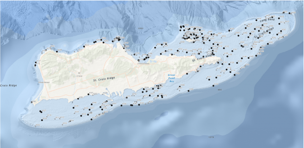
Virgin Islands National Park, encompassing 60% of the land area on St. John and about 9 square miles of the adjacent ocean, is a beautiful place full of tropical forests, historic ruins, and fringing coral reefs. Surrounding it is Virgin Islands Coral Reefs National Monument, adding an additional almost 20 square miles of protection to the reefs around the island. I was here for the second leg of the National Coral Reef Monitoring Program (NCRMP), a nation-wide effort to survey and keep track of the health of coral reefs. Lead by NOAA, this was a collaborative effort including groups like the NPS and University of Virgin Islands. This work was identical procedurally to what I worked on in St. Croix, as the survey methods must be the same in order to create comparable data. After my previous warm-up round a month before, these surveys collecting information on reef complexity, fish diversity, and coral health felt very comfortable and familiar. There was one big difference between the two for me though: in St. John, I collected much more data.
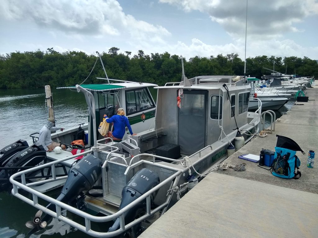
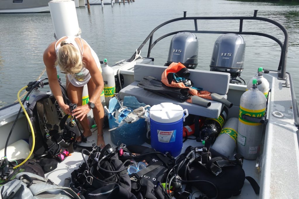
In St. Croix, I spent 3 of my five diving days photo-documenting the work at hand and shadowing to try and pick up the survey methods, only jumping into data collection on the last two days because the team was short a member. In St. John, I collected data from start to end – forcing me to data dive with a bulky camera strapped to my BC if I wanted to get any photos of the reefs. This was fun, as I like scientific diving and data collection, but did have one major downside. All of this fun data collection was paired with another, far less fun, task: data entry.

All that data has to go somewhere

All data entry had to be done by the end of the trip, so each day of diving 5-7 dives a day means 5-7 data sheets are waiting for you when you return home, tired after a long day of diving. Sure, you could wait to enter these until a little bit later in the trip but they’ll quickly pile up, creating an imposing stack of impending work. This data entry obligation was difficult to manage, with all the other internship duties I had along with dinner and other evening activities. To make matters worse, the survey type that I was doing, line-point intersect, was collecting information on percent cover of the benthic environment – meaning that I’d always have 100 points to enter, regardless on how barren the site was. Certain less-than-interesting sites gave the fish and coral surveyors a welcome break from the intense data collection, but the hapless LPI diver was doomed to work tirelessly.

Sometimes the tables were turned, and recording point after point of turf algae seemed preferable to counting and sizing hundreds of fast-moving fish

All of my gripes aside, this data entry is a key portion of the survey process – completely necessary if you are interested in doing any types of analysis or learning anything from all of these numbers that have just been produced. Additionally, doing it right after collecting it leaves little room for forgetting key information. It’s much harder to decipher messy underwater handwriting a month after it was written rather than a couple hours later.

So what was all this survey data on? If you were to ask members of my vessel during the St. John NCRMP leg, you might get a lot of answers of ‘scrubble’, a lovely benthic habitat composed of sand and rubble (and often not much else). The protocol is designed to survey any type of habitat that could potentially harbor coral, including the ones that may boast one small coral colony in 50m of seafloor (we visited some of these). As long as there was a single piece of hard substrate, we’d survey it (and yes, that little rock over there in that seemingly endless sea of sand counts – we checked). The words ‘coral reef surveys’ may invoke beautiful mental images of expansive living grandeur, that isn’t always the case. Sometimes, you have to monitor the sites that are what I imagine it would look like if a coral reef sneezed and forgot to cover its mouth, or sites that have so much algae and so little coral that you’ll have to double check you aren’t diving in California. However, someone has to collect this data – after all, zeros are important data points too.

Sometimes the algae/coral balance was skewed a little bit more towards the algae than you’d like it to be

As with St.Croix, these were randomly selected GPS waypoints that were chosen based off of benthic maps created using bottom sounder data.  This means that you’re often diving on sites that have never been visited before – and that no one really knows what type of habitat you’ll be dropping in on. Sometimes, that hard bottom that you (and the quickly growing dataset) have been pining for isn’t so hard after all. My team had more than our fair share of bounce dives, dropping in on large swathes of sand or seagrass and coming right back up. Sometimes, these seemingly-uneventful bounce dives would unearth thrilling sites: a school of hundreds of adult bonefish, tiny cryptic sargassum-dwelling invertebrates, or potentially my favorite sight of the trip – the largest palm tree I’ve ever seen. Sitting calmly on the dark ocean floor at around 90 feet deep, this submerged giant must have been over 70 feet tall.

While these soft-bottomed dives sometimes had fun surprises, the reefs were still much nicer

Despite feeling as though our team had somehow angered the gods who pass out the site survey assignments and were doomed to spend our days ticking off point after point of turf algae, we did still manage to visit some pretty spectacular sites. The Friday of our first week was the uncontested peak of the trip – visiting five aggregate and patch reef sites, with unparalleled visibility and surprisingly high coral cover. To top things off, our very first site was on the fringing reef, the reef furthest away from the islands and widely-thought to be the nicest around.

One of the nicer reefs we got to visit

With not many observed instances of disease or bleaching by our team, these reefs seemed pretty healthy. However, it was pretty clear that they had recently been subjected to some wild, intense, storm-driven swells. Occasionally, we’d run into coral colonies that looked like they’d been bashed in by a couple of angry garbage trucks on a bender, huge chunks of growth split apart in ways that seem impossible to comprehend. We’d also run into other signs of storm damage as well. Entire trees underwater was a common one, unintentional visitors from an outside world who’ve turned into a semi-permanent reef feature. Fragments of roof was another one, forcing one to imagine just how strong winds must have been to rip this huge chunk of metal off of someone’s house and deposit it a quarter mile offshore. We also ran into the wreckage of what looked like a rather large ship, broken apart and scattered across the reef.

Remnants of an unfortunate ship

While not a huge amount of disease was observed, as it has relatively recently made its way to the Caribbean, this doesn’t mean that we didn’t take any precautions to avoid spreading it. This park was the most cautious out of all the ones I’ve been to in terms of taking preventative measures – they were promoting what they hope to become ‘the new rinse’. Consisting of soaking gear in a diluted bleach solution (less than 1%) and then rinsing in freshwater, this thorough procedure is designed to remove any possibility of disease transmission through diver’s gear. The Parks Service is attempting to popularize this procedure throughout the Caribbean, supporting local recreational dive operations in their transition by supplying the bleach, with hopes that it’ll become widespread.

With a lot of the surveying gear touching the bottom, disinfecting is a crucial precaution

This disease, stony coral tissue loss disease, has only recently been detected in the U.S. Virgin Islands but poses an incredibly dire threat. Affecting 22 different species of coral with a mortality rate from 66-100%, it poses to decimate Caribbean reefs. First making an appearance near Miami in 2014, this disease quickly spread through the Florida Keys and has recently made its way out to the Caribbean as well, putting reefs already in major distress from climate change under even more stress. Described by researchers as being comparable to an underwater Ebola, this disease is currently incurable and ripping through reefs, killing corals that are hundreds of years old in mere weeks. Scientists are forced to result to dire containment measures, physically removing infected coral colonies from the reefs in a last-ditch effort to stop the spread. The speed and intensity of this disease make it a very real issue, putting even more importance on the island-wide monitoring we were undertaking. With a wide distribution of sites surveyed, this program has a good chance of locating and identifying disease before it becomes too widespread.

A diseased coral quickly losing living tissue – this may be a different disease, black band disease

Diving off of St. John, there’s a lot of boat traffic. Ferries travel around constantly moving between the many islands peppered through the area, private charters zip back and forth between beaches, and seemingly every other person on the islands has their own boat. This meant that we had to be extra vigilant when surfacing, especially as we managed to do a surprising number of sites in major boating channels. For some reason, vessels in this area don’t really seem to care much about dive flags – despite being clearly marked and obvious in the water, they’ll power right over them. Thankfully, the largest vessels (the ferries) weren’t very stealthy – their powerful, rumbling engine was audible even 90 feet down, and was hard to ignore when its booms resonated through your body.

Another hazard that we had to deal with was currents. While sometimes simply a nuisance, causing more exertion than desired, these had the potential to cause more serious issues. We had one memorable dive with such a raging current that I was almost unable to swim against it. The LPI diver has to swim into the current twice in the dive, once to reel out the transect and once more to collect their data, so I had to fight this angry stream of seawater twice over, exerting myself much more than I would have liked at depth to make the tiniest bit of headway. When we’d finally finished that dive and were able to stop fighting it, we noticed that our gas consumption and physical exertion weren’t the only things that this current had taken a toll on – it had also pulled down our dive float. Lying pitifully on the end of a suspiciously slack line at 85 feet down, wrinkled and compressed to half its size, our small buoy and handheld GPS combination had been yanked down to the depths by a whole lot of fast-moving water. With the help of a lift bag and a quick decrease in pressure, it happily returned to its former full and turgid state but was the subject of quite a few post-dive discussions in the days to come.

Strong currents really made us appreciate the dives without them

One final hazard was weather. Despite St. John rarely getting thunderstorms, we had quite a few during our monitoring trip. Often these storms would quickly materialize out of dark clouds without warning, surprising us in the middle of our day. We had one memorable dive where a lightning storm started while we were under – I remember the eerily calm surface of the water, the surface mottled with the impacts of thousands of raindrops and the occasional blast of illumination on the darkened reef from a flash of lighting.

Calm and serene underwater, cold and wet above

One small perk of doing all of these high-traffic, high-current, scrubble dives in the middle of the channel was a small novelty that I’m really pleased to be able to say that I’ve done – an international dive. With the close proximity between the USVI and the British Virgin Islands, it only made sense for a couple of these randomly selected points to fall right on the border. And sometimes, the transect happens to head across international lines, or a drifting safety stop takes you a little into someone else’s territory (it’s hard to see these borders underwater). While essentially meaningless, I got quite a kick out of these globe-trotting dives.

Some British fish

Like St. Croix, the dives for this program were fast and seemingly non-stop. Over the course of the two-week period, we quickly worked ourselves up to an average of 6-7 a day, occasionally even doing eight. Diving a range of depths and a mix of air and nitrox gases, high numbers of dives were achievable and safe – but sometimes lead to long days out on the sea.

Long days underwater are always worth it when you’re rewarded with sights like this

A huge perk of spending two weeks in St. John was that it gave me an entire weekend off between surveying to explore a bit more of the island. A huge amount of the island is National Park, encompassing a vast expanse of undeveloped forest and beaches. While lovely to see from the water as it really highlights the scale of the whole area, it was nice to get up close and personal as well. During time off I got a chance to see the sea turtles at Maho Bay, juvenile lemon sharks at Reef Bay, and even to take a quick visit to the British Virgin Islands. This was a really beautiful area that I’m glad I got a little time to see.

Juvenile lemon shark in the shallows at Reef Bay

I was happy to join on for another couple weeks of the National Coral Reef Monitoring Program as it’s such an important cause. At such a pivotal point for the fate of coral reefs it’s exciting to be on the forefront of the monitoring, collecting the data that will be used to inform policymakers about the ocean health. Additionally, I welcomed the opportunity to learn more about these reefs and the issues they face – all relatively new stuff to a cold-water diver like myself. After two busy weeks full of diving and data, I left the Caribbean for good. I was now heading to the opposite side of the country, to spend the remainder of my internship diving in a completely different ocean. It was time to say goodbye to the corals of the Caribbean and hello to the ecosystem that got me into diving – the lush kelp forests of California, at Channel Islands National Park.

Share