Category Archives: Current Internships

Fin

A week has passed since my last day at REEF and I am home reflecting on all the fins I got to see during my three months in The Keys.

Turtle Fins:

I was able to help trained NOAA volunteers by going out on turtle walks. During the months of June and July, Loggerhead sea turtles come ashore in Islamorada to nest. On our Sea Oats Beach, we had 21 nests and 15 false crawls this season. A false crawl is a marked incident where it looks like a turtle has come ashore to nest but there was no nest dug; this usually happens if the turtle gets spooked or the conditions are unfavourable.

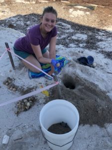
After 60 days since being marked, nests are checked regularly for signs of hatching. I was able to help excavate 3 nests this summer and released 3 baby turtles that were trapped in a nest. We collected data on the number of eggs and which of those were hatched/unhatched. Then we open the unhatched eggs to record if they are fertilized or not. All this information is important to monitor the turtle population in the area.

Fish Fins:

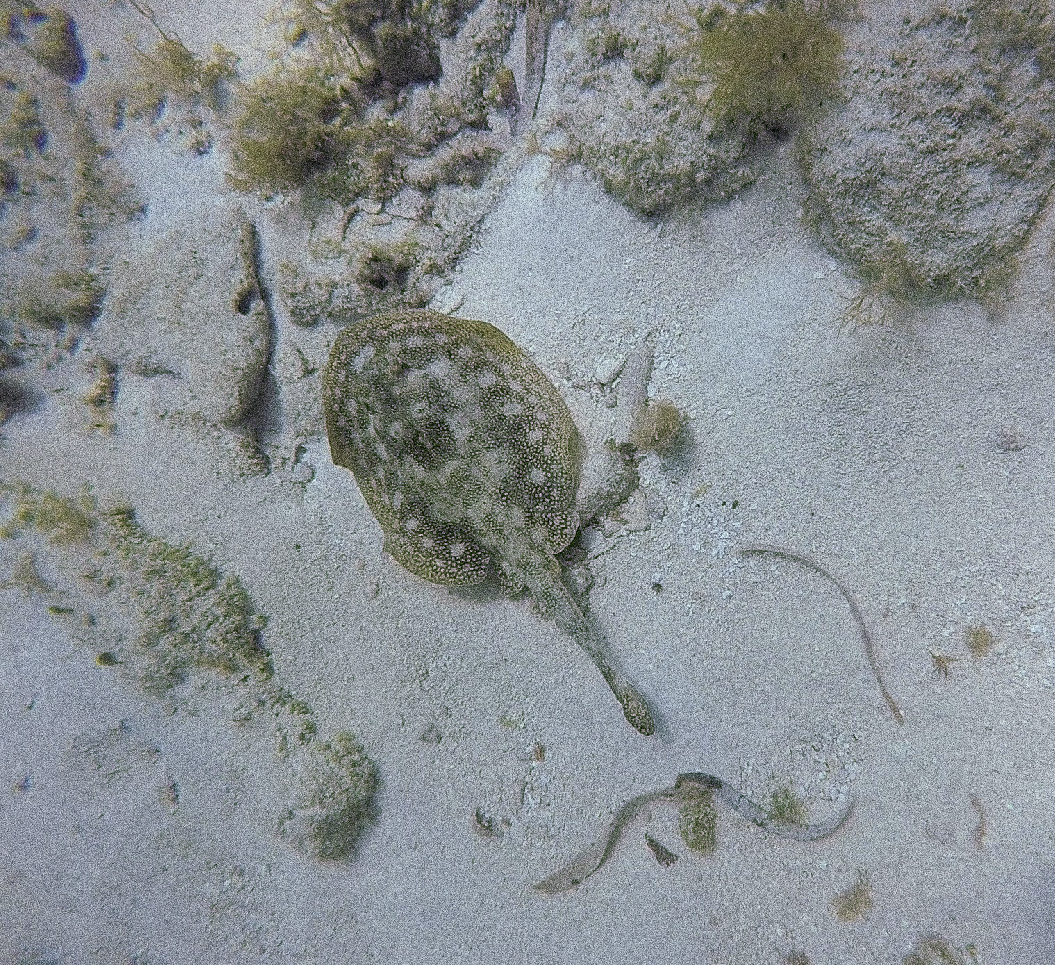
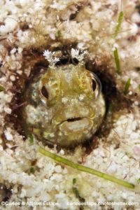
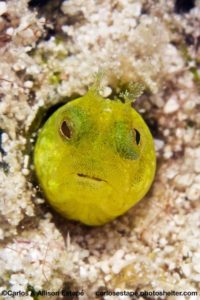
Since getting to know more fish species, I have started to appreciate seeing rare fish. For example, finding these Papillose blennies was a real thrill.

I spotted them during a dive with Allison and Carlos Estape who are established REEF members and fish ID experts. Carlos was very excited by my find as this was the first time they have seen this species in the keys or otherwise. It is an especially rare find because it is not listed in the Alligator Reef and Evirons paper which is the most comprehensive list of species of the area to date; it contains 618 different blenny species!

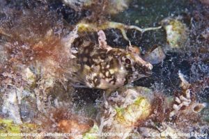
Another set of small fins belongs to the Mangrove blenny.


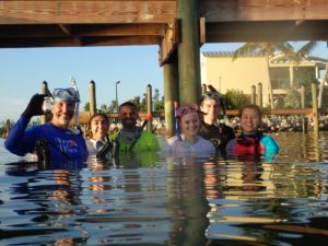
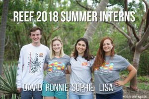
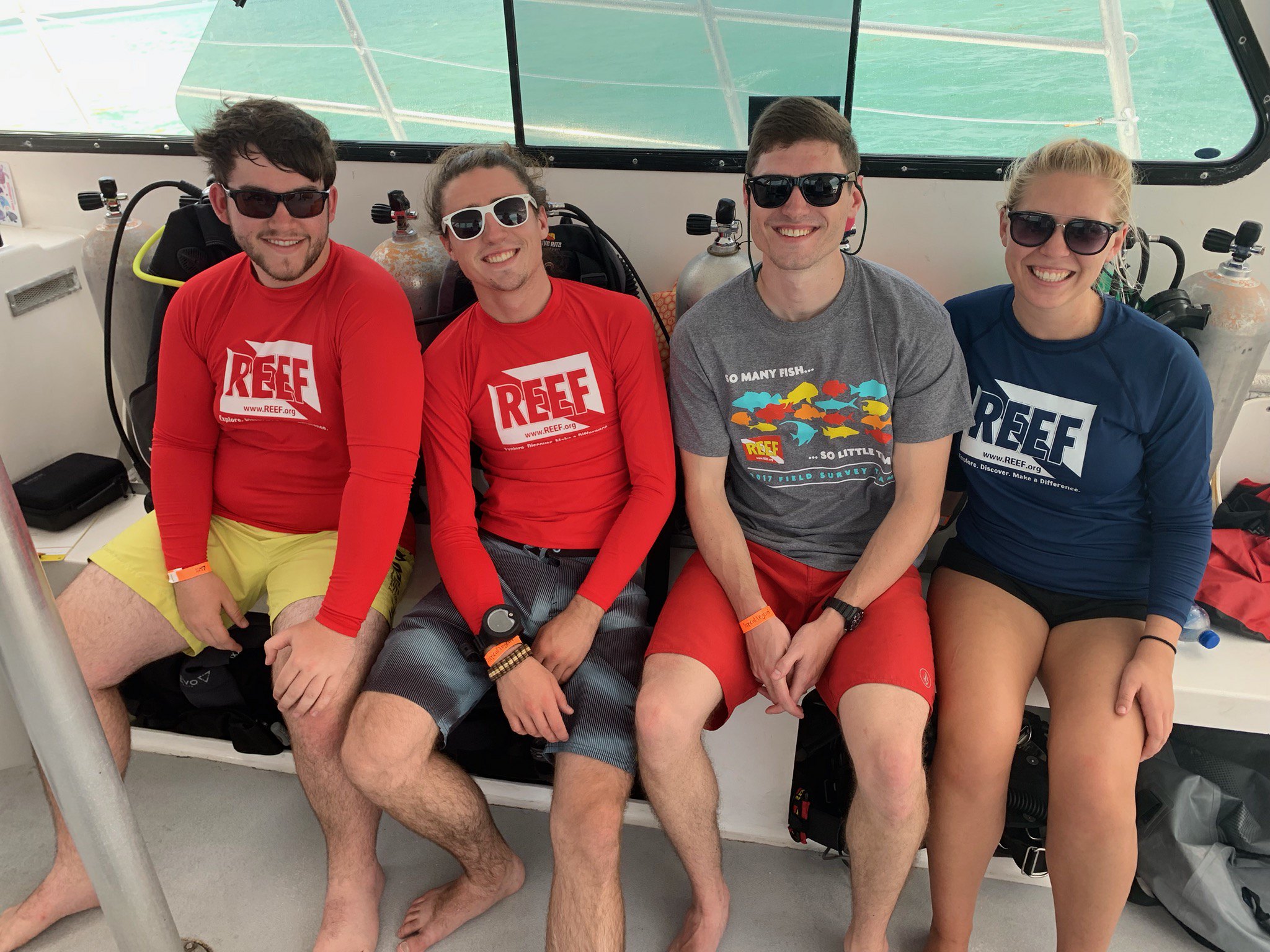
Amy Lee, REEF Trip Program and Communications Manager, informed us that she had seen a Mangrove blenny while snorkelling through some dock pilings. This was surprising news because Mangrove blennies have only been described to be in Cuba. So, we organized “The Great Bayside Blenny Hunt”. The group of us pictured below went out to find this far from home fish.

After a couple of hours snorkelling, we were able to capture two live specimen and obtain in situ pictures. The specimens were sent out to a lab for DNA sequencing and we received word that our predictions were correct: this was in fact a Mangrove blenny. Thanks to our efforts, it was the first time its DNA had been sequenced and the first specimen captured in Florida since the 1960s.

Human Fins:

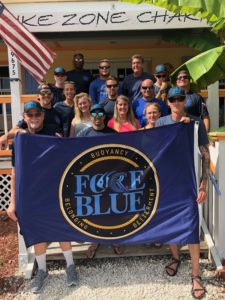
A high percentage of my summer consisted of helping with educational programs. A specific one that I will always remember is Force Blue. Force Blue is a program that unites Special Operations veterans and marine conservation professionals to create a team of conservation warriors. Force Blue employs these veterans’ highly trained diving skills to assist in conservation efforts which accomplishes two missions: helping to assimilate combat veterans to civilian life and supply aid and bodies to citizen science initiatives.

REEF participated in this program by training The Blue Force team to contribute to our database by surveying fish. We also educated them about the lionfish invasion and trained them to properly remove lionfish. It was an amazing opportunity to dive with these men and to learn a little bit about their world. For some of them, this was the first time they had seen a coral reef despite being trained divers for many years.

……

As far as the question I asked in my first blog, how REEF’s extensive database can be used to engage a wide audience on ocean conservation, I have decided to answer that by staying on past my internship to help with the Fishinar program. Fishinars are REEF’s brand of interactive webinars designed to teach the finer points of identifying fish. They are meant to be an aid for those already involved in our Volunteer Fish Survey Project and an introduction to fish surveying for those who are not. Fishinars can also be on relevant topics of ocean conservation.

I will be helping to grow this program by sourcing different advertisement opportunities and creating topics to deliver a Fishinar myself. Speaking, as a form of science communication, is a passion of mine and I am excited for the opportunity to grow that skill.

My time here at REEF gave me first hand experience in the world of marine conservation. Because of this experience, I now have a better understanding of where I want to contribute in the future. The connections I made and the chances I had to grow my skill set were invaluable. I have many people to thank but especially my supervisor, Ellie Splain for giving me the trust and encouragement to accomplish my goals this summer. As well, thank you to the Our World Underwater Scholarship Society who without, this experience would not have been the same.

Best Fishes,

Ronnie

Share

Kalaupapa National Historical Park: An Isolated Hawaiian Paradise

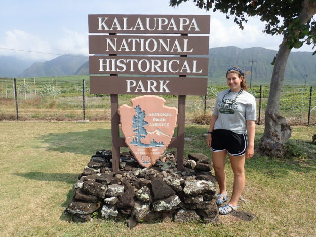
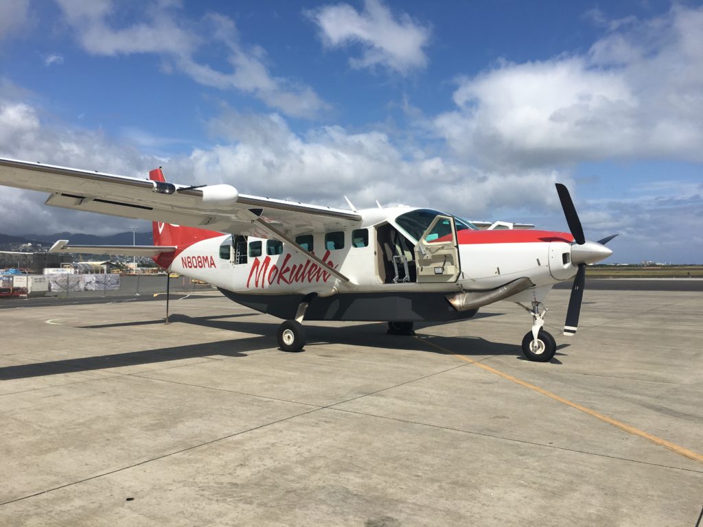
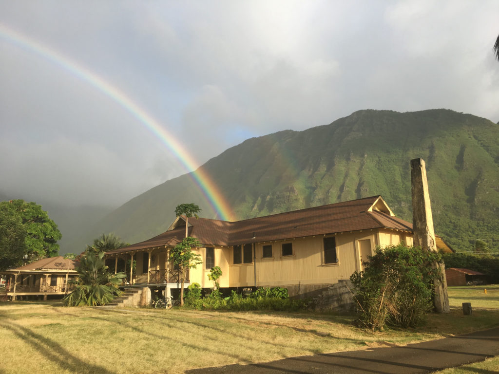
On Sunday, after arriving in Honolulu the previous night, I caught an 8-passenger plane to Kalaupapa National Historical Park (KALA). I was picked up at the airport by Eric Brown, the Park Dive Officer and a marine ecologist at KALA, and his wife, Claire, who have lived on the peninsula for 13 years. After a quick tour of the settlement, Eric dropped me off at Bay View Home, my home for the next week. Built in 1916, Bay View Home originally served as a group home for older, disabled, and blind patients.

With my duffel, dive bag, and groceries in hand, I climbed aboard to begin my next adventure!

With no known cure in 1866, as Hansen’s Disease began to spread across Hawaii, the current monarch (King Kamehameha V) decided to exile thousands to the isolated peninsula. Families were broken as children and spouses were ripped away from their homes and relatives. Patients of this isolated colony were treated as prisoners with limited access to resources and reduced contact with the outside world. Over 8,000 people lived and died on this remote peninsula. By 1949, forced isolation at Kalaupapa had ended and the lives of patients drastically changed as the new superintendent promoted social activities and lifted restrictions that prevented patients from holding jobs. Officially, the Hawaiian isolated policy was not abolished until 1969, at which time, patients were given the choice to remain or leave. Today, Hansen’s Disease, otherwise known as leprosy, is curable and is one of the least contagious of modern-day communicable diseases. In 1980, Kalaupapa National Historical Park was established to protect the remaining residents and preserve the history of the peninsula. Nine patients still remain in Kalaupapa with about 70 national park service and department of health employees.

Upon arriving in the office on Monday morning, I met the natural resource management team and set out in search of green sea turtle nests with Alexandra Engler, a participant of the International Volunteers in the Parks Program, and Yubee Isaac, a UH Hilo National Historical Park Intern. Every morning, they checked the nearby black sand beach for nests. On average 5-6 nests are found per year at KALA, unfortunately, no nests had been observed this season.

Natural Resource Management Building at KALA

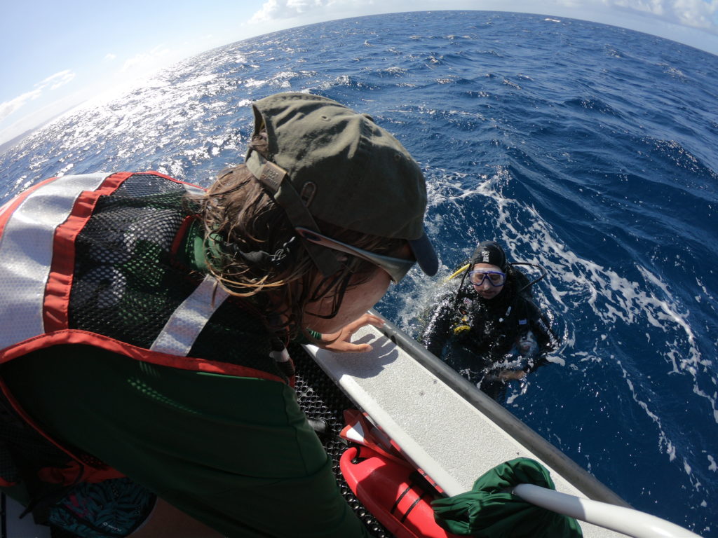
The remainder of my Monday was spent at sea. In partnership with the University of Hawai’i, acoustic receivers were placed in the waters surrounding KALA. In previous years, large pelagic fish and sharks were tagged with acoustic transmitters. When they swam near these strategically placed receivers, the movement of these apex predators was recorded and then studied. With the study complete, Randall Watanuki, a maintenance mechanic at KALA, and I spent the afternoon diving to remove these receivers. Using GPS coordinates, Randall and I would jump into the rough seas only to be met with a calm underwater environment that allowed us to quickly locate the receivers and unhook them from the ocean floor.

Alex helps me out of the water after successfully retrieving a receiver PC: Yubee Isaac

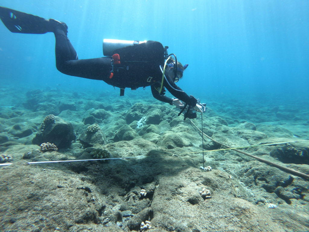
The following day was spent practicing the benthos and fish monitoring protocol that the marine team would employ later in the summer to monitor 30 sites around the peninsula. In the harbor, Eric laid five, 25 meter transects. Along each transect, Eric counted the number of fish and estimated their size. Fish density and species richness would be determined from this data. As Eric focused on fish counts, Randall and I took turns measuring rugosity with a chain and operating the camera. Photographs taken at every meter were analyzed to determine coral cover and disease prevalence. Though the harbor was a relatively barren, shallow habitat, the morning dive gave Eric and Randall a chance to refresh their skills in preparation for the busy monitoring season.

Practicing my underwater photoquadrat skills in KALA’s harbor PC: Yubee Isaac

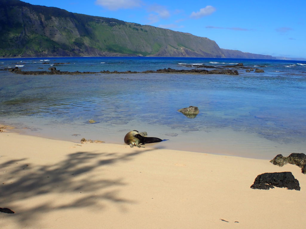
On Wednesday morning, I accompanied Alex and Yubee as they monitored Kalaupapa’s monk seal (Neomonachus schauinslandi) population. Endemic to these islands, monk seals are an endangered species once almost hunted to extinction. Currently, there are around 1,300 monks seals throughout the Hawaiian islands. To monitor the seals, Alex and Yubee walk along the beaches in search of the mother’s and their pups. Monk seals spend a majority of their lives in the water; however, females return to the beaches where they were born to give birth. They then remain on land with their pups for about 2 months before abandoning the pup and returning to sea. After being weaned, the marine team at KALA in association with NOAA Hawaiian Monk Seal Research Program, measure the pups, given them immunization shots, and tag their flippers so they can continue to monitor the pups as they grow. The purpose of these morning walks was to not only check in on KALA’s population but to determine whether any new pups were ready to be tagged.

An adorable pup feeds from his mother while she sleeps in the shallows

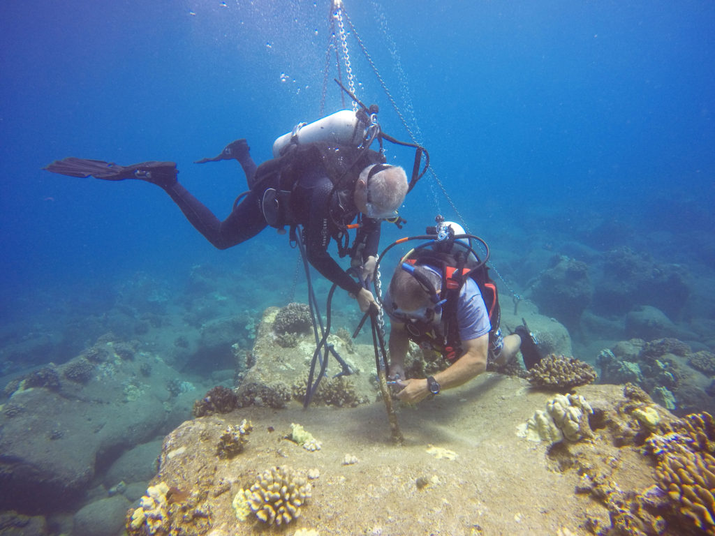
In the afternoon, Eric, Randall, and I completed a short, harbor dive to set up a mooring for the park boat. Due to the large swells and rocky shoreline, Eric wanted a place further from shore to attach the boat when necessary. This dive gave me the opportunity to observe some shallow maintenance work while exploring the nearby ecosystem.

Eric and Randall work together to set up the offshore mooring system for the NPS boat

With more receivers to remove and water samples to collect, the marine team loaded the boat on Thursday morning and headed out for another adventure. Similar to our previous dives, Randall and I successfully collected three more receivers even after battling some strong surface currents. While Randall handled the tools, I controlled the line for the surface buoy that marked our location. In between dives, I assisted Eric, Randall, Yubee, and Alex as they collected water samples from three predetermined sites. At each site, a Niskin bottle was used to collect water from the surface. The samples were filtered and then stored for later analysis. Two snorkelers would also enter the water at each site. With a multiparameter instrument attached to a float, they would lower the device to depth to collect data such as water salinity and temperature. Water quality data collected around Kalaupapa’s peninsula allows Eric to monitor any water chemistry trends that may influence the marine ecosystem.

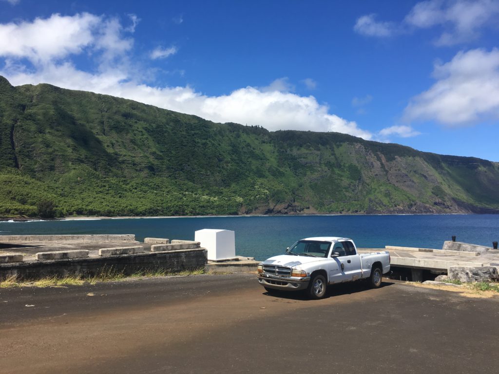
Meet Esmeralda. This rusty truck belongs to the marine team and is used to carry scuba gear to and from the docks. When the barge arrives this summer, the team will say farewell and a new truck will take Esmeralda’s place.

Upon returning to shore and drying our gear, Alex and Yubee were kind enough to invite me over to their home for the evening. Staff Row, built between 1890 and 1930, originally served as housing for the medical professionals living at the settlement. Today, these buildings are home to a group of interns working for the National Park Service. We spent the evening trading stories as we enjoyed an outstanding ratatouille dish cooked by Alex.

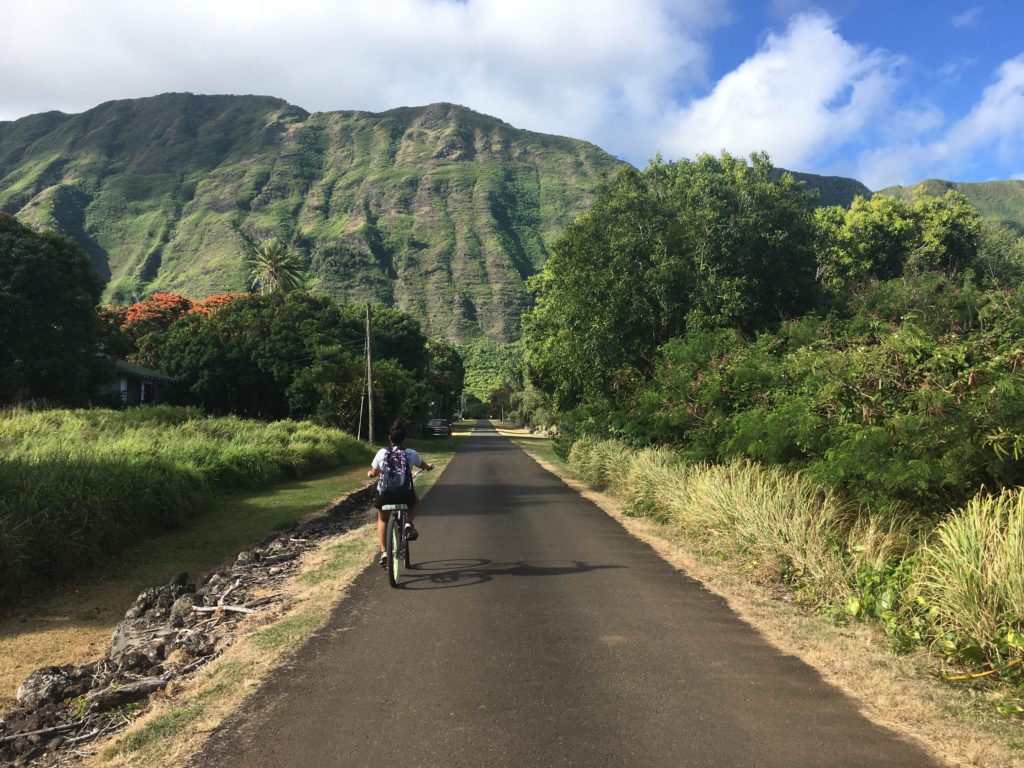
With limited access to gasoline and a relatively flat landscape, a majority of the workers use bikes to get around

While our work week was behind us, Yubee, Alex, and I awoke early the next morning to begin our hike to the topside of Molokai. Kalaupapa National Historical Park is accessible by plane or by a single hiking trail. The trail is around 3 miles, 1,600 feet, and has 26 switchbacks. No roads connect the small settlement of KALA to the 7,500 people living on the other side of Molokai. Many inhabitants of KALA, hike this trail multiple times a week to get groceries, visit topside, and/or live with their families who reside topside. Unlike Eric, whose impressive trek takes less than an hour, Alex was patient as Yubee and I took our time. We were enjoying the scenery while simultaneously catching our breaths.

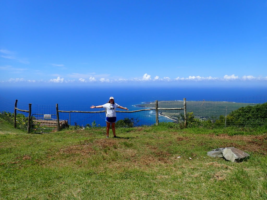
What a view! PC: Alexandra Engler

Upon reaching the top of the trial, Eric drove a group of us down 10 miles to Kaunakakai, the largest town on the island, home to two grocery stores. There we explored the small, lively town while filling our bags with groceries and our stomachs with ice cream. After returning to the settlement, that evening, I joined several members of the community for their weekly potluck and movie night at Tim’s house. Tim is the chef for the nine patients who remain on the peninsula.

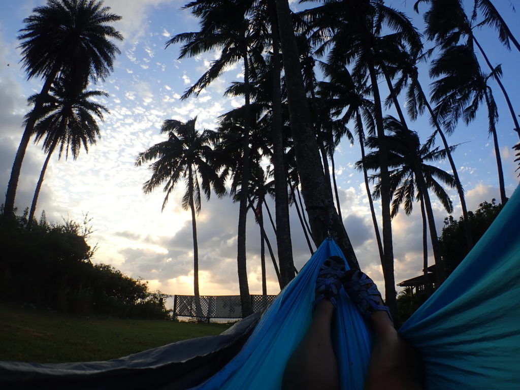
Enjoying the scenic views and calming breeze from my hammock, while avoiding the falling coconuts

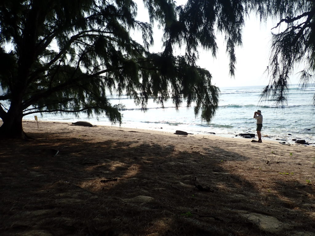
After enjoying a relaxing Saturday morning, I accompanied Eric on a weekly monk seal walk. Starting at the Kalaupapa airport and ending at the harbor, we walked along the shoreline to count the monk seals, record their activity and habitat. To prevent seals from becoming accustomed to humans, we stayed low and avoided eye contact. During the walk, we observed three nursing mothers, a pregnant female, and multiple weaned pups playing in the shallows.

Eric gets a closer look at the pregnant female’s flippers to determine whether she has been tagged

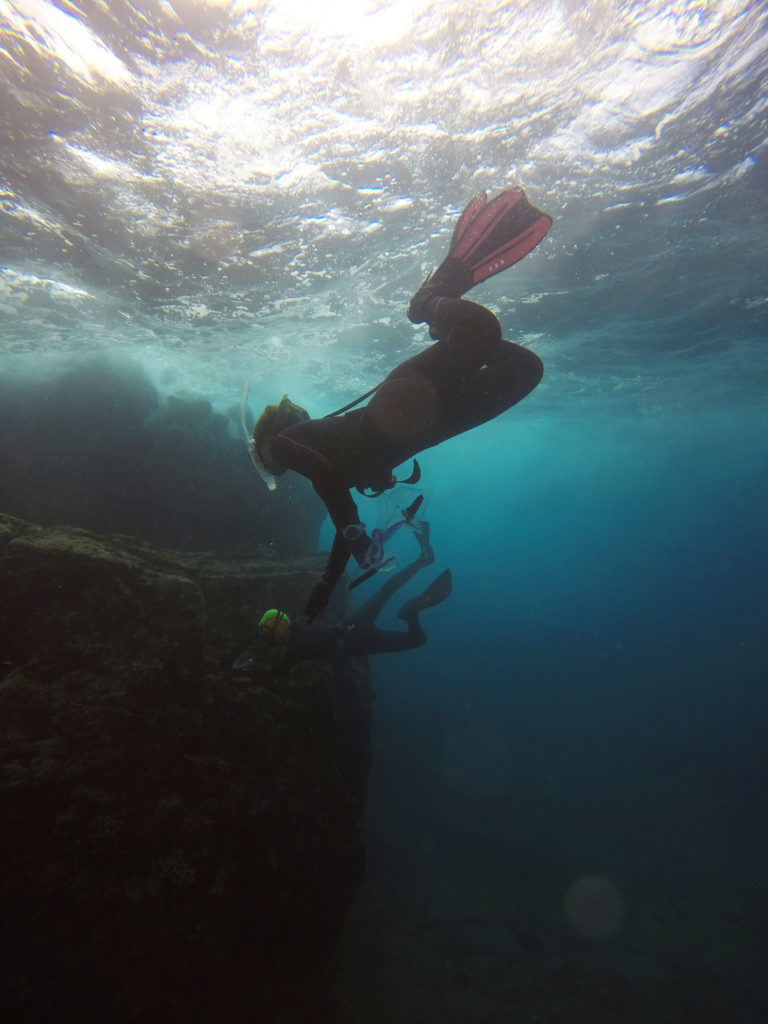
Monday morning marked my second to last day at Kalaupapa National Historical Park. In the morning, I assisted Randall as we filled the boat’s gas tank. Due to a sizable swell, we were unable to pull the boat against the dock. Instead, Randall and I swam three gas tanks out to the boat. Upon returning to headquarters, we were greeted by Erika Johnston, ‘Ale’alani Duboit, and Emily Conklin. All three are Ph.D. candidates in the Toonen-Bowen lab at the University of Hawai’i at Manoa. For the next week, they would be freediving and collecting samples of two native coral species for a connectivity study. We spent their first day in the field at two sites. At each site, we collected ~20 samples of each species from separate coral colonies located around 15-20 feet deep.

Erika and ‘Ale’alani freediving below the waves to collect coral samples along KALA’s coastline

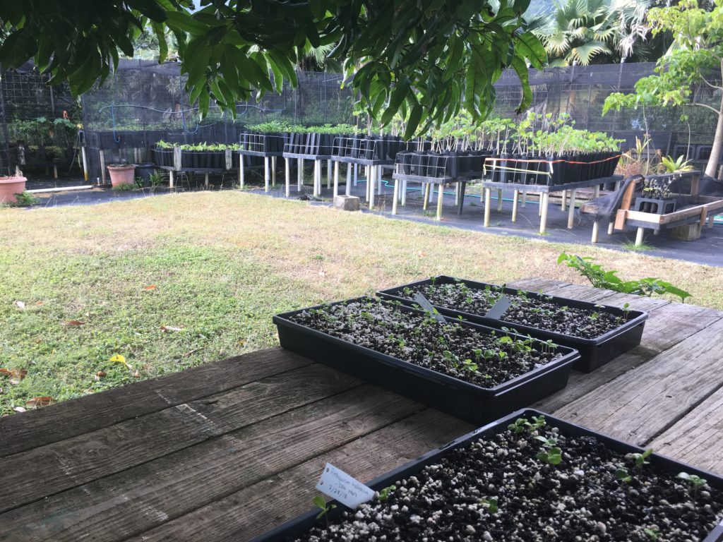
My final morning at KALA was spent at the settlement’s nursery. Alongside Ryan, a volunteer for the terrestrial team at KALA, Yubee and I helped transfer juvenile plants to individual containers so they could grow freely. While the nursery was filled with native plants, most of Kalaupapa’s peninsula is inhabited by non-native species. Pittosporum halophilum (native coastal species) and Reynoldsia sandwicensis (native crater species) were the two species we transferred. After growing in the nursery, these plants would be transferred by the terrestrial team to their natural habitats. While the re-introduction of these native species at the crater had worked well due to their fenced environment, the plants sent to the coastline of KALA had seen limited success due to deer predation.

Hiding in the shade of the nursey as we replant a few hundred juveniles

After our trip in search of the pregnant monk seal ended with no success, Eric, Yubee, Alex, and I jumped into the trunk and headed to the airport. With my baggage in tow, I climbed into the small plane, this time crowded with seven other passengers and headed back to Honolulu, Hawaii. Before returning to the mainland, I would spend the next four days at World War II Valor in the Pacific National Monument.

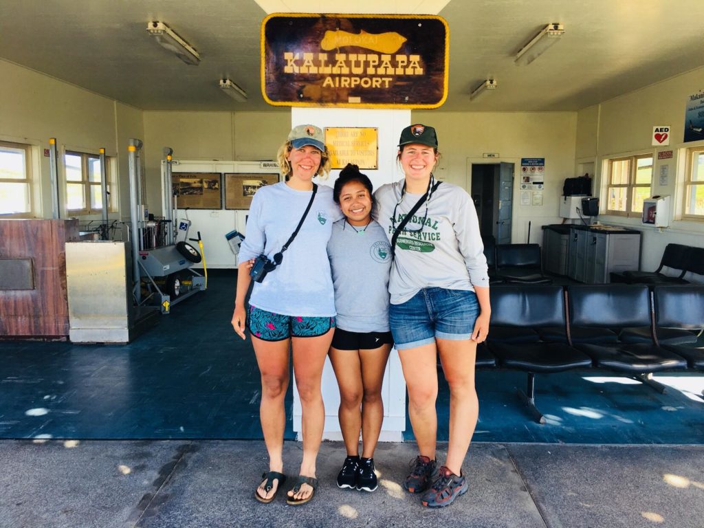
Alex, Yubee, and I pose in front of the tiny KALA airport PC: Eric Brown

Thanks to the amazing team at Kalaupapa National Historical Park for welcoming me with open arms. You made me feel like a member of the community, and I look forward to hopefully returning in the future!

Quick facts about KALA

  • Following my departure, KALA welcomed its 11th monk seal pup for this season beating a previous record set in 2013
  • Once a year, a barge brings large items like furniture and cars to the peninsula
  • The only gas station on the peninsula is open 3x a week and each person is limited to a specific amount of gasoline – therefore most people travel by bike
  • To enter KALA, you must have a resident sponsor. For tourists, permits are provided by the Kalaupapa resident owned and operated tour company, Damien Tours
Share

Lionfish & Shipwrecks

Now that we are through with camps for the summer, my remaining weeks will be spent either at the office or at a lionfish derby. The lionfish derbies are part of REEF’s Invasive Lionfish Program. They consist of dive teams, freediving or scuba diving, which collect lionfish by spearfishing or netting. There are prizes for the most, the biggest, and the smallest lionfish.

Lionfish first started appearing on the Florida coastline in 1985 due to aquarium releases. Since then, they have spread to most of the Caribbean directly competing with native fishes. The last derby in Ft. Lauderdale brought in 506 lionfish from 7 teams! Our derbies are a great community event that help educate people on the detrimental effects of releasing a non-native species


Our remaining derbies for the summer are in Palm Beach and Jacksonville. Aside from taking lionfish out of the water, the other objective of these derbies is to demonstrate how tasty lionfish are. We serve free lionfish ceviche at the derbies and have a culinary competition by participating chefs. If we can increase the demand for lionfish by patrons at restaurants and grocery stores, then removal efforts by divers will become more cost effective.

Two weekends ago my regular days were interrupted by a welcomed guest, Shannon Brown the OWUSS NPS intern! We managed to connect while she was here in South Florida at Biscayne National Park. She and other members of the NPS team took me out to the Maritime Heritage Trail to significant and very old ship wrecks. I did what I do best and conducted a fish survey on these wrecks. Because I am not AAUS certified, I could only snorkel these areas, but I was able to see plenty!

Shannon and her co-worker, Joel, changed my perspective on Marine Archeology. While I was busy being distracted by the biology of the area, they were marvelling at the stories the structure of the ship could tell. With their help, I was able to appreciate what I was seeing a little bit more and understand their excitement for maritime history. Shannon tried on my hat and conducted a fish survey herself which she was very proficient at! The entire NPS team was extremely welcoming to me and it was a great reminder of what a privilege it is to be apart of the Our World Underwater network.

Thanks again to Shannon for the pictures and to Dave Conlin for the warm welcome!

Share

Counting Kids not Fish

One of the programs here at REEF that I mentioned in my last post is the Explores Education Program. I am working specifically on the Ocean Explorers Camp. This is an environmental camp with an ocean focus for kids ages 7-12. Each day we are in or on the ocean in some capacity doing activities like snorkeling and kayaking. We host the camp at John Pennekamp Coral Reef State Park.

The responsibility to physically be at camp as a counsellor switches between interns. When I am not actually there, I am working on camp curriculum design. This is one of my independent projects I have undertaken. Thanks to my last position, I have experience in environmental education camp program design. I am thrilled to be given the trust and support to exercise this skill set.

In my previous position, I learned and implemented Earth Education Guidelines into my designs. Explained to me by my supervisor but synthesized by Steve Van Matre in his book, Earth Education, “Earth Education is the process of helping people live more harmoniously and joyously with the natural world.” By following the guidelines, you can hope to achieve three outcomes: feeling, understanding and processing. Essentially you aim to create programs that emotionally connect participants to the environment while also having them achieve an understanding on a subject of importance. The last outcome focuses on the participant’s own impact on the environment and how they can take action towards positive change.

I am hoping to take my knowledge and experience using these guidelines to create a comprehensive program design that can be used by REEF in years to come. One of the program components I am creating is a “New World Scavenger Hunt”. Working with a local museum, The Florida Keys History & Discovery Centre, I have gathered information and resources on what life would have been like for the early European explorers and the Native American population of the area. The goal is to have the kids experience how these people interacted with the environment around them. My desired outcome on this particular component is to teach the kids that it is important to look at our past and the perspectives of others to make smart decisions about our environment.

Education is in REEF’s name and I am excited to contribute.


Share

The end of my Alaska adventure

I left off my last blog post while I was aboard The Lituya motoring along from Juneau to Prince of Wales with Ginny and her husband Matt. My trip down was spectacular. The weather was great and the opportunity to spend a few nights on the boat, anchoring in places with almost no one in sight was out of this world. The first night we anchored in glassy waters just outside the bay of a town called Kake. I will honestly never forget the feeling of sitting on the boat as the sun was setting watching the eagles soar over the water and trees.

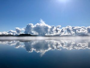
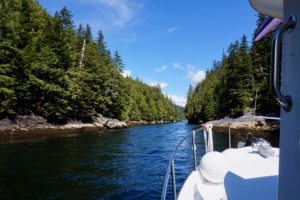
The next morning was met with rivaling views. As the fog cleared after our early morning departure, the most magnificent reflection I’ve ever seen was created on the water. The second day was packed with spotting sea otters (which would later come in handy when learning to do sea otter surveys with the Prince of Wales team), dodging kelp, and navigating the Rocky Passage, a big but shallow short cut Ginny decided to take. 

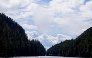
We made it to our destination in Prince of Wales later that day but had time to spend before our meet up on the North of the island with the team the following day. We decided to check out a small bay called Hole in the Wall, named because of its extremely narrow passage, which can only be navigated at certain tides. Luckily our timing was perfect and Matt and Ginny were able to navigate through. We spent the rest of the day relaxing and spying for black bears on land.   

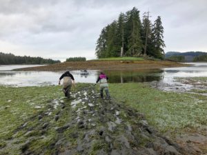
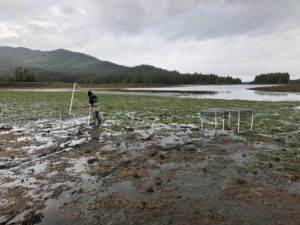
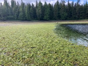
The following day I hopped off the boat, drove down to the south of POW and met up with some of the team. For the rest of the week I helped out with all of the intertidal sea grass surveying that took place every morning. Overall, my one week on POW was outstanding. Despite the extremely early wake ups at 2:00 and 3:00 each day to catch the low tides, I was able to help out a lot and have a great time with all the people there. For anyone interested in the science being done on POW, I definitely recommend checking out the APECS (Apex Predators, Ecosystems, and Community Sustainability) website to learn all about impacts of sea otters on ecosystems and marine resources. 

After working with the crew in POW, I flew back to Juneau for my final week and got ready to fly back home to California. This internship experience was five weeks of intensive cold water diving and field work, during which I learned new hands on techniques as well as participated in real applications of scientific processes I have recently studied in school. I undoubtedly learned more about myself and my future goals, and would like to thank the many people at OWUSS, AAUS, and the University of Alaska who made these opportunities possible for me. Thank you again to all who have followed and supported me on this journey!   


Share

Biscayne National Park: Coral Reefs, Seagrass, and Endless Mangroves

In the early 1950s, developers and conservationists fought over the future of the northernmost keys of Florida. Located by Biscayne Bay, developers envisioned building hotels, roads, and a large industrial seaport to support the growing population. The battle between the two groups raged on for many years, until 1968, when Biscayne National Monument was created. Expanded and re-designated as Biscayne National Park (BISC) in 1980, the park protects the ecological and historical resources found in Florida’s northern keys.

Upon arriving in Miami, Shelby Moneysmith, the Regional Dive Officer and a biologist at BISC, picked me up at the airport alongside Herve, her husband who works for the University of Miami in coordination with BISC. After a filling lunch, I unpacked at park housing and accompanied Shelby and Herve for a quick stop at a popular fruit stand (Robert is Here). The once small, fruit stand started in 1959 but has since grown into a huge operation which sells a wide variety of fruit and delicious milkshakes. My mango milkshake was especially delicious!

That evening, I met my roommate for the next two weeks. Originally from North Carolina, Devon received an internship to work with the interpretation department through the Historically Black Colleges and Universities Initiative. On Monday (Memorial Day), Devon and I took the free day to explore the grounds and the visitors center. While Biscayne National Park is approximately 180,000 acres, 95% of the park is water.

Due to weather, my dives on Tuesday and Wednesday were canceled. However, luckily on Wednesday, I was able to accompany Shelby and Elissa Condoleezza-Rice, a biological science technician, on one of their turtle nest monitoring trip. Every few days, six beaches along Biscayne’s keys are checked for loggerhead turtle activity. Loggerhead turtles reproduce every 2-4 years but often nest multiple times throughout the season (May-October). As an endangered species, the greatest threat to loggerhead sea turtles is the loss of habitat due to coastal development, predation, and human disturbance.
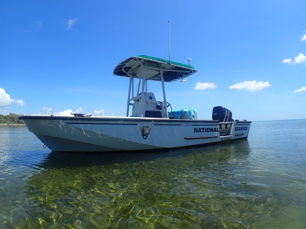
For turtle nest monitoring, we anchored near a beach, popped off the dive door, and waded towards the shore

After wading to shore at a few beaches and observing no activity, Shelby and Elissa found evidence of a false crawl on our fourth beach. When a female turtle crawls onto the beach to explore a nesting area but in the end decides to move on, this is characterized as a false crawl. At each false crawl, the surveyors marked the site, record location/site characteristics, and any additional metadata. This information prevents the surveyors from recounting the activity, and in case the false crawl ends up being a misidentified nest, they have the location for future monitoring.

Within a few more minutes, Shelby, Elissa, and I stumbled upon our first turtle nest. Compared to a false crawl, a nest was distinguishable because a patch of sand/vegetation was clearly disturbed as the loggerhead dug a chamber to store her clutch. At each nest site, we gently dug about an elbow deep into the sand to locate the clutch. Little contact was made with the eggs to limit the introduction of bacteria. To protect the nest, a screen was placed above the nest to protect the chamber from predation.
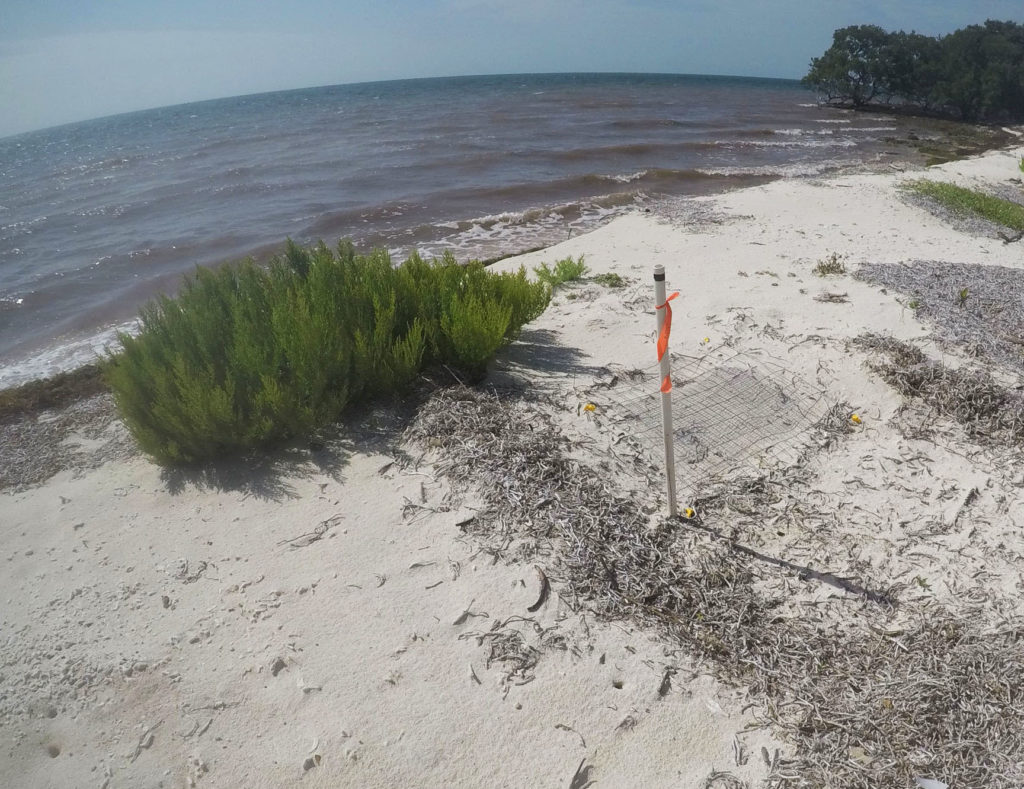
Hopefully, in about 60 days, little hatchlings will be crawling from this nest to the water

On Thursday, I finally participate in the diving operations at BISC. For two days, Arlice Marionneaux, an American Conservation Experience intern at BISC, and I planned on surveying several archaeology sites within the park’s borders. Checked every ~5 years for damage and looting, Biscayne National Park has over 120 archaeological sites. Most of these sites are known only by GPS coordinates. At each site, we used a map to locate pre-recorded wreck fragments including wood decking and ballast piles. Several sites had been damaged by Hurricane Irma, and on a few occasions, we were unable to find the marked artifacts.

Thursday was also filled with a multitude of boat problems. From radio issues to boat battery problems, our engine stopped working on a few occasions and forced us to throw anchor in a channel to prevent running aground. While stressful at the time, I learned a lot about boats and troubleshooting from Arlice.

On Friday, with a different boat, we headed out to finish several more archaeological sites. On our second of the four dives, Arlice and I visited the Lugano. Sunk on March 9, 1913, this British steamer was heading to Cuba with general cargo and 116 passengers when it grounded on Long Reef during high winds. Unlike the previous sites, the Lugano is a more exposed wreck site. While surveying the area, we observed a large diversity of reef fish, a nurse shark, and removed several fishing lines wrapped around gorgonians.
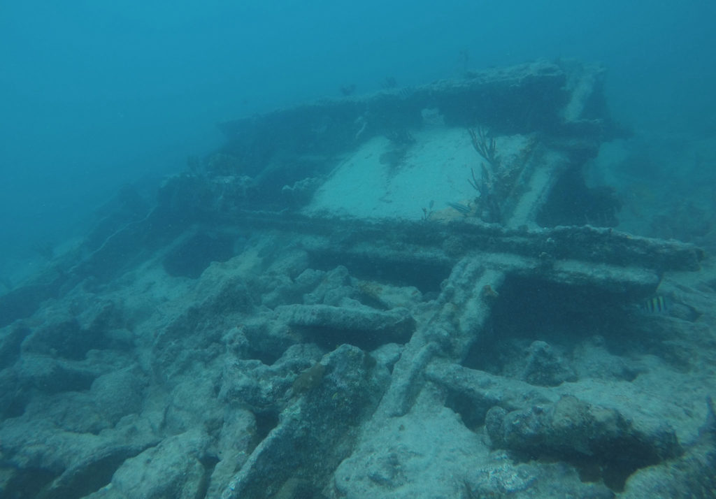
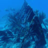
Located along BISC’s Heritage Trail, the Lugano is a well-preserved wreck inhabited by a variety of marine life

That evening, Dennis Maxwell, a park ranger at BISC, was kind enough to bring Devon and me on an evening kayak trip through the mangroves. With the visitors center in the background, Devon and I took off on the crystal clear water as the sun set over BISC. As we rounded the corner of a mangrove, we observed brown pelicans dive-bombing mullets riddling the shallow waters. To evade the pelicans, mullets jump out of the water. From our fluorescent orange kayak, the show as pretty spectacular.
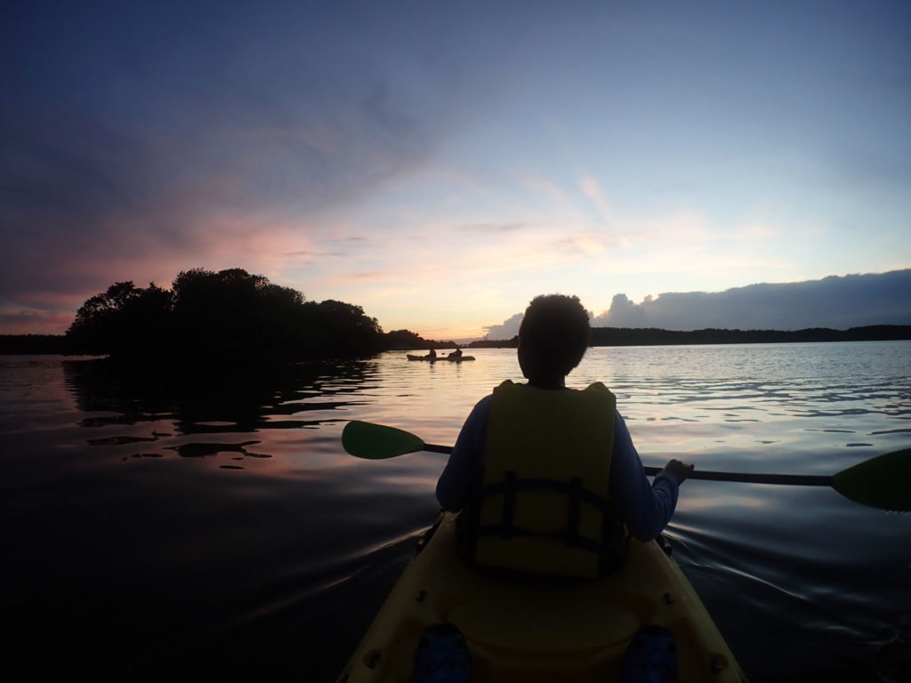
Definitely one of the best ways to spend the evening at Biscayne National Park

Saturday morning began with a knock on my door. Terry Helmers, a volunteer at BISC for 31 years, asked whether I wanted to spend the day assisting with mooring buoys. With no weekend plans, I immediately jumped at the opportunity. Throughout BISC, there are 40+ mooring buoys along the heritage trail and various other locations to allow visitors to easily explore their park without damaging the marine habitat below. Replaced every year, these buoys can get damaged by hurricanes or boat engines. Mostly by freediving to 10-30 ft, Terry and Ana Zangroniz, another volunteer, spend several weekends at the beginning of the summer season replacing the buoys. While I had experience freediving for fun, I struggled to stay down for extended periods of time while also expending energy to unscrew bolts and remove caked on organisms. Terry, on the other hand, could unattached a buoy and bring it the surface in one breath. It was beyond impressive!
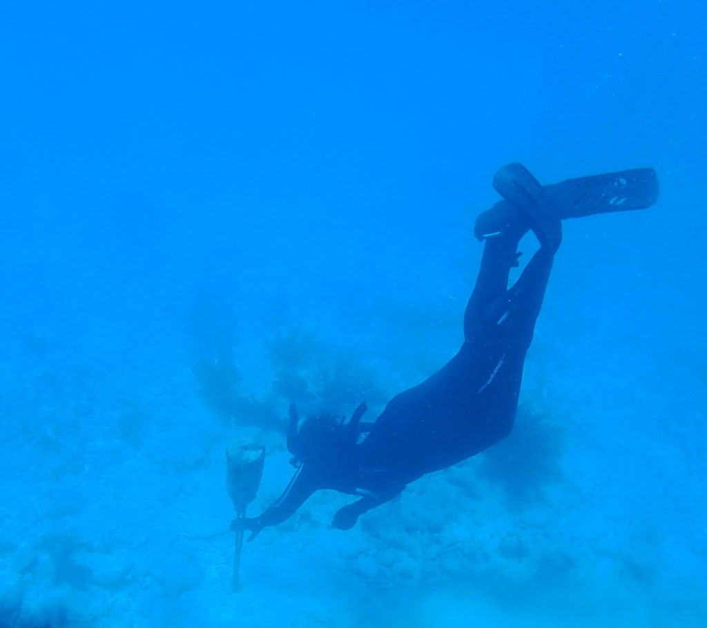
Replacing a float underwater to mark the location of a future buoy on the Heritage Trail – PC: Ana Zangroniz

In addition to replacing buoys at six sites, Ana and Terry let me snorkel the Mandalay. Sunk in 1966, this luxury-line from the Bahamas to Miami hit a shallow reef. All 35 passengers were rescued and scavengers later stripped the vessel. Sitting in shallow, clear water this well-persevered wreck is teeming with fish life. At the surface, hundreds of chubs surrounded you as you explored every small crevice of the vessel. In addition, I saw a midnight parrotfish. While relatively common in Biscayne National Park, when in Bonaire, I was the only member of my marine station to not see a midnight parrotfish after living there for seven months. Finally, after traversing the dang Atlantic, I could finally check a midnight off my list!


Unintentionally, we also collected a large amount of marine debris while out for the day. With limited fishing regulations and a crowded metropolitan city nearby, Biscayne has a sizable amount of marine debris. From plastic bags floating along the surface to abandoned crab traps scattered on the bottom, Terry, Ana, and I collected what we could.

Following a relaxing Sunday, I traveled out again with Elissa and Hayley Kilgour, an NPS intern, to check for turtle nests on Monday. After observing Shelby and Elissa the previous week, I was excited to correctly identify two nests myself during the day trip. While returning to the boat, we also saw five juvenile blacktip reef sharks swimming through the shallows. In the shallows, we commonly saw stingrays or tiny fish but sharks were definitely a treat.
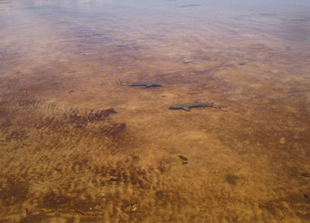
Aren’t they adorable? – PC: Elissa Condoleezza-Rice

On Tuesday, I assisted with the ongoing marine debris study. Previously, transect markers/floats were placed at 12 sites through the park for a lionfish removal study. After the study was complete, the natural resources department decided to use these sites to study the accumulation of marine debris. Marine debris is collected from each site once a year and the amount/type is recorded to estimate the overall accumulation. Every 6 months, markers are cleaned and damaged floats are replaced. While diving with Vanessa McDonough, a biologist at BISC, we were met with strong currents and a float bag that decided to prematurely travel to the surface. Fortunately, we managed to check the markers and to spear a few lionfish along the way.

Lionfish are carnivorous fish native to the Indo-Pacific. These beautiful fish were popular ornamental fish which were either intentionally released in the Atlantic and accidentally released due to storms. In the Atlantic, lionfish have no known predators, reproduce year-round, and compete with native fish for food and space. At BISC, biologists spear lionfish in hopes of reducing their numbers at the park. At the end of our day, we measured the total length of each lionfish and stored them in the fridge for future interpretation programs.
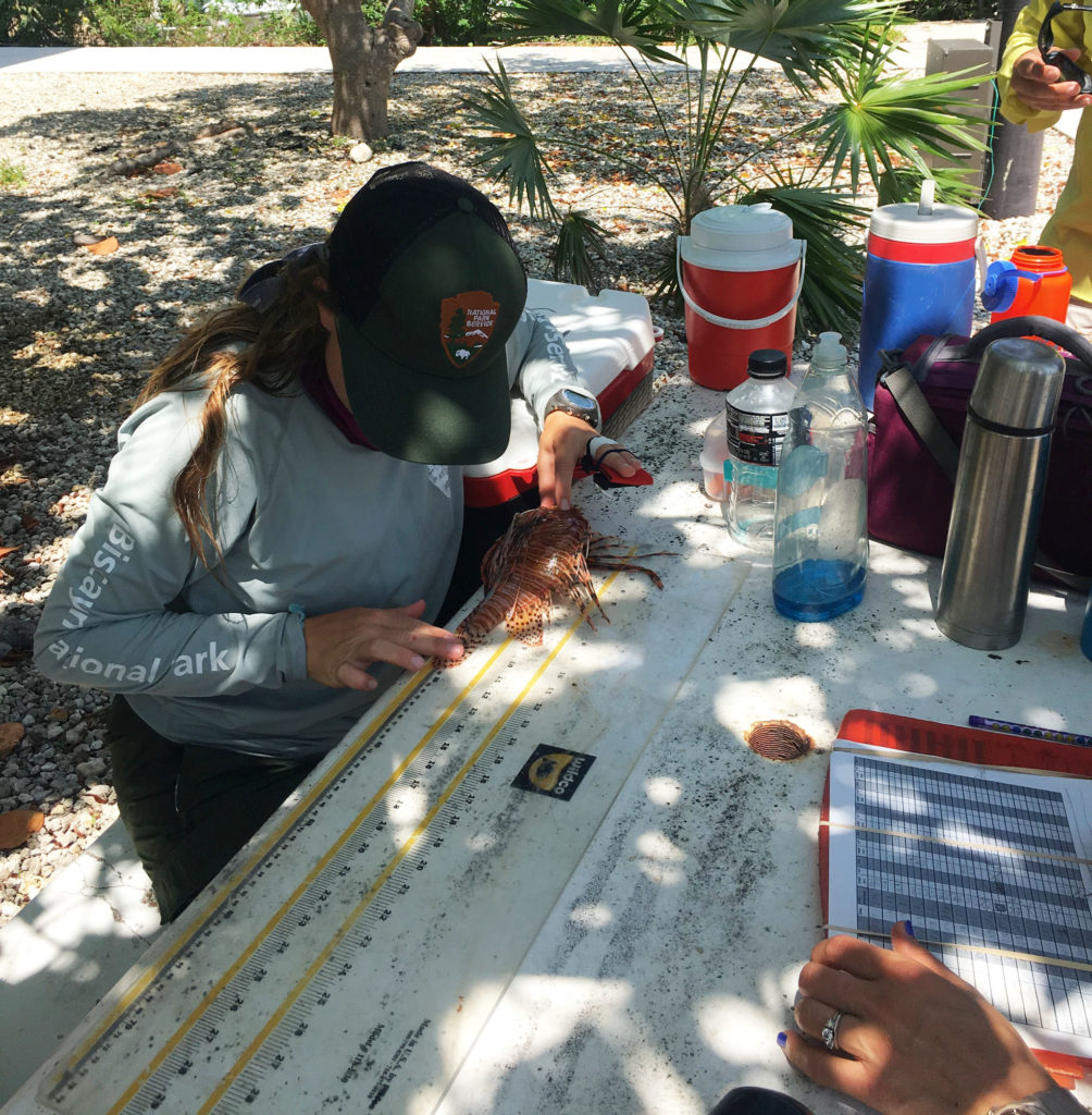
 

Elissa measured each lionfish while carefully avoiding their 18 venomous spines

After an eventful day in the field, I was starving. Jay Johnston, BISC’s education program coordinator, was kind enough to invite me and several other employees and interns to his house for Taco Night. Our evening was filled with chips and salsa, scrumptious tacos, and great conversation.

With Amanda Bourque, an ecologist for BISC, as my dive buddy, we completed two more marine debris site dives on Wednesday. Since these sites are apart of an ongoing study, we were not allowed to pick up any debris within the transect. Already within six months, these sites were covered in stray lines and crab traps that were hard to resist collecting.
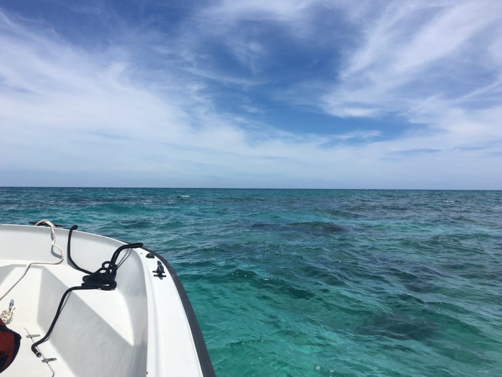
Blue skies and calm waters….ready to dive!

Thursday was spent assisting with goliath grouper survey dives. Relatively uncommon within BISC, at previously chosen locations, 20 min roving diver surveys are used to search for this critically endangered species. Unfortunately, during our four dives, a Goliath was not observed. We did, however, manage to spear a bunch of lionfish even one that decided to hid under Elissa’s legs mid-capture.

My final day was spent monitoring the turtle nesting beaches. With no new nests, Elissa, Hayley, Suzy Pappas, and I decided to perform a short beach cleanup on Tannahill. Suzy runs a non-profit organization called the Coastal Cleanup Corporation whose mission is to remove marine debris from Florida’s coast and educate the public. She volunteers with the turtle monitoring group at Biscayne and often sponsors beach cleanups throughout the year. During our quick 30-min beach cleanup, the four of us collected 10-12 full garbage bags of trash ranging from glass, buoys, and microplastic.
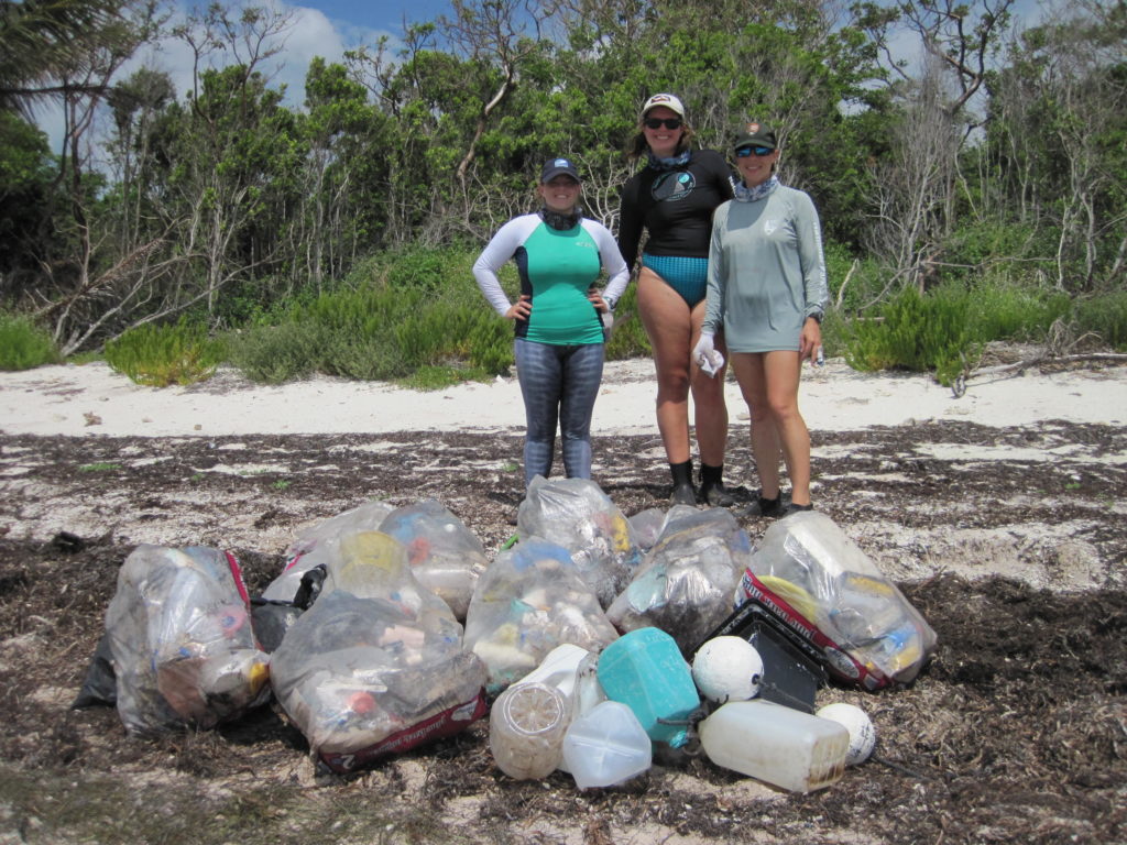
Cleaning up the trash and hopefully making more space for turtle nesting – PC: Suzy Pappas

After returning to headquarters and disposing of the trash, I was greeted by several individuals from the natural resource management department. Apparently, while Herve and Austin were collecting samples for water quality analysis earlier that morning, they came across a 3 m Burmese python hanging off the buoy about 1.4 miles offshore. Vanessa, Elissa, and Herve worked together to restrain the invasive species and get an accurate length measurement. My fear of snakes definitely prevented me from jumping in to help wrangle the creature.
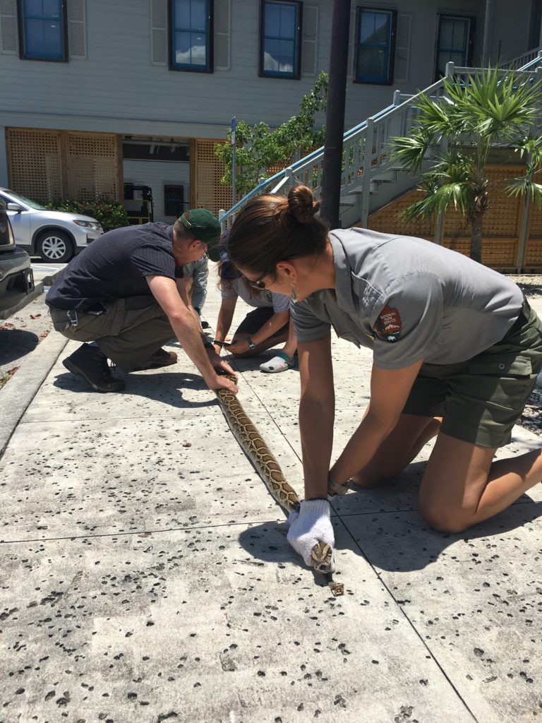
Vanessa, Herve, Elissa, and Hayley handled the ~17 lbs animal

In the early hours of Saturday morning, Shelby and Herve drove me to the airport so I could continue my adventure. Three flights, lots of snacks, and almost a full day later, I would arrive in Honolulu, Oahu. From there, I would take a small plane to my next destination, Kalaupapa National Historical Park.

Thanks to all the great people who made Biscayne National Park feel like home for two weeks!

Quick facts about BISC:

  • Park has four distinct marine ecosystems: a fringe of mangrove forest, southern expanse of Biscayne Bay, northernmost Florida keys, and portion of the third largest coral reef
  • Fishing and other harvesting activities are dictated by state law within the park boundaries
  • Home to many protected species including the Schaus swallowtail butterfly, American crocodile, five species of sea turtles, and elkhorn and staghorn coral
Share

Channel Islands National Parks: Exploring the Majestic Kelp Forests

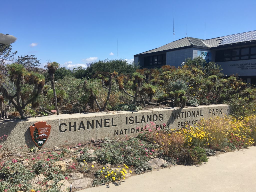
With Denver in my rearview mirror, I flew into LAX ready to visit my first park. Headquarter in Ventura, California, Channel Islands National Park (CHIS) is composed of five spectacular islands and their surrounding marine environment. Created in 1980, the main goal of this National Park was to protect the diverse terrestrial and marine ecosystem of the Channel Islands.

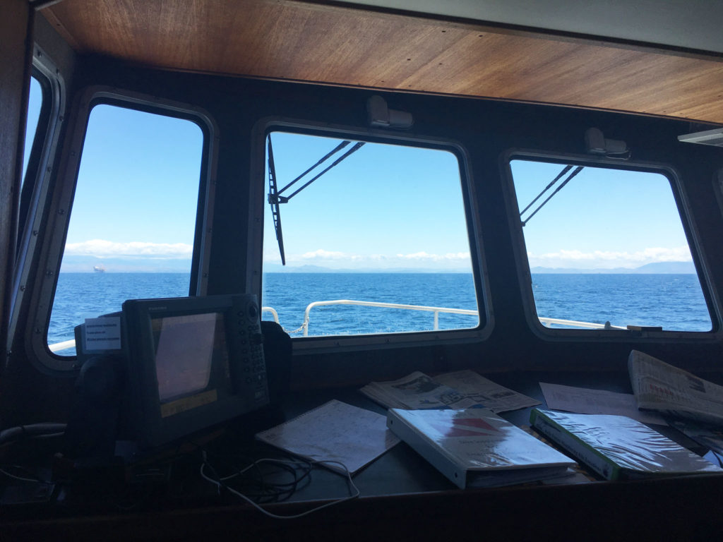
After a shuttle ride along Highway 101, I was met by Joshua Sprague, a marine ecologist for CHIS. He graciously showed me to my accommodations for the evening, the Sea Ranger II. The 58-foot research vessel would be my home for the next six nights. On this fine Sunday evening, the boat remained docked behind the Visitors Center. With the crew not arriving until early Monday morning, I spent the evening exploring the harbor, walking the beach, and learning how to not bang my head into every overhang on the Sea Ranger II.

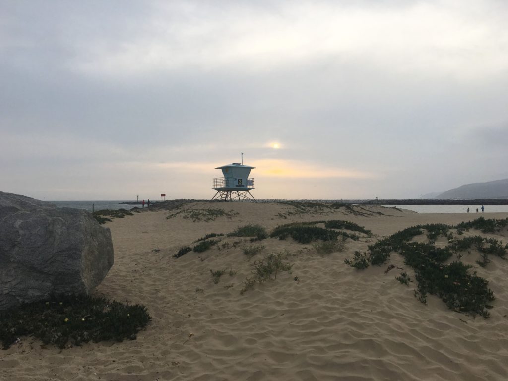
Beautiful view as I walked along the beach across from the Channel Islands National Park Visitors Center

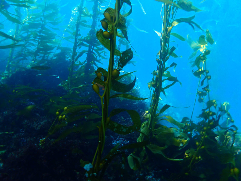
In the morning, the members of the long-term kelp forest monitoring project began trickling in. After organizing our gear and stocking the kitchen with a healthy supply of snacks, we bid farewell to our loud barking neighbors (i.e. the California sea lions) and headed towards our first site of the week along Santa Cruz Island’s coast.

The Kelp Forest Monitoring (KFM) Program at CHIS is an extremely impressive, complex operation. Starting in 1982, the program initially monitored 13 dive sites around the islands but as of 2005 has expanded to 33 sites. The marine ecosystem surrounding CHIS supports over 2000 species. Each year from May to October, these 33 sites are surveyed to collect the size and abundance information of 120+ species of marine fauna (e.g. algae, invertebrates, and fish). The data allows researchers to examine the kelp forest’s health and monitor ongoing changes to the environment. KFM was not created with the intent of answering questions. The data from the program is public record, and the identified baselines are used to help establish marine protection protocol. Currently, 20% of CHIS waters are considered state marine protected areas. In addition to the KFM program, Channel Islands National Park supports a wide variety of other programs that focus on the overall health of the park resources (e.g. intertidal, pinniped, bird, and invasive plant monitoring).

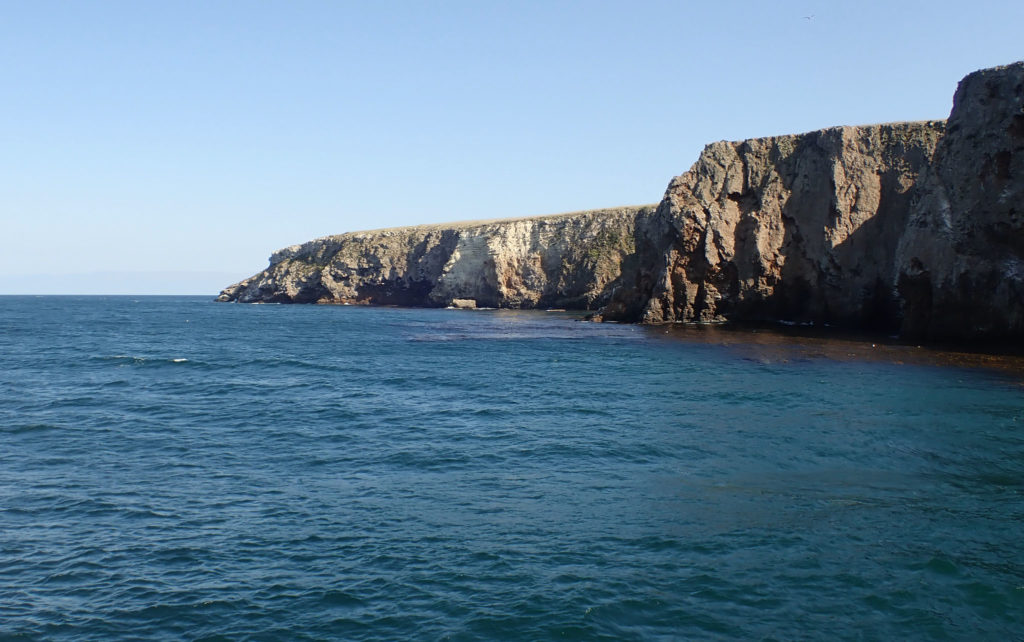
With a rougher Pacific Ocean passage behind us, we arrive at our site for the day, Pedro Reef– Santa Cruz Island. Not located within an MPA, the dive site is barren and uninhabitable. The lack of kelp at this site can be attributed to overfishing. When predators of sea urchins are overfished, their population size increases. As herbivores, urchins consume the kelp that provides food and habitat to other marine organisms.

Topside view of Pedro Reef- Santa Cruz Island

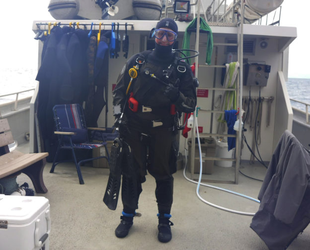
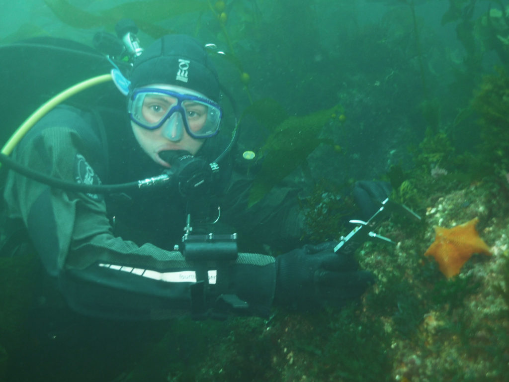
Having just completed my blue card certification in Colorado, I still had to finish the open water portion. For this, David Kushner, the Regional Dive Officer and head of the KFM program, ran me through several underwater skills. While the low visibility had me a little disoriented at first, I am proud of how I handled my first open water dive in a drysuit and my first dive in the Pacific Ocean. Getting out of the water was another feat entirely. With the waves rolling and about 20 lbs. resting on my hips, let’s just say I rolled onto the boat platform rather than gracefully glided. Definitely not a picture worthy exit. As part of my exam, I was also supposed to perform a surface swim. However, due to a recent great white shark sighting, it was decided that me swimming across the surface in a brown drysuit might appear too seal-like.

After finishing my dive and realizing that my drysuit didn’t actually manage to keep me dry, I spent the remainder of the day assisting topside as the KFM crew finished collecting data. From band transects to roving diver fish counts, a multitude of different surveys are performed at each site to observe the fish, invertebrate, and algal communities. Water temperature is recorded, and a video transect of each site is captured for historical reasons. The imagery allows the KFM members to visually look back on the 33 sites visited each year during their survey season. One of the most impressive survey protocols used by the KFM program is Random Point Contacts (RPC). In a full-face mask attached to surface supplied air, a diver travels along the transect and at random points calls out the organism covering the substratum. The full-face mask allows the diver to communicate with the surface support person and the need for a slate is eliminated. Such a technique, allows a massive subset of data to be collected in a shorter amount of time.

Kenan Chan (surface support person) records benthos information communicated to him by Cullen Molitor (diver)

In the evening, Captain Keith Duran anchored the Sea Ranger II at Smuggler’s Cove. We ate a lovely dinner, and then I watched as the crew checked and consolidated the data collected at Pedro Reef. Each evening of the cruise, the team spent 1-2 hours discussing the site in detail. They recorded any anomalies and worked together to create a species list for the site (ranking species based on their prevalence).

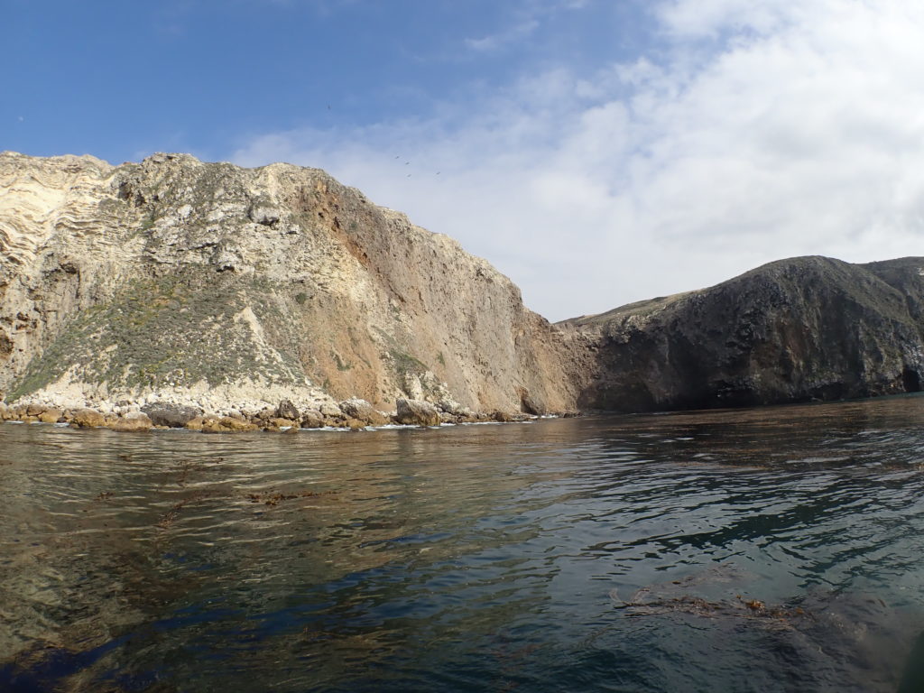
On Tuesday morning, with the anchor pulled at 7:30 am, Captain Keith drove us to our second dive site of the week, Landing Cove – Anacapa Island. Tuesday’s dive site was located in a marine reserve established in 1978, the oldest in California. Diving this site provided a unique contrast to the urchin-dominated Pedro Reef where we spent the previous day. Landing Cove also gave me my first opportunity to observe the diverse kelp forest habitat in its full glory. With a leaking drysuit, I was fortunate enough to borrow Cullen’s extra 7mm. The suit definitely kept me warm and the camouflage pattern was a great fashion statement. On my first dive, I accompanied Merrill McCauley, a park ranger, as he completed a macro survey. Macro surveys involve counting stipes on 100 giant kelp (Macrocystis pyrifera) along the transect line. During the second dive, I followed Luis Hernandez and Merrill through the towering kelp as they performed 5-m transects. Since I had no experience identifying the fauna at CHIS, by the second day, I was still too green to contribute to official data collection.


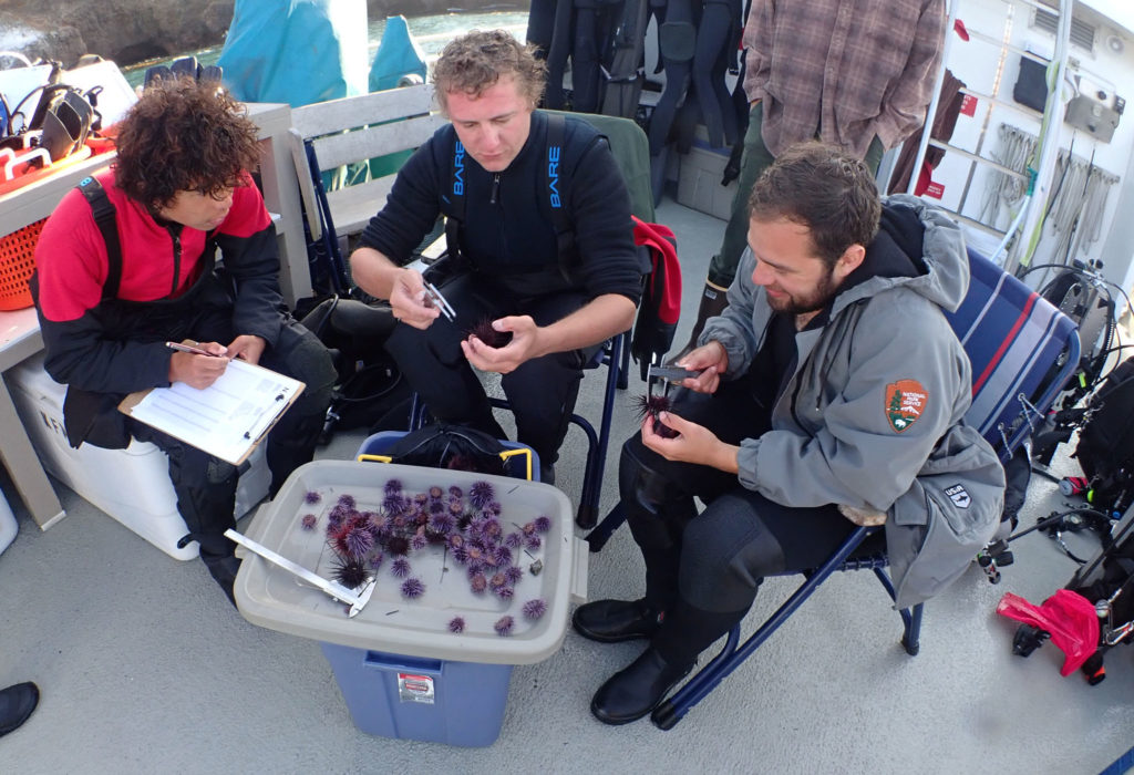
Topside, I assisted Kenan, Luis, and Cullen as they measured 100+ sea urchins brought to the surface. Safely returned to their homes on the subsequent dive, these sea urchin measurements allowed the team to understand the population dynamics of the three common sea urchin species found in CHIS: purple sea urchins (Strongylocentrotus purpuratus), red sea urchins (Strongylocentrotus franciscanus), and white sea urchins (Lytechinus anamesus).

One urchin, two urchin….white urchin, purple urchin

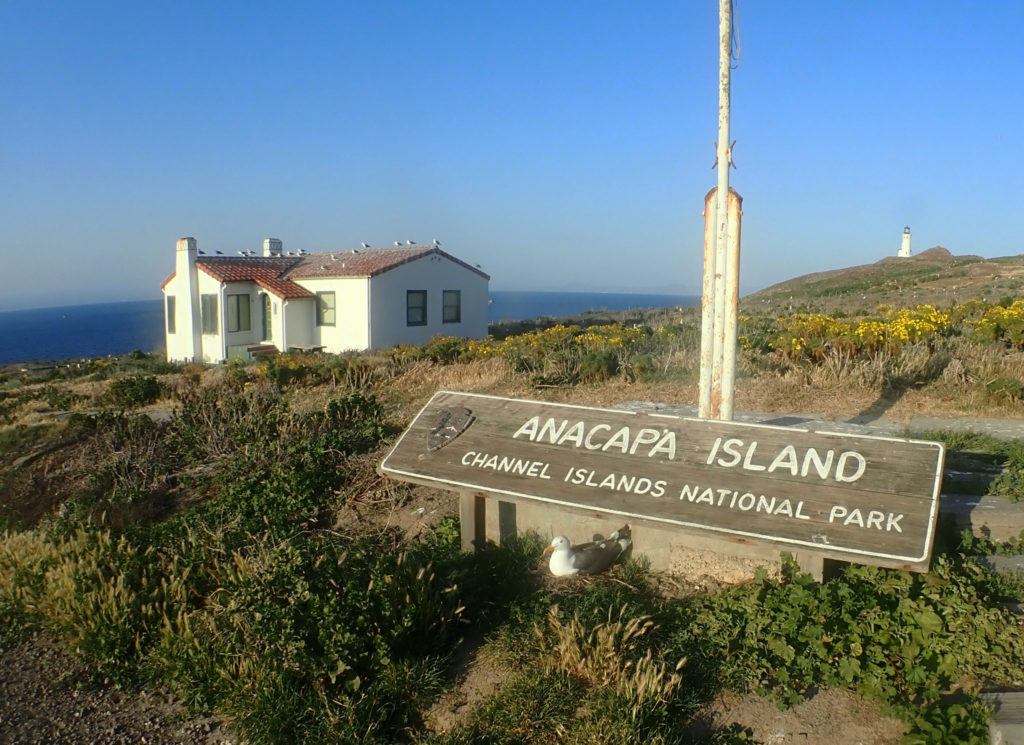
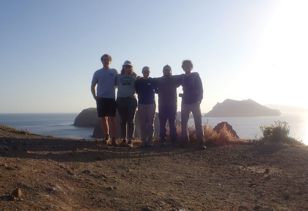
Following a productive day of diving, the seasonal interns and I explored Anacapa Island. This small desolate island becomes a dense, western gull breeding ground from May to July. Anacapa supports the largest protected breeding colony of western gulls in the world with over 10,000 individuals. While we enjoyed the amazing views and the baby seagulls, Erin Jaco, unfortunately, learned the hard way that these birds sometimes use their poop as a foul weapon.

From the roof to the island’s sign, no place is untouched by the western gull population on Anacapa Island

OWUSS Intern + Seasonal KFM Interns (Cullen, Erin, Luis, and Kenan)

On Wednesday morning we anchored at Cavern Point – Santa Cruz Island. Located in an MPA established in 2003, this site gave me the opportunity to contribute to the data set for the first time. Luckily, the previous evening, Cullen was kind enough to help me patch my drysuit. And thankfully, his repair was successful. On my first dive, Merrill and I performed macro counts and measured gorgonians. For the second dive, Captain Keith and I were given the opportunity to explore. I became enticed by the spectacular invertebrate community at the site. From the sea cucumbers to tunicates, these are creatures that you don’t notice when you are focused on counting Macrocystis stipes or searching for the next gorgonian to measure. Keith and I also saw several massive California sheephead (Semicossyphus pulcher). Overfished in some regions of the park, the KFM program has found that targeted marine fish, such as sheephead, have larger average lengths within MPAs. And bigger fish means there are more eggs.

Topside view of Cavern Point – Santa Cruz Island

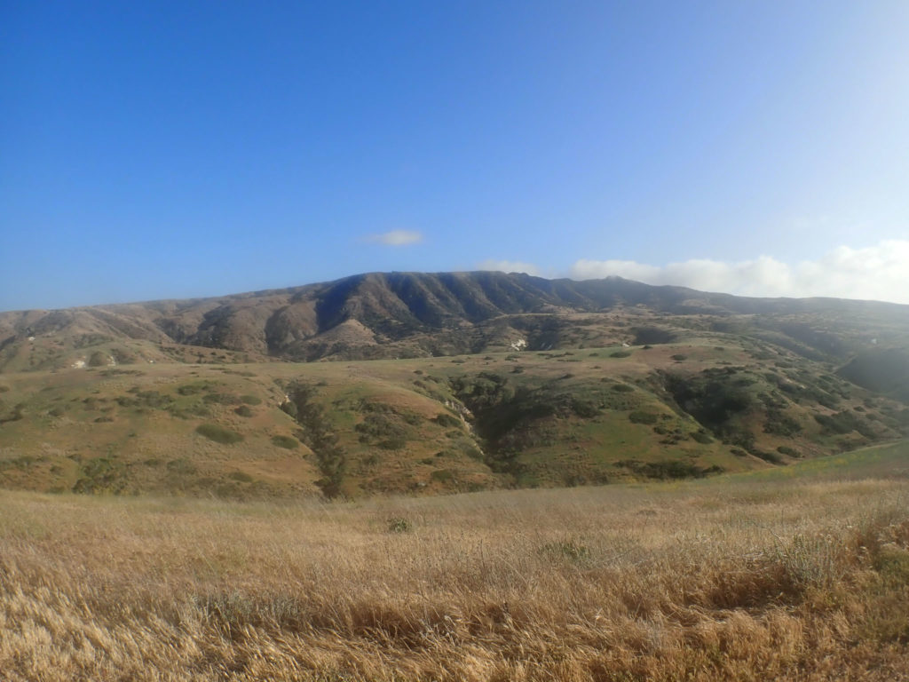
Graced with a few more hours of daylight, the group explored Santa Cruz Island. The largest of the Channel Islands is split between the National Park (24%) and The Nature Conservancy (76%). Docking at Scorpion Anchorage, we hiked 3.5 miles (roundtrip) to a vantage point of our day’s dive site. Compared to Anacapa, this island was covered in green vegetation and rolling hills. While on the island, island foxes, a unique subspecies, ran along the campsite trails. Living on six of the eight islands, these foxes are 1/3 smaller than their mainland ancestor.

Rolling hills of Santa Cruz Island

Located in a marine conservation area established in 2003, Thursday’s dive site: Keyhole – Anacapa Island, is closed to all fishing except recreational/commercial lobster and pelagic fish. Unique to this data collection day, Merrill and I spend one of our three dives measuring the bat stars (Patiria miniata) that riddled the site along the transect line.

Look, it’s me! PC: Merrill McCauley

Since Friday marked the end of the KFM trip, the team did not have sufficient time to visit another survey site. Instead, we used the morning to complete a 90-foot dive at Yellowbanks – Santa Cruz. Open to all fishing, this kelp-less landscape is dominated by brittle stars and enormous sea urchins. Previously a home to abalone, the only evidence of this species was a large shell trapped in a discarded lobster trap entangled on the ocean floor. Upon completing the dive, we were accompanied by common dolphins as we traveled back to Ventura.

Calm waters led the way to CHIS Headquarters

By the end of the KFM trip, I had learned a lot. My buoyancy with a drysuit had drastically improved, and my entry/exit from the water was nowhere near as clumsy as my first day. When I arrived, I have to admit I was intimidated by the amazing, dedicated divers of the KFM program. To collect data vital to the park’s records, they performed long dives several times a day often in limited visibility and current. I learned a lot from them and enjoyed getting the opportunity to dive all week in this lovely park. I even had a fantastic drysuit hand tan to show for my first national park of the summer!

Like my first night in Ventura, my final night was spent on the docked Sea Ranger II surrounded by a chorus of barking sea lions. After almost missing my shuttle back to LAX, I arrived hours before my flight and got the chance to catch up with a close, college friend, Chloe Von Helmolt. In the evening, I headed back to the airport in search of warmer waters. Biscayne National Park about an hour south of Miami, Florida would be my next destination. While I enjoyed kelp forest diving, tropical waters were calling my name as I boarded my red-eye in search of the sunshine state.

Thanks again to the amazing Kelp Forest Monitoring team!

Quick facts about KFM Program:

  • Longest established marine inventory and monitoring program within the National Park Service
  • Over 400+ divers have assisted with the Kelp Forest Monitoring Program
  • Have been able to map the spread of several invasive species (e.g. Sargassum horneri)


Share

Life on (semi) Permanent Vacation

The Keys are not what you call a bustling metropolis. Most metropolitan dwellers come to the Keys to escape their everyday, busy city lives. For most people its just that, a vacation. But for me, and the other three interns for REEF’s 2018 summer semester, its our current home. I am not in Nova Scotia anymore, that’s for sure.

I am fairly familiar with the area as I have been coming down to dive it the past six years. But since I’ve started at REEF, I have gotten the opportunity to know the community better. My supervisor, Ellie, set up meetings for me and the other interns with other organizations in the area over the course of our first couple weeks. This included the History of Diving Museum, The Coral Restoration Foundation and The Florida Keys Wild Bird Rehabilitation Center. Each of these organizations is filled with passionate people who are dedicated to spreading the good work of environmental conservation across the Keys. Its an exciting place for me to be as I explore the potential pathways for my career.

For those who don’t know, REEF has four main categories of focus: The Grouper Moon Project, The Invasive Lionfish Program, the Volunteer Fish Survey Project (VFSP) and the Explorers Education Program. I will talk more in depth of each of these categories in future posts. As an intern here, I have the opportunity to add to or take on a project that is in line with REEF’s focus. I am particularly interested in the VFSP because since its beginnings in 1993, it is now the world’s largest database on marine fishes! I plan to contribute to its database while I’m here by diving as much as possible. Being able to identify the fish in the area is giving me a greater sense of appreciation for everything I see, big and small.

The VSFP is a great way to encourage already ocean concerned people, like scuba divers, to participate in the bigger picture of conservation. It is also a great resource for scientists and researches. But what about those who don’t have a background with the ocean? How can the REEF database be used to engage the rest of the public on issues of conservation? Stay tuned as I try to answer this question over the course of my internship.

Share

80° to 40°: Leaving Hawaii and the start of my summer in Alaska

Hey everyone! For those of you who don’t already know, my name is Lena and I have the honor of being the first OWUSS/AAUS Mitchell Scientific Diving Research Intern. I’ve included my full biography below for those of you who want to know a bit about my background, otherwise I will get right in to telling you about the start of my internship and some adventures I’ve been up to already. 

I am 21 and just finished my sophomore year studying Marine Biology at the University of Hawaii at Manoa. Originally from Santa Cruz, California, I have grown up connected to the ocean and chose to study biology in order to combine my love of conservation and diving. In high school, I volunteered with The Marine Mammal Center, helping rescue stranded marine mammals along the California coast. 

I became PADI Open Water certified in 2014 during my senior year of High School. After High School, I embarked on a gap year, traveling to Thailand, Cambodia, Vietnam, Fiji, and Madagascar. In Thailand, I volunteered at Elephant Nature Park, and had the unique experience of assisting with the rescue of an injured and abused elephant. In Cambodia, I taught English to second grade Cambodian children. In both Fiji and Madagascar, I had my first experiences with scientific diving, doing fish and invertebrate surveys as a volunteer with a non-profit group. Living simply on small islands and diving almost daily I found my passion, bringing together diving and scientific study. While in Fiji I gained my PADI Advanced Open Water, Rescue Diver, and Dive Master certifications. Subsequently, I worked as a dive master in Fiji, deepening my love for the underwater world. Determined to keep excelling as a diver, I earned my AAUS Scientific Diver certification in the Spring of 2017. I am excited for this summer and the opportunity to acquire new scientific diving skills. 

This summer, I am working closely alongside doctoral student Jared Weems as he conducts his research on Blue King Crabs (BKC) around Saint Paul Island (SNP), located in the Pribilof Islands in the Bering Sea. With the goal of understanding the difficulties behind stock recovery of BKC after severe overfishing prior to 1999 when direct harvest was closed, Jared has dedicated his time and research to studying three possible causes: larval supply, predation on juveniles, and habitat availability. Detailed info about Jared’s research can be found on his website, Pribs Blues Muse, https://www.sfos.uaf.edu/research/pribsbluesmuse/, but I will tell you a bit about the methodology of each project as it comes up throughout the summer. 

My summer is broken up into two asymmetrical chunks of time or trips to Saint Paul, the first of which I have just finished. I left home in California on May 18th, just a week after finishing school, and flew up to Juneau. After a couple days of shopping for food and supplies, where I got my first ever pair of XtraTufs, a staple in Alaskan work and style, Jared and I began our journey to Saint Paul. We left Juneau in the morning and after a short stopover in Anchorage and then Dillingham where we waited for the weather to clear, we made it to Saint Paul on a flight full of birders, undoubtedly heading to the island to explore its world renowned sea bird colonies.

We arrived in Saint Paul to surprisingly nice weather and settled in at the NOAA Staff Quarters. (For anyone interested in the history, Saint Paul has a unique story involving Russian slavery and the Fur Seal trade prior to Aleut Independence). Saint Paul, also one of the 2,500 islands that make up the Alaska Maritime National Wildlife Refuge, is home to arctic fox, a reindeer herd, fur seals, stellar sea lions, harbor seals, whales, colonies of millions of sea birds (and the extremely rare walrus! pictured later). 

Jared, looking out over the harbor and town of Saint Paul on a stormy day hike

Taking advantage of the good weather, the first few days of work were long and packed with preparation as we waited for our dive gear to arrive on another plane. We prepped and painted 44 concrete blocks, which will later act as anchor lines for our survey sites around the island. We also made 125 glaucothoe settlement bags, which are placed around each of the anchors to collect juvenile crabs over the course of the summer in order to assess population abundances. 

After days of preparation and the start of a streak of bad weather, we waited out the wind and the seas inside and exploring around the island. I began learning my cold water species of algae, fish, crab and other invertebrates while Jared worked on calibrating the cameras for the deep water camera drop surveys and making bread in his beloved bread maker. When our first weather window to go out on the water appeared in the forecast we loaded up our concrete blocks on The Lunax, the islands amazing rescue boat, and headed out to set as many of our sites as possible. It ultimately took two days and lots of energy from peanut m&m’s but we finished putting in all but two blocks.

Another project that we worked on, as I mentioned a bit earlier, was the camera calibration. Sheila, so named by Jared’s tech from last summer, is a modified crab pot that holds a stereo GoPro system used to assess the benthic habitat at deep water sites. With bad weather and one unsuccessful attempt diving in the harbor to calibrate Sheila’s camera, we decided to get creative and think of another method to calibrate the cameras in water. Later that day, I found myself suiting up to climb into a fish tub filled with ice cold water at the Trident Foods warehouse. 

One of the final projects we worked on was deploying SPATTSs (Solid Phase Absorption Toxin Tracking) as part of a harmful algal bloom (HAB) study in the area. In addition to setting the SPATTs in the small boat harbor, we deployed them at four of our dive sites in order to be able to dive, retrieve, and replace them later. 

Finally, after two and a half weeks we finished our early season preparations and will be ready to start diving when we return from our two week break on June 24th. Yesterday, June 7th, we made it back to Juneau where I met up with Jared’s advisor, Dr. Ginny Eckert, to join her on a short trip to assist with some of her other students’ research on Prince of Wales. I am currently writing from her boat, The Lituya, which we will be on for two nights as we bring supplies down to the island. The mountains and snow along the passage are like nothing I’ve ever seen before, so I’m loving these few days to relax, take in the views, and hopefully see some whales! Its been a completely unique experience for me already these last two weeks so I can’t wait to see what’s next.  

On our last day, just before we flew out of Saint Paul, a walrus was spotted off East Landing on the island! Having not seen a walrus come to Saint Paul in nearly 15 years, this was an extra special day to see my first walrus. I had already checked my bag, which had my camera, at the airport but luckily a friendly bird guide let me borrow his binoculars and I was able to take a few pictures with my phone through the binoculars!


Share

Discovering the Heat-Resistant Reefs of Ofu Island at the National Park of American Samoa

“Don’t mind the lizards, watch out for mean dogs, and don’t drink the water. Those are my three biggest island tips,” Tori tells me as we are preparing to go to the grocery store. “I wasn’t sweating it about the lizards, but good to know about the dogs!” I respond. Tutuila, the main island of American Samoa has a rash of stray dogs. As cute as they may look (they generally do not look cute), they are wild animals and fairly ferocious.

Tori picked me up from the airport last night, and I was instructed in an email to look for a “blonde woman that is extremely tall, she will stand out.” Sure enough, in a sea of Samoans, Tori stands out. She has adjusted to the island after 7 months of working at NPSA and embraced many of the traditions here. As a native Ohioan, she has a wholesome flavor to her and is probably the most hard science/technically focused of the team.

The shoreline of Olosega Island.

After a short drive, we enter a chaotically arranged grocery store and Tori excitedly exclaims, “Zucchinis! I haven’t seen zucchinis since I’ve been here!” As beautiful as American Samoa is, it’s geographically closer to New Zealand than the mainland US. Being that far away creates challenges for trade, and particularly for produce since very little is grown in Polynesia.

We are shopping for our upcoming trip to Ofu Island in the Manua islands. Ofu is about 75 miles away from Tutuila, where the National Park Service (NPS) is based out of. We will be flying out tomorrow on a small 12-passenger plane. There are about 150 people that live on Ofu and about 200 that live on Olesega, which is connected to Ofu via a narrow, 100m long bridge. Needless to say, provisions are hard to come by on the island. Once we pack up the car, we head to park headquarters to ready our coolers for the morning.

Our destination is in Manua. Here are the beautiful islands of Ofu and Olosega.

After Tori introduces me to some of the park staff, I meet Bert Fuiava, Park Diving Officer and acting Marine Ecologist at the National Park of American Samoa (NPSA). Bert is a massive man. In the words of the acting NPSA superintendent, Daniel George, “Bert’s arm is the size of my leg!” Bert’s muscular exterior belies his fun-loving personality. Though he works extremely hard, he is the biggest prankster on the NPSA team and embodies the “no worries” island attitude.

After I meet Bert, I meet Ian Moffitt. Ian and I connected virtually many years ago. Truth be told, I have applied to work at NPSA multiple times over the years. Being from Los Angeles himself, Ian and I have a mutual contact that connected me with him years back. After occasional internet chats, it is great to actually meet him in person. “Want to come help me out with some boat stuff real quick?” he asks me.

(L-R) Bert Fuiava, myself, and Daniel George at park headquarters.

Soon enough, we are at the NPSA boat yard. Ian shows me around and I get to work gathering equipment for Ofu and doing a bit of housekeeping. Unfortunately, Ian isn’t coming with us to Ofu, so this may be one of my only opportunities to talk with him. Ian’s been in American Samoa for almost 3 years- the longest of any of the pelongis (non-Samoans) on the NPSA team. He tells me about the benefits and challenges of his stay on the island and how his career has progressed at NPSA. Without Ian, NPSA would have trouble continuing their dive program. His mechanical knowledge is a precious resource, as he keeps all the park boats up and running. We also talk about our hometown of Los Angeles a bit as well. I don’t always have a hunger to be around people that grew up in the environment I did, but it is really nice every now and then. Ian is such a solid guy. He is constantly working and hyper focused, but knows how to have fun and isn’t so serious that he can’t crack a joke every now and then.

Tutuila is one of the hubs of the tuna industry in the Pacific. The scene of locals preparing nets for massive international fishing vessels is common in Pago Pago.


Tori, a few of her friends, and I are lathering up in bug spray at Tisa’s. Tisa and her husband, who oddly goes by the name of “Candyman” run Tisa’s Barefoot Bar. It’s a bar/restaurant that makes from scratch or catches nearly everything they serve- including fresh fish and piña coladas. While Tisa’s food and drink was the draw for us, I was more interested in their Marine Protected Area (MPA). Tisa and Candyman manage the MPA that lies directly in front of their business. “Their giant clams are the biggest I’ve seen on the island,” Tori tells me.

I ask Candyman how they deal with poachers. He tells me that it’s usually easy because they can see them walking on the beach or snorkeling on the surface, but lately it’s been tough. “There are no scuba shops on the island, but people are still getting scuba gear here. They go out at night for the clams and they are hard to see underwater. I’ve been kayaking out though and dropping some rocks in the water when I see lights!” Though this sort of management would never be considered acceptable in the developed world, it is working here and quite an inspiration to me.


“So apparently there’s a matai on our plane,” Tori tells us as we are loading up the van in the morning. Matai’s are high-ranking Samoan chiefs. Having a matai on your plane means that you and your luggage will not get priority and may or may not make it to your destination. Normally, this isn’t a huge deal. However, there is only one flight a week to Ofu. Even though we sent most of our heaviest equipment via boat last night, not having our gear (or even worse, crew) for the week would be devastating.

Ofu’s corals have quite the reputation and it’s easy to see why!

Once we get driving, Daniel lightens the mood. He says, “someone described these planes to me the other day as a ‘flying busses,’ which is comforting…how high do these planes go?” Bert responds, “4000 feet I think.” “Ok, good. If it was 5000, it might be a problem, but I feel totally fine hoping out of the plane at 4000 feet if it comes down to it.”

This is the essence of Daniel. Daniel has spent most of his life on the Pacific coast of the lower 48 and currently heads an Inventory and Monitoring team based out of Pinnacles National Park in California. He perfectly walks the line between being professional and having fun. As such, he is quite popular with his team. Daniel is also one of those people that is probably the smartest person in any given room that he walks into. He is an avid birder that leads his team by example with a strong work ethic and is probably the funniest person I’ve met all summer.

The plane coming down on the runway at Ofu Island.

Once we get to the airport and grab a quick breakfast, we board the plane with the matai without a hitch. After unsuccessfully looking for whales outside my window for 30 minutes, we arrive on Ofu and head to “the lodge.”

The bridge that connects Olosega and Ofu.

The lodge is a 1-minute walk from the airport (note that the airport is just an airstrip and an open structure). It’s odd to not have to find transportation to my destination from an airport, but really convenient. The lodge sits right by the coast and next door to the NPS visitor’s center on Ofu. A married island couple named Ben and Deb run the lodge. They each spent significant amounts of time stateside and can communicate and connect well with their guests.

Elsa and Jason Bordelon inspecting a prized delicacy on the island- coconut crab.

We quickly put away our food in the breezy kitchen of the lodge to a reggae soundtrack and start putting together gear for the day. While we are gathering up the equipment we need, I hear 3 year old Elsa Bordelon exclaim, “best day ever!” as she looks out on the ocean. Elsa is the really the star of the trip. She is the daughter of Jason Bordelon, Chief of Interpretation. Jason and I bond quickly as he also spent several years on the west end of Catalina Island and likes to surf. Between Elsa and work, Jason is staying pretty busy on Ofu. Elsa is a free spirit if there ever was one and makes the whole crew laugh throughout the week.

There is a small store on Olosega where residents can buy mostly canned goods. Chicken is also available in zip loc bags.


Once we are ready to go into the field, Bert, Tori, and I hop in the truck with the Ofu NPS team- Brian and Boy. Ofu is of particular interest to the scientific community because of what happens in its nearshore “pools,” where seawater gets held up at low tide and the interaction with the open ocean is limited. These pools heat up to above 90 F, which is much hotter than corals should be able to withstand. Yet, the corals in the pools are thriving. Why is this? What makes these corals different? Does this provide us hope in the face of a warming ocean?

NPS is continually working with Stanford and Old Dominion University to answer these questions. This week, we are taking water quality samples (just like I did at KALA) as part of the Inventory and Monitoring process that goes on in the Pacific, as well as looking at coral reef plots that partnering universities are researching. The latter exercise involves us finding corals that the university has tagged in the warm pools, retagging them (the tags get covered in encrusting algae very quickly), and taking photos so that all involved parties can analyze how quickly the coral is growing, bleaching, or receding. The idea is to find which corals are growing well in the warm pools and why that is.

Massive, bouldery Porites corals make up the majority of the coral cover on the island.

As we are taking our water quality samples, Bert is teaching Boy and Brian how to do it so that they can help with the study when the Tutuila-based team isn’t on Ofu. After we go to several sites and finish all of the water quality samples we need to take on Ofu, we call it a day and head back to the lodge.


It’s a warm afternoon on Ofu and Tori and I are swatting mosquitos off ourselves. We are on day 3 of our Ofu mission. I’m getting the hang of searching for tagged corals. It’s been very challenging because the tags are small to begin with and are often completely fouled or missing. We are struggling with certain tags more than others and start to see a pattern of which ones are missing. This helps us determine where we need to make new sites versus where we should actually spend effort looking for tags.

Bert inspects one of our new tags, they are never this obvious when you come back to them in 6 months time.

After our second site of the day, Bert shouts out, “Sione!” Sione is my name in Samoan and has become my nickname on Ofu. “Let me see how you husk a coconut!” I told Bert that I can husk coconuts- which is true. There is a perfect husking stick at this site. The thing is, I haven’t had a perfect husking stick to husk a coconut on in 4 years. It should be easier, but because I’m out of practice and have been husking coconuts with a pocket knife all summer, I struggle a little. About 8 minutes later, I’ve husked my coconut. “I’ll show you the Samoan way!” Bert says, as he proceeds to husk a coconut in about 20 seconds and we all laugh.

Tori records data about the corals and the number of our new tag to makes sure it all makes sense for both NPS staff and collaborating universities.

As day turns into night, we are all cooking dinner. I look at the food Daniel brought, which is only rice, beans, and quinoa. I have to ask him. I turn to Daniel and say, “are you vegetarian?” I am hoping for a fellow vegetarian in American Samoa. Despite how every single person I’ve met who has been to American Samoa has told me how difficult it is to be vegetarian here, it’s actually not too hard. However Daniel is not a vegetarian, “I’m mostly vegetarian, but I’ll slam an animal every now and then if I need to.” I can’t help but crack up at that statement. Slam an animal?! That has to be one of the funniest ways he could have put it.

Coral nurseries like this are common in Ofu.

Though Daniel is hilarious, what I admire about him most is his commitment to his values. The reason he brought so little food with packaging to Ofu was because knows that what is brought to Ofu gets put into a “dump” (a hole in the ground) on Ofu and often will end up in the ocean or burned. In order to reduce his footprint on the island, he brought food that has the least amount of packaging possible. This is what a leader should be doing.

Daniel dives in to get a photo.


My scuba boot tan is pretty spectacular right now. After 5 days of surveying, the back of my legs are extremely tan and the skin under my boot line is not. Today, we are also doing some video surveys along our transect lines. The way it works in-water is Bert and I set up the transect tape at each site, then Tori swims along the tape taking video. The video is analyzed later and compared to past videos. NPS is specifically looking at coral cover and coral health from previous survey to this survey.

Healthy corals mean healthy fish!

Additionally, we are taking a cow bile mixture with us today in case we see any crown of thorns sea stars (COTS). COTS are native to Samoan waters, but they are what I like to call “coral reef lawnmowers.” They are ravenous coral eaters and don’t really have natural predators. It’s difficult for humans to remove them as well since their bodies are covered in venomous spines. As such, having multiple COTS in a small area can spell death for that entire section of reef. NPS uses cow bile to kill COTS. It is inserted into the COTS through a syringe and will disintegrate the COTS within 24 hours without harming any other marine life.
The white “scar” on the coral on the left side of this structure was caused by the COTS that ate it, cryptically hanging out under the overhang. COTS are generally much more active at night than during the day.

After our first site, we head to a site where we’ve been seeing COTS throughout the week. I take my camera in the water. Tori, Brian, Boy, and I look for COTS while Bert holds the cow bile mixture. After about an hour of work, we inject 10 COTS. American Samoa experienced a massive COTS outbreak many years ago and it has been the primary objective of NPSA to manage the outbreak until this year when it was deemed managed. All in all, they killed over 26,000 COTS.

A more conspicuous COTS. They really do live up their name, don’t they?! Crown of thorns?

This is even more impressive when considering the logistical challenges of American Samoa. There are no dive shops nor places to get boat parts in American Samoa, and shipping to and from the territory is unreliable at best. That being said, the fact that Brian and Boy can accomplish the things they accomplish is even more impressive. They are the only two NPS employees on Ofu.

Throughout the week, I’ve gotten to know Brian and Boy pretty well. Brian is a clear communicator who has infinite curiosity and an open mind about his new island home (he’s been on Ofu for about 3 months). He is supported by his wonderful bohemian wife, Rebecca- a California surfer with the most caring heart. Boy is a local. Born and raised in Manua, his local knowledge helps fill in the culture and local ecology knowledge gaps for Brian. Boy is also one of the hardest workers I’ve met this summer.

Bert injects a COTS with cow bile as Brian looks on.

After a long day of surveying and COTS management, we head back to the lodge. Jason and his family have ordered dinner tonight as a special treat and the dinner is a locally speared fish. Daniel and I start to talk about the experience of a speared fish and Daniel says, “yeah, I imagine that the fish probably tells his friends ‘hard pass’ in regard to being speared.”

Later on, Daniel and I team up again. This time, it’s to take down some of the locals in a game of billiards, and by take down I mean that our goal is solely to keep our dignity in tact after we leave the pool table. We proclaim ourselves “Team Pelongi.” As Team Pelongi gets the game started, I miss an easy shot. Daniel jokes, “oh nooo! Your whole family is embarrassed and they’re not even here!” I end up laughing so hard, it’s difficult to finish the game. I never get tired of Daniel’s humor.


Marine debris is an issue even in the remote waters of Ofu.

Today is our last day in Ofu. The mission for today is removing some marine debris that we spotted a few days ago at one of our sites. There is a huge fishing net wrapped around a dead coral head. It likely killed that coral head along with countless others. It’s hard to say if it also killed other, larger animals in the ocean, but marine debris does that more often than not.

The team works to free the net.

Once we are at the site, we find the debris and begin moving it. Boy brings a machete, which makes the process surprisingly quick. Within 2 minutes, the net is ready to be removed. My job is to document the whole thing, but by the time I’m ready to shoot, they have almost removed the net! Once the net is removed, the team drags it onto shore and into the truck.

Run Forrest, run! Boy leads the charge taking the net back up onto the beach.

After the removal and some fun snorkeling, we go over to Boy’s family’s land to harvest some young coconuts. Brian picked some would-be trash and turned it into a pole to knock coconuts off of trees. Once we have 7 or 8, Boy starts giving us a lesson. “You see? Like this,” as Boy flicks a coconut to show us how to tell if it’s good or not. Then he starts flaking off the top of the coconut with his machete. I ask him I can do my own, because I’ve always wanted to try. He agrees and I start hacking away to get the perfect drinking hole in the top. The process is really fun for a beginner but also a little more difficult than it looks. How do the locals have such pinpoint accuracy with their machetes?


I leave American Samoa tomorrow, so I need to finish editing all of my photos and get my last good byes in. My first stop is the NPSA office. After many hours of editing, I say my goodbyes to Jason and Bert. “Sione! This is for you,” Bert says giving me a NPSA shirt. I thank Bert for hosting me, all of his hospitality, and showing me the ropes on Ofu. I also tell him to come visit me in California when he and his family go to their second home on the west coast.

Later that evening, Ian and Paolo (another NPSA employee) come over to hang out with Tori and I. Ian brings up something I said after meeting him last week, “We’d been talking for no longer than 5 minutes, and then I’m walking out the door to help someone and I hear you say ‘thanks Ian, you’re so cool and thoughtful!’” Paolo lets out a laugh, “cool and thoughtful! HA! That is classic!” Ian puts things into context, “I was kind of stressed and didn’t even notice when you said it. Then I was like, wait, did he just say that?! Was that a joke?! Ha ha ha.” For the rest of the night, “cool and thoughtful” becomes our phrase of choice. “I hope that ‘cool and thoughtful’ becomes my legacy at NPSA,” I laugh.

Boy reaches to play with an octopus on Ofu.

I had a blast with Paolo and Ian. It’s really fun to be around two California guys so far from home. Unfortunately, I say my goodbyes to them and Tori when Daniel picks me up for my flight. Daniel is my last goodbye. I tell him that I am going to contact him when I get up to Pinnacles one of these days and that I think he makes an excellent Superintendent.


American Samoa is one of the most remote and unique places in the National Park Service. It was such a privilege to be able to go to NPSA, and particularly Ofu. It was the perfect end to my summer tour- a beautiful landscape and equally beautiful seascapes with the best crew I could ever ask for. I was also happy with my own effort and work at NPSA, which is a great feeling to have. I would say that I feel like I finished on a very high note, but truth be told, I’m not finished. In 36 hours, I’ll be in Washington D.C…


Share