Category Archives: News

Link

Since we are unable to get together in New York City this year, we hope you will join us for our virtual event.

Saturday, June 6th,
4pm EDT – New York
3pm CDT – Chicago
1pm PDT – Los Angeles
9pm BST – London
10pm CEST – Berlin
6am AEST (Sunday, June 7th) – Sydney

We’ll have video messages from our returning 2019 Scholars and Interns.
We will also check in with some of our alumni to see what they have been working on, and we’ll hear from Dr. Joe MacInnis who will provide us with some inspirational words.

We will wrap up the presentation with an announcement of the new Society Interns and Rolex Scholars who will start their experiences in 2021.

If you are unable to join us at the scheduled time, the event video will be available following the event.

https://youtu.be/01PNRBkw3s8 

Share

COVID-19 Effects on the Our World-Underwater Scholarship Society®

Due to the unprecedented circumstances of the coronavirus (COVID-19) pandemic, the Our World-Underwater Scholarship Society will defer the 2020 Rolex Scholarships and the 2020 Internships until Summer 2021. Additionally, the Society’s annual Symposium and Rolex Awards Ceremony, scheduled for June 6, 2020, in New York City, will be moving to an online, virtual event.

The decision to postpone was not easy, especially having just recently selected three new Rolex Scholars and five new Interns. However, the Board of Directors of the Society recognizes the seriousness and continually evolving nature of the pandemic; therefore, the Board decided it would be irresponsible and potentially unsafe to send Scholars and Interns out into the world at this time. All have agreed to defer appointment until 2021, and a formal announcement of the 2020 Scholars and Interns will be released soon.

Each year, the Our World-Underwater Scholarship Society hosts an annual weekend to honor and celebrate the Society’s returning Scholars and Interns, as well as to appoint new Scholars and Interns for the upcoming year. This year, the annual weekend was moved to June to coincide with World Oceans Week.

Given the current travel and stay-at-home restrictions, as well as social distancing guidelines, the Society must cancel this year’s in-person events. In its place, we will hold an online, virtual event, or possibly multiple events. Exact details are still in development, but we still hope to have presentations from the returning Scholars and Interns as well as the world premieres of the films from the 2019 Rolex Scholars.

It is always a great pleasure to bring the Society ‘family’ together each year in New York to renew friendships, celebrate our Interns and Rolex Scholars, and acknowledge the efforts of our volunteers. We, as a Board, are disappointed that we cannot meet in-person this year. However, though we may not be able to gather together, we can assemble apart and present an opportunity to allow people to join in from around the world.

It is more important than ever that we celebrate success while we recognize the challenging times we are all facing.

I look forward to celebrating with you all soon.

Steve Barnett
President
1990 Rolex Scholar

Share

Franziska Elmer: Influential Scientific Diver and Mentor to OWUSS Interns

At the Our World-Underwater Scholarship Society’s 45th annual meeting, held in New York City in May, four of the five incoming OWUSS interns for Summer 2019 discovered a common connection: a tie to diving and passion for science that could be traced back to work with Dr. Franziska Elmer.

2019 OWUSS Interns (Left to right) Ben Farmer, Abbey Dias, Kyra Jean Cipolla, and Liza Hasan at the 2019 OWUSS annual event.

“Fran” is a professor and research mentor who is known by students for her work at CIEE Bonaire and School for Field Studies Turks and Caicos (SFS TCI). Fran is from Switzerland and has her Ph.D. in Marine Biology from Victoria University of New Wellington (New Zealand). Her focus is on coral recruitment and calcium carbonate budgets, as well as on the macroalgae Sargassum sp. She is currently a professor of Marine Ecology at SFS TCI and uses 3D modeling to study coral reefs and hurricane damage. She is also working with other SFS TCI faculty in collaboration with the world-renowned biochemical algae lab at Greenwich University in London to find possible products that can be made from sargassum such as fertilizer and biofuel. The floating sargassum rafts accumulate near the TCI and wash up on the beaches, which can cause harm to existing seagrass ecosystems. The ultimate goal is to use the sargassum for biofuel in the TCI and reduce the importation of fossil fuels to the islands.

Fran also has an interest in the infection of reef fish by the dermal parasite Scaphalocephanus expansus and is monitoring the parasites present in the TCI.

Franziska “Fran” Elmer, Ph.D.

Abbey Dias (DAN/OWUSS Dive Safety Education Intern) and Kyra Jean Cipolla (Dr. Lee H. Sommers AAUS Scientific Diving Intern) met during their semester abroad studying marine science in the Turks and Caicos at the School for Field Studies. There, they took Fran’s Marine Ecology class and were both part of her research team studying topographic complexity of corals and biodiversity using 3D photogrammetry.

“Fran is one of the most fun people to work with on land and underwater. She is innovative and pays close attention to detail. She taught me how to write my first full-length scientific paper, how to make ‘nice cream’ out of frozen bananas, and multiple different ways to make a meal out of sargassum! Her ingenuity and commitment to conservation are inspiring. She supported me when I wanted to design my own research project and provided me with the guidance and encouragement I needed for it to succeed.” – Abbey Dias

“Not only does she teach science well, she is a model at marine conservation and an advocate for sustainability. During the semester that I spent with Fran, I could tell she really wanted her students to do well, and she always communicated with us about opportunities, new research technologies and techniques, and gave us great advice on how to be effective scientists. She definitely helped me grow as a marine scientist, and I wouldn’t have succeeded as the AAUS Scientific Diving Intern without knowing and learning from Fran.”—Kyra Jean Cipolla

Fran (bottom right in pink) diving with students Abbey (in blue) and Kyra (blue fins) in South Caicos, Turks and Caicos, to conduct coral reef research during Fall 2019 at the School for Field Studies.

Liza Hasan (AAUS Mitchell Scientific Diving Research Intern) and Ben Farmer (Dr. Jamie L. King REEF Marine Conservation Intern) also knew each other previously through their study abroad program at CIEE Bonaire.

“[Fran’s] mentorship on my coral disease research project is what truly sparked my passion for marine research and fieldwork… She showed me how to be an intense researcher that gets a lot of things done, while also staying passionate about what you believe in, and having fun doing it. I could not have asked for a better mentor to direct me into the world of tropical marine science, and I am overjoyed to be rejoining her again in Turks & Caicos in the fall, this time as a Waterfront Assistant. She was one of the people that inspired me to stay involved with the education abroad world, and I am very excited to work alongside her soon!”—Ben Farmer

“Dr. Elmer inspired us all with her personal testament of what the pristine marine world looks like through her experiences on the Palmyra Atoll. I was inspired by Dr. Elmer to seek out interesting field positions and educational experiences far and wide after learning about the previous positions she has held. It was Dr. Elmer who suggested that my fellow CIEE students and I apply for internships through Our World-Underwater Scholarship Society. It is no coincidence that four of Dr. Elmer’s students across two different study abroad programs have received Our World-Underwater Scholarship Society internships. Not only is Dr. Elmer dedicated to research and conservation, but she is dedicated to her students.”—Liza Hasan

Fran (peeking out from the middle of the back) preparing to dive with students Liza (far left) and Ben (far right) in Bonaire.

Aside from scuba diving and marine science, Fran is passionate about art and environmental conservation. She is currently working to fund the purchase of a device that will turn plastic waste into useful items such as flower pots for the small island of South Caicos, where the SFS center is located.

This upcoming year, Fran will take a climate change sabbatical which will allow her to develop a number of projects. The first is to begin project management of offshore sargassum harvesting research for carbon sequestration and biofuel sources. Then, she will then bike 1,800 miles across seven countries while documenting environmental projects taking place along the Danube river, starting in Germany. Finally, Fran will organize the Caribbean section of the Global Coral Reef Week symposium, and increase accessibility to students and the general public.

Abbey, Kyra, Liza, and Ben would like to thank Fran for her hard work teaching students like us about the importance of marine ecosystems and ocean conservation. Fran’s influence on these interns has been incredibly important to their interest in pursuing careers in marine science and advocating for the protection of our ocean.

Kyra Jean and Fran on the last day in TCI.

Abbey and Fran on the last day in TCI.

Ben and Fran working together in TCI.


Share

An Isolated Paradise -Marine Monitoring at Kalaupapa National Historic Park

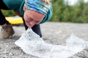
Kalaupapa National Historic Park is one of those places that you can tell is special from the moment you get there. Isolated from the rest of the Hawaiian Islands by towering sea cliffs and from the rest of the world by thousands of miles of open ocean, this small peninsula was once a colony for people with Hansen’s disease (or leprosy), reminding us that even the most beautiful places can be a prison. Under orders from King Kamehameha V of Hawaii, victims of this disease were snatched up from their lives with little to no notice and indefinitely interned on this remote peninsula. Facilities were minimal and compassion was almost entirely absent. The patients were left to live in isolation, unable to have any type of physical contact with visitors, from 1866 until the end of mandatory isolation in 1969.

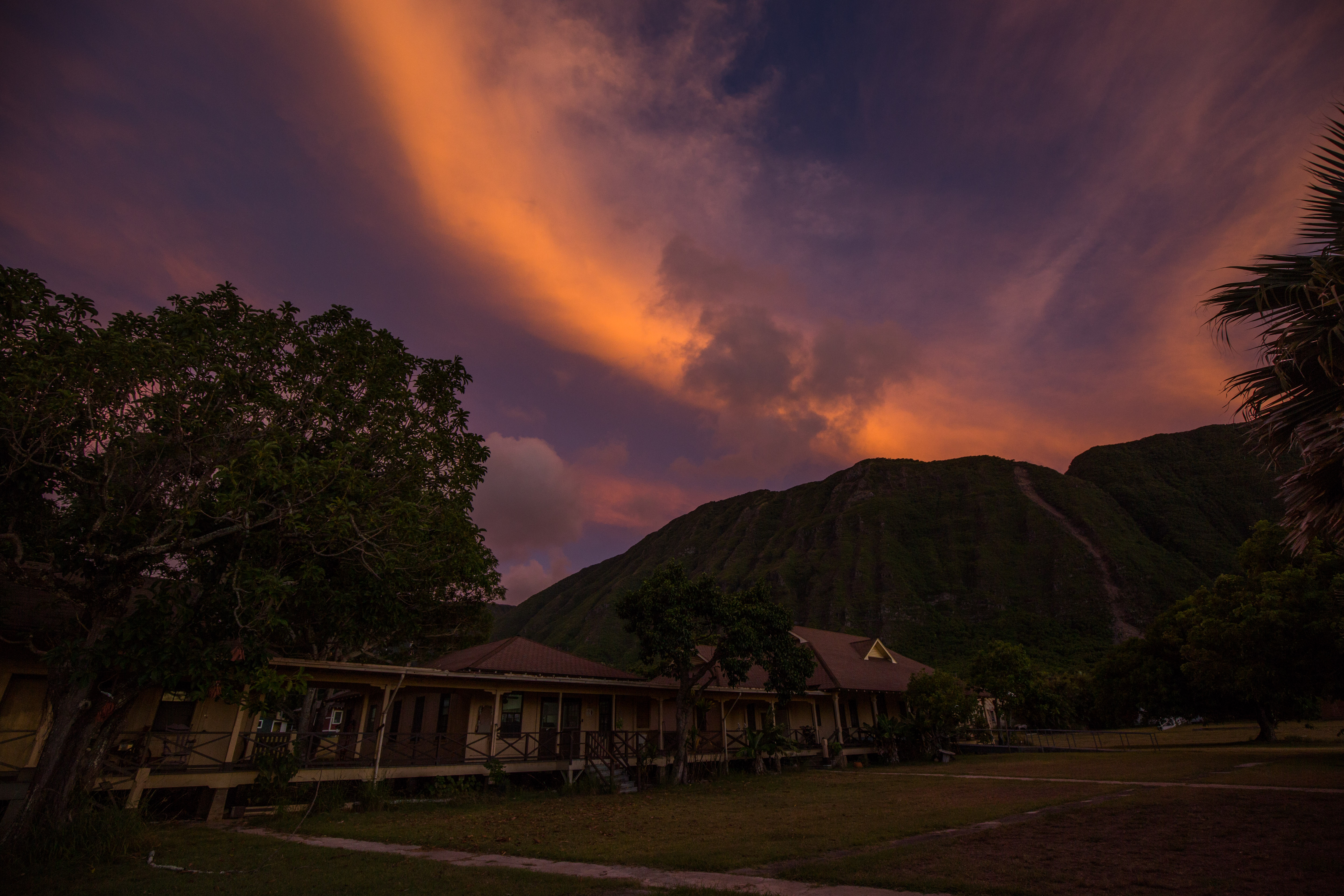
Bay View Housing, formerly for the patients but now occupied by NPS employees

Since the cure of the disease, the settlement has become a much happier place, with some of the patients choosing to stay on what is now their home despite the lifting of travel and visitation restrictions. Around 9 patients still live on the settlement, with the rest of the residents being employees of the NPS or the Department of Health, who remain on site to maintain and support the park and patients.

My visit to Kalaupapa wasn’t always in the books. Due to personnel changes in the park (the long-time marine ecologist, Eric Brown, moving to a new position in American Samoa), I was told that I wouldn’t be able to visit during my internship as the annual marine surveys wouldn’t be taking place. While in Channel Islands National Park, I met Kelly Moore (who is taking the Kalaupapa marine ecologist position) and learned that the surveys were back on the schedule and were going to take place right after my time on the islands ended. After some quick arrangements with various parks service folks, I found myself on a flight out to Hawaii just two days later, eager to join up with a new team.

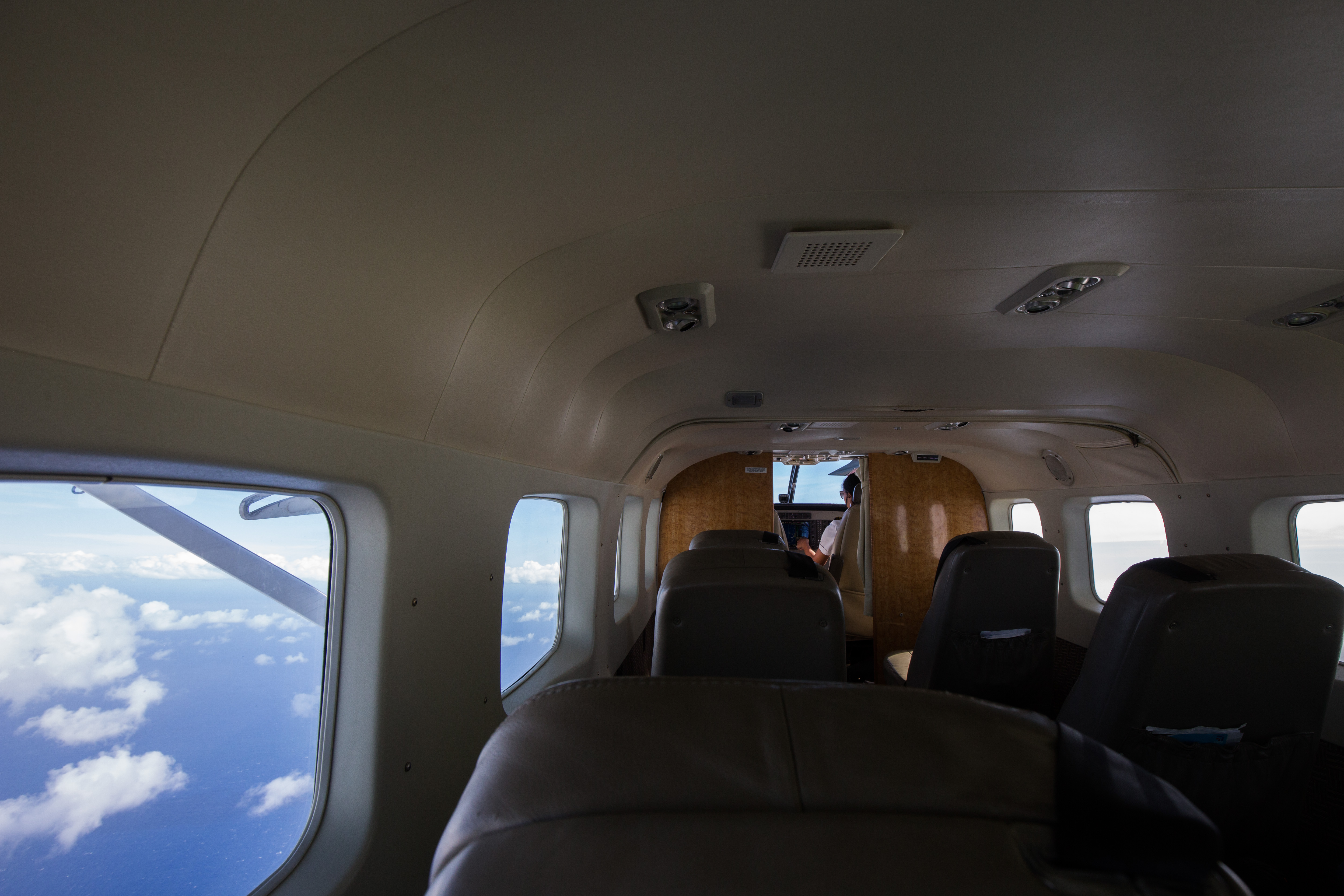
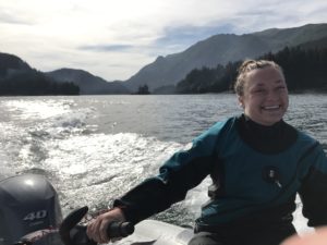
My ride into the settlement

When the strict isolation laws of Kalaupapa were let up, the governing of the peninsula was turned over to the patients. In order to retain control of the land that is now the only home that most of them know, they set up some rules to ensure that it remained a happy place for themselves. These rules include ones like no children under the age of 16 (as historically children weren’t allowed on the settlement and any birthed there were taken from their mothers as soon as they were born, so children spark unpleasant memories for some patients), a strict limit on the number of visitors allowed, and an escort required for all visitors outside the settlement grounds. The last rule was the first one that I noticed, as I wasn’t allowed to leave the airport until my park sponsors were there to pick me up.

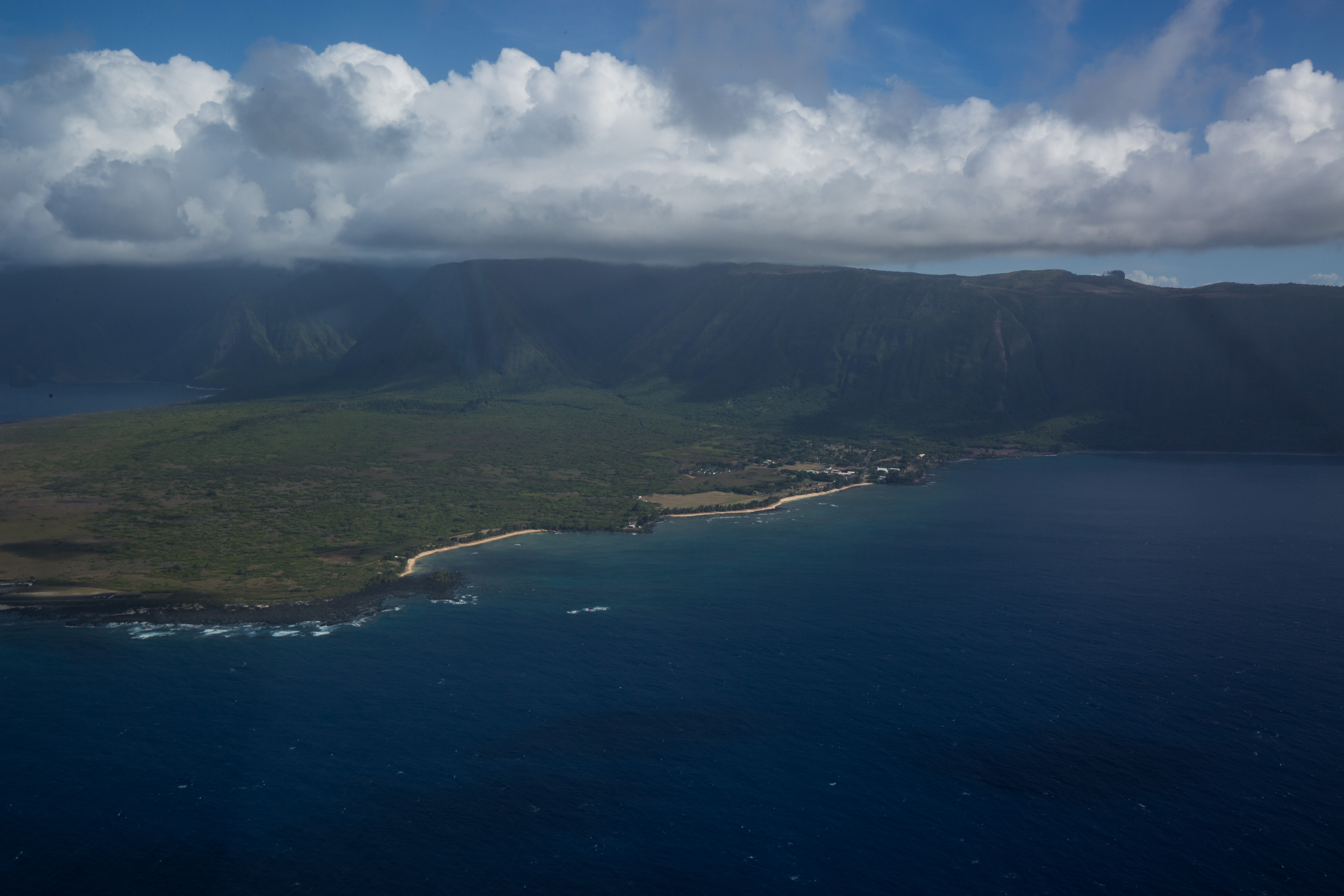
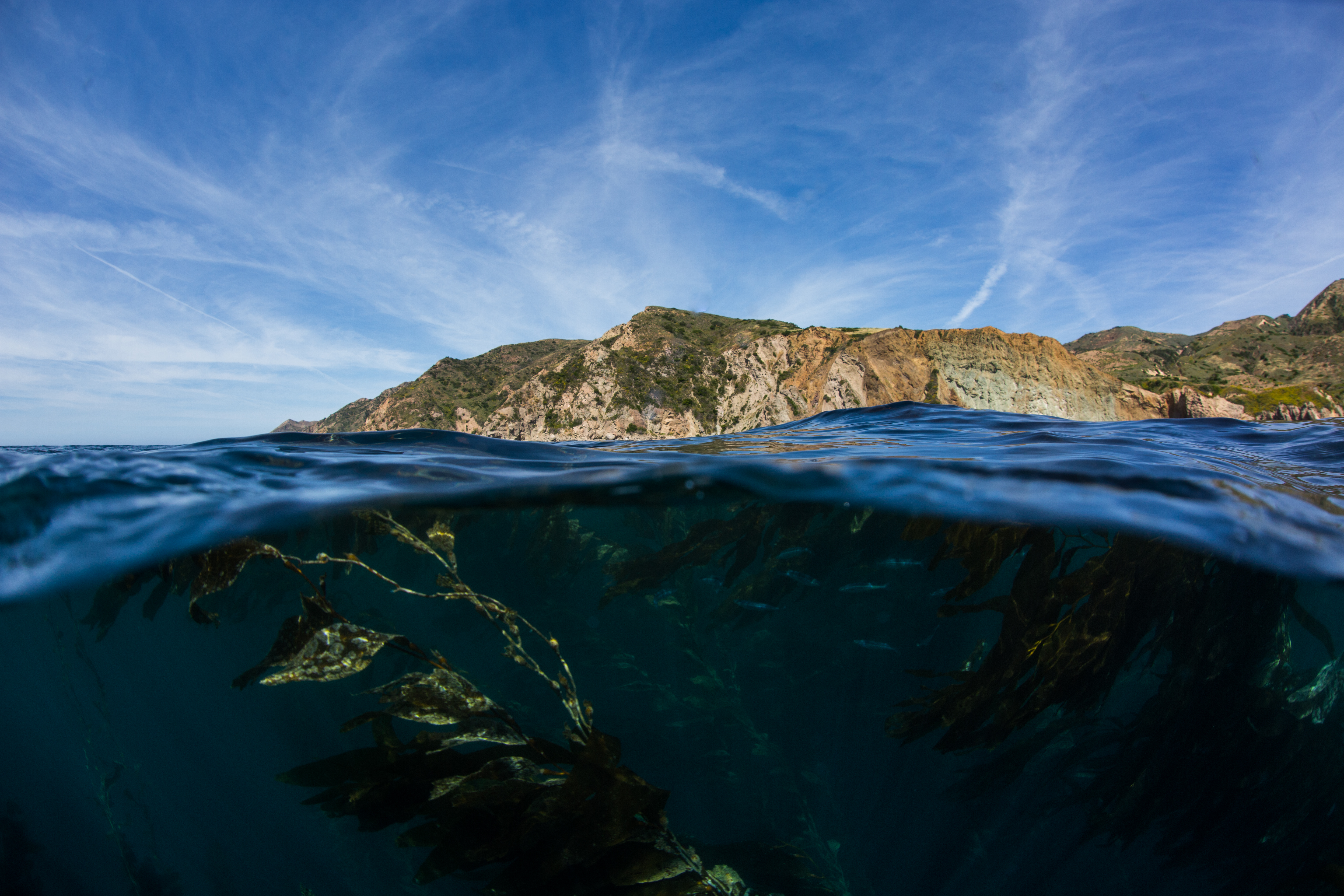
The peninsula and settlement from the sky

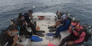
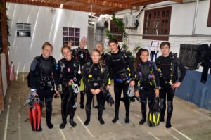
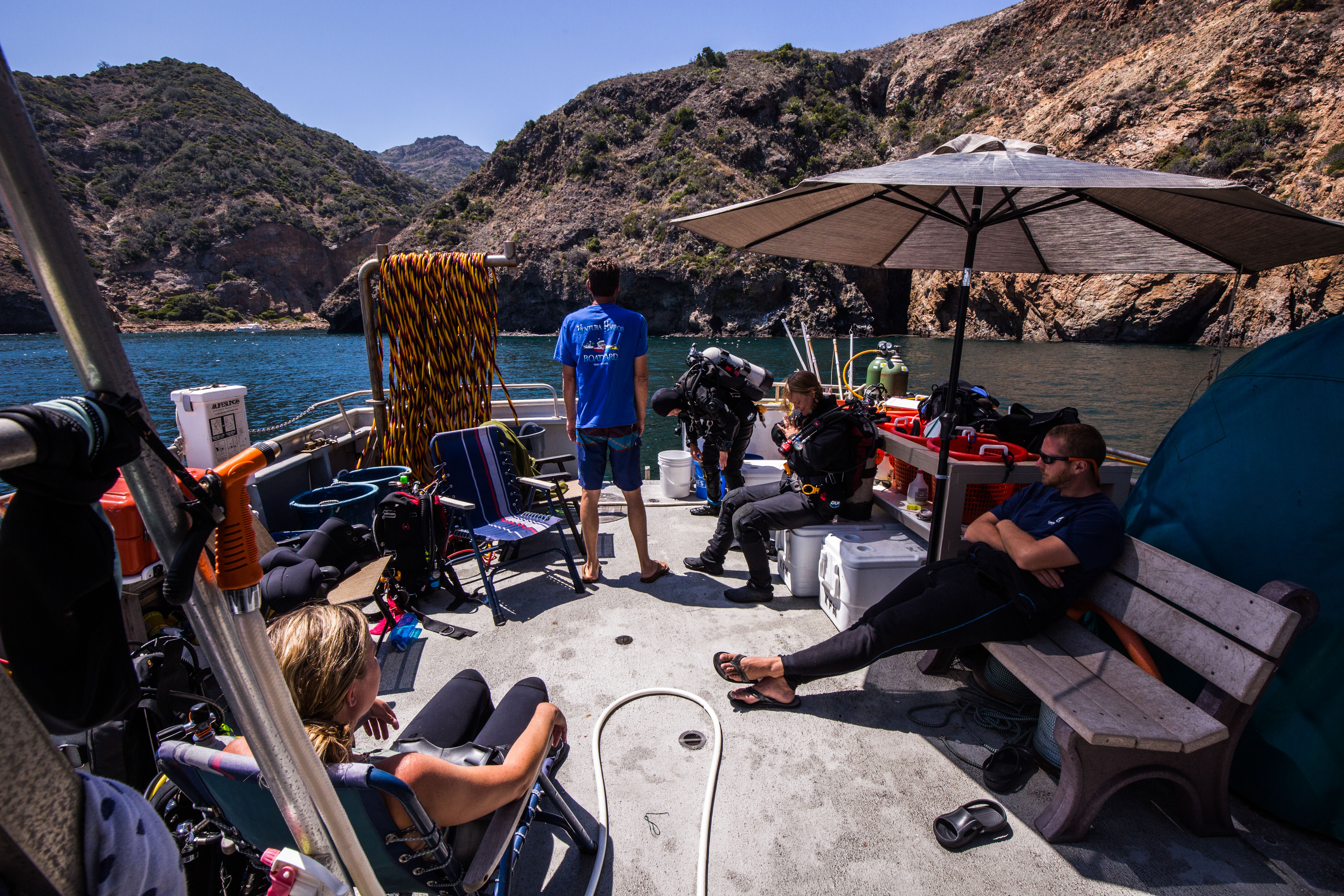
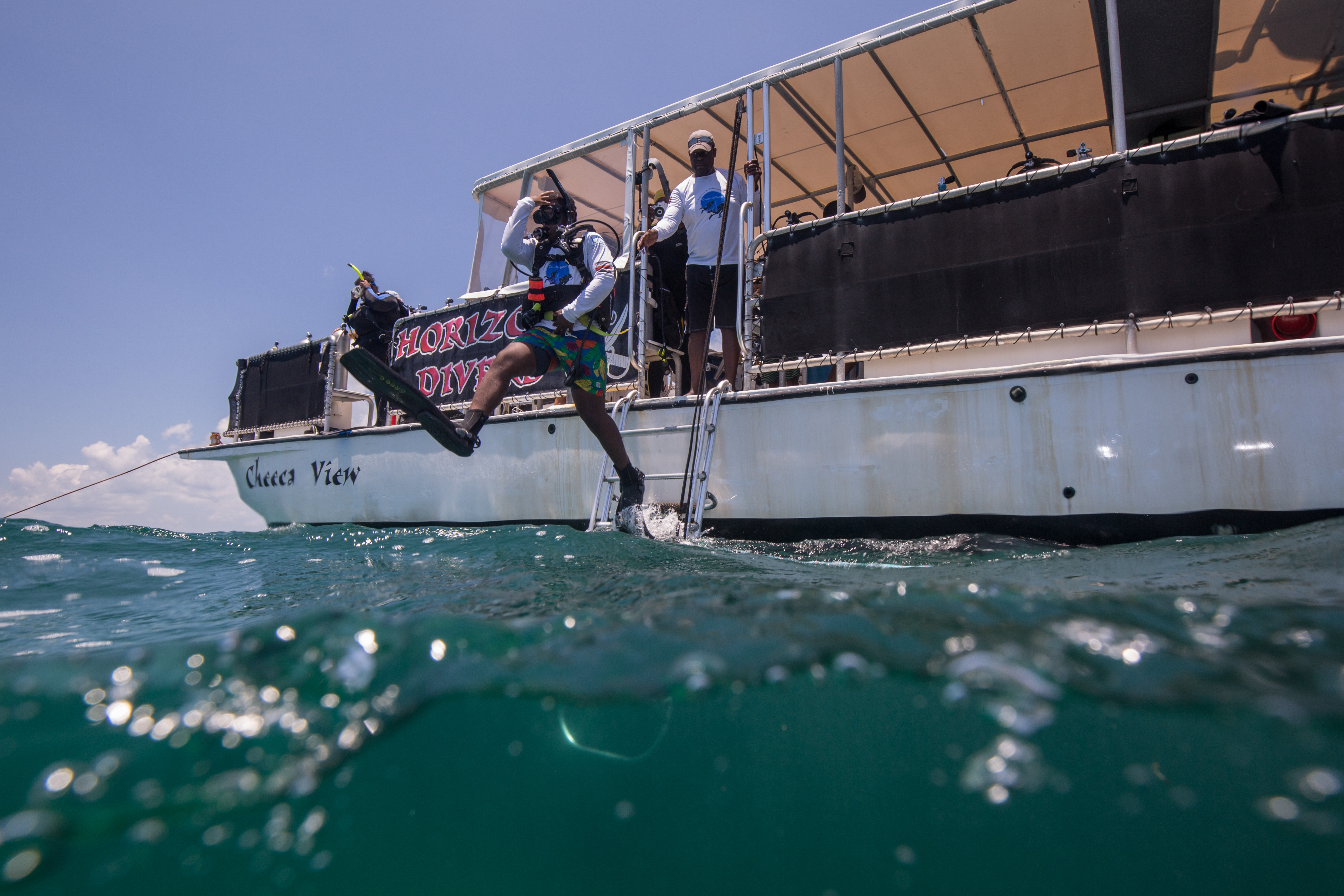
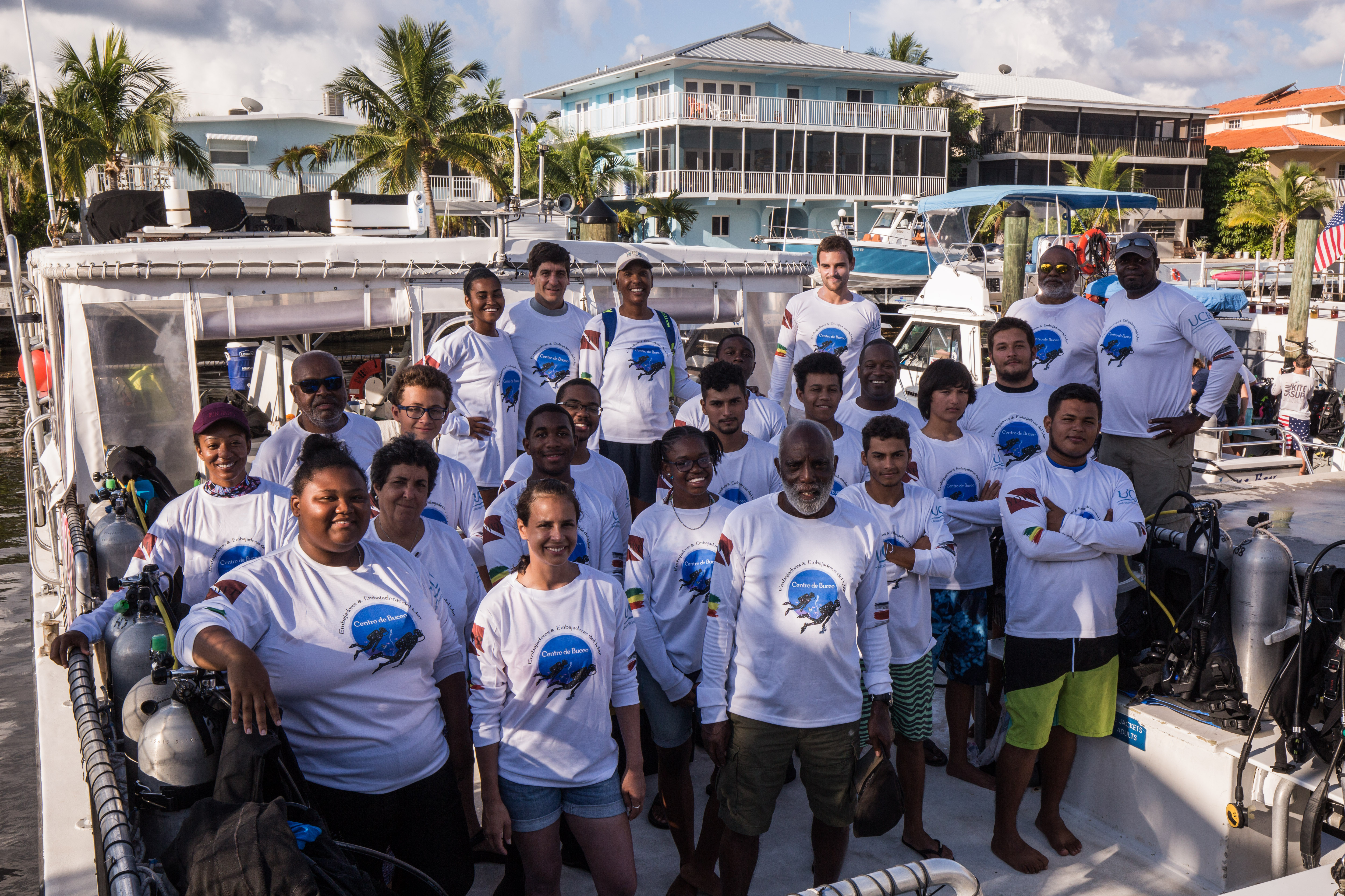
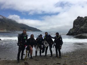
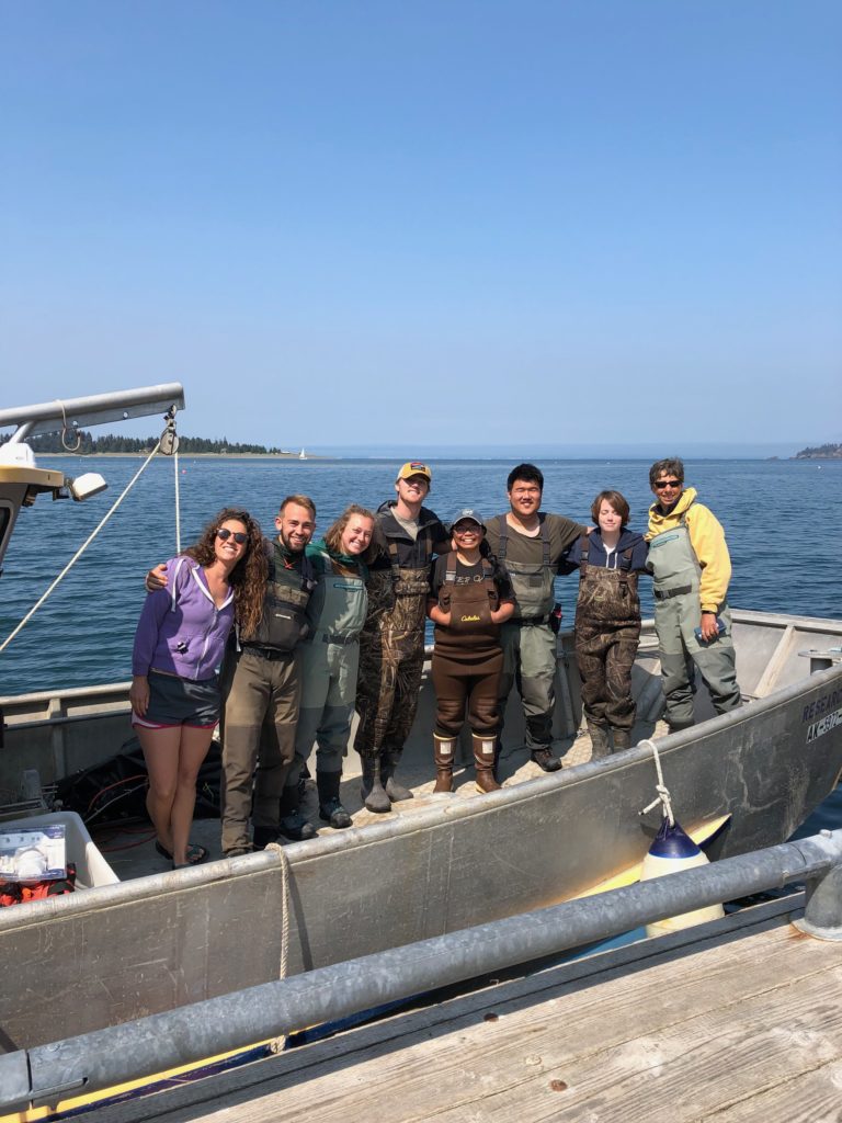
Landing on Kalaupapa’s airstrip in a small, 8 person passenger plane, I walked across the tarmac and picked up my luggage to be greeted by Sheila McKenna, marine ecologist with the Pacific Parks Inventory and Monitoring,  and Glauco Puig-Santana, a biotech working for both Pacific Parks I&M and Kalaupapa. From there, we rode into town and met Eric Brown and quickly began to orient ourselves on the survey protocol. We had a lot of sites to get done, around 20, and a short window to complete them all so we got right to work.
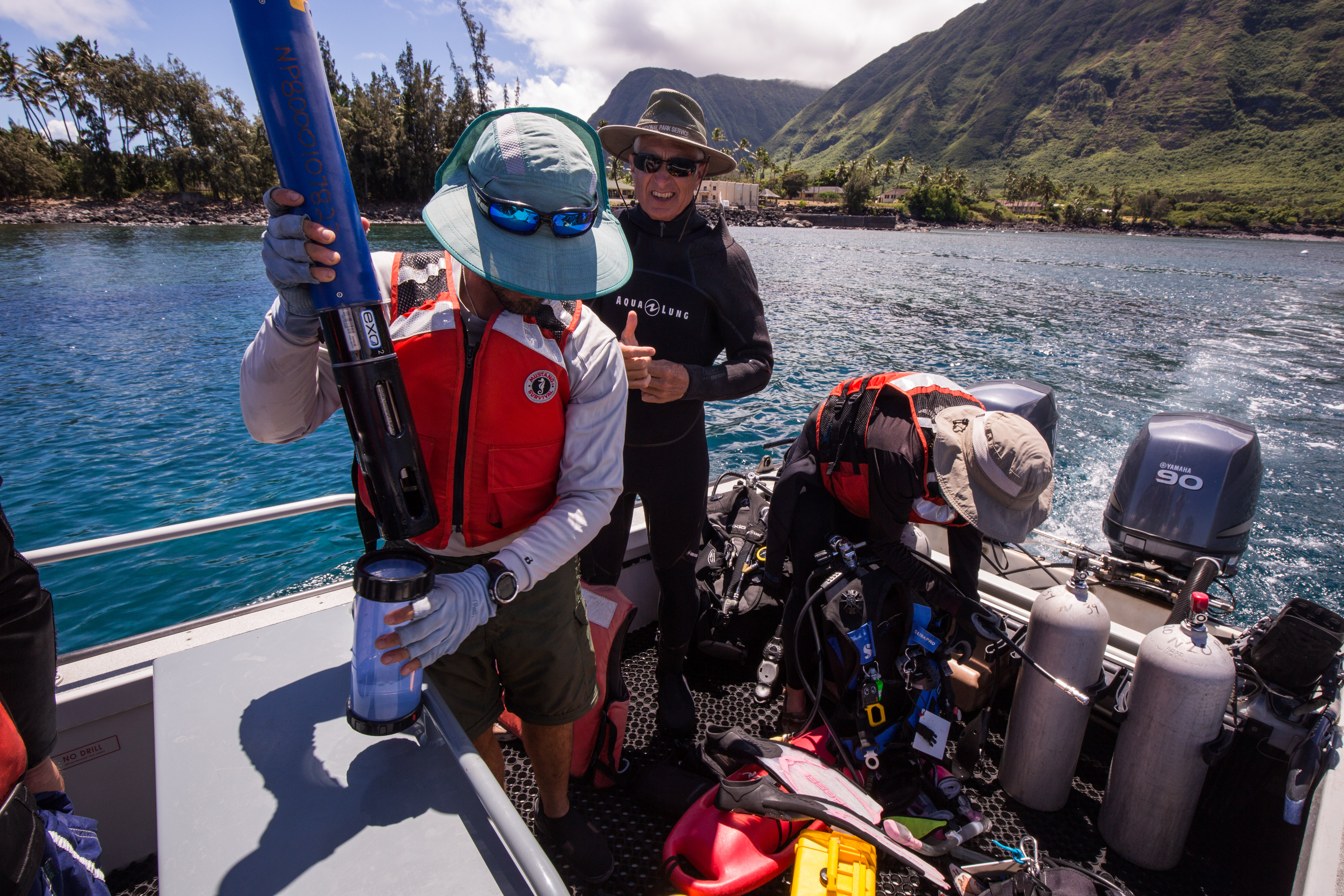
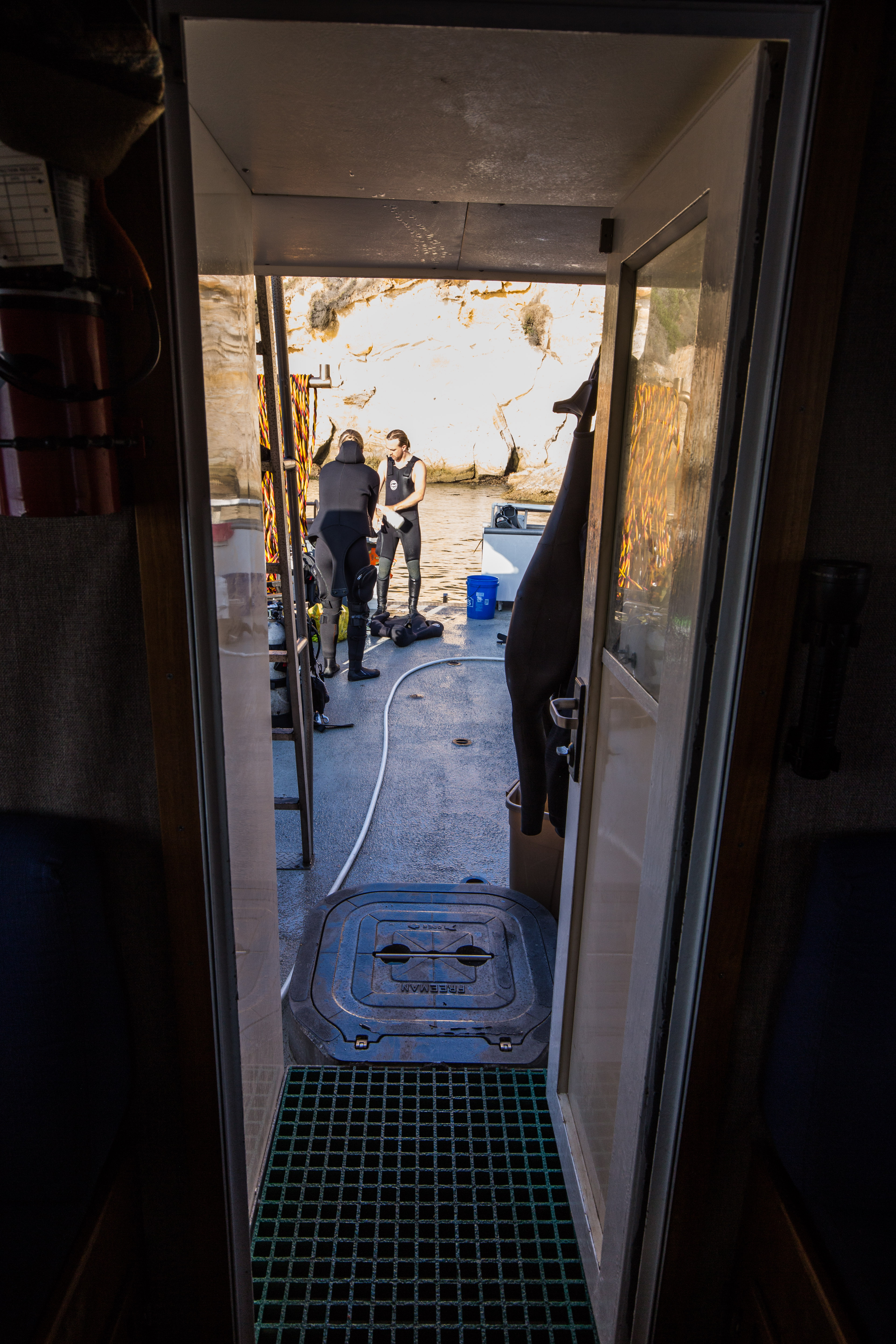
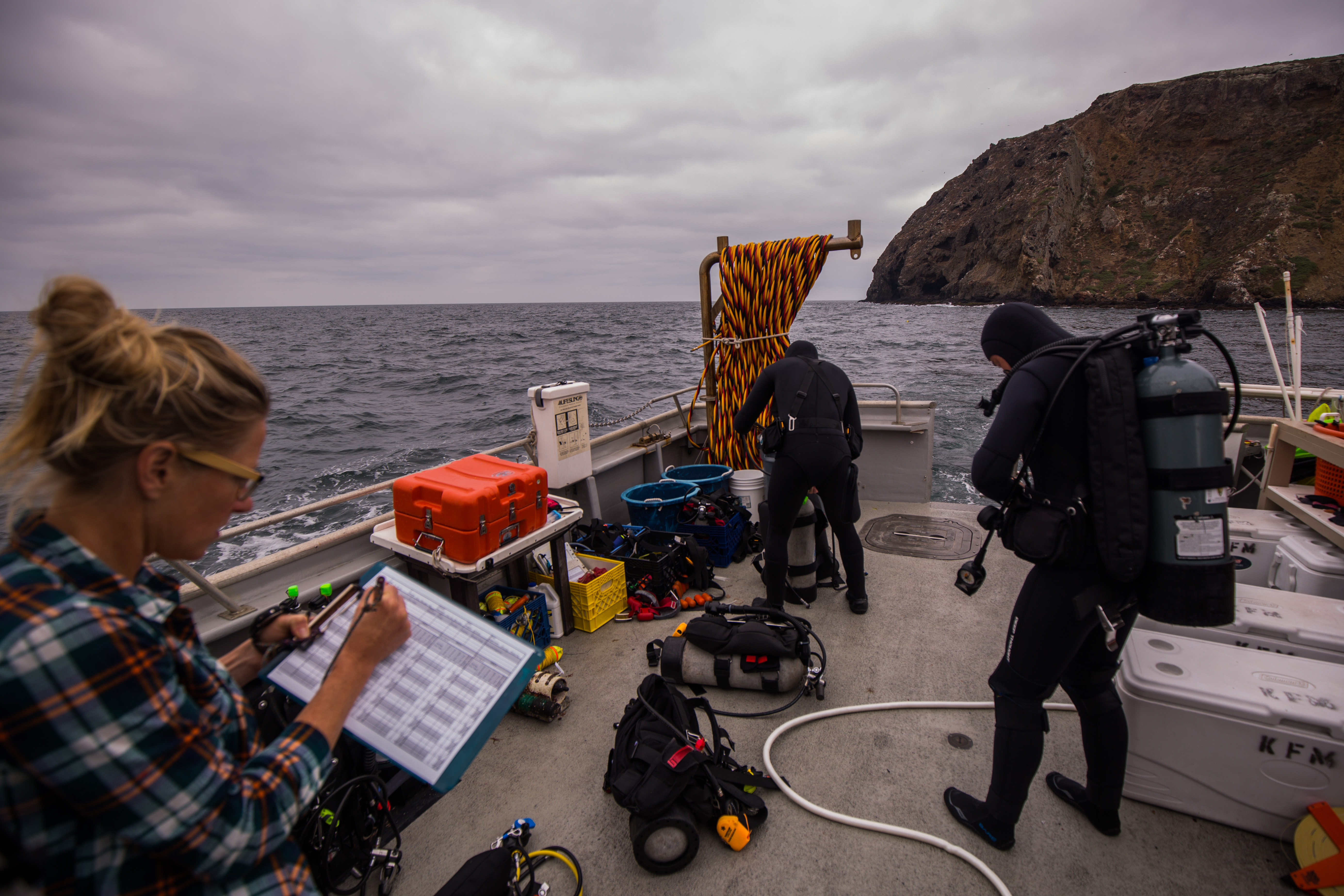
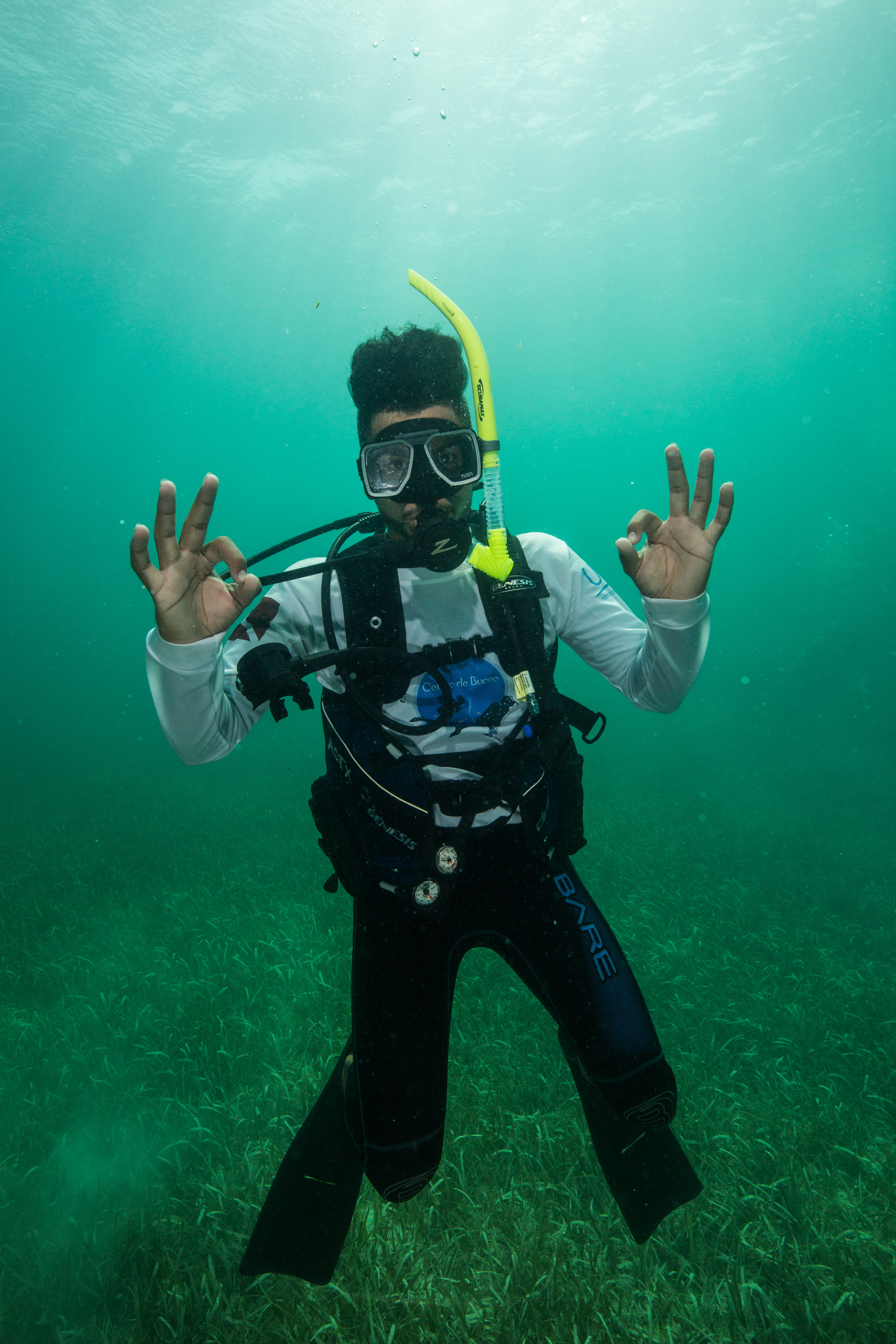
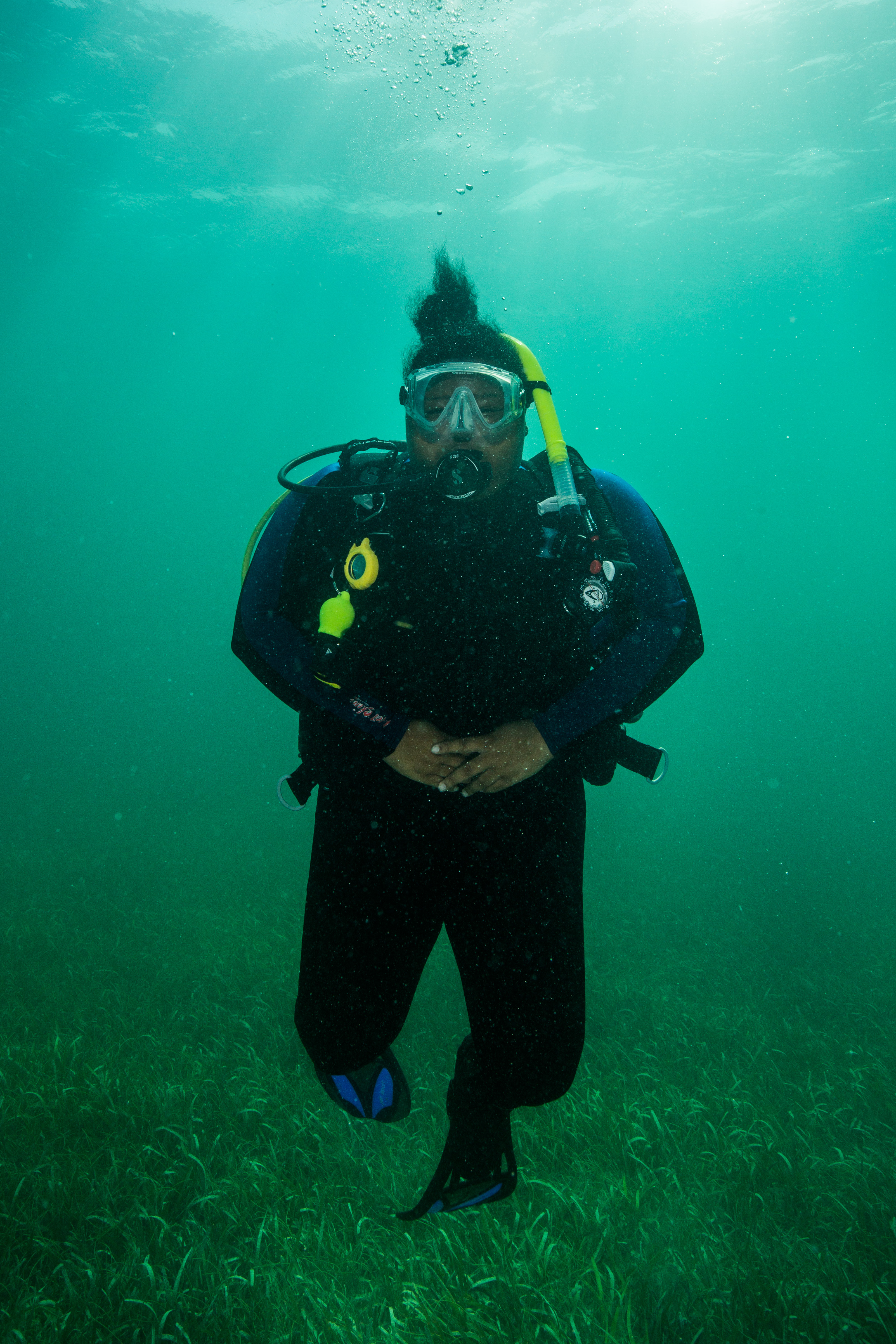
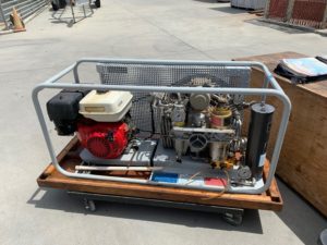
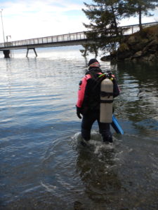
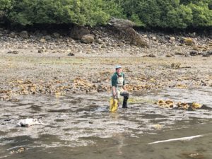
Pre-dive setup

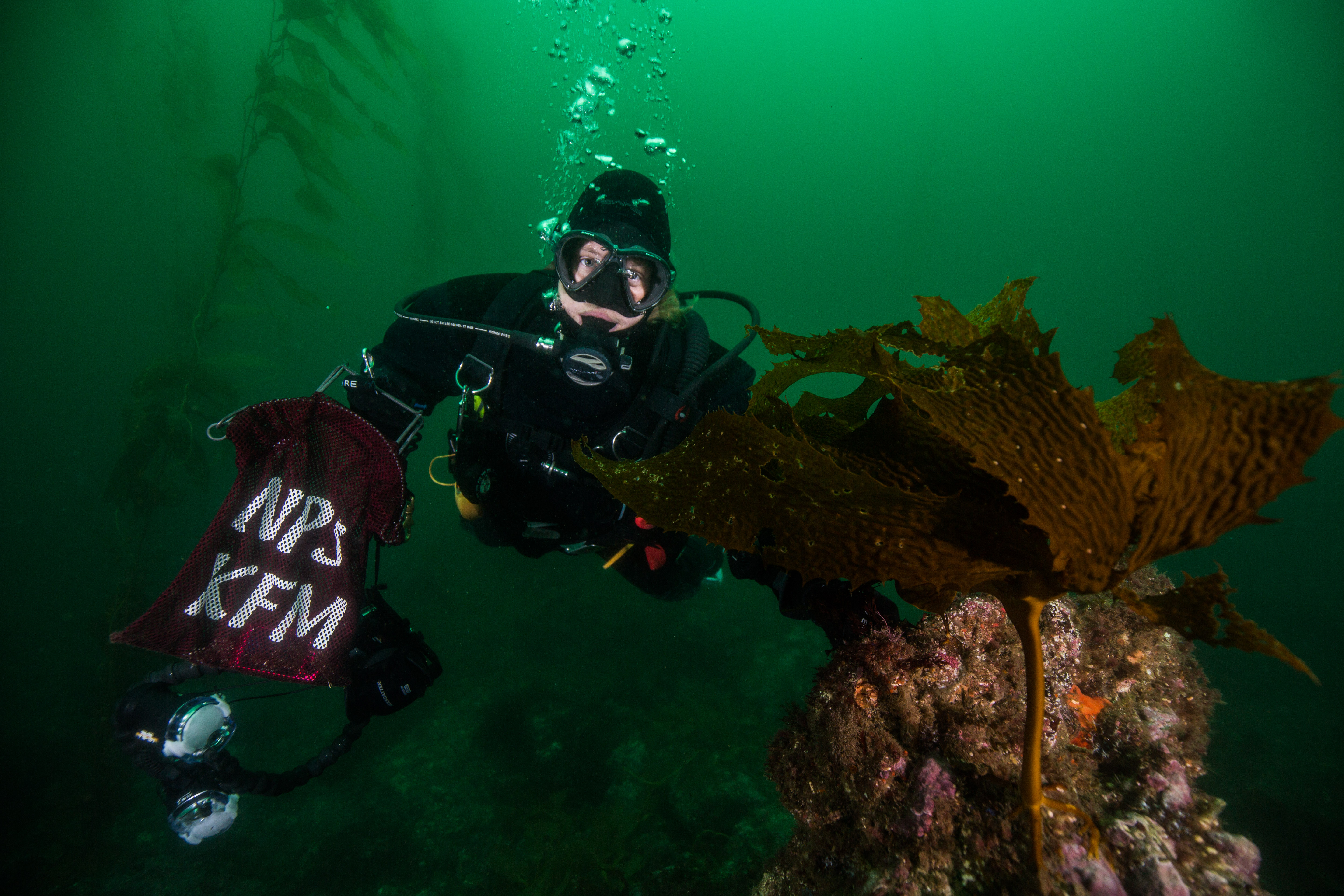
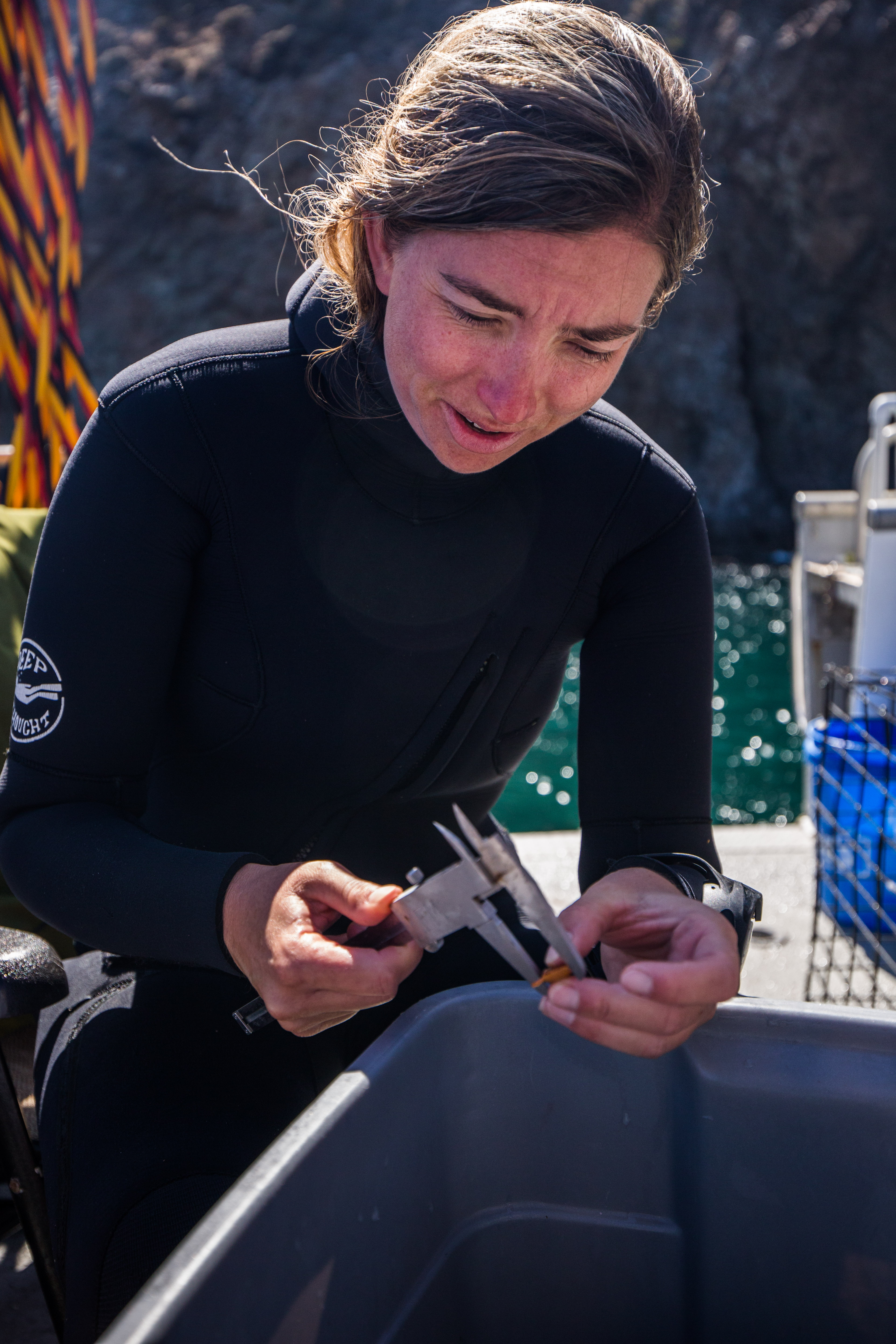
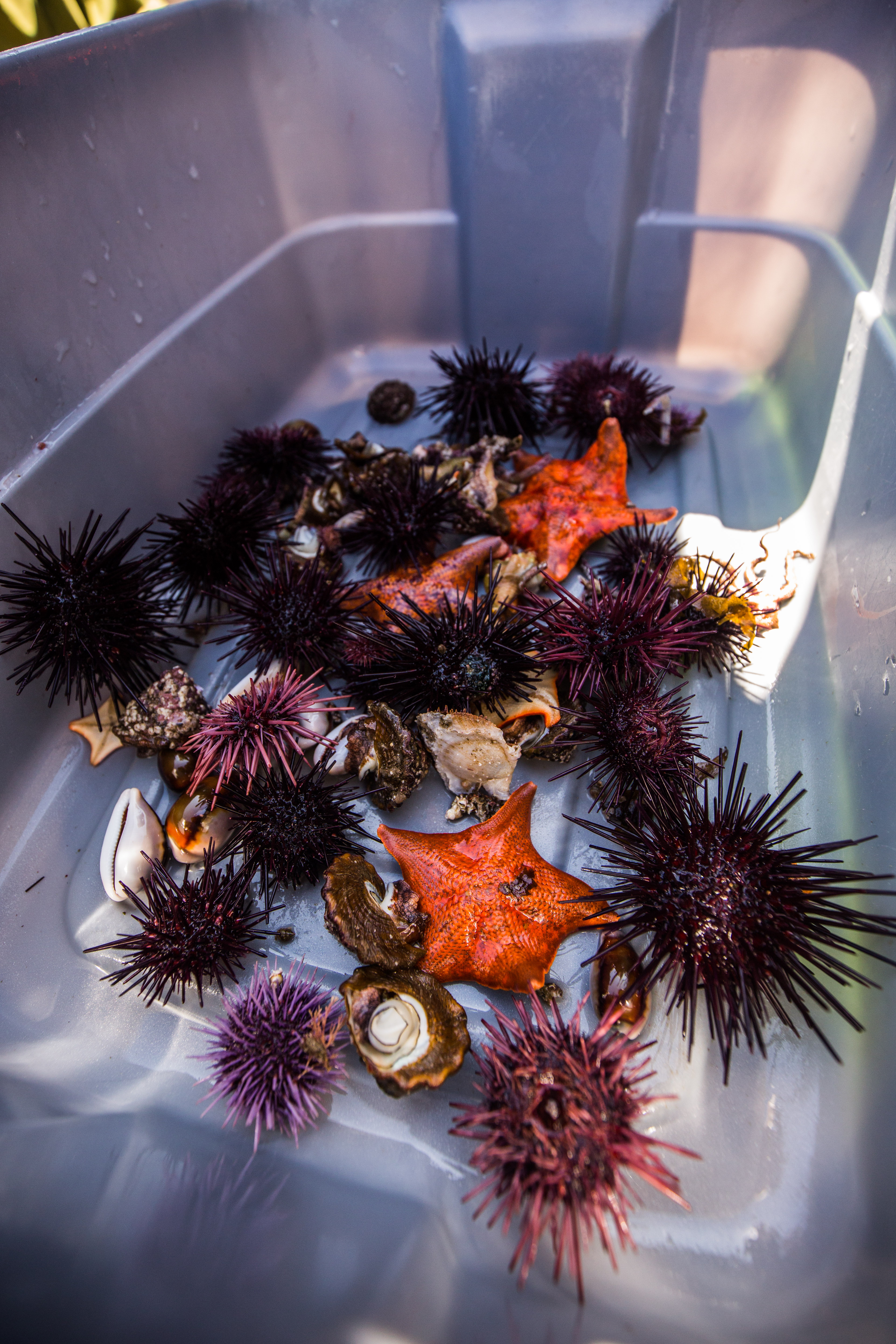
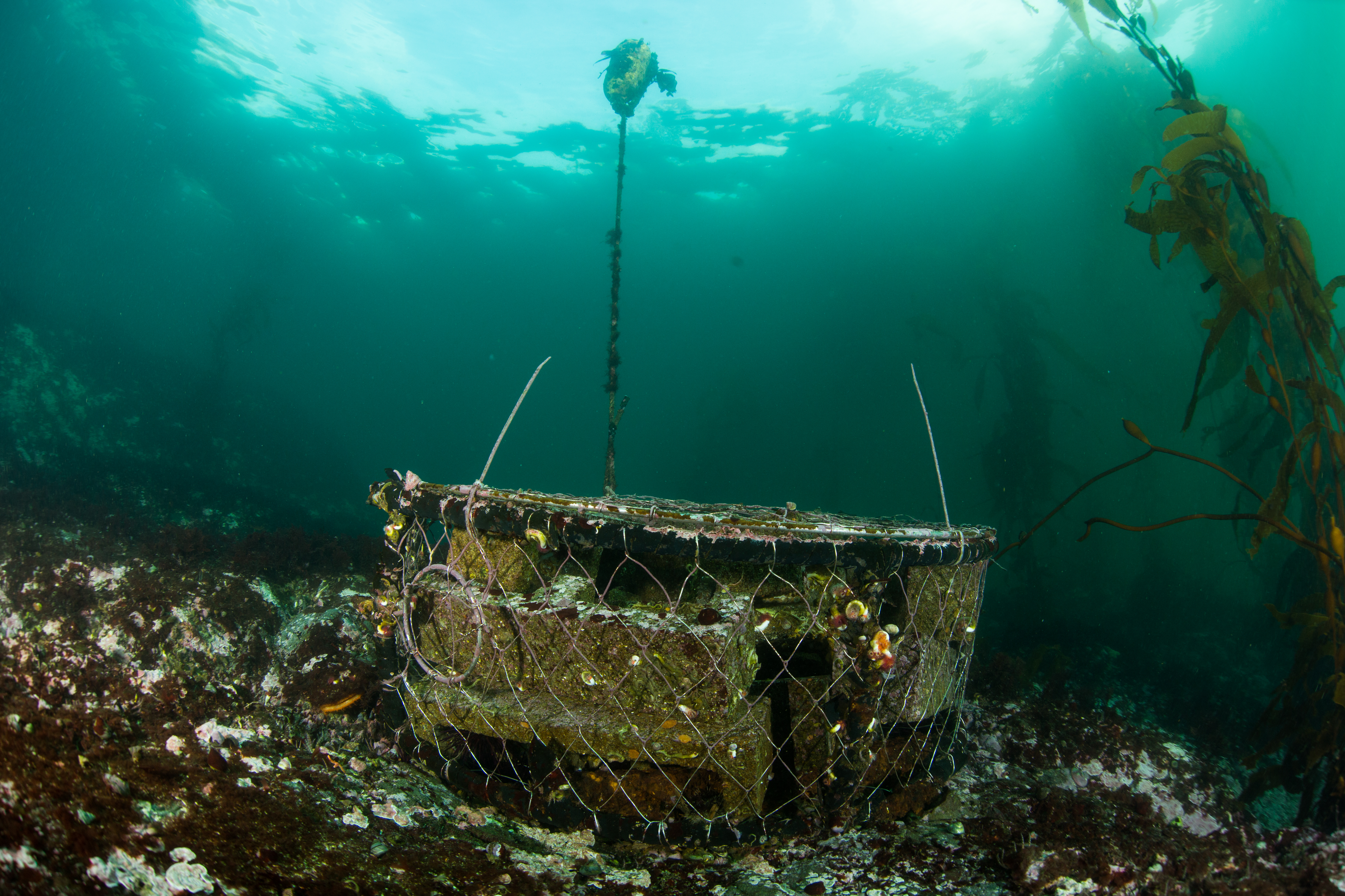
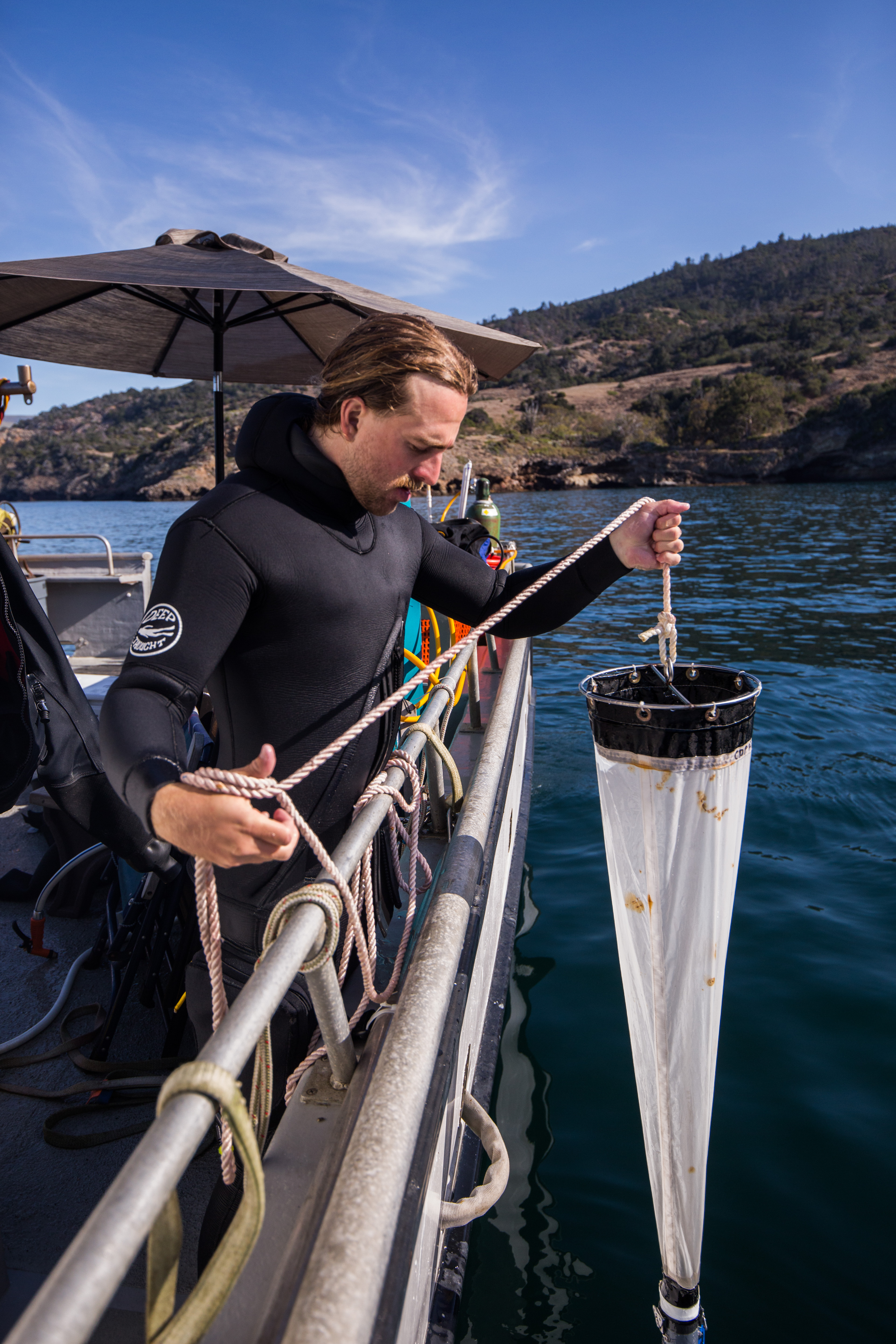
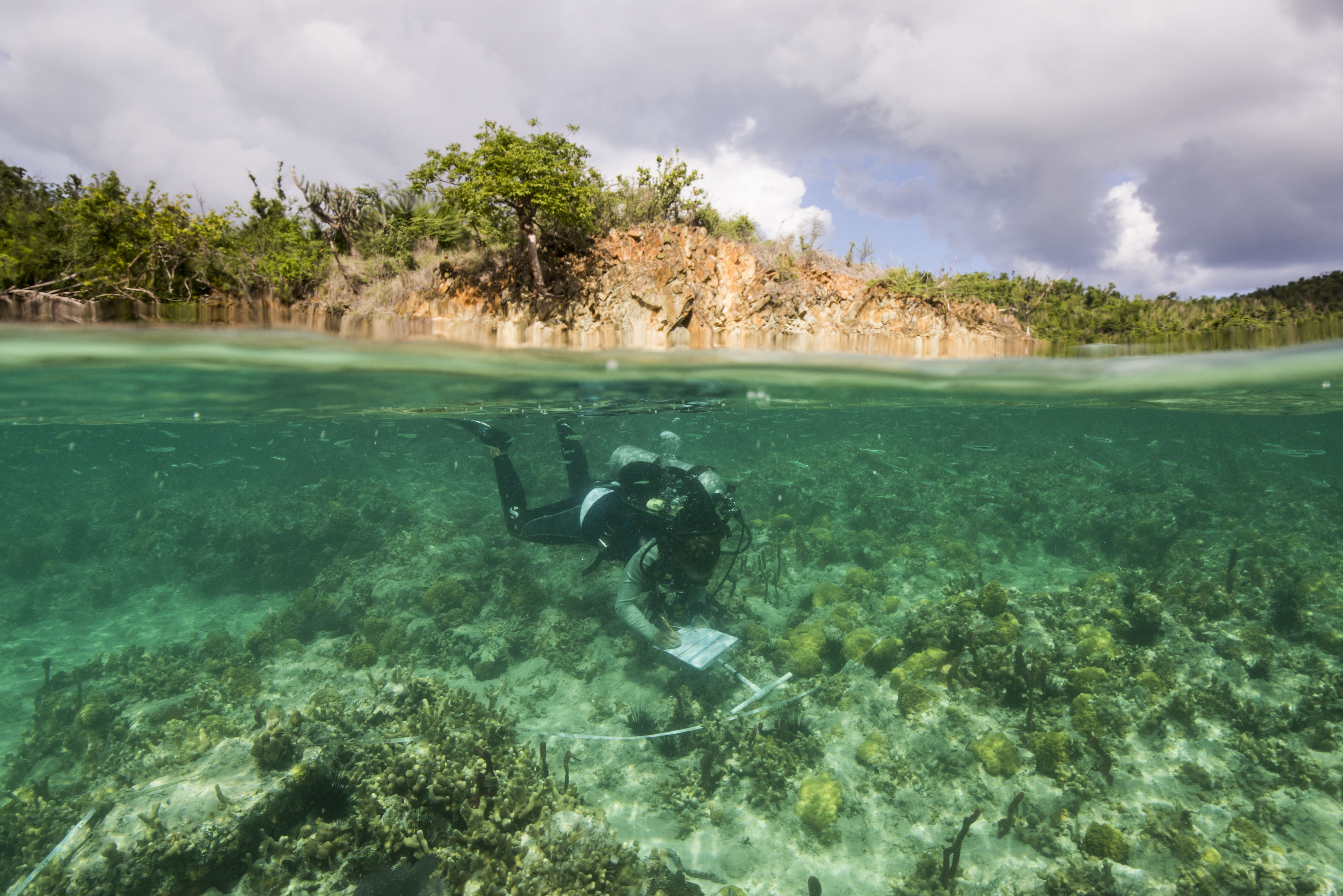
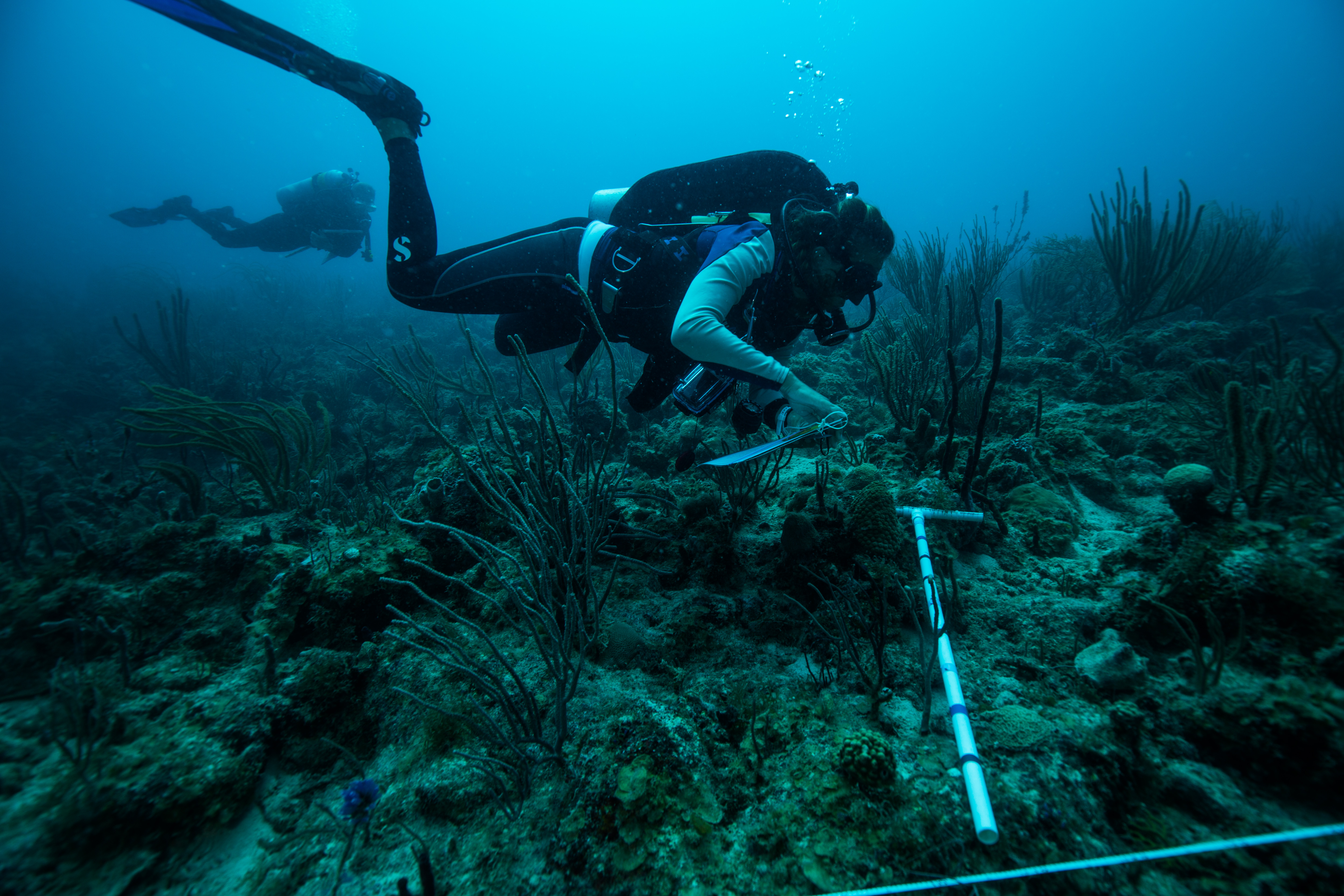
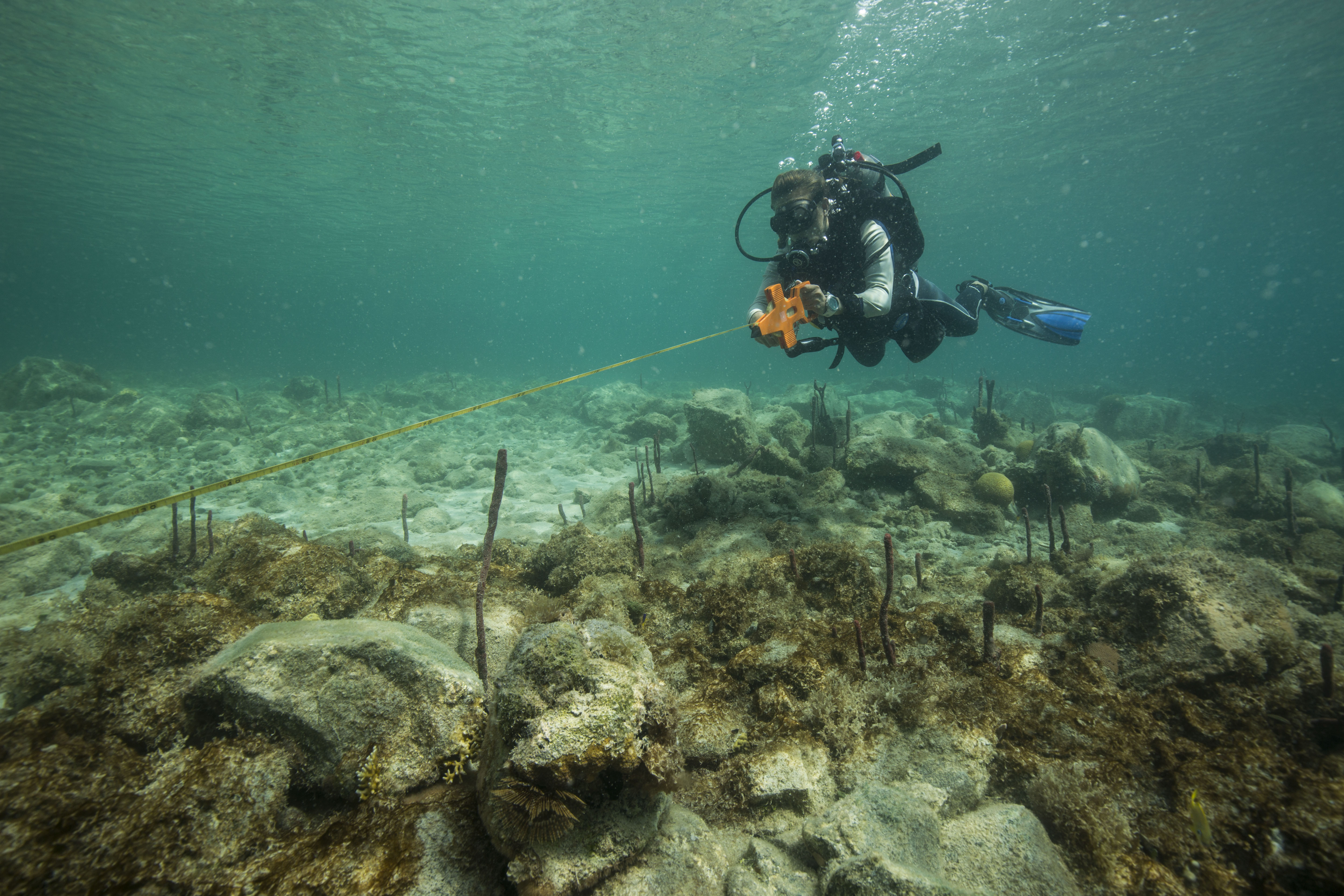
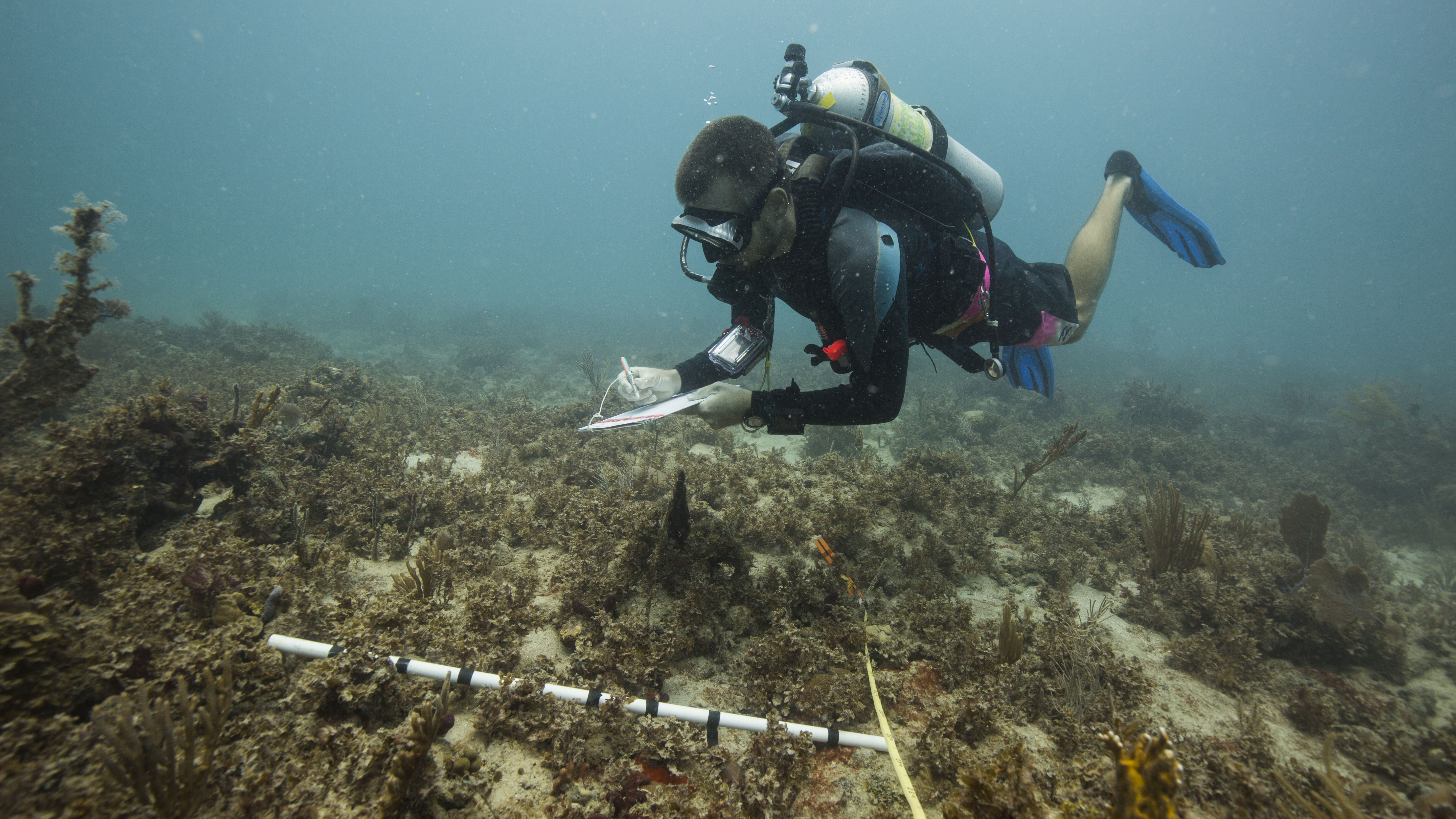
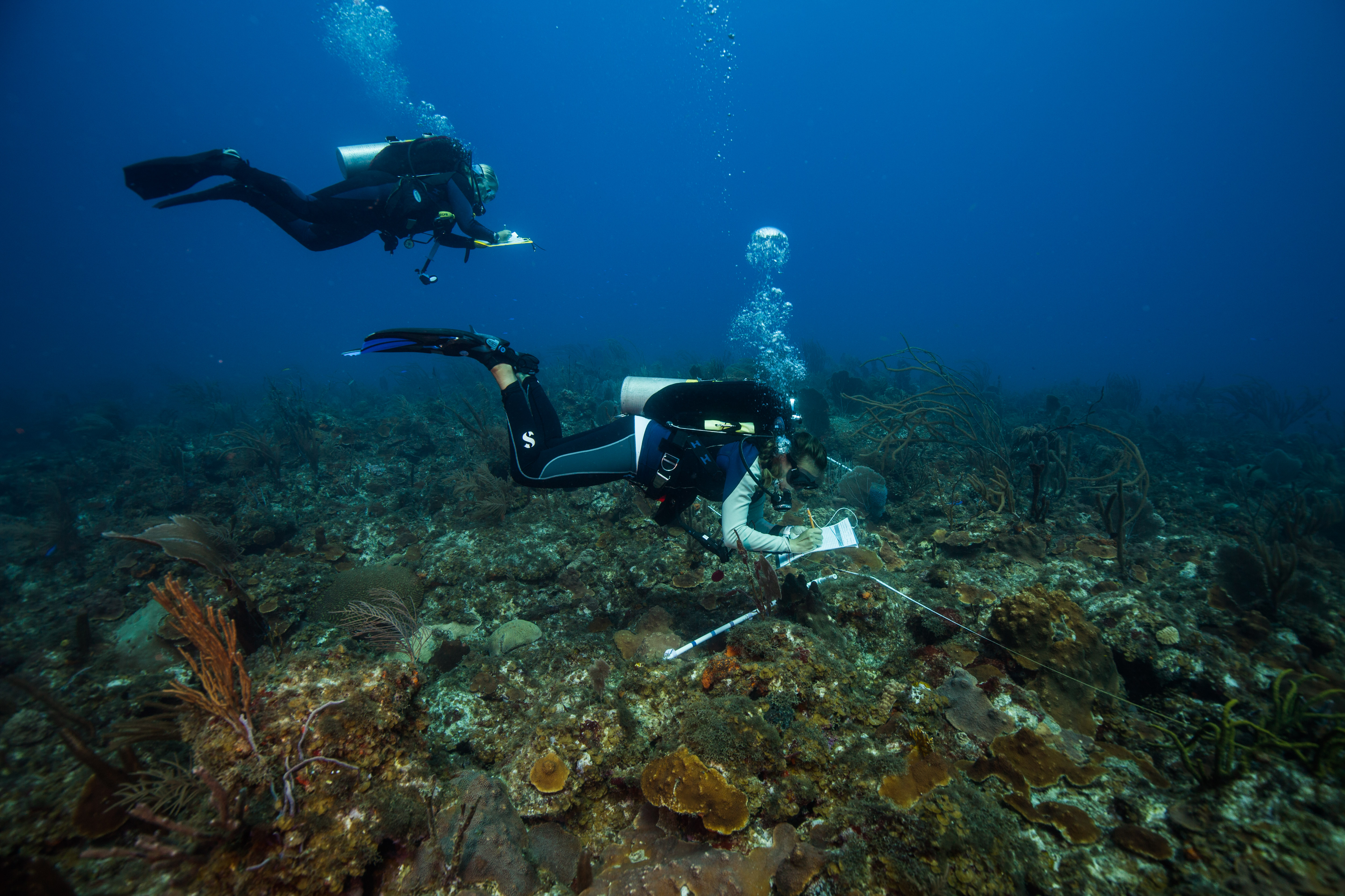
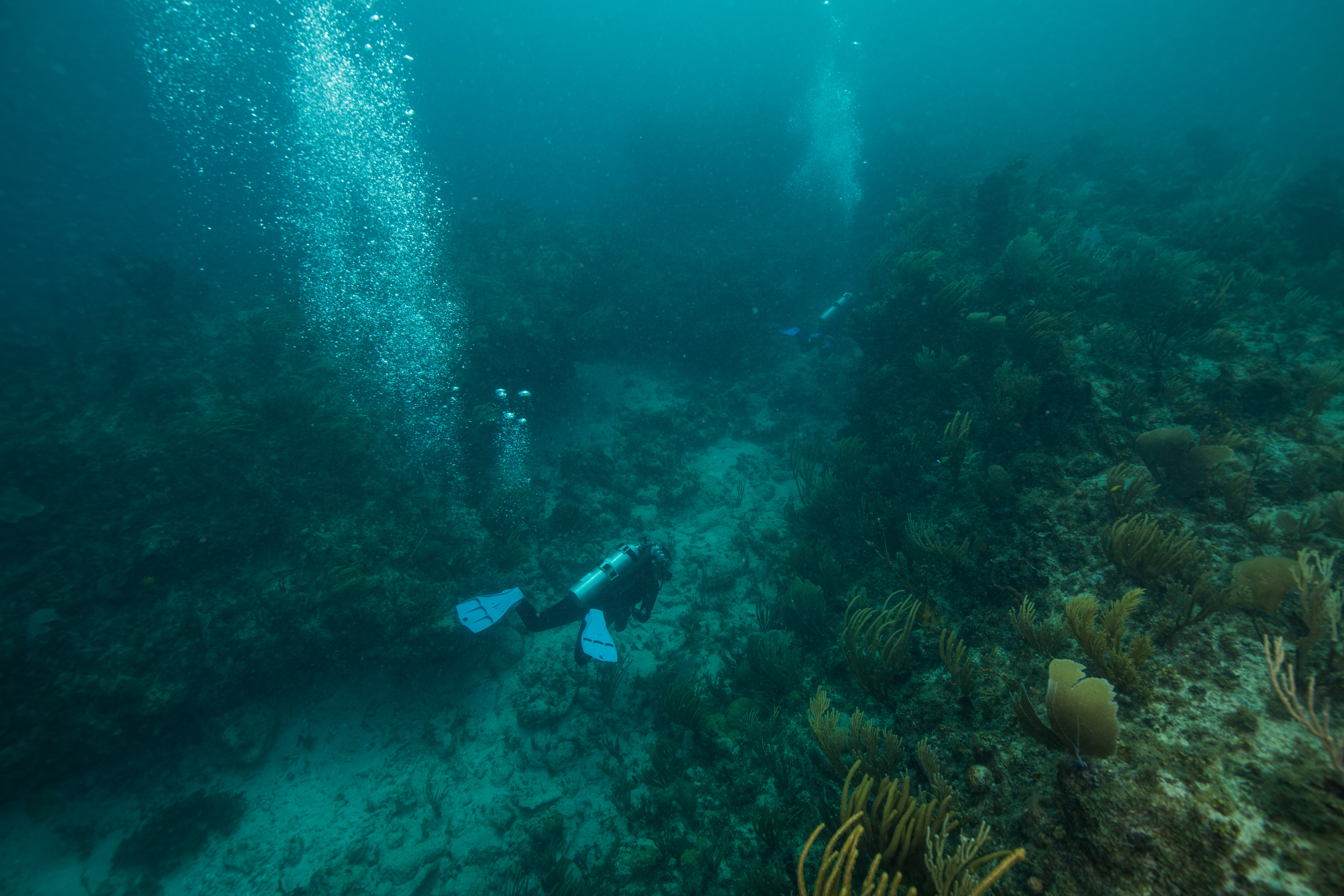
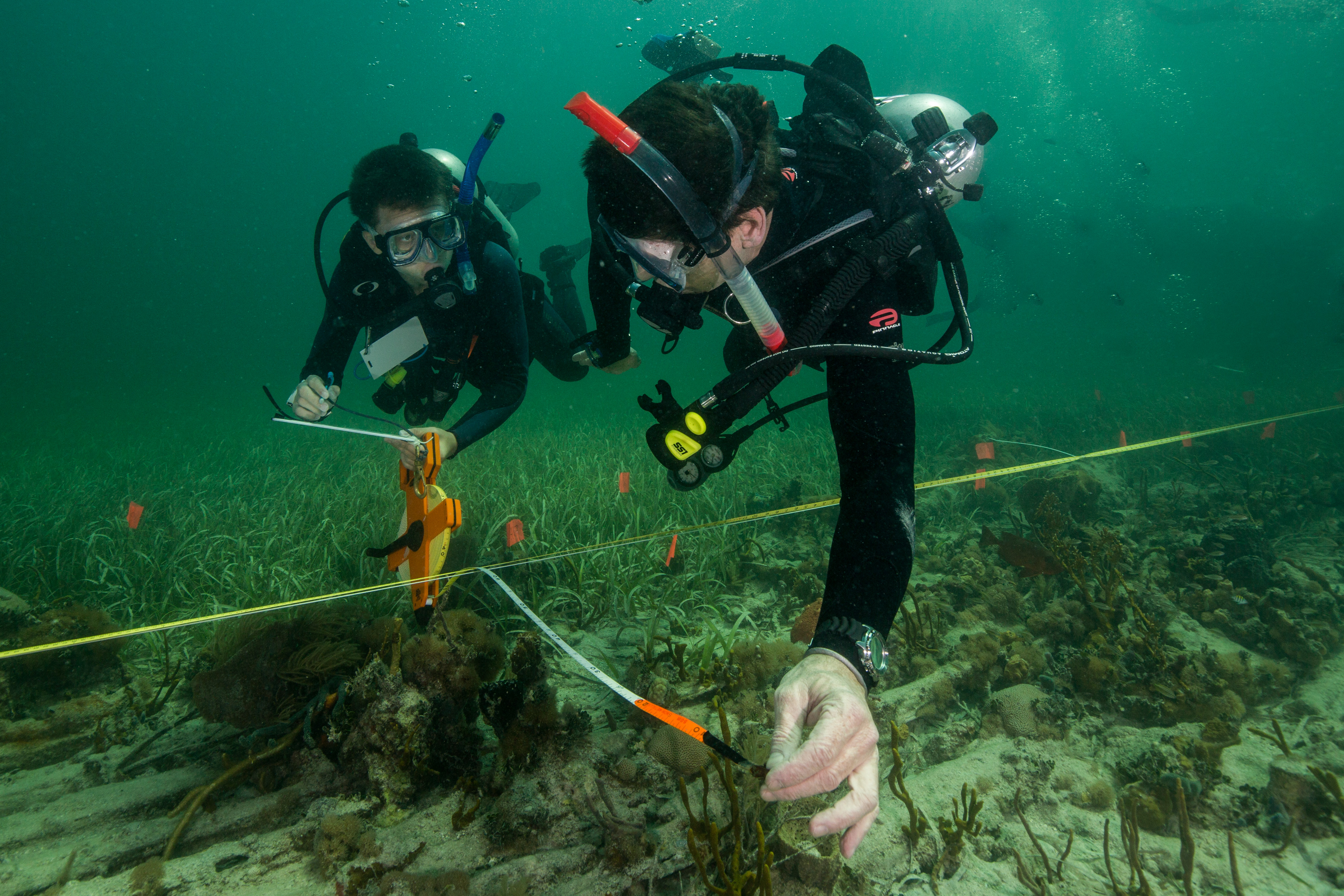
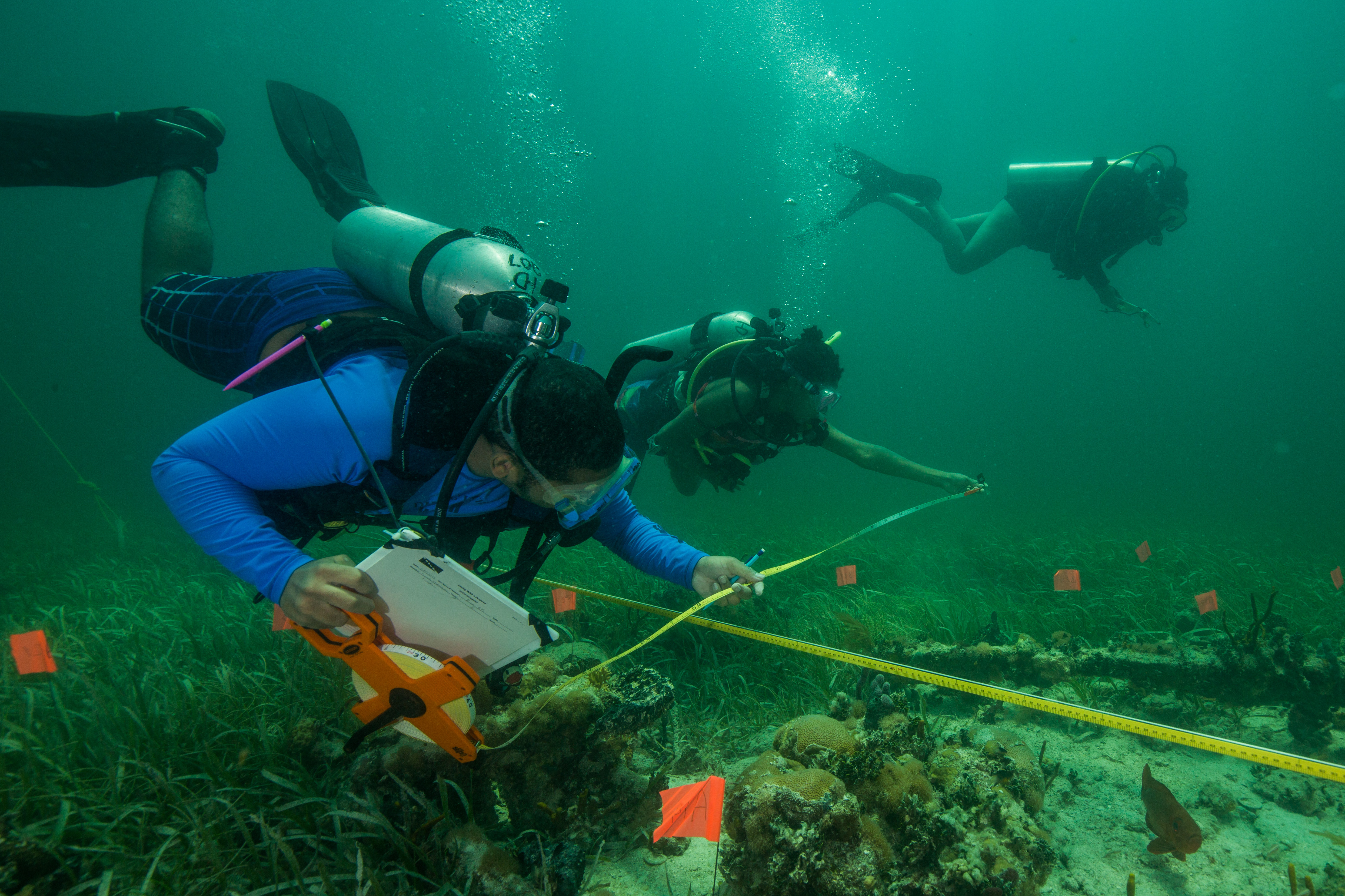
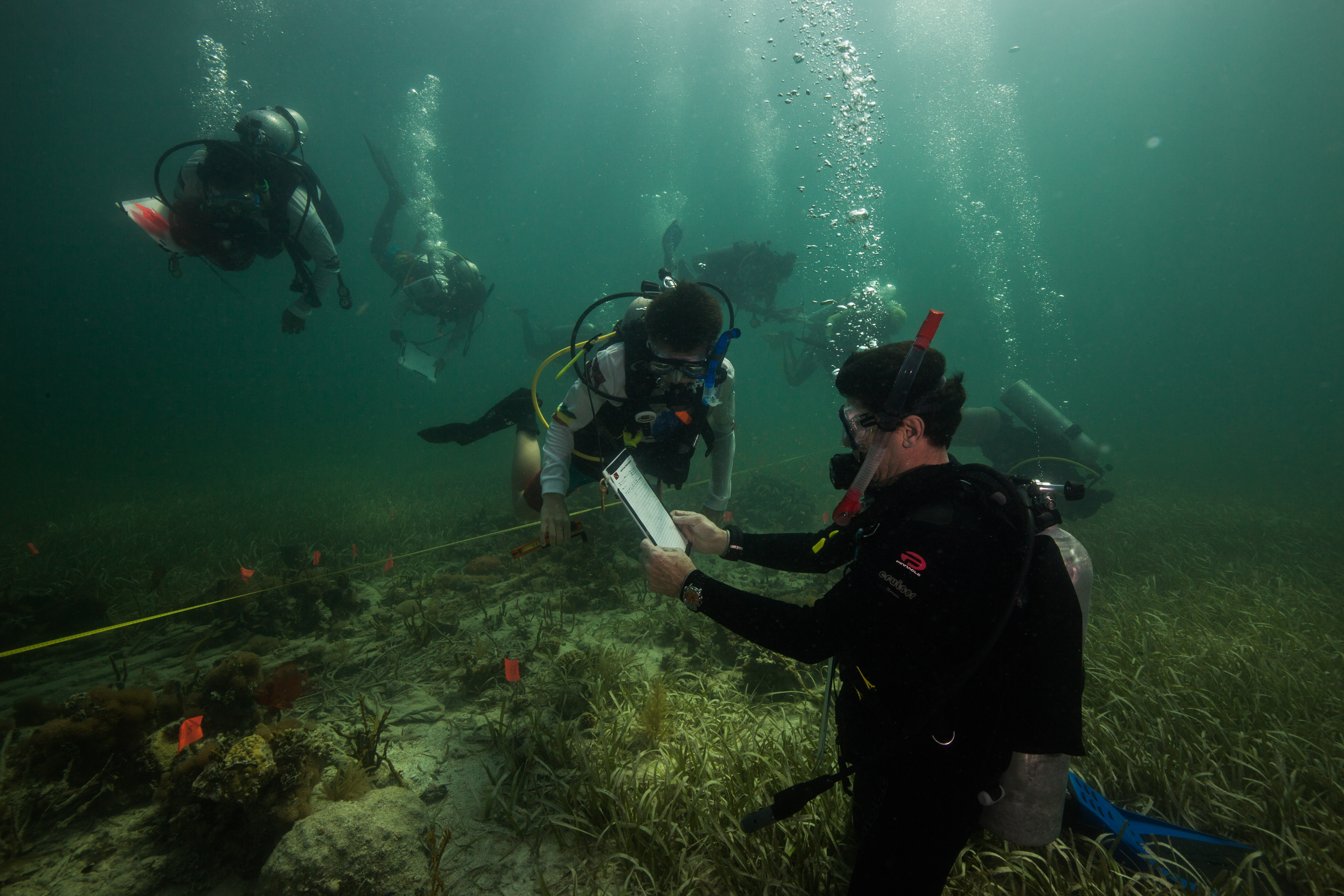
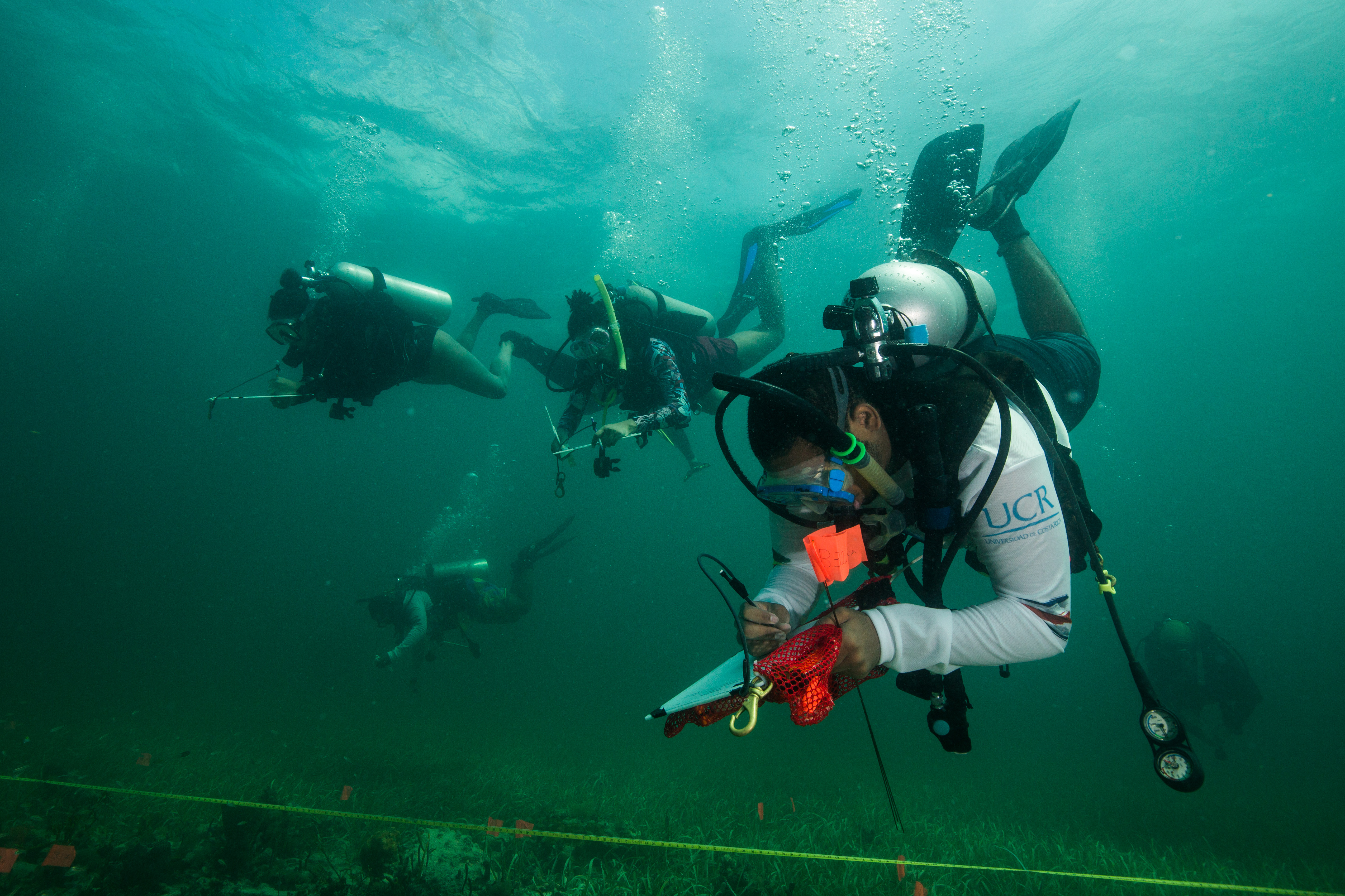
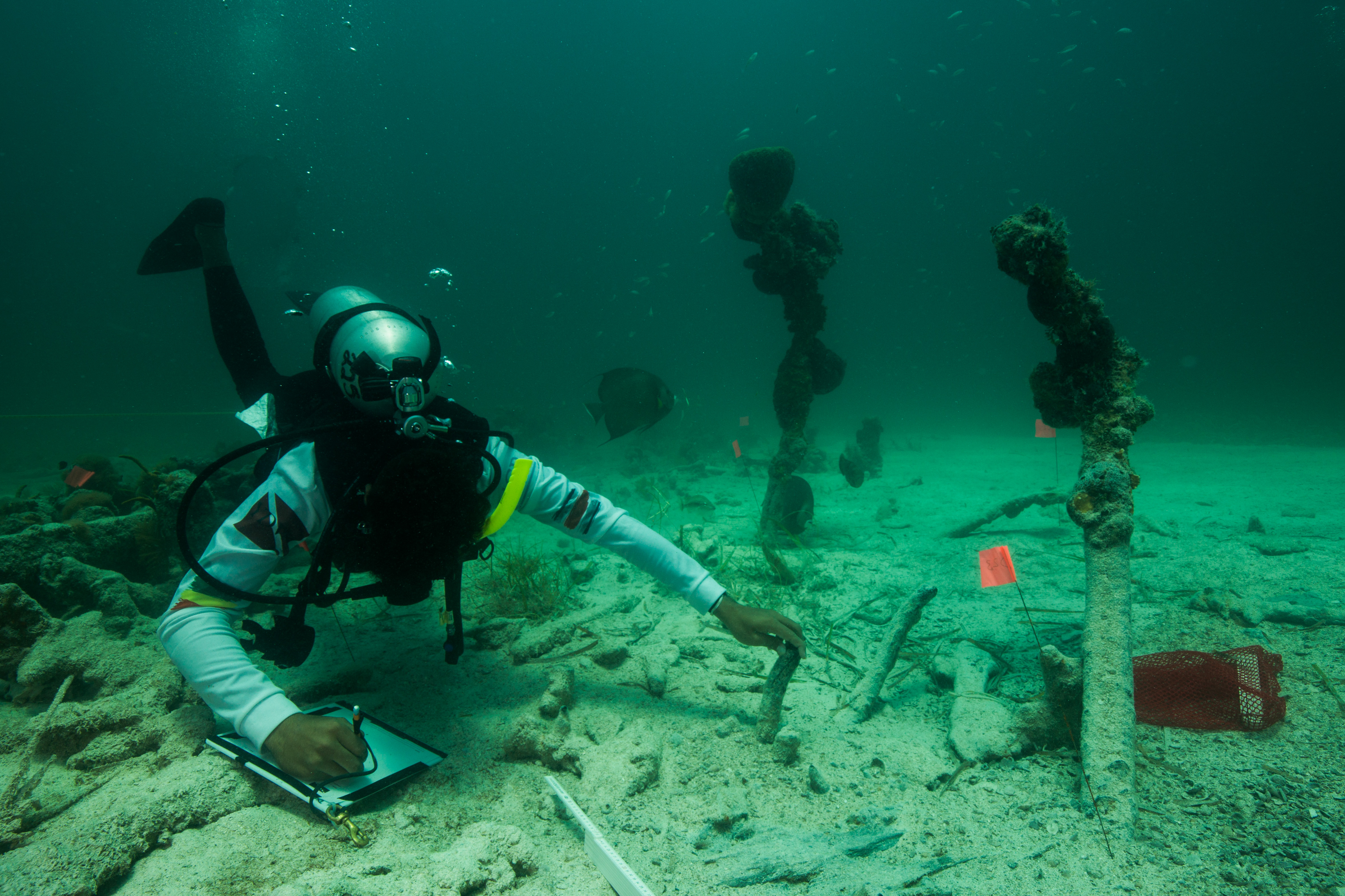
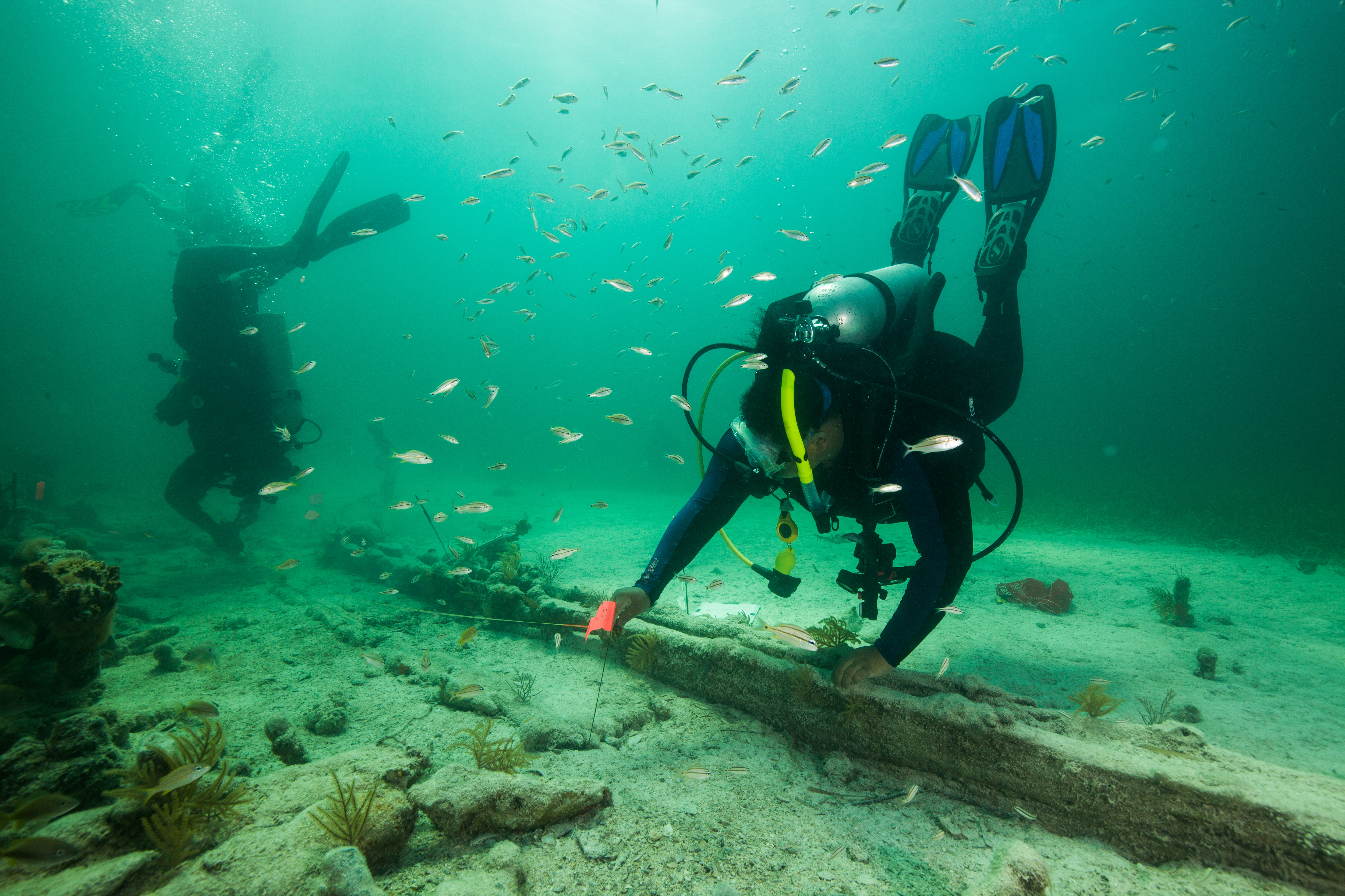
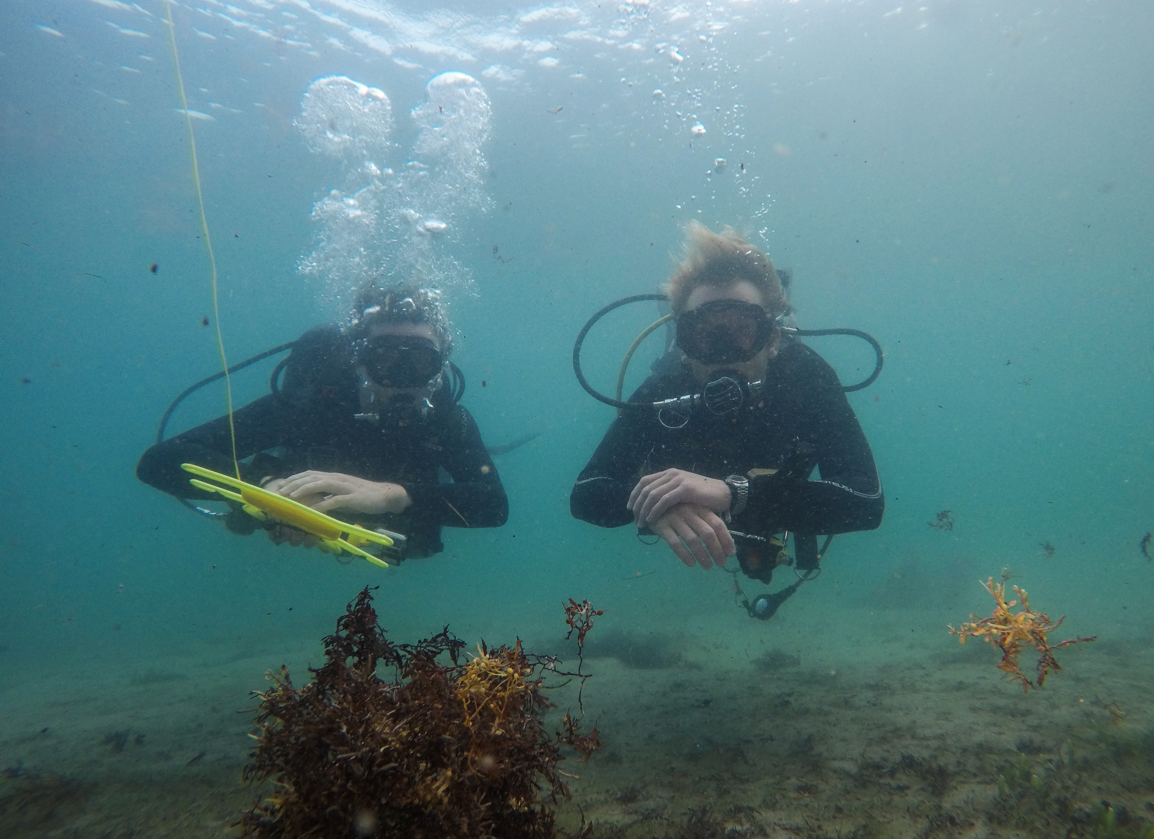
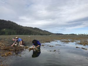
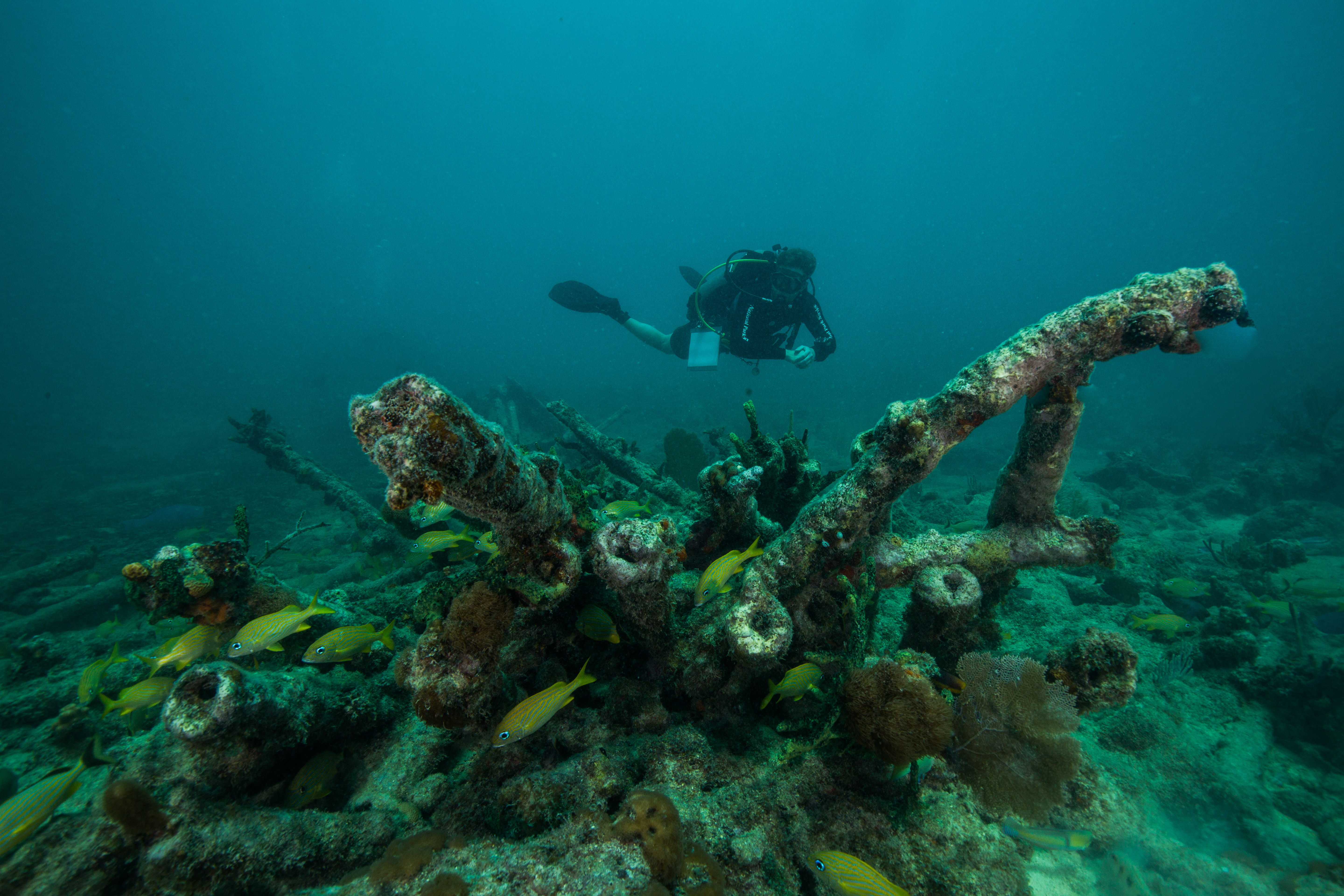
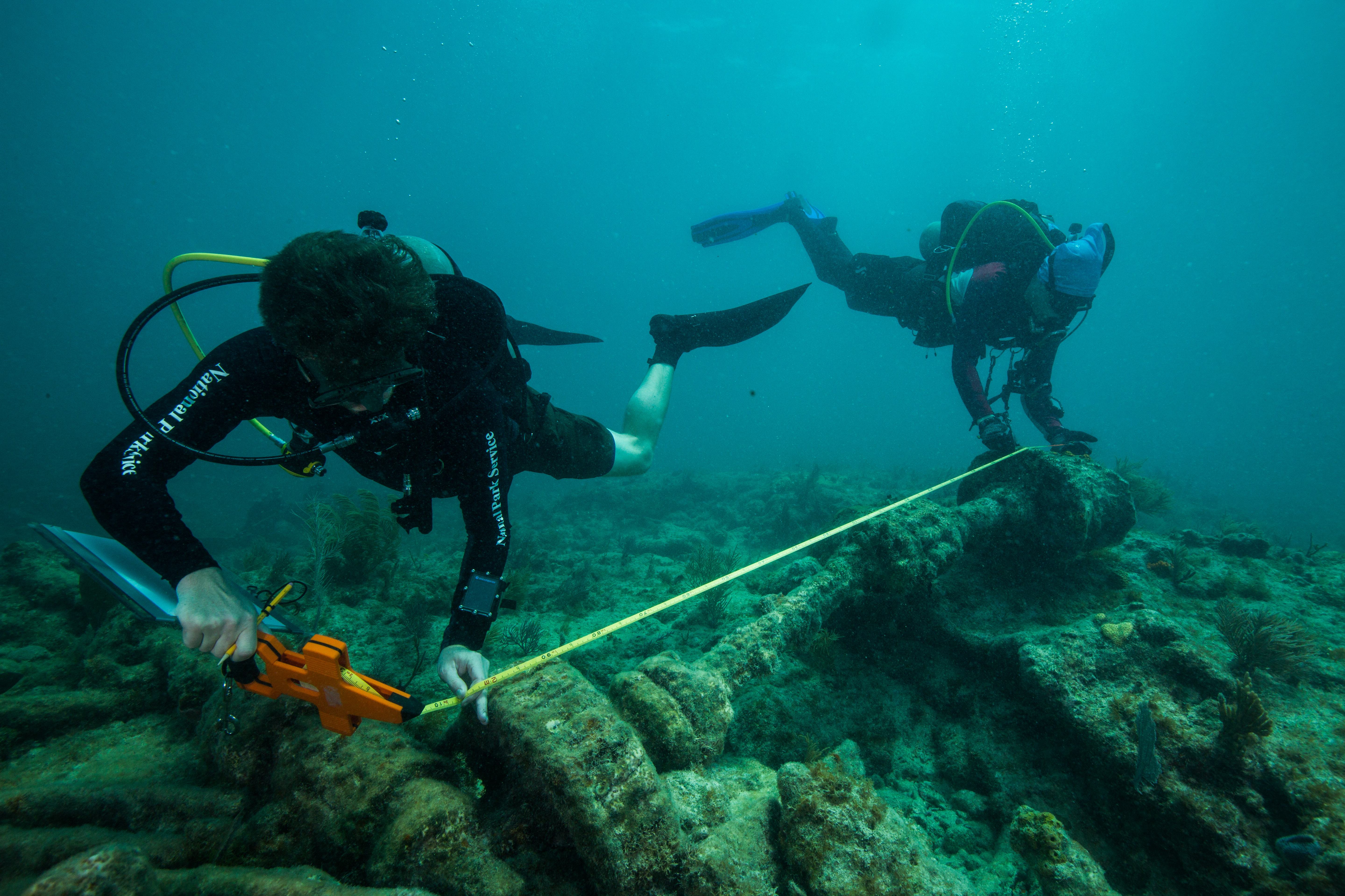
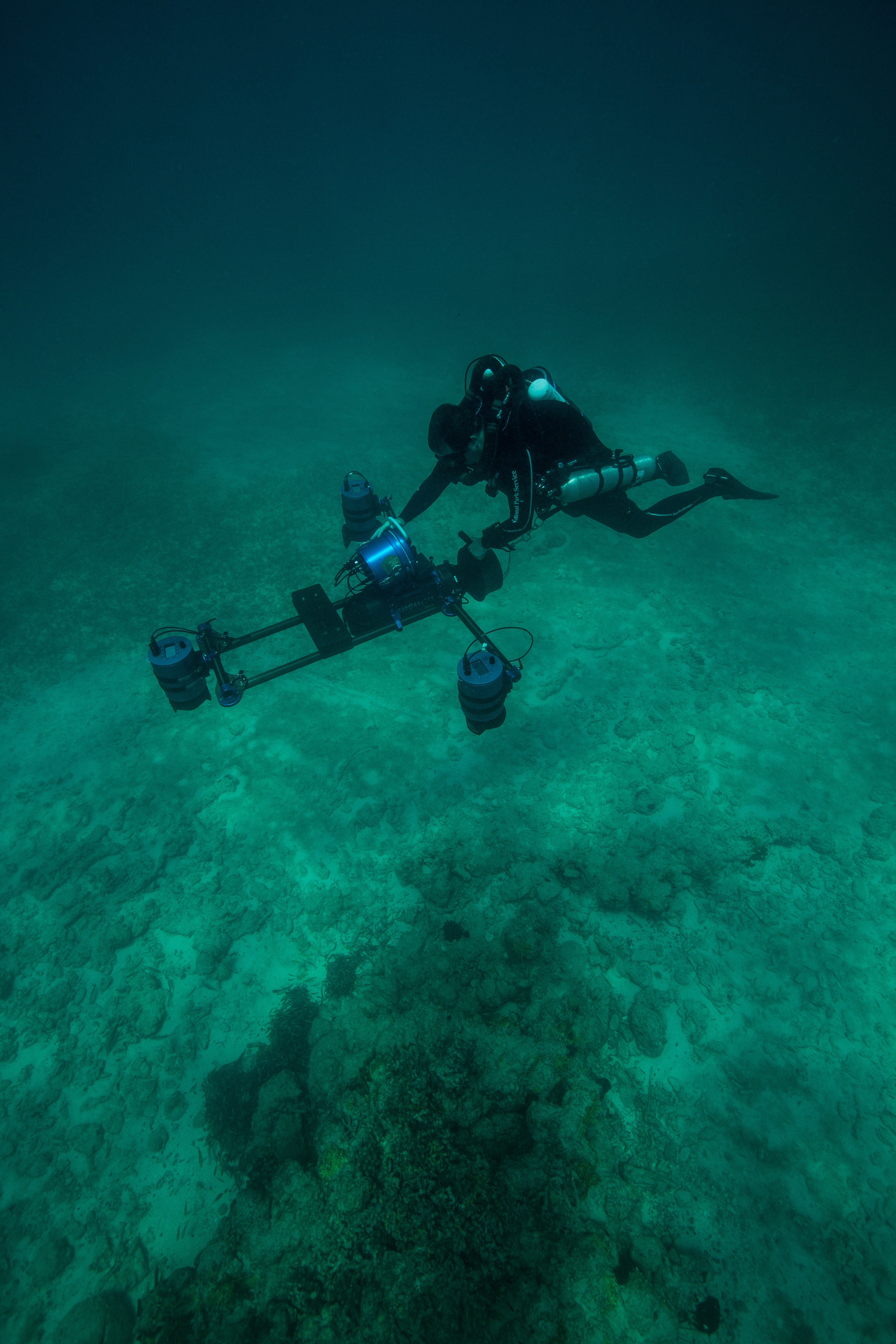
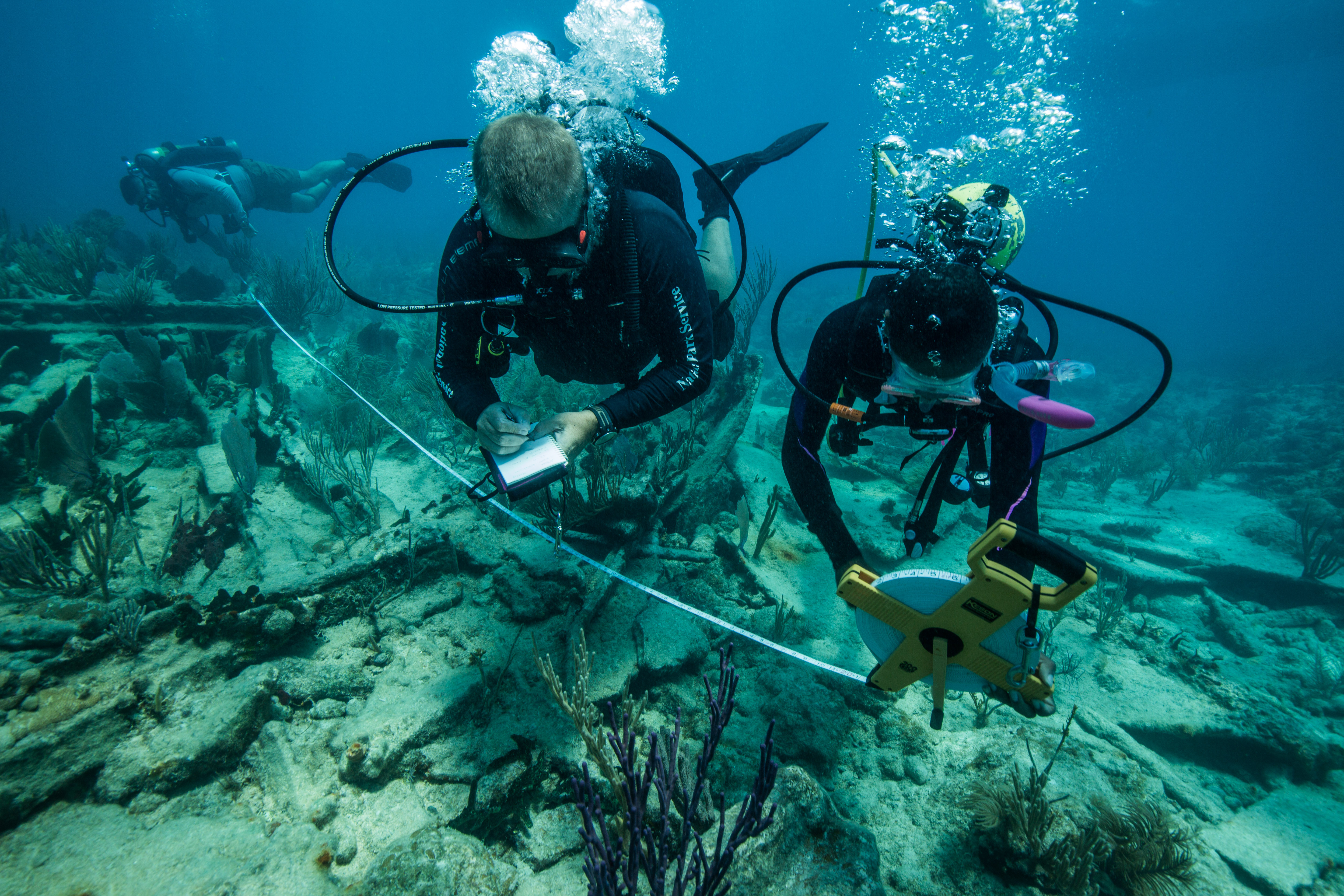
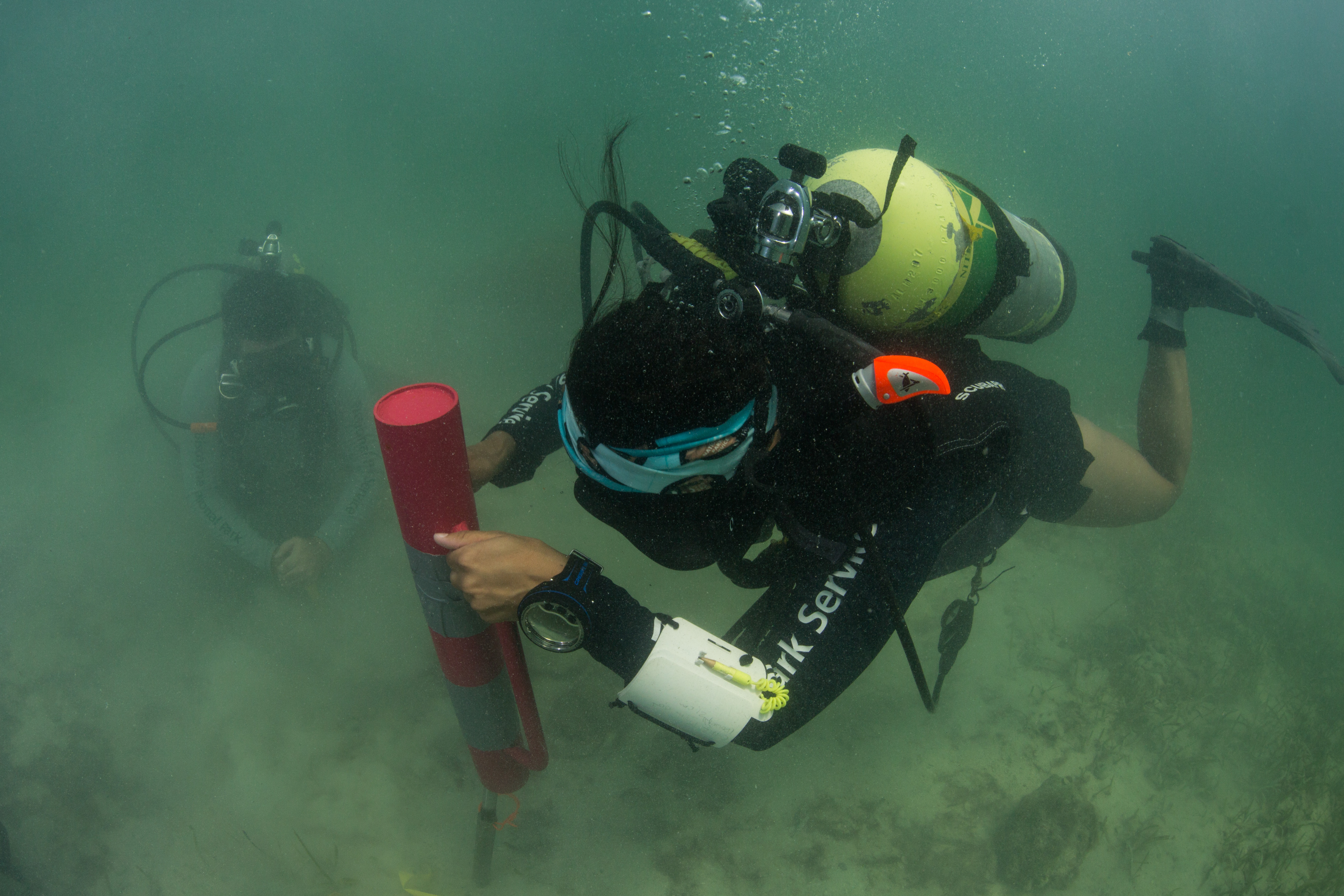
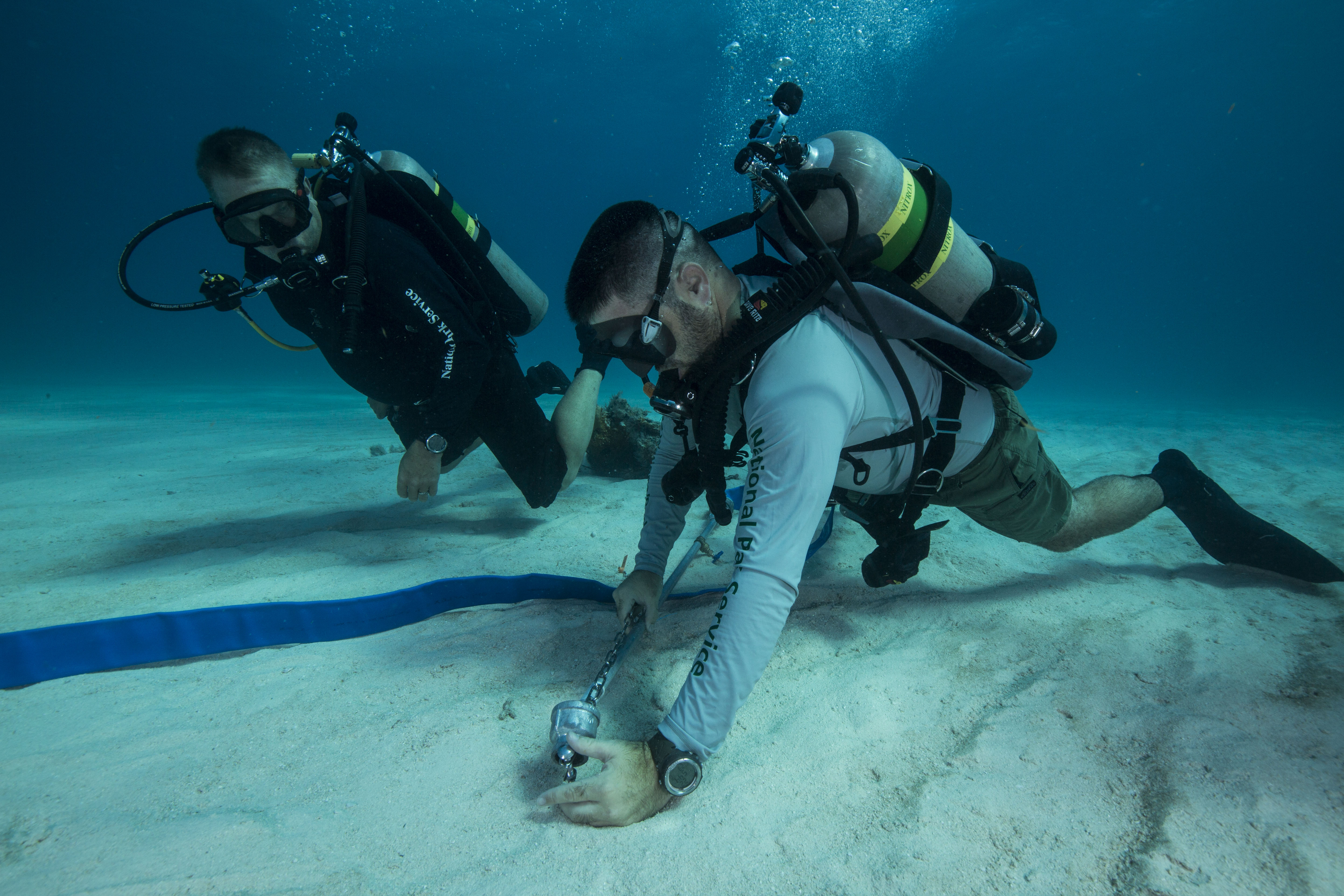
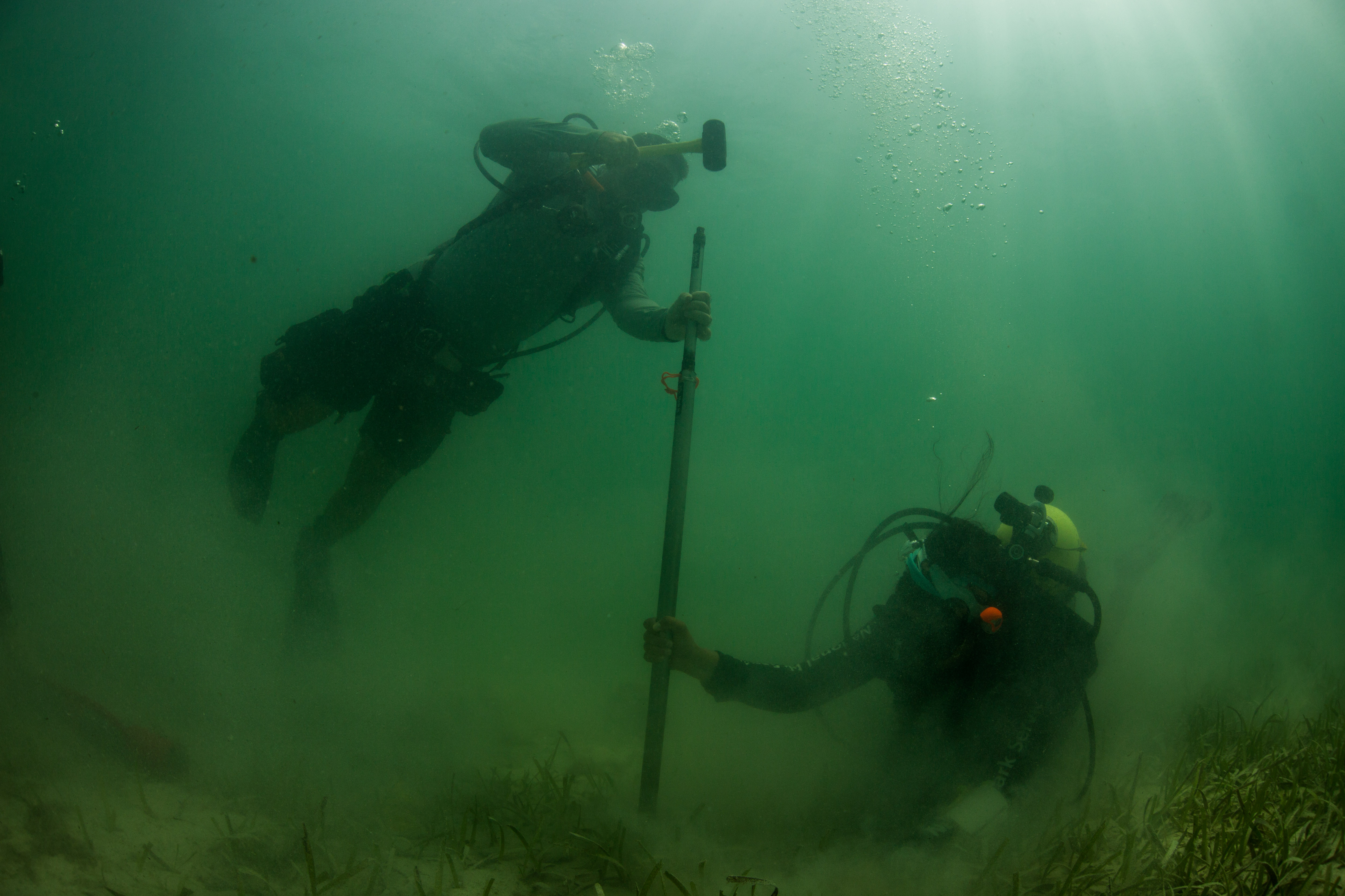
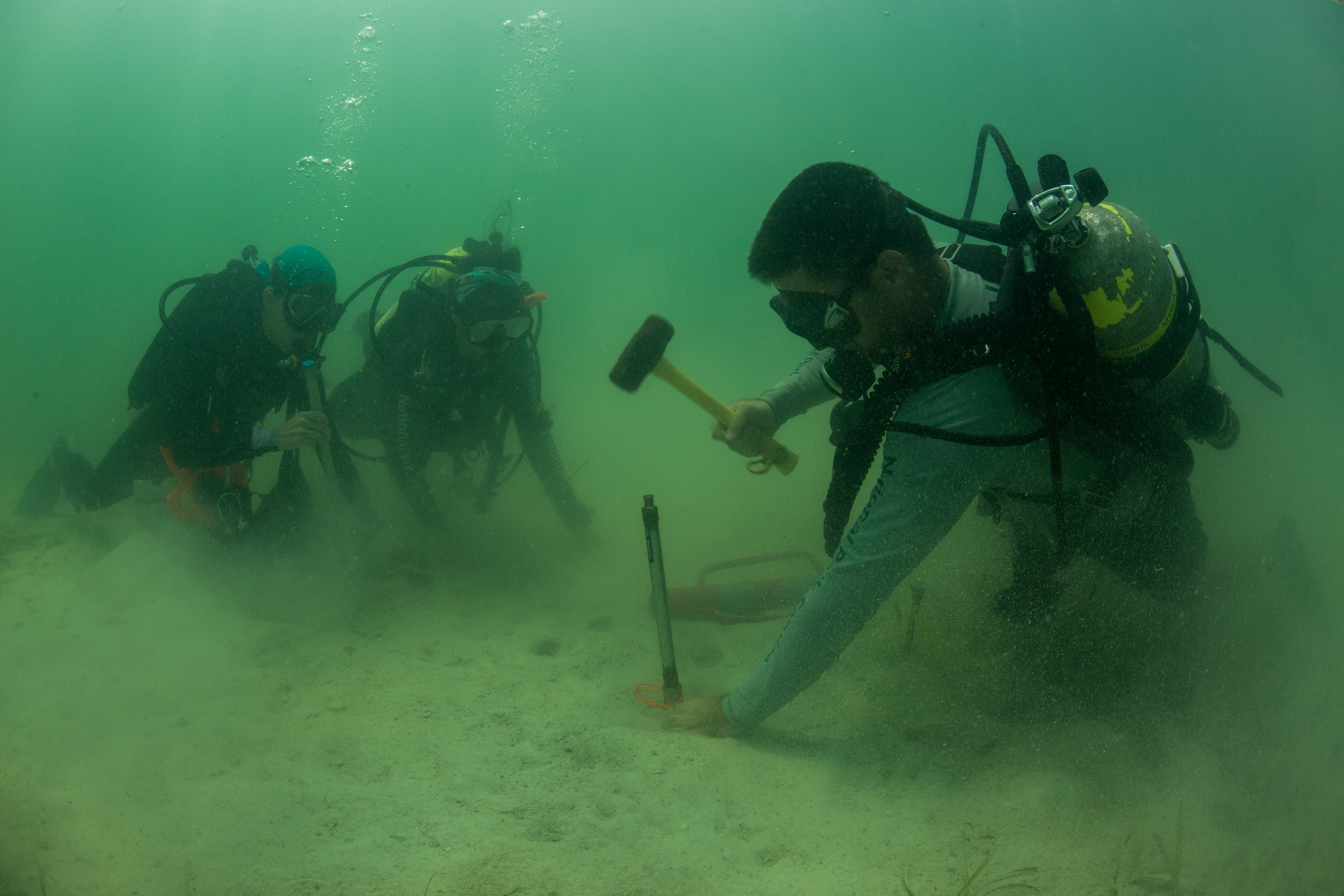
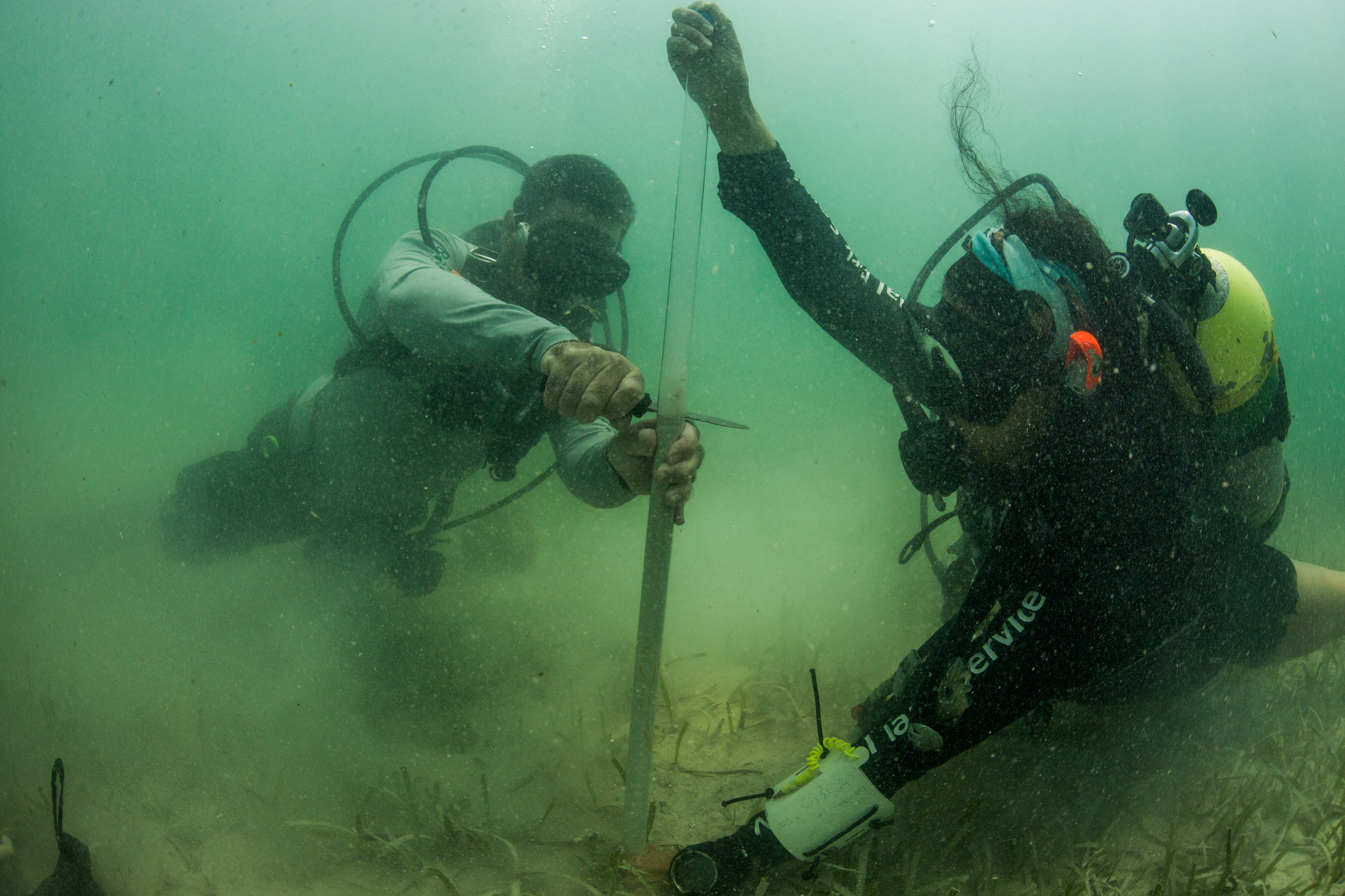
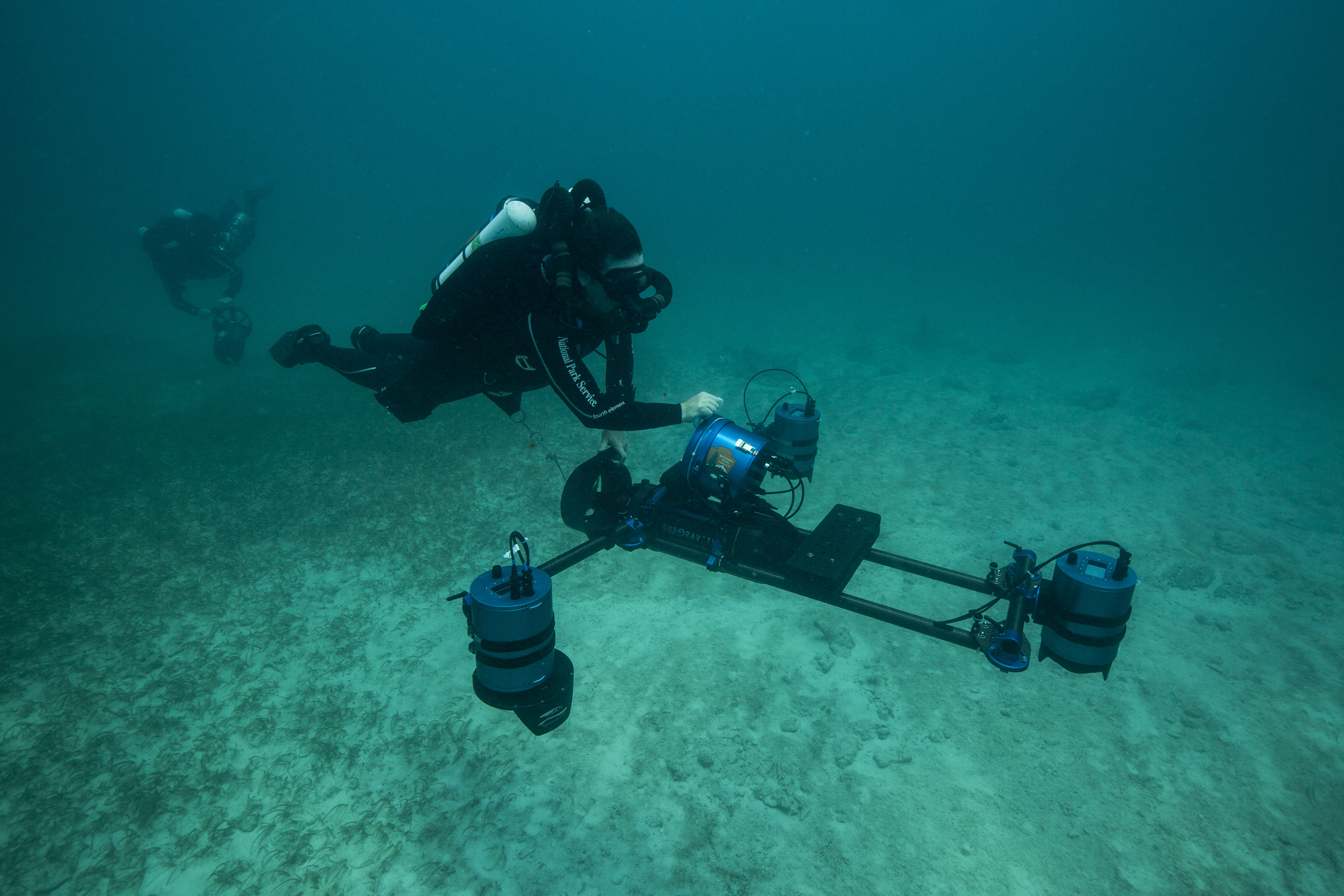
Following a typical I&M protocol, these surveys were straight forward. Eric Brown, a seasoned Kalaupapa surveying veteran, handled the fish counts, while a buddy (either Sheila, Glauco, or myself) would cover the benthic photoquadrats to determine bottom cover. Temporary sites, ones that were randomly selected each year, had an added survey type – rugosity measurements. This required another diver, who would work with Eric to reel out and lay down a rugosity chain while the benthic diver finished their photoquadrats. This chain was reeled out along the transect line and laid flush with the bottom, following all contours. Once it reached the end of the transect, the length of chain laid out would be counted to give a measure of benthic complexity. The more chain was laid out over the 25m transect line, the more complex the rugosity was.

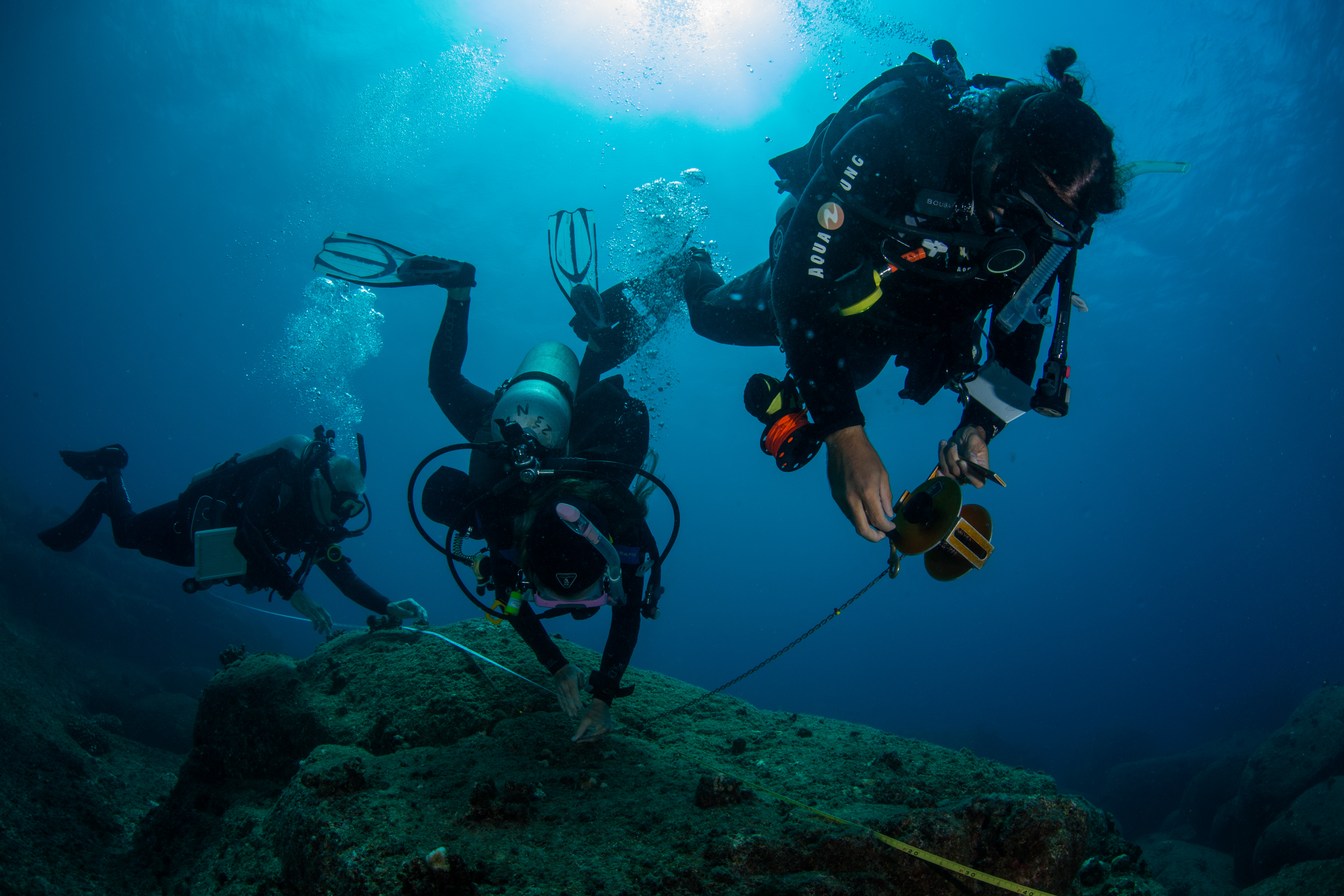
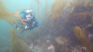
The team laying down a rugosity chain on transect

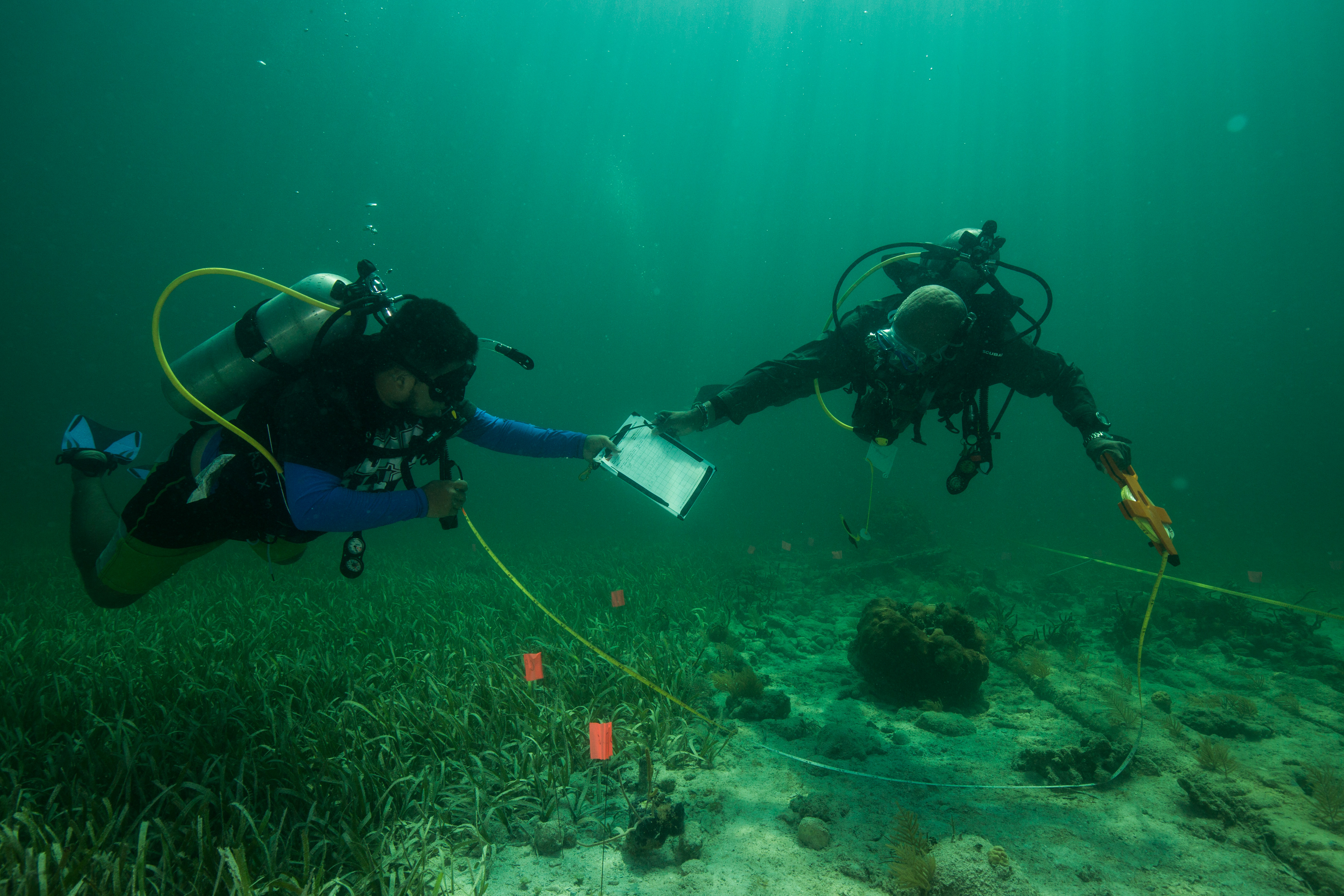
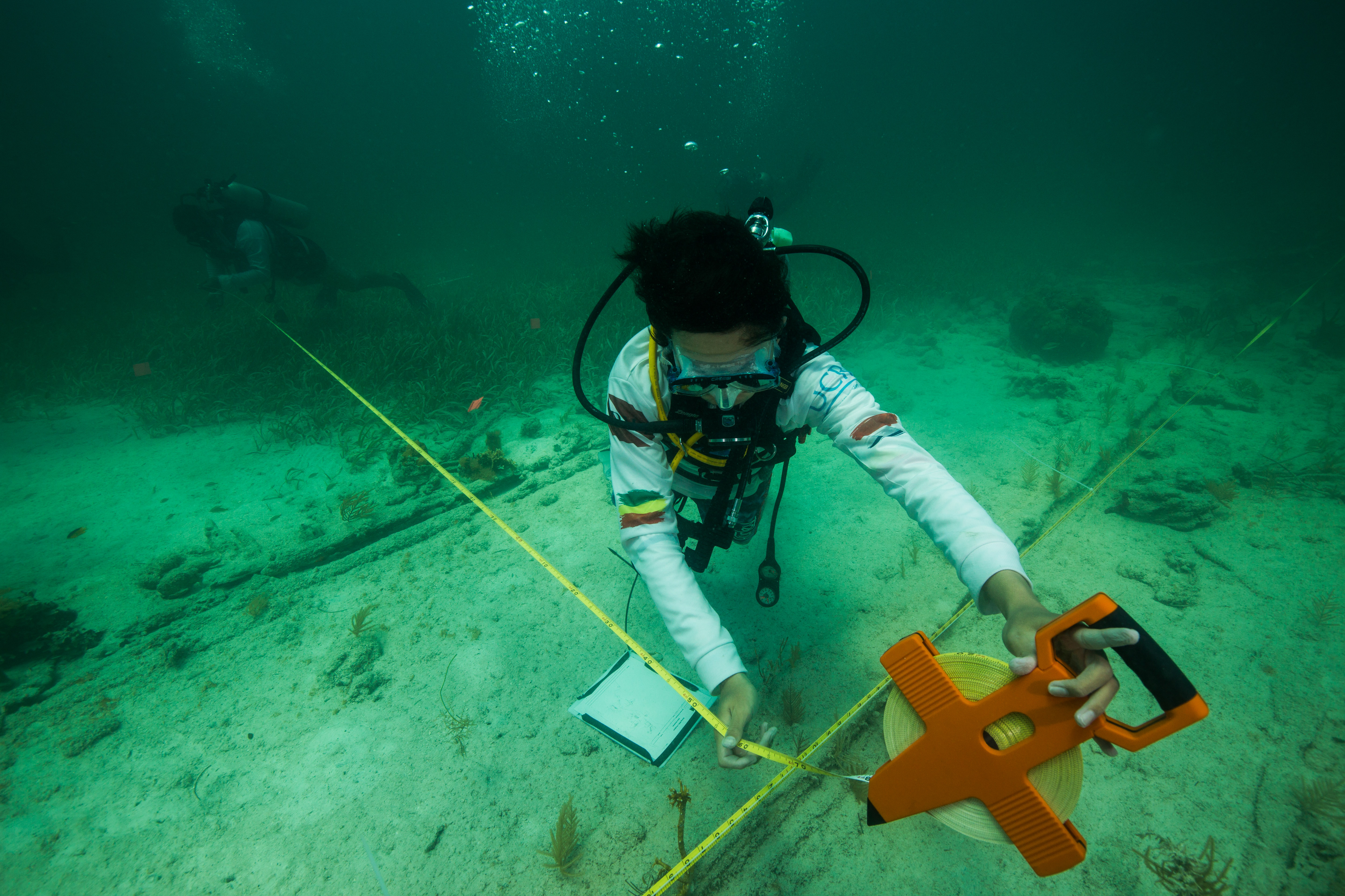
Permanant sites, ones without rugosity, were alot easier and faster than the temporary ones. With only fish counts and benthic photoquadrats to complete, the work went by pretty quickly. Working as a photoquadrat diver was a pretty good deal too. You’d have to wait for Eric to get some headway on his fish counts before starting, which gave you a little time to look around and enjoy the site. I took full advantage of this free time and took my fill of photos.

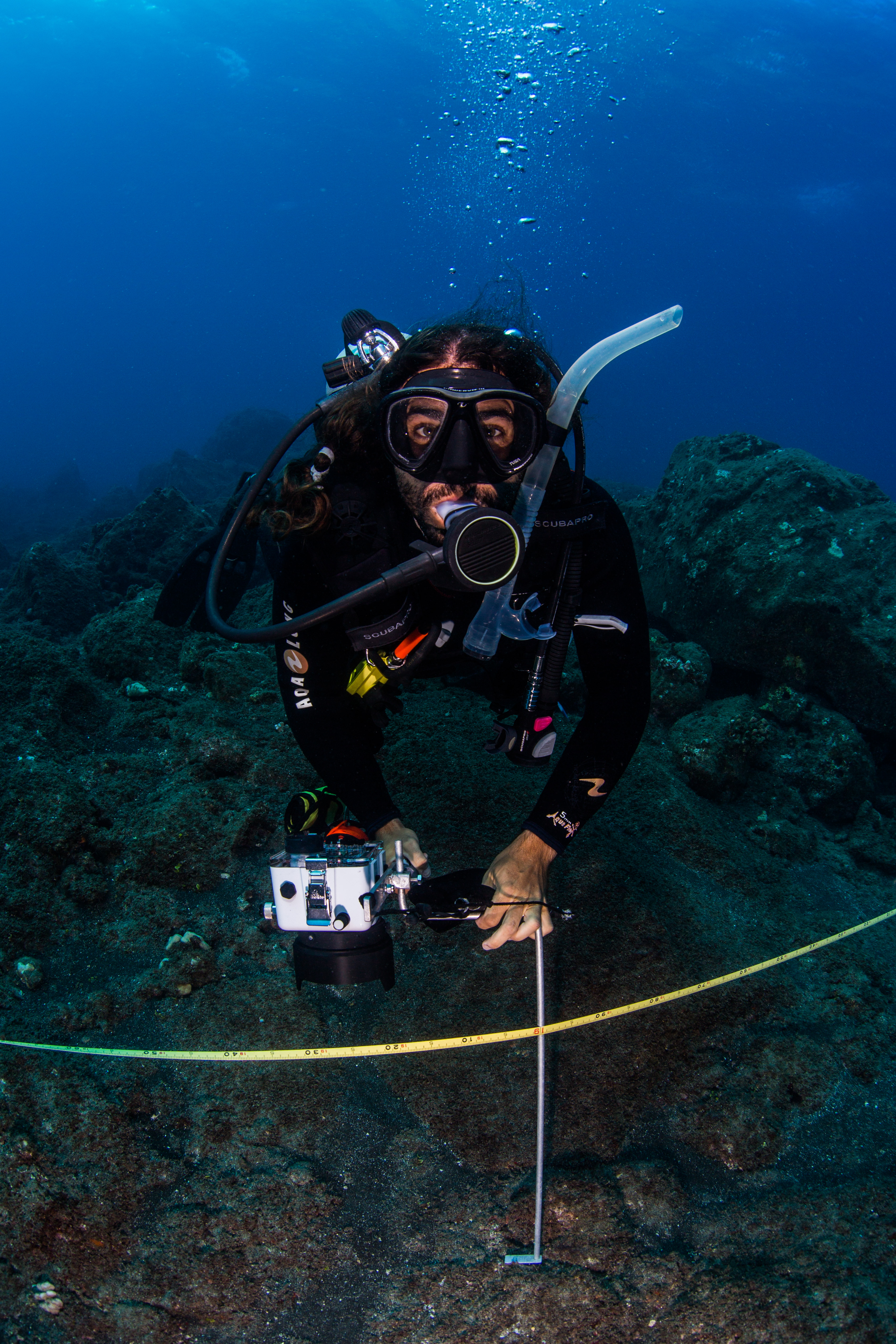
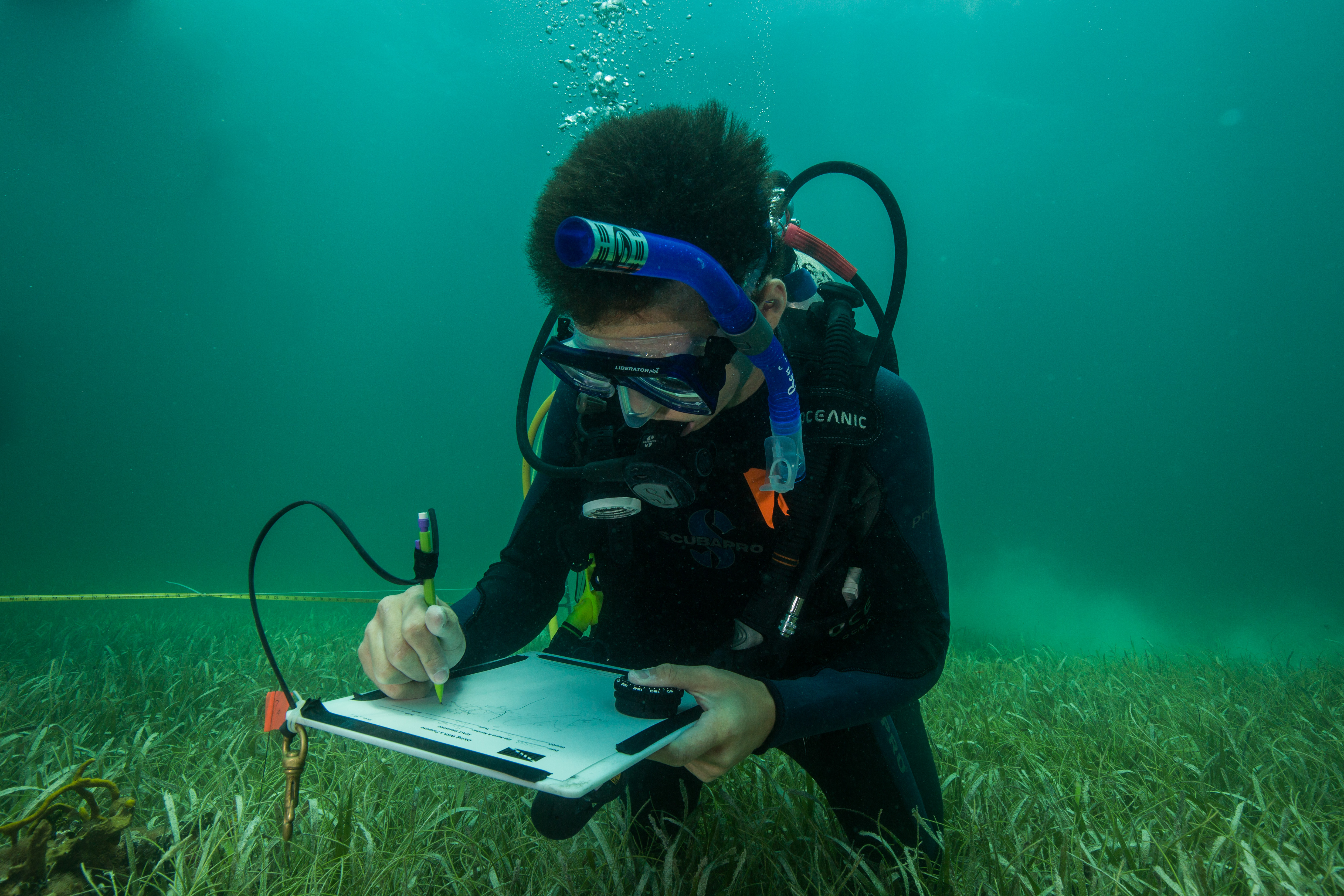
Glauco Puig-Santana taking some benthic photoquadrats

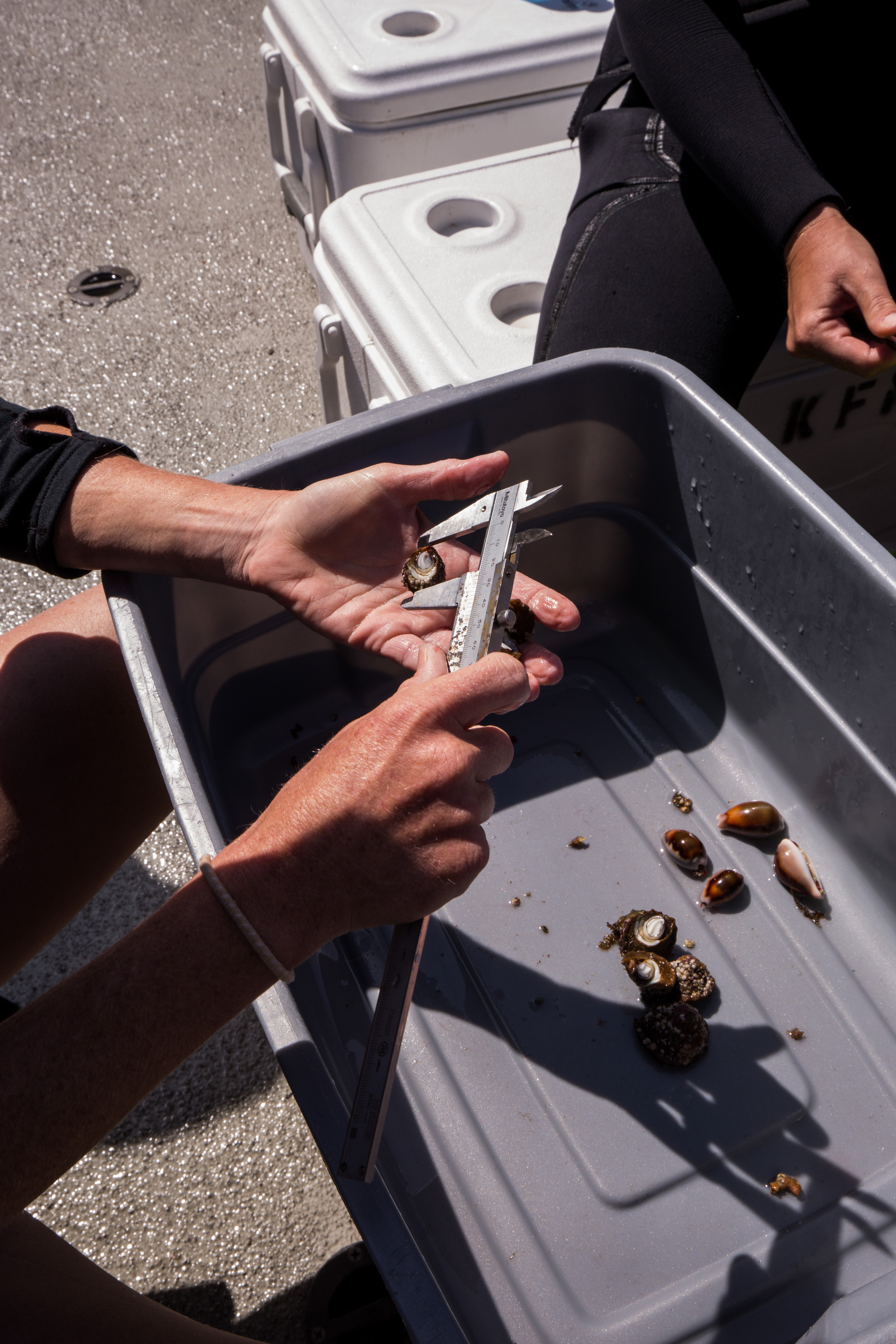
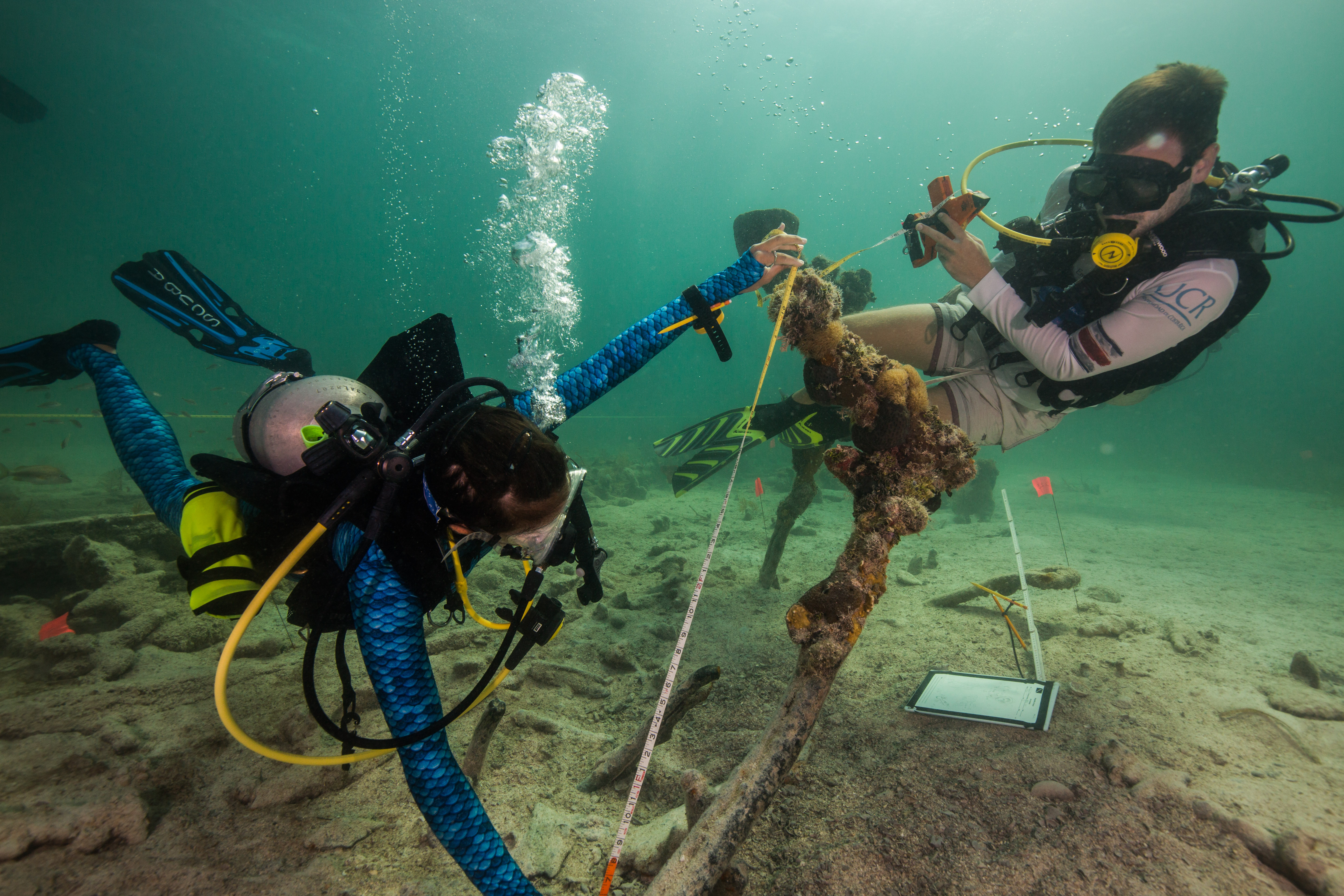
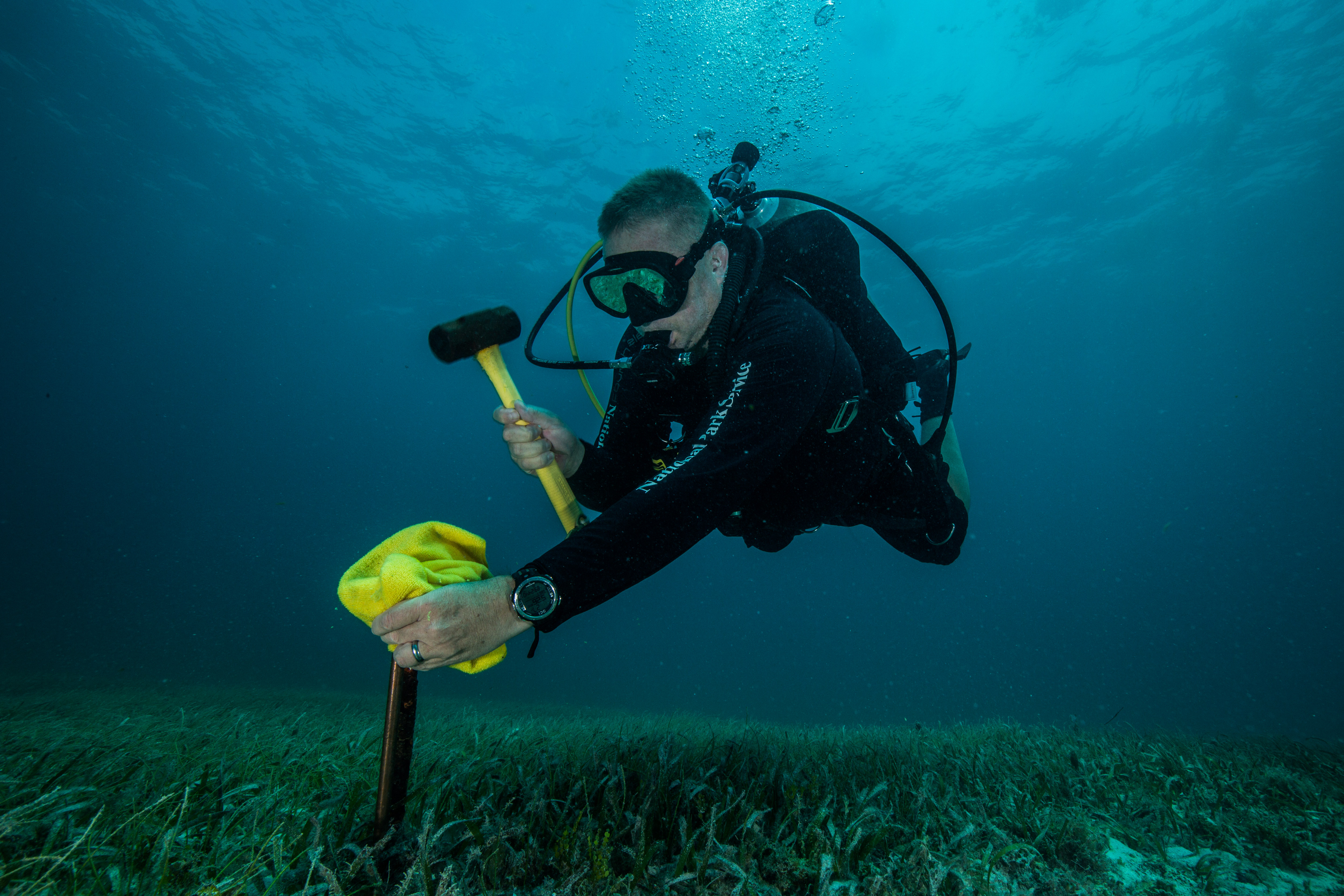
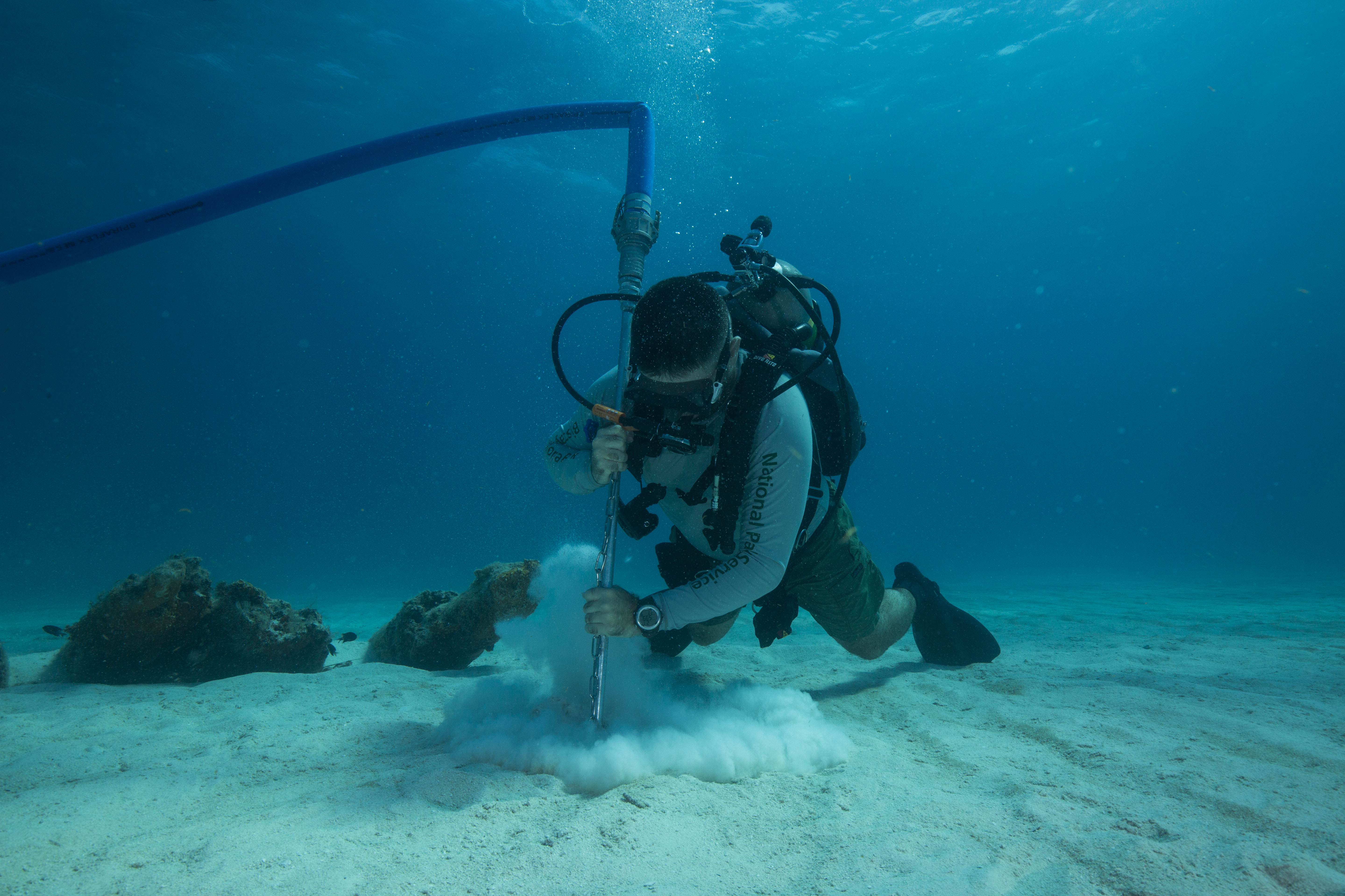
Another important part of the surveys, something that happened at both temporary and permanant sites, was water quality measurements with a sonde. A sonde is a multiparameter that collects data with six user-replaceable sensors, collecting a wide variety of data, ranging from conductivity and temperature to turbidity. This high-tech piece of equipment would be used to compare subtle biotic and abiotic differences between sites and see how they might influence biological life.

The sonde working away taking measurements

For the first couple days our team consisted of Eric, Sheila, Glauco, myself, and Randall Watanuki. Randall, a long-time employee of Kalaupapa, covered the boating as he was highly experienced with it and had a recent injury that kept him from diving. We started off with some easy sites close to town, on the leeward side of the peninsula. Kalaupapa is subject to high winds, making the leeward and windward sides of the peninsula have drastically different weather.

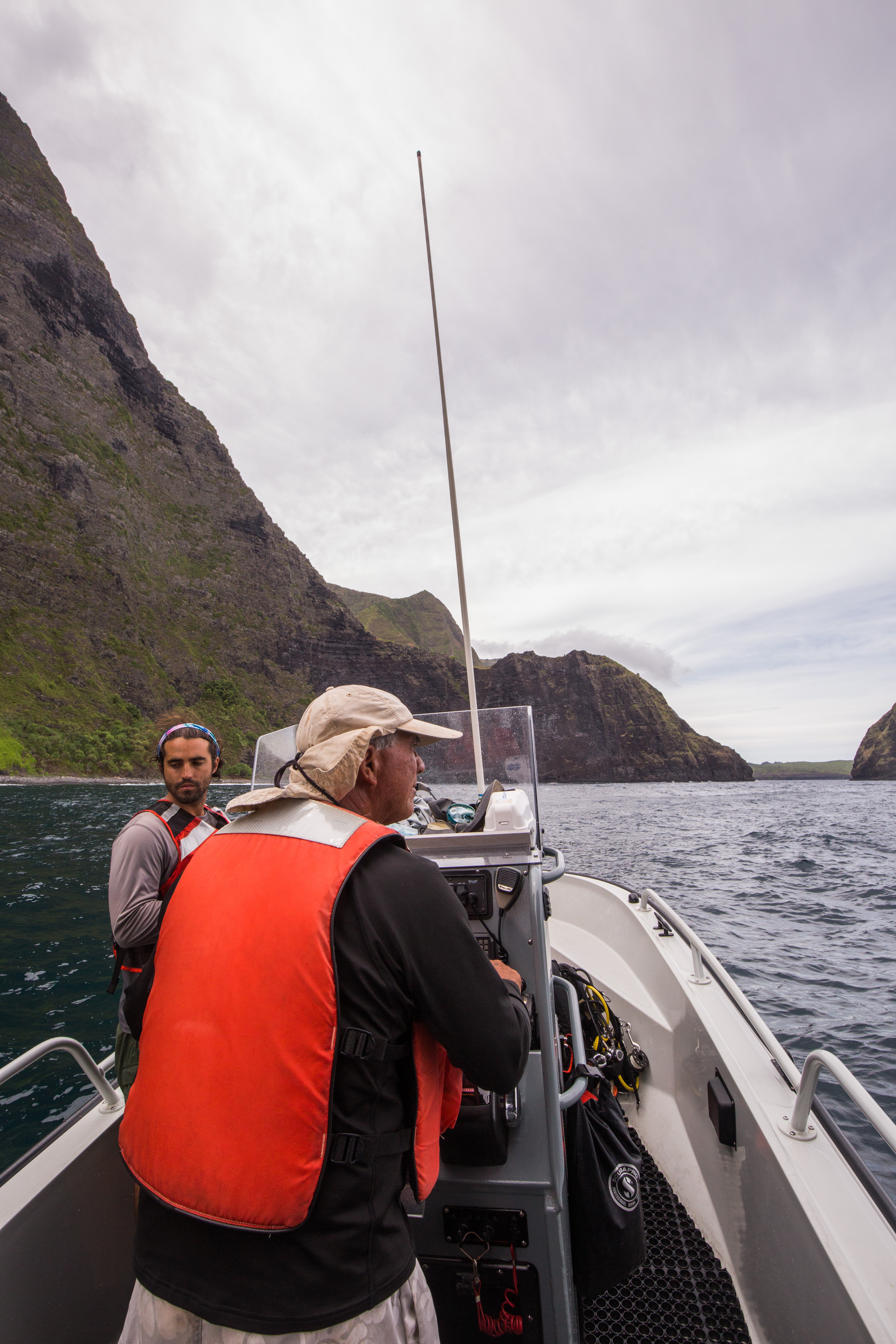
Randall Watanuki, our expert boat operator

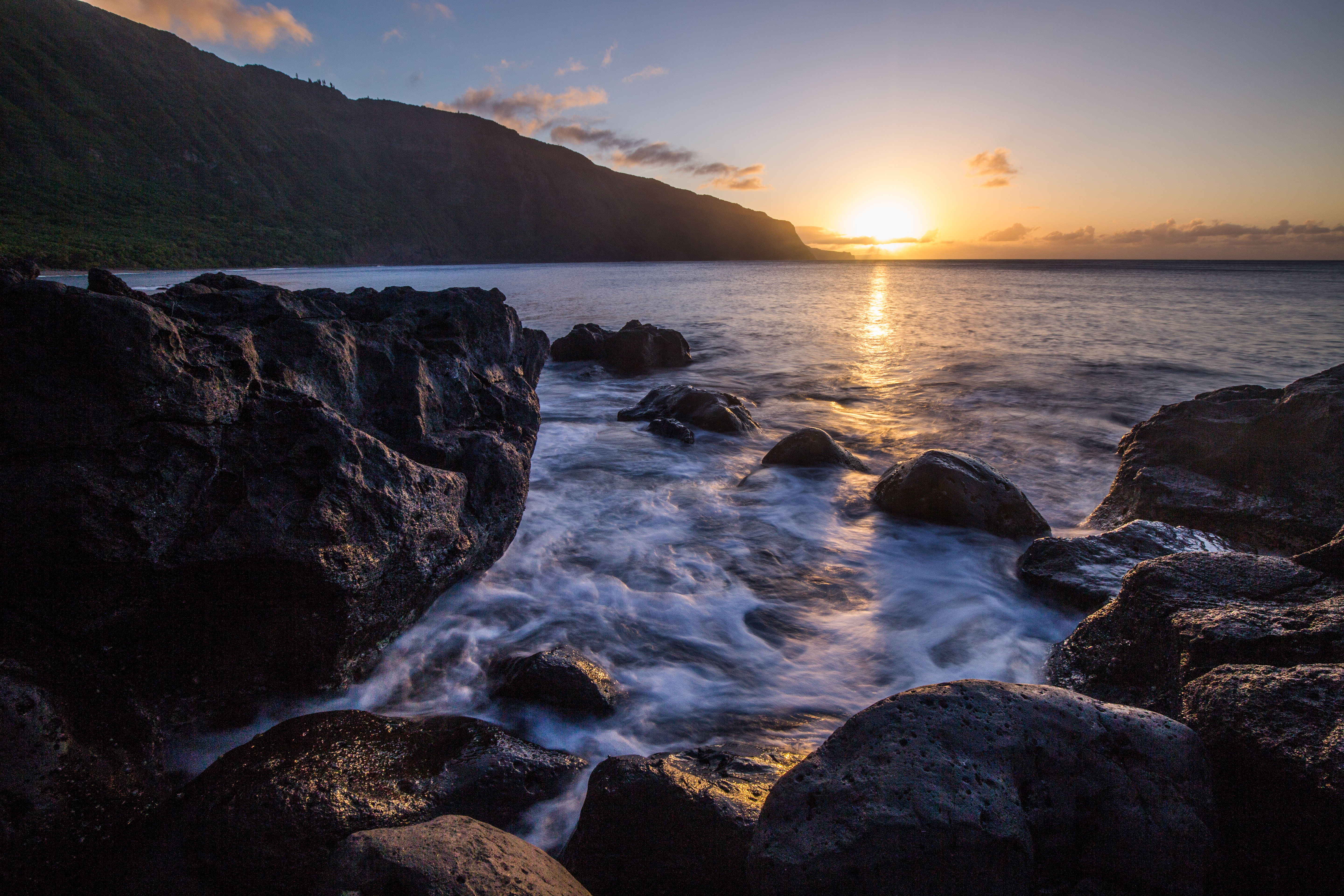
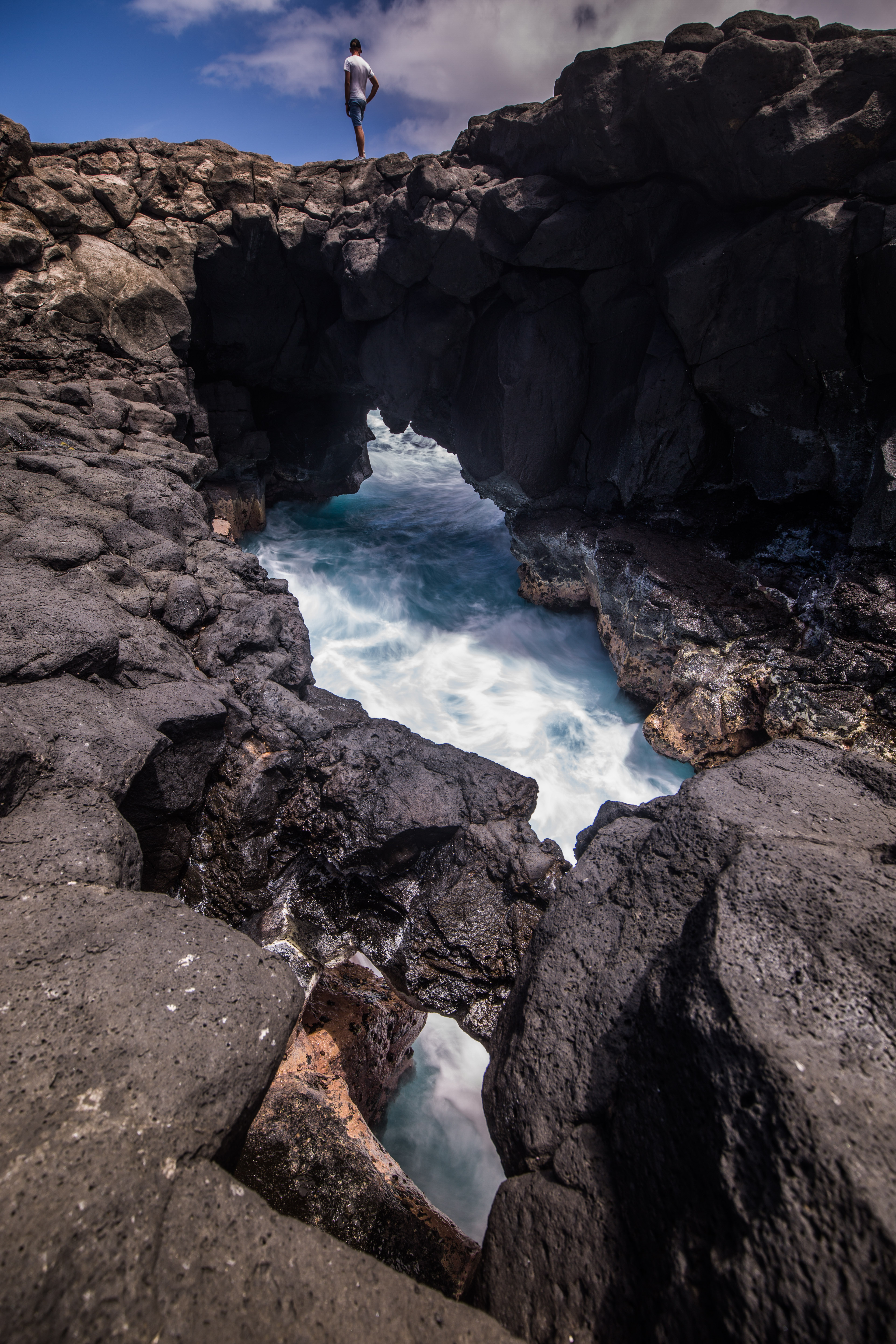
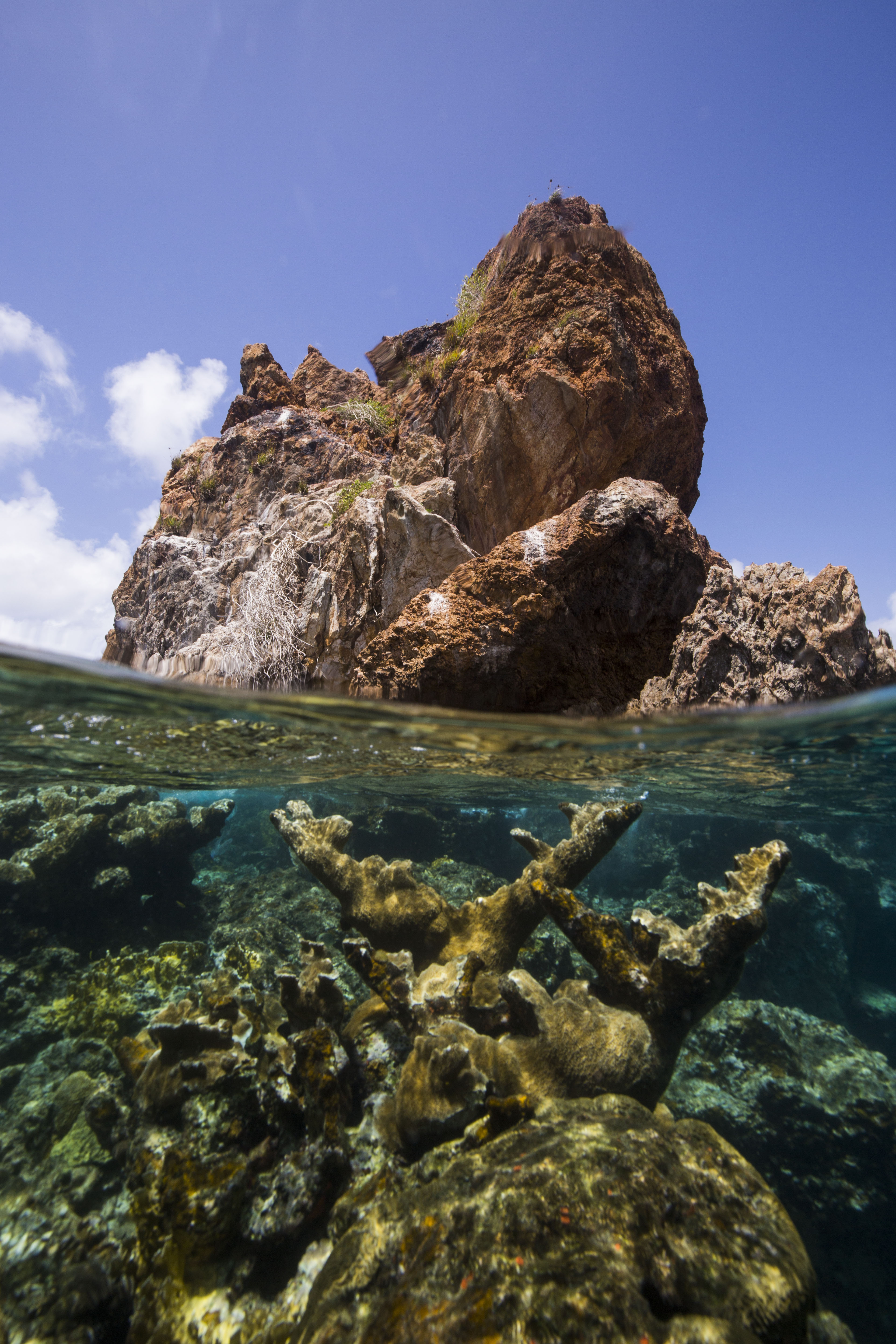
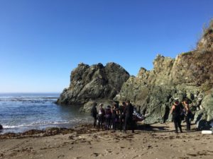
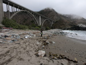
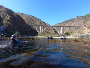
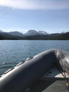
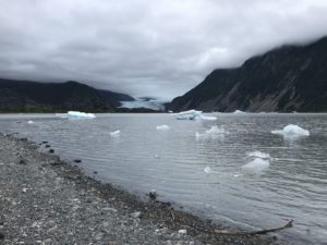
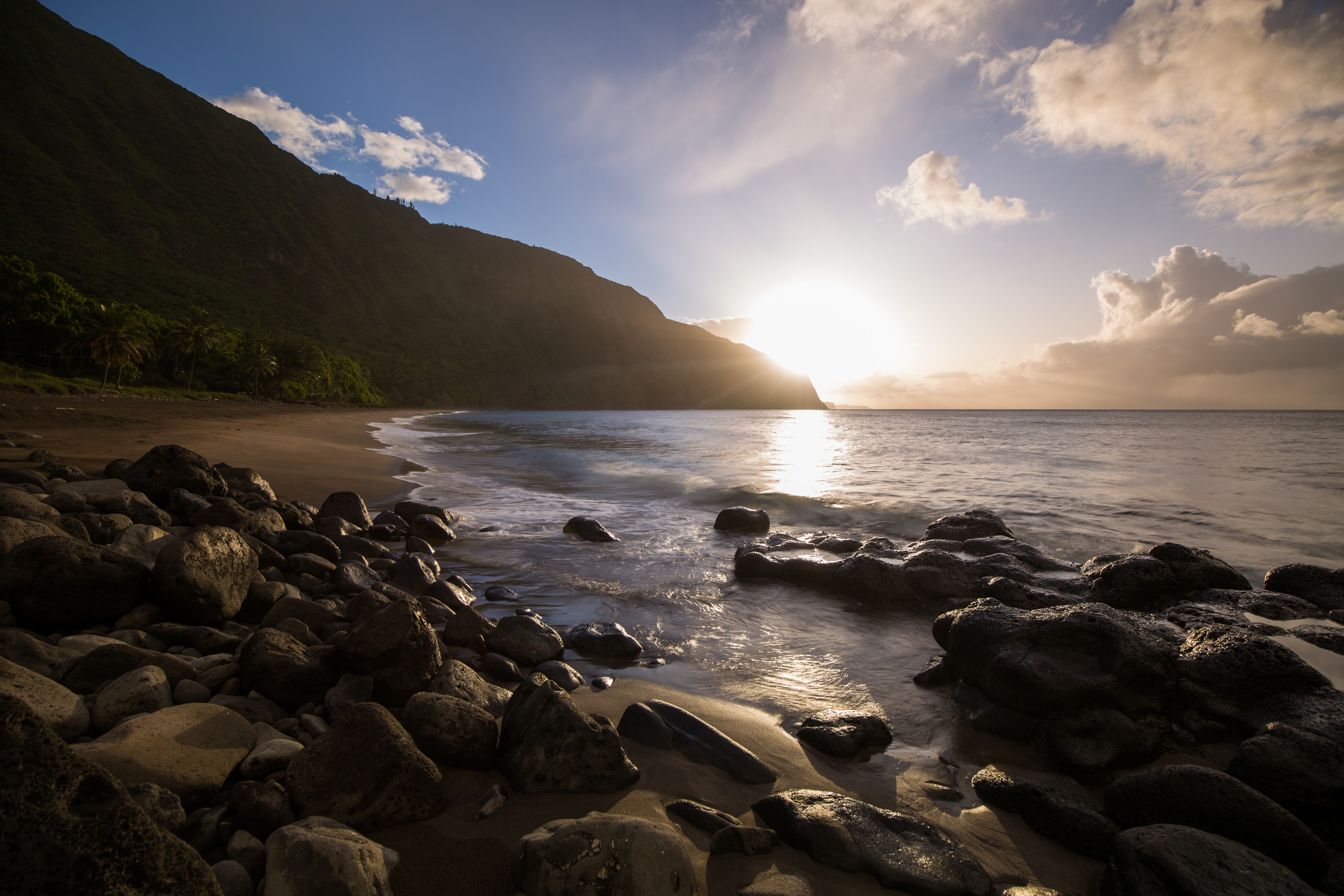
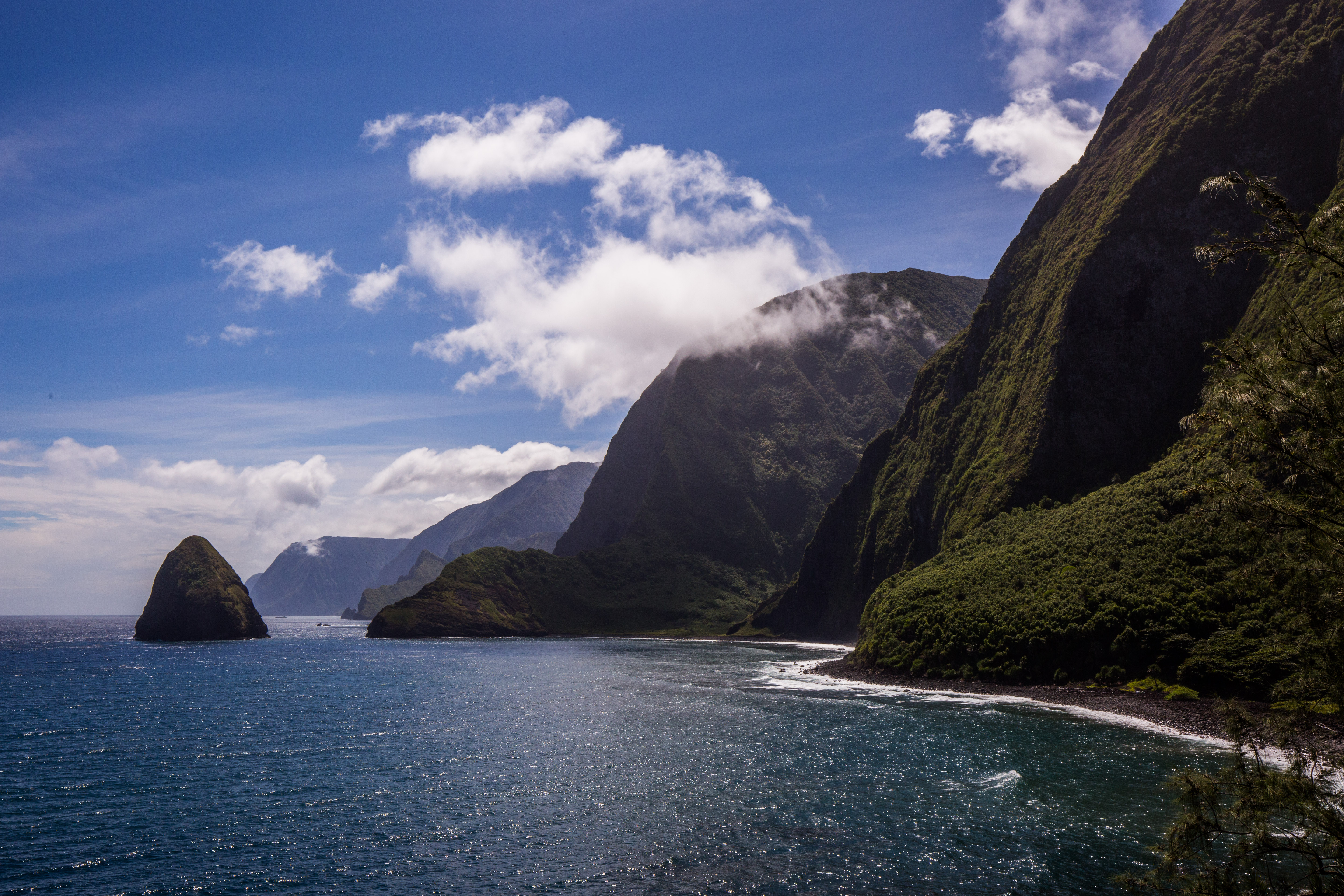
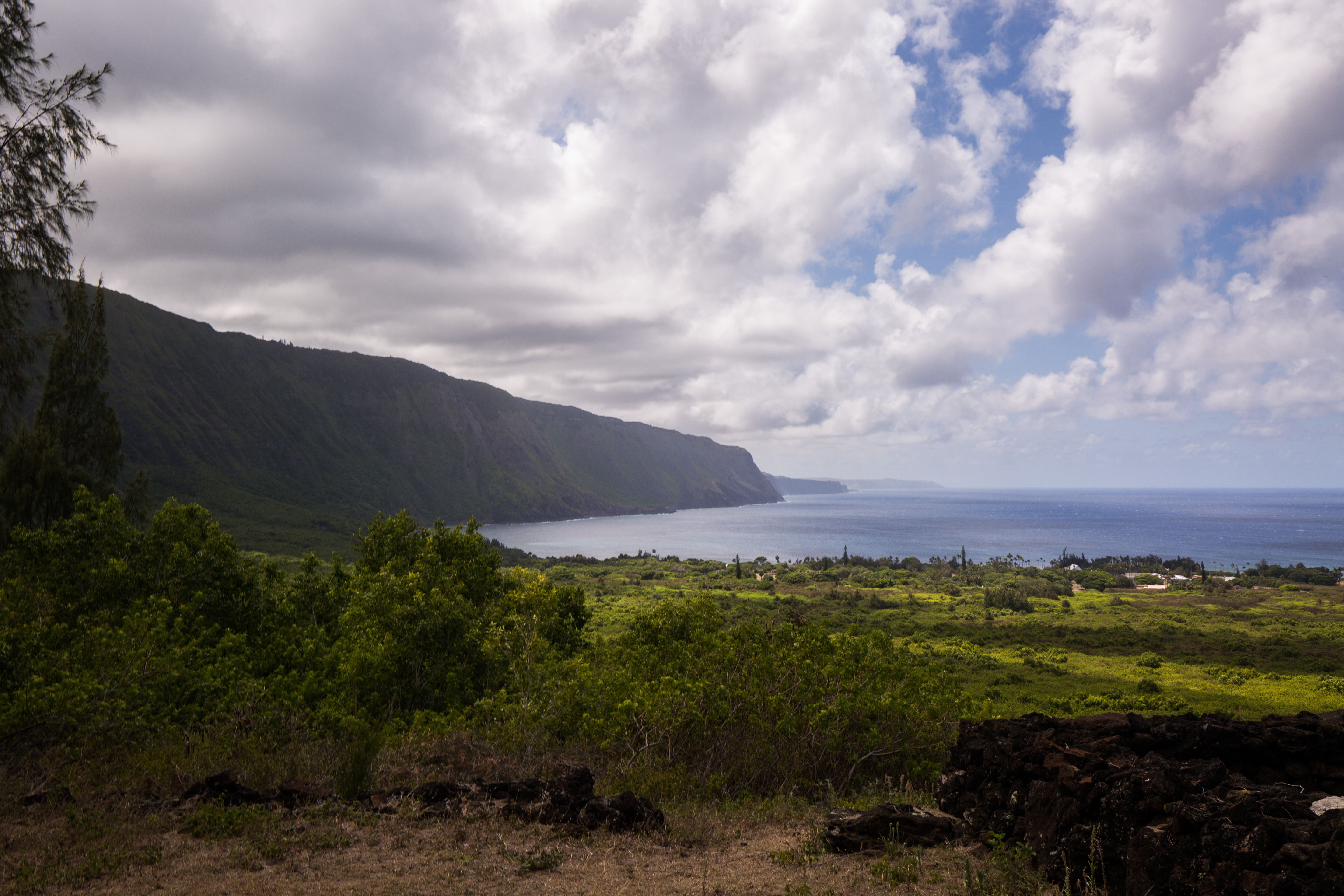
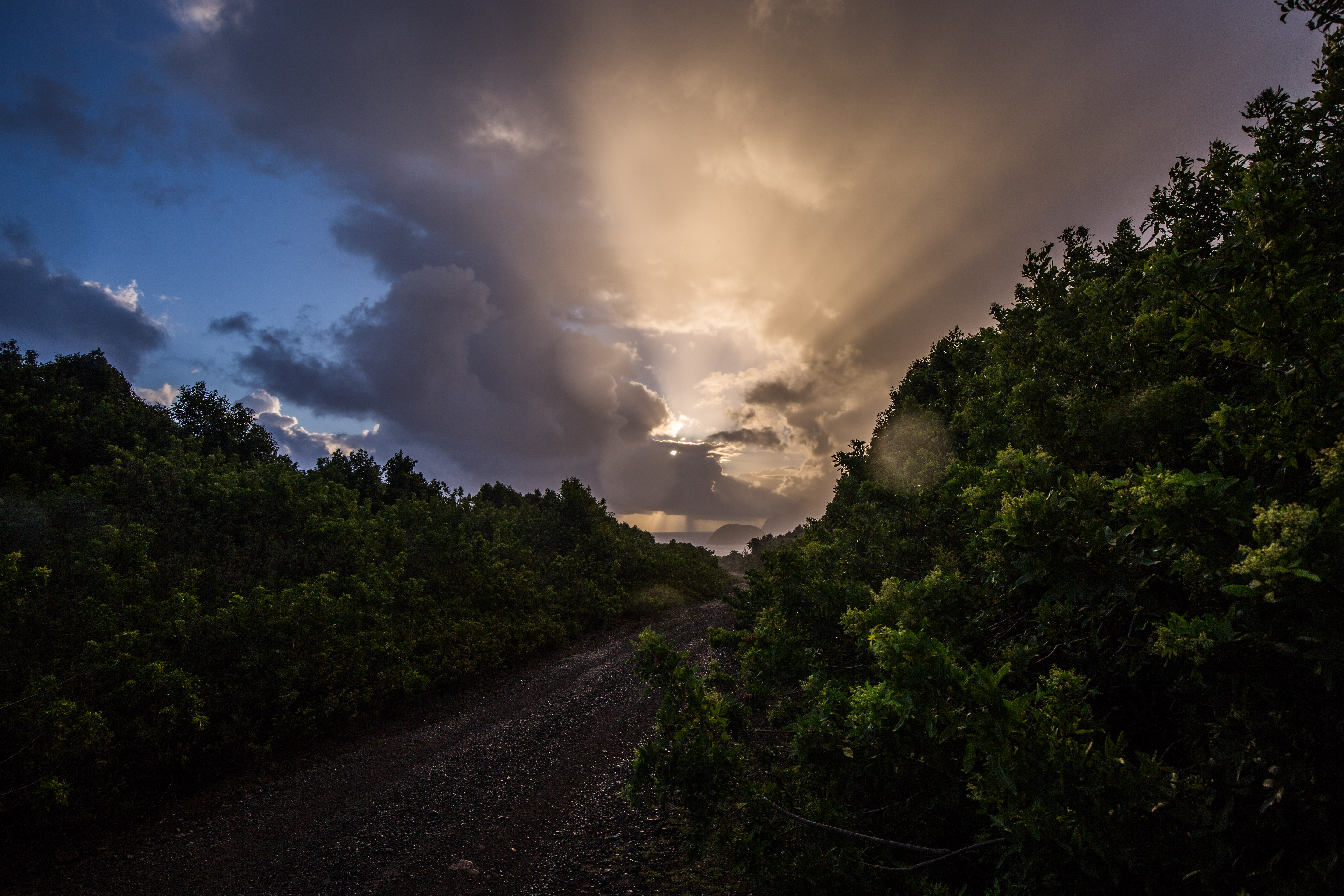
Shortly after knocking out a couple easy protected sites, we got a weather window allowing us to venture over to the exposed side. This area is rarely visited by anyone due to its remote location and exposed nature, so it hosts some of the finest diving on the peninsula. It also has some very dramatic views of the sheer sea-cliffs and assorted islands. The north shore of Molokai has some of the highest sea-cliffs in the world, which made a lovely backdrop for some fieldwork.

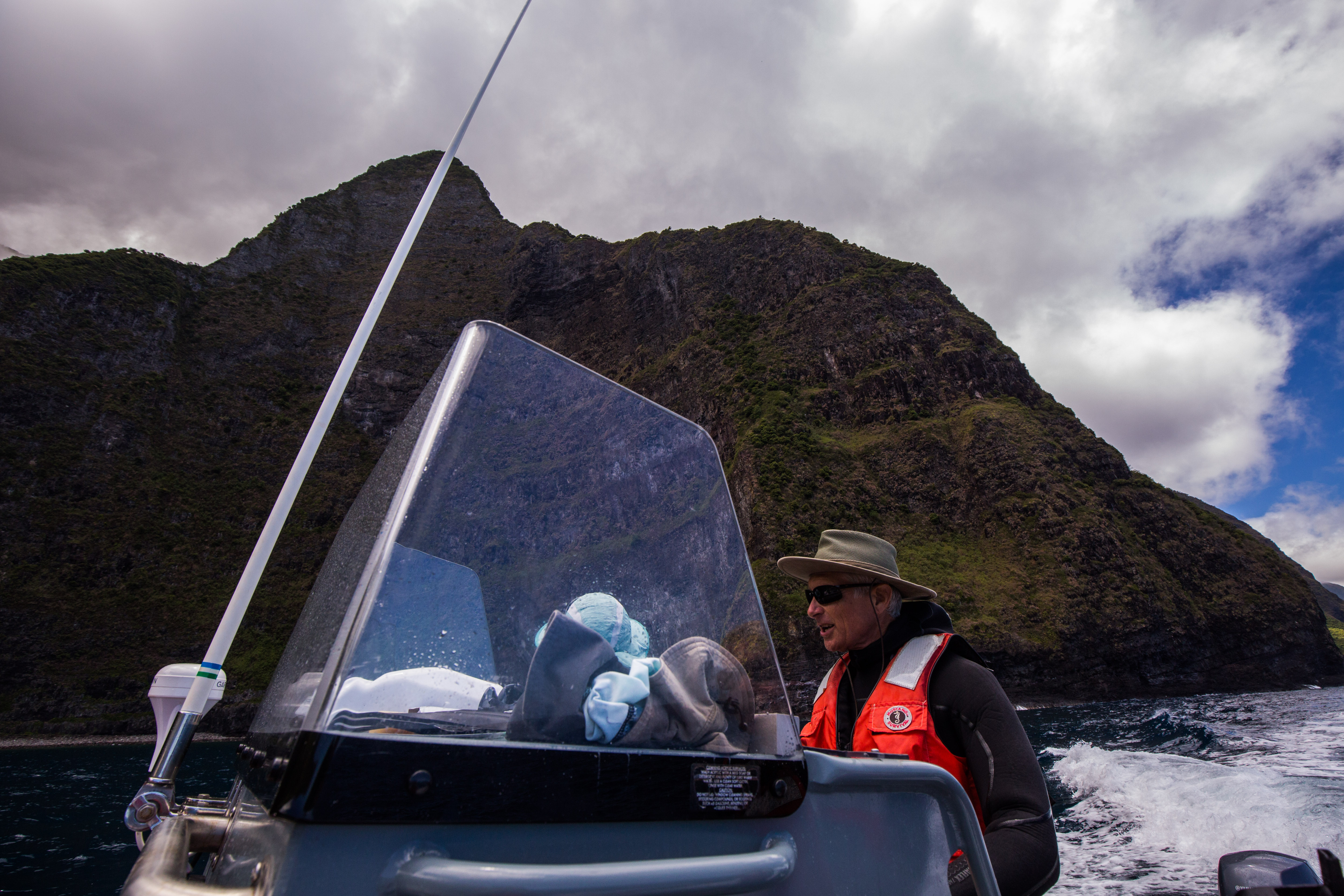
Those are some serious sea cliffs

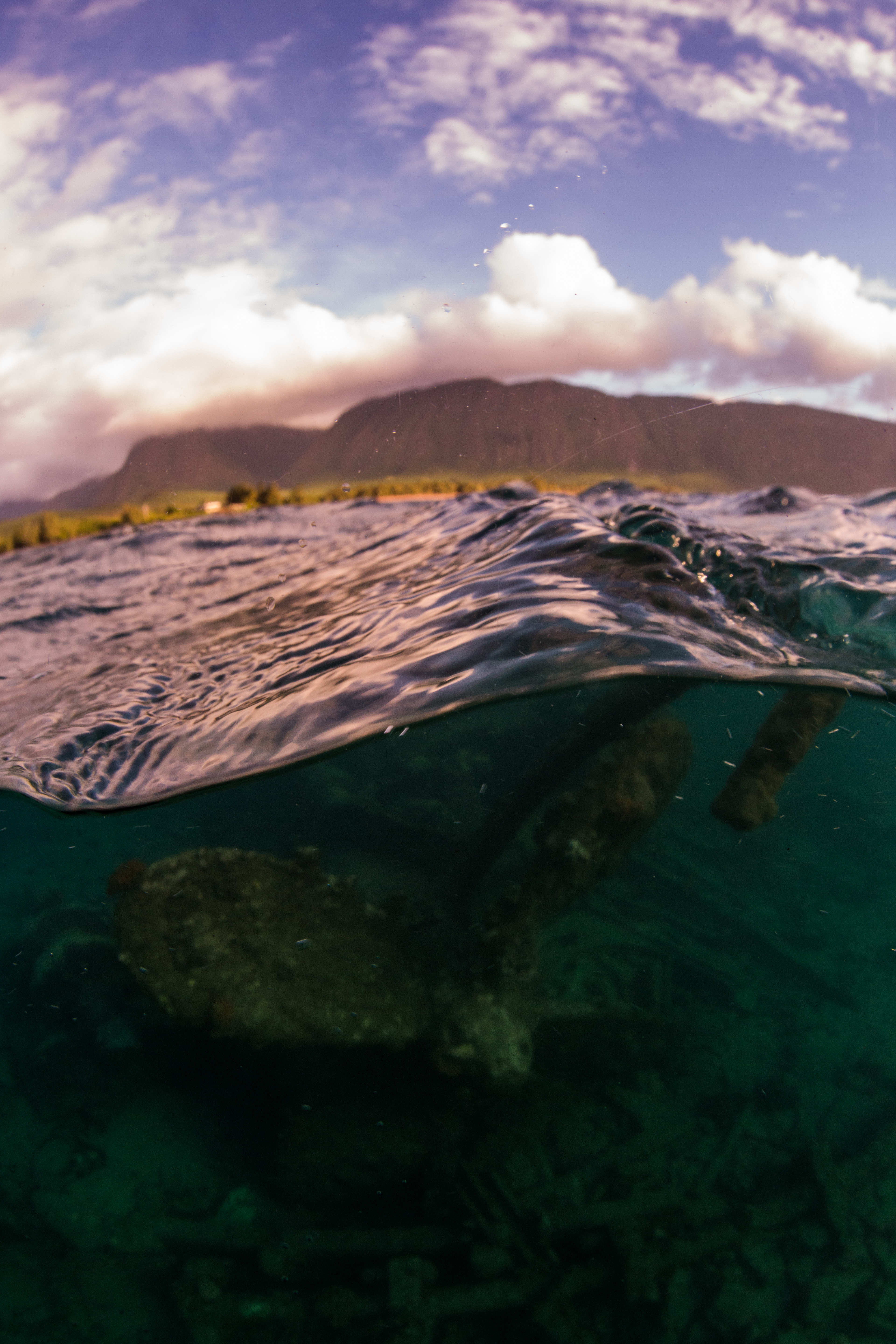
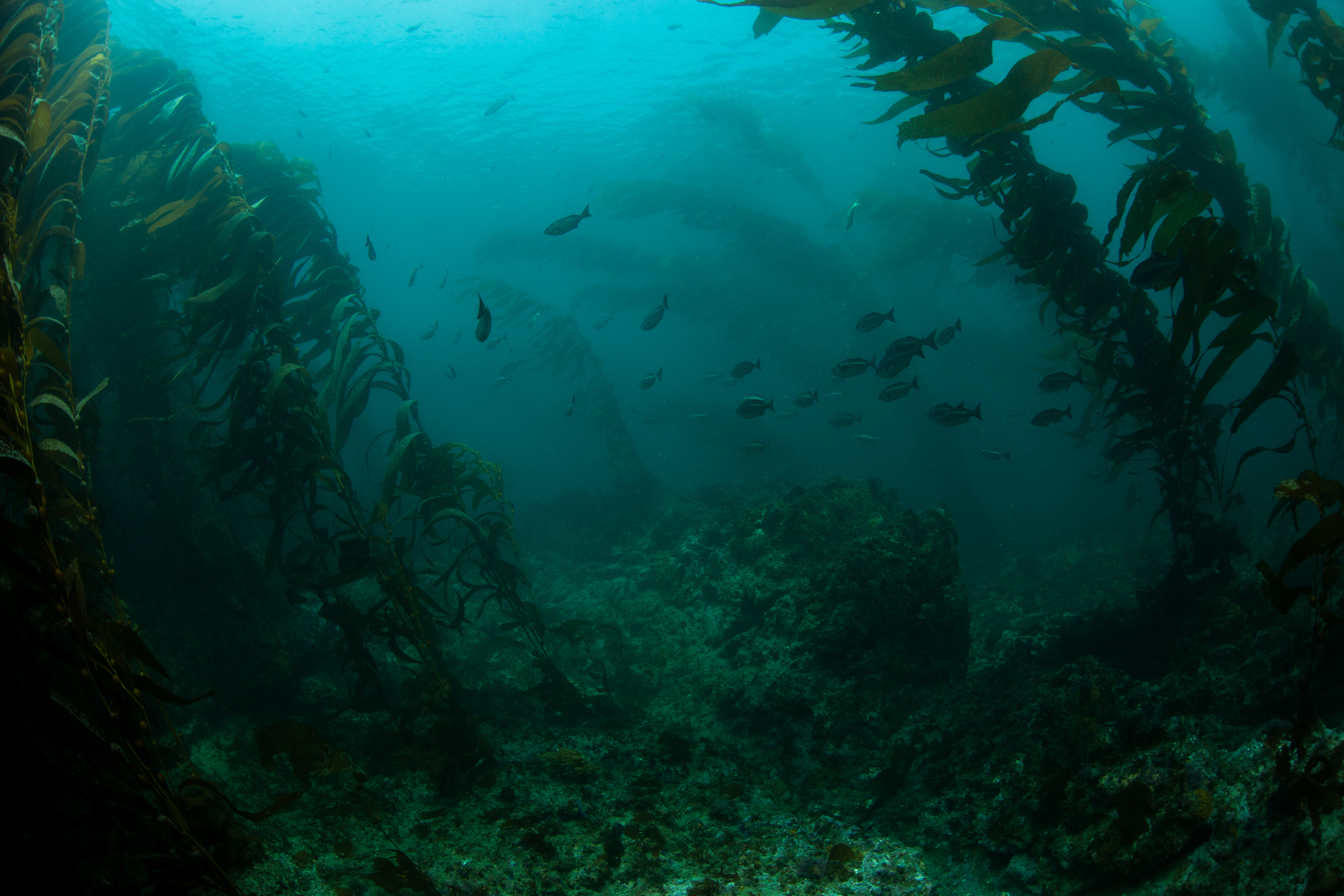
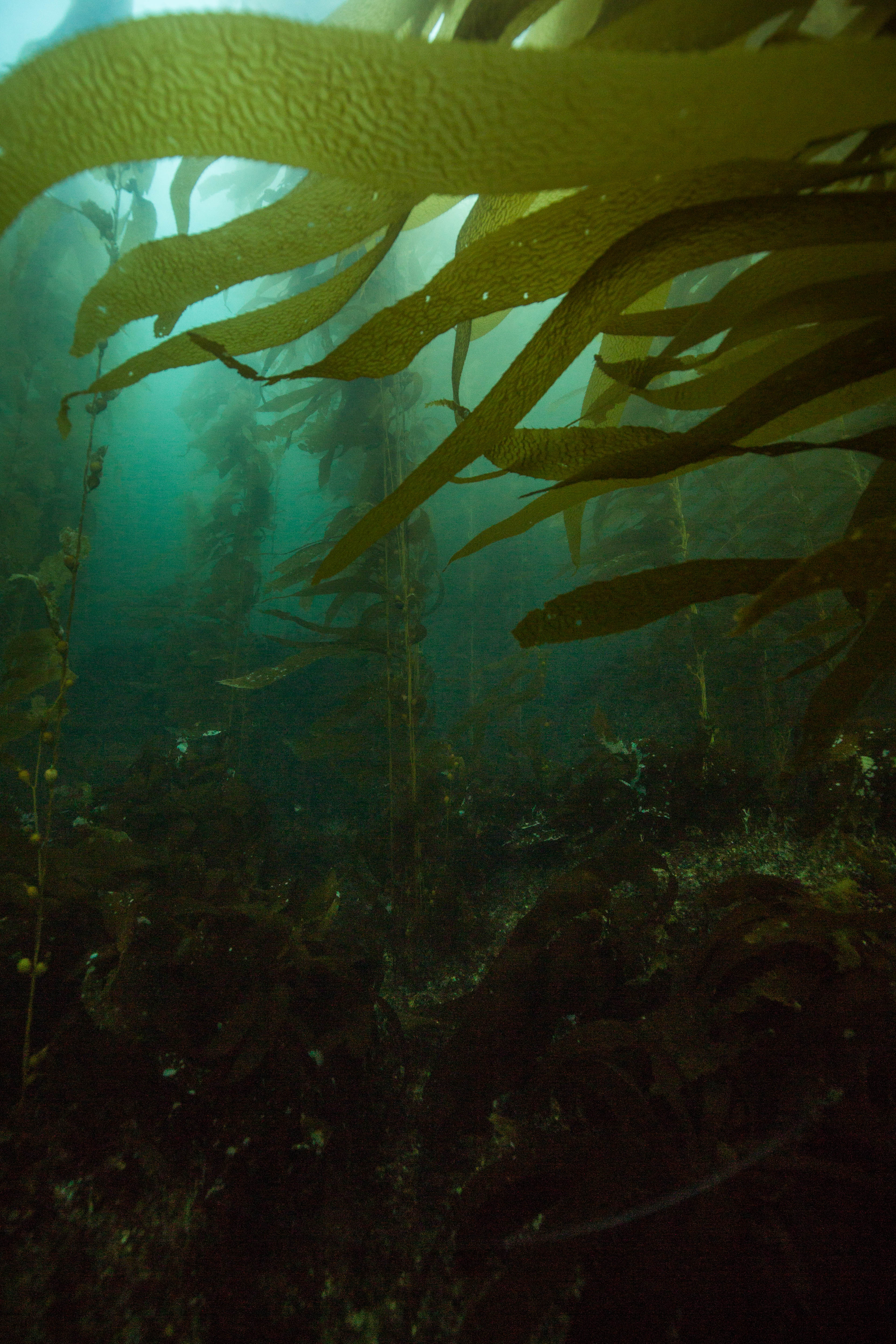
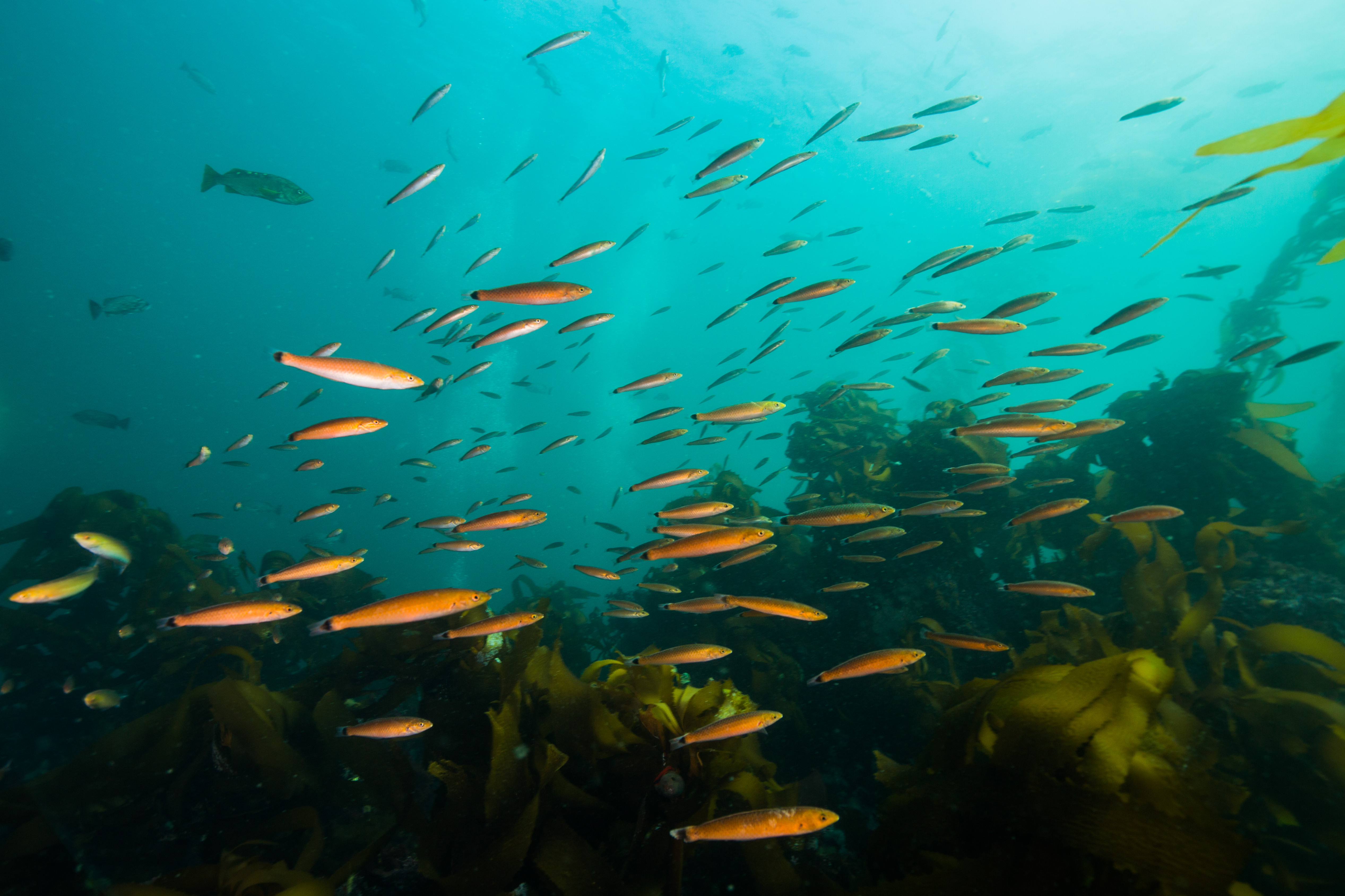
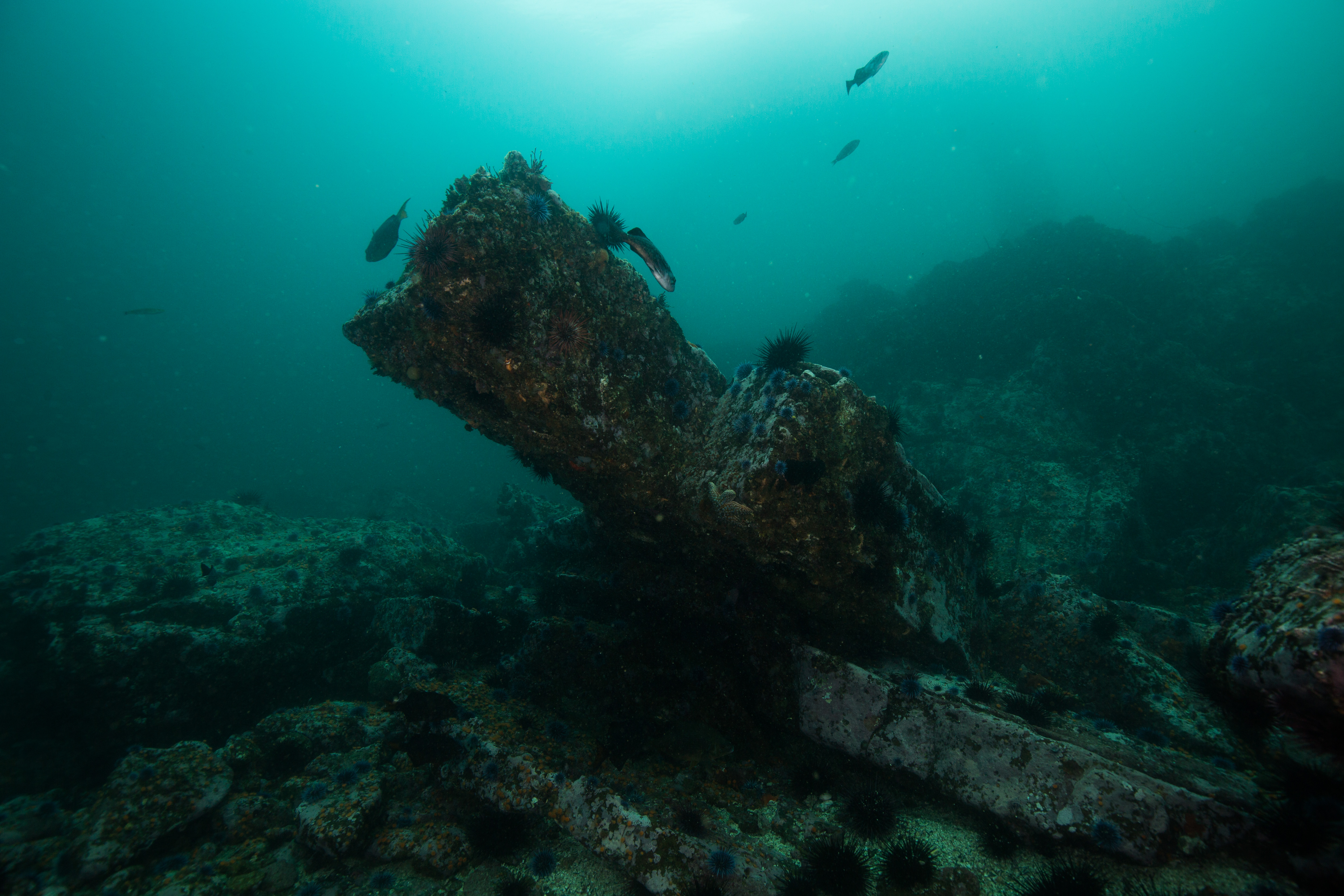
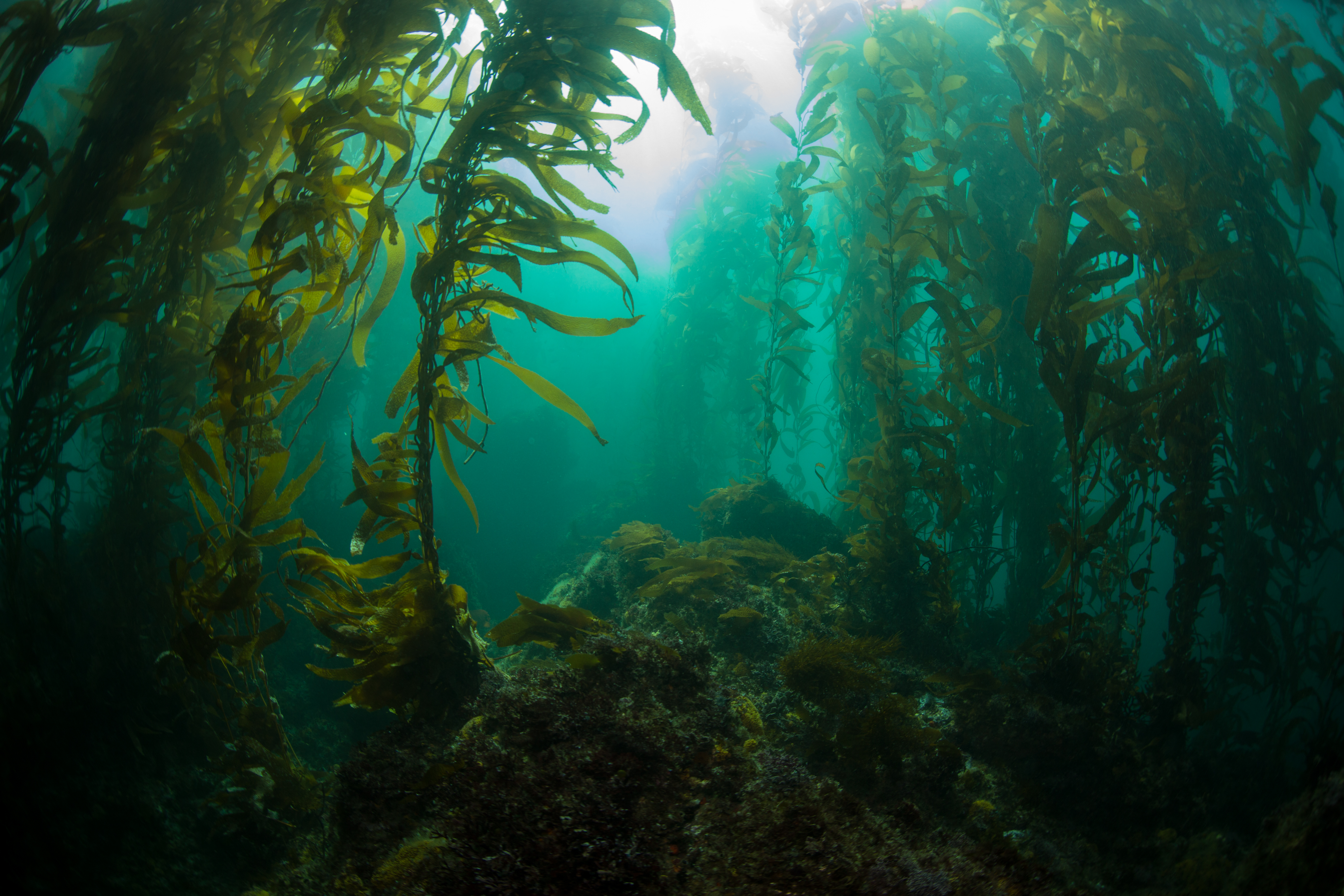
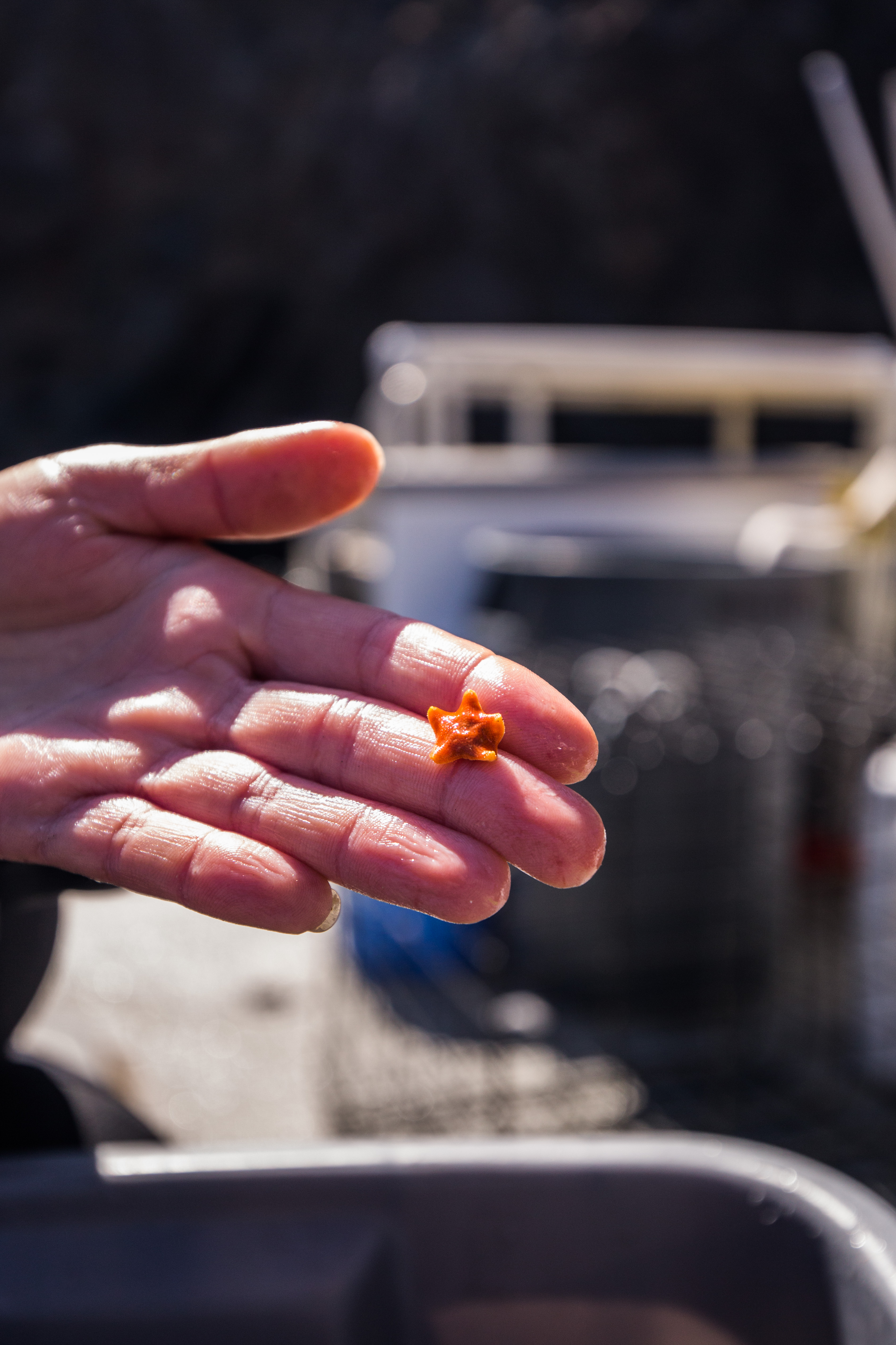
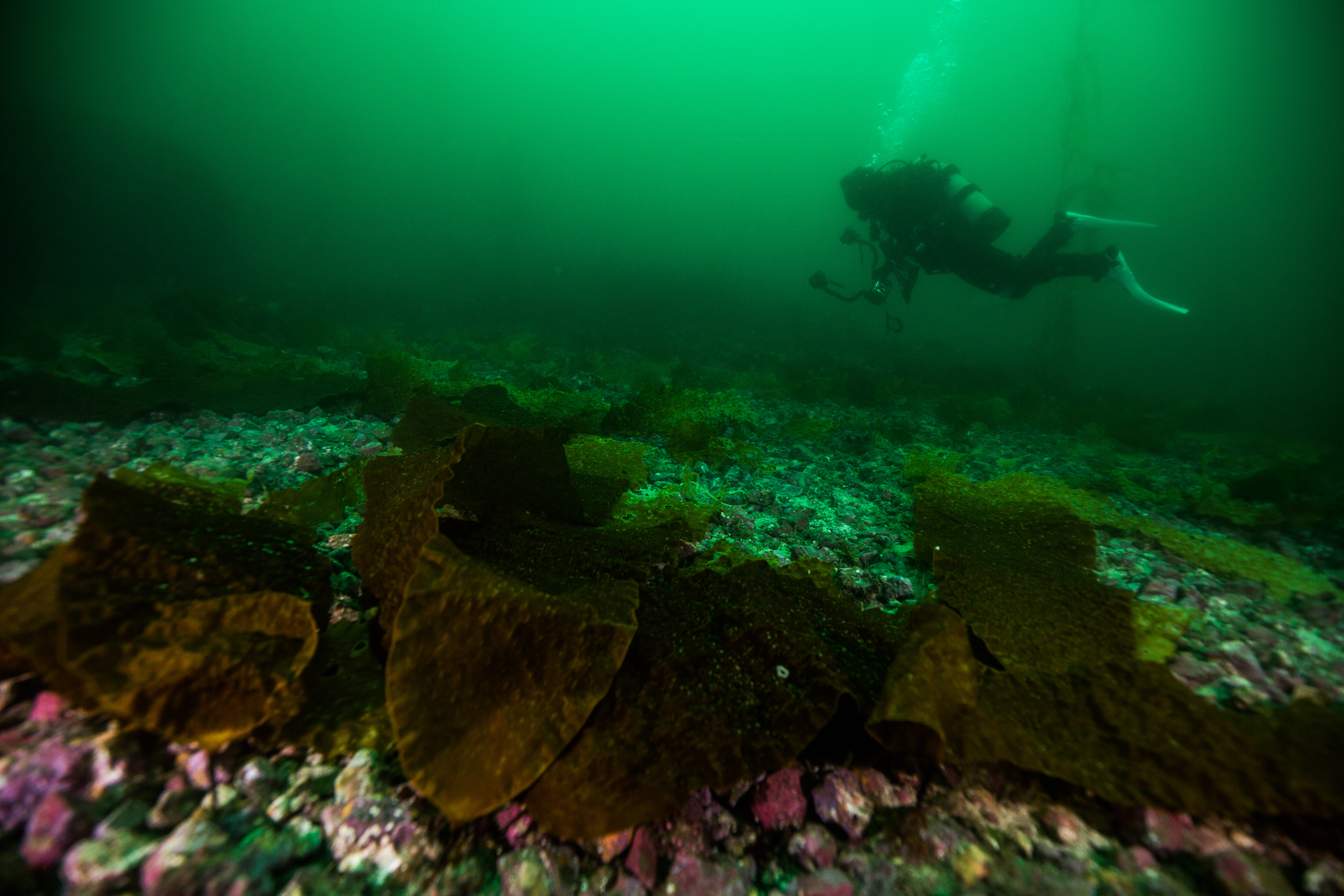
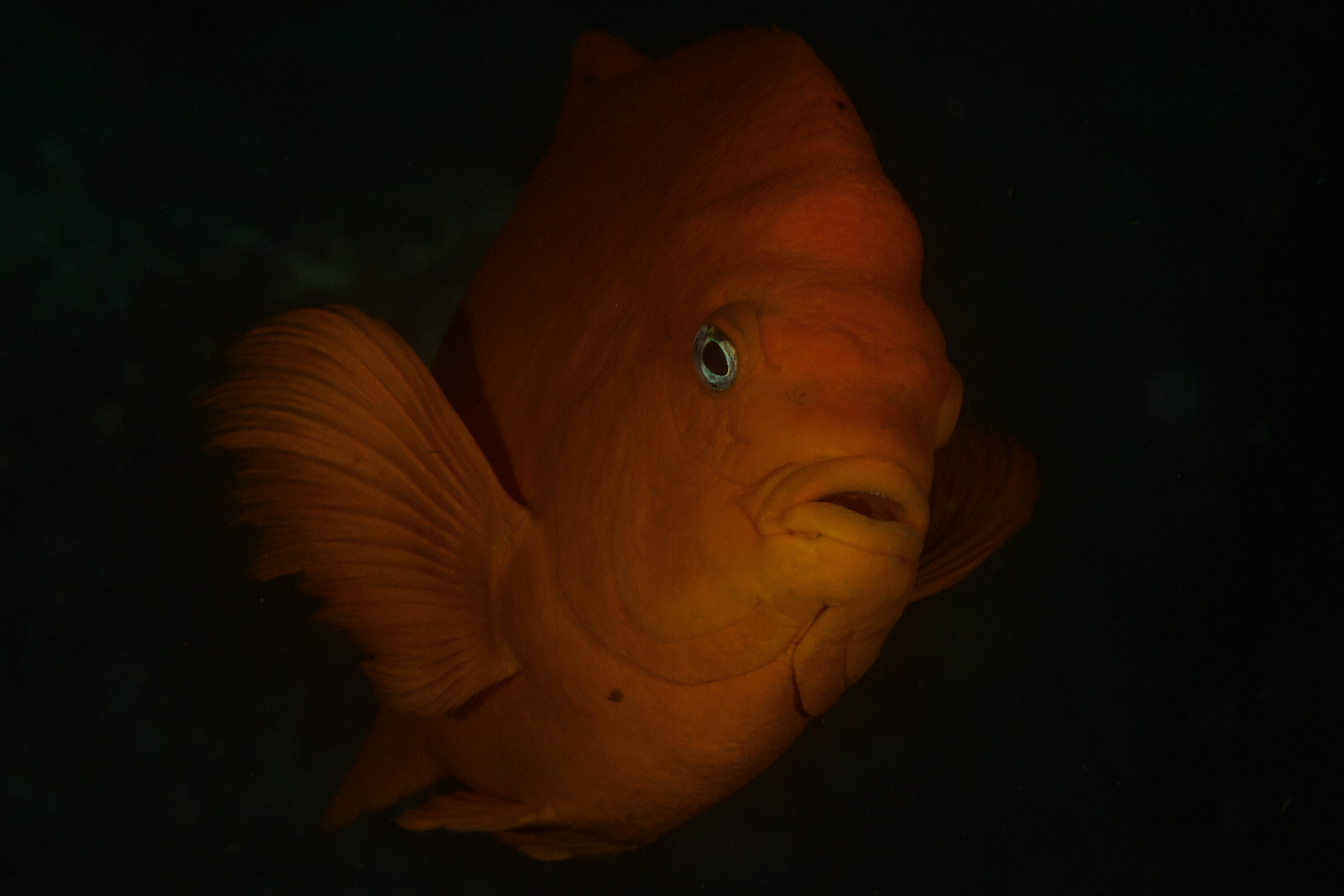
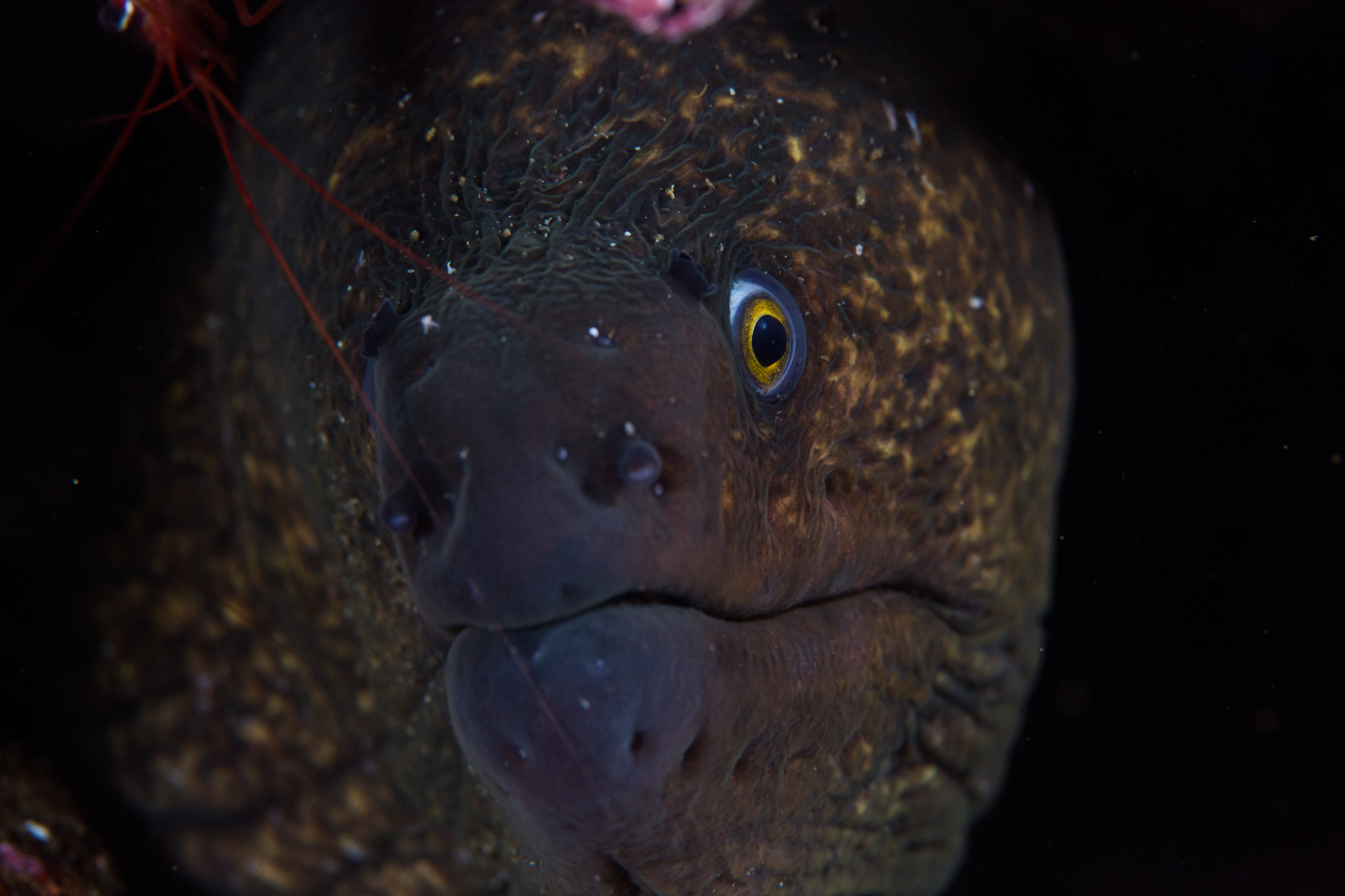
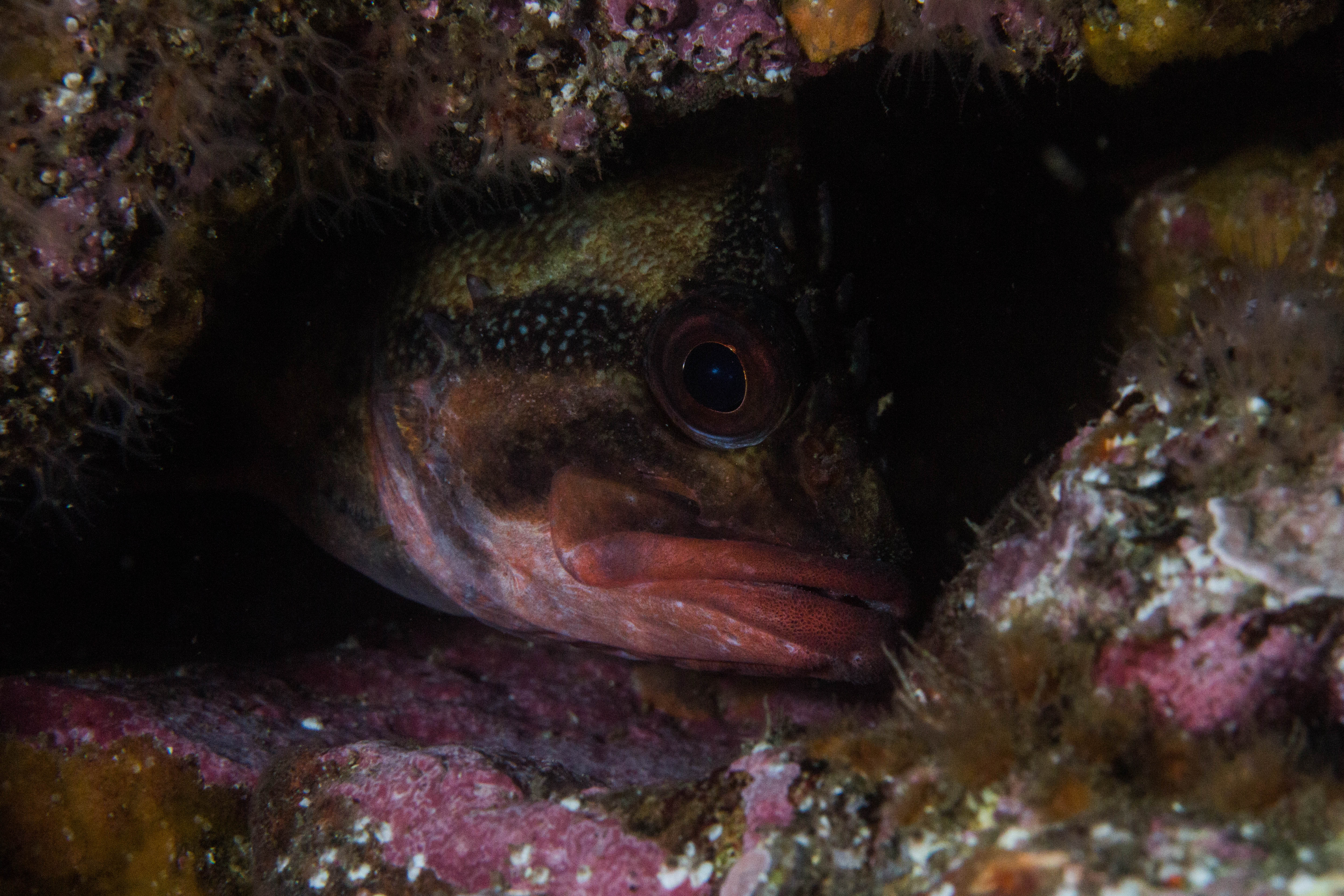
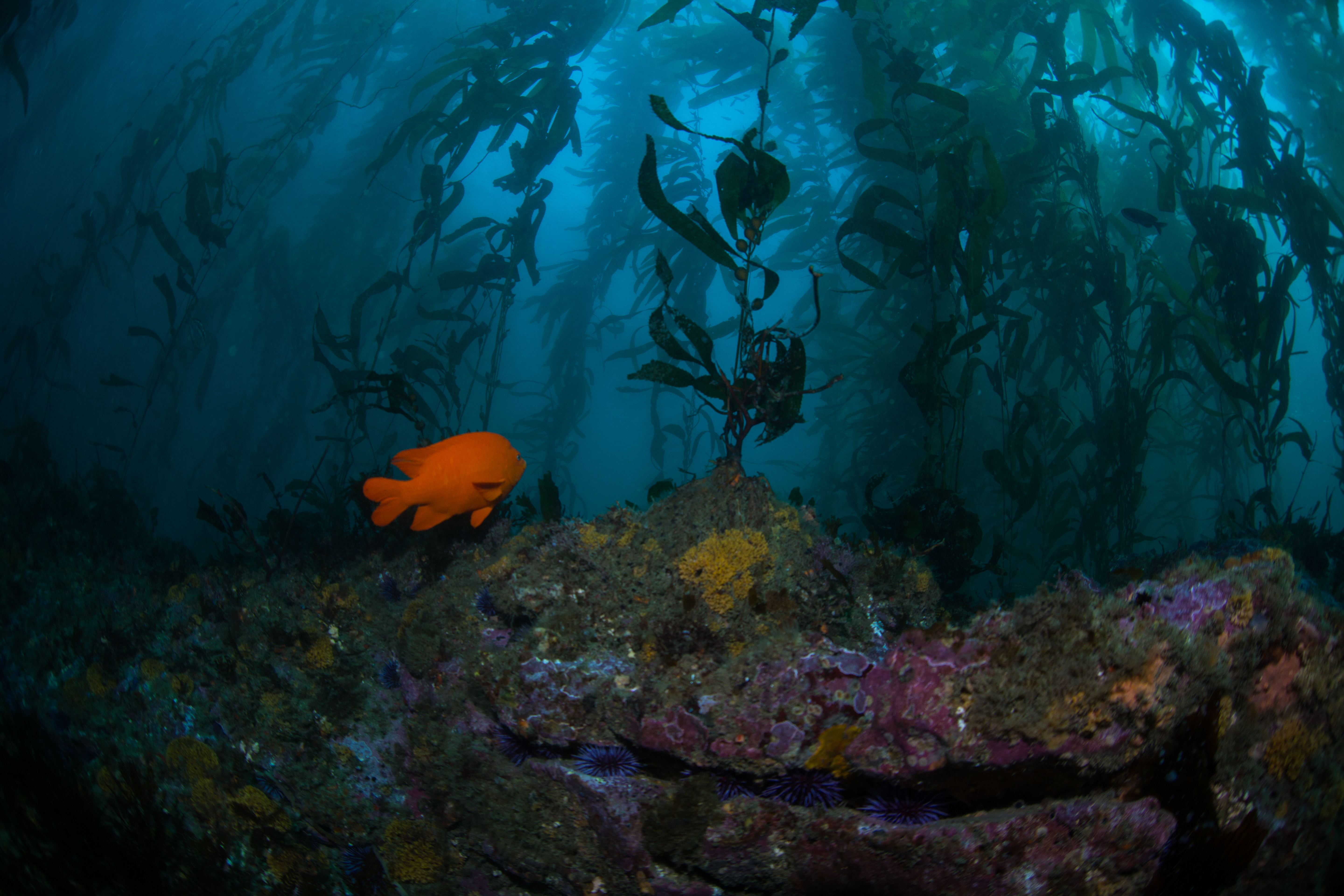
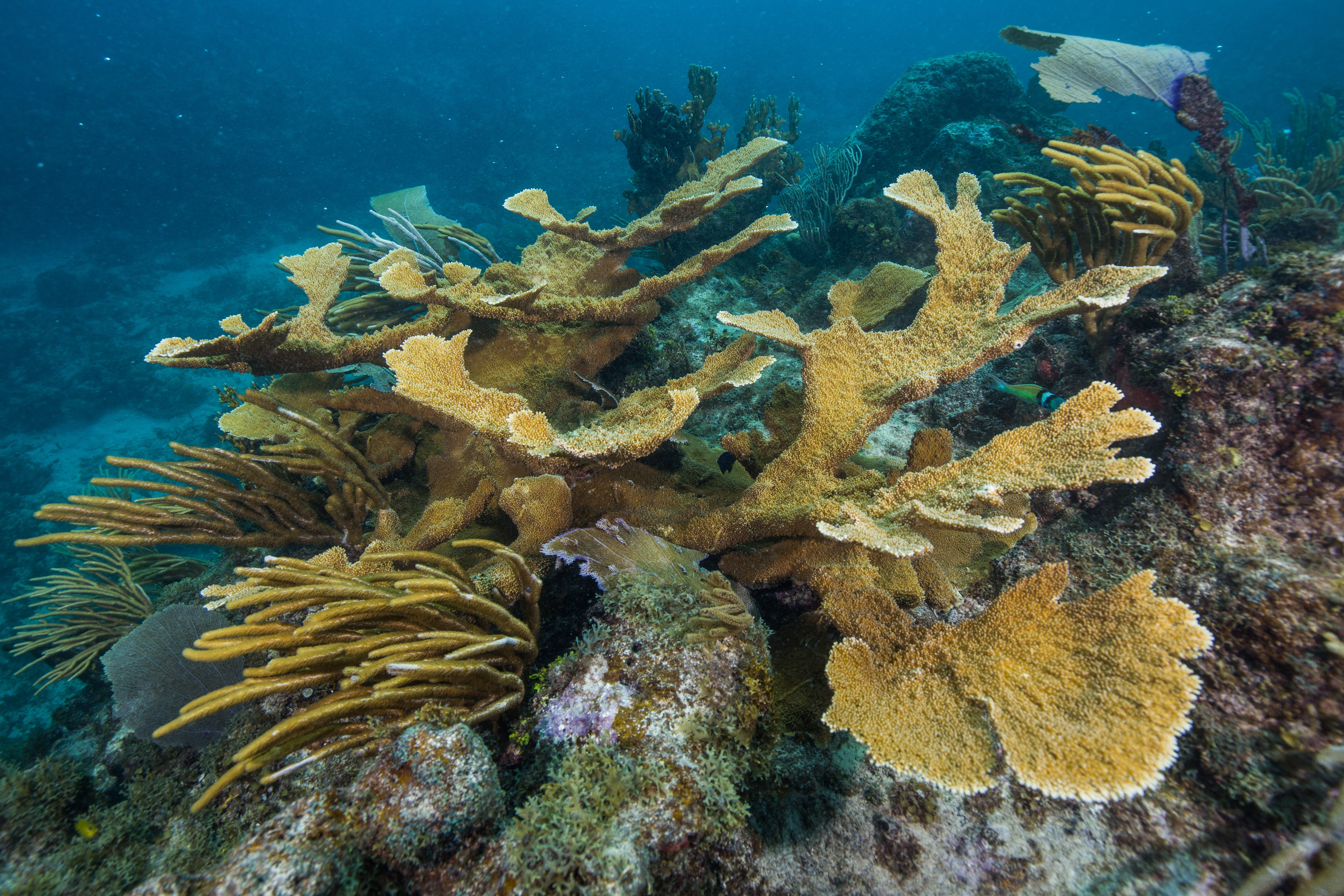
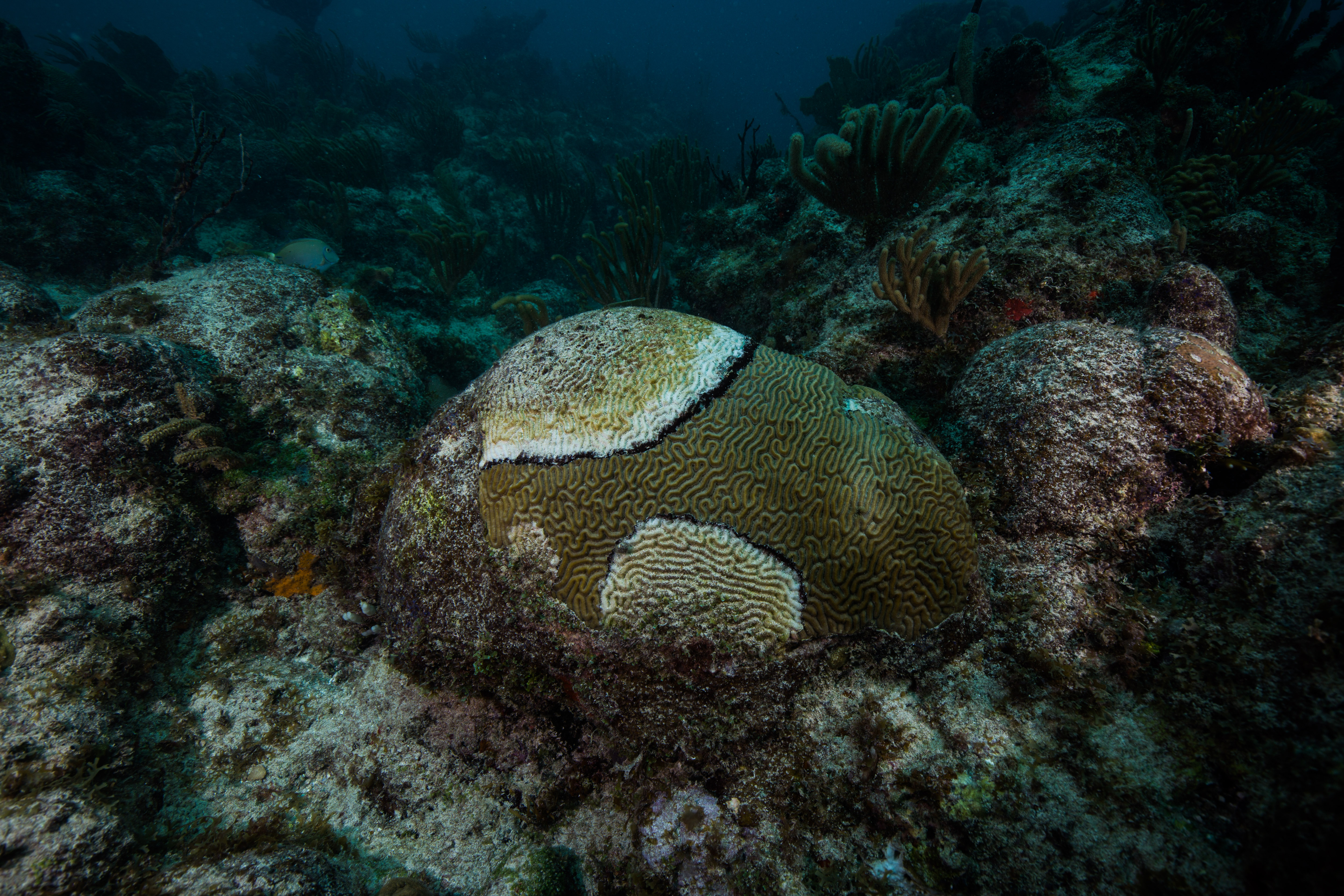
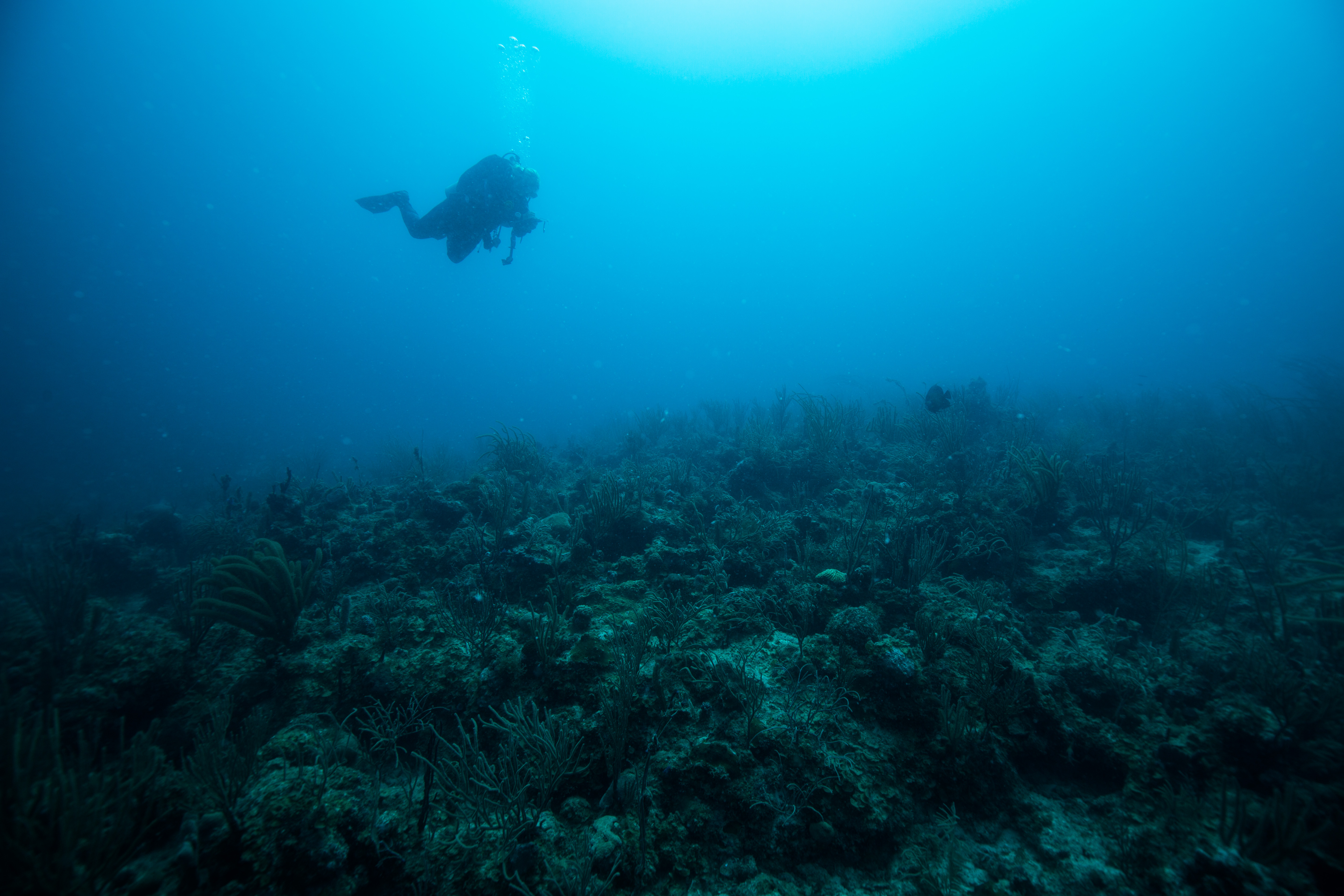
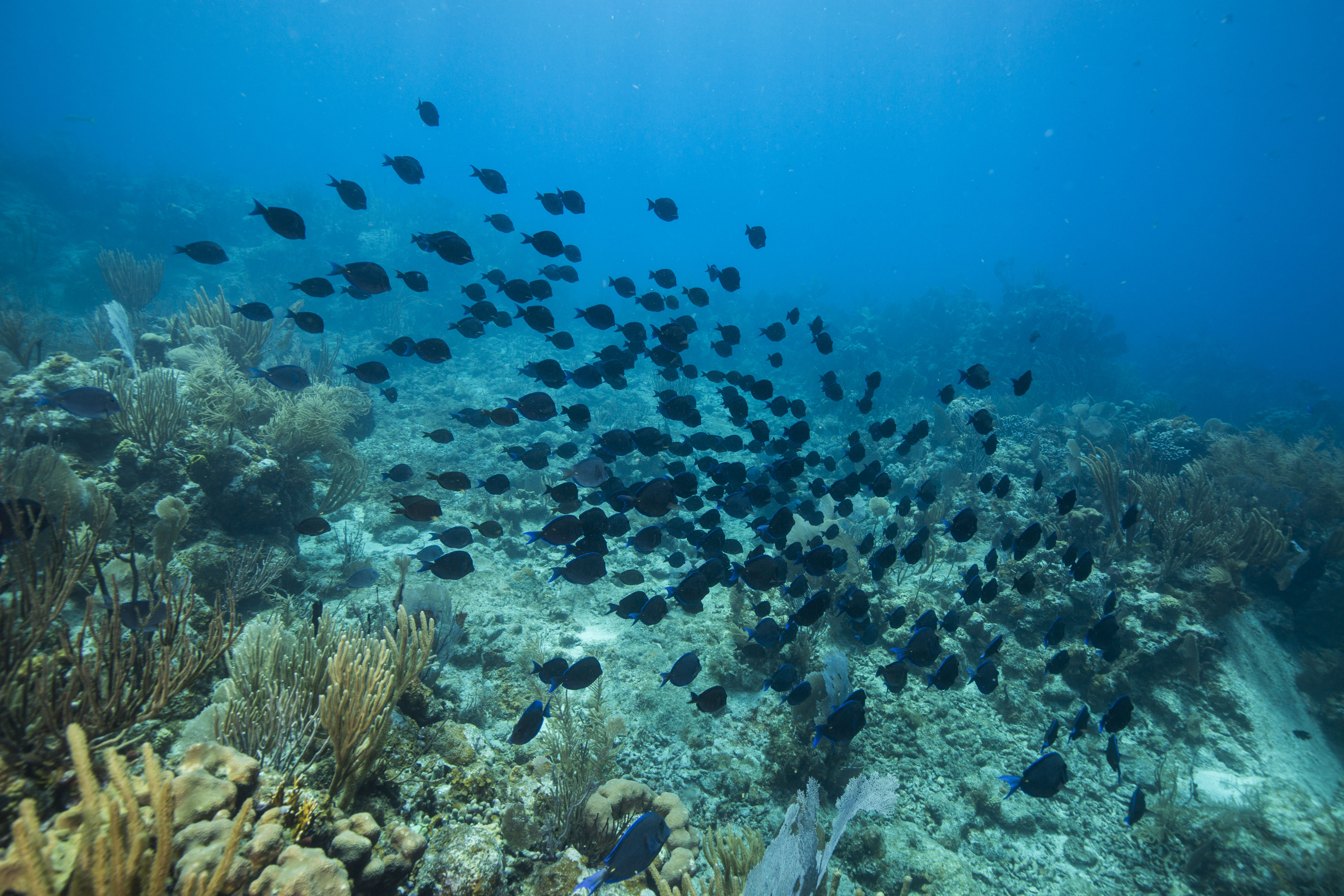
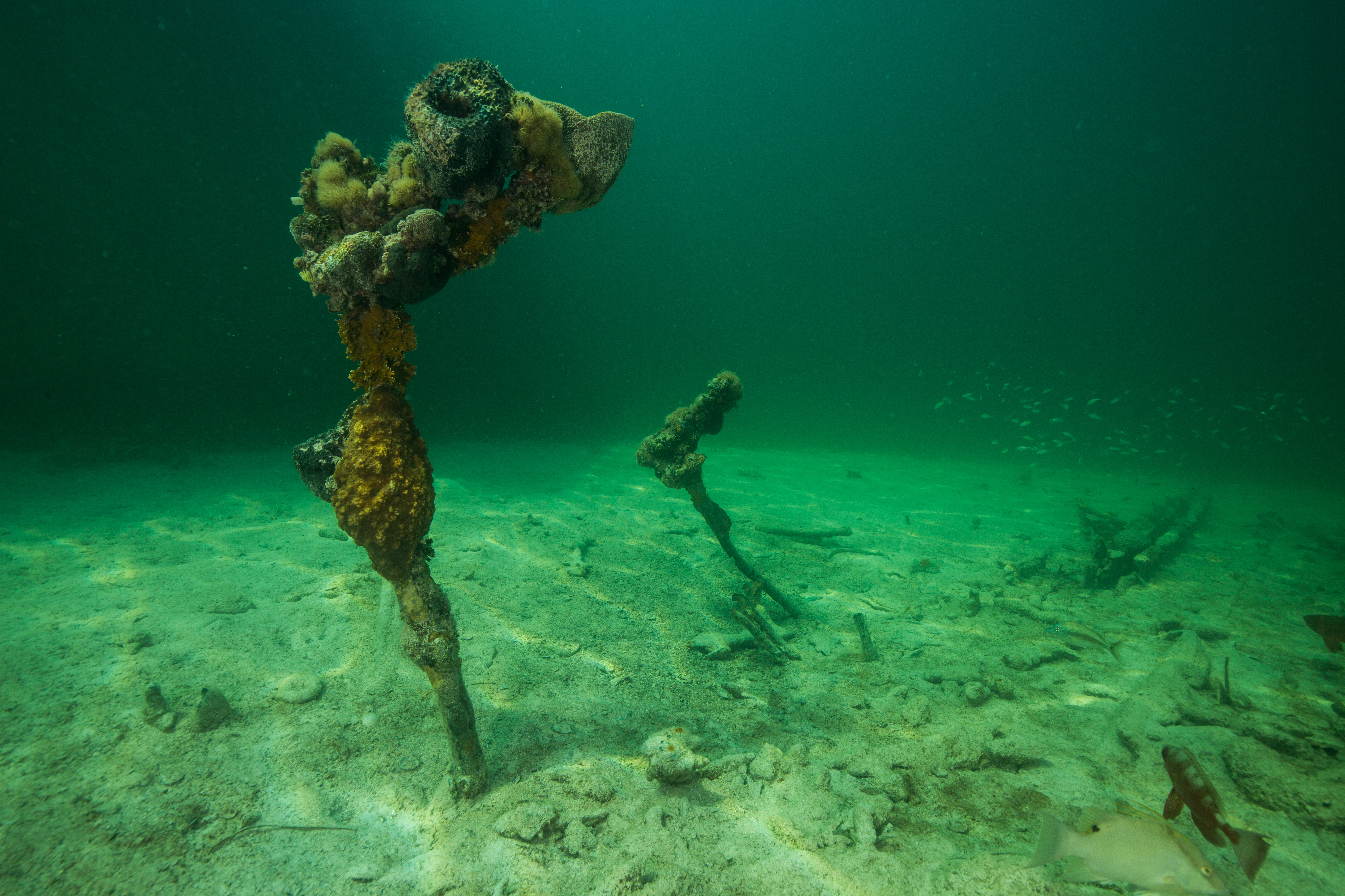
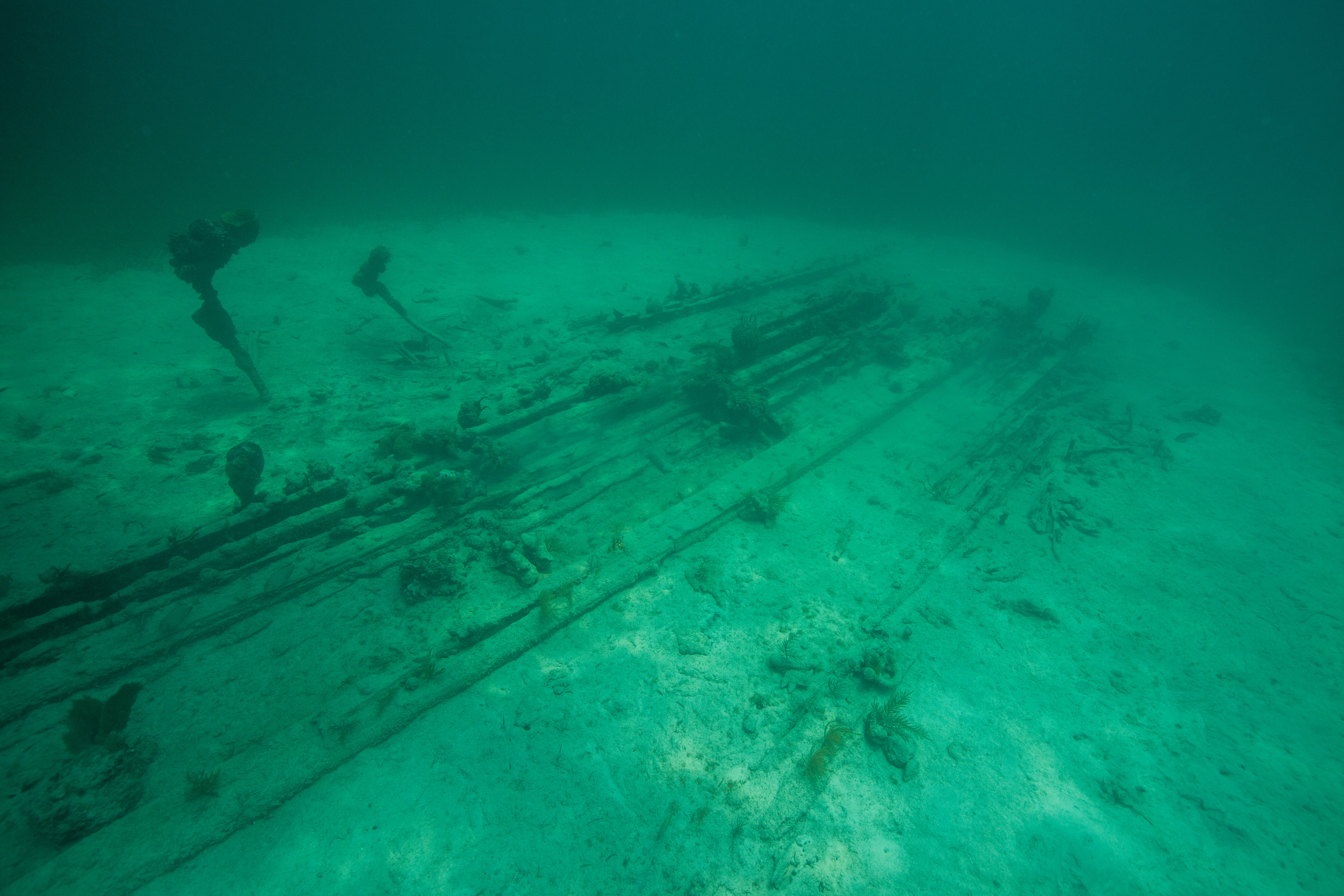
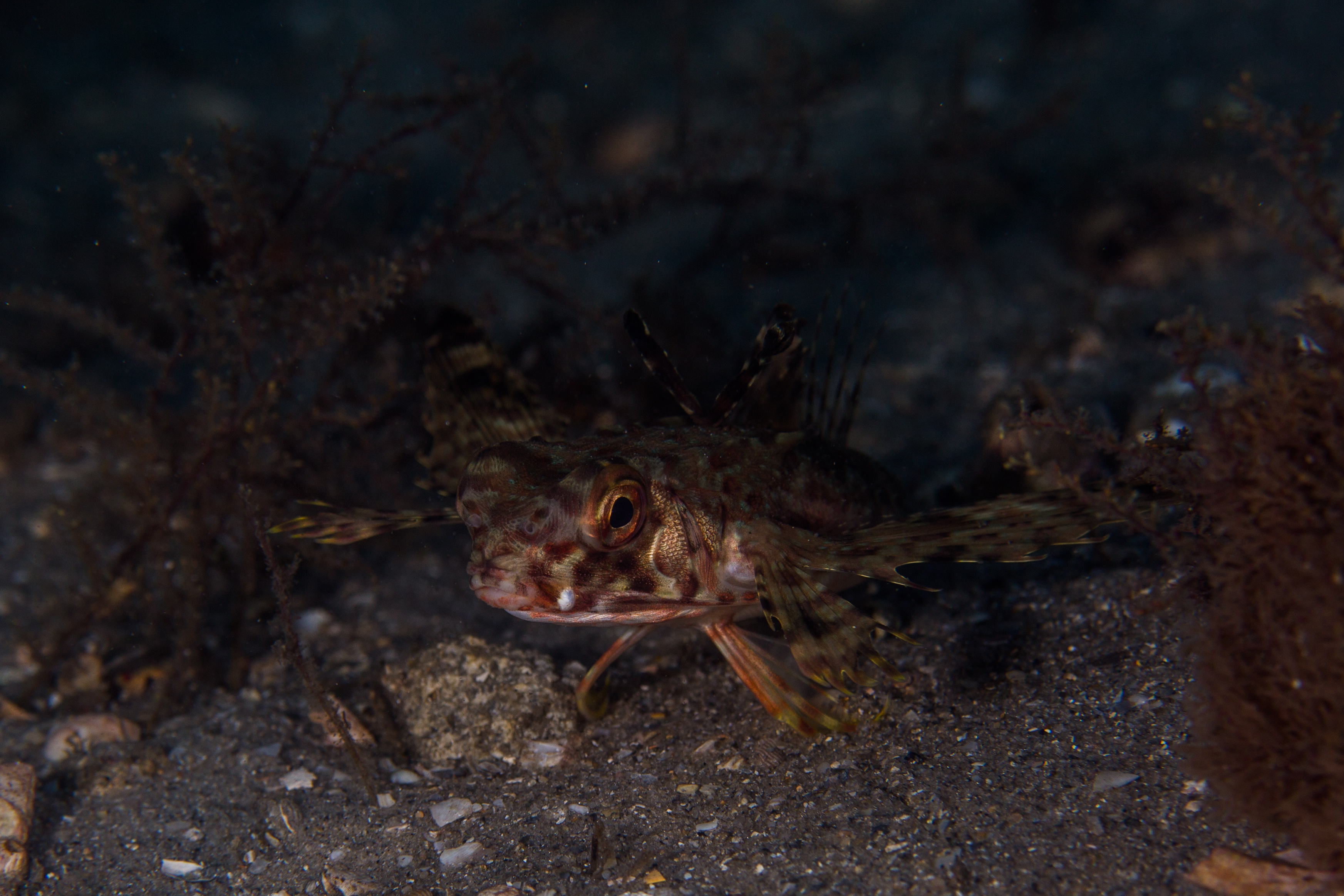
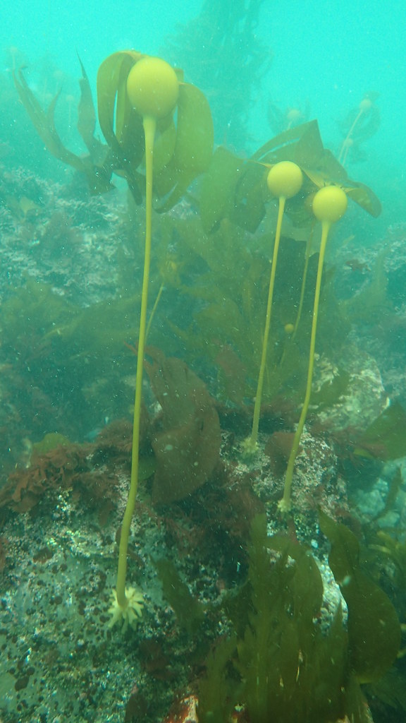
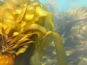
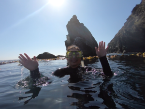
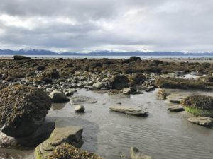
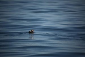
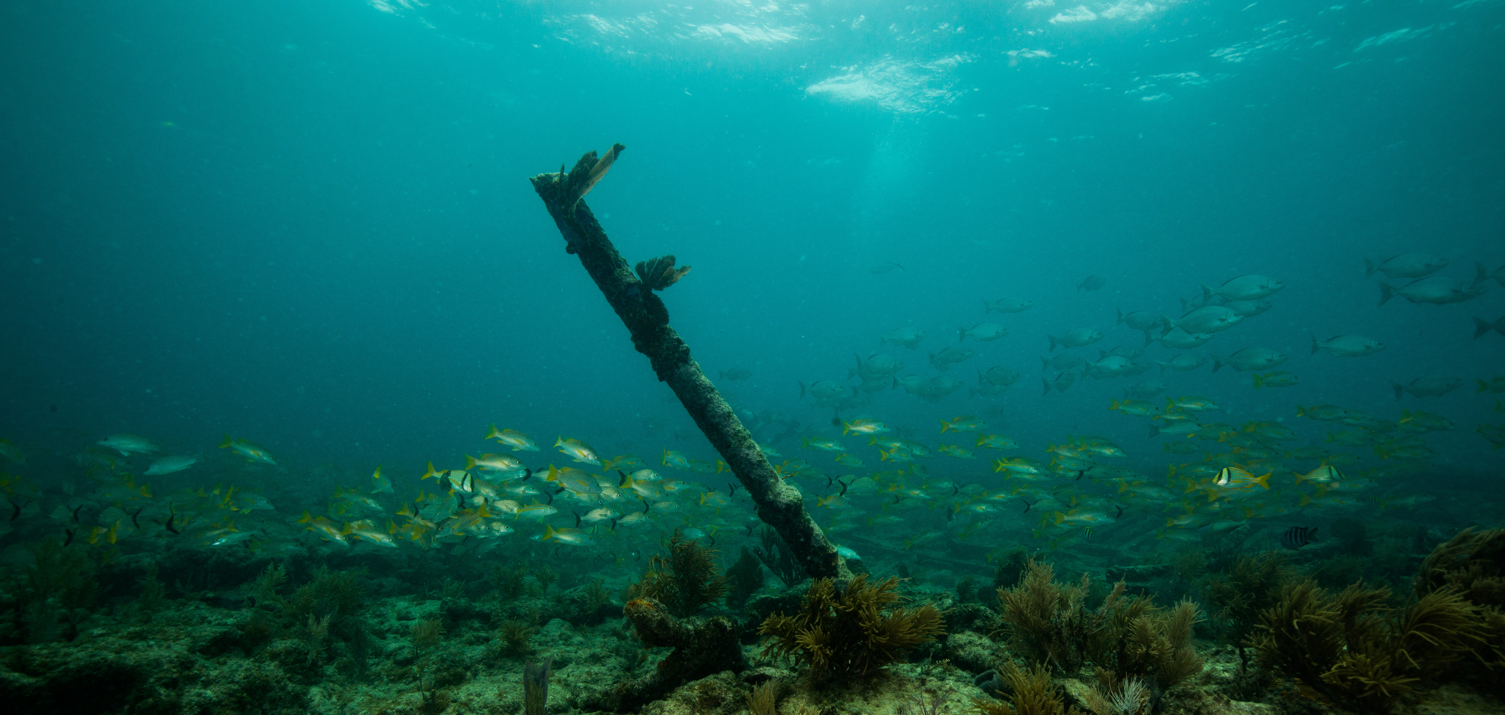
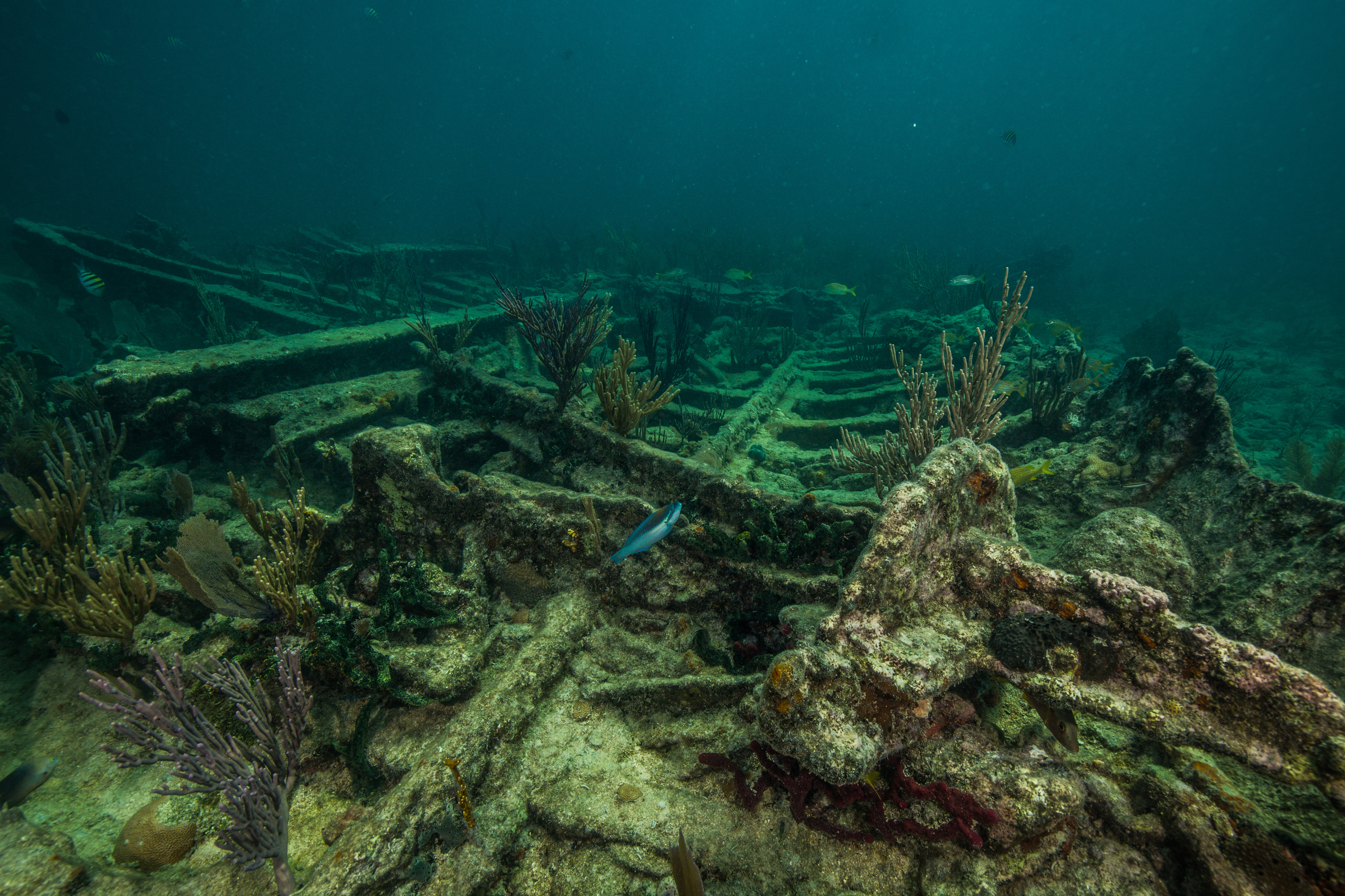
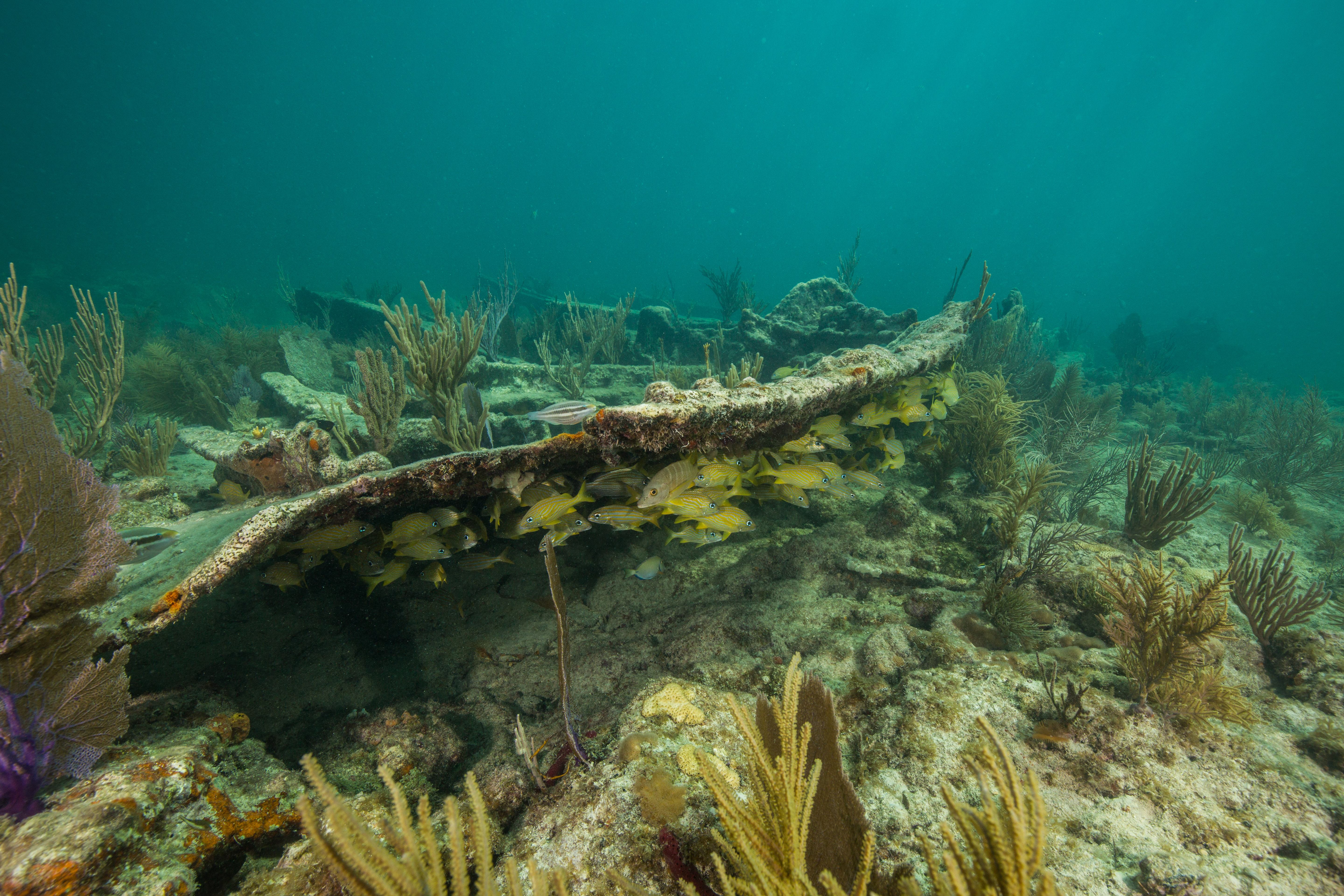
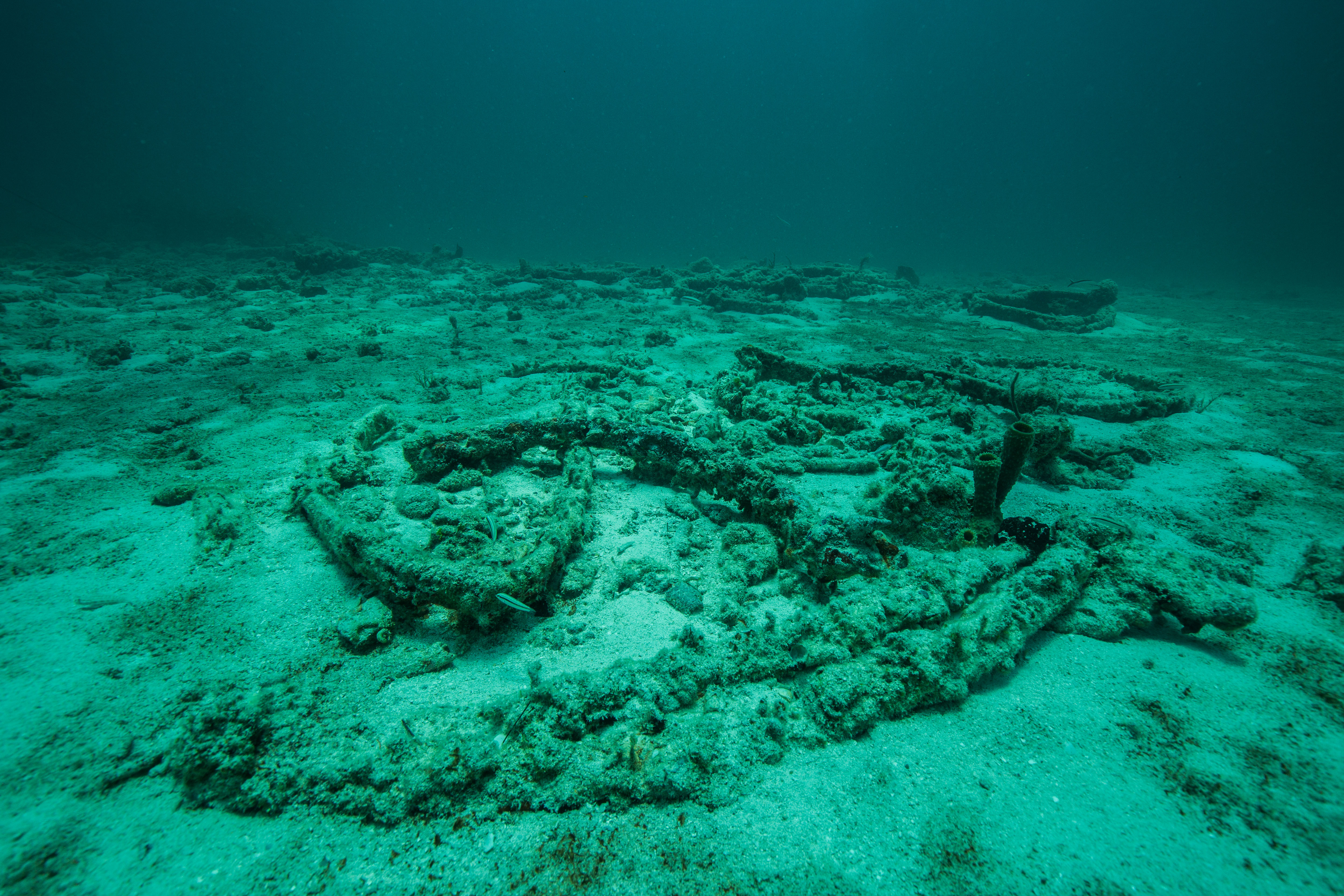
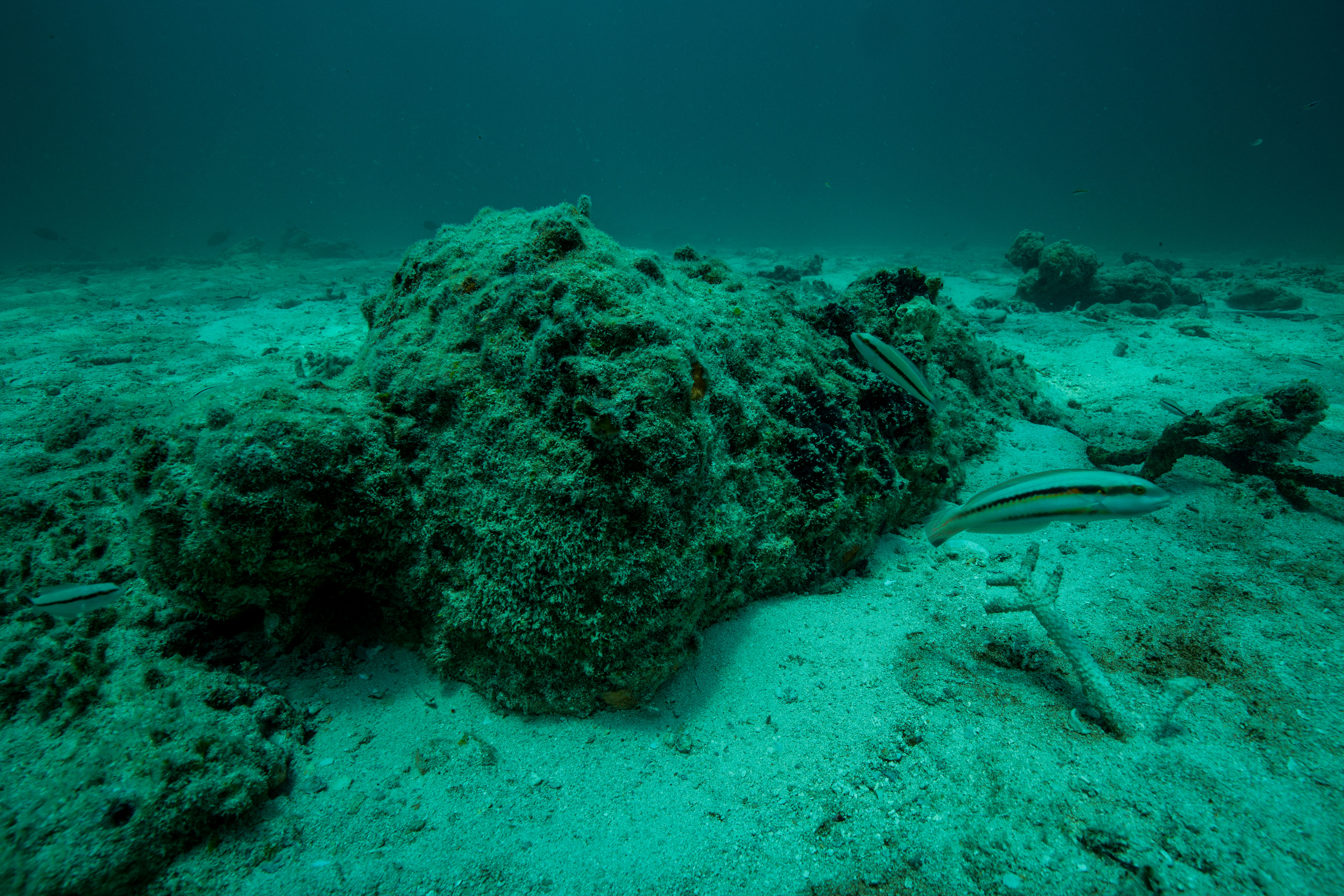
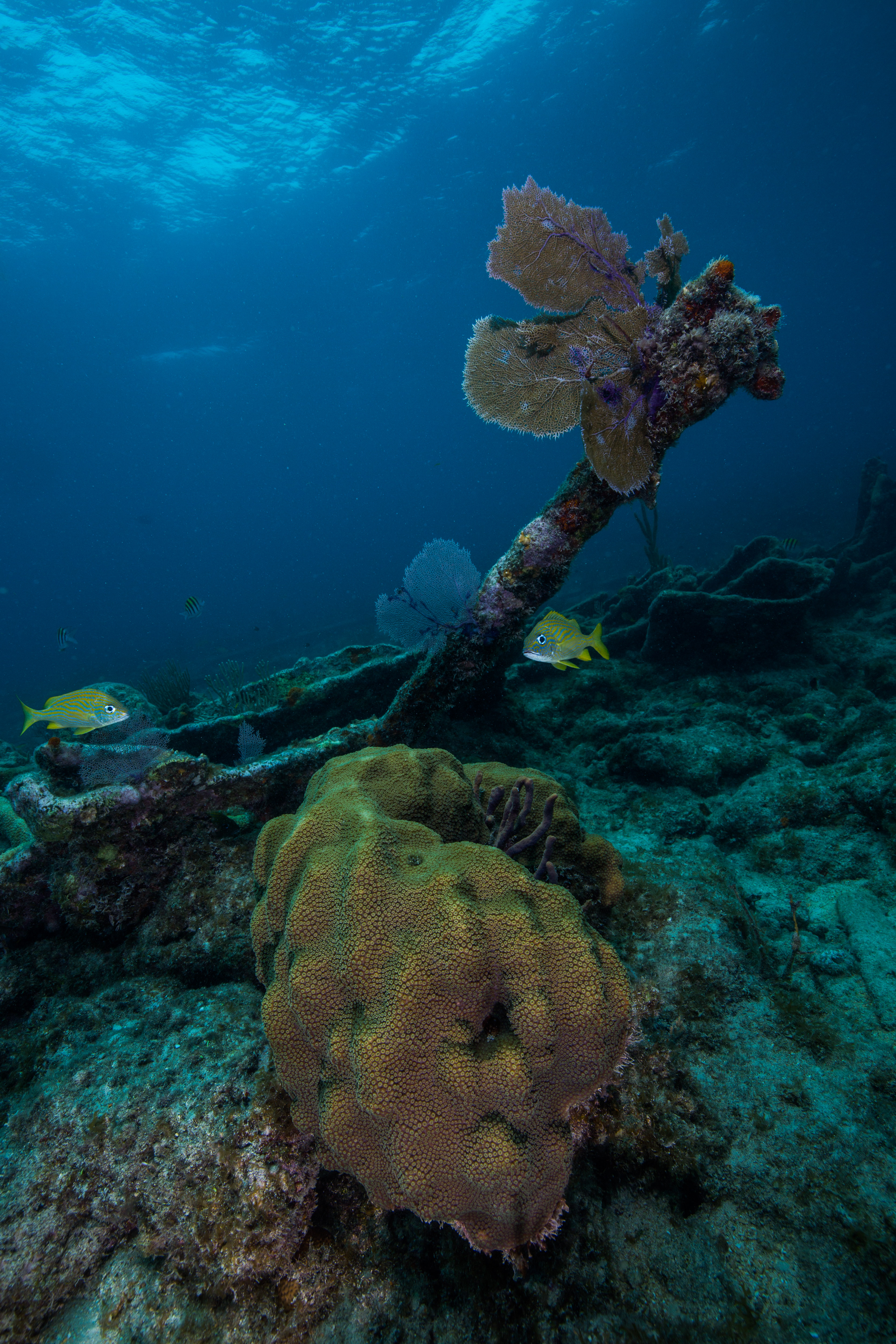
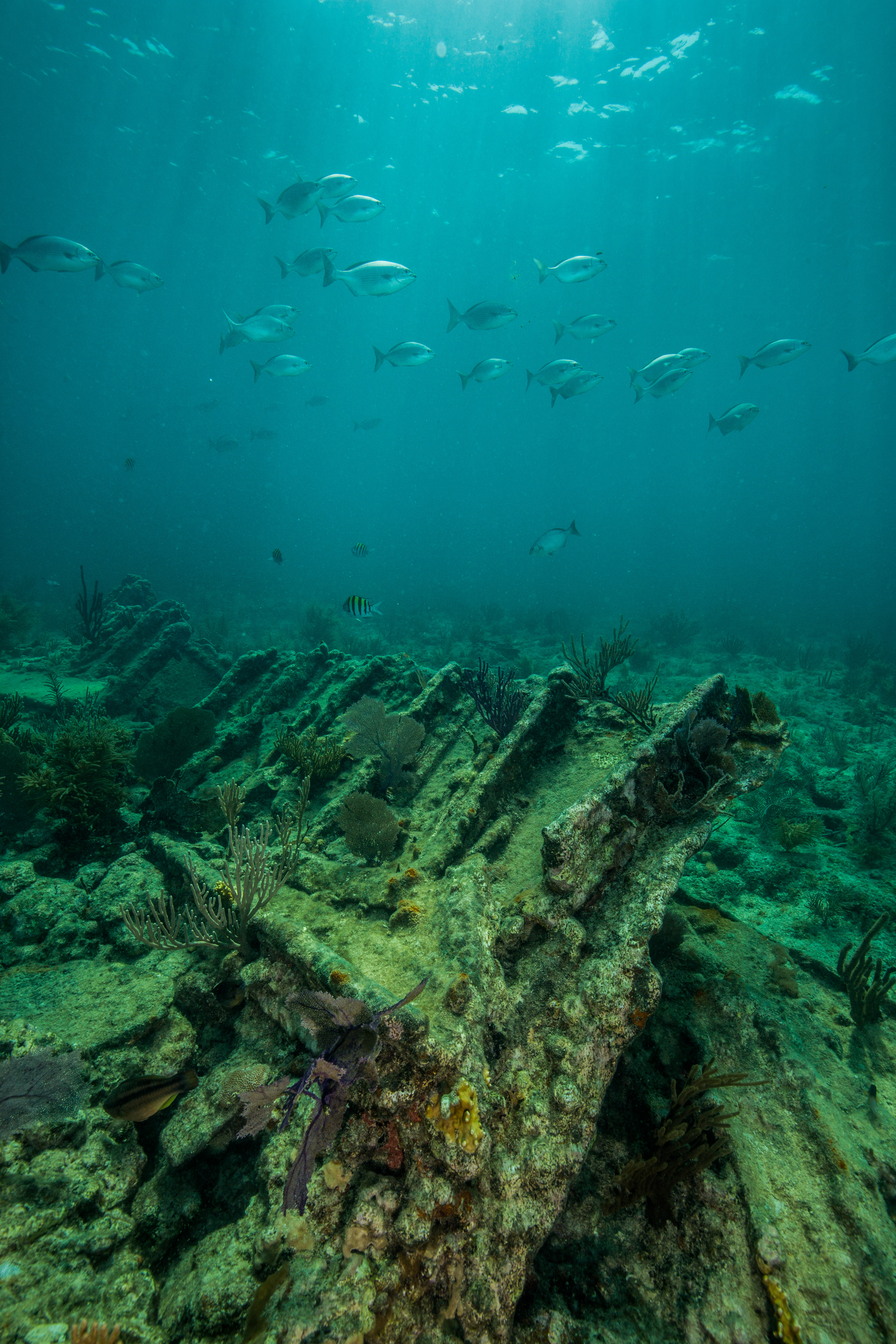
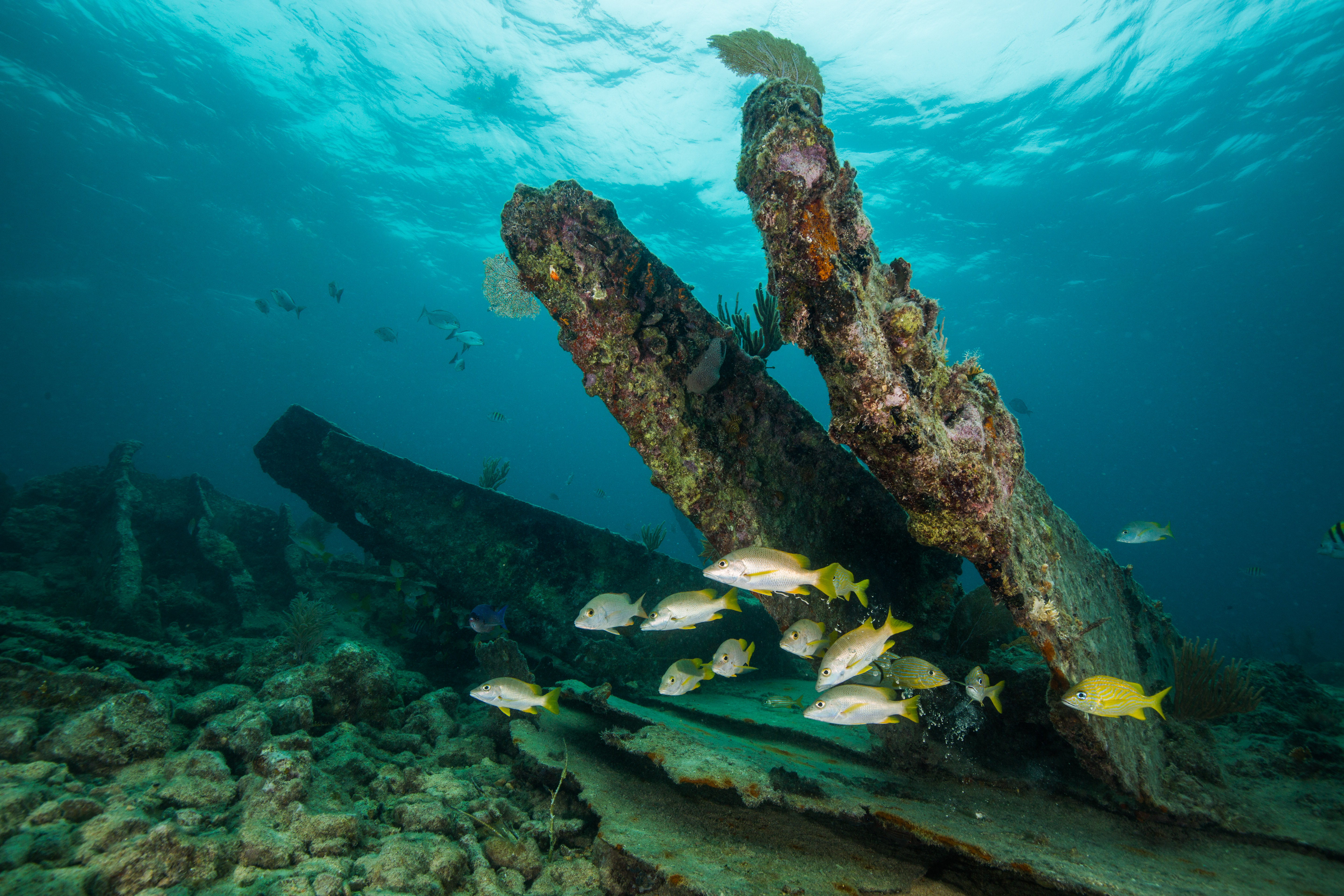
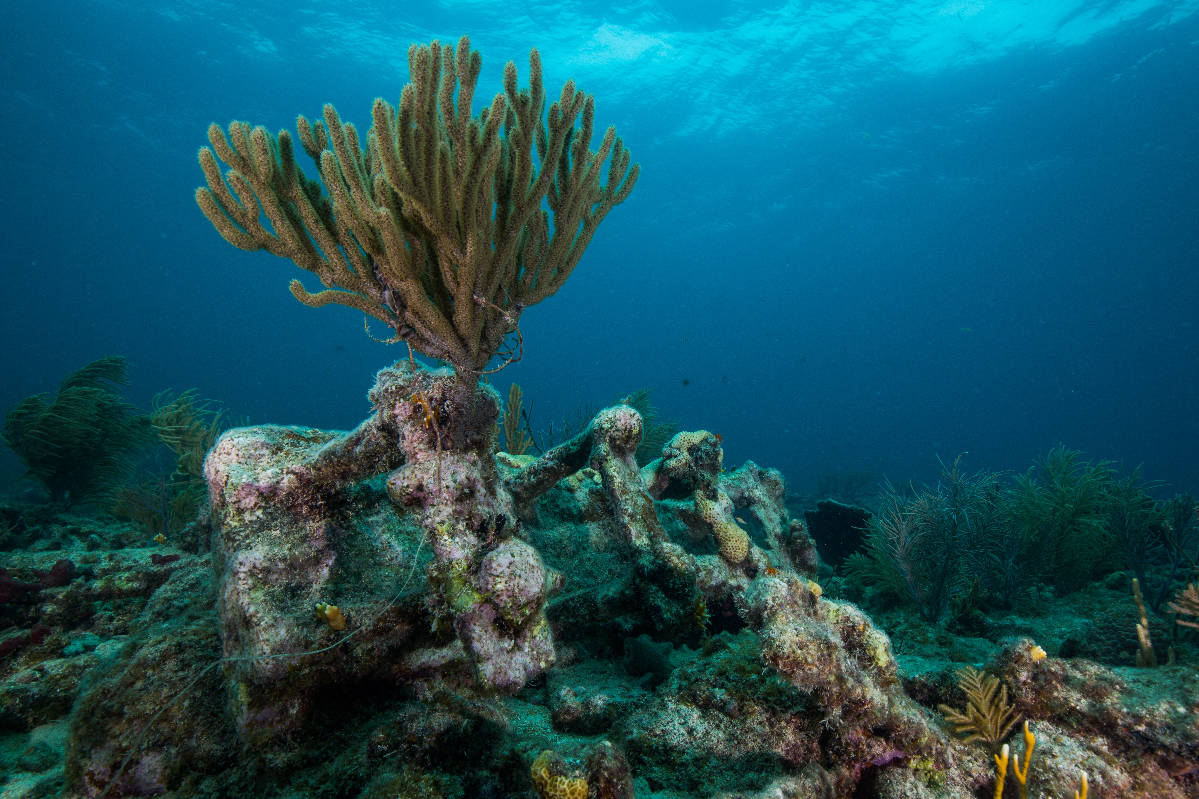
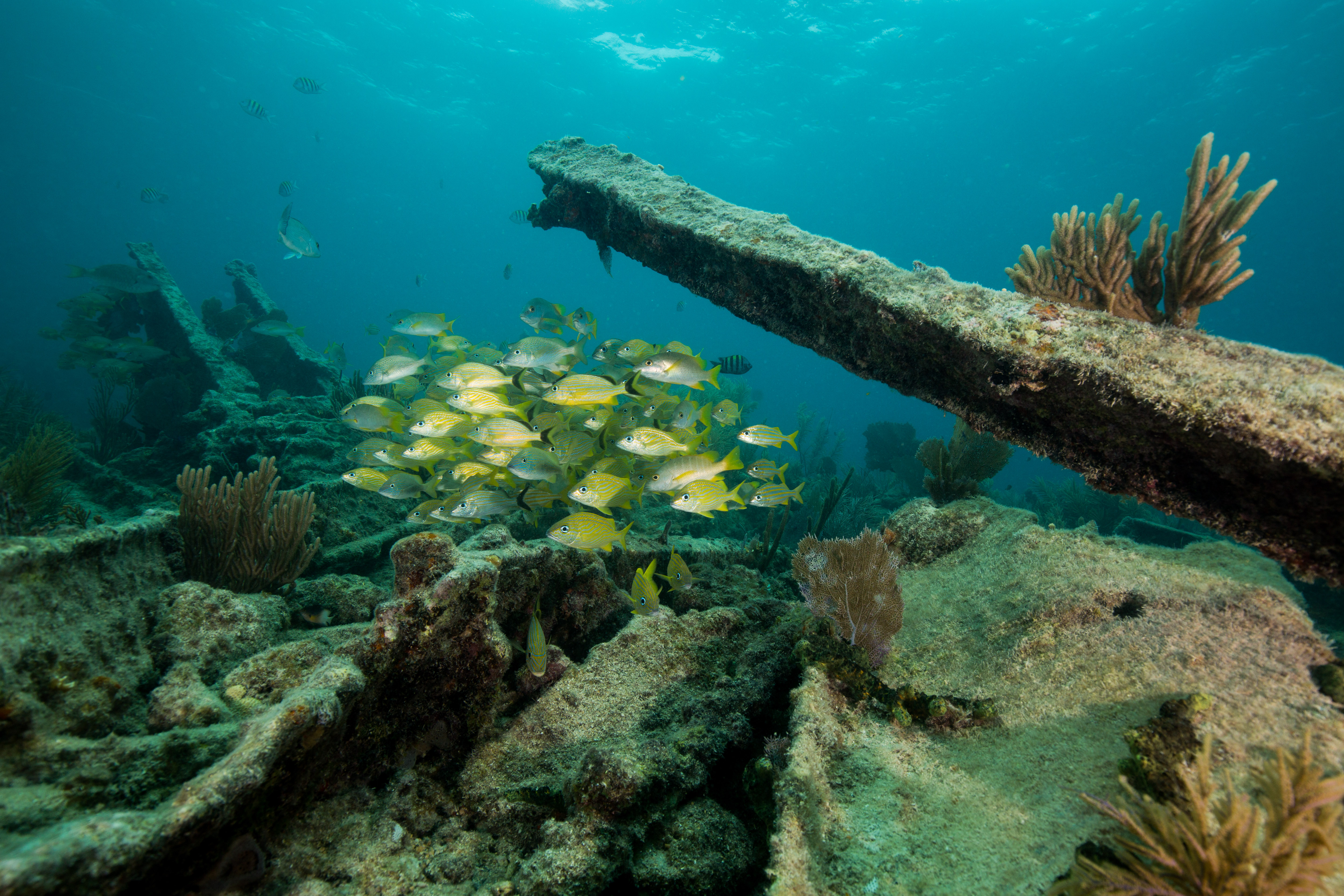
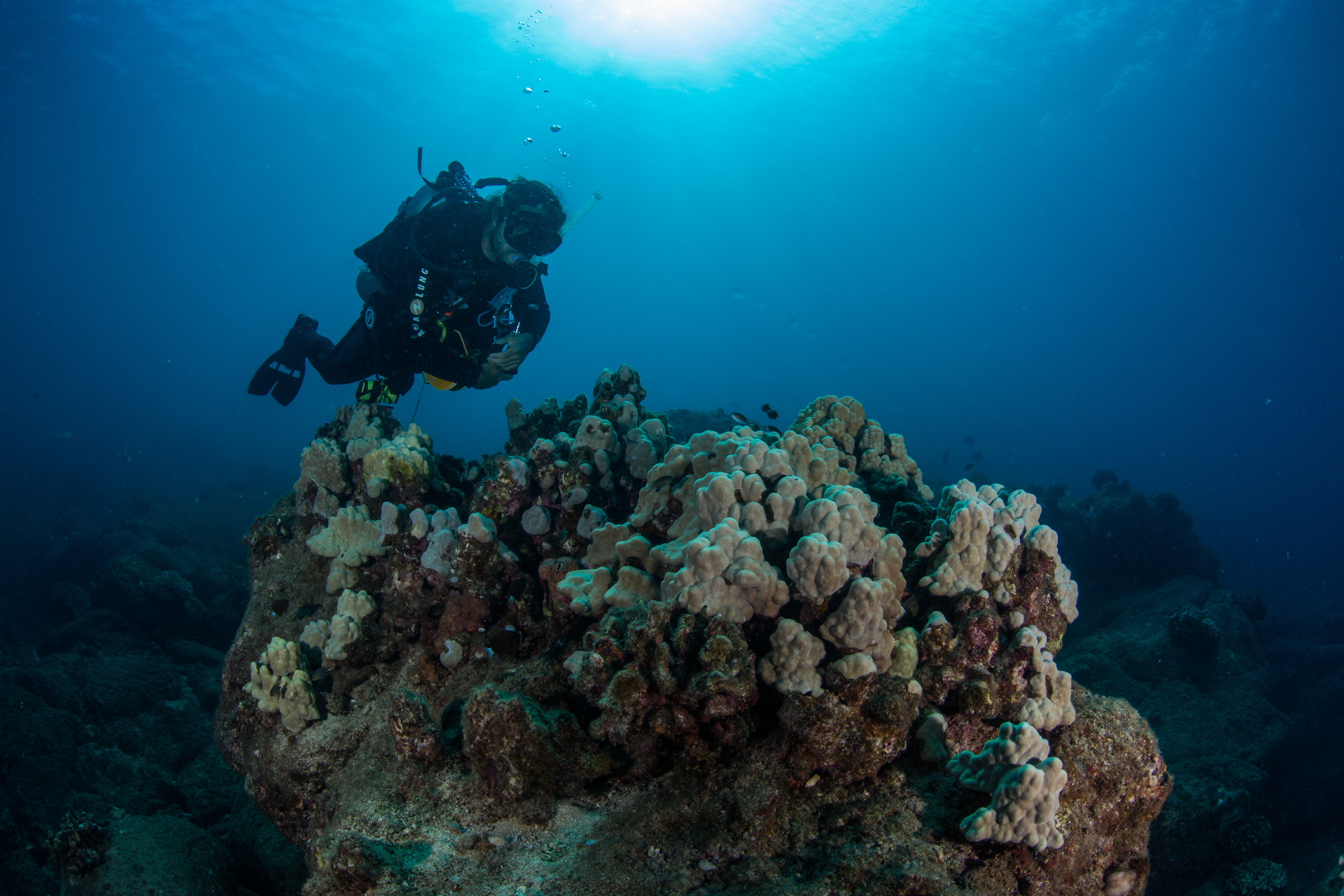
The diving in Kalaupapa NHP was beautiful and different from anything that I’d done before. Unlike a lot of the rest of the state, there aren’t any aggregated reefs surrounding the peninsula, but instead lots of scattered individuals of cauliflower and antler corals. This is a low, but relatively stable, coral cover and is pretty healthy, with a low frequency of disease and bleaching. The seafloor is a lava boulder habitat, composed of primarily large chunks of bedrock and huge scattered boulders, making lots of sharp relief and fun diving. While the corals and rocks are cool, the fish life is what makes Kalaupapa really shine. It boasts a high fish abundance and biomass, the highest in the main Hawaiian Islands. With very little fishing pressure, these fish are free to thrive without fear. These waters were also incredibly clear, with some of the best visibility I’ve experienced.

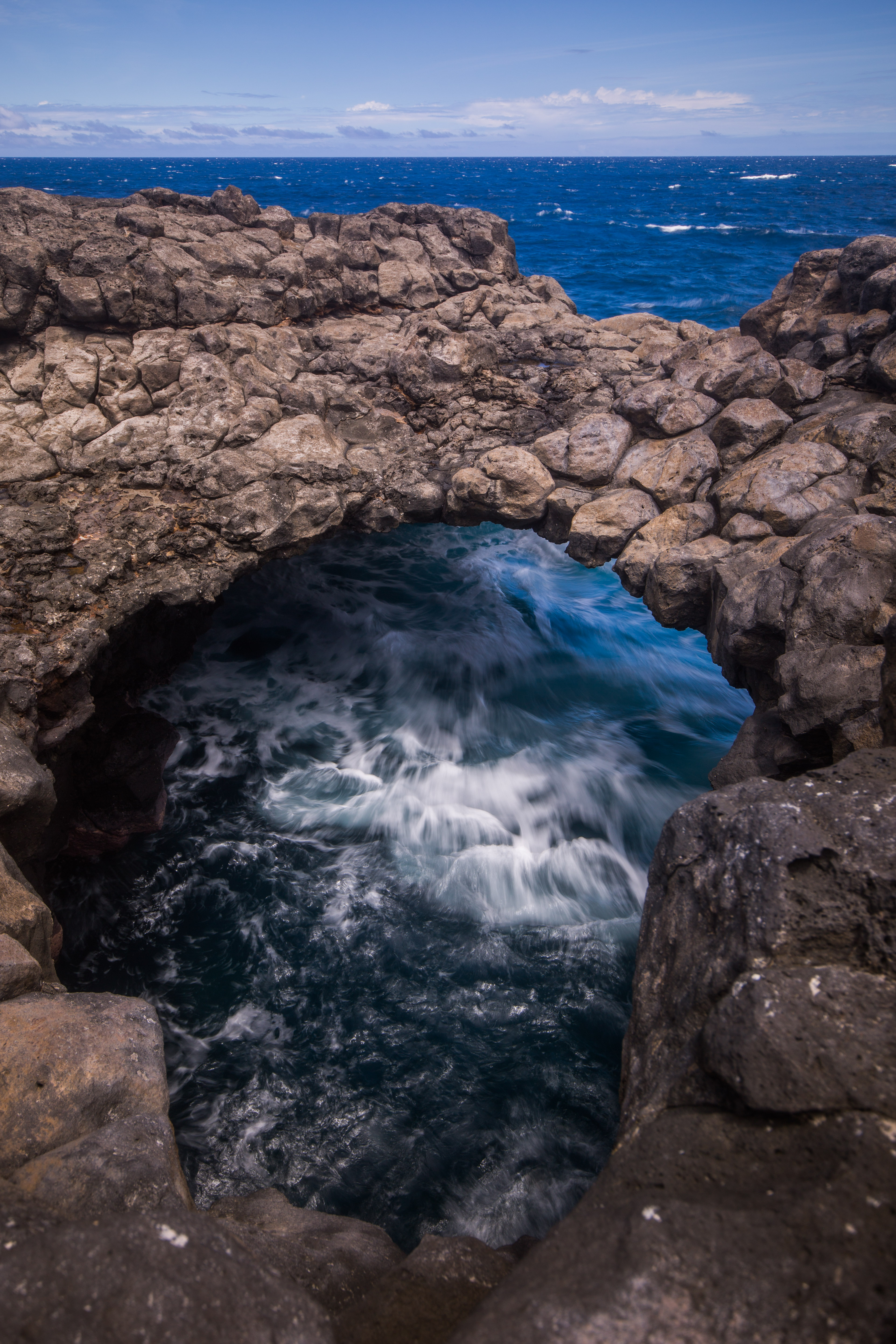
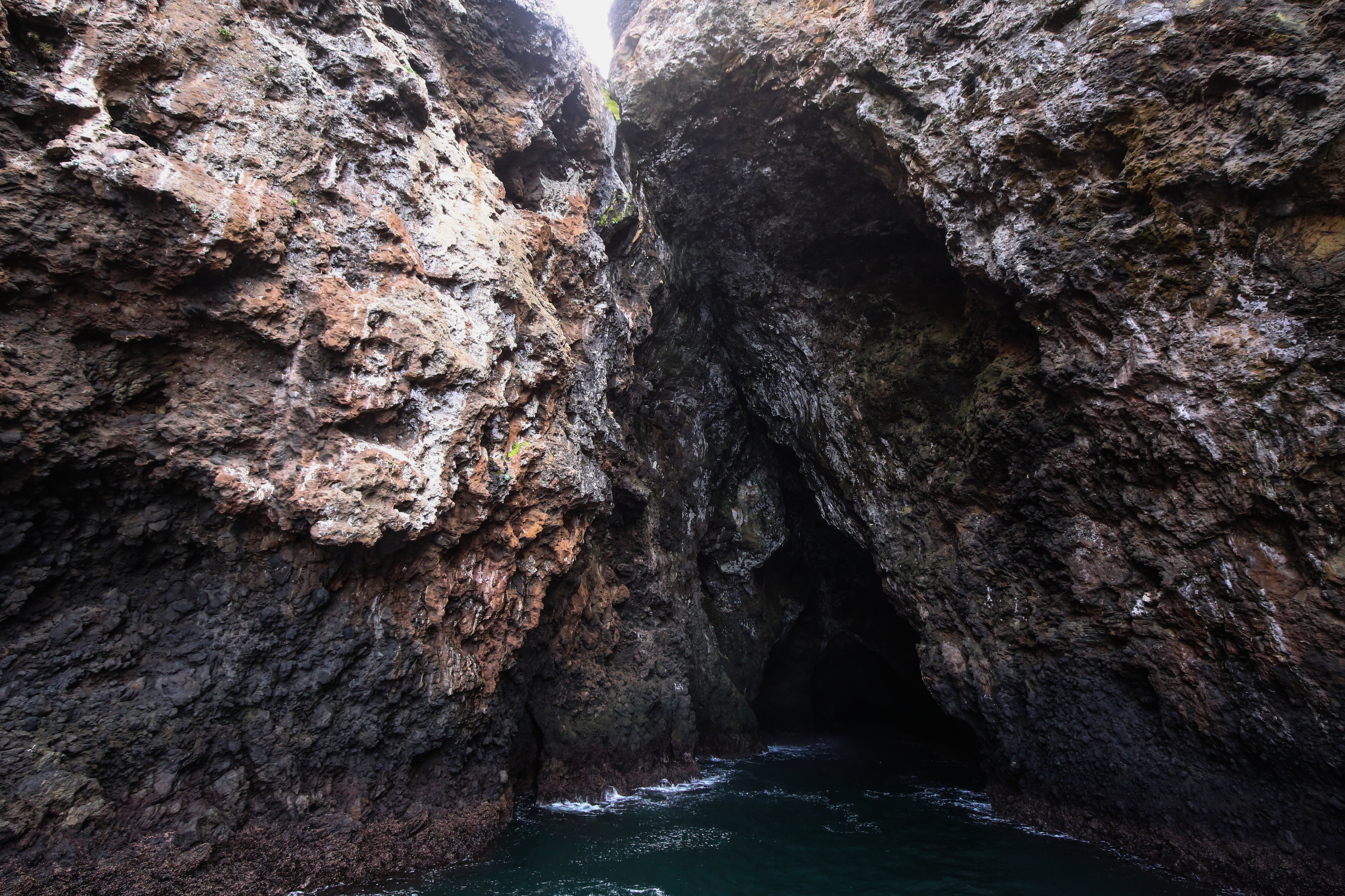
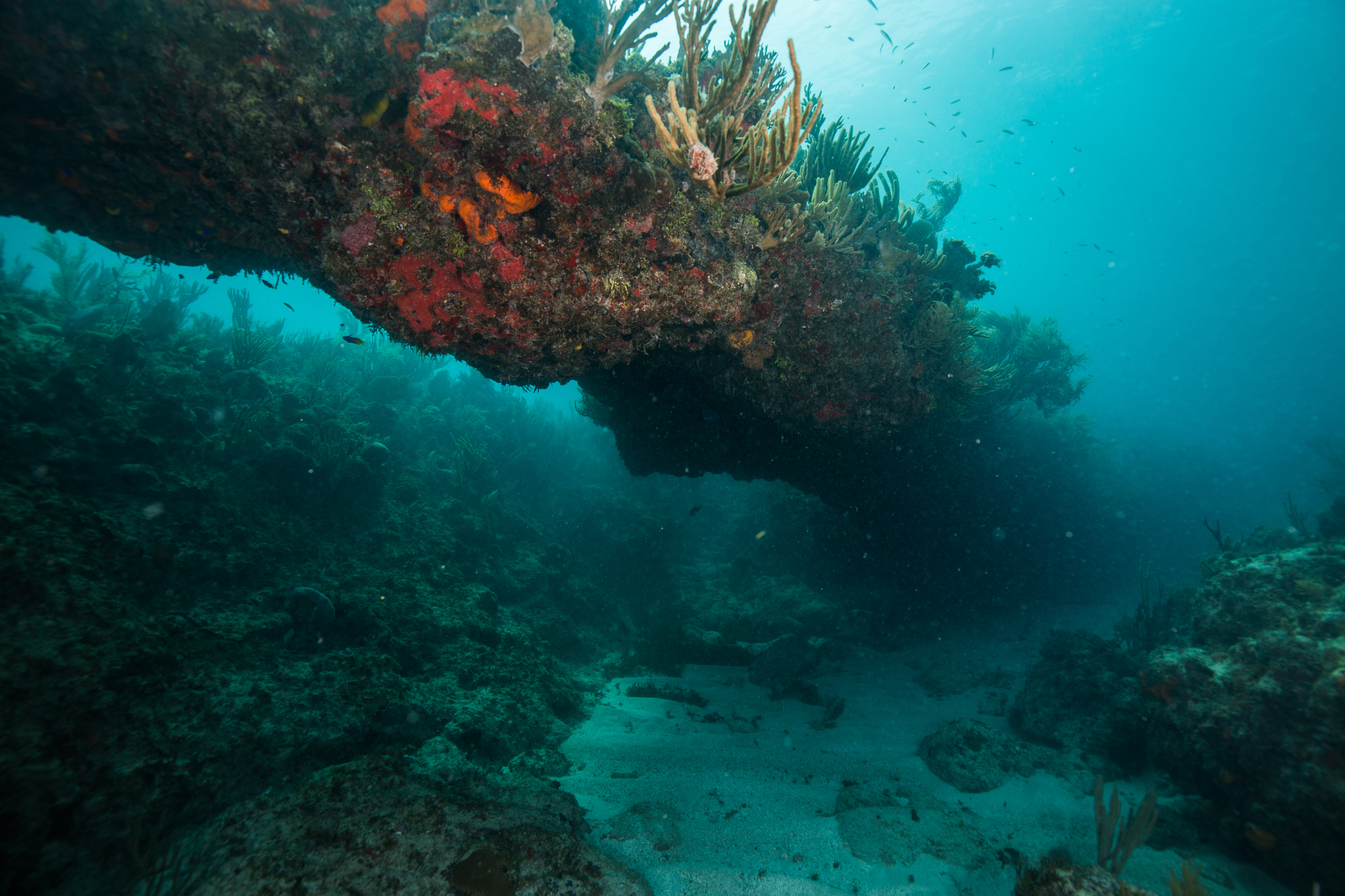
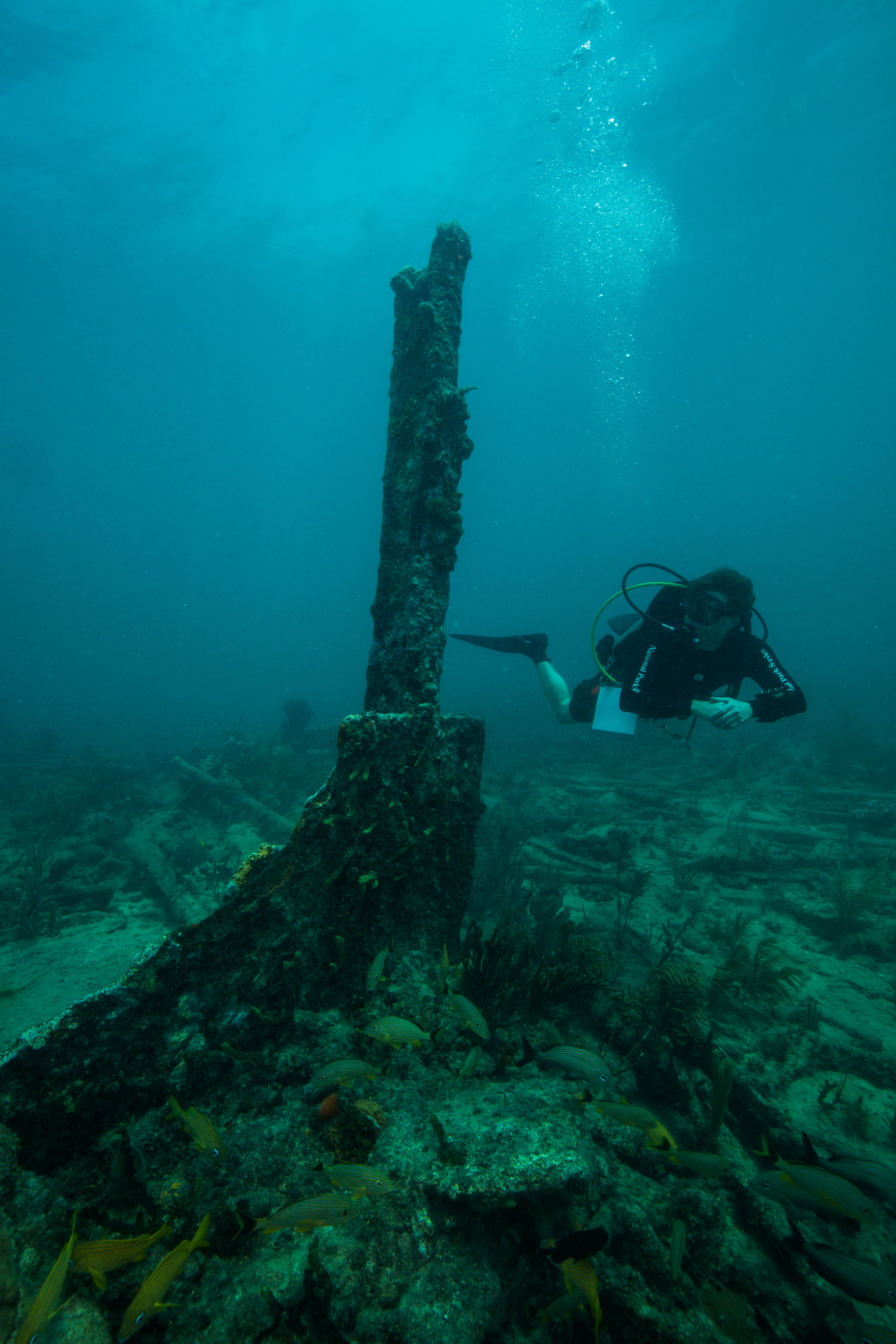
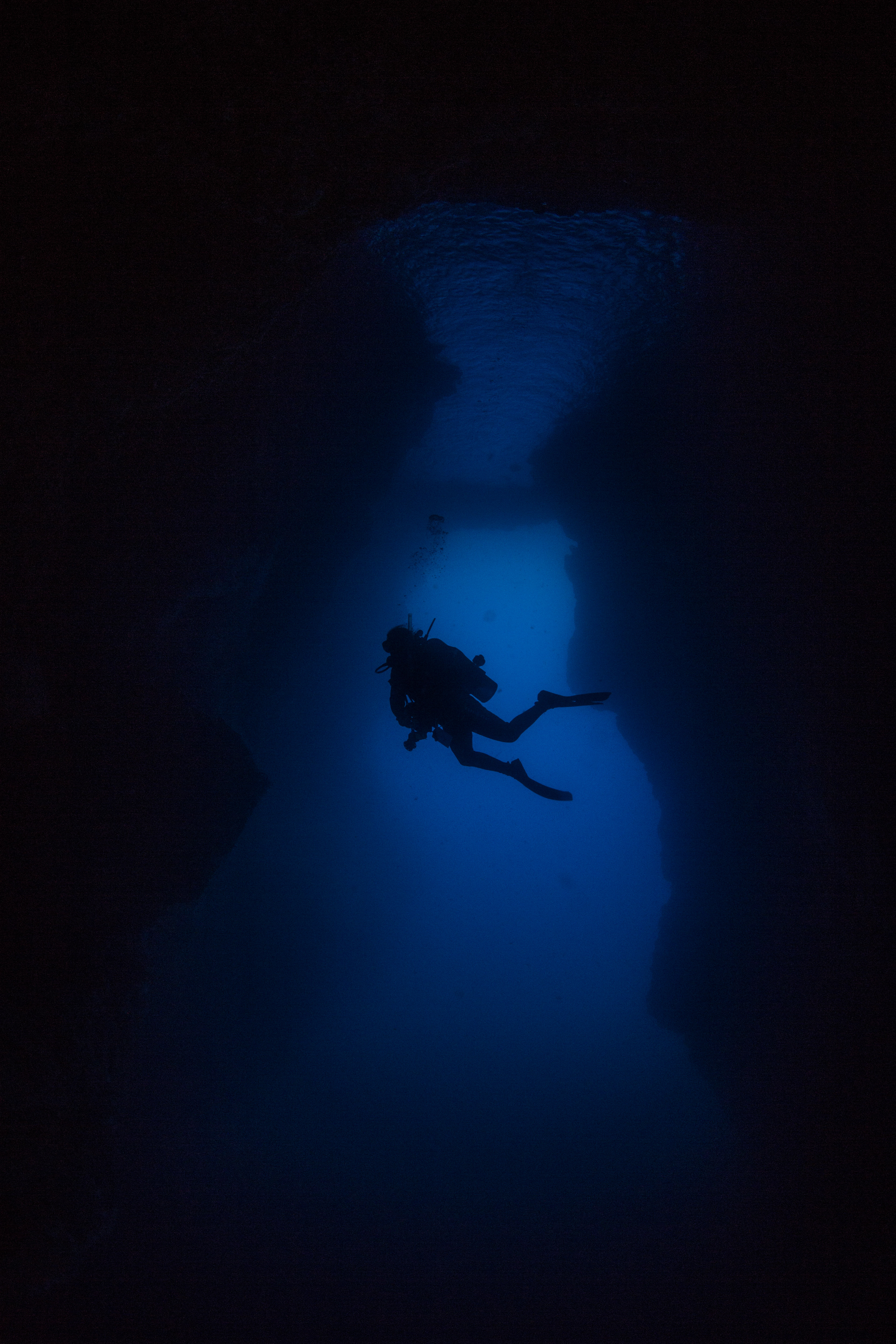
Hidden on the far side of the peninsula was an incredible treat. Underneath one of the few islands dotting the clear blue waters was an awe-inspiring structure – a massive underwater arch, allowing for a swim-through underneath the island itself. Around 70 feet tall and 30 feet wide, this was a truly unique experience unlike anything I’d done before. I had heard about this from past interns and was sincerely hoping I’d have a chance to visit it myself, and thankfully Eric found some time at the end of a long survey day to take us over. Our trip through this arch was made even more special by a visit by two turtles, who gracefully glided around the opening. It really was a dive to remember.

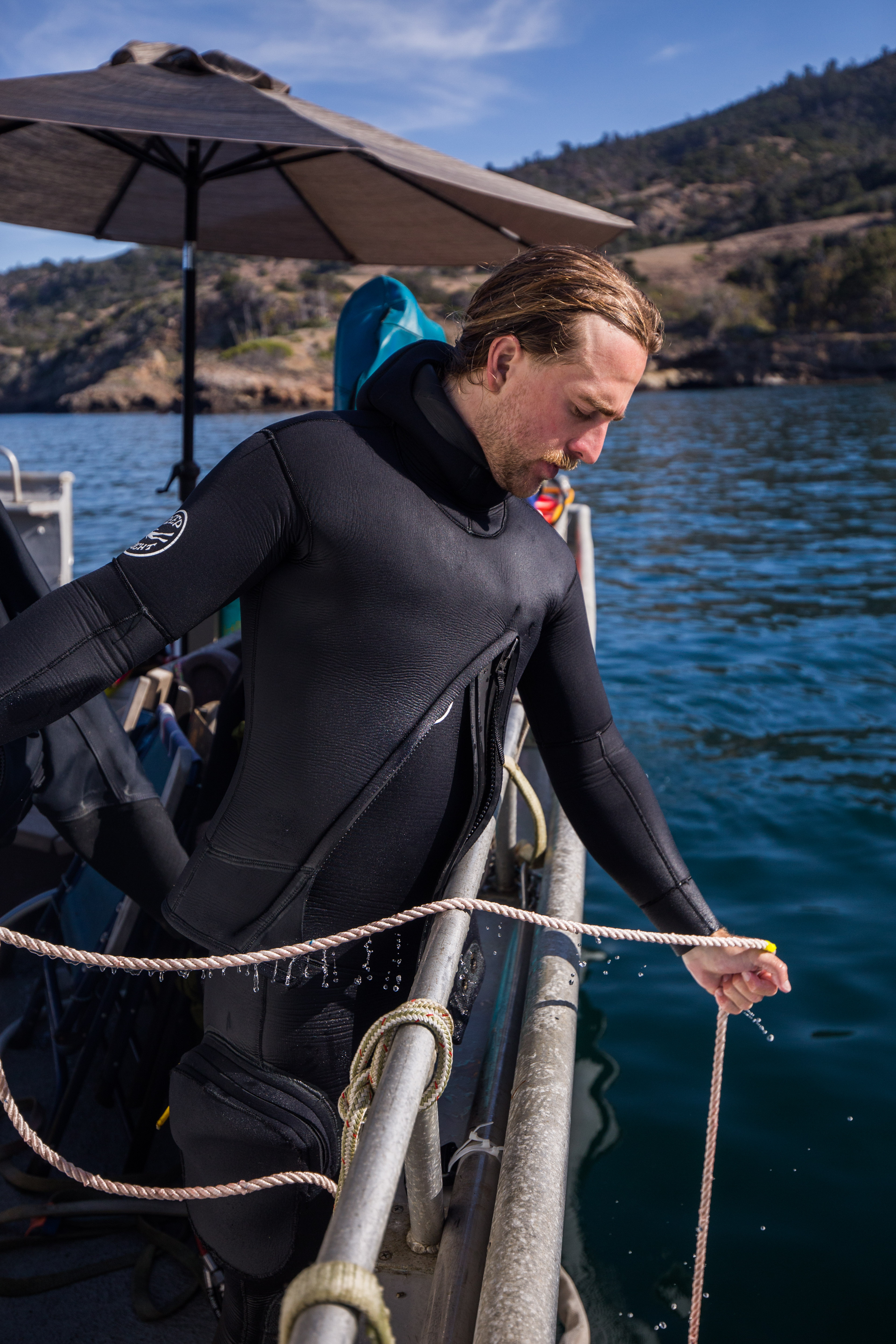
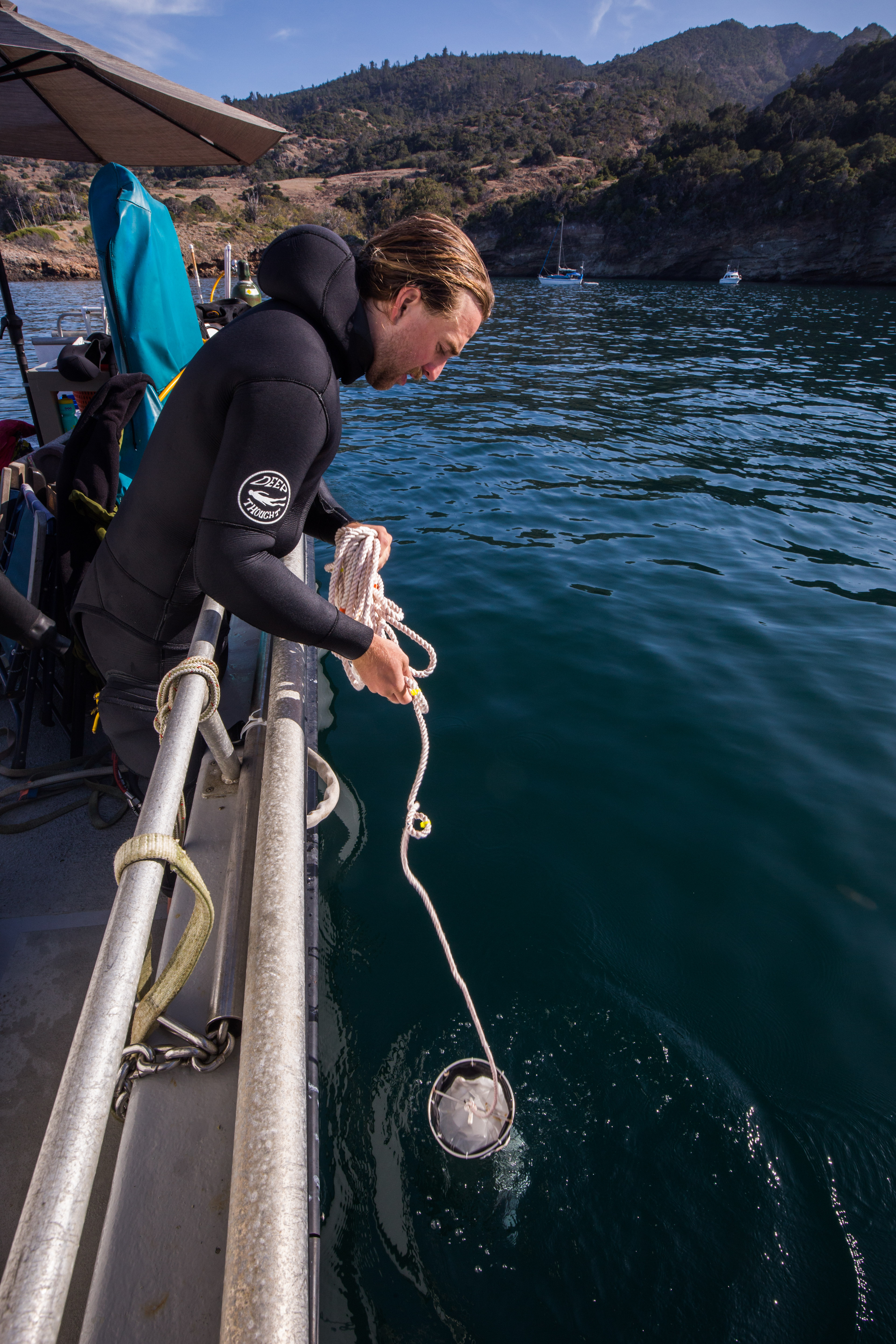
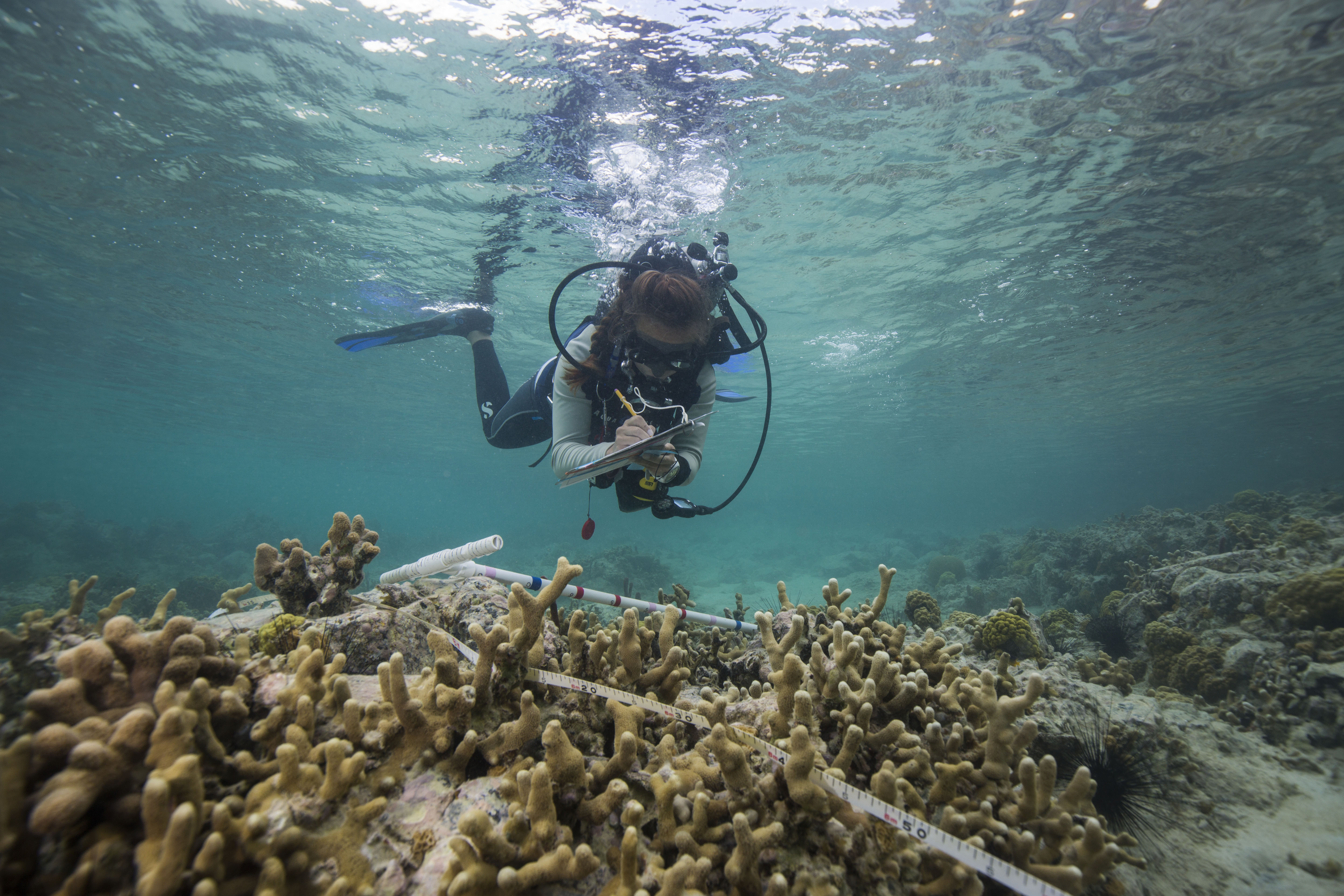
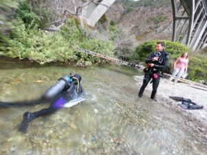
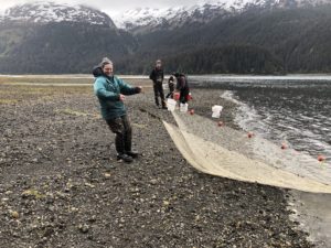
Each dive day was meticulously planned out by Eric Brown. The high potential for rough weather meant we had to take full advantage of good windows to visit the exposed side. Winds could quickly whip up a small craft warning, preventing us from using the boat and from working efficiently. Even when conditions were below that threshold, swell could prevent us from working. It wasn’t really the diving that was hard to do in rough weather, it’s all pretty calm when you’re underwater, but more so the water quality measurements. Certain sites required water samples to be taken from a variety of depths, which typically took about 20-30 minutes of sitting on the deck carefully collecting and securing the samples. This work was easy enough in calm weather, but much more difficult when the small boat is being thrashed around by 3-4 foot waves. We ended getting almost all of our sites done before a small craft warning came through, forcing us to visit our last 3-4 from shore with a little swim (up to 800m offshore).

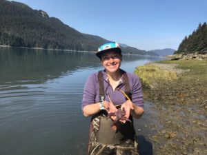
Glauco collecting a water sample

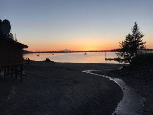
While out on the water, we visited some of the finest lunch locations I’ve ever been to. Whether it was a view of crystal clear water and seabird-doting islands, sea caves and sea arches, or seasonal waterfalls, each day brought on a new lunchtime treat.

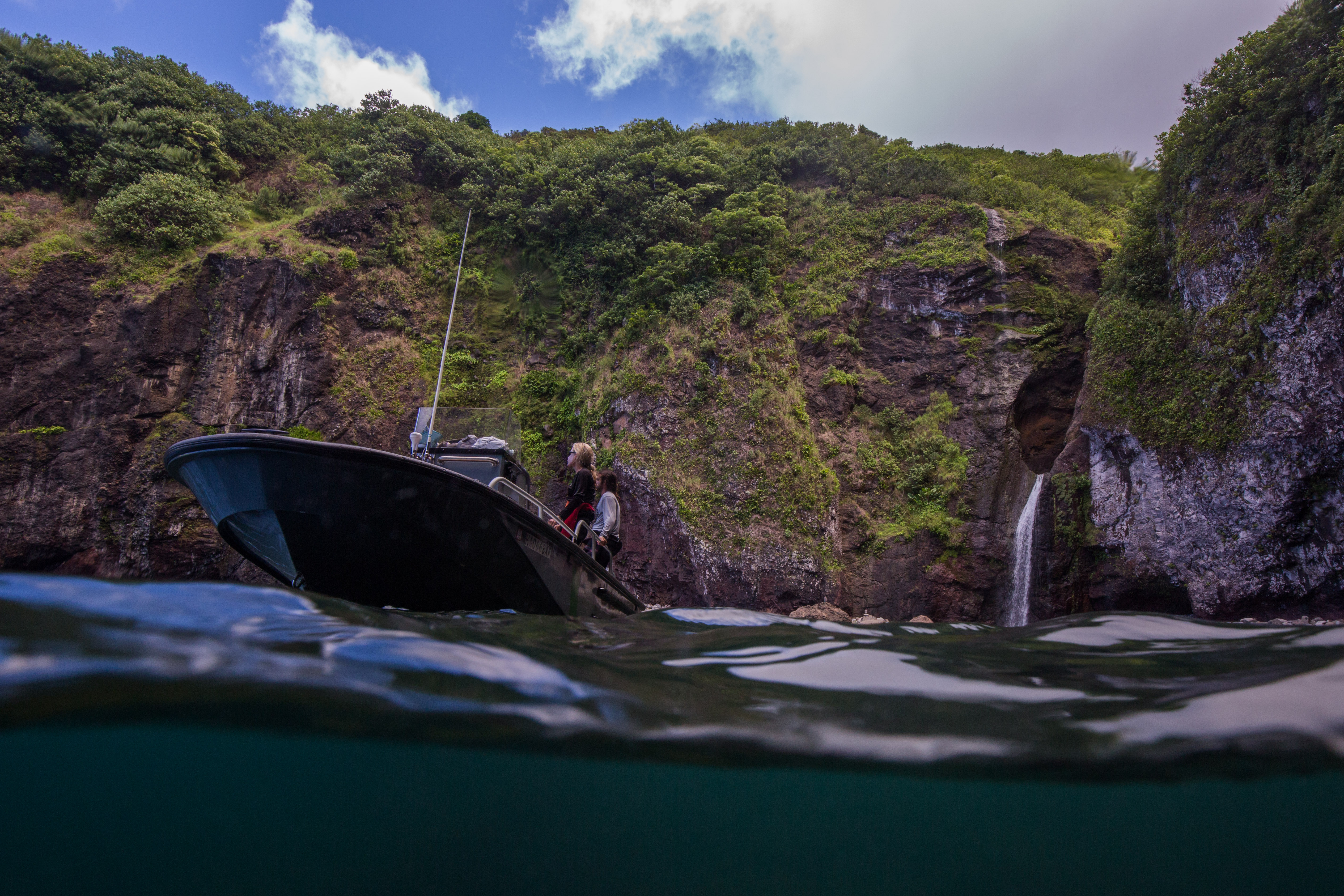
An unforgettable lunch by a waterfall

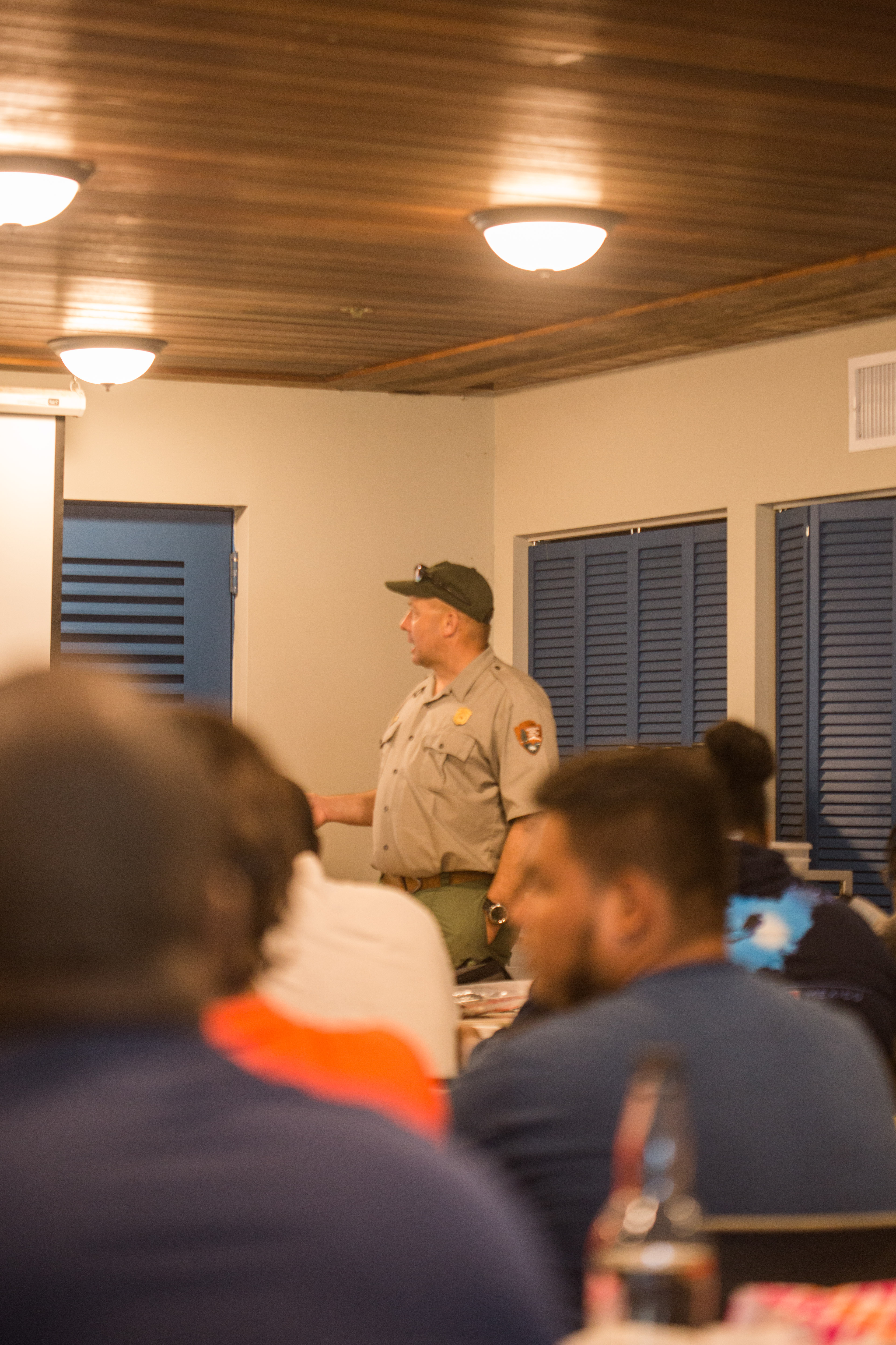
One thing that struck me about this park was how safety-conscious they were. Every morning before going out we all gathered and discussed potential hazards, changes from previous days, and risks to make sure everyone was comfortable and on the same page. We were very careful to have extreme redundancy in terms of communications, bringing 4-5 different ways to contact help if needed. This park was also the best in terms of all the units I’ve visited in terms of using PFDs. As soon as you got back on the boat after a dive, PFD time. Stepping on the boat from the dock? Hope you’ve got your PFD. These precautions are all understandable when considering the remote location and the proximity of any potential help. The Park only has one vessel (the one we’d be using) so any assistance would have to come from elsewhere, the closest spot being on the other side of the island. Safety had to be a big concern.

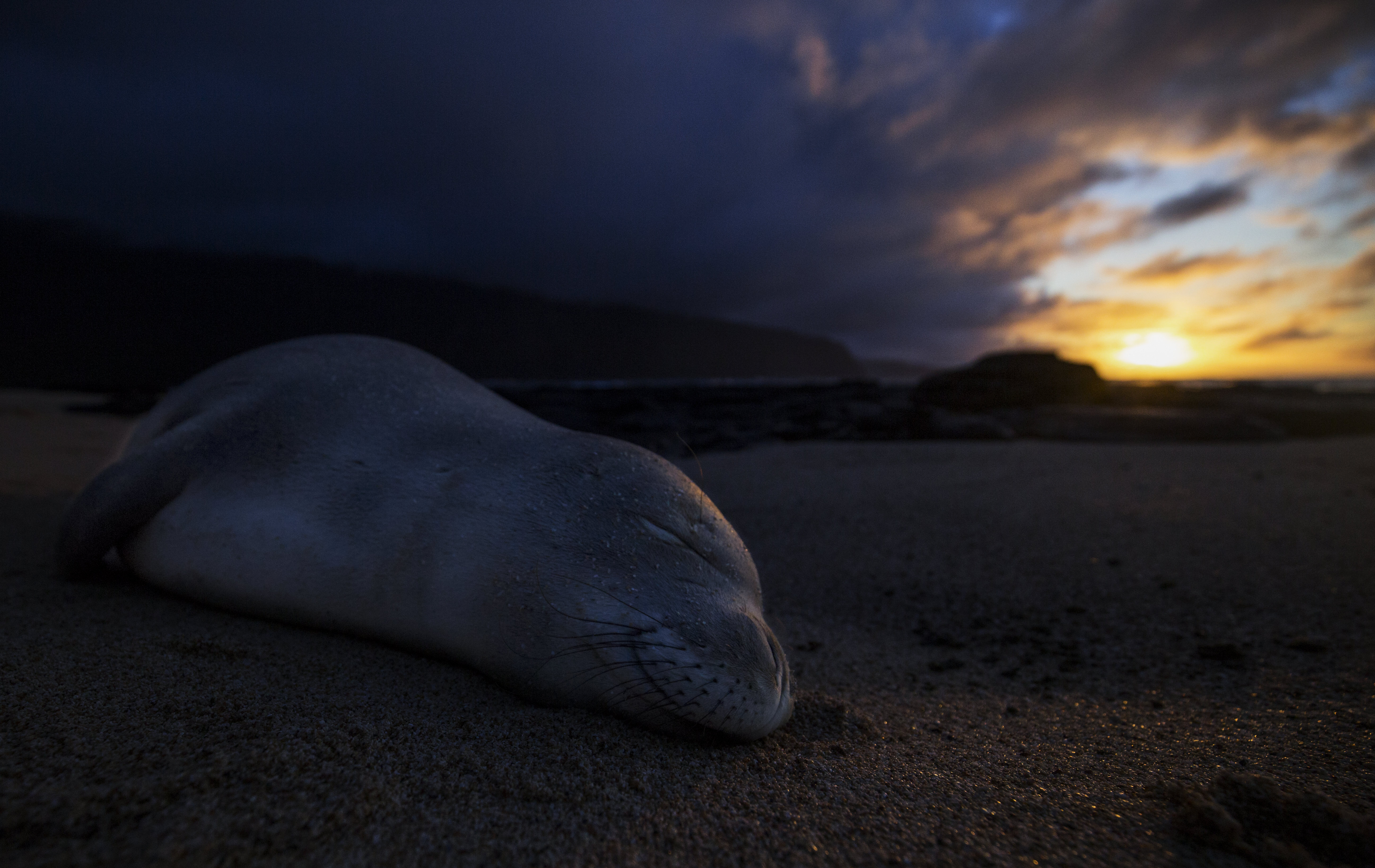
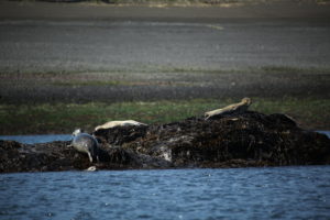
Sleeping monk seal, shot under NOAA/NMFS Permit #16632-02

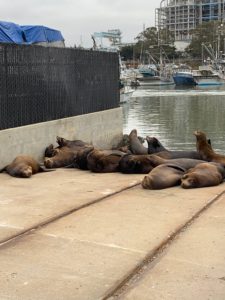
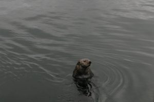
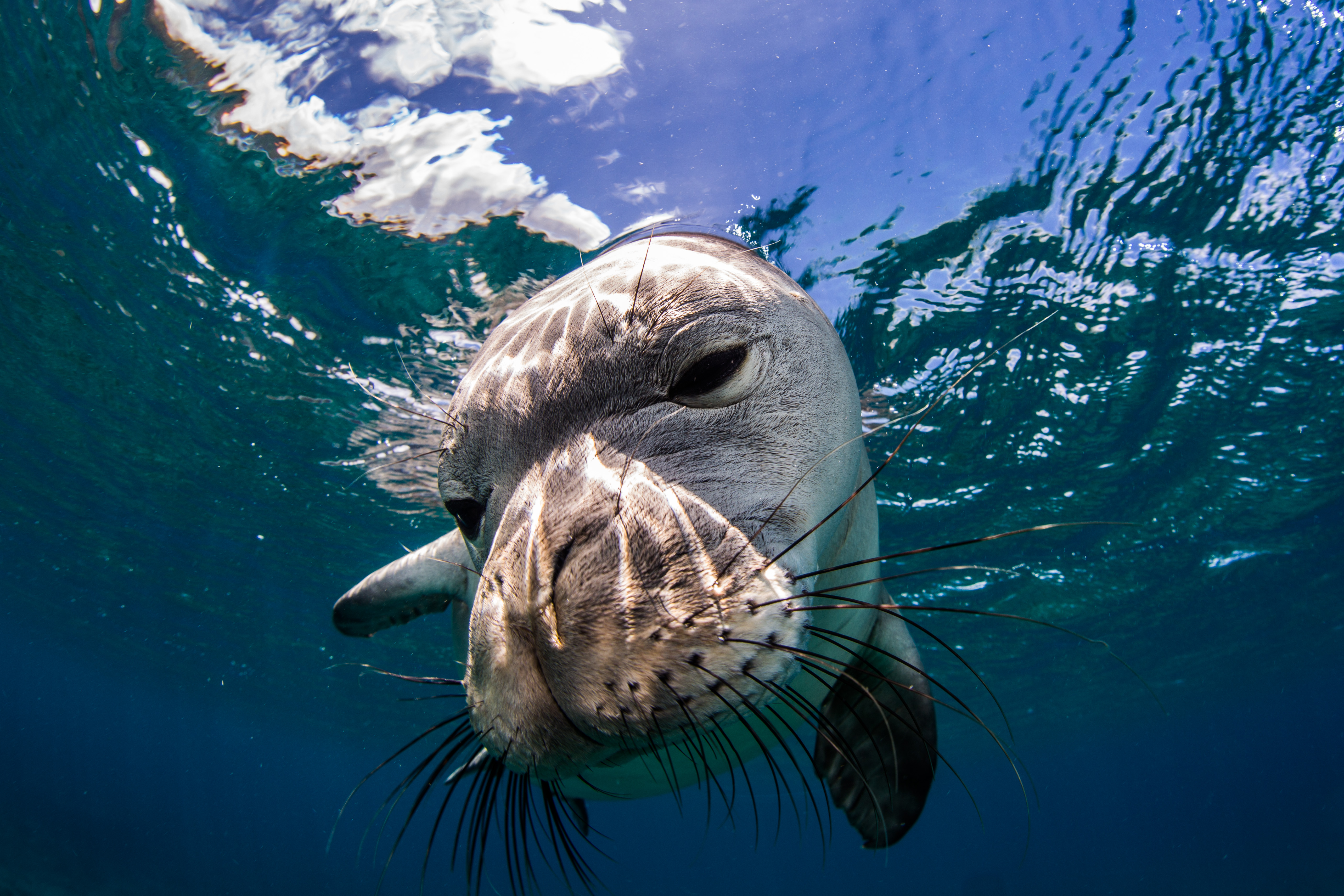
Alongside all of the marine monitoring, I was able to help out with a more land-based survey as well – monk seal walks. I joined Glauco for a couple treks along the coastline, searching for, identifying, and counting any monk seals that we came across. These endangered seals have taken a liking to the Kalaupapa peninsula and have chosen to return here often to pup, making it the number one pupping location in the main Hawaiian Islands. Since 1997, 123 pups have been born on these beaches – a substantial amount considering their small population size of around 1400 individuals, only around 300 of which live on the main Hawaiian islands. I really enjoyed getting to go along with Glauco and get an up-close glimpse of these seals, who spent their afternoons slumbering like logs on the beach. We got lucky on a couple of our dives and were greeted by some underwater, so it was cool to see them on land as well.

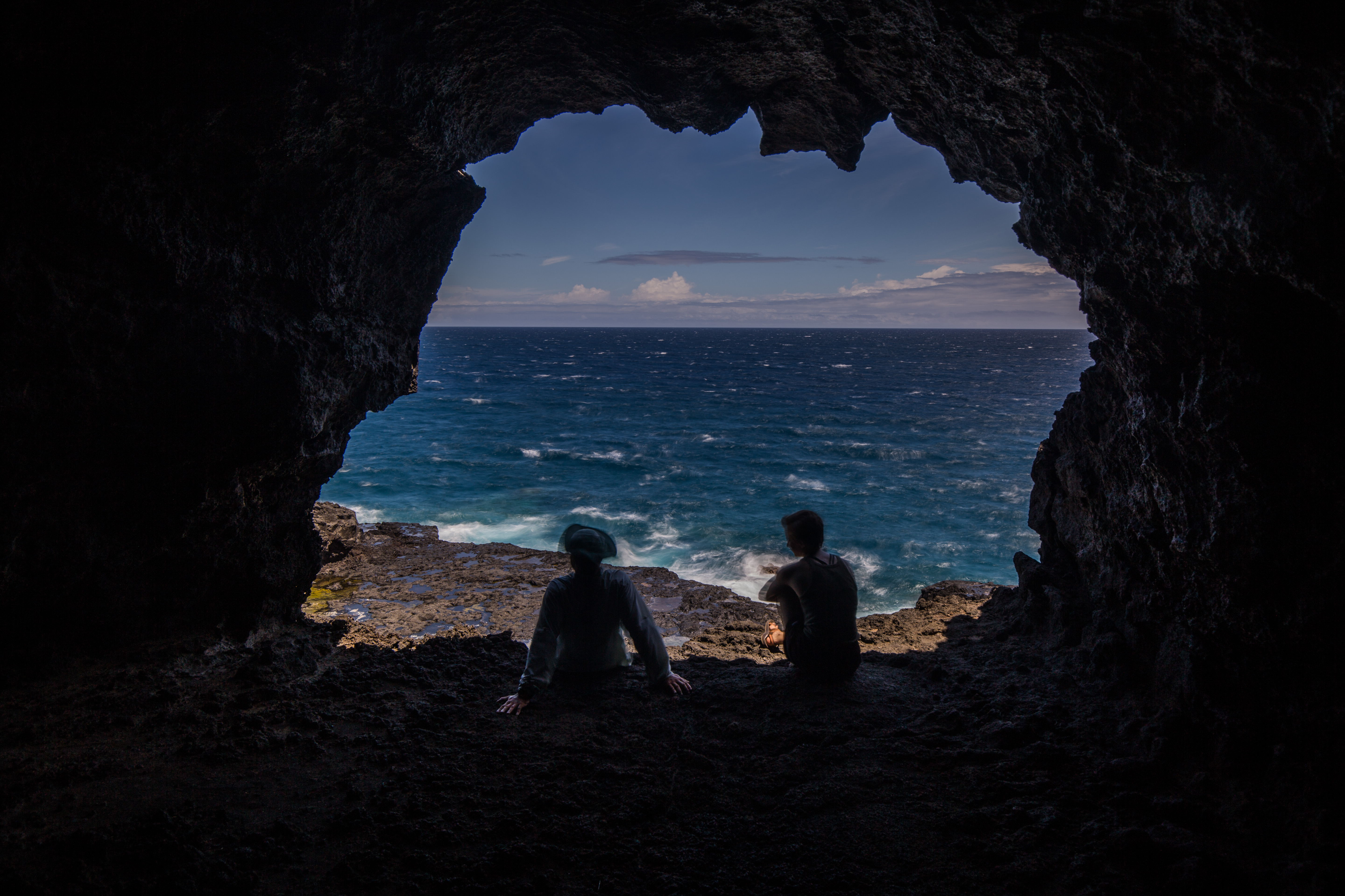
Staying in Kalaupapa for almost three weeks I had ample time to explore around, which was great as there was a lot to see. Just being a Hawaiian Island means it comes with some inherent beauty, but this peninsula had a lot more than blue water and nice beaches (although it did have a lot of those too). Travelling around with Glauco, who made sure to show me all the cool spots, I was able to see some of the treasures that Kalaupapa has to offer – lava caves, sea arches, sea caves with seabird rookeries in them, historic buildings, sea cliffs, and a small lake inside a crater with the greatest depth to surface area ratio of any lake in the world (814 feet deep and 160 feet wide). I took my camera all over with me, taking in the stunning sights and beautiful views.

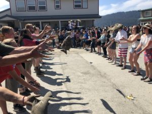
All of the work that we were doing really highlighted some of the difficulties of being such a remote park unit. Eric told me that, despite the size, the NPS employees for Kalaupapa are the costliest out of any park unit simply because of the expenses of shipping out all the necessary supplies. With no roads leading in or out of the park as the peninsula is flanked by steep sea-cliffs, all supplies must be either flown in on small passenger planes or brought in on a ship. A supply barge comes once a year with various foods, supplies, and equipment, and is a major event for the town.

The settlement and its adjacent sea=cliffs

As well as being remote, Kalaupapa is a small park with an even smaller dive team, so some things ran a little bit differently than other places I’d been to. The compressor where tanks were filled is shared with the town’s fire station. Having only one park vessel meant that help is often very far away. Fueling that vessel is another challenge – the Park’s only fuel source is a small gas station, which is only open one day a week, meaning fueling consists of waiting in a long line as everyone fills up, filling up 6-8 gas cans, and then swimming them out to the boat’s mooring. Lots of things take a couple extra steps. A small team complicates these marine surveys even more, as there are only really two full time Kalaupapa employees who dive. This makes the help of the Pacific Parks Inventory and Monitoring that much crucial, as they not only send out someone to help with the surveys (Sheila McKenna), but also fund a joint biotech with Kalaupapa and the Pacific Parks unit to assist with work like this (Glauco Puig-Santana). This collaboration is crucial to getting the necessary work done.

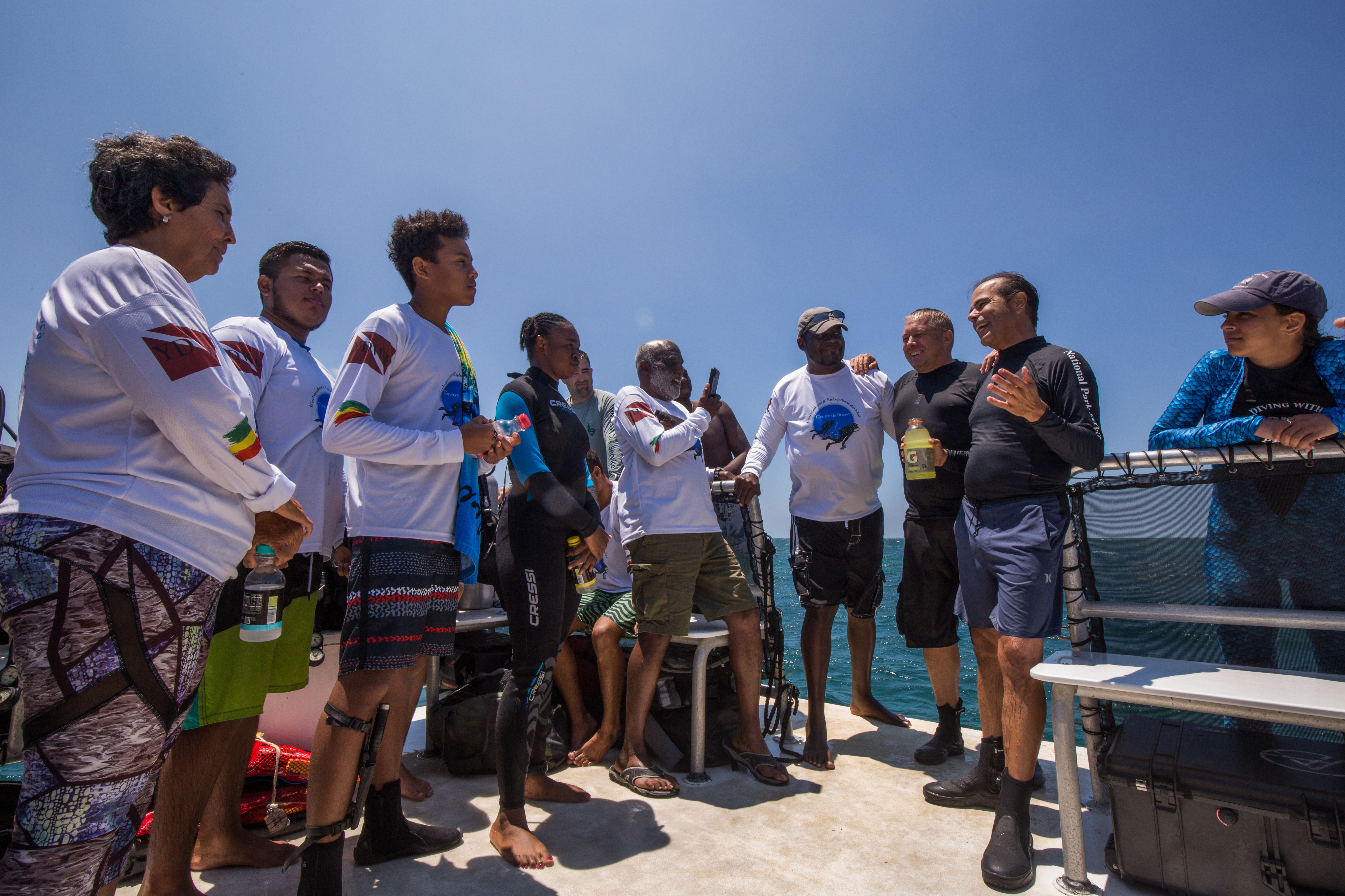
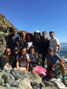
The size of the town is another thing that really makes this place special. It’s small. Small enough that everyone knows each other, making for a really tight-knit community. Spending a little under three weeks there, I just brushed the surface of how close of a bond this is. Weekly volleyball games, game nights, movie nights are times for the town to catch up and enjoy each other’s company. Travelling around with Eric, who before recently leaving for a new job had spent years living here, I saw how not a single person went by him without saying hello and catching up a bit. Even to me, an outsider, everyone was very welcoming.

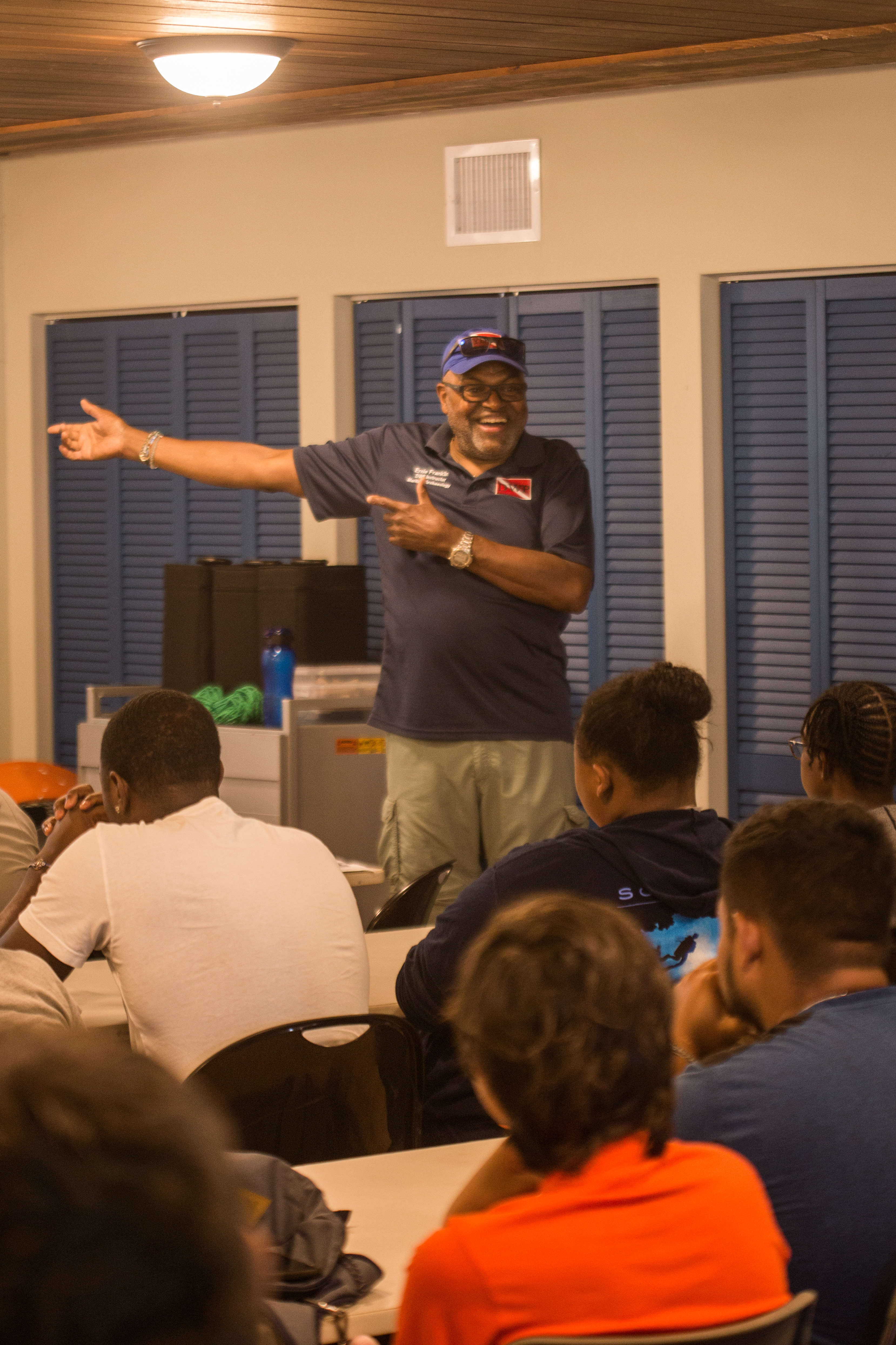
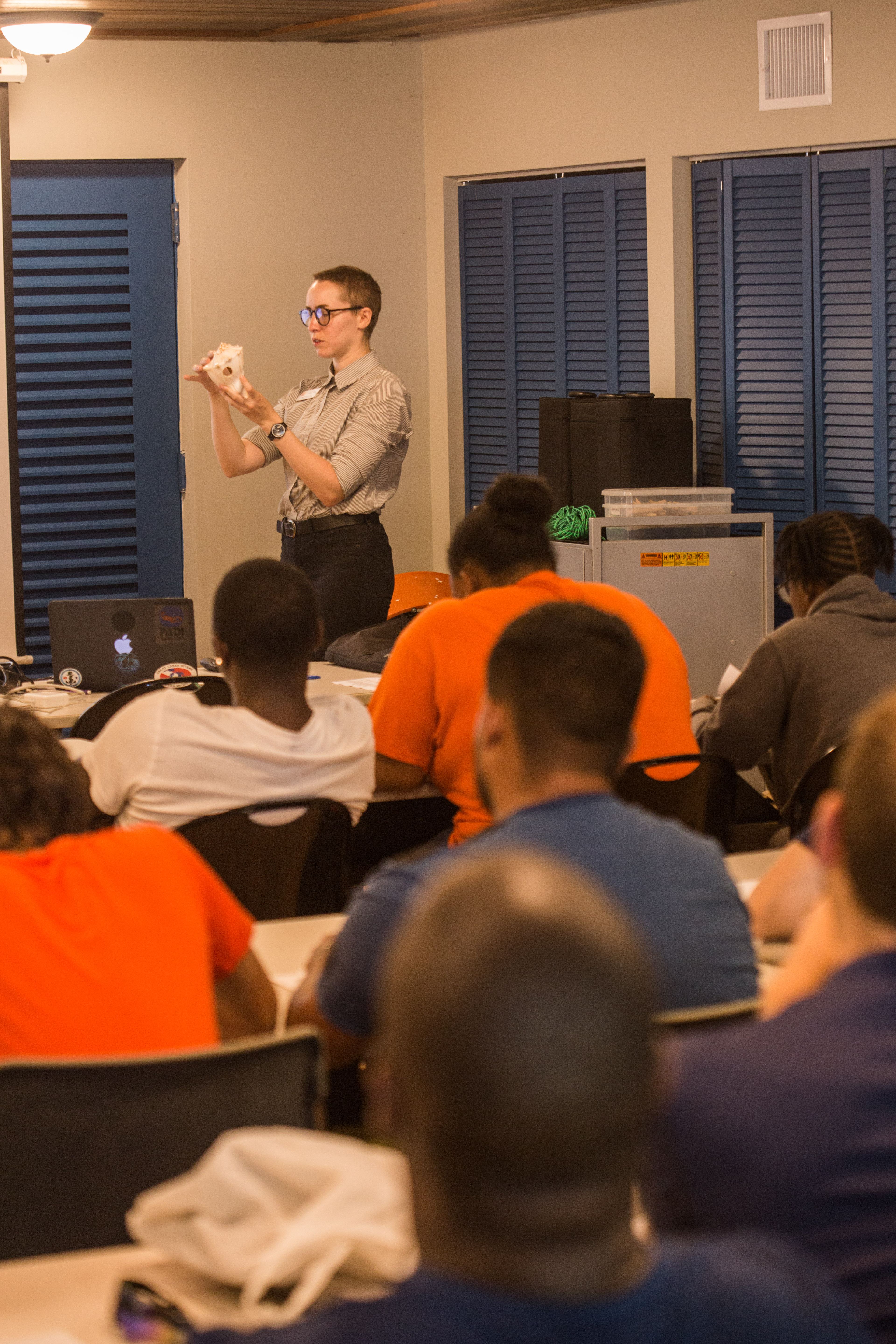
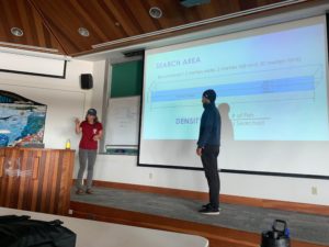
Near the end of my time at Kalaupapa, it became apparent that there was interest to see some of the videos I had taken during our survey dives. Pretty much everyone who lived in the settlement had never really seen the marine environment in depth, anything past a quick snorkel near the jetty. There’s a wild and beautiful ecosystem down there right off the coast, but rocky cliffs and rough weather make them pretty inaccessible if you don’t have a boat. With a little arranging from Glauco, we setup a little marine presentation for the town. Eric was to give a quick talk on the state of the marine program and environment, while I would create a short video highlighting their underwater backyard. While taking some time to complete, this video was very well-received and much of the community came up to me afterward to express their wonder towards what lies just offshore. It was a very fulfilling experience, being able to give back a bit to the community that was so welcoming to me, and I’m glad I was able to share a bit of what I’ve been lucky enough to see. This video, if you’d like to see it, can be found here.

In a little under three weeks, we were able to knock out the entirety of our survey sites, making excellent time with a nice clear window of weather. With the marine work winding down for the year, I had to move on. I had one final park left for me on this internship, one that I knew I’d remember for a long time. Pearl Harbor National Memorial, where I’d join their dive team to visit the USS Utah and USS Arizona.

Share

Exploring Submerged Forests at Channel Islands National Park


Santa Cruz Island

Kelp forests are a magical place. An incredibly productive ecosystem packed full of biological life, these temperate underwater forests are an absolute delight to dive in. The image of towering kelp is what initially inspired me to pursue diving, so I was understandably excited to visit one of California’s finest kelp forest diving locations: Channel Islands National Park.

I was visiting Channel Islands to join up with their Kelp Forest Monitoring (KFM) team on one of their week-long monitoring trips. This program, which has been surveying the islands for 38 years now, is one of the longest running monitoring programs in the NPS. Visiting sites all around the five islands that make up Channel Islands National Park, the KFM team collects a huge amount of data to assess the health of this diverse ecosystem and to aid in management decisions.

The island areas closest to ports are heavily impacted by fishing activities. Despite 20% of the Park’s water being closed to fishing, sport and commercial fishing are allowed in the remainder of the Park and is the greatest impact on the marine environment there. The Park’s islands make up around 3% of the California coastline yet account for 15% of all California commercial marine fisheries landings. Unique ocean conditions mix warm and cold water currents around the islands, making them an incredibly diverse location for marine life – more than 2000 marine species live in the area. Such an abundance of life in a place so close to millions of people needs to have some type of monitoring keeping an eye on it, and that’s where the KFM team comes into play.

In order to effectively monitor and gather information on the complex environments, the KFM team collects a litany of data to monitor fish, invertebrates, and algae. They employ a wide array of survey types and methods, from quadrats and swaths to count individuals, to size frequency surveys and recruitment modules to learn of recruitment events and size classes, to more specialized types of data collection like plankton tows and collecting acoustic data to answer more specific questions. They utilize special techniques to be more productive underwater, like using a diver attached with surface-supplied air and communication equipment along with a surface-based tender and data recorder to allow for longer dives without the need for the diver to spend any time writing stuff down, or breathing pure oxygen from a hanging bar while on safety stops to be able to do such long and repetitive dives safely.  If you can think of a type of data to collect in a kelp forest, there’s a good chance this group is doing it.

I was to join up with them for one of their week-long trips out on the water. With so many sites to survey and the relative isolation of the islands (the closest being 9 miles offshore, and the furthest 70 miles), this group does their surveying from a live-aboard research vessel – the Sea Ranger II. This 58 ft. vessel is the perfect floating research station, complete with bunks, a galley, scuba compressor, and lots of sampling gear. It has everything you’d need for a week out on the water. Working and diving from this vessel allows the team to get much more work done, staying out on the ocean all week instead of making the trip back to the mainland each evening.

The back deck of the Sea Ranger II

I joined up with the KFM team Monday morning and before I knew it we were off to the islands. With no time to waste, we’d be going straight to our first survey site and going straight to work as soon as we’d arrived. We had a couple hour boat ride on the way out, giving me plenty of time to read up on the group’s survey protocols and to prepare myself for some cold-water diving. While I’m not a stranger to diving in chilly seas, it had been a couple months since I donned a drysuit for Isle Royale’s 36-degree waters, so I had a little bit of setup in front of me.

When we were on site and bundled up in various forms of exposure protection, we jumped off the swim step and got to work. I had done some kelp forest surveying before during my time at university, so I was put right to work on algae counts and size frequencies. Counting all individuals of certain species within 5m quadrats, I swam down the 100m transect with Joshua Sprague, a Marine Ecologist at CINP. We were counting a small selection of algae and sea star species, one of these being probably the most conspicuous resident in kelp forests, giant kelp itself. As the backbone of these forests, giant kelp creates habitat for countless species of fish and invertebrates. Certain conditions can cause rampant herbivory, often at the tube feet of spiny sea urchins, which can result in these bountiful forests being reduced to bare rock, or  ‘barrens’. Unsurprisingly, some of the species that we collected a large amount of size frequency data on was the two most common species of urchin in Californian waters, the red and purple urchins. I spent a large portion of my first day swimming around plucking these living pincushions off the sea floor and chucking them into a mesh bag for topside sizing.

The Kelp Forest Monitoring team does a lot of sizing of invertebrates, as a robust collection of sizes can be used to glean information of recruitment events and potentially even die-offs. Sizing, however, can take a fair amount of time. Calipers are used for precise measurements and sizes must be physically written down – which all sounds easy and quick but can really add up when you’re trying to size at least 200 urchins at each site. Additionally, time spent underwater is limited, so it must be maximized to its full extent. At sites where urchins are abundant, these inverts are sometimes brought up to the surface to be measured in order to increase efficiency. It seemed like after almost every time I returned to the back deck post-dive there was part of the team sitting out there sizing something.

In addition to the urchin size frequencies, there was a whole other source of need for sizing – artificial recruitment modules, or ARMS. These, essentially little stacks of halved cinderblocks designed to create available and desirable habitat for juvenile invertebrates, are a way for the KFM team to learn a little bit about waves of larval recruitment happening inside their park. Each year, these modules are visited, taken apart and picked clean of their invertebrate residents, brought up to the surface, sized, and then brought back down and put back away in their little artificial homes. This task was a coveted one by the team, and was described to me as the kelp forest monitoring equivalent of opening a Christmas present – you never really know what you’ll find inside. I grew to agree with them, it was always a fun surprise. Sometimes you’d get nothing but some small urchins and a what seems a couple hundred brittle stars, and other times you’d be greeted by a mother octopus and her clutch of eggs (no, we didn’t bring those up to size them as well).

An Artificial Recruitment Module

Diving with the Channel Islands crew, it really was work pretty much all day long. With so much data to collect, there isn’t much time for slacking off. Even when all of the diving was over there was still more data to get – a plankton tow to complete, hydrophone recording to make, or a species list to compile. It was inspiring to see them working nonstop to gather all the information needed to thoroughly monitor these special forests.

After finishing up our site on Santa Rosa Island, we headed off to the neighboring Santa Cruz Island for our next stop. Santa Cruz, the largest of the northern Channel Islands, also has the most native vegetation – the result of a huge effort to remove introduced grazers and reestablish a natural landscape. This made for a beautiful commute, getting a chance to view these sheer sea-cliffs and the greenery that blanketed them. We also got a chance to visit a unique Santa Cruz Island feature – the Painted Cave. One of the largest sea caves in the world, this enormous cavern extends a quarter mile into the island with an opening big enough to fit a 60-ft boat into it. Keith Duran, the skilled captain of the Sea Ranger II, brought the vessel all the way into the cave to give us a close look.

The entrance to the Painted Cave, which stretches up to 160ft tall at its opening

Once we arrived at our new site off of Fry’s Harbor, Santa Cruz Island, we went straight to work. I was starting off with the familiar 5m quadrats, but little did I know I was in for a surprise. The previous sites were relatively easy for these quads, with only a couple species to count, but this one was a different story. A silty bottom with scattered boulders, it seemed like every exposed surface was covered in an invasive algae species called Sargassum horneri. Resigning ourselves to an a long, mind-numbing dive, my buddy Laurie Montgomery and I committed to the count, in the end reaching tallies of thousands of individuals, a task which took 75 minutes and almost all of my sanity.

Understory growth, like the ones pictured here (not Sargassum) can form dense carpets and severely complicate counts

Also while on Santa Cruz Island I got a chance to break out the camera. For most of this trip there was too much work to do to be able to take photos, but I seized an opportunity to join Rilee Sanders and Cullen Molitor as they finished up some work. As visibility was low, I opted to shoot macro, something that I haven’t gotten a chance to do much of recently, in hopes of getting some nice photos of the California morays that everyone was talking about.

The next day we finished off our final site of the trip, and then went to do some logger retrievals. The KFM team has set out some acoustic loggers throughout the park and I was able to join some of the pick-up dives. In hopes of being able to use these hydrophone recordings to gauge ecosystem health, these loggers take 5-minute recordings every 15 minutes until they run out of battery or memory. Diving with Joshua Sprague and Kelly Moore, these dives were short and sweet – drop down, grab the logger, and bring it back up – but a nice way to get a quick view of some diverse sites. While doing these logger pickups, I visited my first marine protected area of the trip – a beautiful, lush kelp forest full of healthy marine life.

Channel Islands National Park is home to a network of marine protected areas. A mix of State and Federal marine reserves and conservation areas, these designations offer various forms of protections to marine life and serve as a sanctuary to preserve species diversity and abundance. In 2005, the KFM team added new sites to their protocol to survey inside and outside of these protected areas to try and gauge their effectiveness, and the results are clear. These MPAs work wonders for preserving species diversity and sizes, which allows for the maintenance of a healthy ecosystem. This is pretty clear when diving in them as well – the protected sites were among the most beautiful ones I visited on the trip, a telling testament to the importance of protection of special places.

We wrapped up our final day with some diving on Anacapa Island, the smallest of the northern islands and the closest to the mainland. This was one of the two islands out of the seven that I had never been diving on, so I was excited to check it off my list (only San Clemente Island left!). Even more exciting was that we had enough time to get a survey dive in after finishing off the last bit of work. We’d be working a couple sites around Anacapa, picking up loggers and such, and would have a little bit of free time before needing to head back to the mainland. I was able to jump into the chilly waters a couple final times and got to enjoy the beautiful kelp forests in the marine reserves off Anacapa Island for a bit before heading back home.

Shortly before leaving the Channel Islands I was met with an unexpected surprise. I was chatting with Kelly Moore, a long term KFM veteran who is about to start a new position at Kalaupapa National Historic Park. Kalaupapa NHP is one of the parks that is frequently visited by OWUSS NPS interns, but was one that I didn’t think I’d be able to visit this year due to shifting personnel and an unfortunately scrapped survey season. I mentioned this to Kelly, and was surprised when she mentioned that the fieldwork was in fact not scrapped, but still planned and was to start literally the day after I returned back from the Channel Islands. Even more exciting, she thought they could probably use an extra hand. At this point in my internship, I had no parks planned for me after CINP, so I sent out an email and before I knew it I was booking flights to Hawaii two days in advance from my phone while on a boat 50 miles offshore. With these exciting plans ahead of me, I drove straight to San Francisco as soon as I left the Channel Islands harbor in Ventura and hopped on a flight to another beautiful island chain, one a little bit more remote – the Hawaiian Islands.

Santa Rosa Island

Share

Keeping an Eye on the Coral – Coral Reef Monitoring at Virgin Islands National Park

As soon as I saw the bright blue tropical water from the small plane window I knew my flight was going the right way. The unmistakable vibrant waters of the Caribbean were moving closer and closer as we began our descent. I was eager to return to this part of the world and was looking forward to more picturesque beaches and wildly clear waters. This trip I was returning to the Virgin Islands, but to a new one this time: St. John, home of Virgin Islands National Park.

Virgin Islands National Park, encompassing 60% of the land area on St. John and about 9 square miles of the adjacent ocean, is a beautiful place full of tropical forests, historic ruins, and fringing coral reefs. Surrounding it is Virgin Islands Coral Reefs National Monument, adding an additional almost 20 square miles of protection to the reefs around the island. I was here for the second leg of the National Coral Reef Monitoring Program (NCRMP), a nation-wide effort to survey and keep track of the health of coral reefs. Lead by NOAA, this was a collaborative effort including groups like the NPS and University of Virgin Islands. This work was identical procedurally to what I worked on in St. Croix, as the survey methods must be the same in order to create comparable data. After my previous warm-up round a month before, these surveys collecting information on reef complexity, fish diversity, and coral health felt very comfortable and familiar. There was one big difference between the two for me though: in St. John, I collected much more data.

In St. Croix, I spent 3 of my five diving days photo-documenting the work at hand and shadowing to try and pick up the survey methods, only jumping into data collection on the last two days because the team was short a member. In St. John, I collected data from start to end – forcing me to data dive with a bulky camera strapped to my BC if I wanted to get any photos of the reefs. This was fun, as I like scientific diving and data collection, but did have one major downside. All of this fun data collection was paired with another, far less fun, task: data entry.

All that data has to go somewhere

All data entry had to be done by the end of the trip, so each day of diving 5-7 dives a day means 5-7 data sheets are waiting for you when you return home, tired after a long day of diving. Sure, you could wait to enter these until a little bit later in the trip but they’ll quickly pile up, creating an imposing stack of impending work. This data entry obligation was difficult to manage, with all the other internship duties I had along with dinner and other evening activities. To make matters worse, the survey type that I was doing, line-point intersect, was collecting information on percent cover of the benthic environment – meaning that I’d always have 100 points to enter, regardless on how barren the site was. Certain less-than-interesting sites gave the fish and coral surveyors a welcome break from the intense data collection, but the hapless LPI diver was doomed to work tirelessly.

Sometimes the tables were turned, and recording point after point of turf algae seemed preferable to counting and sizing hundreds of fast-moving fish

All of my gripes aside, this data entry is a key portion of the survey process – completely necessary if you are interested in doing any types of analysis or learning anything from all of these numbers that have just been produced. Additionally, doing it right after collecting it leaves little room for forgetting key information. It’s much harder to decipher messy underwater handwriting a month after it was written rather than a couple hours later.

So what was all this survey data on? If you were to ask members of my vessel during the St. John NCRMP leg, you might get a lot of answers of ‘scrubble’, a lovely benthic habitat composed of sand and rubble (and often not much else). The protocol is designed to survey any type of habitat that could potentially harbor coral, including the ones that may boast one small coral colony in 50m of seafloor (we visited some of these). As long as there was a single piece of hard substrate, we’d survey it (and yes, that little rock over there in that seemingly endless sea of sand counts – we checked). The words ‘coral reef surveys’ may invoke beautiful mental images of expansive living grandeur, that isn’t always the case. Sometimes, you have to monitor the sites that are what I imagine it would look like if a coral reef sneezed and forgot to cover its mouth, or sites that have so much algae and so little coral that you’ll have to double check you aren’t diving in California. However, someone has to collect this data – after all, zeros are important data points too.

Sometimes the algae/coral balance was skewed a little bit more towards the algae than you’d like it to be

As with St.Croix, these were randomly selected GPS waypoints that were chosen based off of benthic maps created using bottom sounder data.  This means that you’re often diving on sites that have never been visited before – and that no one really knows what type of habitat you’ll be dropping in on. Sometimes, that hard bottom that you (and the quickly growing dataset) have been pining for isn’t so hard after all. My team had more than our fair share of bounce dives, dropping in on large swathes of sand or seagrass and coming right back up. Sometimes, these seemingly-uneventful bounce dives would unearth thrilling sites: a school of hundreds of adult bonefish, tiny cryptic sargassum-dwelling invertebrates, or potentially my favorite sight of the trip – the largest palm tree I’ve ever seen. Sitting calmly on the dark ocean floor at around 90 feet deep, this submerged giant must have been over 70 feet tall.

While these soft-bottomed dives sometimes had fun surprises, the reefs were still much nicer

Despite feeling as though our team had somehow angered the gods who pass out the site survey assignments and were doomed to spend our days ticking off point after point of turf algae, we did still manage to visit some pretty spectacular sites. The Friday of our first week was the uncontested peak of the trip – visiting five aggregate and patch reef sites, with unparalleled visibility and surprisingly high coral cover. To top things off, our very first site was on the fringing reef, the reef furthest away from the islands and widely-thought to be the nicest around.

One of the nicer reefs we got to visit

With not many observed instances of disease or bleaching by our team, these reefs seemed pretty healthy. However, it was pretty clear that they had recently been subjected to some wild, intense, storm-driven swells. Occasionally, we’d run into coral colonies that looked like they’d been bashed in by a couple of angry garbage trucks on a bender, huge chunks of growth split apart in ways that seem impossible to comprehend. We’d also run into other signs of storm damage as well. Entire trees underwater was a common one, unintentional visitors from an outside world who’ve turned into a semi-permanent reef feature. Fragments of roof was another one, forcing one to imagine just how strong winds must have been to rip this huge chunk of metal off of someone’s house and deposit it a quarter mile offshore. We also ran into the wreckage of what looked like a rather large ship, broken apart and scattered across the reef.

Remnants of an unfortunate ship

While not a huge amount of disease was observed, as it has relatively recently made its way to the Caribbean, this doesn’t mean that we didn’t take any precautions to avoid spreading it. This park was the most cautious out of all the ones I’ve been to in terms of taking preventative measures – they were promoting what they hope to become ‘the new rinse’. Consisting of soaking gear in a diluted bleach solution (less than 1%) and then rinsing in freshwater, this thorough procedure is designed to remove any possibility of disease transmission through diver’s gear. The Parks Service is attempting to popularize this procedure throughout the Caribbean, supporting local recreational dive operations in their transition by supplying the bleach, with hopes that it’ll become widespread.

With a lot of the surveying gear touching the bottom, disinfecting is a crucial precaution

This disease, stony coral tissue loss disease, has only recently been detected in the U.S. Virgin Islands but poses an incredibly dire threat. Affecting 22 different species of coral with a mortality rate from 66-100%, it poses to decimate Caribbean reefs. First making an appearance near Miami in 2014, this disease quickly spread through the Florida Keys and has recently made its way out to the Caribbean as well, putting reefs already in major distress from climate change under even more stress. Described by researchers as being comparable to an underwater Ebola, this disease is currently incurable and ripping through reefs, killing corals that are hundreds of years old in mere weeks. Scientists are forced to result to dire containment measures, physically removing infected coral colonies from the reefs in a last-ditch effort to stop the spread. The speed and intensity of this disease make it a very real issue, putting even more importance on the island-wide monitoring we were undertaking. With a wide distribution of sites surveyed, this program has a good chance of locating and identifying disease before it becomes too widespread.

A diseased coral quickly losing living tissue – this may be a different disease, black band disease

Diving off of St. John, there’s a lot of boat traffic. Ferries travel around constantly moving between the many islands peppered through the area, private charters zip back and forth between beaches, and seemingly every other person on the islands has their own boat. This meant that we had to be extra vigilant when surfacing, especially as we managed to do a surprising number of sites in major boating channels. For some reason, vessels in this area don’t really seem to care much about dive flags – despite being clearly marked and obvious in the water, they’ll power right over them. Thankfully, the largest vessels (the ferries) weren’t very stealthy – their powerful, rumbling engine was audible even 90 feet down, and was hard to ignore when its booms resonated through your body.

Another hazard that we had to deal with was currents. While sometimes simply a nuisance, causing more exertion than desired, these had the potential to cause more serious issues. We had one memorable dive with such a raging current that I was almost unable to swim against it. The LPI diver has to swim into the current twice in the dive, once to reel out the transect and once more to collect their data, so I had to fight this angry stream of seawater twice over, exerting myself much more than I would have liked at depth to make the tiniest bit of headway. When we’d finally finished that dive and were able to stop fighting it, we noticed that our gas consumption and physical exertion weren’t the only things that this current had taken a toll on – it had also pulled down our dive float. Lying pitifully on the end of a suspiciously slack line at 85 feet down, wrinkled and compressed to half its size, our small buoy and handheld GPS combination had been yanked down to the depths by a whole lot of fast-moving water. With the help of a lift bag and a quick decrease in pressure, it happily returned to its former full and turgid state but was the subject of quite a few post-dive discussions in the days to come.

Strong currents really made us appreciate the dives without them

One final hazard was weather. Despite St. John rarely getting thunderstorms, we had quite a few during our monitoring trip. Often these storms would quickly materialize out of dark clouds without warning, surprising us in the middle of our day. We had one memorable dive where a lightning storm started while we were under – I remember the eerily calm surface of the water, the surface mottled with the impacts of thousands of raindrops and the occasional blast of illumination on the darkened reef from a flash of lighting.

Calm and serene underwater, cold and wet above

One small perk of doing all of these high-traffic, high-current, scrubble dives in the middle of the channel was a small novelty that I’m really pleased to be able to say that I’ve done – an international dive. With the close proximity between the USVI and the British Virgin Islands, it only made sense for a couple of these randomly selected points to fall right on the border. And sometimes, the transect happens to head across international lines, or a drifting safety stop takes you a little into someone else’s territory (it’s hard to see these borders underwater). While essentially meaningless, I got quite a kick out of these globe-trotting dives.

Some British fish

Like St. Croix, the dives for this program were fast and seemingly non-stop. Over the course of the two-week period, we quickly worked ourselves up to an average of 6-7 a day, occasionally even doing eight. Diving a range of depths and a mix of air and nitrox gases, high numbers of dives were achievable and safe – but sometimes lead to long days out on the sea.

Long days underwater are always worth it when you’re rewarded with sights like this

A huge perk of spending two weeks in St. John was that it gave me an entire weekend off between surveying to explore a bit more of the island. A huge amount of the island is National Park, encompassing a vast expanse of undeveloped forest and beaches. While lovely to see from the water as it really highlights the scale of the whole area, it was nice to get up close and personal as well. During time off I got a chance to see the sea turtles at Maho Bay, juvenile lemon sharks at Reef Bay, and even to take a quick visit to the British Virgin Islands. This was a really beautiful area that I’m glad I got a little time to see.

Juvenile lemon shark in the shallows at Reef Bay

I was happy to join on for another couple weeks of the National Coral Reef Monitoring Program as it’s such an important cause. At such a pivotal point for the fate of coral reefs it’s exciting to be on the forefront of the monitoring, collecting the data that will be used to inform policymakers about the ocean health. Additionally, I welcomed the opportunity to learn more about these reefs and the issues they face – all relatively new stuff to a cold-water diver like myself. After two busy weeks full of diving and data, I left the Caribbean for good. I was now heading to the opposite side of the country, to spend the remainder of my internship diving in a completely different ocean. It was time to say goodbye to the corals of the Caribbean and hello to the ecosystem that got me into diving – the lush kelp forests of California, at Channel Islands National Park.

Share

Photography, Archaeology, and Outreach – YDWP in Biscayne National Park

This final short week in Biscayne National Park was almost definitely the one week of my internship that I was most nervous for. By a wild stroke of luck, I had been handed an incredible opportunity: a chance to take photos for a magazine, something that many photographers dream of. Mary Frances Emmons, editor-in-chief at SCUBA Diving Magazine and good friend of Dave and Brett, had reached out to Brett asking if he’d be able to photograph a program happening at Biscayne National Park this summer. Brett was unavailable, as he had SeaArrays to drive and shipwrecks to model, but as luck would have it he would have an intern in the area right around the same time – me.

The job was to photograph this year’s maritime archaeology segment of the Youth Diving with a Purpose program, an initiative to get underprivileged youth into subtidal work through archaeological and biological experience. I’d be working with a journalist and a few members of the Parks Service to document and assist this program during its time at Biscayne. This was obviously something that I was very excited for, the chance to not only have published photos in a major magazine but to shoot on assignment as well, but also a daunting task.

This was my first real underwater photographic assignment and a big one too – the folks at SCUBA Diving had taken a bit of a gamble on me, trusting the good reviews from Brett and Dave and hiring someone with no real magazine experience as the only one to provide photos for their article. I was honored that everyone had so much faith in my shooting ability and determined to make them all proud. However, I knew this assignment would touch on some of my weaknesses as a photographer. Despite spending most of the past couple years taking photos, my photographic experience was limited in two major aspects of this assignment: taking topside photos and underwater shots of people. Most of my experience comes from underwater wildlife photography, so while I was very comfortable using a camera I was a little hesitant as to how to approach this. Thankfully, the past couple weeks of this internship had been an excellent warm-up with the large number of images I produced for my blogs.

The program that I was assigned to document, Youth Diving with a Purpose (YDWP), is one that the SRC has been collaborating with for a while. YDWP is an offshoot of the successful Diving with a Purpose, a nonprofit designed to preserve and protect submerged cultural resources while also providing archaeological education and training. These programs have a special focus on shipwrecks of the African slave trade and uncovering more detail about the maritime history and cultures associated with this. A specific maritime target of the group since its founding is the wreck of the Guerrero, a high-profile slave ship that is believed to have sank somewhere off the Florida Keys. This particular vessel has yet to be located, so in the meantime the group is focusing on assisting the Parks Service with mapping the many wrecks located within the boundaries of Biscayne National Park.

This year, students from across the U.S., U.S. Virgin Islands, and Costa Rica travelled to South Florida with a team of instructors to tackle the mapping of a wreck in Biscayne called BISC-60, or Captain Ed’s wreck (named after the Captain who discovered it). This site is the remains of a mid-1800s vessel, lying in 22 feet of water just above the southern border of the Park. These students would spend a day in the classroom learning the basics of underwater mapping and maritime archaeology along with some history about the park, before venturing out into the field to put those newly discovered skills to work.

Jumping into a dive on the site

This week started off with a long day of lectures and land-based exercises. I travelled to the Dante Fascell Visitor Center at Biscayne National Park with the team of NPS personnel who would be assisting the YDWP team this week: Dave Conlin of the SRC, David Gadsby (an archaeologist from the Washington branch of the NPS), Josh Marano (maritime archaeologist with south Florida parks), and Sydney Pickens (a recent YDWP graduate and budding marine archaeologist). While my main job would be to photograph the program, the rest of the Parks Service team would be working to facilitate the program from the Parks side of things: setting up the classroom and the wreck site, making sure the program has everything they needed, and of course lending their valuable expertise.


While the students got an assortment of lectures, ranging from everything from the history of the DWP program to scientific illustration, I worked to document the process. Taking classroom photos of lectures and illustration practice wasn’t the most exciting thing I’ve done during this internship but was still something that I took seriously. Thankfully, I was also able to pick up a little of the info that the various lecturers had to say, learning a little bit about the Park, the history of YDWP, and about maritime archaeology. After taking a couple hundred shots of the students hard at work absorbing lectures and practicing their sketching skills, we moved onto a welcome outside break to practice the mapping process itself.


As minutes underwater is much more precious than those on land, the YDWP instructors took their time in ensuring that the students were very clear on the mapping procedure before they even stepped foot on a boat. In the muggy Florida heat outside the visitor center the students gathered to watch the instructors demonstrate mapping on a mock shipwreck – an assortment of objects laid on the grassy ground. This was a fun experience for me as, like these students, I had no real experience with mapping shipwrecks. I’d been able to observe the Submerged Resources team modeling quite a few with next-generation technology but had never really learned much about the old-fashioned way of doing it – with pencil and paper. Using measuring tapes and lots of patience, the instructors thoroughly explained the basics to the mapping to the students – including trilateration, how to take careful and accurate measurements, and the importance of not disturbing the baseline. The baseline, a transect tape that is reeled out through the middle of the site, is what all measurements are made in reference to. If it gets uprooted or moved before the in-water mapping is finished, all progress could be lost.

Early the next day, I met up with the NPS team to head out to our site. We were going to arrive a little earlier than the YDWP folks, who were departing with a dive charter out of Key Largo, to set up the marker buoys and the baseline. Arriving at the wreck site, the water was wildly calm – not a ripple to be seen. Josh and David geared up and hopped in to set up the lines while Sydney and I swam around to get a quick look at the site before the group arrived. The serene calm on the surface of the water extended to the dive site, as water motion was negligible. Perfect conditions for the first day.

One of the last times I’d see the wreck without anyone on it

Soon after we’d gotten in, the YDWP team arrived and it was time to get to work. I wanted to have the maximum amount of time possible to photograph them, so I went down as soon as the first people started dropping in. Now, before starting the dive I was a bit hesitant as to how my shots would all turn out, but I had clear ideas of what type of photos to produce and was confident in my ability to procure them. I’d had a lot of practice photographing people doing somewhat similar work in earlier parks so I figured this wouldn’t be too different – but boy was I wrong. I hadn’t accounted for the sheer amount of people on such a compact site – there were four different teams of 4 students, each team with an instructor leading them. This wreck wasn’t huge either, at one side it compacted into what was roughly a 10X4m area (and this is with 10 divers working in it). To make things worse, divers were now fighting a slight current which had just picked up, forcing everyone to maintain a slow kick into it.

That’s a lot of divers – in some parts of the site, divers had to work in very close quarters to get their measurements done

These crowds meant one important thing to me, something that I hadn’t foreseen. With so many people on the site, it was difficult for me to produce clean shots without distracting background action. It seemed like every time I spotted a team doing some work that would display nicely and moved into position, someone else would drift into the background of my composition or a rouge fin would appear from outside the frame. Wanting to create distinct images without parts of people cutting in or out of frame, I ended my first dive disappointed. I felt as though I had largely failed on my mission and had to re-plan my approach to get less busy images. Thankfully the group was doing at least 4 dives on the wreck, so I had a couple more chances.

Some images (like this one) turned out nicely but still had a few more people in the background than I’d have liked

The next dive went slightly better, although there was also some added difficulty. I had received a request by the YDWP instructors to get portraits of each student underwater, so added this concept to the back of my mind while trying to get clean magazine shots. Trying to isolate single students out of the masses was difficult in itself, but I also ran into another problem that I didn’t really think I’d ever have: no one would look at the camera. Typically, when shooting people underwater I don’t really want that, I’d prefer to have the people as an accessory in the shot for scale or added impact and to have them look towards the subject – but for portraits it’s a different game. I did admire the student’s steadfast dedication to the task – despite my shoving a camera in their face and praying that they’d look at it (even for just a second), no one caved. I ended the first day of diving feeling unsuccessful – I hadn’t managed to produce many clean working shots and had only gotten nice portraits of one or two of the students. I knew I had to approach things differently for our upcoming dives.

Students were so absorbed in their mapping that they paid no attention to the photographer snapping away photos right in front of them

Overnight, I had pondered plans for ways to isolate my subjects and get clean shots. I had thought up ingenious ways to briefly distract the students to take their portraits, and clever methods of capturing backgrounds free of rogue divers. As it turned out, I really didn’t need any of these. This day I was to ride out of Key Largo with the YDWP team and took that opportunity to ask a couple of the instructors if they’d mind assisting me with the portraits a bit and running their students by me at the start of their dive. I’d planned to be waiting right beneath the boat and the teams could drop down, stop by my marine portrait station, and then be on their way. As always, this proved to be much simpler in theory (I ran into issues with teams jumping in at the same time, forgetting to stop by, or just getting in each other’s photos) but was much easier than yesterday’s approach. With some light hounding on some of the instructors, I managed to get everyone to bring their students past me for picture.


As for the magazine shots, things just seemed to work out in my favor that day. Students weren’t as tightly packed together on the wreck, people weren’t swimming around as frantically, and everything seemed more relaxed and calm. While still requiring careful compositions and an ever-vigilant eye to watch for roving divers, I had a much easier time getting good photos this day.


For such a seemingly small event, this year’s YDWP was getting a bunch of attention. There was obviously the article for SCUBA Diving magazine, which myself and a journalist were working on, but there were a couple other media outlets: AARP sent out a team to do an article on Ken Stewart, the founder of YDWP, and Washington Post was there doing video piece as well. On top of that, the program attracted some high-ranking Park officials. Joe Lewellyn, Acting Superintendent of Biscayne, came out for a day on the water, as did Pedro Ramos, Superintendent of Everglades and Dry Tortugas. Florida Public Archaeology Network’s Rachel Kangas rejoined us for a dive too- everyone wanted to see this program in action. Pedro Ramos joined everyone on the YDWP boat and spoke many kind words encouraging the students to continue this work and stressing the importance of them striving to uncover this history. It was nice to see all the Park support for this impactful program, an excellent use of our public lands in an educational and outreach-oriented program.

After the first two days of diving, it was time for our last day in the classroom – the mapping day. This was when the students would put their field illustrations and measurements to work, taking all of the info that they had gathered while underwater and transcribing them on land. First, they’d map out their portion to scale on a little personal map, and then once they’d finished add that section onto master map with the entire wreck on it. This was very cool for me to see, all the hard work that I’d observed happening underwater turning into a tangible product, and something that I’m sure was very satisfying for the students as well.

Students adding their portion to the final product

The mapping day was much like our first classroom day, with lots of hard work indoors sketching away, but this time everyone knew what they were doing. The students worked a hard, long day turning their field sketches into a polished result. Unfortunately, their work wasn’t done yet. As these things sometimes go, they needed just a few more measurements to get the map finished. Thankfully, a day was left open just for this possibility. Friday, our last day in the program, was left open for any potential re-measurements so we went back out.

Students hard at work on the final product

Only needing a few measurements, Friday wasn’t too hard of a working day. We still did two dives, but they were both very relaxed. Most everyone was taking measurements on the first dive, collecting the last little bits of data that they needed for the map. After a nice long surface interval, where the YDWP team experimented with an ROV to compare their map with one generated from ROV-collected photos (a new approach that the group is testing out), we went back in for one final time. With almost all the necessary data collected at this point, this was more of a clean-up and fun dive. Seeing everyone swim around and just enjoy absorbing all the maritime history was nice, and a good way to polish off the trip. At this point I had gotten pretty much all the shots I’d wanted for my magazine assignment, so I worked with the journalist from Washington Post to capture some video clips for her story – another fun venture into the world of media for me.

Getting those final measurements

After Friday’s final dive, the team finished up the week with a victory barbeque. Gathering up to celebrate the hard work and accomplishments with good food and drinks was a lovely way to cap off the project. Just before this, I was able to polish up all the portraits I’d shot and deliver them to the YDWP instructors, which was also a nice experience. Everyone was very kind in thanking me for joining them. While I joined the group for a photographic assignment, by the end of the week I felt like I was more than just their photographer. The instructors and students were very welcoming to me, despite not knowing me, and were open and accepting to me joining their program and photographing their every moment. As someone who hasn’t done many assignments like this, I was a little hesitant at first to get so up close and personal with the team – at first, I felt like an outside viewer, invading personal space for the shots. Working with this group that feeling quickly melted away and I felt at ease and appreciated – I couldn’t have asked for a better program to work with, and I was sad to see it end.

The 2019 YDWP Team

With this program wrapping up, my time in South Florida was coming to an end. Before heading out, I made sure to make time for what is becoming an Our World Underwater intern tradition – an annual meet-up between the NPS intern and the REEF during their times in South Florida. Ben Farmer, this year’s REEF intern, was kind enough to invite me to join him and some of his fellow REEF coworkers to dive at West Palm Beach’s blue heron bridge, a popular dive spot a bit north of Miami. I was able to join him two weekends in a row for spectacular dives full of interesting marine life, where we saw cool creatures like frogfish, flying gurnards, and pike blennies. I had a great time meeting up with and diving with Ben, an excellent diver, who is going on to an exciting year of working in the Turks and Caicos after his internship. It’s a pleasure seeing what exciting futures other members of the Our World family are going on to pursue.

Ben Farmer and I on our Blue Heron Bridge dive


After Biscayne I left South Florida, checked out of my motel home, and headed to the airport. From there, I returned to the Caribbean for the second part of my Virgin Islands adventure: the next round of the National Coral Reef Monitoring Program, this time on St. John.

Share


For the last two weeks of my internship, I shed the title of “scientific diver in training” and became an AAUS Scientific Diver thanks to Diana Steller, Shelby Penn, and my fellow classmates. The first week consisted of lectures on different topics including equipment, cylinders & regulators, species identification, dive emergency & rescue, diving physics, and diving physiology. After expanding our minds in the classroom, we enhanced our skills in the water. We had our checkout dives at Breakwater Cove (where I had my first cold water dive at the beginning of the internship). Then at Hopkins Marine Station, we had our first practice on Reef Check surveys.

Left image- Diana Steller demonstrating how to conduct fish transects with a 2-meter reference, Eliseo Nevarez 

Right image- Tumbling tanks that has red rust on the inside. Thanks to Shelby Penn for showing me how to tumble tanks!

Reef Check helps ensure the long-term sustainability and health of rocky reefs and kelp forests along the coast of California. They monitor rocky reefs inside and outside of California’s marine protected areas. Reef Check also provides scientific data (which is collected by dedicated volunteers) needed to make knowledgeable decisions for the sustainable management and conservation. Reef Check California volunteers are divers, fishermen, kayakers, surfers, and boaters! I am so happy that I had the chance to get involved with Reef Check this summer and for anyone living in California interested in diving and conservation, please volunteer! Check out their website to learn more.

We learned species identification of fish, abalone, crabs, sea stars, slugs/snails, sea cucumbers, urchins, kelp, and other algae. As a dive team, we conducted four different surveys: algae, fish, invertebrates, and uniform point contact (UPC) using 30 meter transect tapes. For algae, we counted individuals (only if they met certain length requirements) and recorded number of stipes for two species: Feather boa and Giant kelp in an area of 2 m across the transect. We also had to keep an eye out for algae species that are invasive including Caulerpa sp., Undaria sp., Sargassum muticum, and Sargassum horneri. For invertebrates, we counted individuals (of certain lengths) and recorded sizes of abalone. For fish, our instructors and trained volunteers counted and sized the fish that they observe in an area 2 m across the transect tape and 2 m off the bottom (30 m x 2 m x 2 m). The goal of UPC is to characterize the habitat so this survey combined cover, substrate, and relief at 30 points along the transect.

Left image- Bull kelp with other algae on a rocky reef.

Top image- All of the students moving the zodiac into the water for our deep dive.

During the second week of the diving course, we camped and practiced more Reef Check surveys at Big Creek State Marine Reserve in Big Sur, California. Big Creek is a 14.51 square mile MPA that was established September 2007. This dive site is the perfect place to obtain our AAUS certification. There was an easy beach entry, a freshwater stream nearby to rinse off our equipment, grassy area for our belongings, and super thick kelp to explore in.

Top image- Students happily rinsing off in the stream after a long dive. 

Left image- View of the beach, bridge, and the mist during a break in between dives.

Right image- Our lovely compressor that we used to fill tanks while camping. 

Our normal day included waking up at the camp site, preparing lunch, walking to the beach, practicing as many surveys and we could on 2 dives, rinsing off in the stream, then continuing with lectures and/or exams. On our last survey day, Dan Abbott from Reef Check came to test us on our species identification skills. We then divided into 3 teams with each diver in charge of one specific survey. Each team had two transect sites to finish and luckily, we all finished them on the last day!

Top- (Left) Beautiful view of our dive entry site and our guardian, a seagull. (Right) Normal view of our swim to the temporary transects. 

Bottom- (Left) Our first snorkel/kelp crawl at Big Creek (Right) More beautiful kelp. 

I couldn’t have wished for a better way to end the AAUS/OWUSS internship. This small group of people (there were only 7 students in our class) have become lifelong friends and dive buddies. From spending time every day with each other for two weeks, we all became very close and helped build one another’s skills and experience. Through difficult and hard times, we supported each other well and lifted each other’s spirits when they were low. Scuba diving is an activity where you trust your dive buddy with your life. This allowed us to build strong relationships and work together perfectly. We trusted each other to finish surveys as a team and most importantly, dive safe. We studied hard to remember the species we needed to know to conduct surveys and we quizzed each other until we all felt comfortable and confident.

Left- Group photo of our wonderful AAUS class + Dan Abbott from Reef Check.

Middle- Fellow student, Lauren Strope, loving the kelp, water, and sun.

Right- Some locals welcoming us back to Moss Landing the day we returned. 

Deepest thanks to Diana Steller, without her there is no way I would’ve obtained four diving certifications, completed Reef Check training, helped on multiple research projects in California and Mexico, and had the time of my life this summer. I’ve learned many lessons about marine science, diving, and life from Diana. Thank you to the people from Moss Landing Marine Labs, San Diego State University, and those who participated in the AAUS Scientific Diving Course for the adventures, shared laughter, and teaching me how to be a better diver, researcher, and person. I can’t wait to see the success of future OWUSS/AAUS interns and to follow in the footsteps of past researchers and scientists. Although this is my final chapter as the OWUSS and AAUS intern, I am looking forward to dive deeper into marine science in the future.

A team (Chase McCoy, Shelby Penn, myself, Diana Steller, Mariana Kneppers) after our last dive at Big Creek.


Share

The Alaskan Adventures Continue

It has been an incredible summer down on the Kenai Peninsula to say the least. It is hard to put into words how many new experiences I have had and how much knowledge I have gained over the past three months. I am endlessly grateful for OWUSS, AAUS, and Dr. Brenda Konar for allowing me to have this experience as the 2019 AAUS Mitchell intern. 

In addition to diving in Kachemak Bay’s rich and diverse kelp forest ecosystem, I had the chance to work in the rocky intertidal, seine fish along the beach, survey marine birds and mammals from boats, operate ring and trawl nets, use underwater drills, and even hike upstream to sample a glacial stream. As an ecologist coming from Colorado with a background in tropical marine ecology, the cold water ecosystem of Alaska offered a new lesson just about every step of the way. It is one thing to learn about one of the most common examples of a keystone species, the sea otter, in an ecology class in a landlocked state, and it is another to be immersed in an ecosystem where the kelp-urchin-otter dynamic is occuring. I have come away from this summer feeling more confident as a scientific diver, possessing  a strong drive to continue asking questions about this system, and being humbled at the wealth of knowledge and skills the amazing mentors I have had the pleasure of working with hold and are willing to pass on.

One of the most important pieces of advice I received before beginning this internship was to always say yes to opportunities. After three months of saying yes to every chance I got to go on a dive, go out on a boat, or help with something new in the lab, I have compiled a non-exhaustive  list of firsts sprinkled with photos. 

First…

  • First time setting foot in Alaska!
  • Put on a survival suit (just for fun)

Testing out a survival suit. Photo by Brenda Konar.

  • Dive not in a 3mm wetsuit
  • Dive in a drysuit

First dry suit dive! Photo by Brenda Konar.

  • Sea otter in the wild

Otter raft. Photo by Emily Williamson.

The curious local otter in Kasitsna Bay. Photo by Emily Williamson.


  • Whale!!! Yes, I freaked out. 
  • Sea star in the wild

Matching with a purple Evasterias. Photo by Tibor Dorsaz.

  • Dive in a kelp forest

Nereocystis forest. Photo by Katrin Iken.

  • First time catching a fish!

View from our fishing spot.

  • First time working in the intertidal

Working in the intertidal in Kasitsna Bay. Photo by Katie McCabe.

The intertidal on Bishop’s Beach.


  • Beach seine

Beach seining in Tutka Bay. Photo by Brenda Konar.

  • First time operating an underwater drill

Post-drilling, we brought the SeaFET unit up to clean off growth and download data. Photo by Marina Washburn.

  • Delightful experience of walking through knee deep mud near a seagrass bed

Stuck in the muck. Not pictured: my right leg that was buried in mud. Photo by Brenda Konar.

  • 100th dive!!!
  • Drove zodiaks

Photo by Marina Washburn.

  • Seal in the wild

Seals! Photo by Tibor Dorsaz.

  • Sea lion in the wild
  • First time seeing an iceberg… this one surprised me, too

The Grewingk Glacier

  • Taste of glacier ice

Photo by Naomi Hutchens.

  • Sunset over Kasitsna Bay

Sunset view from the Kasitsna Bay Lab.

  • Tossed a salmon

Seldovia salmon toss on the Fourth of July. Photo by Corey A.

  • Saw a puffin

Puffin on the water. Photo by Tibor Dorsaz.

Lucky for me, this is not a list of lasts. Alaska has stolen my heart and I have decided to stay a bit longer than just one summer. In Spring 2020, I will be beginning my masters in marine biology at the University of Alaska, Fairbanks. This means that I get to continue to learn and grow as a scientist  under the mentorship of Brenda Konar, as well as return to the Kasitsna Bay Lab next summer. 

This opportunity has been so much more than a summer internship. I have grown as an individual, a scientist, a diver. It has been a springboard for my career in marine ecology fostered by invaluable experiences and supportive mentors. I recognize that this field has been built by the scientists and divers before me and I am humbled by their contributions. As a member of OWUSS and AAUS, I hope that I can pay it forward so other young scientists like myself can continue to make their exciting lists of firsts. So, thank you to the building blocks of this experience: OWUSS, AAUS, the team at the Kasitsna Bay Lab,  and most of all, Brenda Konar! 

My wonderful team at the Kasitsna Bay Lab! Left to Right: Katie McCabe, Tibor Dorsaz, Liza Hasan, Andrew Scotti, Brianne Visaya, Brian Zhang, Emily Williamson, Brenda Konar.

Share

Traveling the Maritime Heritage Trail in Biscayne National Park

A couple hundred years ago, the water off the coast of south Florida was not a good place to be a mariner. Fringed by submerged reefs, shoals, and islands, this treacherous coastline claimed many unfortunate vessels before the modern era of detailed charts and high-tech equipment. Many of these ships remain in these waters, slowly deteriorating from years of exposure to saltwater and biological activity, but still serving as a piece of history. Now, they act as a maritime time capsule, preserving a glimpse of the past underneath the warm waters.

Matt Hanks exploring the Lugano

These wrecks can teach us a lot about years past, but they aren’t completely safe in their watery resting places.  Along with the slow breakdown of vessel materials from the salt and biological activity, these wrecks are also subject to salvagers and the occasional heavy storm. While the days of intense wreck salvaging are behind us and the protection of National Park waters can serve to keep them safe, these boundaries don’t do much to deter hurricanes when they decide to come to town. Recent years have brought some strong storm activity through the park, causing potential damage to these historic sites.

Dave Conlin examining the Alicia

Biscayne National Park, located in south Florida just below Miami, is a 173,000-acre park that is 95% water. Protecting a number of distinct ecosystems, from mangroves to coral reefs, this park hosts boundless underwater sights. It also is home to a number of shipwrecks – 40 which have been officially documented but countless more likely lay undiscovered. Out of these, a selection of six of the most visit-able wrecks have been turned into the Maritime Heritage Trail – an opportunity for visitors to experience some of the Park’s treasured cultural resources. This trail, encompassing a wide range of vessel types, sizes, and eras, is a curated trip through some of the unfortunate maritime mistakes that occurred in Biscayne’s waters. By utilizing maps, brochures, and mooring buoys, park visitors can see, learn about, and experience these wrecks for themselves while snorkeling or diving.

Jim Nimz reads an informational plaque at the wreck of Arratoon Apcar

I was here with members of the Submerged Resources Center: Dave Conlin, Brett Seymour, Jim Nimz, and Matt Hanks. We were joined by Josh Marano, a talented maritime archaeologist who works the South Florida Parks. While here, we had a couple of objectives, all based around checking on the status of these historical wrecks post-hurricanes. Firstly, we’d be using the SeaArray, the SRC’s cutting-edge photogrammetry machine, to model the wrecks of the Maritime Heritage Trail. This would preserve them digitally as well as to start a baseline for continuous imaging-based archaeological assessments. We would also be conducting an assortment of measurements to learn about the composition and stability of the sediments around the sites – a way to learn how well they can preserve the wrecks and how much they change with the constant influx of storm-based wave energy.

Everyone’s favorite photogrammetry machine at work in Biscayne National Park

Biscayne National Park has a very busy dive program, so while we unpacked and prepared our equipment (a myriad of dive, imaging, and survey gear) we tried to be as compact as possible and to make the smallest impact on the Park as we could. This was a bit difficult with the sheer volume of stuff required to do our work but we did our best, and only colonized a portion of the outdoor patio and roughly half of a large restroom. You have to work with what’s available, even if sometimes it means storing your dive gear next to a toilet – it’s all part of the adventure. Another important first step was to introduce ourselves to the Acting Superintendent of Biscayne, Joe Llewellyn. The SRC works directly for superintendents and park managers so its important that they understand the research or fieldwork, as well as just nice to share info with interested parties.

Superintendant Joe Llewellyn observing the SRC team at work in the field

Once we had prepared all our gear, launched the SRC’s boat the Cal Cummings, and worked out our game plan, it was time to get out on the water. Our first wreck of the trip was the Arratoon Apcar, a wreck on the Heritage Trail in the far northern part of the park. As I mentioned earlier, the waters of Biscayne are full of shallow sandbars and shoals, so navigating out to our site for the day was a twisting trail through countless channels and around submerged hazards. The Arratoon Apcar wrecked in 1878 in especially unfortunate circumstances – this wreck is just a couple hundred feet from a lighthouse which was actively being built at the time of the wreck. The builders at the time were forced to watch as this vessel ran aground right in front of the light, which was just weeks from being complete.

The wreck of Arratoon Apcar

Our goal here was to create a 3D model of the site using the SeaArray. Brett Seymour would operate the beast with Jim Nimz as his buddy, and I was tasked with documenting the process along with creating images of the wreck for the Maritime Heritage Trail’s online documents – websites, story maps, etc. This was a fun opportunity for me to work on my wreck photography – a skill I had just started to develop earlier this summer at Isle Royale – as well as to get a nice introduction to the warm Biscayne waters. This wreck itself was nice, mostly just the bare structure remained after the decades spent underwater but what was left painted a clear image of what the vessel used to be. Located in shallow, clear water with covered in invertebrate growth and surrounded with reef fish, it was a lovely dive.

Fish take shelter under wreckage of Arratoon Apcar

After the dive on the Arratoon Apcar I headed out with Dave Conlin and Matt Hanks, the archaeologists of the SRC, to do some good old fashioned archaeology. For this we were joined by Josh Marano, maritime archaeological expert of the south Florida parks, whose local knowledge and expertise was indispensable when locating these wrecks and navigating the waters. We were to go to a couple more wrecks on the Heritage Trail to create GPS-based datums marking the site. This would allow the SRC to tie their newly created 3D models into maps, to place them accurately in their locations and allow for a full spatial understanding of the site in context to the map. This process involved a couple steps. First, a team of divers would descend on the site and locate two suitable locations on the fringes of the site. At these locations the divers would hammer in metal pins into the substrate, pins which would be incorporated into the model and a map to pair the two. Finally, it was time to take a GPS waypoint of the pins. This required a slightly different diver setup: as GPS signals are unable to travel through water, one diver would swim up to the metal pin underwater while towing along a buoy to mark their location. The other diver would swim along the surface following the buoy with a GPS in a drybag, taking waypoints when the buoy was directly over the metal pin.

Dave Conlin adding a marker pin near the wreck of HMS Fowey

I was able to join Dave, Matt and Josh on three more sites that day: the HMS Fowey, 19th century schooner wreck, and the China wreck. It was pretty special to visit four new wrecks in one day. These next three were full of surprises and artifacts. The China wreck site is littered with pieces of fine China (plates, dishes, bowls), pieces of its original cargo that still remain from when it wrecked years ago. The 19th century schooner was essentially two large piles of ballast (think big stones) but still had some of the original vessel material buried underneath. The HMS Fowey was one of my favorites: this was a 18th century British warship that sank in 1748.

Dave Conlin showing off an encrusted cannonball from the wreck of the HMS Fowey

This wreck is one of the crown jewels of the park with a secret location, limited dive access, and a restricted zone surrounding it to protect it from potential salvagers. This wreck is home to much of the wood siding of the vessel (protected from decomposition by being buried in an anoxic sediment environment), along with many exciting artifacts: piles of cannonballs (the ship’s shot locker, which rusted into an artificial reef after years in saltwater), a cannon, and a sword (amongst others). This is such a historically important wreck that it recently underwent a couple huge archaeological projects: one large excavation effort to uncover the site from its silty resting place in order to map and understand the full extent of the site, shortly followed by a large reversal of that process – covering the wreck in hundreds of pounds of sand in order to halt the decomposition process and to hide it from anyone who might damage it. This huge cover-up operation was unfortunately rather ineffective, as shortly after it was completed a hurricane paid the site a visit and promptly removed much of that newly added sand. This, again, was one of the reasons why our visit to this site was especially important: it was necessary to check in on such a historic cultural resource in the wake of powerful storms.

As well as adding the marker pins a final step to add to the models was site measurements. While the 3D models created by the SeaArray should theoretically be perfectly to scale, the SRC wanted to ground truth the data. To do this, they took an assortment of detailed measurements at the modeling sites -finding the lengths of conspicuous pieces of wreckage to check with the model later, as a way of proofing it. I joined the archaeologists for a couple dives to document this process, always great to see science in action.

Matt Hanks and Matt Lawrence take measurements on the Lugano

The next couple of days were mixed with a combination of shooting site photos with Brett, Jim, the SeaArray, and with marking site GPS points with Dave, Matt, and Josh. I was able to visit four more wrecks, all with storied histories. There was the Mandalay, a luxury windjammer that ran aground in 1966 on New Year’s Eve and was quickly stripped of its fineries. The Alicia, carrying so much valuable cargo that it sparked a huge battle between 70 different groups of salvagers that lead to court battles and salvage law changes. The Lugano, who at the time of her wrecking was the largest vessel ever to wreck in the Florida Keys. The Earl King, a cargo carrier who ran aground in the Keys and was saved and repaired, only to run aground one final time in Biscayne 10 years later. It was a real pleasure to dive on all these sites with the SRC, and travel the Maritime Heritage Trail.

A couple of days into the trip we were joined by two new members of the team: Tara Van Niekirk, a graduate student and frequent collaborator with the SRC doing sediment studies at Biscayne, and Sydney Pickens, a recent Columbia graduate and Slave Wrecks Project collaborator getting an introduction to maritime archaeology with some of the NPS’s finest. They joined up with the archaeological dream team of Dave, Matt, and Josh, creating a talented group of professionals that I was honored to work alongside.

With this team we started to work on some sediment studies, part of Tara’s graduate research that the SRC was working on with her. These were conducted in order to learn more about the stability and composition of the sediments at the site – important factors responsible for preserving the organic materials of the wreck. Silty, mucky sites tend to be the best for preservation, as the muck creates an anoxic environment that greatly slows the decomposition process. By taking sediment cores from locations around study sites and carefully analyzing the layers, archaeologists can learn a lot about the site itself. Along with merely the sediment composition, they can look at the layering and see how it has changed over time: comparing and dating the layers between each other can tell them about the movement of sediments through periods of heavy storm activity, which can be helpful in understanding the abiotic factors affecting the site. Another useful measurement device that we would be installing were scour chains. These, essentially carefully marked and measured lengths of chain, are buried into the sand with a set amount of links exposed. When returning to the site at later dates, archaeologists can continuously check the chain to see if any more or less chain is exposed, telling them information about the changing sediment levels – if the site is being slowly excavated by weather, or slowly covered up.

Josh Marano and Dave Conlin prepare a scour chain for installation

The goal was to take do these measurements at a selection of the Maritime Heritage Trail wrecks. We started off with taking sediment cores at a couple sites, including some of my favorites like the HMS Fowey and China Wreck. The coring process was a cool one to witness. To start, a plastic coring tube was inserted into a length of metal pipe. This pipe was then smashed down into the substrate using a variety of tools, ranging from a mallet to this metal contraption used to drive in stakes (affectionately called a ‘whammer-jammer’ by the team). This core sometimes slid through the sediment with ease and other times took much more effort – it all depended on the substrate composition. Afterwards, the pipe was removed from the ground and the internal plastic core taken out. This was the finished sample, which was to go up to the surface to be sent out for analysis. I enjoyed seeing the sediment cores on the boat – sometimes distinct layers were visible even to my untrained eyes, and it was cool to see the differentiation in sediment types.

After taking all our sediment cores, we moved on to the scour chains. While burying chains in sand may seem like a simple process, it takes a little more effort than you might think. In order to bury them deeply enough and without disturbing too much sediment, the team utilized a special dredge-like tool. Composed of a metal pipe linked via a hose to a water pump on the boat, this tool sends high-powered jets of water into the sand, essentially liquefying it and allowing the chain to be effortlessly planted into the ground. It was very fun to watch the team utilizing this tool at work, and I’m thankful that I was able to document the experience.

Josh Marano adding scour chains in the Pillar Dollar Wreck

Interspersed in between all of this archaeological work I was able to still spend time with Team Imaging (Brett, Jim, and the SeaArray) as they worked to model the sites. I had a really good time working with these guys, especially as I was able to spend most of my time working to creatively photograph the wreck sites. I have fun with all types of underwater photography but it’s a particularly enjoyable experience when I’m able to truly spend time with a site to figure out how I think I can best capture it. It’s a welcome break from the often fast-paced world of documenting science at work, and I really like being able to slowly swim around a site and carefully scrutinize it to determine how I want to portray it. It’s also still thrilling to see the SeaArray cruise through the water, snapping away photo after photo of the wreck sites. I even got the chance to trade roles with Jim for a bit, trading my camera for a DPV, and spent a couple minutes following Brett around as his buddy.


One interesting thing that differed between our modeling work at Isle Royale and Biscayne was the exposure of the project. In sharp contrast to the remoteness of Isle Royale, Biscayne is in close proximity to a lot of people – just south of Miami and just north of the Florida Keys. In an area with such rich maritime archaeological history, there are a lot of people who were very interested in the SRC’s work. Because of this, we had visitors from other organizations come out almost every day to experience the team and the SeaArray at work. We were visited by the Florida Keys Marine Sanctuary’s maritime archaeologist Matt Lawrence, who joined us for a day of diving and site measurements. Florida Public Archaeology Network’s Sara Ayers-Rigsby and Rachael Kangas joined us to check out some sites and help with sediment measurements. Superintendent Joe Llewellyn came out to check out our work in his park one day and visit some wrecks. Jesse, an archaeological intern from Everglades National Park came out with us. A University of Miami graduate student working on science communication joined us for a day, who was excited to witness the modeling process that would make these offshore wrecks so attainable to the general audience. Most of all, everyone wanted to see the SeaArray in action and to watch this cutting-edge imaging tool at work at important archaeological sites. It was really special for me to see the far-reaching impact of this project, the interest and excitement it created, and the collaborative efforts taking place to get this work done. This solidified in my mind how important this work was, with so many different parties wanting to take part and help it along the way.

Brett Seymour operating the SeaArray with his buddy Jim Nimz following closely behind

My first two weeks at Biscayne flew by before I knew it in a wild flurry of archaeology, shipwrecks, and imaging. I really enjoyed my travels down the Maritime Heritage Trail, exploring the submerged history that this beautiful park has to offer. I’m grateful for Biscayne National Park’s support of all our activities during these busy few weeks, Josh Marano for lending his time and expertise, and as always the SRC for having me along for their wild adventures. Now, I’m on to my next project at Biscayne National Park, one I’m especially excited for: working on my first magazine assignment with SCUBA Diving Magazine, documenting the Youth Diving With a Purpose program!

Excited for new projects at Biscayne National Park


Share